
Day’s distance / Total distance – 297 miles / 5,874
Today’s weather was not so pleasant. Temperatures ranged from low 50s to mid 60s. It rained heavily at times, more lightly at other times. The roads were wet most of the day, with the exception of the last few hours. And, if that wasn’t enough, there was heavy fog in the early afternoon and the last five miles of the ride.
Because of the weather, I didn’t take many photos. But there were a few photos I had to get, even if it meant getting camera lenses wet.
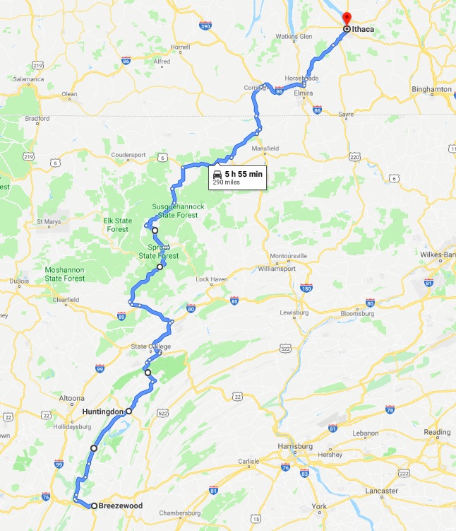
The first third of the ride from Ithaca, NY to Galeton, PA was along larger highways and I-95.

I crossed into Pennsylvania while on I-95 and traveling through heavy rain.
My gear kept me dry with the exception of just around my collar and shoulder where rain would sneak in from the side of my helmet. Oh, and my gloves got wet, but the heated grips kept my hands from getting cold.
I did stop at a bakery in Galeton for some coffee and to take a needed break.
The road I was looking forward to riding, state route (SR) 144 started in Galeton. I learned about SR 144 on motorcycleroads.com, a very useful site. The rider who posted their route along it described it this way, “… a flawless piece of twisting tarmac that ascends and descends the mountains in a series of tight sweepers and fun switchbacks while you are sheltered by mountains on all sides. No stop signs, no intersections…..just ride.”
So the second part of today’s ride focused on SR 144.

The part of the ride is broken up by the town of Renovo and the West Branch Susquehanna River, hence the funny jog in the road there.
The description quoted above described only a 15 mile section of SR 144. Some other roads merged with the highway, but overall, then entire 78 miles was bliss.
The only downside was a lack of shoulders along most of the route, especially in the northern half. In that regard, it reminded me of the Twisted Sisters, highways in Texas’ Hill Country that I rode on my 2015 Southern States Tour.
Taking photos of a road with no shoulders is difficult. In the past I’ve used the GoPro, but I didn’t bring it this time. I made due by pulling over as far as possible and putting the hazard lights on. Then I hopped off the bike and quickly got the shot.
I did this only twice today, and only after noting the very light traffic (one vehicle came by every ten minutes or so) and low speed limits (45mph and 35mph).
This was my favorite stretch of the top half of SR 144, but all of it was very zen-like.

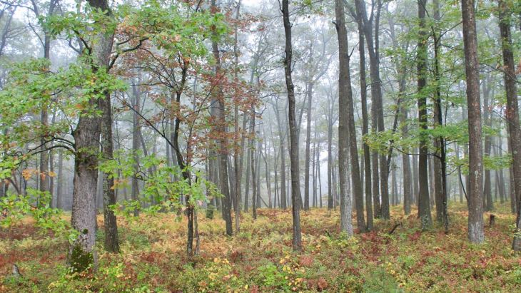
Fog, heavy at times, was waiting for me on the second half, or southern half, of the route. But sometimes fog can make a good backdrop for a fall photo of the woods.
The southern half of the route was labeled as Pennsylvania Wilds Elk Scenic Drive.
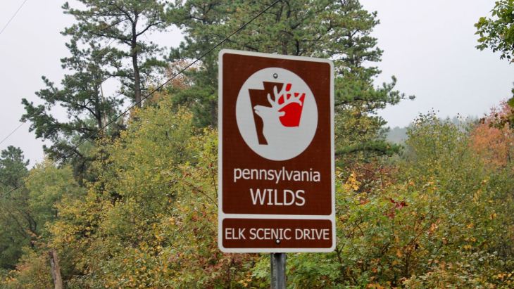
The above photo took some effort to get. Most of the signs were shot full of bullet holes. 🙂 This one must have been recently installed – lol.
The last part of the design of today’s ride was a trip down memory lane. I rode through Huntingdon, Pennsylvania, where I lived during my last two years of high school and first year of college.
This was the first time I visited the high school in 40+ years.

And I took the opportunity to drive past the house I lived in back then.
Though it had been heavily modified and was used exclusively as offices now, it was still standing.
That was trippy to see and to see how it changed.
The Dairy Queen was still operating at the top of the hill about half a mile away. Some things never change.
The last section of today’s ride, from Huntingdon to Breezewood was uneventful. Fog was blanketing Breezewood, though, making the last five miles a bit stressful.
As it stands, I have two days remaining to get to Columbus. If I took the shortest route there, using the interstates, it would take about four and a half hours. So I’m going to take two days, a bunch of scenic backroads, and use 460 miles to get there “the long way.”
Stay tuned!
