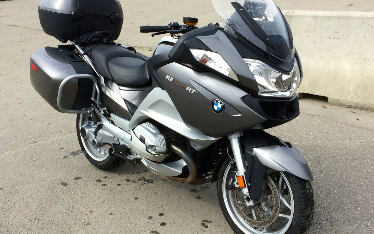
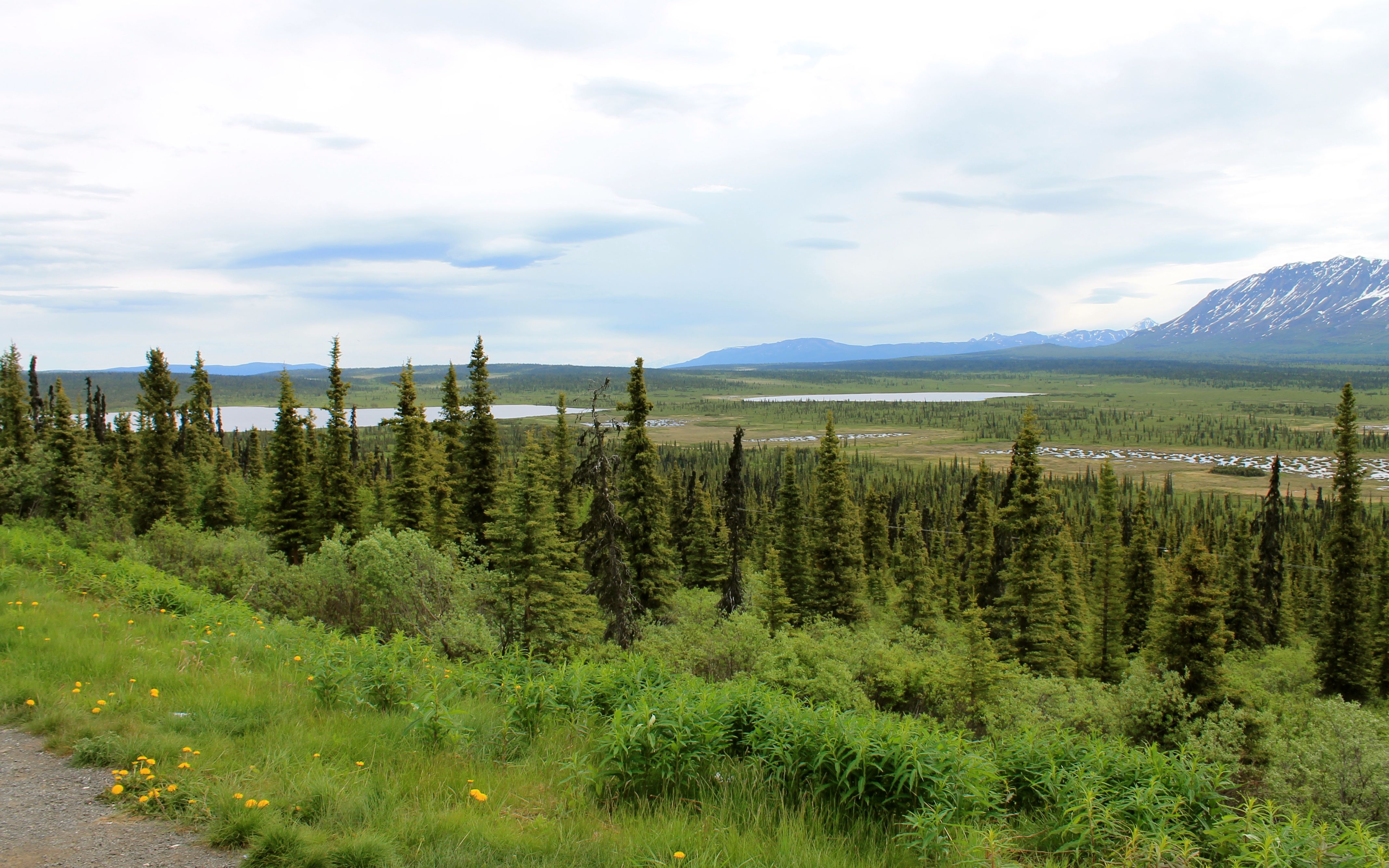
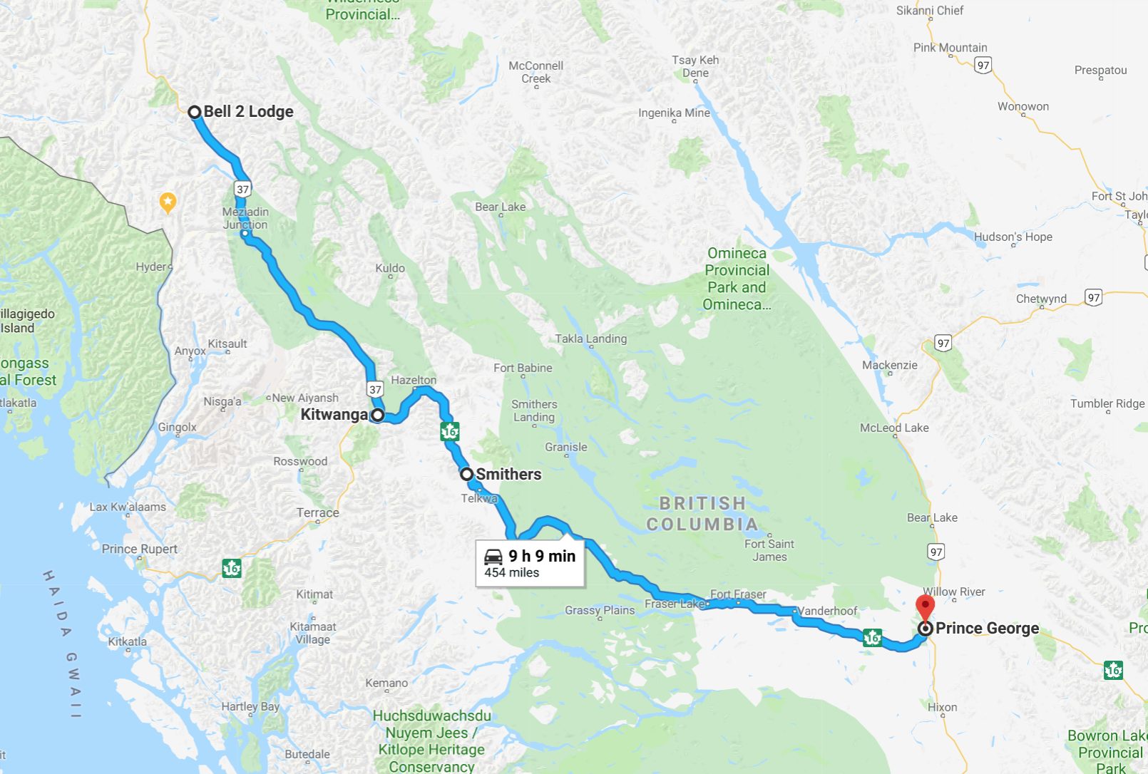
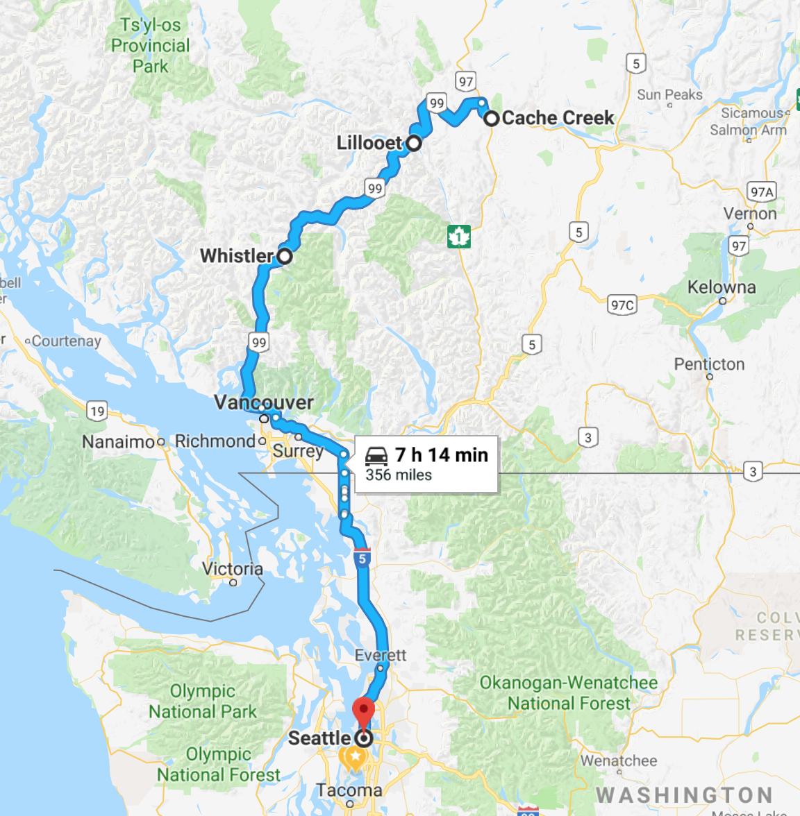
This 6,000 mile, 23-day solo adventure began on Jun 6th, 2018. I reached the start of the Dalton Highway on the morning of my 60th birthday. This adventure goes beyond the borders of the continental US to explore more remote and desolate parts of North America. I visit British Columbia on my way to Alberta and the Canadian Rockies, ride the entire Alaskan Highway, visit to Fairbanks, Anchorage, and the Gulf of Alaska at Seward before returning along the northern portion of the remote but beautiful Cassiar-Stewart Highway.
Day 1
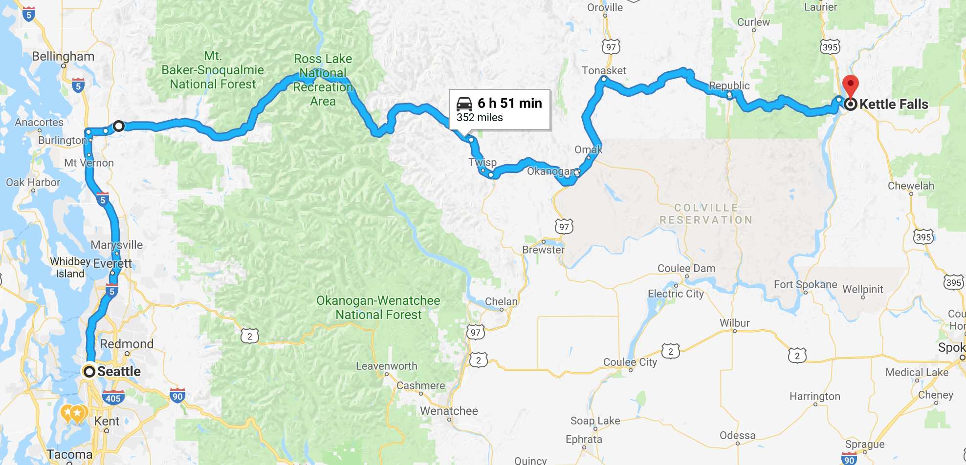
Day’s distance: 352 miles
Clear skies and temperatures in the mid 50s greeted me this morning. I pulled out just after 7am.
My route out of Seattle, taking I-5 north, is mostly counter-commute except around Everett, near the Boeing plant. Traffic was fast moving this morning and I landed in Sedro-Woolley for breakfast before 9am.
Breakfast was fine but I was too excited to eat much.
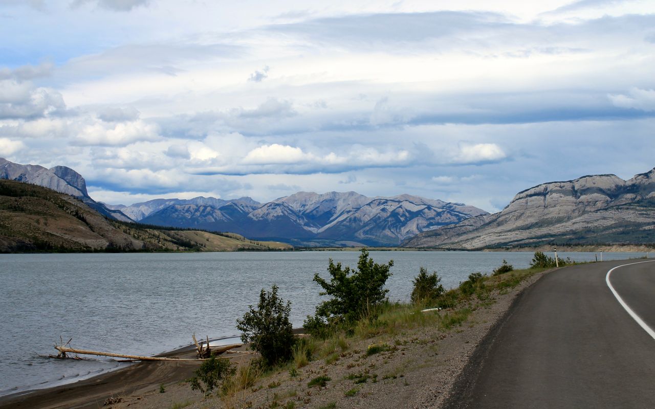
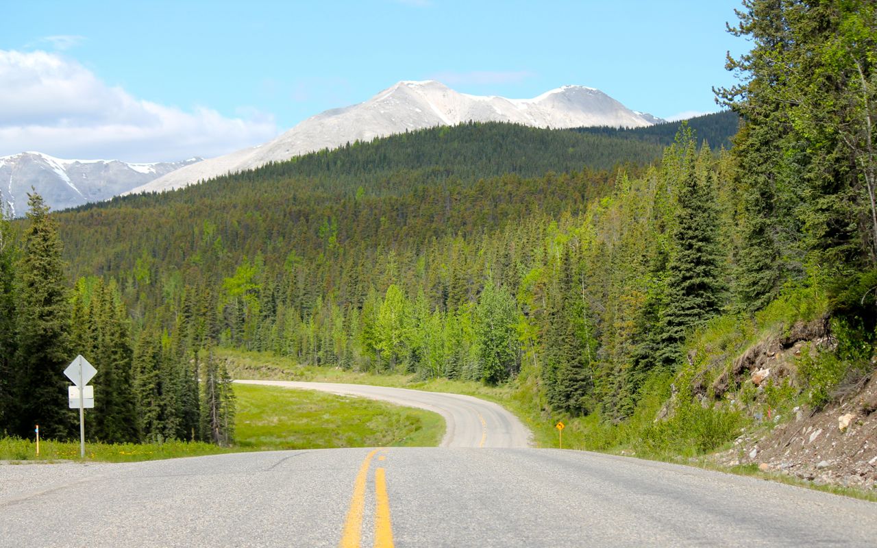
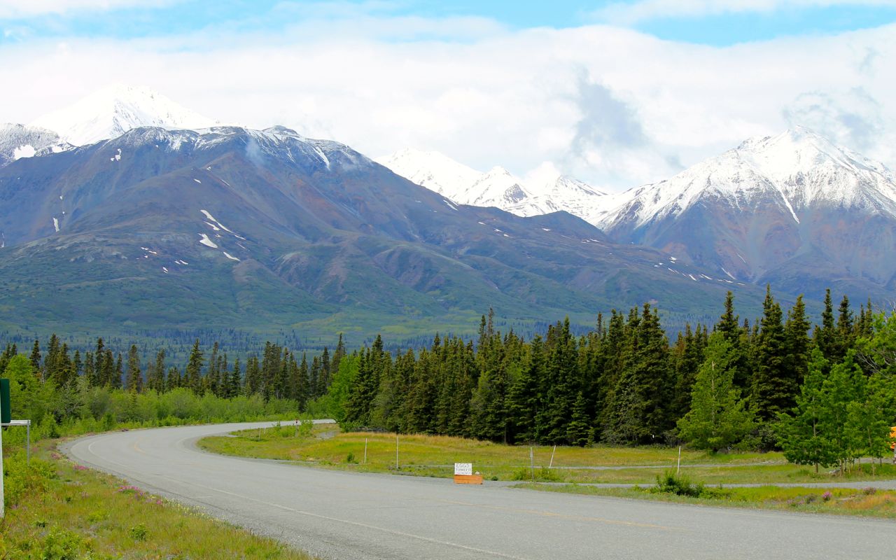
I reached the North Cascades National Park just after 10am.
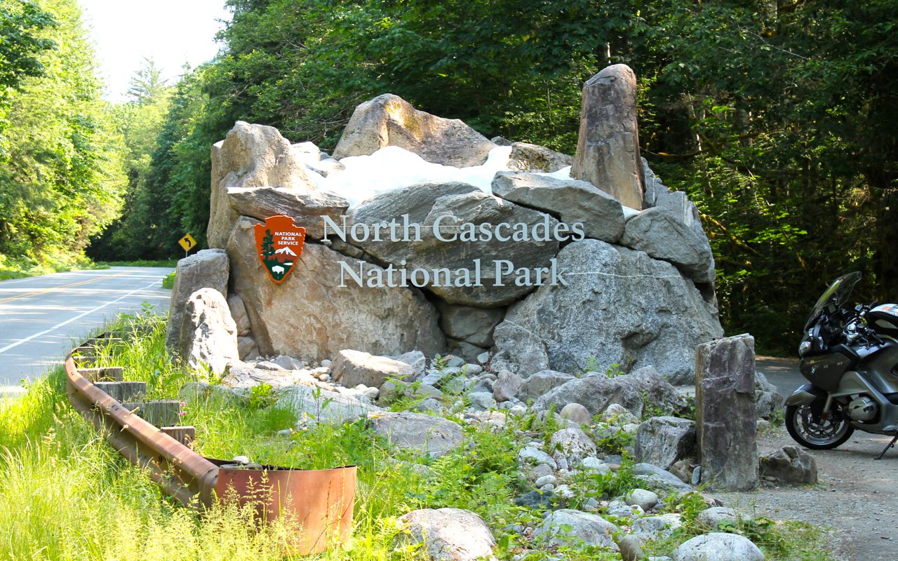
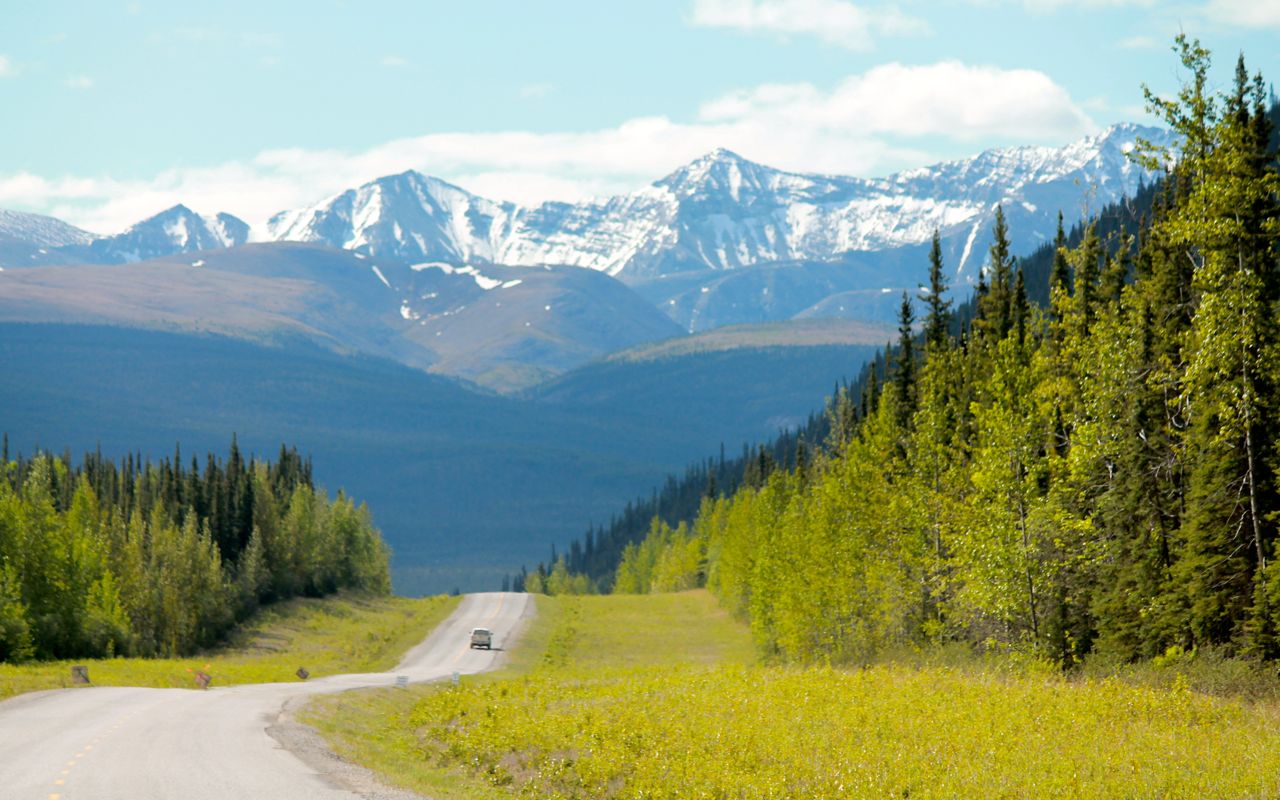
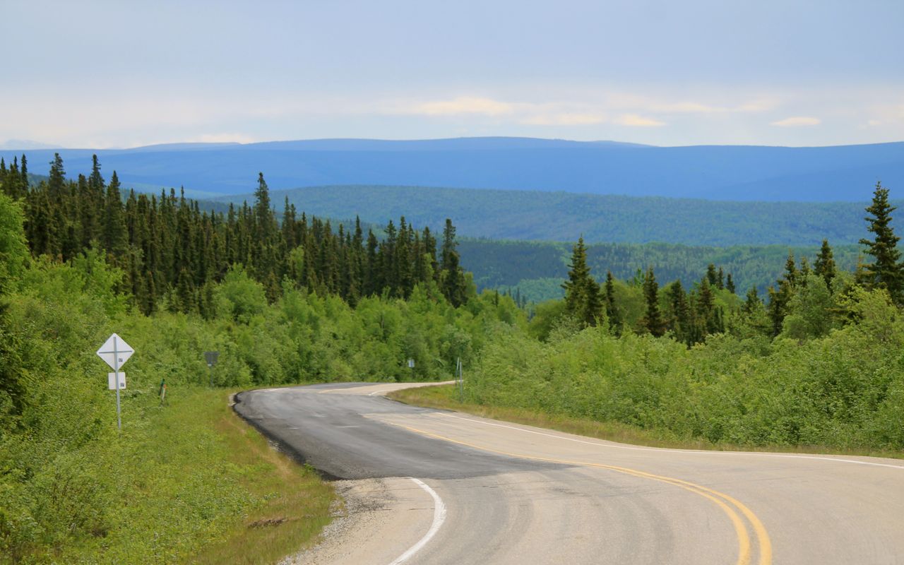
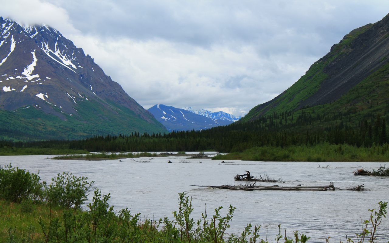
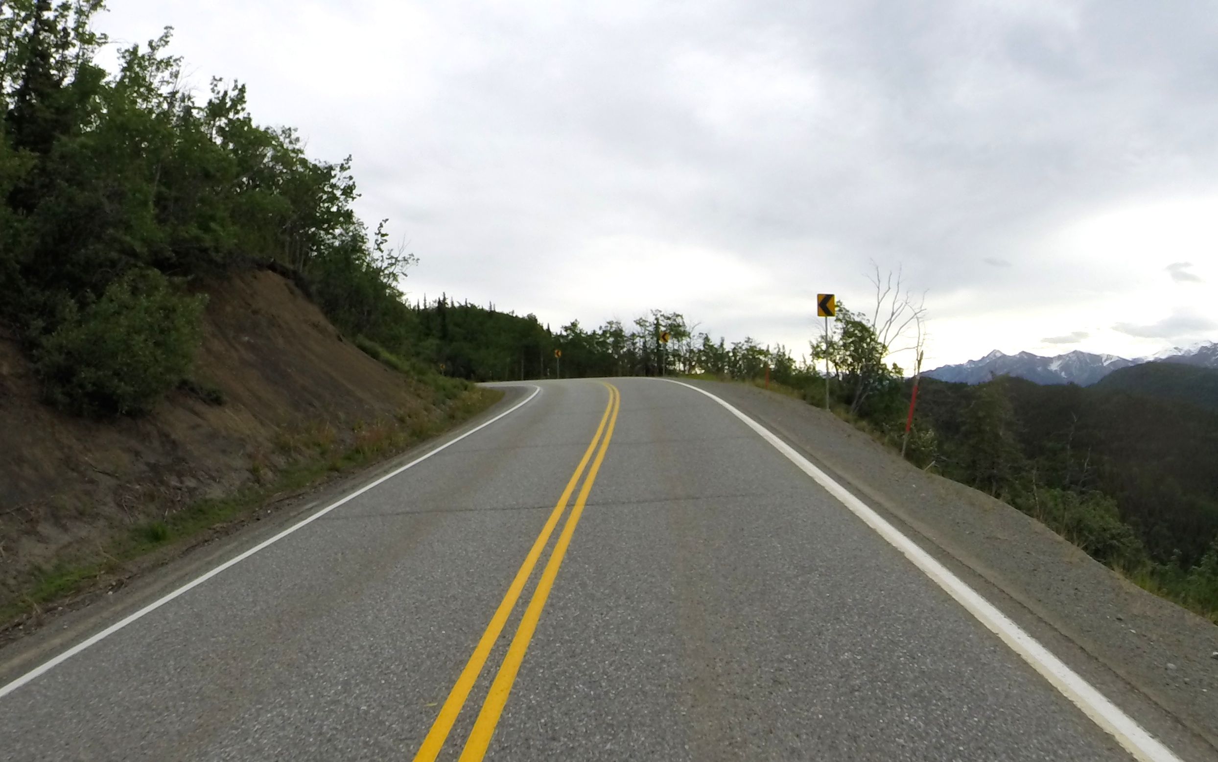
The road is in good shape, though a few frost heaves are lurking in the curves . Soon I was at Diablo Lake.
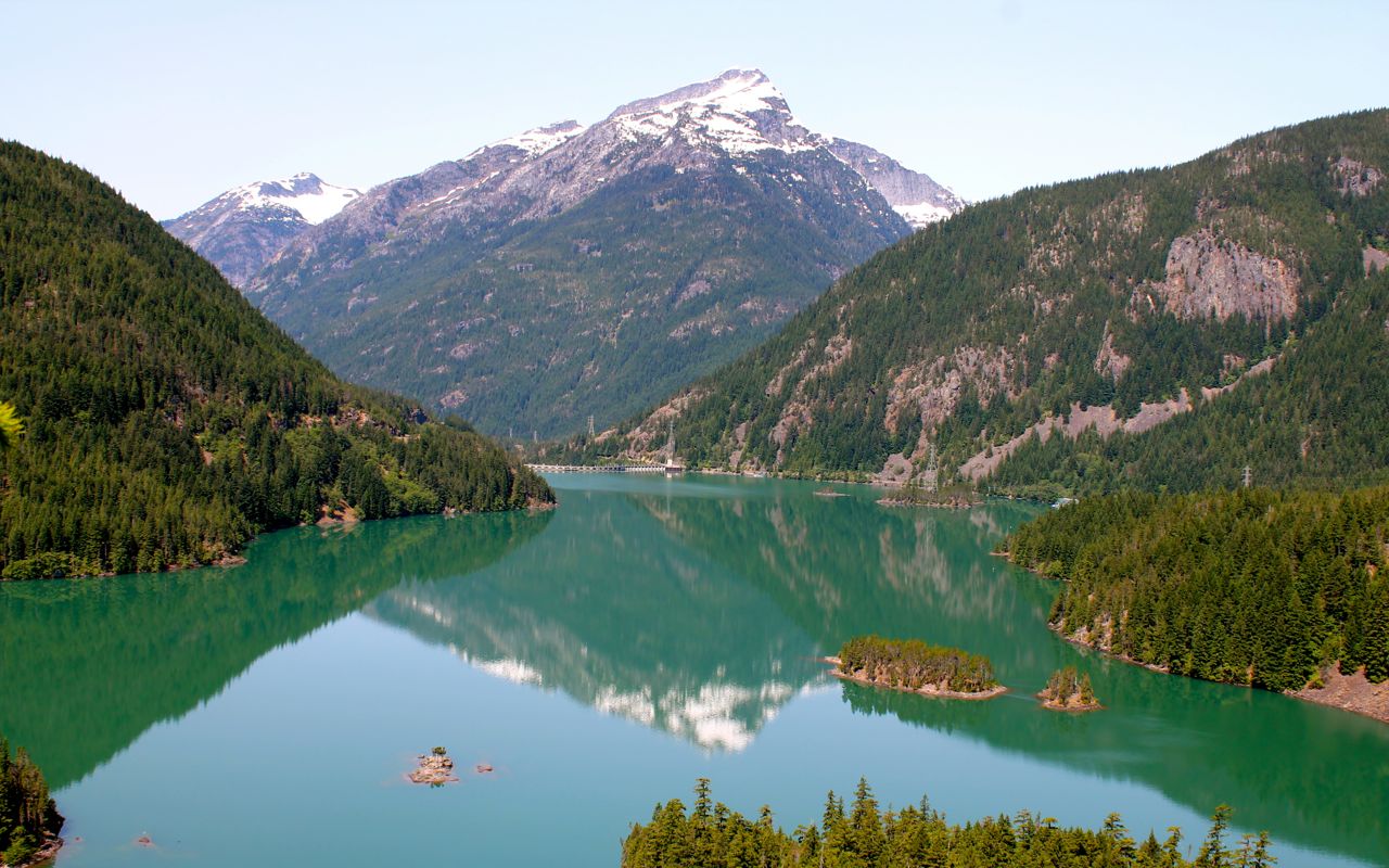
At Diablo Lake, a gentleman introduced himself and asked how I liked the RT. Tom, it turns out, has ridden since he was young and growing up in Orange County. As a teen, he was hiding his riding from the parents, avoiding their disapproval. He still has one motorcycle but doesn’t ride anymore. We talked for about 10 minutes before I returned to the road.
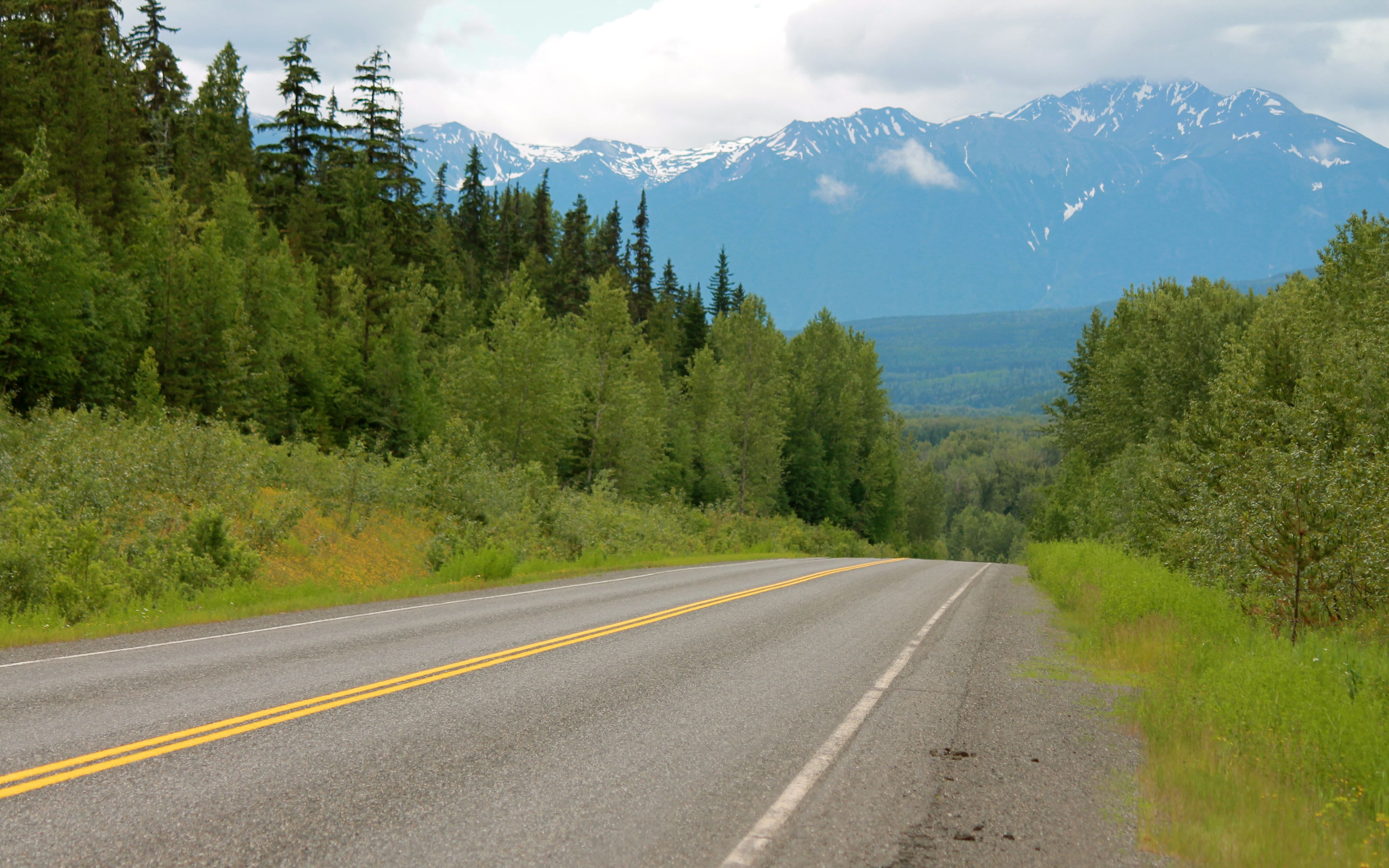
Washington Pass was clear and sunny.
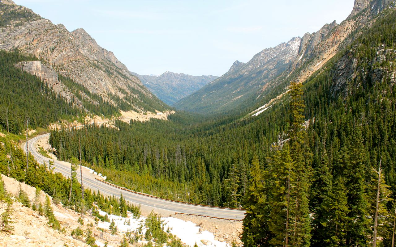
What a wonderful Day 1 morning and preview of the amazing moutain scenery in store for me over the next several weeks.
I stopped at the Rocking Horse Bakery in Winthrop for lunch.
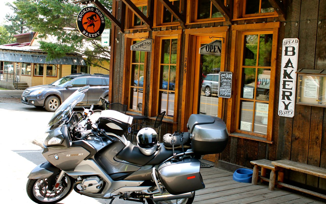
Both the Quinoa salad and the latte were very good. The bakery reminded me of some in Santa Cruz with a bit of a hippie vibe. Usually I eat at Three Finger Jacks Saloon but wanted something lighter today.
I’ll take my jacket liner out before hitting the road again – it is plenty warm enough now.
Just east of Twisp, where Hwy 153 splits off and heads south, the road surface had lots of slippery tar snakes. Fortunately, the worst of it lasted only a few miles.
Hwy 20 joins Hwy 97 as I turn north towards Tonasket. That section of Hwy 97 is not that interesting. Turning east at Tonasket, traffic drops to almost nothing again as I make my way through flatter ranch lands.
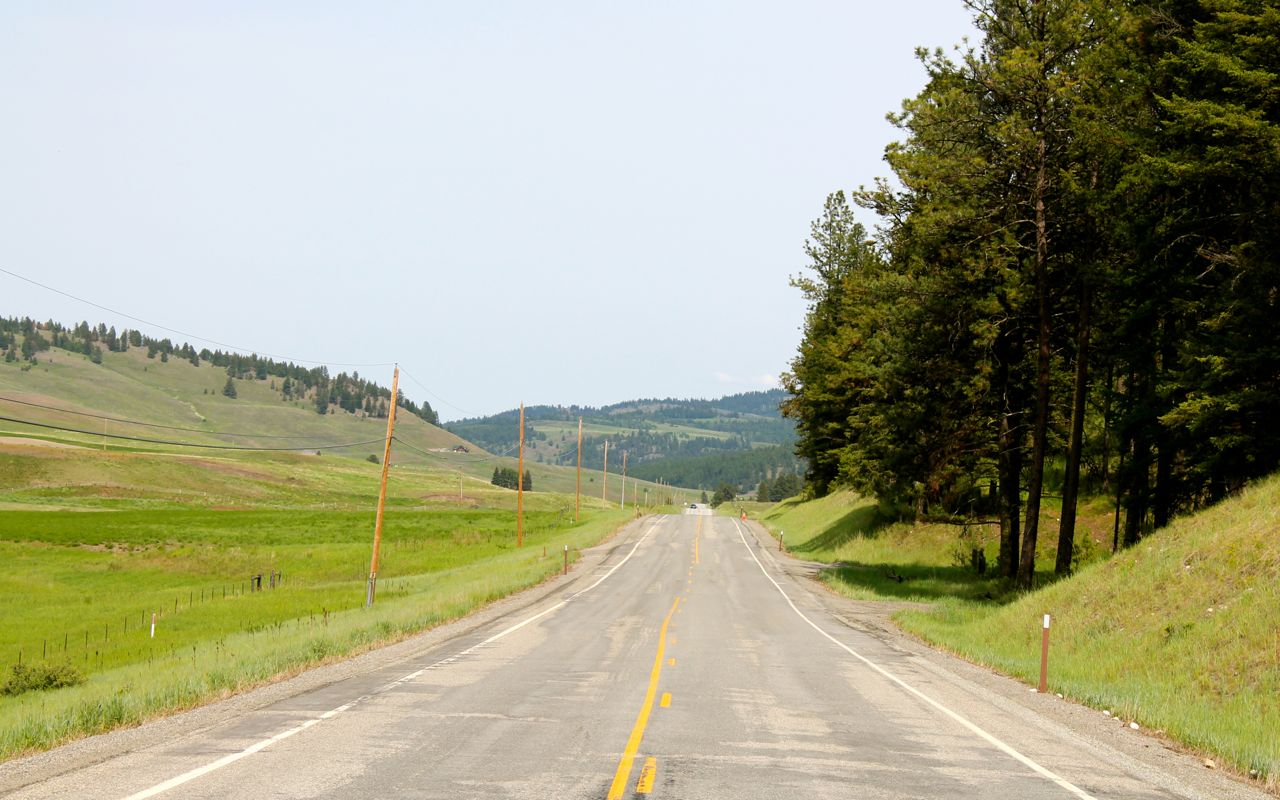
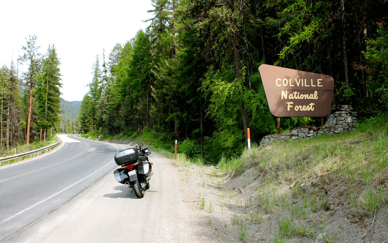
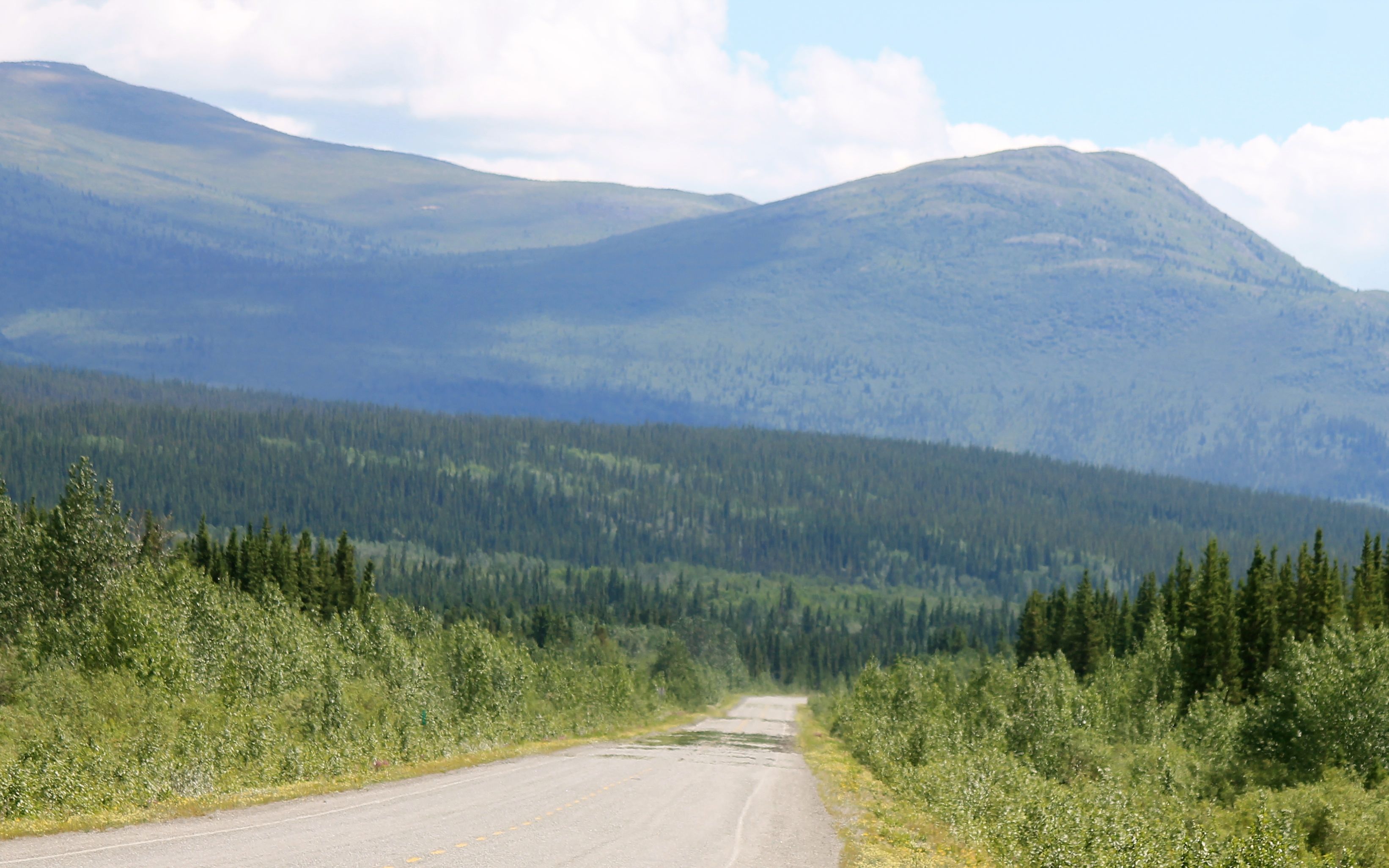
Soon I’m in the Colville national forest and climbing towards Sherman Pass. This part of Hwy 20 is called the Sherman Pass Scenic Byway.
Without the snow covered peaks, Sherman Pass is nice but not as dramatic as Washington Pass.
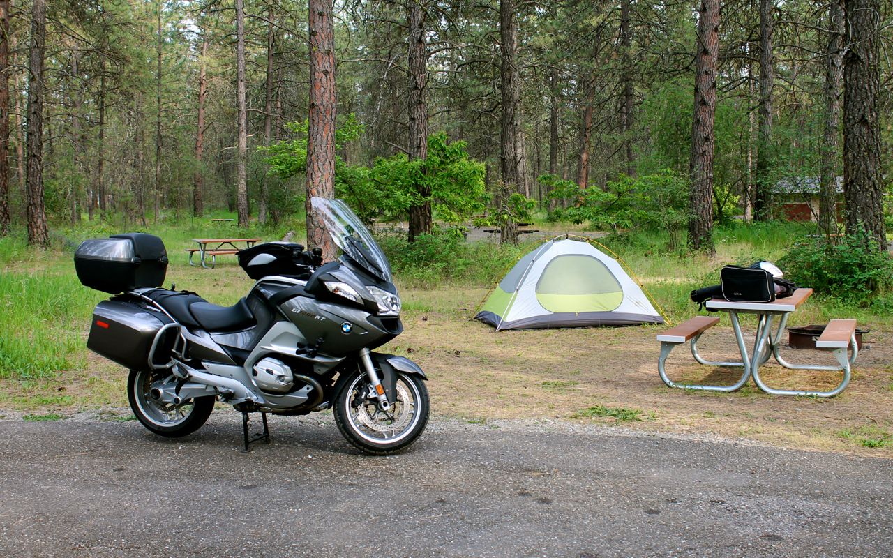
On reaching Kettle Falls, I stopped at Taco Joe’s (inside the Natural Foods Store) for a burrito before heading to the campground.
Many sites here are first-come, first-served. I had many choices.
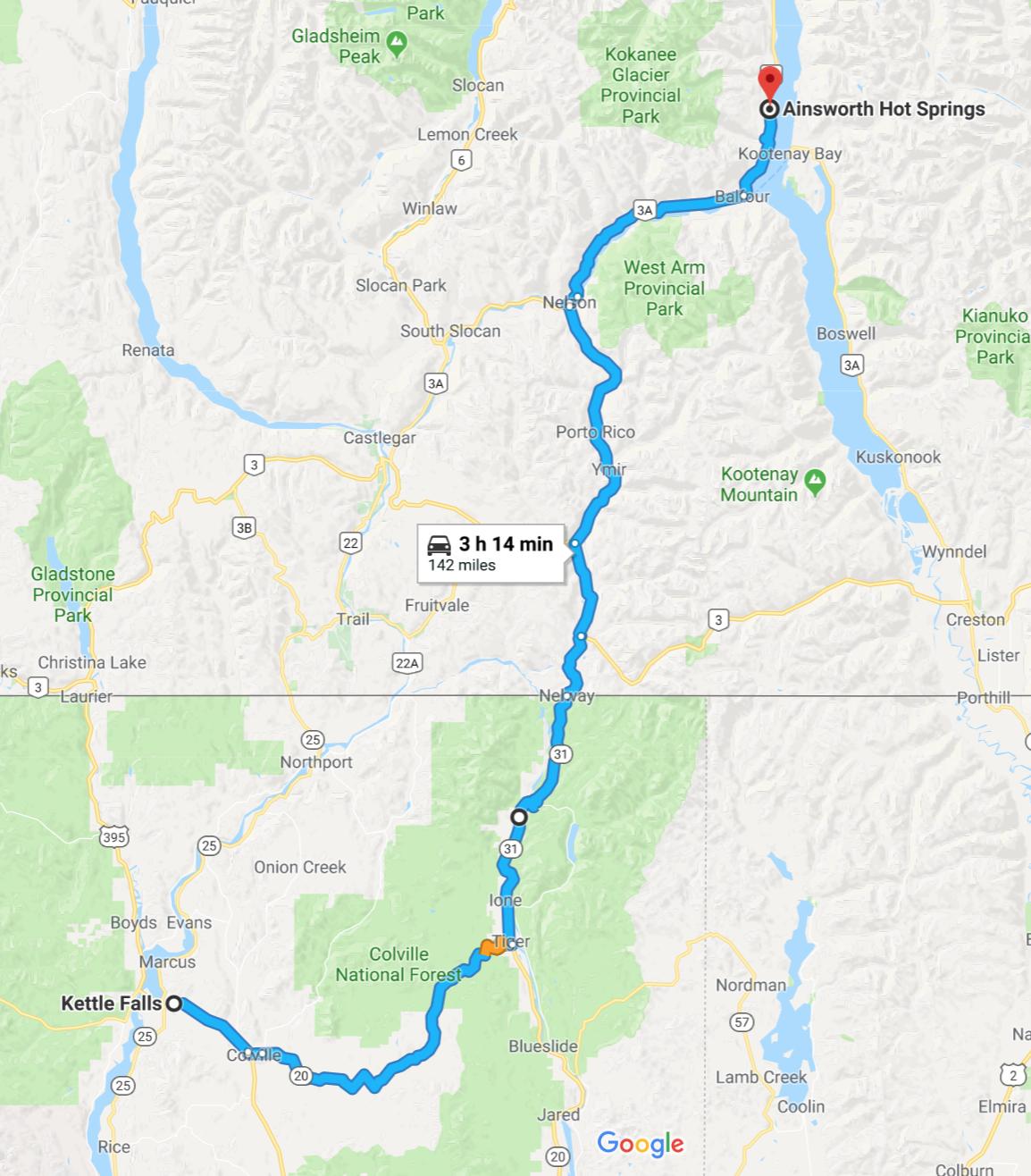
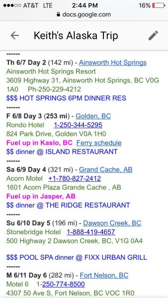
Tomorrow, I have a shorter ride to Ainsworth Hot Springs along Kootenay Lake. I will likely arrive a few hours before check-in but they allow use of the hot springs pools until the room is ready.
PS
Regular readers of the blog know that I don’t like strapping stuff to the back seat when I travel. However, I usually end up strapping my sandals in case they are wet or dirty. This trip, I’m bringing a second layer of rain gear. I purchased some Frogg Toggs to wear over my riding gear for heavy rains in an attempt to avoid getting wet and cold miles from nowhere. Specifically, I purchased the Road Toad jacket and pants.
To avoid the possibility of the metal tangs on my bungee net ripping my Frogg Toggs, I bought a fabric “bag” designed to store the Frogg Toggs and I am using Rok straps for this trip. I’ll let you know how they work out.
I’m also trying a new location for the GoPro – behind the wind screen. If successful, it will be convenient to be able to record photos or video of my route while staying out of the path of bugs fowling up the lens. The issue so far is it is very shaky there, so I’m trying to better secure it.
Day 2
Day 2 distance: 142 miles
Total trip distance: 524 miles
Another sunny and warm day with temperatures starting in the mid 50s and rising to the mid 70s.
Today was an intentionally short day. My destination, Ainsworth Hot Springs Resort, has hot springs pools and I wanted to have time to enjoy them. 🙂
I left Kettle Falls at 8am. It took about 30 minutes for my tent pad, moist from the condensation from the ground, to dry. In the meantime, I ate a muffin I brought from Seattle.
Coffee came in the form of a latte from Ritzes, the same coffee shop I stopped at on Day 2 of my 2016 Northern States Tour.
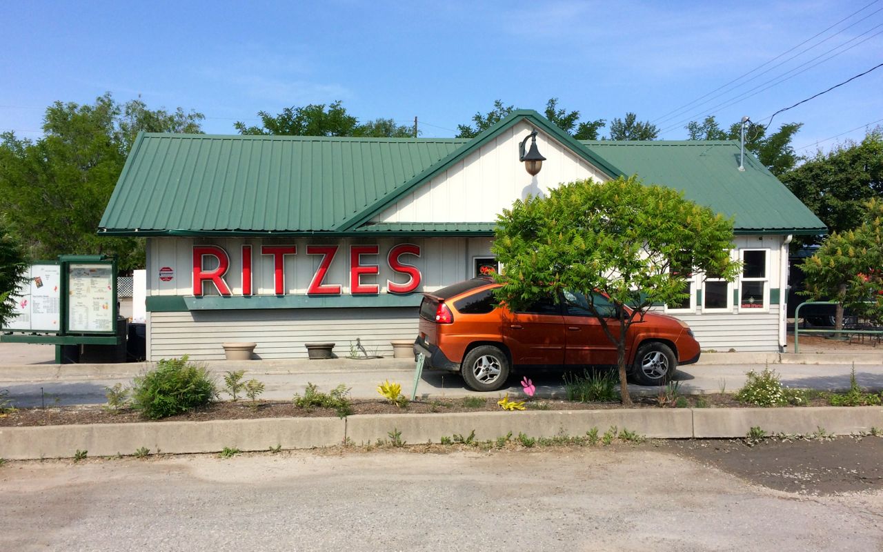
The owner actually recognized me, probably because I wear the same riding gear. She remembered I write a blog but didn’t remember any details. Still, pretty amazing memory!
On that 2016 ride, Hwy 20 east of Colville had a 10 mile stretch of road that was freshly oiled. This time the surface was ideal.
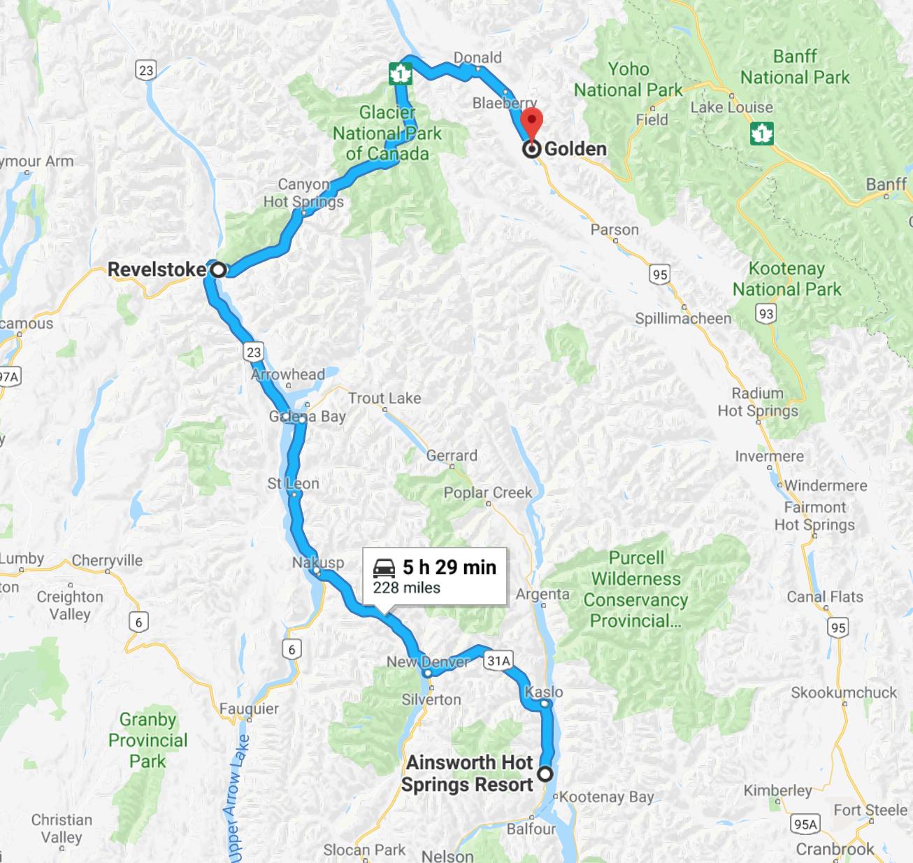
I rode Hwy 20 east until reaching Tiger, and then turned north on Hwy 31 to head for the border. This road follows the Pend Oreille River and has some slow sweepers and is in overall great condition.
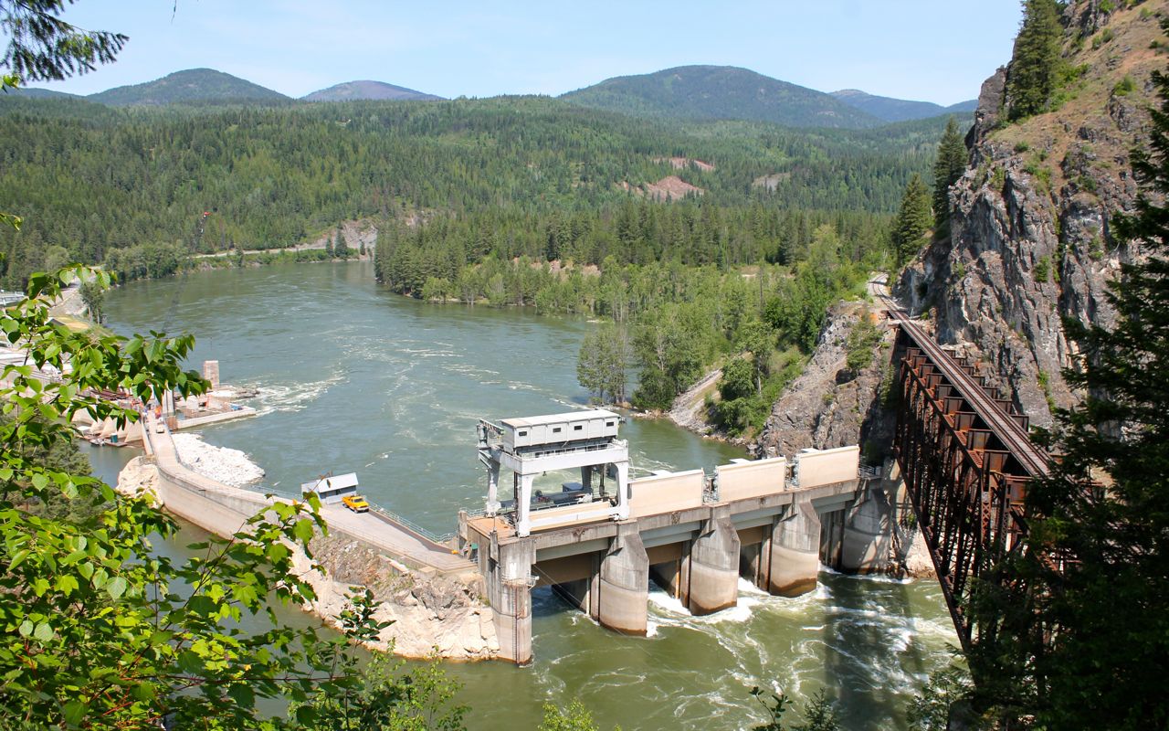
I stopped at the Box Canyon Dam vista point.
The border crossing at Nelway, open 8am to midnight, was very quick. I didn’t have to wait and was on my way in less than 5 minutes.
I stopped in Salmo to exchange some money for those times when cash is needed.
Nelson was a bigger town than I expected. Seemed like a nice town with a lot of tourist traffic, but things moved along pretty quickly. Among the many restaurants, I found a bakery that made lunch sandwiches and stopped. But once inside, I found a very long line and decided to abandon those lunch plans. 😦
Following Hwy 3A along Lake Kootenay Lake, there was a solid line of traffic until I passed Balfour, where a ferry takes cars to Kootenay Bay.

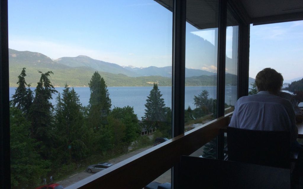
I continued north, now on Hwy 31. There was a short but fun section of narrow and twisty roadway through an avalanche prone area. Soon after I arrived at my stop for the day. I guess it was shortly after 1pm. My room was ready so I unpacked and jumped on the opportunity to use the pools.
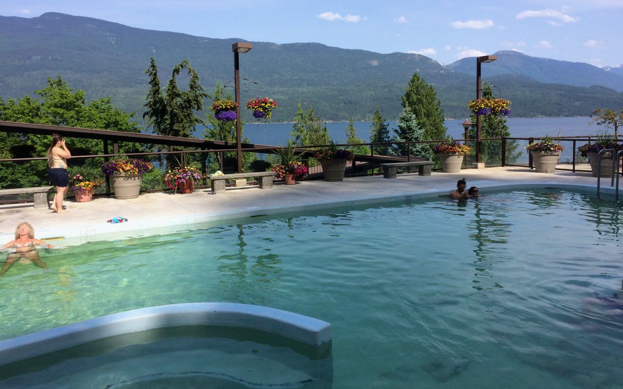
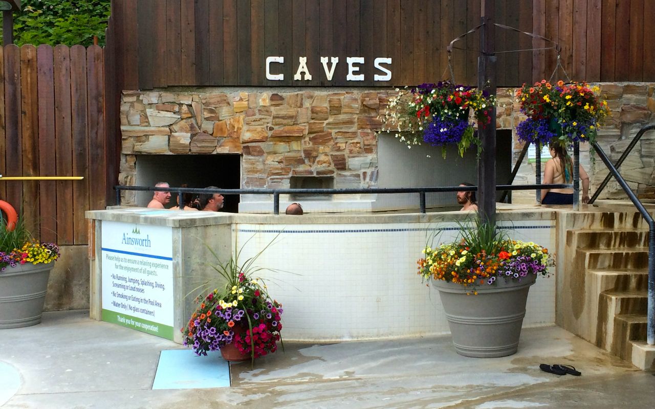
Yes, there is a small cave that you can soak in, stalactites and all. Inside the cave, the water towards the back is approximately 110 degrees while the rest of the cave is closer to 104.
There is also a cold plunge. And a great view of the mountains across the lake. This place is pretty cool.
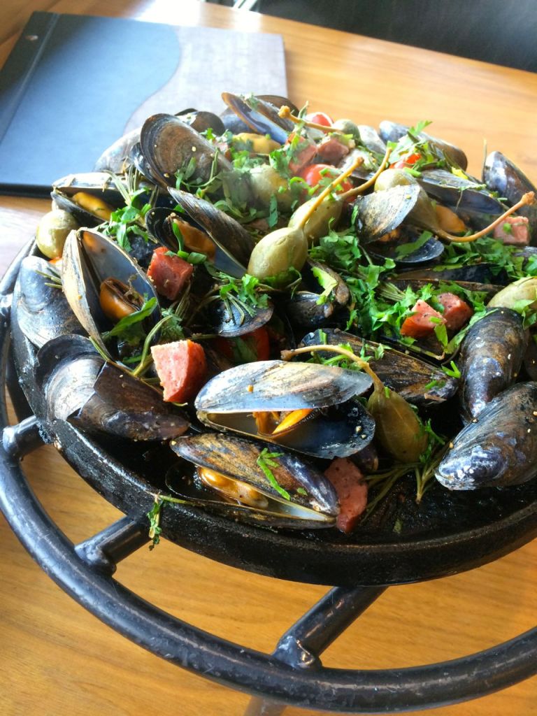
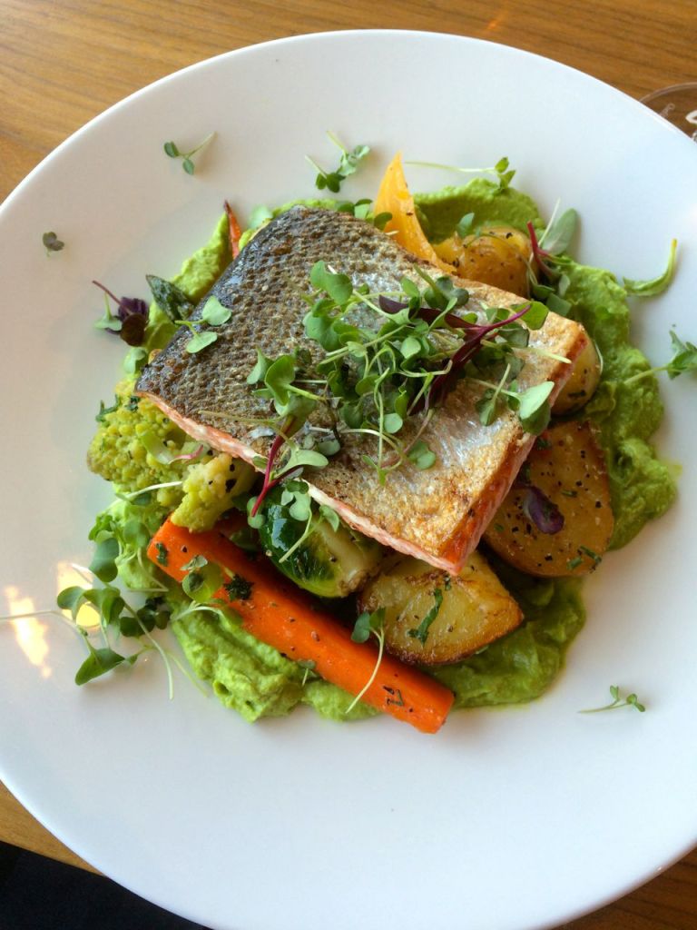
Dinner was on premise, at the Ktunaxa Grill. I had skillet roasted mussels for a starter followed by Wild Sockeye Salmon. The restaurant sources food as locally as possible. It was all tasty and filling. I had a window table, having made reservations some weeks ago.
Tomorrow I’m looking forward to riding Hwy 31A between Kaslo and New Denver. It is reported to be one of BC’s finest motorcycle roads.
Day 3
Day’s distance: 253 miles (odometer)
Total trip distance: 777 miles
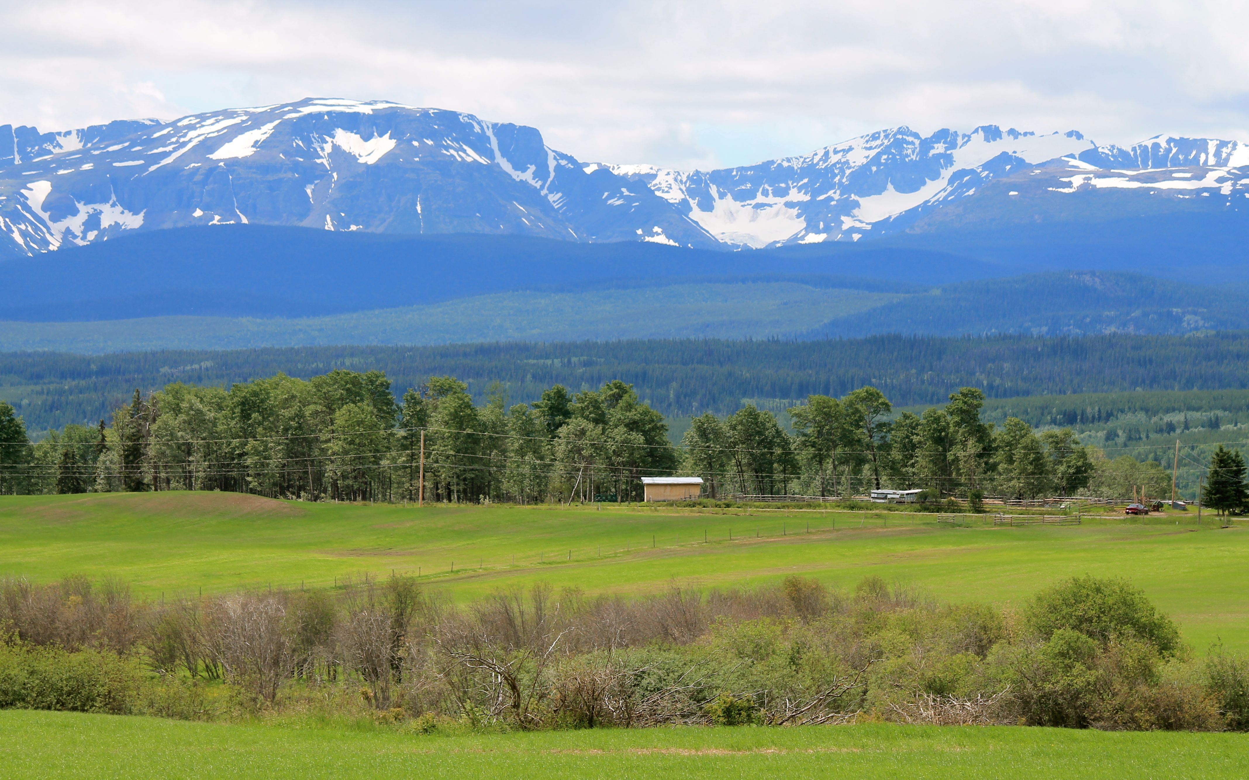
Sun and 65 degree temperatures started the day, while clouds and sprinkles moved in during the afternoon. It was sunny again in the evening here in Golden, BC.
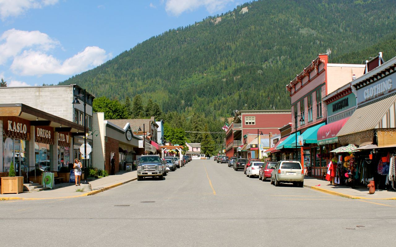
Kaslo, a town just north of Ainsworth Hot Springs, was my first stop. I filled up with fuel and then stopped at Bluebelle Bistro for my morning latte and an amazing apple muffin. My server last night at the Ktunaxa Grill, Sydney, said she knew most of the folks in Kaslo from growing up there. I tested that and asked my barista if she knew Sydney. “Oh, yeah, she’s my cousin. “
Other than Ainsworth, my reason for coming through this part of BC was to ride Hwy 31A between Kaslo and New Denver.
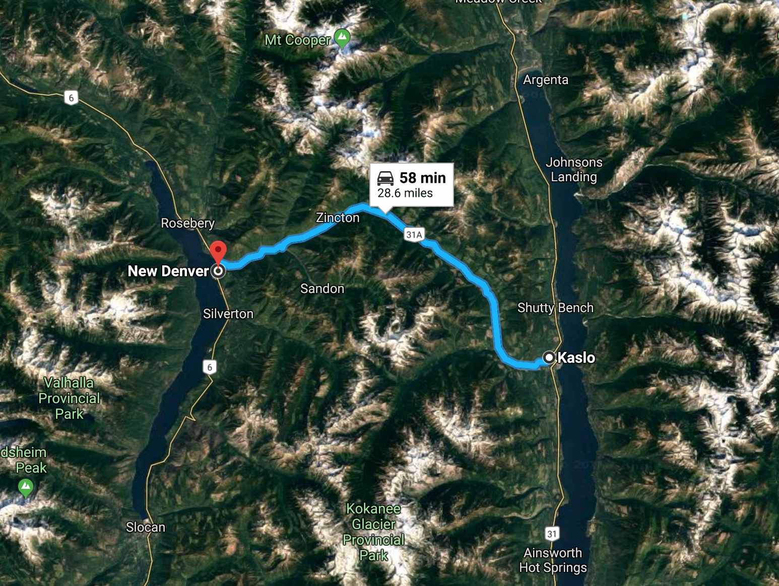
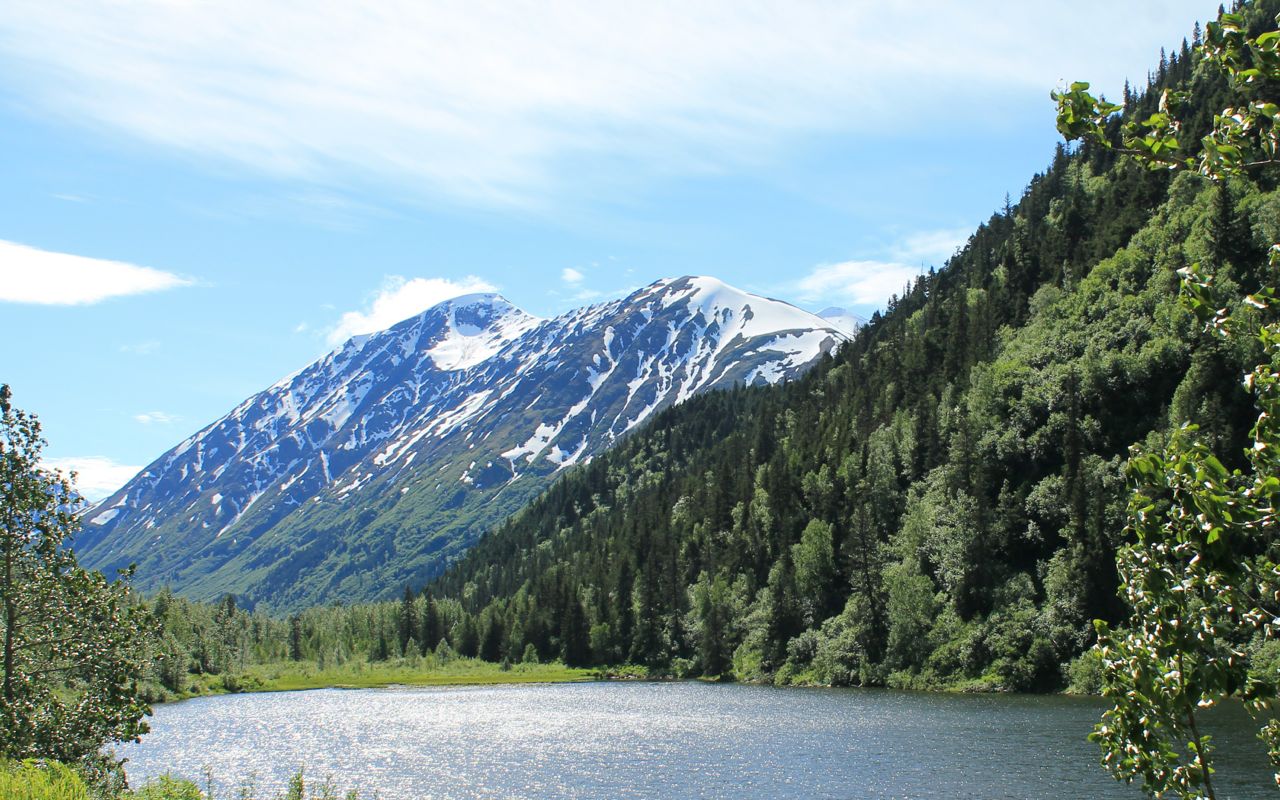
This was a fun, twisty canyon road with a river alongside much of the route and snow-capped mountain peaks at each end providing a backdrop trying to distract one’s attention.
I arrived in New Denver and turned around, going almost all the way back to Kaslo to ride it again. Thanks, Al, for that suggestion!
I relied on my GoPro behind the windscreen to take photos for me while I rode. That was a test that unfortunately didn’t have a good outcome. In short, I don’t have any photos of this part of the ride. 😦 Guess I’ll have to return some day.
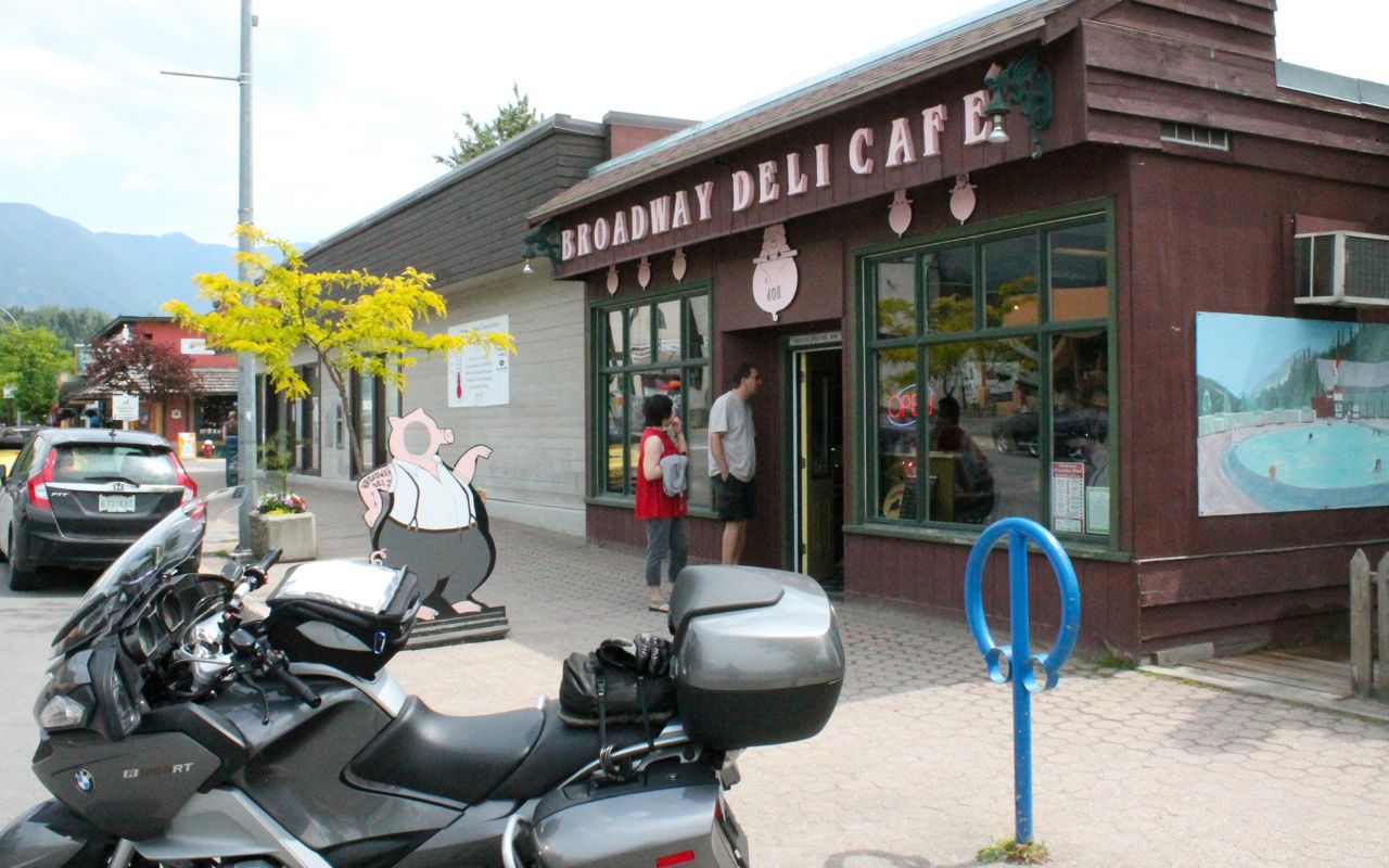
I continued beyond New Denver to Nakusp and stopped at the Broadway Deli Cafe for a sandwich.
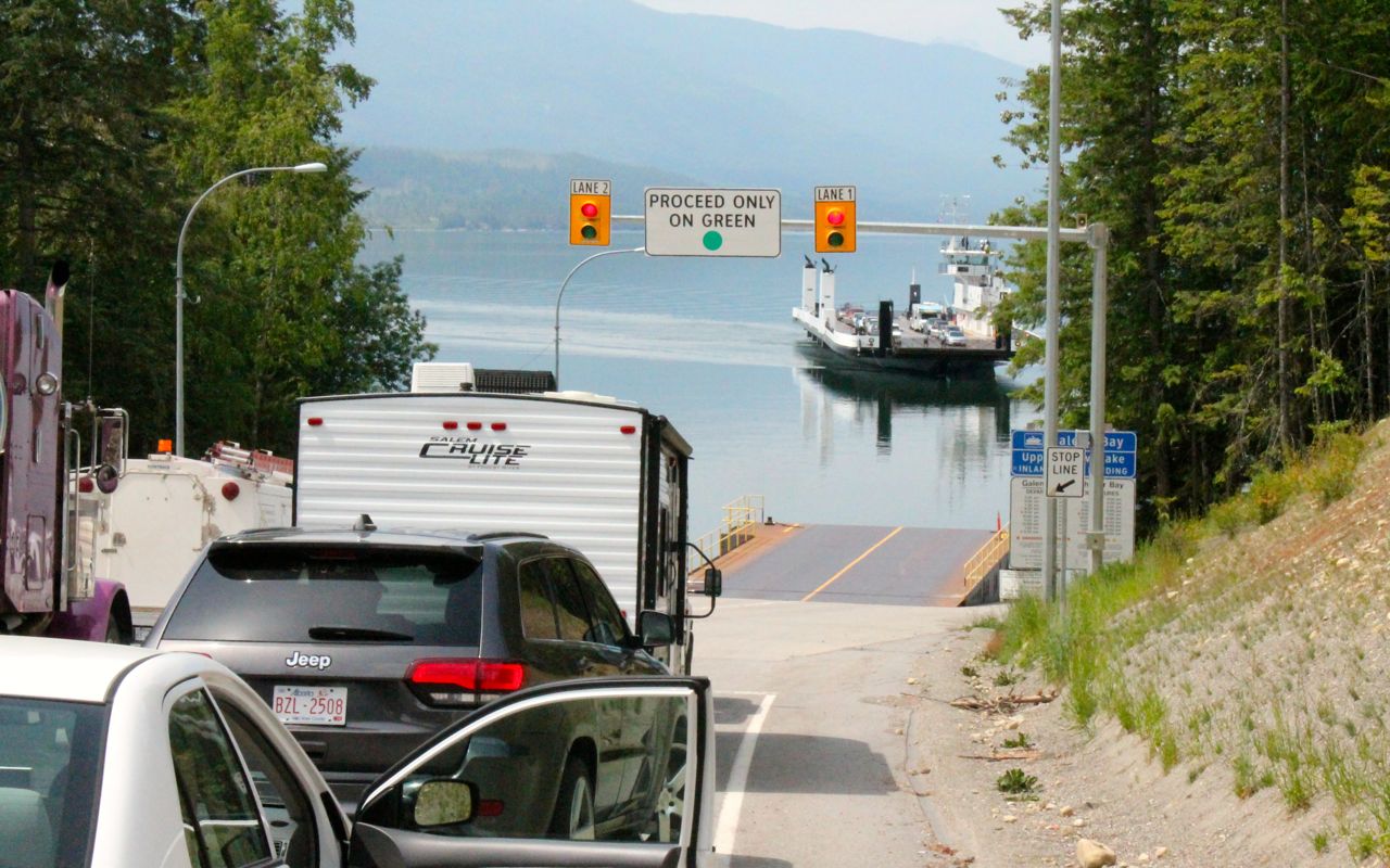
Next up was a short ferry ride across north Arrow Lake.
Motorcyclists used to get priority boarding (not that it mattered today), but that stopped a few years back after drivers complained.
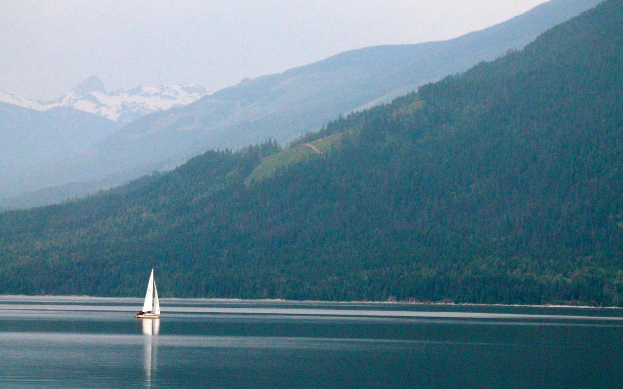
Haze, humidity and clouds were rolling in so vistas were somewhat subdued.
There wasn’t much wind at this point, but a sailboat in Galena Bay was out doing its best.
The ferry ride was under 30 minutes and the road(s) from there to Revelstoke were not too interesting. It started to sprinkle, and the clouds seemed to follow me west for a while.
There was a lot of construction along Hwy 1 but traffic was never stopped as it was past 4pm and I think the crews had mostly completed there work for the day.
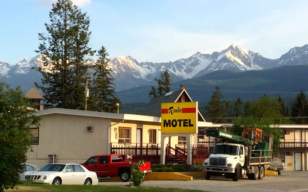
I arrived in Golden about 6:30pm, though for me it was really 5:30pm before the time change.
There was plenty of time to get checked in at the Rondo and cleaned up for dinner.
I ate at The Island, a local well-rated restaurant just a few blocks away. Sitting outside, I enjoyed the evening with a Duck salad and glass of wine.
It was a good day and I met a few bikers and locals. Everyone was super friendly.
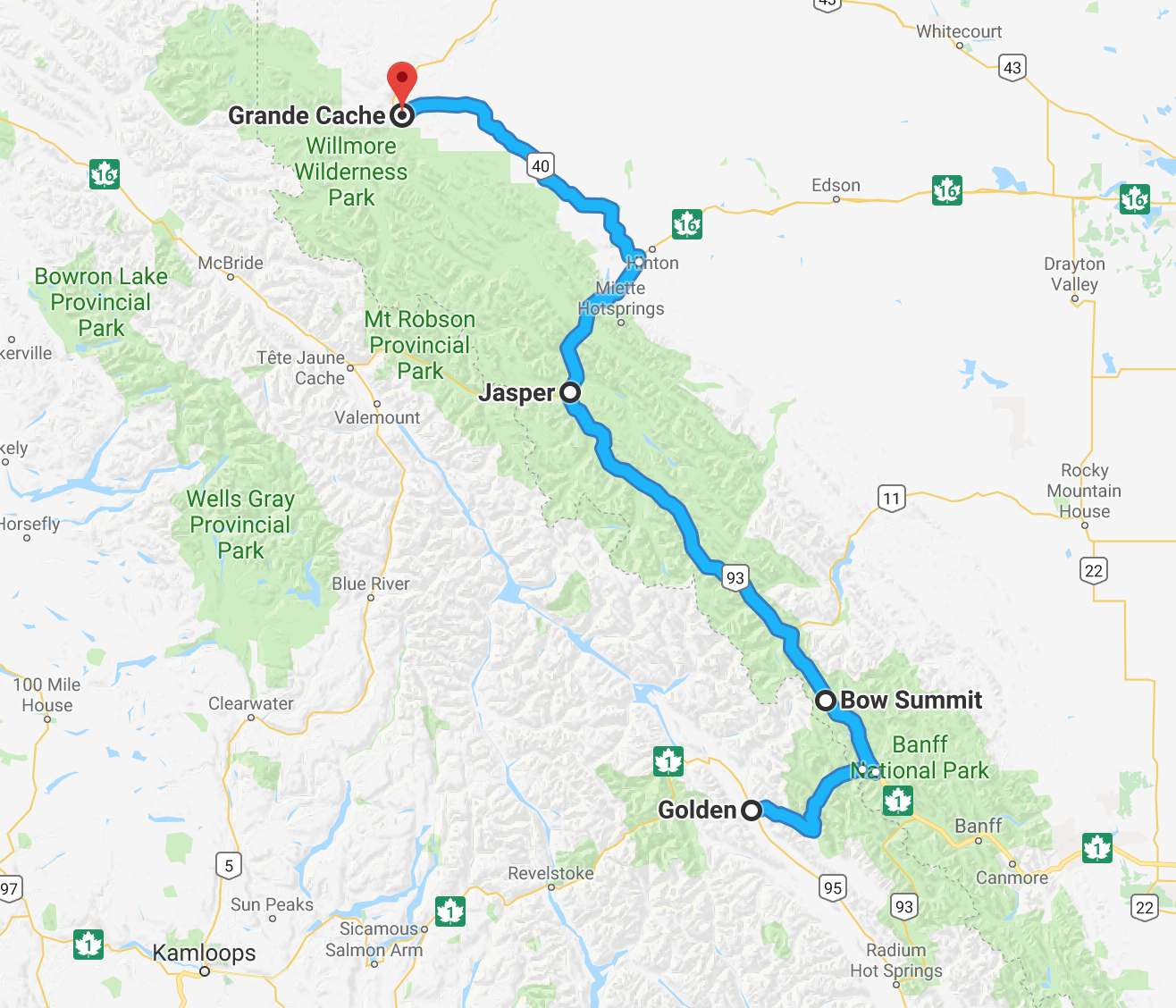
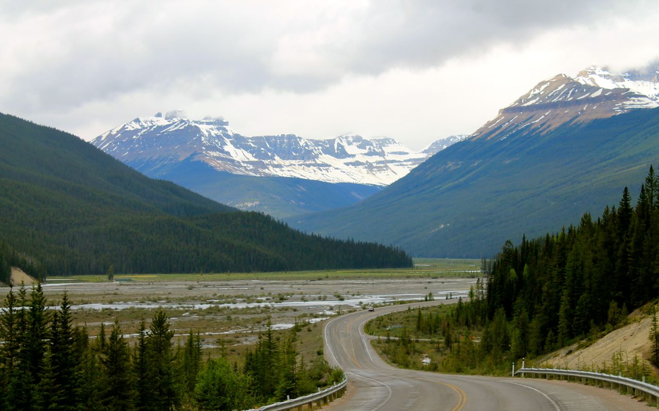
Tomorrow I’ll cross the Canadian Rockies, traveling through Jasper. The weather is predicted to be rainy at times, so I might be testing my two layers of rain gear, for part of the day, anyway. Fingers crossed I don’t hit snow up in Jasper or Lake Louise (not predicted to be anywhere near that cold).
Day 4
Day’s distance: 321 miles
Total trip distance: 1,098 miles
Temperatures in the mid 50s and light rain started the day. More rain and temperatures into the low 40s while riding into the higher elevations along Hwy 1. The rain stopped near Bow Summit and the temperatures began to rise, eventually hitting 70 in Jasper. I encountered light rain near Grande Cache and the temperatures fell back into the high 50s with winds picking up.
The Frogg Toggs kept me dry and with that additional layer on, I was comfortable with just my long baselayer, my cold weather liner, and my outer gear, even into the 40s.
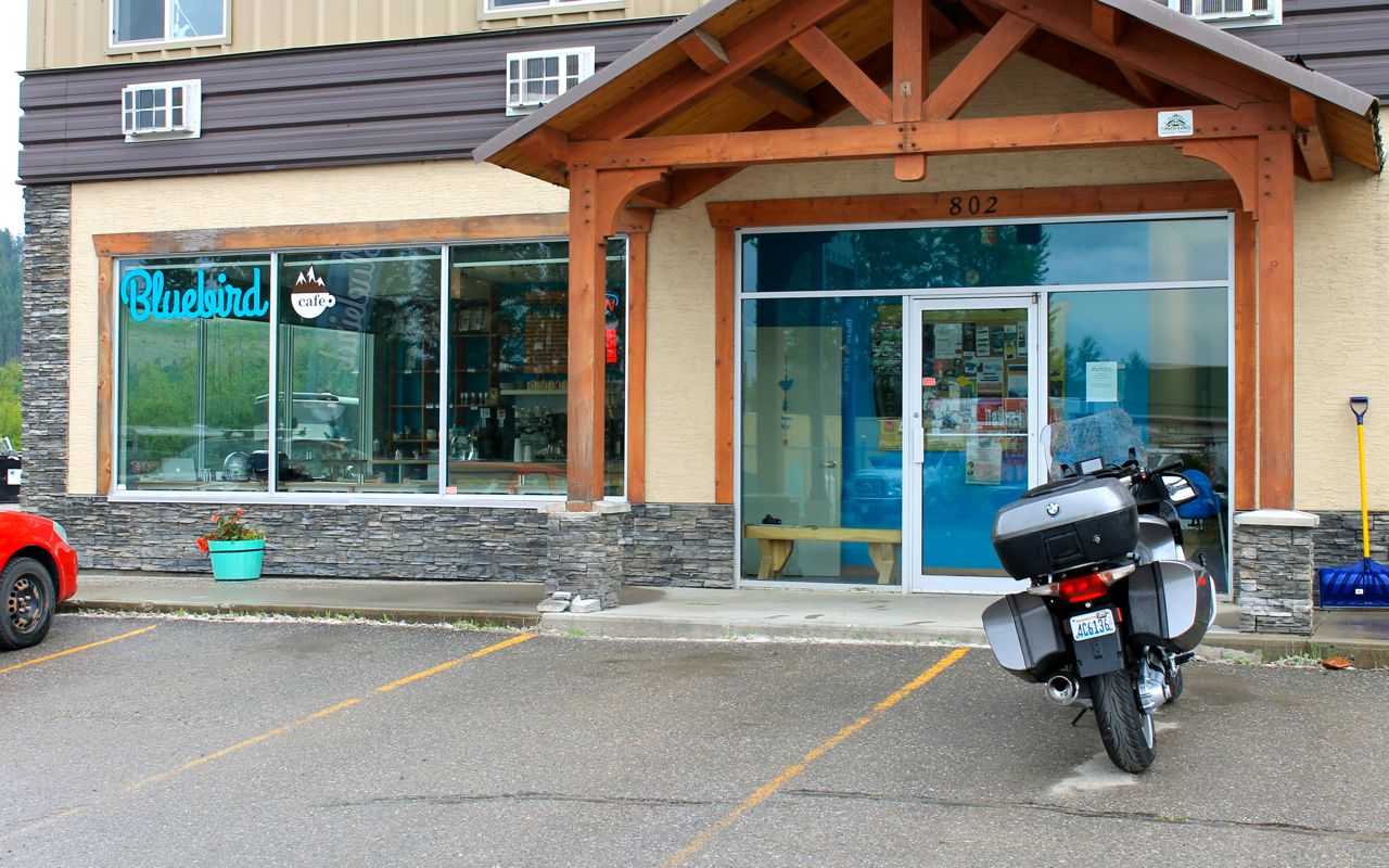
I think it was about 10:15 when I crossed into Alberta, but I’m getting ahead of myself. Let’s rewind to my morning latte, today from the Bluebird Cafe in Golden. With a friendly staff and good muffins, I completed my blog post using their wi-fi while I fueled up with caffeine.
The young guy working there told me that he was working on getting his motorcycle license allowing him to legally ride in BC. However, that didn’t stop him from flying to Vietnam a year earlier with some friends where they all bought motorcycles and rode around the northern part of the country for a month. He laughed and said, “I had no idea what I was doing or even how to ride.” I loved his story. You get away with things like that when you’re young. Well, sometimes you do.
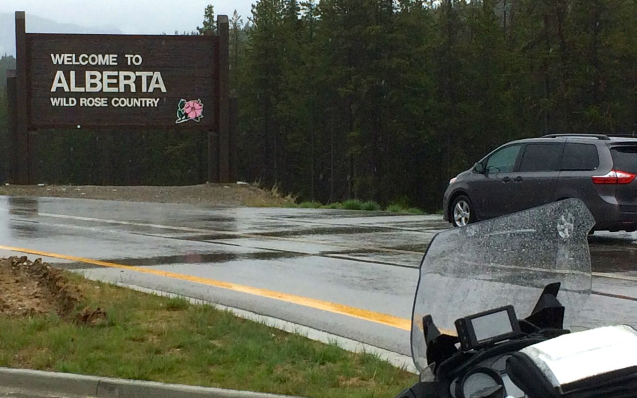
I left Golden a little after 9am and reached the border of Alberta about an hour later.
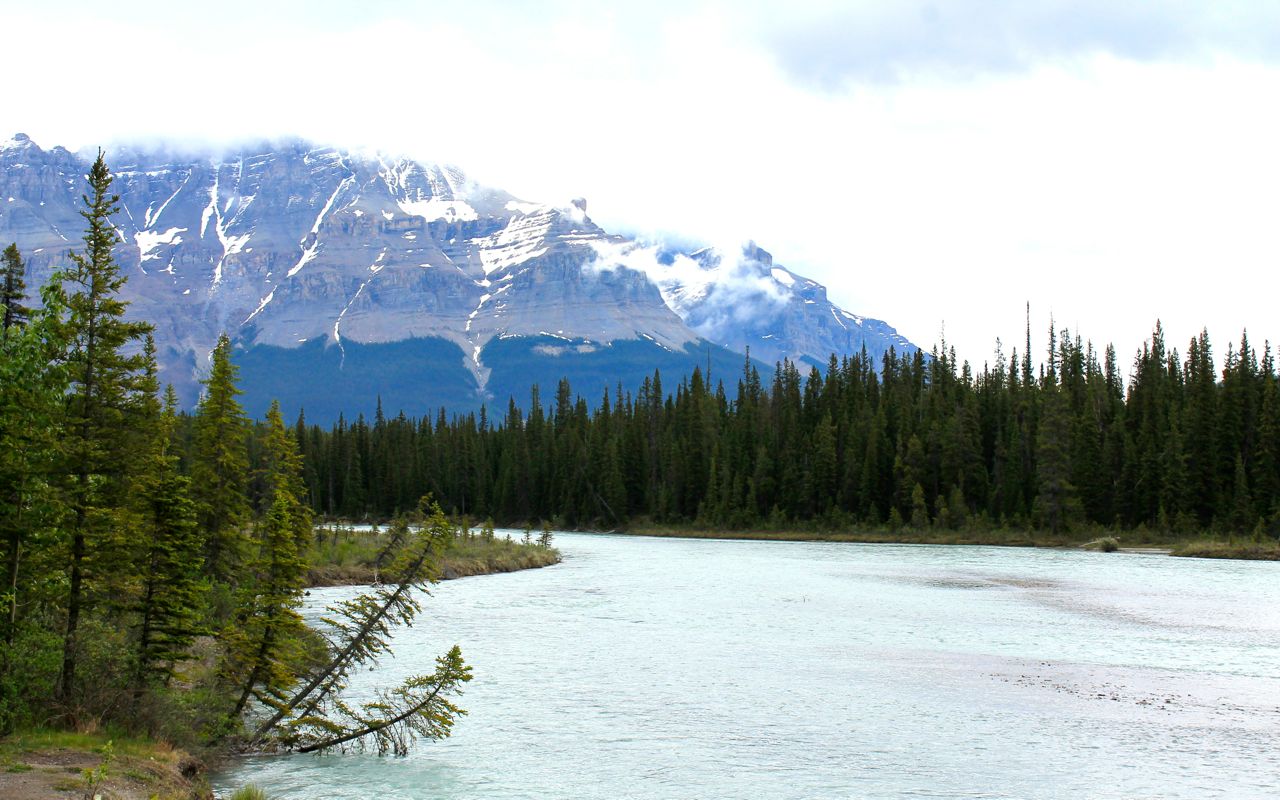
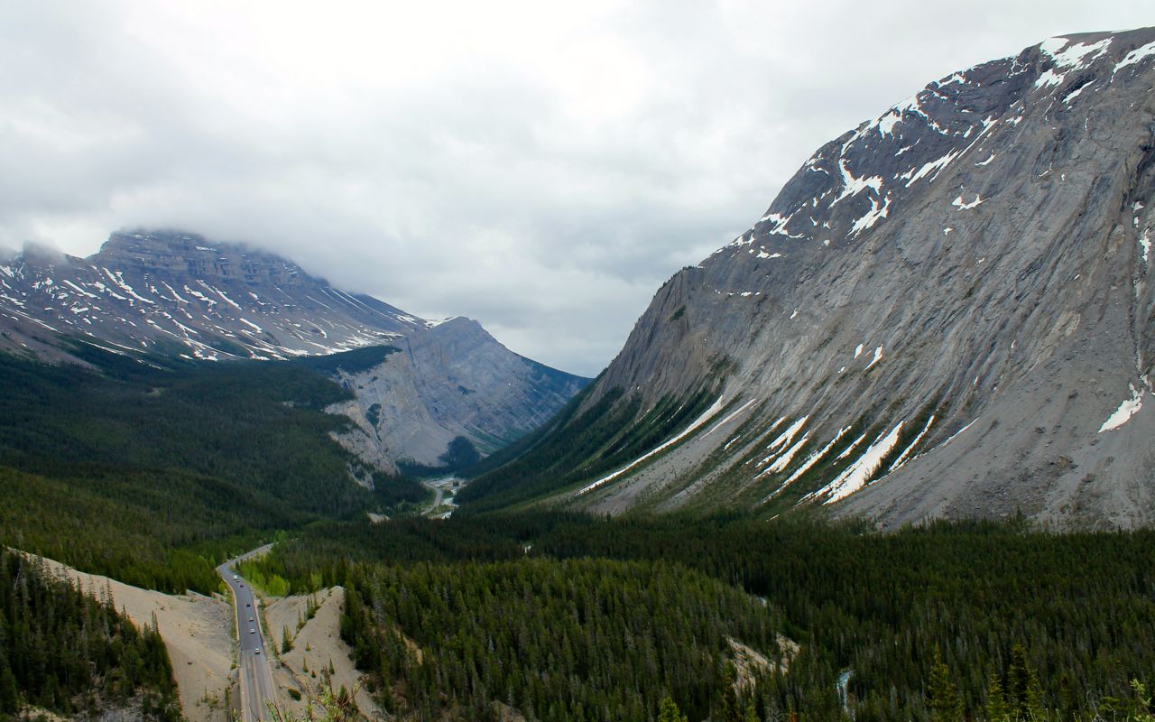
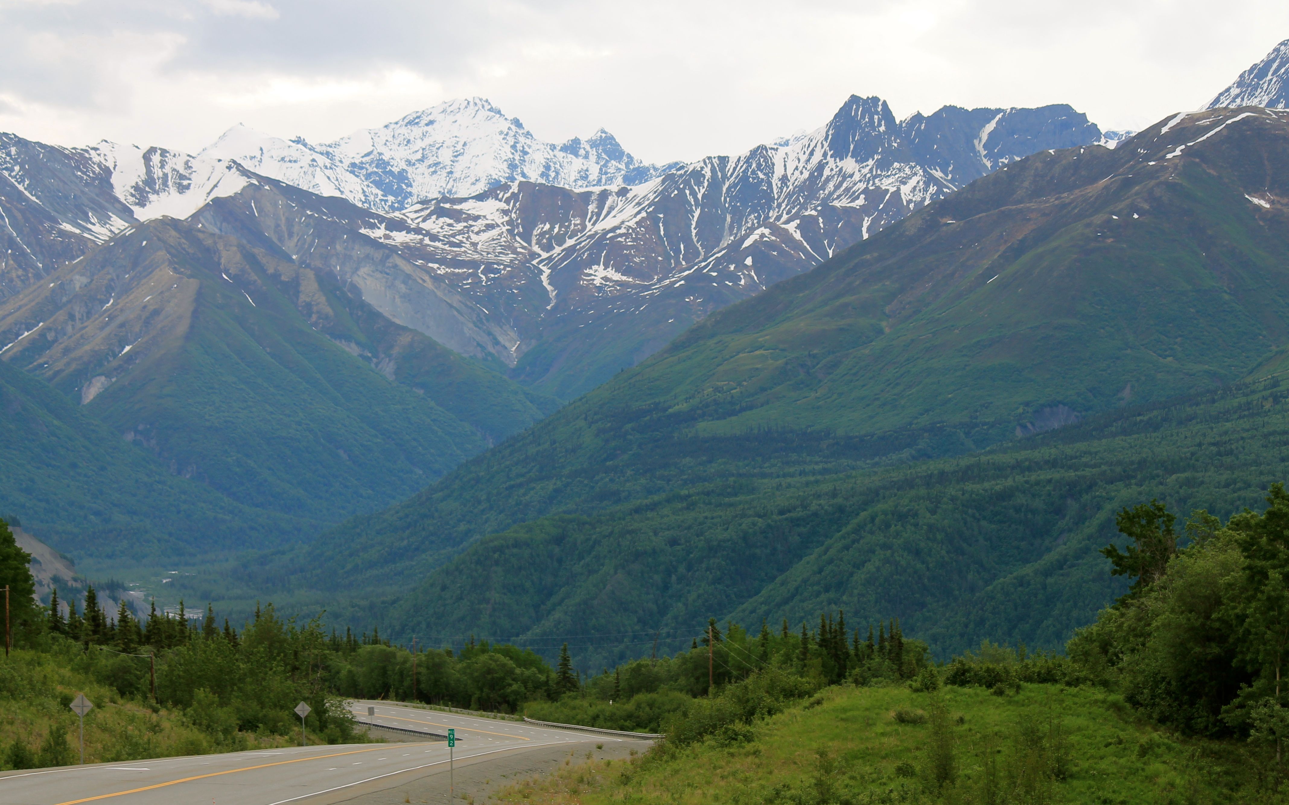
This was my first time traveling through the Canadian Rockies. Even on a cloudy rainy day, they were impressive. Turning north onto Hwy 93, I headed to Jasper.
I had the opportunity, once the rain stopped to take a few pictures. It is difficult to capture the grandeur, but I’ll have lots of learning opportunities in the coming weeks.
Wildlife sightings included one black bear in a ditch alongside the highway.
I knew something was there, because just like at Yellowstone, drivers will just stop to gawk. Jeez, folks, it’s a highway, eh?
Other wildlife included deer and mountain sheep. No photos of the animals, yet. Sorry. My regular riding buddy would say, “Well then, you really didn’t see them then.” LOL
The rock face of the mountains reminds me of those in Glacier National Park. I guess that shouldn’t surprise me since this is all part of the greater Rocky Mountain Range.
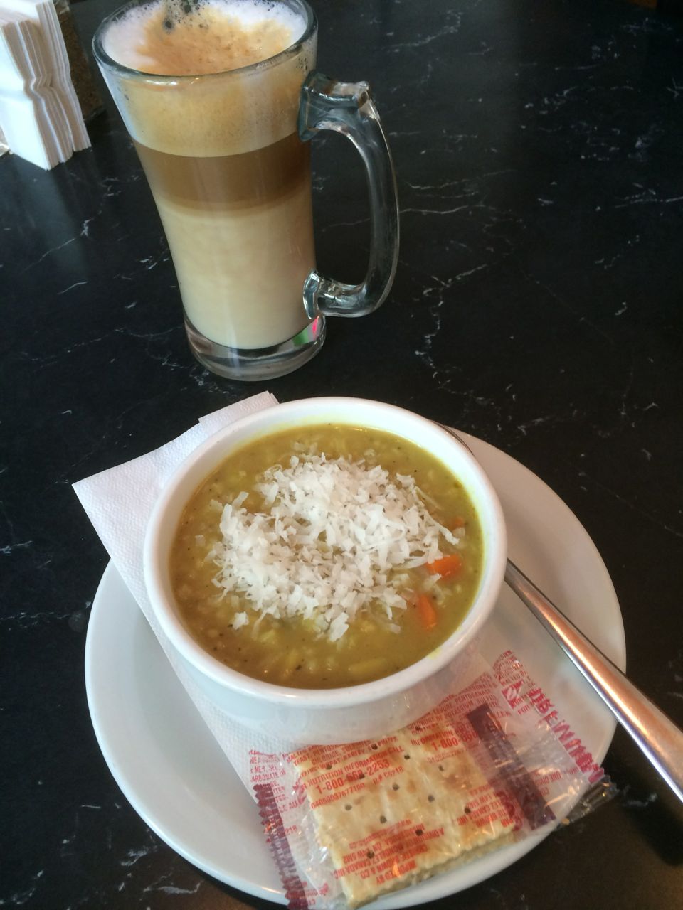
Approaching Jasper, I needed some lunch. I had eaten a rather giant apple muffin from Bluebird Cafe so soup and a second latte sounded great.
I asked the gods of Garmin for advice. My GPS showed me a number of choices and I picked Moody’s Cafe. Well the shortest route was blocked by construction. And, it turned out the second shortest route was also blocked by the same construction. I asked a flagger for directions, and he said, “That’s my mom’s coffee shop! Tell her Dale sent you.” and he told me how to get there with the current street situation. Small towns, eh?
I tried the Mulligatawny soup (with coconut sprinkles) and it was great! According to wikipedia, it is an English dish of Indian origin. It is a chicken stock with curry seasonings served with rice. I’m going to have to try to make this at home, as it would be awesome comfort food.
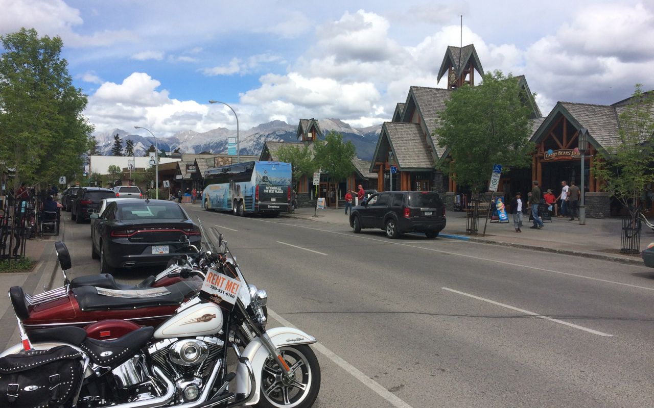
I parked near the coffee shop on one of the main walking streets in Jasper. Turns out it was just in front of a motorcycle shop focusing on rentals and tours (of the area in a sidecar) and retailing gear. After lunch, I spoke with one of the guys at length about where to stop in Watson Lake, not to miss the Laird Hot Springs, etc..
I turned east onto Hwy 16 and the geography started to change.
About an hour out of Jasper, I turned north onto Hwy 40, or what my GPS referred to as a Range Road. Much of the road was in good shape and the speed limit was 100kph.
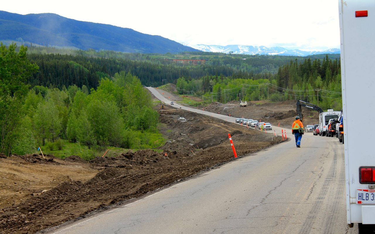
As I approached Grand Cache, there was an ongoing highway project widening Hwy 40 that resulted in one 15 minute delay.
On this trip, since I made reservations for every stop ahead of time, I also researched the local restaurant options and listed my favorite on my itinerary. Tonight, I would check out The Ridge, about a block from my motel.
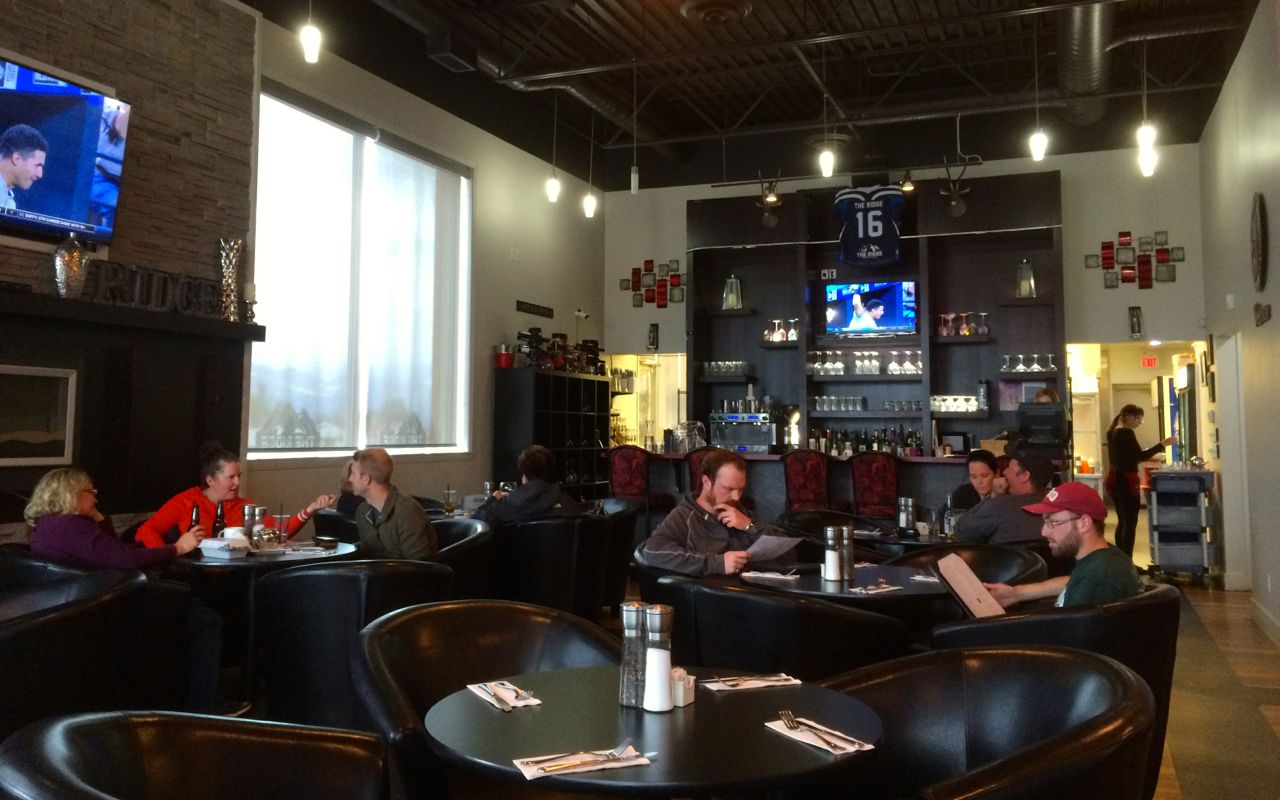
I had a sirloin steak sandwich with a spicy mac’n’cheese side. Both were excellent! My server, Jordan, was super friendly and she made the suggestions. The decor was contemporary, just like the room decor at the Acorn Motel. I love that type of surprise and would recommend both the restaurant and the motel. 🙂
Tomorrow, I have a relatively short ride to Dawson Creek where the Alaskan Highway begins. Woo hoo!
Day 5
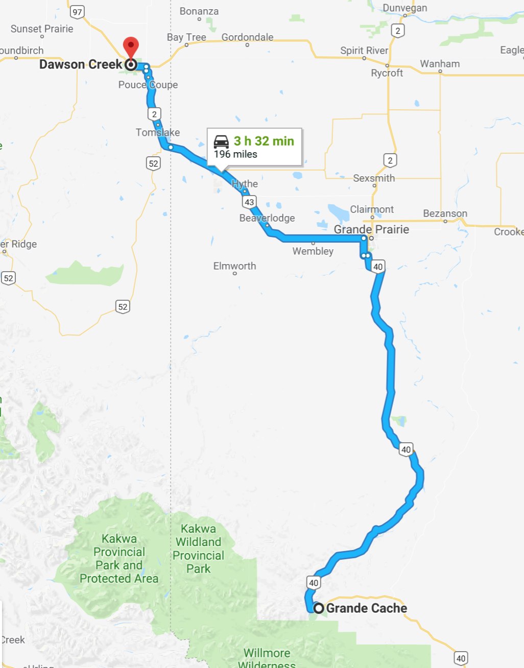
Day’s distance: 196 miles
Total trip distance: 1,294 miles
Temperatures were in the low 40s at 9am when I started to pack up the bike. It stayed in the 40s for a couple hours before climbing into the 50s. It was cloudy but dry today. Winds started to pick up as I approached Grande Prairie.
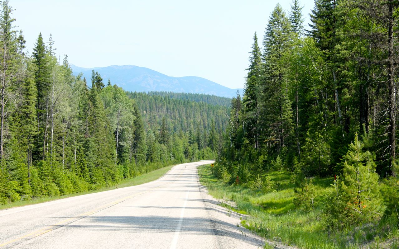
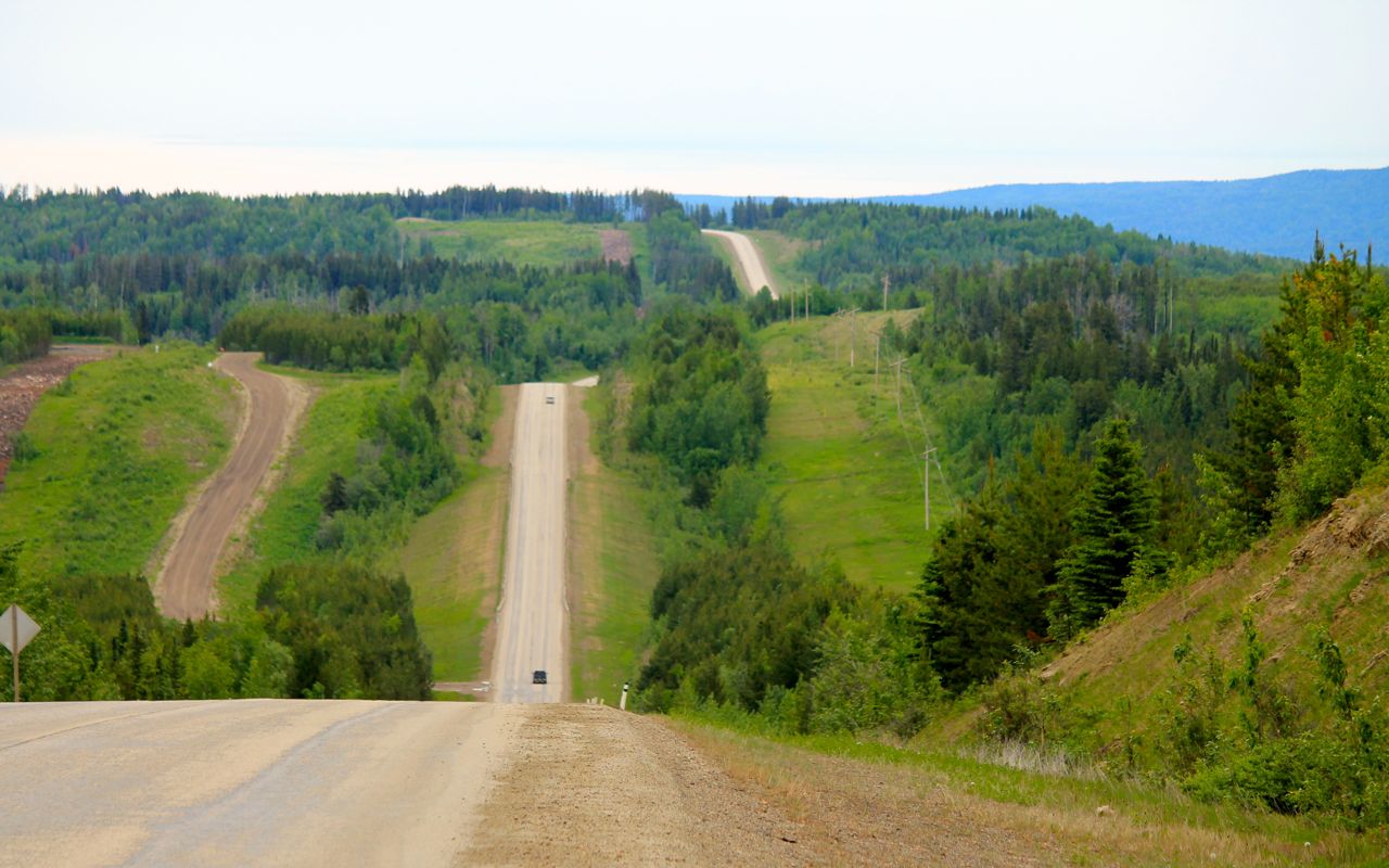
North of Grande Cache, Hwy 40 is well-surfaced and in good shape. It winds over and around the hills. Much of the traffic is associated with the gathering and transport of natural gas and other commodities. Much of the land is actively forested, mined, or drilled.
Riding a motorcycle, one is exposed to the smells of any area you are riding through. While the coal plant didn’t smell, some of the gas fields did. 😦
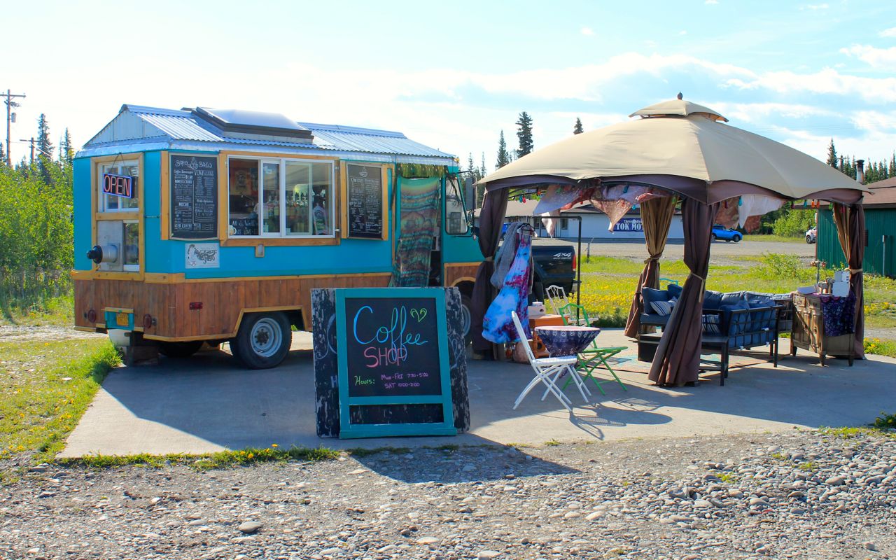
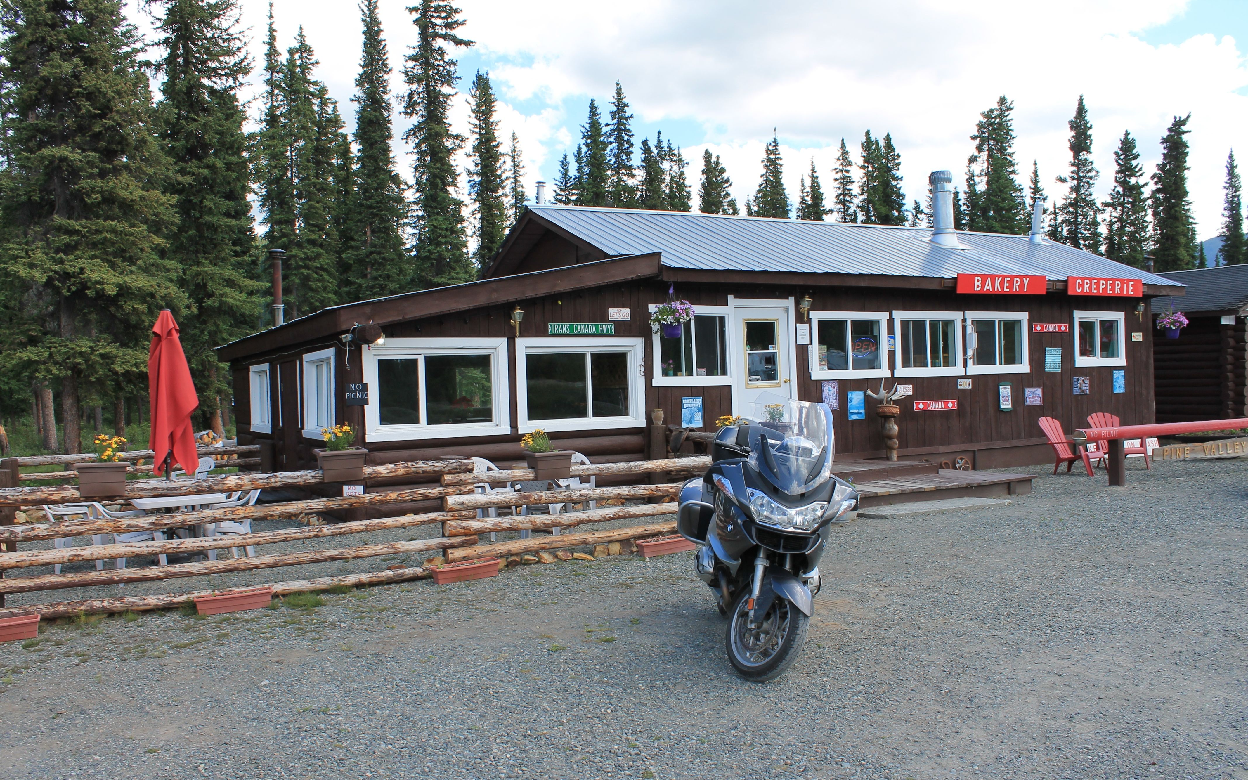
I was still close to an hour from Grande Prairie and considering stopping to make some instant coffee when I came across this food/coffee trailer.
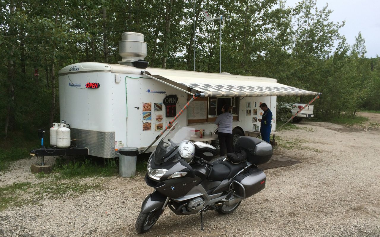
I grabbed a coffee and had some of the snacks I had in my pack. The owners are a local husband and wife team. Kevin, the husband in that team, was talking to me about the motorcycle and our conversation turned to airplanes (he’s a pilot) and travel.
In 2014, I traveled to Tanzania. Kevin, it turns out, helped start the Kilombero-Valley Farm in Tanzania. Kilombero Farms is a private cooperative producing staple food southwest of Dar Es Salaam. That conversation and looking at the photos on the website linked above brought back memories of my trip, though the time I spent was in a different part of the country.
People live such interesting lives. I am continually surprised at the connections between each of us, no matter how far apart we live.
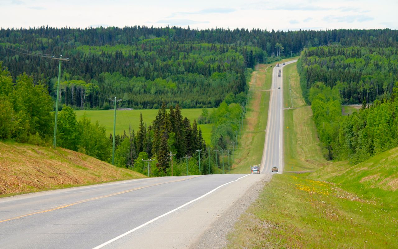
Hwy 43 was two lanes in each direction just west of Grande Prairie, narrowing to one lane each way later. Most of the landscape between Grande Prairie and Dawson Creek reminded me of the midwest. Low rolling hills dotted with farms and ranches and lots of wind. The wind was kicking up a bit during this part of the ride, as mentioned. Nice road but not interesting.
I arrived in Dawson Creek about 1pm. For me, it seemed like 2pm, but I’m now back in the Pacific time zone, so I gained an hour back. My room was ready so I have the afternoon off today – yay! This was the plan and the reason today’s hotel has a pool and spa. 🙂
Tomorrow, I start along the Alaskan Highway, which begins here in Dawson Creek at the Mile 0 marker downtown.
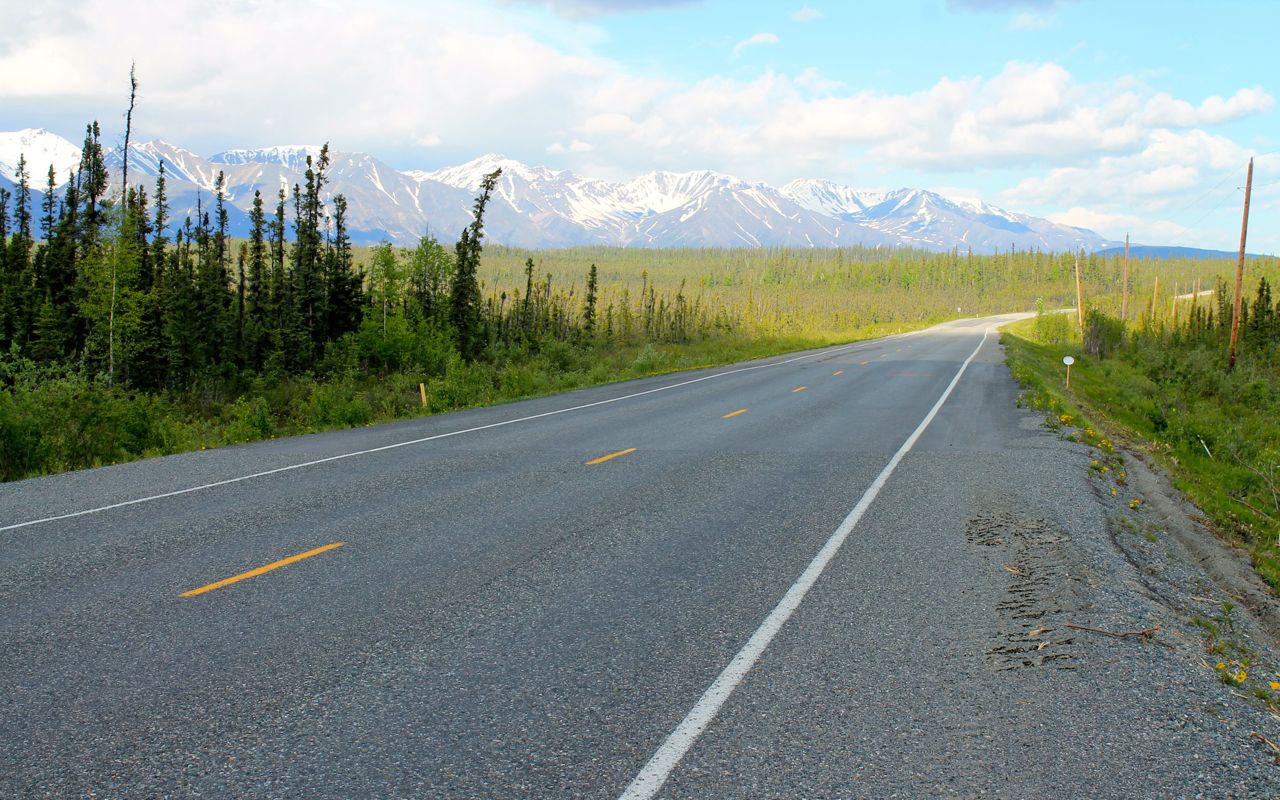
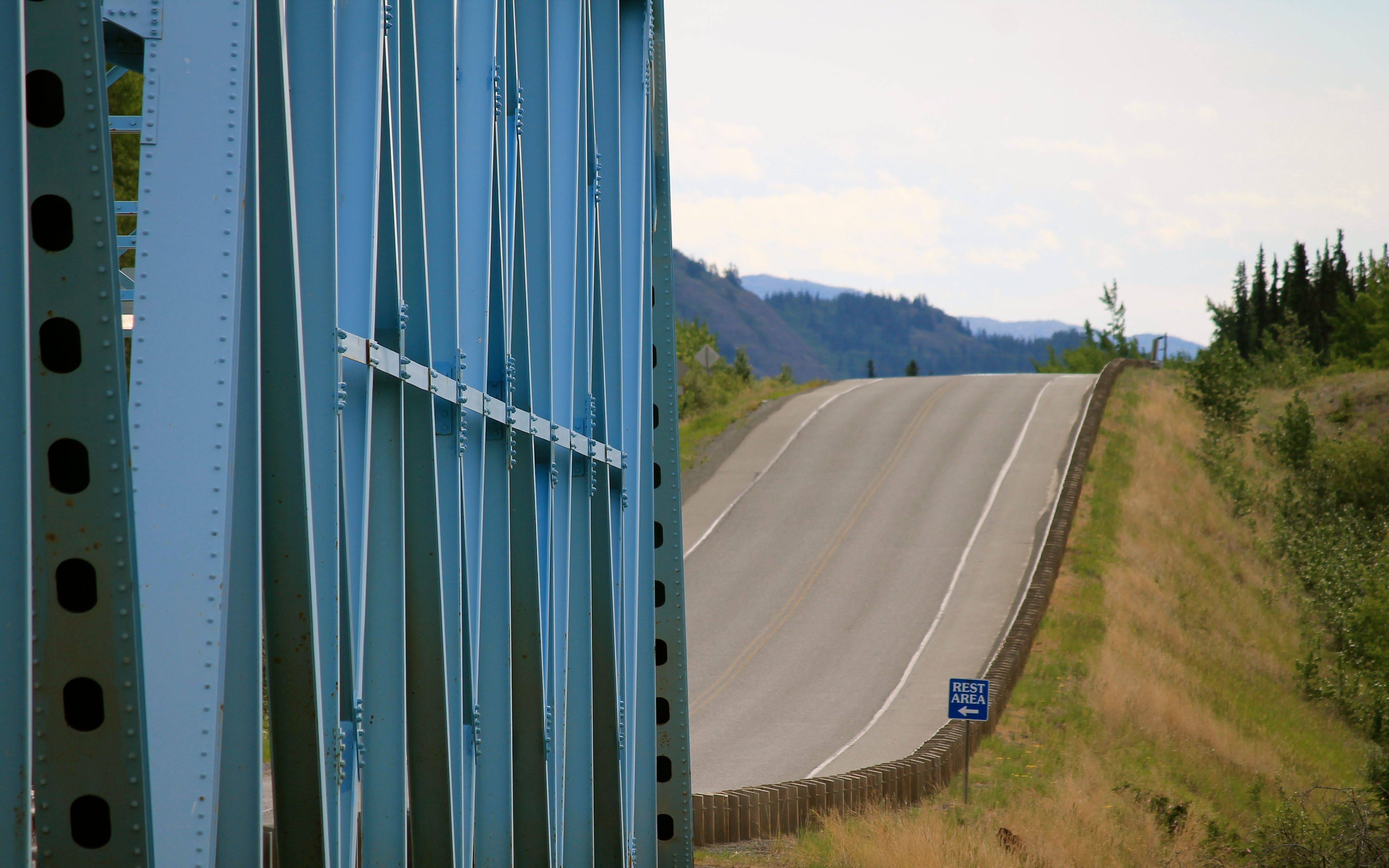
The ride between here and Fort Nelson, almost 300 miles away, will consist of a lot of straight sections. No rain is predicted, but it may get windy in places.
A look ahead at next weekend, the Dalton Highway is currently in good shape and no significant rain is predicted before my opportunity to ride part of it on Saturday.
Stay tuned!
PS
I ate dinner at the Fixx Urban Grill right here at the Stonebridge Hotel. The Cajun Blackened Chicken and Prawns were excellent. I sat at the bar with others and the folks on both sides of me ordered it, and it was recommended by a former staff member I met earlier in the day at the casino next door (where I stopped to have a beer).
Day 6
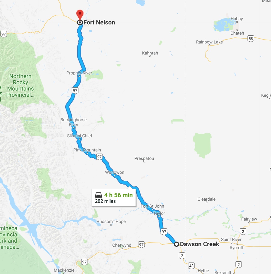
Day’s distance: 282 miles
Total trip distance: 1,576 miles
Mid 50s in both the morning and evening with a daytime high of mid 60s. Some moderate winds this morning and a few heavier showers this afternoon just during my last 50 miles or so.
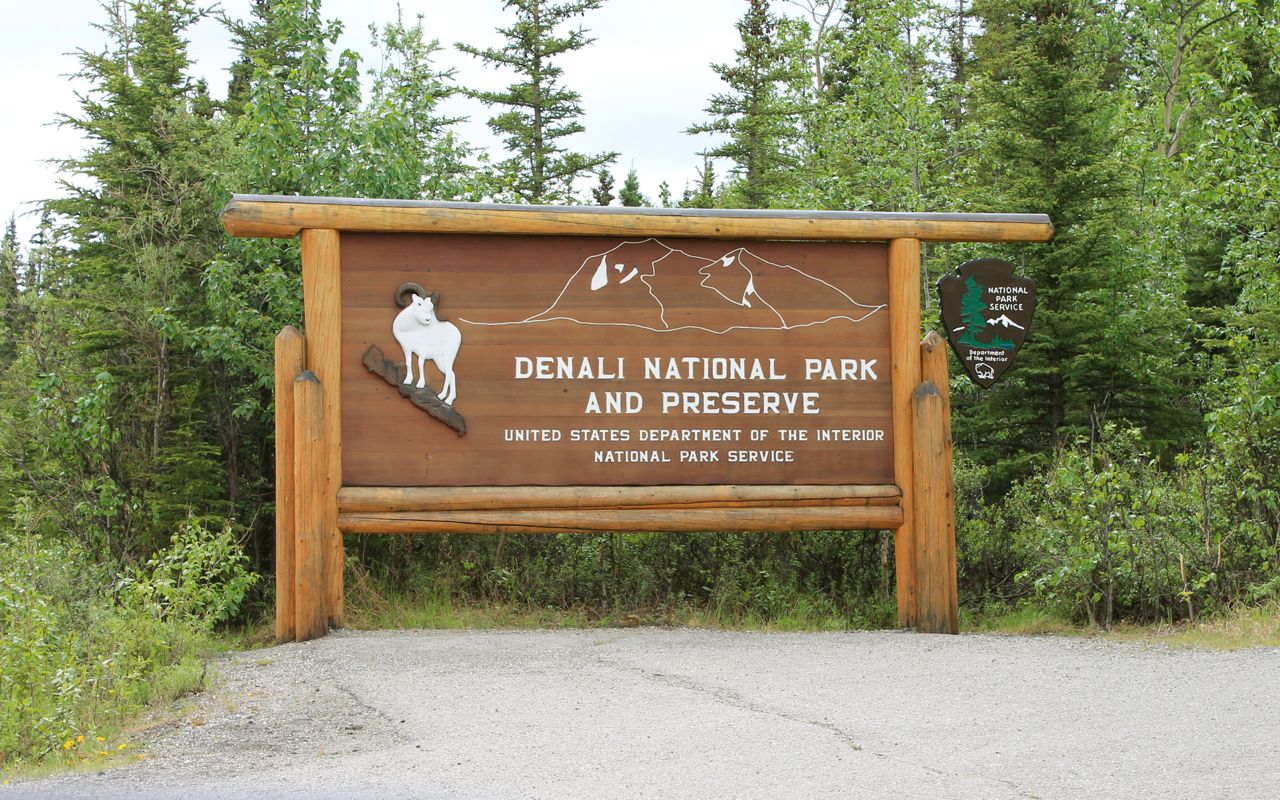
As mentioned in yesterday’s post, the Alaskan Highway begins in Dawson Creek.
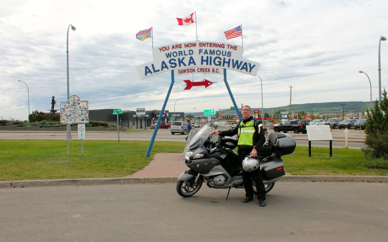
According to wikipedia,
The Alaska Highway (also known as the Alaskan Highway, Alaska-Canadian Highway, or ALCAN Highway) was constructed during World War II for the purpose of connecting the contiguous United States to Alaska across Canada. It begins at the junction with several Canadian highways in Dawson Creek, British Columbia, and runs to Delta Junction, Alaska, via Whitehorse, Yukon. Completed in 1942 at a length of approximately 1,700 miles (2,700 km), as of 2012 it is 1,387 mi (2,232 km) long. The difference in distance is due to constant reconstruction of the highway, which has rerouted and straightened out numerous sections. The highway was opened to the public in 1948.[1] Legendary over many decades for being a rough, challenging drive, the highway is now paved over its entire length.[2] Its component highways are British Columbia Highway 97, Yukon Highway 1 and Alaska Route 2.
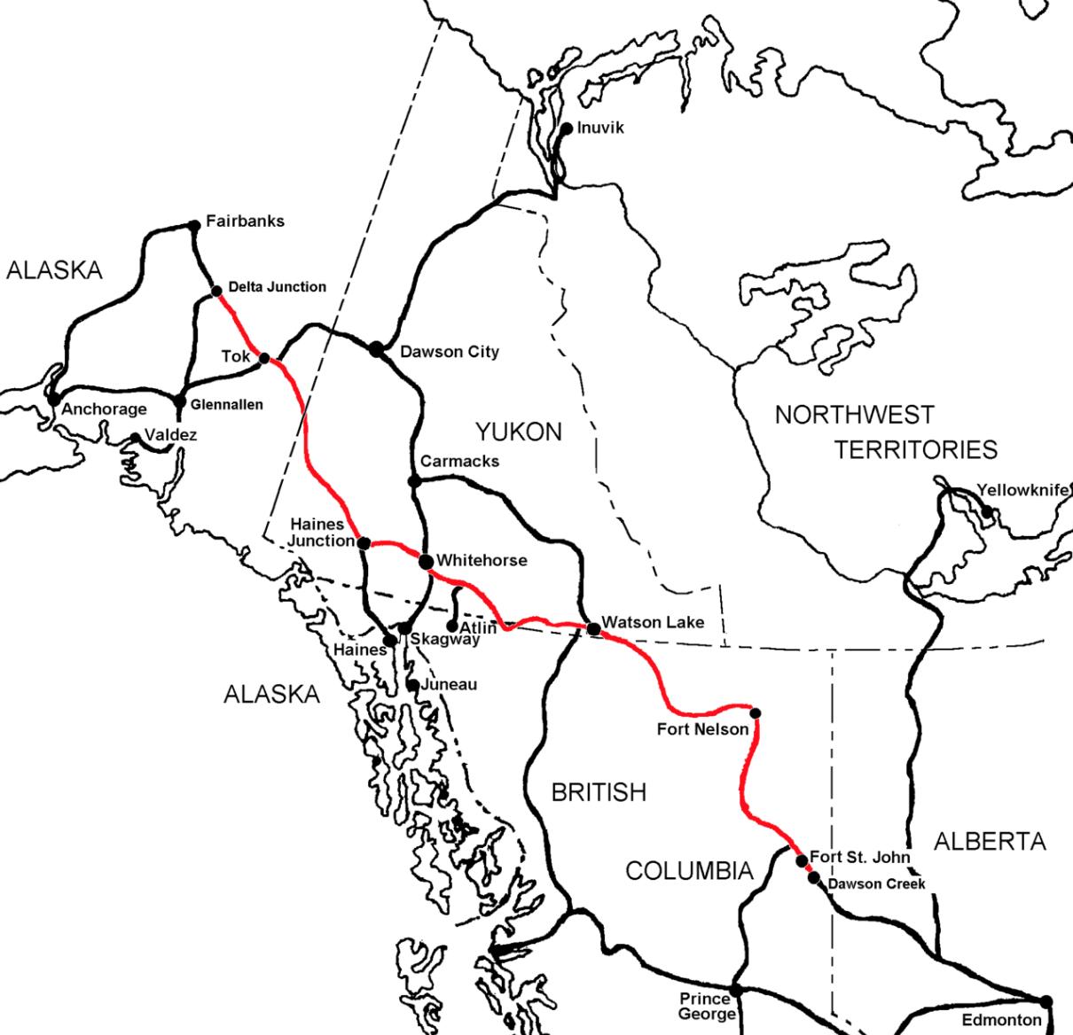
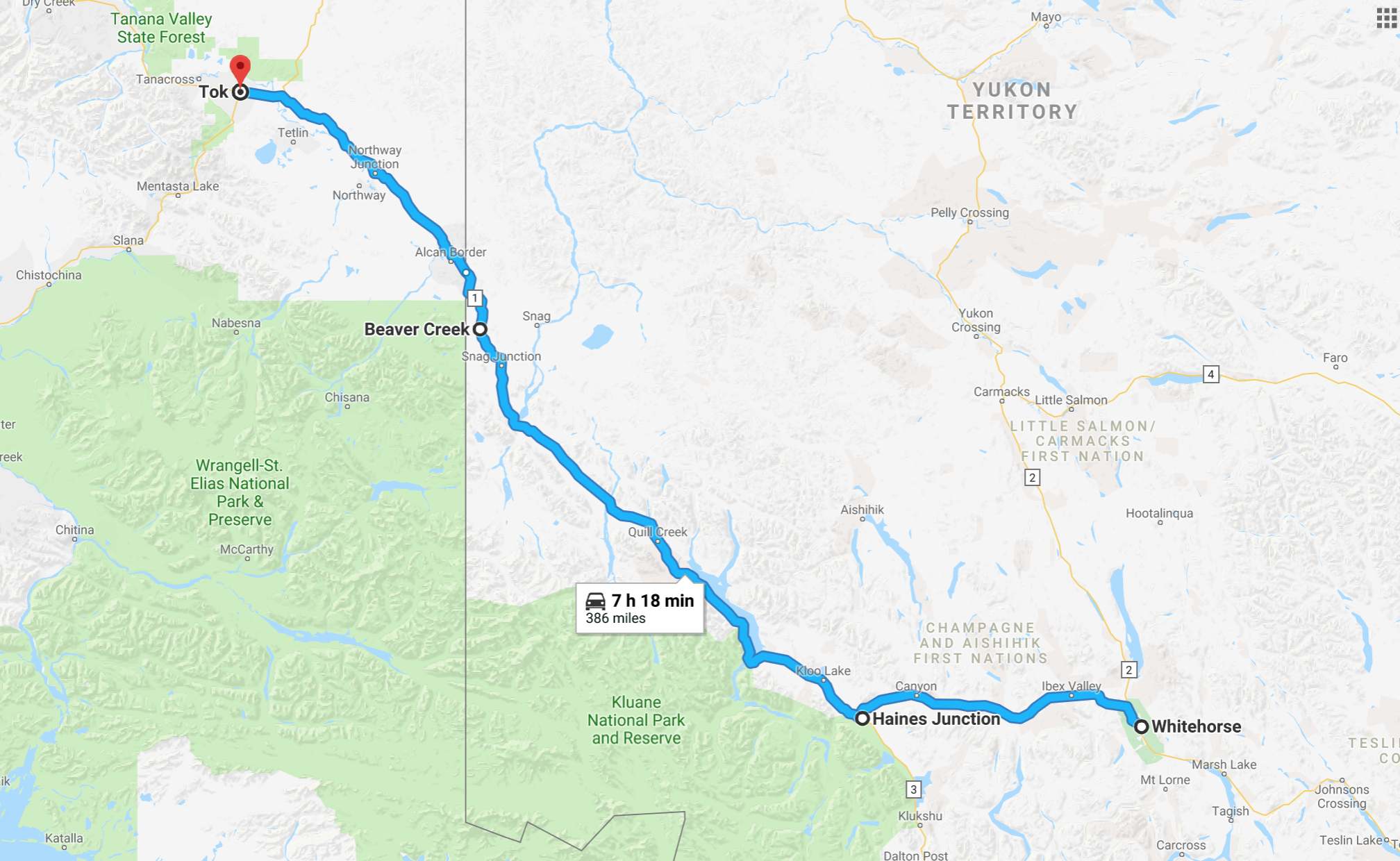
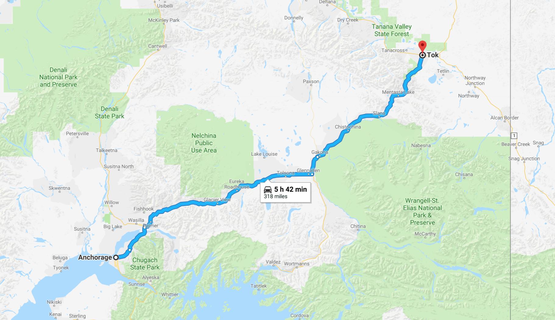
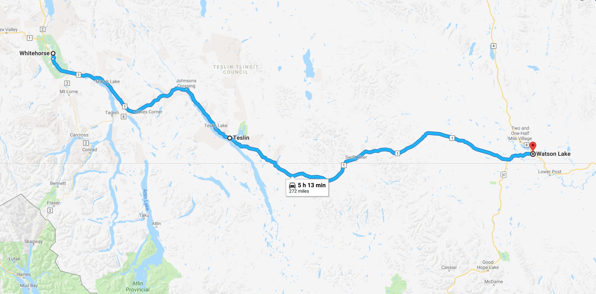
It will take me many days to travel the Alcan. I will be stopping in Watson Lake on Day 7, then Whitehorse, and finally Tok before reaching Fairbanks at the end of Day 10.
Other riders will travel faster and farther, covering the total distance in fewer days. My plan covers roughly 300 miles of the Alcan each day.
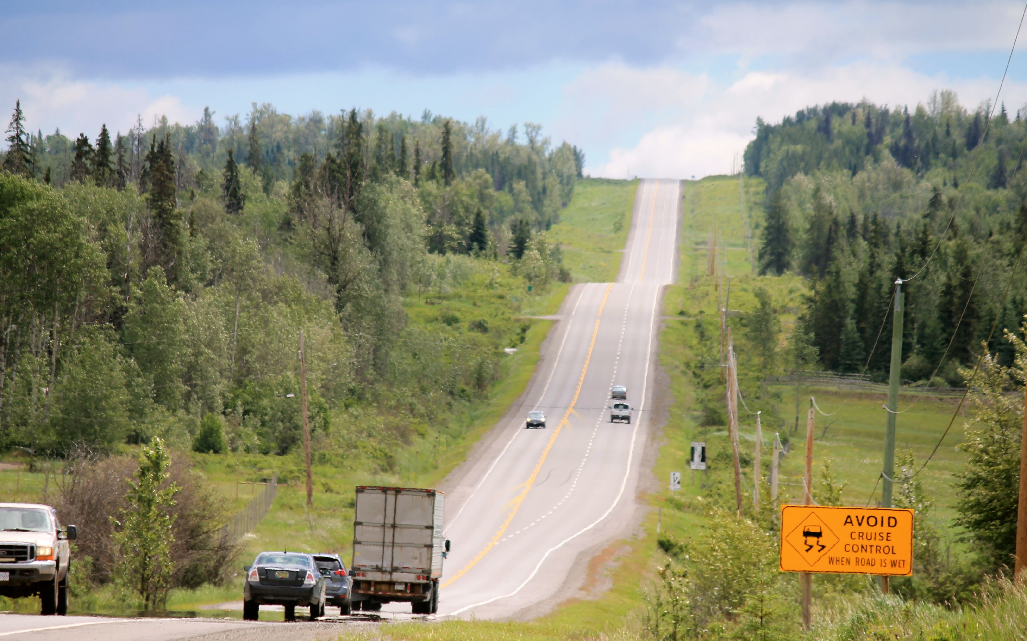
Speed limits along the highway are generally 100 kph, except in towns and construction zones.
Between Dawson Creek and Fort St. John, the road is pretty much like any semi-rural highway in the US. I felt more isolated along Hwy 40 heading to Grande Cache. 😉

North of Fort St. John, I encountered less traffic. It seemed vehicles are either trucks hauling commodities like fuel or tourists, like myself.
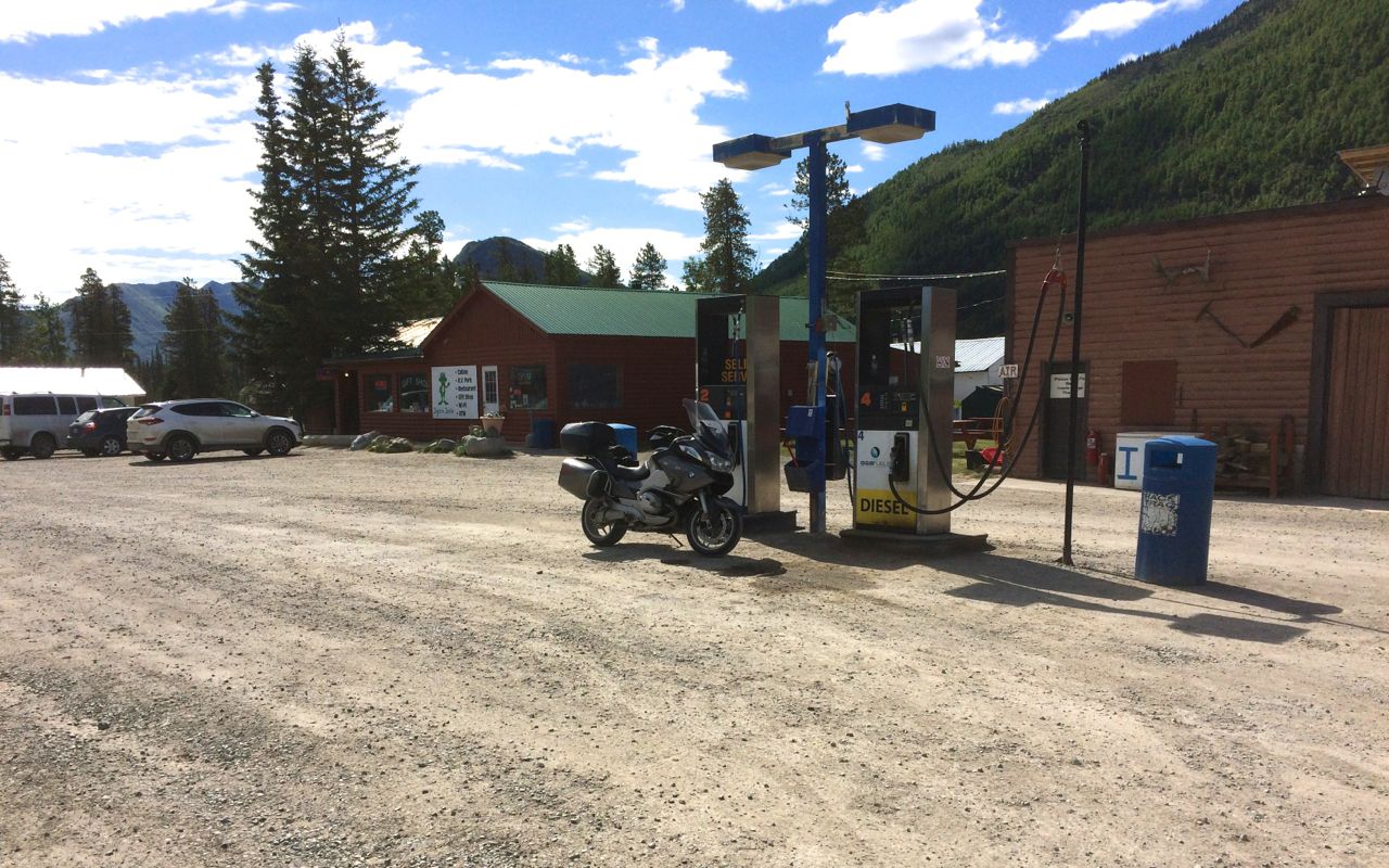
I planned my gas stops according to the information I found from the internet. So far, that has worked well for me. Below is a photo taken in Wonowon, BC.
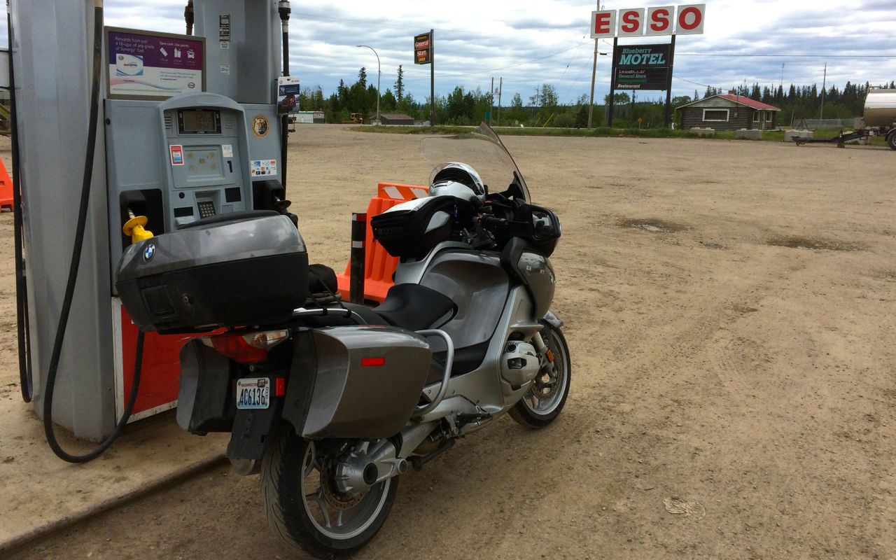
Pleased to find premium fuel here, I topped off the tank. The price of premium fuel so far has been about $1.50 to $1.67 CAD per liter.
Here is Canada, you explicitly prepay for fuel. If using a credit card, you (can usually) select or specify the maximum amount you want to spend, say $40 CAD, and the card will be pre-authorized for that amount to make sure funds are available. Then you fill up and your card is charged for the actual amount you use. The preauthorized amount falls off your credit card balance a day or two later.
Some stations default to a preauthorized amount of $200 CAD unless you go inside and make arrangements for a lower amount, a good idea if your card has a lower limit or you carry a balance.
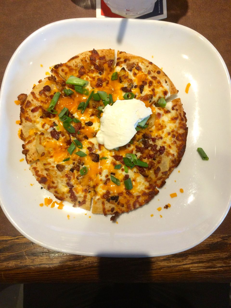
I arrived in Fort Nelson before 4pm, delayed by the late rain showers and a 15 minute wait at a highway construction zone south of town. There was a Boston Pizza restaurant and sports bar next door with good reviews so I headed over after cleaning up.
I ordered an individual sized Spicy Perogy pizza and a pint of Richard’s Red. The pizza had a sour cream base, bacon, cactus cut potatoes, green onions, cheddar and mozzarella cheeses, finished with another dollop of cream. It was very good.
On my return to the motel, I met two other Washington riders, Michael (Mike) and Jim. Jim bought his bike from Roman, the same salesman that sold me my bike. Small world, eh?
They had yet to eat and thought the pizza sounded great. I went back to the restaurant with them and had another beer while we talked for another two hours.
Restaurants use these wireless handheld devices to process credit card transactions. It was a little weird at first, but overall it seems convenient, reliable, and you don’t have to hand over your credit card to anyone during the process.
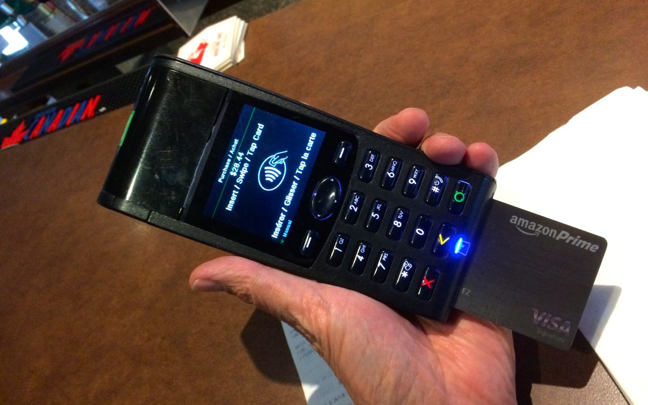
I have alerts set up on my cards and usually receive an email with the US dollar pricing of the charge before I’ve even left the restaurant.
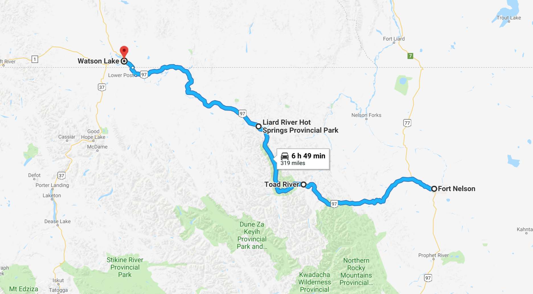
Tomorrow, I continue to Watson Lake with a stop at Liard Hot Springs Provincial Park for a soak, if things work out.
From my trip planning notes, posted before leaving,
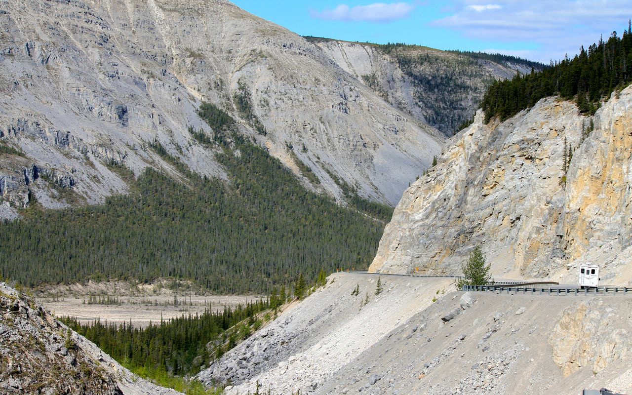
North of Fort Nelson, the Alaska Highway crosses the Rocky Mountains: Expect about 200 miles of narrow road with curves and hills with 10 percent grades and few passing lanes. This stretch of road crosses Summit Pass (Historic Milepost 392), highest summit on the Alaska Highway at 4,250 feet elevation. You may experience an odd snowstorm here, even in July. After winding through the MacDonald River valley—few guardrails and watch for caribou and stone sheep on the road—the highway straightens out again for the next 140 miles into Watson Lake, YT
Fun, fun!!
Day 7
Day’s distance: 319 miles
Total trip distance: 1,895 miles
Mid 50s to high 60s with sunshine and fluffy clouds. Nice day, really, for anyone on a motorcycle wearing as much gear as I do.
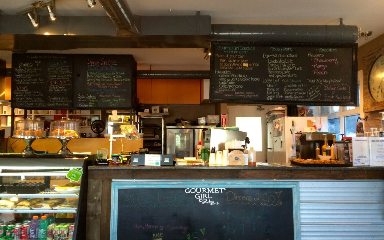
The Gourmet Girl coffee shop was the perfect place for me to start my riding day. Thanks for the suggestion, Carson!
Fresh baked cherry turnover to die for and an excellent latte, the owner here has been in business for going on two years.
I am seeing more bikers each day, and the scenery is getting really beautiful now that I’m back in the mountains.
The road description that I had posted as part of my trip planning was spot on about today’s twistier roads. But I now realize it was likely written by someone in a car. The highway was not particularly challenging for an experienced rider. That’s not to say the twisties weren’t welcome or beautiful – both apply.
Signage along the road is generally spot on regarding gravel, rough spots and trucking activity. So, just pay attention to the signs, except maybe the speed limits in the curves, which are universally too conservative for a biker in dry and sunny conditions.
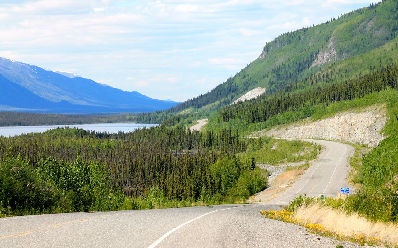
The road surfaces are in good shape, though there is some ‘washboard’ areas where I set my suspension to its softest setting to avoid the shakes. Also, in avalanche areas, watch for rocks in the roadway. I only saw a few but they were big enough to damage a rim. 😦
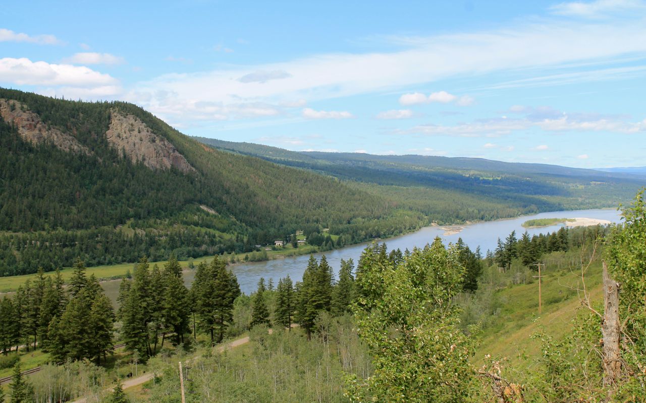
Here are a few vista shots.
Toad River was my expected fuel stop about halfway along today’s ride. This was the first station that I’ve used that only had regular gas. Since I have been filling with 91 octane (premium), and I had half a tank, I did not add octane booster this time.
I stopped at a small place in Muncho Lake for a sandwich. This place looks like its mostly a hunting and fishing spot. The breads were homemade and the servings were huge. They had fuel available, as well, but I had a full tank.
The roadway followed the edge of the lake. This photo was looking south, at where I had just been.
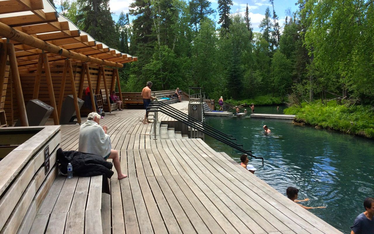
I stopped at Liard River Hot Springs for a planned soak. The entry fee was $5 CAD and well worth it.
I kept my tank bag, the only thing I can’t lock up, with the staff at the gate. They have towels and suits to wear, if needed, as well as water and soda.
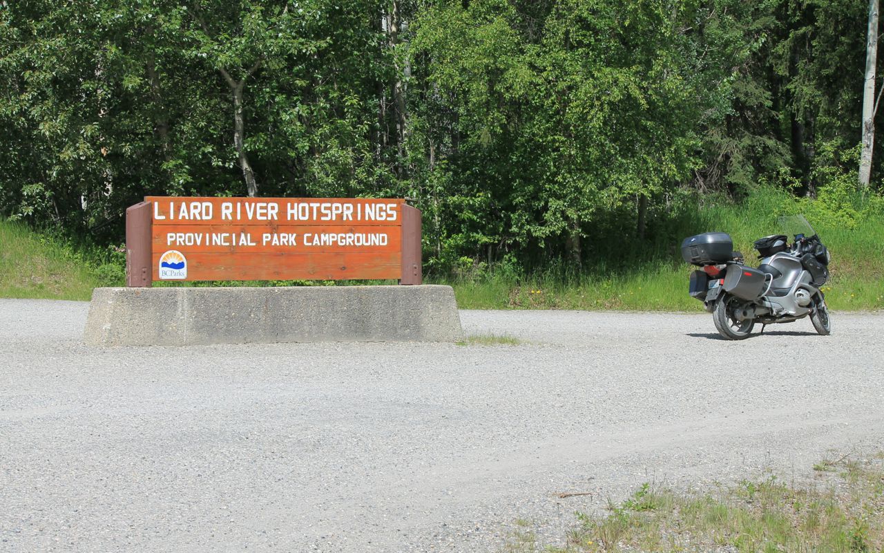
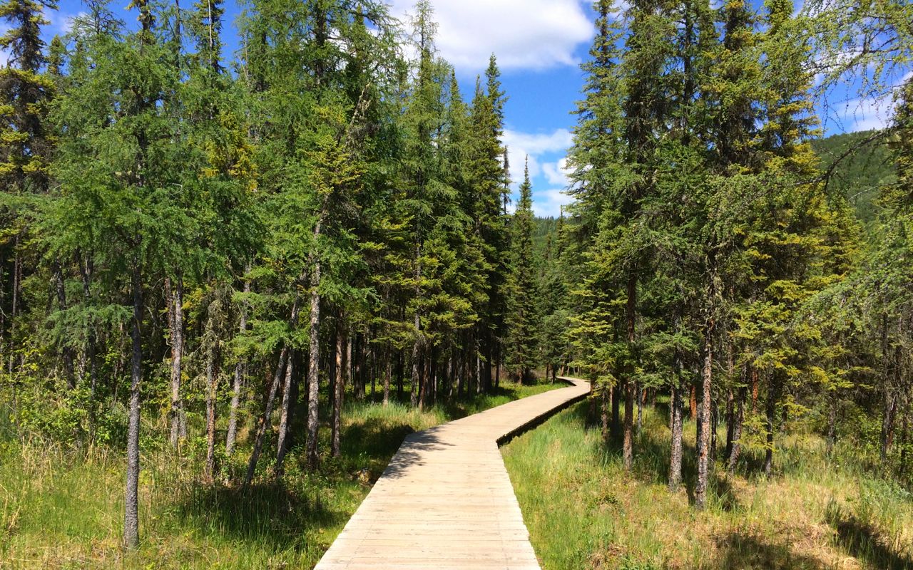
You park and then take a short 5 minute walk to the springs along a boardwalk.
They have changing rooms and open lockers for your stuff. It is easy to keep an eye on things as it wasn’t crowded today.
I met another biker in the parking lot. Harald was in the process of moving from Fort St. John (if I remember correctly) to Vancouver Island. We talked about travel, the work we’ve done, etc. Very enjoyable and time passed quickly.
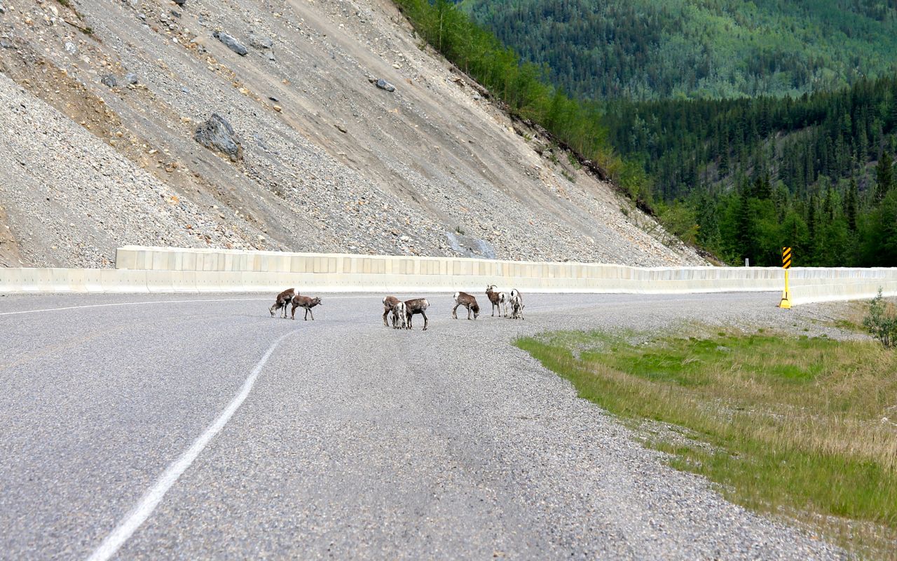
I captured some of the wildlife as it found its way to the highway. Mountain sheep …
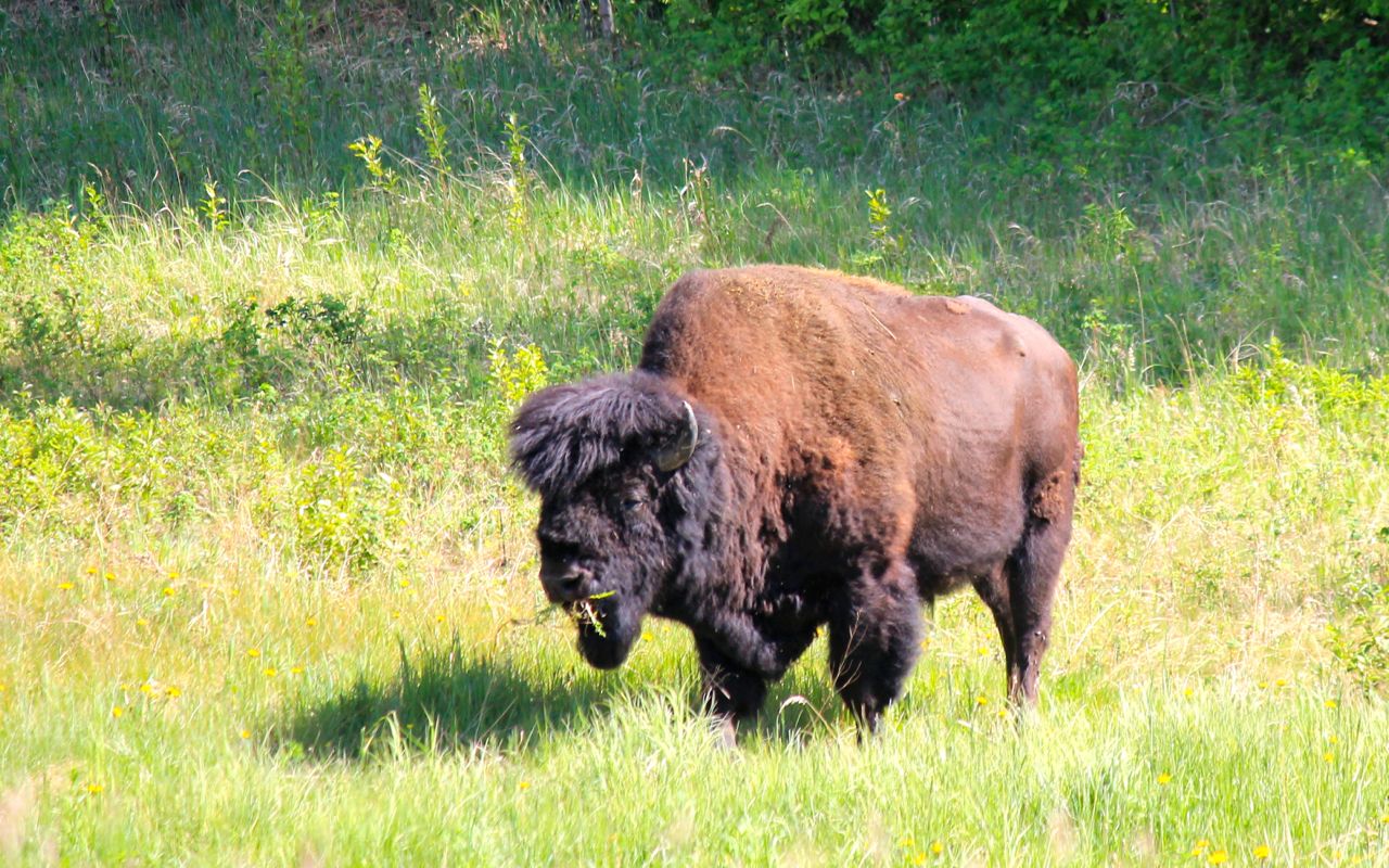
buffalo …
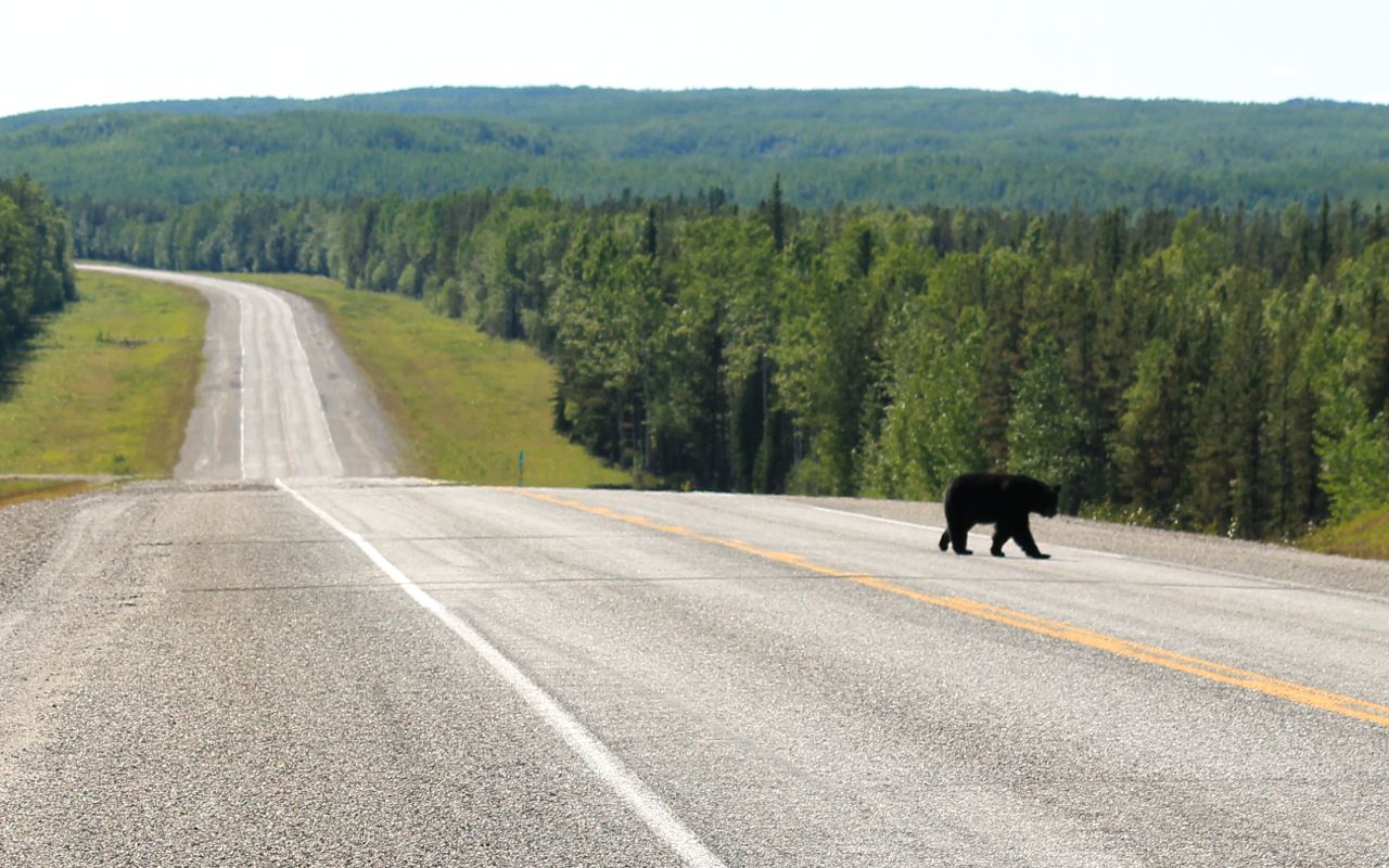
and black bears, among other smaller critters. This was the best of the black bear photos so far.
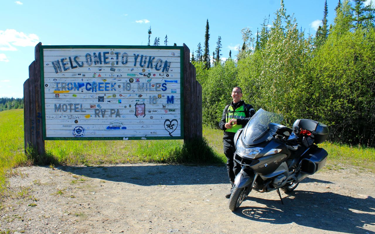
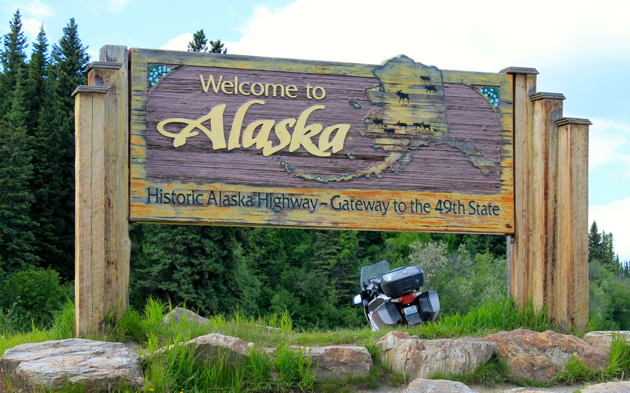
I entered Yukon for the first time a little after 4pm. I say the first time because the Alcan travels above and below the BC / Yukon border as it follows the mountains (see the map above).
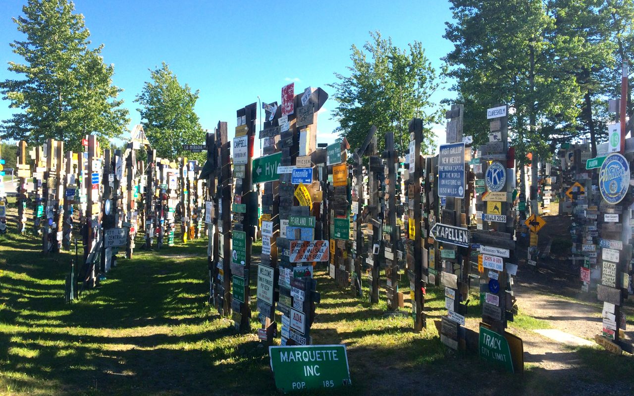
The Sign Post Forest is a favorite point of interest for bikers. The original signpost was started by a homesick soldier in the 40s during the construction of the highway.
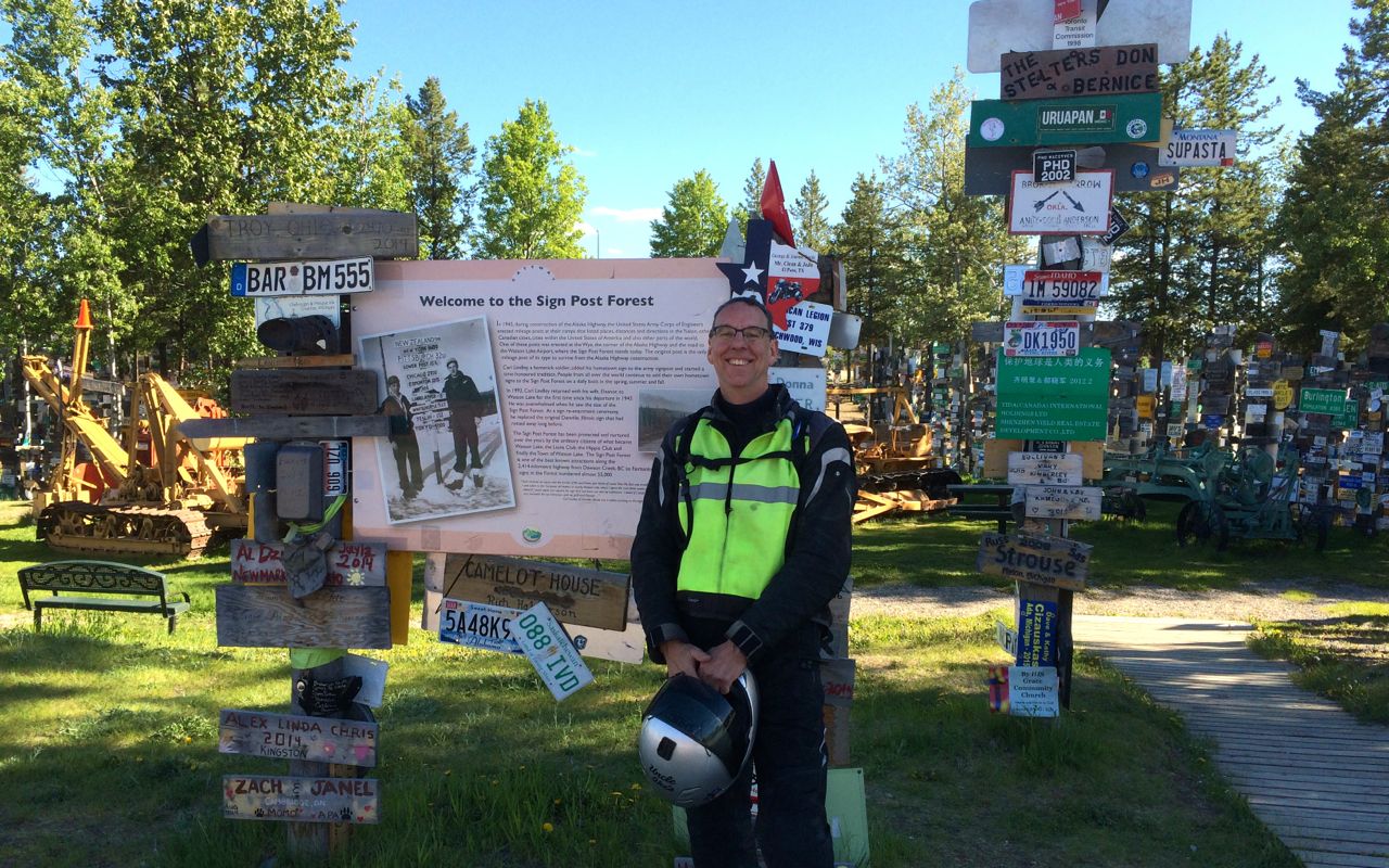
It now covers about one square block of area.
I found premium fuel at Tag’s and topped off for my ride tomorrow. By the time I checked in to the motel, it was 6:30pm and I had to hurry off to dinner.
I had a steak sandwich at Kathy’s Kitchen. It was fine but I will try another of Watson Lakes restaurants on my way through going south. There are three or four choices, total.
I’m staying at the Big Horn Motel, but on my return trip, I’ll be trying the Air Force Lodge.
Tomorrow is more Alcan and more Yukon. Remember I’m on this highway for five days! Perhaps in my next life I’ll be an Iron Butt rider capable of traveling over 1,000 miles a day, but I’m not that person now. LOL
Day 8

Day’s distance: 272 miles
Total trip distance: 2,167 miles
The day started in the mid 50s and finished in the mid 60s. It was dry all day. Clouds moved in as I approached Whitehorse but the morning was pretty sunny.
I encountered the two longest stretches of gravel road so far. One patch was very dusty so I hung back until I was the last one through. While waiting, I spoke with the flagger. She said that in these situations, it is acceptable for bikers to ride to the front of the line.
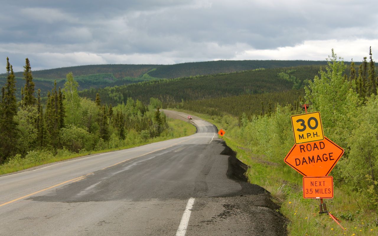
The road conditions in Yukon were not as consistently good as in British Columbia. There was a stretch of 100 miles or so where the road surface repairs were obvious and only temporarily effective. I had to watch for fresh potholes, choosing my line around some of the bigger ones.
I didn’t see any wildlife along the roadside the entire day. Guess the animals get a day off now and then, too. 🙂
As I approached Teslin, I stopped at a viewpoint above town for a short break. I met a woman from Smithers who was out traveling and we had a great conversation. She had many questions about traveling by motorcycle.
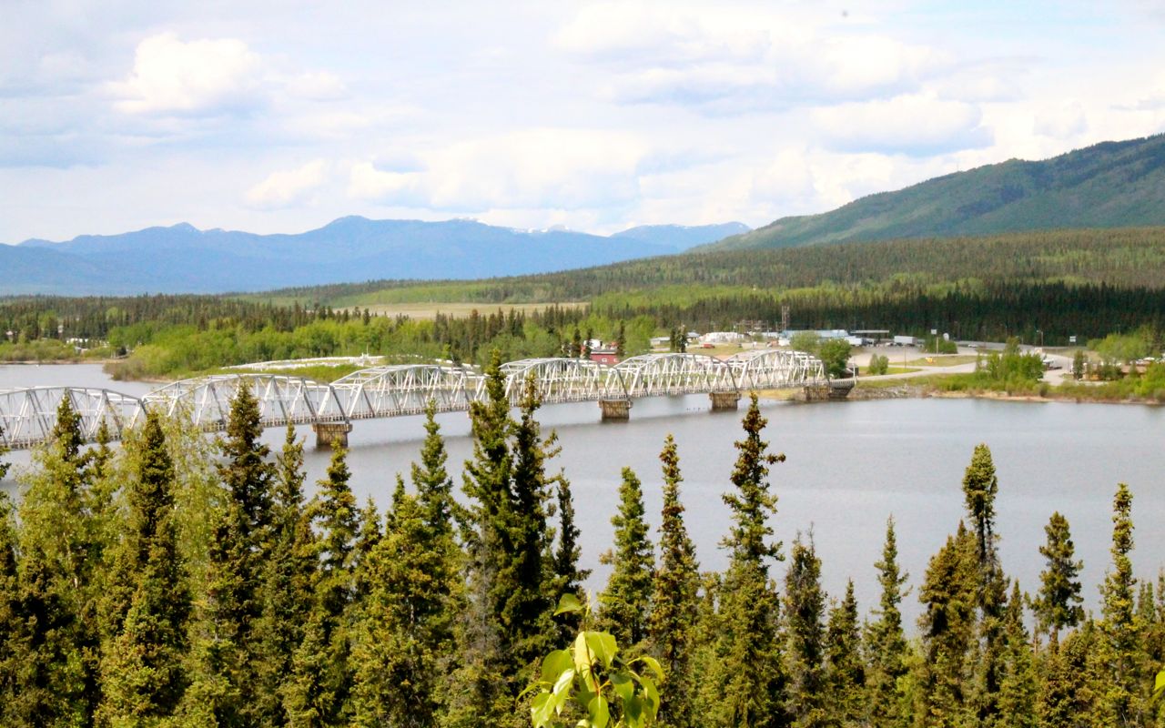
Many of the bridges along the Alcan have surfaces of bare metal grates. This was the longest encountered so far.
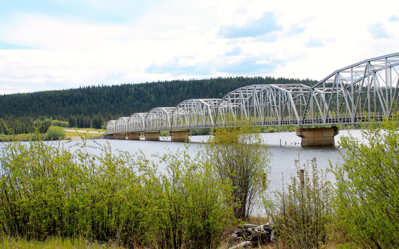
The Pilot Road 4 tires like to shimmy quite a lot on these and it makes for some excitement, especially when sharing the narrow bridge with oncoming trucks.
I refueled with premium at Teslin, about halfway to Whitehorse. One station had premium while the other didn’t. Glad I asked. The price of fuel has remained incredibly consistent along my entire ride. So far anyway, there isn’t a lot of price gouging in either gas or food.
While in Teslin, I grabbed lunch at the Yukon Motel & Restaurant.
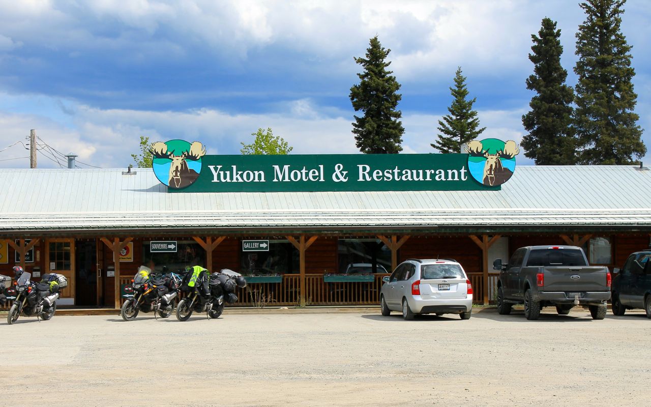
I ordered the buffalo burger, the lunch special. It was tasty and came quickly. I ran into the group of riders I saw from Argentina the evening before.
My next stop was about 30 miles later at Johnson’s Crossing where I grabbed a cherry turnover and some coffee. I had a chance to meet a bicyclists I had passed a few minutes earlier. Tobias was German and on a very long bicycle ride that originated in Panama!
With the two longer conversations, here and at Teslin, I arrived in Whitehorse at about 5pm, just in time for the rush hour in Whitehorse (kidding!). I got checked in and took my time getting ready for dinner.
I planned to eat at a well considered restaurant called Antoinette’s, just two blocks away. Covered by the TV show You Gotta Eat Here, twice, the place was packed and I had to return an hour later when my table was ready.
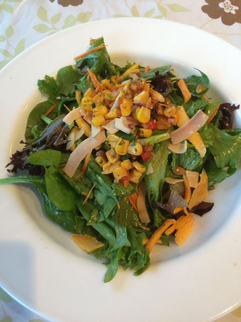
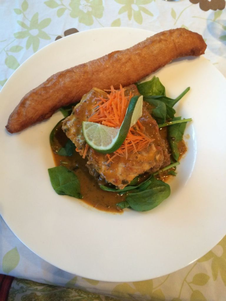
I had the Carribean Salad, the day’s appetizer special, and the Halibut TnT, served in a light coconut-tomato curry on coo coo (polenta) with fresh spinach and float (fried sweet bread).
Both were so very good I made reservations for the following week when I would be coming through Whitehorse on my return leg.
Despite being busy, the staff was super friendly and calm under pressure. Antoinette was in the restaurant, eating dinner with some friends. It was a great experience.
Tomorrow I enter Alaska. Rain is predicted for the morning. Tok, my destination, shows increasing clouds and some wind, but no rain. It will be my longest day so far at 386 miles, and I’ll be camping, so expect my next blog entry to be from Fairbanks in two days.
Day 9
Day’s distance: 386 miles
Total trip distance: 2,549 miles
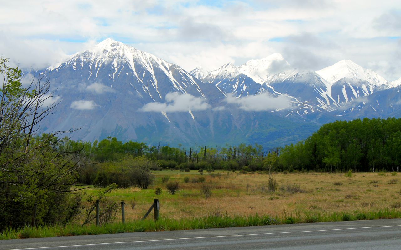
The day started out with steady rain that lasted until reaching Haines Junction. It was pretty cool at 41 degrees. After that, it warmed up eventually into the mid 50s with clouds and sun breaks.
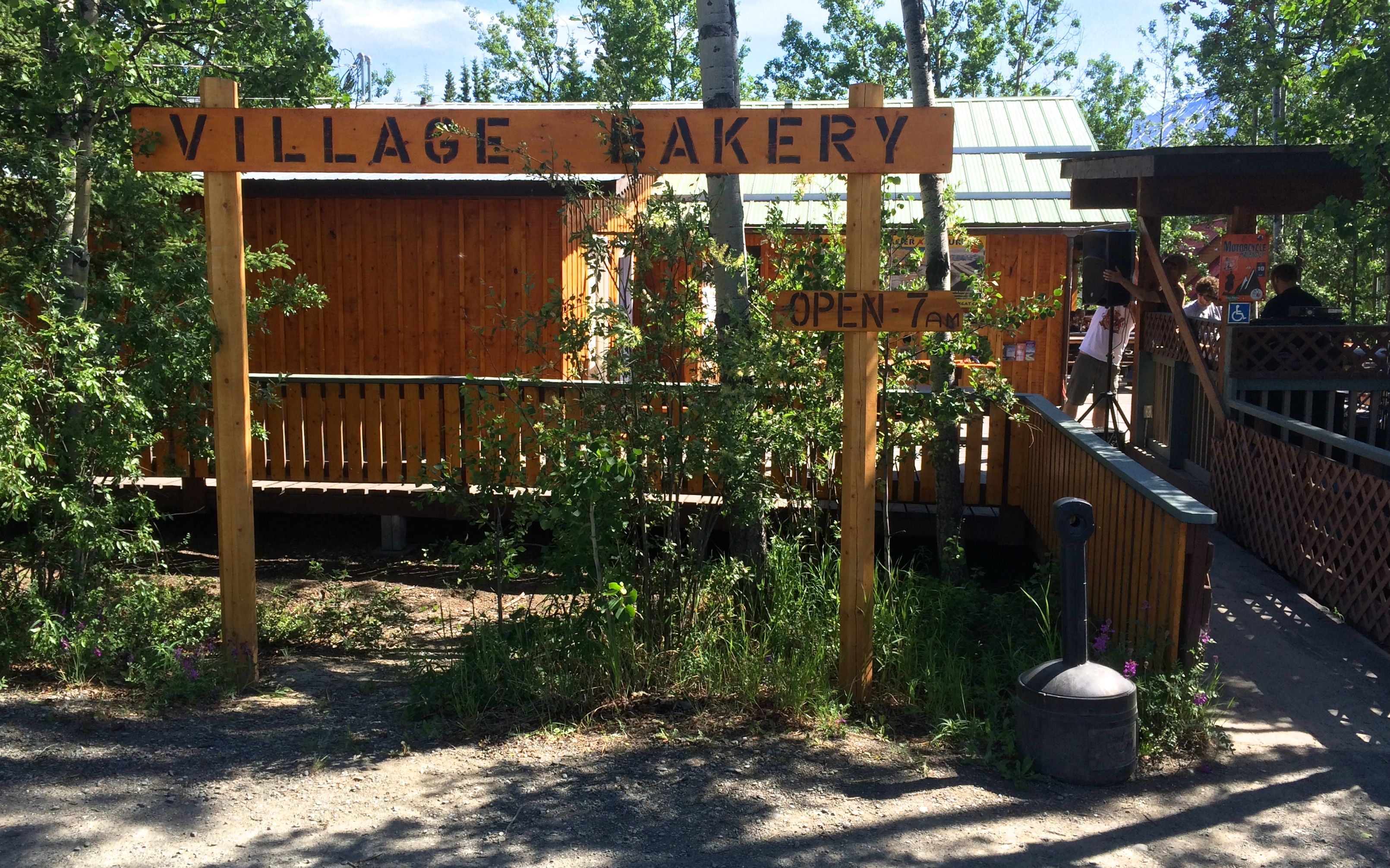
In Haines Junction, I stopped at the Village Bakery and grabbed a savory scone and some beet soup, as well as an extra hot latte. After eating, I put on a sweater and topped off my gas tank before taking off again.
I have to say the mountains of the Kluane National Park were pretty spectacular, even hiding behind the cloud cover.
The roads continued to be in good shape, though amenities like painted center lines seemed to be lacking in spots. No biggie.
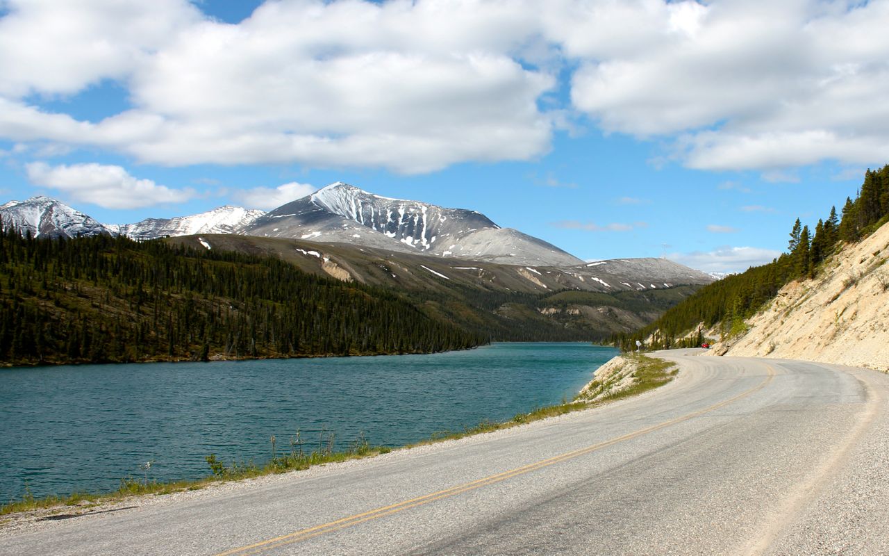
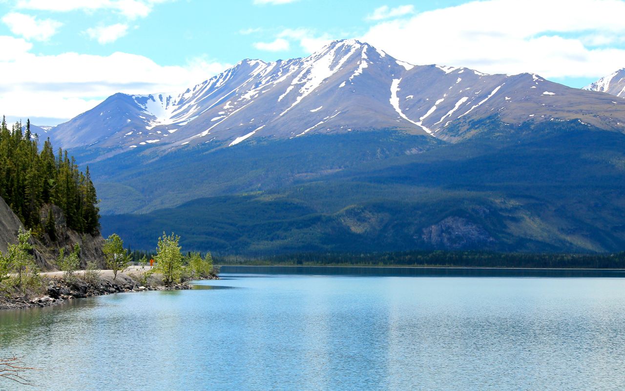
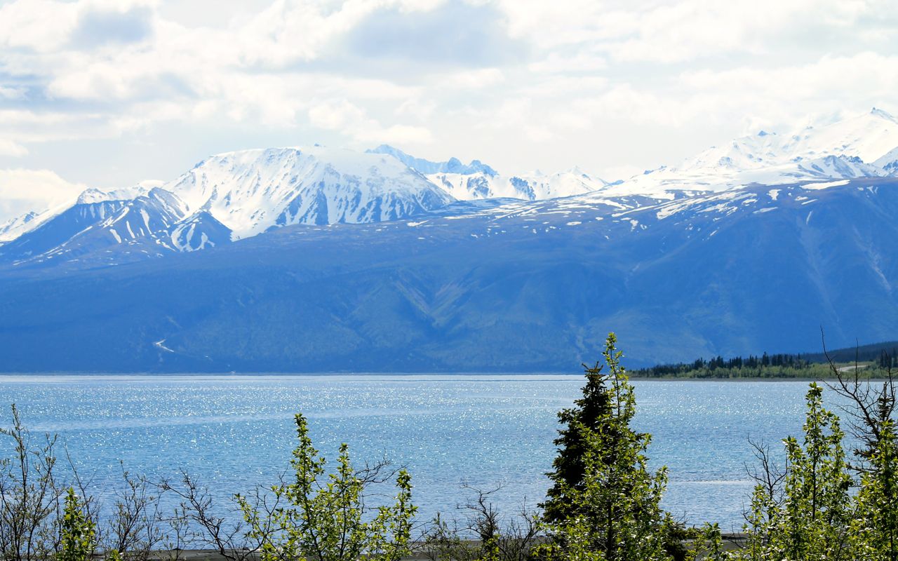
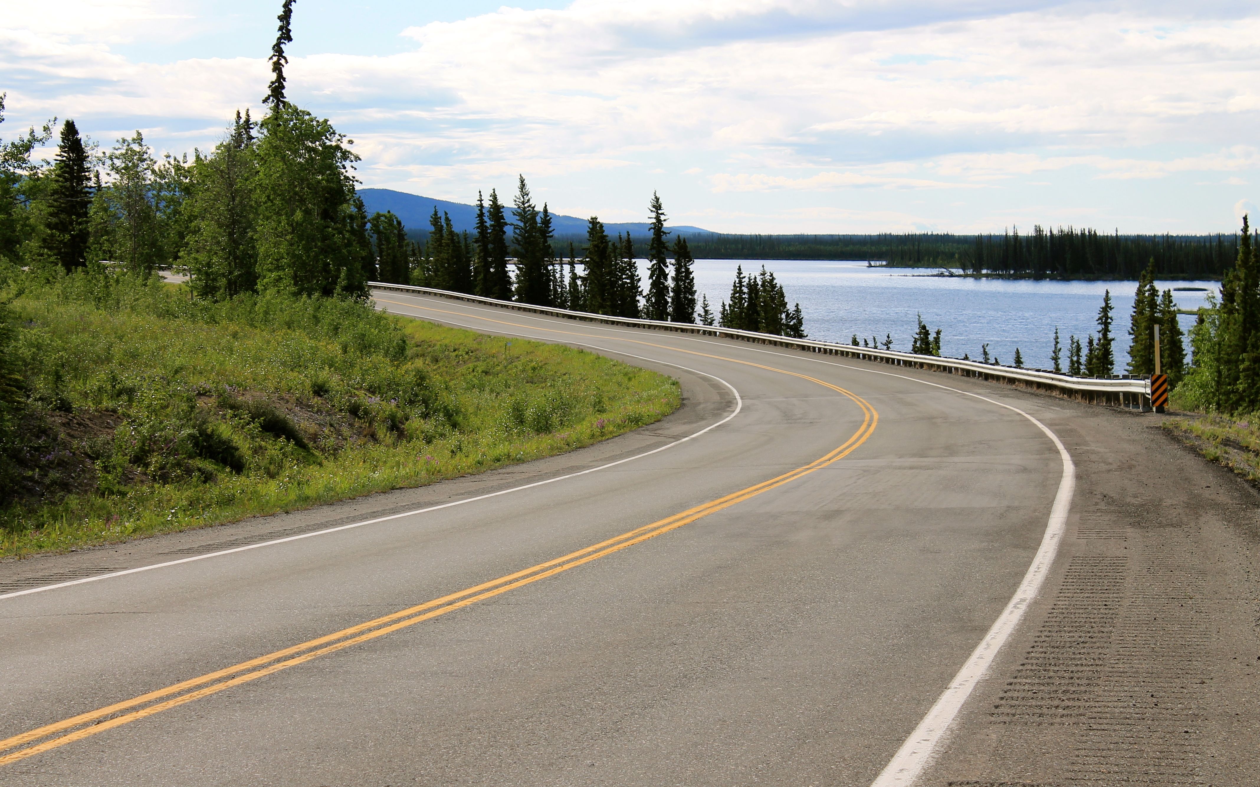
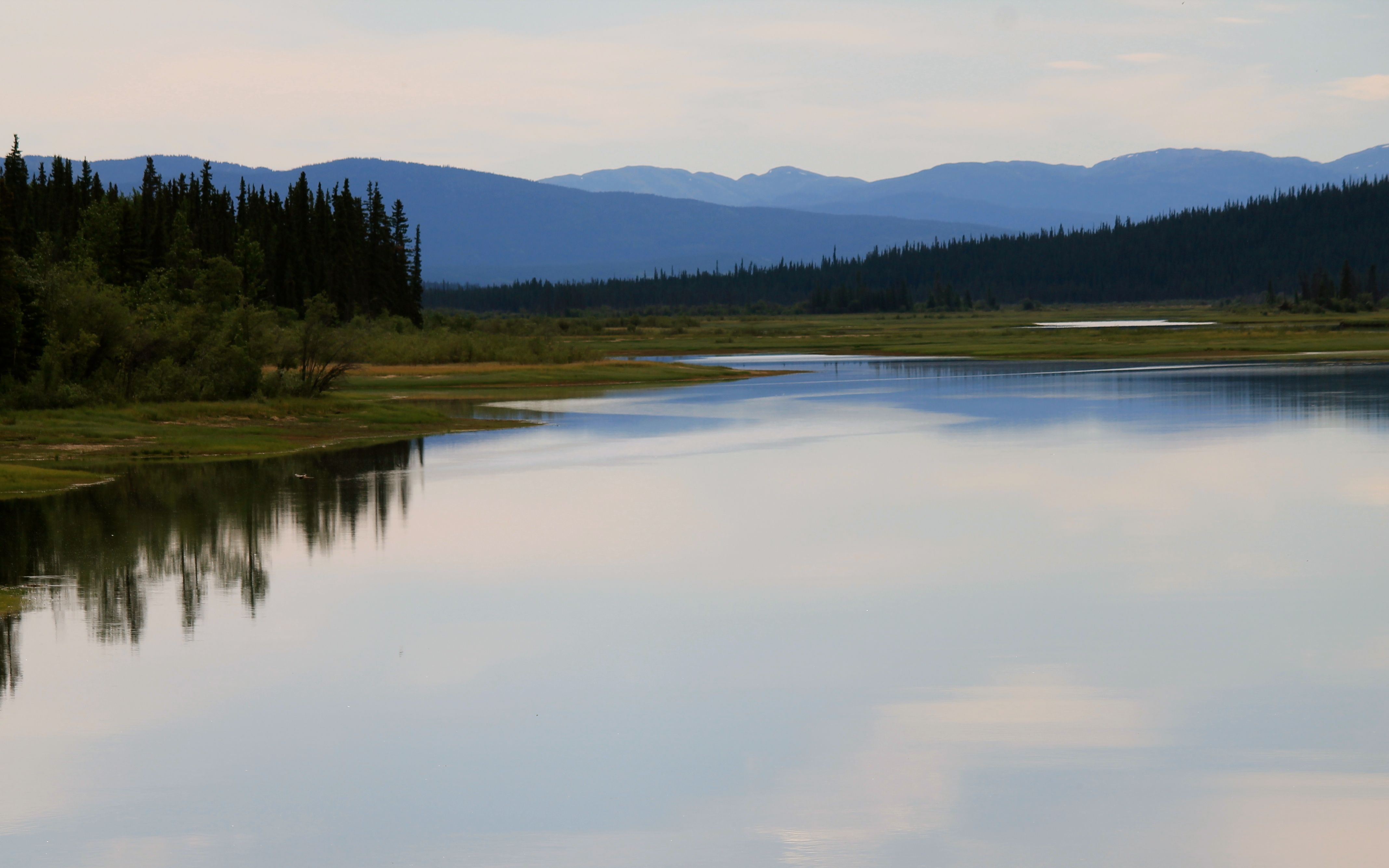
Kluane Lake was beautiful and a nice place to take a short break.
And while I wouldn’t call the road twisty, it was interesting and scenic.
Just south of Beaver Creek, the last town before the Alaska border, I came upon a BMW GS rider who had broken down. Apparently I was only a few minutes behind him and he was still kind of panicked.
His drive shaft broke. He was able to point to the rubber boot that covers this critical area. It was loose and there was a lot of opportunity for dirt and gravel to enter the driveshaft mechanicals. His trip was likely over.
In this case, the only assistance I could provide was help in thinking through his options. He was able to flag down a truck with travelers willing to drive him as far as Tok, but in driving ahead, I saw that Beaver Creek had towing services and a pay phone. I bet he stopped there to ensure his motorcycle wouldn’t be left on the side of the highway overnight.
What lessons could I gleam from his trouble?
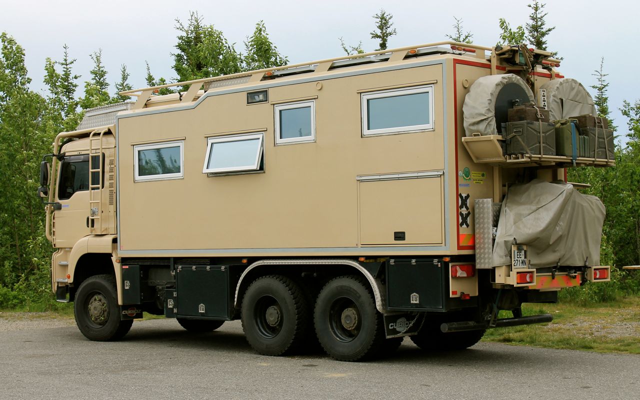
Well, his bike was very, very heavily loaded with all kinds of gear strapped outside his full side boxes and top case. I have never seen a motorcycle loaded down like this one. This likely added stress to the drivetrain.
Also, the rubber boot around the articulated drive shaft should always fit tightly. His was, at least now, not fitted well. I don’t think he maintained the driveshaft either, based on his unfamiliarity with the type of maintenance performed on these parts.
Finally, he had no towing service arrangements – his BMW roadside assistance didn’t apply as he already had exceeded the warrantied mileage and he didn’t have AAA or an equivalent.
I followed him into Beaver Creek and wished him the best. I topped off with gas here, since I was stopped. That was a good thing because my planned stopped just over the border was closed. Whew! While I think I would have made it into Fairbanks on the fuel I had, it made the rest of the ride more relaxed knowing I had a full tank.
There is about a 20 km distance between the border and the US customs station.
The quality of the roads on the US side of the border were easily the worst of the trip so far. Hmmm, not really surprised.
The landscape here was flatter, with mountains sometimes visible, but often you just road down this two lane roadway between the trees.
I reached my campsite in Tok about 6pm. It was a bit windy, but my site was sheltered from the winds by tall trees. Still, I went to dinner at Fast Eddie’s Restaurant before setting up the tent.
Usually, I enjoy sitting at the bar and talking to whoever is sitting next to me. I sat at a table this time as there was no bar in Fast Eddie’s. A woman traveling alone was seated near me and I invited her to join me. Elizabeth was from the Zurich area and traveling here to meet a friend a few days later. We talked for at least an hour over dinner. It was quite enjoyable.
The sun doesn’t really set this time of year. The photo below was taken about 10:30pm when I was ready to try to sleep. Why did I bring a headlamp? LOL
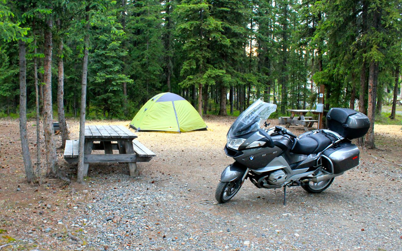
The tent site had wood chips for the tent. These worked out well to avoid mud, and in the morning, the tent pad was dry despite the light showers through the evening.
I reach Fairbanks tomorrow.
Day 10
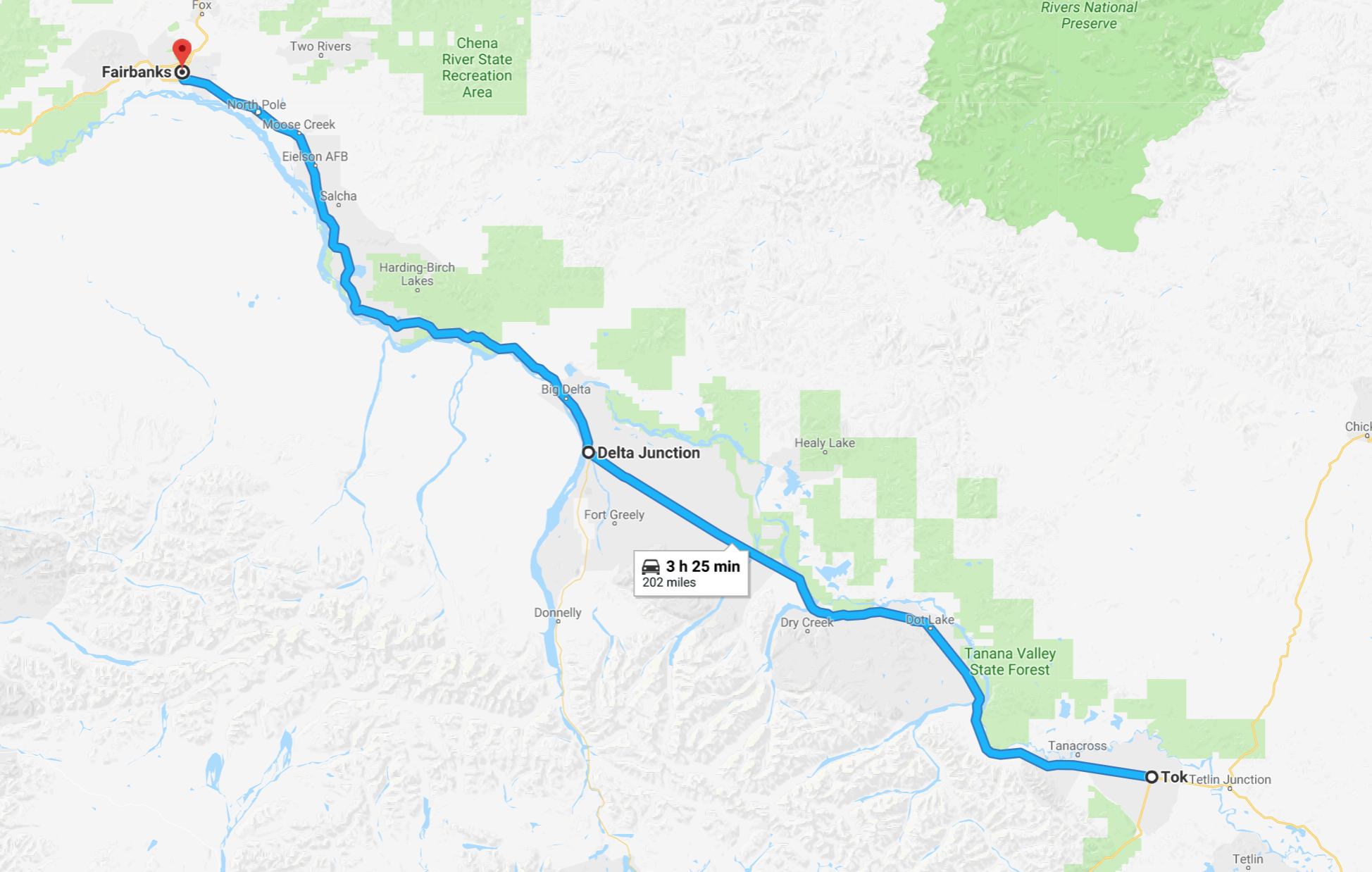
Day’s distance: 202 miles
Total trip distance: 2,751 miles
Though a bit windy, temperatures remained in the mid 50s most of the day until reaching Fairbanks. Partly cloudy, the sun would show up now and then. It was dry all day. In Fairbanks, most folks were running around in t-shirts and shorts.
With help from the campground host, I was able to secure my morning latte. This coffee trailer is open year-round. In the summer, it is set up with outdoor seating and in the winter as a drive through. So cool and highly recommended if you’re in Tok.
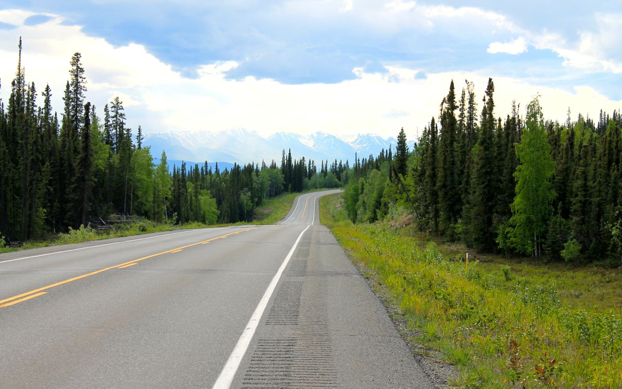
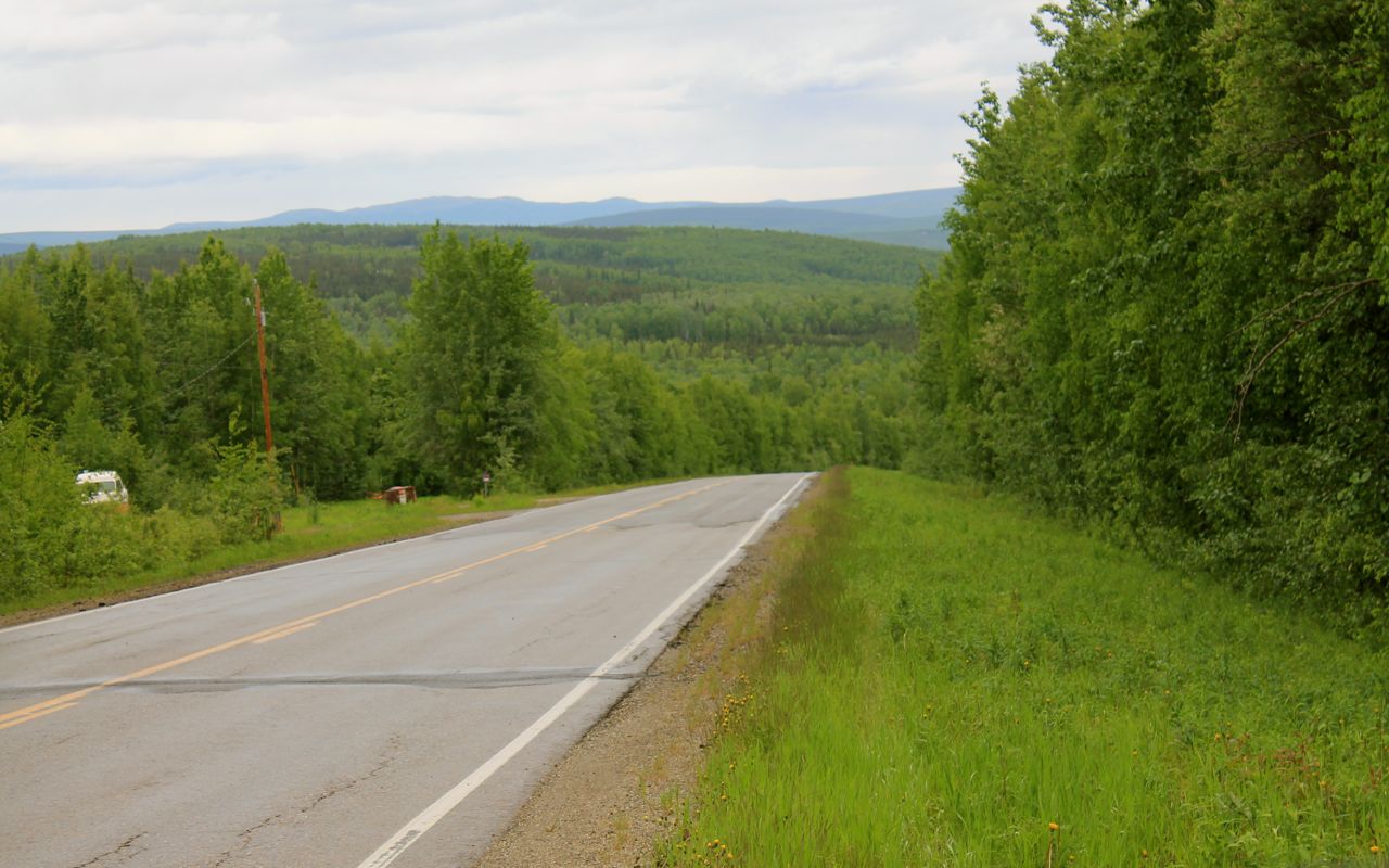
The terrain between Tok and Fairbanks was flat with mountains in the distance.
The Alaskan Highway officially ends in Delta Junction after starting some 1,422 miles earlier in Dawson Creek.
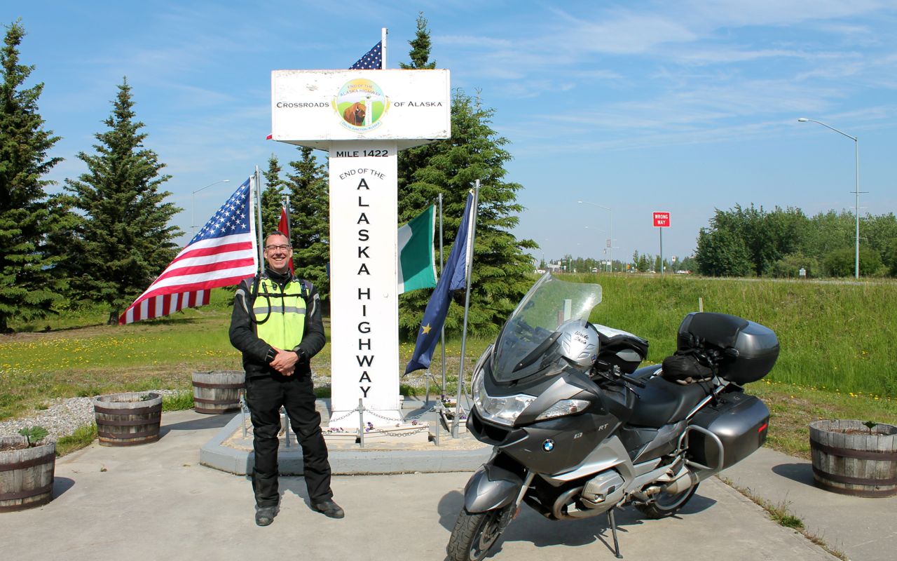
I can check this off my bucket list now! The bike is filthy 😦 I’ll get her washed off this weekend.
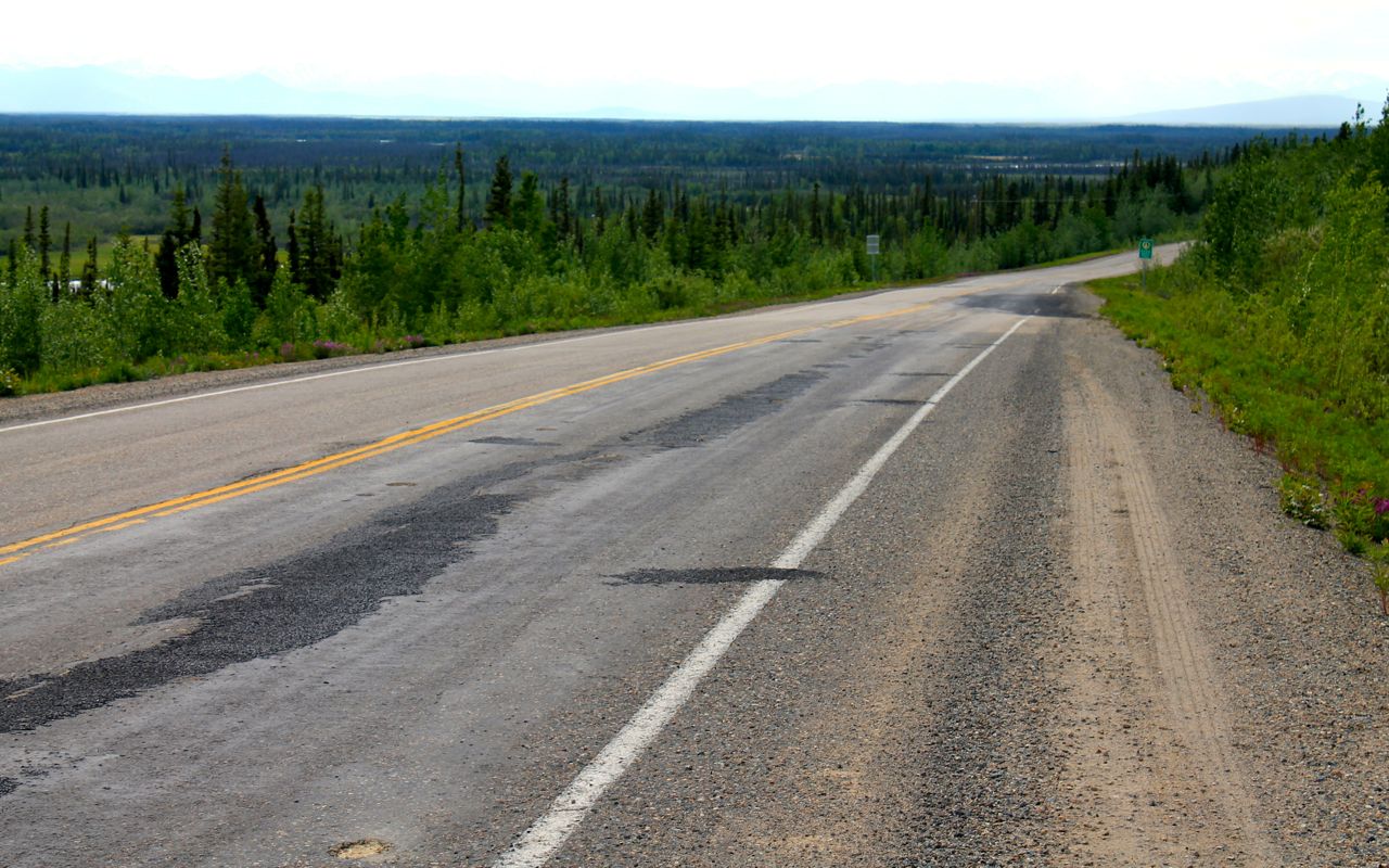
Every so often, the roadway would rise up and in this case, there was a parking area where I could safely stop and try to capture a sense of the landscape.
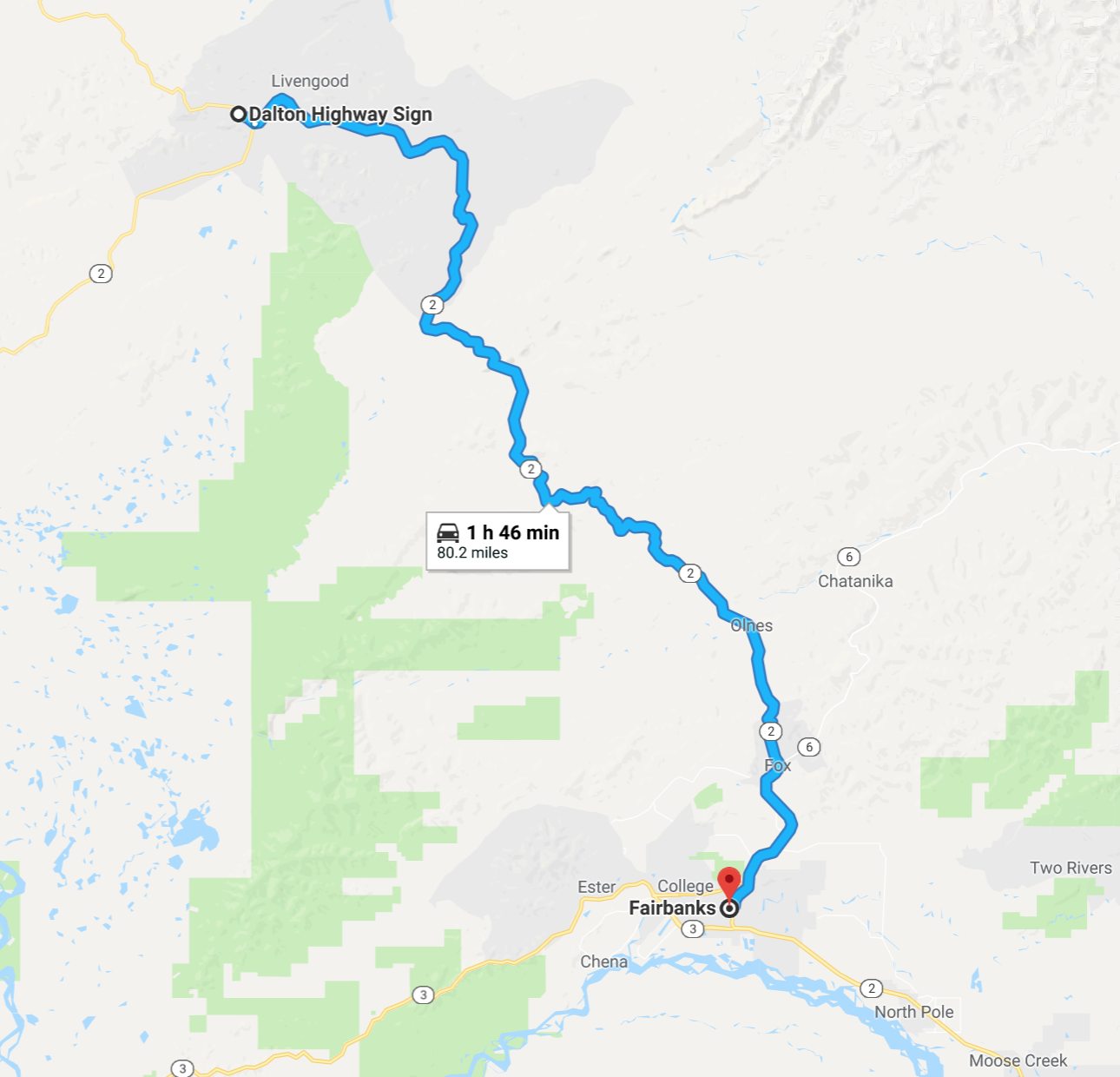
Now here is the satellite image of today’s route for a bigger picture.
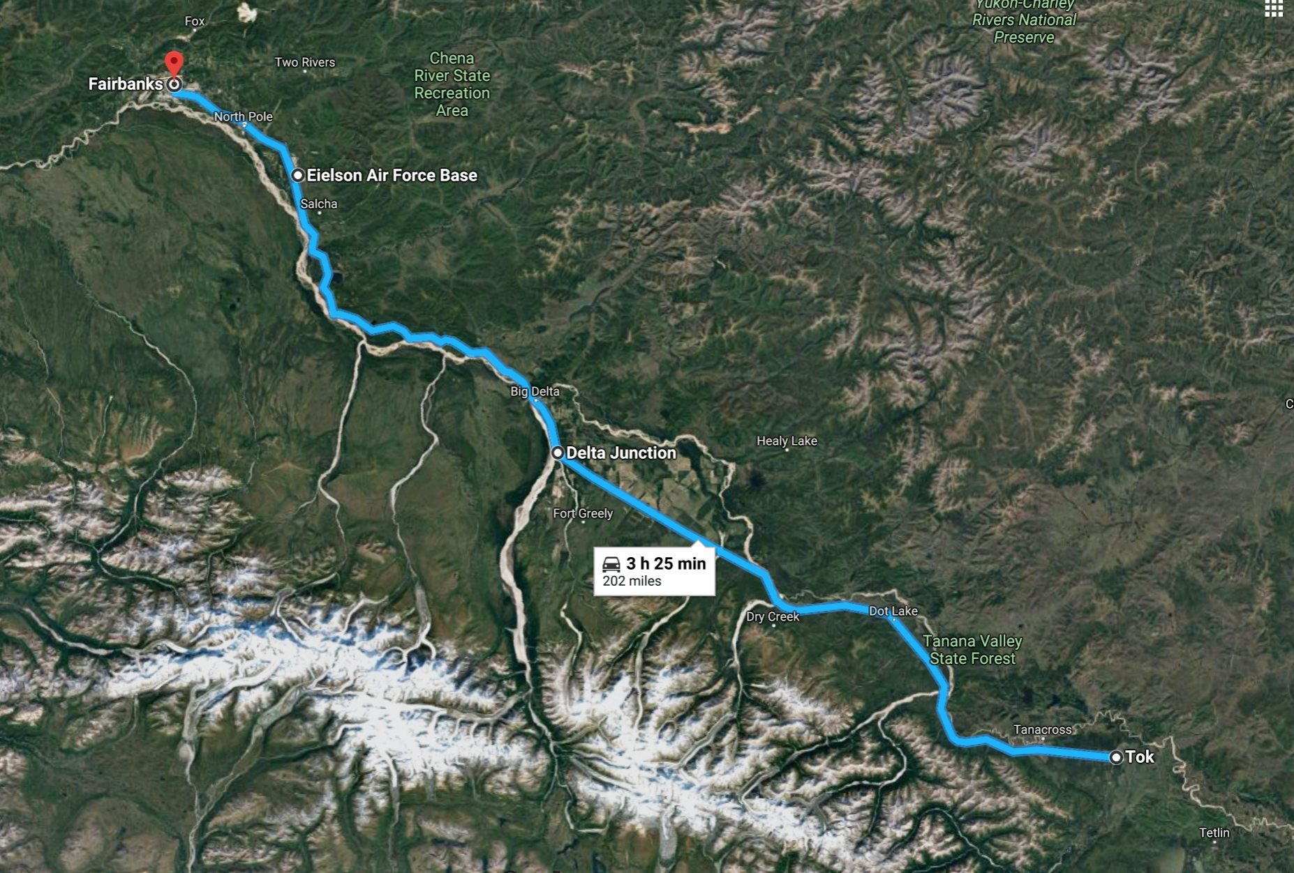
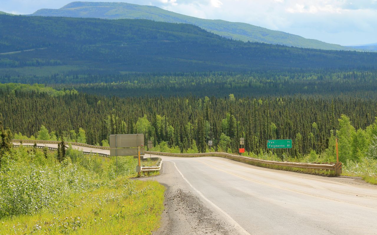
As I approached Fairbanks, congestion steadily increased in the form of signposts along the highway, streets / driveways directly off the highway, and increased traffic coinciding with the broadening of the highway into two lanes in each direction and passing Edelson AFB and into North Pole.
Of note, I had a cell signal most, if not all, of the way from Tok to Fairbanks.
I checked in at my hotel about 2pm and took a short nap after unpacking the bike.
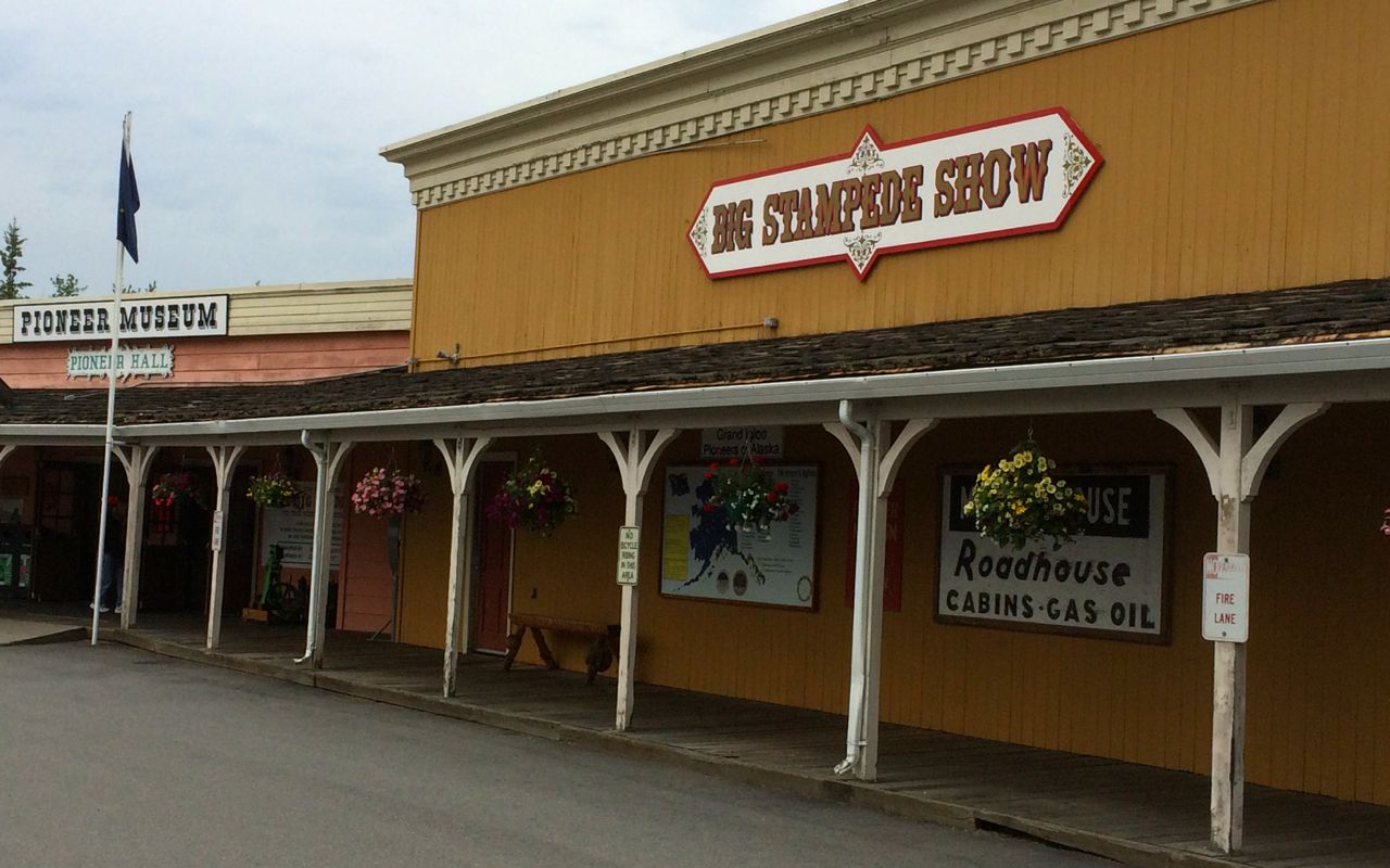
While I’m near downtown, things are spread out. A hotel staffer suggested I could walk to Pioneer Park, a 40-acre amusement park, reminiscent of a park called Frontier Village that was a favorite when young, with facades of the old (north)west …
for the Alaska Salmon Bake, an indoor / outdoor buffet of prime rib, wild salmon, and beer battered seasonal fish (currently cod).
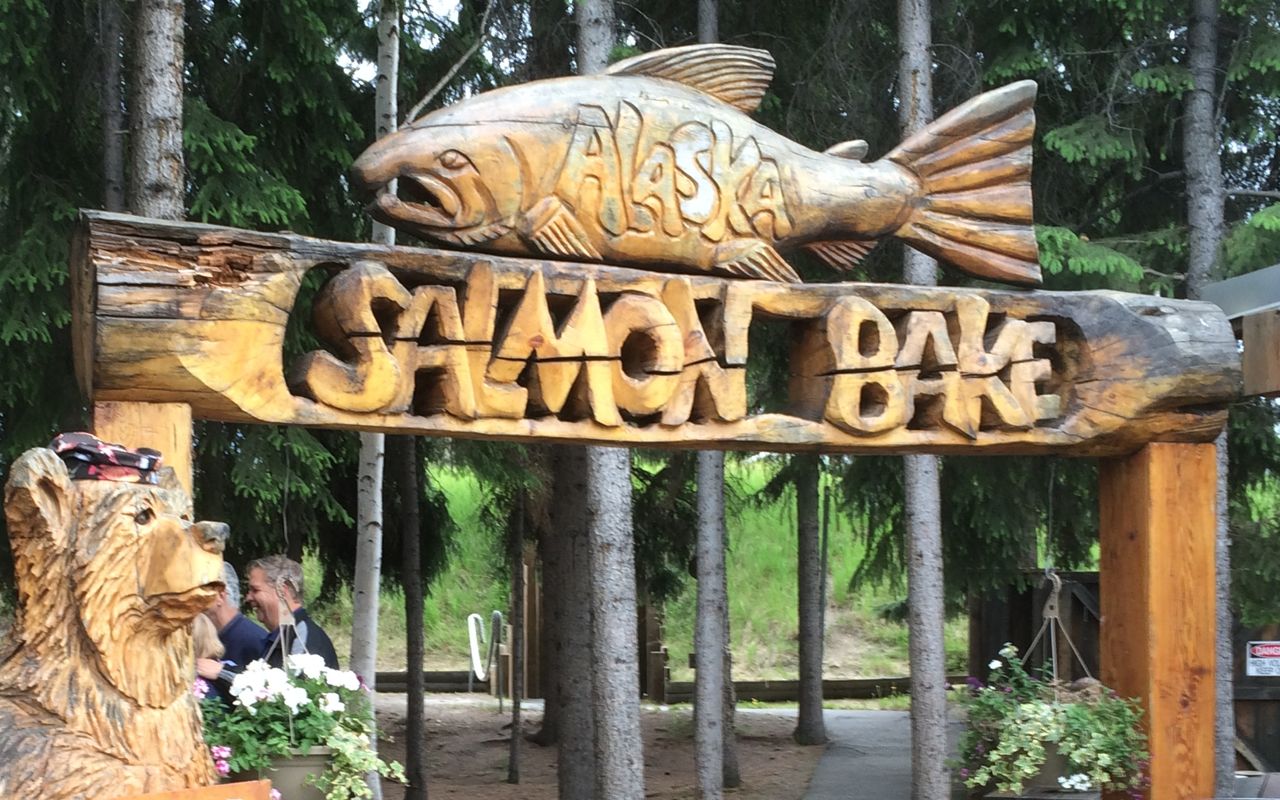
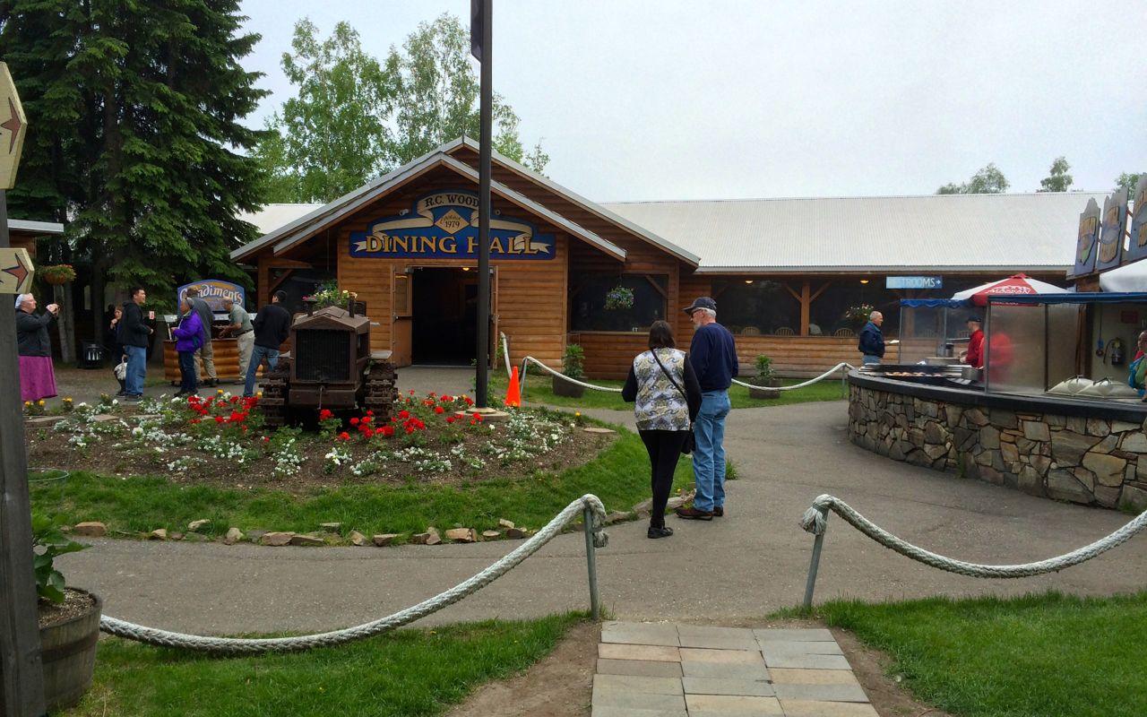
I was pretty hungry and able to take advantage of the all you can eat entry price, especially since I got a small discount using a coupon supplied by the hotel. 🙂 I did decline to go to the nightly live show.
It is supposed to rain in the morning, so I’ll put off my trip to the Dalton Highway sign until Sunday morning. Instead, I’ll do some necessary chores like getting some US cash, stop by the local BMW shop to pick up a liter of oil and some cleaner, wash the bike to remove the built up dirt and gravel so I can inspect her carefully, and perhaps ride around town a bit.
Days 11/12 (birthday weekend)
Weekend’s distance: 198 miles (odometer)
Total trip distance: 2,949 miles
Mid 50s to 60s with showers and sun breaks both Saturday and Sunday.
Saturday morning was spent running errands. I stopped to get some cash and took the opportunity to wash some of the grime off the bike.
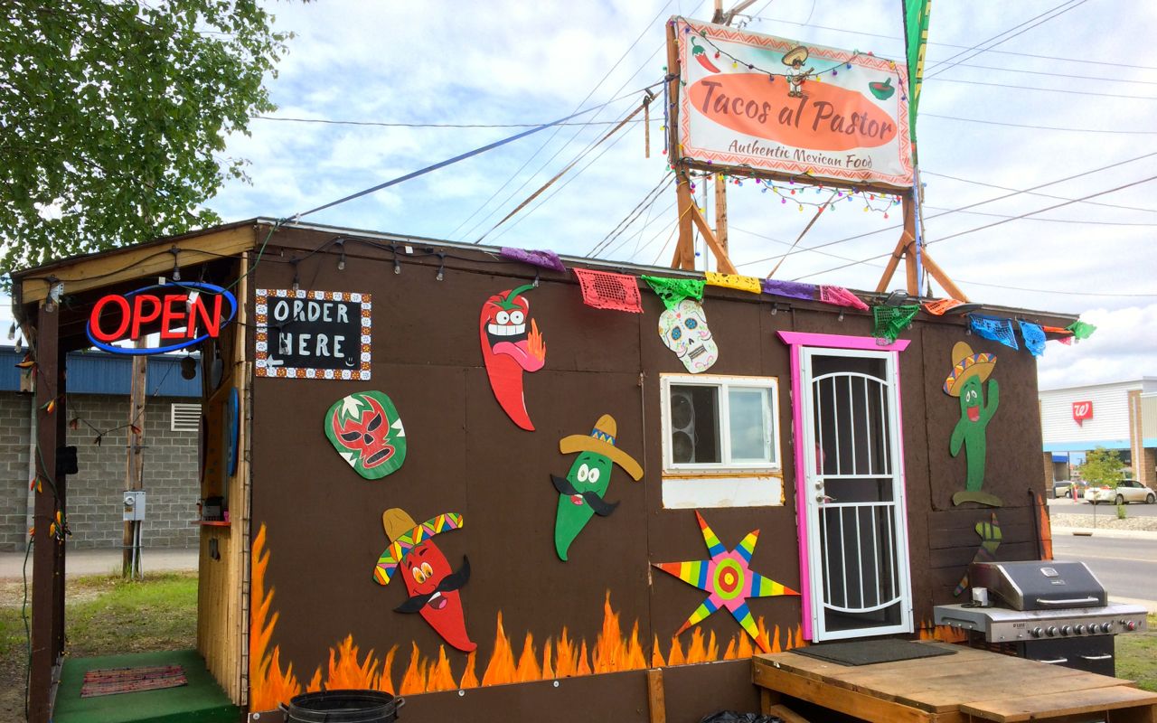
I passed this tiny taqueria on my way to the car wash. The grill was going and I knew I wanted to stop for lunch next. It was fantastic, perhaps the best tacos al pastor I’ve had since leaving San Jose in the 80s.
On my return to the hotel, I went through a pre-ride inspection and removed the top case for my ride to the Dalton Highway Sign. I would lighten my load as much as possible to maintain stability should I encounter bad roads.
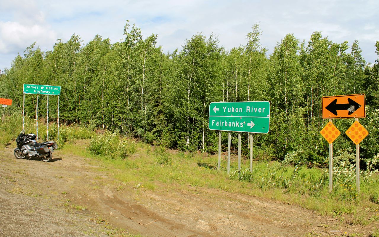
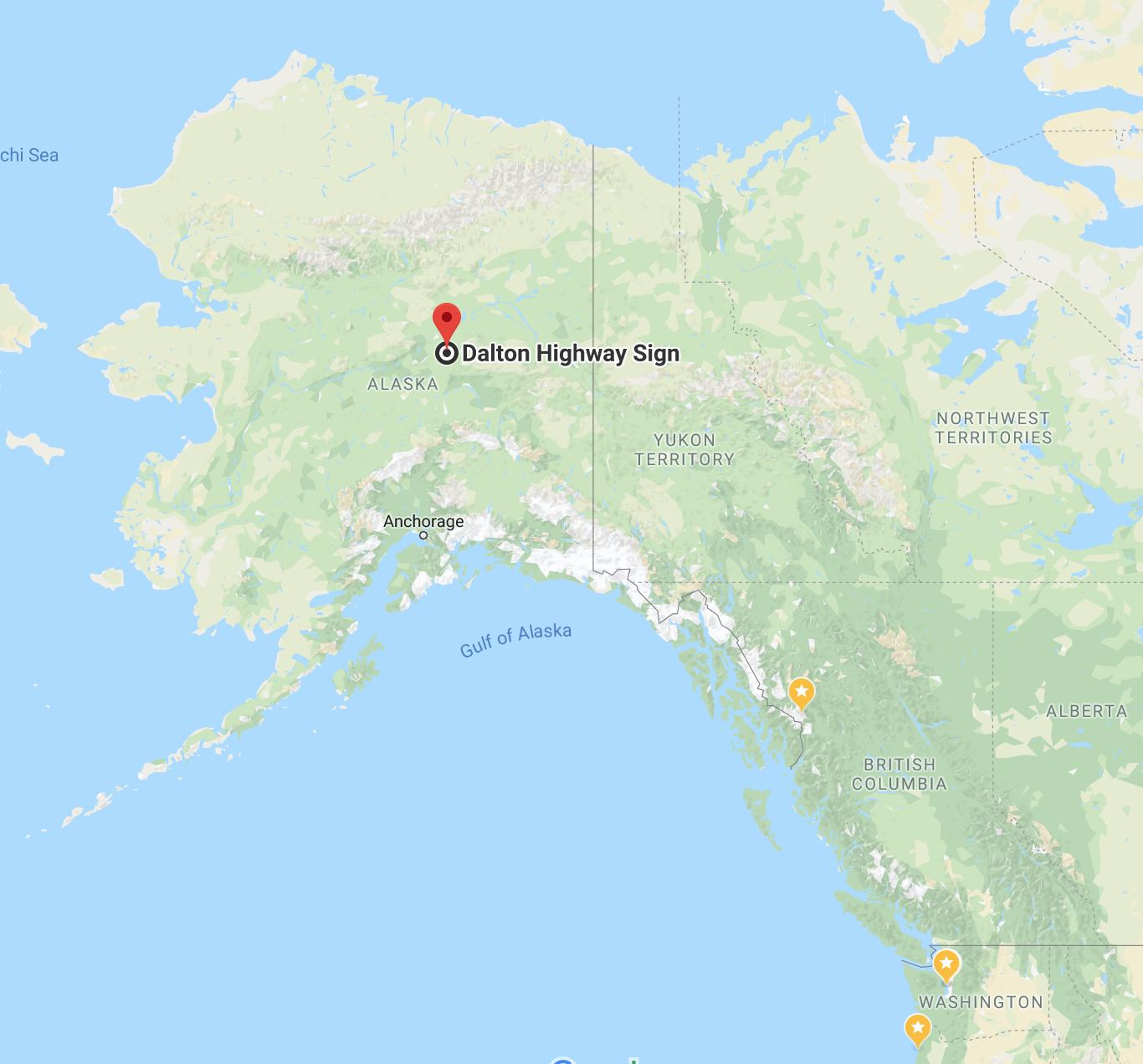
Sunday morning I left to ride up to the Dalton Highway. This would be my final push north for this ride.
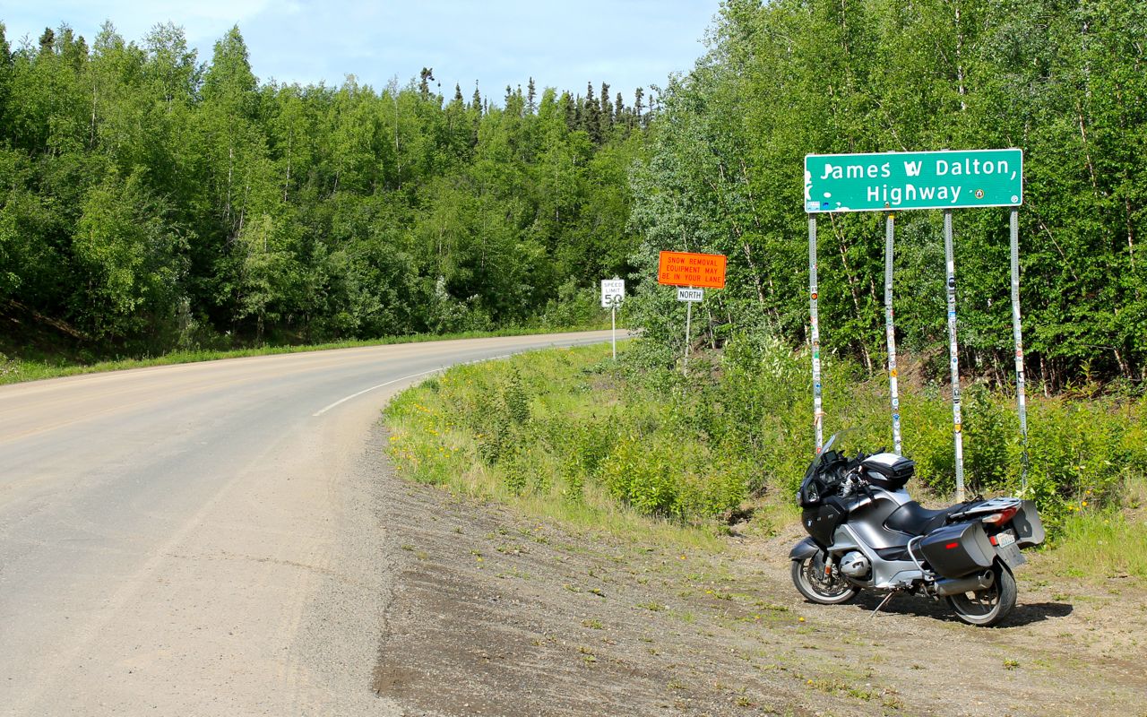
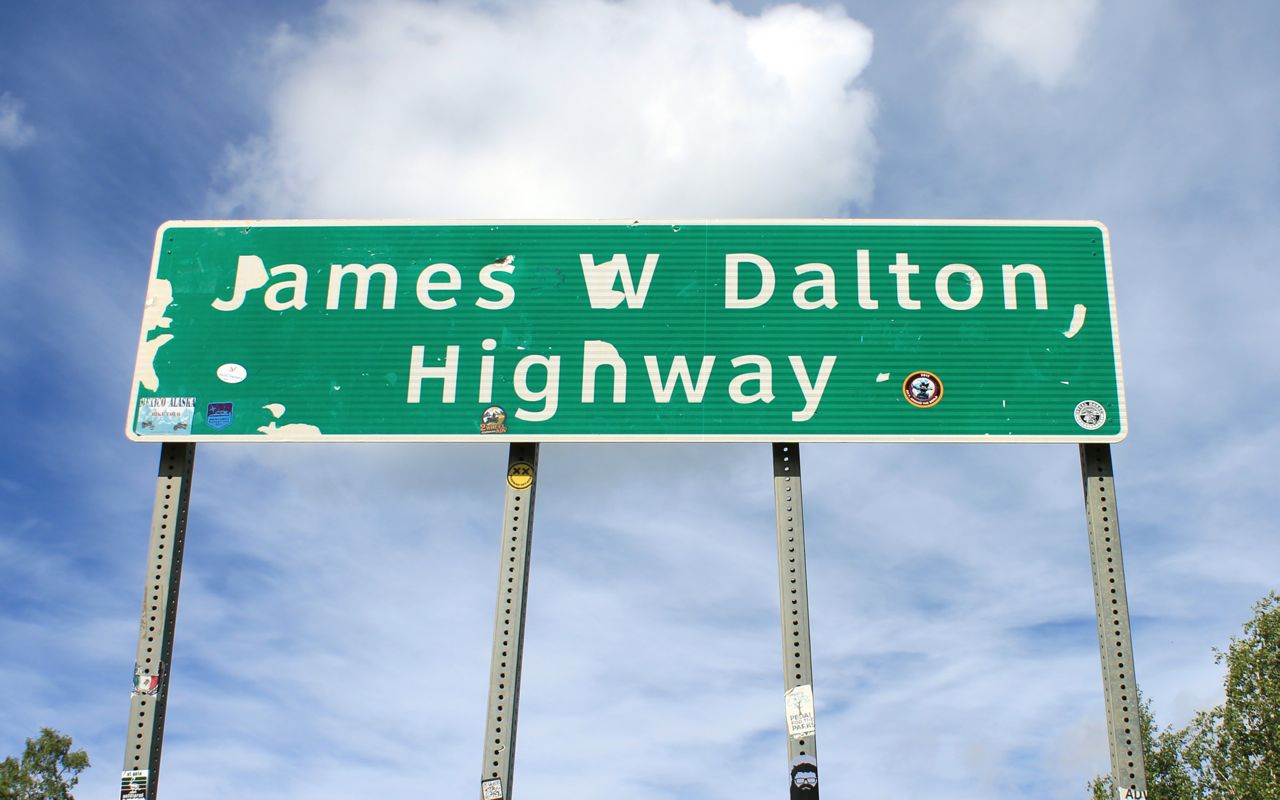
I reached my turnaround point today, the start of the Dalton Highway.

I reached it on the morning of my 60th birthday!
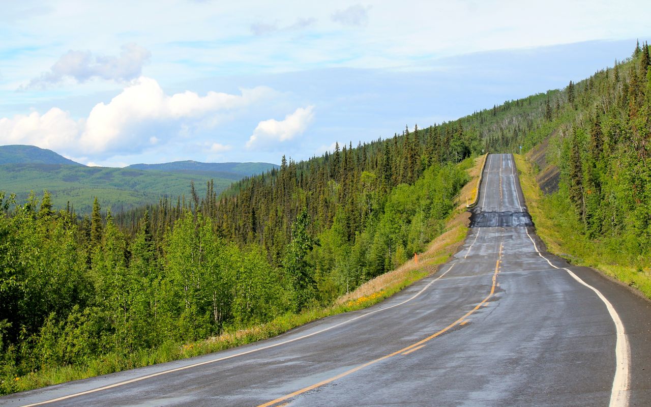
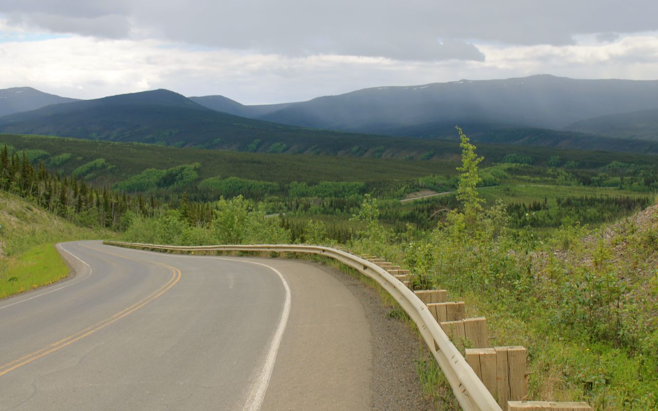
The roads followed the hills and were in fair to good shape.
It was raining off and on. The sun was behind me on the way north.
I came across a variety of road surfaces. Surprisingly, there were only a few potholes and the surface was mostly clear of loose gravel. There were a few short gravel sections and I came across only one construction crew working on resurfacing a bridge. The wait was brief in both directions.
The main issue with the roadway for me were the dips from frost heaves or erosion. I mitigated the impact of these by having shed the bike of my top case and some of the side case contents that weren’t needed.
When I say there were few potholes, that doesn’t mean there weren’t many, many repairs present.
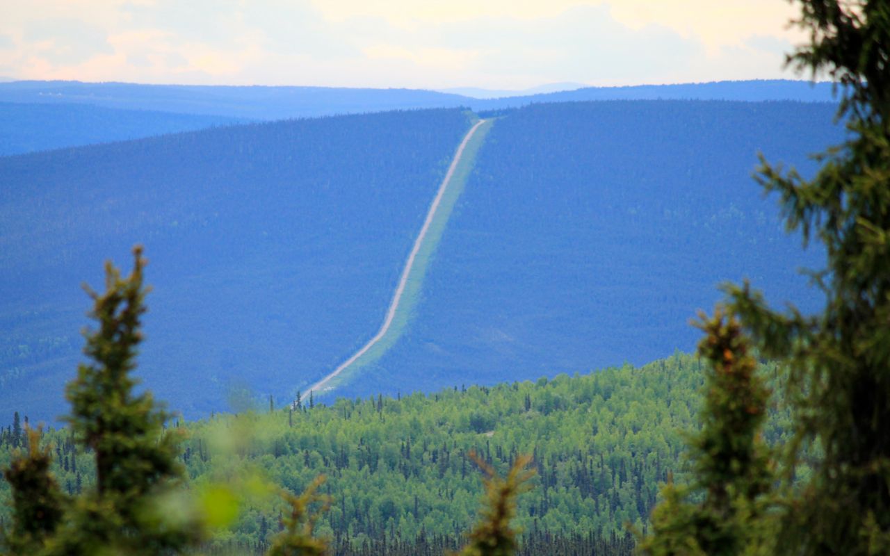
I would see the pipeline now and then, traveling at a distance but parallel to my path.
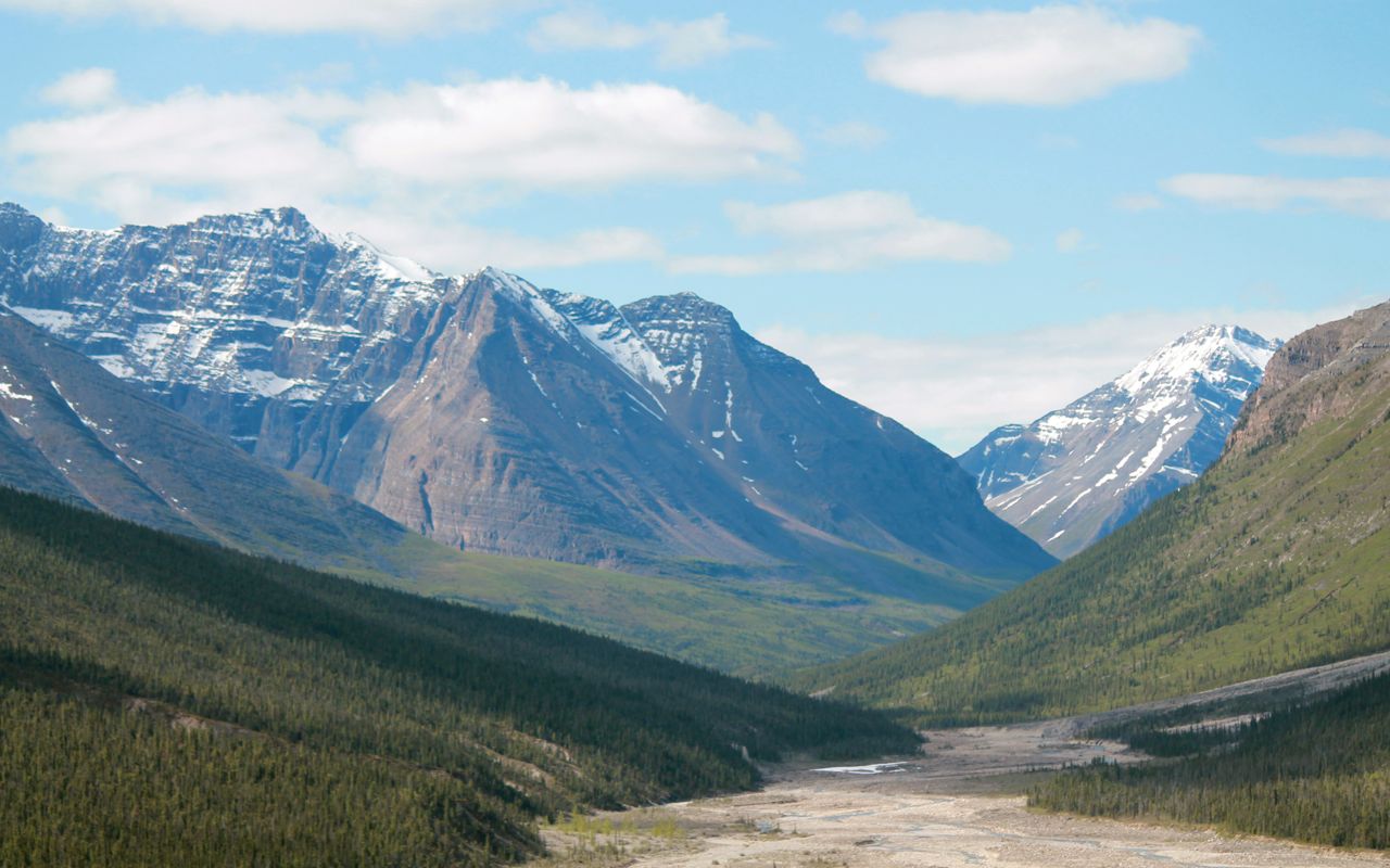
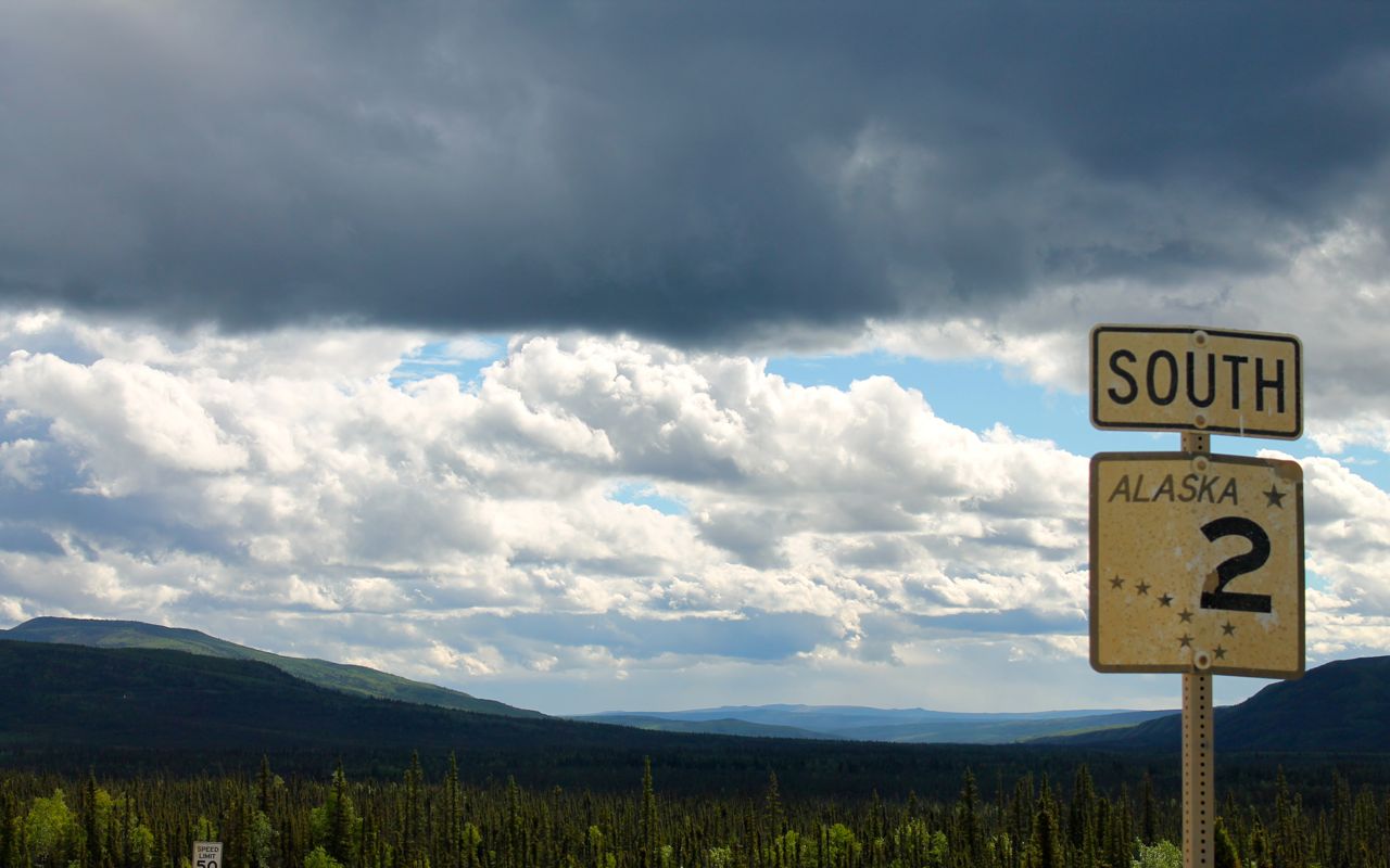
The hills were generally gentle, for a motorcycle anyway. Here’s some more scenic shots.

And the furthest point north I’ll travel on this trip, perhaps ever. It is at latitude 65.489347, according to google maps.
I completely spaced that I brought my 360 degree camera. Doh! You’ll have to settle for a few more photos of the intersection and my return to Fairbanks.

I’ll likely head out to a steak dinner, but I wanted to get this posted.
I’m certain I’ll have more to say about this day in my reflections after the trip, but for now I will say I live a charmed life. 🙂
Tomorrow I head to Denali to camp for a night. Then I head into Anchorage. Expect the next blog post then!
PS
I had dinner at the Pump House Restaurant and Saloon. Great oysters on the half shell and Filet Mignon. Recommended.
Day 13
Day’s distance: 156 miles
Total trip distance: 3,105 miles
Temperatures were in the 50s most of the day. It was very windy at times with showers throughout the afternoon.
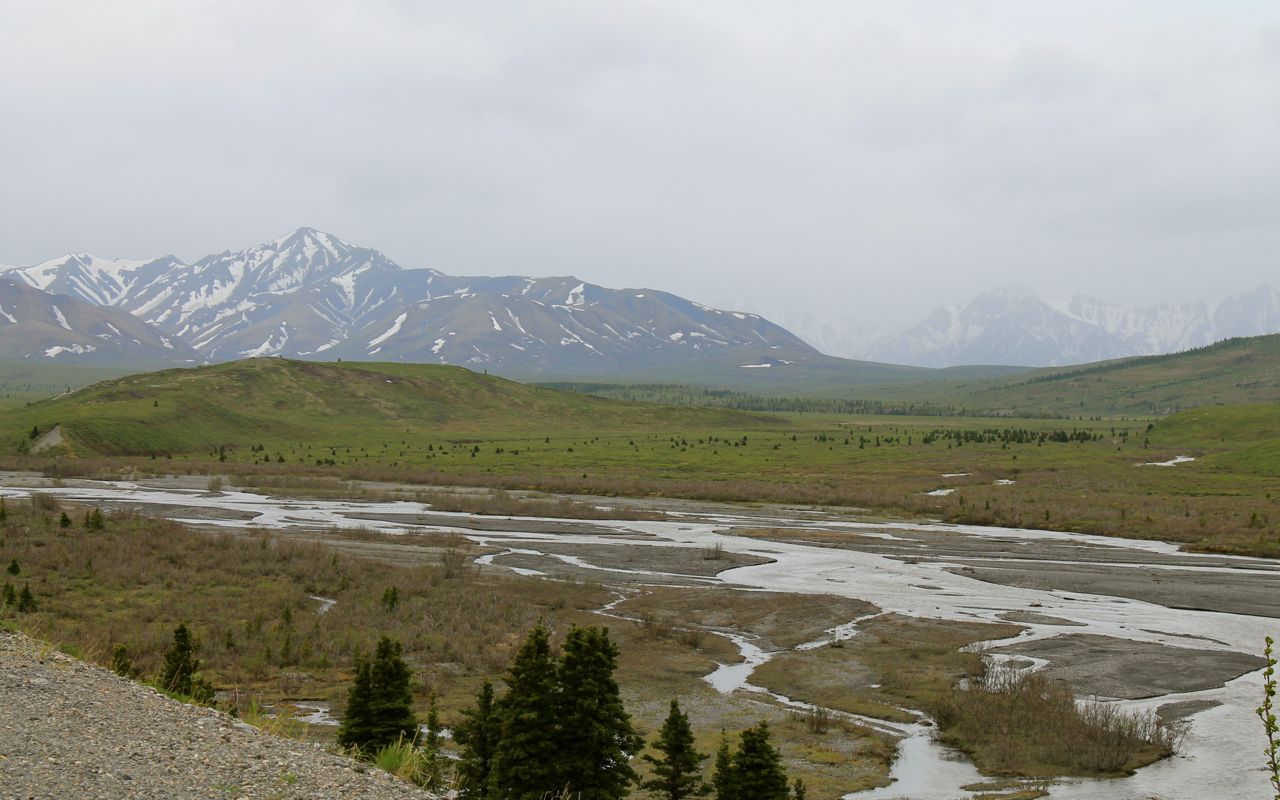
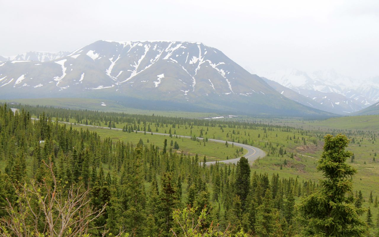
Today would be a short ride south to Denali National Park.
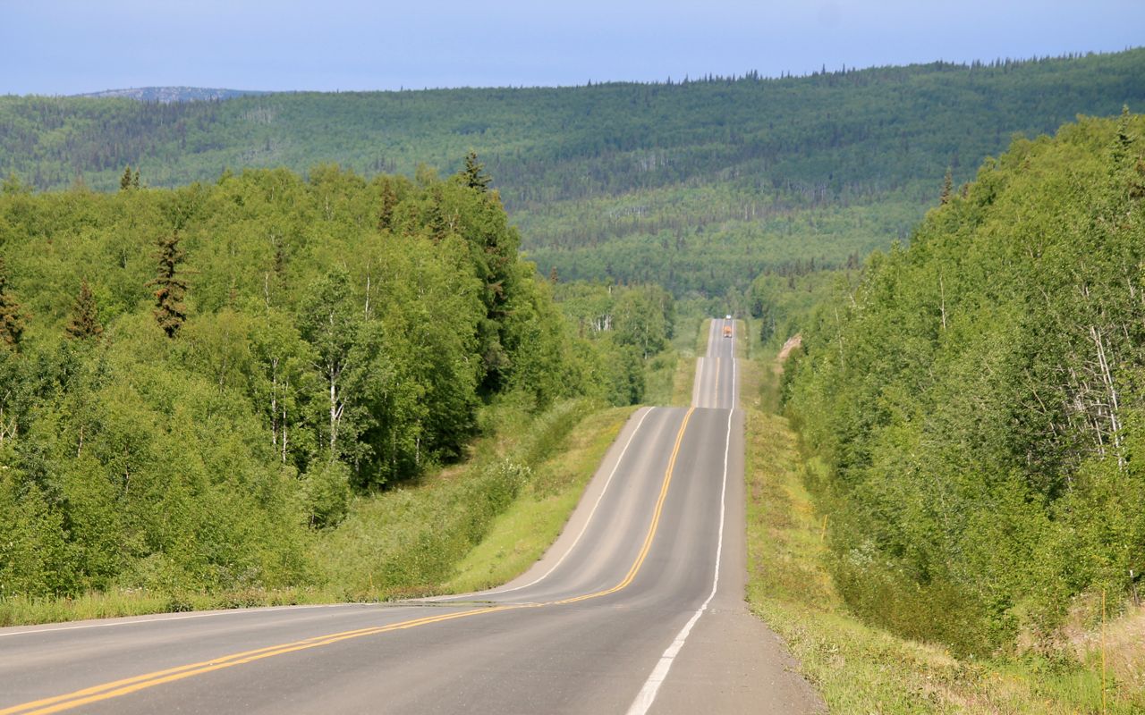
The scenery was fantastic. It was difficult to capture the grandeur of this section of the ride as the valleys were wide at times with copious cloud cover.
At no time did I feel isolated today. This is a main thoroughfare between Fairbanks and Anchorage and I shared the road with many others, including some rather serious off-road RVs.
As big as that looks, it is even bigger. I didn’t get a chance to talk to the owner as he was crawling around under it and looked frustrated and busy.
Speed limits were generally 65mph and the surface in generally good shape. No problem for the RT.
Weather systems in this area seem very localized. It’s been tough to get a good sense of conditions ahead of time.
There was a built up area of hotels and restaurants just north of the park entrance, near McKinley Chalet and Resort. I had everything I needed, having topped off with fuel in Healy and carrying my Mountain House meal I would have for dinner tonight.
There was a bridge just south of that buildup that was a challenge to cross. The winds, which had been getting stronger as I approached Denali, were howling and the barriers on each side of the bridge seemed especially low. I timed my crossing so there was no oncoming traffic. The bike canted one way and then suddenly the other way and shifted positions in the lane. It was a heart stopper, for sure.
I arrived at the park just a few minutes later.
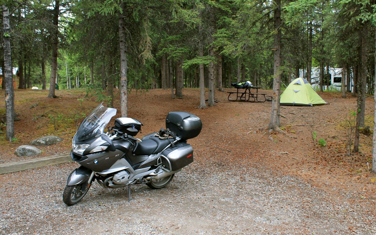
Check in was pretty easy. You aren’t assigned a specific spot. Instead, after checkin you find a spot of the type (A, B or C, depending on the presence and size of the vehicle) and place the paper copy of your reservation on the post in front of the site.
With that taken care of, but it still a bit too windy and rainy to set up the tent, I instead rode the bike up to Savage River, the farthest point into the park you can travel in your private vehicle.
It was rainy and very windy at Savage River, so I took a few photos on my way back to the campsite, despite the now steady rain.
I hung out under cover at the Merchantile where I checked in, having a snack and waiting for the rain to stop. Eventually it did, mostly, and I got my tent set up and my meal prepared.
Though it was only a bit past 8pm, I called it a day and got some extra sleep.
Day 14
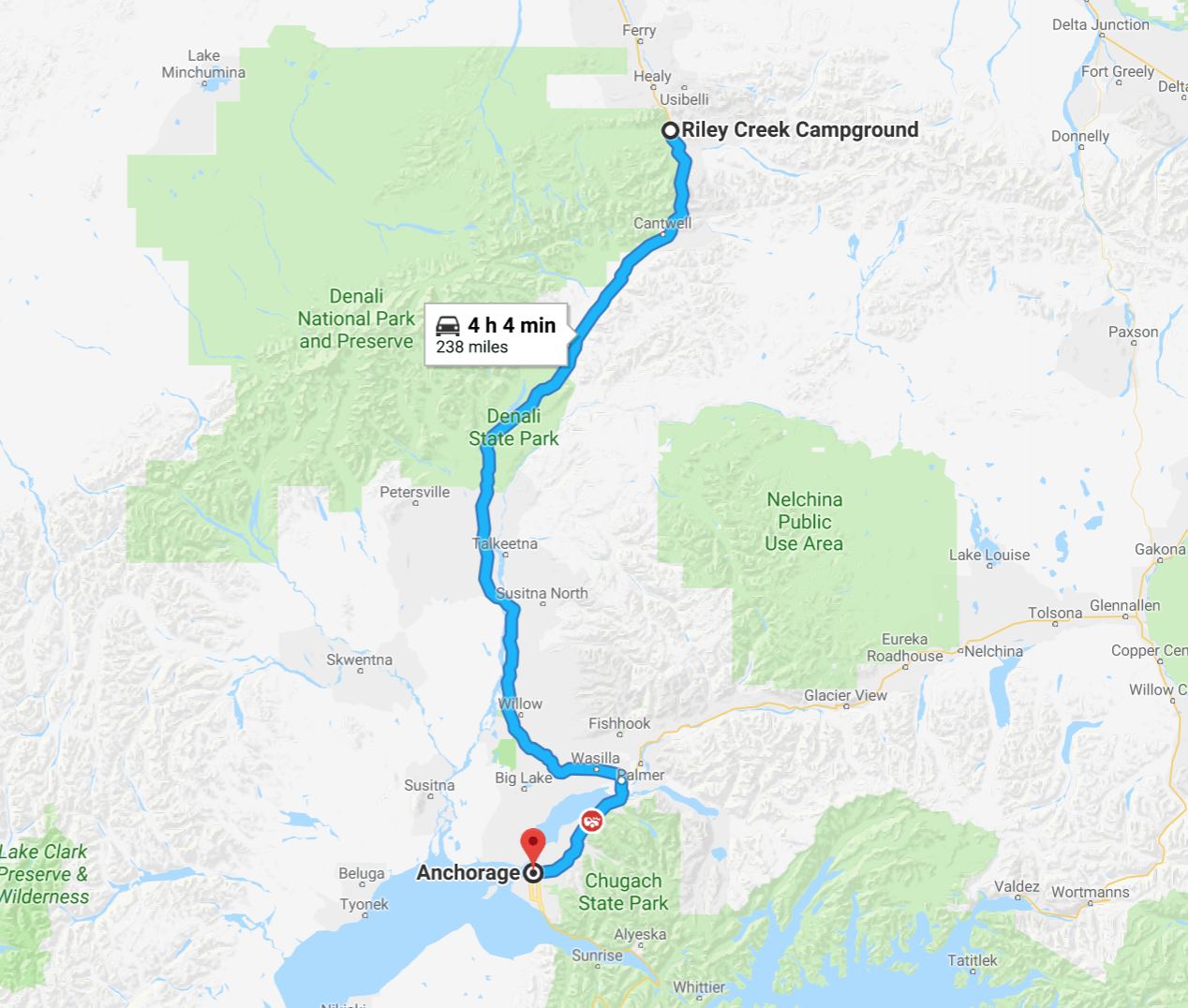
Day’s distance: 238 miles
Total trip distance: 3,343 miles
Another cloudy day with temperatures in the 50s and showers most of the day.
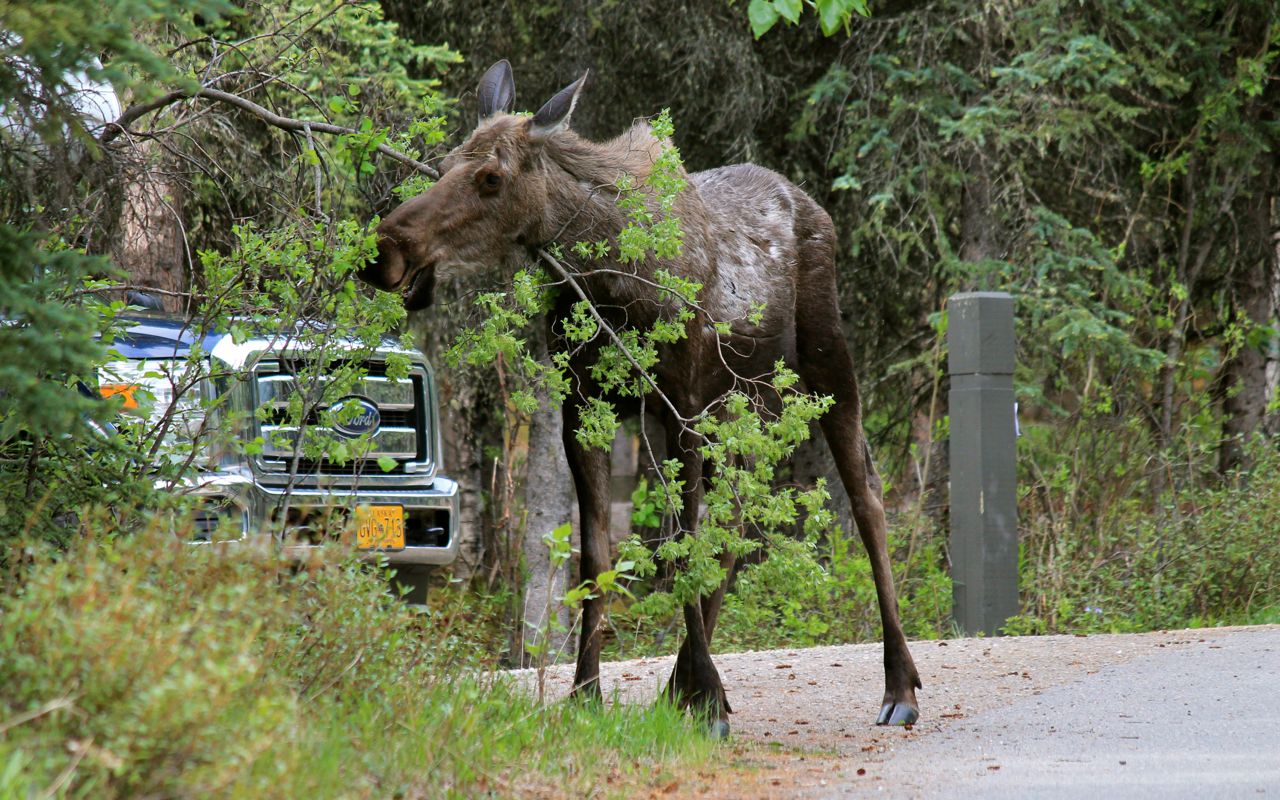
A moose was having breakfast as I was getting ready to leave. This was a common site in this campground. I kept my distance as she was giving me the eye and I didn’t know if she had a calf nearby.
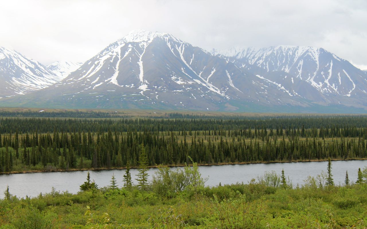
The scenery along the highway did not disappoint, …
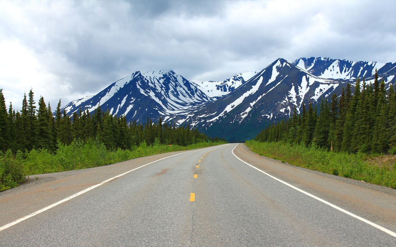
but I was getting tired of the low clouds and showers. 😦
I had a late breakfast at the Trapper Creek Trading Post just before noon. A small breakfast burrito supplemented with a stack of pancakes and lots of coffee. It was a welcome break.
Two long road projects delayed me by about an hour. It wasn’t so much we waited an hour but the time we did wait combined with the slow speeds through the construction zone, often less than 10mph, made the few miles seem like forever.
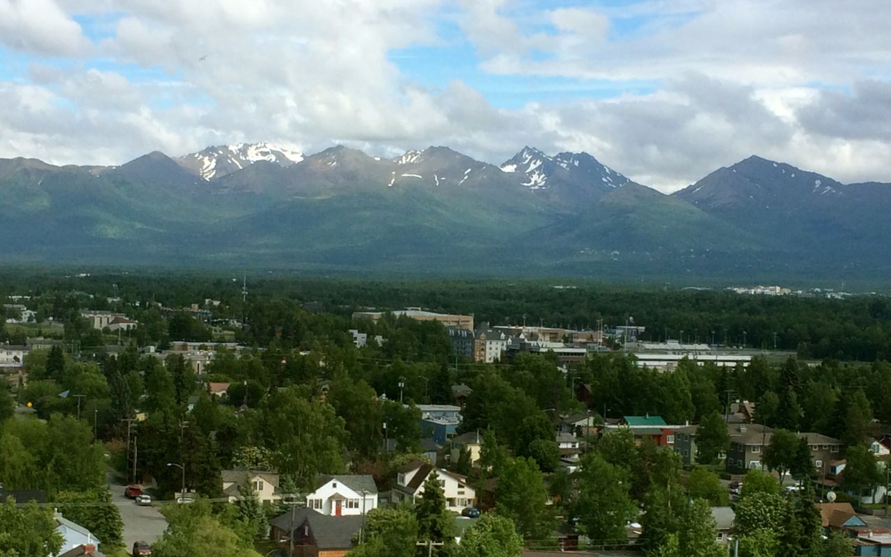
I stopped in Wasilla for an afternoon latte to restore my energy and get me ready for the final dash into Anchorage, where the clouds broke up and the sun shone a bit more than earlier.
This was the view from my hotel room downtown.
I unpacked and cleaned up and headed down to the hotel bar for a drink. Stepping out of the elevator, I encountered three other riders who met me later in the bar.
Dennis, Steven and Isabelle rode their motorcycles up from Los Angeles and were on the Dalton on the same day I was. We chatted for a couple hours, comparing notes on equipment and telling stories of our adventures and experiences. Great times!
Tomorrow I have the day off. I will likely take a day ride south of Anchorage, perhaps to Seward, weather permitting.
Day 15
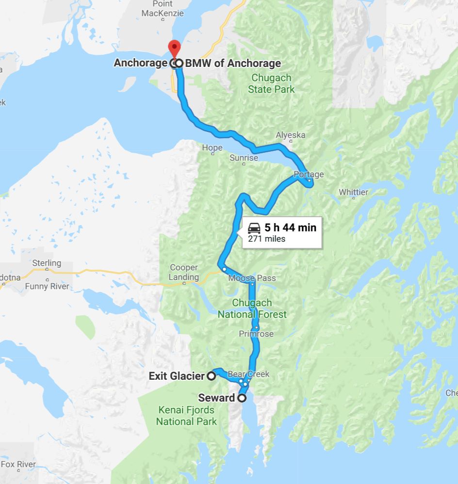
Day’s distance: 271 miles
Total trip distance: 3,613 miles
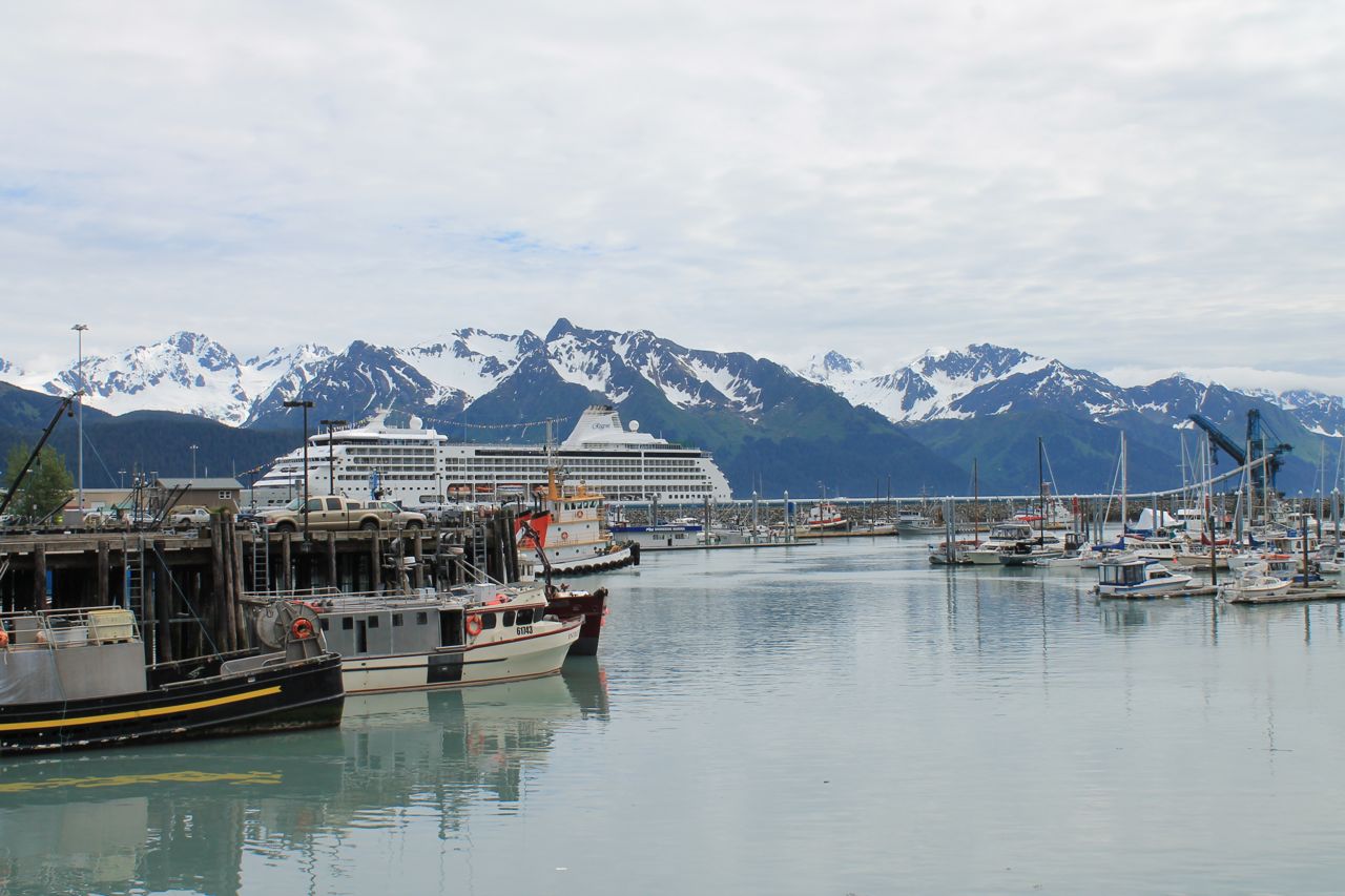
Sunny skies with afternoon clouds and temperatures in the 60s and 70s, it was a beautiful day for a ride out to Seward, a coastal town south of Anchorage.
With my schedule continuing to overlap that of the trio Dennis, Steven and Isabelle, we met up in the morning to ride to Seward together with one proviso. Steven’s KTM may need new fork seals and Dennis’ front wheel may need rebalanced.
The Anchorage BMW/KTM dealer was nearby and our first stop once we departed the hotel. I took the opportunity to pick up a liter of oil for my bike on arriving at the shop.
I also discovered the GS with the broken drive shaft that I came upon in Yukon with a broken shaft had been repaired at this shop and was now ready. Apparently Gary got a ride all the way into Anchorage with the two guys who picked him up in the truck. He rented his own truck and trailer and drove back, some 450 miles, to get his bike and trailer it here, to Anchorage, for repairs. Good for him!
The bad news was that the shop wanted to keep both Dennis’ and Steven’s bikes for the day. I would ride to Seward alone.
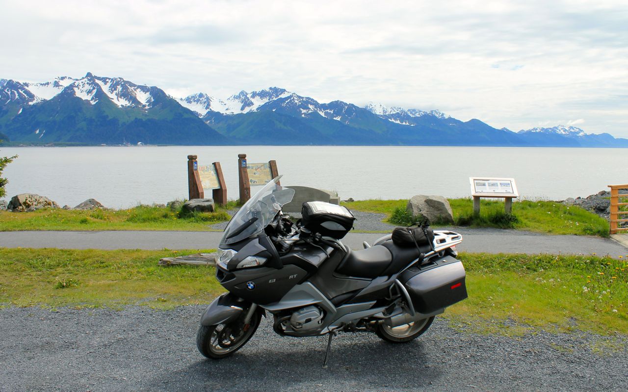
The ride down to Seward took about two hours. The roads were in good shape and, while there was traffic, it was fast moving. Alaska Hwy 1 travels south along the bay.
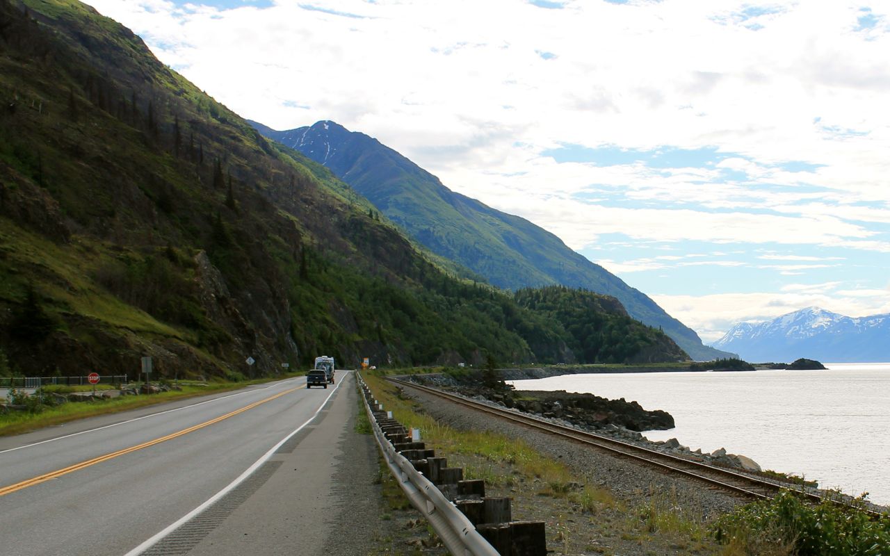
It starts out scenic and just continues to impress as the mountains get closer.
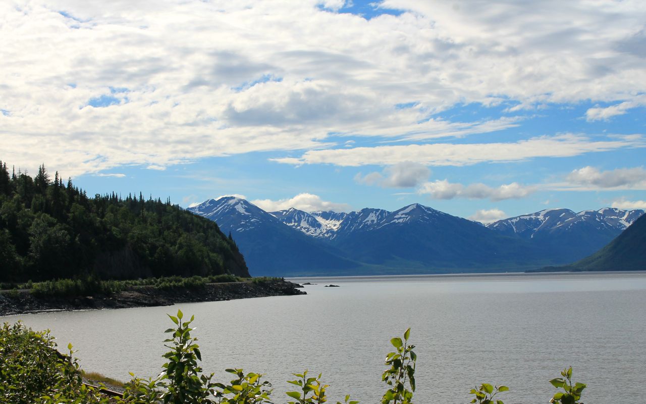
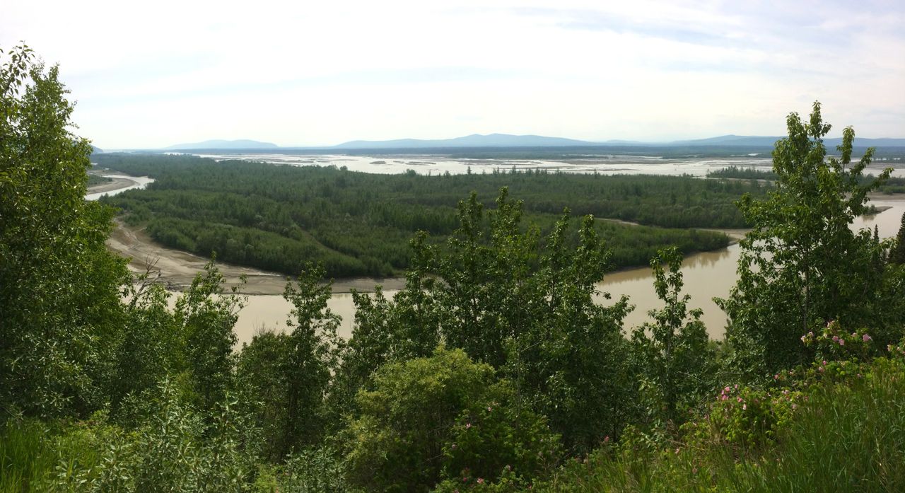
The water gets shallow and is eventually replaced by large mud flats as I reach the town of Portage. The satellite image of the map shows these clearly.
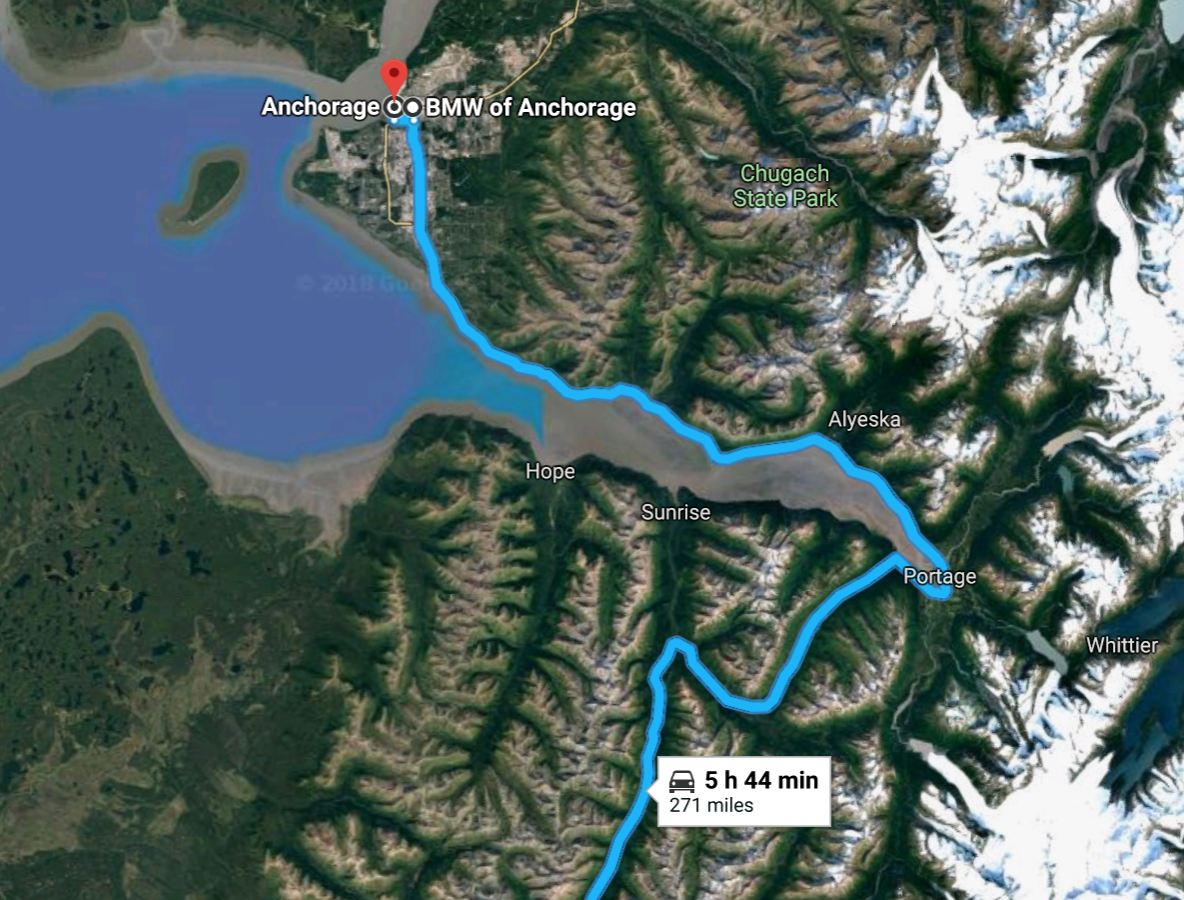
From Portage, Hwy 1 weaves through some glacial canyons and between some very beautiful country.
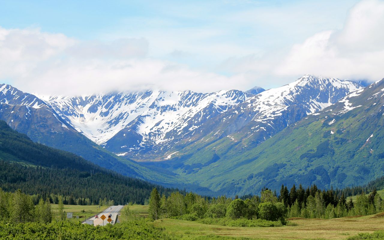
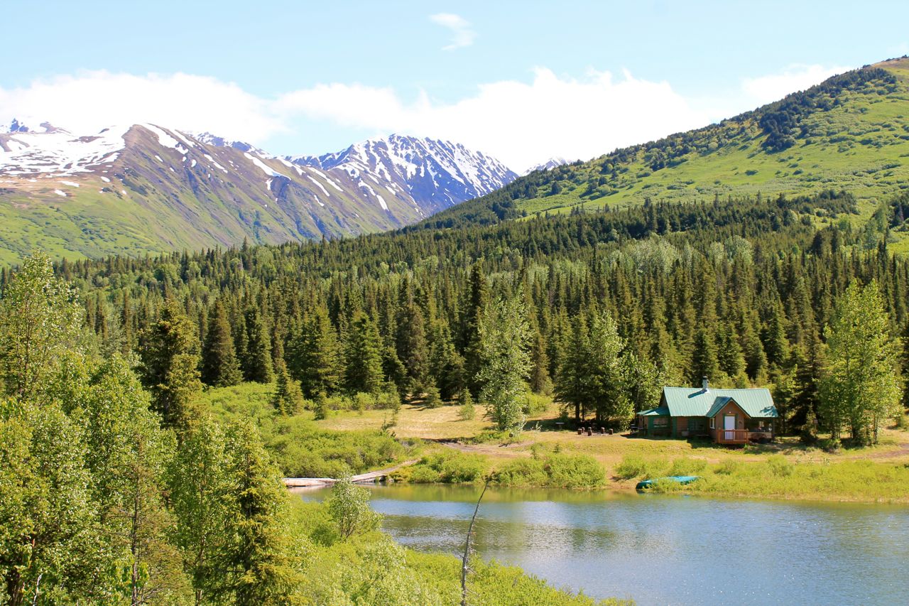
Summit Lake and other small bodies of water add to the beauty. The photo below a home located on Lower Summit Lake.

As Hwy 1 continues to Homer, I turned on Hwy 9 to Seward. On my arrival, I topped off the tank with premium and found the Sea Bean Cafe and stopped for lunch.
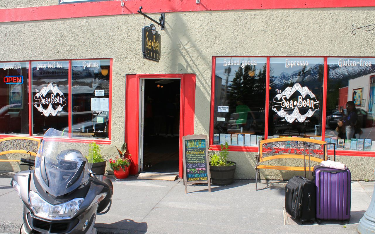
I can recommend their coffee and the Quinoa and Kale salad.
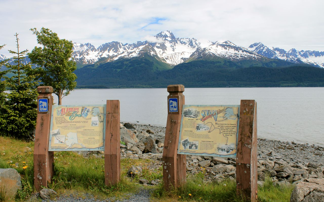
Afterwards, I rode around the small town, focusing on the waterfront.

The information on the boards mention miners blazing trails from Seward to gold fields in Central and Western Alaska. A system of pack and sled trails, wagon roads and railroad beds became the famous Iditarod Trail.
Obviously, some folks arrive these days by cruise ship.
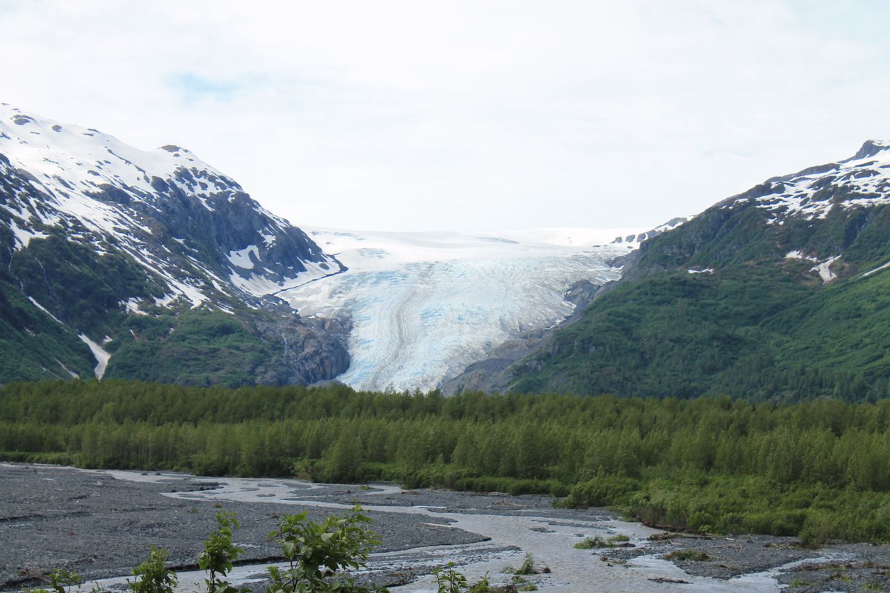
Before returning to Anchorage, I took a quick ride to see the Exit Glacier, inside the Kenai Fjords National Park.
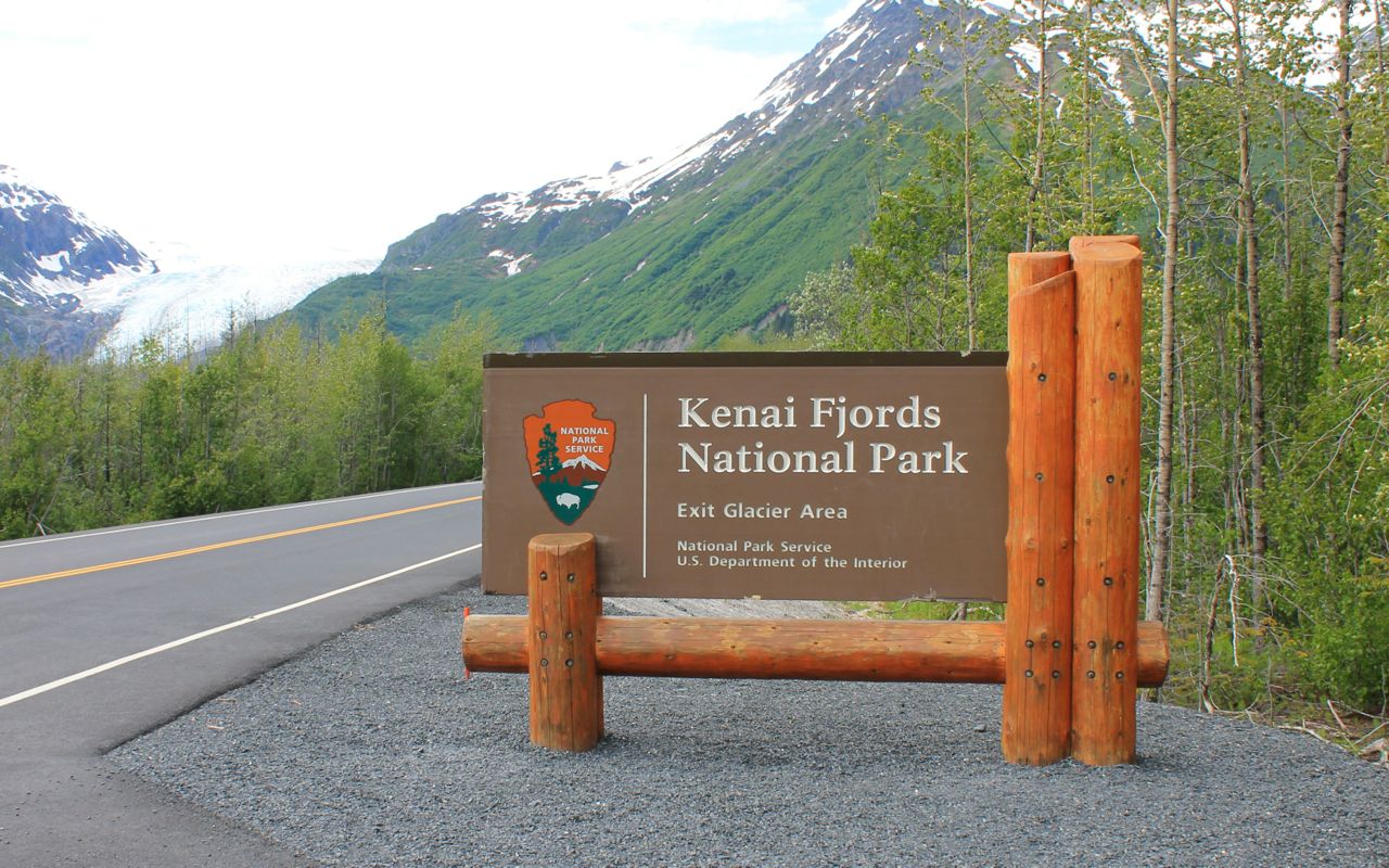
The current size of the glacier is much smaller than in the past, but still impressive.
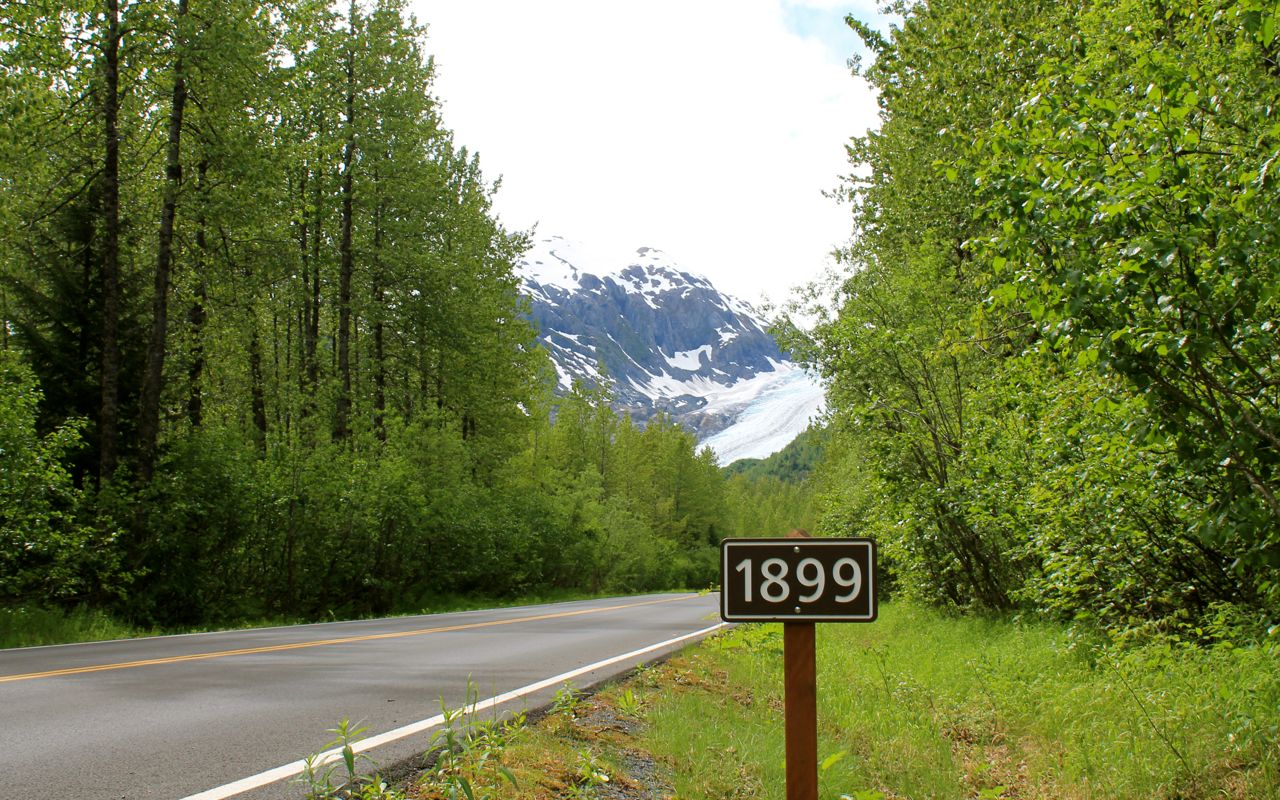
Signs are located in the park that indicate the past boundaries of the glacier. Here’s one from the year 1899 with the Exit Glacier in the background above it, approximately two miles away.
On my return to the hotel, I met up with the gang of three from Los Angeles and we walked to the 49th State Brewery for dinner.
I sampled two different ales with my Yak burger. The place was crowded, and the photo only shows one of the four or five floors to this place. We talked again for hours before heading back to the hotel.
Tomorrow I head back to Tok along Hwy 1 north. It will be my last full day in Alaska.
Day 16
Day 16 distance: 318 miles
Total trip distance: 3,931 miles
Temperatures mostly in the 60s with cloud cover most of the day. Roads were dry.
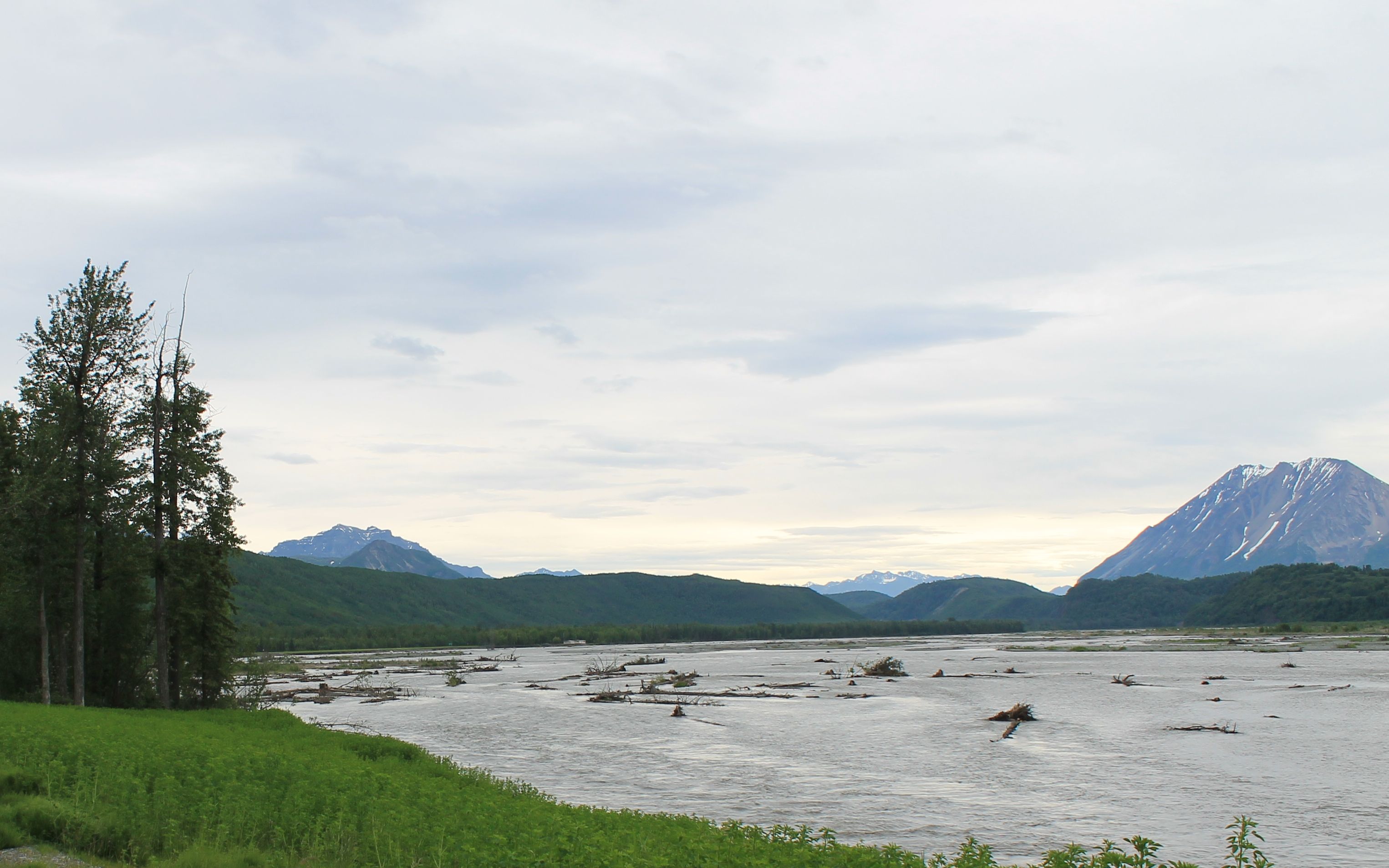
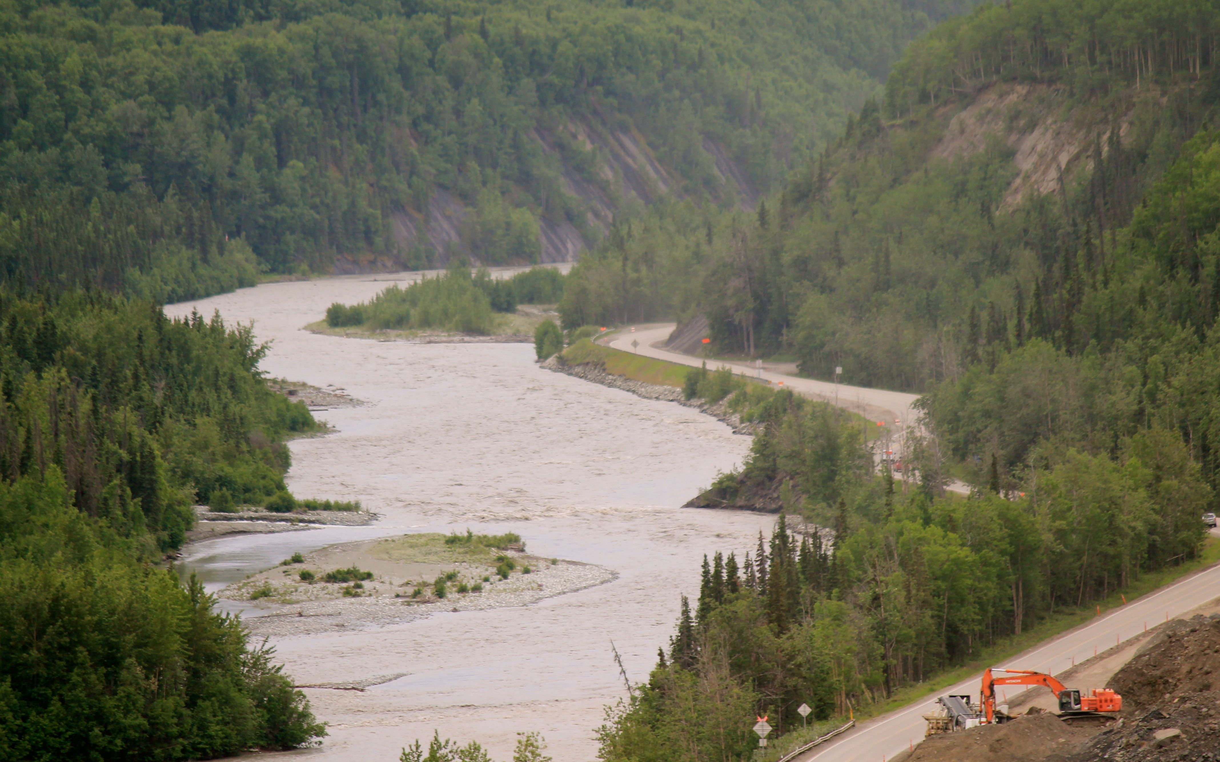
This would be my last full day in Alaska for this trip. Leaving Anchorage about 9am, I headed north to Palmer and continued northeast from there.The path of Hwy 1 follows the Matanuska River through the small towns of Farm Loop, Sutton Alpine and Chickaloon.
There was one major construction delay in a slide area.
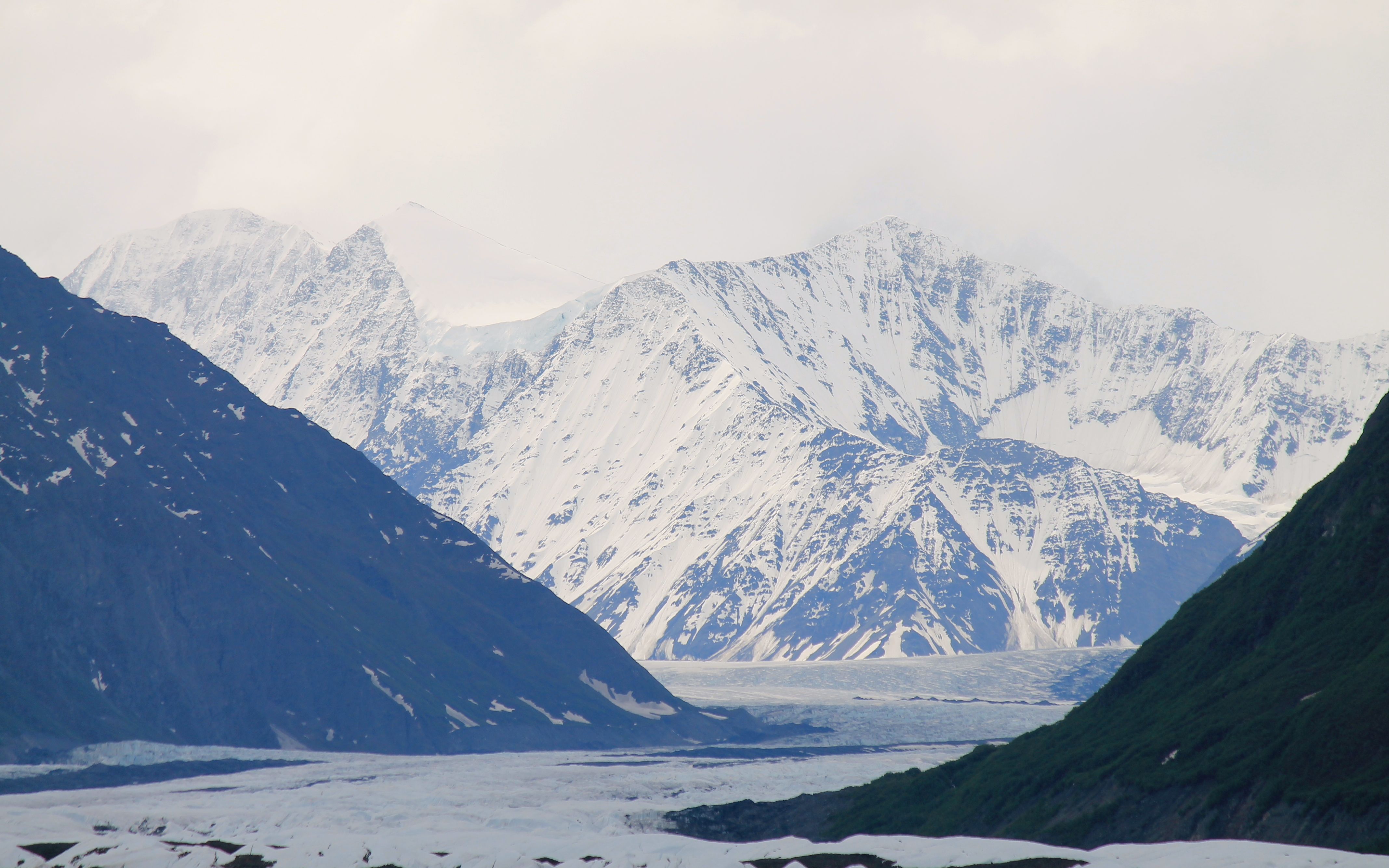
When not immediately adjacent to the river, the road hugs the walls of this glacial canyon providing glimpses of snow capped peaks.
It always sharpens the focus when you realize there are no guardrails and only a suggestion of a shoulder. This part of today’s ride was definitely exciting, with twists and elevation changes along with scenic views.
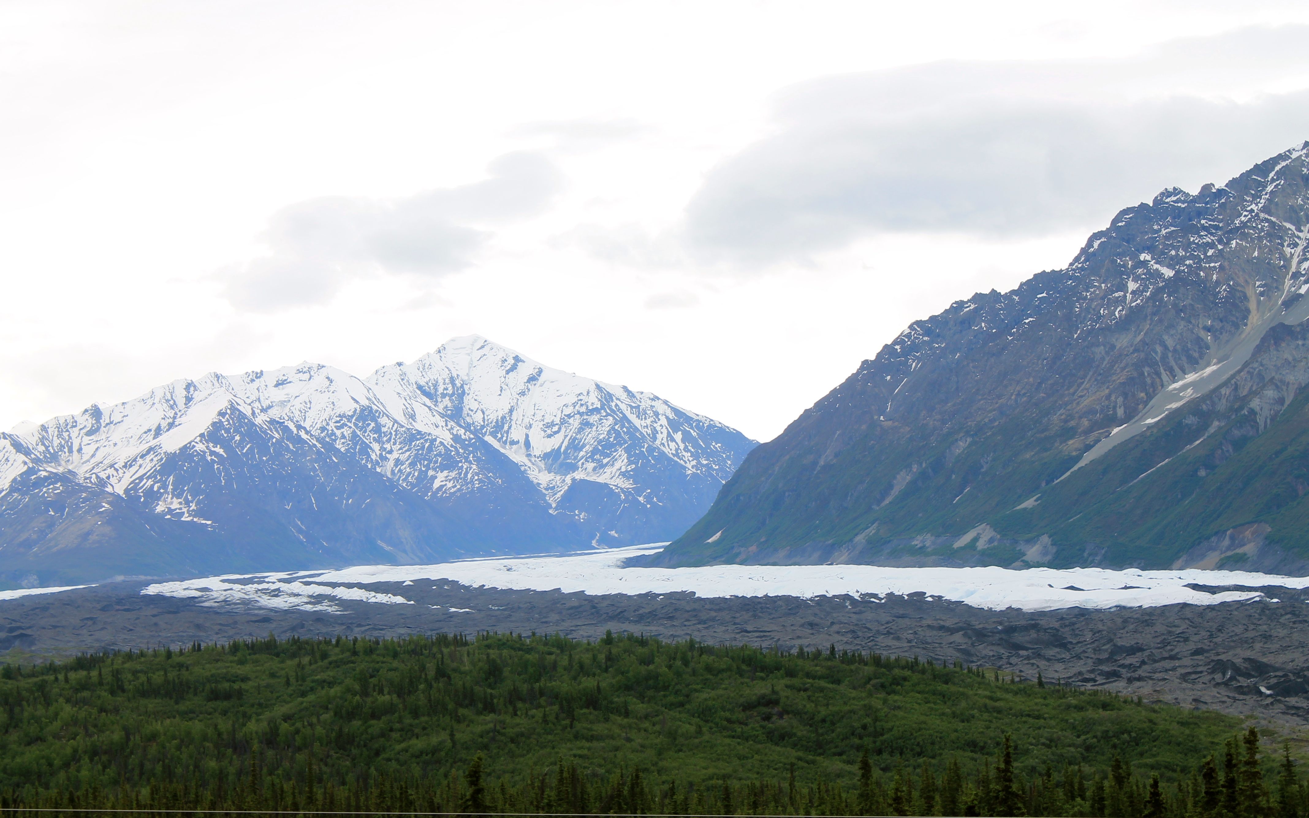
The road widens as I approach the source of the Matanuska River, the ice field and glacier of the same name.
Eventually, the narrow canyon widened into huge and lush valleys. The road itself was in good shape for the most part, but mostly straight and much less interesting.
I topped off with fuel in Glennallen, Alaska and stopped at the IGA supermarket to pick up some deli items for lunch. I met Joe, a local resident who asked where I was from. On hearing my answer, he announced, “This is Trump country here.” Joe has been a long time resident and, apparently a well-known source of fishing flies.
It started to rain and rained off and on for the rest of the day, though it was never too heavy, so I mostly just focused on riding.
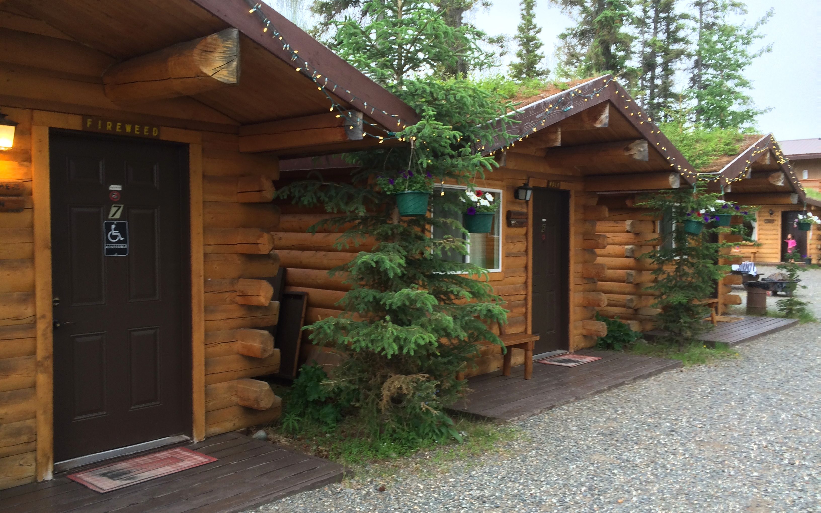
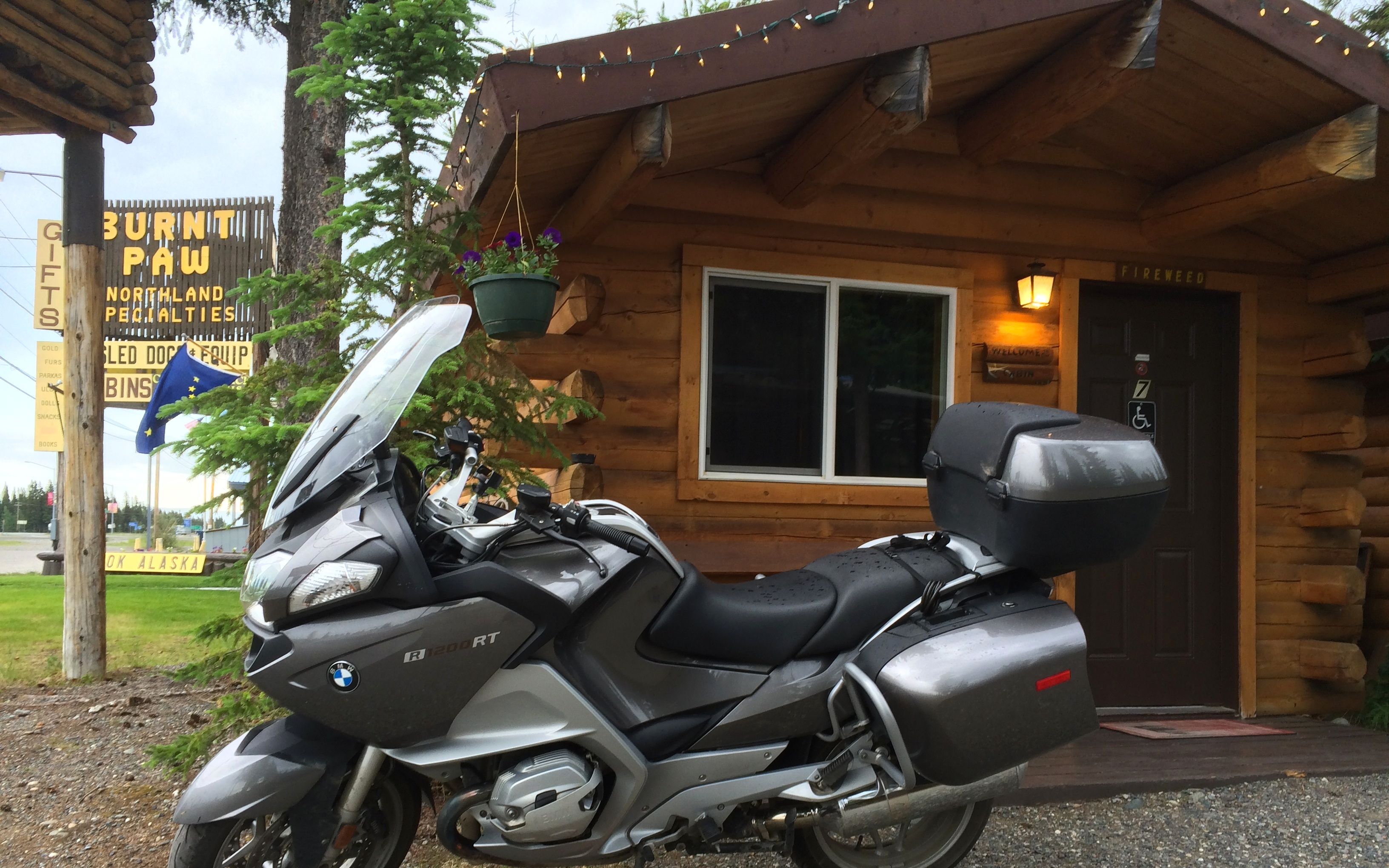
Last time in Tok, I set up my tent. This time, I would be in a cabin, just to mix it up.
Instead of heading to Fast Eddie’s Restaurant again, I just decided to have a Mountain House meal at the cabin. I have been carrying them for weeks and rehydrated the Beef Stroganoff.
While it was “soaking”, I gave the bike a bit of a sponge bath using the rags available in the room. 🙂
I would be heading back down the Alaskan Highway from here.
Day 17
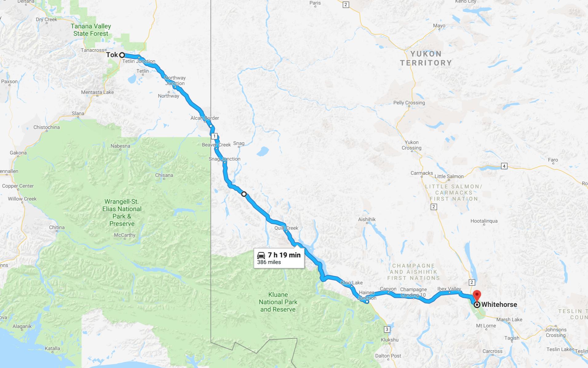
Day’s distance: 386 miles
Total trip distance: 4,317 miles
The day was warm, sunny with some strong afternoon breezes. I headed out of Tok after stopping for a latte and breakfast sandwich, which seemed more to my liking than the breakfast selections offered at the cabin.
The border crossing was only 90 miles from Tok, and I encountered one construction delay on the way there. I was able to cut to the front of the line for this one, and got a jump on the line of RVs I had been stuck behind.
There were several patches of loose gravel and other patches of fresh oil on the road this morning.
At the border crossing, I was still in front of everyone. I pulled up and was on my way in just a few minutes.
Today’s ride included a long gravel section of road that kept things interesting, but mostly it was long stretches that looked like the photo below. I kept repeating to myself, “Yukon is a big place. Yukon is a big place.” 🙂
There were small lakes dotting the landscape …
and this time I stopped at this bakery near Quill Creek that I noticed on the way up.
I grabbed a roast beef sandwich on a small baguette and had some coffee. Both were delicious and inexpensive.
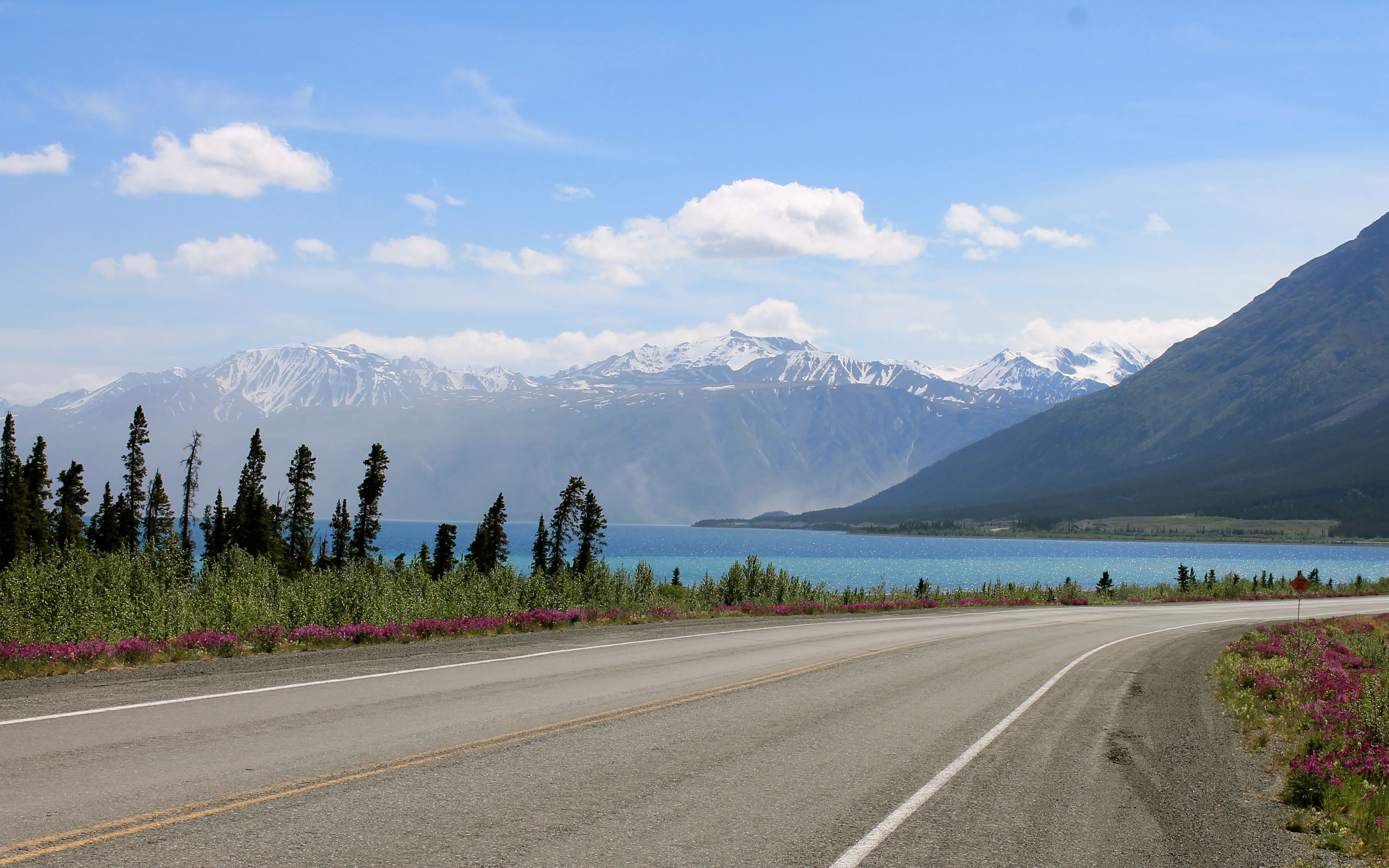
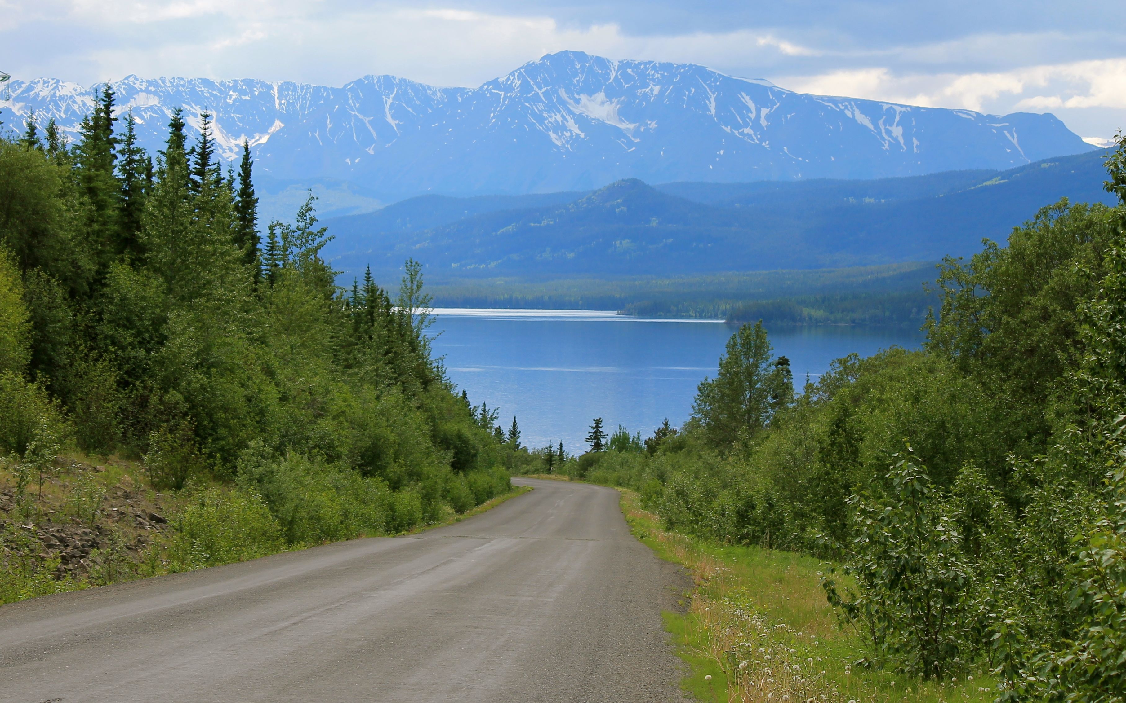
Continuing on, I passed by Kluane Lake again …
and refueled in Haines Junction. By refueled, I mean I put gas into the bike and one more latte from the Village Bakery into me. It looked like I was going to miss a music event that was being set up.
With the time change, I arrived in Whitehorse just a few minutes after 6pm. I got checked into the same hotel I stayed at last week and cleaned up. It was warm and sunny, and everyone was running around in shorts and t-shirts.
Last week, I made reservations for Antoinette’s for tonight and started a delicious dinner with a martini.

Dinner was Curry Chicken Stew with spiced prawns. It was spicy and delicious. I had a great time talking with the staff about travel, blogging, art and living in Whitehorse and Seattle.
A good meal finishing a good day. You can’t ask for more.
I spend one more day on the Alaskan Highway, landing in Watson Lake. After that, I turn south and ride the Cassiar Highway, a new road for me.
Although my lodging in Watson Lake advertises high-speed internet, I would be surprised if it is actually useable. The night after that is camping, so it may be a few days before I get to update the blog again. Stay tuned!
Day 18
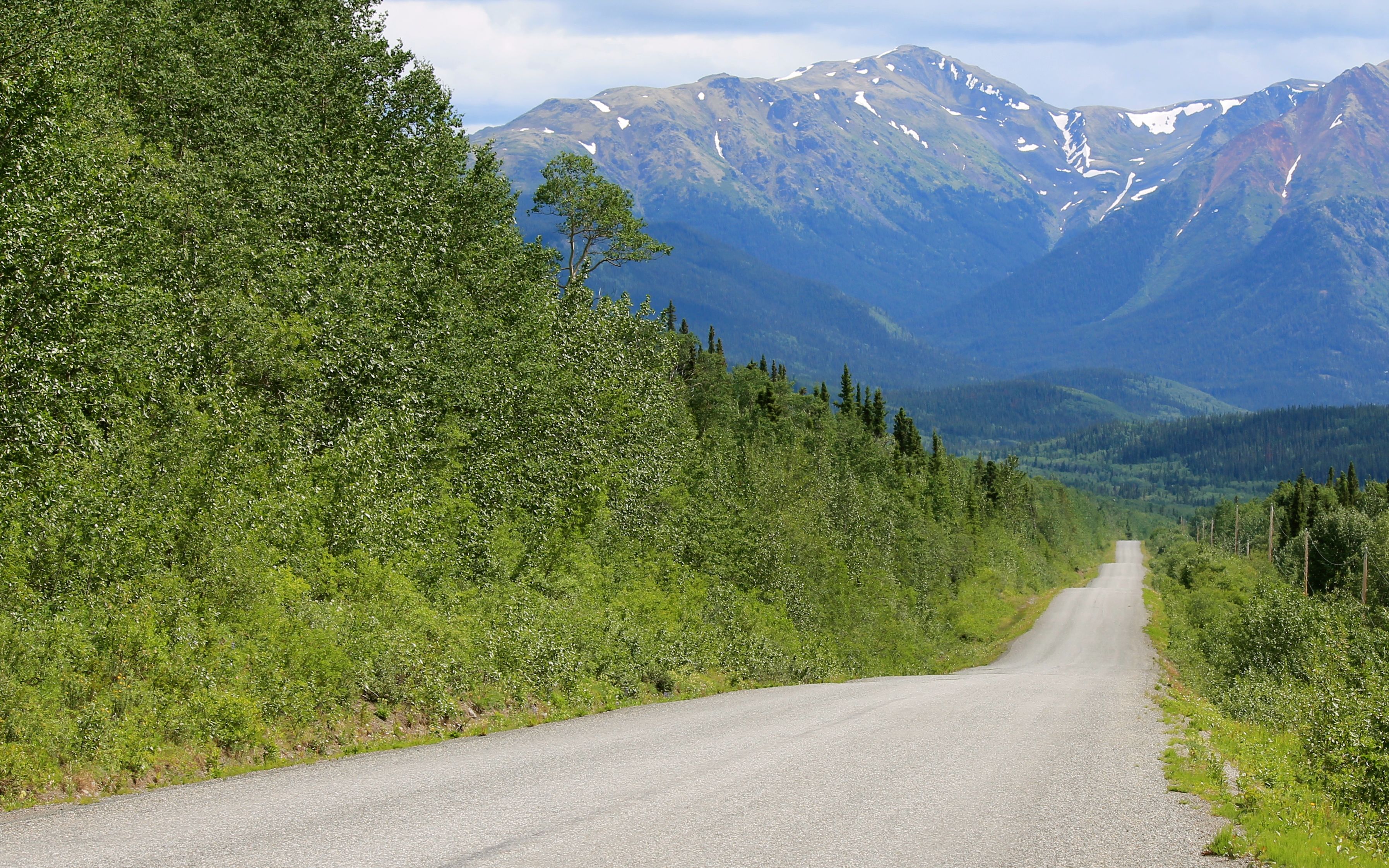
Day’s distance: 272 miles
Total trip distance: 4,589 miles
Temperatures ranged from the mid 50s to the mid 70s with some sunny skies and some clouds. Almost no wind this morning with a light wind developing this afternoon near Watson Lake.
Since I’ve traveled this route before, I wanted to try to take some more creative shots this time. Some came out, others did not. That’s the way it is. 🙂
Here are some of today’s favorites.
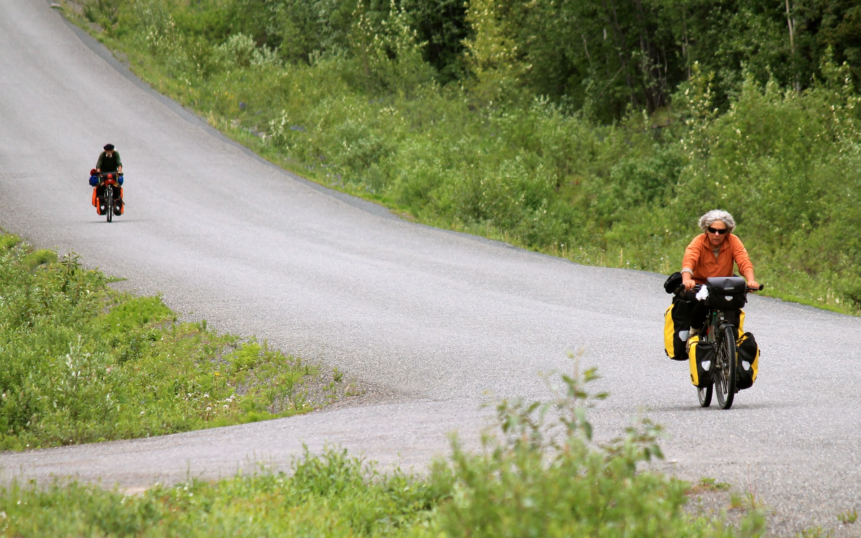
There are a lot more bikers out and about compared to last week. I saw these bikes behind me and the curvy road ahead and grabbed the shot.
I did see a black bear but wasn’t in a place I could easily stop and be safe at the same time. One has to have priorities – bikes, yes but bears, maybe. LOL
Tomorrow is new territory for me, the Cassiar-Stewart Highway. According to ourbc.com,
this was the route that the ore-carrying transport trucks drove from Cassiar to Stewart, BC. The road is now seal-coated most of the way with highway improvement projects happening regularly.
Though the distance is only about 300 miles, google maps predicts a travel time in excess of seven hours, so I’m expecting the speeds to be lower than other roads I’ve been traveling.
I will be camping so look for the next blog post in two days when I reach Prince George.
Day 19
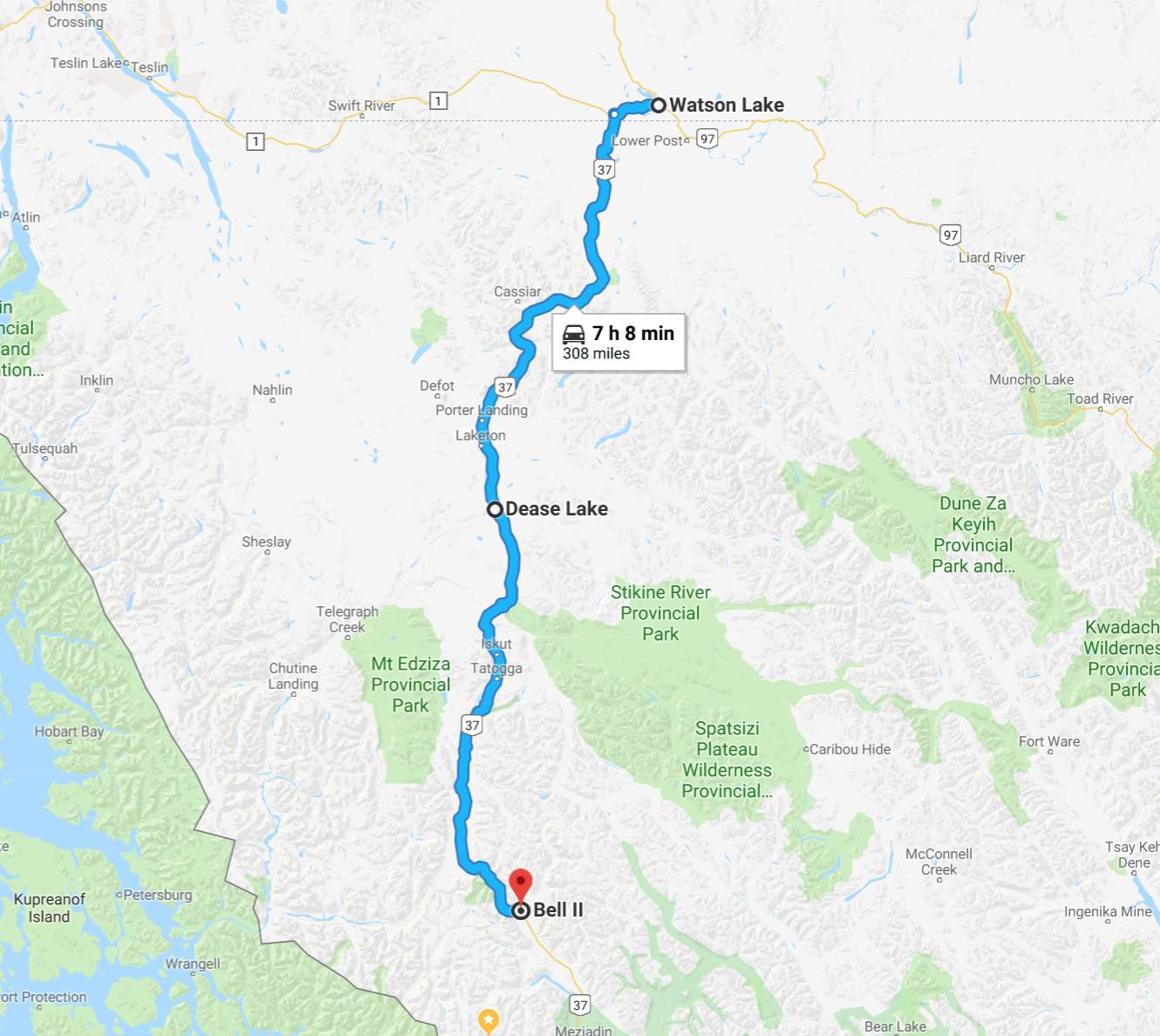
Day’s distance: 308 miles
Total trip distance: 4,897 miles
Temperatures began in the low 50s with mostly sunny skies. Steady showers started in the afternoon south of Dease Lake and continued through dinner time.
I woke up early and received an email alert that my credit card had been charged by the Big Horn motel just a few minutes earlier. While I stayed there last week on my way through, I canceled my second night and switched to the Air Force Lodge for last night’s stay. Since I would be leaving town, I decided to stop at the Big Horn and clear the charge. This took about 20 minutes.
I stopped at Kathy’s Kitchen for breakfast since I would not have another chance to eat before Dease Lake. There I spoke with a few bikers while we ate, comparing previous rides, the gear we carry, and the bikes we were riding. It was interesting that all three of us were heading off in different directions since there are only three directions to go. 🙂
I backtracked along Hwy 1 north for about 20 miles until reaching the turn off for the Cassiar-Stewart Highway (Hwy 37). I had no cell signal at this point and would not regain signal the rest of the day.
The road was in good shape, with the first 25 miles having an 80 kph speed limit.
From about mile 25 to about mile 50, new pavement was laid down recently and was super smooth. Then the chip seal surface, still in good shape, continued.
The brush was cut back from the side of the road in the past, but was growing back. This meant if there were animals along the side of the road, I might not see them as early as on other roads, like Hwy 1. I kept the speed down a bit and applied continued vigilance, but ended up seeing no animals the whole day.
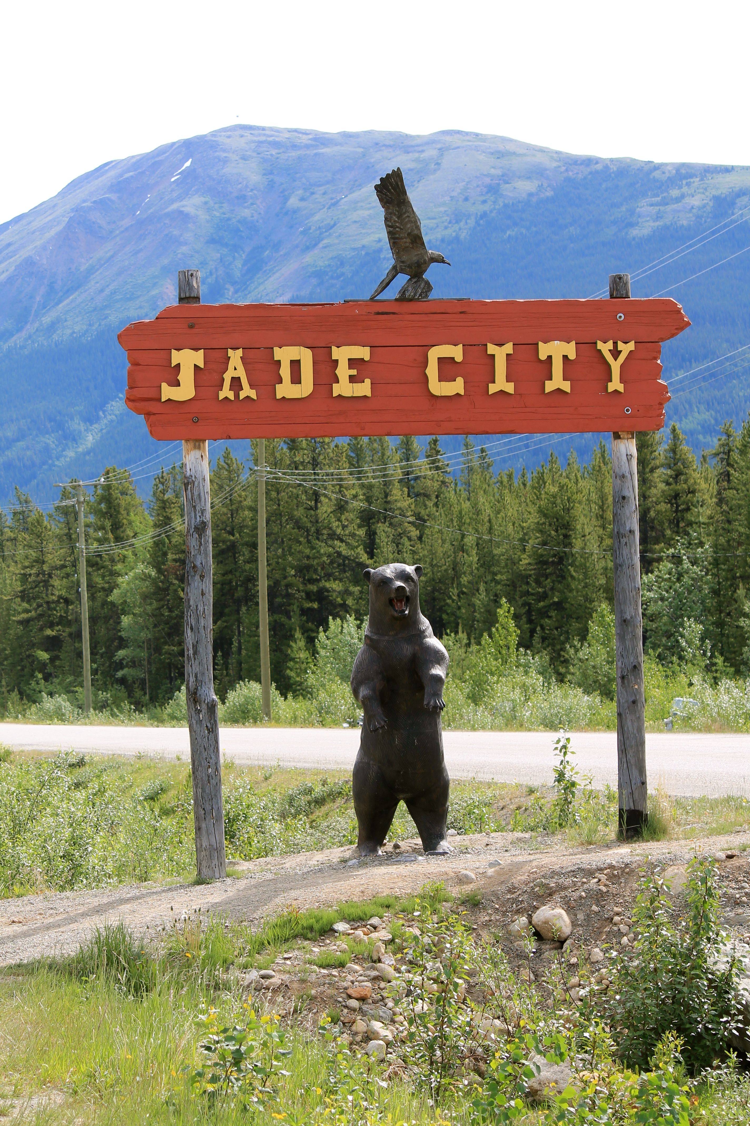
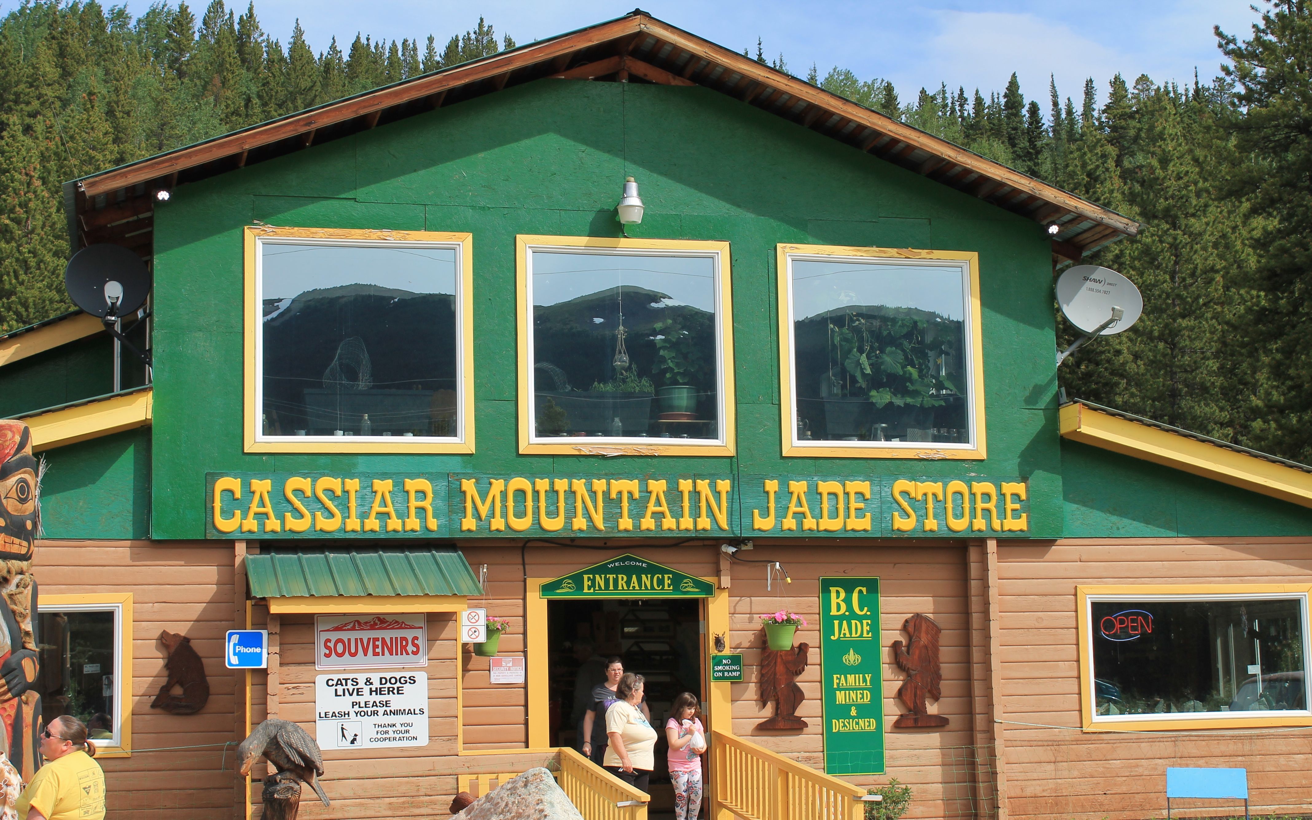
About one-third of the way, I came upon Jade City, a family run mining and retail operation specializing in jade.
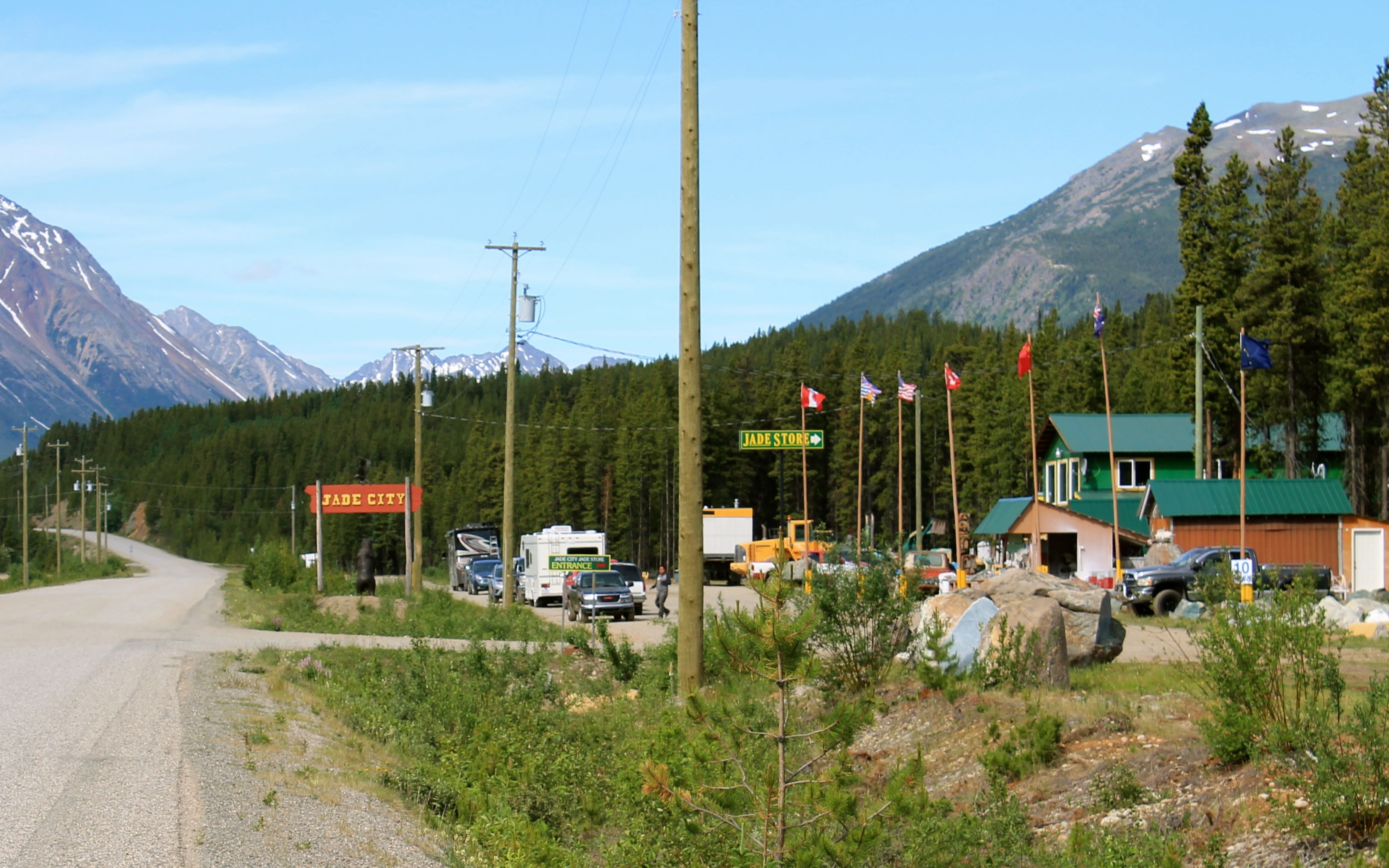
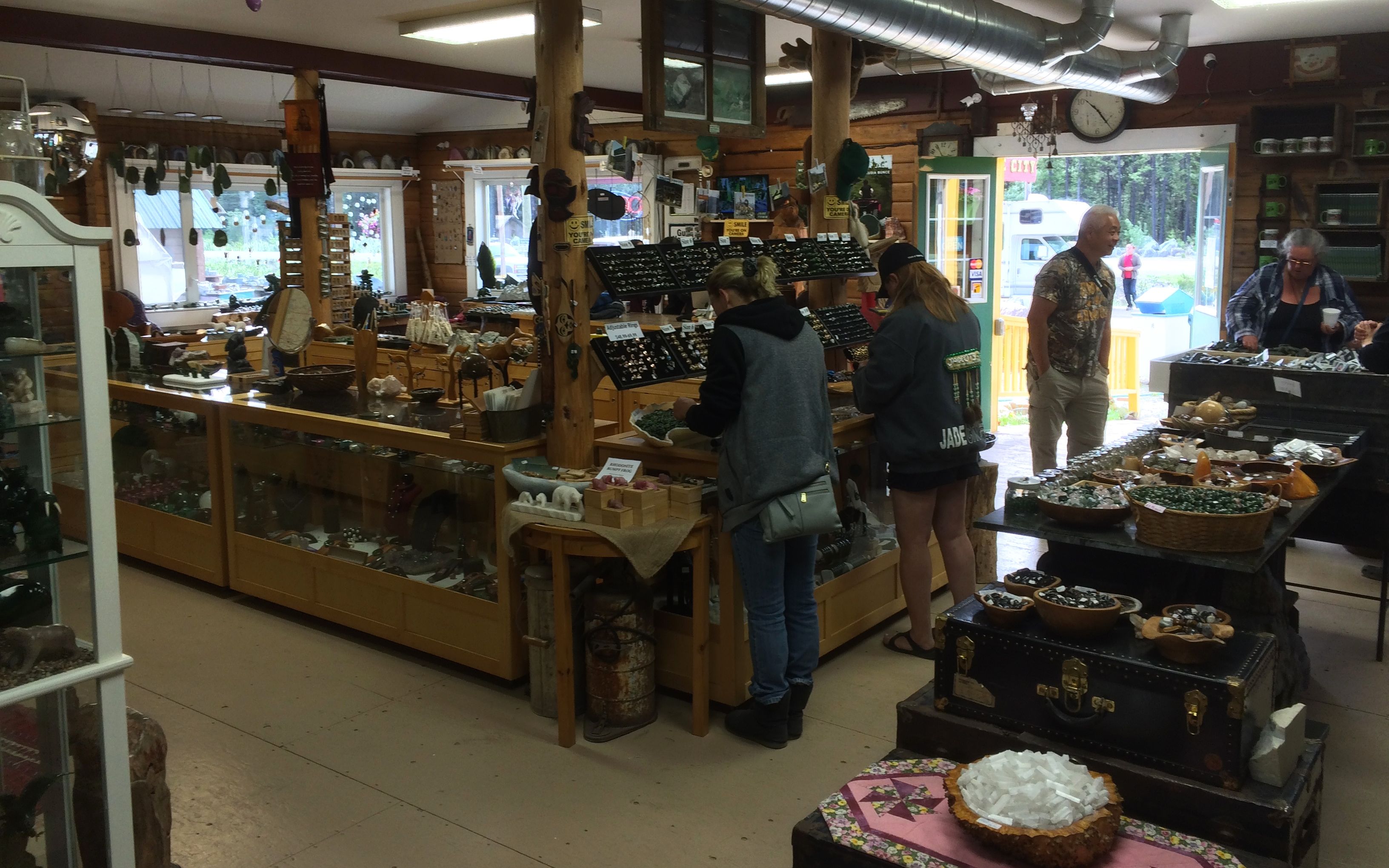
While I wasn’t particularly interested in buying jade, they offered free coffee to lure travelers into the store. I was in need so I stopped.
The coffee was, of course, in the back of the store. I was grateful and left a small donation of a Loonie for my cup of joe.
My GPS wasn’t allowing me to reach Bell II (or Bell 2) using this road. It was a bit later that I discovered it didn’t think the road went through. In fact, for the middle third of this trip, while my GPS indicated it knew I was traveling south on Hwy 37, it showed an otherwise blank screen. This was a little unnerving, but everyone I spoke with said the road went through and the information signs at the rest areas also indicated solid surfaced roads went all the way.
I tried to not let it bother me too much after reading the highway information signs, which also confirmed fuel should be available in Dease Lake. I was able to stop now and then to take some photos of the scenery.
Most of the roadway was narrow and semi-trucks were present, though because it was Sunday there were likely fewer than on other days. I was told before leaving Watson Lake that there was a fatal collision between a trucker and a motorcycle just the week before on this road.
With no usable shoulders in many spots, it was necessary, in the curves especially, to anticipate their presence and stick to the ‘steep’ side of the highway.
There was indeed fuel in Dease Lake. Surprisingly, it wasn’t way expensive. In fact it wasn’t even the most expensive I’ve seen for Canada. I grabbed a grilled cheese sandwich at the market’s deli after filling the tank. There I found other bikers and spoke at length with one of them while we ate.
I was told there was a wi-fi connection at the local college just down the street and the login information was posted for public use. Alas, it was only turned on between 8am and 5pm, Monday through Friday. Oh well, no updating my support team back home.
The ride today easily felt like the most desolate area I’ve ridden on this trip. That said, it seemed someone came by each time I stopped for a break, so I wasn’t too anxious.
I was told the road south of Dease Lake may be rough. While it wasn’t in as good as the first half of the ride, it wasn’t too bad. There were many many sections of loose gravel that seemed to be 10-20 feet wide, sometimes longer at this point in the ride.
I would slow a bit, depending on the width of the patch.
I saw at least a handful of bicyclists along the highway. Personally, I was glad to have an engine to propel me, but these folks reminded me of rides I’ve done when I was younger – all much less adventurous than this.
It was a long ride, but very scenic. I am spoiled for life, I think. I don’t know if I’ll find anything more scenic and remote and still paved anywhere in the US.
If there is a reason to call this a ride of a lifetime, it would be for the opportunity to experience such a remote adventure on a street bike with street tires. More so than the ride on the Alaskan Highway, this day’s ride really conveyed the feeling of desolation.
There was one or two lengthier sections of gravel roadway. On the one below, it was really hard to focus – the view was spectacular!
It was a bit later that the rain started and I packed away the camera and put on the rain gear. As mentioned, it continued until I reach the Bell 2 Lodge. Rooms were available but way pricey, and the rain was supposed to stop shortly, so I ate dinner at the lodge restaurant with some other travelers while waiting.
I was able to set up the tent and sleep with no further rain. The tent area was pretty wooded and filled with hungry mosquitos. I left my riding gear, and gloves, on while using the mosquito net I purchased for over my head while setting up the tent. That netting saved my sanity!
I guess that’s what I get for being too stubborn to spend the money for a room. 🙂
The restaurant was good, and not very expensive, so I planned on breakfast there in the morning. Wi-fi was doled out using 30 minute access passes that I had to purchase. Again, being stubborn and thinking wi-fi should be universally free, I only purchased one to update folks back home and check mail and the weather forecasts.
I did sleep fine noticing it got dark at night, unlike further north in Alaska.
With the exception of an hour remaining on the Cassiar-Stewart Highway, I’ve previously traveled the remaining roads on this trip I’ve been on before. I do look forward to reaching Prince George and taking a day off tomorrow.
My final thought of the day – British Columbia is a big place. British Columbia is a big place.
Day 20
Day’s distance: 454 miles
Total trip distance: 5,351 miles
Overnight temperatures were in the high 40s but it didn’t rain until I was underway. Showers dominated the morning but were over, I thought, when I reached Smithers. But showers re-appeared as I approached Prince George. I put the extra rain layer back on just in time for them to stop again. Ugh. I just left on the extra layer until arriving at the hotel.
The fog hung low against the mountains this morning.
When the road moved away from the mountains, the void was filled by enormous forests.
I stopped in Moricetown, but no First Nation Wet’suwet’en people were fishing at this time.
As I saw on my 2105 trip to Hyder, these folks use nets on poles while walking out over the Bulkley river along planks to fish.
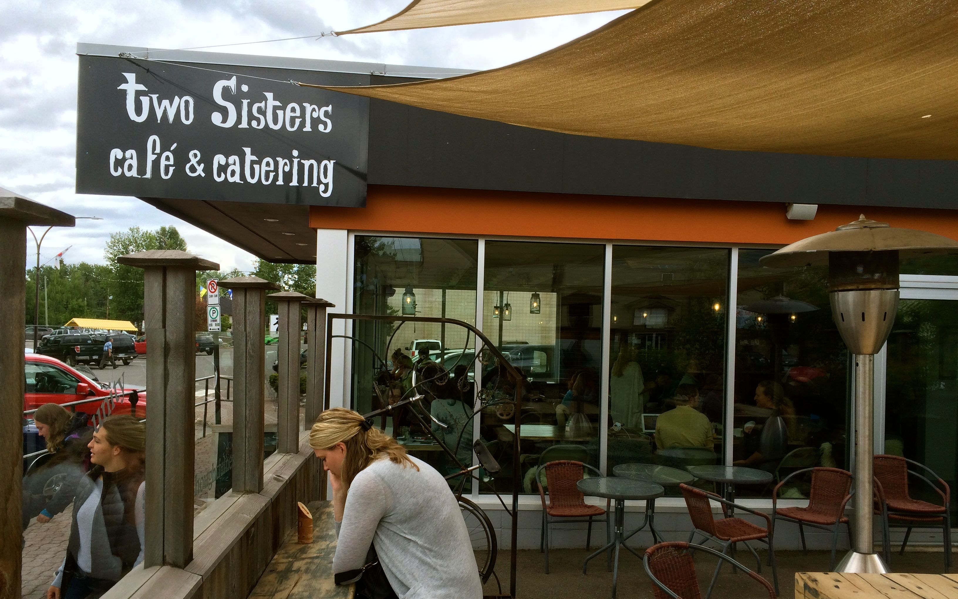
I spoke with another lodge guest while eating breakfast and she suggested the Two Sisters Cafe in Smithers for lunch.
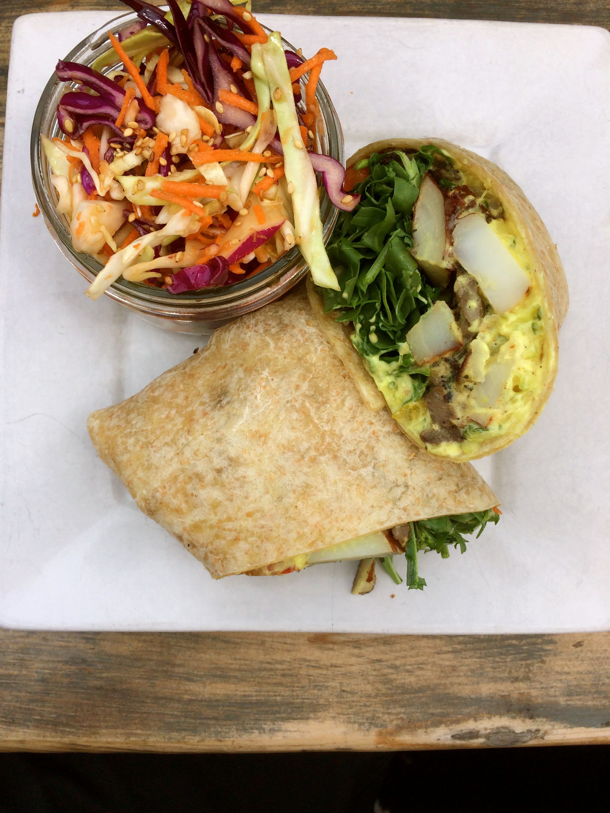
I had the Garlic Steak Wrap, local marinated steak sautéed with potatoes and peppers, and rolled up in a 12” tortilla with raita and arugula. It came with a side and I chose the coleslaw. Everything, including the large latte, was excellent!
I topped off with fuel here as I heard there may be some stations to the south out of fuel. That actually was the case at a stop I made for Red Bull a few hours later.
In this area, the mountains recede and farm land fills in along the road.
The highway is pretty congested, traffic increasing steadily since getting on Hwy 16 at Kitwanga.
There was road construction close to Prince George that did not present delays, per se, as the work wouldn’t start until after 6pm. But, the speed limits were lowered in the area to 70kph, enforced by the only police car I saw the whole trip that was monitoring speeds.
Thanks to the unknown trucker who alerted me to their presence. I was getting tired of Canadian drivers passing me all day long and was, by then, going a bit faster than the lowered limits. Whew!
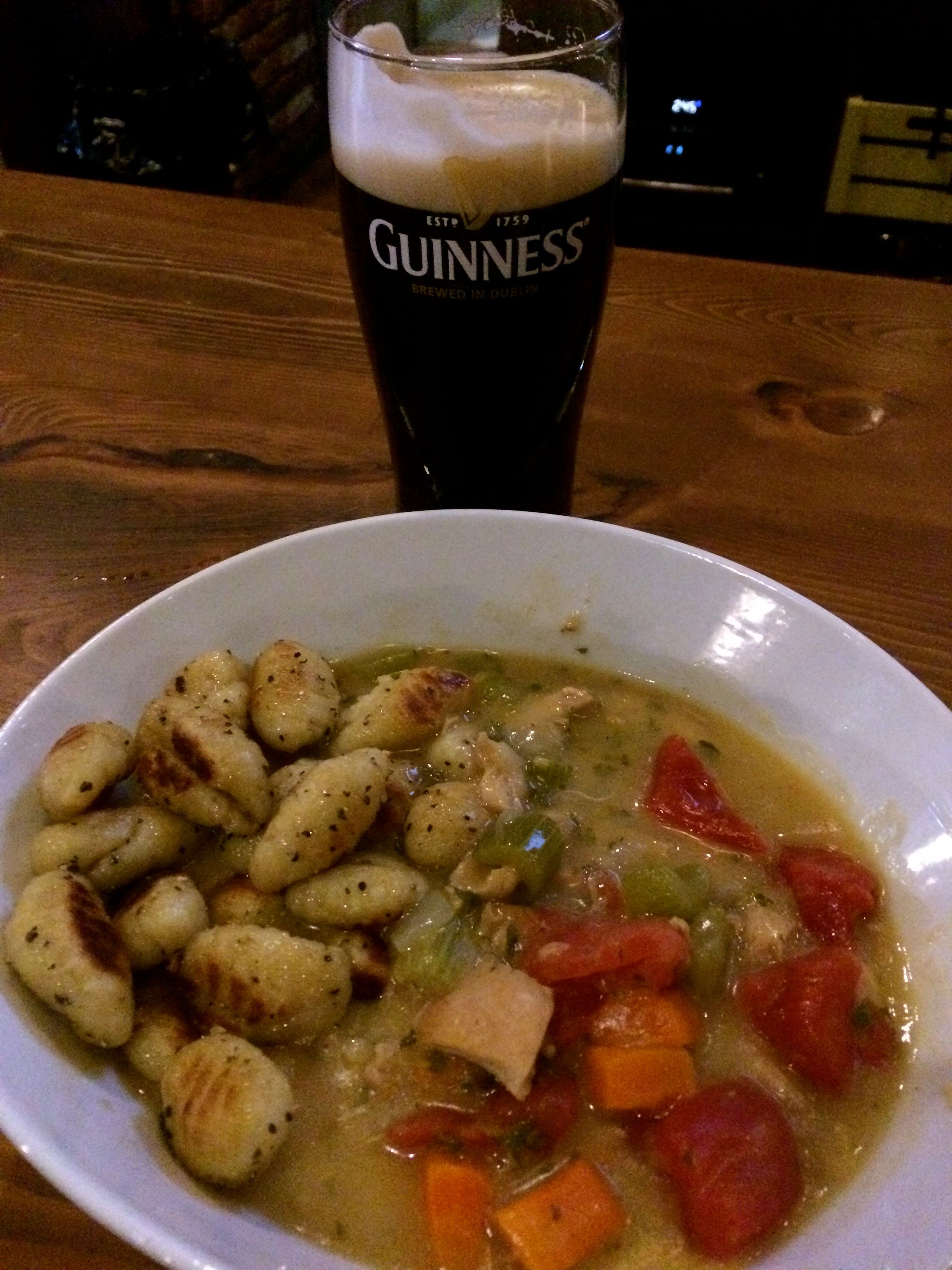
After checking in to my downtown Prince George hotel shortly after 6pm and getting cleaned up, I walked to the Twisted Cork restaurant and brew pub for dinner. In keeping with the theme of sampling wild meats, I had the rabbit stew and a Guinness.
The stew was most excellent! Highly, highly recommended.
Tomorrow is a day off the bike, with the exception of topping off fuel and maybe washing it for my final two days of riding home.
Day 21
Today was a day off the bike. In fact, I didn’t even wash it or top it off with fuel. Instead I had a relaxing morning drinking coffee in my room, getting the blog caught up, and using the hotel pool and hot tub.
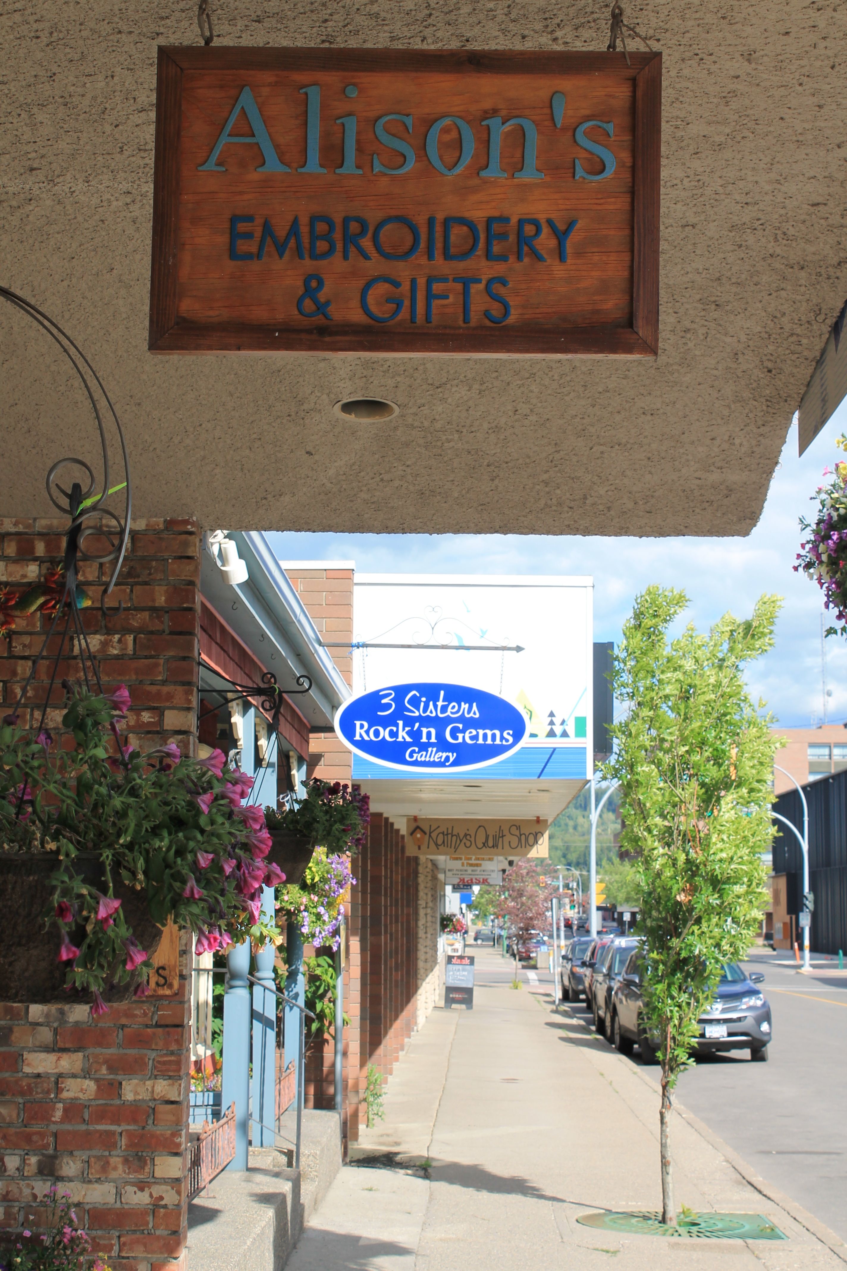
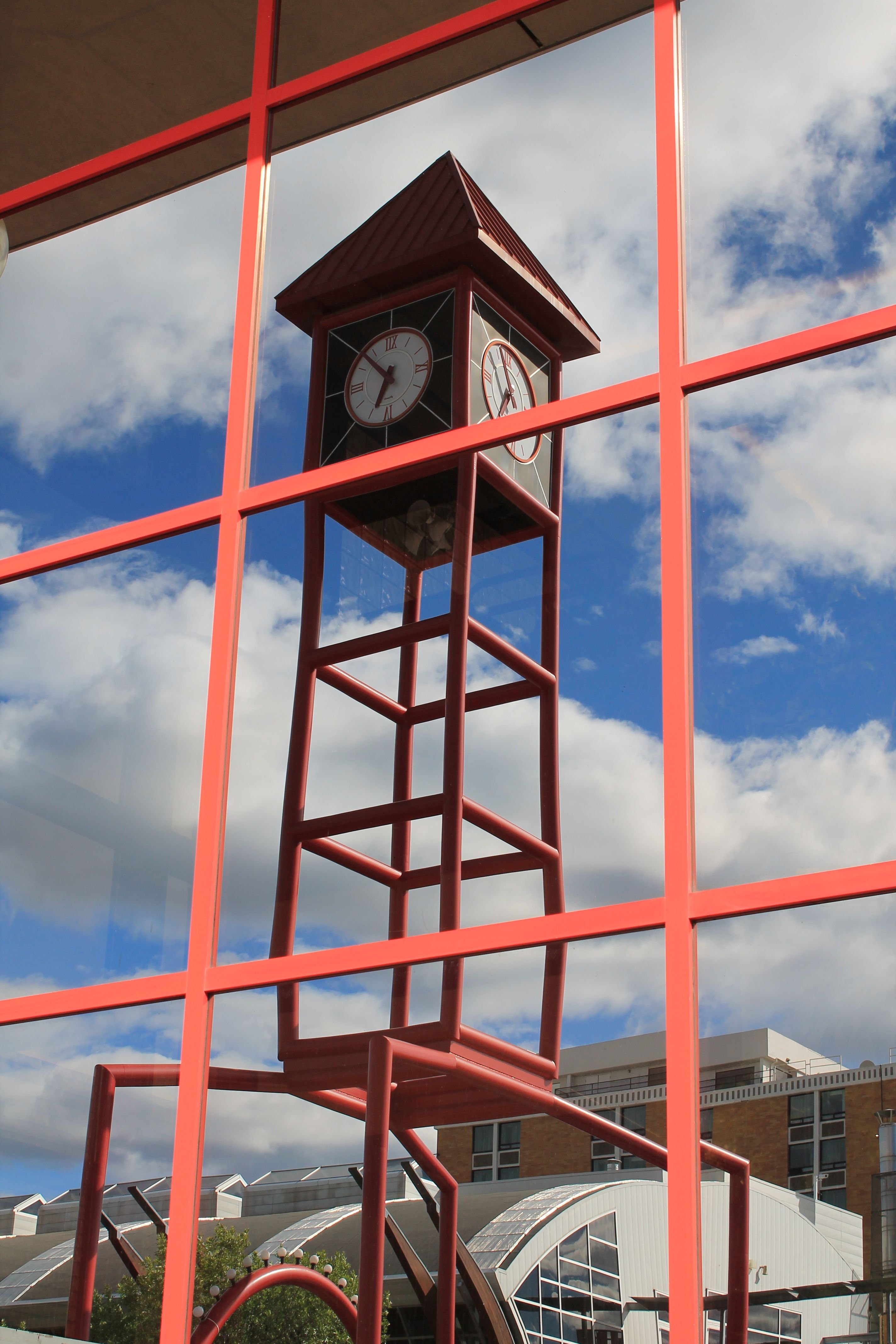
By noon, I needed to find a latte and something for lunch. I grabbed my camera and took some photos of the section of Prince George’s downtown adjacent to the hotel.
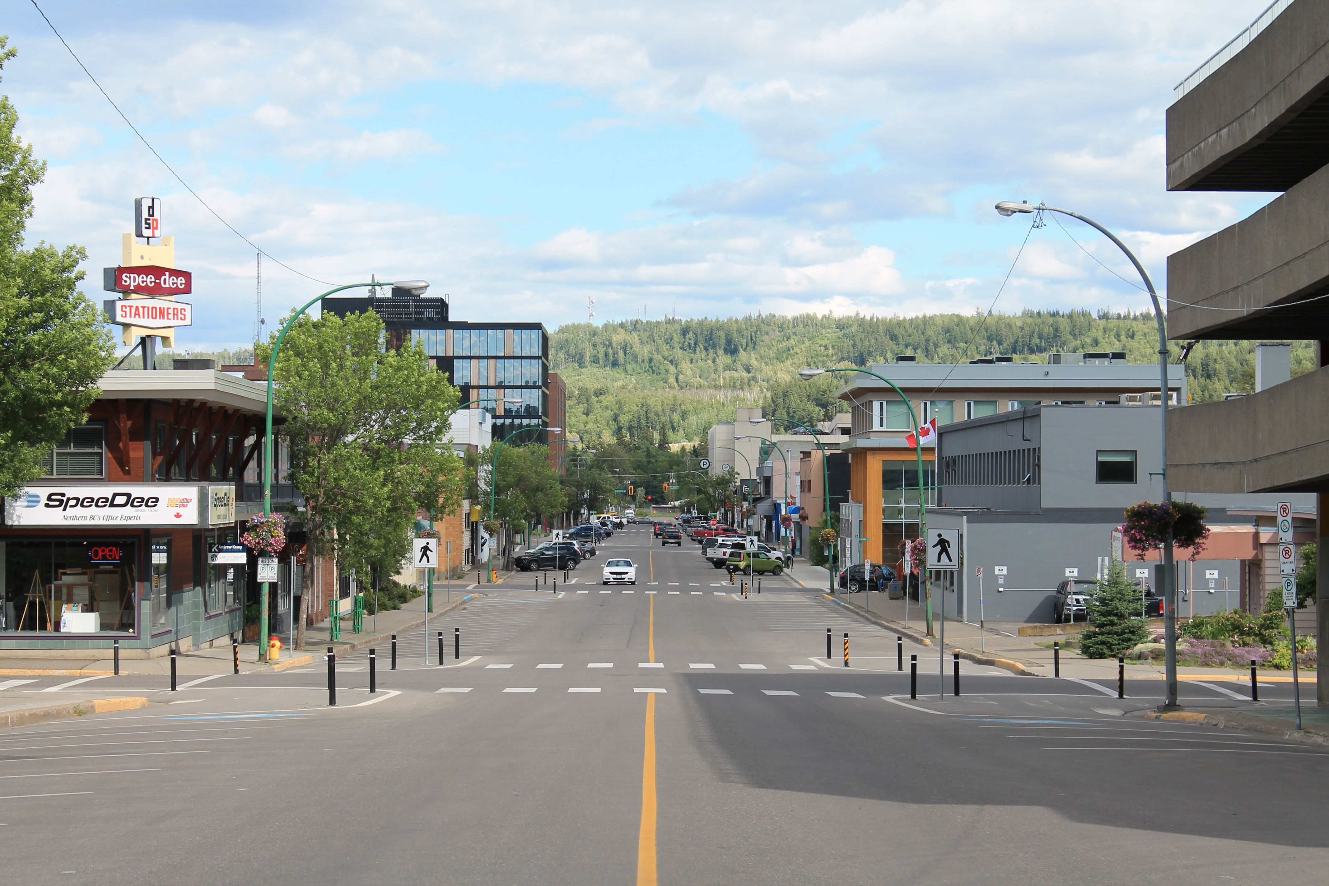
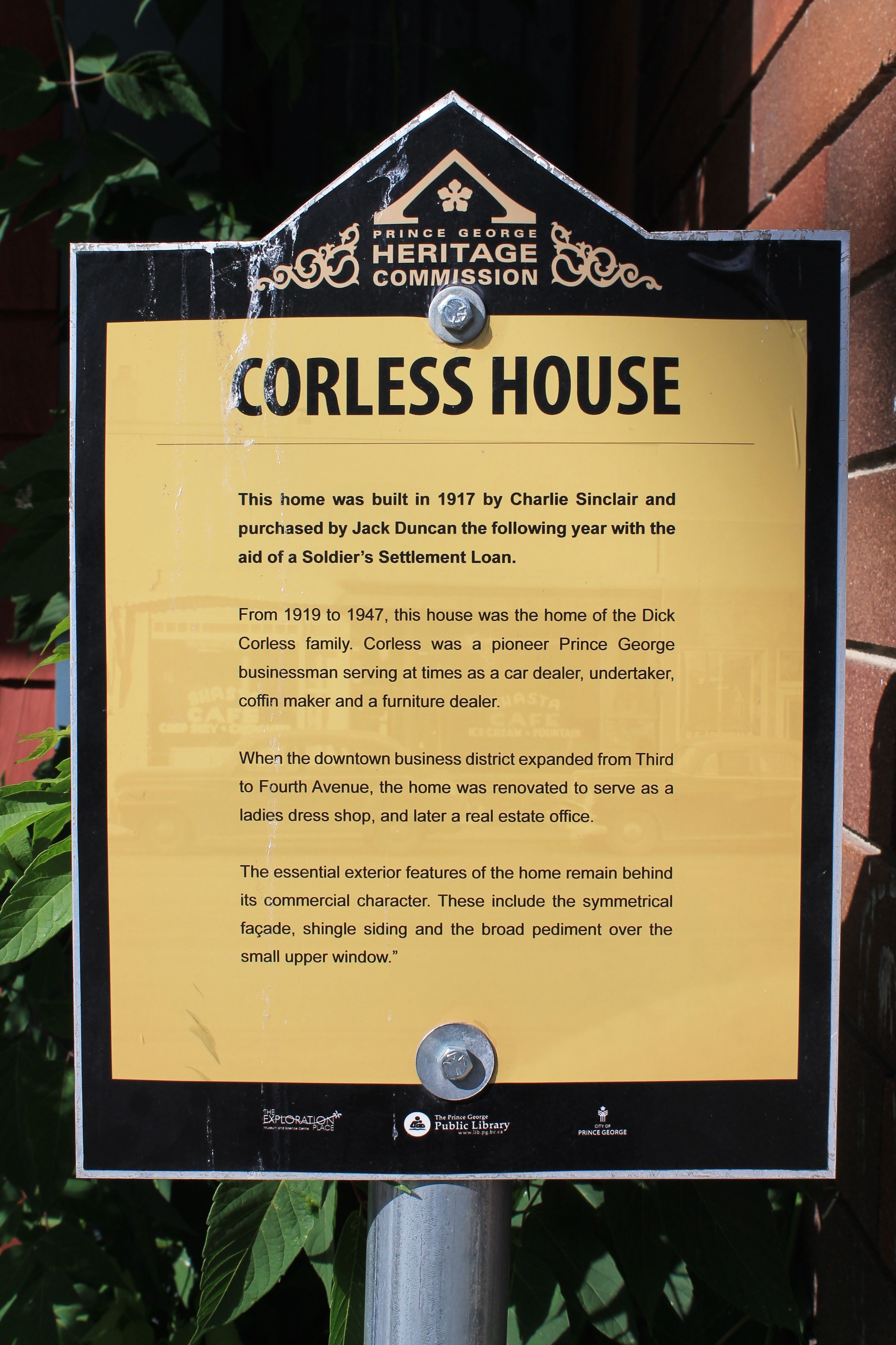
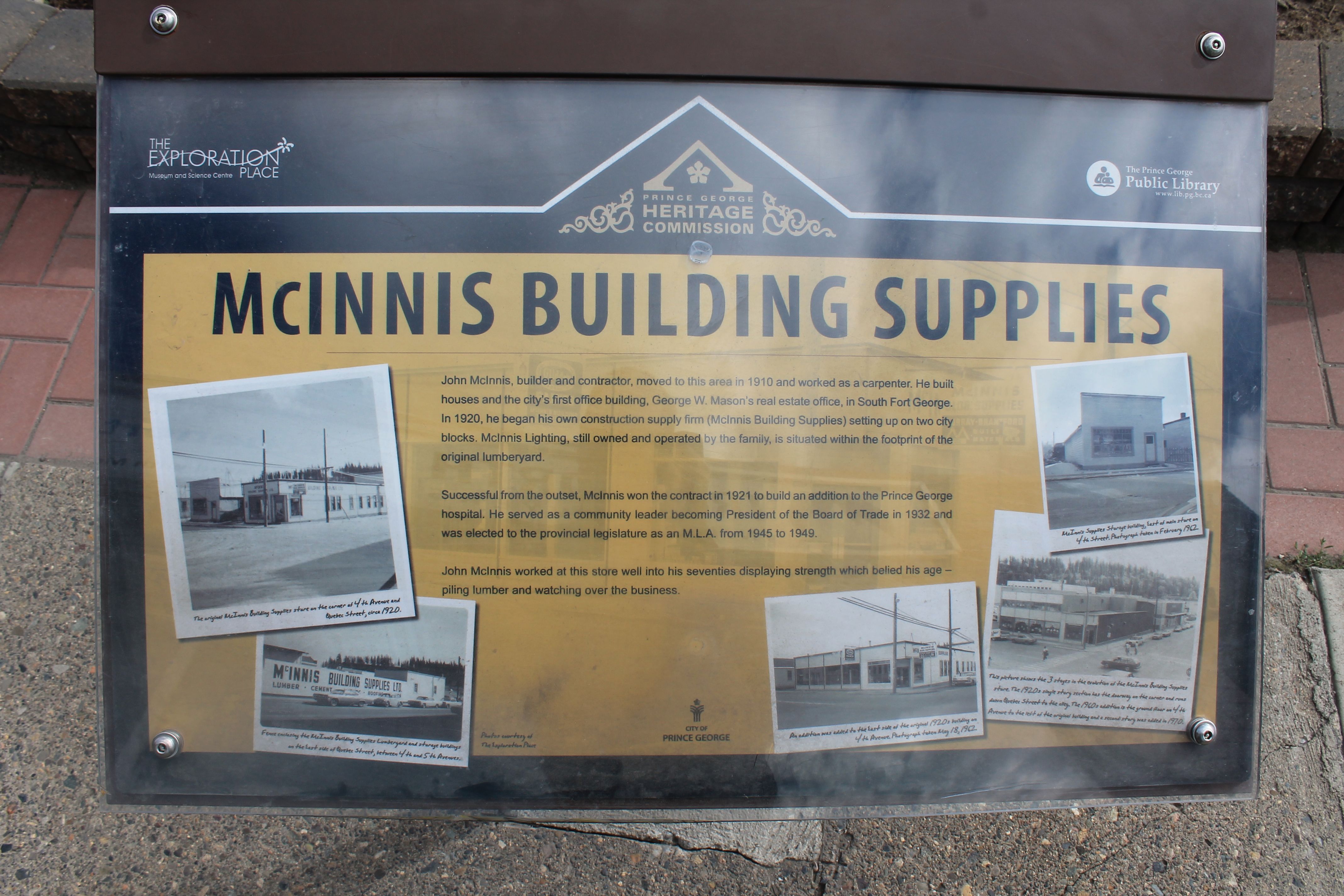
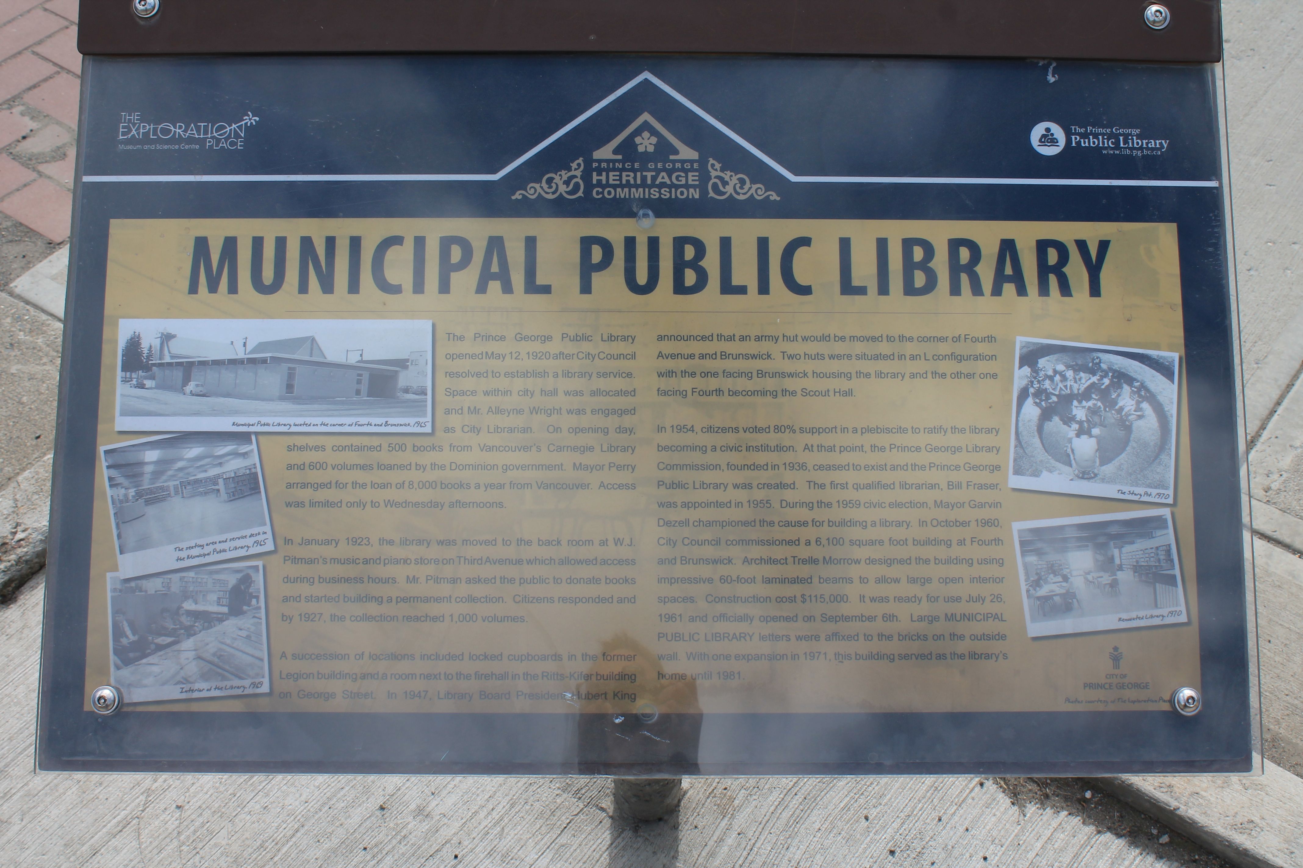
The Prince George Heritage Commission has created a walking tour of historic buildings. According to this website,
The City of Prince George, in collaboration with the Prince George Heritage Commission, has installed heritage interpretive signs throughout the downtown area, in a number of city parks, and along various trails. These signs tell stories of PG’s history, its unique buildings, and of interesting events and people. There are presently twenty-five (25) interpretive signs installed across the City at sites of historical interest.
Here are a few examples that I came across.
The Corless House, built in 1917.
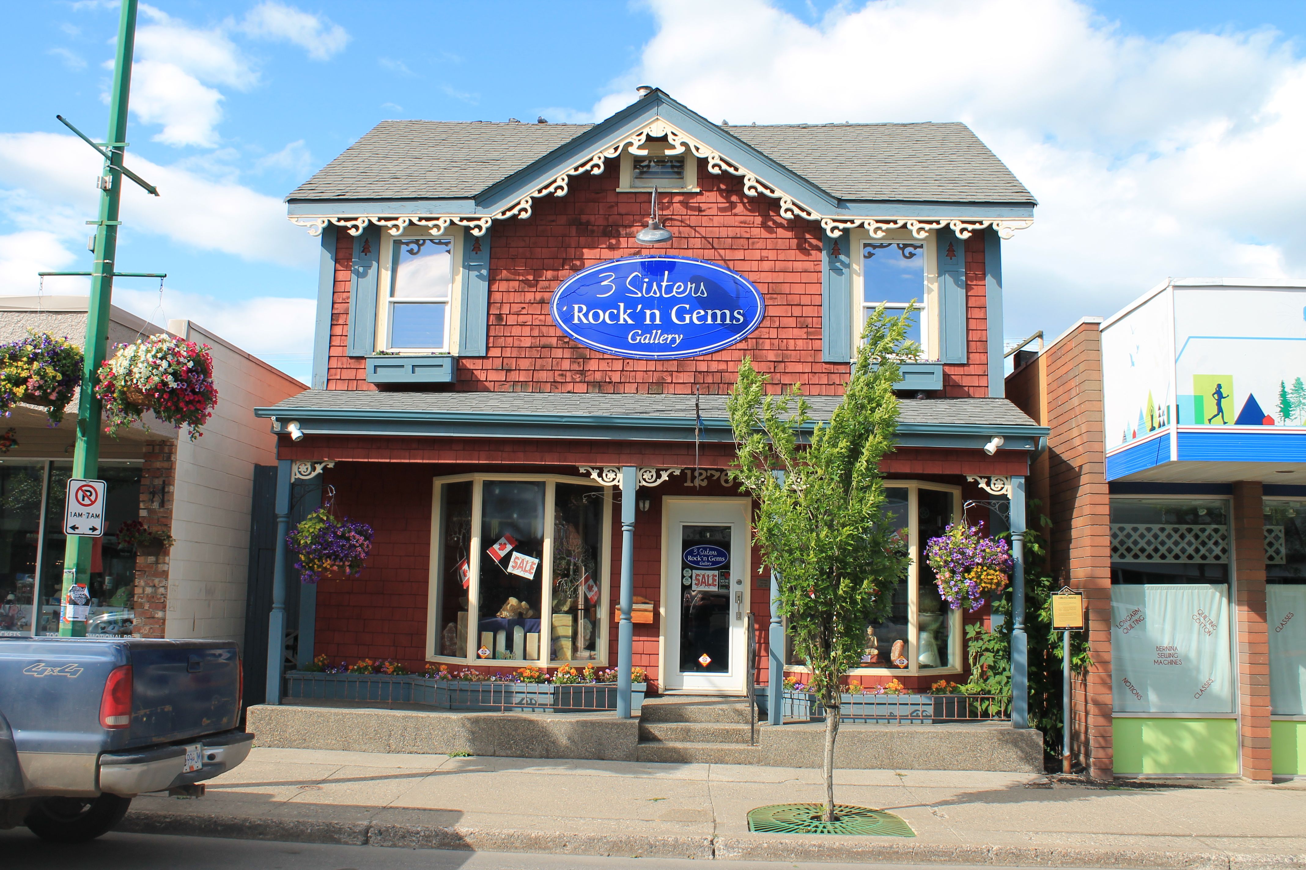
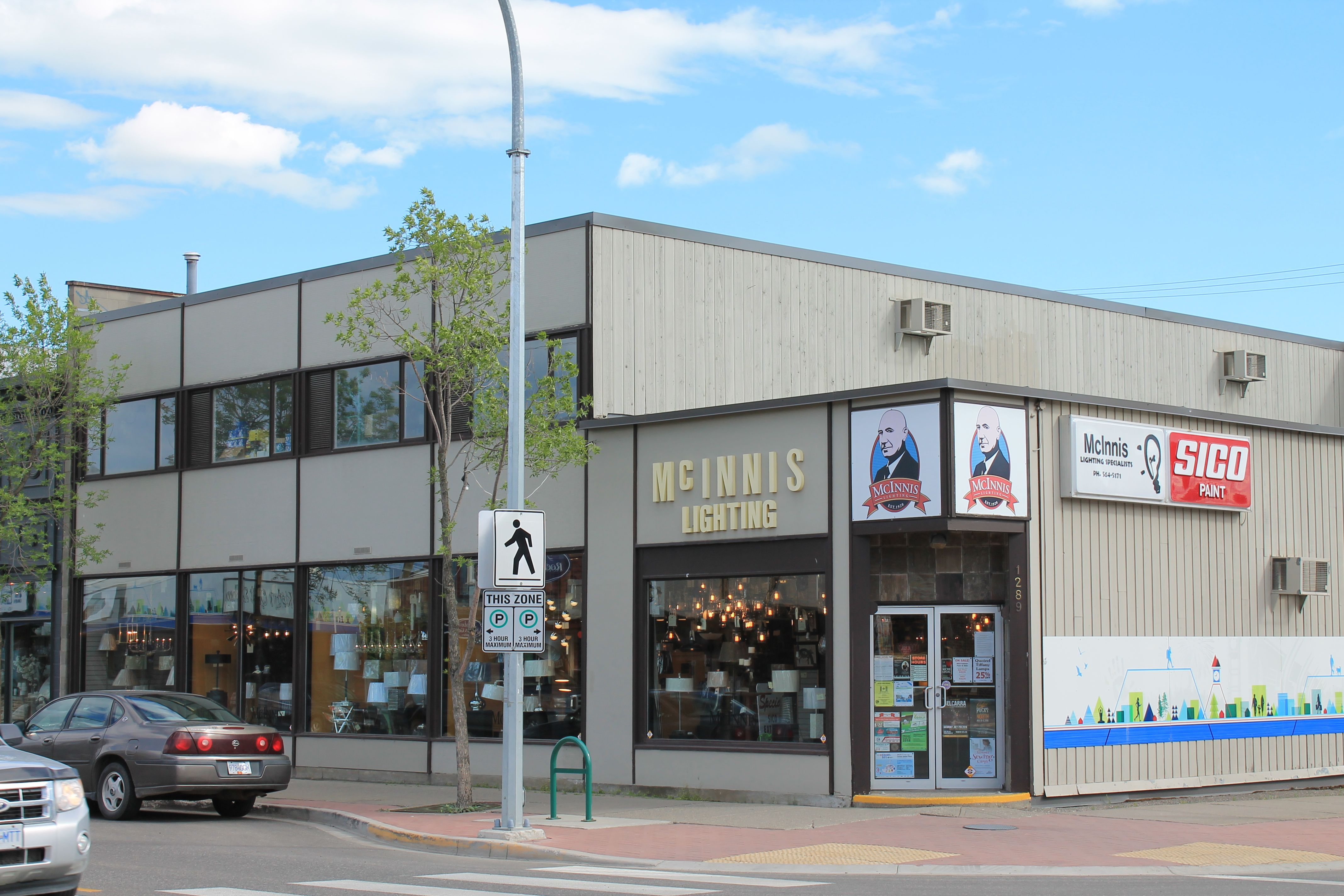
The McInnis Building, constructed in 1920.
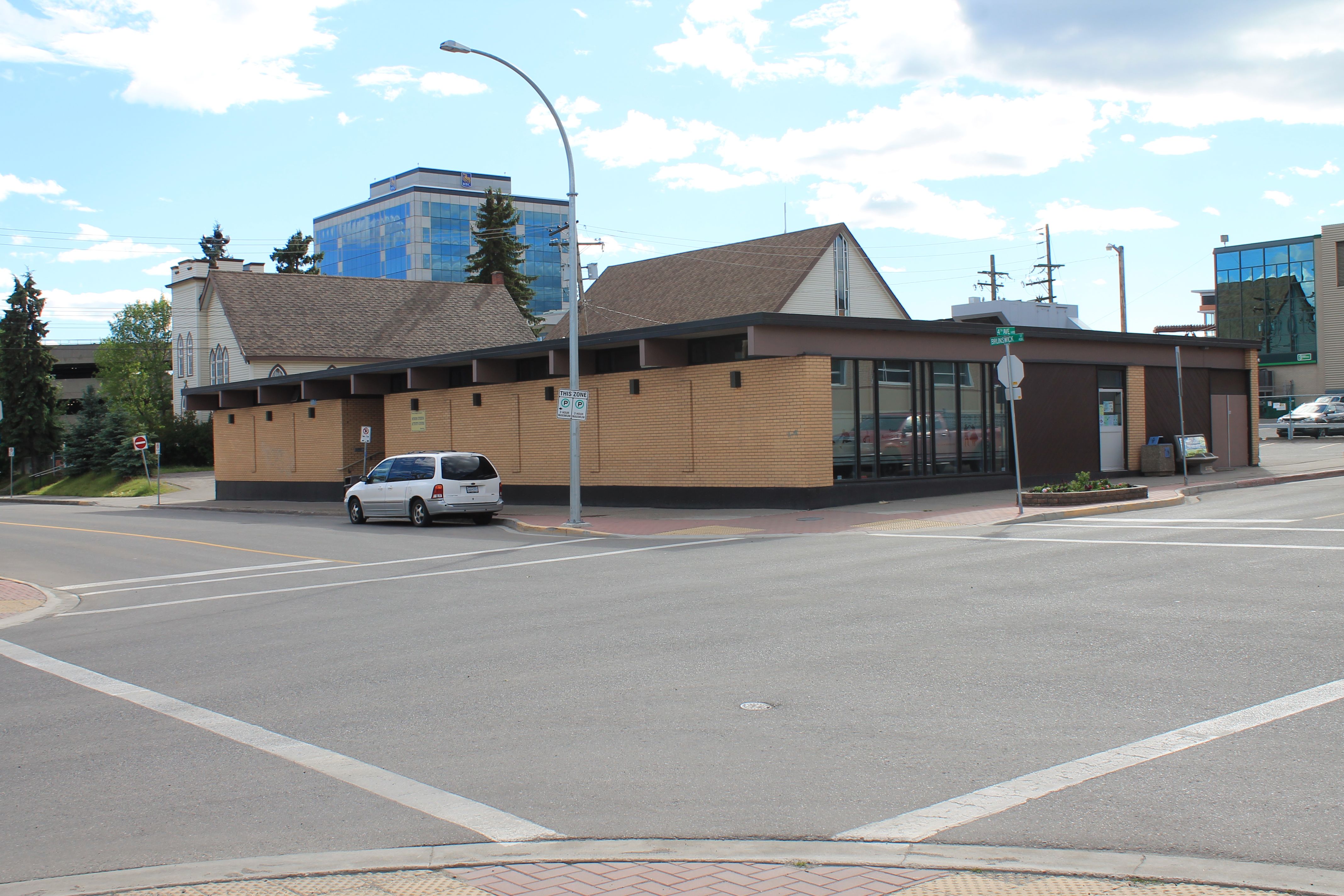
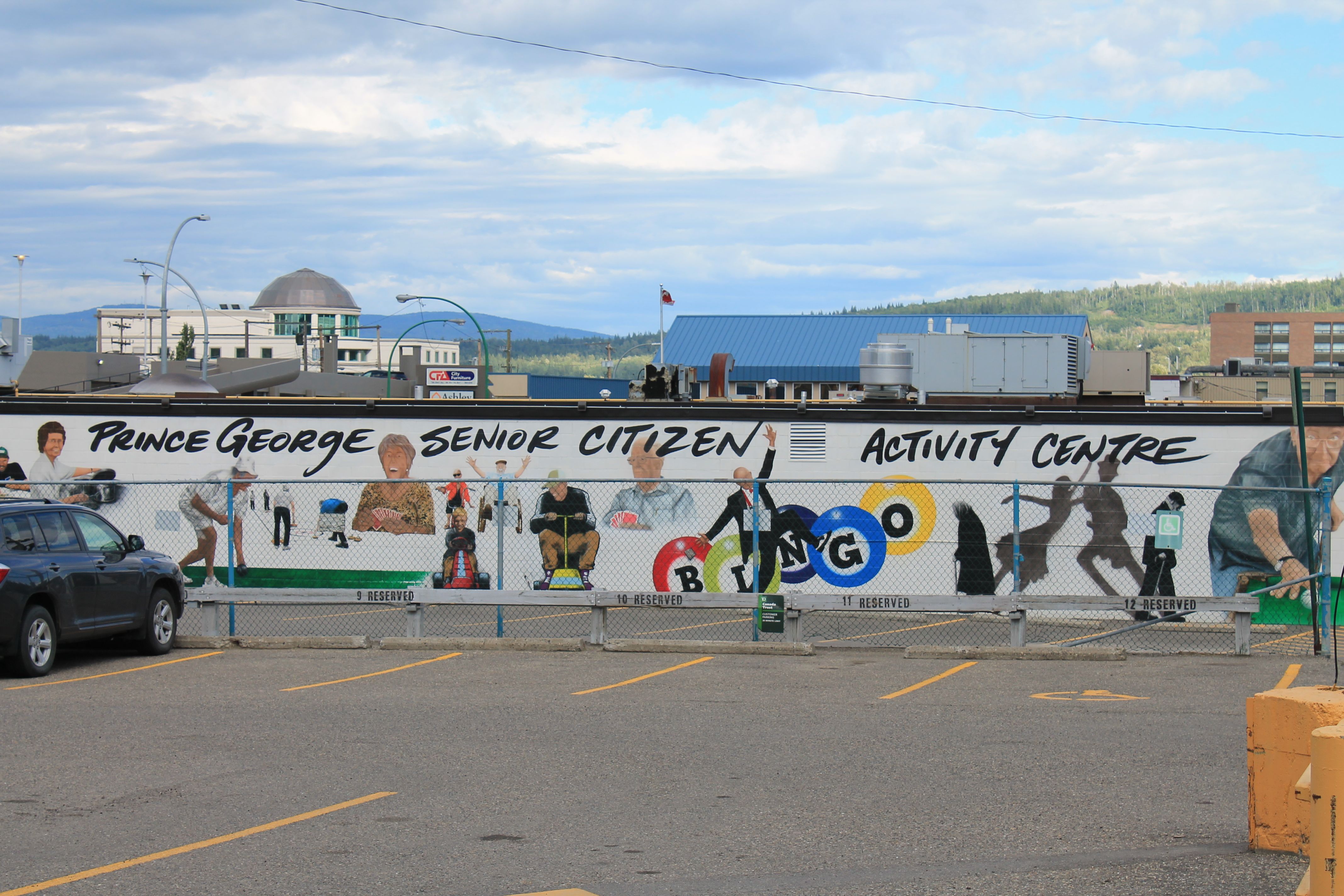
Finally, the Public Library, opened in 1920 and now being used as a senior activity center.
There were newer buildings as well, including the RCMP headquarters,
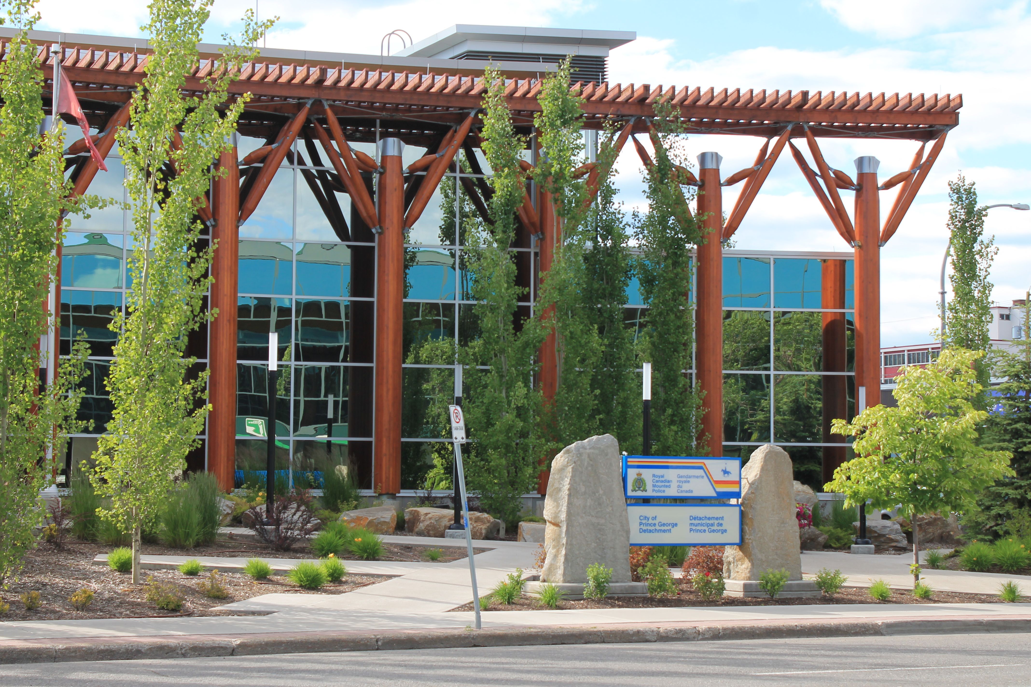
the Civic Center,
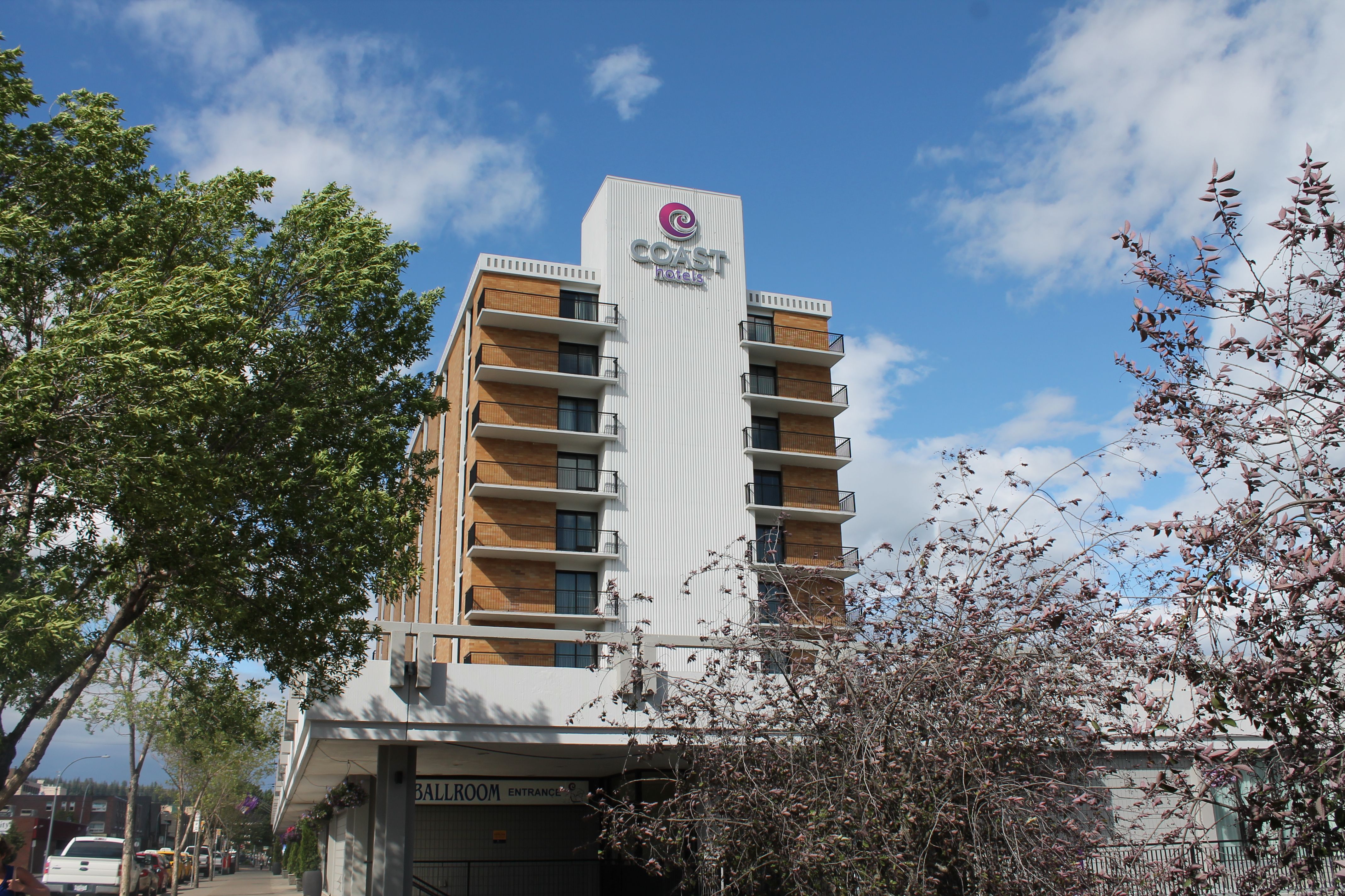
and my hotel for this visit.
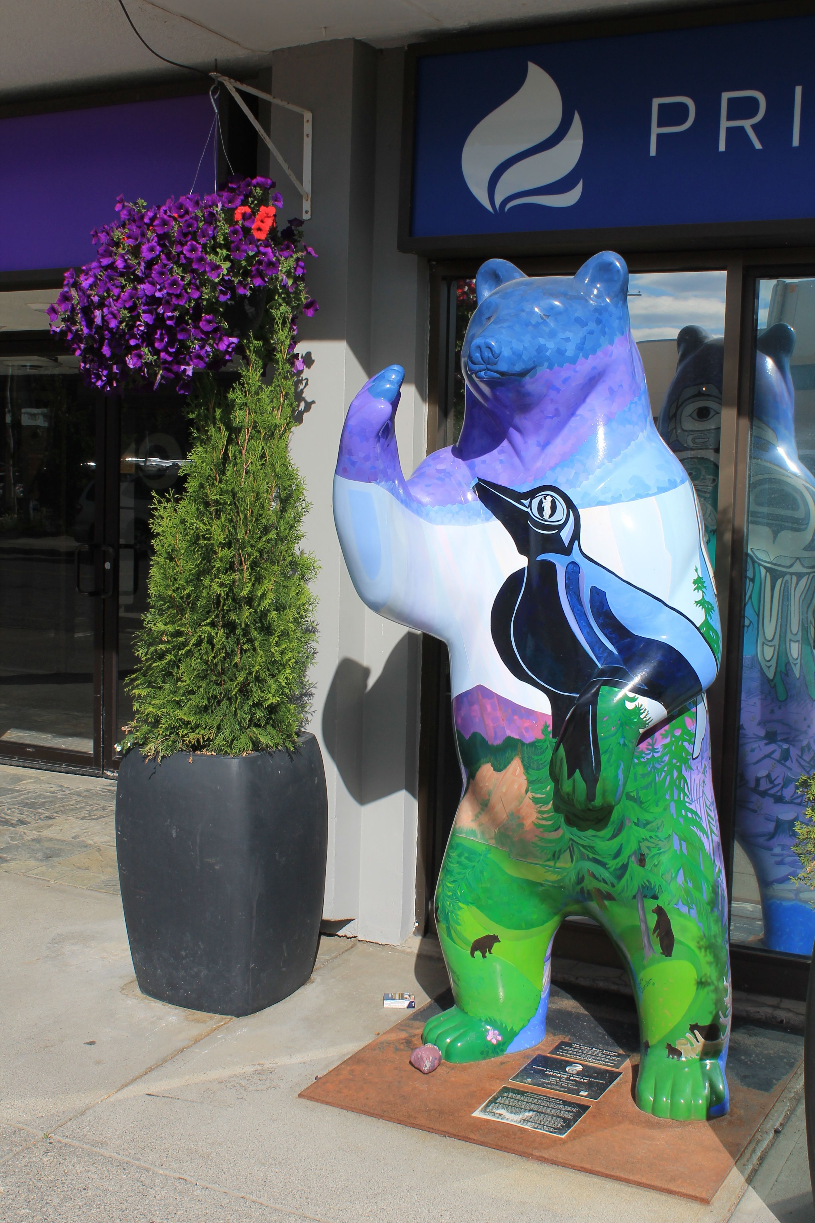
Readers familiar with Seattle know that there is a series of art installations downtown in the shape of pigs. Here are two examples from a Google image search.
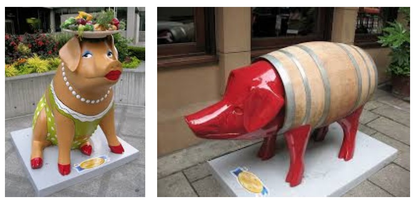
Prince George has installations in the shape of bears around the downtown area. Here’s the one outside the Coast hotel.
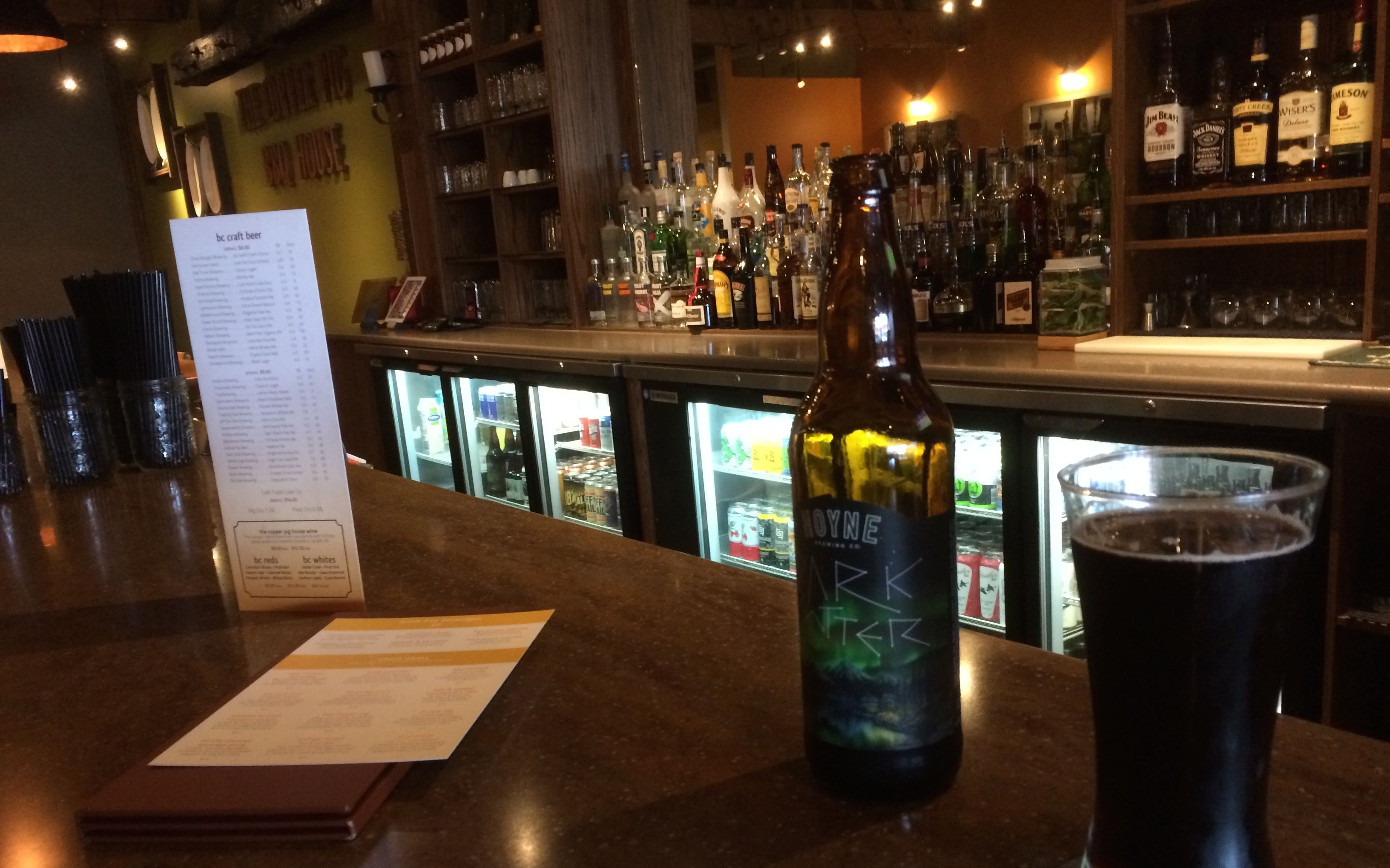
Dinner tonight was at the Copper Pig, a BBQ restaurant that was highly recommended.
Walking there only took about five minutes and it was totally worth it. I passed by the kitchen on my way to wash my hands and spoke with the chef to see what was especially good tonight. “Brisket,” he said.
So, with a beer recommendation from the bartender to get things started, and another with dinner, I was in BBQ heaven.
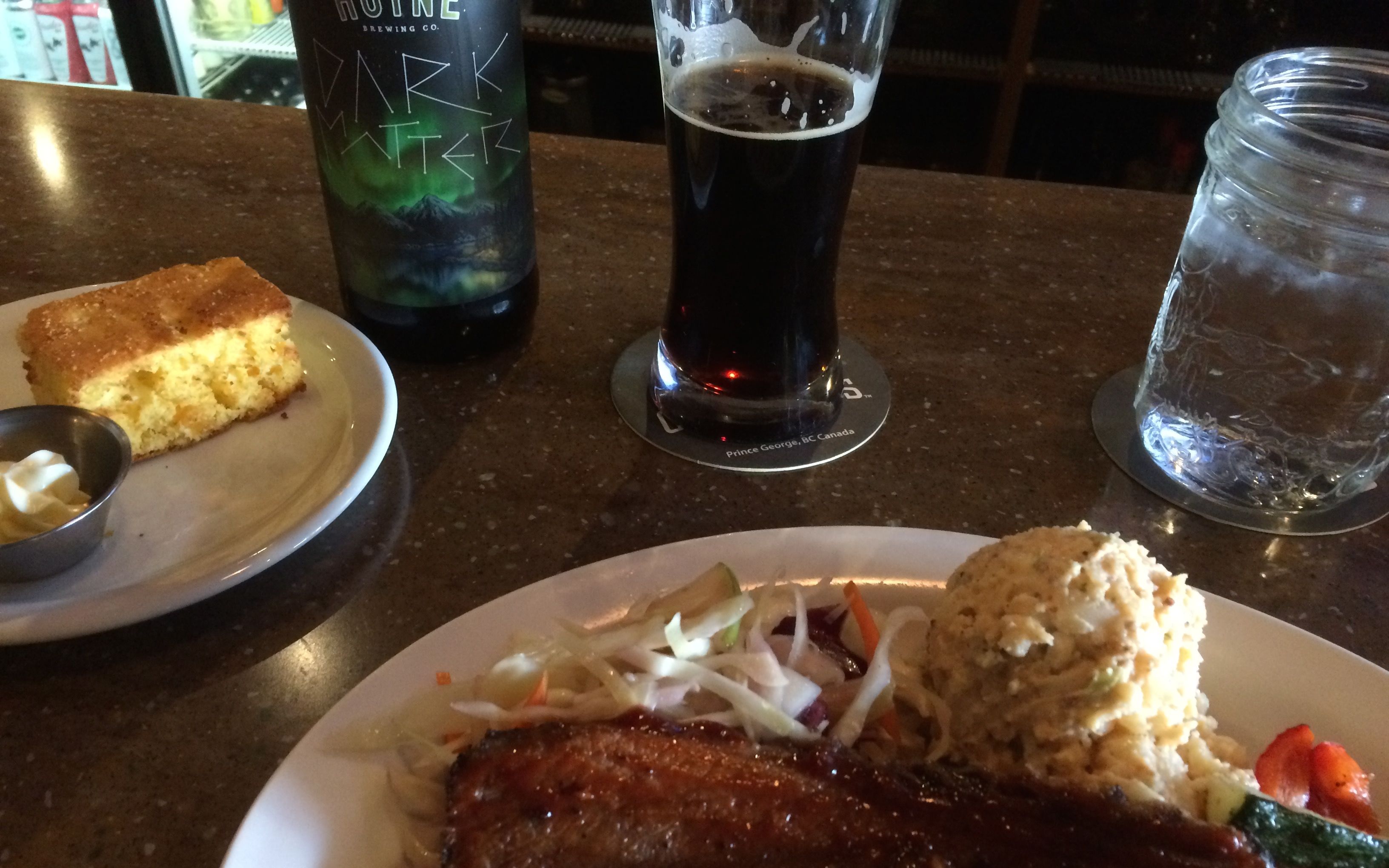
I’m usually a chocolate dessert fan, but the Caramel Apple Pie and Ice Cream was a delicious way to end the meal.
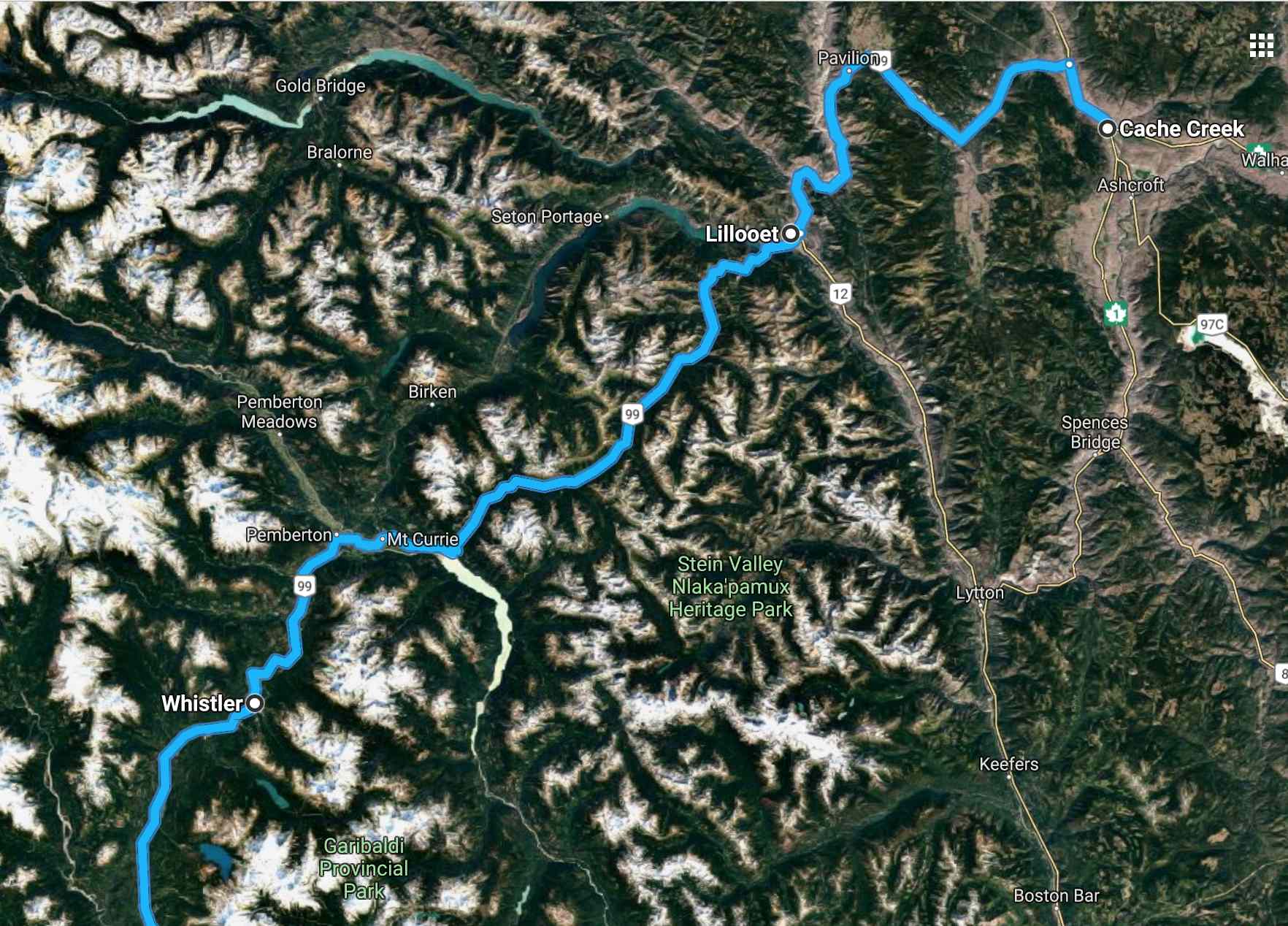
Tomorrow is my penultimate day on this tour. I ride down to Cache Creek along Hwy 97. Barring construction delays, it should be less than six hours.
My last day includes a ride along Hwy 99 through Lillooet and Whistler, one of my favorite BC roads.
The motel in Cache Creek advertises wi-fi but I found it unwise to expect good streaming and uploading service from the smaller towns. Expect the next post to be published after I arrive home.
Stay tuned!
Day 22
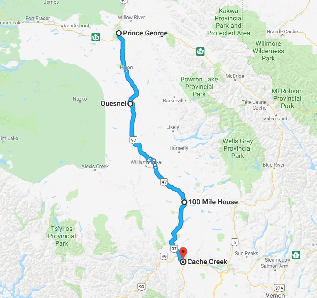
Day’s distance: 293 miles (odometer)
Total trip distance: 5,644 miles
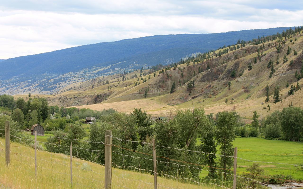
Pleasant weather greeted me today. The ride has scenic moments but in reality I’m traveling on a busy highway that gets congested as it enters each town along the way.

Loosely following the Frasier River, this part of British Columbia I believe is referred to as the Frasier Valley.
The hills begin to transition to a dryer climate landscape near Cache Creek. The Frasier Creek has turned westward. We’ll catch up again tomorrow in dramatic fashion.
I checked in and, as expected, the wi-fi was unusable. So I got cleaned up and walked up to get a BBQ chicken pizza from Anie’s Pizza & Bakery.
Day 23
Day’s distance: 356 miles
Total trip distance (final): 6,000 miles
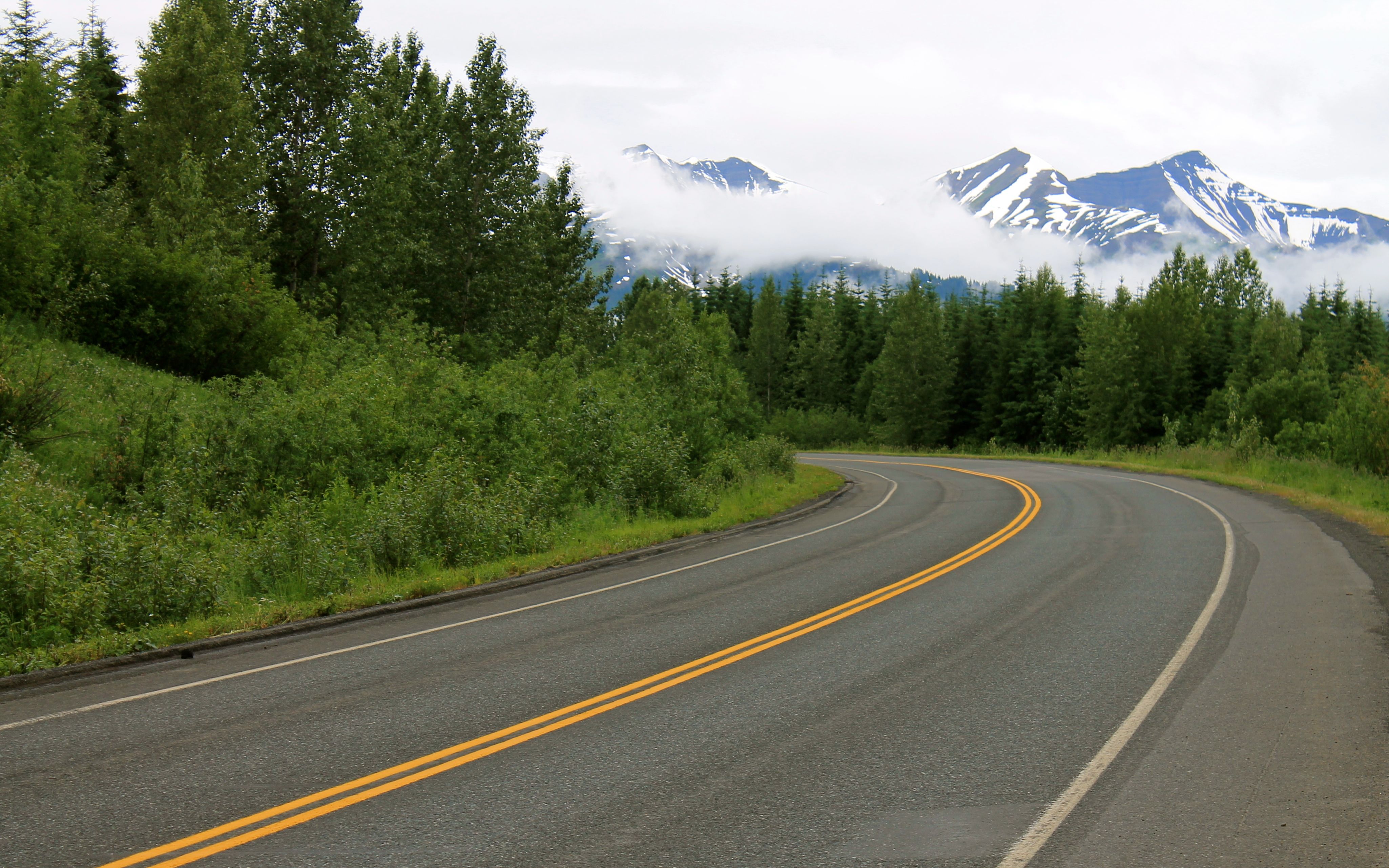
Varied temperatures from 47 in the mountain peaks to mid 60s accompanied by showers in the mountains and south of Whistler made for a nice enough day for a ride through one of my favorite roads in south BC.
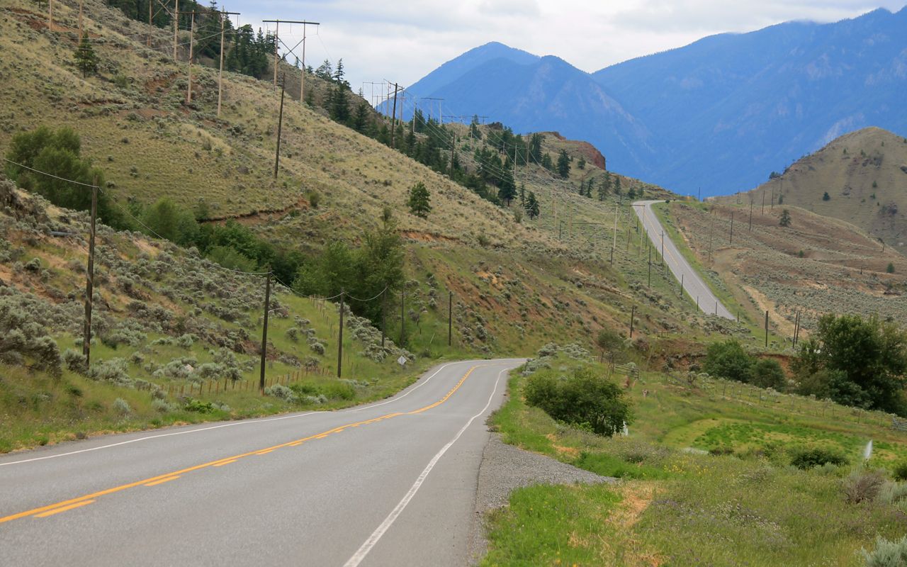
Today’s route and the staging down in Cache Creek was all about riding Hwy 99 west into Vancouver. It is scenic and less traveled. Much of it follows narrow canyons, sometimes presenting snow capped peaks in late-June.
Traveling west, the speed limit is 100kph and the limits gets progressively lower as one enters the mountains and various towns. I traveled at well controlled speeds safe for conditions but not necessarily comparing to posted, or last posted, until I arrived in Whistler.
Just west of turnoff from Cache Creek the road is perfect and there is nothing technical. Fun and relaxing.

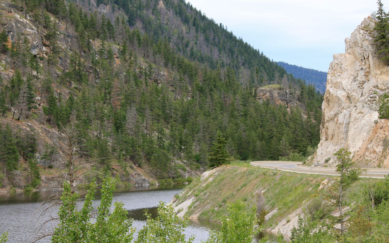
In the next photos, we’ve ridden through canyon land carved out by the Frasier River, which we’ve rejoined.
Hillside real estate is shared by the Canadian National railway.

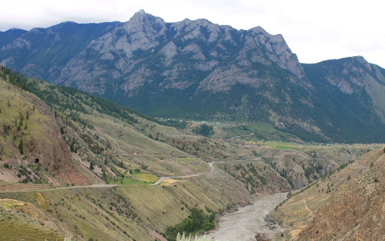
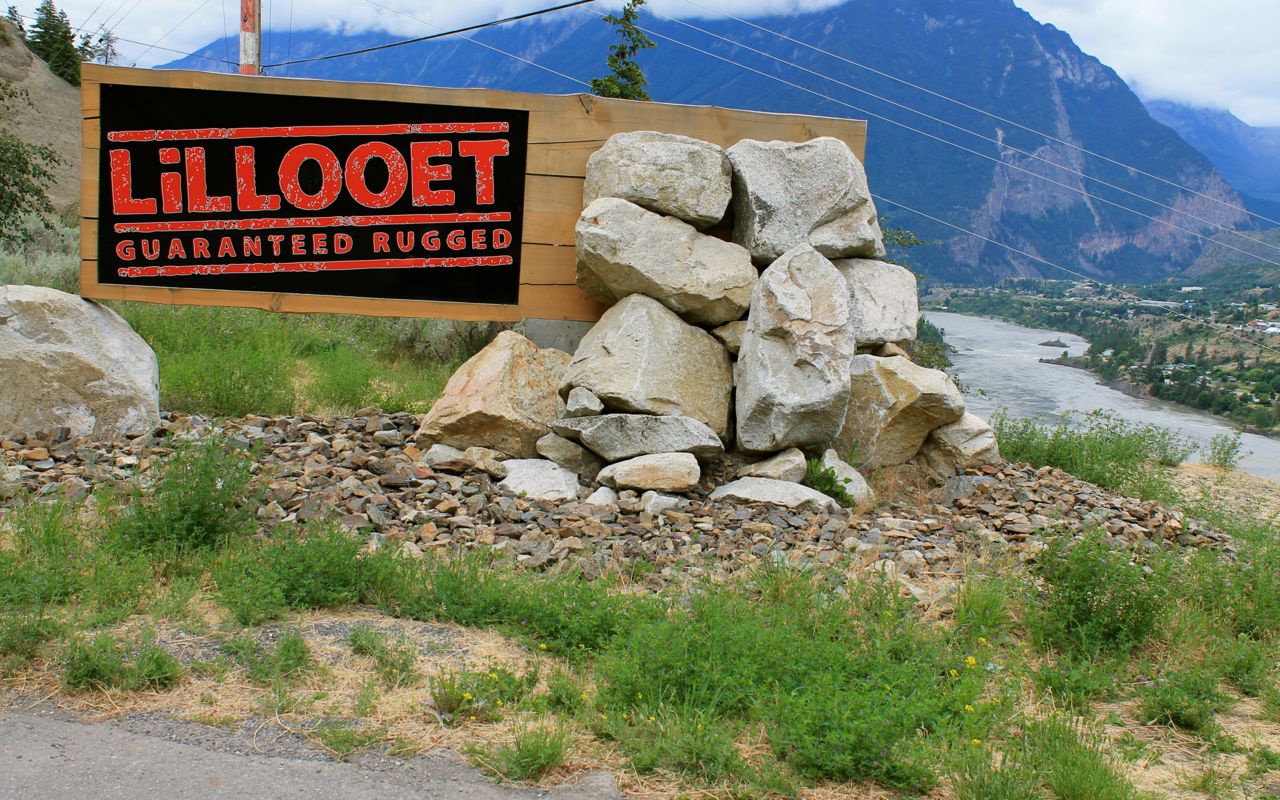
Entering Lillooet, along with the Frasier River.
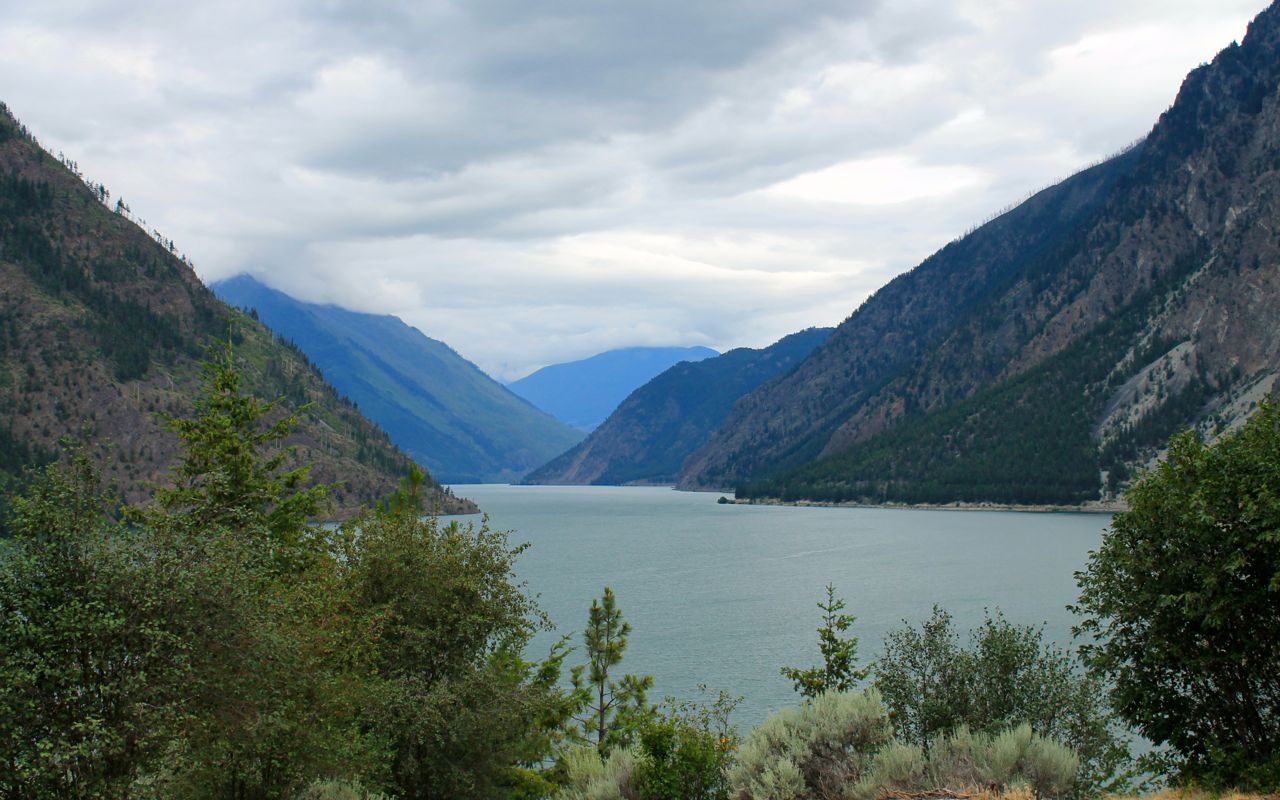
And Seaton Lake, located on the other end of town.
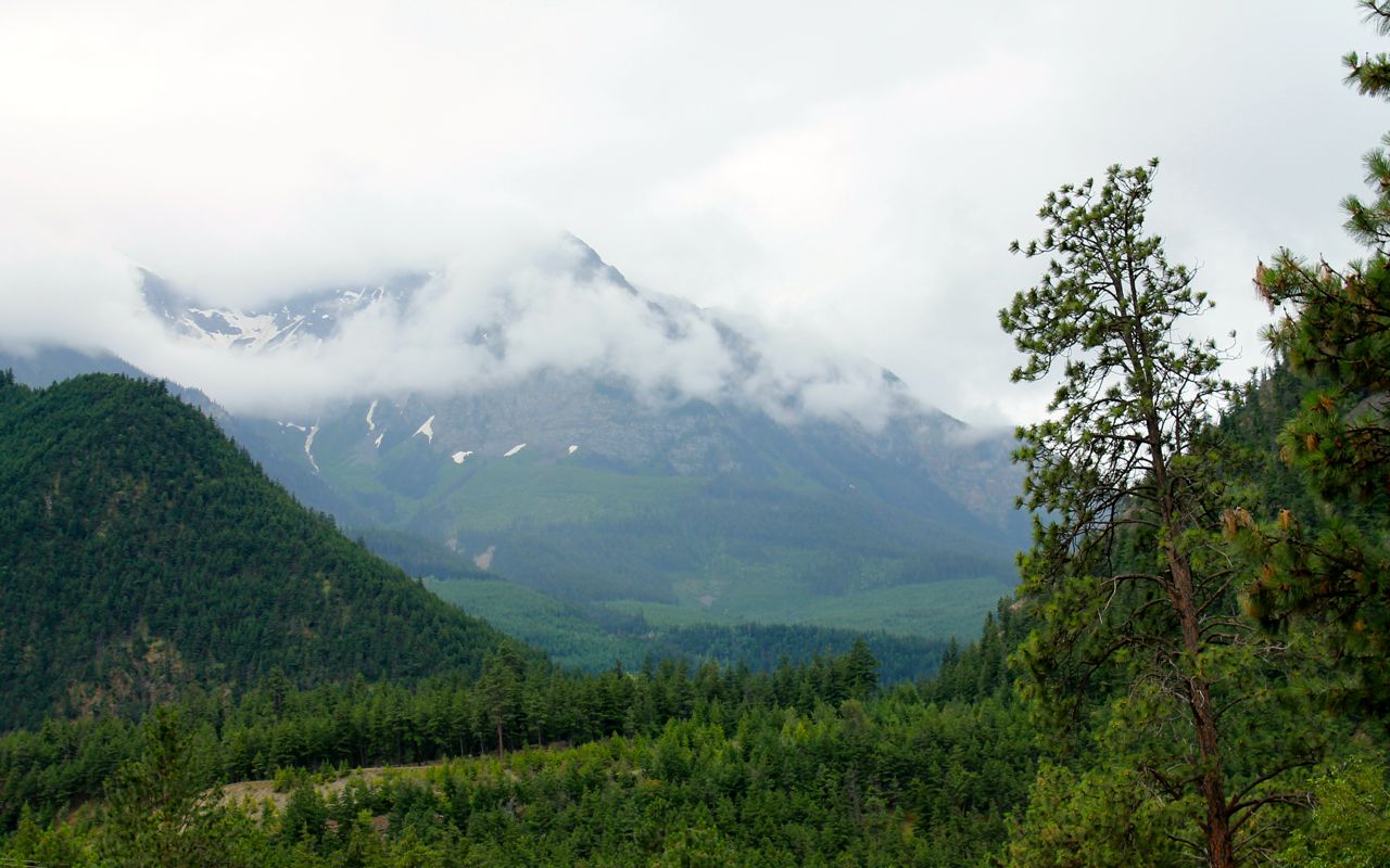
Rain clouds were building up in the mountains I would travel through.
I did catch news of this prior to leaving the motel (local news weather report). And, voila! I put on the rain suit and continued on.
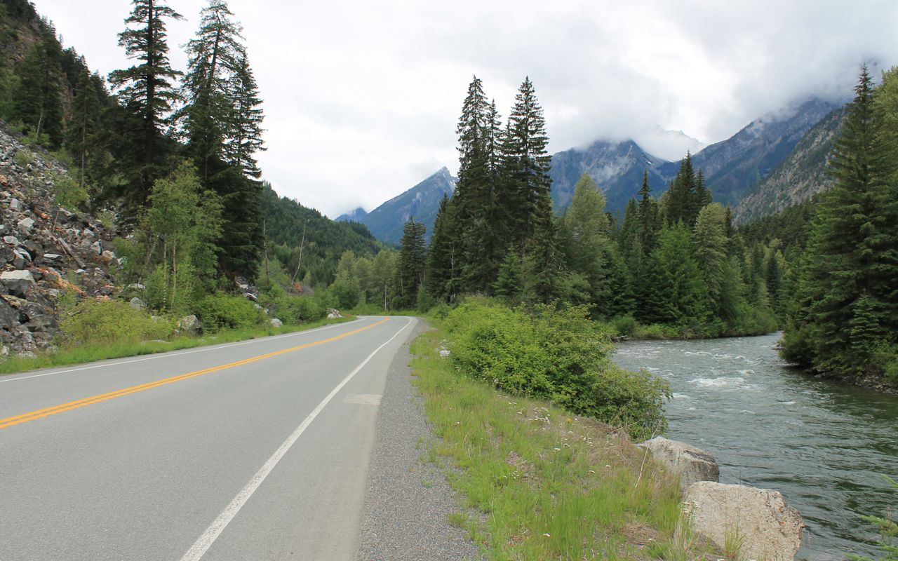
This might have been the Gott Creek, but there were so many crossing path with us.
Here’s a video of this section of road from the 2014 Loop through Cache Creek trip. I travel west to east in the video. Instead of late-June, it’s on a sunny and warm late-September day.
Note: the song used on the video, combined with the gentle curves and scenery recreates for me, the one who was there, a sense of the peace and rhythm found on a good motorcycle road like this one.
Note #2: A tour bus was at the narrow bridge you see at 1:30 in the video. I knew this time the bridge was there and quickly yielded the entire bridge to it. What are the odds meeting a bus right there, wow?
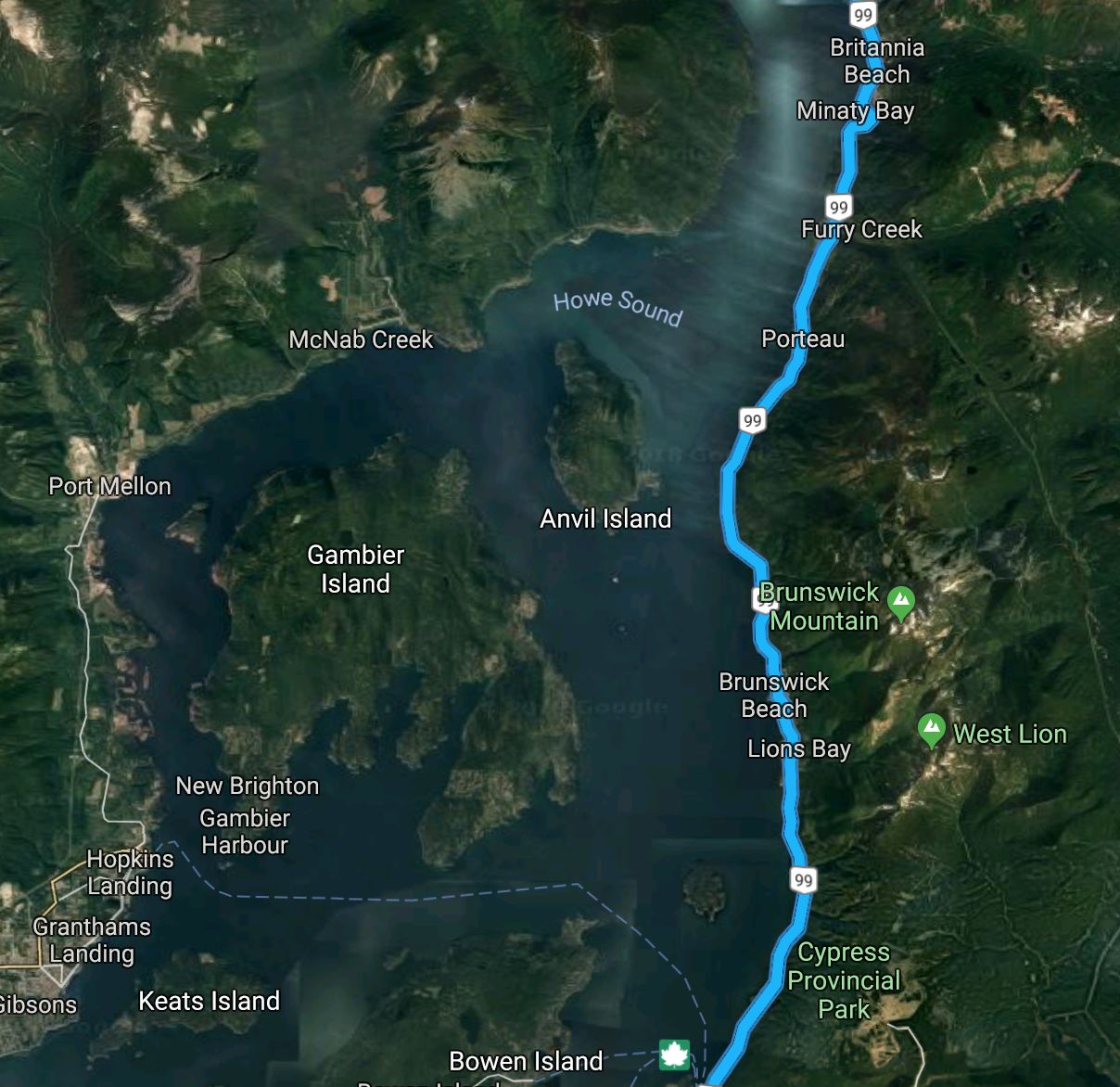
My route also took me along the picturesque Howe Sound. With the cameras packed away, I didn’t stop at the handful of risky to enter/exit turnouts in the rain on this hwy being used by commuters along with tourists.
I crossed through Customs at the Truck Crossing on Hwy 13, just a few miles west of Abbotsford. There were two cars in one line and nobody in the other, so I was on my way again in just a few minutes.
I reached the house at 4pm. It took about 45 minutes to finish the last 10 miles, but that’s predictable and was planned around with one additional gas stop. With delays in North Vancouver and east of Lillooet, a fine last day all things considered.
Reflections
What was the highlight of the trip?
This is a common question but one I find difficult to answer. If a single event had to be highlighted, I would say it was the ride up to the Dalton Highway sign on the morning of my 60th birthday.
Just 114 miles south of the Arctic Circle.
Say, “cheese!”
How did the extra preparation work out?
Really well, actually.
With regard to reserving all my lodging ahead of time, I know my patterns and preferences well, nowadays. Also, I had just completed a ride of equal length four weeks earlier. So I planned days off on the return leg, shorter days in case bad weather made the ride more challenging, and a wide range of accommodations.
Knowing I had confirmed reservations at the end of each day was honestly a joy. Choosing lodging while on the road can be frustrating and time consuming.
Also, stopping at the Liard Hot Springs was rewarding. I was stoked afterwards that I spent a bit of energy planning this enroute stop, something I need to do more often.
Having researched the best dinner options in an area in advance was also nice. I like to try to lodge near where I want to eat. My advance choices worked out well on this trip.
What were the roads like?
Better than expected – smoother and cleaner. Some definite challenges inside construction zones and more remote, less maintained parts of my route. More day-by-day info in the trip details, but nothing felt unsafe or threatening. I saw campers and rented Canadream RVs on every road I was on.
That said, I chose not to ride up the Dalton. The weather was far from perfect. Afraid I would hold up trucks on narrow road surfaces and never be relaxed, it seemed like an easy decision.
I later learned from the gang of three, a group of three bikers whose paths crossed my own in Anchorage, who rode that same day to the Arctic Circle sign, that I would likely have had trouble.
My route at the time I traveled was definitely street bike friendly, enough, that I returned home from the 6,000 mile trip with no issues to report.
It’s funny to me now to re-read my reflections from my 2015 trip to Hyder, Alaska, including this response to the question, “Would you travel to Alaska again?”
Yes, but not on my current motorcycle. My road bike, a 2013 R1200RT, doesn’t like gravel roads much, and my impression is that the further north one travel’s, the higher the likelihood of finding gravel or mud. I would like to explore more of Alaska and northern British Columbia on an adventure bike or a larger enduro bike.
Some practice on gravel is recommended if you haven’t ridden on hard packed dirt or gravel roads on the bike you’ll be riding.
Over time and experiences usually not sought out, I’m not nearly as freaked out by the varied conditions I’ve chosen to ride into and over. The RT is a stand-up bike – not perfect but dependable, comfortable, powerful. I make it home again.
Mud ended up covering the bike, especially through construction sites. Boots and lower half of riding gear will get dirty. Expect tar and oil to accumulate and gravel to act as bullets when they pop out from under the tire of a big ride coming at you.
I’m getting the bike cleaned up for another service. We’ll see then if there was any other issues to report.
Using Google Doc to record & update itinerary
I found this to be useful. You can share access with members of your support team back home, or more broadly if you choose.
As mentioned, this was the most extensive pre-planning I’ve done. Tracking details is what provided the value as a support tool, so folks back home know where I should be at the end of the day and so I know what to look forward to that evening.
I set up an additional page should it have been needed to navigate through or re-route the trip due to road conditions or bad weather. I really didn’t use it as the weather was not severe at any point, except for the wind, which was very gusty at times.
Did I have a cell signal often?
Yes, surprisingly so. I would say off the cuff that the busier the road, the more likely there is a cell tower nearby. That said, sometimes it seemed everywhere. I was texting halfway between Fairbanks and the Dalton Highway sign.
That has the down side is getting accustomed to having it. I believe I finished/started each day with the ability to update folks. Definitely one day with no cell whatsoever in between seemed the most desolate, in both that regard and the literal out there in the wilderness sense.
Was it cold?
There were cold days, and wet days, but fewer of each than I expected. Day 4 at Bow Summit was the coldest point on the ride.
In hindsight, my experience with the weather could be summed up as summer breaking out from spring leftovers. It was summer, longest days and no darkness, but early summer from a weather perspective.
There were no hot days, though I might remember taking my jacket liner out once, back on again soon afterwards.
The Frogg Toggs, acting as a second rain suit, worked out well to keep me mostly dry and always warm in the rain. I found they add a bit of warmth, less than a mid layer but noticeably less draft-related heat loss.
Was premium grade fuel widely available? Expensive?
There were only two gas stations that did not have premium. I never used the octane booster I brought for this trip, but I’ll keep around for future use.
The highest price I paid was $1.71 / liter. I was surprised to find gas stations were not price gouging in that the lowest price paid was around $1.45 / liter.
Part of my trip planning included identifying fuel stops in advance. I love having a 250 mile range, reducing the total number of fuel stops required. For this trip, in all but one case, these worked out to be appropriately conservative and open!
One more thing that helped reduce anxiety and keep me focused on reaching my night’s accommodations.
Most merchants took Visa
There were a few places that I paid cash for things by choice, but very few that required cash. I went through maybe $350 CAD cash on the trip and used about $100 US during my time in Alaska, for comparison.
I describe the process for buying fuel and paying at restaurants in the trip details.
Best Meal?
Easy. The rabbit stew at the Twisted Cork in Prince George. I highlight a lot of my favorites in the trip details.
Did I need the warmer sleeping bag?
No. Readers may recall I was considering a warmer sleeping bag. I decided that if it was that cold, I would not likely decide to camp and so didn’t purchase it. I was never cold at night on any of the four nights that I did camp.
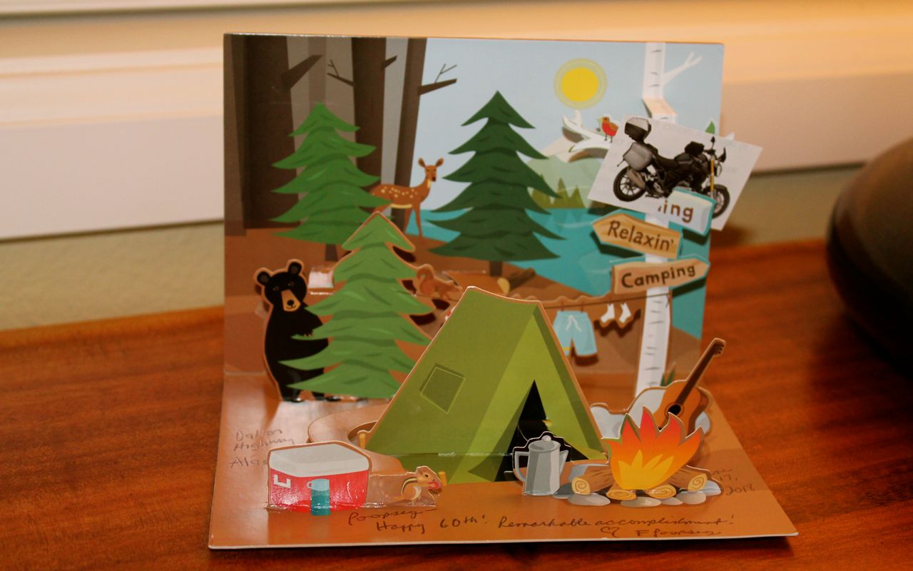
Motorcycling Relaxin’ Camping
A pop-up 60th birthday card from my sister was waiting for me. It needed a minor edit …