
This solo 3-day motorcycle adventure began on May 22 and covered 996 miles. The first and last days were spent traveling fast along some major highways and interstates. The middle day was spent exploring lesser traveled roads through the small towns and scenic places between Baker City to the east and the greater Portland area to the west. Two roads specifically, the Dooley Mountain Highway and County Road 20, were incredibly scenic, lightly traveled and with good road surfaces.
Day 1
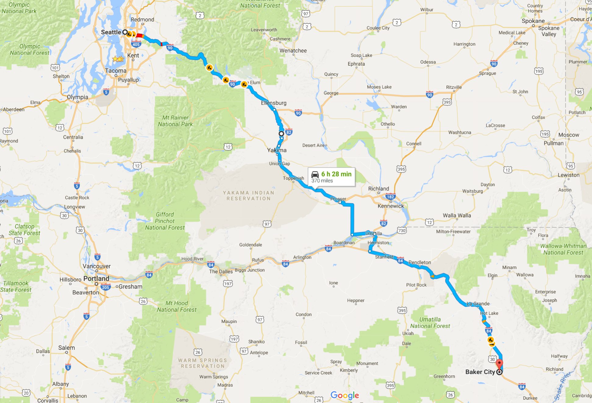
Day’s distance: 370 miles
Sunny and warm, with temperatures ranging from 50 to 85, depending on elevation and time of day. The afternoon was a bit breezy, as expected.
I departed at 7am. While I wasn’t planning on leaving early, I was wide awake at 5:30am and figured instead of waiting for commute traffic to die down I might as well just leave before commute traffic got too bad.

Stopping at Preston for a latte and snack, I noticed that the bleed valve on one of the front calipers was leaking.

I first noticed this last night during my close “pre-trip” inspection. At the time, I suspected the mechanic who did the service last week just forgot to wipe down the caliper housing after bleeding the brakes. Now I knew the bleed valve wasn’t tight enough. I had the 8mm wrench needed and was able to gently tighten down the valve against its seat.
Especially designed for the oil-cooled R1200RT, I purchased the Ultimate Compact toolkit from Adventure Designs back in 2013 to supplement the laughable kit supplied by BMW. The kit is small enough to store under the seat and have it with me at all times. Today, I was super happy to have tools with me.
Fluid levels in the reservoir remained good. Because it was a minor leak, there were no bigger issues.
As mentioned in my previous post, most of today was spent on fast moving, multi-lane highways. Hwy 821 was a pleasant exception. Much of the road has a new asphalt surface and is super smooth.
I didn’t see any road kill, common on my previous trips along this route.

The only issue I have with the Yakima River Canyon Scenic Highway is the 45mph limit. It seems so slow, especially with the new asphalt.
The winds picked up in the afternoon, especially after crossing the Columbia River into Oregon. Nothing too bad, but I confirmed that the bike is much less affected by the wind when I’m not using the top case.
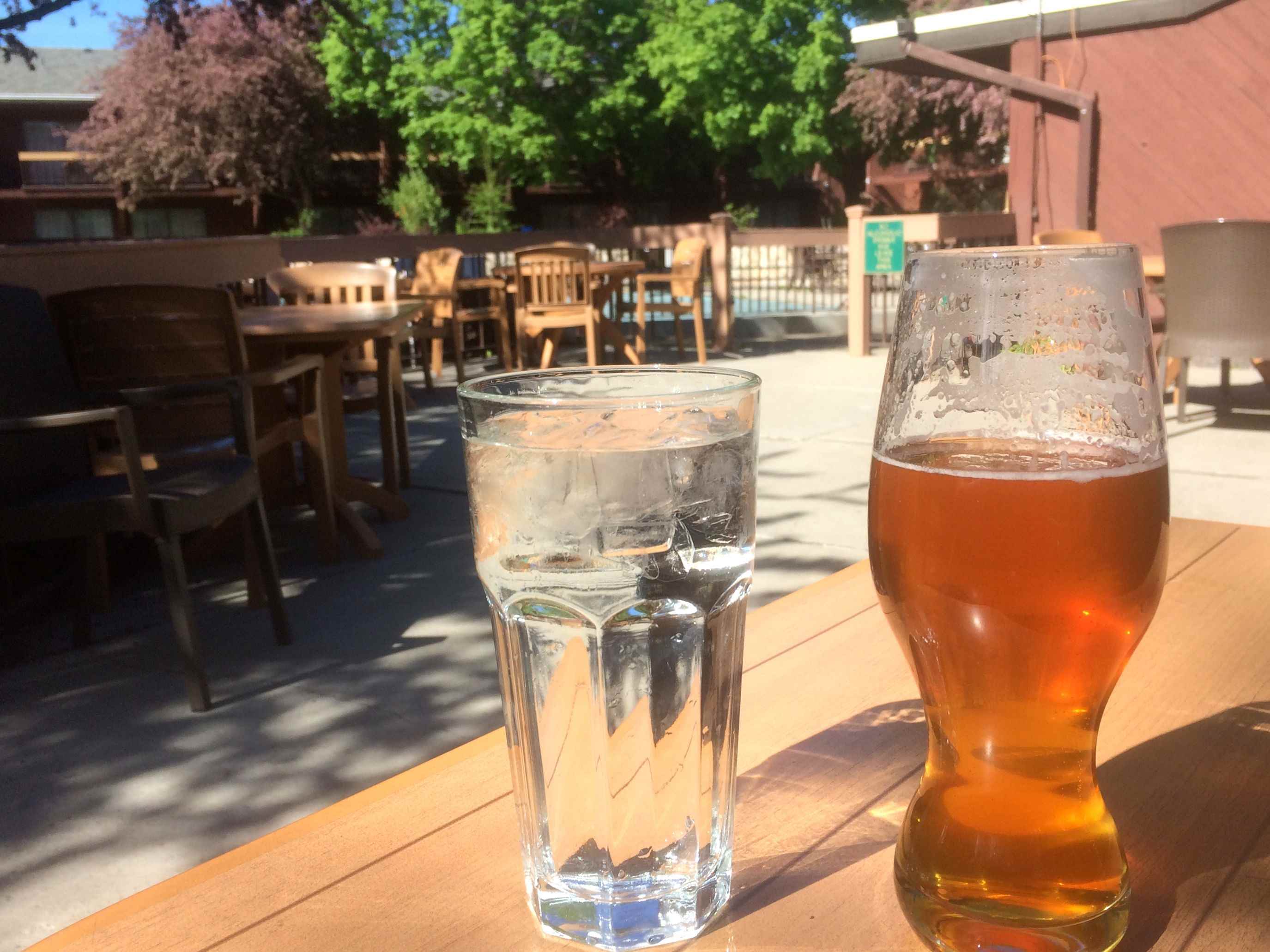
I arrived in Baker City in need of rehydration. 🙂
I’m looking forward to tomorrow’s ride west towards Mt. Hood. I’ll be covering some new roads in some really beautiful country.
Day 2

Day’s distance: 358 miles
Total trip distance: 728 miles
Another sunny day with temperatures ranging from the low 50’s to the low 90’s.
Today’s ride included many miles of just the type of roads I love – scenic, two-lane highways with little traffic and good surfaces.
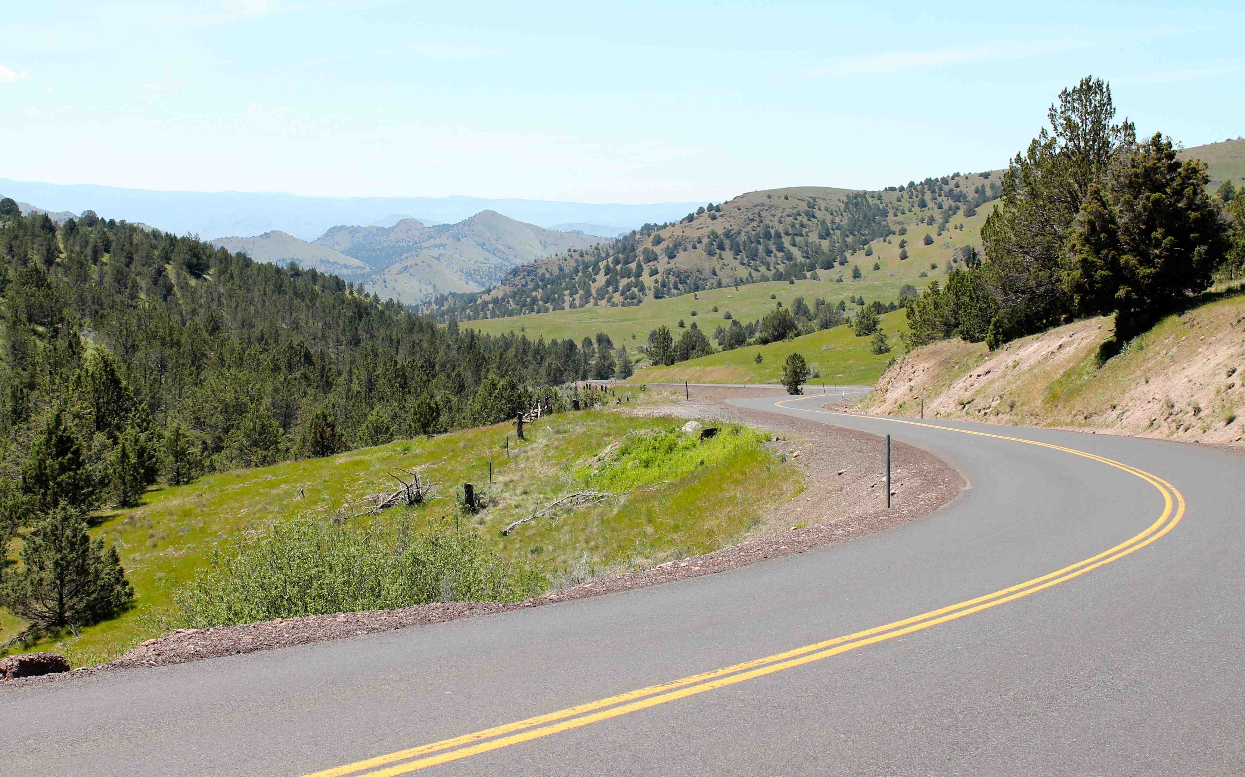
The day began heading south from Baker along Hwy 7. I’ve been on this road before, on my 2015 Trip to Fossil. This time, I turned onto Hwy 245 to ride over Dooley Mountain.
The Dooley Mountain Highway, as it’s called, reminded me a lot of Rattlesnake Pass, the nickname given to Hwy 3, not far away. You’ll see few guardrails, gravel shoulders, and logging trucks on both.
A forest fire in August, 2015 burned much of the area.


The road surface was good, but there was gravel here and there, both gravel kicked up from the shoulder in the tight turns and leftover gravel used this past winter.
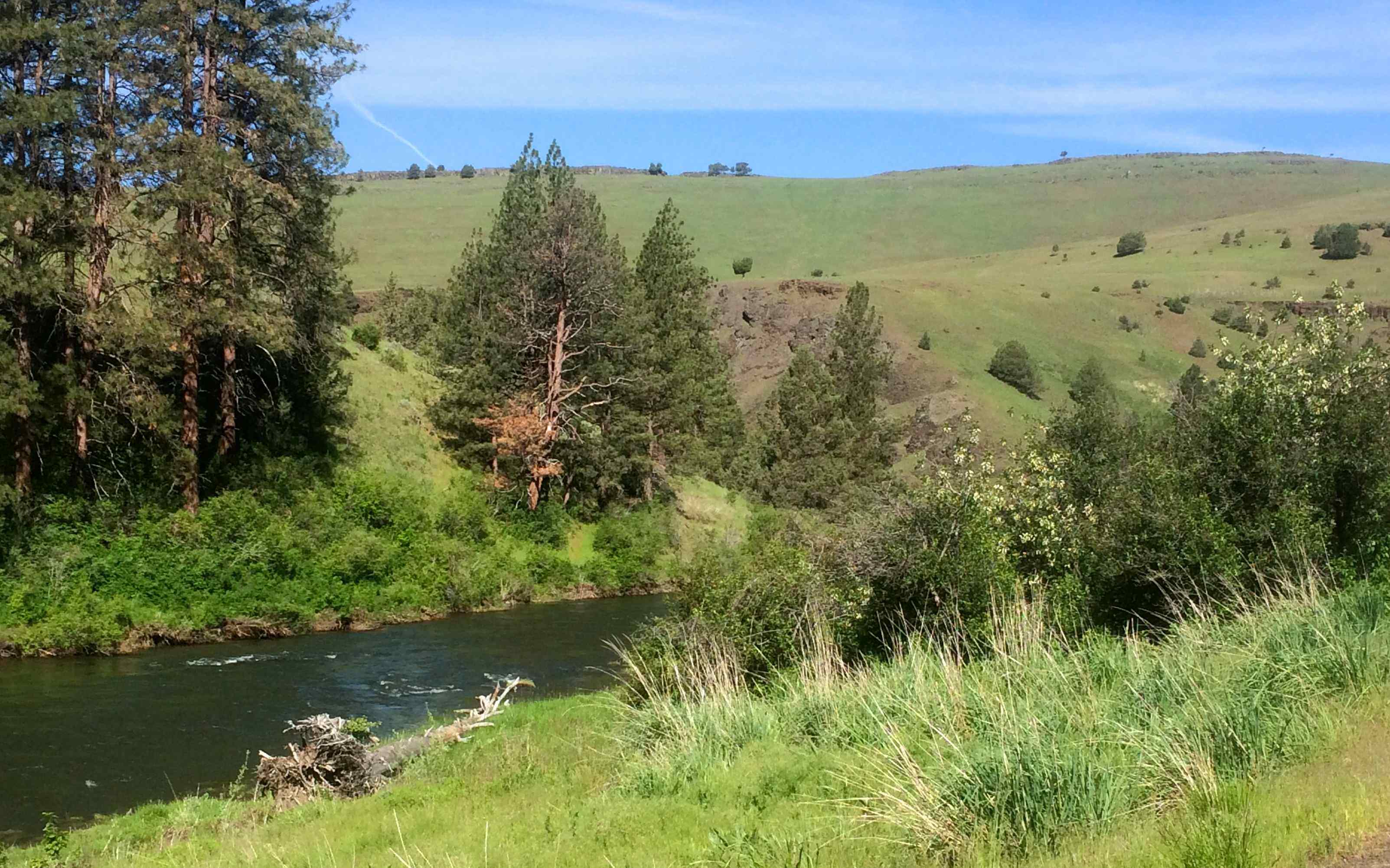
The day’s ride was scenic almost everywhere. I took this photo on Hwy 26 after passing through Unity.

The next spectacular section was County Road 20 or the Middle Fork Road, named after the middle fork of the John Day River. CR 20 reminded me very much of the Idaho side of Lolo Pass, Hwy 12. This was about 40 miles of bliss.

The final “noteworthy-for-its-twisties” section was Hwy 218, between Fossil and Antelope. Where the other two notable sections were new to me, I’ve ridden this road in the past and it doesn’t disappoint.
Just west of Maupin, where I turn onto Hwy 216, Mt. Hood begins to get closer.

Turning onto Hwy 26, I did get startled by a flashing highway information board that indicated I was entering a Snow Zone and I was required to carry chains. Alas, there was no need for chains today 🙂 Someone should turn off that sign.

Tomorrow I head back to Seattle.
Day 3

Day’s distance: 258 miles
Total trip distance: 996 miles
Today’s high temperatures were much lower than the past two days with temperatures starting the low 50’s and staying in the 60’s. Cloud cover was significant and I ran into one rain shower that lasted about 15 minutes.
I woke up early but did not rush to get on the road as this was going to be a shorter day. So I pulled out of the motel at about 9:30am. The plan was to get a latte in Carson, WA before heading north into the Gifford Pinchot National Forest, along Hwy 30.
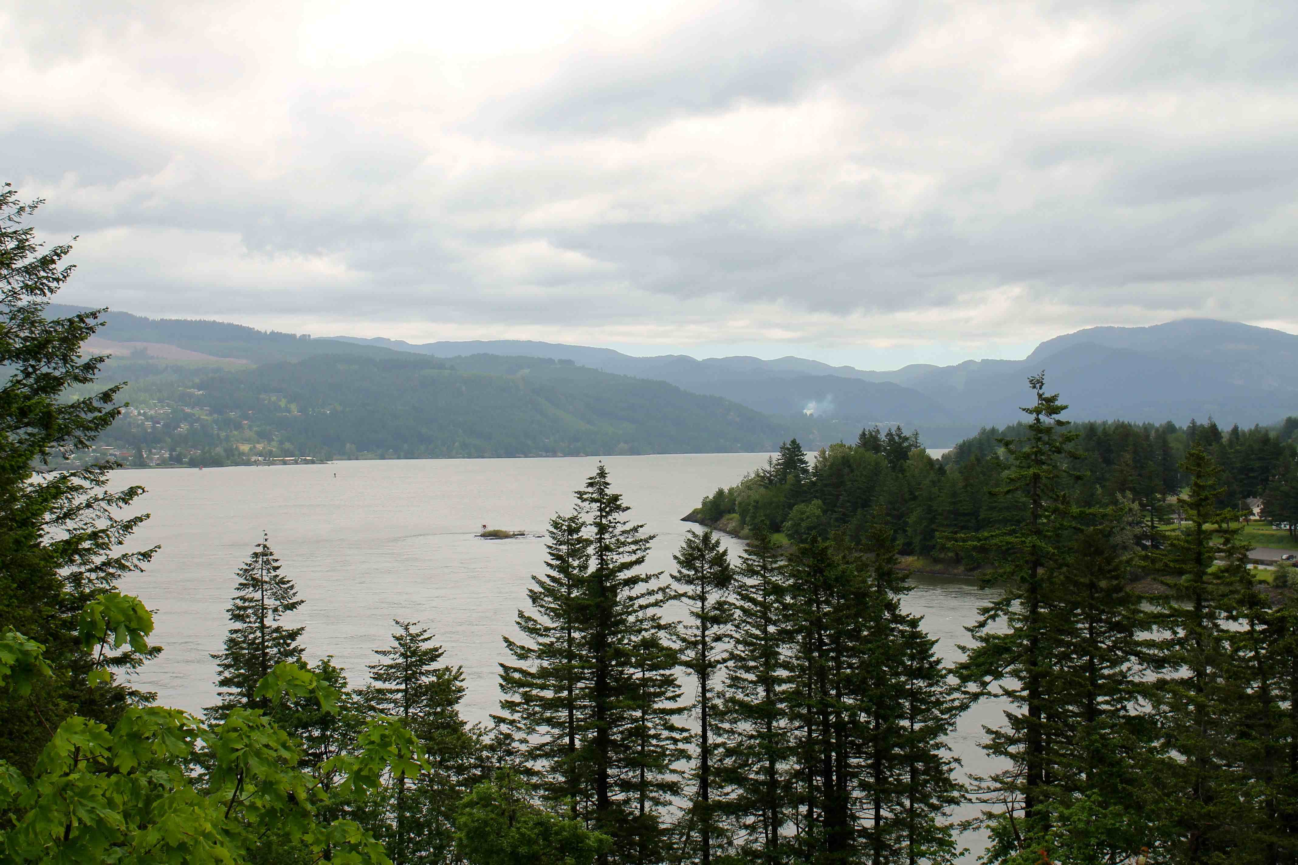
I crossed into Washington at Cascade Locks using the Bridge of the Gods. To see what the area looks like on a sunny day, check out the short video I made from a previous trip.
Here’s a photo I took today looking east towards the Gorge from the Washington side.
Before leaving the motel, I did a few internet searches to ensure the roads between Carson and Randle were open. I found no notices otherwise, but I had lingering doubts as the roads around Mt. Rainier were not open yet.
So without knowing for sure whether or not the road was open, I headed north along the Wind River Highway after stopping in Carson for a latte.
Well, it wasn’t too long before I came across a road crew and I used the opportunity to confirm I could get to Randle. Good thing I asked because the best information they had was that my route was closed at higher elevations.
With conflicting information, I decided to turn around now. If I was forced to turn around later, it could require hours of backtracking to find an alternate route home.
I hopped onto Interstate 5 near Vancouver, WA. Despite traffic and the brief rain, I made it back to the house in time for a short nap before dinner.
I’ll write up some reflections on the trip over the next few days. I will say, as always, it’s good to arrive home safe and sound.
Reflections
The ‘Loop’
In a sense this ride seemed too short and quick to call a trip, so I am calling it ‘Loop’. My 2017 rides will likely be shorter and within the greater NW as I anticipate being busier at work. I envision a loop being organized differently than an adventure; fast travel using interstates, at least one full day of amazing riding, and a fast ride home.
This trip wasn’t meant to be a fast ride home, but the route chosen used roads closed in the winter. It was a concern but based on the information I had, it was possible. So I had to plan on-the-fly and everything turned out fine.
First overnight ride for 2017
This was my first multi-day trip of the year and it occurred late in the year. Since reaching my initial goal of riding in all the states (you can reach by road), it seemed hard to decide where to go, as silly as that sounds. On top of that indecision, it was the rainiest Spring on record.
Considering a Spot tracker
On this ride, most of the “fun bits” happened on Day 2. But on Day 2, I had no cell coverage most of the day, so no way to call for assistance. This is less than ideal and could delay assistance when critically needed.
Spot Trackers allow for tracking my location automatically through satellites to a website where your friends can follow your trip. It can also send an S-O-S to a Response Center that provides your GPS coordinates and information to local emergency responders.
More info for those interested can be found here. The device is on sale for $75 and the annual service is $200/yr.
Carrying basic tools
As mentioned in the blog entry for Day 1, having a small wrench to tighten a leaking bleed valve helped prevent trip delays. There were other solutions likely available, like detouring to a service station or a store to purchase a wrench, but because I had tools with me, it was no hassle to stop, grab the toolkit and tighten the nut.
Again, I carry the Adventure Design Toolkit specifically for the oil cooled RT.
Traveling w/o a top case
I usually pack camping gear in my top case, including a mattress pad, sleeping bag, tent and camp pillow. Since there would be no camping on this trip, I left the top case at home. As expected, the afternoons were a bit windy and, as hoped, the bike is less perturbed by cross winds without the case – a nice benefit to packing light.
Scenery
Eastern Oregon is one of my favorite places to explore. This was my third trip specifically to the area and I’m never disappointed. And now, I have a new favorite road – Middle Fork Road (CR 20) between Hwy 7 and Hwy 395. That said, there are many scenic highways and byways in this area.
Highly recommended!
