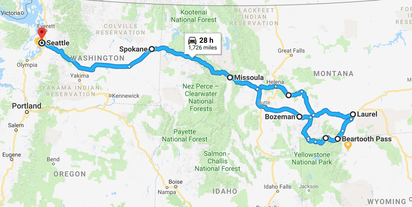
This 5-day, 1,737 mile solo trip took me over Beartooth Pass. Departing on Sept. 5th, I traveled through Missoula and Helena to Laurel, Montana where I would turn south for my first ride on the Beartooth Scenic Byway.
The Beartooth is one of the top 5 favorite motorcycle rides in the US. It was easy to understand why. While snow fell on the pass the previous week, this day was warm and clear. Perfect conditions for this Steel Horse Journey.
Day 1
Day’s distance: 474 miles (Seattle to Missoula)
Temperatures ranged from the low 40s in the shadows of Snoqualmie Pass to the mid 80s later in the day and closer to Missoula, where I’m staying for the night.
A moderate haze along today’s interstate-only route made for little opportunity to take pictures. So I’ll provide a little background on the Beartooth Highway and some links if folks want to explore more.
According to the website that bears its name,
The Beartooth Highway is a 68 mile stretch of US Highway 212 that, from its western most terminus at the Northeast entrance to Yellowstone National Park, runs east to Red Lodge, Montana.
Reaching 10,977 feet at Beartooth Pass, and surrounded by 20 mountain peaks that reach over 12,000 feet, the Beartooth Highway crosses some of the most extreme country in the world. The high alpine climate ensures that severe weather conditions occur almost every month of the year. Summertime temperatures can range from the 70s on sunny days to below freezing during sudden snowstorms. Keep these extreme conditions in mind when planning a visit to the Beartooth Highway.
The Beartooth Highway is on every list of the best motorcycle roads in the US. This trip is my second opportunity to check it off my bucket list.
My first opportunity came on day 36 my 2016 Northern States Tour. I rode the Chief Joseph Scenic Byway, which intersects with Beartooth Highway, intending to turn right and head to the Pass.
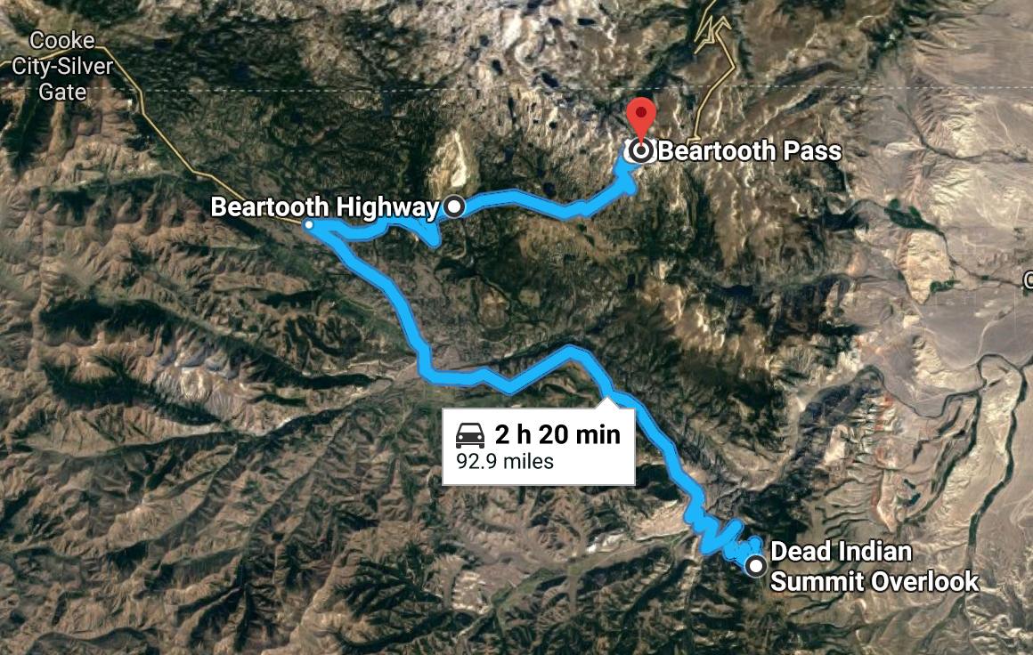
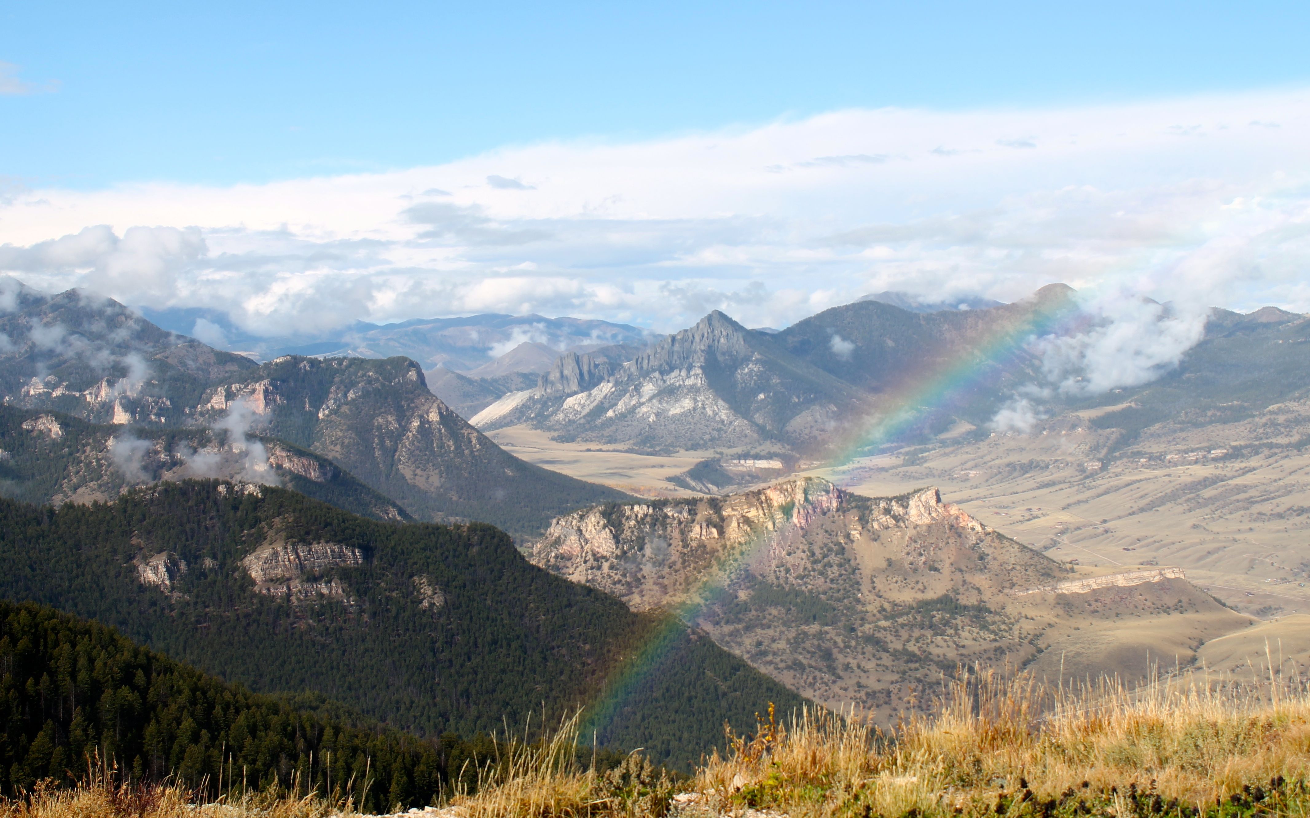
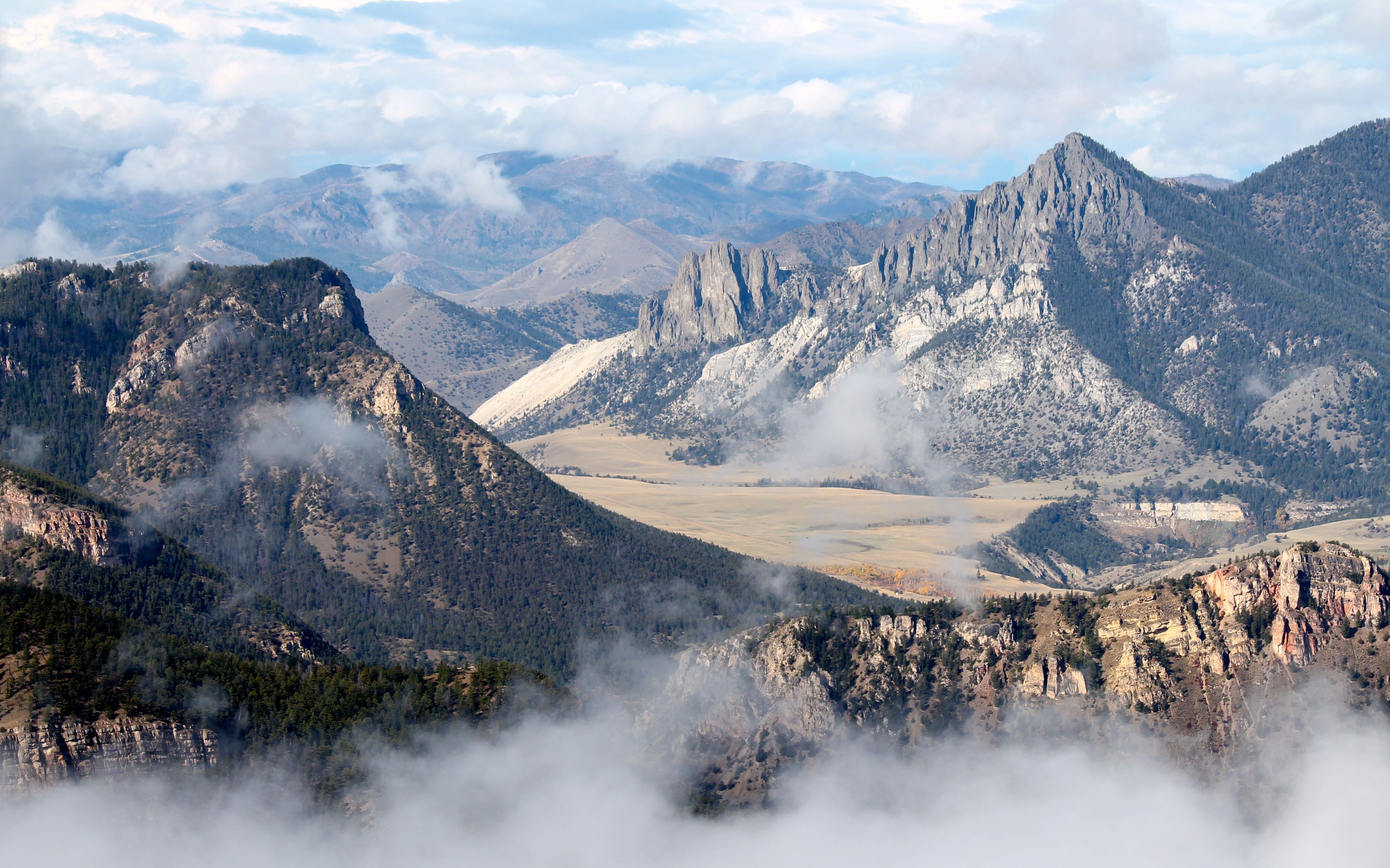
But because of the rain I encountered getting to Dead Indian Summit Overlook from Cody, I assumed it snowed on the Pass. I had no cell reception and couldn’t verify conditions, so I decided to skip it and head into Yellowstone Park.
Here’s a couple images of what I saw from that day at the Summit and what gets me excited to see what I missed by not riding to the Beartooth Pass.
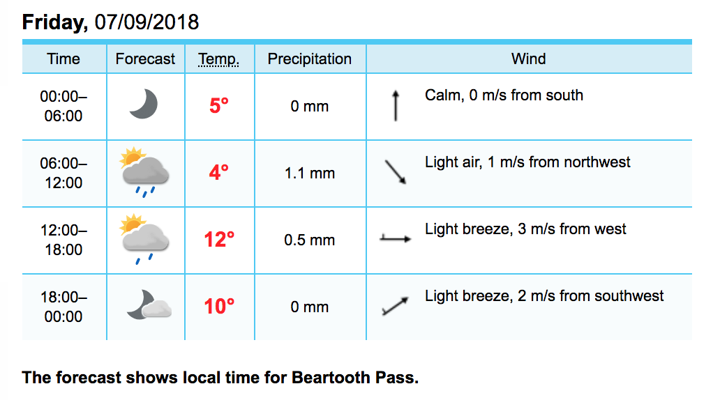
I’m scheduled to ride the Beartooth on Friday. Here’s the current forecast for the pass:
Tomorrow I ride to Laurel, Montana to set up my ride over the pass on the following day. Stay tuned!
Day 2
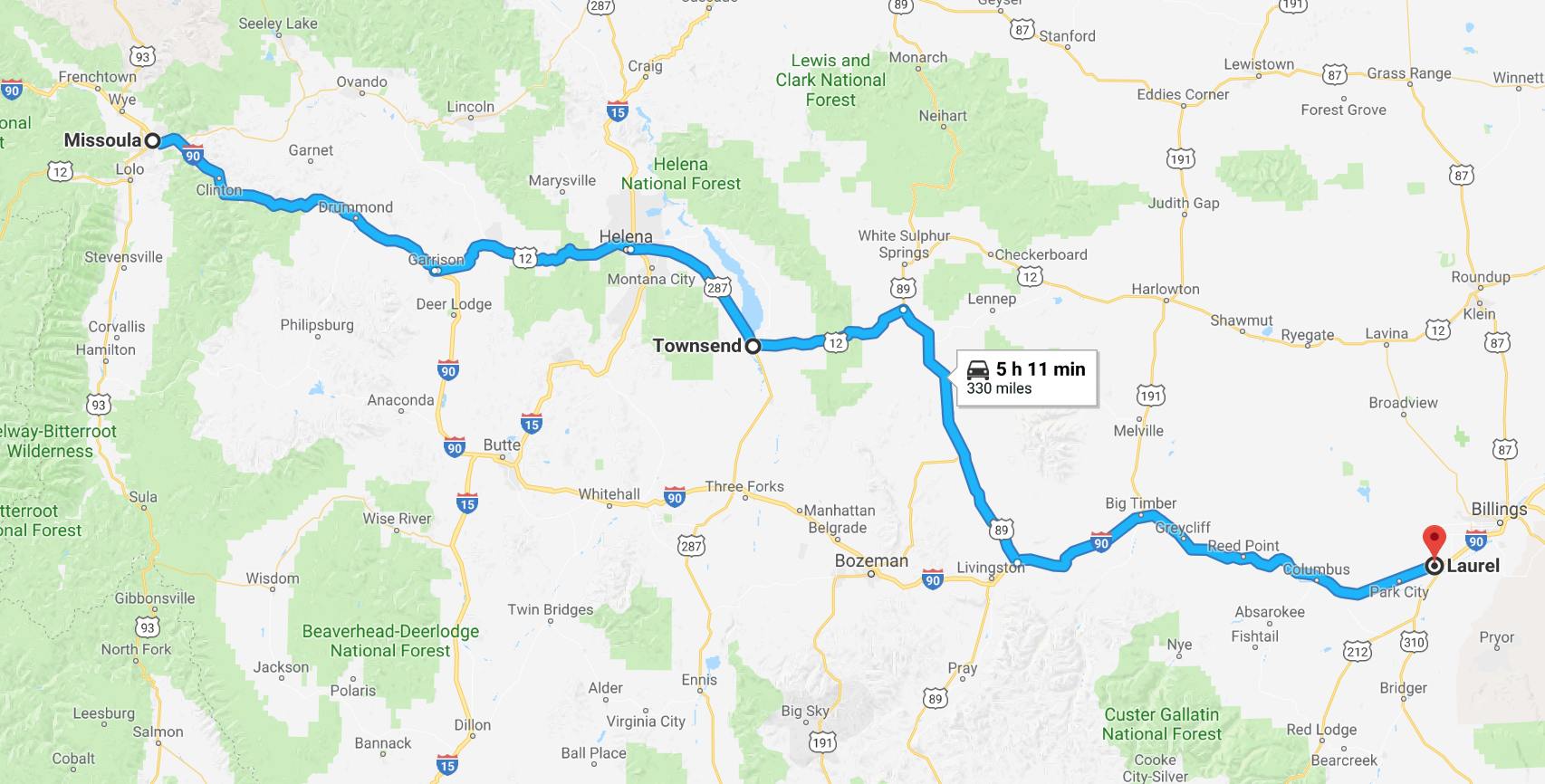
Day’s distance: 330 miles
Total trip distance: 804 miles
It was a bit warmer today with lows in the mid 50s and highs in the low 90s. Mostly clear skies after the overcast that blanketed Missoula burned off.
I felt no wind except for the last section in Laurel, and even that was very light. I am not camping on this trip, so I was able to leave the top case at home in case the winds were an issue.
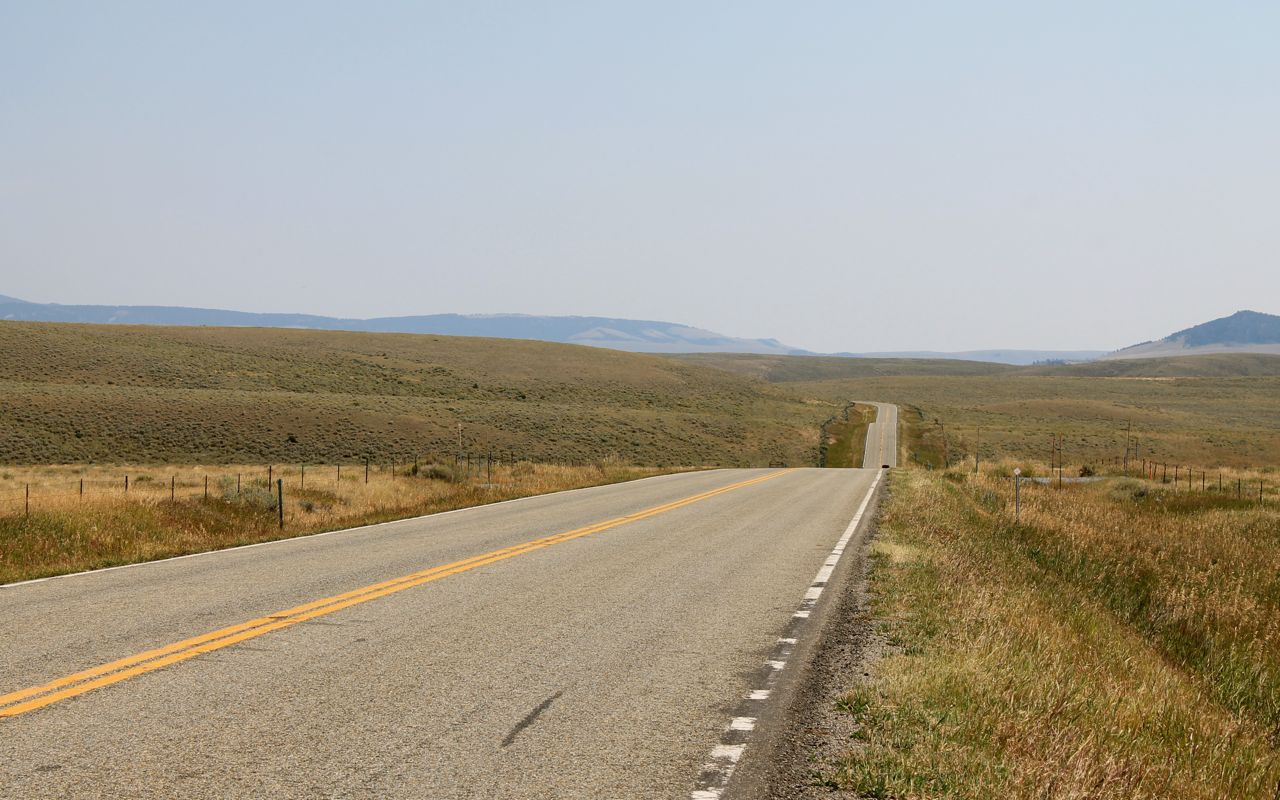
The day started on Interstate 90. I took Highway 12 east near Garrison to ride through Helena. The road was in good shape, sometimes two lanes in each direction, and 70mph, even when traveling through the narrow canyons of the Helena National Forest east of Townsend. You have to love Montana for its liberal speed limits.
Below is the view from MacDonald Pass looking east.
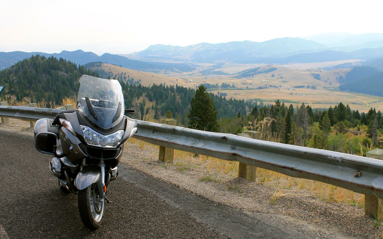
After the pass, you get into a lot of rolling grass covered hills. This was the most common scenery until I would get back on I-90 later in the ride.
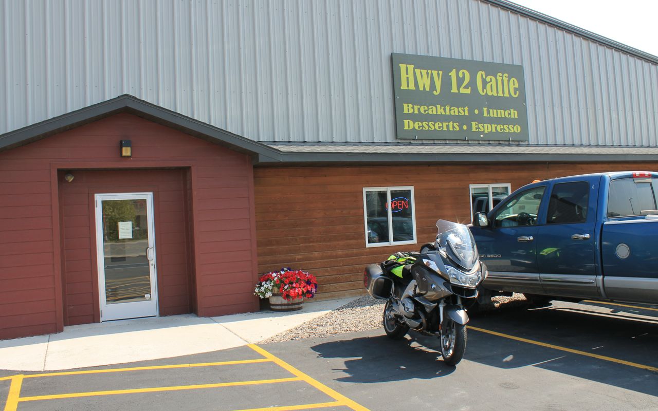
I had a great brunch at the Hwy 12 Caffe in Townsend, just east of Helena. It was shortly after 11am, when the cafe switches from breakfast to lunch. But they suggested I try the quiche. It was wonderful – good flavor and a delicate crust. Recommended!
Soon after lunch, continuing east I cut south on Hwy 89 to get back to I-90. Long stretches of essentially straight two lane in good condition.
One might be tempted to exceed the already generous 70 mph limits because it feels so desolate, but I did notice a police car waiting for speeders some 20 miles from nowhere. Luckily, I was only tempted to go faster.
Tomorrow I head over Beartooth Pass.
The latest weather report remains materially unchanged from yesterday. I’m hoping for good light and and absence of haze. Fingers crossed!
Day 3
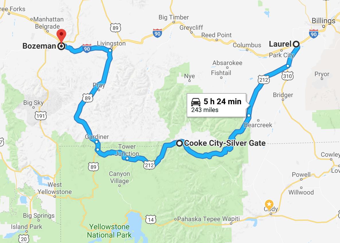
Day’s distance: 243 miles
Total trip distance: 1,047 miles
The weather was near perfect for today’s ride. Temperatures started out in the mid 50s, were in the mid 60s at the start of my ascent, then dropped back into the 50s on Beartooth, and finished in the mid 80s after I left Yellowstone and headed to Bozeman.
The motel had a hose, soap and wash rags for their biker guests to use, so I washed some of the bugs off the windscreen and headlights while enjoying the sunny start to the day.
I’m not a big breakfast eater but I try to eat as much as I can if the motel has a breakfast offering. I also grabbed an apple to put in my tank bag for later in the day.
The first stop was in Red Lodge for fuel, both premium for the bike and a latte for me. I also grabbed a piece of banana bread for later on.
The entrance to the Beartooth Scenic Byway was just outside of town.
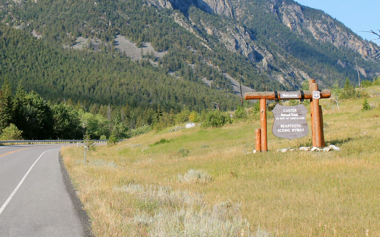
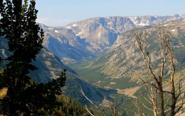
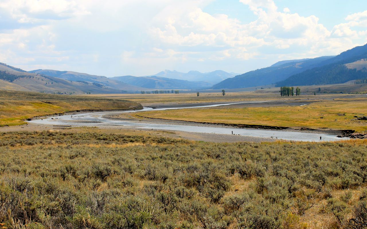
Riding into the park from the north, you wind your way into the valley and then up the mountain through a series of switchbacks.
In the photo below, that means you come in from the road in the lower right corner and continue along the valley floor …
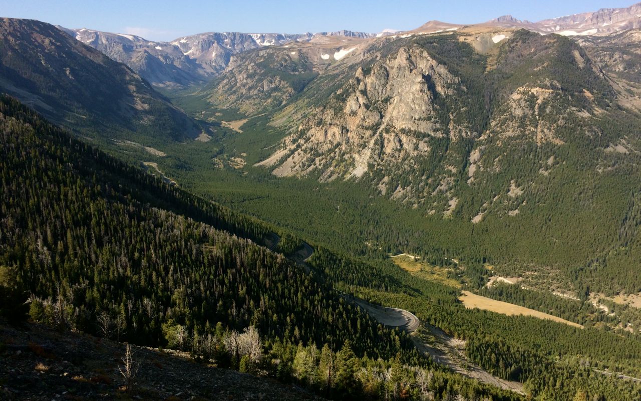
until you start weaving back and forth up the hillside …
to the first of many spectacular vista points.

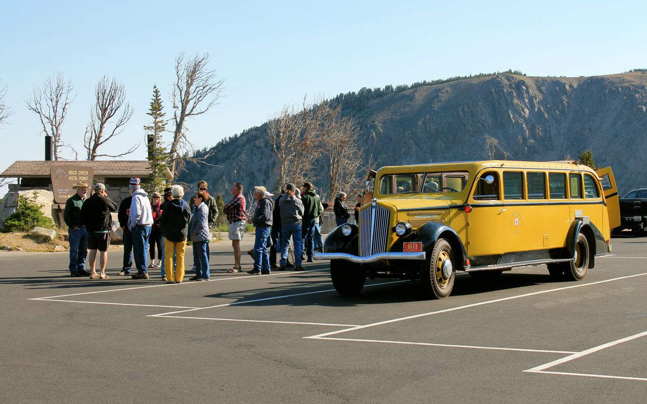
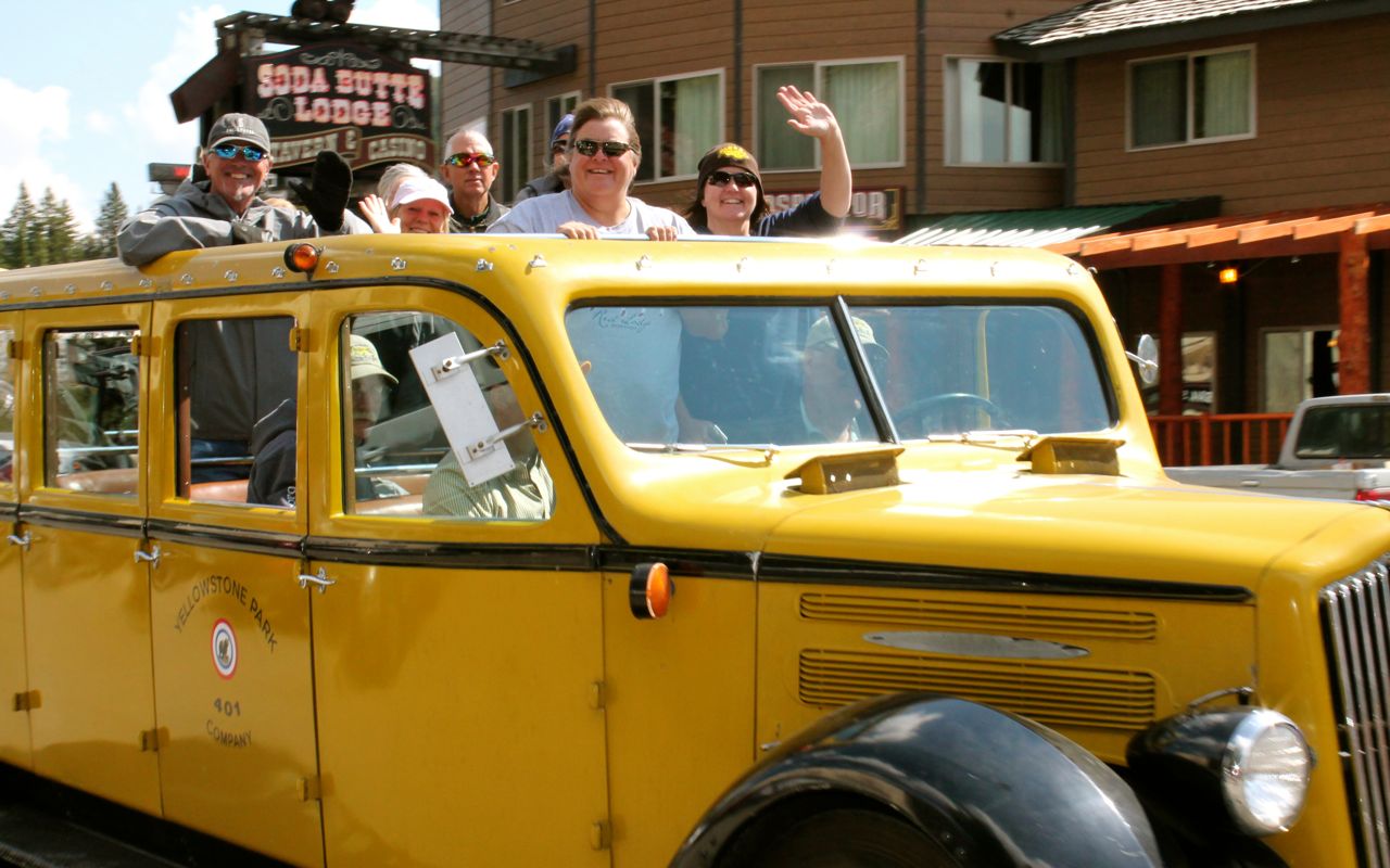
Like Glacier National Park, there are jammers full of folks who are choosing to ride the Beartooth Highway instead of driving.
I made it to the summit!
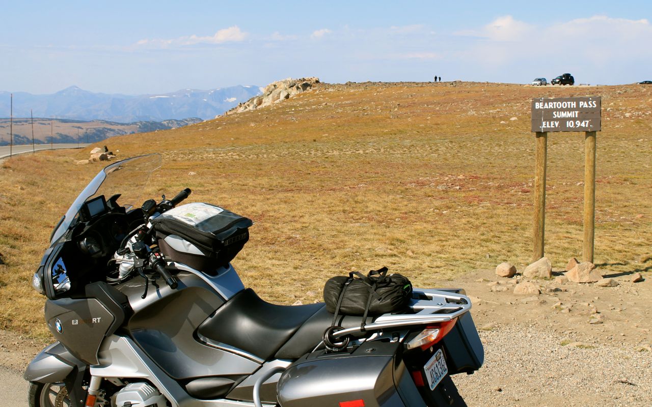
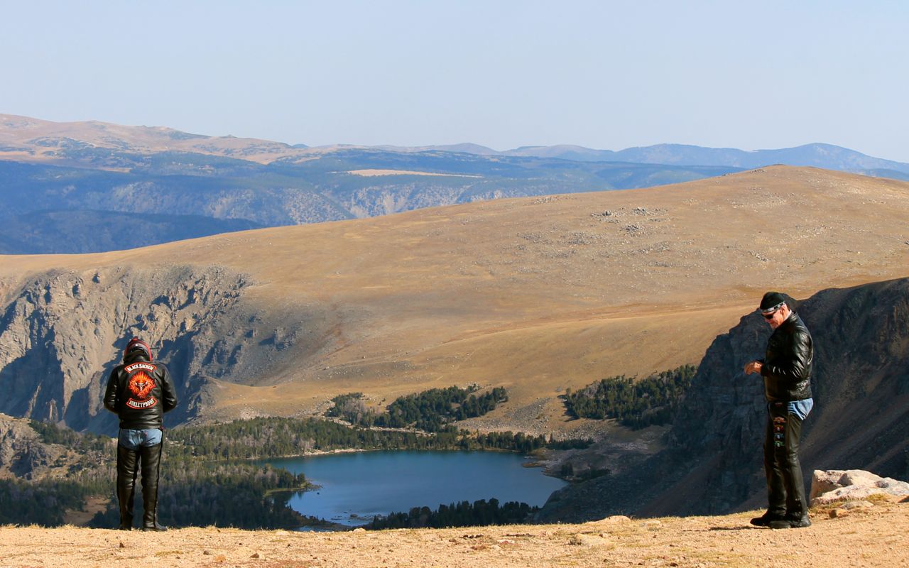
There were a lot of bikers. These two were riding Harleys with Colorado plates.
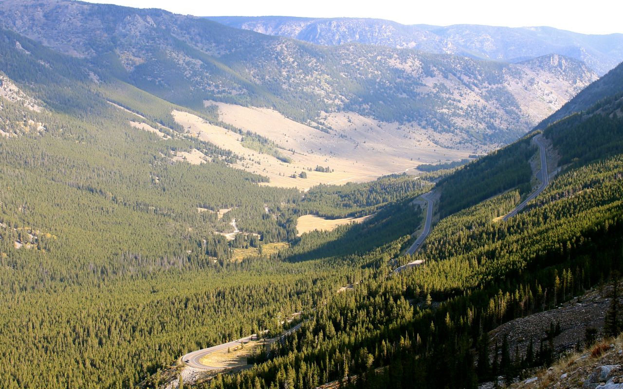
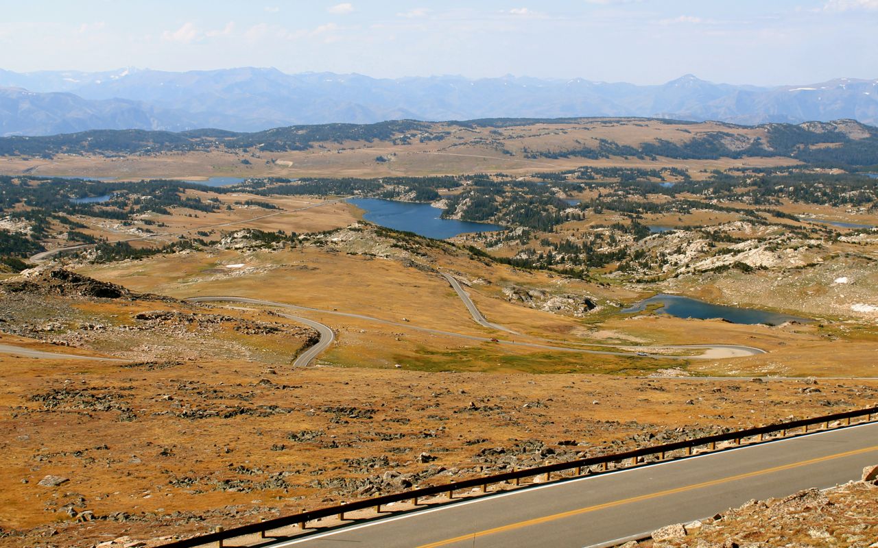
Looking south at the road as it winds down from the summit.
South of the pass, there is a bit of road construction resulting in some delays …
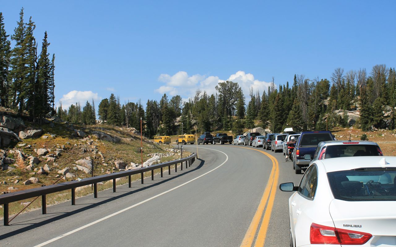
and a couple miles of hard-packed gravel. For those familiar with the road, the construction began (or ended, in my case) at the Top of World Store.
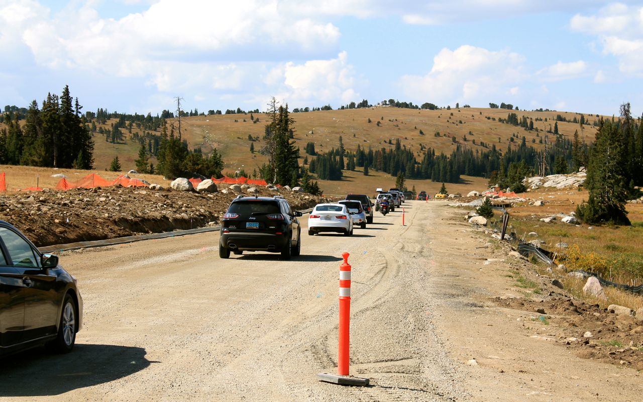
Outside of the construction zone, the roads were all in excellent shape.
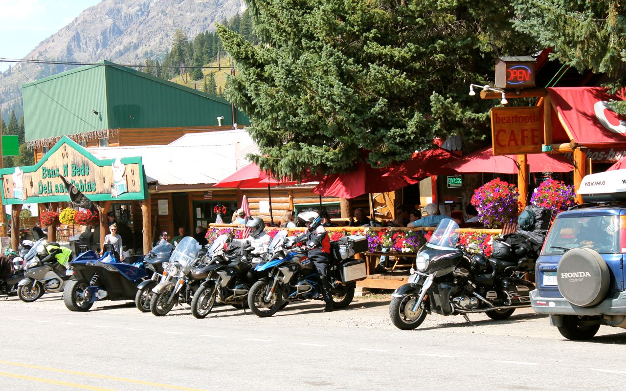
I believe the scenic byway officially ends in Cooke City, where I stopped for soda and to look at the other bikes. It sure was a lot nicer than in October of 2016, when I was last here. That day was cold and rainy, but not today.
One of the jammers came through town. At first, I didn’t realize they had an open top. Anyway, I caught a quick photo of the one-jammer “parade” as it drove past. 🙂
I can now officially check off the Beartooth from my bucket list!
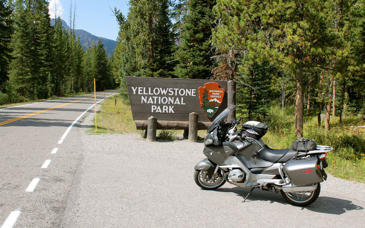
Cooke City is just a few miles from the Northeast entrance to Yosemite.
As the weather report predicted, the clouds gathered in the afternoon, though it never rained, on me anyway.
Much of the time in Yellowstone, I was following a line of cars that would stop in the middle of the road to take photos. At least I pulled off the road. LOL
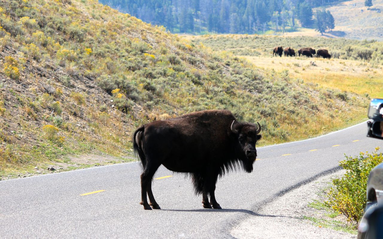
I’d been told to watch for the bison. There were many herds in this part of the park. This one was obviously in charge. 🙂
There was more traffic than I expected and it took an hour longer to exit the park along Hwy 89 than it should. Ugh. That’s the way it is during the summer in our national parks and I wasn’t too surprised.
Following the Yellowstone River, I traveled north to Livingston and then west to Bozeman, where I’m spending the night.
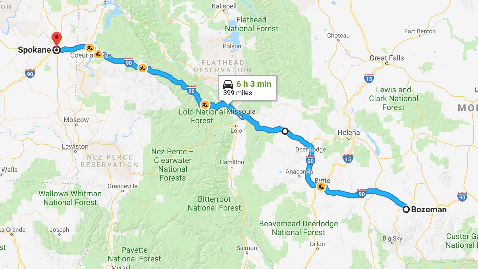
Tomorrow, I’ll be heading to Spokane to catch up with friends who live there. I’m looking forward to it.
What a great day!
Day 4
Day’s distance: 406 miles (odometer)
Total trip distance: 1,453 miles
With temperatures in the 70s throughout the day, it was a pleasant ride from Bozeman to Spokane. The air was hazy around Missoula, but surprisingly clear afterwards.
At the recommendation of the folks at the motel, I rode to Grandma’s Gourmet Donuts to start my day. Located near the college campus, the shop was busy and smelled great. While waiting in line I noticed the sign indicating that they did not take credit cards. I used the last bit of cash on me the day before and was bummed. I didn’t feel like finding a bank with an ATM and coming back, so I will have to visit again on my next trip to Bozeman.
My second stop was an independent coffee shop nearby, according to my GPS. Upon arrival, I discovered that shop looked like it was permanently closed! Some of the information on my Garmin is out of date, apparently. I’ll have to update the maps when I get home.
I chose a third coffeehouse to try. On my way, I passed a bagel shop and quickly pulled into the parking lot. The shop, called Bagelworks, has been open for 25 years. While they didn’t have espresso drinks, the bagel was tasty and hit the spot. I felt ready enough to ride now. 🙂
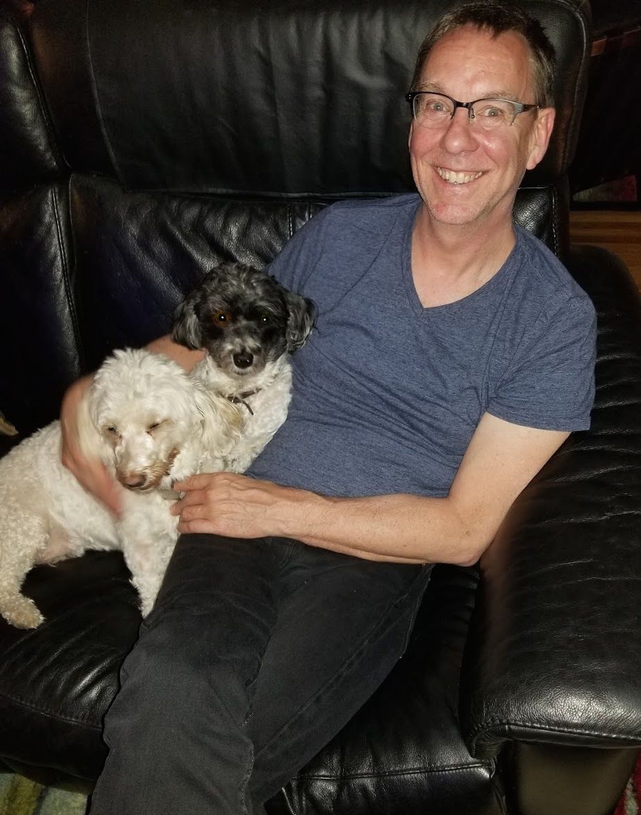
After stopping in Butte for my latte, and Missoula for lunch and fuel, I arrived in Spokane in the mid-afternoon. The rest of the day would be spent visiting Christopher and his companions, GoldieHawn and Rambo, who became best friends immediately.
We walked to the Manito Tap House nearby for dinner. They have excellent food and over 50 draft beers on tap. I had the Tap House Burger and sampled six (2.5 oz glasses) of the beers. Everything was quite yummy and I recommend a visit if you’re in the area.
Tomorrow I head back to Seattle. I might run into some showers if I arrive too late in the afternoon. I will keep my rain gear handy.
Day 5
Day’s distance: 284 miles
Total trip distance: 1,737 miles
Nice day, temperature-wise, 60s and 70s. The rain showers predicted in Seattle didn’t arrive until well after dark. Winds picked up ahead of the rain, but weren’t too bad earlier in the afternoon.
Rocket Market is the place to get your morning latte in the South Hill neighborhood of Spokane. Excellent latte and breakfast burrito, and the staff was super friendly and helpful. Thanks for the suggestion, Christopher!
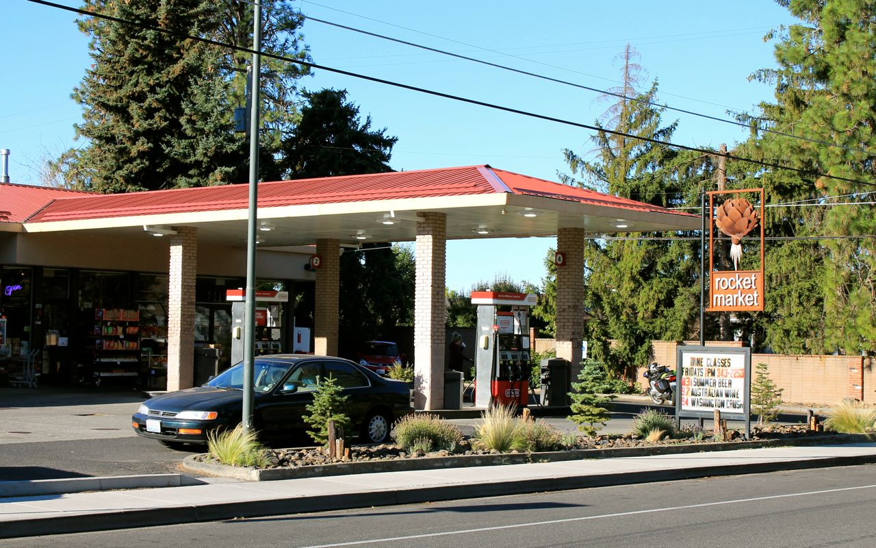
The vista seen from South Hill.
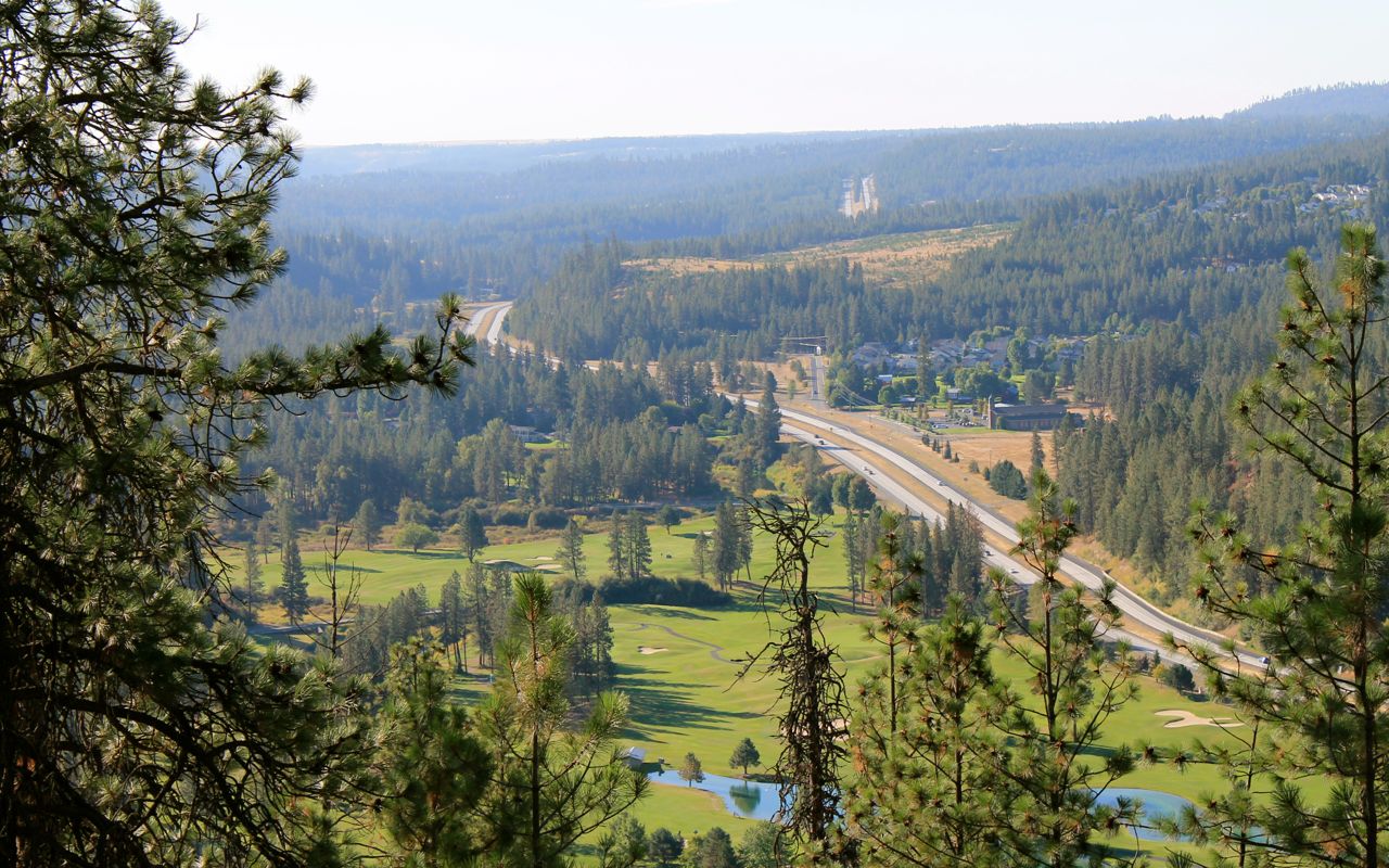
The ride west to the Columbia River was uneventful. Some haze but orders of magnitude clearer than Wednesday when I passed through heading east.
Just after I crossed the river, and climbed up the hill past Vantage, WA, I rode through a small wildfire in the median of I-90. It was still very small, maybe 15 minutes old, but it had jumped to the north side of the freeway, as well. Traffic was still moving through at speed as did I.
The freeway was closed shortly after and didn’t fully reopen in both directions until 8:45pm. Whew!
It was smooth sailing again until nearing Cle Elum, WA, where traffic indicators were suggesting a significant delay ahead. I pulled off in a rest area and discovered a crash west of Cle Elum closed both westbound lanes. I diverted into Cle Elum and hung out at the Dairy Queen for an hour or so until traffic started to clear.
A fair share of traffic drama is a reminder that I’m getting close to home. I expect it and try to steel myself, so neither the fire or the wreck (because there was warning of it) bothered me too much and I arrived home safe and sound.
Thanks for following along!
Reflections
How does the Beartooth rank among other scenic rides?
Near the top and definitely one of the top five rides I’ve personally completed. It was suggested to travel south over the pass from Red Lodge. It certainly is dramatic in this direction. The rock faces and other elements of the scenery reminded me of Glacier National Park’s Going-to-the-sun Road. Catch the Beartooth on a good day and you’ll never forget it.
I think I could pack even less!
For no-camping trips, I can likely leave my USB battery at home. It is rather large and heavy and while I used it on the last day of this trip, it could have easily been avoided. I brought too many shirts, too many pairs of socks and one too many pairs of jeans. Culling these and a few other items might allow sufficient room for my jacket liner to go inside one of the side cases when it wasn’t needed.
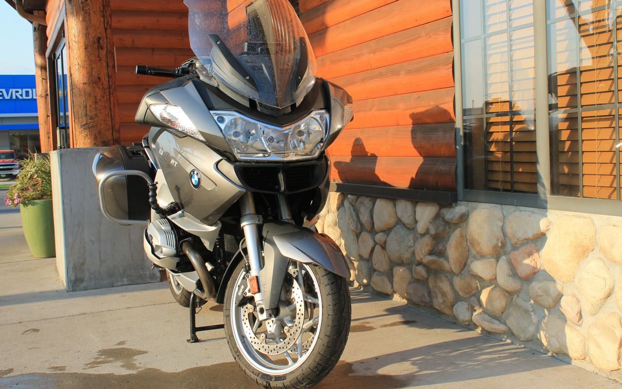
Pilot Road 4 GT tires are wearing well
My tires are wearing well. I can’t wait for the Pilot Road 5 GTs, which might be out in the spring. They are even better reviewed and promise better wet traction longer into the normal life of the tire. I have 8,200 miles on the current set but they won’t see 10,000.
How far did you travel each day?

How’s the bike running?
Very well. The last service resulted in a very smooth engine at speed. Way to go, Finn! Even with more than 74,000 miles, there is no sign that I will need a clutch replacement any time soon. I added oil at the end of Day 4. The bike uses about 100ml per 500 miles, consistently, while cruising – a bit more if I’m really flogging it on the twisties.
Best food experiences?
Spokane rocked it all. Best coffee (and breakfast burrito), best burger and best beers. Thanks, Christopher!
Internet at night was excellent
Every night I had enough bandwidth to upload images and stream Netflix, no problems. This included two different nights at a Motel 6. That makes my overnight experiences all that much better.
Lots of interstate miles
Roughly two-thirds of this ride used I-90. While unusual for my longer trips, readers might recall I anticipated more of this “out & back” style of travel. In June, 2017 I test rode a K1600GT, considering it a platform that would perform better on the interstates. The RT managed this route perfectly, easily cruising at 80 mph and comfortably navigating around traffic. No top case and no strong cross-winds helped keep buffeting down to a minimum.
