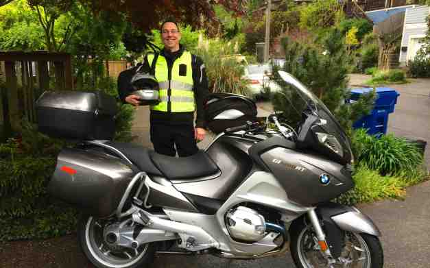
I call my first multi-week motorcycle tour ever the 2014 Western States Tour.
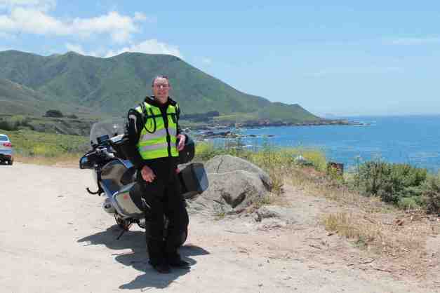
Starting in Seattle on May 5th, I traveled down the coast through Oregon and California. Then I followed Hwy 101 and Hwy 1, taking side trips on occasion.
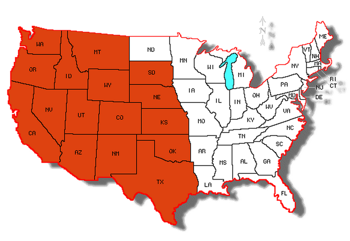
After spending time with friends, I then road east through California, Nevada, Utah, Colorado, Arizona, New Mexico, Texas and Oklahoma. I visited many national parks and riding many scenic byways.
I travel across Kansas, Colorado, Wyoming, Nebraska, South Dakota, Montana, and Idaho before returning to Washington.
In all, this solo adventure I called the 2014 Western States Tour was 8,555 miles long. Traveling through sixteen states in all, the adventure included many national parks and scenic byways, old friends, and lots and lots of new things !!
Scroll down to find each day’s route, commentary, photos. You’ll find answers to some often-asked questions about the trip at the end. Enjoy viewing the detailed record of the trip. There is a map for each day’s progress, as well as a few special photos taken that day.
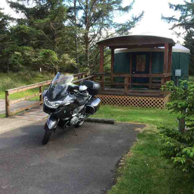
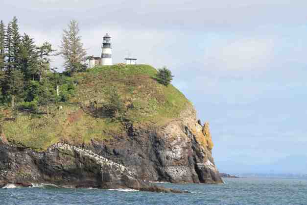
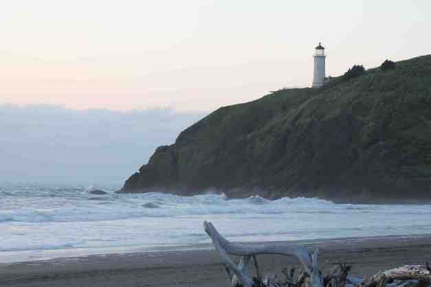
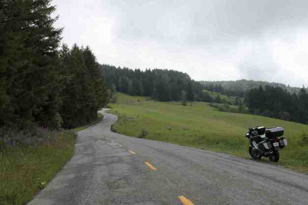
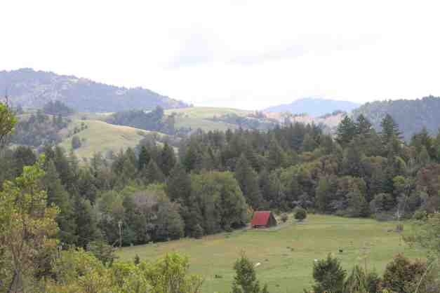
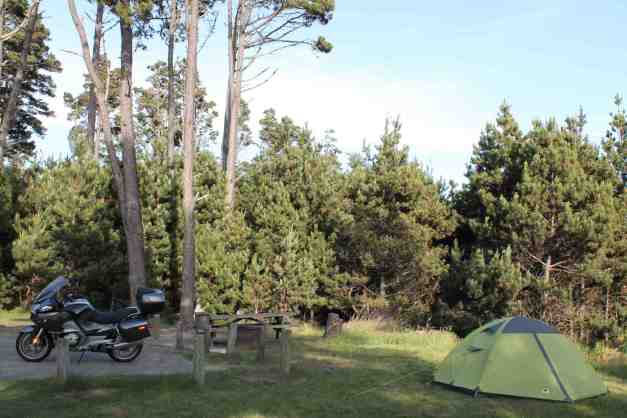
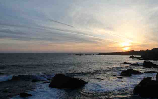
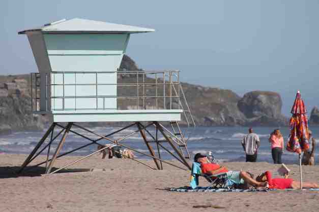
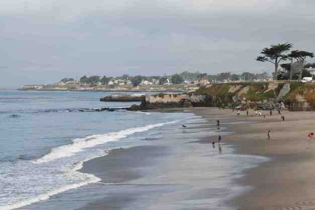
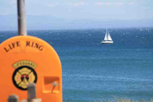
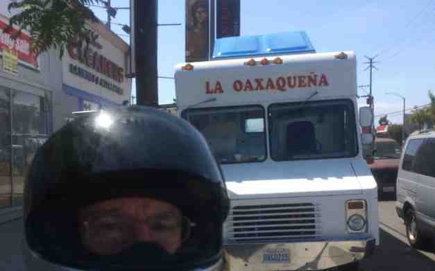
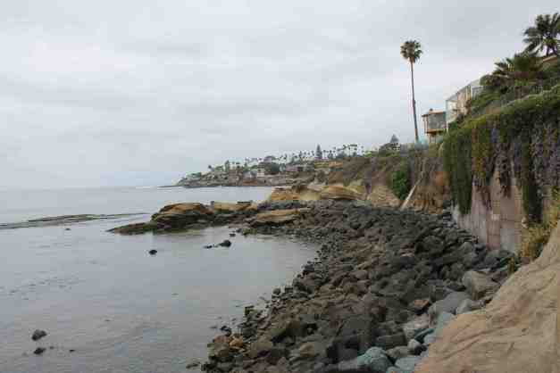
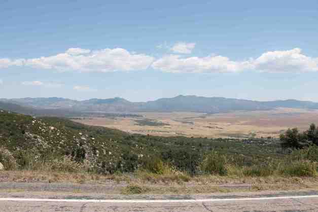
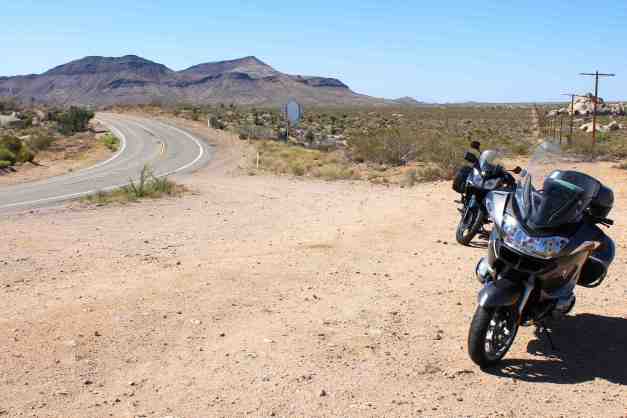
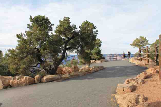
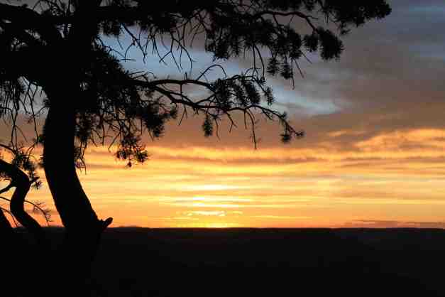
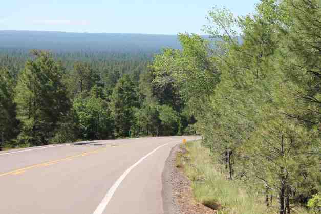
Day 1 – Seattle to Cape Disappointment

Day 1 distance: 199 miles
The weather was rainy with showers throughout the day and temperature in the 50’s.
Planned for the first day was a stop in Hoquiam, WA to visit the manufacturer of LDComfort base layer clothing and pick up more product. Mario Winkelman, the owner, showed me around the factory and filled me in on the product. He is a long distance Ironman rider and developed this gear out of need. Thanks again, Mario, for your time and for developing a really superior product.
Reservations were made Sunday for an overnight stay in a yurt as I was expecting the rain to continue into the evening. Instead, it cleared up and allowed me to take the photos of the two lighthouses guarding the Washington side of the mouth of the Columbia River. The yurt was comfortable and yet it still felt like camping – a nice transition for my first evening.
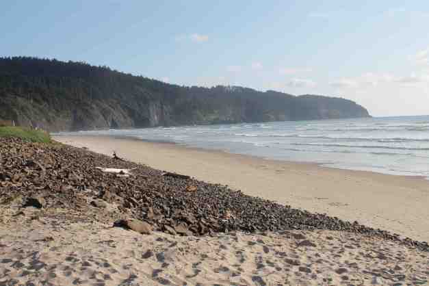
Day 2 – Cape Disappointment to Cape Lookout

Day 2 distance: 189 miles
Trip total distance: 388 miles
The weather today was mostly sunny with temperatures in the high 50’s.
As the route map indicates, I detoured inland from Astoria to check out the roads. Hwy 30, then Hwy 47, and finally Hwy 202. Hwy 30 and the last 19 miles of Hwy 202 were pretty decent, however the rest was pretty challenging. By that I mean these were logging roads with potholes, gravel, and lots of repaired areas that were still in need of attention.
Detours however can take you past interesting places. Riding along Hwy 202 did take me past the Wildlife Refuge at Jewell, OR. It is an Elk Refuge. They must have all been catching some sleep somewhere as I didn’t see any at the time of my visit.
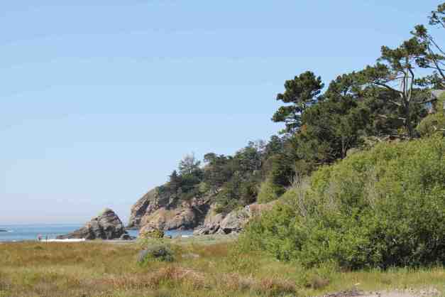
Back on the coast, I passed Canon Beach and stopped for a break, then continued south. I was stopping often, distracted by the scenery and taking frequent breaks.


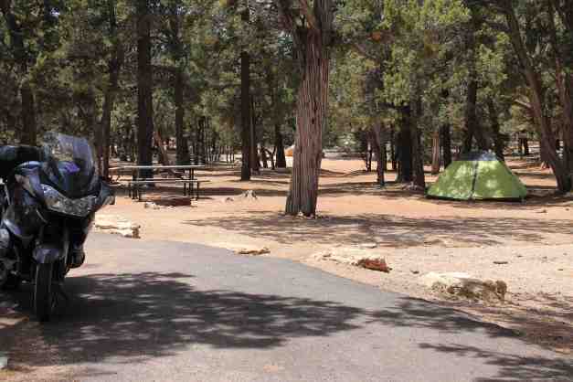
Today was a day of “firsts”. This was the first night of tent camping, as opposed to a yurt. This was also my first motorcycle trip that was longer than a single overnight stay in more than 25 years. I’m going to smash that to pieces in the coming weeks!
I really liked this campground. Tenting on grass is nice and the campground was not crowded at all, although I’m told is becomes very crowded after the long weekend. I’m glad I’ll be off the coastal roads by then, if all goes as planned.
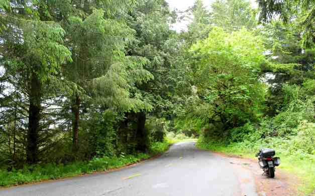
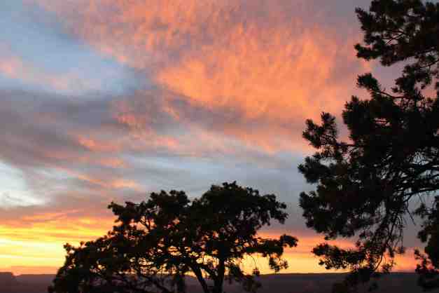
Day 3 – Cape Lookout to Florence

Day 3 distance: 140 miles
Total trip distance: 528 miles
The weather today was sunny with clouds rolling in later. The temperature reached 60.
While I woke up just before 6am today, I wasn’t south of Tillamook until five hours later. I made breakfast while in camp, talked to new acquaintences, packed up the tent and other gear, and arrived in Oceanside at the bakery where I was going to have a latte and update the blog.Well, the bakery is closed Tuesdays and Wednesdays, but the owner walked up from across the street and, after I asked, provided me the password for the bakery’s internet. So I stood outside and updated the blog.
A resident of Oceanside approached me during this time. He just purchased a used BMW R1200 cruiser as his first ever motorcycle. He asked lots of questions about my motorcycle clothing choices.
I stopped in Tillamook for a latte after shooting some video in Oceanside. More video was taken throughout the day and I edited it down to the video below. I am still learning a lot about, really a nice way of saying struggling with, creating interesting video and embedding music using the YouTube editor.
Enjoy!
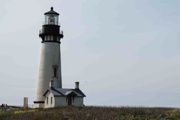
You can’t travel along the coast without appreciating the various lighthouses along the way.
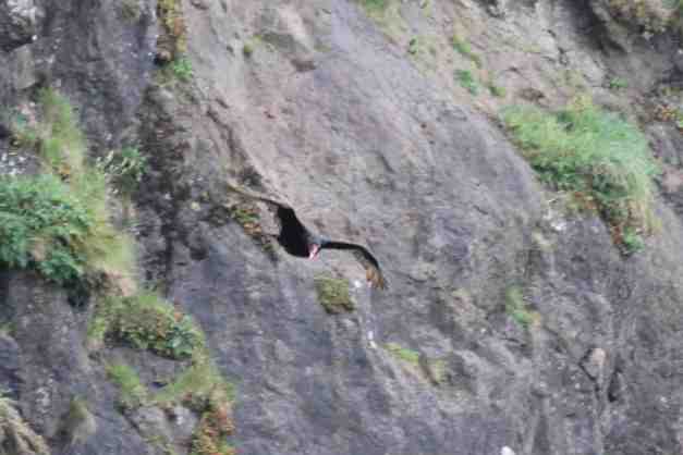
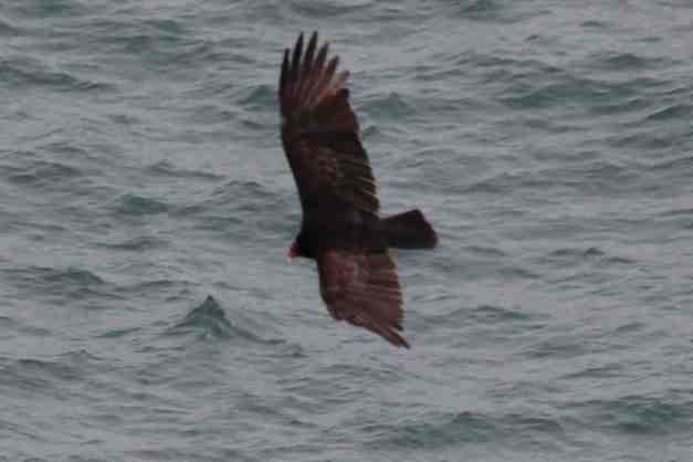
At Sea Lions Cave, I saw what I thought was a pair of California Condors. Because they aren’t tagged they are more likely vultures, but I watched them for a while.
I didn’t really mind getting a late start, but I was hoping to hang out at Cape Perpetua. I arrived just after 5pm and the Visitor’s Center was already closed. This looks like a place I’ll have to explore on another visit.
As it was supposed to begin to rain later tonight, I stayed at the Old Town Inn, in Florence. While there, I met a couple who also ride a R1200RT. We ended up having dinner together in the historic section of Florence.
Throughout each day of my adventure so far, people have approached me with questions about my journey. They often share stories of their own, which I really enjoy. I haven’t yet felt like I’m traveling alone, but instead I feel that I’ve joined a larger community of past, present, and future motorcycle travelers.
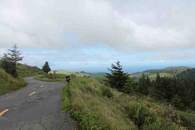
Day 4 – Florence to Brookings

Day 4 distance: 154 miles
Total trip distance: 682 miles
The weather today was windy and rainy with temperature in the mid 50’s.
The winds were strong and the rain heavy along the southern Oregon coast this afternoon. Road conditions demanded my full attention so I skipped making any videos or taking pictures. However, since I’m already holed up in a motel in Brookings drying out my gear, I’ll convey a short story that relates today’s ride to something that happened last year (2013).
During a day trip early last summer, I stopped by a motorcycle shop in Port Angeles to borrow a very tiny screwdriver that I used to reset my Chatterbox (my helmet’s bluetooth communication device). Will, my regular riding buddy, and I were talking to the owner of the shop about where we’ve been and where we were heading. Our original destination was Hurricane Ridge, but the upper parking lot was full and there was a long wait at the park entrance, so we decided not to stay.
The shop owner suggested we continue around the Olympic National Park and loop back to Seattle through Forks and Aberdeen. We considered this alternative, but it was already late in the afternoon and it would have been dark by the time we returned home.
I explained that I was just getting back in to motorcycle riding and hadn’t yet ridden at night or in the rain. The shop owner offered me some Kerosene soaked rags to wrap around my boots. I asked what he was talking about and he replied, “You need something to keep the ants off your candy ass.”
We all laughed, and Will has reminded me of that a few times since. After today’s ride, I don’t need any kerosene soaked rags – thank you very much.
Day 5 – Brookings to Eureka

Day 5 distance: 140 miles
Total trip distance: 822 miles
The weather started off rainy but cleared up. The temperature ended in the low 60’s.
Today was a good day, with one exception. It seems the rain yesterday was too much for my Chatterbox. This small bluetooth device sits outside my helmet and it hasn’t worked all day. I use it to listen to GPS instructions and music. Not critical but a bummer anyway.
The plan today was to see some of the Redwood National Park that runs along the coast from Crescent City south. I had an idea of what to do but wanted to talk to the folks that work for the park. So, after the required morning latte, I crossed into California and was at the Park Headquarters in Crescent City by 9am when they opened.
After speaking to the docents and coming up with a plan, I stopped to get a shot of the Battery Point Lighthouse. I took many photos, but for some unknown reason only found three on my memory card this evening. So I posted the best one below.

The next stop was the Klamath River Overlook off Requa Road. You may recall in an earlier post how I enjoyed the frequent interactions with strangers I meet. While at the overlook, I met the uncle of one of the employees (Kevin) at Ride West BMW. He has owned 13 different BMW motorcycles, starting with an R75/5. It is such a small world :). I’m glad to be out making these connections.
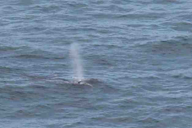
Gray whales were present, but at some distance away. I believe there are two whales in the photo below, while only one spout is present.
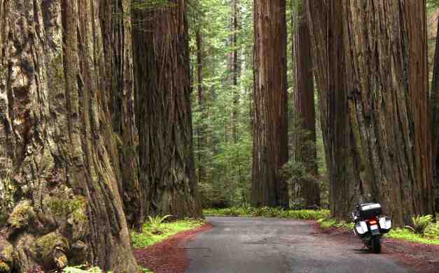
I rode through the Prairie Creek Redwoods State Park next. The Newton B. Drury Scenic Parkway parallels Hwy 101 but travels through some dense redwood forest.

A ride up part of Bald Hills Road followed. A steep 15% grade up a really rough and wet paved road provides a wonderful view of both redwood covered mountains and grassy prairie.
I edited down some of the video taken in the redwoods today. Enjoy!
Dinner tonight was really delicious. If you’re in Eureka, check out ‘Bless My Soul Cafe’. Excellent southern cooking and cajun food.
I’m staying in a motel this evening because it is likely to rain. I’ve been price comparing using a combination of apps and generally settle for the least expensive AAA ‘approved’ place nearby. Tonight it is a Day’s Inn on 5th St..
Day 6 – Eureka to Fort Bragg

Day’s distance: 185 miles
Total trip distance: 1,007 miles
The weather mostly cleared after morning showers. Temperatures reached the mid 60’s inland and high 50’s along the coast.
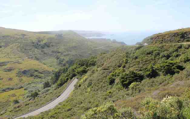
Today I detoured off Hwy 101 to travel the Lost Coast Scenic Drive, starting on Mattole Road in Ferndale and ending in the Humbolt Redwoods State Park. It was beautiful.
The road begins with a climb into dense forest …
and opens up as it approaches the coast.
Mattole Road travels roughly five miles along the coast …
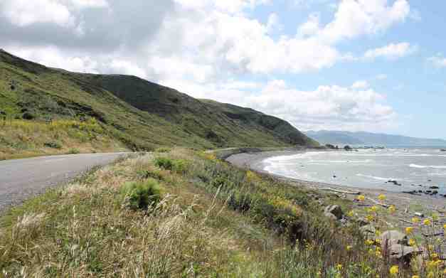
and climbs again as it approaches Petrolia.
The drive ends in the Humbolt Redwood State Park. Redwood forests are magical 🙂
After lunch, I reached the beginning of the Pacific Coast Highway (aka Hwy 1). The pavement on this two lane highway was in good shape and made the twisty road quite fun. So fun, in fact, I didn’t stop to take video or photos. After reaching the coast, I did stop and consider reversing course to travel it again, but it was getting a little late in the day.
Day 7 – Fort Bragg to Salt Point State Park

Day’s distance : 202 miles
Total trip distance : 1,209 miles
The weather was warm and sunny. Mid 70’s inland and high 60’s on the coast
It was suggested that I try to ride Hwy 128, so I detoured inland today. Both Hwy 20 and Hwy 128 were excellent motorcycling roads, with the ladder being as perfect as I have experienced. It was almost all new blacktop, very smooth, and quite twisty. Thanks, Roman!
Each day I feel more comfortable and capable on the motorcycle. My old rowing coach, Conal Groom, once said in response to practice makes perfect, “Perfect practice makes perfect.” I think one learns from imperfect practice, as well.
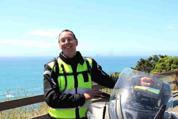
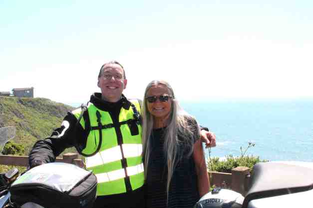
While at a rest stop on Hwy 1 half way to Salt Point State Park, I met Susanna and Debra, who were on their way to Seattle. We spent a few minutes trading cameras and I ended up with a shot of me and the bike overlooking the ocean, and one of me and Susanna!
Tent camping was the order of the day …
as was a visit from one of the residents.
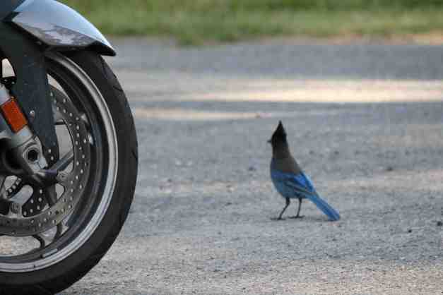
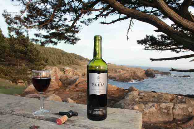
The camp host rides a Honda Goldwing and we started telling stories of our adventures. Later I was gifted a bottle of wine, complete with opener and a glass 🙂 I sat down by the ocean to watch the sunset.
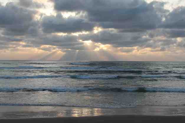
I guess I was getting a little creative while waiting for the sun to set …
and it finally did set.
Day 8 – Salt Point State Park to Stinson Beach

Day’s distance: 78 miles
Total trip distance: 1,287 miles
The weather was warm and sunny. Temperatures reached 85 inland and 75 on the coast.
Highway 1 has some challenging curves and hills (with no guardrails at points). I think some of the most challenging is just north of Jenner. The switchbacks here were incredibly scenic and a bit scary.
All was better after some excellent breakfast quiche and a latte at Cafe Aquatica in Jenner.
The original plan today was to arrive at Point Reyes, get camp set up in the early afternoon, and then hike around the national park. However, I discovered midday that there is no “car camping” at Point Reyes. You have to hike in to every camp! I’m not set up for hiking in to set up camp 😦
Instead, after checking out one private campground (a little too barren of natural beauty for me), I decided to bypass Pt. Reyes altogether. I found a really nice hotel in Stinson Beach, called ‘The Sandpiper Lodging at the Beach’. It is really close to restaurants and a long stretch of sandy beach. I arrived about 4pm and was on the beach by 4:30.
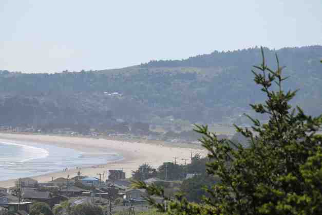
Beach life …
This was the first time this year I’ve had my feet in the ocean.
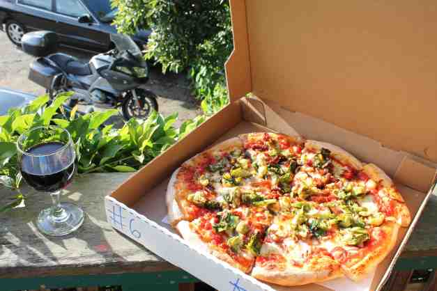
After walking the beach, it was time for dinner and some wine. At the suggestion of the woman who checked me in to the motel, Saphira, I tried the bacon and brussels sprouts pizza from Parkside. It is her husband’s favorite. It was so good !!
Unplanned events happen to us all the time. I had to stop quickly on Hwy 1 today in Jenner – a woman pulled out in front of me. However, after stopping I noticed the Aquatica Cafe and decided to eat. I had a really great breakfast. While pulling into Stinson Beach, I missed the turn to the motel. When I turned around on a road that headed up a hill overlooking the town, I had an opportunity to take a beautiful picture for the blog. I’m noticing that if I remain open to my surroundings at these times, it can result in something good, at least sometimes 🙂
Day 9 – Stinson Beach to San Francisco

Day’s distance: 32 miles
Total trip distance: 1,329 miles
The weather was very warm for the area. My weather app recorded 90 degrees in San Francisco.
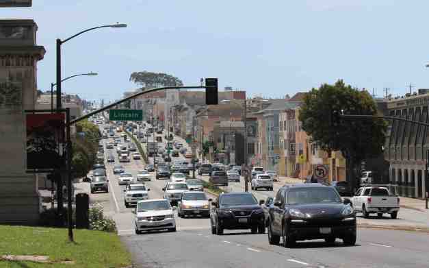
Today was just a hop across the Golden Gate Bridge to my friend Craig’s place. I’m going to keep the bike parked for the next few days while visiting the city.
I passed Muir Beach on the way into the city.
I did capture some video of my bridge crossing. I’ve been over the bridge in a car and on a bicycle before but I think this is the first time on a motorcycle.
I arrived ahead of schedule and hung out in Golden Gate Park for a while.
I met up with Craig, parked the bike and unloaded to stay for a few days.
Day 10 – San Francisco

The weather in San Francisco was sunny and very warm. The temperature reached 88.
Craig led me on what he labeled a “Staircase Tour” of the neighborhoods around his place in the Haight-Ashbury district. According to him, these staircases were created before our preoccupation with driving to facilitate foot travel between one’s home and the transit available along select streets. Most of these cut through public easements between homes creating an urban trail around this hilly city.
The typical staircase travelled today …
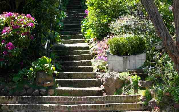
would pass beautiful homes …
and picturesque streets …
We traveled along various staircases towards some of the local parks found on top the neighborhood hills. From Tank Hill, Kite Hill, Corona Heights and Buena Vista park (marked with yellow stars on the map above), we were able to see the entire city and much of the surrounding area.
A short pan of the city from atop Corona Heights Park. The wind kept us cool on this hot day in the city.
We stopped for lunch in the Castro district. I recommend Cafe La Taza, if you’re in the area.
Day 11 – San Francisco

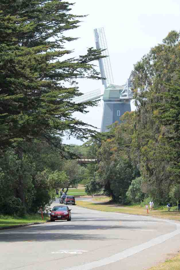
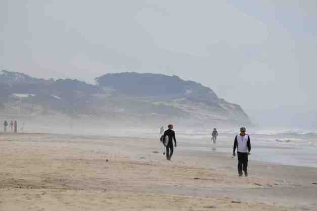
A Golden Gate Park walk was the order of the day. We started from the Haight-Ashbury end and headed west to Ocean Beach. Here are some of the photos taken during the walk.
From the beach, we hopped on a Muni light rail trolley to the Mission District. We ate lunch at the Taqueria El Buen Sabor. Definitely recommended !!
Looking ahead about ten days, it was suggested that after I visit Las Vegas, I detour to St. George and into southern Utah. I thought that was a great idea and have an update for that part of the trip. This route takes me past Zion, Bryce Canyon, and Escalante prior to the Grand Canyon. Thanks, Roman and Carson for their input !!

Day 12 – San Francisco to Santa Cruz

Days distance: 85 miles
Total trip distance: 1,413 miles
The weather in the Bay Area continues to cool a bit. My app indicates 79 in Santa Cruz.
Today was a short morning hop down the coast. I stopped for my latte on the pier in Pacifica. By the time I had breakfast at the Whale City Bakery in Davenport, the fog had burned off. I think the bakery has changed names since I lived in Santa Cruz but I remember riding my bicycle out there for breakfast in the past. Yummy, though, just like I remembered.
When I first arrived at the bakery, there were about a dozen Harley Davidsons in the parking lot. Apparently a tour group of French riders was there and most of the Harleys were rented.
I’ll be hanging out in Santa Cruz for the weekend before continuing down the coast. I moved to Seattle from Santa Cruz late in 1993. It will be fun to catch up with my friends here and see what’s changed around town.
Loose plans at this time are to camp in the Big Sur area on Monday night and possibly at El Capitan State Beach on Tuesday night.
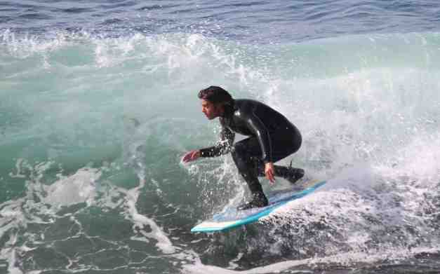
Day 13 – Santa Cruz
The weather was a nice warm ( ~ 80) and there were high clouds remaining after the fog burned off. After my morning latte at Emily’s Bakery on Mission, I spent some time along West Cliff Drive this morning. There were surfers …
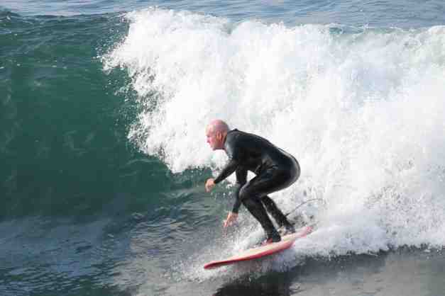
older and younger.
This is the museum dedicated to them …
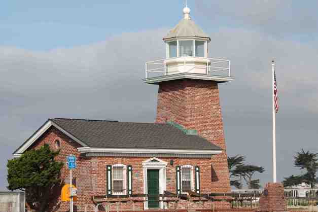
West Cliff Drive follows the coast from the boardwalk to Natural Bridges State Park.
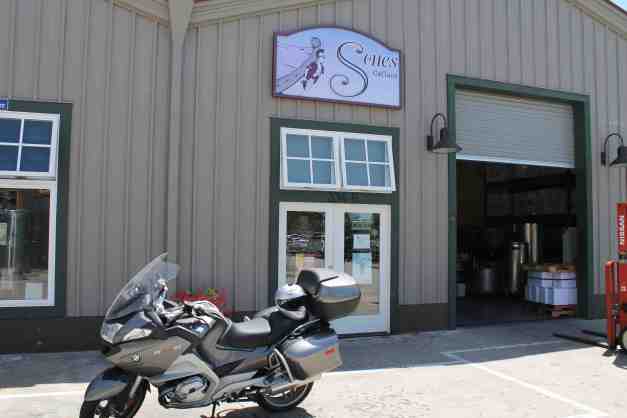
Friends of mine own the Sones Cellars winery and I stopped by for a visit. It is a shame they are not able to ship their wine to Washington 😦
The evening ended with a great dinner party – Paella cooked outdoors and some good wine.
Day 14 – Santa Cruz
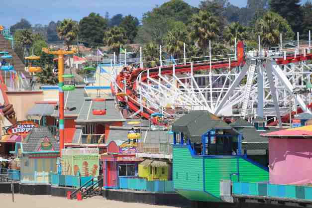
Sunday was my last day in Santa Cruz. In the morning, I found myself taking pictures of some of the places I used to spend my time visiting. The Boardwalk is home to the Giant Dipper, a wooden roller coaster built in 1924. According to a wikipedia article, it took 47 days to build at a cost of $50,000.
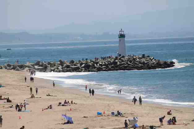
Then there is the Walton Lighthouse, marking the harbor entrance.
I spent more time in the afternoon walking on West Cliff Drive (again). I spent a lot of time on the west side of Santa Cruz, both on this visit and when I lived here.
My visit to Santa Cruz has been super nice. Special thanks to my hosts. Today’s travel is a short hop south to the Big Sur area where I will likely be camping tonight. Looking ahead to my mid-week plans, wildfires may impact my travel, at least indirectly.

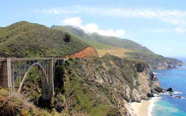
Day 15 – Santa Cruz to Big Sur

Day’s distance: 92 miles
Total trip distance: 1,524 miles
The weather was nice. Mostly sunny and high 60’s along the coast.
Viewers who tour on their motorcycles are likely shaking their head at my sub-100 mile days. I am certain that in the second half of my tour, from Denver back to Seattle, my day’s mileage will increase. Again, I’m trying to coordinate schedules with the friends I’m visiting.
I am having a good time getting “there” …
and taking some photos along the way.
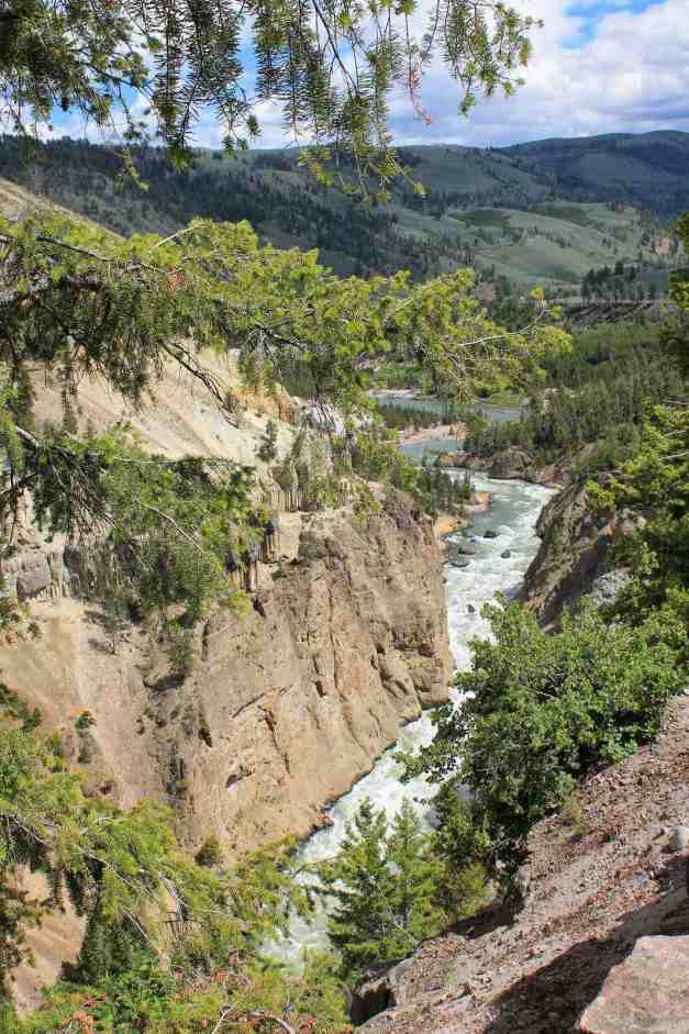
I arrived at my campground in the early afternoon. I was camped adjacent to the Big Sur River (upper right in the photo below).
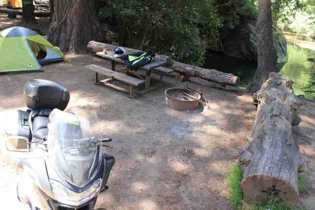
The campground rents inner tubes, and I couldn’t resist my first tubing of the year. I used it as a chance to test the GoPro in the water.
Turns out there was a Pub about 300 feet from the campground, so I went there for dinner 🙂 A few beers and dinner hit the spot and I slept well.
Day 16 – Big Sur to Pismo Beach
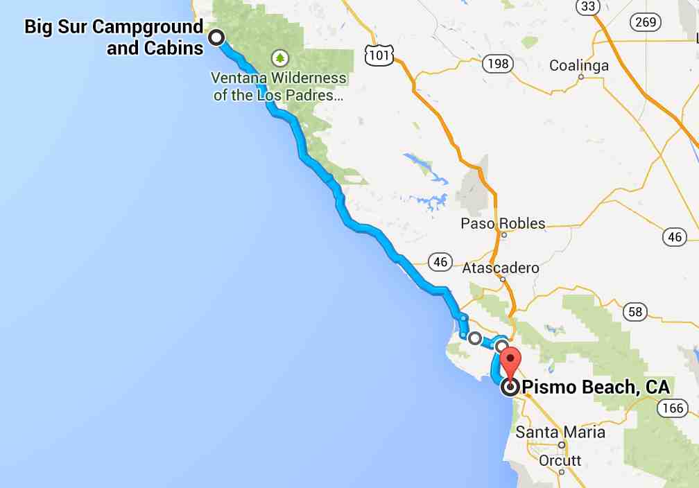
Days distance: 153 miles
Total trip distance: 1,677 miles
The weather was cool in the morning but warmed up to high 60’s along the coast.
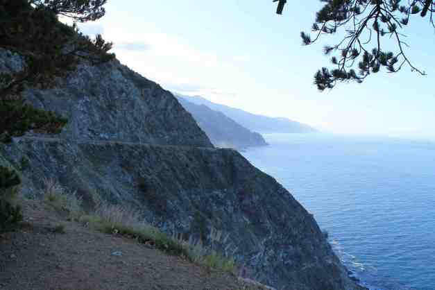
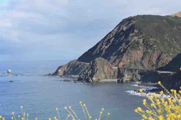
I departed the campground before 8am and took some morning photos along the Big Sur coastline.
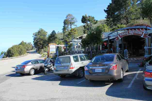
Coffee shops along this part of Hwy 1 don’t seem to open until 9am, so I stopped at the Whale Watchers Cafe at about 9:10am to get my latte.
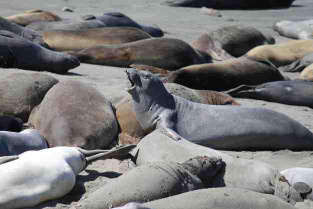
Point Piedras Blancas, about 5 miles north of San Simeon, has a colony of Elephant Seals. A few photos seemed in order.

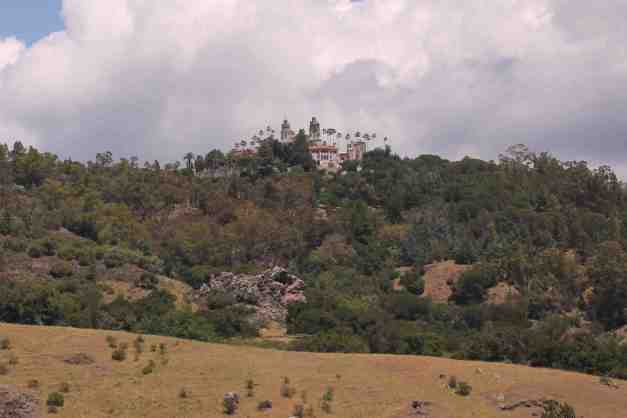
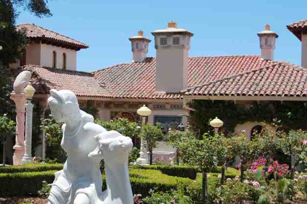
I also stopped at Hearst Castle for a tour. I arrived about an hour before my tour and put my tank bag and jacket in a locker. This was my first time visiting and I took the Great Rooms tour, as recommended. Besides the tour of the Hearst Castle, there is also a 40 minute movie shown at the Visitor’s Center that is included in the admission. Both were fun and it was worth the time.
The property is located about 1600 feet above the San Simeon coastline. You are transported from the State Park Visitor Center by bus with the others in your tour group.
You are dropped off at a very dramatic entrance …
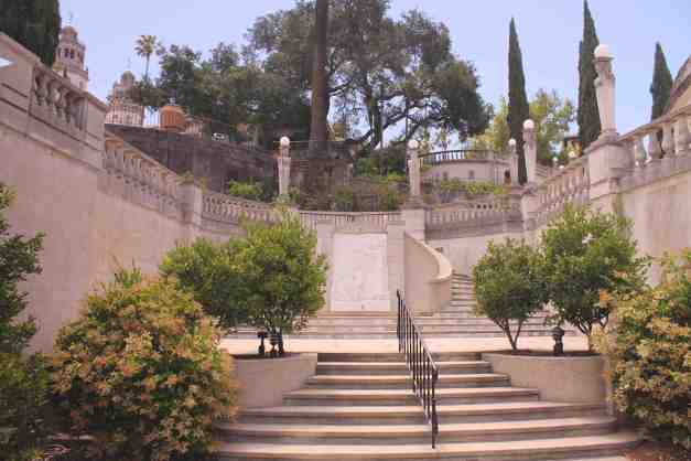
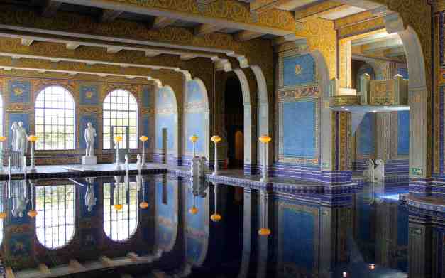
The Great Rooms we saw are in the main mansion, or the Casa Grande. Afterwards, you are free to walk around the immediate area to visit the Neptune Pool and the Indoor Roman Pool.
My impression was the building, largely constructed of reinforced concreate, was beautiful, though not my taste. It seems that Hearst collected “ceilings”, ornate doors, art, tapestries, etc. and somewhat designed the rooms around the art pieces.
The Neptune Pool was drained – I was totally bummed and adjusted my picture taking to try to emphasize other architecture instead.
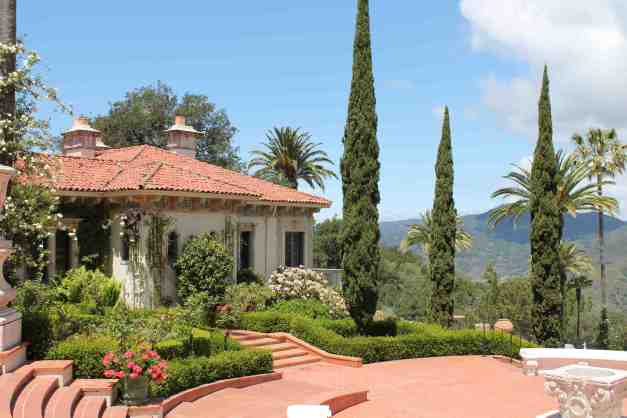
The indoor pool had water 🙂
By the time I finished with the tour, and the movie they show afterward, it was after 2pm. I was told while talking to a Captain for Southwest Airlines at the Whale Watcher Cafe to check out a deli called Sebatian’s in San Simeon. Unfortunately, they were closed on Mondays and Tuesdays.
I went in to Cambria and ate at the Main Street Grill instead. While parking, I met two other BMW riders. We ended up eating together. I do love how motorcyclists are open to meeting other riders. It makes travel very entertaining.
As I mentioned in an earlier post, my intention today was to travel to El Capitan, but as I type this, it is 6:30pm and I’m in Los Osos charging my laptop while catching up on the blog. I’ll be ‘moteling it’ in Pismo Beach tonight instead of camping.
Day 17 – Pismo Beach to Sunset Beach

Day’s distance: 236 miles
Total trip distance: 1,913 miles
The weather in the morning was cloudy and only in the high 50’s. Eventually, the sun came out and the temperature reached the high 70’s inland and high 60’s on the coast.
Just south of Pismo Beach, I found myself traveling through farm land and farm towns like Guadalupe. I past by the Lompoc Federal Penitentiary, an intimidating and depressing place shortly after a coffee break. Then I passed the main entrance to the Vandenberg Air Force Base. By then, the landscape changed again – hills and trees.
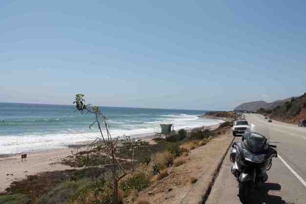
I detoured off the Pacific Coast Highway briefly to ride up towards Ojai on Hwy 150. I recommend this road. Higher speeds, twisties, good views, and smooth concrete.
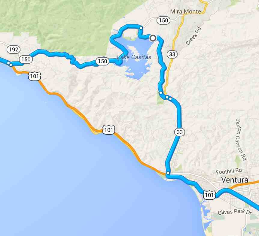

I traveled the Pacific Coast Highway the rest of the way …
passing Malibu, Pepperdine and Loyola Universities, and lots and lots of taco trucks 🙂 I stopped at this one for lunch – tacos al pastor!
Eventually, I made it through LA traffic to my destination, Sunset Beach. I did not lane split, though in California it is legal to do so.
Tomorrow, I arrive in San Diego and leave the Pacific Coast Highway to the travelers who will be vacationing this long weekend.
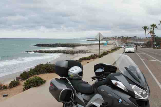
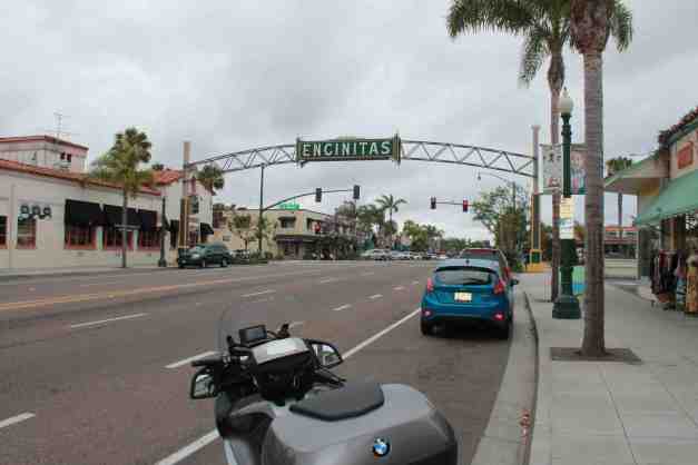
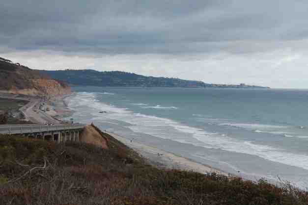
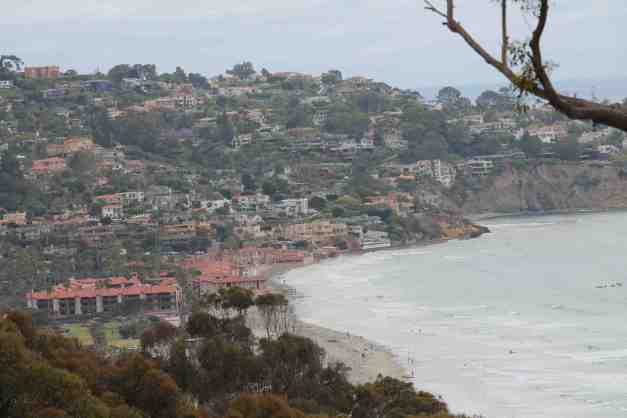
Day 18 – Sunset Beach to San Diego

Days distance: 101 miles
Total trip distance: 2,014 miles
The weather was cloudy all day with temperatures in the 60’s.
I stayed along the coast as much as possible today. It was interesting to compare coastal towns. Newport Beach, Laguna Beach, Encinitas, La Jolla. Some are more developed than others, but all have a common theme – long sandy beaches. This is not the rocky, heavily wooded coast of Big Sur and points north.
Travel plans from San Diego to Zion National Park are being solidified. I’ll have company on this next leg. If possible I will also be getting some service performed on the bike.
Stay tuned !!
Day 19 – San Diego

The weather was mostly cloudy and the temperature reached the 70’s.
I spent the day off the bike and on my feet, walking around Balboa Park.
Pizza at Hillcrest Brewing Company was awesome. We had a pizza with ham, pineapple, and Jalapeno spiced bacon! It seems my adventure in California is all about bacon pizza 🙂 We had some local craft beers, as well.
Day 20 – San Diego
This morning was spent on planning the next stage of what I’ve been calling the 2014 Western States Tour. There are some updates to the original route that I cover in detail below.
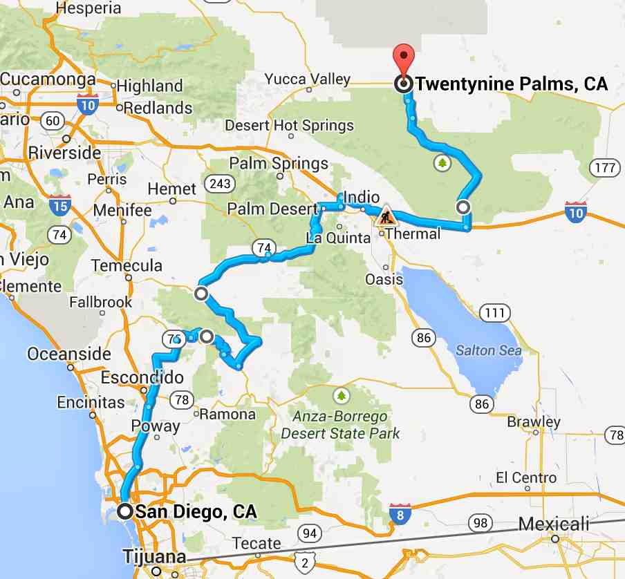
Tomorrow (Sunday), I will be leaving San Diego accompanied by my long-time friend Blake. For the curious, he rides a V-Strom 650. The plan is to travel up to the Palomar Observatory and then through Joshua Tree National Park on our way to an overnight stay in Twentynine Palms, CA, covering at least 240 miles. We are skipping Anza Borrego and Palm Springs in order to spend more time in southern Utah.
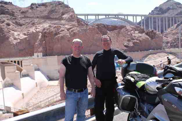
The second day with Blake will cover a trip through the Mojave National Preserve, a visit to the Hoover Dam, and either camping near Lake Mead or a stay in one of the old school “off the strip” motels like The Orleans, depending on how we feel at the time.
At this point, if we are tired of the 100 degree plus temperatures, and if Blake wants to continue moving away from San Diego, we will visit Bryce Canyon. Otherwise, staying in Zion is an option.
After finalizing the plan, we took the car down to La Jolla. Stopping first at Bird Rock Coffee Roasters for another latte …
then to the shore in La Jolla …
and then past some beautiful homes with lovely sculpted gardens, most with the seemingly requisite palm tree(s) and to the downtown area …
On our way back, we stopped at REI and then had fish tacos and fish stew at Oscar’s in Hillcrest. Yum !!
I’m going to wash the bike today and look it over closely before we depart in the morning. Tomorrow feels like the start of the next phase of my adventure – leaving the coast roads and heading northeast.
I sent a few things I was traveling with back home. The 50mm fixed lens for the camera and some other miscellaneous photo gear, redundant electric charging cords (I continue to carry USB cables for charging equipment), my battery cables, and a few small articles related to camping that I haven’t used and don’t expect to need now. This opens up room for carrying extra water and more food supplies, especially important as I leave the populated coast and enter a desert environment.
This afternoon, Blake and I rode the bikes down to a cycle shop in Chula Vista. I bought a replacement Chatterbox, the helmet bluetooth device that stopped working after the rain storm. After that, we went to the last exit on I-5 before the Mexico border so I could see the border. This was the first time to see this border in person.
We stopped at the Imperial Beach Pier …
and continued into Coronado and past the Hotel Coronado.
We crossed over the Coronado Bridge back to San Diego. This bridge reaches 200 feet over the water to allow for Naval vessels to travel underneath. Pretty intimidating to drive over if you happen to look anywhere but the road in front of you 🙂
Day 21 – San Diego to Twentynine Palms

Day’s distance: 240 miles
Total trip distance: 2,303 miles
The weather was sunny everywhere. The temperatures varied but reached 103 at one point.
I had a pleasurable ride today. But, I’m clearly not on the coast anymore.
The road up to the Palomar Observatory was fun once we got off the roads from San Diego and onto Palomar Mountain. Nice and twisty, fairly good road surface most of the time, and very little debris. And the view did not suck.
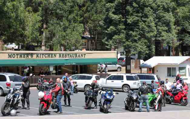
There were a lot of sport bike riders out today. This mountain road is clearly a favorite. We stopped at Mother’s Kitchen Restaurant, another clear favorite 🙂
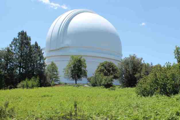
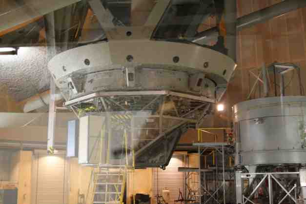
After breakfast, we stopped at the observatory where there is, among other telescopes, a 200 inch reflecting telescope. At the time it was placed into service (1949) it was the largest in the world.
Crossing between Palomar Mountain and the Santa Rosa – San Jacinto Mountains was our first taste of how hot the day was going to be as the temperature climbed to 96 degrees.
Passing through what I think is referred to as the Anza Valley, we climbed again, along Hwy 74. The roads were not too crowded given it’s a holiday weekend and, again, the view was beautiful. We stopped at a vista point to check out the sprawl that is Palm Desert, Mission Hills, and Indio.
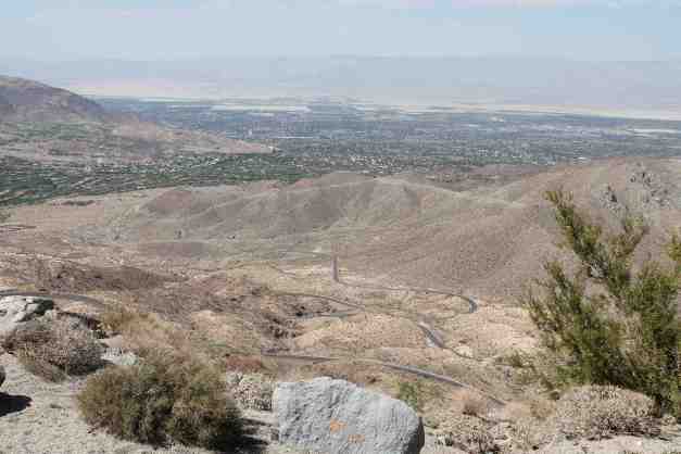
Note the switchbacks that were yet to come.
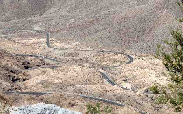
Here’s a video of the descent from the viewpoint through the switchbacks and into Palm Desert.
The temperature here reached 103 degrees. I kept cool by wetting the sleeves and neck of my LD Comfort base layer clothing. With a fabric jacket, versus a mesh one, the moisture created a cool environment inside that was effective at keeping me cool. I would adjust the height of my wind screen and could feel the cooling effect being impacted. Then it was a matter of maintaining a ‘sweet spot’.
We drove east through Palm Desert to get to Joshua Tree National Park. It was Blake’s first visit and our other major destination today.
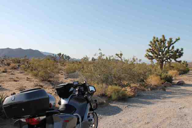
We are staying in the Best Western – Gardens motel in Twentynine Palms tonight. Nice pool open late and a big group of German motorcyclists who were traveling west on Route 66.
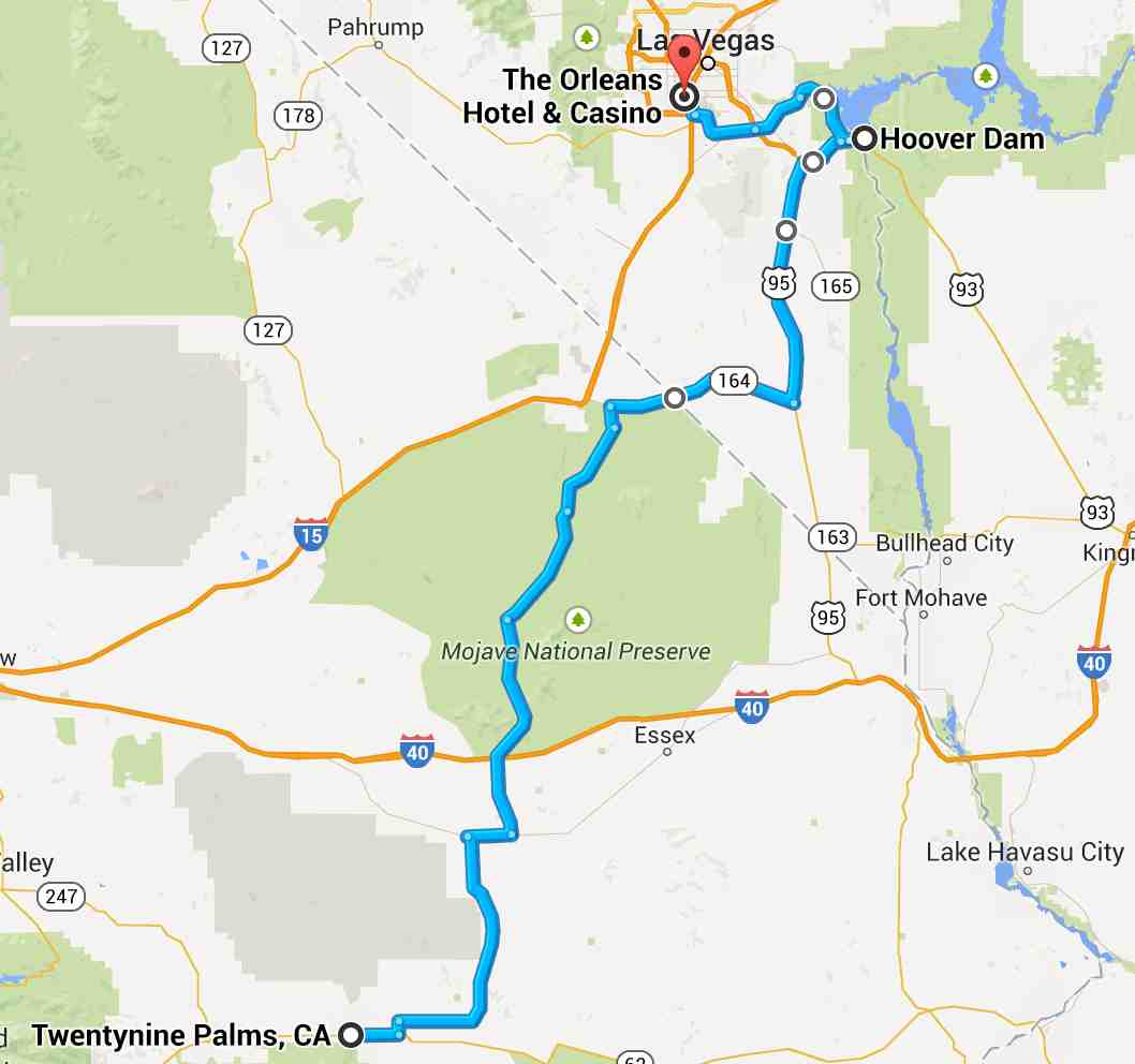
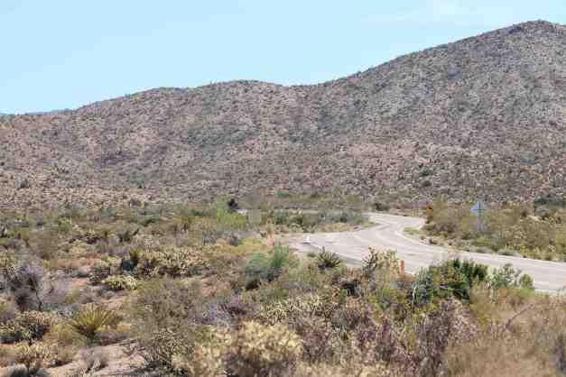
Day 22 – Twentynine Palms to Las Vegas

Day’s mileage: 240 miles (est)
Total Trip mileage: 2543 miles (est)
The weather was sunny and temperatures reached a high of 109 degrees. Hot !!
Blake and I departed Twentynine Palms at 8am when the temperature was still comfortable. Our route passed through the Mojave National Preserve.
Interestingly, at the higher elevations of the preserve, this area had more Joshua Trees than we saw in Joshua Tree National Park as well as other similar plant life.
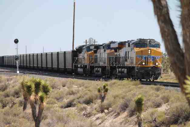
We stopped to check out the museum at Kelso.
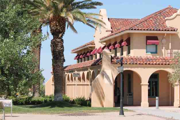
The Kelso Lunch Room was closed until further notice so we moved on after watching an interesting documentary film on Kelso’s history. The documentary mentioned the variety of animal life, and the importance of the railroad in the development of this area.
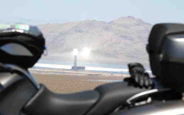
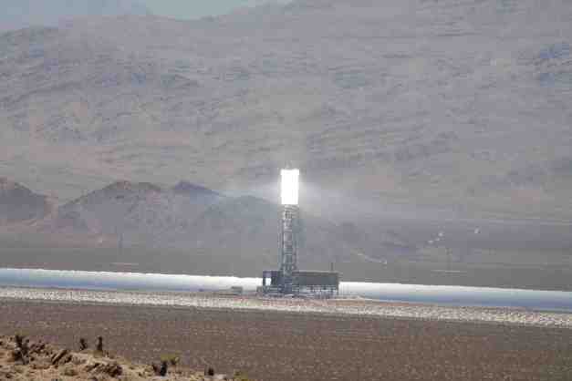
We traveled briefly along Interstate 15. At the Hwy 164 turnoff, we were able to see (in the distance) the Ivanpah Solar Project. There are three solar collectors in operation at this time. Below is one of them.
We ate lunch at the Whistlestop Cafe in Nipton, CA, along Hwy 164. It was really good homemade food. Definitely recommended if you’re in the area. And yes, it was cool inside. 🙂

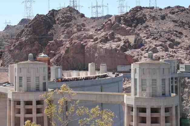
Our next stop was the Hoover Dam. Of course, it was Memorial Day and the place was crowded. Combined with the highest temperatures of the day, reaching 109, we didn’t stay to do the tourist things.
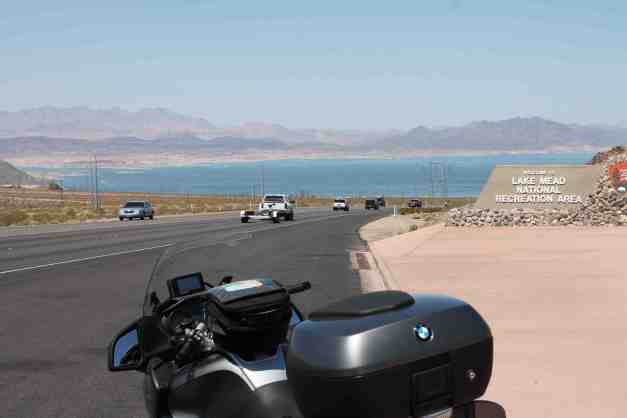
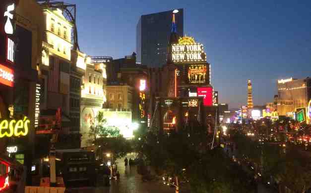
We decided not to camp at Lake Mead the day before when we looked at the weather report and instead went into Las Vegas. We’re staying at the Tropicana for two days.
Day 23 – Las Vegas
Days distance: 20 miles
Total trip distance: 2,577 miles
The weather continues to be sunny and hot. Temperatures hit 109 degrees.
I had a lazy morning. First, I went to Starbucks for a latte and to use the wifi from a nearby restaurant. Wifi in the room at the Tropicana is severely lame – only allowing 1MB of data transfer per day! I did find a spot in the reception area with unlimited usage, tipped off by one of the hotel staff 🙂 I’m using it now to update the blog.
About noon, I took the bike in to BMW of Las Vegas. It got new Michelin Pilot Road 4 tires and an oil change. The front OEM tire was wearing unevenly and needed replacement while the back tire likely had some life remaining, but I replaced both. I should be good for the remainder of the trip, at least for tires.
After returning to the hotel, I spent time lounging about the pool. After the sun went down, Blake and I wandered around and I took some video and still photos with the phone.
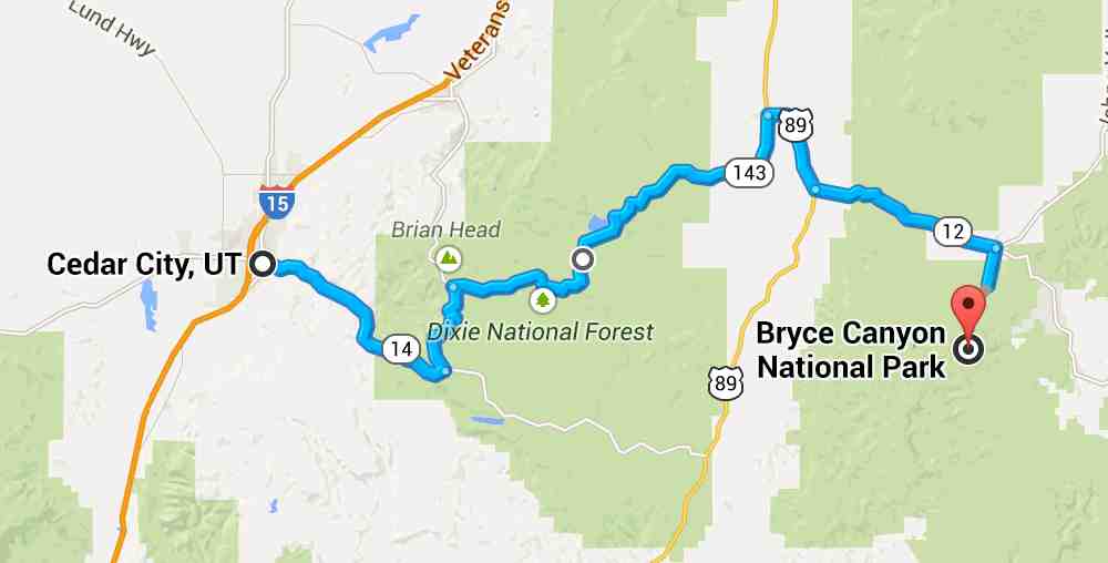
Because of the high temperatures, camping at Zion is not really an option. I will be modifying my route tomorrow and head to Cedar City, stopping to check out Kolob Canyon.
I will stay in the Best Western motel in Cedar City and get restocked to camp in Bryce and beyond in the coming days. It should be cooler than it has been in Vegas.
Day 24 – Las Vegas to Cedar City

Day’s distance: 198 miles
Total trip distance: 2,775 miles
The weather in Vegas was clear and hot. However, Cedar City was partly cloudy. The temperature was in the high 80’s.
Blake returned to San Diego today as I continued to Cedar City. We both left Las Vegas early to avoid the worst of the heat responsible for our change in plans (discussed in yesterday’s post).
I stopped in Mesquite, NV for breakfast and fuel. This was my only stop until reaching Kolob Canyons, part of the Zion National Park. There was some road construction in Arizona, but once in Utah, the travel was fast with a speed limit of 80 MPH. The bike road smooth with the new tires and I took advantage of the cruise control throughout the day.
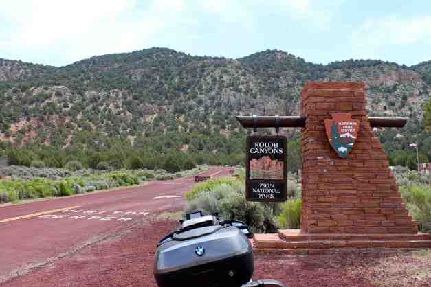
The 5 mile road takes travelers through the canyons, which are incredibly scenic. It ends at a viewpoint directly in front of several formations.
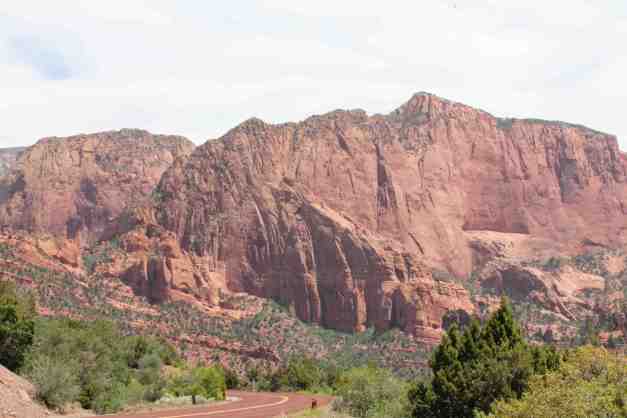

Here are some additional photos in the form of a video.
I had lunch at the Centro Woodfired Pizzeria just around the corner from the motel. Dinner was at Rusty’s Ranch House where I enjoyed a really tender and well prepared Filet Mignon.
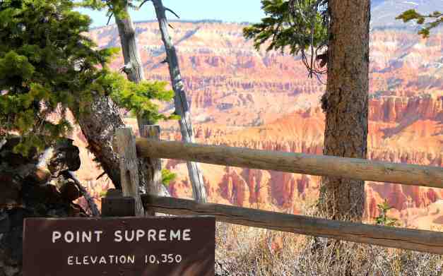
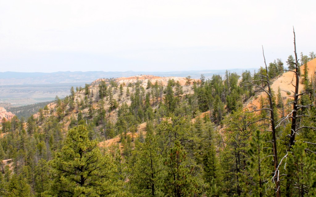
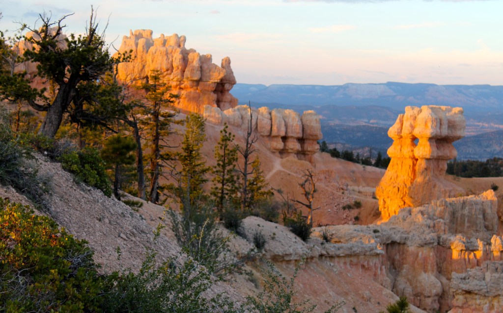
Day 25 – Cedar City to Bryce Canyon National Park
Days distance: 89 miles
Total trip distance: 2,859 miles
The weather was mostly sunny and the temperatures comfortable and varied. Low was 50 and the high was about 80.
I wanted to arrive at the Bryce Canyon National Park relatively early as I didn’t have reservations. So today was a low mileage day by design.
I left Cedar City shortly after 7am, filled with some breakfast, coffee, and gas for the bike. I climbed up Hwy 14 quickly, leaving the small town behind and below.
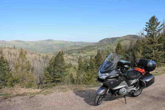
My route today took me past the Cedar Breaks National Monument at an altitude of more than 10,000 ft. The bike was closet to snow than ever before – last winter’s remaining pockets of snow were lining the side of the road. The canyon, or natural amphitheater was amazing!
I headed into Panguitch from there. The roads were scenic the whole way to this small town.

Panguitch is my housemate Carson’s birth place. Very small, very quaint – he calls it Mayberry but I think Mayberry may be bigger if it were a real place. I stopped there for coffee and a donut. Carson told me that anyone over the age of 45 would know him, but I didn’t have a chance to strike up a conversation while there.
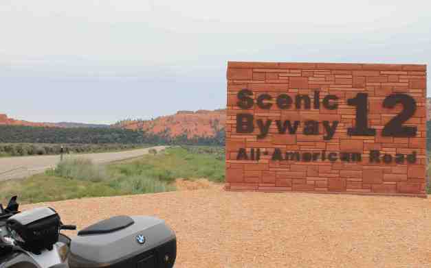
I took Hwy 12 to Bryce and will continue on this scenic road tomorrow.
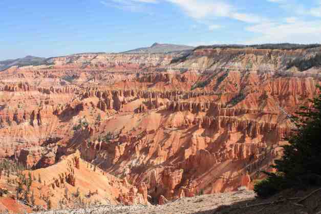
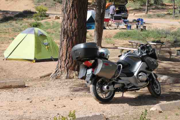
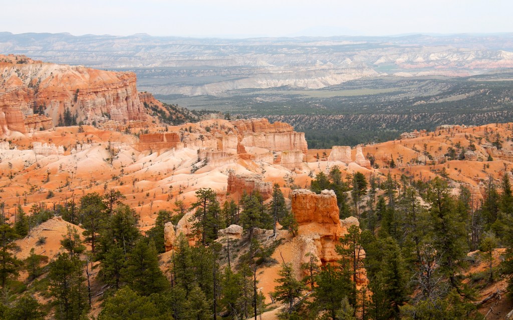
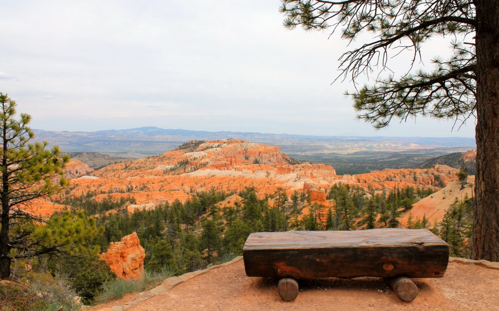
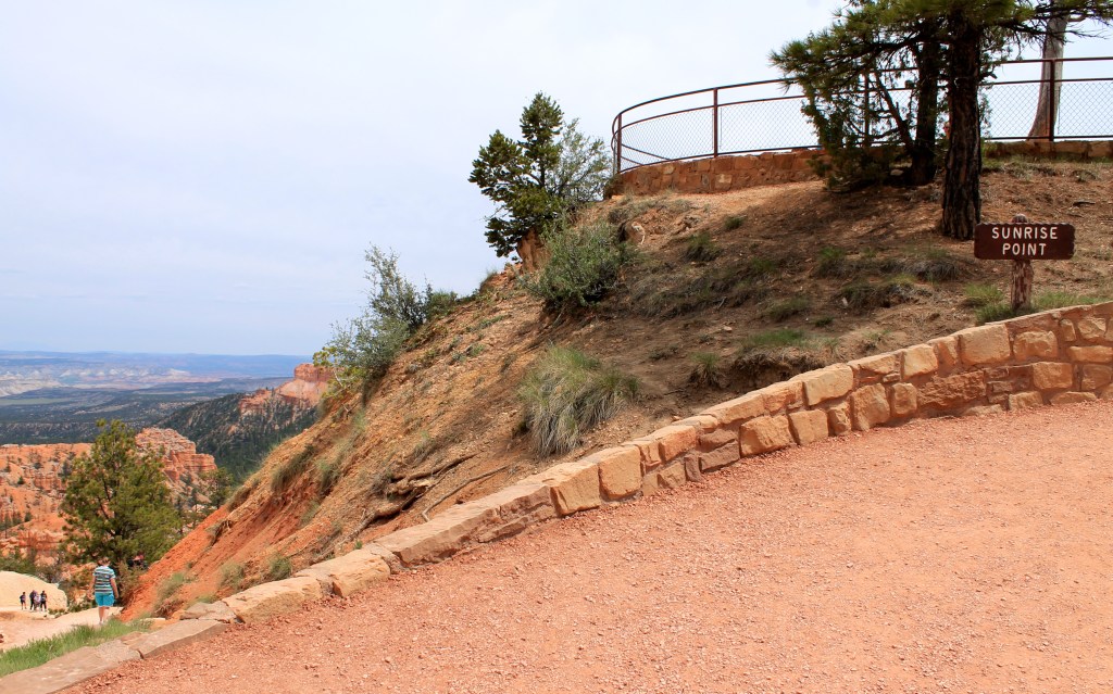
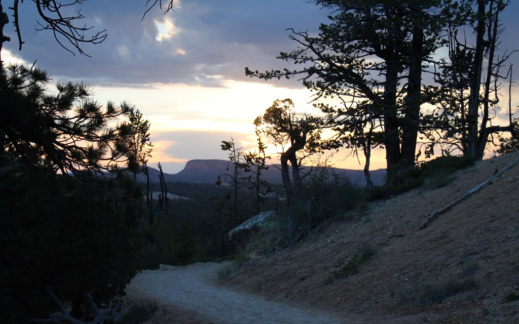
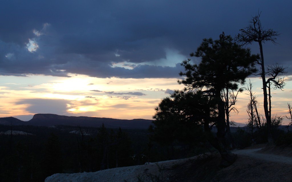
Arriving at Bryce, I found the Sunset Campground had already filled up but I secured a spot in the North Campground. All spots were taken by the time I filled out my registration and set up my tent.
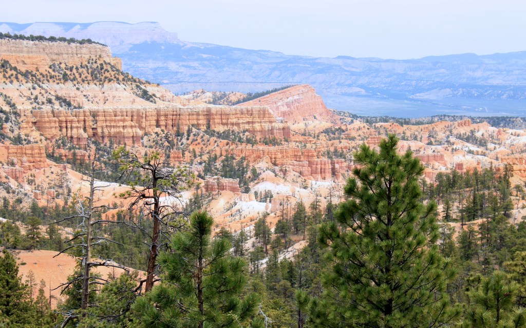
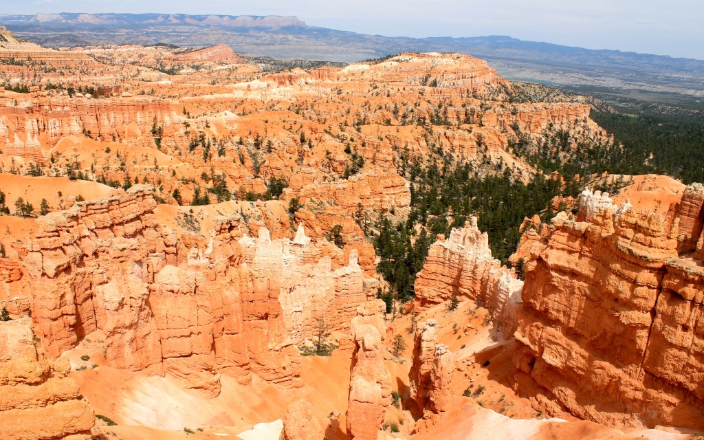
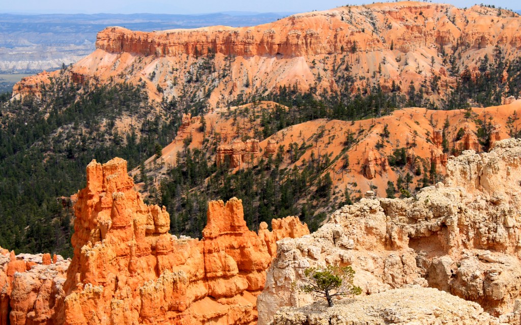
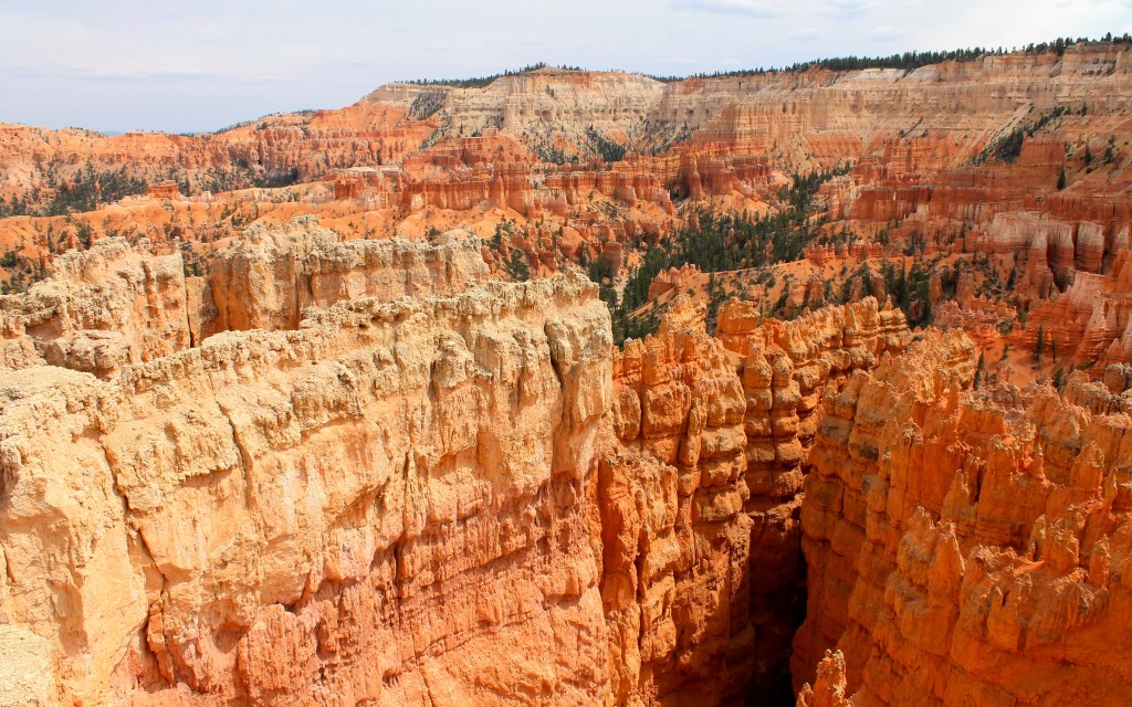
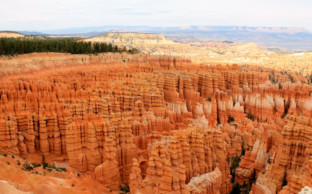
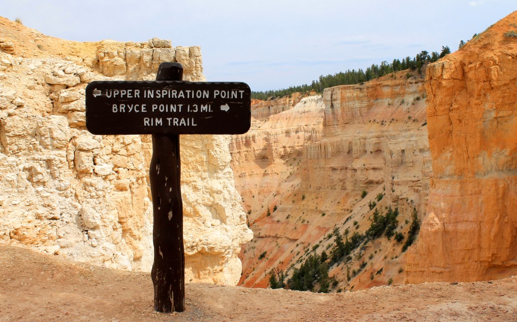
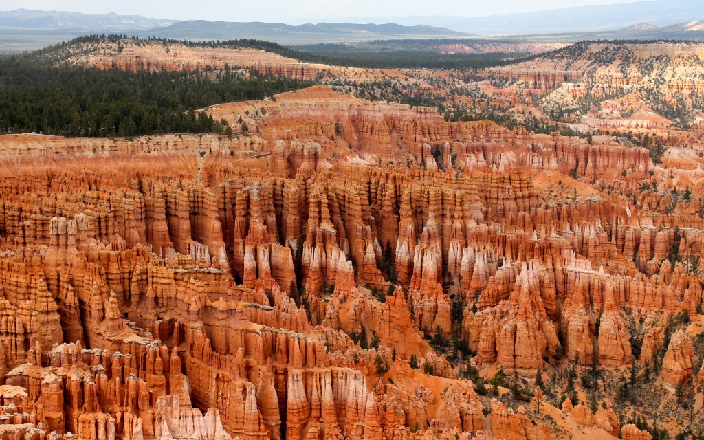
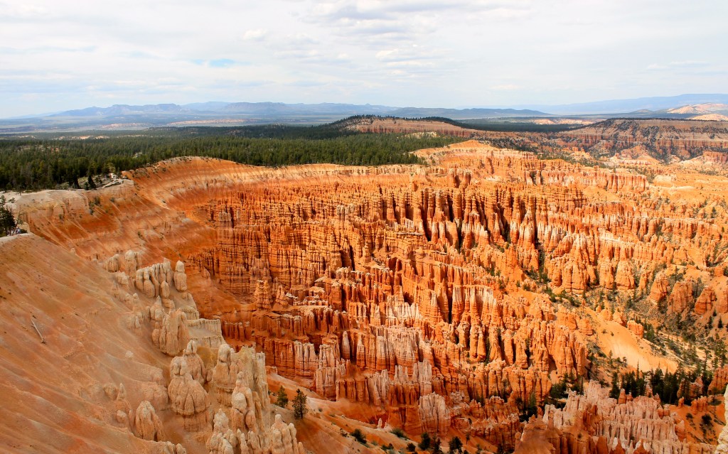
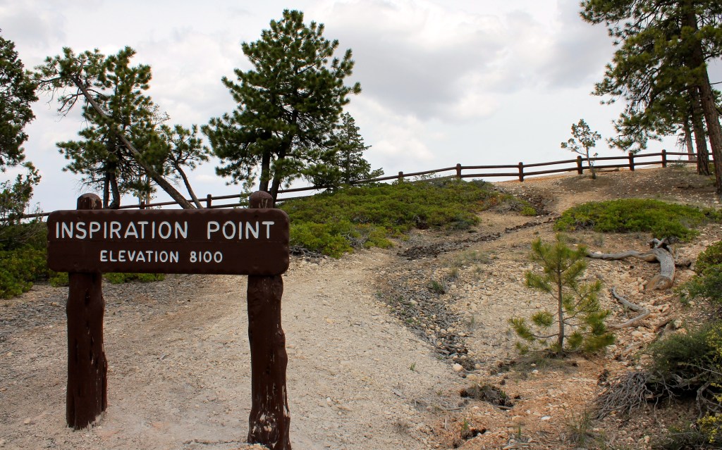
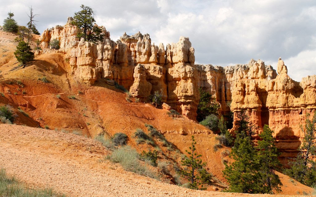
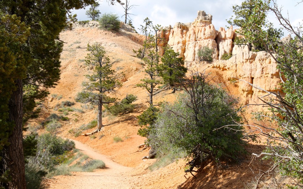
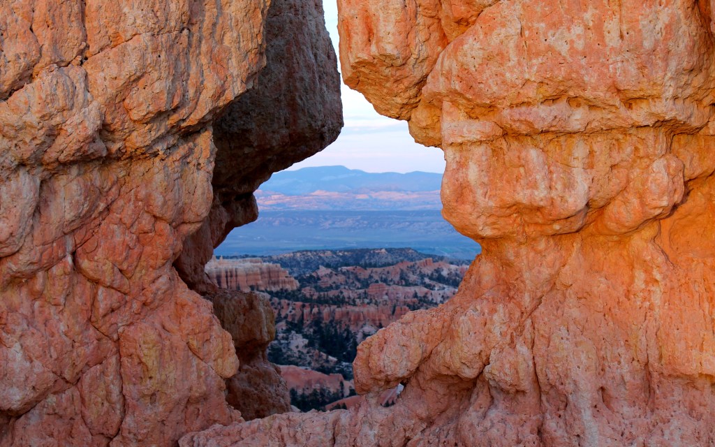
Bryce was beautiful. I’ll post more photos later when I have time to organize them. He’s just one, taken from Inspiration Point, one of the overlooks inside the park. I hiked much of the Rim Trail during the afternoon and evening.

Here’s a slide show of shots from Bryce Canyon.


Day 26 – Bryce Canyon National Park to Blanding
Day’s distance: 316 miles
Total trip distance: 3,175 miles
The weather varied. The morning was clear and sunny. About lunch time, I encountered just a bit of rain from a passing storm, having missed the worst of it. As the afternoon progressed, it was mostly sunny with high fluffy clouds. The temperature when I woke up was 41 degrees, but later it was in the low 90’s.
I started the day with an early breakfast at the Bryce Canyon Lodge dining room. I was curious about the of the lodge and wanted a chance to see the rustic design on the inside. It was striking.
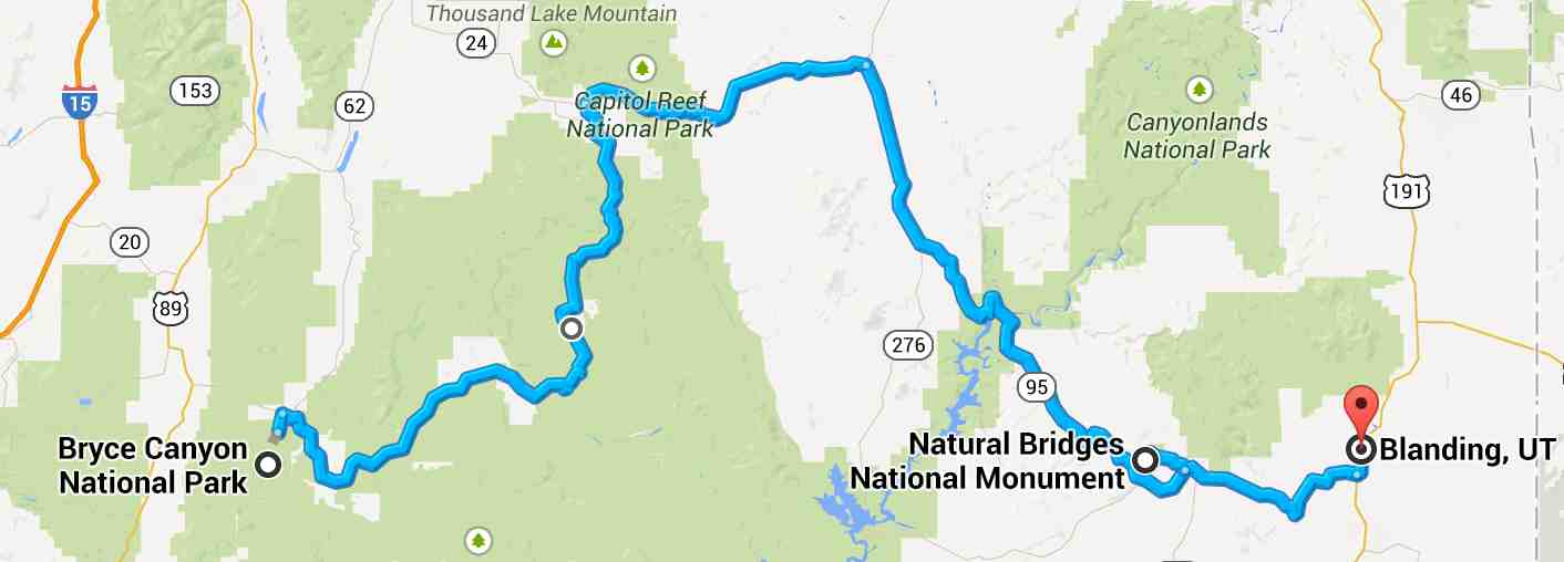
It was recommended that I travel all of Hwy 12. So at 8am, I began to finish what I started the day before. I was not disappointed at all by the scenery and experience. Thanks, Roman!
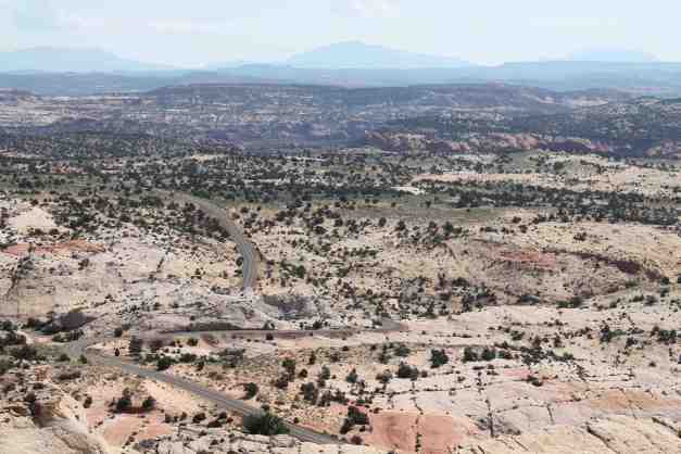
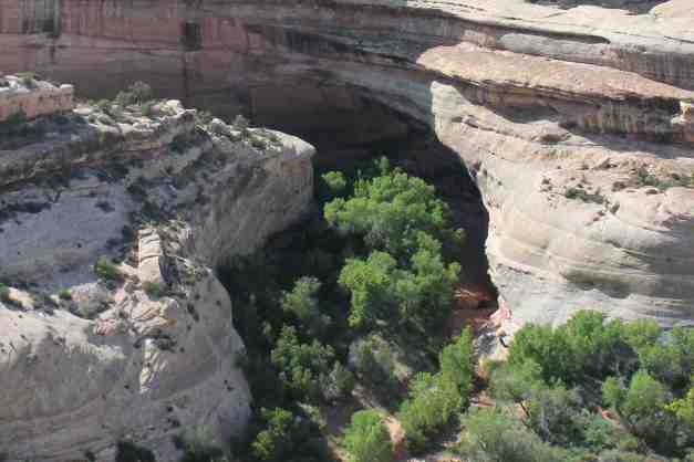
Just when I thought I’ve seen the best, I came to the Hogsback section. Seen from the air (source) …
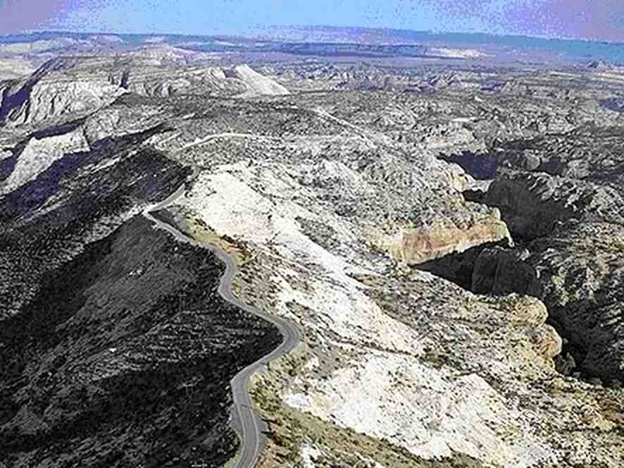
and seen from my helmet …
With my destination, Natural Bridges National Monument still far away, and counting on first-come, first-served camping again, I needed to hustle a bit.
The scenery changed throughout the day, as you might imagine from this satellite version of the day’s route. I ran into my first rain on this stage of the trip. I skirted a rain storm, only minimally impacted. It was lunch time and I was just pulling into Torrey to grab a sandwich.

Alas, upon arriving at Natural Bridges, the campground was full. I rode around Bridge View Drive, the park’s scenic road loop and captured a photo of the Sipapu and Kachina natural bridges.

The trails to the bridges were relatively short but I wanted to get to Blanding, my backup if the campsite was full.
The motel told me there was only one family run restaurant in town.
When I arrived at the Homestead Steak House, it was packed, with both travelers and locals. I had Chicken Fried Chicken with mash potatoes and gravy. I was needing some comfort type of food and it fit the bill.
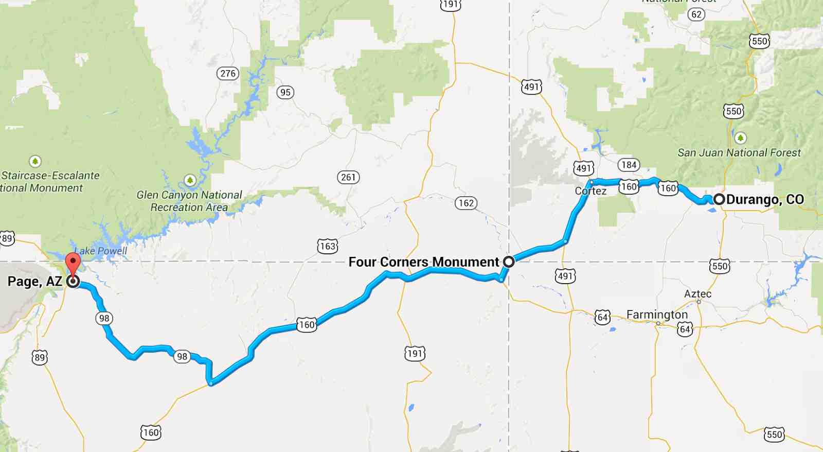
Day 27 – Blanding to Durango

Day’s distance: 263 miles
Total trip distance: 3,438 miles
The weather was partly cloudy to sunny, depending on where I was. Temperatures at lower elevations were in the low 80’s and dropped to low 60’s in the San Juan National Forest near the summit.
I did not get an early start today, leaving the motel in Blanding at 9:30 and stopping for gas in town. I was searching for camping acommodations in Durango before leaving the motel and its wi-fi.
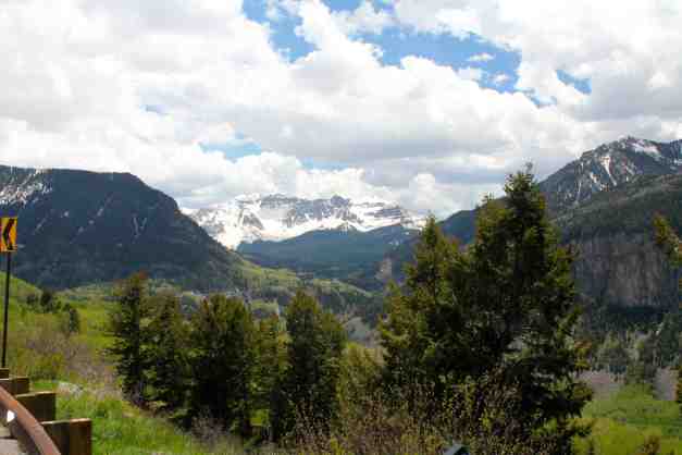
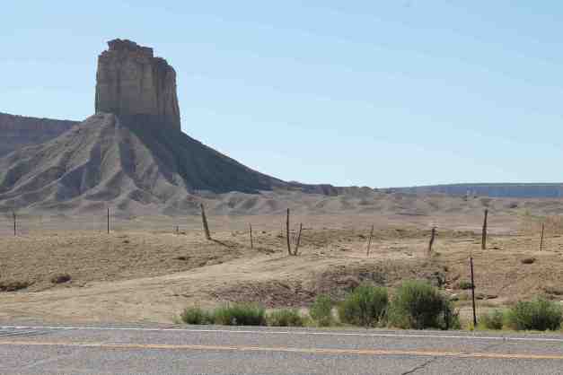
My intention today was to ride on the “Million Dollar Highway”, aka Hwy 550. However, I found out that Hwy 550 is currently closed south of Ouray Monday through Saturday with the exception of one hour at midday, due to a rock slide. I decided to ride along Hwy 145 instead. Both go through the San Juan National Forest. While I may get another chance to ride the Million Dollar Highway at a later point in my trip, I wanted to ride through the San Juan National Forest today in case another opportunity doesn’t present itself.
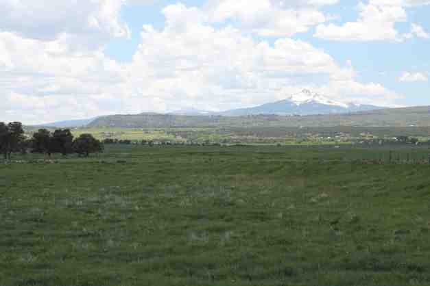
I didn’t stop often until I reached Norwood. I was able to make up some time this way. The landscape once I crossed into Colorado was farmland and rolling hills, but with the San Juan NF mountains in the background.
The highlight of today began once I turned onto Highway 145.
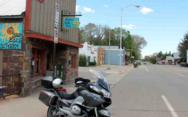
I stopped at the Happy Belly Deli in Norwood, just before noon, and had a delicious egg scramble and a tall latte. I highly recommend this place should you be in the vicinity.
While eating and talking to Carson, I made reservations for Monday night to camp at Mather Campground in the Grand Canyon. I’ll stay or near Page Sunday.
I passed the turnoff for Teluride and saw some amazing mountains and alpine meadows filled with flowers.
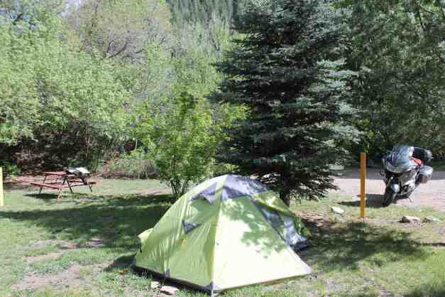
I set up camp at the Lightner Creek Campground outside Durango,
and went into town for dinner.
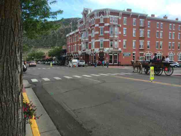
I snapped this photo with the phone on Main Street. The horse drawn carriages are pulling up to the Strator Hotel, a working historic luxury hotel.
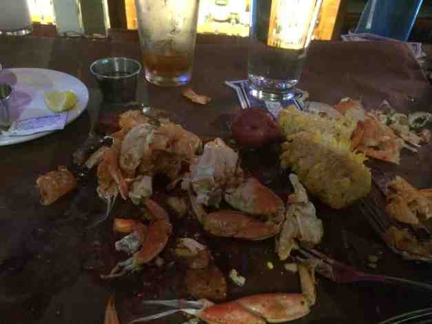
I had a second amazing meal today at Steamworks, on 2nd.
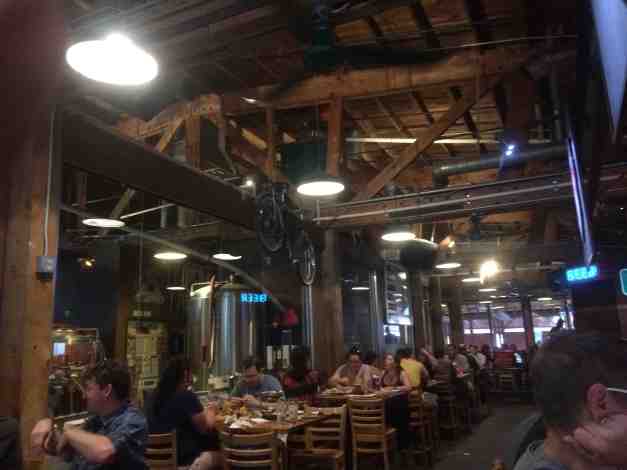
I ordered the Cajun Boil. It was lobster, shrimp, sausage, potatoes, corn all cooked in cajun spices and served on a big sheet of waxed paper. It was a mess to eat and very very good.
I ate at the bar to avoid waiting for a table. The guy sitting next to me was the retired Dean of Students at the University of California Santa Cruz. I moved to Seattle from Santa Cruz. We agreed it is a small world.
I was stuffed and happy as can be. Here’s a shot of the remains … LOL
Today was a good day, with lots of good food and scenery. I live a charmed life 🙂
Day 28 – Durango to Page
Day’s distance: 291 miles
Total trip distance: 3,729 miles
The weather was clear and sunny all day. Temperatures started in the 30’s this morning and finished at 96 in Page.
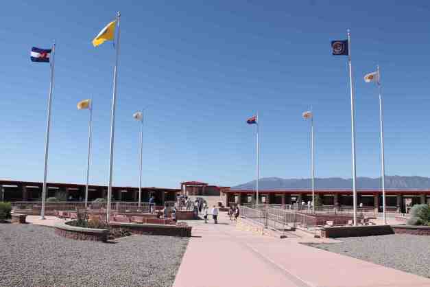
Today marks the end of four weeks on the road! I travelled west, circling back towards the Grand Canyon. It was desert, for sure.
Because it felt familiar, and because I was traveling west instead of east, I felt that I was not making ‘progress’ – that somehow, I was not ‘on track’ with my journey. Of course, that’s not true and I felt better after some activities were accomplished today.
I stopped at Four Corners Monument. It is a point on a map where Utah, Colorado, New Mexico and Arizona meet.

After this, I hustled to Page and checked in to my motel. It was 1 o’clock, local time. I actually thought it was 2pm and welcomed the extra hour.
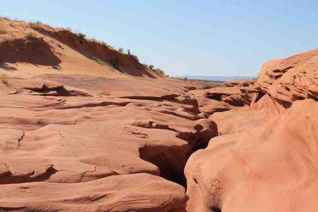
It was suggested that I check out Antelope Canyon and this was first on my to-do list. My first call was to a tour group advertised by the motel. They were fully booked out for the next three days. I saw the turnoff to the tour site on my way into town, so I decided to just head out there to see if I can join a tour.
The turn off onto the site was gravel that quickly turned into loose and deep sand. I barely managed to keep the bike upright and made it to the parking lot where I got stuck trying to park. Pulling the bike out of the sand, I parked it on safer gravel section. Ugh. I was hoping this would be worth it.
There is a site admission fee and a tour fee – $28 total. Everyone is escorted by a guide. We start at the far end and climb down some steep stairs to get down into the canyon.
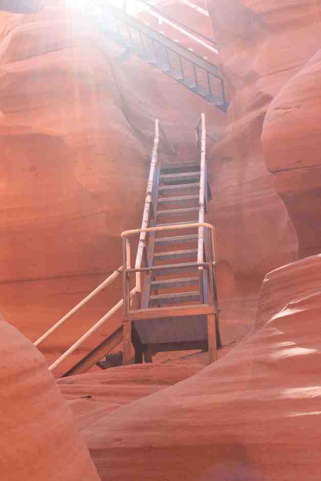
Once inside the canyon, my mood quickly mellowed. The serenity and beauty of the place replaced my frustration and the cool temperatures replaced the 96 degree heat above.
The water flowing through these canyons depositing different minerals together with the natural light from above creates amazing colors and patterns.
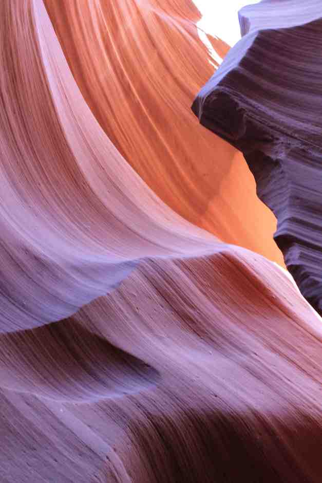
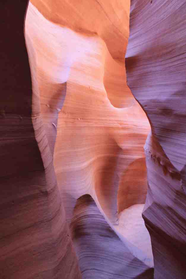
At the end of the tour, we come back up. Looking back, you wouldn’t know it was something special. Totally worth it 🙂 Thanks for the suggestion, Liam!
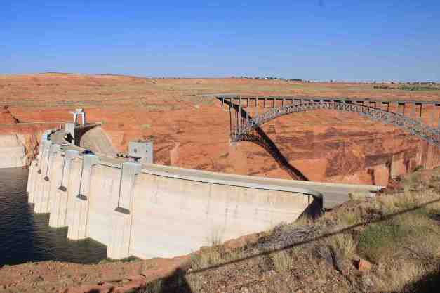
I went from here to the Glen Canyon Dam.
I used my National Parks Pass to get onto Lake Shore Drive, a road into Lake Powell’s recreational areas ….

including the Wahweep Beach area. I jumped into the lake for a swim.
On my way back to the motel, I picked up some BBQ and ate it by the pool. It was still hot so I swam again. Best thing ever in the heat!
Day 29 – Page to Grand Canyon Village
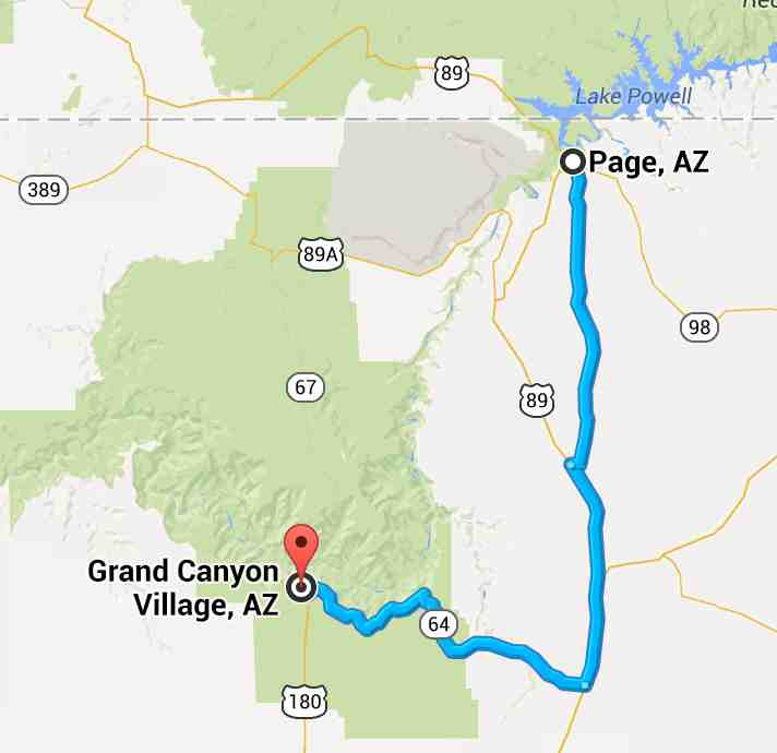
Day’s distance: 133 miles
Total trip distance: 3,862 miles
The weather was warm and sunny. High temperatures in Flagstaff were mid-80’s.
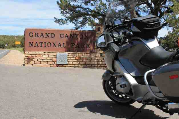
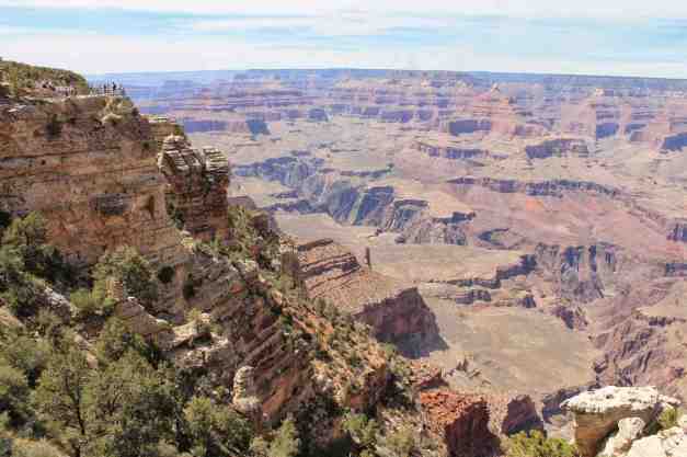
Today’s big destination was the Grand Canyon. Staying in Page gave me a nice short ride so that I could spend the most time in the Canyon rather than on the bike.
I arrived at the East Entrance about 11:45 am.
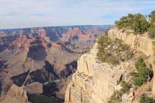
The views were amazing …
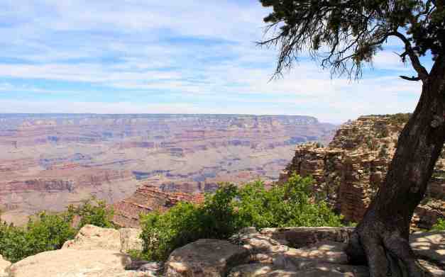
I camped at Mather Campground. There are hundreds of sites in the Mather Campground but I didn’t feel crowded at all.
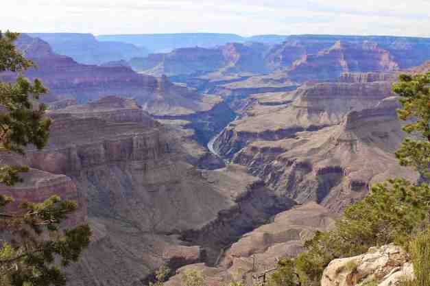
After taking a shuttle to the Visitors Center, I went to Mather Point, just a five minute walk away.
Later in the day, I took a shuttle bus to Pima Point, where I spent some time people watching and taking photos. The Colorado River was visible from several points at the overlook.
Sunset came quickly and was gorgeous. I could not help but post a few pictures of that !!
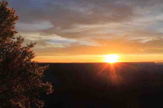
In planning my trip, I was reticent to stay at the Grand Canyon because of I had an expectation of huge crowds everywhere. But it was actually pretty easy to find less crowded space to be with my surroundings. The camp site was, with my National Parks Pass discount, only $9 – by far the cheapest I’ve paid on my trip. It was totally worth stopping for the day and camping overnight.
Day 30 – Grand Canyon Village to Flagstaff

Days distance: 100 miles
Total trip distance: 3,962 miles
The weather was partly cloudy, keeping temperatures in the 70’s in the Canyon this morning and the mid 80’s in Flagstaff. It was the first morning after sleeping in the tent without dew on the inside of the tent cover.
One of the fun aspects of traveling is having people approach me and tell me their travel stories. This happened today as I was packing up the bike. A swede who was in his 70’s told me about some of his BMW motorcycle travels as a youth. He had taken his Beemer to the Arctic Circle, through Europe, America and Mexico. In Mexico, he crashed twice. After that, the motorcycle only ran on one cylinder and had to be pushed started. He was always running out of money and finding ways to continue his travel until he eventually gave up riding. While getting coffee at the Visitor’s Center, the folks who parked next to me were from Mt. Vernon, Washington and saw my license plate and had to ask about my travels.
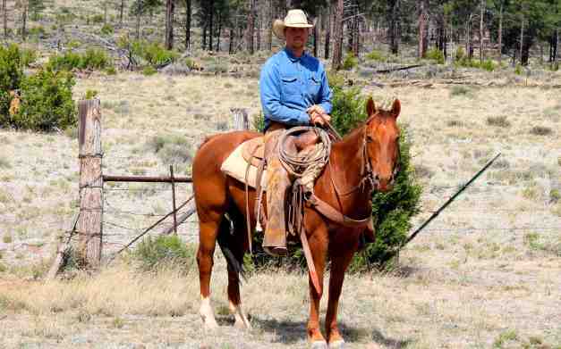
Despite these delays, I was on the road by 8:30. After turning onto Hwy 180, the scenery turned into pine forests.
A cowboy rode by at the same time I took the picture above, and he allowed me to photograph him on his horse.
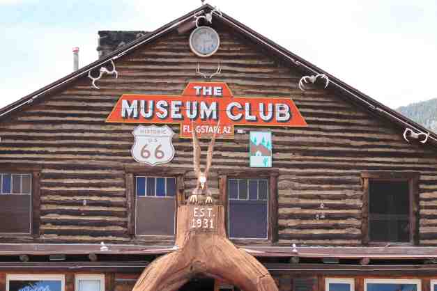
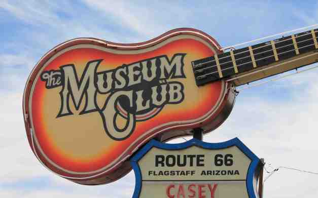
I’m staying with friends in Flagstaff for the night. We went into town to pick up preparations for BBQ. We stopped downtown for coffee after taking a peek inside the Museum Club. The Museum Club is an old school road house. Musicians on their way to Vegas or LA will often stop to play here. This was the first of my Route 66 historical stops. Way cool.
My route during the next few days has changed a bit. I’m paring down the stops to both get through the hotter areas more quickly but also to get to Oklahoma City by Saturday afternoon.
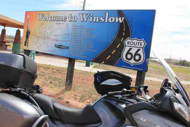
Day 31 – Flagstaff to Winslow

Day’s distance: 276 miles
Total trip distance: 4,238 miles
The weather was mostly sunny. High clouds formed later this afternoon providing some welcome relief from the glare. Temperatures ranged today from mid 80’s to mid 90’s, depending on elevation.
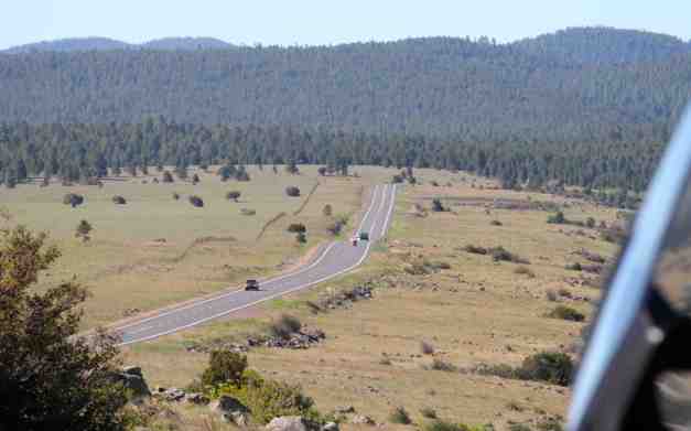
As mentioned, I shortened my plans to get to Oklahoma City by Saturday afternoon. Today’s ride started out much like a scenic Sunday drive with 55 MPH speed limits and nice roads.
I saw what I think was a coyote dash across the road, a deer on the side of the road (it didn’t cross the road after seeing me), and the largest road kill I’ve ever seen (an elk).
The ride took me through forests and grass lands.
Arriving in Winslow, having gone the long way to get here.
I checked in, had a shower, and a drink at the bar.
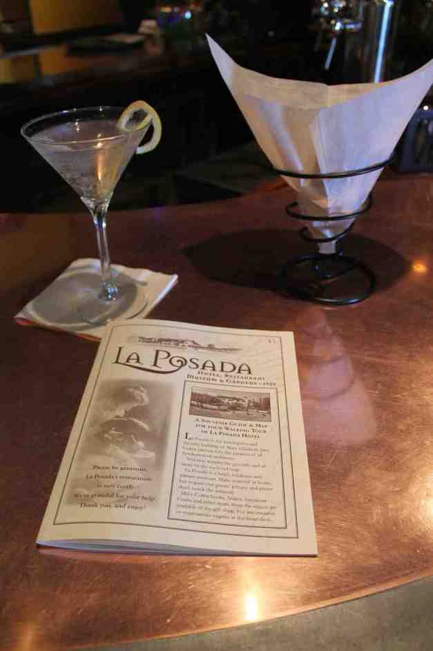
There is a self-guided tour that takes visitors around the grounds and interior of the hotel. Some photos from that tour …
and one of the pretty sunset.
Dinner at the hotel was most excellent. I had stuffed squash blossoms as an appetizer. Then I ordered black bean and cream corn soup with an entree of fried quail, elk medallion, and a wild boar / bison / elk tamale. I had a baked chocolate souffle for dessert.
Day 32 – Winslow to Santa Fe

Day’s mileage: 344 miles
Total trip mileage: 4,582 miles
Today’s weather was sunny and warm. Temperatures started in the mid 70’s and hit 100 before reaching Santa Fe, where is was a bit cooler.
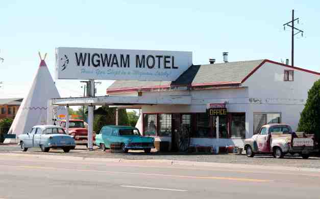
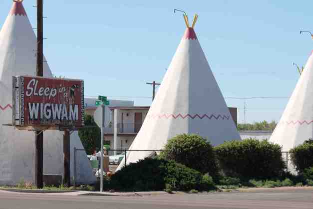
The ride today was along Interstate 40. I stopped in Holbrook to check out the Wigwam Motel, mentioned in my Route 66 literature.
A bit further down the road, I stopped at the entrance to the Petrified Forest National Park. I like to try to photograph the bike with the park’s signs, but today I was able to get a photograph with the Ms National Classic Route 66 Beauty Queen, Monica Burrola.
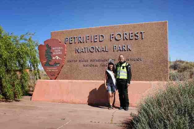
Here’s the backstory.
I was pulling up to the park and saw two folks taking pictures in front of the sign. Their car was in the way of my planned shot, so I just waited. The photographer walked up to me to ask if I wanted a picture with his friend. I really didn’t know what was going on and hesitated, thinking to myself why is this guy asking me to pose with this woman. I told him I just usually take a picture of my motorcycle in front of these signs. He looked at me like I was missing out and kind of pathetic.
After Gary, the photographer, explained that Monica was the Ms National Classic Route 66 Beauty Queen and that they were promoting an upcoming Route 66 event, I thought how lucky I was to get this chance. So instead of another bike shot, you all get this 🙂
Monica was really nice and asked about my trip, wishing me safe travels as they departed the park.
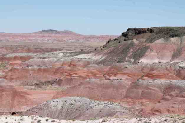
After the photo, I went into the park to look around. I got a few shots of the Painted Desert. I liked this panorama shot the best 🙂

Here’s a more traditionally formatted photo.
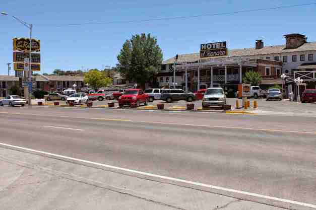
Hotel el Rancho is another Route 66 landmark, located in the historic portion of Gallup, NM. Gallup is located about another 30 miles east. It marks my passage into New Mexico.
I arrived at the Hotel Santa Fe about 5:15pm local time. I lost an hour because of Arizona’s refusal to change to daylight savings time when the rest of the country does so. Get with the program, people !!
Despite losing an hour, I was able to get cleaned up and have a glass of wine before my massage. Yes, with help from my friends in Flagstaff, and their friend here at the hotel, I was able to get a discount on my room, an upgraded room, half off on my massage, and a free breakfast.
I have really enjoyed splurging on myself the last few days. Thanks to all who helped !!!
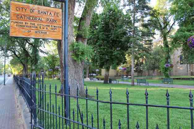
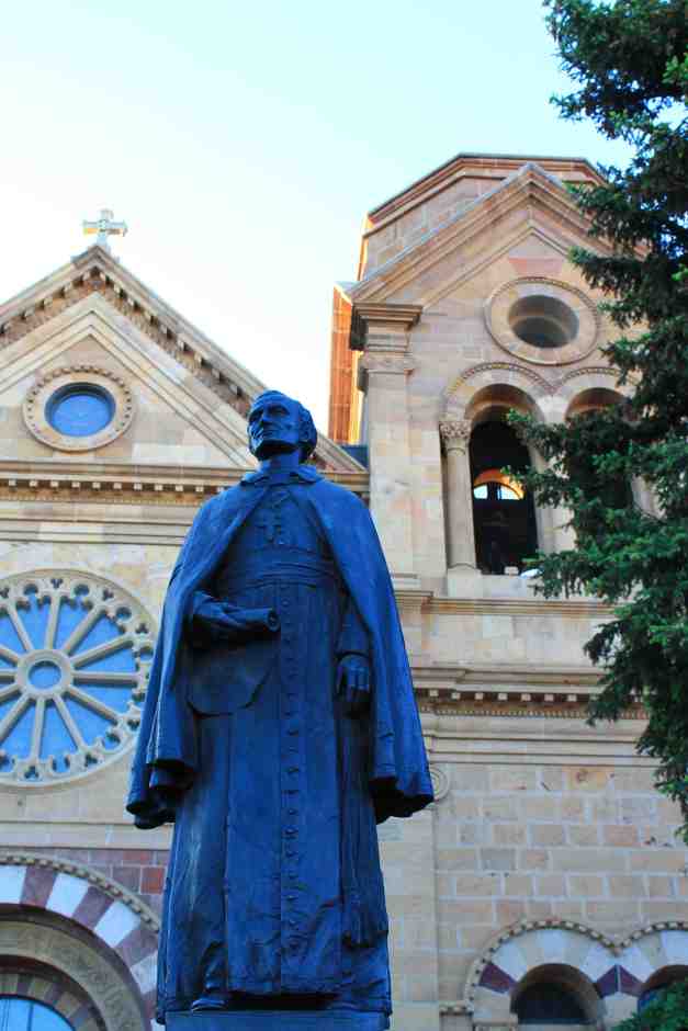
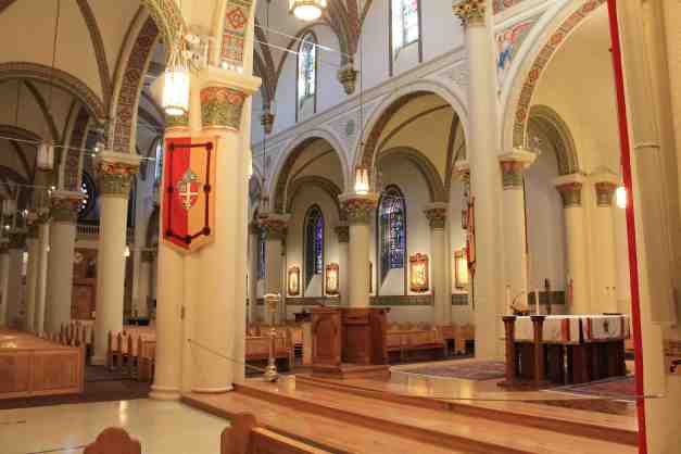
I woke up early (this is the next day) and I decided to walk to the Plaza in the center of historic Santa Fe, located about a half mile from here. The Santa Fe Plaza is a National Historic Landmark located downtown. Here are a few photos from the area …
Day 33 – Santa Fe to Amarillo

Days distance: 266 miles
Total trip distance: 4,848 miles
The weather was cloudy. The temperatures stayed in the 80’s. Amarillo, where I’m staying tonight, is currently under a tornado watch. Looks like we’ll get thunderstorms but the worst will not hit here.
I left Santa Fe about 9am local time. I stopped to capture the terrain south of Santa Fe (and take a photo of the bike).
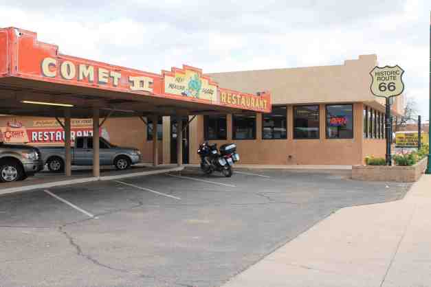
After that, I stayed focused on moving eastward until I hit Santa Rosa. I stopped for lunch at the Comet II, run by the Martinez family since the 1920’s and located on route 66. I recommend the enchiladas 🙂
Passing through Tucumcari, I stumbled across folks setting up for the Rockabilly On the Route 2014 weekend. It is a benefit for the New Mexico Route 66 Museum.

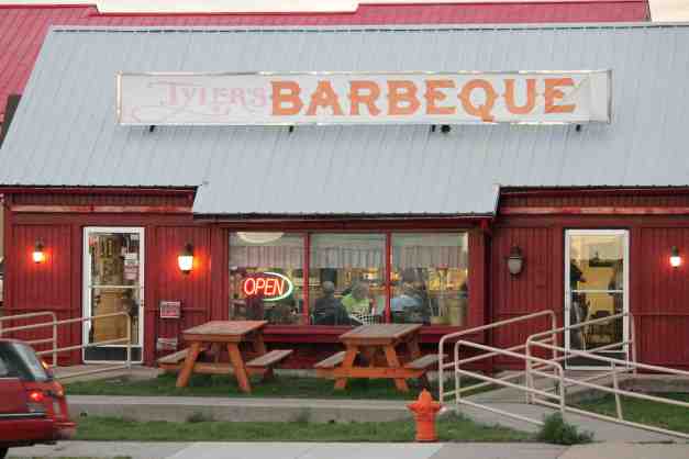
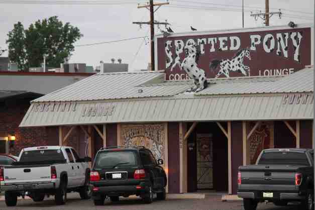
Crossing the Texas state line, I lost another hour as my clocks reset themselves to Central Daylight Savings. I arrived at the motel in Amarillo and discovered the strong cross winds I felt all afternoon were a precursor to tornado warnings. It is currently storming but no tornadoes in the immediate area. Fingers crossed.
Many motorcyclists are at the motel. We were given permission to put our bikes under cover to avoid hail damage. Afterwards, most went across the street to Tyler’s BBQ for dinner and The Spotted Pony for pool and beer.
Day 34 – Amarillo to Oklahoma City
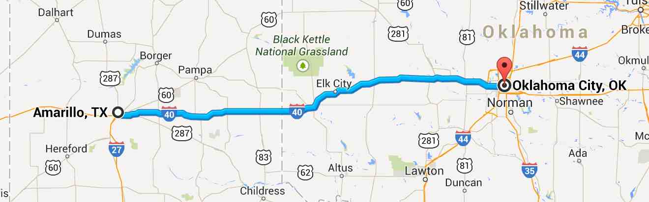
Day’s distance: 275 miles
Total trip distance: 5,123 miles
The weather was stormy in Amarillo when I woke up before 6am. Thunderstorms continued to roll in through the night. I had a opportunity to leave about 7am after the storm cleared. I reached Oklahoma City dry. Temperatures were in the 80’s this afternoon with some humidity.
With yesterday’s storm fresh on my mind, I wanted to travel as quickly as possible to Oklahoma City to avoid being caught on the road in stormy weather. Weather predictions showed a six hour window so I stayed focused on moving east.
I did pass by a town called Groom, Texas where I saw something I had to try to photograph. It was a cross near the highway that was 19 stories tall !!
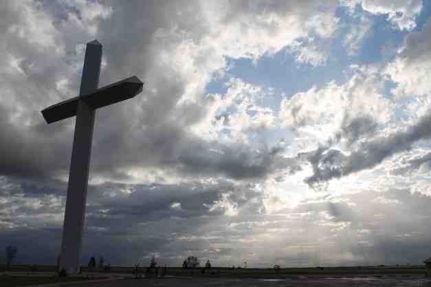
This 190 foot tall cross can reportedly be seen from 20 miles away. There are life-sized figures of the fourteen Stations of the Cross, a replica of the Shroud of Turin and an Empty Tomb exhibit. Read more here, if interested.
My friends in Oklahoma City gathered a few other friends and another family member and we all went out to an excellent dinner at Boulevard Steakhouse. We talked of travel, Oklahoma politics, and current events, and other things well into the evening.
I’ll be staying here for the next two days (Sunday and Monday) before beginning my trip back to Seattle. I’ve made an appointment at BMW of Denver for my 12,000 mile service. This is scheduled for next Friday morning.
Day 35 – Oklahoma City

The weather varied throughout the day. I’m told if you don’t like the weather, wait five minutes. The temperature reached the low 80’s and it was fairly humid. They was rainfall last night associated with some thunder and lightening.
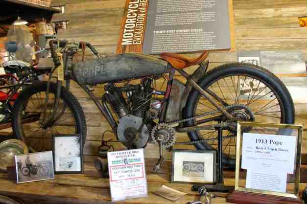
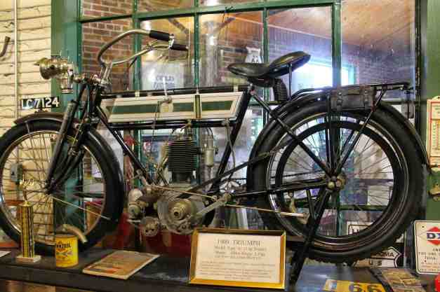
There are three yellow stars in the map above, all are along historic Route 66. We went out to Warwick, Oklahoma first, visiting the Seaba Motorcycle Museum.
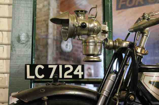
Originally built in 1921 as a gas station. Sold to the current owners in 2007, renovations begun and it now operates as a museum. More history can be found here. The collection of motorcycles exceeded my expectations. It is superb! There were motorcycles from the early 1900’s. Below are photos of a 1913 Pope and a 1909 Triumph.
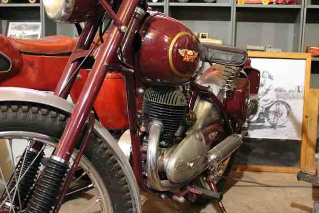
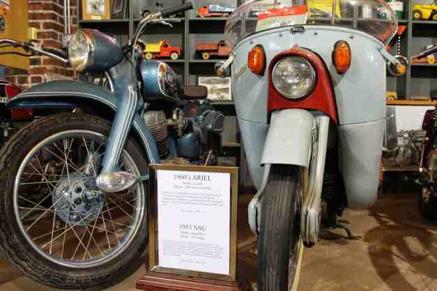
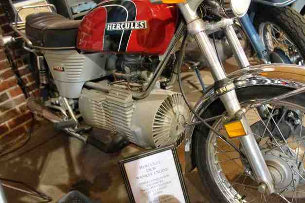
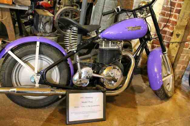
The museum had many lesser known brands from the 50’s and early 60’s, like the James, NSU, Ariel, Hercules, and Mustang shown below.
My host rode a Yamaha to a 3rd place Scramble finish at the Big Red Scrambles in 1970. He was loving the museum, as well.
There were so many, many more bikes and photos. It was by far the best Route 66 attraction I saw.
We moved on to a few others in the area. The Round Barn was next. Originally built in 1898 and restored in the late 80’s and early 90’s under direction from a local contractor/volunteer Luke Robinson, it is a unique American landmark.

Finally, we stopped for lunch at Pops, a recently built diner and gas station in Arcadia specializing in an extremely large selection of soda pops.
Day 36 – Oklahoma City

The weather varied from mostly cloudy to partly cloudy with temperatures in the mid 70’s.
I spent the day touring Oklahoma City, driving through or stopping in many of the neighborhoods downtown with my host. We stopped by Regatta Park where you will find Chesapeake Boathouse, Oklahoma City’s newish rowing facility. Many may know that I rowed at Lake Union Crew for years. As a rower, I was curious about the facility and the adjacent river.
We also visited the Bricktown neighborhood, an entertainment district just east of downtown and Stockyards City, Film Row, Nichols Hills, and the Asia District.
Lunch was downtown in the Devon Energy skyscraper followed by a walk through Myriad Botanical Gardens.
Finally, we stopped at the National Cowboy & Western Heritage Museum, aka the Cowboy Hall of Fame. I especially enjoyed the art on exhibit.
This was a relaxing day. Tomorrow I begin the “second half” of my adventure. By that, I mean that I begin my return to Seattle. I miss Seattle and am happy to be heading back. I’m also looking forward to seeing a lot more of the country.
I’ll be heading to Denver next as the bike will need its 12K mile service. That is scheduled for Friday morning. So I have a few days to get there. Provided the weather is good, I’ll stop in Hutchinson, Kansas Tuesday to visit the the Cosmosphere and Space Center. Wednesday, I’ll ride the “World’s Loneliest Road” (Hwy 50) some 399 miles to Pueblo, Colorado, if I can avoid bad weather. This gives me a full day to get to Denver on Thursday evening. I’m thinking I’ll take a ride through the Pike National Forest on my way, if predicted thunderstorms do not materialize.
Day 37 – Oklahoma City to Hutchinson

Day’s distance: 213 miles
Total trip distance: 5,336 miles
The weather cleared up as the day went on and I traveled north. Temperatures started in the mid 60’s and ended in the low 80’s.
Before departing Oklahoma City, I added a some oil in to the crankcase and some air in the tires. A departure photo was taken and I headed out at about 8am.
My luck at traveling between storms continued today. One stop for a latte and a couple of stops for toll booths in Kansas, and I arrived in Hutchinson at about noon. The ride was windy and I slowed down to 65 MPH to accommodate until I got past Wichita.
Before checking in to a motel, I stopped by the Kansas Cosmosphere and Space Center. It didn’t look like much from the outside. Before visiting though, I wanted to figure out where I was going to stay.
I first stopped at a less expensive motel, but it was really sketchy. So was the other nearby motel. I found a Hampton Inn eight blocks from the Space Center. They only had one double available, but it was a room for smokers. I checked it out while also checking out the indoor pool, and took the room after getting a 33% break on the price.
I changed and went back to the museum. The entry price depends on what you want to see and do. I purchased the full package and was pleased with that decision. The cashier helps you schedule everything within your available timeframe.
The Dr. Goddard’s Lab presentation was a little cheesy. The planetarium was good, focusing on identifying constellations seen from the Northern Hemisphere. I finished my visit with an WWII Imax documentary on the Normandy Invasion.
The highlight for me, however, was the museum. It has the largest collection of Russian space artifacts outside of Moscow, according to their site.
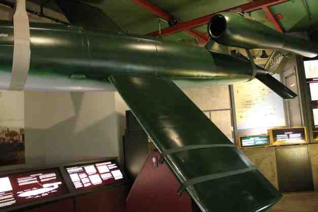
It also has flown spacecraft from the Mercury, Gemini, and Apollo programs, a V-2 rocket, a V-1 flying bomb, as well as an SR-71 Blackbird.
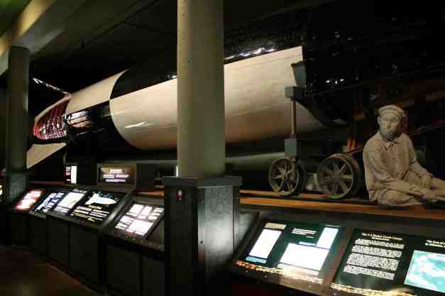

This place definitely exceeded my expectations. I returned to the motel and swam in the pool for a while as the water was really warm and it was super relaxing.
Day 38 – Hutchinson to Pueblo

Day’s distance: 410 miles
Total trip distance: 5,746 miles
The weather was quite varied today. I’ll say more about that below. Temperatures ranged from the mid 60’s to mid 90’s.
This was the most distance I’ve ever covered in a single day, so far. I left at 7am and arrived at the motel shortly after 3pm, stopping a handful of times to gas up and stretch, and twice to eat.
It was easier to cover 400 miles than I thought it would be. I had snacks and water, and drank a bit of caffeine along the way 🙂 I also had 4G and was streaming a variety of music throughout the day. That was nice and helped pass time.
There were two wind-related parts of the day’s travel.
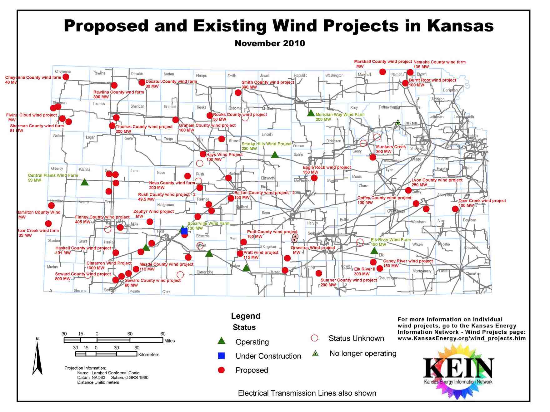
The first occurred about a 100 miles west of Hutchinson. A crosswind started to blow past me, from left to right (from the south). I was hoping the wind wouldn’t start until later in the day. It was just east of Spearville (which is east of Dodge City). As I continued, I drove by maybe a hundred or more wind generators and assumed it was windy there pretty much all the time.
Apparently, there are many wind projects underway in Kansas. Go renewable energy!
During my stay in Oklahoma City, my hosts suggested I download a weather-related phone app called Radar Scope. It displays the output of weather radars and also issues weather alerts. Radar Scope was clear in Spearville, so I just slowed a bit and continued. I’ve also been using the National Weather Service site to stay informed.
About 30 miles from Pueblo, I skirted an area in the sky that looked to be developing into a more severe thunderstorm. It was a few miles south of me. I didn’t get wet but felt wind gusts that I’m certain were related. Hwy 50 was taking me away from the worst of it, so again I slowed down but continued. The weather cleared up shortly after and stayed clear for the rest of trip to Pueblo.
All day, the weather app indicated an increasing probability of thunder showers in Pueblo this afternoon. I felt a bit rushed so I didn’t stop to take any photos. Sorry about that. The thunder showers did show up just after 5pm and after I was all settled in. The worst went around my immediate location, but I had taken the hard cases off the bike and brought them in just in case.
I did want to mention the Cafe in Dodge City, Cup of Jo’Nes. Good latte 🙂
Day 39 – Pueblo to Denver

Day’s distance: 209 miles
Total trip distance: 5,955 miles
The weather was cloudy and relatively cool today. Temperatures started in the 60’s in Pueblo, to the 70’s while in the mountains, to the low 80’s in Denver.
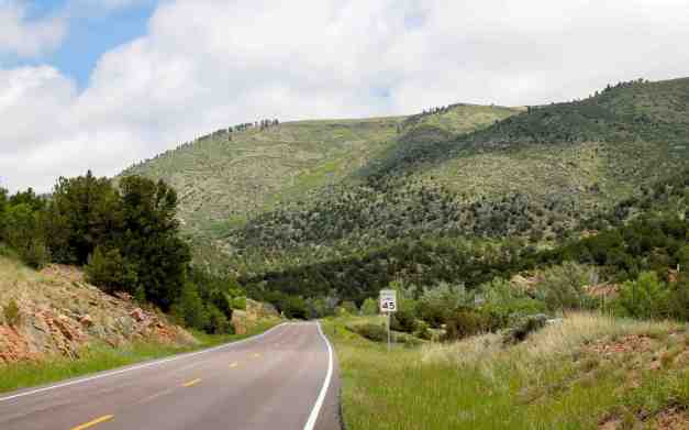
Rather than travel directly to Denver today, I took a slightly longer route through some of the countryside located west of Interstate 87. My first stop was the Royal Gorge Bridge, the world’s highest suspension bridge. A year ago yesterday ( Jun 11, 2013), most of the structures on the Bridge and Park grounds were destroyed by a fire. Access is restricted and I was only able to view the bridge from a picnic area located about 1 mile down a dirt and gravel road. Even at that distance, the bridge is impressive.
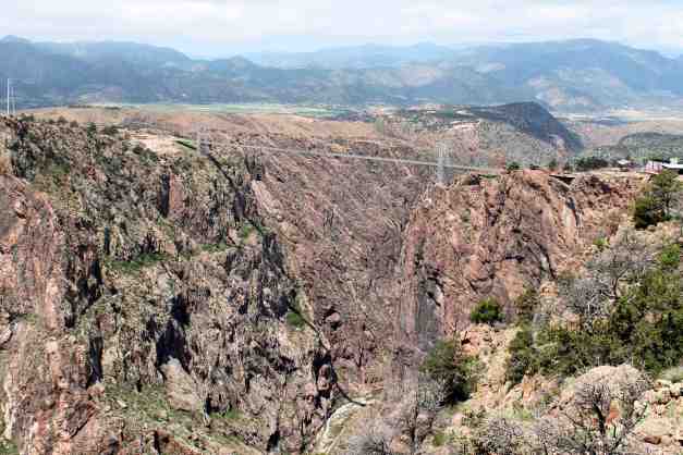
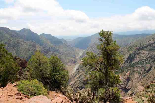
From the same picnic area, but looking eastward.
After leaving the Royal Gorge area, I traveled on Highway 9 north. The scenery was hilly and there were ranches and grassland all around.
As I entered the little town of Guffey, I had just pulled over to take a picture of their town sign when a man pulled up and asked if I was looking for a place to eat. I said I was going to take a picture but asked what my food options were. He said there were two, but since the Pub’s sign (lower left in the photo below) wasn’t turned on, it meant I only had one. Assured that they made good sandwiches, I decided to try it. He then drove off as quickly as he showed up.
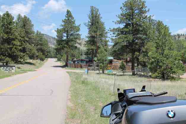
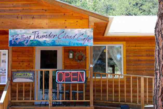
Well, since it was about noon, I decided to stop. The place was called Rolling Thunder Cloud Cafe. It is owned and operated by Wayne and Kathy. They’ve both lived in Washington – Kathy was once Miss Lynnwood. 🙂
I suspect having lived in the Seattle area is why their espresso was so good. Good pulled pork and desserts, as well. Highly recommend stopping here if you’re in the area.
I enjoyed being on minor highways and county roads today. The Pike National Forest road was pleasant to smooth. I thought I was going to get rained on for sure, but managed to skirt another storm while in the mountains. Just a few drops, again.
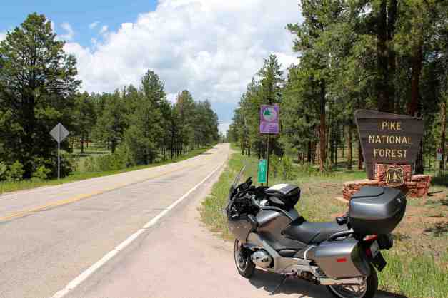
Part of this forest experienced a fire last year, as well.
The bike is running well. I washed it a bit at a car wash while still in Pueblo. It gets serviced in the morning.
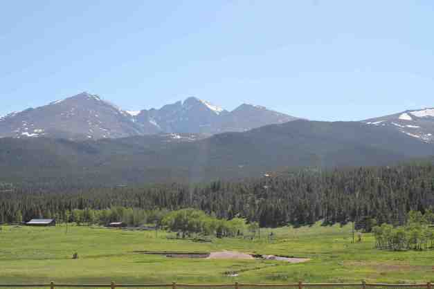
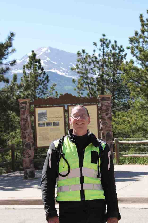
Day 40 – Denver to Estes Park
Day’s distance: 95 miles
Total trip distance: 6,050 miles
The weather was mostly sunny. Temperatures reached the mid 90’s in Denver but were in the high 70’s arriving in Estes Park.
I got the bike serviced today at BMW of Denver. It was ready about 4 hours later, and it was even washed! Great experience. Thanks to Bob and Linda, and to Bill for the t-shirt.
There was an early rush hour in Denver. I guess everyone gets off work on Fridays at 2pm 😦 Same story in Boulder. Combined with temperatures of about 95, it was tiring. And, there was a detour in Lyons for traffic heading to Estes Park. However, in this case, it was a very pretty detour along State Highway 7.
Upon arriving at Estes Park, I stopped at a local credit union to pick up some cash and at the liquor store to pick up a bottle of wine to have this evening. I went swimming in the outdoor pool and relaxed.
Day 41 – Estes Park to Cheyenne
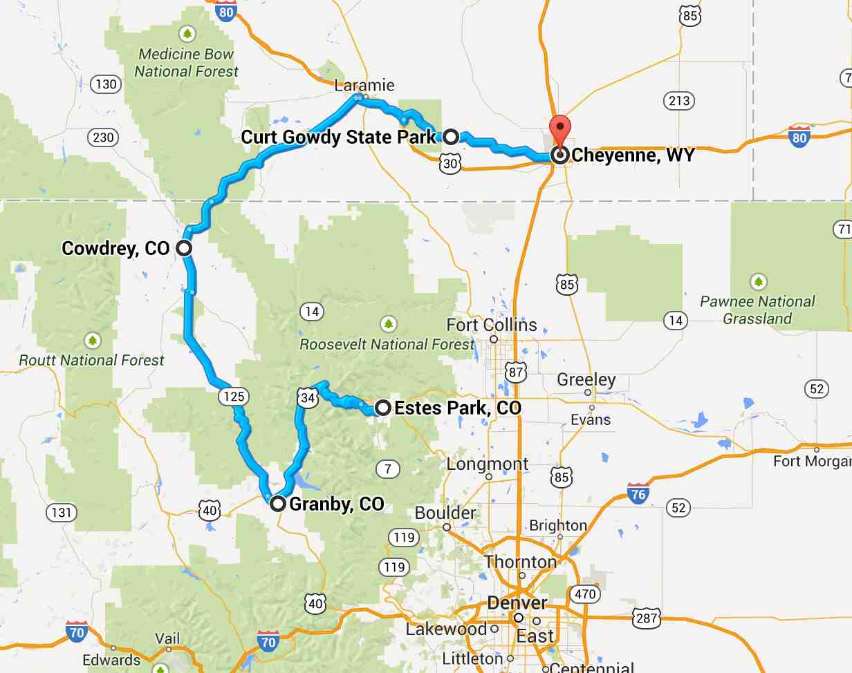
Day’s distance: 238 miles
Total trip distance: 6,288 miles
The weather varied a bit today. The day started out sunny as I left Estes Park but clouds rolled in later on in the day. Temperatures ranged from low 40’s to the high 60’s only, I think. It was very windy, at times. More on that below.
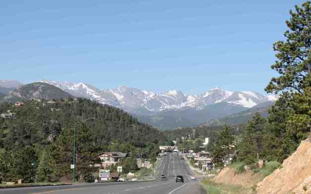
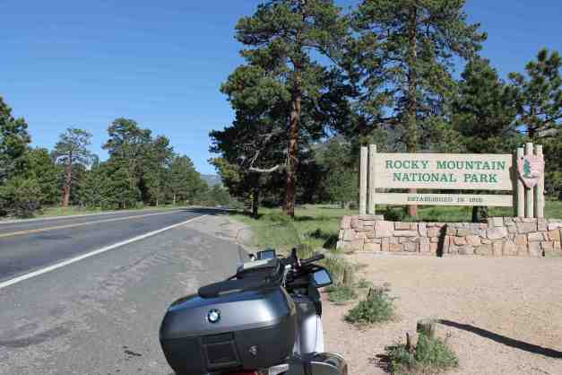
I’ve been looking forward to today’s ride. Trail Ridge Road is the name given the portion of Hwy 34 that traverses the Rocky Mountain National Park. It is the highest continuous paved road in the US. The road begins at the entrance to the Rocky Mountain National Park.
Climbing higher up …
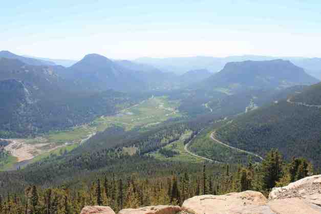
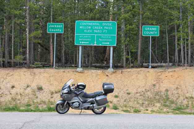
until it crosses the continental divide at Milner Pass, elevation 10,758 ft.
The road continues to climb to an elevation of 12,183 ft before winding its way down.
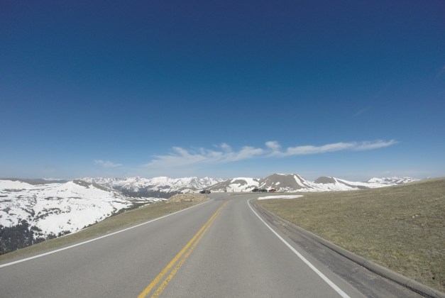
The temperature fell into the low 40’s near the top. I stopped early on to put on my jacket liner. The road was dry for the most part and in very good shape. It was a very fun, scenic, and worthy ride 🙂 I put my GoPro photos taken at 1 minute intervals into a video.
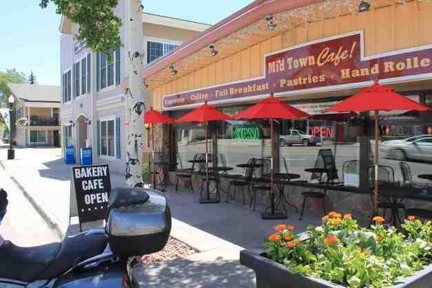
I stopped in Granby, CO for late brunch and a latte. The Mid Town Cafe offered up a tasty scramble and a satisfying latte. Recommended !
Not yet ready to stay on the Pacific side of the Continental Divide, I crossed back over to the Atlantic side at Miller Pass.
And the Rocky Mountains gave way to the plains of Wyoming. There was a strong wind through most of the afternoon, but luckily it was coming from behind me.
A word or two about a section of today’s route.
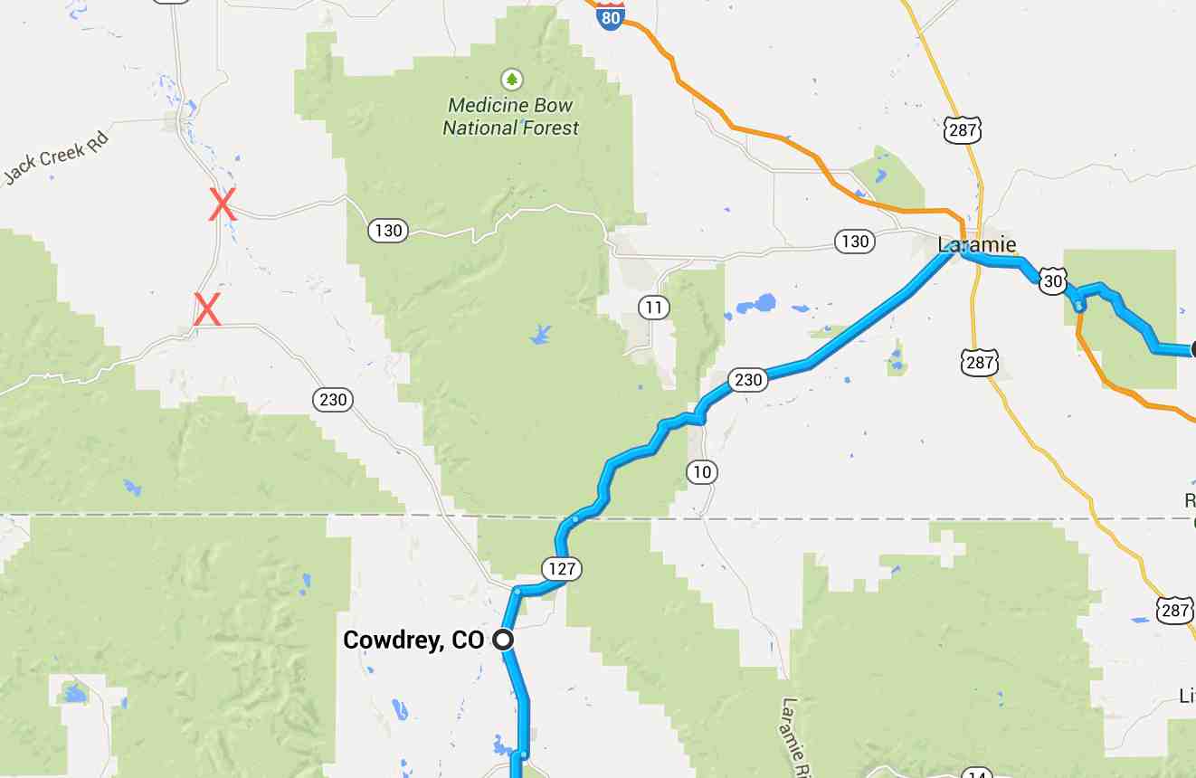
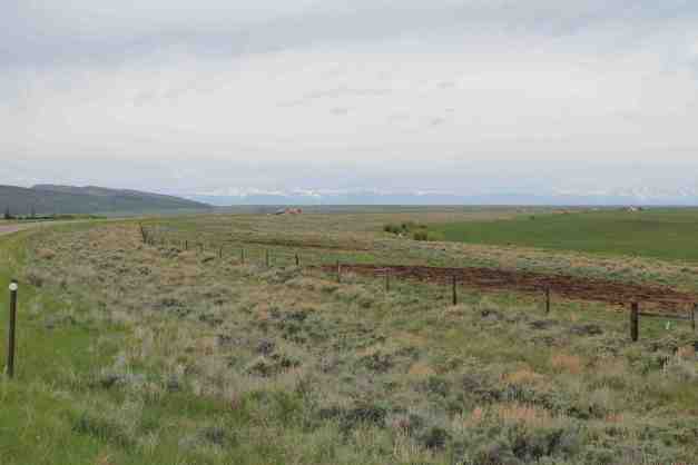
It was my intention to travel northwest from Cowdrey and turn east onto Hwy 130, known as the Snowy Range route through the Medicine Bow National Forest. See where I placed two ‘X’s in the map above. Instead, I ended up taking Hwy 230 to the south. I am not sure if I simply turned the wrong way and the GPS recalculated a route for me, or that I didn’t program it correctly. Either way, it isn’t a super big deal but I want to go forward having a paper map ready each day and placed in the clear pocket of my tank bag.
I’m in Laramie now (about 3pm), having an early dinner / late lunch. I hope to camp tonight at the Curt Gowdy State Park, located between Laramie and Cheyenne, if there is a spot available. I’m going to publish this now, though, as I won’t have internet connectivity at the camp site.
*** UPDATE ***
So there were two spots available at Curt Gowdy. It was very windy throughout the afternoon, as I had mentioned. I did set up the tent but it didn’t take long before the strong gusts were pulling the tent stakes out. I didn’t trust them enough to even go back to the office to register, so I pulled down the tent and repacked it.
Instead of camping, I’m staying in a motel in Cheyenne.
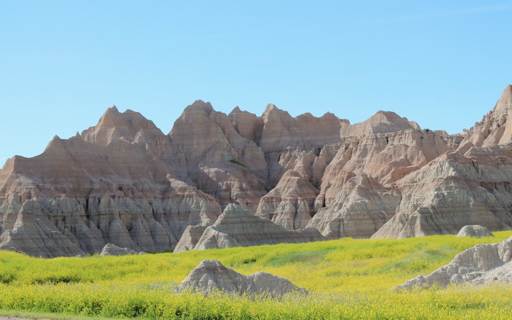
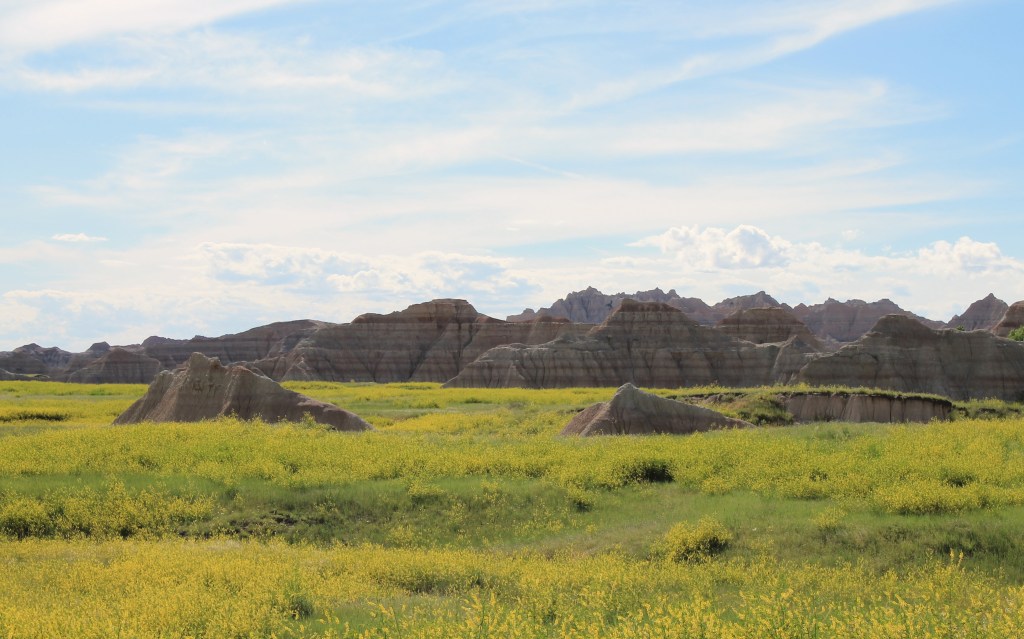
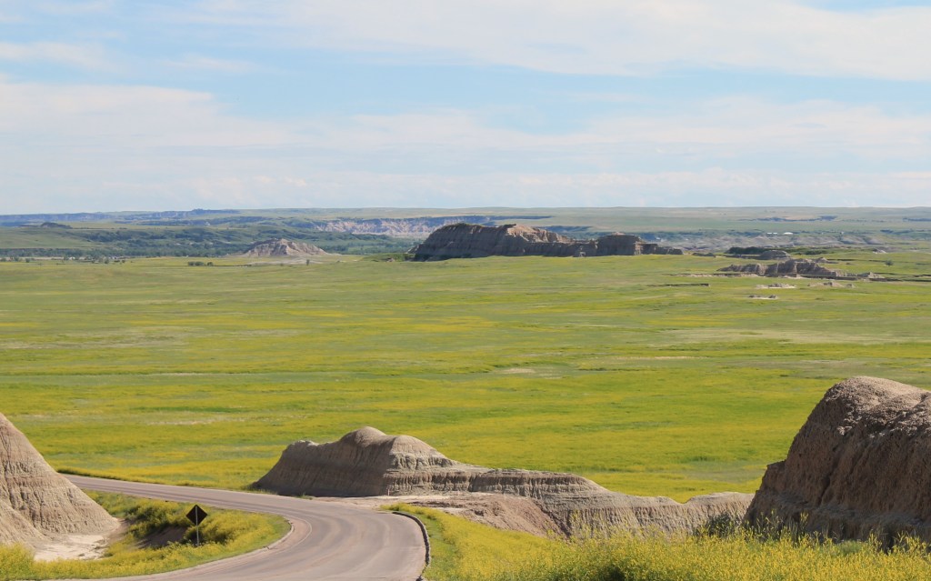
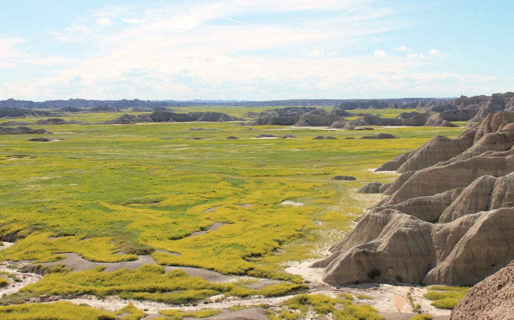
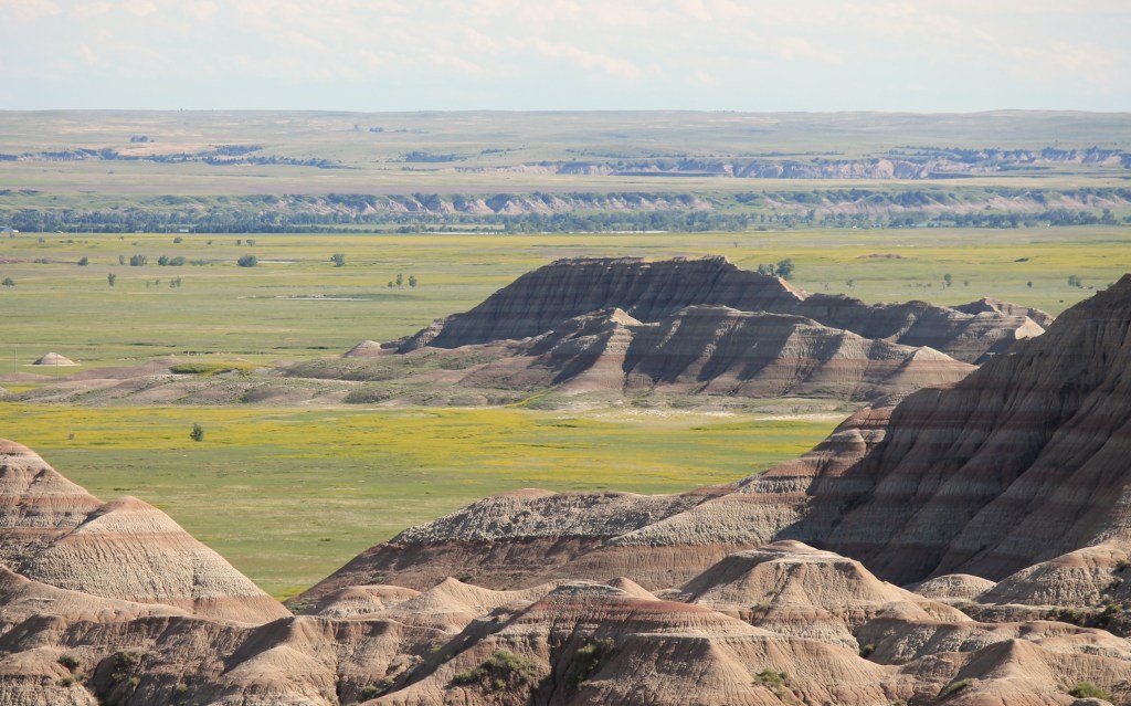
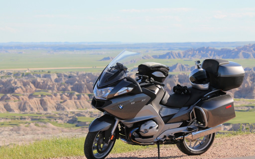
Day 42 – Cheyenne to Rapid City

Day’s distance: 449 miles
Total trip distance: 6,737 miles
The weather was pretty ideal today. Sunny most of the day with high clouds. Temperatures were cool, mostly 60’s but then mid 70’s towards the late afternoon. I had on my jacket liner until about 3pm.
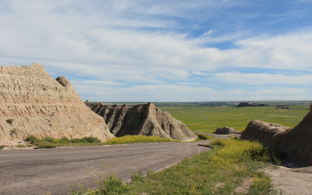
Today’s distance was a personal record. Weather-wise, I couldn’t ask for a better day so I wanted to try to see both Wounded Knee and the Badlands National Park while including Nebraska. I arranged to have some shortcuts built into the route in case they were needed.
The day started later than I wanted but with focus, good roads, and 65 MPH speed limits, I made good time. Most of today’s terrain was a variation of soft rolling hills and grasses, sometimes with trees and sometimes without.
I stopped for my latte and lunch at the Bean Broker Coffee House in Chadron, Nebraska. Good sandwich wrap and great espresso. Definitely recommended for espresso addicts.
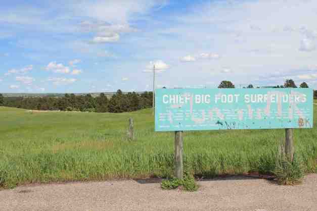
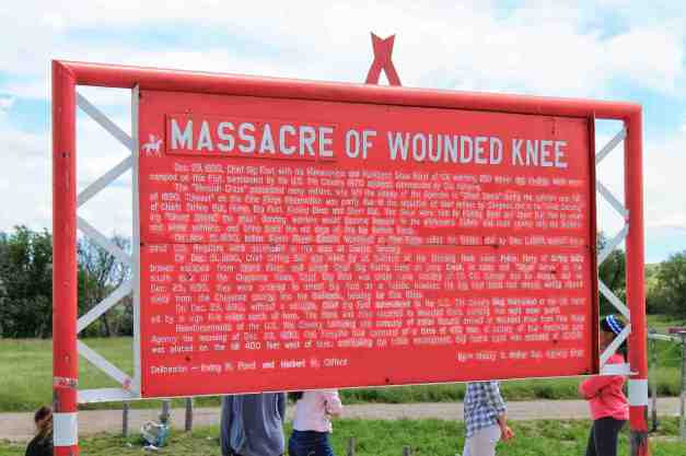
Traveling to the Wounded Knee area, there was a road sign for both the area where Chief Big Foot surrendered and where, the next day, soldiers opened fire killing 146.
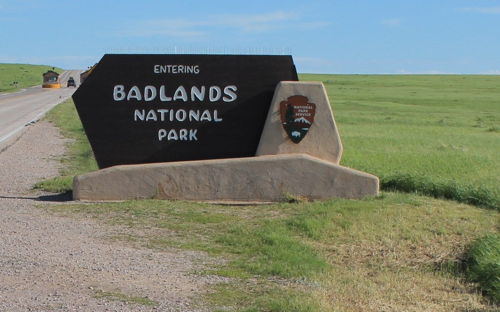
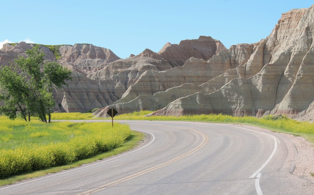
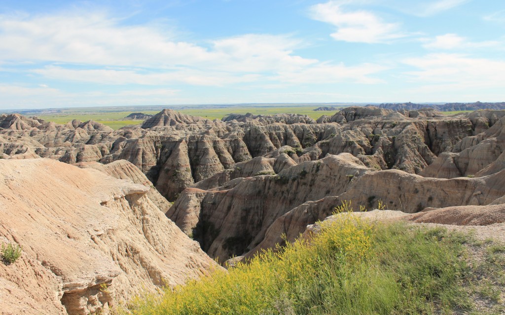
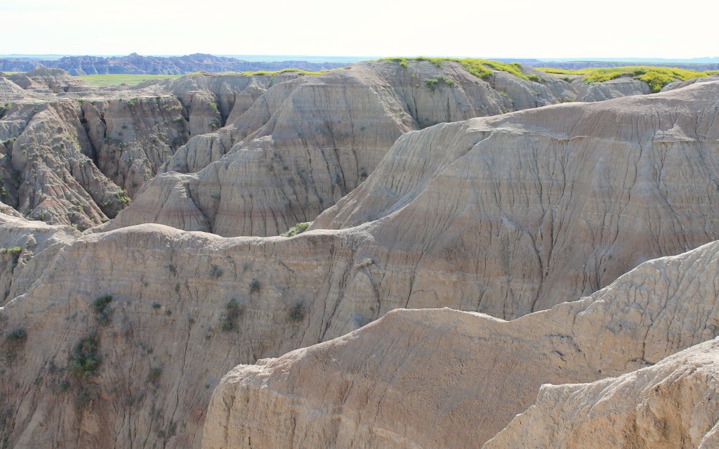
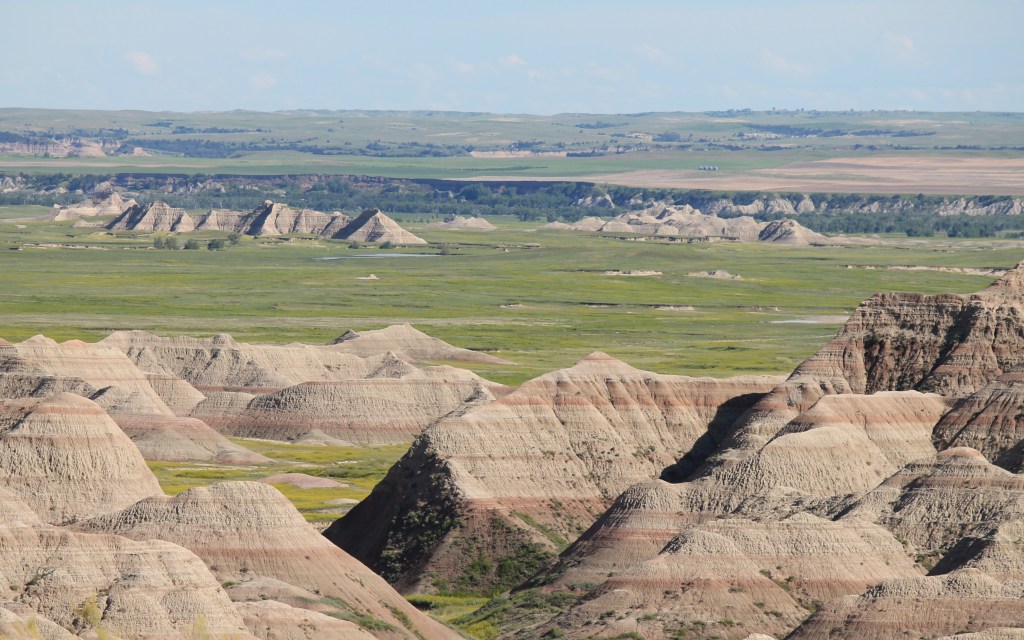
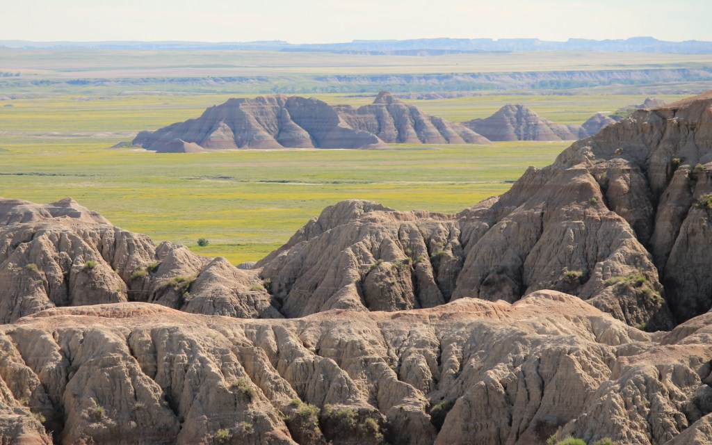
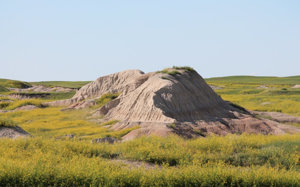
Continuing east to the Badlands National Park, I used the Interior entrance, on the eastern side of the park. I then traveled west through the park. The road climbed up to give visitors a view of the White River Valley.
A Badlands National Park photoset …
I am staying in a downtown hotel in Rapid City. The sun was getting low in the sky by the time I was cleaned up and had a chance to walk around. This part of town has many shops and restaurants. It seemed to draw tourists and residents in the evening, as you can tell by the lack of open parking spaces.
After sunset, I socialized over a glass of wine with a couple from France (who don’t travel by motorcycle) and a New York couple, who do, from the rooftop bar. They provided me with some first hand suggestions that should come in handy on my ride through the Black Hills tomorrow.
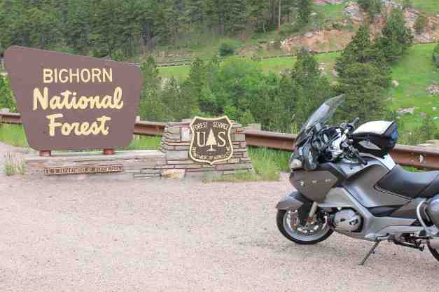
Day 43 – Rapid City to Gillette

Day’s distance: 274 miles
Total trip distance: 7,011 miles
The weather was warm and mostly sunny. Some thunderstorms came through the Gillette region, but I wasn’t rained on, just saw some of the roads were still a bit wet. Temperatures reached the mid 80’s and it was a warm evening.
Today was about exploring the Black Hills region of South Dakota.
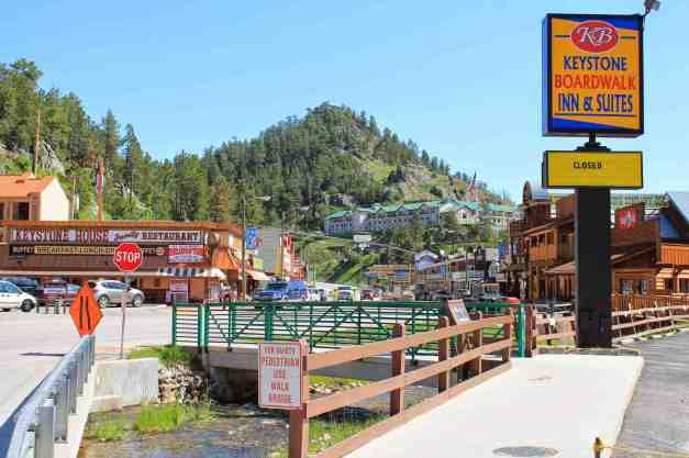
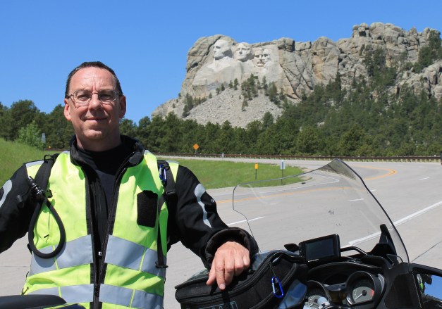
One somewhat obligatory stop was Mt. Rushmore. I went through Keystone to get there. Many of the small towns I rode through today are completely focused on tourists.
This was my first visit to Mt. Rushmore. The guy who took the photo rides a R1200C, which is a cruiser version of my bike.
After visiting the likenesses of past presidents, I explored Custer State Park. It is generously forested with lots of hills and narrow roads. The photo below shows one of six tunnels that can be driven through.
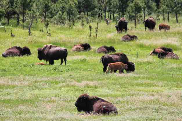
There is a Wildlife Loop Road that had some surprises, including mules that block traffic …
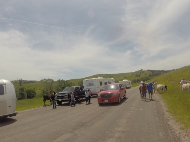
and bison that, well, eat 🙂
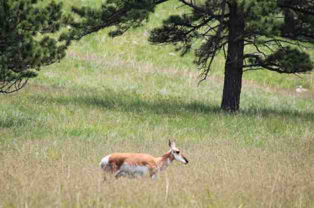
A few antelope were seen, as well.
While the scenery here was great, a lot of cars and low speed limits were making me cranky 😦 It was good to get onto roads outside the park. But first, I stopped in Custer for a late lunch and a latte. I had a buffalo meat wrap, thanks to the folks at Baker’s Bakery and Cafe.
The roads between Custer and Sturgis (see the route map) were brilliant. As scenic as those inside Custer Park, but almost no traffic. The roads were in good shape, clean for the most part, and speeds varied from 35 to 65.
The last photos for today were taken in Sturgis, South Dakota. This is home to the famous annual Sturgis rally, this year is in August. I spoke to a couple this evening that have attended the rally. They stayed in Sundance and rode in each day. Finding your motorcycle among thousands of others parked on the same street was apparently a challenge.

The Black Hills area of South Dakota has a great collection of back roads and I can totally see why motorcyclists love the area. This morning, I mapped out an option to loop through Deadwood and Lead, back to Spearfish. But it was after 5pm when I arrived in Sturgis and I was getting tired. It took a while this morning to get through Custer State Park.
I departed South Dakota and headed west. Originally, I planned to stop at Sundance, but the motel’s pool and hot tub were not functional. I got over that, but the internet didn’t reach my room, either. So I continued on to Gillette. This eliminates the option of seeing Devil’s Tower. I’ll just have to return to the area some day 🙂
I noticed about midday that one of my two low beam headlights was out. The other is still functioning and I will stop in Missoula to replace the burned out bulb. I arrived in Sturgis too late to get one there. I’m glad there is some redundancy built in.
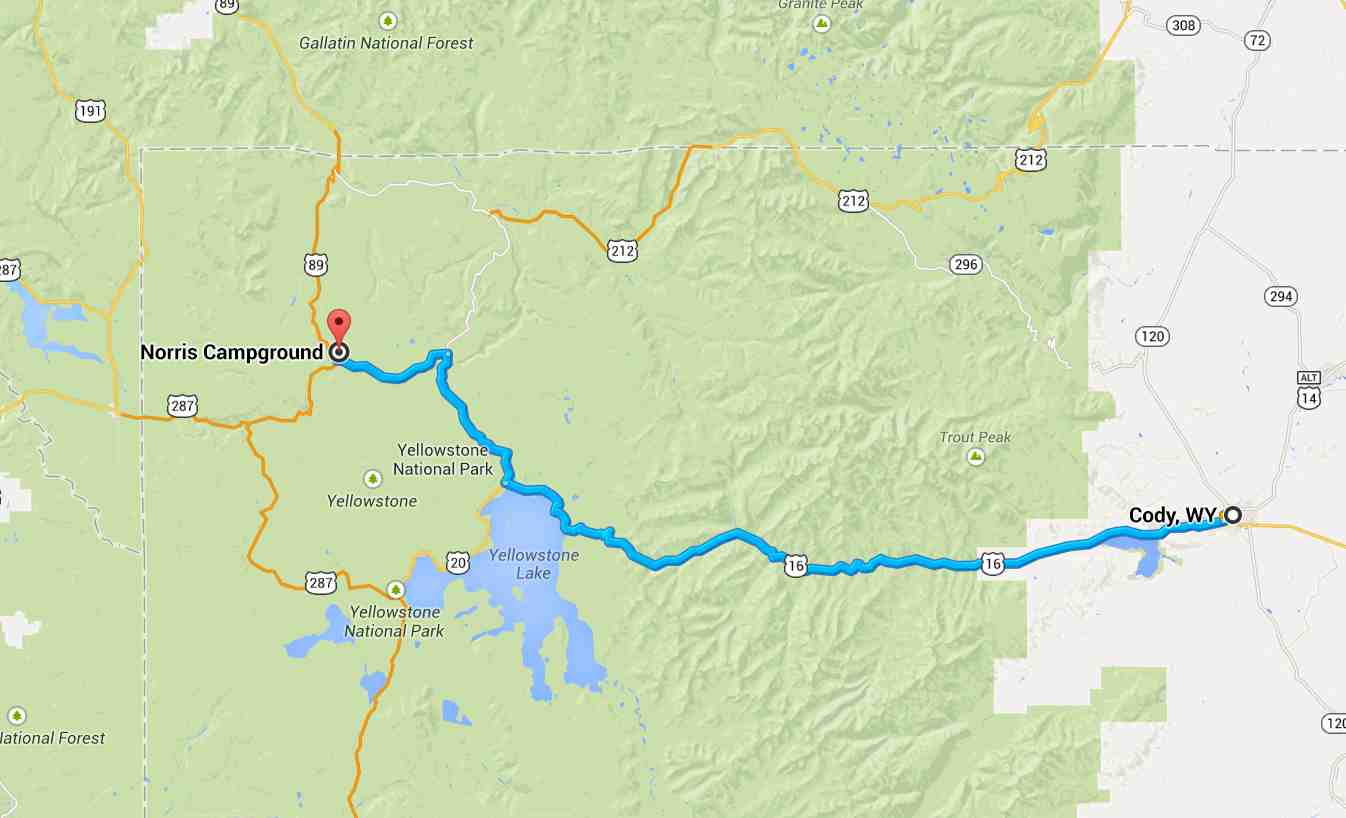
Day 44 – Gillette to Cody
Day’s distance: 275 miles
Total trip distance: 7,286 miles
The weather worsened throughout the day. I successfully skirted the rain clouds until my last 30 minutes on the road today. The temperatures were in the 60’s generally, but dropped quickly as the storm opened up on me, falling to a low of 47.
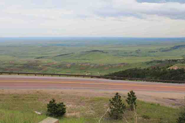
Like the scenic byway of South Dakota’s Black HIlls, the scenic byway of the Bigfoot National Forest did not disappoint. Almost immediately after entering the park …
the road begins to climb. The road condition was excellent and the speeds limits were 65 much of the time. One of my favorite rides of the trip.
Traveling from east to west, visitors are presented with a choice of routes when they reach the summit area. Hwy 14 or hwy 14A ?? I took Hwy 14 because it heads south and it looked like storm clouds were developing to the north.
There were lakes and rivers next to the road.
The Western side began to open up with some dramatic cliffs.
Hwy 14 travels past Shell Falls.

I’m staying in Cody. For dinner, I went to the Wyoming Rib & Chop House. I had a Buffalo Rib Eye Steak. Yummy and so tender. I sat at the bar and met a local couple. They own Moose Alley Lodging and have lived in the Cody area since 1980. They were great company and provided help in planning my Yellowstone visit. Thanks for the birthday glass of wine, you two!
I’m unable to stay in my current motel tomorrow as it is already fully booked, but I’m going to stay in town tomorrow for a day off the bike. I need a little down time to plan my Yellowstone visit and to relax. I’ll have to figure out where to stay in the morning.
I do want to visit the Buffalo Bill Center of the West. This single building combines five separate museums. It was recommended by several of the local folks I’ve met.
Day 45 – Cody
Today was mostly sunny with temperatures only in the high 50’s.
I needed a day with few or no activities as I was feeling a bit burned out. I picked up some supplies for camping, should I be able to get a ‘first-come, first-served’ campsite tomorrow morning. The only other activity was visiting the Buffalo Bill Center of the West.
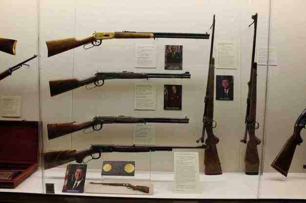
The Center contains five separate museums. I first visited the Cody Firearms Museum. The depth of their collection was impressive to me. They had both European and American Air Guns (who knew?) …
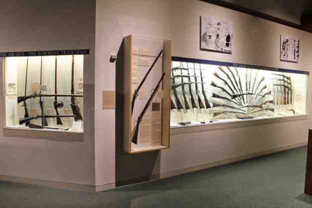
as well as engraved rifles presented to past presidents.
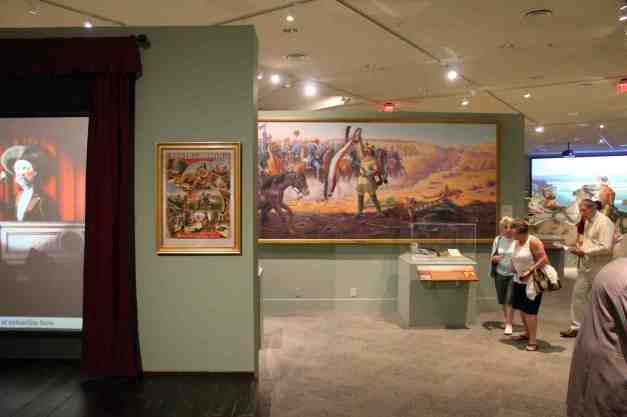
The Plains Indian Museum had many exhibits …
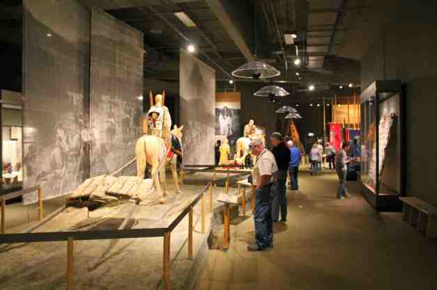
as did the Buffalo Bill Museum.
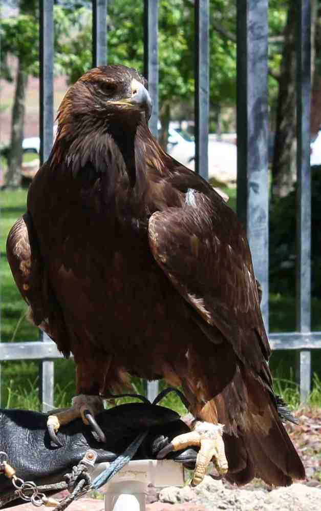
museum cares for a what I believe is a Golden Eagle (I was late to the presentation).
It was suggested that a trip to Old Trail Town, just a short distance from downtown Cody, would be interesting. However, after the museum, I really just wanted to rest. I will leave Cody early in the morning and head into Yellowstone via the East entrance. Hopefully, I can get a campsite for one night.
My original plan has me leaving through the North entrance and that is still the plan if I only have one day in Yellowstone. I have worked out a curved path through much of the park for this possibility.
However, if I get a campsite, I will try to use tomorrow to explore much of Yellowstone, and then the next day exit via the South entrance and ride through Grand Teton National Park.
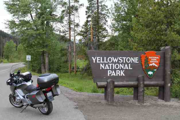
Day 46 – Cody to Yellowstone

Day’s distance: 182 miles
Total trip distance: 7,468 miles
The day was mostly sunny with some clouds and fog in the mountains. Temperatures ranged from 32 (in the mountains) to the 70’s.
From information found on the National Park Service website, I had six options of getting a first-come, first-served campsite. So I left Cody just after 6am. The ride to the park was traffic free, as you might imagine. There was a bison walking alongside the highway about 5 miles from the park’s East entrance. It was to be my closest brush with wildlife. Sorry, no photo 😦
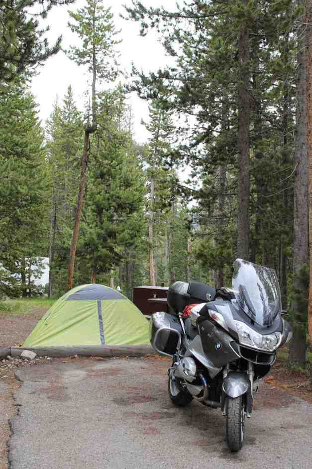
The process of getting a first-come, first-served campsite here is to visit each campsite until you find one with an open space. The information at the East entrance was at least several hours old. It was suggested that I stopped at Canyon Village and seek more updated information. I stopped on my way to a campground, but they had no information. I’m not sure where the disconnect was, but I was getting frustrated.
I went straight to the campsite that was most centrally located. It was before 9am when I arrived. Luckily I found a spot !! In a funny turn of events, after another hour, there were lots of open spots. Apparently, I arrived too early – prior to most people who weren’t staying another night even left their site.
I had my tent set up pretty quickly and had some instant coffee to warm up.
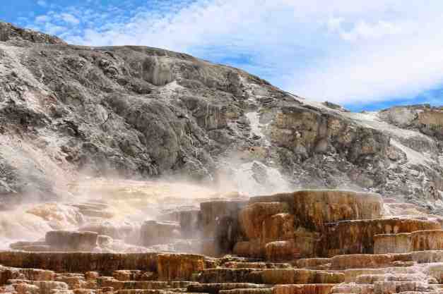
The main roads around Yellowstone are shaped more or less like a figure eight. I chose to ride around the north half moving clockwise. I stopped at the Terrace Grill for lunch, named after the Mammoth Hot Springs Terraces.
Here is one of the Hot Springs, the Minerva Terrace.
By now, it was well past 1pm. Every parking lot was full and traffic was very heavy. I wasn’t able to maintain equanimity among the crowds and decided to move on and continuing clockwise around the upper loop.
There was a traffic accident which blocked traffic for about 30 minutes. After that, there were several traffic jams due to cars stopping on the road (presumably to take a photo). It took another three hours to get back to camp.
Despite my growing frustrations and impatience with the crowds, Yellowstone is a beautiful place. Here are some of the photos taken between Mammoth Hot Springs and returning to Norris campground.
Day 47 – Yellowstone to Missoula

Day’s distance: 335 miles
Total trip distance: 7,803 miles
The weather was in the high 30’s when I crawled out of my tent in Yellowstone’s Norris campground. It was clear and going to be sunny when the sun rose above the trees. Later on in the day, I hit some brief showers between Butte and Missoula, where is was as hot as 80.
I woke up early in an attempt to see some sites before the crowds arrive. This seemed to be a winning strategy.
I saw some of the lower half of Yellowstone, starting at the Norris Geyser Basin, across the road from where I was camping. There is a museum completed in 1930 as a trailside rest station. It wasn’t open as it wasn’t yet 8am, but it was beautiful from the outside. You can walk through the breezeway to get to the geysers.
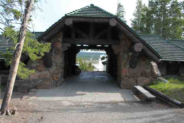
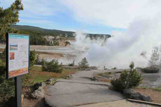
Traveling south, I detoured onto Firehole Canyon Drive. It was suggested that I visit this area by the folks I had dinner with my first night in Cody, WY. There were folks fishing Firehole River. I stopped at the Falls to take a photo. And towards the end of the one-way road, there was a swimming hole. I’ll know for next time, assuming it is warmer 🙂
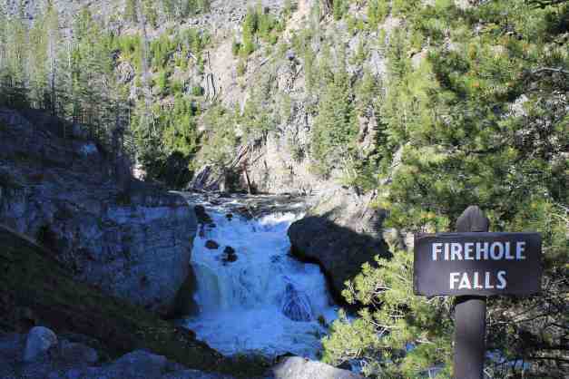
While there, I met another BMW rider, traveling back to Toronto from visiting Scott’s Valley, CA. If you remember, that’s where I stayed while visiting Santa Cruz. Small world, eh? (accent intended)
Finally, I made it down to see Old Faithful.
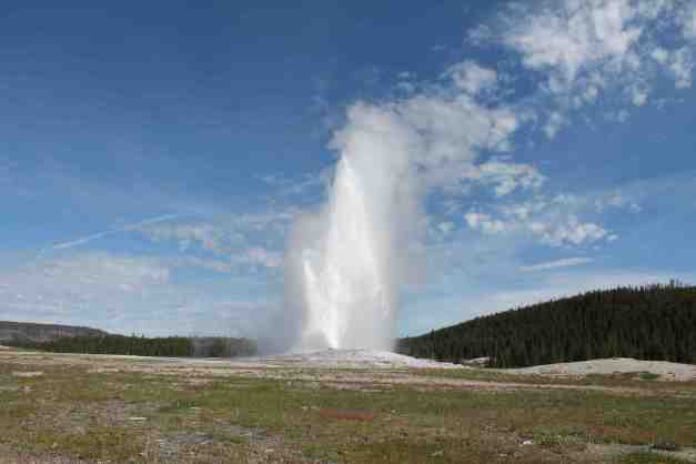
After grabbing a latte at the Old Faithful Inn, I noticed it was close to 11am. I assumed from the prior day that the parking lots at the other popular areas would be filling up. It was time to figure out which exit I wanted to use to leave the park.
I studied the road conditions at Glacier National Park. As you may remember, one of the last roads I wanted to travel was the Going To The Sun road in Glacier. According to the National Park Service site, the park experience both significant snowfall followed by significant rain. There was a resulting rock slide, and apparently some guardrails were destroyed. In addition, there is now significant avalanche danger. Finally, the plows that had been attempting to clear the roads at higher elevations were repositioned to lower elevations to clear them (again).
I’ve decided to skip Glacier on this trip. I will attempt to schedule a trip to the park later this summer.
Once that decision was made, I chose to travel directly to Missoula today. The BMW dealer is closed on Sundays and Mondays, so I am going to get the headlight replaced tomorrow (Saturday) at the dealer here in town.
Then I’ll head west on Hwy 12.
Day 48 – Missoula to Moses Lake

Day’s distance: 379 miles
Total trip distance: 8,182 miles
It was a picture perfect day. Few clouds and comfortable temperatures, mostly in the 70’s. Light winds only.
The first order of business today was to get my headlight bulb replaced. Did that at the Big Sky Motorsports shop in Missoula. It took less than 30 minutes. Good strong coffee by the parts desk!
In no time, I was leaving Missoula on Hwy 12, which takes you quickly out of the city and into small farm and forest lands. The roads are in good condition with one lane each direction and the speed limits in Montana were still 70 MPH.
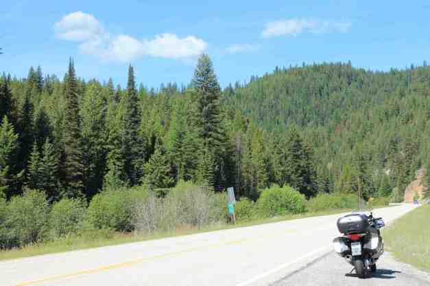
The road follows the historic Lewis and Clark Trail through Lolo Pass. There is a Visitors Center at the summit. At this point, I have just crossed into Idaho. This is the sixteenth and final state of my adventure!
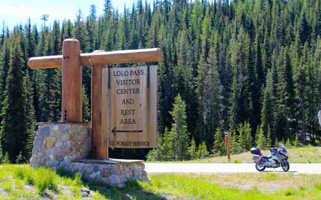
Just down the hill a mile or so, I saw a sign that made me grin from ear to ear. Perhaps the message is applicable to any interesting and worthy journey.
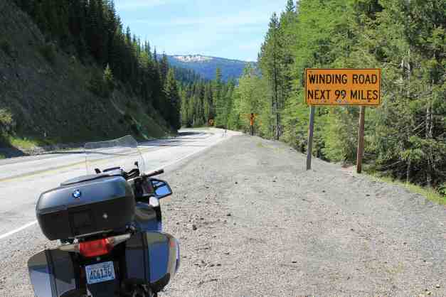
The Idaho side of the Lewis and Clark Highway was superb roadway for a motorcycle. Good surface, beautiful scenery, 55 MPH and twisty for 99 miles. The road follows the Lochsa River, and there were rafting parties out today.
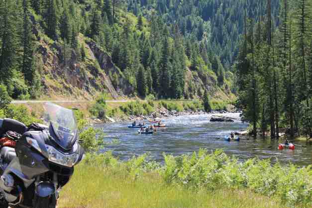
There were also Pipeline riders on surfboards, stand up boards, and boogie boards. Here is a short video showing what can be described as stationary surfing.
I noticed a large number of butterflies on the Pass. While filming the pipeline action, I had a butterfly visit. I wonder if they are migrating or hang out there year-round.
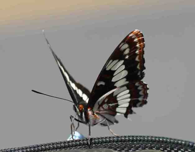
I stopped in Kooskia for lunch.
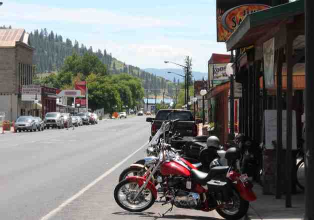
My route after Kooskia was a little random. I was going to go to Spokane and start my last day from there, but I thought I could go a bit farther. The destination changed again as I approached I-90 and wanted to be sure to stay in a nice(r) place tonight for my last night on the road. Finally, I decided on a place in Moses Lake.
Day 49 – Moses Lake to Seattle (Last Day)

Day’s distance: 373 miles
Total trip distance: 8,555 miles
Temperatures were warm, the day sunny and comfortable. The winds were moderate on the western side of the North Cascades.
I left just a little after 8am, and headed north on Hwy 17. I wanted to visit the Grand Coulee Dam. The road was lightly traveled and the terrain was beautiful, helped by a number of lakes and geology that reminded me of the canyons in Utah.
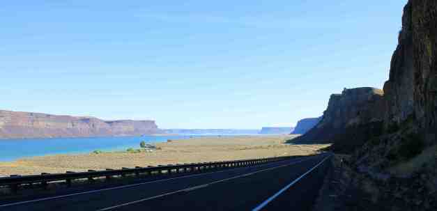
The Grand Coulee Dam. Constructed between 1933 and 1942, it is the country’s largest hydroelectric power production facility. It is also one of the largest concrete structures in the world.
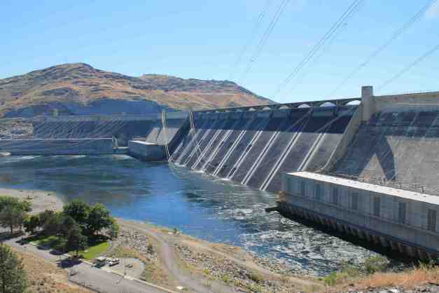
Heading for the North Cascades National Park, I passed through Omak for a latte stop, then I headed for Hwy 20 in Okanogan, WA. On the reservation lands east of Omak, I saw a young-ish black bear running into the woods from near the side of the road. Since I could not tell what he was running from, and I was traveling at speed, I didn’t get a photo. Bummer, it is my only bear sighting on the trip.
My final goal and one of the local highlights of the trip was to travel through the North Cascades. It was beautiful.

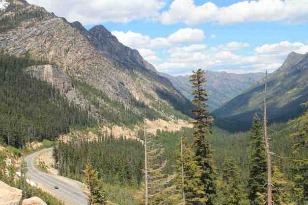
As it was early afternoon, traffic was a bit heavy and I ended up following a long line of cars down the western side of the park to Diablo Lake and beyond.
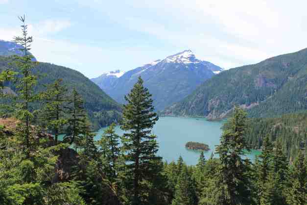
Traffic on I-5 was relatively light and I arrived home shortly after 5pm. I had a celebratory martini (or two) once the bike was safely back in the garage. What a great motorcycle adventure to have taken!
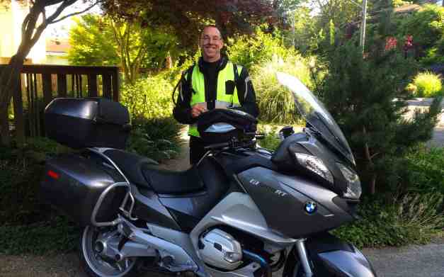
Wow, I will have to do this again !!
Reflections on often-asked questions …
On a scale of 1 to 10, 10 being the best, how would you rate this vacation?
Definitely a 10. Here’s why …
– I found a fun way to travel
Touring by motorcycle is a travel option that fits me well, at this point in time. Exposure to the local environments and the pace of travel (a few hundred miles per day) create a sense of journey that is essential to a satisfying travel experience. Vacationing this way takes longer and therefore provides more of a break from daily life. It provides opportunities to interact with others along the way and this sharing adds depth to a journey.
– I pushed the boundaries of my comfort zone
This trip is the longest motorcycle ride I’ve ever taken, by a large measure. It turns out I planned enough to be confident in my ability to complete the journey, but not so much that I killed the spontaneity. By completing the ride, I’ve acquired a sense of accomplishing something pretty rare – an adventure of great length and breath.
– I visited many new places
Before this trip, I have never been to many of these places. To discover them by traveling minor highways and scenic byways was icing on the cake. To arrive in a place and see motorcycles everywhere seemed reassuring. Arriving by motorcycle seemed to continually provide a sense of accomplishment.
– I met lots of interesting people
I was asked if I was lonely traveling this way. Most of the time I was not. Pretty much every day I met people who asked where I was from, where I’m going, how far do I ride each day, etc. And most folks had their own travel stories. I shared meals and drinks with many along the way.
– I shared my experiences as I went
Blogging was new to me when I started this trip. It was an effort but I found it surprisingly worthwhile. On the road, I would look for stories to share and photos to capture, keeping me engaged all the way up to the last day. It was satisfying to hear from folks who followed me and how it reminded them of their travels, or how it made them want to travel, or gave them a sense of vicarious travel.
– I felt safe and well supported on the road
I had good friends to call when I needed help or ideas on what to see. And an entire network of BMW dealers spread around the Western United States available. Finally, I had AAA coverage and insurance galore. Of course, with all that preparation, I encountered no major problems, lost nothing and had nothing taken from me.
How far did I ride each day?
It varied. Below is a chart with each day’s distance. I took days off throughout the trip. Even taking one down day helped refresh me. I did have two days where I traveled more than 400 miles and I traveled more than 1,000 miles on the last three days combined.
 |
| Daily Mileage during the trip |
Was it comfortable to ride a motorcycle that far and for that long?
Yes! It took about a week to get used to being on the bike for an extended period everyday, but this bike is designed for touring. The wind screen adjusts up and down and helps keep me from feeling beat up at the end of the day. The handlebar grips and the seats are heated, the suspension adjusts electronically for comfort. As I put on the miles, I became very comfortable with the way the motorcycle handles and how well designed and built it is. I wore appropriate clothing that is specially designed to keep me warm, dry, and comfortable.
What was the best part of the whole trip?
That’s easy. The best part of the whole trip was taking time off to make it happen. We so often put off our dreams for so long that they become impractical or impossible. I’m very happy to have created the opportunity to take this trip. Thanks go to everyone who helped support it and make it so very rewarding.
