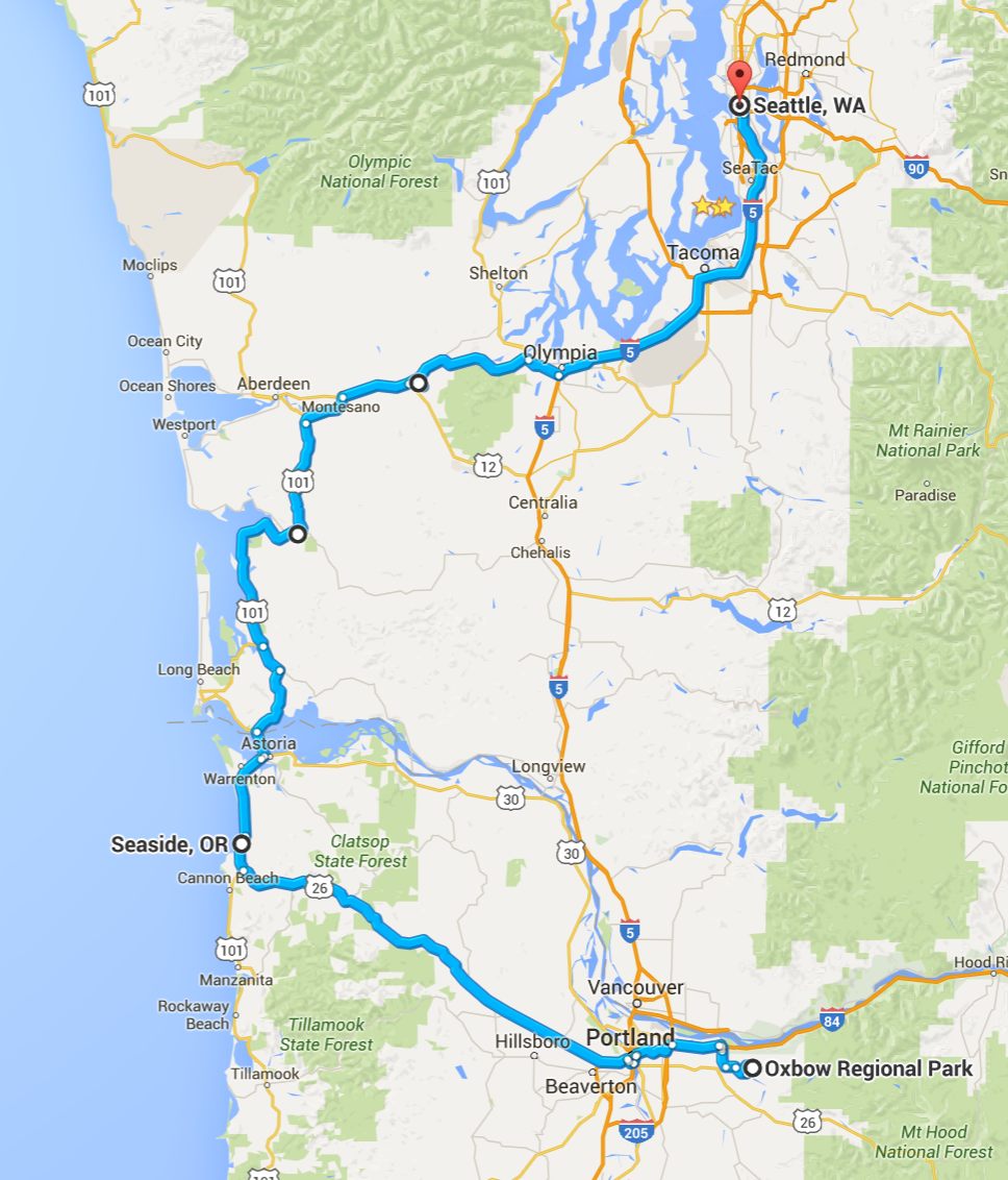
This three-day solo motorcycle adventure thru the Lower Columbia River Basin began on October 4th.
I would first travel along the east and south base of Mt. Rainier, then head southwest to ride along the northern shore of the Columbia River before crossing into Oregon.
From Heppner, OR back to the coast, I would visit small towns along the ‘Blue Highway’ and ‘Lost in Time’ Scenic Byways of that region. I end up at the base of Mount Hood, before heading further to the Oregon Coast.
Day 1

Day’s distance: 349 miles
The temperature ranged from the low 50’s in the mountains to high 70’s along the Columbia River. It was partly cloudy but not even a hint of rain.
Leaving the house just after 9am, I traveled east on I-90 to Hwy 18 west. I then traveled south on Hwy 169 into Enumclaw for a latte and some fuel for the bike.
Continuing east on Hwy 410, I left Enumclaw and headed along the eastern edge of Mt. Rainier.
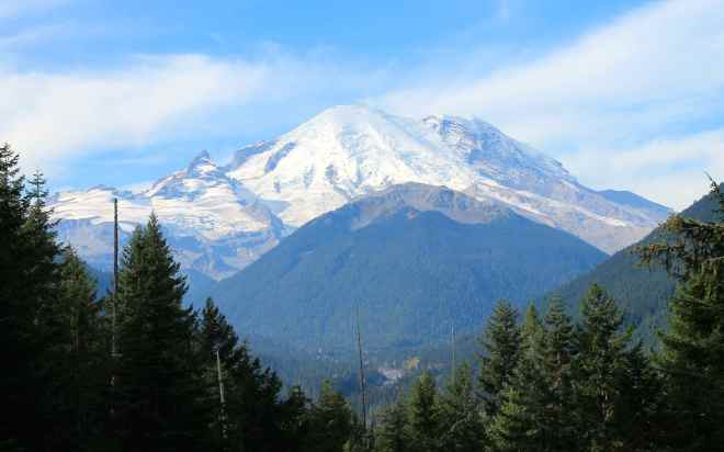
I planned on riding along Hwy 123 but passed the turnoff, temporarily, to travel a few miles further to Chinook Pass.
From a previous day-trip, I knew there would be an opportunity to get another photo of Mt. Rainier near Tipsoo Lake.
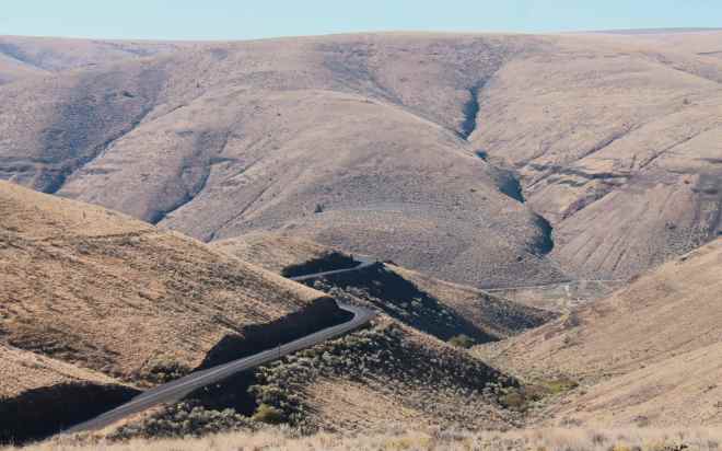
I turned around and returned to the turnoff for Hwy 123. This is a fun, twisty road that continues to hug the base of Mt. Rainier.
Some shady parts of the road were still damp from overnight fog and while the road is in good shape generally, the few tar snakes that are present were pretty slick this morning.
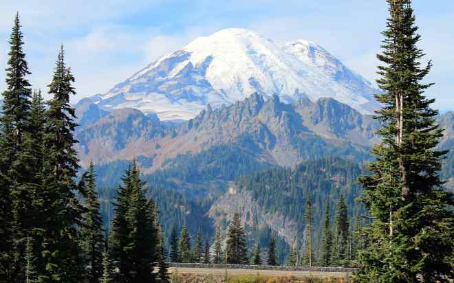
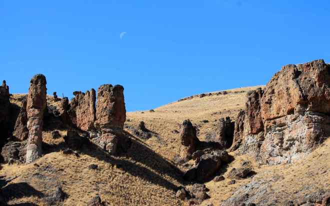
Soon, Hwy 123 ended and I turned east onto Hwy 12. The Palisades Viewpoint is a scenic overlook along Hwy 12 just west of the top of White Pass. I saw another good view of Mt. Rainier from here …
as well as an interesting column basalt rock formation.
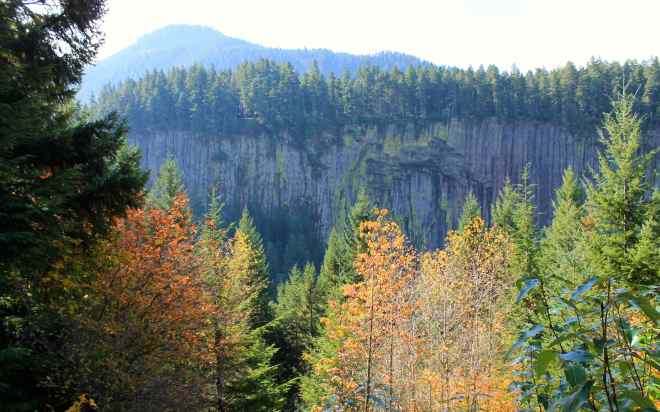
Here’s the story of how a local volcano’s lava flow is assumed to have created the column basalt.

and a close up that fails to capture the amazing qualities I saw in person.

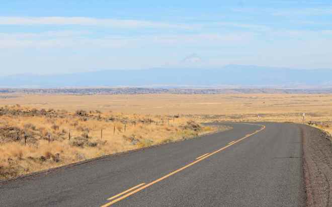
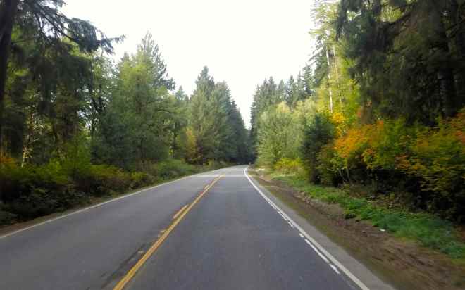
Hwy 12 lead to Yakima where I chose to take Hwy 97 south because I enjoyed the forested portion of the road north of Glendale …
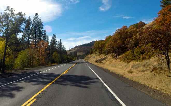
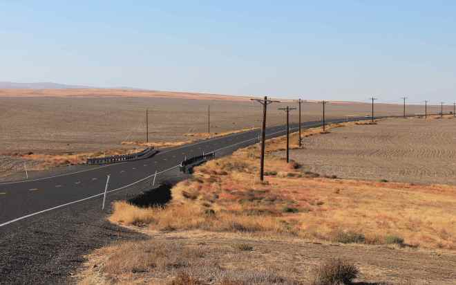
and I enjoy the ride along the Columbia River.
For those considering traveling along the north shore of the Columbia River, be aware there is a significant distance without access to fuel. I believe it is an 82 mile stretch between service stations. I knew this from a ride I took in 2013 with my regular riding buddy, Will, and topped off in Goldendale.
Day 2

Day’s distance: 268 miles
Total trip distance: 617 miles
Temperatures ranged from 50 to 78 and the skies were mostly clear all day.
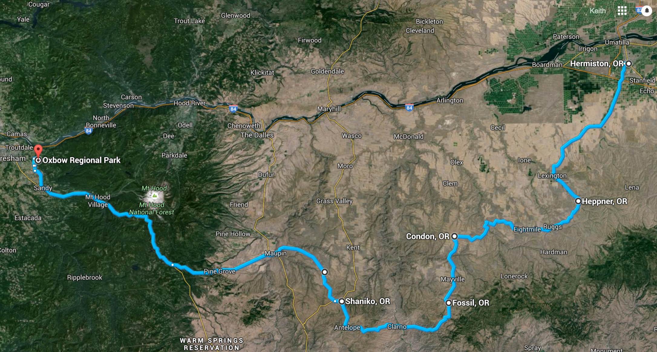
My original goal today was to get to the coast, but when I was programming my route into the Garmin (GPS) this morning, I realized that was going to make for a very long day if I used the back roads as planned. Since I was here to see the back roads, the only choice was to shorten my day. 🙂
In order to convey the variety of landscapes I traveled through today, I’m adding a satellite view of my route.
After checking the weather around Mount Hood to see how cold it would get tonight, my new goal was to camp at Still Creek as I had done on my 2015 Trip to Wallowa Lake. With my route set, I was ready to head out. The time was about 9:15am.
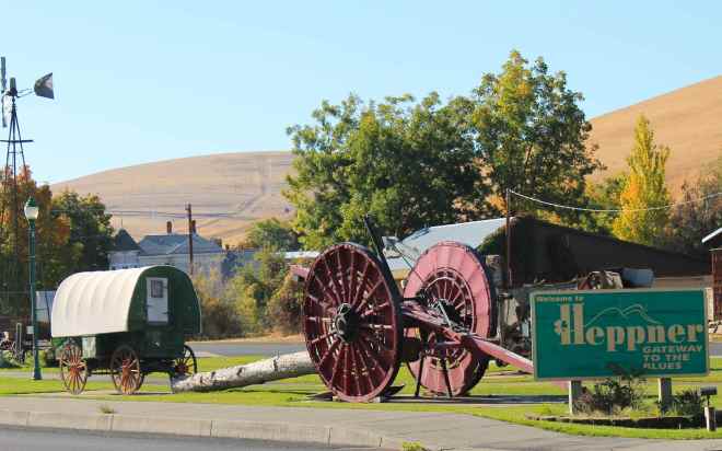
I traveled Hwy 207 to Lexington and turned south on Hwy 74 to Heppner. The road took me past what seemed like very large farms stretching virtually as far as I could see. The two-lane paved road was in good shape, with a few gentle turns to accommodate the slightly hilly terrain. Traffic was light, locals mostly with a camper now and then.
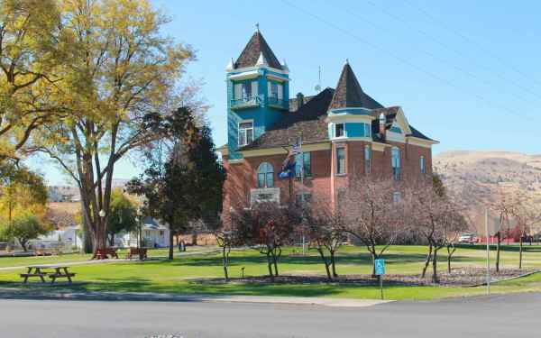
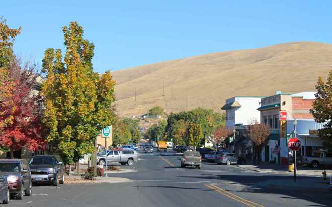
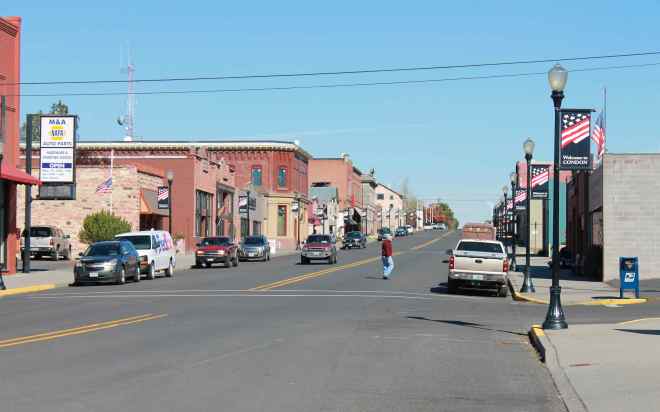
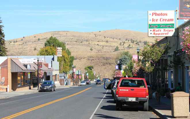
On reaching Heppner, I found an storybook small town.
I took Hwy 206 to Condon. Along this part, the valley seemed to narrow and the otherwise gentle turns were punctuated by the more frequent and interesting turns. There was a good set of curves about 2/3rds of the way, including a downhill hairpin and a set that looked snake-like.
I stopped in Condon for an early lunch,
choosing a cafe & retail shop named Powell’s because they had an espresso sign. I had a chicken bacon wrap with a latte. Both were good, unexpectedly so 🙂
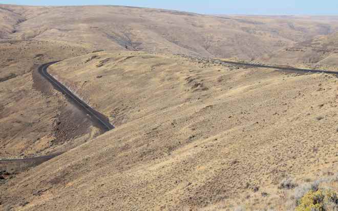
From Condon, I headed south along Hwy 19 to Fossil. The valley continued to narrow turning into more of a dry ravine at times and then open up again revealing smaller farms and ranches. The road was generally in good shape with some patches from prior maintenance work. Not as smooth as before but not too troubling.
Today’s tidbits: Fossil is a town intersected by the 45th parallel, according to a sign I read. This means it’s located halfway between the equator and the North Pole. It is known for fossil beds named after John Day, and explorer from the early 1800’s that are located near the town.

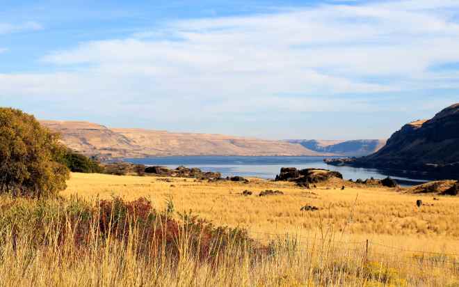
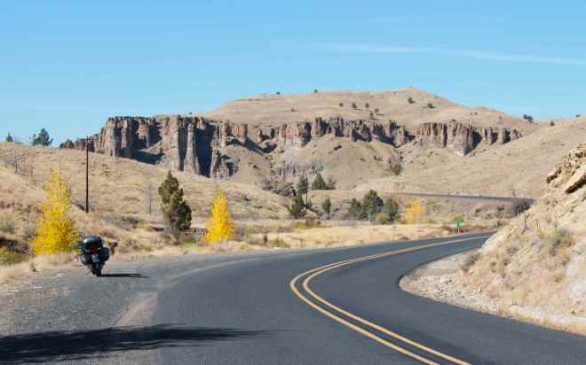
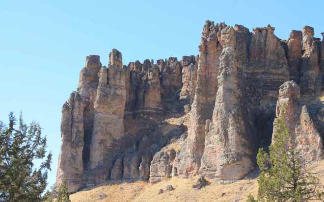
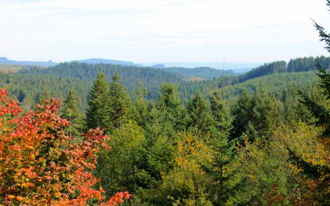
The variety of scenery seemed to just get better and better this day. West of Condon are the John Day Fossil Beds located at multiple sites. The local landscape at the Clarno Unit was other wordly.
Entering Antelope, I turned north to Shaniko and from there I headed to Maupin using the Bakeoven-Market road. This was a view of Mount Hood, my destination, from across a wide valley.
There was a series of switchbacks coming down into Maupin that would have been more fun if the gravel kicked off the shoulder by trucks in the tight turns. I just took it slowly and avoided sliding.
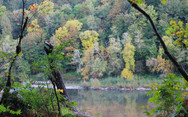
The Deshutes River runs through Maupin and it was here I took a break to have a soda.
I met two riders on Harleys from Iowa. They were heading to Astoria to then travel down the coast and return to Iowa along route 66.
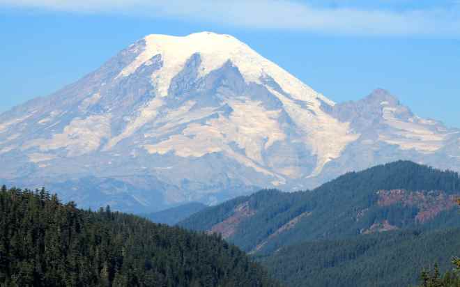
Taking highway 216 west towards Government Camp, I began to discern what I thought was a wildfire near Mount Hood. I couldn’t find any information on it online and reached out to Will, who was at work, to see if he could find anything online while I continued onward. Neither of us found any information and it now seemed to the east of Mount Hood, so I stopped worrying about it.
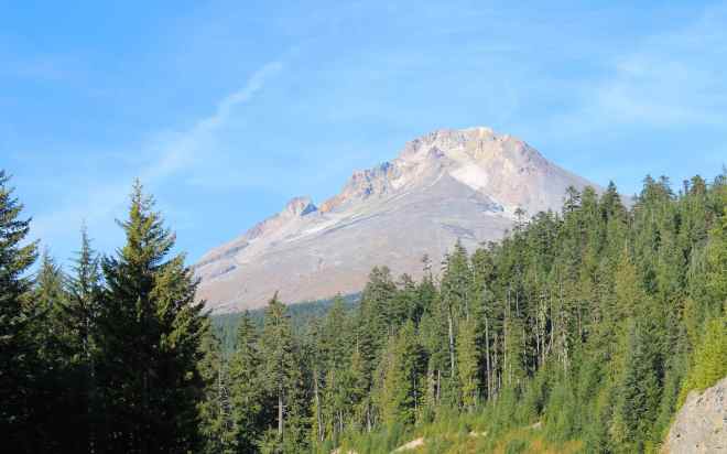
After stopping for fuel, and taking a photo of Mount Hood …
I reached Still Creek Campground to find it closed. 😦
In fact, I found all the Mount Hood National Forest campgrounds in the area were already closed for the season. That seemed a shame on a day when it was 78 degrees and only dipping into the 50’s at night. Oh well, it was time to come up with a new plan.
I remember about a County Park that allowed camping near Sandy, Oregon called Oxbow Regional Park and called. They were open and had plenty of spots. I let folks at home know about the change in plans and headed there to find it to be a wonderful campground, situated along the Sandy River.
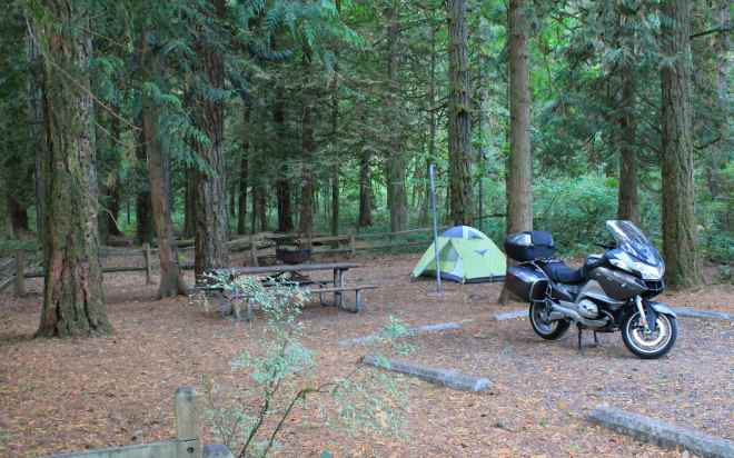
It was quiet at night and I slept well.
Day 3
Day’s distance: 297 miles
Total trip distance: 914 miles
Temperatures began in the low 50’s and warmed up to the 60’s along the coast. On reaching the coast, I found it to be pretty windy, though mostly for me a it was a tail wind, the best direction for a biker 🙂
My route this morning took me through Portland and then to the coast along Hwy 26.
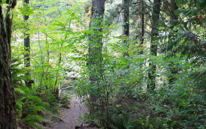
Hwy 26 travels through the Clatsop State Forest and provides some pretty views.
On reaching Seaside, I turned north along Hwy 101 and stopped for lunch before leaving town. As mentioned above, it was pretty windy. While I was considering camping on the coast one night, I received an updated weather report from Will, who’s been following my trip. Rain was predicted for this evening. I decided to head home.
Re-entering Washington, I could have gone either left, towards Cape Disappointment and Long Beach, or right where I would be slightly inland and would meet up with Hwy 101 a little later in the day.
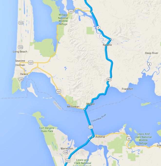
I decided on the ladder option, a route I haven’t ridden since 2013. I grabbed a photo of part of the Astoria-Megler Bridge, now behind me, before saying goodbye to the Columbia River and my exploration of the lower Columbia River Basin.
Highway 401 follows the Columbia for a while until turning north to meet Hwy 4. Both these roads are two lanes and are in fine shape. I saw a few other bikers heading the other way and waved. The clouds were building up, as was the truck traffic. As it was roughly 2pm, I knew I would end this trip in commute traffic on I-5 near Seattle. Not incredibly relaxing. 😦
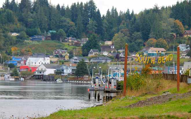
I stayed focused on making progress and stopped only once more for fuel and to take a photo of South Bend, a small fishing town.
It was just after 5pm when I arrived home, safe and sound. A great trip, this felt a little like my last “longer” trip this year as Seattle’s weather will begin to enter it’s fall pattern of rain, and more rain.
Reflections
With this ride, I have surpassed traveling 21,000 miles this year, so far. That puts me about 6,000 more than last year at this time. It’s been fun, to say the least. A record-year for service costs go along with the mileage record. I’m in already for more than $2,100 and projecting to pass $3,000 with the next service and tire set due later this month. No doubt choosing an R1200RT and riding it so much is a luxury 🙂
The Pilot Road 4 tires have lasted 11,000 miles and I can likely get another 1,000 miles while staying safe. I’ll switch them as soon as I need to stay within the usable tread life. While I was able to stretch my first of PR4 tires to 13,000 miles, this third set has mostly been used ‘loaded’ down with luggage. I’m very happy with these tires and will use them again.
I recommend traveling east to west between Hermiston and Mount Hood, if you follow this route through the Lower Columbia Basin. You’ll see changes unfold that increase the fun as well as the scenic value. Feels like it just gets better 🙂
Watch for gravel on the roadways through the farmland in the lower basin, especially where it gets twisty. These highways are used by 18-wheelers and they kick up gravel in the curves. Just FYI.
