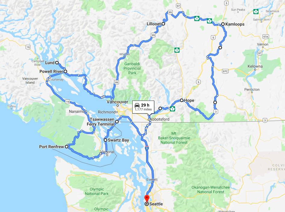
On June 6, I started a seven-day motorcycle adventure with three new friends. The first-half of my 1,074 mile (odometer) ride included 103 miles of ferry travel. Views of the Pacific through southern Vancouver Island and down the Sunshine Coast from Desolation Sound.
The second half of the ride included Duffy Lake Road to Lillooet, BC and new to me, the Princeton-Kamloops Highway (Hwy 5A) and EC Manning Provincial Park to Hope along Hwy 3.
Day 1

Day’s distance: 145 miles (odometer)
Temperatures ranged from the low 50s to low 60s with occasional showers. I left the house shortly after 8am and stopped for a coffee and snack in Sedro-Woolley.
Today’s goal was to get to Vancouver Island to meet up with Harald, a friend who is joining me for much of this trip. He is hosting me at his home for this first night.
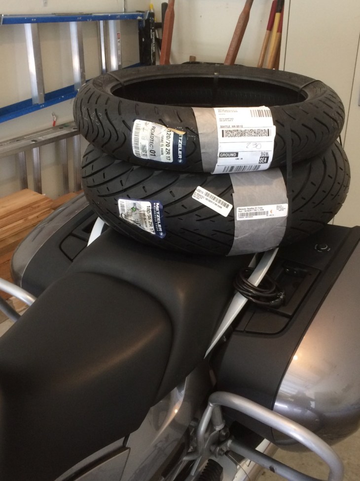
In preparation for the trip, I had the bike serviced and new tires installed.

After using the Michelin Pilot Road 4 tires for years, I decided to try a set of the Metzler Roadtec 01 HWM tires, shown in the photo above. I will provide some feedback on these tires after the trip, but I’m hopeful they are smoother and a bit better performing overall that the PR4s.
I’m also trying some new dehydrated meals. For years, I’ve used Mountain House brand meals. This trip, I packed meals from both Backpacker’s Pantry and the Good To Go brands, just to see how they compare in price and flavor.
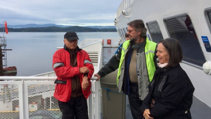
Motorcycles get priority boarding here, just like in Seattle. After paying my fare, I rode to the front of the line. The cost of the ferry, me plus the motorcycle, was just under $35 US.
Instructions are posted on the bulkhead for newbies like me.

Another motorcycle rider was able to walk me through the process. It was a smooth sailing on this rather large ferry.

The scenery from the ferry was pretty amazing, especially traveling through the relatively narrow cut between Galiano Island and Mayne Island.

The ferry crossing was about 95 minutes long. Harald met me near the ferry terminal and escorted me to his house. Afterwards, we went out Sidney for an afternoon coffee and a bit later to friend’s of Harald for dinner.
It was a good start to the trip and I’m excited about exploring new-to-me parts of the western side of Vancouver Island tomorrow.
Day 2

Day’s distance – 195 miles
Total trip distance – 340 miles
Temperatures ranged from 50 to 65 and showers continued along the coast and followed us inland throughout most of the day. The skies did eventually clear in the mid-afternoon.
We departed Harald’s place a little after 8am.

Our first destination was the town of Sooke. We both topped off with fuel here. Premium fuel was $1.74 CAD / liter which translates to about $5.14/gal in USD at today’s exchange rate.
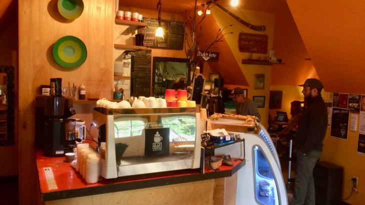
Next came finding that morning latte. For that, we continued along the coast to Shirley, where Harald knew of a cafe in the town of Shirley, named Shirley Delicious Cafe.

The inside reminded me of cafes in Santa Cruz – kind of a hippy vibe. The place was super busy, both with tourists like myself but also with the locals. Good pastries and great coffee, I recommend stopping!
Because Harald doesn’t have a helmet communicator that could pair to mine allowing us a chance to talk while moving, I took the lead riding to Port Renfrew. This allowed me to stop for photos whenever needed.
Hwy 14 had some rough patches, including frost heaves and tar snakes, but was a blast to ride. The road is used by tourists, bicyclists, logging trucks and locals, the road is heavily used and it shows. What makes it fun to ride are the frequent curves, the constant elevation changes as it sometimes is on the coast, sometimes a little inland, blind curves with just a bit of gravel thrown in mostly where the logging trucks exit the forest roads.
While it was raining when we arrived at the cafe, it stopped by the time we left, providing at least a temporary opportunity to get out the camera.
The Jordan River spills out onto the coast between Shirley and Port Renfrew.

Because of how waves break at this point, this is one of the most popular places on the island to surf. Alas, there were no surfers out when we went passed. 😦

A short time later, we entered Port Renfrew.
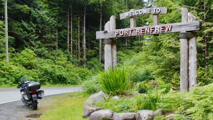
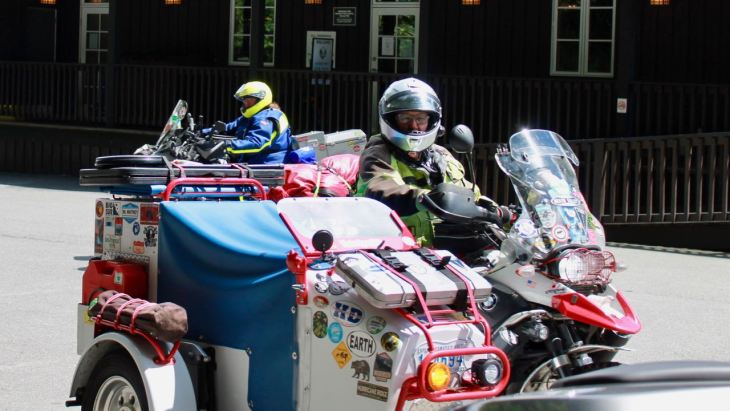
Although you only see my bike in this picture, we spent 10 minutes talking to two sidecar riders who were on their way to Alaska.
Randy has, over his lifetime, ridden BNWs over one million miles. Lori, in the other sidecar, was fulfilling a lifelong dream of visiting the Grizzlies in Kodiac. Their custom sidecars carried a lot of supplies and fuel allowing them to camp and travel independently for days. Lori was capable of carrying 18 gals of fuel, for example. Randy’s motorcycle, with him on it, weighs 1800 pounds!
We took a short break at the marina and ate the lunch sandwiches that Harald packed for us before heading across the island past Lake Cowichan.

The Lake Cowichan road was rougher and narrower than Hwy 14. The rain returned as we entered the mountains – heavily enough that we stopped to add a layer of rain gear around us.

For me, this was the most enjoyable road of the day – very twisty, very fun. Watch for one-lane bridges on this road – there are many.
The new tires are performing excellently in all conditions so far! I’m happy to have them.
We stopped for another break in Lake Cowichan. I had a Root Beer Float at the local A&W located right across the park in the center of town.
The rest of the ride to our campsite consisted of stop and go commuter traffic.
We decided to stay at the Rathtrevor Beach Provincial Park. We did not make advanced reservations and only the tent area was available. That was fine by us!
The beach was just beyond the trees. The rain had stopped for the day. After we had two of the camp meals I brought, we took an enjoyable walk along the shore.

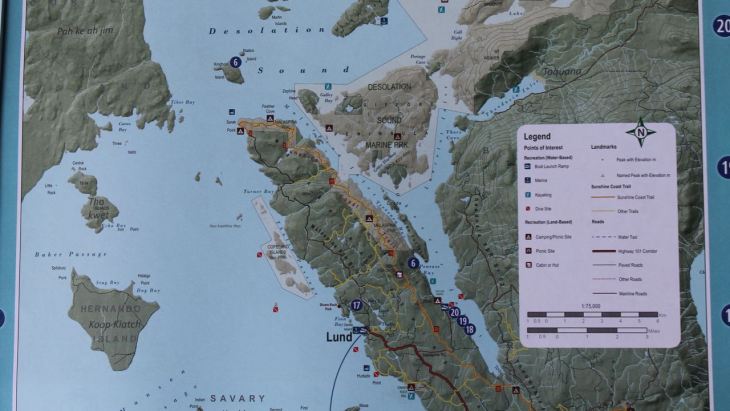
Tomorrow, we continue north a bit further before we catch a ferry to Powell River, our staging point for a visit to Desolation Sound.
Day 3

Day’s distance: approximately 100 miles (odometer)
Total trip distance: 440 miles
The day was partly cloudy with warmer temperatures, mid-50s to mid-60s. No rain fell on us today.
Since I brought an oatmeal/quinoa breakfast meal, we rehydrated it along with some tea for breakfast. After we finished, we packed up our gear. No dew settled on the tent overnight, so packing up was quick.
Our first stop was Starbucks for a latte.
We sat outside and planned our day. Our only realistic option for the ferry to Powell River departed at 3:25pm, so we had time to do a little site seeing.
Harald, an avid hiker, took me to MacMillan Provincial Park. There are short trails easy to navigate for most folks. Each trail is short so we walked along two of them.
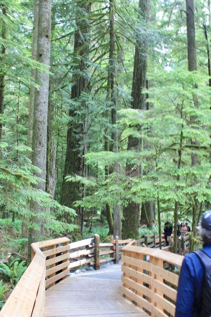
MacMillan lake is visible from one of the trails.

We backtracked to Coombs for lunch at the Old Country Market. The draw here for tourists, besides local cheeses and meats, are the goats on the roof. There are four or five goats who graze on the grass.
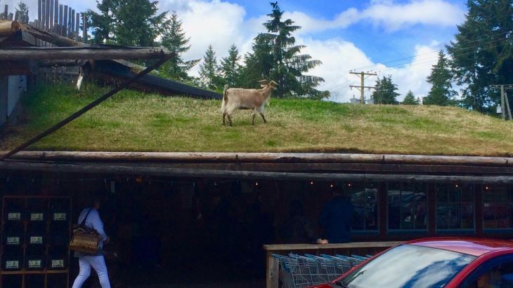
Lunch was great! Highly recommended.
Afterwards, we continued north on Hwy 19. At the rest stop just south of Union Bay where we met Preston Gill. His motorcycle trip started in Louisiana on his three-wheeled motorcycle. His newly replaced clutch gave out in Modesto, CA. The dealer who installed the clutch apparently was refusing to warranty the service so he ended up continuing his trip on a used bike he purchased there.
Preston switched to a trike when his knees started to give out. Being shorter and older and now used to riding a trike, Preston found he can’t manage this used two-wheeled bike and was cutting his trip short – a very stressful decision for him.
We wished him well and I am following his trip now on Facebook.
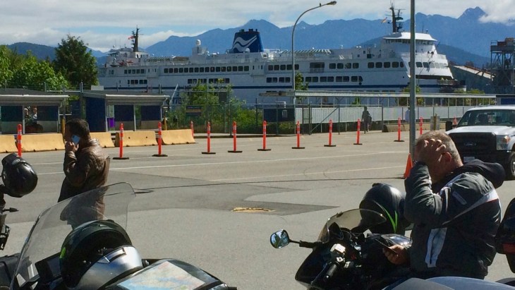
We first arrived at the ferry terminal just after 2pm. There was time to back track a few kilometers for an afternoon coffee before boarding. We met a Canadian there who had put over 300,000 kilometers on his Gold Wing. That is well over twice the distance I’ve ridden – amazing!
The line to board the ferry was short. Bikers are given priority boarding.
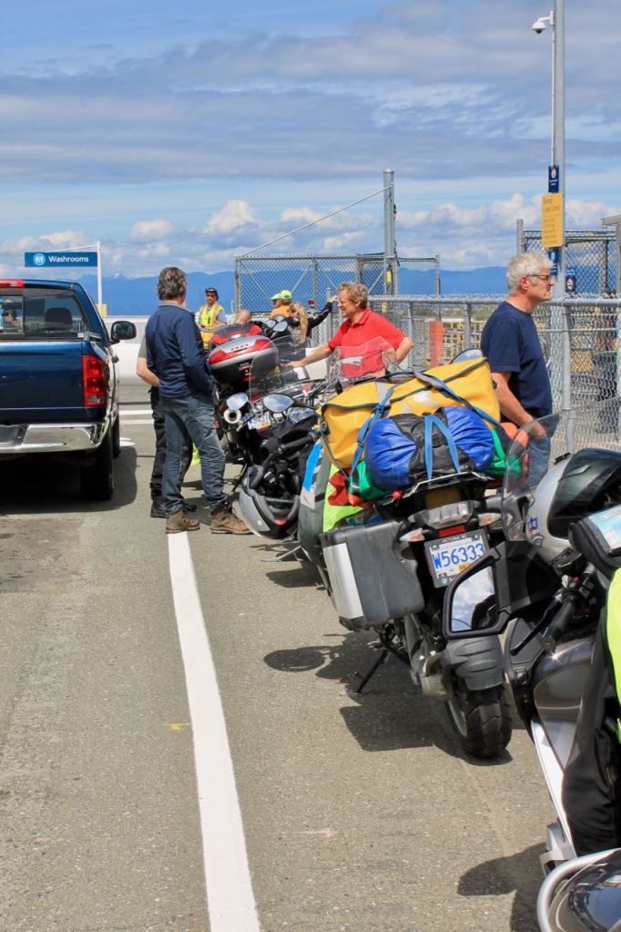
On these ferries, motorcycles are loaded at a 45 degree angle to the direction of the ship. You leave the bike on the side stand in low gear, and place a block under the side opposite the side stand. That’s it!
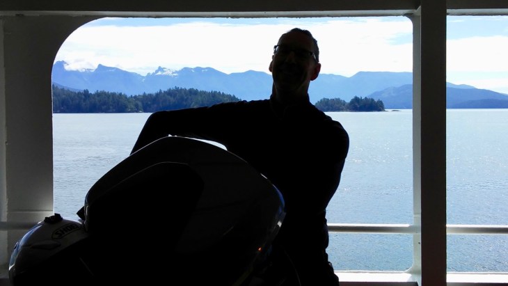
The ferry crossing to Powell River took about 90 minutes and was calm sailing.

Our hosts for the weekend live near Lund on about 20 acres. The place is beautiful and has a view of the water and surrounding islands.
They have a lot of fun home-made toys, like a giant teeter totter …

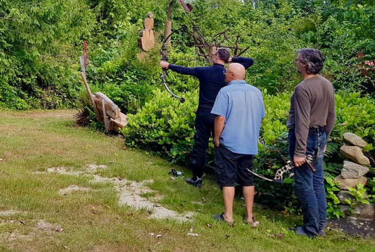
as well as some compound bows, which I’ve never tried before.Image
They suggested we stay here in Lund an additional day. Then they will accompany us on our ride down the Sunshine Coast and eastward to Lillooet, BC on the following day and needed to plan and prepare. Win-win for everyone!
So, Harald and I will do a little exploring on motorcycles in the morning. In the afternoon, our hosts will take us sailing on their boat. I can’t wait!
Day 4
Day’s distance: 25 miles
Total trip distance: 465 miles
Temperatures were in the 60s with occasional cloud cover and a few light sprinkles.
This morning Harald and I rode the few miles remaining to reach Lund, BC, our turnaround point.

Lund is also known as the end (or start) of Hwy 101, the northern most point of the Sunshine Coast Highway.

We walked around the small town a bit before settling into chairs at Nancy’s Bakery, overlooking the marina.


I had a breakfast burrito with my latte. Both were very good. Afterwards, we headed back to our host’s house to get ready to go sailing.
So, in the early afternoon, all four of us headed down to the marina in Powell River. There were only light winds as we headed out.

They let me helm the boat on the way out.
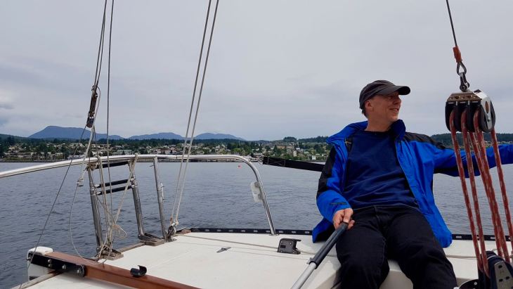
We ended up motoring back after about an hour on the water.
After we returned, I was treated with a bit of a tour of Powell River, including a hike up Valentine Mountain Park …
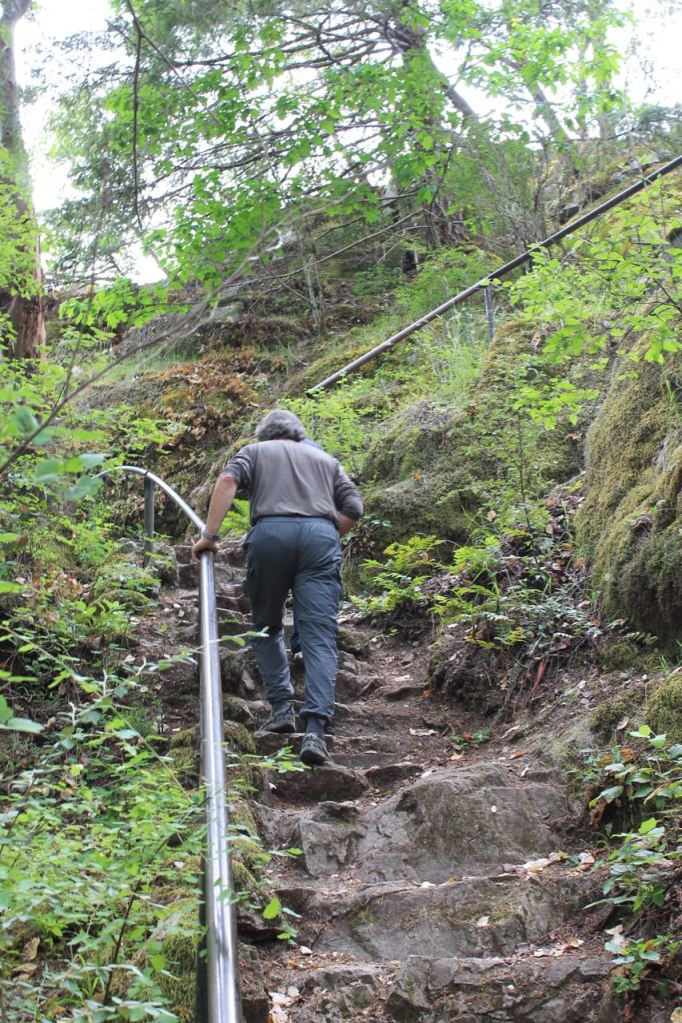
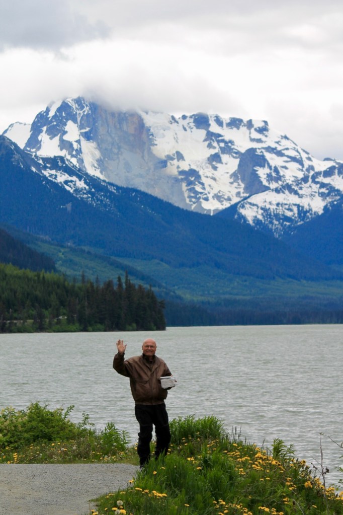
for the view and a chance to take one more photo. 🙂

Tomorrow, all four of us head down the Sunshine Coast Highway and to Lilliooet for another night (or two) of camping while we explore some of the more scenic byways in British Columbia.
Note: As always, I will try to complete each day’s blog in a timely manner but I may not have access to the internet each night we are camping.
Day 5
Temperatures started in the mid 50s and reached into the low 80s inland by the afternoon.
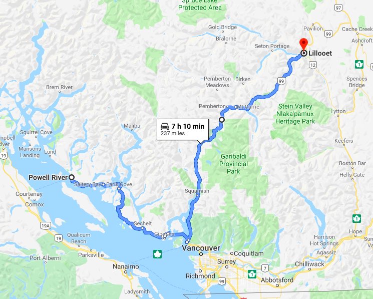
Our route today took us down the Sunshine Coast just north of Powell River to Horseshoe Bay.
Spoiler Alert! Today would turn out to be my favorite day of the trip. The Sunshine Coast was definitely on my bucket list for it’s incredibly scenery. The two ferry rides involved provide time to take in the snow-covered mountains reflecting off the water. In addition, our group now consisted of four riders and three motorcycles!
Our Lund hosts joined us for the second half of this motorcycle adventure. The start time for today’s ride would be dictated by the ferry system. We left the house at 6am and rode down Hwy 101 without stopping until we reached Saltery Bay. To avoid delays in our long day, we planned to arrive early.

A total of five motorcycles were loaded ahead of the cars on this transit.

I felt like an old pro getting the bike on and off the BC ferries. Drive on and park where shown, always at a 45 degree angle to the direction of travel in first gear using the side stand. Then place a block under the high-side of the motorcycle. Easy breezy.
Today would be smooth sailing to Earl’s Cove, about a 50 minute voyage. The day wasn’t as clear as a photographer might want, but it’s all part of the journey.

We turned off the highway during our ride from Earl’s Cove to the next ferry terminal because the ferry schedule has extra time built into it. It was interesting to see one of the local neighborhoods off the main road.

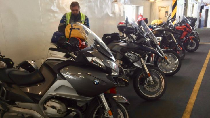
The second ferry ride is shorter and is free if you’re heading south. The terminal is quite a bit busier and the ferry larger. There we more cars than would fit and about 20 motorcycles that load first.
Loading takes just a few minutes and we’re off again.
Once off the ferry, we needed fuel and lunch. We stopped in downtown Squamish. I grabbed some cash from the ATM and met Harald at the Zephyr Cafe.

I ordered the Quinoa Bowl and a latte. Both were excellent and at least one contributed to a healthy road diet. 🙂
The next section of ride, Hwy 99 to Lillooet has a few names. From wikipedia,
The “Sea to Sky Highway” is the name given to the section of Highway 99 from Horseshoe Bay to Pemberton…. [Twenty miles] later, where the Sea-to-Sky Highway ends, Duffey Lake Road begins. After going for almost [62 miles] in very steep mountains …, Highway 99 reaches the junction with Highway 12 at Lillooet.
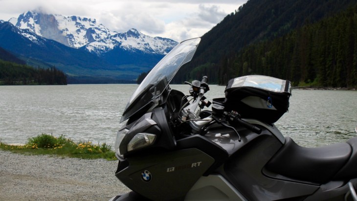
I’ve ridden this road at least three times in the past. Each has been wonderful and each felt different. The mountains have a character that they can’t resist sharing – one which is weather and season dependent.

Here’s a video I took on a past ride to Lillooet.
We noticed today a new slide on Joffre Peak. I read that it occurred just this May. No one was hurt. Whew!
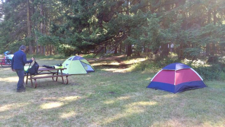
We camped at the BC Hydro Seton Lake Campsite – a free site and filled on a first-come basis. It had water available and pit toilets. Simple basics tonight.
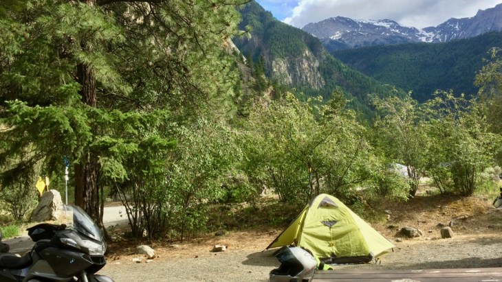
We shared food and conversation until dark. Tomorrow we head east along roads I’ve not traveled before. We expect warmer temperatures and more sunshine.
Day 6

Temperatures warmed up significantly today as we dropped off of the coastal mountains and into flatter lands. Hope was 91 degrees when we arrived.
Similar transitions are found traveling to eastern Washington, Oregon and California.
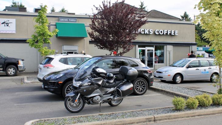
Our day started with a latte from the A.bun.dance Bakery. Woohoo!
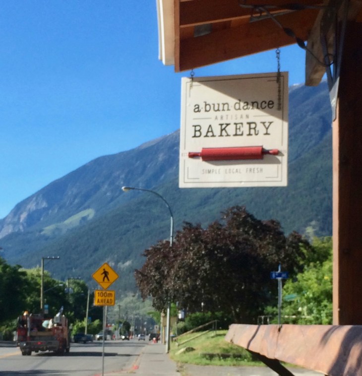
The bakery is just steps from the Mile “0” marker for the Cariboo Wagon Road.

According to Wikipedia,
The town had its start as one of the main centres of the Fraser Canyon Gold Rush of 1858–59, during which it was reckoned to be “the largest town west of Chicago and north of San Francisco“…. Lillooeters still, however, consider their town to be “Mile 0” of the original Cariboo Wagon Road, and it is true that the numbered roadhouse names of the Cariboo district are measured from the bend in Main Street, where a cairn was erected to commemorate this fact. https://en.wikipedia.org/wiki/Lillooet
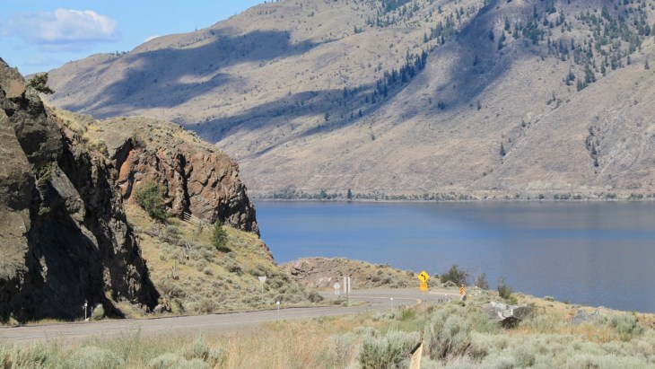
Not yet through the same construction zone located just east of town I encountered last year on the last day of my 2018 Ride to the Dalton in Alaska, we stopped for the view of the Fraiser River Valley.

We continued on to Cache Creek for a quick fuel stop. The rest of the ride would be new roads for me!
We stopped for a quick lunch consisting of our sandwiches and yogurt at a vista point above Kamloops Lake.
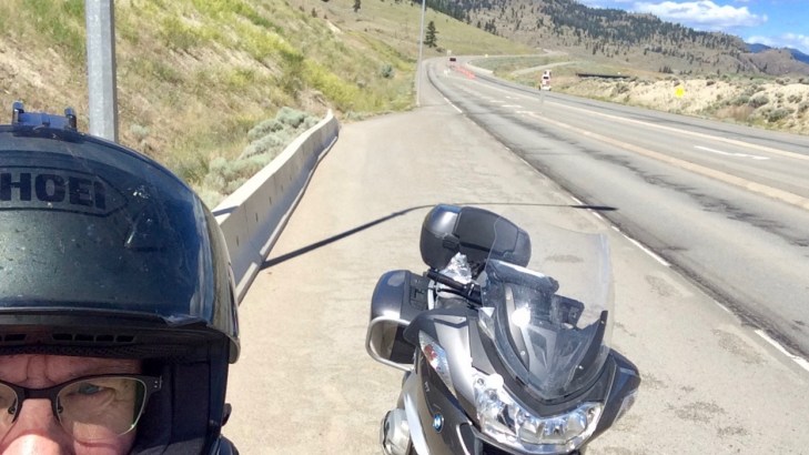
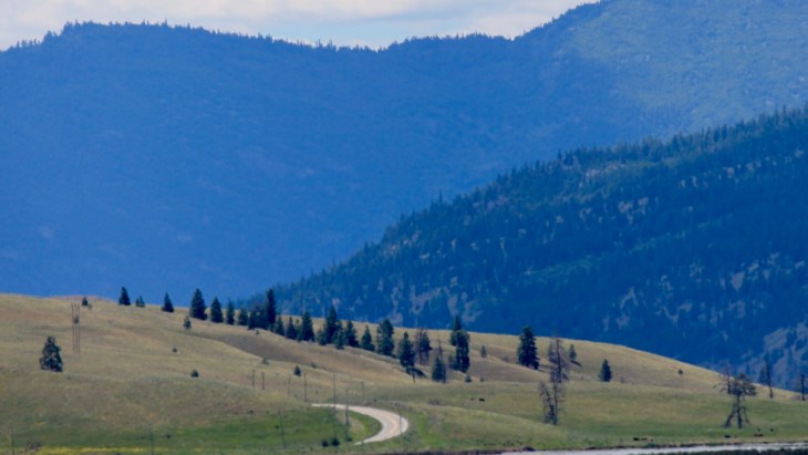
Turning south onto Hwy 5A, our route took us away from most of the traffic and into some idyllic foothills. The road surfaces were good and the speed limited to 50mph in most places.
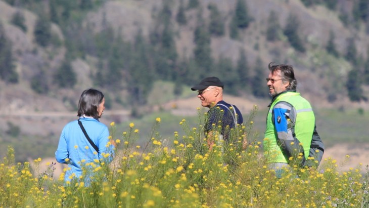
I rode ahead at one point, to get a shot of the rest of the group. 🙂

We stopped at a Starbucks in Merritt for a break. It was sunny and getting warmer.

I took the opportunity to fill my Camelbak with ice and water while we rested. During this trip, I’ve tried a number of new drinks during our afternoon stops. Another one of Harald’s positive influences. Today, I had a mocha frappuccino as it was too hot for a hot drink.
We still had a ways to go before reaching Hope.

Our stops became shorter though it seemed just as frequent. We stopped for a bathroom break in Princeton, then continued on Hwy 3, heading west into the EC Manning Provincial Park. The views were stunning.

There, we stopped to check out Rhododendron Flats, a display of Pacific Rhodes’ inside the park. It reminded me a bit of the Arboretum near my house, but wilder.
Alas, it was too late for the blooms. 😦

We reached the Campground sometime around 6pm.

I was tired and in need of a shower. After finishing that, I set up the tent in our river side campsite.
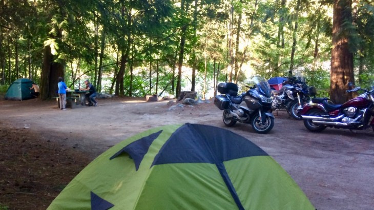
Dinner was at a local Korean restaurant, Kimchi Restaurant, about 10 minutes away from the camp entrance by foot.
This was our longest, farthest and hottest day. I needed a shower to reset and the delightful dinner we got was a bonus. By the time we returned, the temperature began to fall. It would be a warm but dry night – our last night together.
Note to self: start traveling with a deck of playing cards.
Day 7

Day’s distance: 182 miles
Total trip distance: 1,074 miles (odometer) plus 103 miles on ferries
Temperatures were in the 70s and 80s today with mostly clear skies.
I started my day with a latte (and danish) from the Blue Moose Coffee House, about two blocks from the restaurant last night.

Both were excellent!
Our first stop for the morning was Harrison Hot Springs, a small town at the southern end of Harrison Lake. Focused on the lake, both resorts and a public pool offer a chance to enjoy a hot springs experience.

We were hoping to view the gardens, but they are now off limits unless a guest of the Harrison Hot Springs Resort.
We had our last coffee chat before I broke off to head back to Seattle.

It took less than three hours for me to reach home from the Hot Springs.
I continued first along Hwy 7 to Mission, BC. as an alternative to dropping down to the major east-west Hwy 1. Generally one lane in each direction, this “byway” passed through successive little towns like Lake Errock, Deroche and Dewdney. It took a little longer but I arrived at the Sumas border crossing relaxed and ready to tackle US traffic. The wait was less than 10 minutes.
The rest of the trip home was uneventful, with a dose of heavy traffic into Seattle 😦 I grabbed a burrito before getting home.
This was a great trip. I’ll have some reflections of the trip that I’ll post next.
Reflections
Looking back is useful
Reflecting on a trip helps me learn my edges while traveling so that I can do it better and perhaps continue doing it longer. Here are the reflections of my motorcycle adventure to Desolation Sound.
Rugged and Beautiful
This loop took me through the rugged and gorgeous coastal lands on the southern tip of Vancouver Island and inland from Desolation Sound south along the Sunshine Coast.

The ride was extended en route to include new friends …

and new (to me) roads east of the coastal mountains.
Finding great motorcycling roads day in and out is ideal on any motorcycle trip. This loop delivered!

Riding with a group
Most of my past rides are solo trips. This ride, by design, was meant to be a group ride from pretty early on. As it turned out, it was a different group than originally planned 🙂
Let me say that this was a wonderful group of four. We are very close in age and temperament, and all comfortable on motorcycles and camping. Communication among us was very good and I felt we blended eating schedules, fuel stops, coffee time(s) and breaks during the ride very well.
The group-related transitions were slow and linear on this trip. I spent the first day traveling alone, meeting Harald at the end of the ride. Then, the two of us rode together through the next two days. The group expanded to four, including Marie and Herbert, that evening. With the next day together site-seeing and sailing, everyone got a chance to get to know each other. Only on day five did we all start riding together. Each point of the transition felt comfortable and relaxing.
I found breaking away from the group for brief periods of time to take pictures diminishes the feeling of being part of a “parade.” For example, on Day 6, I rode ahead of the group a few miles on the Princeton-Kamloops Highway and waited for them to catch up 🙂 That ended up with some cool photos and helped me change my perspective on the day.
Inexpensive trip
Because both Harald and Marie and Herbert opened their homes to me, and because we carried both fresh food and dehydrated meals, this was a relatively inexpensive motorcycle adventure.
Harald was good at stopping to pick up supplies in the evenings. Things like bagels for sandwiches, cheese, bananas, and yogurt for the mornings. I could learn better habits around eating while on the road and he was showing the way.
I was pleased that the weather cooperated with our plans to camp several nights along the way. Packing away the tent was quick when it stays dry overnight. We couldn’t ask for better.
Finally, I was able to save money on many of the ferries through the use of Harald’s BC Ferry’s Experience Card. He paid for both of us and I would reimburse him.
Dehydrated meals review

I have tried all three of the Backpacker’s Pantry meals and one of the Good To Go meals. All were tasty but I think the Backpacker’s Pantry meals rehydrated with a consistently better texture. And as I recall, the Good To Go meals were more expensive.
My old brand, Mountain House, as well as either of these brands, work well as travel food for occasional use.
Metzler Roadtec 01 tires
I really like the new tires. The casings for the HWM version of the Roadtec tires are designed for heavier weight touring motorcycles like the R1200RT. That said, they feel less stiff than the Pilot Road 4 GT tires, both when cold and warm, translating into a smoother ride with more feedback. Cornering felt linear and predictable, wet or dry. Let’s see how many miles they last, to determine their overall value relative to the long lasting Michelin PR4 tires.