North Cascades Loop

Distance: ~ 420 miles
Time to complete: 10+ hours
A rewarding day ride through the North Cascades National Park over Washington Pass, then along the Methow and Columbia Rivers.
Be prepared to ride a variety of distinct landscapes and in a variety of weather.
Always check road conditions prior to your ride.

Circumnavigating the Olympic National Park

Distance: ~ 390 miles
Time to complete: 9+ hrs
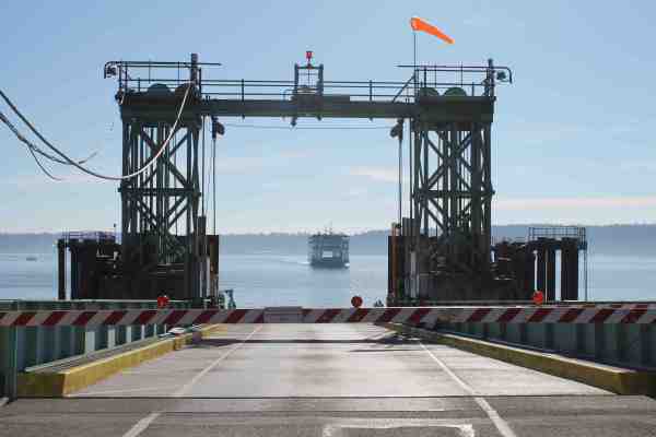
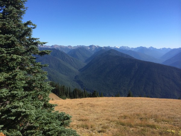
This ride takes all day, especially if it includes a ride to the top of Hurricane Ridge. I find riding the ferry at the end to be relaxing and so travel this route in a clockwise direction. Hurricane Ridge, which is breathtaking on a clear day, requires a park pass.
Motorcycles get priority boarding on Seattle ferries. You will be instructed to bypass the line and wait close to the boarding gate.
Seattle to Cape Flattery

Distance: 320 Miles
Time to Complete: 10+ hours
Cape Flattery is the northwestern-most point in the lower 48 states. This route begins and ends with a ferry ride. The trail at Cape Flattery from the parking lot is about 1/2 mile in length. No pass required.
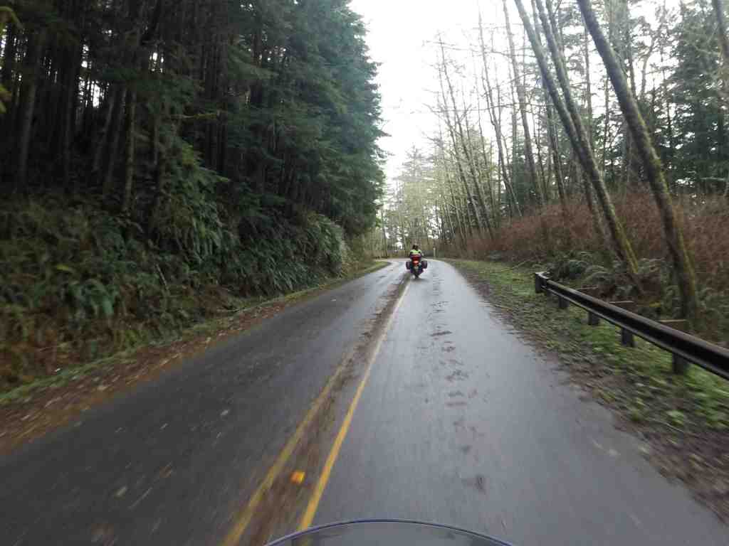
Highway 112 is a sometimes-twisty two lane road next to the Juan de Fuca Strait. You’re likely to find surfers as well as fisherman parked along the road. On this day, we found road debris (leaves, needles, and small branches) still on parts of the road from recent storms.
Be prepared for coastal fog and cool temperatures.
Seattle to Westport Loop
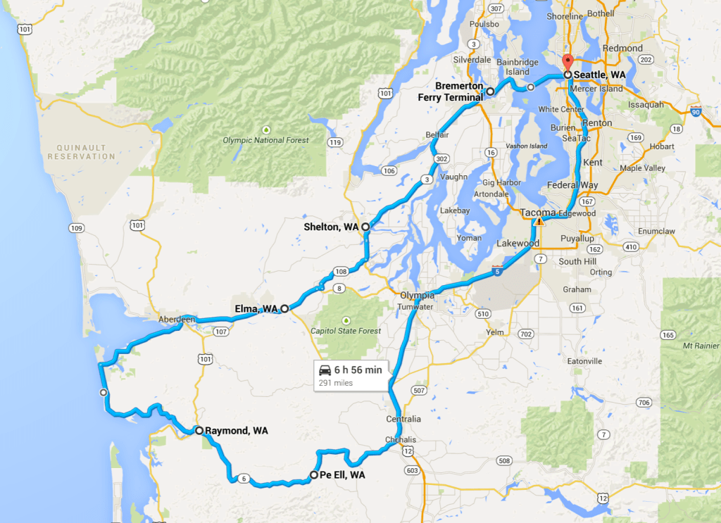
Distance: ~ 290 miles
Time to complete: 8+ hrs
The route takes I-5 south from Seattle turning west on Hwy 6 west to Raymond. Then we follow the coast along Hwy 105 to Aberdeen, then return to Seattle via the Bremerton ferry. I often stop at Evey’s Cafe in Pe Ell (breakfast served until 11am).
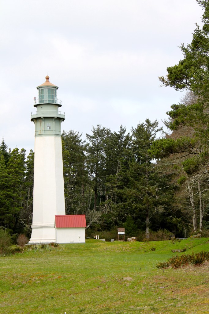
Westport is home to Grays Harbor lighthouse, Washington’s tallest at 107 feet. It was first lit in 1891. Tours are available, though I haven’t taken one. More info on the lighthouse is available here.
This ride avoids the mountains and should be considered in colder months as a more temperate option.
Traveling clockwise results in a relaxing ferry ride at the end of the ride. The ferry back takes about an hour and it was an opportunity to grab some hot cocoa and warm up.
Stevens and Snoqualmie Pass Loop
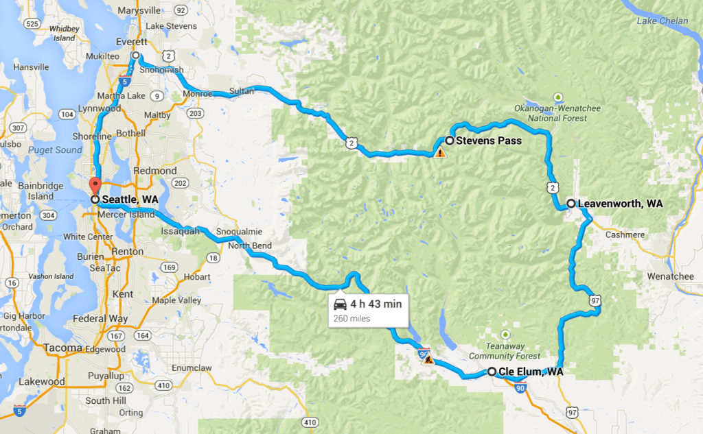
Distance: 260 miles
Time to complete: 5 hrs
Two Cascade passes, both scenic. I prefer traveling clockwise as I-90 is generally less congested in the late afternoon hours.
Riding along the Wenatchee River is very beautiful. Plan to stop in Leavenworth for lunch and, optionally, Cle Elum for some Dairy Queen if it’s hot. There is often construction and traffic backups along Hwy 2 and I-90. Check road conditions in advance.
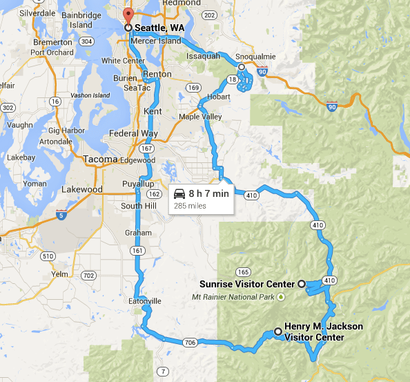
Mt. Rainier (Sunrise Road)

Distance: 220 miles
Time to complete: 5+ hrs depending on stops
This route is unusual for me in that it is not a loop but instead backtracks to Seattle using the same roads. The narrow, twisty 14-mile road from this entrance is well paved and offers spectacular views on clear days. Plan on taking a camera if the skies are clear.
A nice variation would be to also include a ride up to the Henry M. Jackson Visitor Center in the Paradise area of Mt.Ranier, and then returning to Seattle from the southern direction. This increases the distance to about 285 miles.
Sunrise Road is closed during winter. Day pass or annual pass required.
Chuckanut Drive & Deception Pass

Distance: 204 miles
Travel time: 5+ hours depending on ferry schedule
This is a fun ride as Chuckanut Drive (Hwy 11) has some curvy sections. Watch out for local bicyclists – they are a common site here. Check the weather for excessive winds (ferries will be impacted) or excessive fog along the coast.
I like to have lunch in Bellingham, usually somewhere in the historic downtown section when doing this loop.
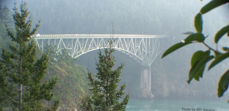
Plan to stop at Deception Pass as it is a beautiful area, despite the congestion that is common on nice days.
This ferry ride is less than 30 minutes. The State Park at Deception Pass requires a permit to park and use the bathrooms.
I have added a video from this loop below that provides a sense of Chuckanut Drive. Enjoy!
Anacortes – Port Townsend Loop

Distance: 177 miles
Time to complete: 6+ hrs
This loop is a variation of the Chuckanut Drive and Deception Pass day ride. However, this one involves traveling on two ferries, so the time it takes is dependent somewhat on the ferry schedule and stops for fuel and food.
I like to eat at the Country Corner Inn near Anacortes when I’m in the area and this ride starts by taking I-5 north to Hwy 20.
This loop takes you over Deception Pass Bridge, connecting Fidalgo Island to Whidbey Island.
Later in the day, one will take the Agate Pass Bridge to Bainbridge Island.
Plan extra time for this double-ferry route.

Vashon Island

Distance: 80 miles
Time to complete: 5+ hours
If you have the desire to spend a leisurely day riding and sightseeing, eating good food and taking some ferries, this is a great, low mileage day ride.
Grab the Vashon ferry in West Seattle, at the Fauntleroy Ferry Terminal. Once on the island, there are numerous parks and scenic roads to ride. Speed limits are generally low, with 50 mph the highest on the island.
I like to eat at the Hardware Store Restaurant. The food is always good. It is located at the corner of Vashon Hwy SW and SW Bank Rd.
Many folks would simply take Vashon Hwy SW from the ferry dock. A fun route for motorcycles is to turn onto Burma Road SW, then turn onto SW Cedarhurst Rd, then onto Westside Hwy SW to SW Bank Rd to Vashon Hwy SW. It only takes about 10 minutes longer but is much more fun and scenic.
Riders have a few options when it is time to leave the island. From the northern ferry terminal, one can travel back to West Seattle, or to the peninsula. From the southern ferry terminal, one can visit Point Defiance on Tacoma’s waterfront. The map shows a route through Point Defiance and back to Seattle.