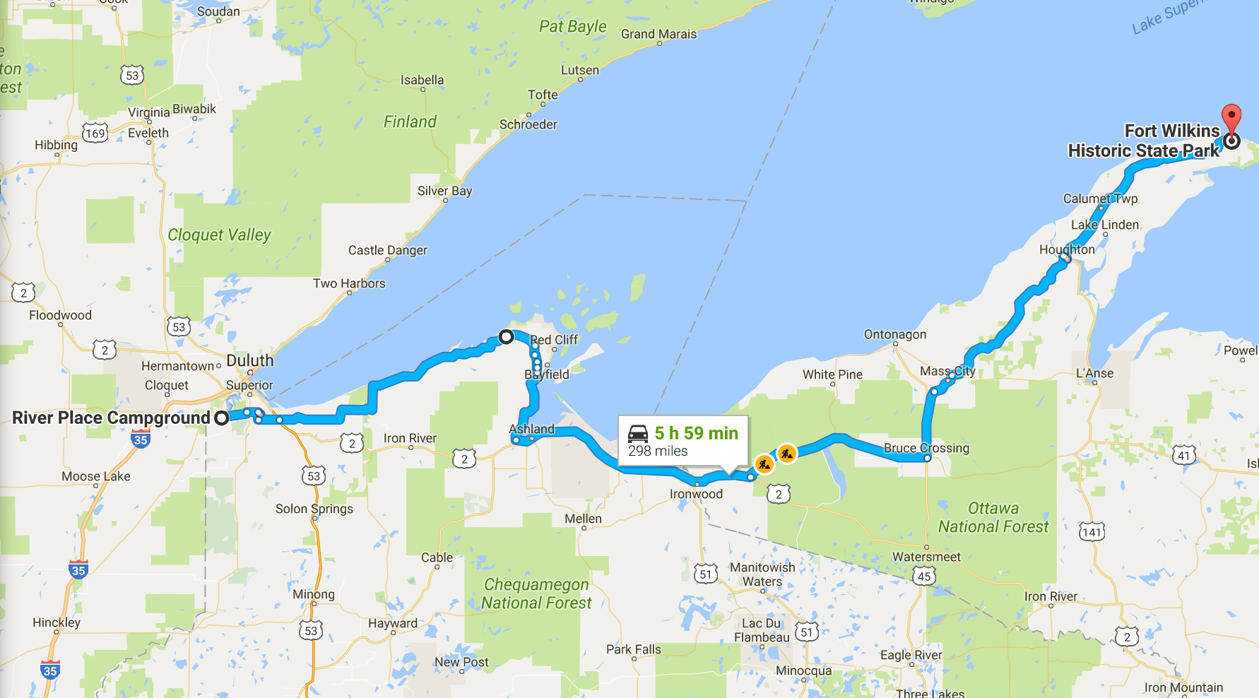
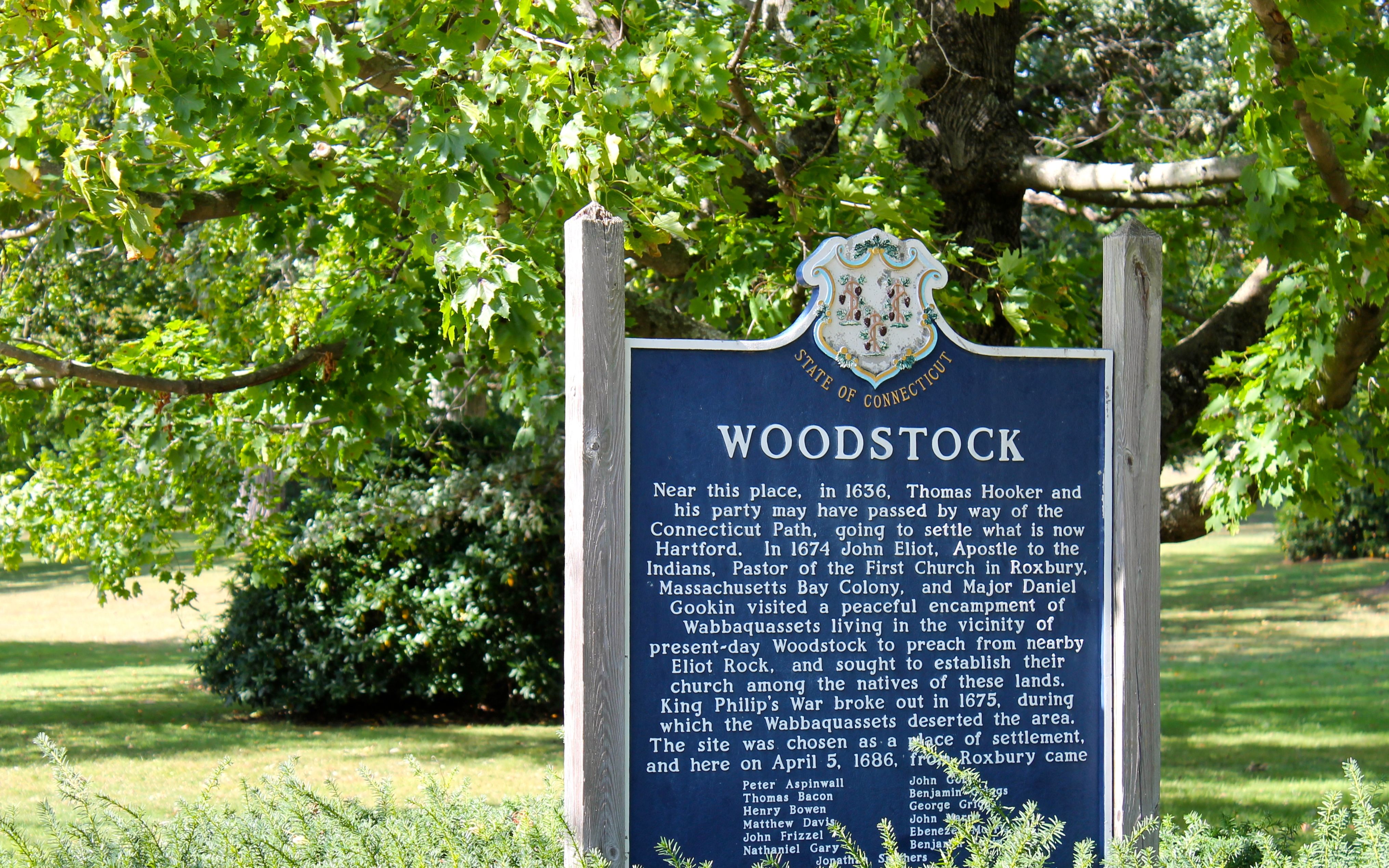
2016 Northern States Tour
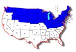
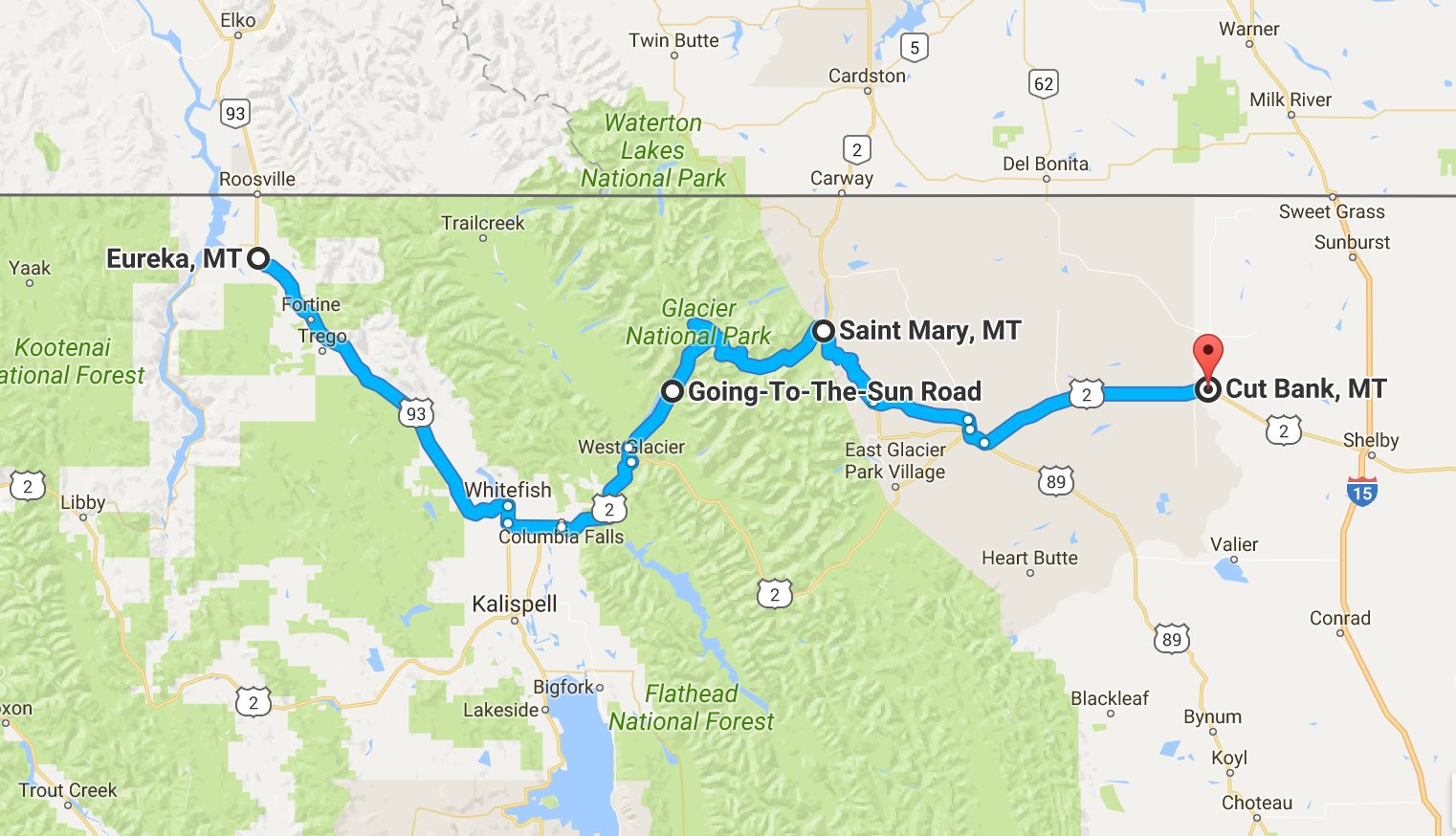
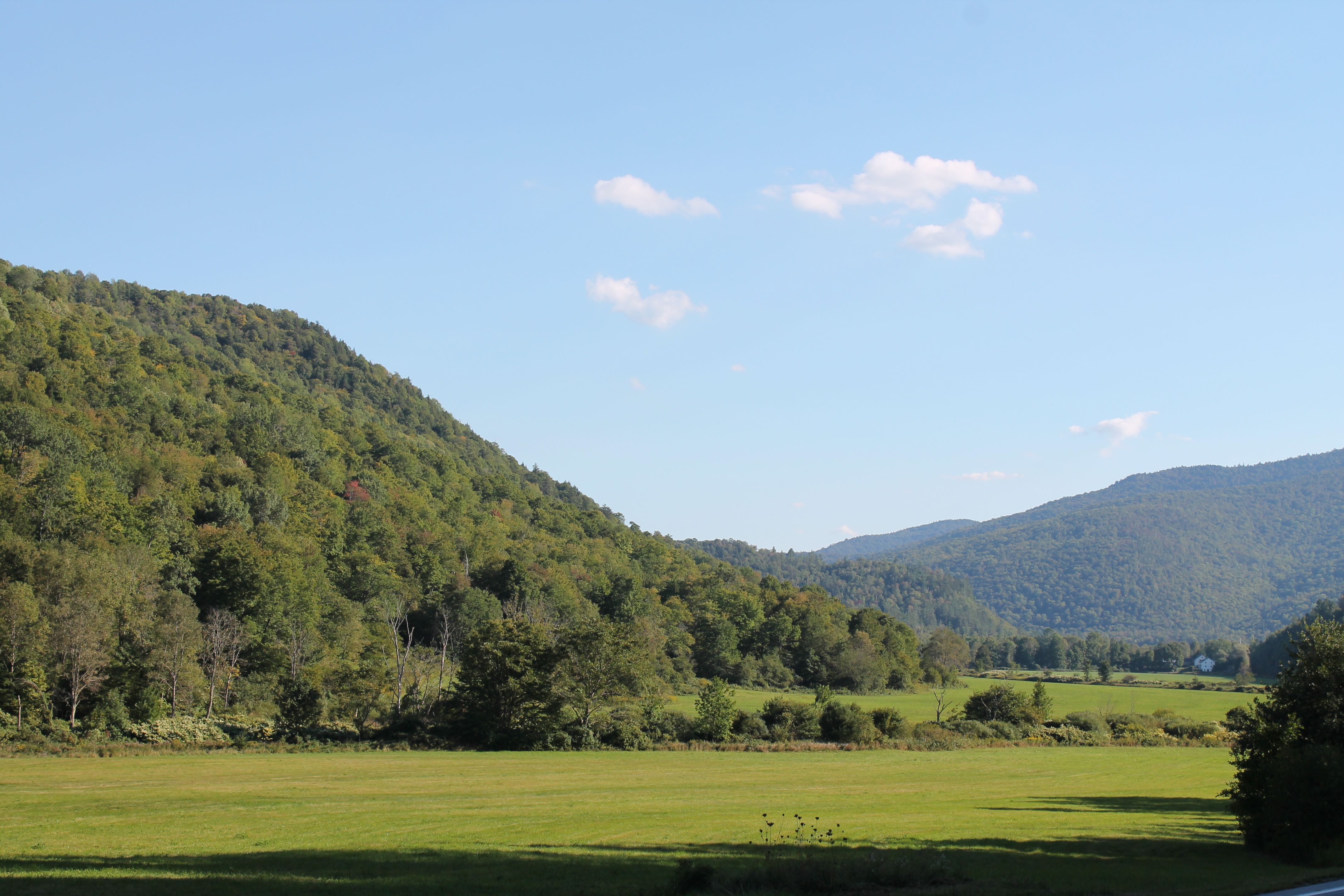
This solo tour began August 28th. It covered 8,910 miles through 28 states over 37 days. Taking a route along the northern border of the US, I traveled between each of the Great Lakes and continued on to the Atlantic Coast. My return route followed a more southernly latitude from Virginia Beach west.
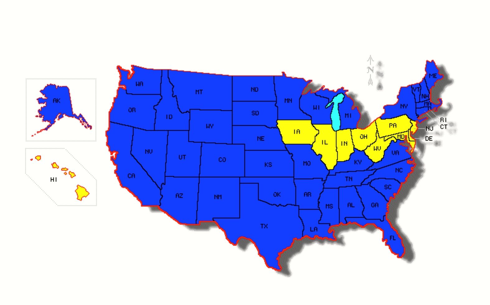
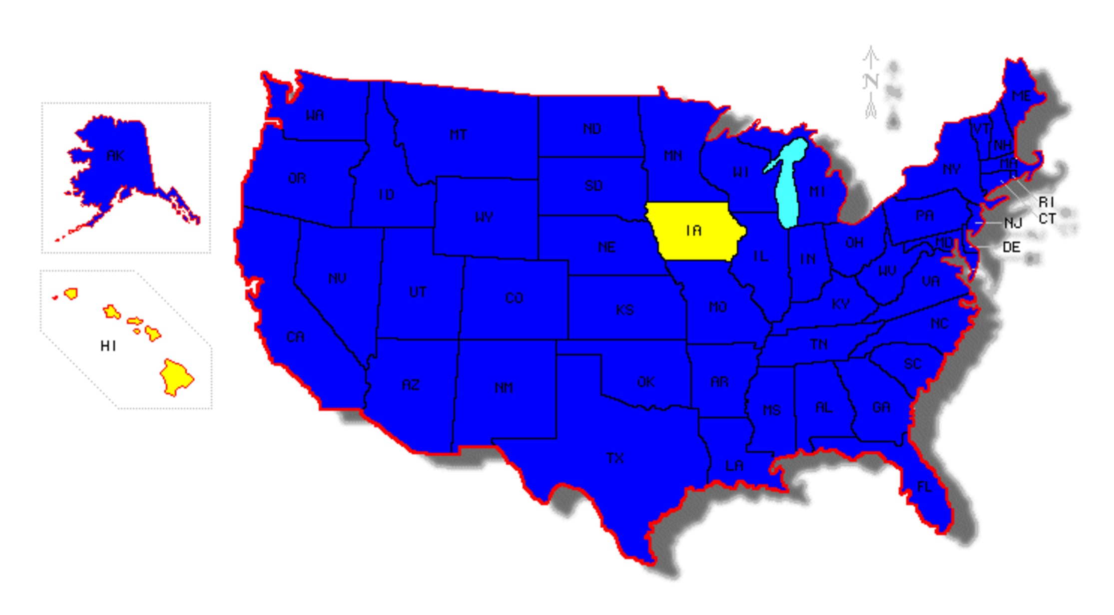
The goal of this trip was to ride in every state not covered by the Western States Tour in 2014 or the Southern States Tour in 2015 while visiting some of the most scenic motorcycle roads available in this section of the country. While not my longest trip, it was my fastest pace, covering 275 miles per day on average, not counting days off. With this ride completed, I have now ridden in every state reachable by road.
Day 1
Day’s distance: 348 miles
I left the house just after 8am. It was 59 degrees and overcast. Temperatures reached a high of 84 and the overcast burned off by 10am leaving only high clouds in the sky. Not great light for photography, but I took photos anyway.
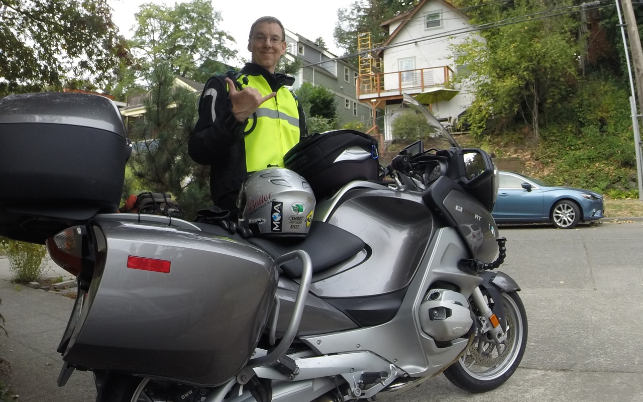
I’m super stoked to be on the road, again. This trip will be about 10,000 miles total and take almost six weeks.
I have to work each day. This requirement wasn’t part of either my 2014 Western States Tour or my 2015 Southern States Tour.
I’m grateful that my manager is flexible and that I can work from the road.
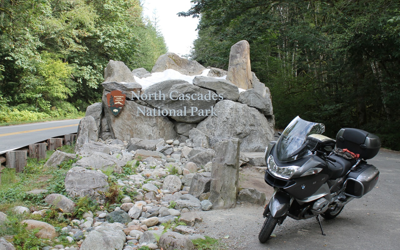
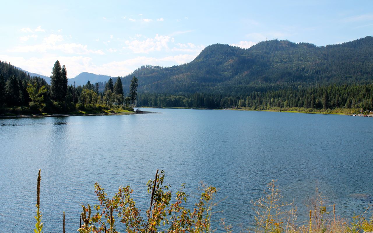
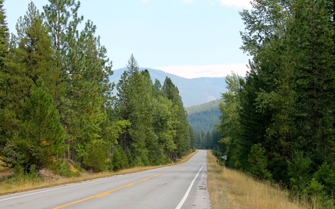
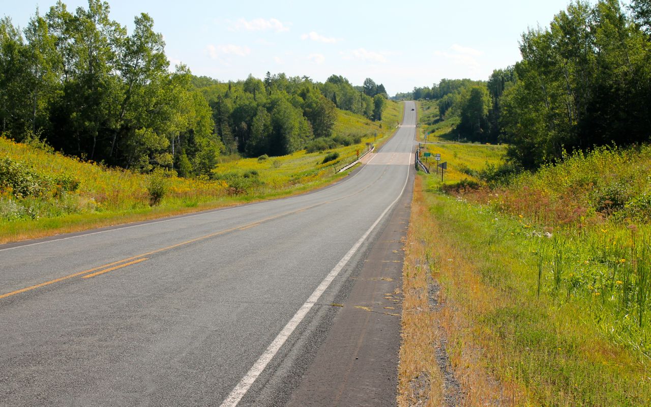
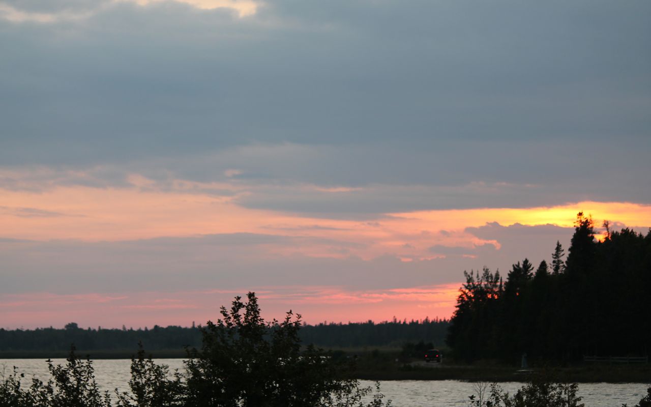
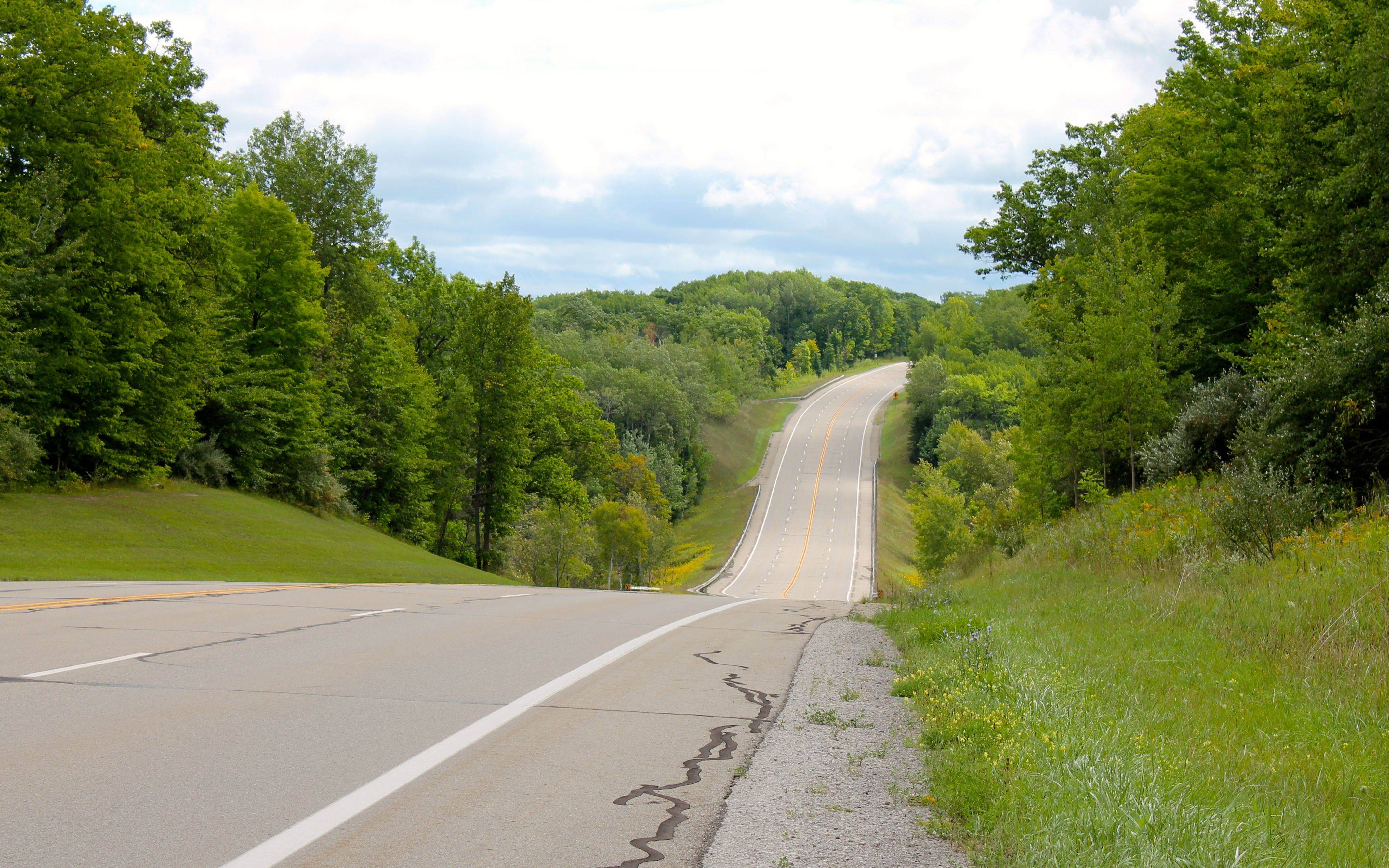
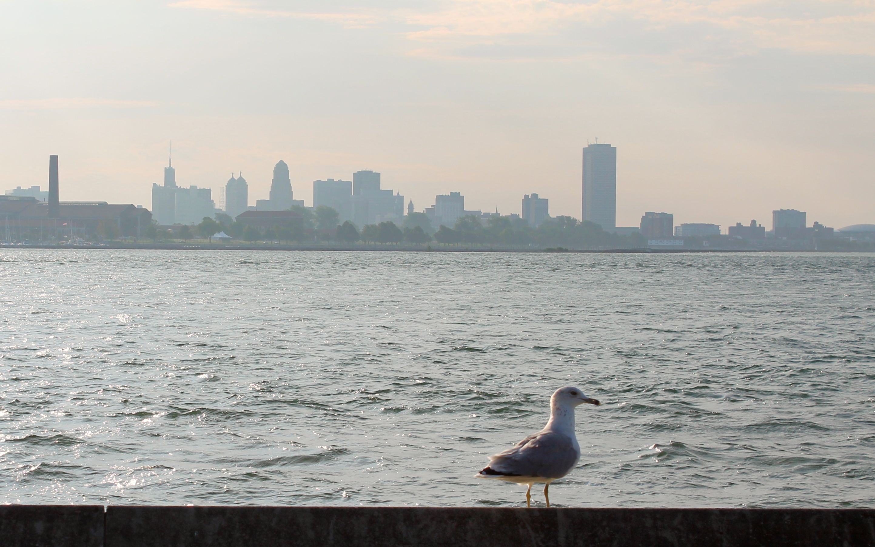
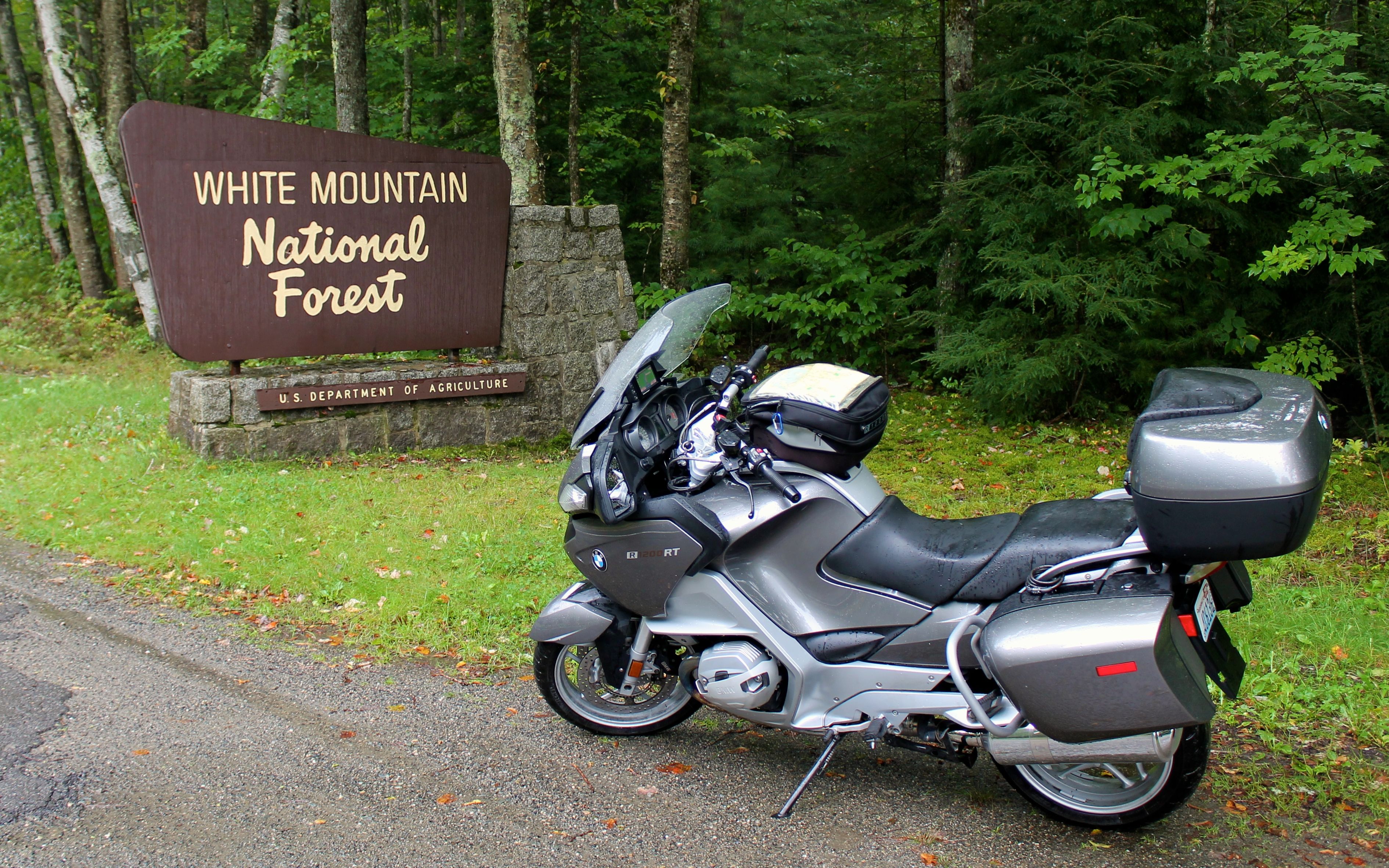
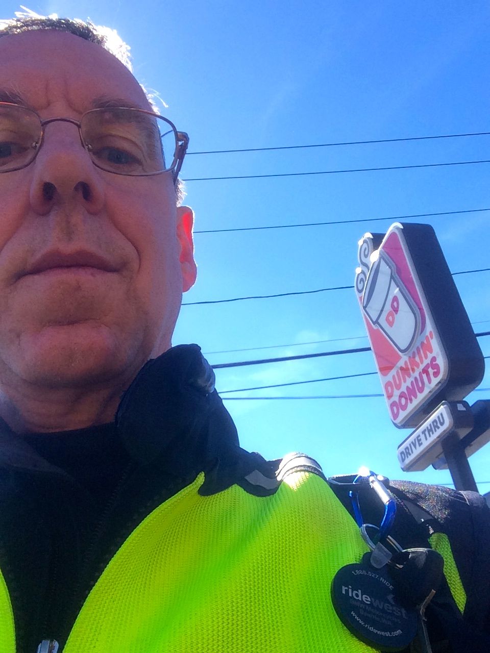
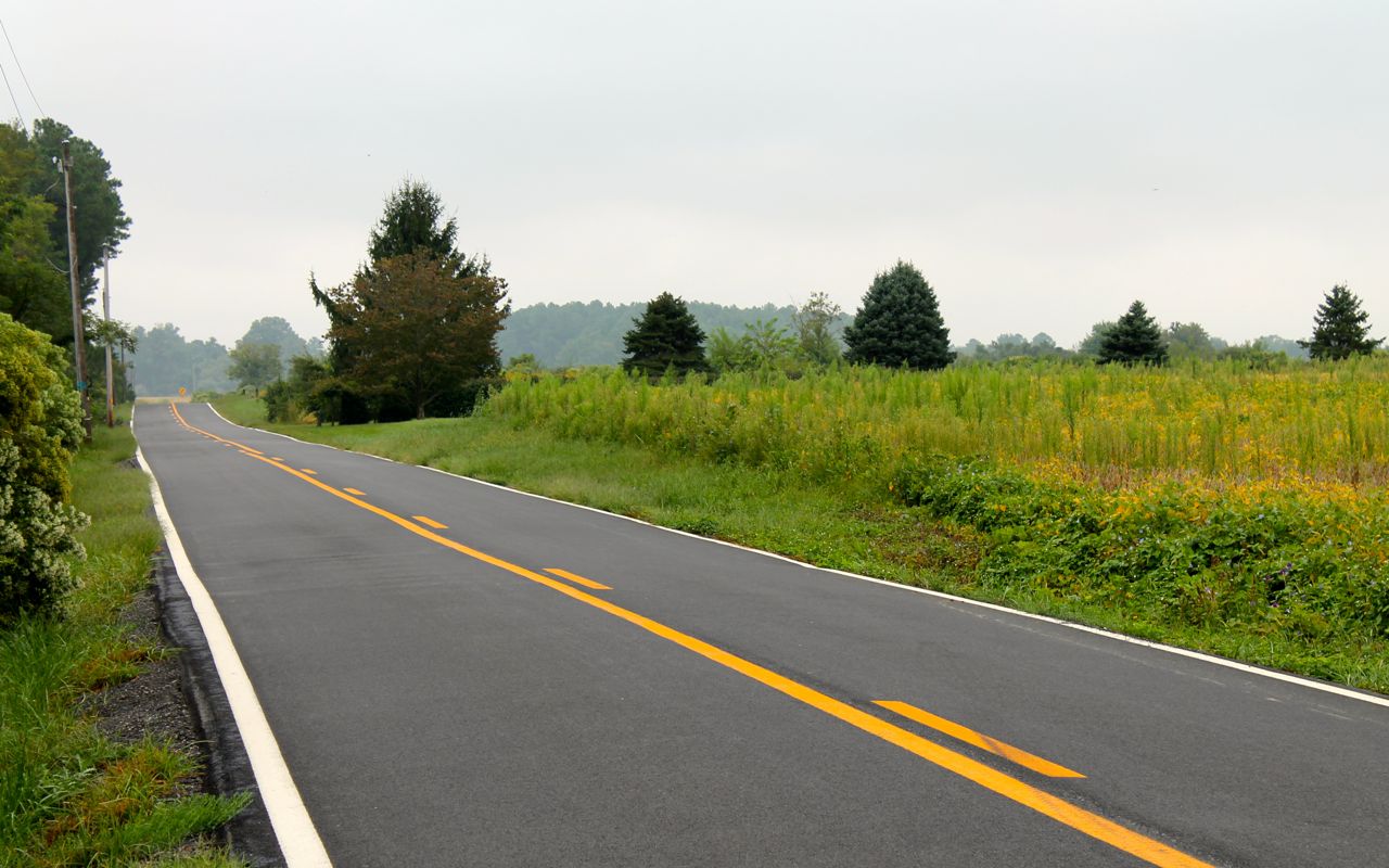
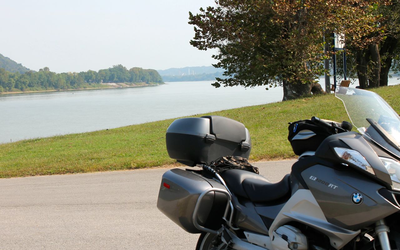
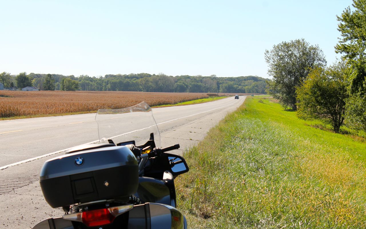
As is my habit, I’ll usually post a photo or two of my bike. Today, the total is four. Below is one taken just after crossing the Sauk River.
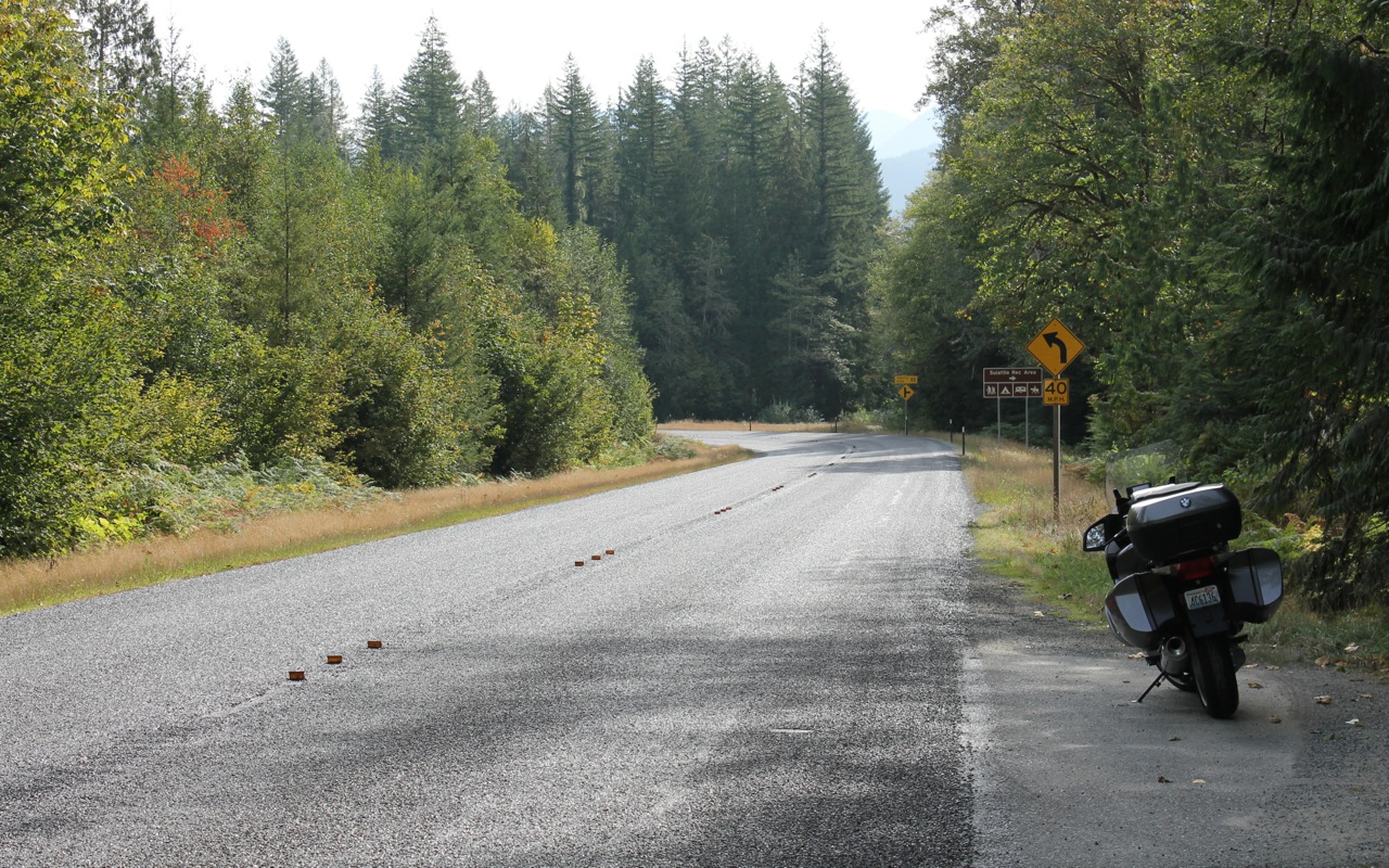
Shortly after taking this photo that I became concerned that I might run out of gas. Rockport, the next town I passed through, did not have a station that wasn’t boarded up. The next thing I saw was a sign indicating last services for 74 miles. Luckily, the sign was intended to make you check before you drove through the town of Marblemount without stopping. Marblemount had two stations, along with Crown’d Coffee, a latte stand where I filled up with espresso.
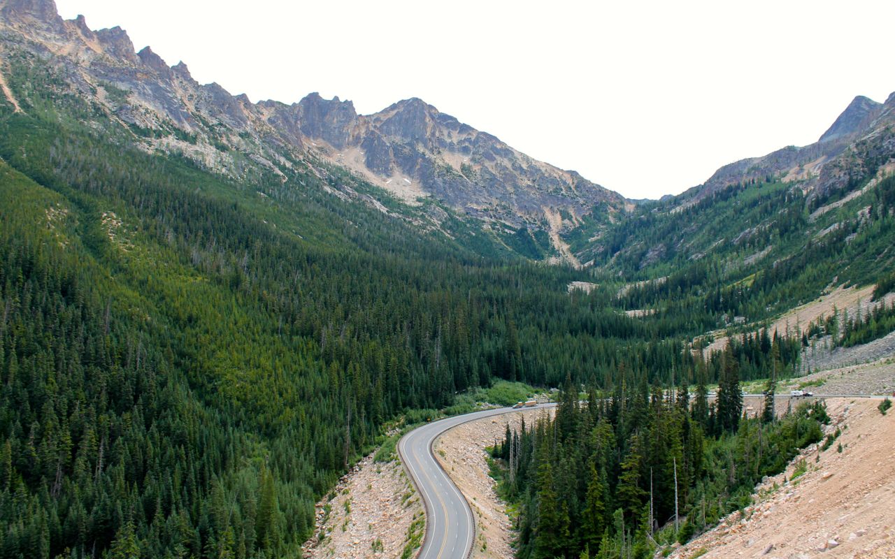
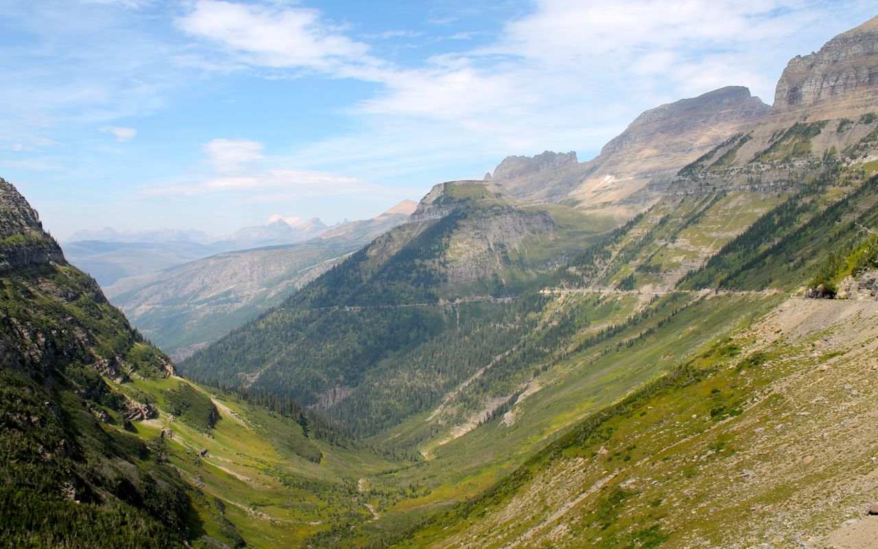
With a full tank and a double shot latte, I was set to continue to the North Cascades National Park. This is my third trip along this route in three years.
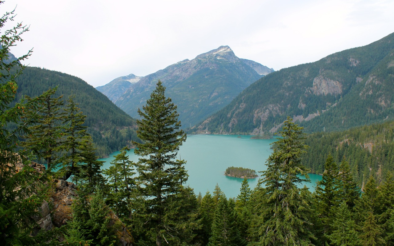
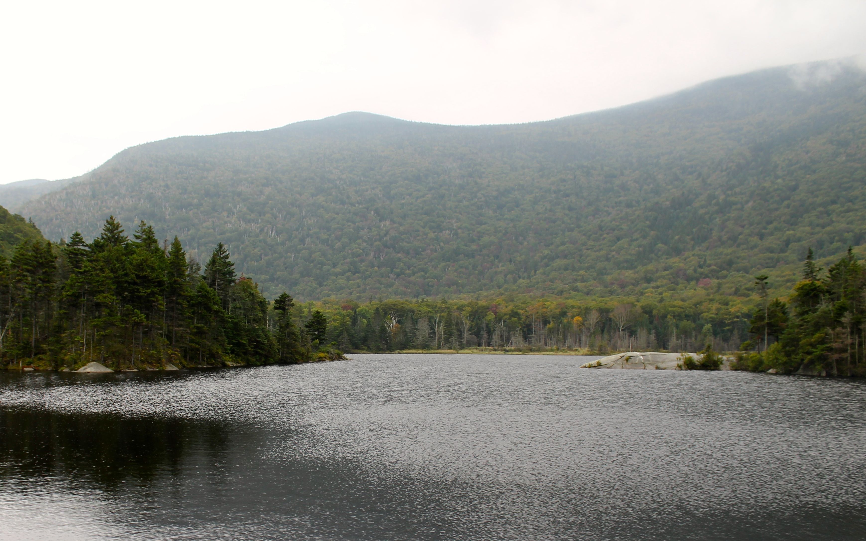
I rode past Diablo Lake
and then Ross Lake.
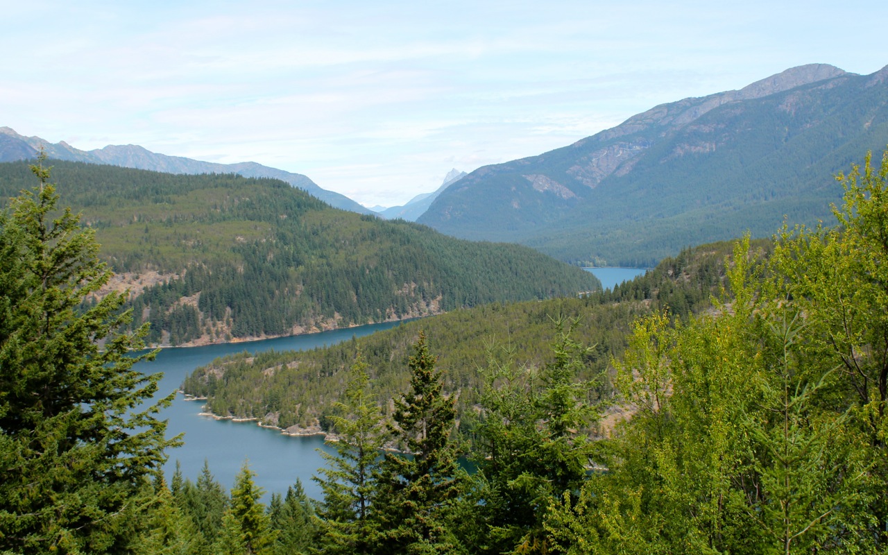
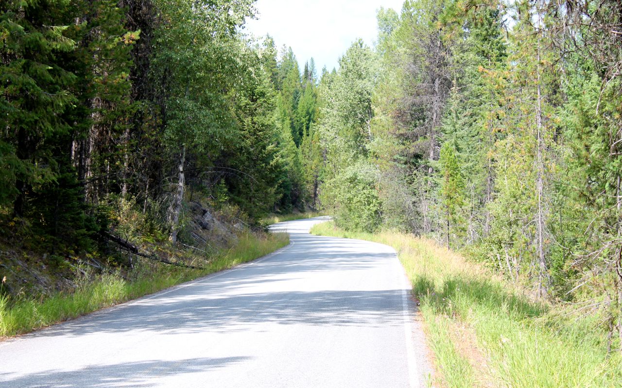
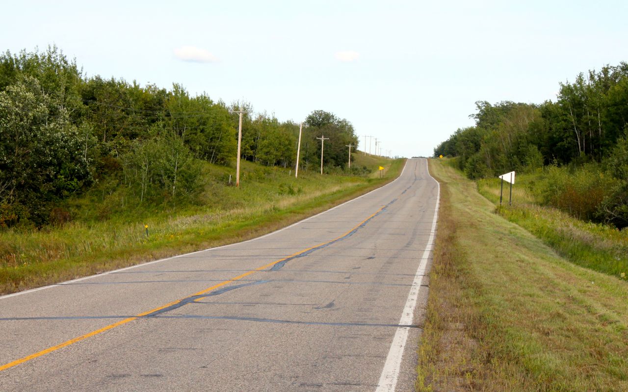
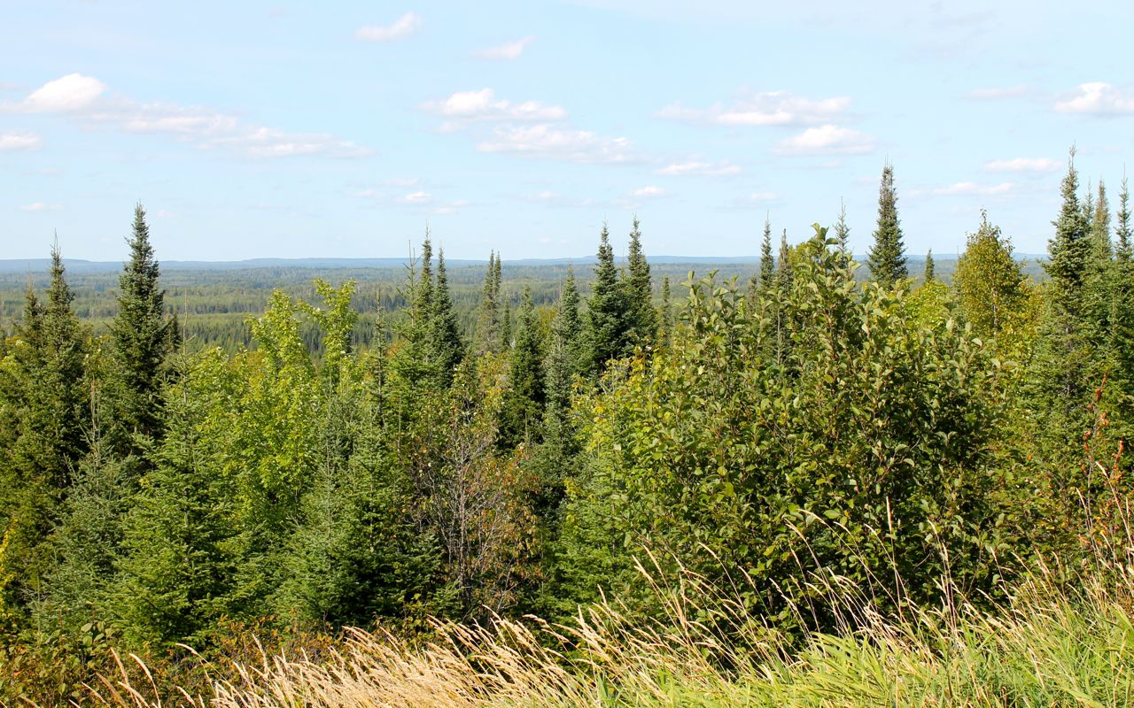
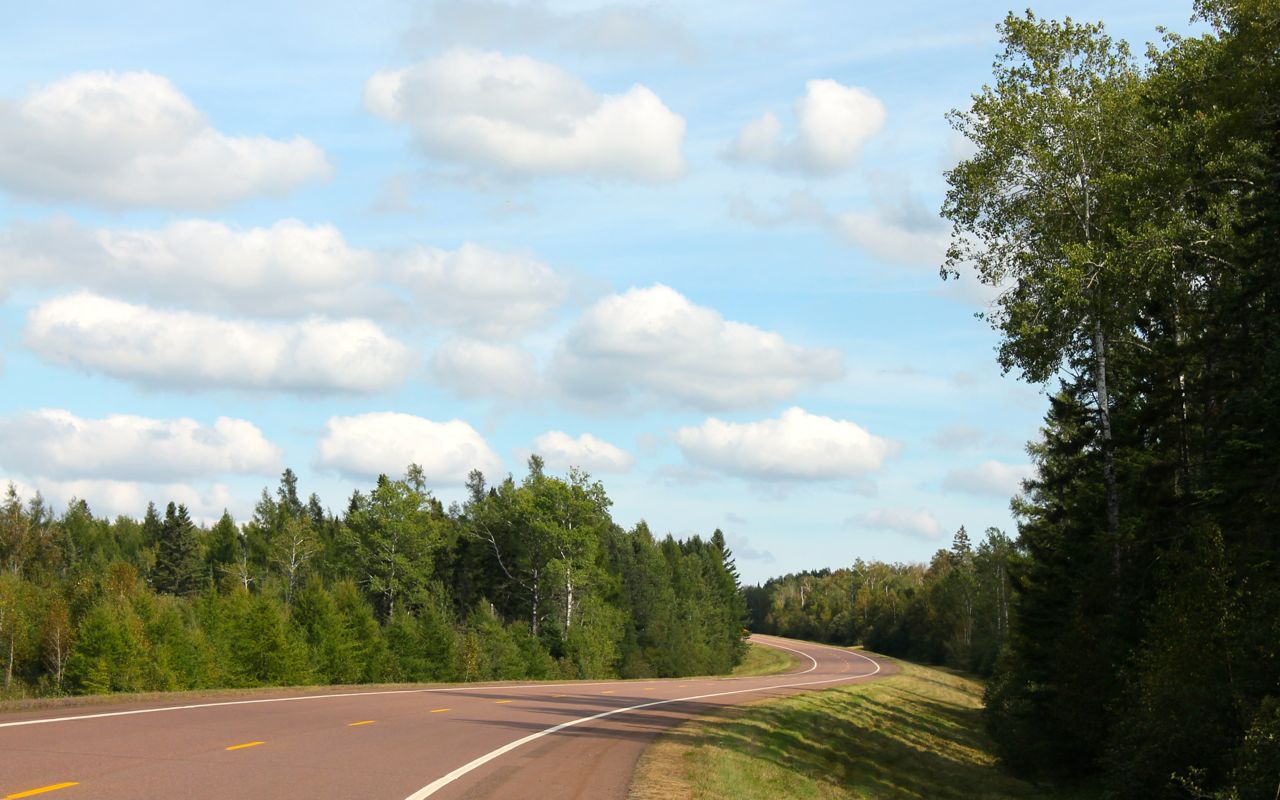
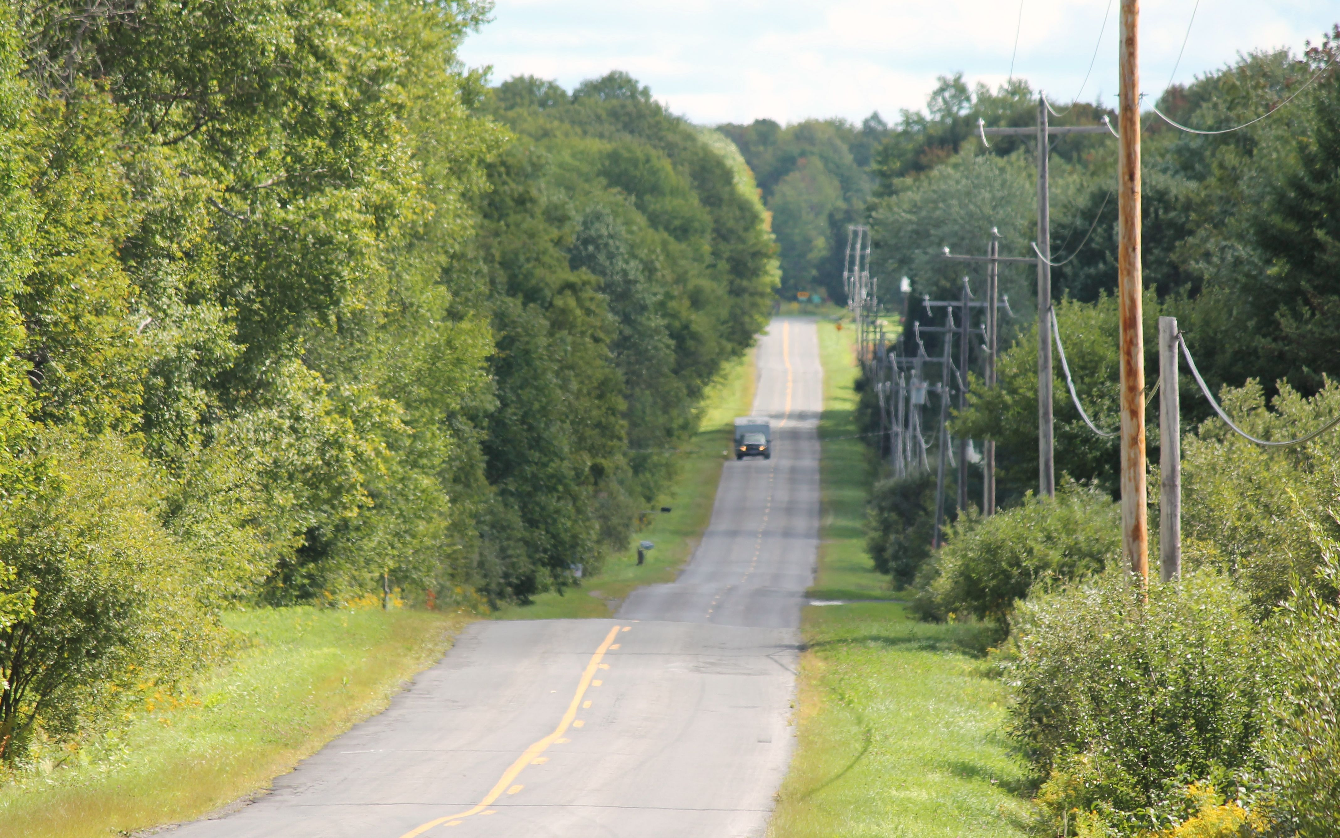
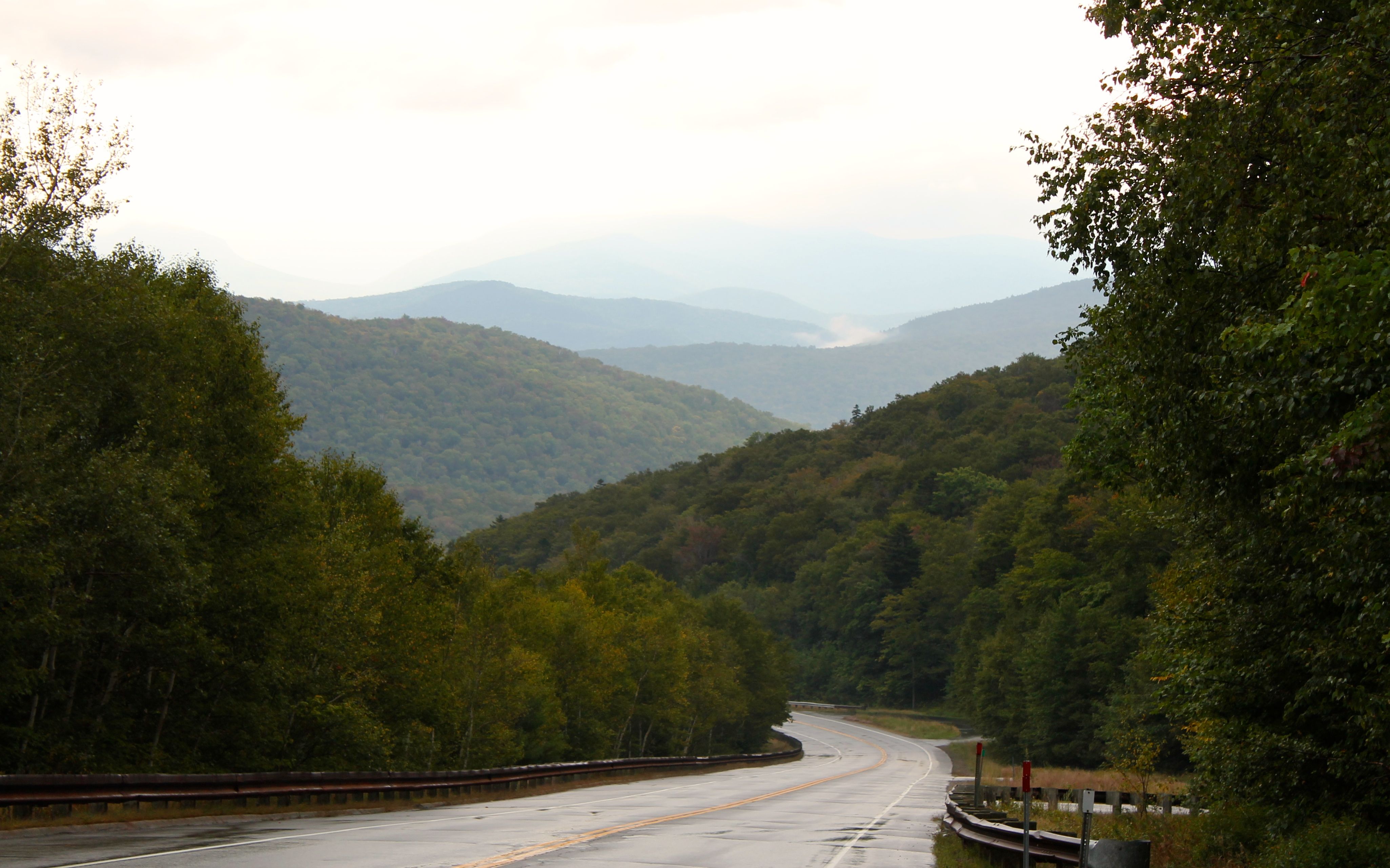
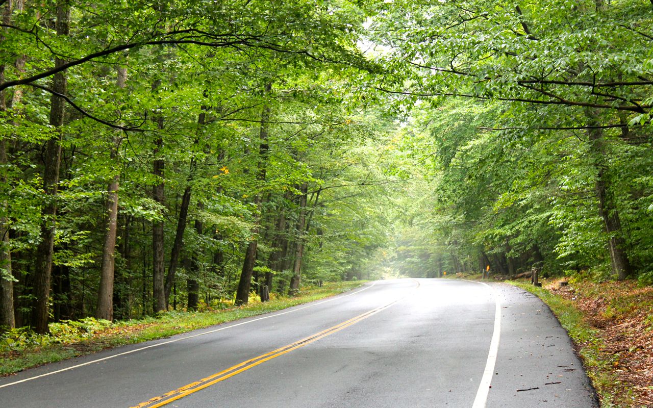
Hwy 20 is a national scenic highway and it is gorgeous to ride on a motorcycle. The road surfaces are good except for the occasional frost heave in the roadway. The scenery is spectacular.
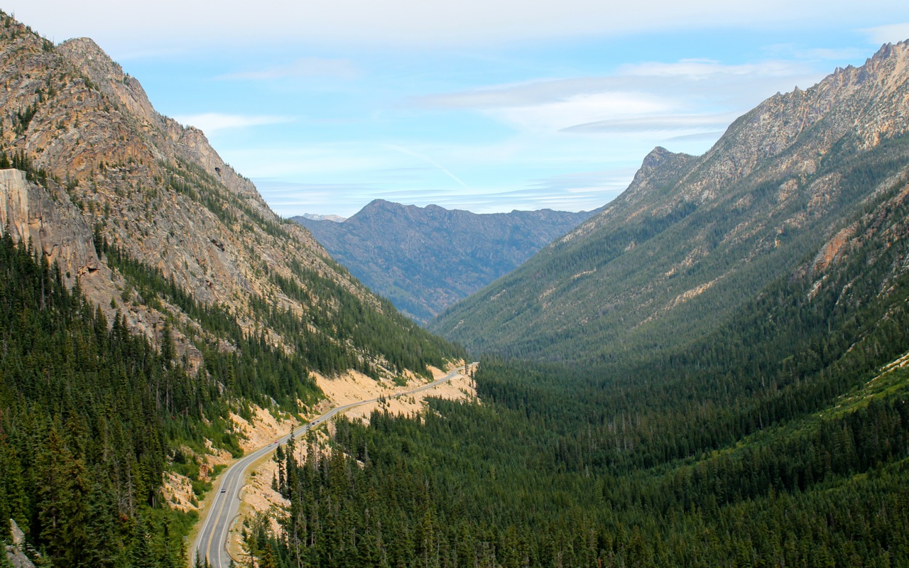
Traffic was light all day. Nevertheless, there were many bikers in Winthrop around lunch time.
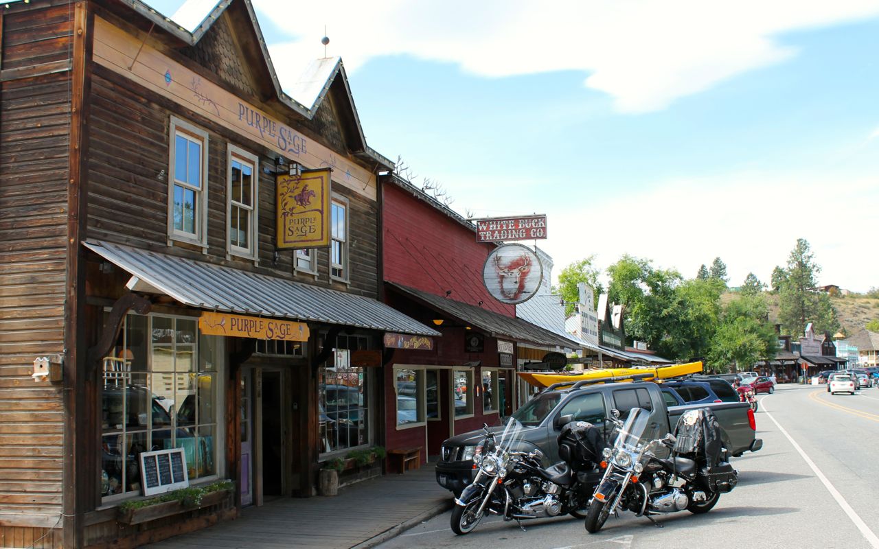
That was my lunch stop, as well. I picked Jack’s Saloon and had soup and a salad.
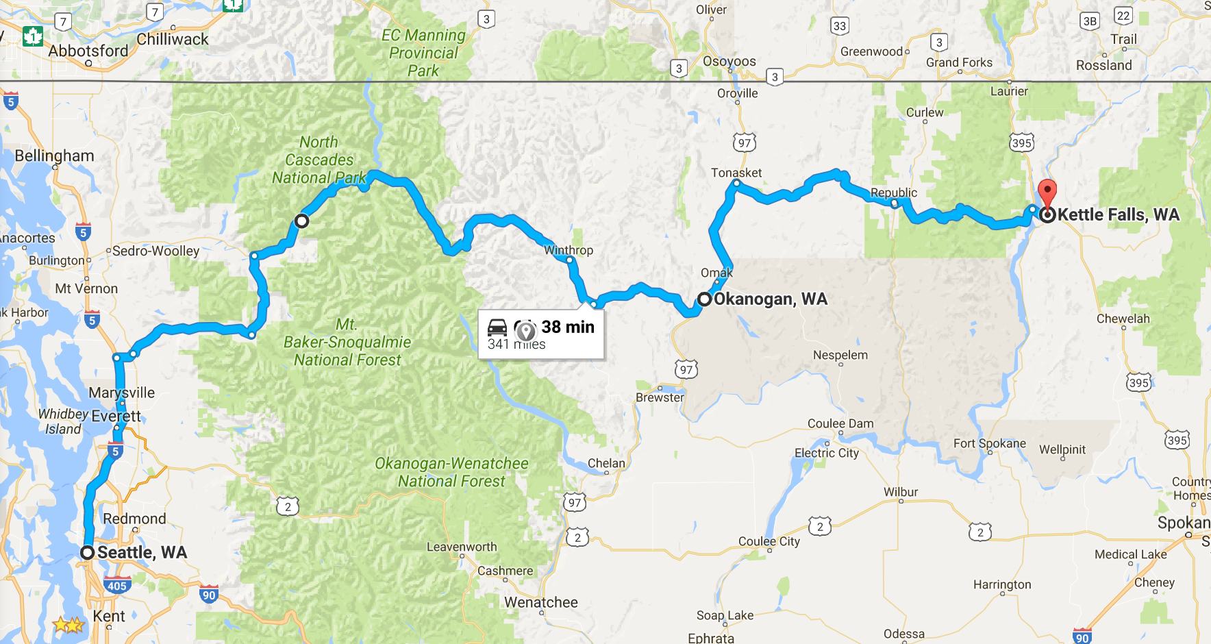
My Garmin GPS estimates my arrival time once it knows my destination. When I first left the house, it told me I would arrive at Kettle Falls just after 3pm. But time slips away at each gas stop, each photo stop, and each extended conversation with others. That estimate changed to 5pm by the time I finished lunch.
I expect this to happen. I’m going to try to follow how much “extra” time I spend each day taking photos, stopping for coffee, fuel, and just hanging out talking to people. I’m not trying to change those patterns, just plan for them to happen.
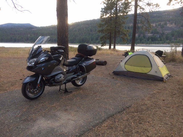
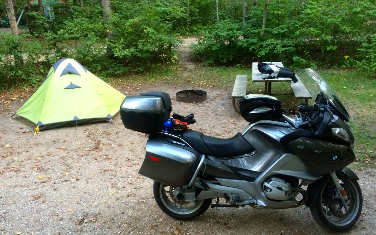
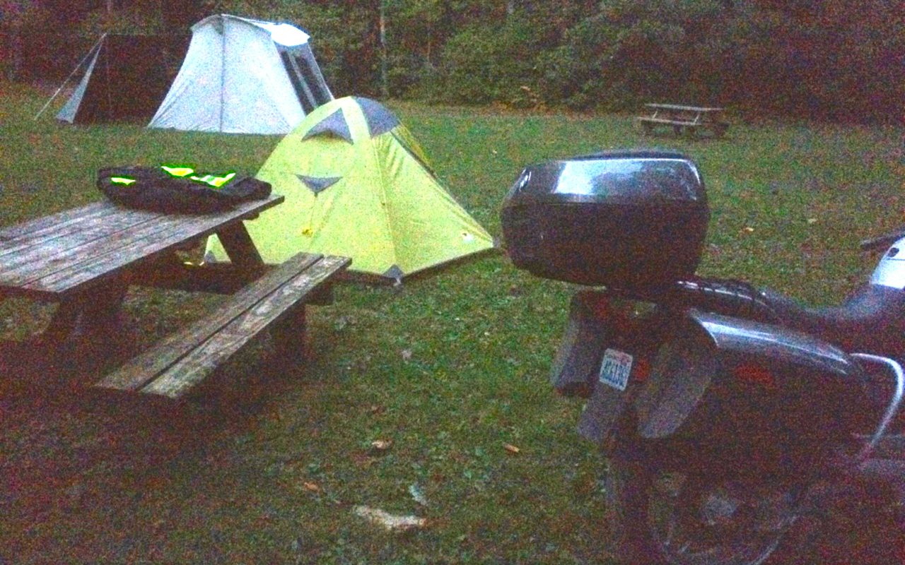
The weather is ideal for camping and I stopped at Kettle Falls campground for the night. I was here last year on my trip to Glacier with my regular riding buddy, Will. The campground was largely empty, as I expected.
I grabbed a spot by the river’s edge. Cool!
I brought meals to prepare but I didn’t want one tonight. Instead, I grabbed a hummus and veggie wrap and an interesting salad called “World Peas” from a local health food store.
The weather looks good for tomorrow. Partly cloudy and temperatures in the 80’s during the day. I travel some new-to-me areas of Montana tomorrow.
Day 2
Day’s distance: 349 miles
Total trip distance so far: 697 miles
The temperature this morning was a brisk 49 degrees. The afternoon saw a high of 88. Mostly clear skies gave way to a late afternoon thunderstorm.
I left Kettle Falls campground by 6:30am because it was going to be a long day. Stopping in Colville for a triple tall latte and bagel, I used the wi-fi to upload the Day 1 blog entry and take care of a little bit of work. It was 8:15am when I left the coffee shop.
A 10-mile section of Hwy 20 outside of Colville was “freshly oiled”. It made me very nervous and I proceeded with an abundance of caution. Except for that section, the stretch of Hwy 20 between Colville and Tiger was a great motorcycle road.
Turning south at Tiger, Hwy 20 followed the Pend Oreille River.
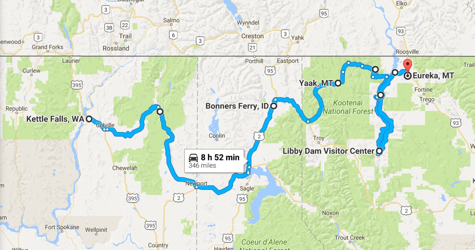
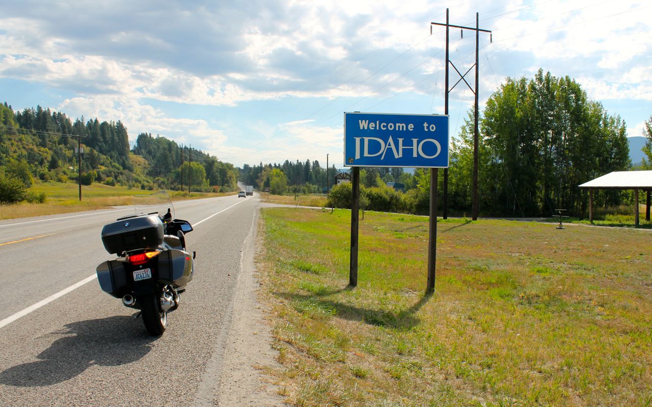
I continued east into Idaho along Hwy 2
I stopped for a lunch break in Sandpoint and proceeded north afterwards. After heading east from Bonners Ferry, I took route 508 towards Yaak. It was beautiful and the speed limit was 70mph. You can count of Montana to allow drivers and riders to go faster than other states, given the same road conditions. 🙂 The road followed the Yaak River. In that way, it reminded me of how Hwy 12 in Idaho follows the Lochsa River.
Yaak has a merchantile, a saloon, a school house and a community center. I probably missed something, but we’re talking small town.
While south of Yaak the road is wide and fast …
the road north out of Yaak is narrower and had more twists and turns.
Another challenge that I faced today was when the Yaak River Road became a gravel road. Ugh, I slowed as I did for the oiled road. The gravel lasted about 7 miles before the pavement re-appeared. This stretch of road wasn’t well maintained, but I was happy to get off the gravel. Granted, it is not used much and I chose to find out what it was like, so I have no rights to complain.
While descending off the peak of NF-750, I saw three deer alongside of the road. It was still pretty early in the afternoon, but I kept my eyes open. Deer have to be one of the dumbest animals. Two of the three deer I saw ran across the road when they panicked rather than staying of the same side and running away. This was challenge number three.
Reaching NF-228, I could see lake Koocanusa and the Koocanusa Bridge.
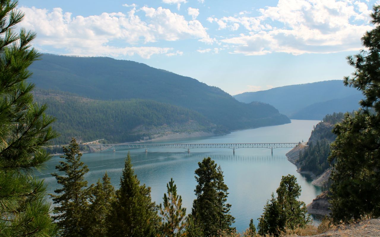
Eureka, Montana is just thirteen miles north from the other side of the lake from where I took the photo above. And I was thinking about staying in Eureka. So, like any motorcycle adventurer, I circled the lake instead of taking the bridge across. I rode down the west side along NF-228 and came back north along Hwy 37 on the east side of the lake, only to see the bridge again a few hours later.
The day’s penultimate challenge was the tar snakes on NF-228, the road along the western side of the lake. Tar snakes are strips of tar used to patch cracks in the road surface. When it gets warms, they are especially hazardous to motorcycles. There seemed like a lot of these patches on the western side of the lake.
The final challenge was the thunderstorm that arrived while I was still on the western side of Lake Koocanusa. While I only caught the edge, it made the road, and especially those tar snakes, even slicker.
I stopped at the Rocky Gorge Recreation area. There were no showers, though the hosts said folks walk to the marina and jump in the lake. Because there was potential for more rain, I stayed in a motel tonight. So I grabbed a room at the Silverado Motel, just north of the town of Eureka.
All in all a day full of adventure. It was 7:45pm when I checked in after losing an hour to the timezone change. I ate across the street at the Crossroads Grill. Forgetting my own rule of sticking to the basics when eating at places that don’t give you an immediate sense of skill in the kitchen, I ordered the enchiladas. They were pretty much inedible, but the two bottles of Going-to-the-sun beer were good!
I am looking forward to seeing Glacier National Park tomorrow. The weather should be clear and warm and the I’m only planning to travel just over 200 miles, a relatively short day.
Day 3
Day’s distance: 194 miles
Total trip distance so far: 891 miles
I took my time this morning. By the time I was done playing with “Chief”, the Silverado Motel’s labrador retriever, topped off the oil, put some air in the front tire, filled the tank, and stopped for a latte, it was already 60 degrees. The highest temperature was 85 and the skies were partly cloudy but with a haze to the air that comes through in the photos.
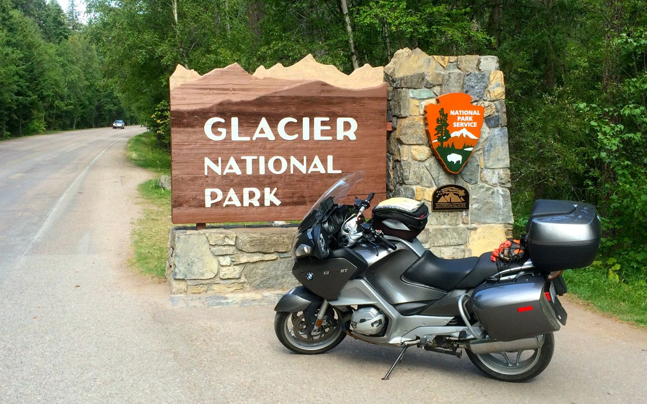
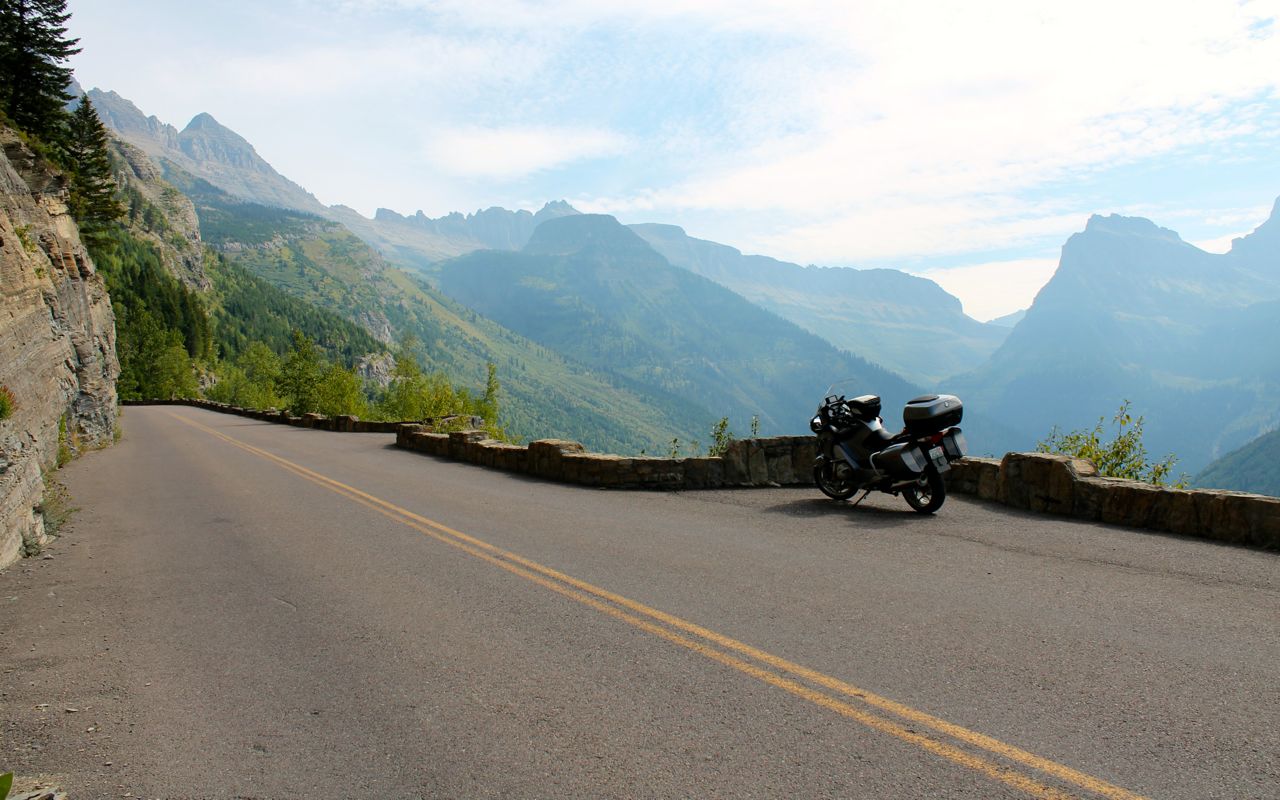
The trip down Hwy 93 was uneventful, but fast and I was in Whitefish quickly. I took Hwy 40 east to meet back up with Hwy 2. I think it was shortly after noon when I passed through the park gates.
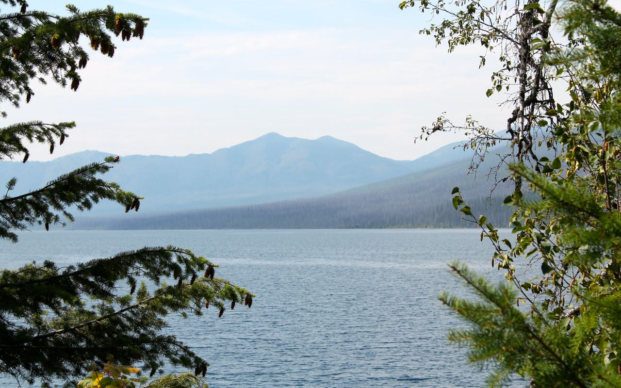
Traveling from the West Glacier entrance, you come first to Lake McDonald.
While at the lake, I grabbed the Samsung 360 and took a 360 degree photo. WordPress doesn’t have the ability to post 360 photos here, so I have to post them to the Steelhorsejourneys’ Facebook page. You’ll also find a 180 degree photo of Glacier.
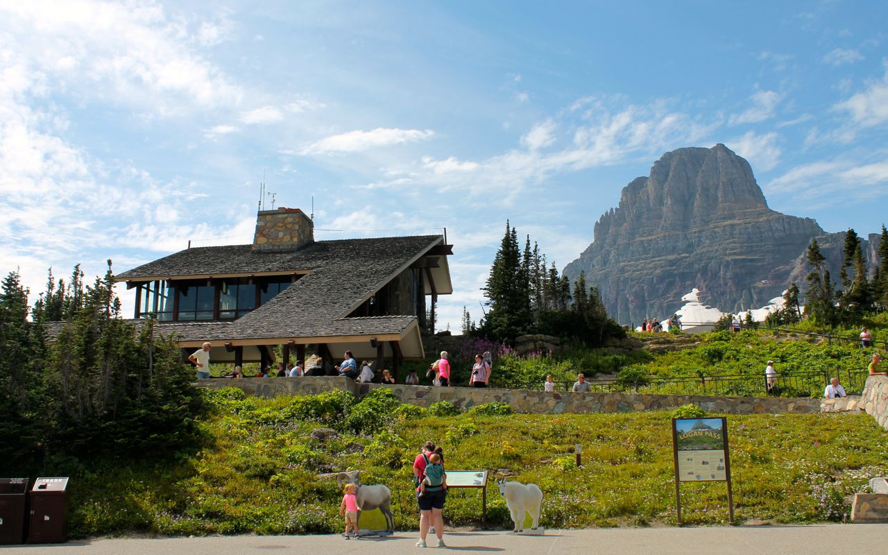
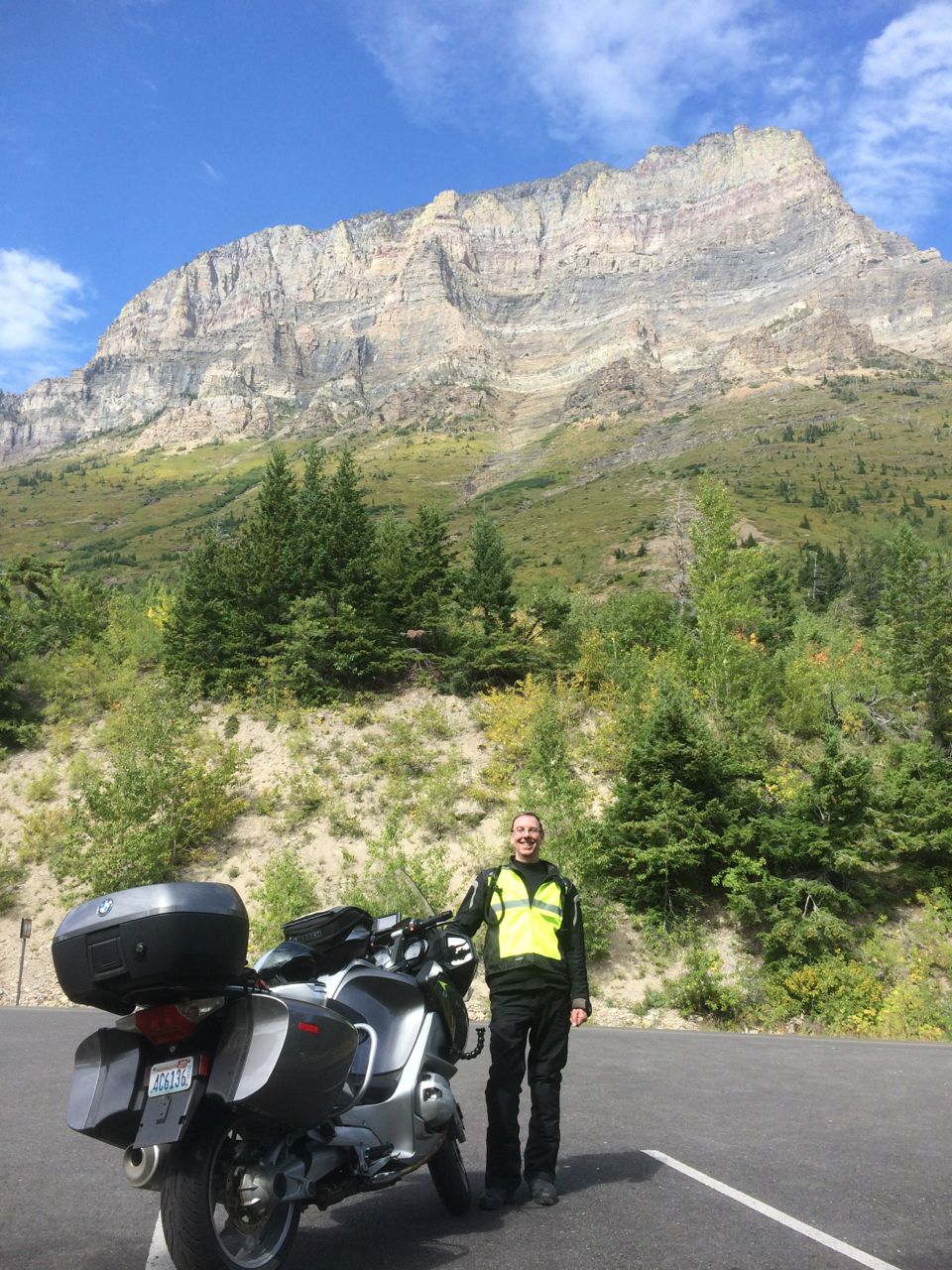
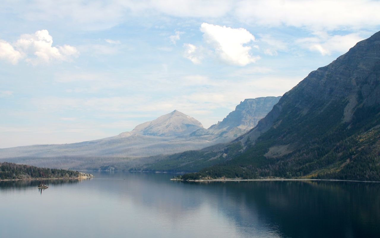
This was my third trip to Glacier in three years. See more (and better) photos from both my 2014 Trip to Glacier and my 2015 Trip to Glacier.
After exiting the park at Saint Mary, I stopped for a sandwich and some water. I met Mark and Lee, who just finished a six day hike through parts of the park. They’re from New Orleans.
It was getting late in the afternoon, and I wanted to get to Cut Bank and figure out where I was going to stay. I forgot how good Hwy 89 is. Lots of fun twisties and the road surfaces are very good.70 mph speed limits help, too!
The only potential trouble is the cattle that roam the roadway. The first one I saw was in a relatively deep ditch next to the road. I first thought it was a bear. I laughed after I recognized it for what it was and shared the experience with some other bikers at the motel I landed in for the night. They had been on the same road and knew exactly what I was talking about. The bikers, three couples, were from Pennsylvania. They were headed to Vancouver, then down the coast to San Francisco.
Another great day on the road. I live a charmed life, for sure.
Oh, I heard back from the service manager at Country Rode Motowerks. They’re unable to schedule my 48,000 mile service. I put in a service request to Max BMW in Troy, NY tonight. Let’s see if they can accommodate my request. Depending on when I can get the service performed, I may have to skip Fairport (too early to tell for sure, Lynda).
Day 4
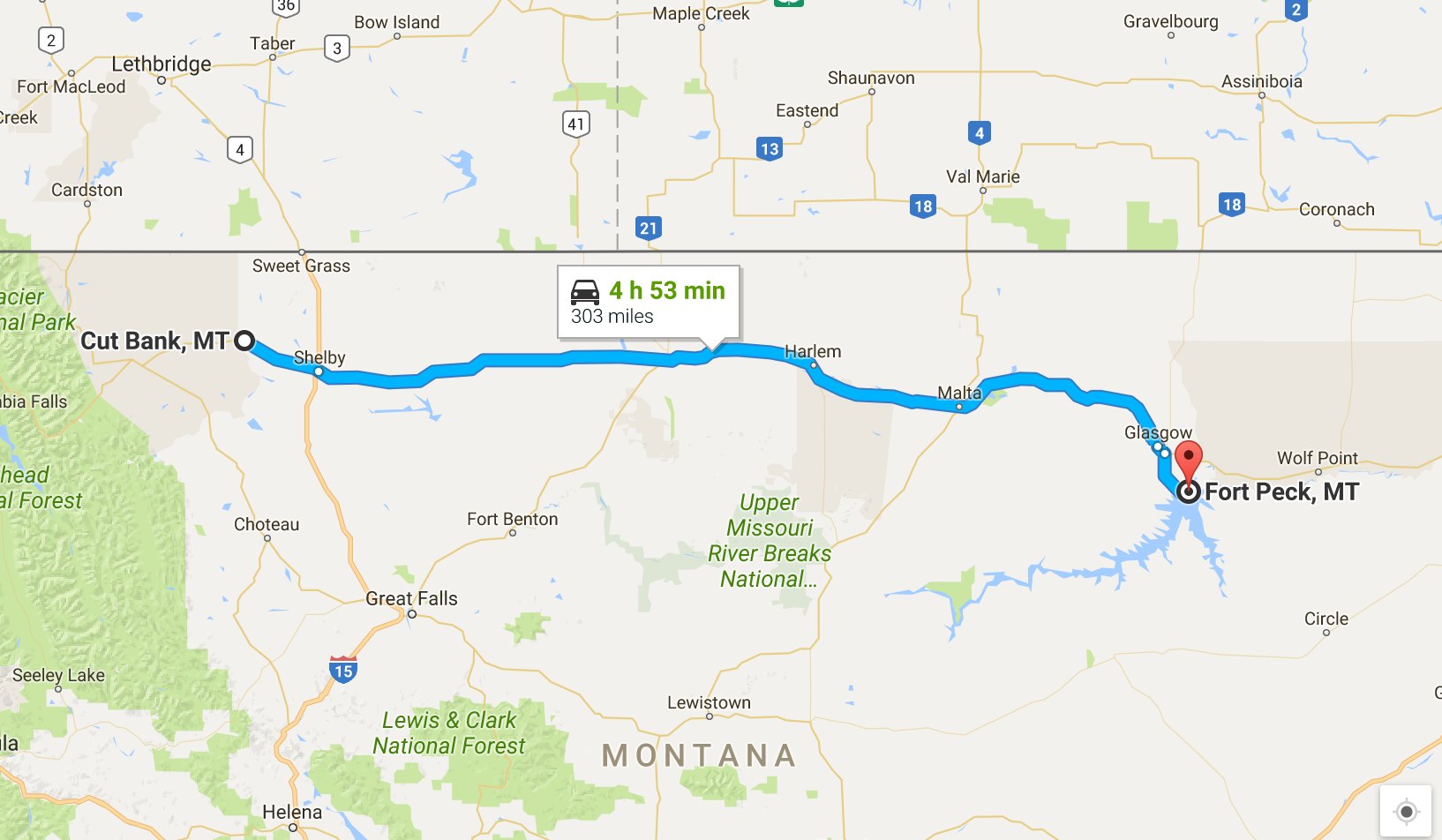
Day’s distance: 303 miles
Total trip distance so far: 1,194
The weather started off in the low 60’s and finished with a high of 101 in Glasgow. It was a bit cooler in Fort Peck. It was sunny all day. I expected thunderstorms given the red sky at sunrise, but I was dry all day.
I left the motel about 9am and traveled along Hwy 2. The landscape has changed since leaving Glacier. There is no doubt I’m in the Plains now.

To see the above in the original 360 format, click here.
Two challenges faced me today. I heard back from the second BMW dealership I contacted about performing an upcoming scheduled maintenance. They could not give me an appointment but would “work on the bike throughout the day”. I called another dealer in Pennsylvania and they did schedule me for September 9th. So I know for sure I can get that service, but this is out of my way and another option would be great.
My housemate, Carson, he suggested I try to stay on my planned route and try to get a service scheduled for early the following week. This made a lot of sense to me and I have reached out to the Essex Junction BMW dealer to see if they can fit me in the following Tuesday. If they can, I can keep or extend my relaxed pace and stay closer to my planned route.
The other challenge had to do with the heat. I stayed well hydrated throughout the day. Tomorrow is also predicted to be hot but after that comes cooler temperatures.
There were far fewer other bikers on the road today. I did meet on rider from Saskatchewan who was heading to Colorado for a rally. This guy talked non-stop for about 10 minutes. Either he was over-caffeinated or hadn’t talked to anyone for a few days 🙂
I had to travel along one gravel road, but it was only about half a mile heading into Fort Peck. No challenge there (but I still don’t like it).
Some days I don’t take a lot of photos while on the bike. Today was one of those days.
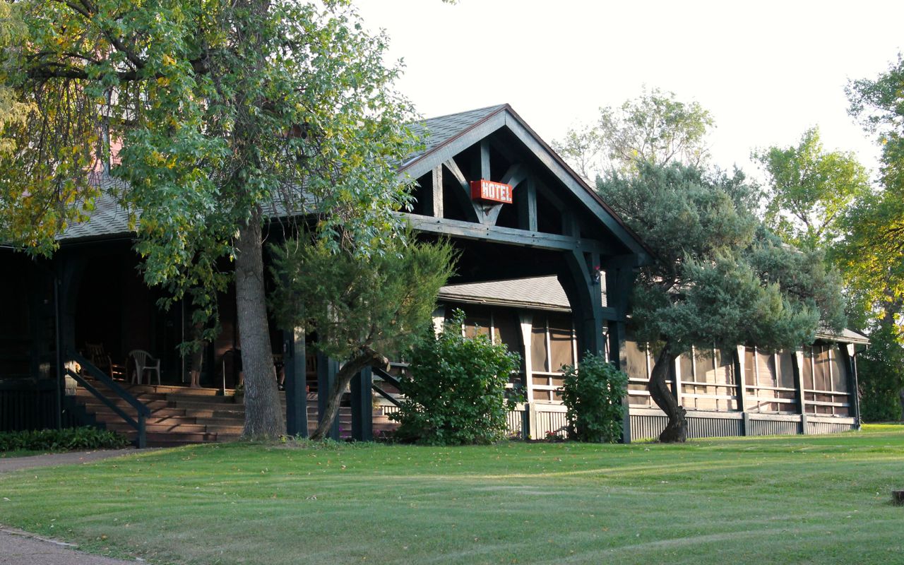
The Fort Peck Hotel where I’m staying tonight was built in the 1930’s. It is not fully restored like the La Posada Hotel in Winslow, but it feels comfortable and people congregate in the common space, making it a very social experience.
Tomorrow is also supposed to be pretty hot. I will likely detour off my planned route to visit the Theodore Roosevelt National Park. Afterwards, I will check out the camping options and play my lodging by ear.
Day 5

Day’s distance: 369 miles
Total trip distance so far: 1563 miles
Temperatures ranged from the 70’s this morning to 91 in the afternoon, before cooling back down to the upper 80’s. The skies were partly cloudy after the overcast burned off. Winds moderate to strong with strong gusts.
Yesterday, when driving through Glasgow, the last town before Fort Peck, I skipped getting gas because I was going to come back through Glasgow this morning. Changing my route last night meant leaving Fort Peck traveling south on Hwy 24 instead of heading north back to Glasgow. Checking my fuel situation, it was going to be tight and maybe not possible to reach the first gas station. I’m thinking, “Again with skipping the gas stop, doh!” Luckily the hotel owner, who owns several boats, had a gallon or so of Ethanol-free premium that I bought off of him.
Lesson learned, again. Feeling grateful and charmed.
I realized how windy it was once I got to the Fort Peck Dam, near the spillway.

I had the good fortune of being able to ease into the windy day as my first leg of the day’s ride was heading south, directly into the wind. Soon enough though, I was heading east and feeling buffeted by the winds.
I have a personal system for rating the strength of winds. Level 1 will buffet my head, while level 2 pushes my whole body around and will cause the bike to cant into the wind. Level 3 tries to push the bike into another lane! Today I experienced level 3 today after leaving the park.
I’ve been in stronger winds, but winds at this level are no bueno. 😦 I took a break every hour or so to stand off the bike and work out some of the stiffness before it became a problem.
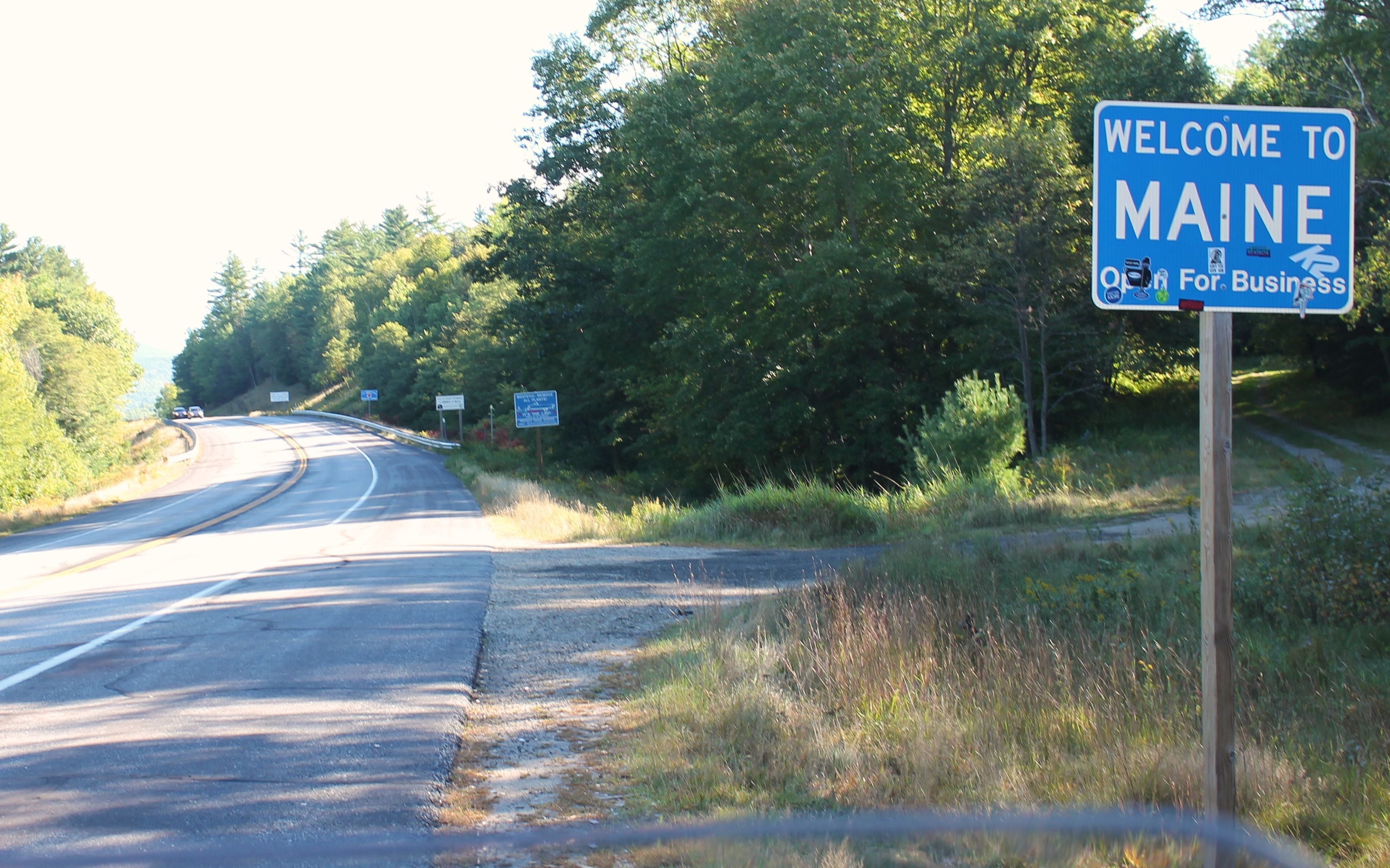
I soon crossed into North Dakota, the first of the “new” states I had to visit to complete my goal of riding all 50 states.

My day’s plan was to visit the Theodore Roosevelt National Park’s South unit.
I grabbed lunch before going into the park at a cafe in Medora, the town outside of the park’s South entrance.
In the park, I cruised around the scenic loop, stopping a few times to try to capture the landscape with the various cameras I have. There were bison, groundhogs, turkeys, and mules (or donkeys?) that I saw but I didn’t get photos of them worth sharing. I will have to practice my wildlife photography 🙂


According to Wikipedia, Badlands are a type of dry terrain where softer sedimentary rocks and clay-rich soils have been extensively eroded by wind and water. South Dakota is known for it Badlands National Park (which I visited in 2014 on my Western States Tour). This is another example of the badlands found in the US.


With the high winds persisting, and the predicted 30 mph gust predicted through the night, I thought camping in a tent was problematic.
On completing the loop, I hopped on the Internet to figure out where to head next.
If I went to Bismarck, I could get back on my planned route tomorrow. I grabbed a motel while I was online. The rest of the day was spent on Interstate 94.
I did find a steak house around the corner fr0m the motel and, though it was a day later than planned, had my scotch and steak. For those interested, I had Macallan 12 year old to start and a ribeye with a glass of Willamette Valley Pinot Noir. Yum!
On a more reflective note, it will take a little more time to relax into my new travel mode. I feel goal / distance / event driven still at this point. No doubt finding a rhythm around keeping up with work will help a lot.
On a happy note, I met a Harley rider that I remember passing about an hour west of Bismarck. Reggie is from Wisconsin and heading home after a 6,000 mile trip out west.
He remembers me passing him and told me he was wondering how I wasn’t impacted by the wind. I laughed told him I think it was the height of the suitcase placed on his top case.
I was also happy to have varied my route from my plans. It was good to see the park, no doubt one one the best parts of North Dakota. The change lets me relax a bit around being so goal and plan oriented.
PS – I was able to reschedule my service for Tuesday, September 13th in Essex Junction, Vermont. This is less than 100 miles off my planned route and gives me a chance to visit Fairport, NY for one day off. Yay, Lynda!
Day 6
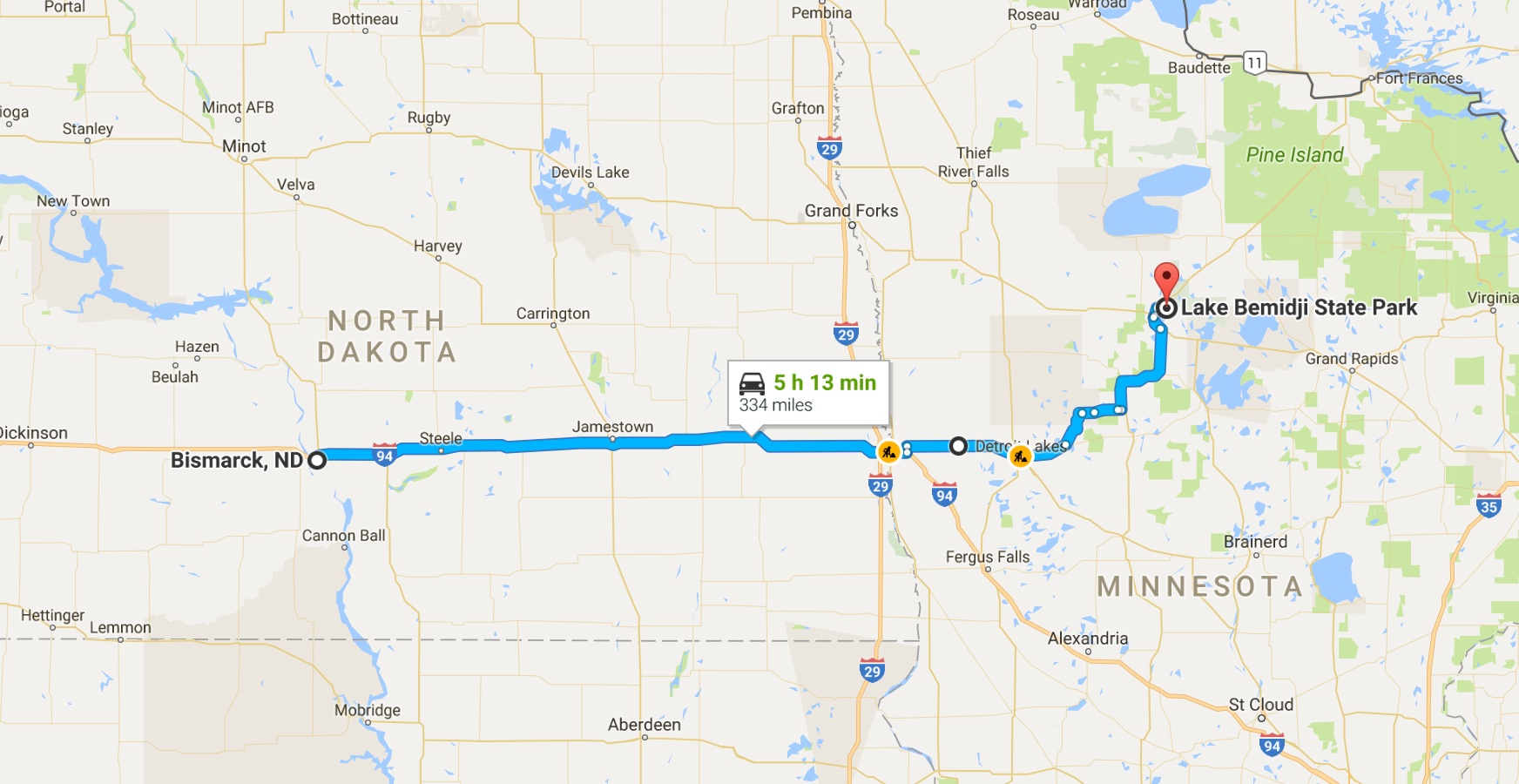
Day’s distance: 335 miles
Total trip distance: 1898 miles
Temperatures started and finished in the mid 70’s, and we’re comfortable throughout the day relative to the prior few days. The winds were as strong as the prior day, but lightened a bit as I entered northern Minnesota’s more wooded regions.
Yes, I ticked off another state from the bucket list 🙂
Before leaving North Dakota, I stopped to call the Garmin support team. My GPS unit had been acting up. I have access to the OEM support unit within the larger team of support techs. They answer the phones immediately and were super helpful, as always.
As I had my laptop with me, I was able to quickly reinstall the recent update and it worked. They helped me do a few other minor things and I was on my way again.
The weather, though windy, was good enough to camp. Being the Friday before a long weekend, I wasn’t hopeful. Looking online for camping near Red Lake, I found Bemidji State Park was well reviewed. When I called, they were able to reserve me a site!
To get there, I traveled I-94 to just east of Fargo and started heading north.
The winds were blowing from the south and it was a relief to have a tail wind. The bike traveled upright and it was so quiet 🙂
I zigzagged through small two-lane, mostly straight highways, hoping my GPS was not taking me somewhere unplanned.
As it was past 5pm, and I still had a cell signal, I stopped to get on the laptop and do my usual Friday social media work for my company. That didn’t take too long as I had things pretty much ready to go.
I stopped for fuel towards the end of my day, even though I still had over 150 miles of range remaining. I guess now I’m overly cautious. That’s not a bad thing, but it turns out Bemidji is a sizeable town focused around the 6,765 acre lake and stopping for fuel before reaching town was unnecessary.
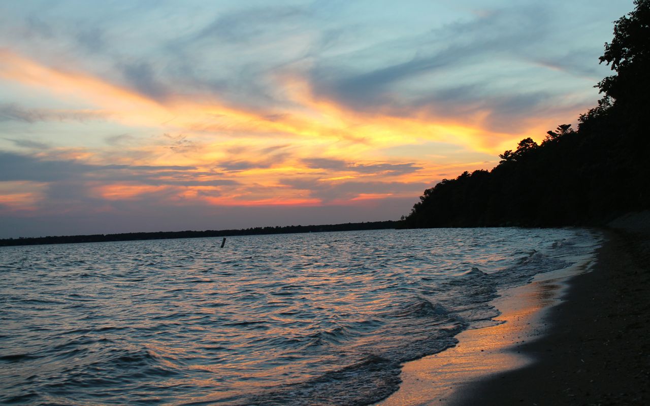
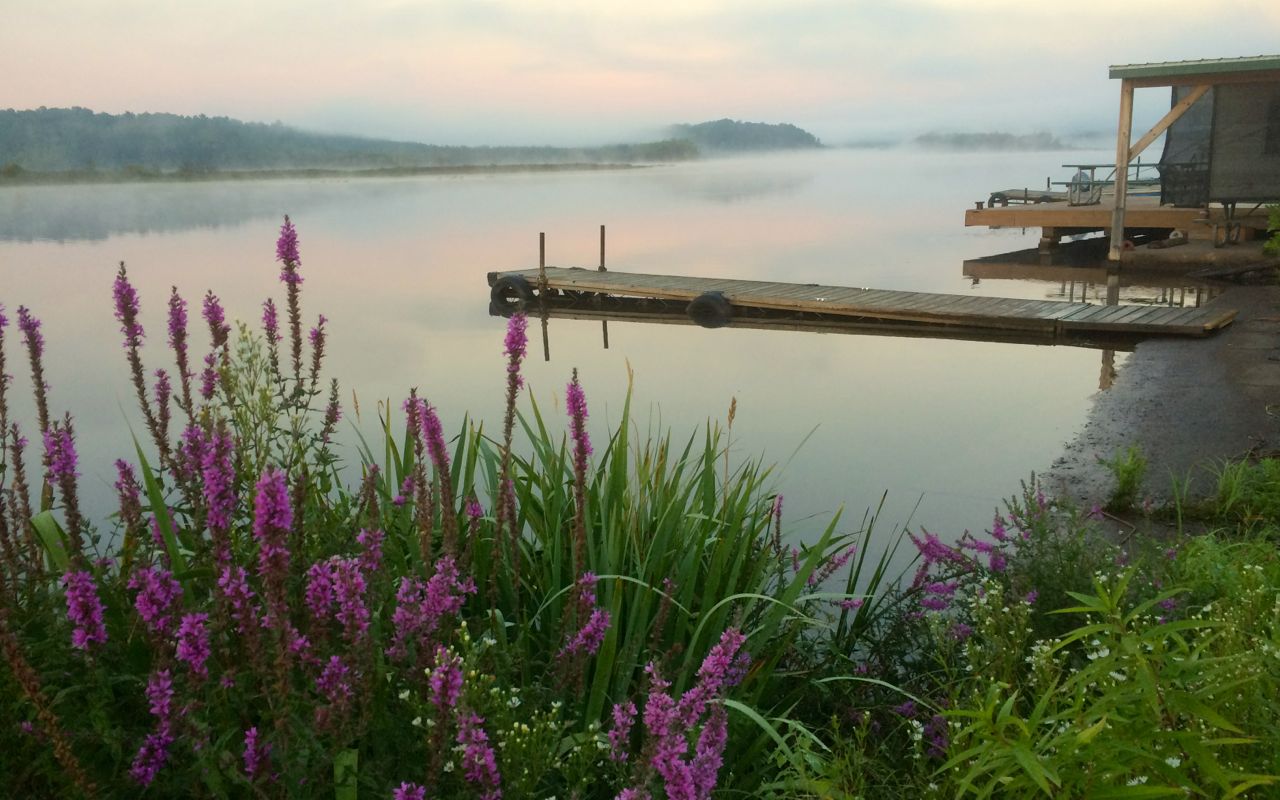
The campground was great and after setting up,
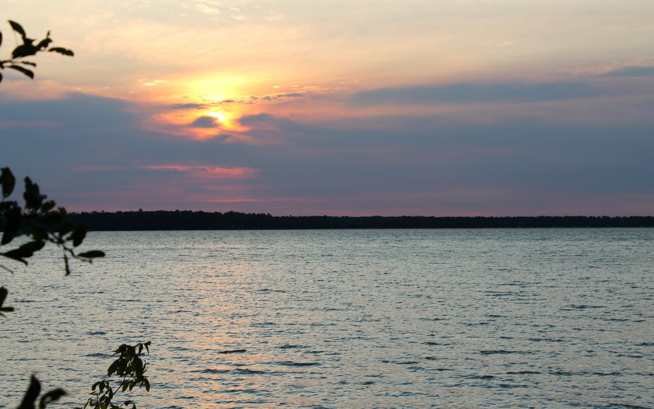
I walked to the lake shore for sunset.
The Rangers gave me some tourist maps that highlight some of the scenic byways heading east that I’ll look over in the morning to set my route to Lake Superior.
Day 7
Day’s distance: 290 miles
Total trip distance so far: 2,188 miles
The day began in the high 50’s with a beautiful sunrise over Lake Bemidji.
The temperatures stayed in the 70’s throughout the day, with some high clouds and lighter winds.
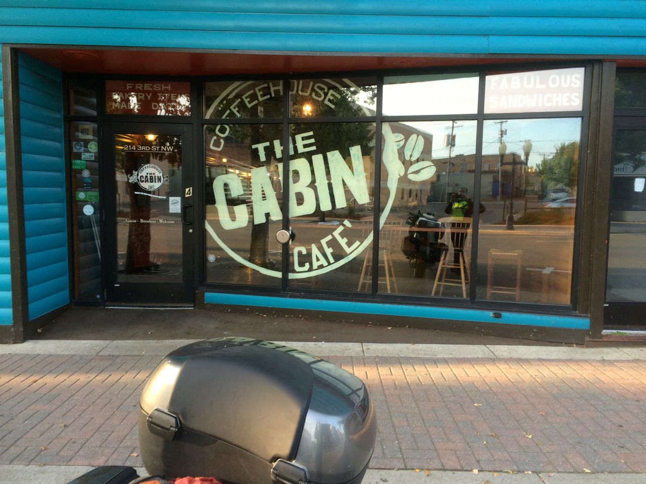
I started the day at the Coffee Cabin Coffeehouse in Bemidji. Great coffee, breakfast wrap, scone and muffin! I recommend this place for a smooth strong latte.
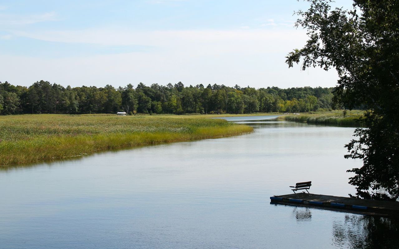
I left Bemidji following part of the Great River Road around Lake Andrusia and Cass Lake (not shown on the map above) before rejoining Hwy 2 east to Grand Rapids. According to wikipedia, Lake Bemidji is located less than 50 miles downstream from the source of the Mississippi River, it both receives and is drained by the Mississippi.
The other scenic byway I traveled was the Superior National Forest Scenic Byway.
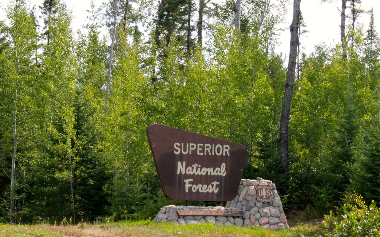
This was a relaxing, two lane highway with little traffic and lots of gentle sweepers through the heavily wooded Superior National Forest.
It was about 4pm when I came out at Silver Bay and got my first glimpse of Lake Superior.
The is the North Shore and it is populated by smaller resort towns. Heavily wooded rocky shores seem to be typical.
As this was Saturday of the Labor Day weekend, and I didn’t have reservations for any of the State Parks, I headed into Duluth to look for a motel. Well, that was absolutely impossible. Every motel I called was completely booked. Every one.
With the help from Carson, working from Seattle, I finally found a private campground , the River Place Campground and Marina, that would allow me to set up a tent on a patch of grassy area for the night. Theresa, the owner, was very nice and met me when I arrived. I feel super lucky I didn’t have to do any illegal camping.
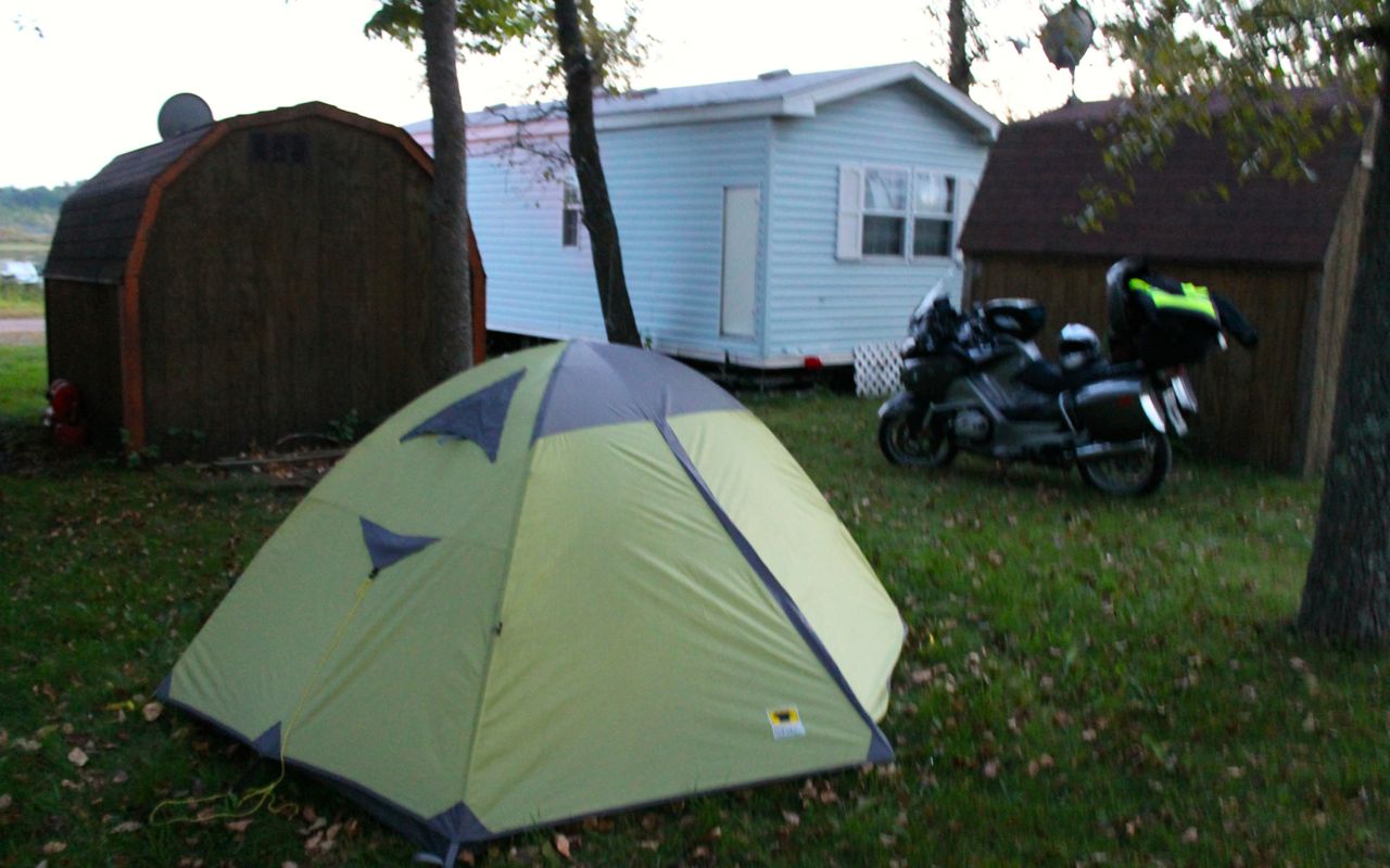
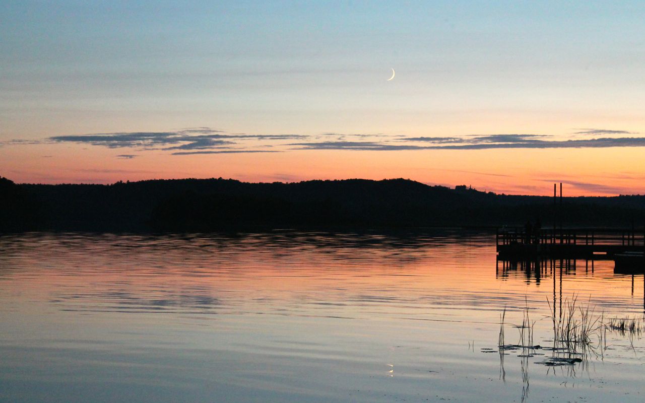
The campground is situated along the shore of the St Louis River. I was lucky enough to get there as the sunset and grabbed this photo taken 50 feet from my tent (though there is no direct line of sight from my tent).
Well, that was likely the worst of the impact from the long weekend marking the end of summer for most. I will be camping at Fort Wilkins Sunday and I’m right back on schedule. 🙂
I do live a charmed life with good friends who support me.
Day 8
Day’s distance: 300 miles
Total trip distance so far: 2,488 miles
The weather remained pleasant, temperatures in the 70’s and winds light with the occasional gust. Skies were partly cloudy.
I grabbed a morning photo from the marina inside the campground before leaving.
I followed the southern shore of Lake Superior along Hwy 13, a pleasant two lane highway.
It passed through one small town after another, with many celebrating the long weekend in various ways. Port Wing, for example, was having a car show and Herbster (I think) was having a running event. Lots of bikers on these roads.

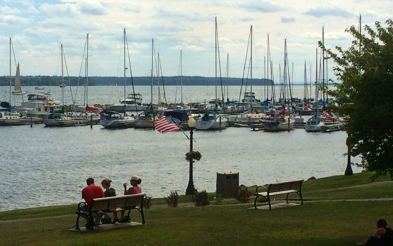
A stop in the tourist town of Bayfield was next. One of the draws here is a ferry to Madeline Island from the marina.
My draw was lunch and I chose to eat at Morty’s Pub. They serve fresh whitefish and chips and it was super good.
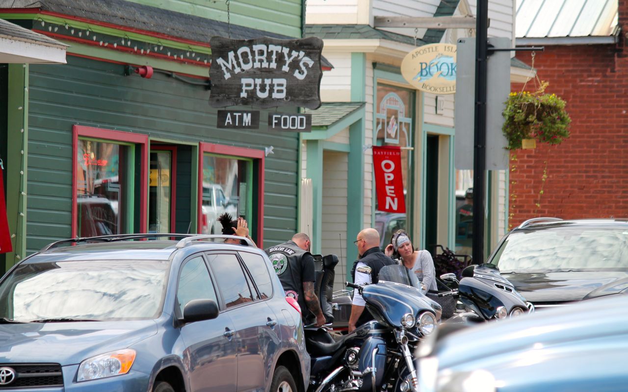
I think there were almost as many motorcycles here as cars. This is Harley Davidson country. I don’t recall seeing another BMW there during my visit.
Soon after lunch, I crossed into Michigan.
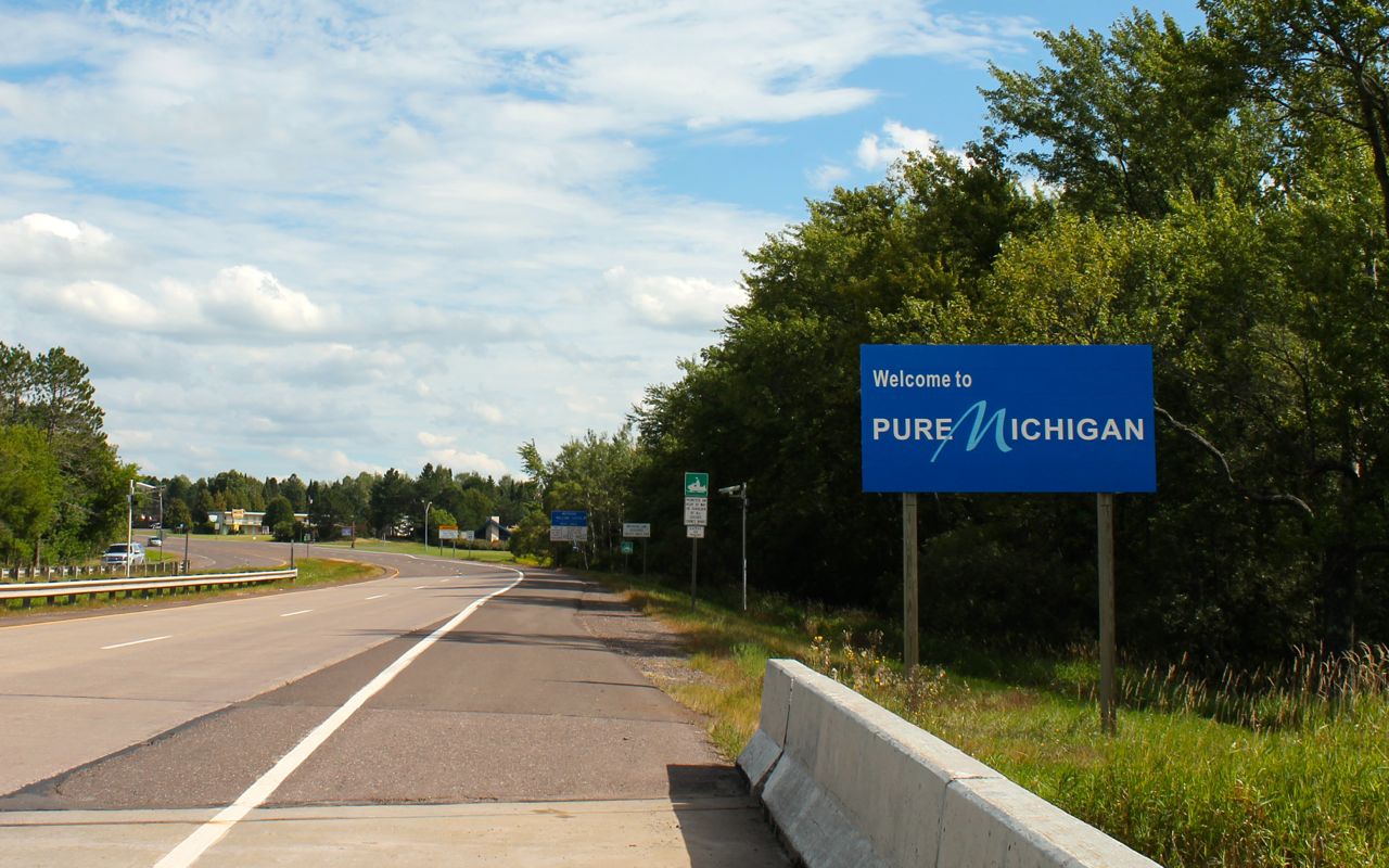
I have no idea what is meant by Pure Michigan. To me, it sounds like pure bull marketing, but who knows.
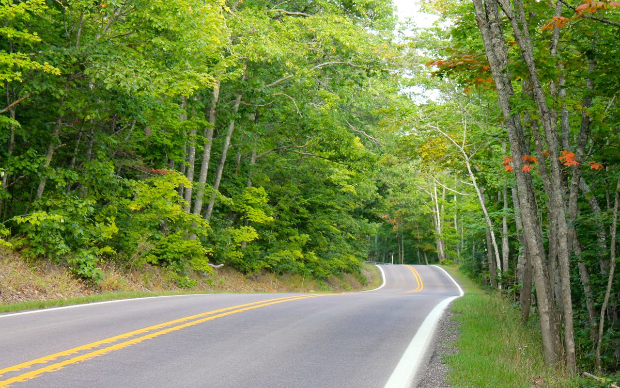
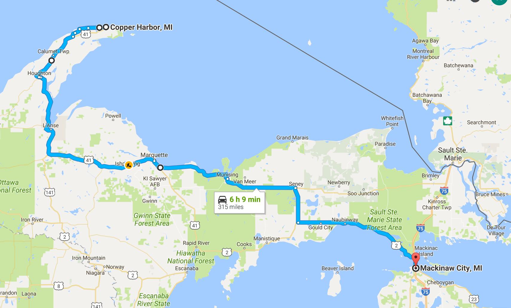
I rode through the Ottowa National Forest and towards the Keweenaw Peninsula and Copper Harbor. The ride passed through some beautiful country with diverse and healthy forest lands.
I was pleasantly surprised by the last 11 miles of Hwy 41 as I approached Copper Harbor. The roadway narrowed and got twisty as the tree canopy reached over the roadway. It was beautiful! The trees are just barely starting to turn their fall colors.
With the final time change of my trip, it was after 7pm when I arrived in Copper Harbor. I had reservations to camp at the State Park.
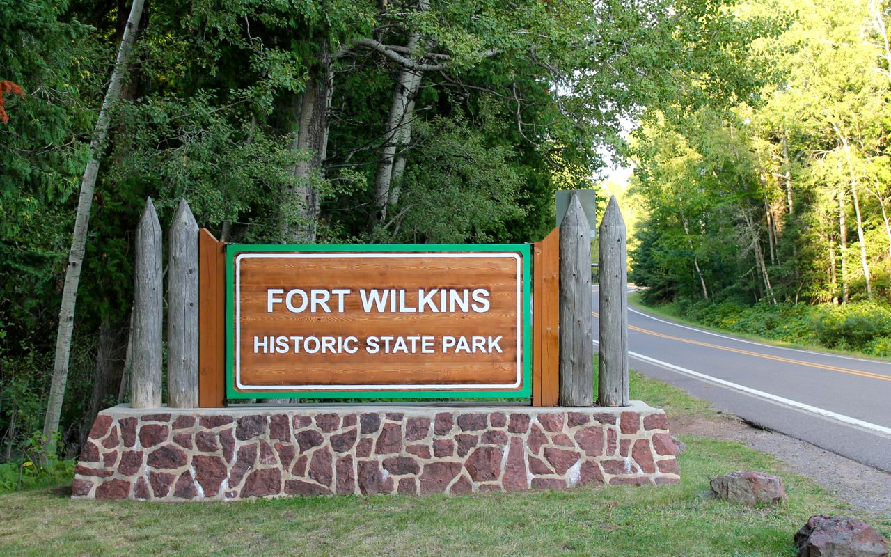
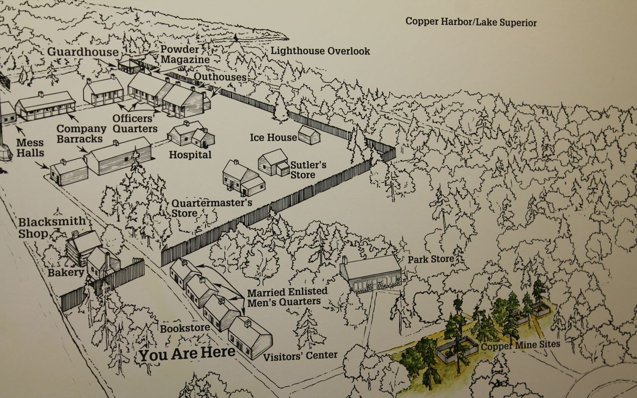
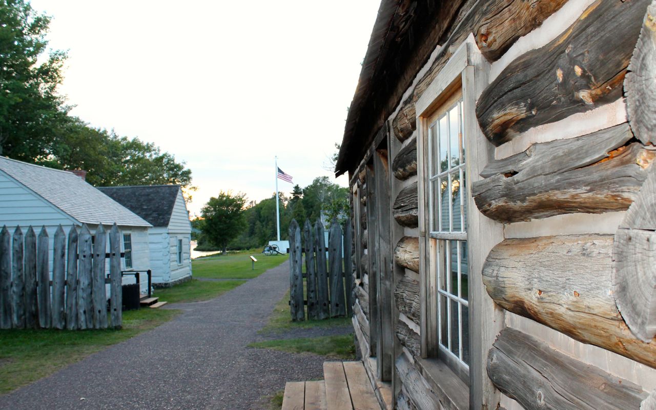
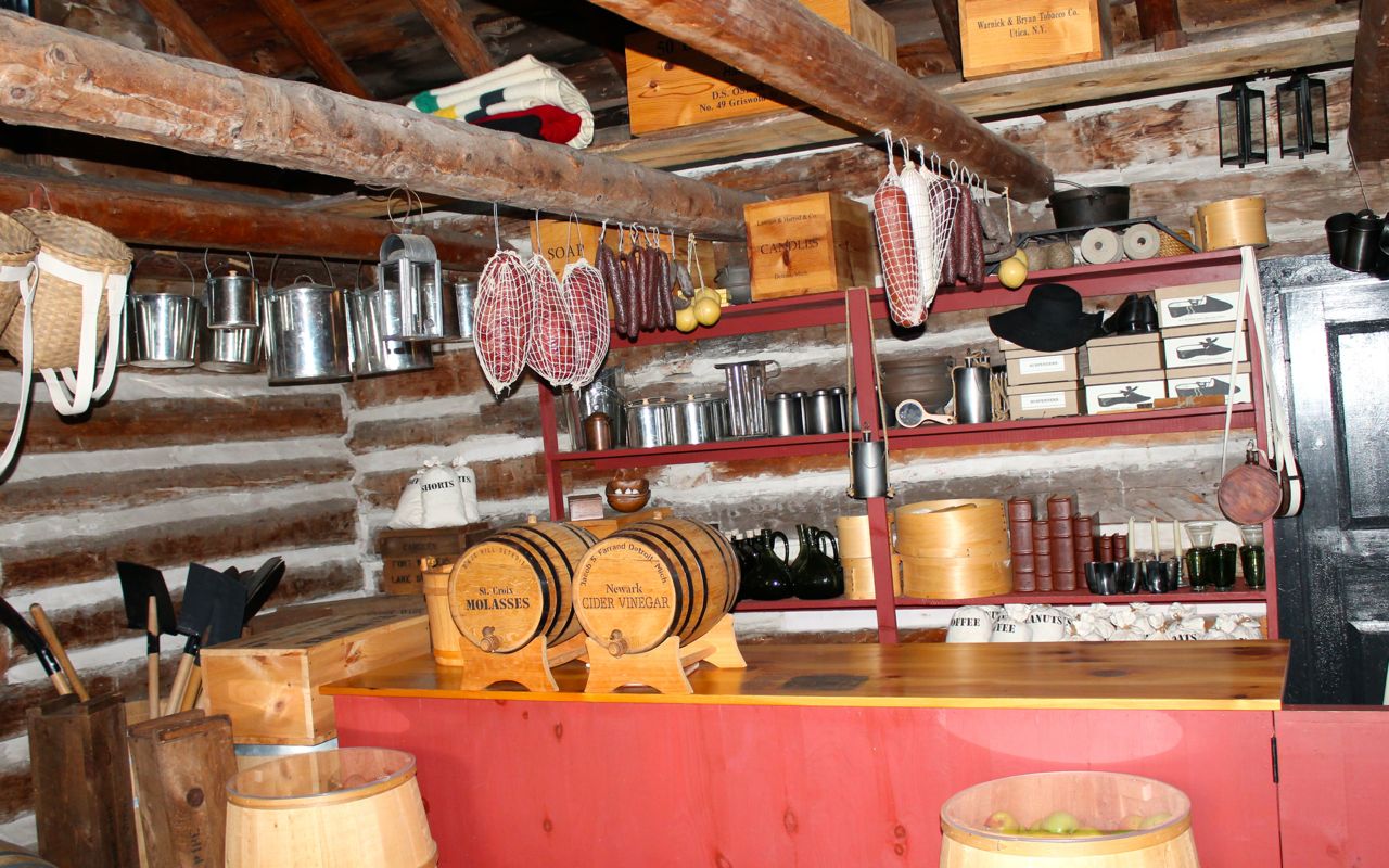
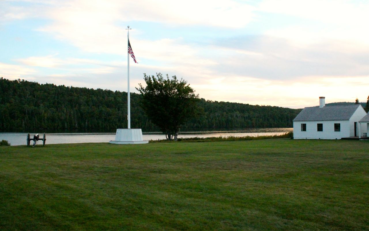
Once I registered, and asked the folks who parked their vehicles in my spot (the place was packed and chaotic – think long weekend), I had only about 20 minutes to visit the Fort before it closed.
Here are a few photos from those 20 minutes 🙂
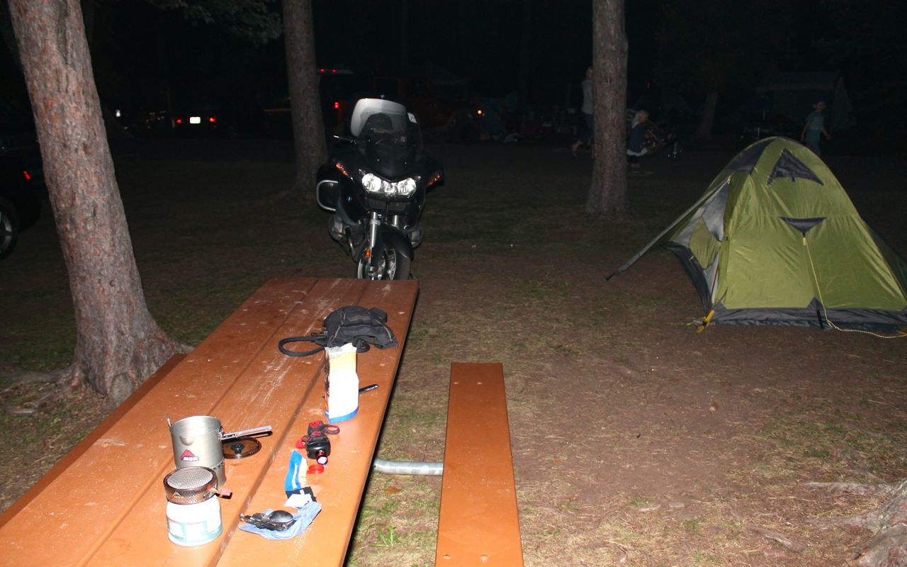
By the time I returned to my site and set up the tent, it was dark.
Tomorrow it is supposed to rain here, but be clear to the east in Mackinaw City. I will probably take a full day off there. I need to do laundry, get a haircut, and some social media marketing work for this coming week’s end.
Day 9
Day’s distance: 327 miles
Total trip distance so far: 2,815 miles
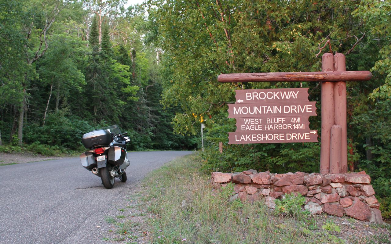
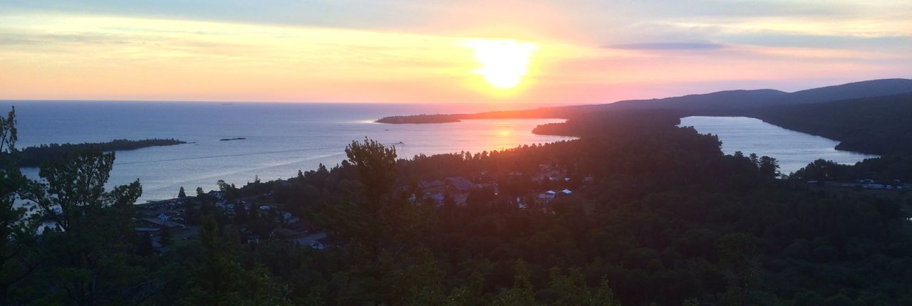
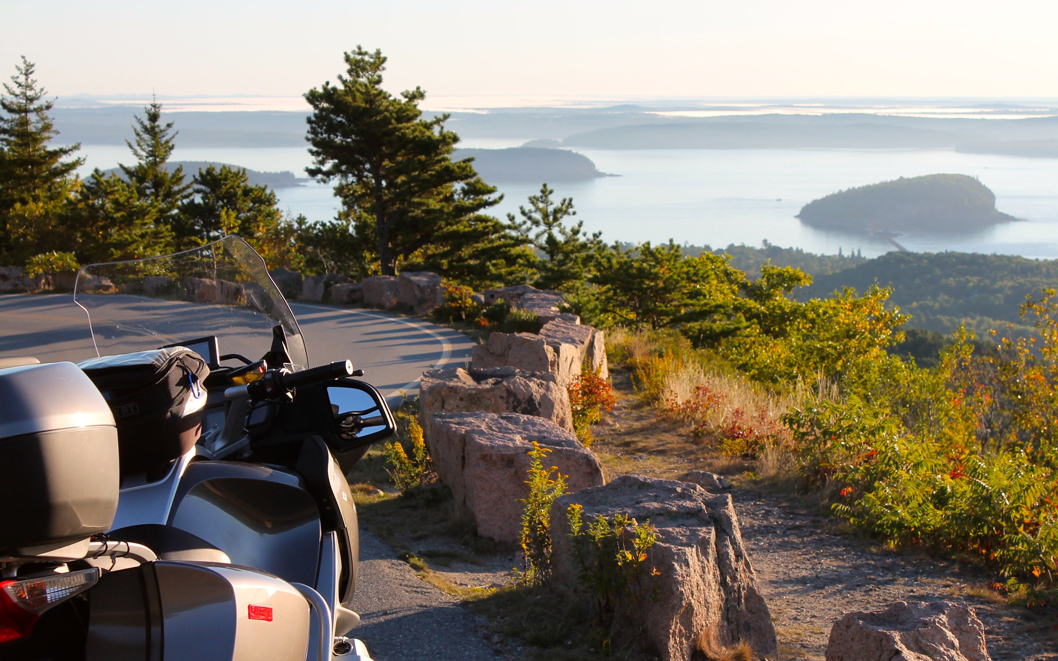
It was about 58 and windy in the morning, and I knew there was rain coming so I got an early start, leaving the campground just about sunrise. One of the rangers told me about a scenic vantage point part way up Brockaway Mountain Drive, so I traveled there first thing.
Here is the best of the photos from the scenic point showing the harbor and town around it.
After that, it was back down the Keneewah Pennisula along Hwy 41. I was looking forward to the twisty roadway, hopefully this time with no traffic. As it was so early, I did keep a sharp lookout for animals on the road.
Too soon after, it started to rain and so I closed up the vents on my jacket and sealed the tank bag so things would stay dry. The rain showers were heavy at times but there was no thunder, lightening or hail.
As I traveled east, the rain would cease, but then catch up if I stopped for a break. I stopped in Marquette to post the to the blog and do some other work. By the time I was finished, it was raining there, so I continued east.
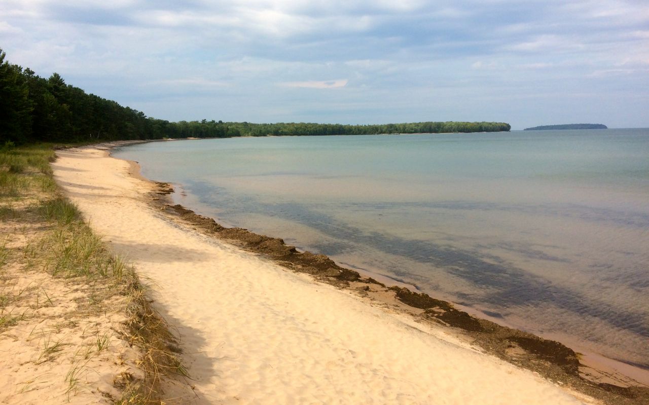
The sun finally came out and I stopped along the shore at Au Train Bay. The beach was sandy and pretty much deserted so I took a quick swim.
This would be goodbye to Lake Superior and on to Lake Michigan. My route took me south on Hwy 77 past many farms. I stopped for fuel just north of Hwy 2 and several folks took the time to tell me about the upcoming traffic jam along my route.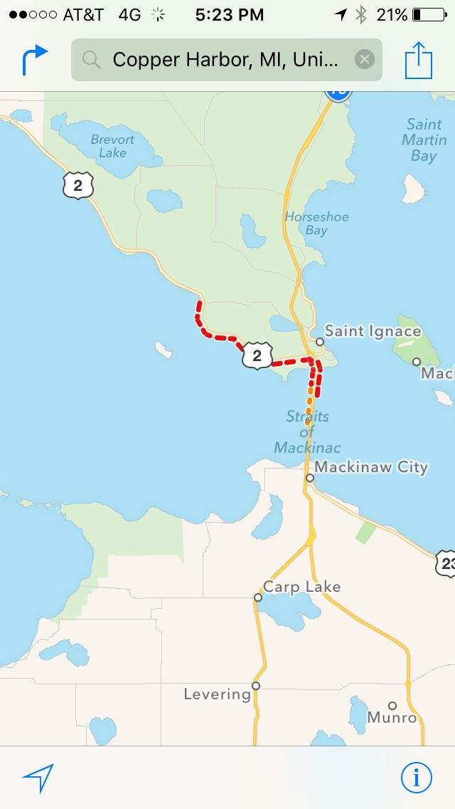
The map is highlighting a 15 mile back up to get across the Mackinaw Bridge. Every Labor Day, they open the bridge to pedestrians to walk. Apparently there were some issues clearing the bridge for vacationers to return home. I took my time and hoped the traffic would clear up before dark.
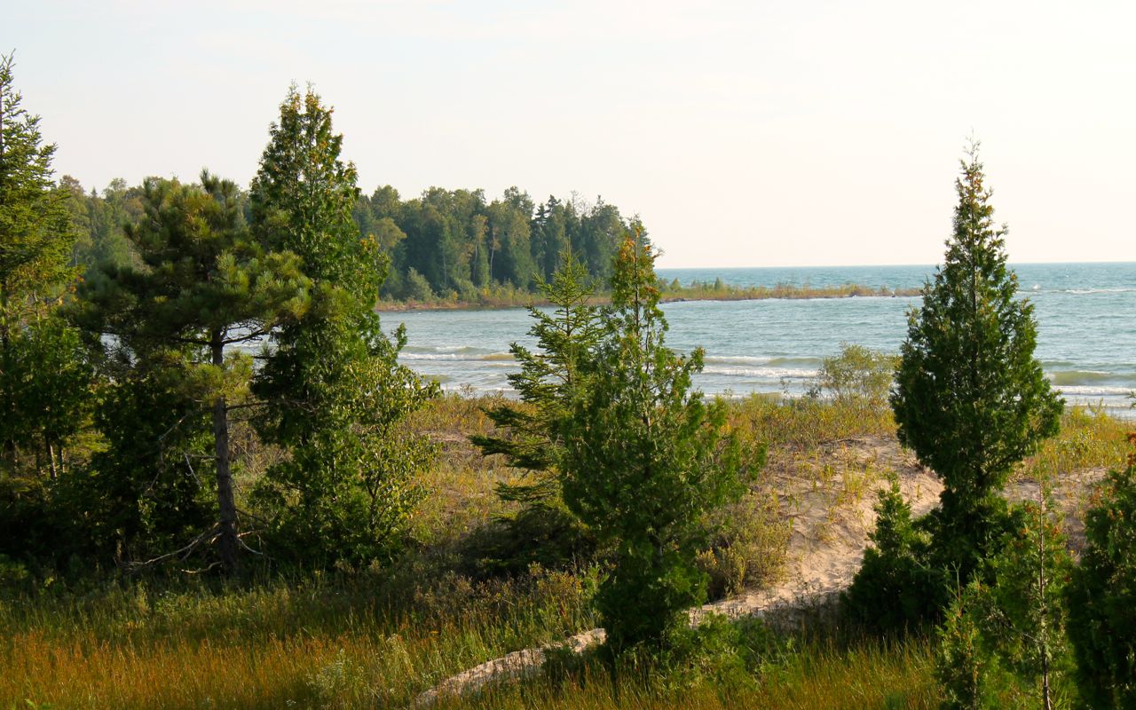
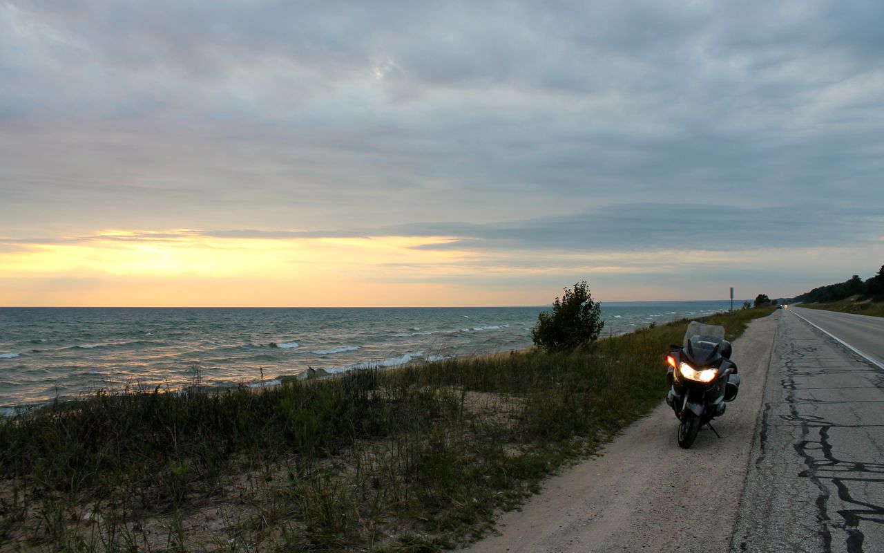
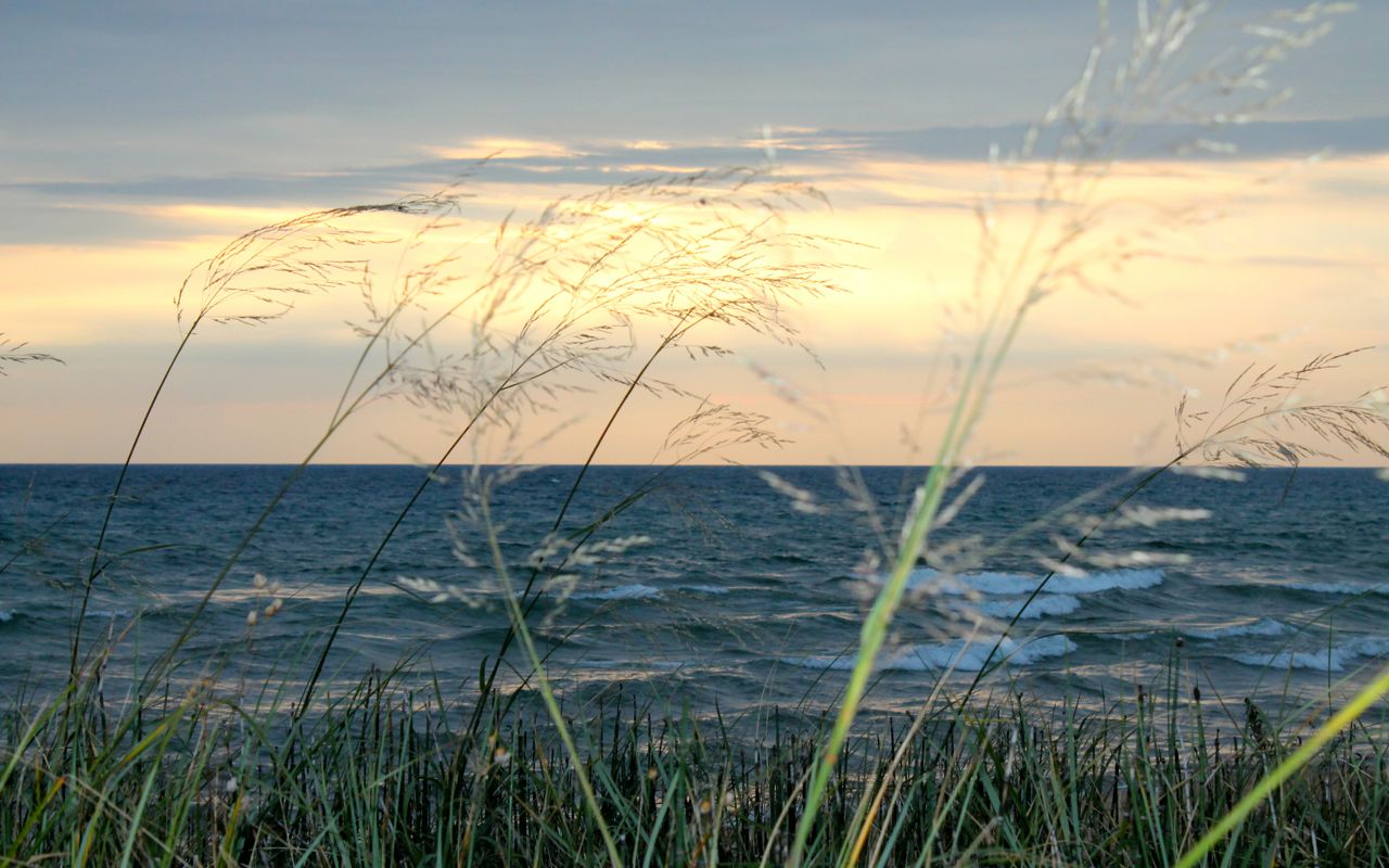
I stopped to get some photos of Lake Michigan’s northern shore.
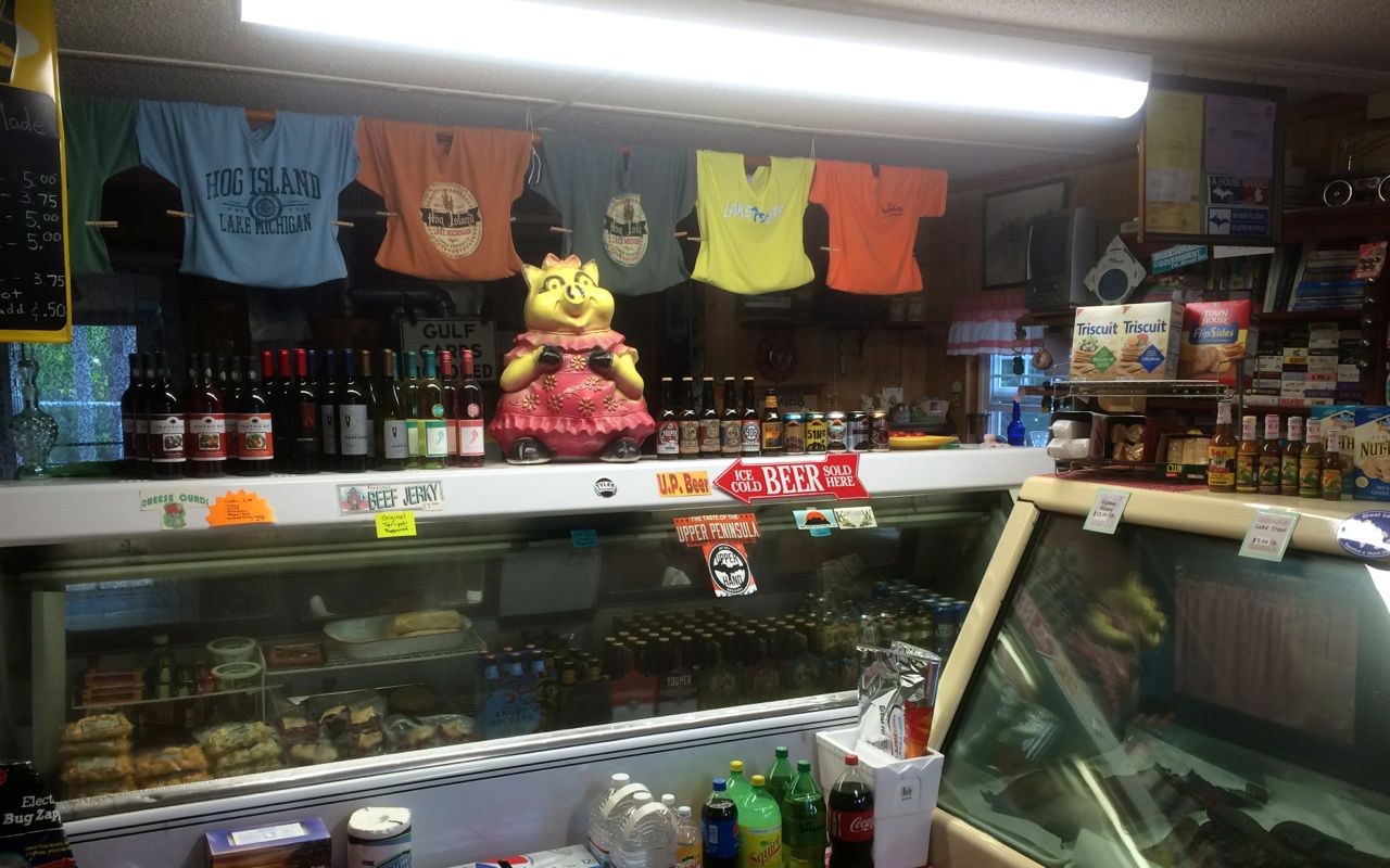
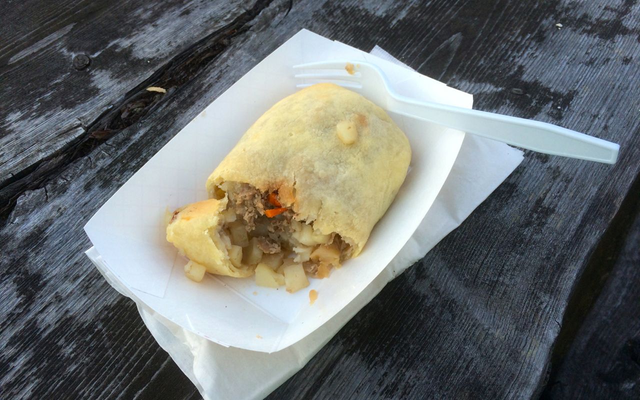
As it was past dinner time, I also stopped to ask about Pasties. The owner of the Hog Island Country Store told me how to pronounce it correctly (“you don’t walk past a pastie“) and heated one of these meat pies for me.
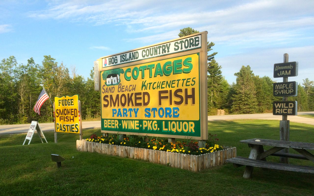
Her store was super cute both outside …
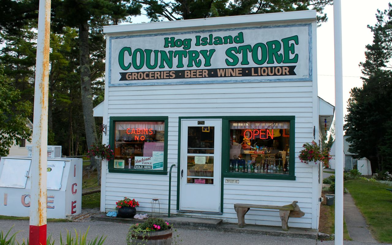
and inside.
It was perfect for this summer evening and now I know what pasties are like.
The traffic was clearing so I continued along the shore, stopping to take a few more photos before crossing the Mackinaw Bridge.
I saw the most intense sunset while crossing the bridge. The sun was a big red ball – you had to be there. Sorry but I couldn’t stop on the bridge.
What a great day on the bike, despite the morning rain. Tomorrow is a full day off the bike to catch up with work and rest.
Day 10
Day’s distance: 0 miles (DAY OFF)
Total trip distance: 2,815 miles
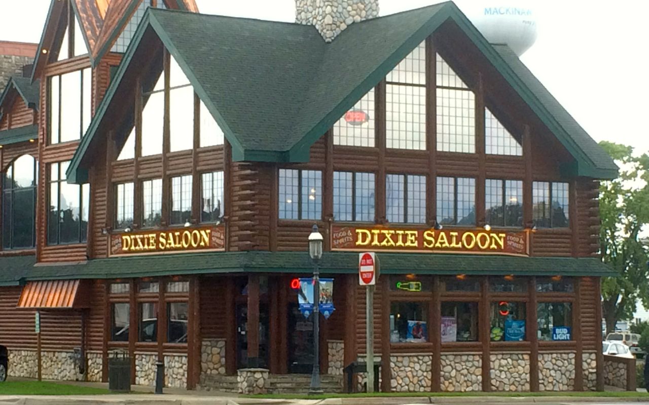
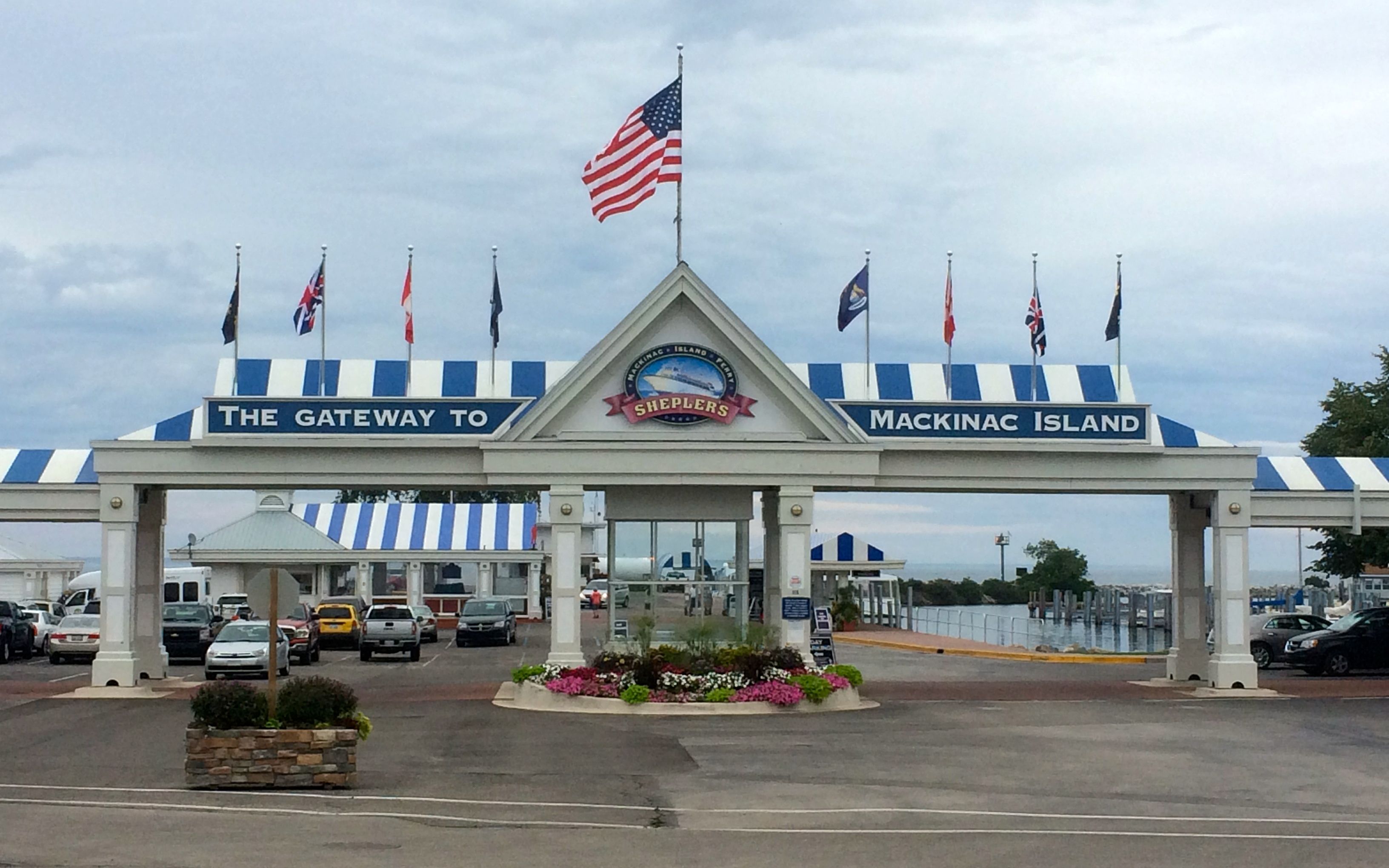
After catching up with the blog and doing some work, I walked around Mackinaw City, ducking into various shops and under eaves during the frequent showers.
Technically a village, Mackinaw City is located at the northern tip of Michigan’s lower pennisula, at the Straight of Mackinac, between Lake Michigan and Lake Huron.
According to wikipedia, Mackinaw City’s population in the 2010 census was just over 800 people. It is primarily a tourist town these days.
Shops are spread out along Central Ave and the Marina, selling gifts and food, both local fudge and pasties.
There are also a few pubs, as you might imagine.
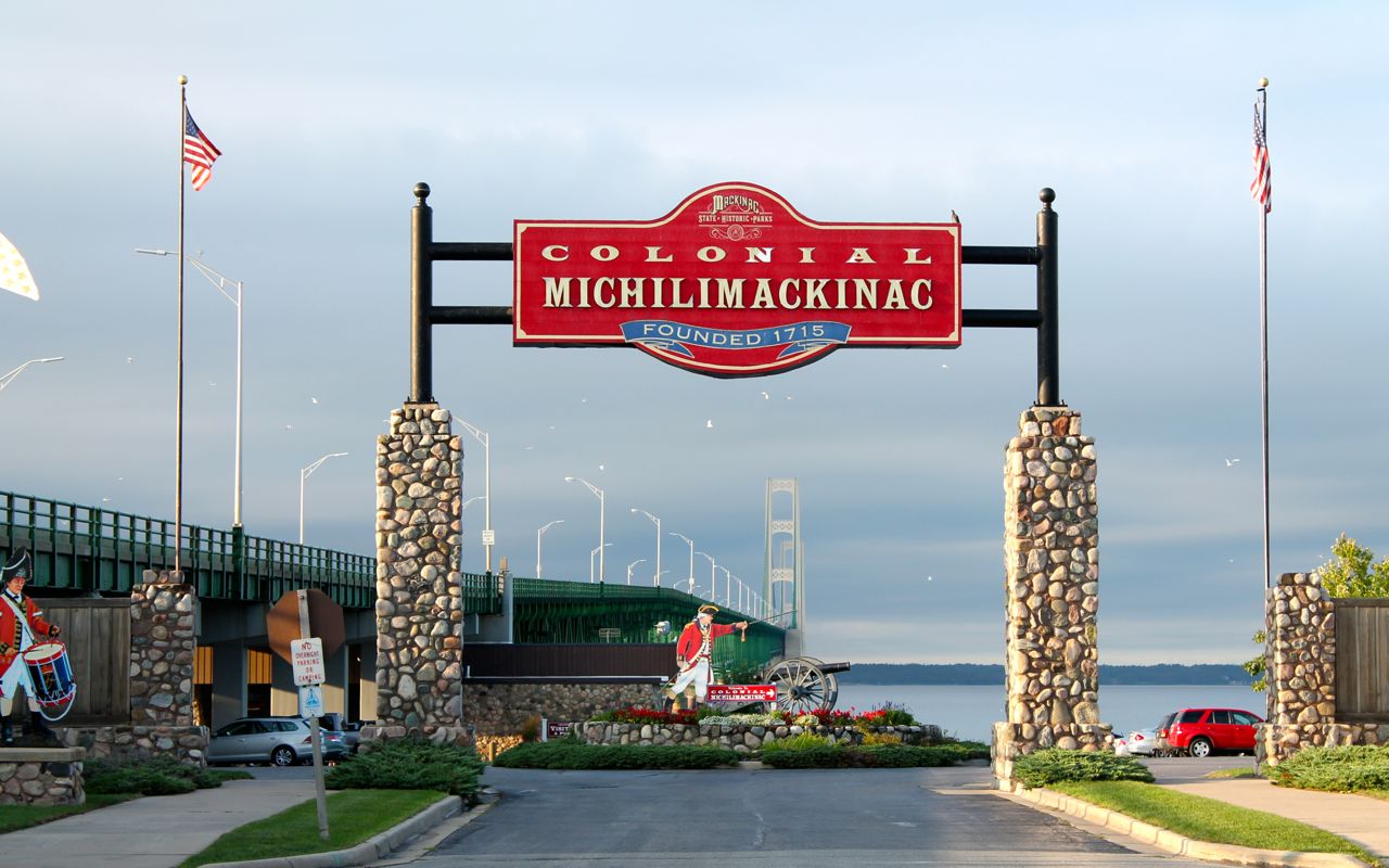
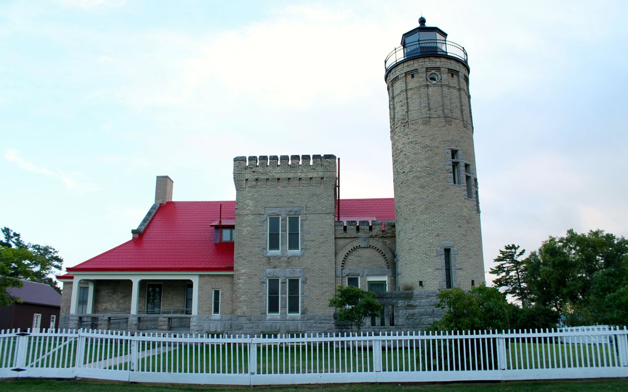
Fort Michilimackinac is near the bridge, along with the lighthouse.
Looking at the weather forecasts both here and further east, I’ve decided to spend one more day off the bike. The chances of running into some significant t-storms is lower tomorrow, though I’m still expecting to hit rain later in the week.
By leaving tomorrow, I’ll still make it to Essex Junction by Monday night for my service appointment Tuesday morning, thanks to having built into my schedule some days off later this week. I will be “out” of days to spend sitting around after today, at least until the bike gets serviced.
Day 11
Day’s distance: 0 miles (DAY OFF)
Total trip distance so far: 2,815 miles
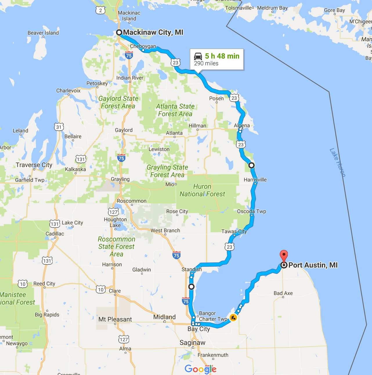
Today was another day off the bike. Yesterday, the predicted weather for my destination was pretty gloomy so I stayed put. I will be taking off tomorrow, headed for Port Austin, MI.
After getting cleaned up, I walked around town again today.
I met two other bikers this morning at the local Starbucks. Mark and Rich both ride Goldwings. Well, technically, one Goldwing and one F6B, the recently released “Bagger” variation of the Goldwing. They are headed west to the headwaters of the Mississippi and then following the river’s route down to St. Louis.
We had an interesting discussion of the use of tires meant for passenger vehicles on their bikes – both were using car tires. Like many bikers who tour long distances, they have been on some of the same roads I’ve visited.
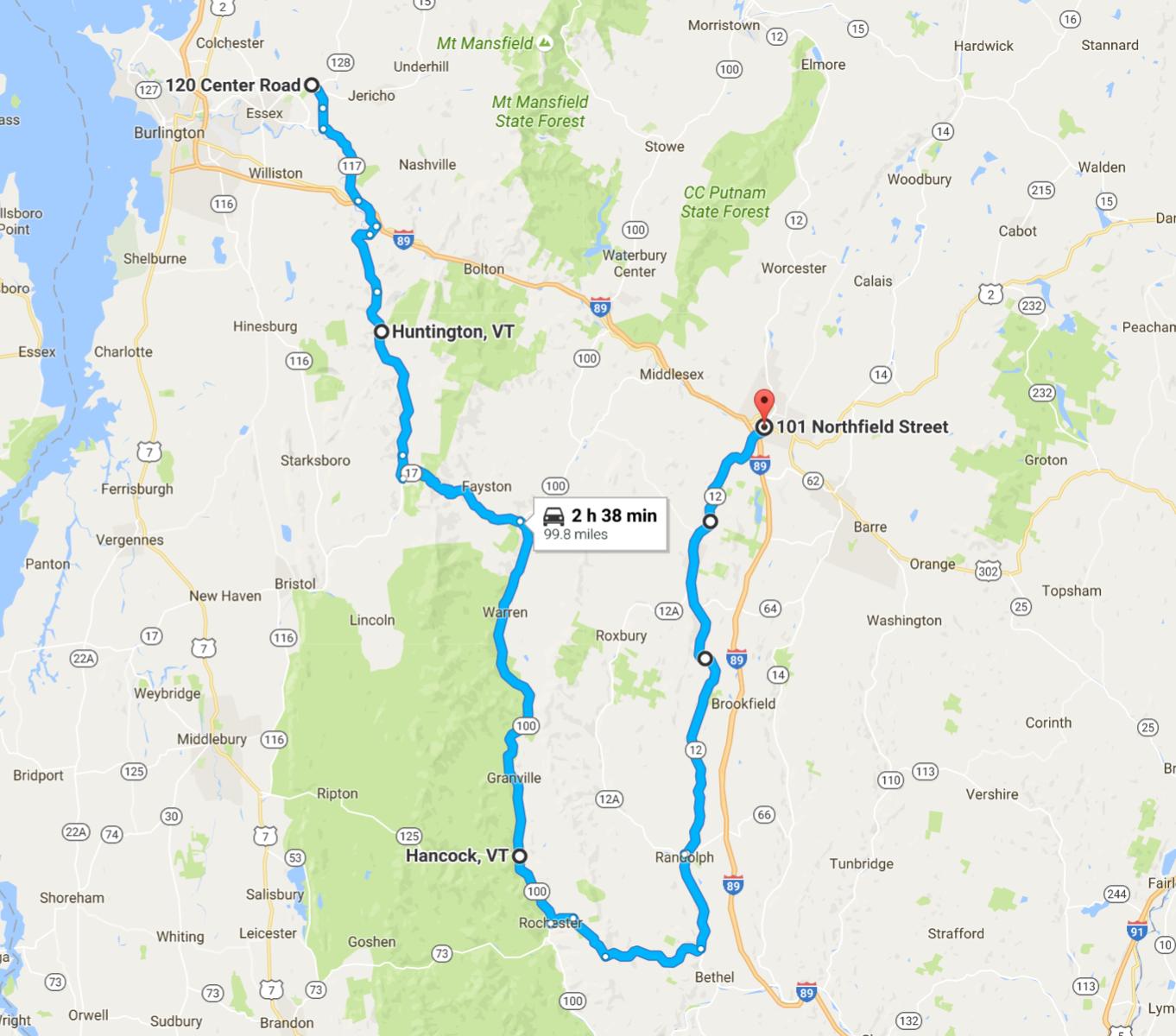
I thought I would take the opportunity to update my schedule for the next few days.
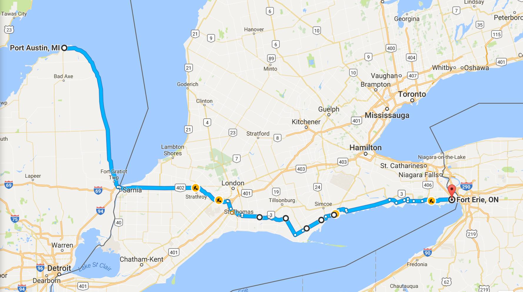
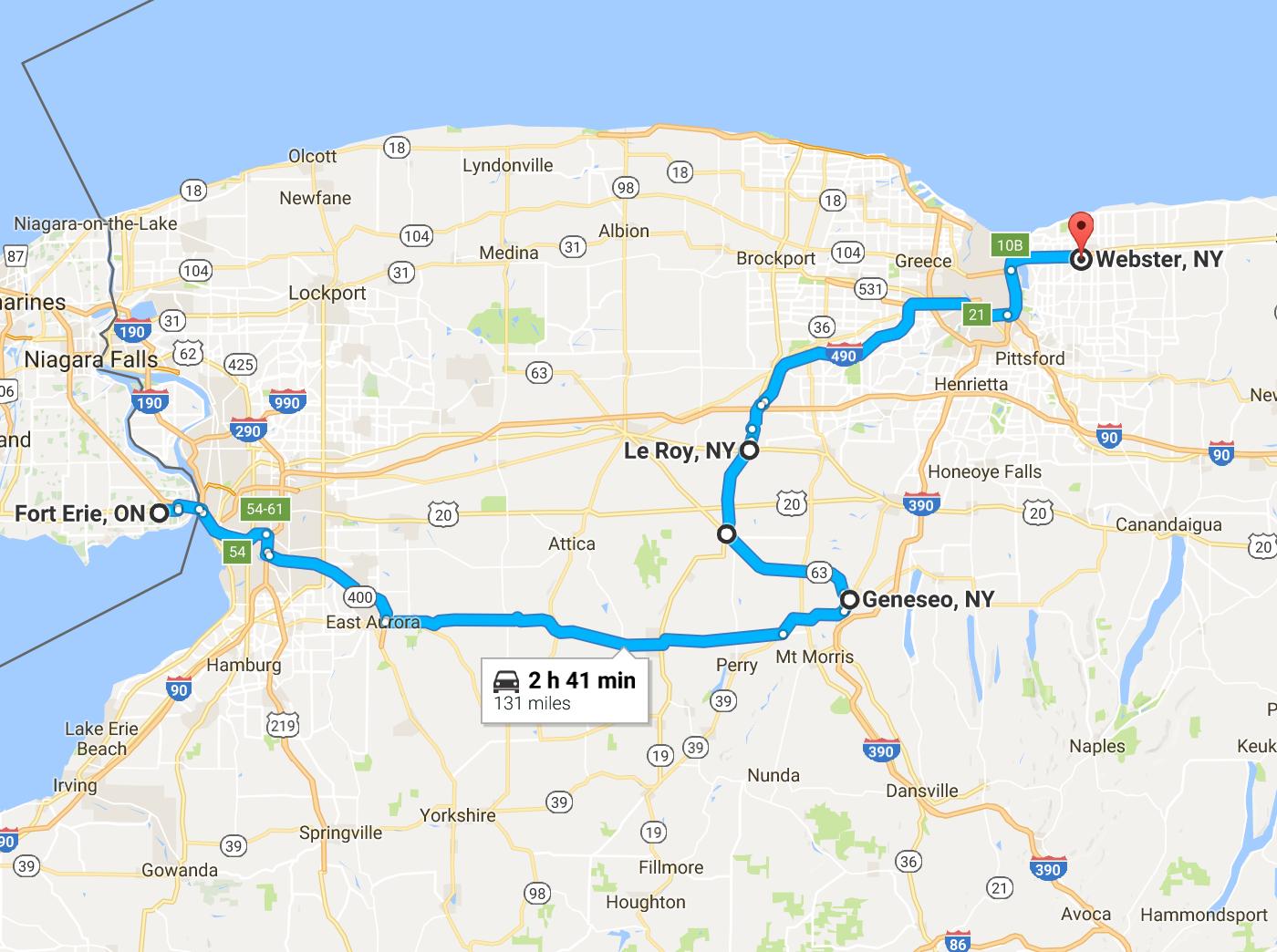
- (Thur, Sep 8) Mackinaw City to Port Austin – (295 miles) Travel along the western shore of Lake Huron. Motel options seem sufficient and rain is probable. [Play lodging by ear.]
- (Fri, Sep 9) Port Austin to Niagara-on-the-Lake – (272 miles) Travel from Michigan to New York via the province of Ontario and along the southwestern shore of Lake Ontario. With the most recent changes to my route, this may be my only visit into Canada. Lots of lodging options in the Ontario city of Niagara-on-the-Lake, recommended by a friend in the office. [Splurge some for Canadian lodging]
- (Sat, Sep 10) Niagara-on-the-Lake to Fairport – (112 miles) My original plan was to get a service here, but I rescheduled it for Essex Junction. [Play lodging by ear. Weather is predicted to be wet.]

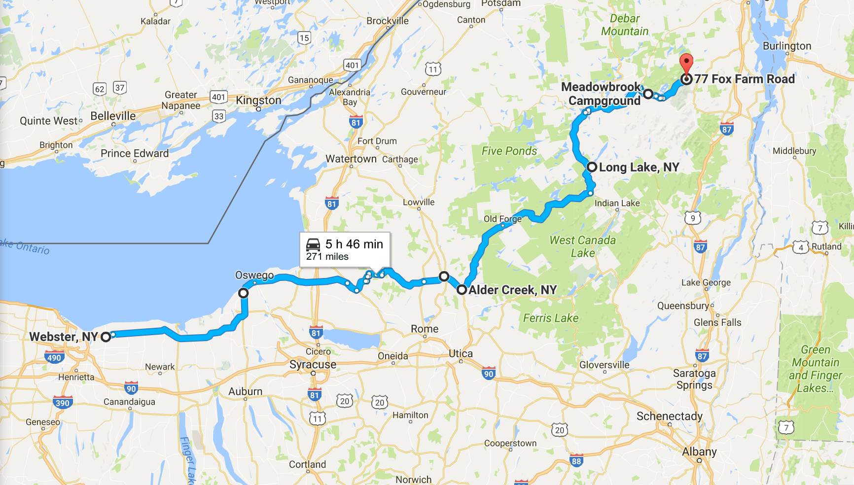
- (Sun, Sep 11) Fairport to Port Henry – (321 miles) Starting with Cedarville Road, Llion Gorge (Hwy 51), through the Adirondack Mountains and finishing with Ensign Pond Road into Port Henry, situated on the western shore of Lake Champlain. [Play lodging by ear]


- (Mon, Sep 12) Port Henry to Essex Junction – (51 miles) Traveling north to get to my destination and find a motel near the dealership. [Play lodging by ear]
- (Tue, Sep 13) Day off – getting a level II service performed.


Day 12
Day’s distance: 288 miles
Total trip distance: 3,103 miles
The temperatures started in the mid 60’s and ended up in the low 80’s. It was humid and misty this morning. By the afternoon, it was humid and mostly sunny.
I found some really nice coffee at State Street Coffee Company, in Cheboygan, this morning after leaving Mackinaw City just after 8am.

The route today followed the shore of Lake Huron, along mostly two-lane roads that were almost always straight and flat. Of course, the photo I choose to post is atypical of those I rode on today.
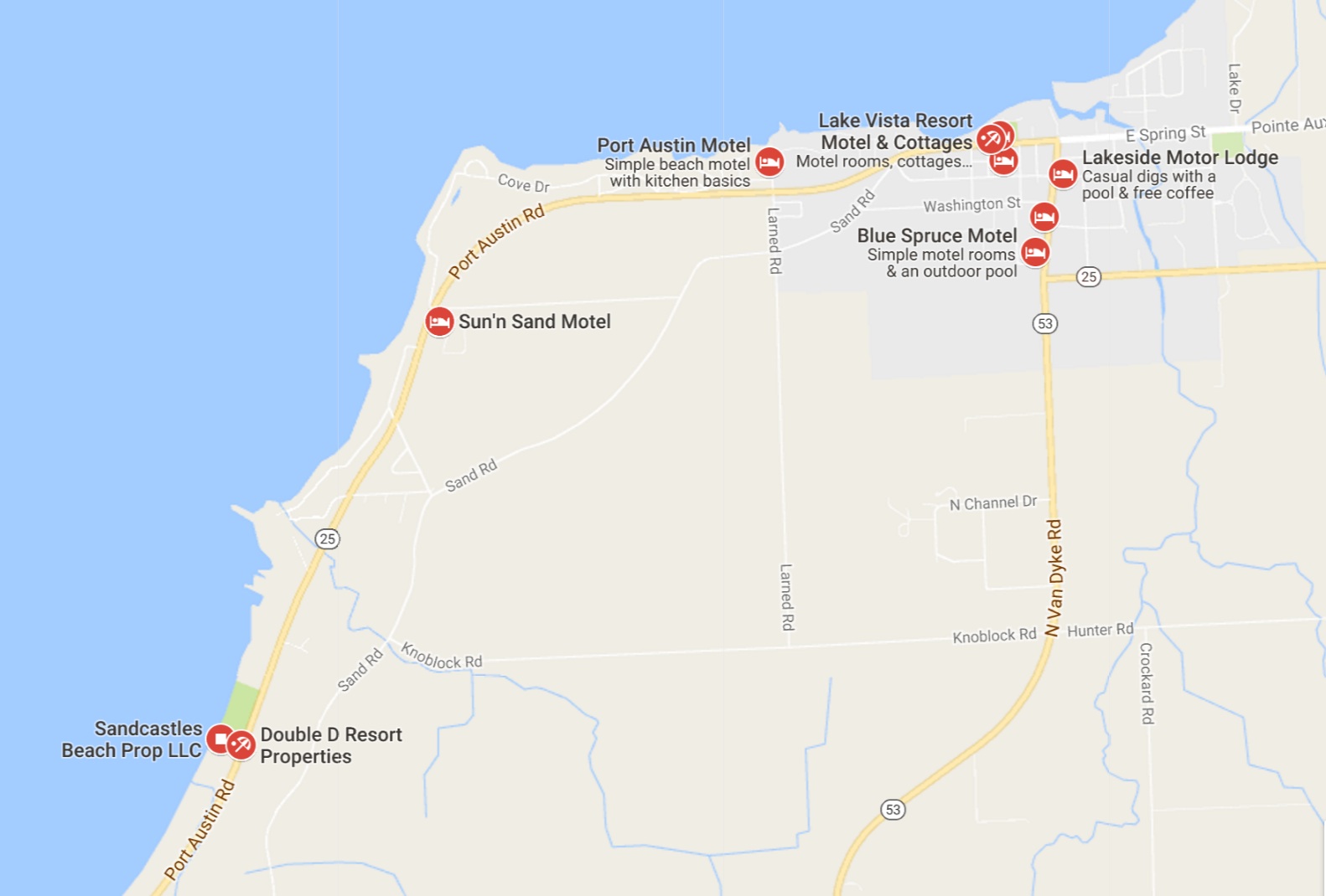
It felt good to be back on the road after two full days off the bike in Mackinaw City. Road construction at various points slowed me down a bit, but no particular stop was too long. Eventually I made it to Port Austin, my destination.While the weather was going to be nice enough to camp tonight, I chose to stay at the Beachcomber Motel.
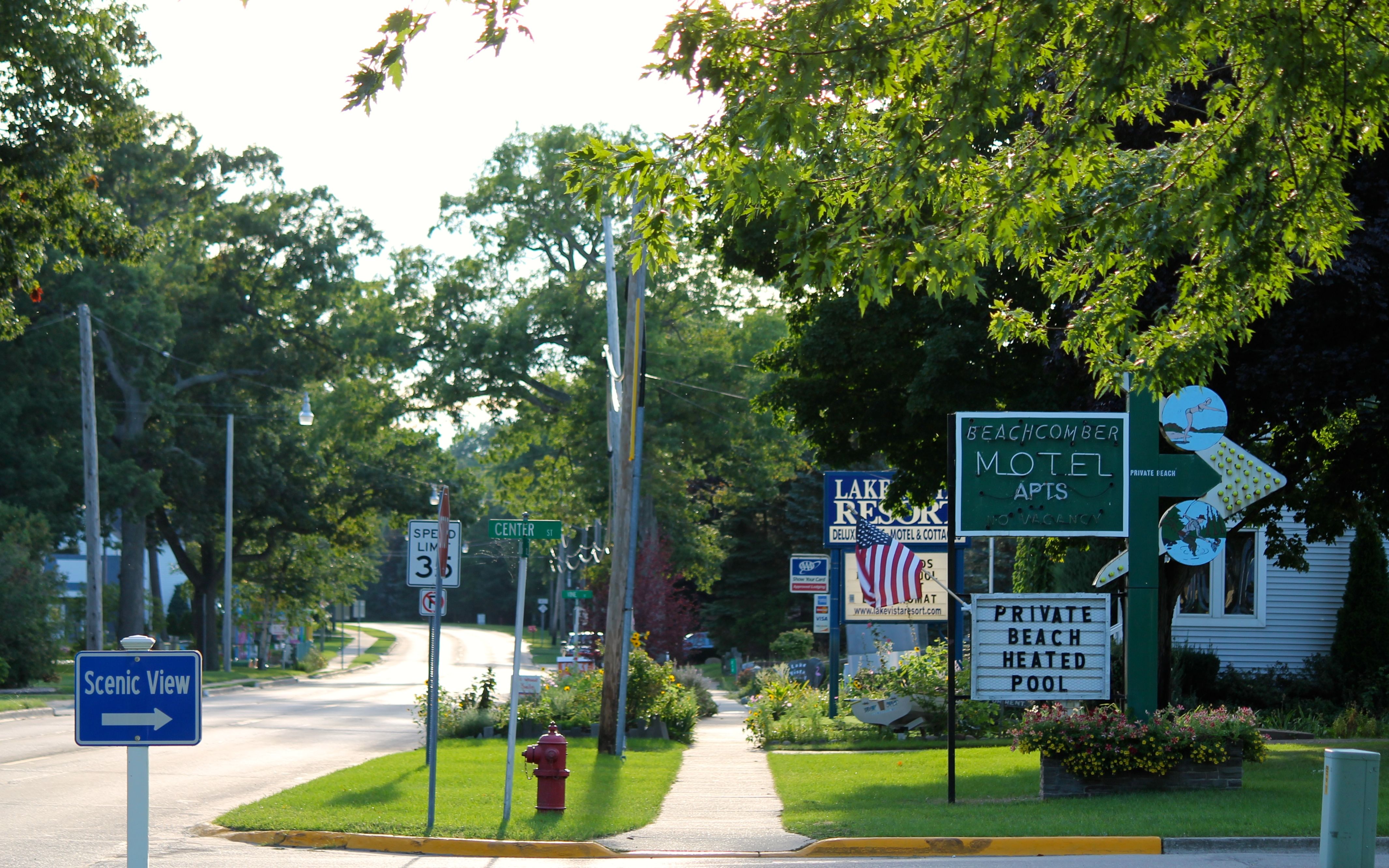
The motel is situated right on the shore of Lake Huron.
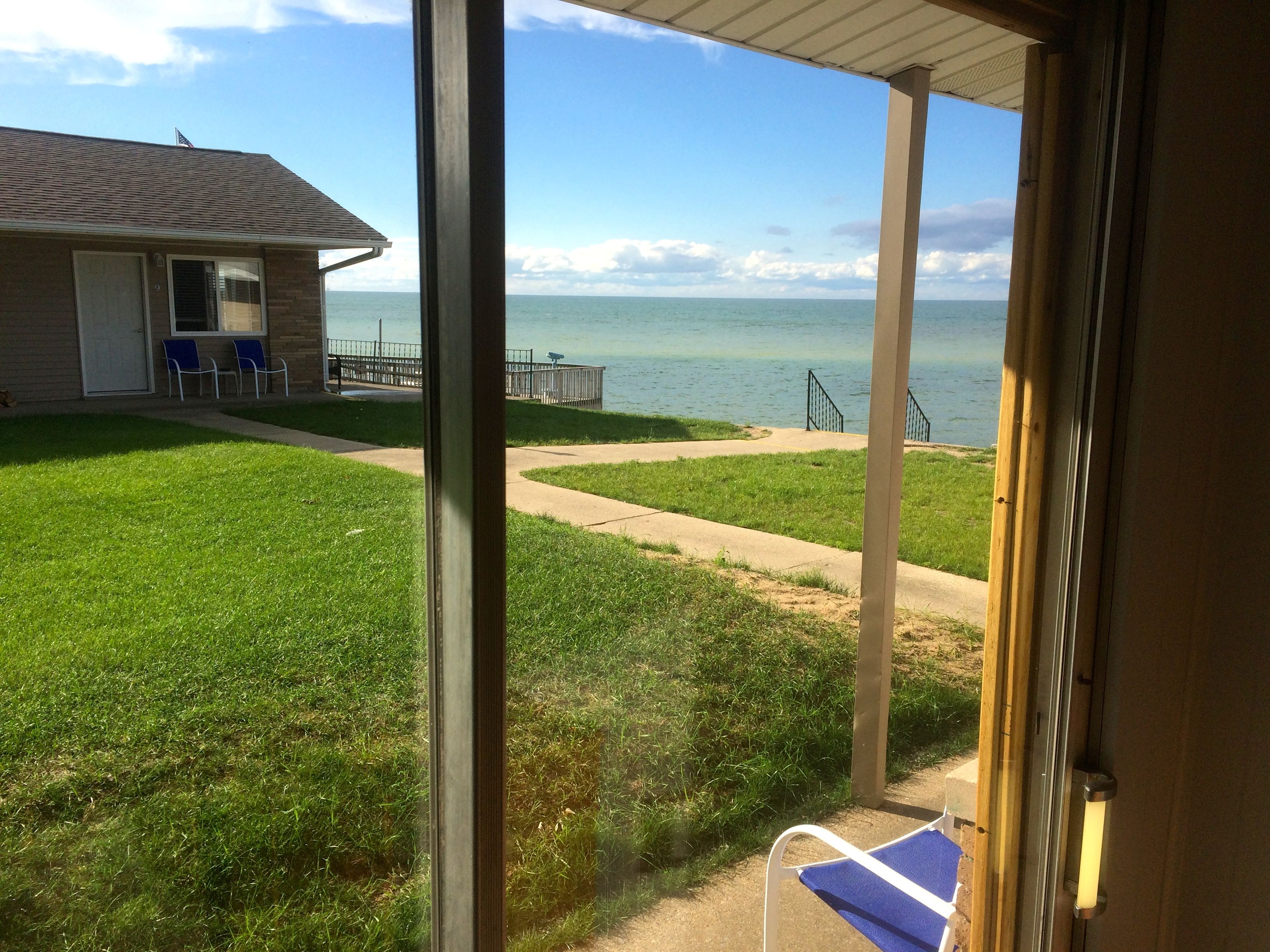
It was a beautiful evening and I enjoyed sunset while having some pizza and beer.
This was a good day. Motorcycle travel is food for my soul. Everything from the misty cloudy morning to the beautiful finish. I live a charmed life.
Tomorrow, I’ll cross into Canada to stay at Niagara-on-the-Lake, a Canadian town near Niagara Falls, NY. Looking forward to it!
Day 13
Day’s distance: 301 miles
Total trip distance so far: 3,404 miles
The day started in the mid 60’s and the high was 84. Mostly sunny throughout the day, winds were light and the humidity moderate.
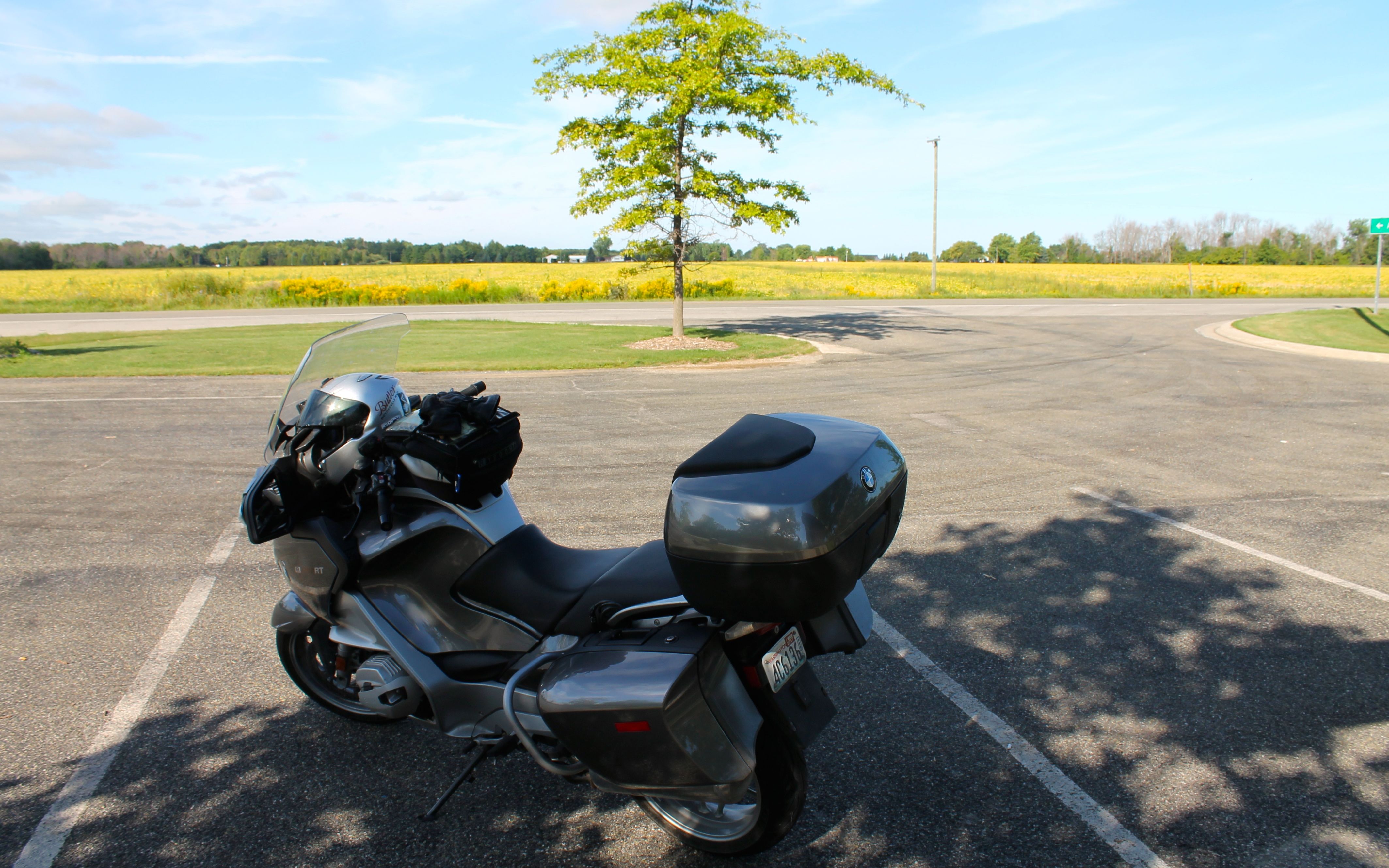
Michigan has the prettiest rest areas. I stopped here to take a photo of the lake, but the farmland was just as pretty.
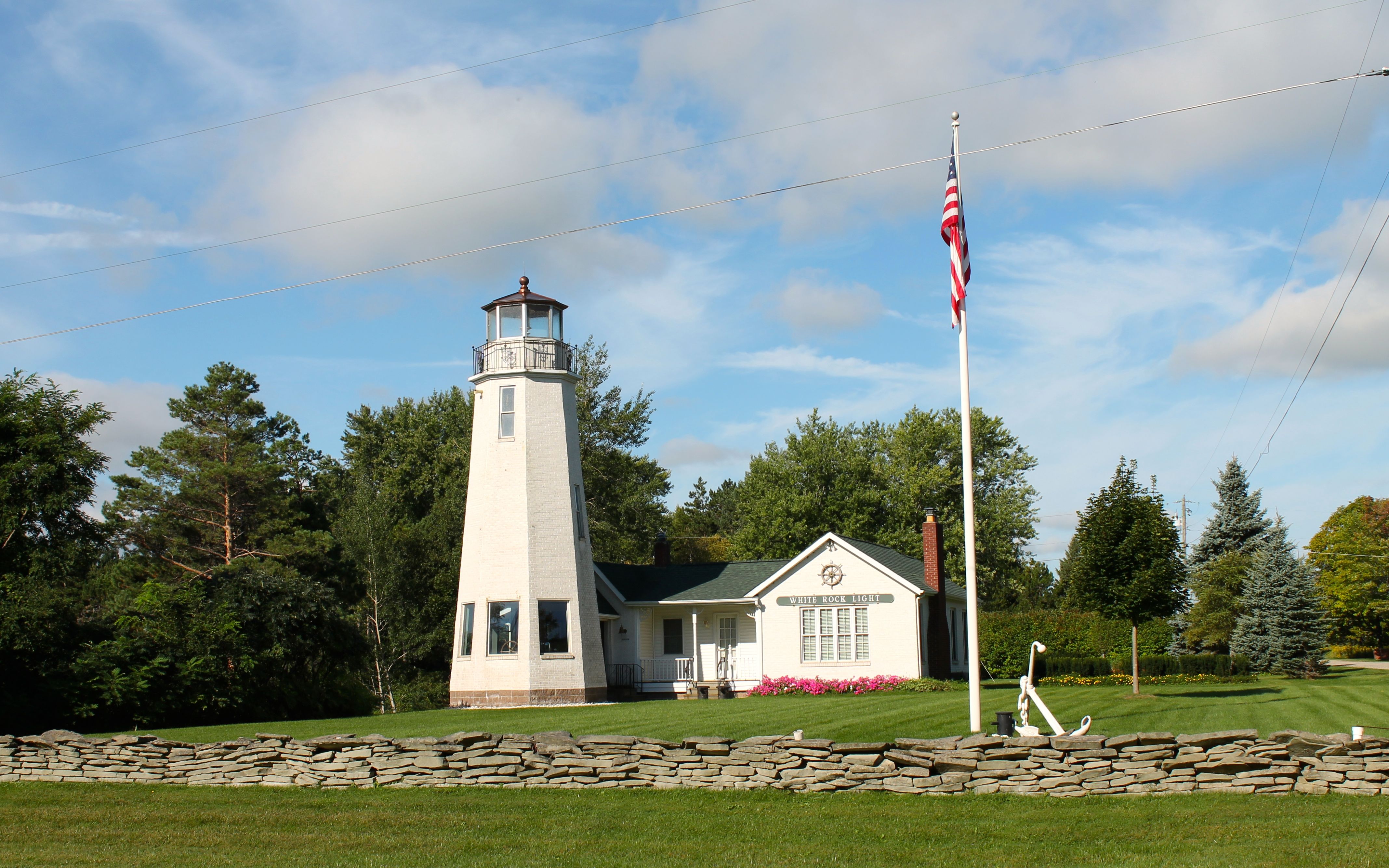
I grabbed a photo of the White Rock Light. According to this article on boatnerd.com, the light, located in White Rock, was built as a private residence and as a memorial to the 1856 White Rock Lighthouse which was destroyed by fire in 1871.
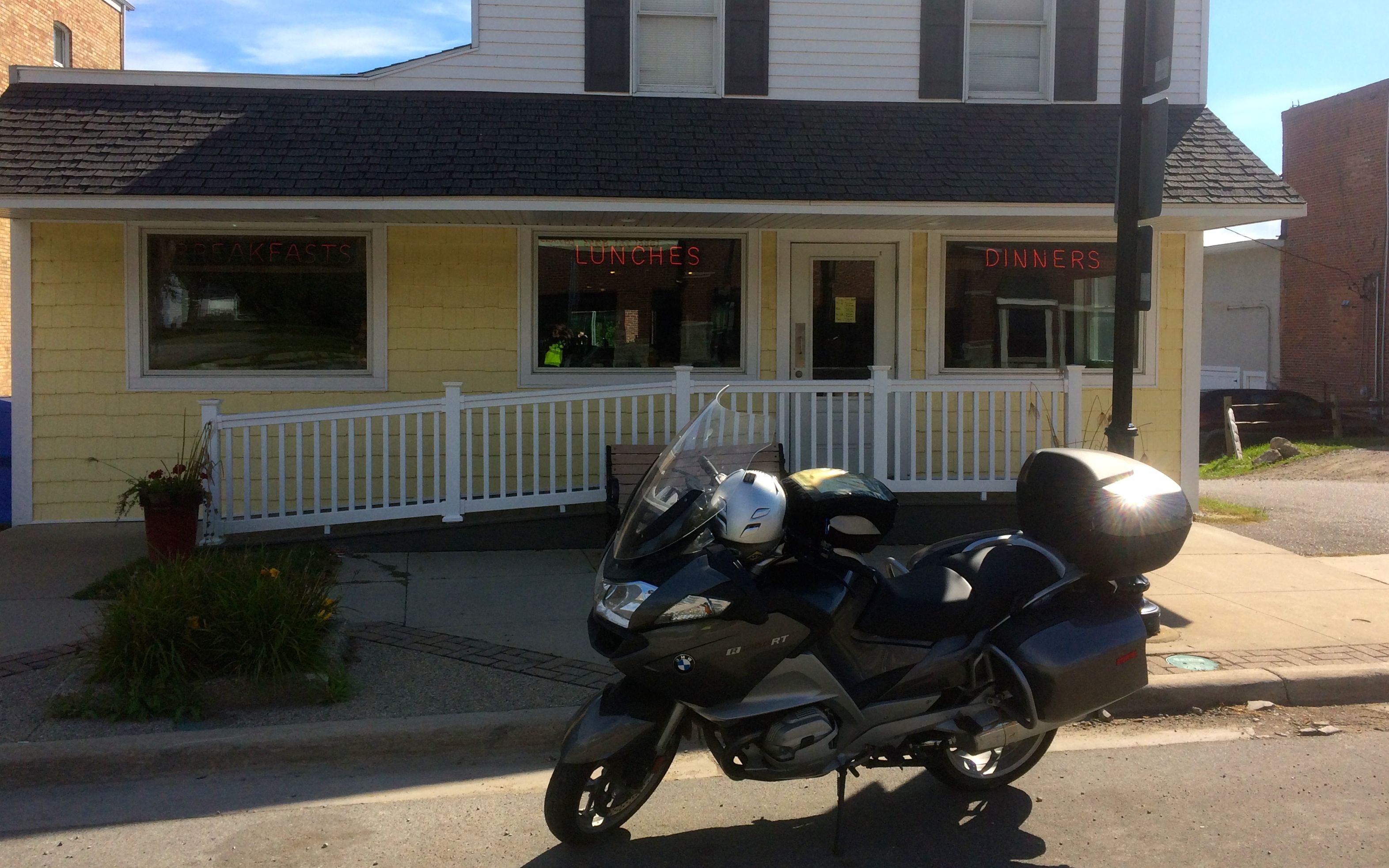
I left Port Austin not having coffee or food. It was about 11am when I reached Port Sanilac and found Mary’s Diner. Good coffee and some breakfast, followed by more coffee 🙂
While I was eating, a woman sitting at another table, obviously a local resident, was outside on the porch smoking. When she returned, she said, “Wow, BMWs sure have changed since I was riding one in the 60’s.”
Her name was Sue and we had a brief conversation about my trip and I shared my blog URL with her. This would be the first of two times someone would approach me today.
The second was at a taco trailer I passed in Aylmer, Ontario. It was about 2:30pm and I was getting hungry, but I wasn’t convinced Dan’s Taco Wagon was the stop for me. But in the 20 seconds or so I was approaching the trailer, two cars pulled in the lot. I turned around after deciding to give it a try.
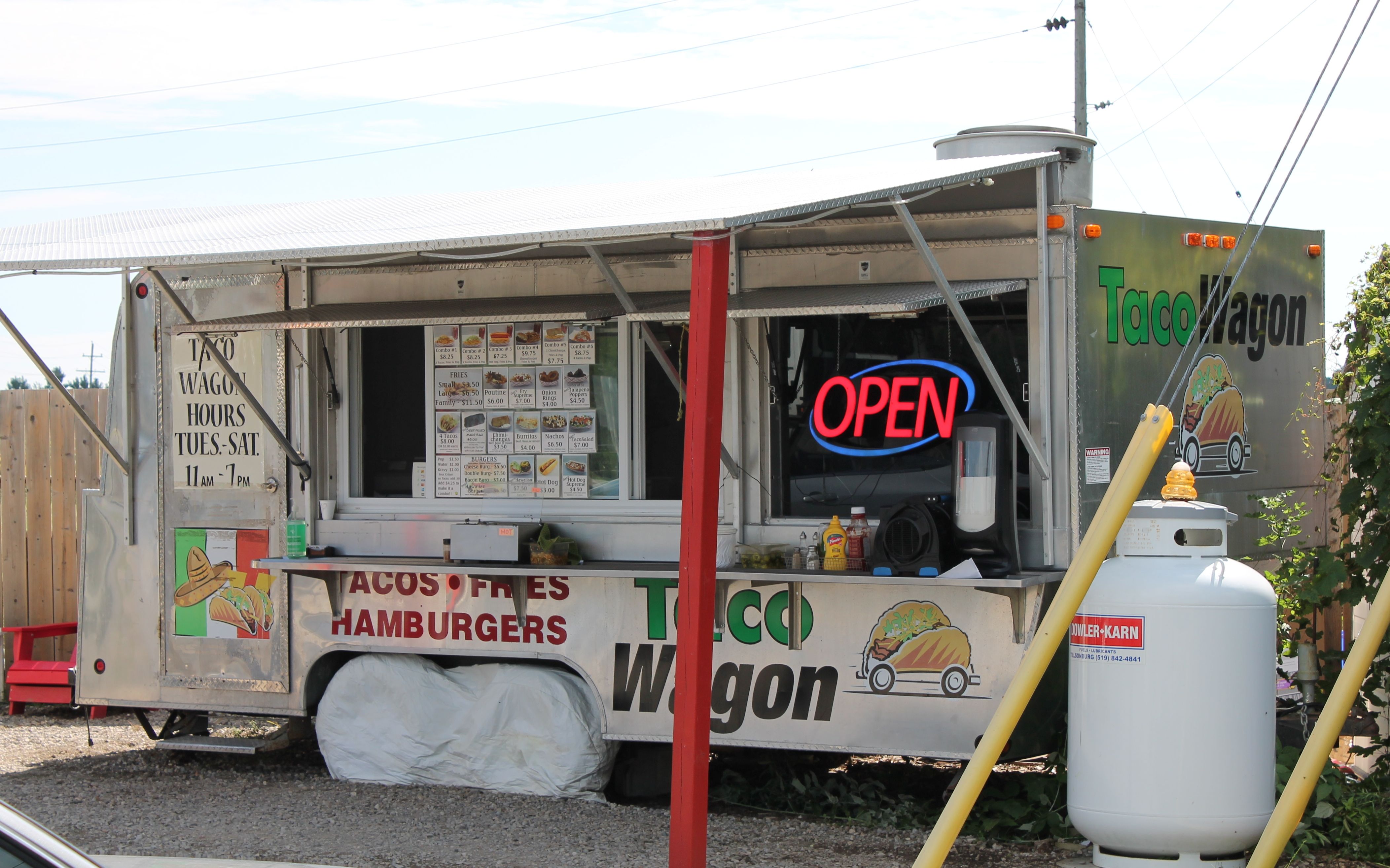
A woman asked me if I really rode the motorcycle all the way from Washington? I laughed and said yes, which started a whole conversation between myself, Beth (her name) and her husband Steve. They lived in nearby St. Thomas and came to the Taco Wagon regularly. They knew some of the story of the Taco Wagon.
Dan is part of the local Mennonite community. A taco wagon makes sense because the community has a German / Mexican background. The ingredients were simple and grown locally. The flavors were well balanced.
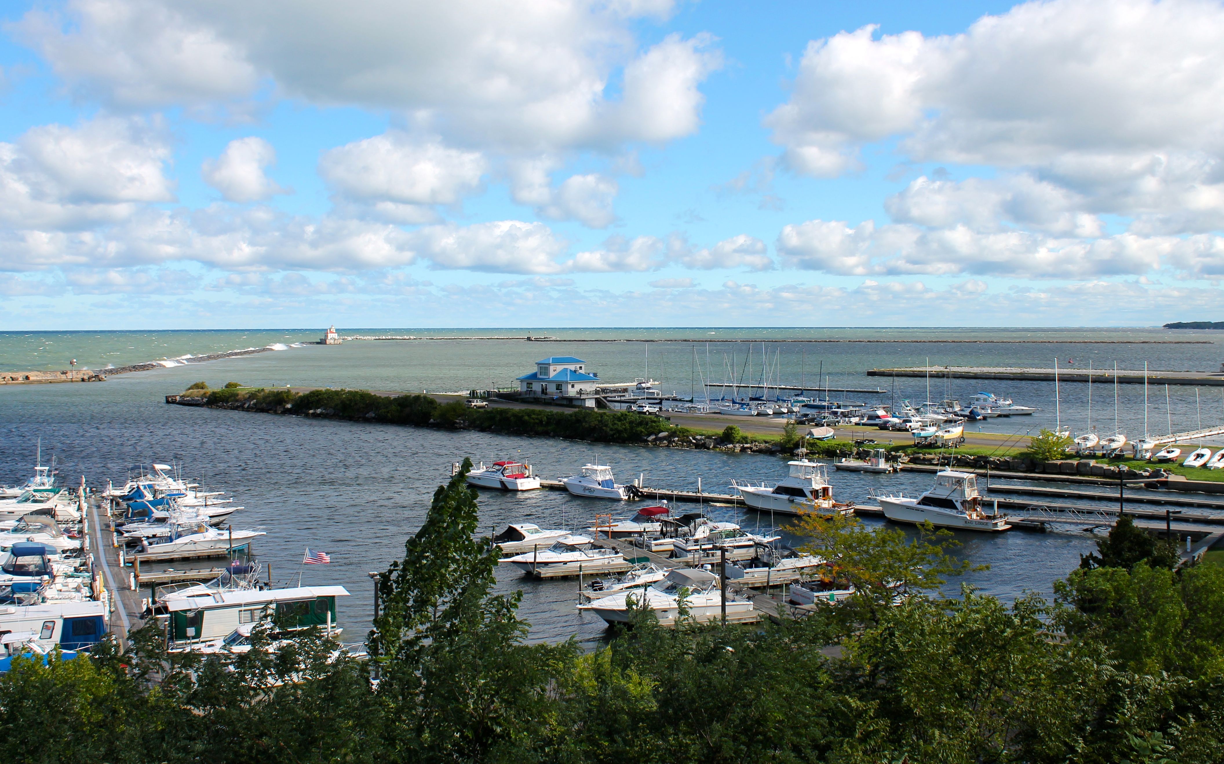
Back on the road after lunch, I continued southeast along various two lane roads. My goal was to get to the shore of Lake Erie.
My route landed me in Port Dover. I took the first photos of Lake Erie’s north shore.
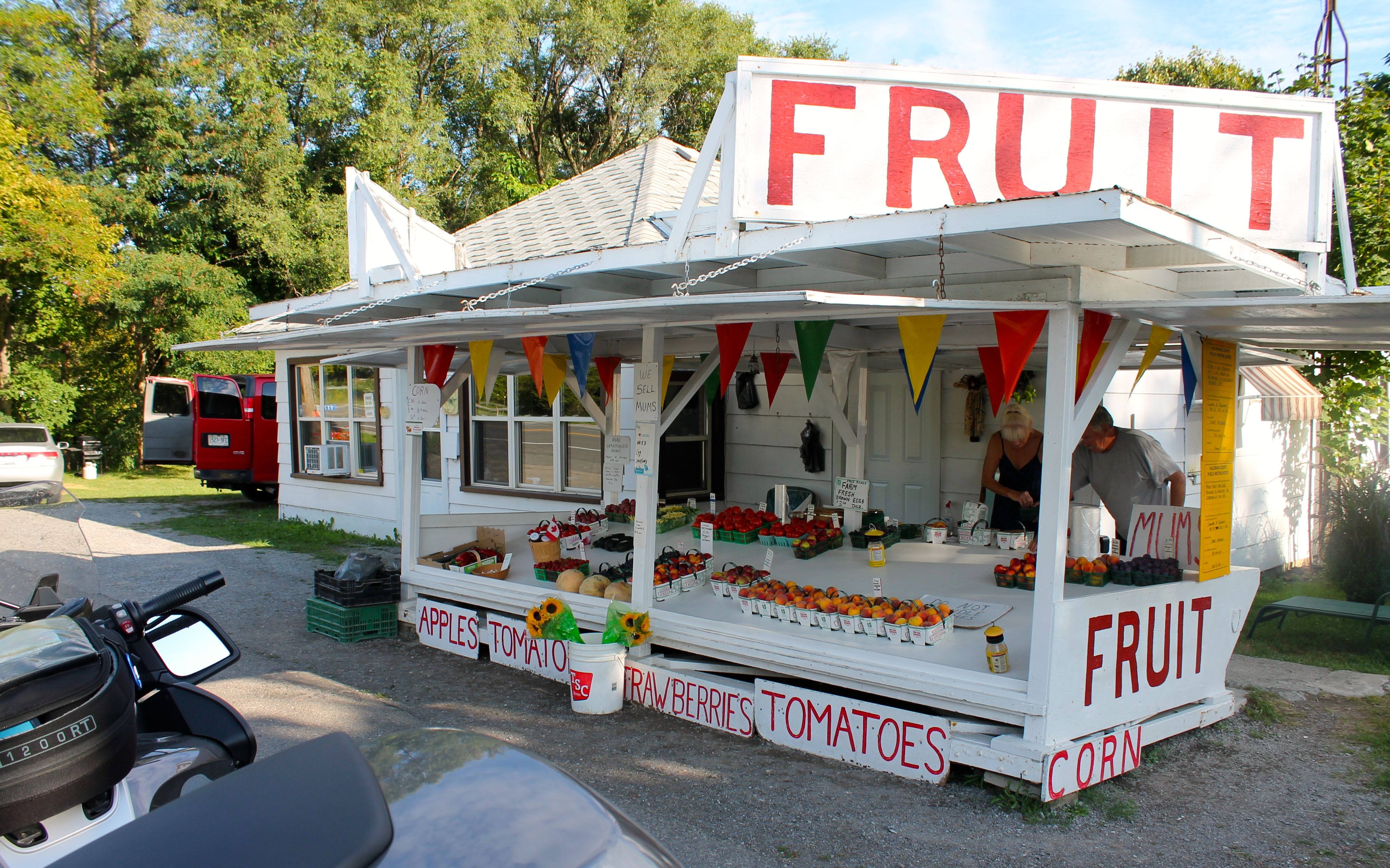
It was about 4:30pm when I rode past this fruit stand. I asked if they sell fruit by the mouthful and they said yes! As I was removing my helmet, I noticed a shiny Harley nearby. The guy confirmed it was his and tossed a peach my way, saying it was on the house!
Followers probably expected me to finish the day in Niagara-on-the-Lake, but I failed to get last minute reservations anywhere. Apparently there are tons of wine tastings going on this time of year and getting weekend accommodations is difficult. I don’t know if taking one fewer day off in Mackinaw City would have made a difference or not.
The motel I’m at tonight is very close to the Peace Bridge. I’ll cross it into New York in the morning.
Day 14
Day’s distance: 134 miles
Total trip distance so far: 3,538 miles
The day’s temperature ranged from the mid 70’s to the low 90’s and it was very humid. Forecasts called for strong thunderstorms and winds this afternoon and evening, so I planned a short day.
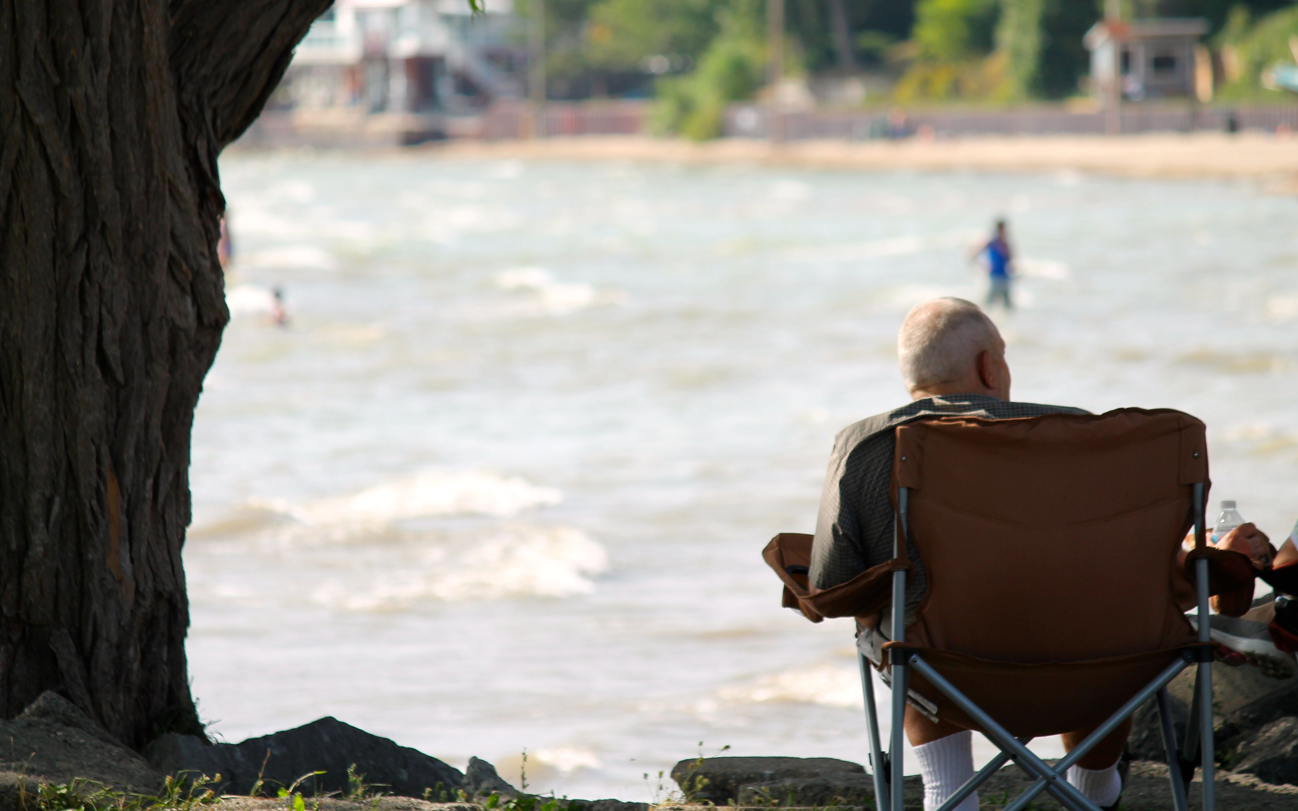
It turned out that my motel was only two blocks from the Mather Park Gate. I couldn’t resist taking a few photos of the Gateway with the Peace Bridge in the background.
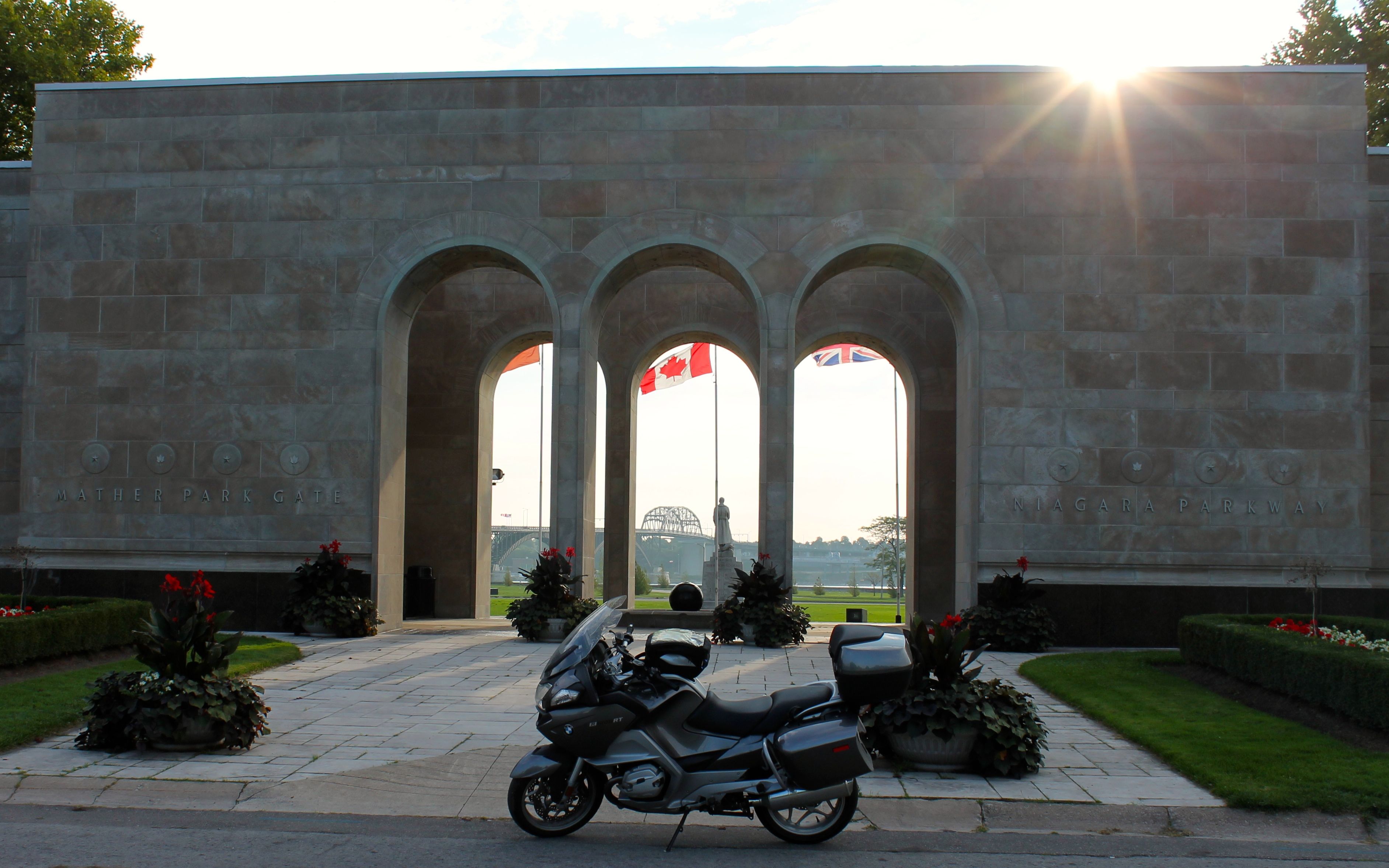
The other side of the bridge you can see the skyline of Buffalo, NY.
As it was Saturday, I assumed the Niagara Parkway would be crowded and I really just wanted to ride during the morning, so I headed straight across the Peace Bridge and through Buffalo. My plan was to take Hwy 19 from Warsaw north, and connect to the roads taking me to Ontario Lake.
I was in Warsaw when I gave up trying to find local espresso and selected a Starbucks my GPS found in Geneseo, a college town hosting New York State University.
It turned out that the Starbucks was in the Union building on campus (somewhere), but I found Cricket’s Coffee Company on Main Street (used a google photo for this one), which wasn’t in my GPS.
I left Cricket’s with my caffeine levels appropriately raised. Geneseo was about 20 miles out of my way, but I headed back towards Hwy 19, though I went through Pavilion instead of Warsaw.
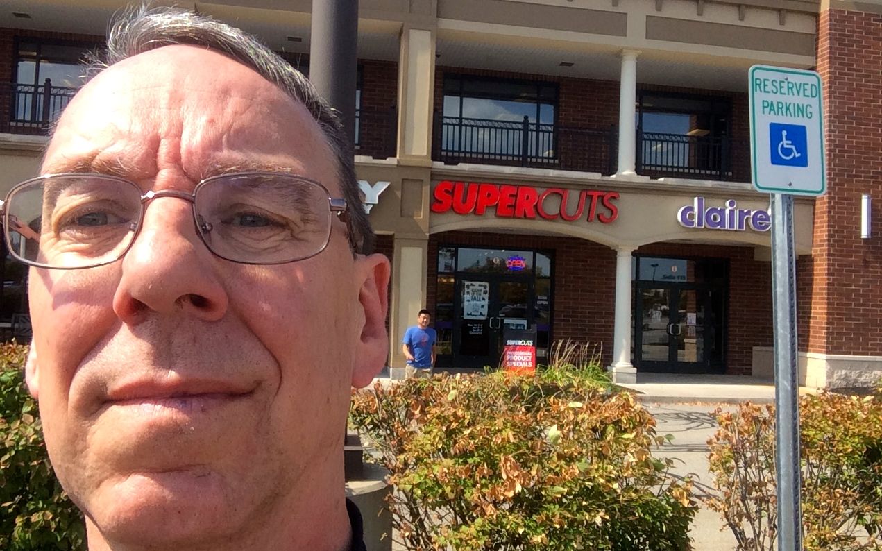
Dark clouds moved in behind me, as I traveled through some pretty farmland. I thought it would be a good time to skip the lake and get closer to my destination. Since I had time, I stopped at the Supercuts in Webster, about a mile from the motel.
Last night, I decided I would splurge for a suite at the Hampton Inn. It was so humid, I just wanted to get to the pool and headed for the hotel as soon as they had a room ready for me. It wasn’t long before I was in the pool 🙂
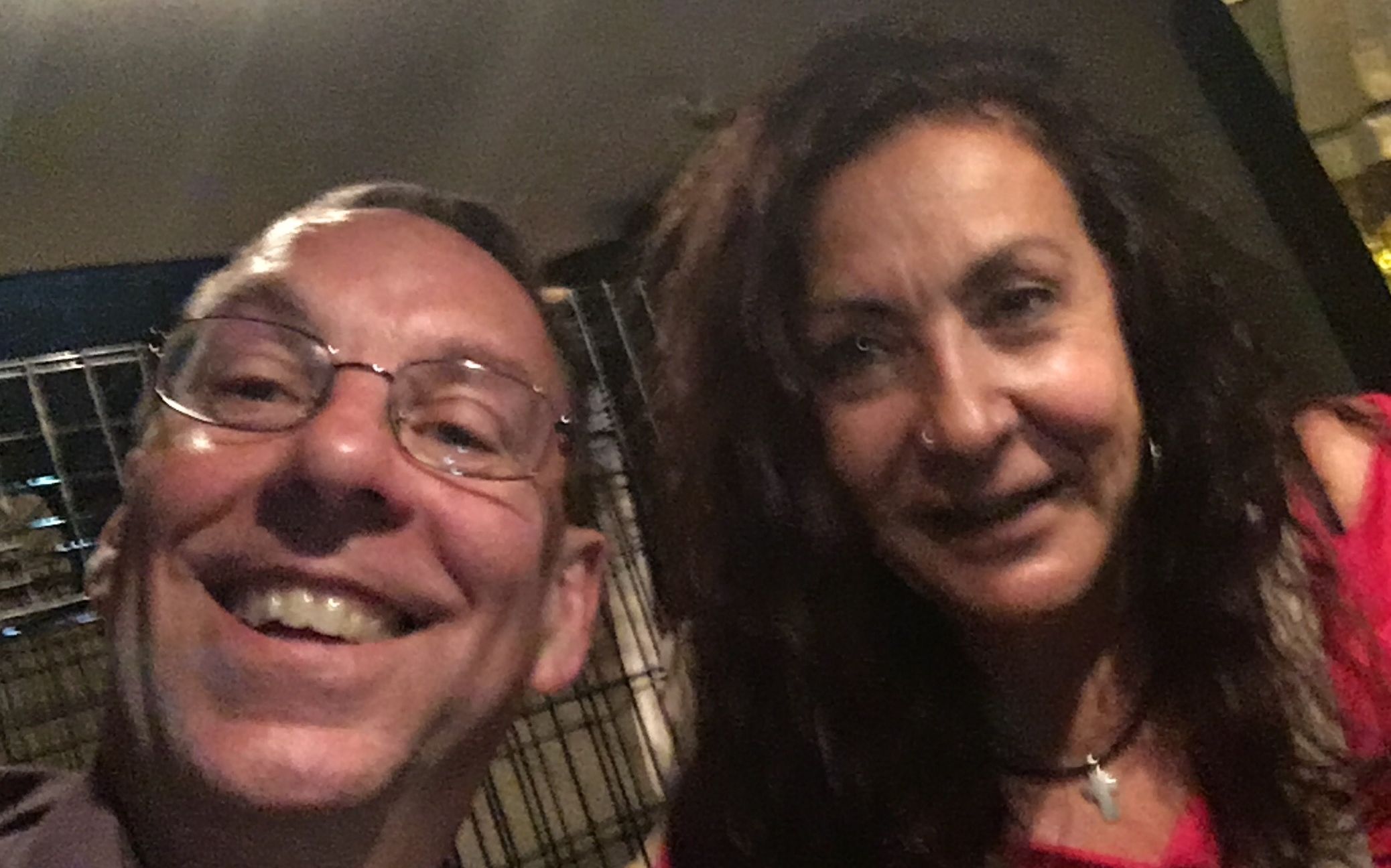
Dinner was a reunion, of sorts. Lynda and I met in Fredericksburg, Texas on day 23 of my 2015 Southern States Tour. She attended college here and has been visiting, re-establishing relationships from that time.
We had dinner at Perlo’s in East Rochester. It was fabulous – a great time! Our last minute, inside the car selfie was pretty blurry – we were laughing too much.
Tomorrow I’m off into the Adirondack Mountains, on my way towards Vermont and the scheduled maintenance on Tuesday.
Day 15
Day’s distance: 273 miles
Total trip distance so far: 3,811 miles
Today was much cooler than yesterday, and much less humid. Temperatures remained mostly in the mid 60’s with some moderate winds through the morning and afternoon. Big fluffy “Simpsons” clouds in the sky much of the day.
I left the Hampton Inn at 8:30 after having some coffee and a light breakfast. I did stop a bit later in Oswego, NY for a latte at the Coffee Connection.
The town of Oswego was preparing for their pride parade today. Quite late in the season, these are more typically held in June.
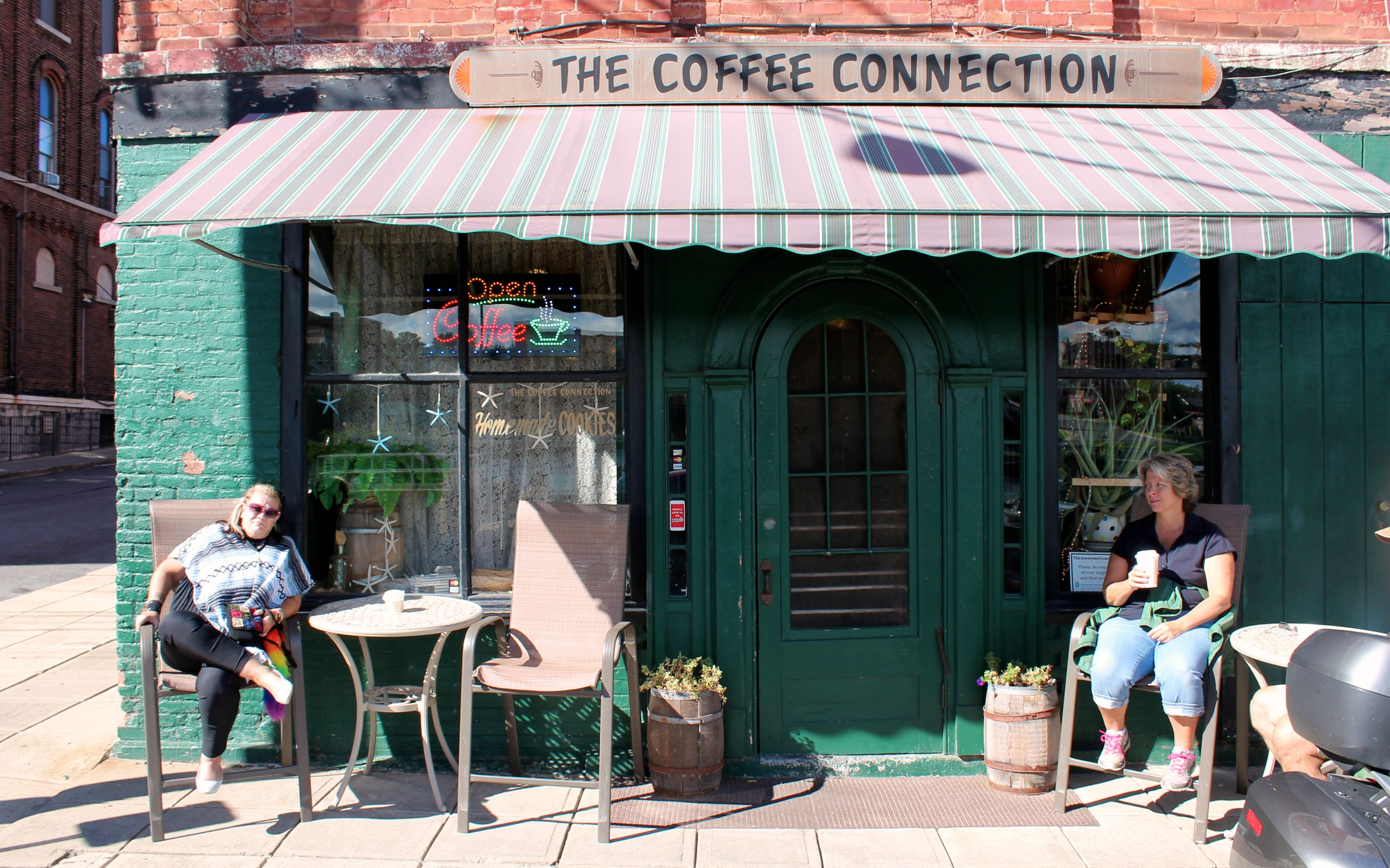
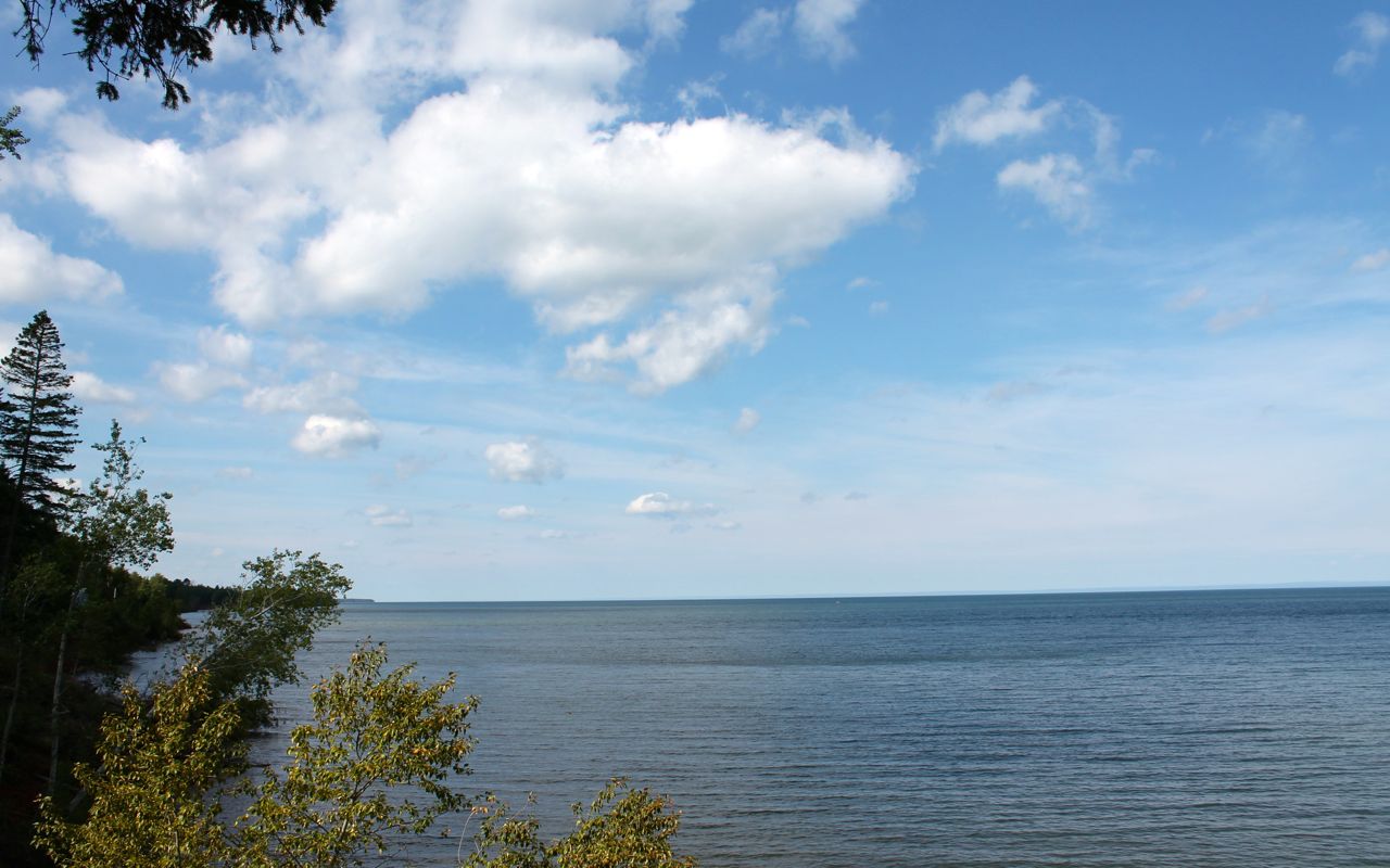
The other reason to stop in Oswego was to say goodbye to the last of the Great Lakes. This would be my last glimpse of Lake Ontario as I headed into the Adirondack Mountains.
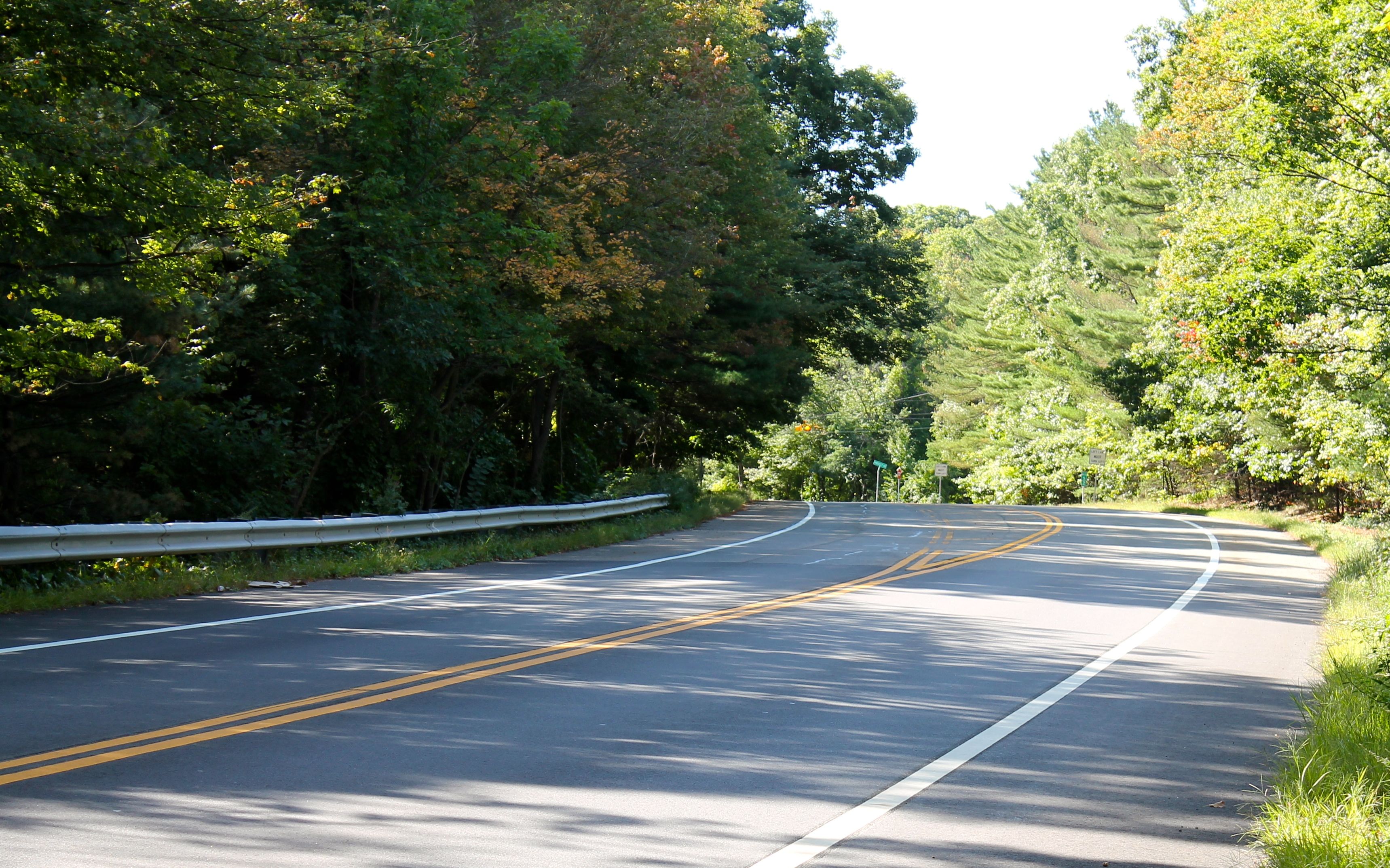
Though most of the roads traveled today were in good shape, one of the country roads was freshly oiled and graveled for about three miles and others were in rough shape. All of them took me through some beautiful countryside …
and past some beautiful lakes. This was Long Lake.
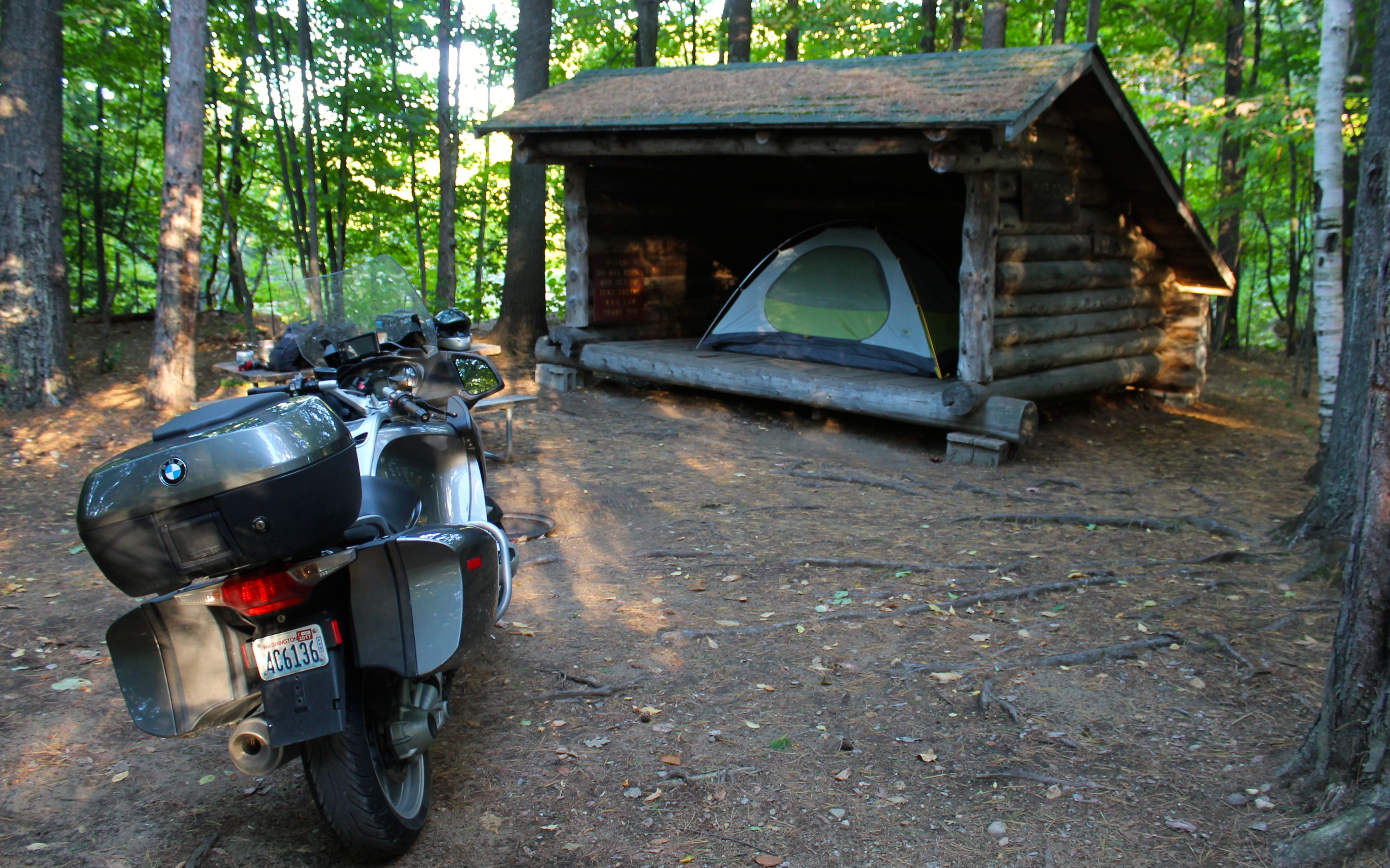
Since the weather forecast called for clear skies tonight, I am camping tonight. A “lean to” structure was only a few bucks more, so I thought I would try sleeping on a level floor and forego concerns about dew on the tent in the morning.
Tomorrow I head into Vermont. The bike gets a service on Tuesday in Essex Junction, so I’ll try to find a way to wash off the bugs that have accumulated before taking it in to the shop.
Day 16
Day’s distance: 136 miles
Total trip distance so far: 3,947 miles
It was chilly this morning with temperatures in the mid 40’s. The sun was shining though and it felt good.
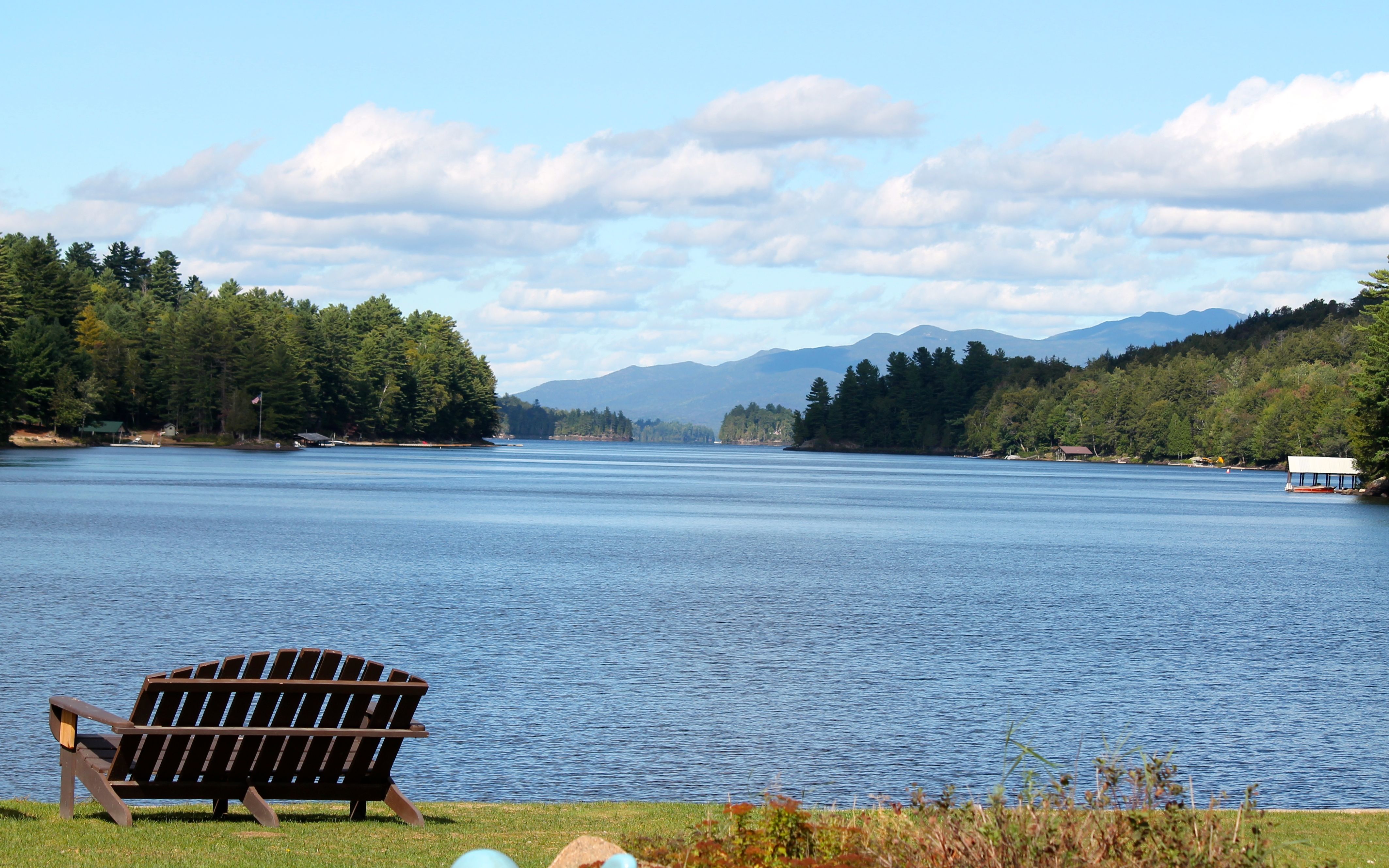
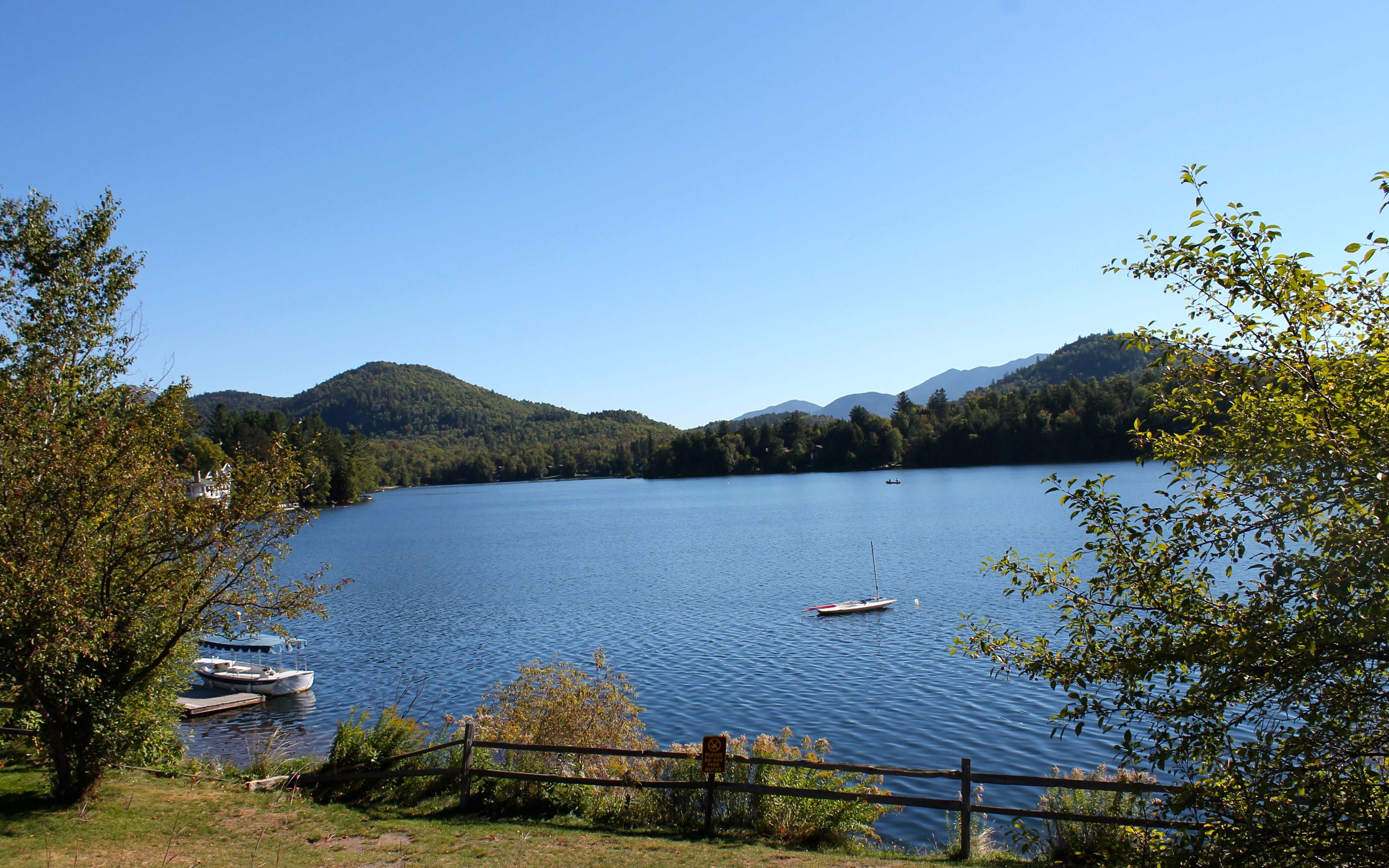
First thing was to head back into Lake Placid for a latte and something to eat. The Coffee House, right in Lake Placid, was my destination.
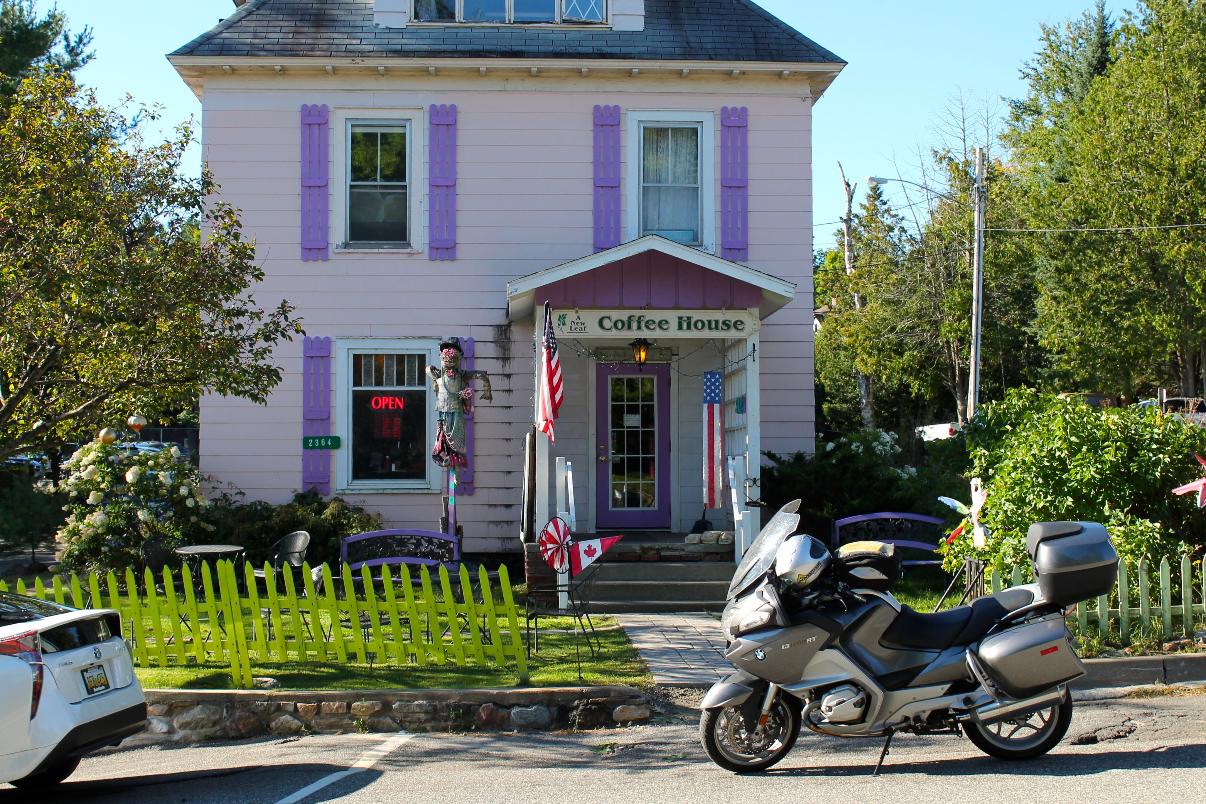
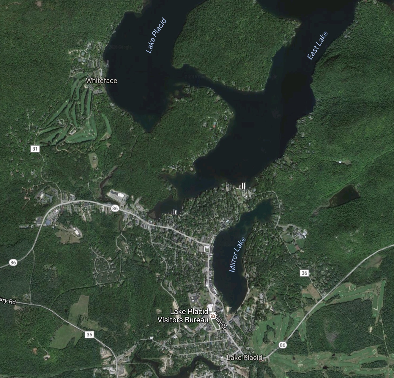
The thing I didn’t know about Lake Placid is the city is really built around Mirror Lake, not Lake Placid.
The downtown looks like a affluent tourist destination with fine restaurants, motels, art and clothing stores.
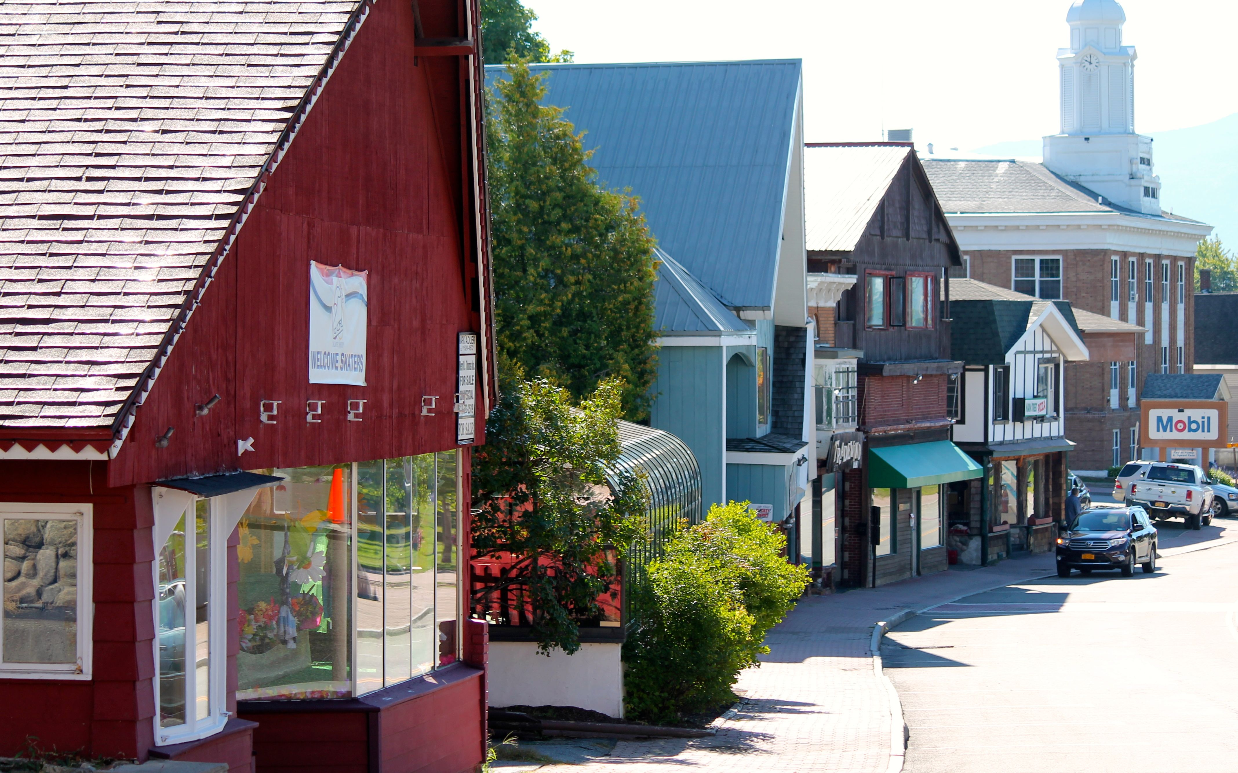
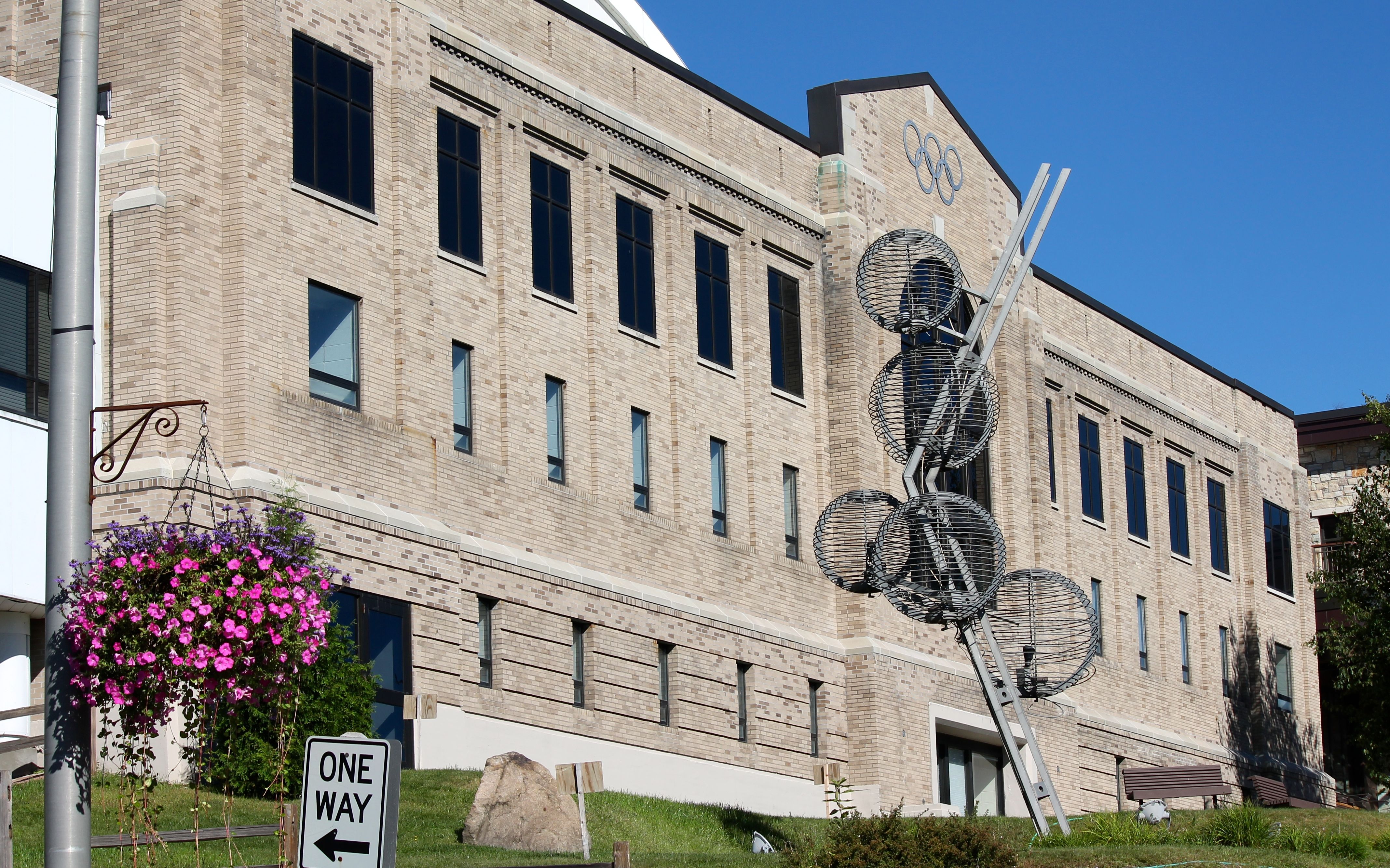
Many buildings used during the 1980 Winter Olympics are a reminder of how this town came to be so well known. I believe the building below now house the Lake Placid Visitors Bureau.
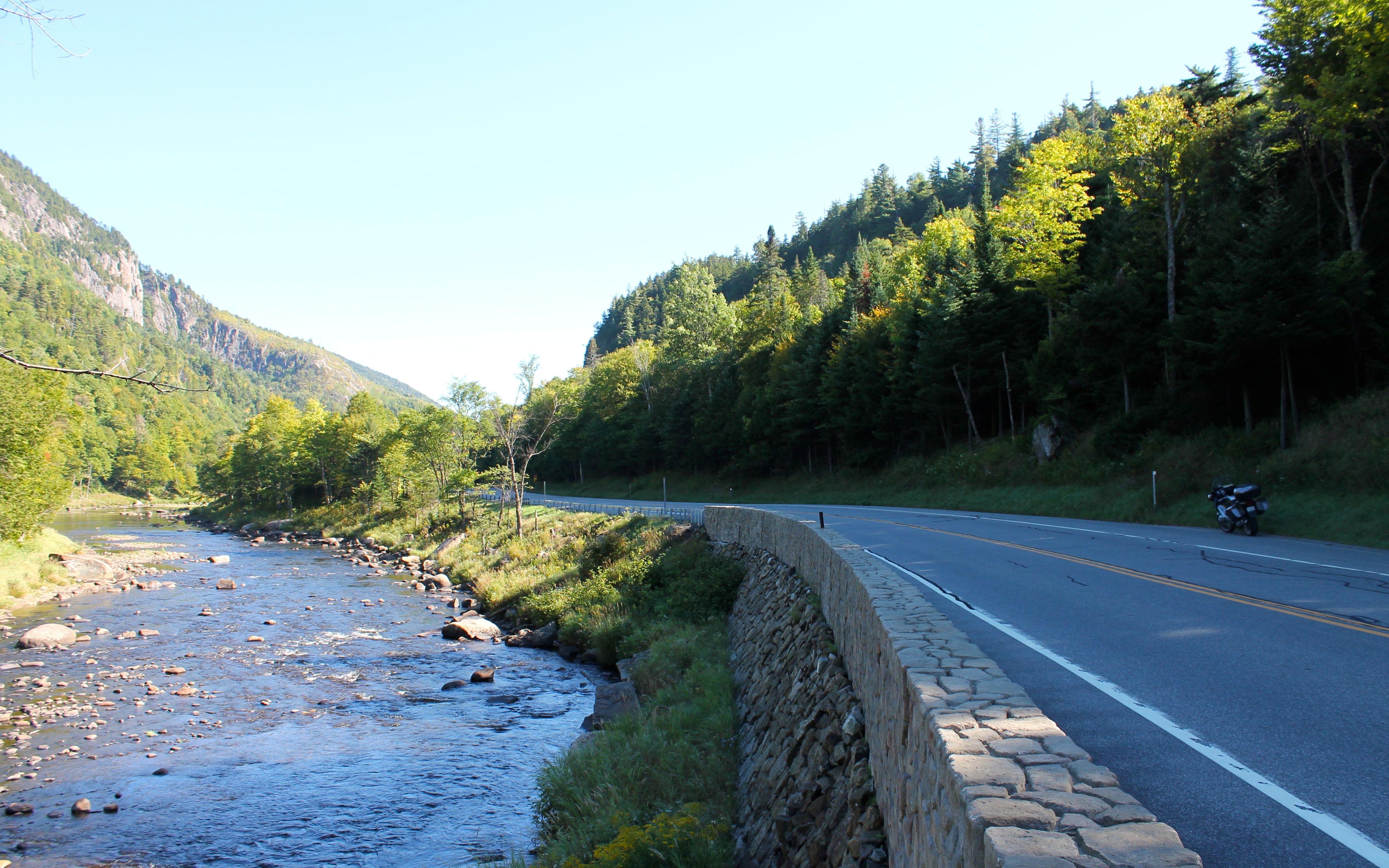
The route out of Lake Placid took me along the Ausable River. It’s my experience some of the best roads for motorcycling follow rivers. This is Hwy 86 heading towards Wilmington.
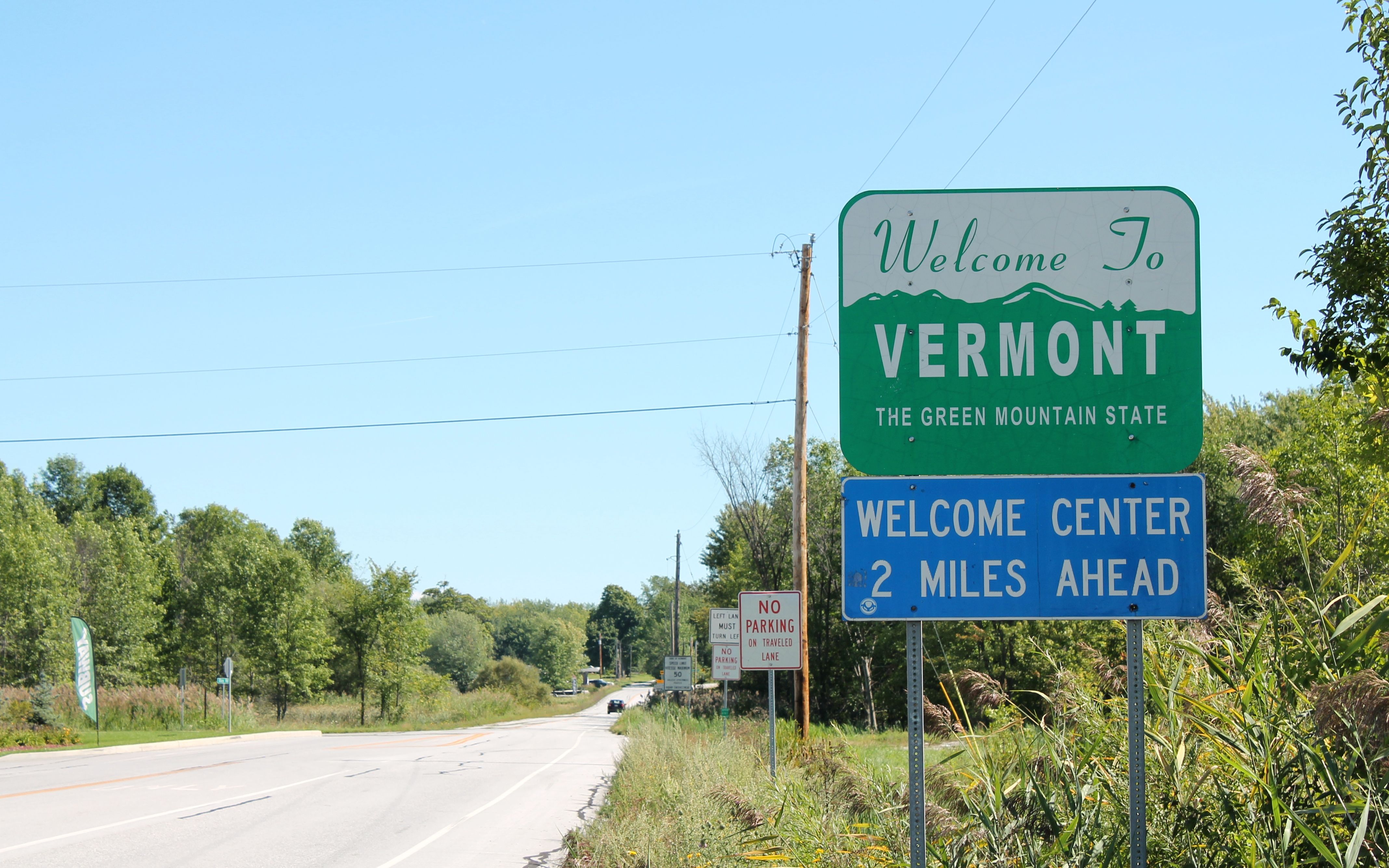
My destination today was not far away, so I took a longer route to get there. No surprises there. I rode towards the Canadian border to the top of Lake Champlain and took Hwy 2 into Vermont.
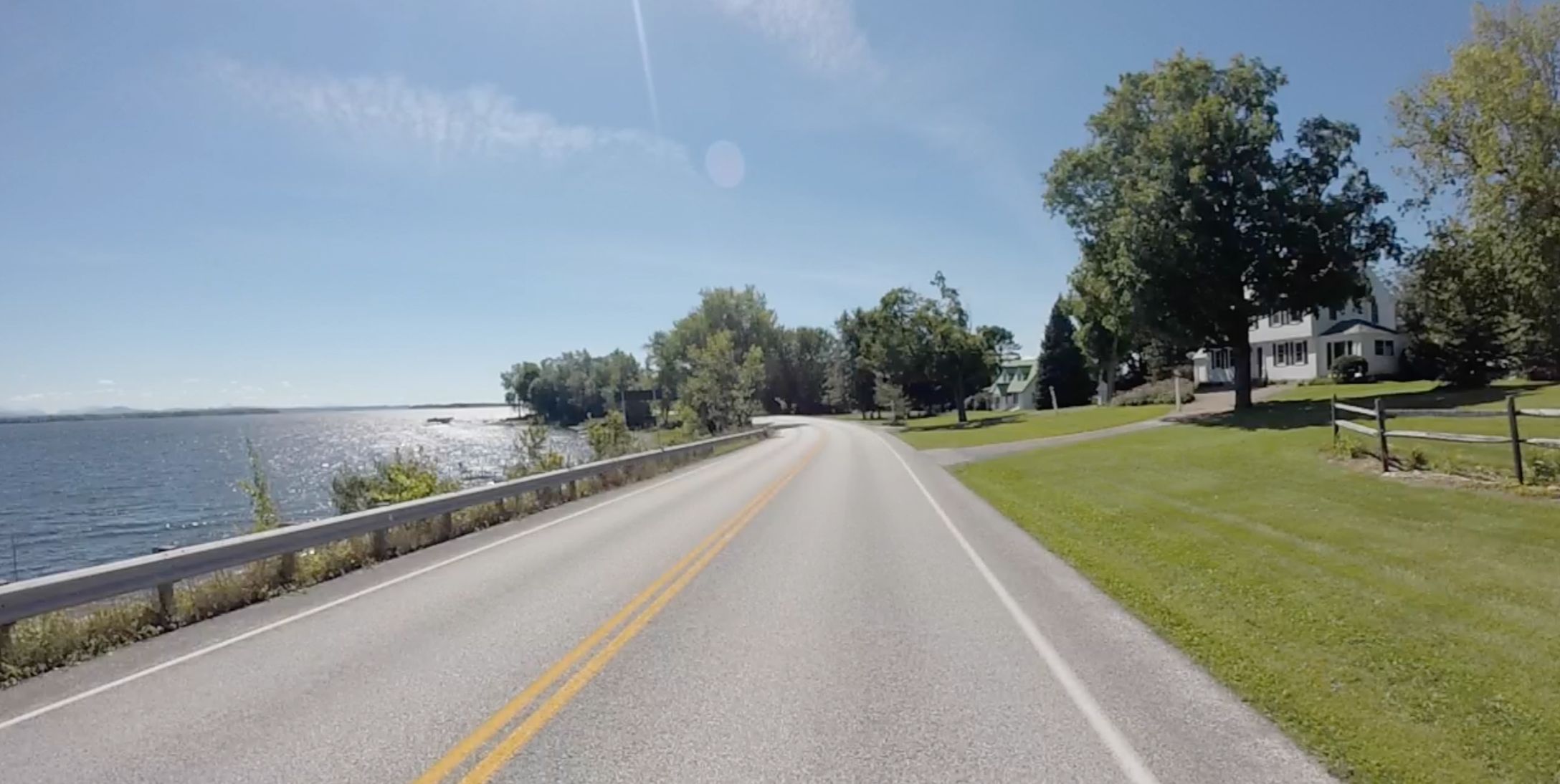
The roads were two lanes wide. Views of water, farms and some beautiful homes were ever present.
I stopped for lunch at Hero’s Welcome. I highly recommend this place for lunch. Great sandwiches!
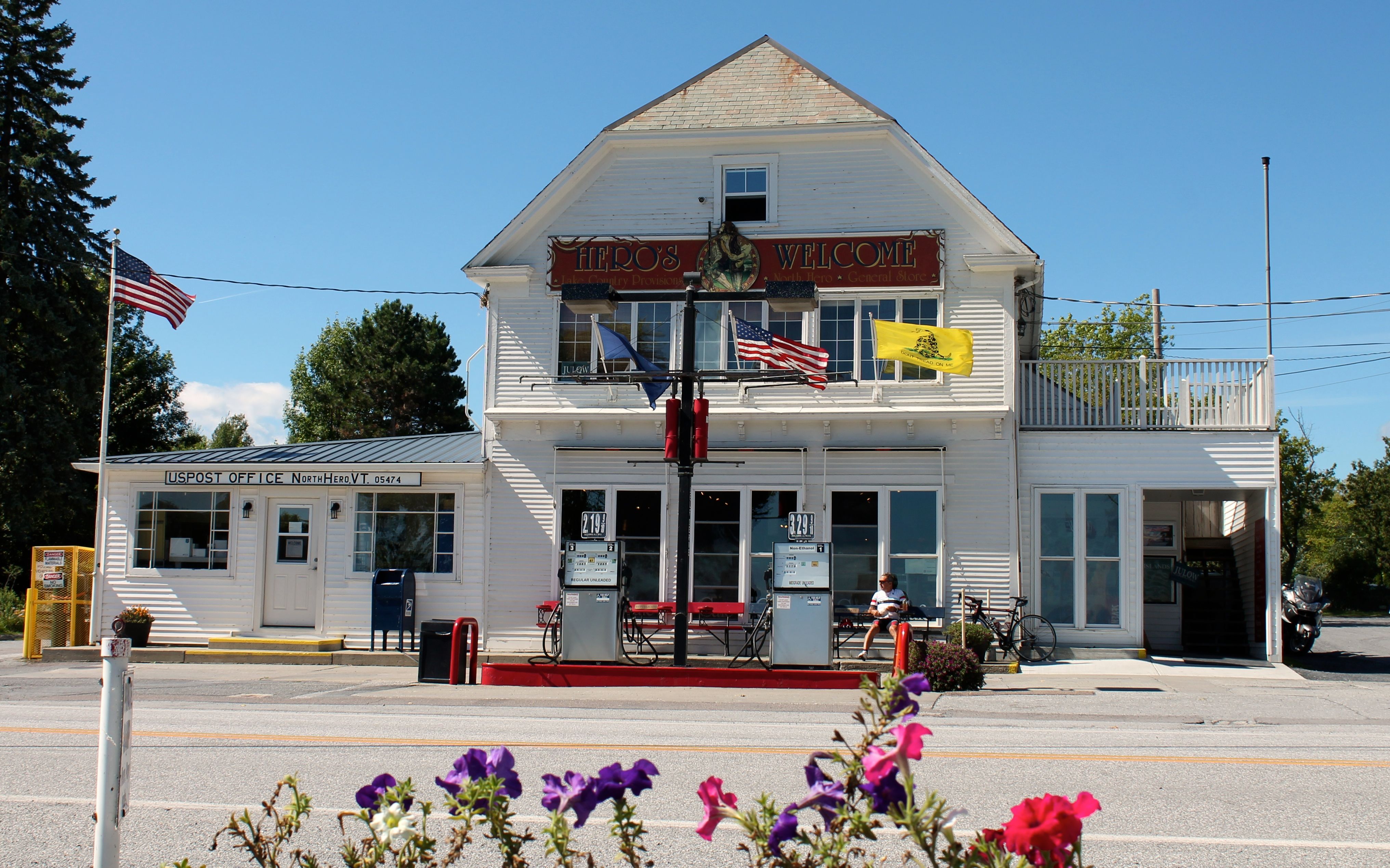
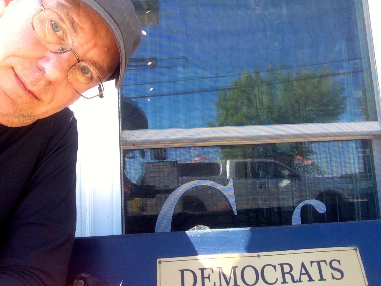
In front of the place were red and blue benches, with one labeled Republicans and the other Democrats. This presented an opportunity for a selfie while eating 🙂
The two gas pumps worked, but had no electronics in them, at all. You pumped your gas and then walked inside the store and told the clerk how much you owed them. One pump was used if you wanted standard gas, the other if you wanted the medium grade.
I arrived at the Ho Hum Motel in South Burlington just after 2pm. I picked this motel as it was relatively close to the shop where I would get the bike serviced and it was not expensive.
Turns out the owner rides. I wanted to get the bike washed before the service and the motel supplied me with rags and a hose while the owner found me some car wash concentrate and a bucket. These folks were seriously nice.
With the bike all shiny clean …
it was time to think about having a beer. Barnyard Wood Crafted Pizza was recommended by the motel staff for having great beers. I had a local lager and some wood fired wings made in this giant wood stove 🙂
The staff at Barnyard seemed to be exclusively 20-somethings. But they provided wonderful service and the food was really good. Scoring good food twice in one day is something special. And good beer on top of that made this a very good day.
Tomorrow the bike gets serviced. Never certain how long it will take, I don’t know if I will stay in Burlington another night or not. Stay tuned!
Day 17
Day’s distance: 113 miles
Total trip distance so far: 4,060 miles
The day started off in the mid 60’s and reached 80 or so, with the sun out all day. Winds were light and only noticeable this afternoon when I was eating lunch outside.
The motel didn’t supply coffee but the Parkway Diner was just a block away. I got a large coffee and a “grilled” muffin, which was new to me. The waitress asked if I wanted the muffin grilled and I looked at her funny and asked her to explain what she meant. She said they slice a muffin in half, slather butter over the center and throw them on the grill until toasted. This particular muffin was a little too sweet but I will have to try this again.
The shop was only about 20 minutes from the motel and I arrived early.
While at the shop I spent time catching up with some work, finishing Day 16’s blog entry, and making reservations for Acadia National Park. I’ll be camping at Blackwoods Campground Thursday night only as the sites were fully booked through the weekend.
With that change of plans, I will be heading more directly towards Acadia over the next two days than I had initially planned.
The service performed was finished just before 2pm. Rear brake pads were all that was needed outside of the usual level II maintenance. I also looked over the selection of gloves and picked out the BMW branded Airflow summer gloves.
I decided earlier in the morning that I probably should not plan a long day because I knew that the service would take between 4 and 5 hours.
Montpelier was only about 40 minutes away, so naturally I would make it 3+ hours through the country.
The Butler Motorcycle Map for Northern New England was my reference for picking this route. They grade parts of roads as either best, better, or good segments. In this part of the country, there doesn’t seem to be long segments of any one grade and I now understand why.
The same highway can be really sweet for a few miles, then turn into a very rough road. Hwy 17 east of Main Rd was nice, as was the road over Blueberry Mountain and a large part of Hwy 12 south of Northfield.
Soon enough, I was in Montplier looking for dinner.
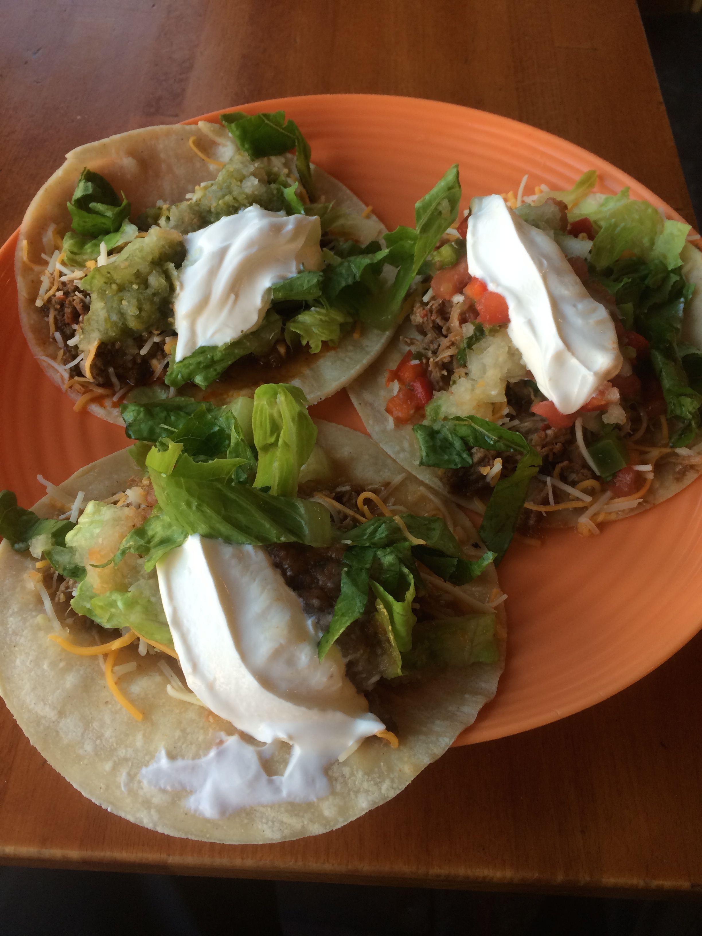
I stumbled across Bagitos, a small hole in the wall that does Mexican food and bagels. There was a small group of folks who, apparently get together to practice their Spanish.
Tuesdays are ‘Taco Tuesdays’ with three tacos for $10. They were pretty good.
The motel wasn’t far away and I holed up there for the night.
Tomorrow it is supposed to rain in the afternoon. I’ll plan a relatively short day to Conway, NH. Thursday I’ll ride from there to the Acadia National Park.
Day 18
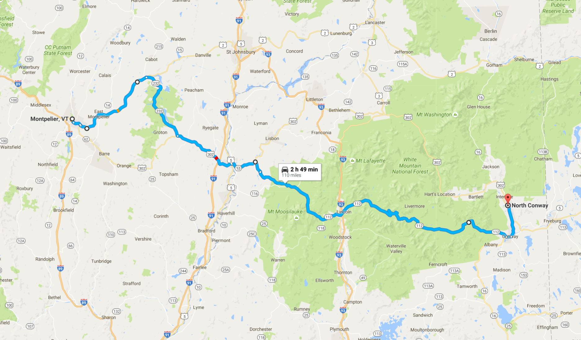
Day’s distance: 121 miles
Total trip distance: 4,181 miles
Temperatures ranged from the mid 60’s to the lower 70’s. The rain showers predicted for the afternoon arrived early. The heavy winds predicted in the Conway area did show up in the afternoon, as predicted, but I was already off the bike.
Like most of my days, I first seek out a latte, if possible. I went straight into Montpelier and found Capitol Grounds Coffee without even needing my GPS. The force is strong with this one. 🙂 This is a Bernie town, it seems.

By the time I was finished it was already raining lightly, but the roads would be wet all day.
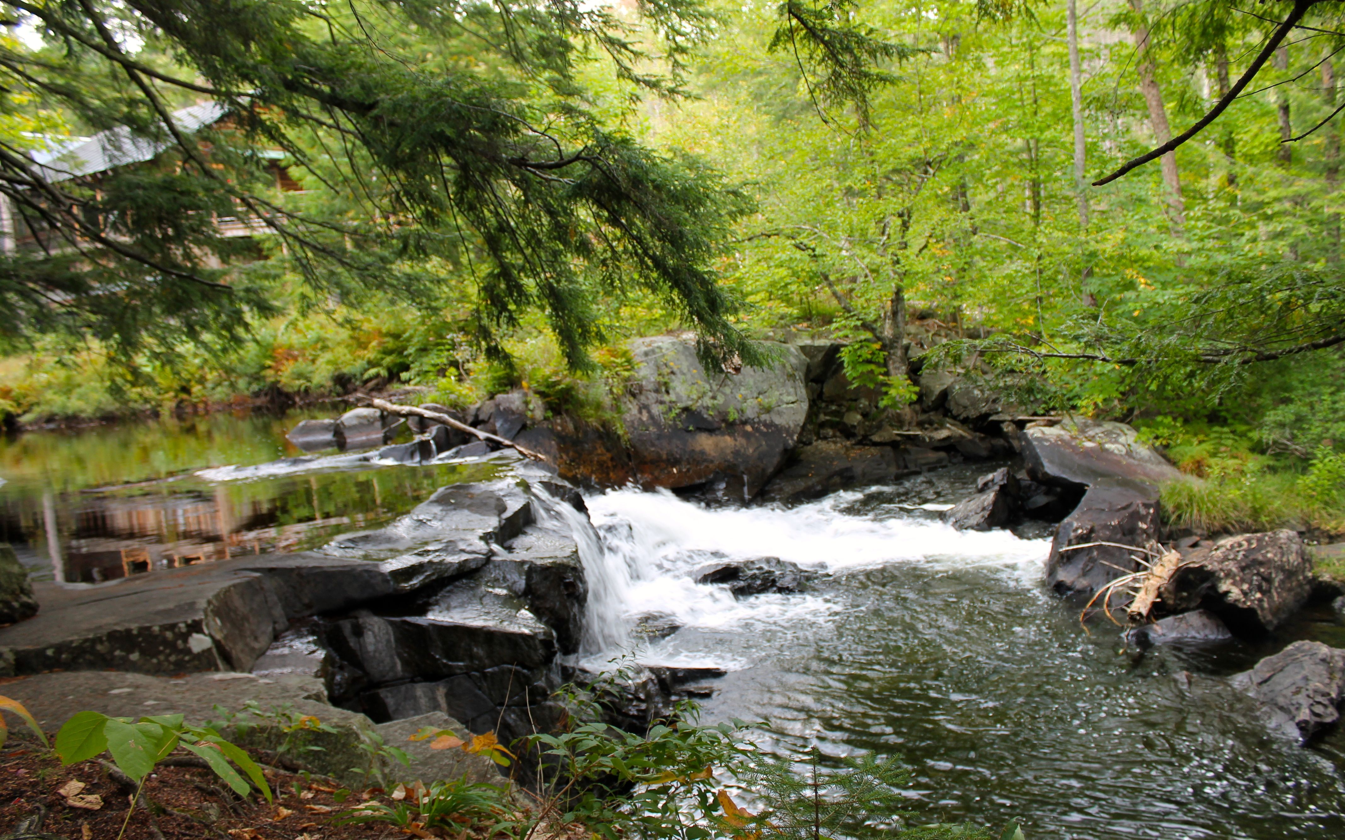
My route took me past Groton Lake on an unexpected detour thanks to my GPS. Usually I know when it is taking me off my route, but this time it took about 4 miles to figure it out. The big clue was turning into a State Park.
Apparently, when I click and drag changes to my route (much like you do on google maps), it added a via point. But then it took me four miles out of the way before it was going to have me turn around. 😦
I did get a couple of photos from the detour.
On my way to the White Mountains, I managed to cross the state line without even noticing and found myself on a road with a Walmart, so I stopped to purchase four more Mountain House camp meals.
The Guns N’ Roses song, Welcome to the Jungle, was playing when I entered the store. Seemed appropriate.

Shopping only took a few minutes and I was on my way again. I entered the White Mountains a little after 11am.
Pretty much right after, the rain started coming down heavily and I pulled into a locally run service station with a market and grabbed some lunch. The rain stopped about 30 minutes later at that location and I kept going.
The closer I got to the top of the pass, the worse the clouds and fog were. But these photos are indicative of the that region.
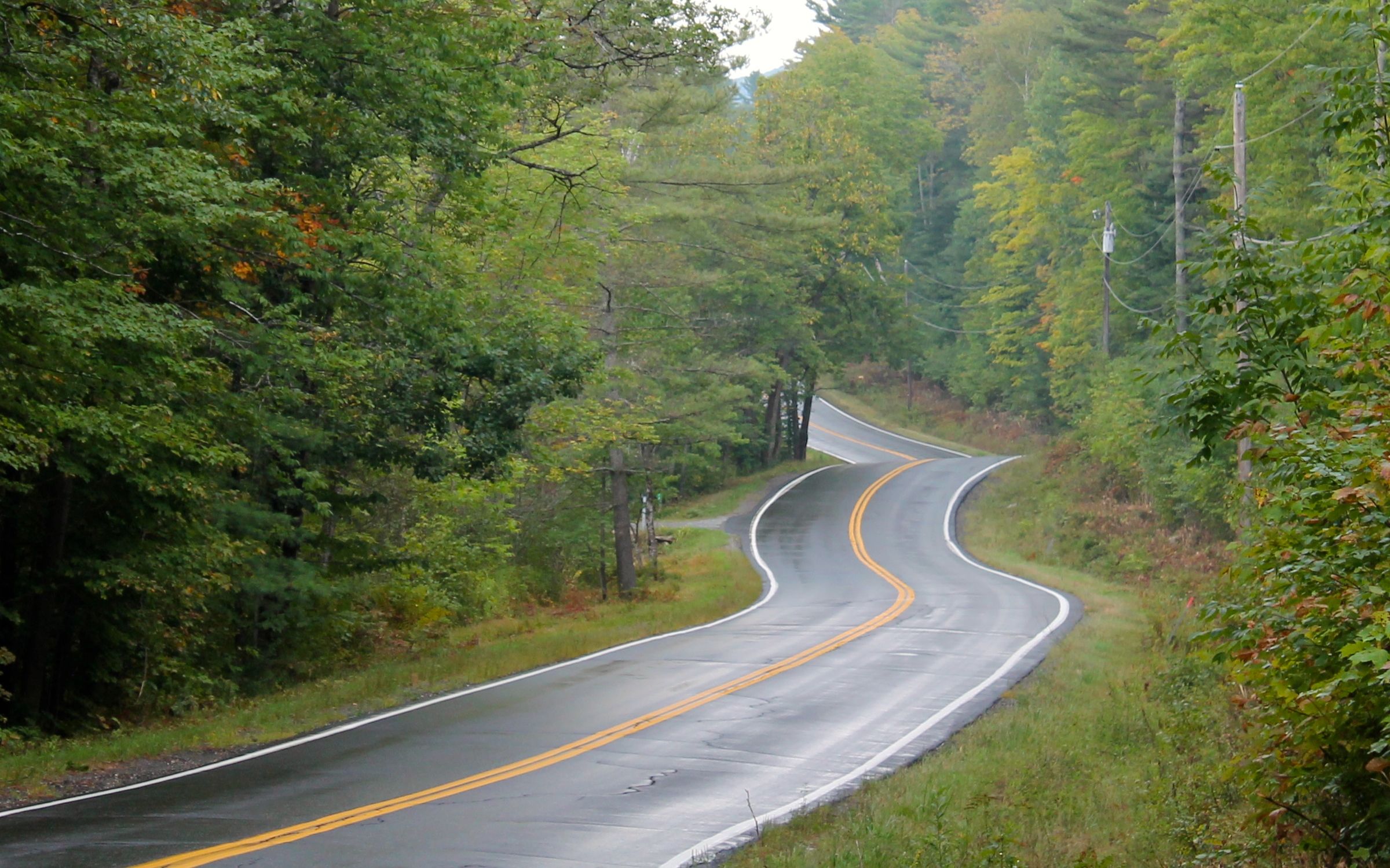
The route over the mountains, Hwy 112, was a great choice. The posted speed limits are generally 40 mph, which seemed pretty conservative except when the road surface is full of frost cracks, which was common.
I had planned a second ride if the weather reports proved inaccurate. A two-hour loop would take me north of Conway and bring me back. The plan was to check in to the motel and evaluate then. I decided since the roads were wet, and the winds were picking up I would instead catch up with work and rest.
I had dinner at the Muddy Moose down the street. The meal of ribs was fine but the ale from a Londonderry, NH brewery called 603 Brewery was yummy!
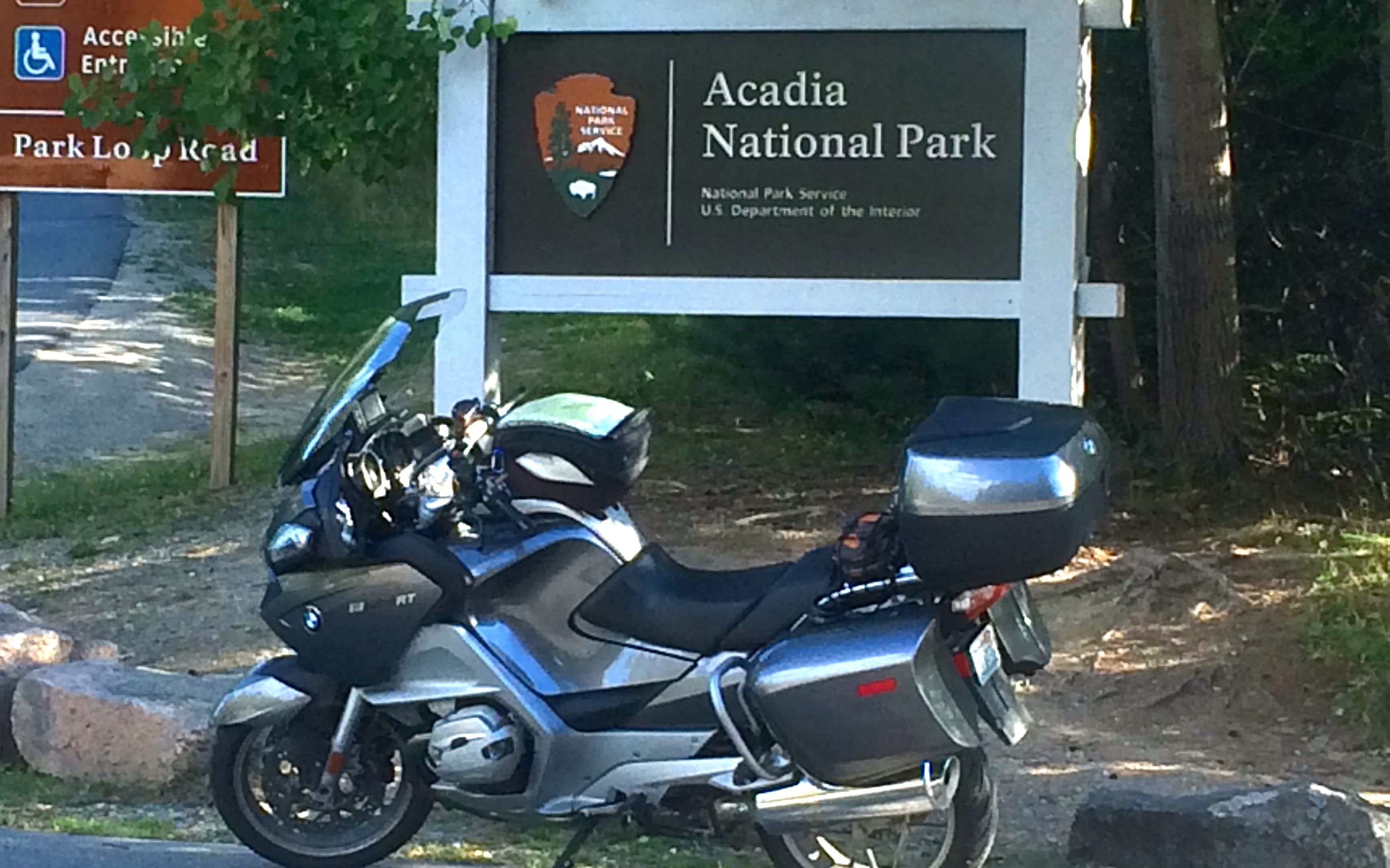
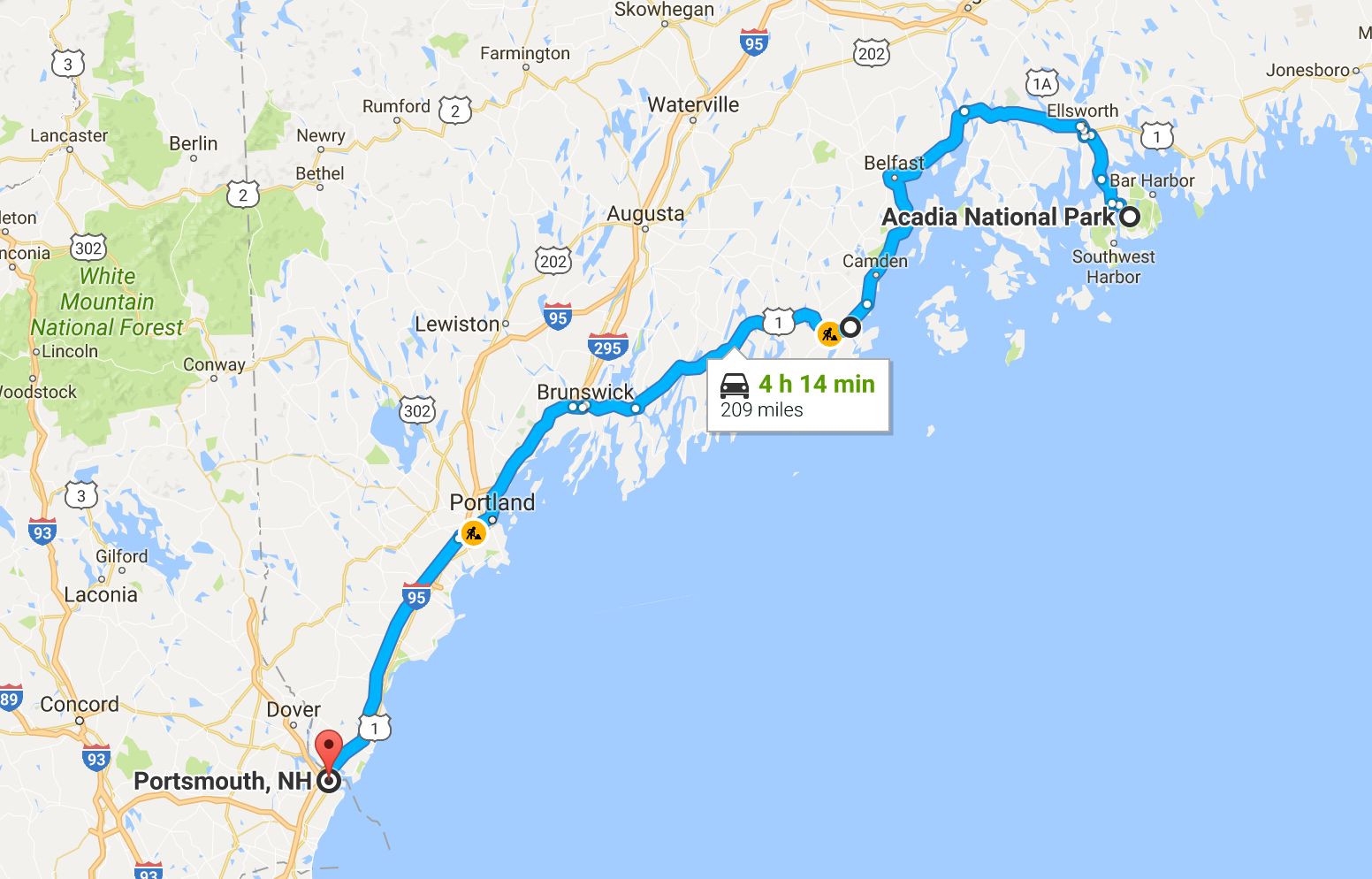
Tomorrow I reach Acadia National Park. The weather is supposed to be good for several days. I will camp at Blackwoods campground one night. That signals the end of the trip east and I will begin to work my way south and west.
Day 19
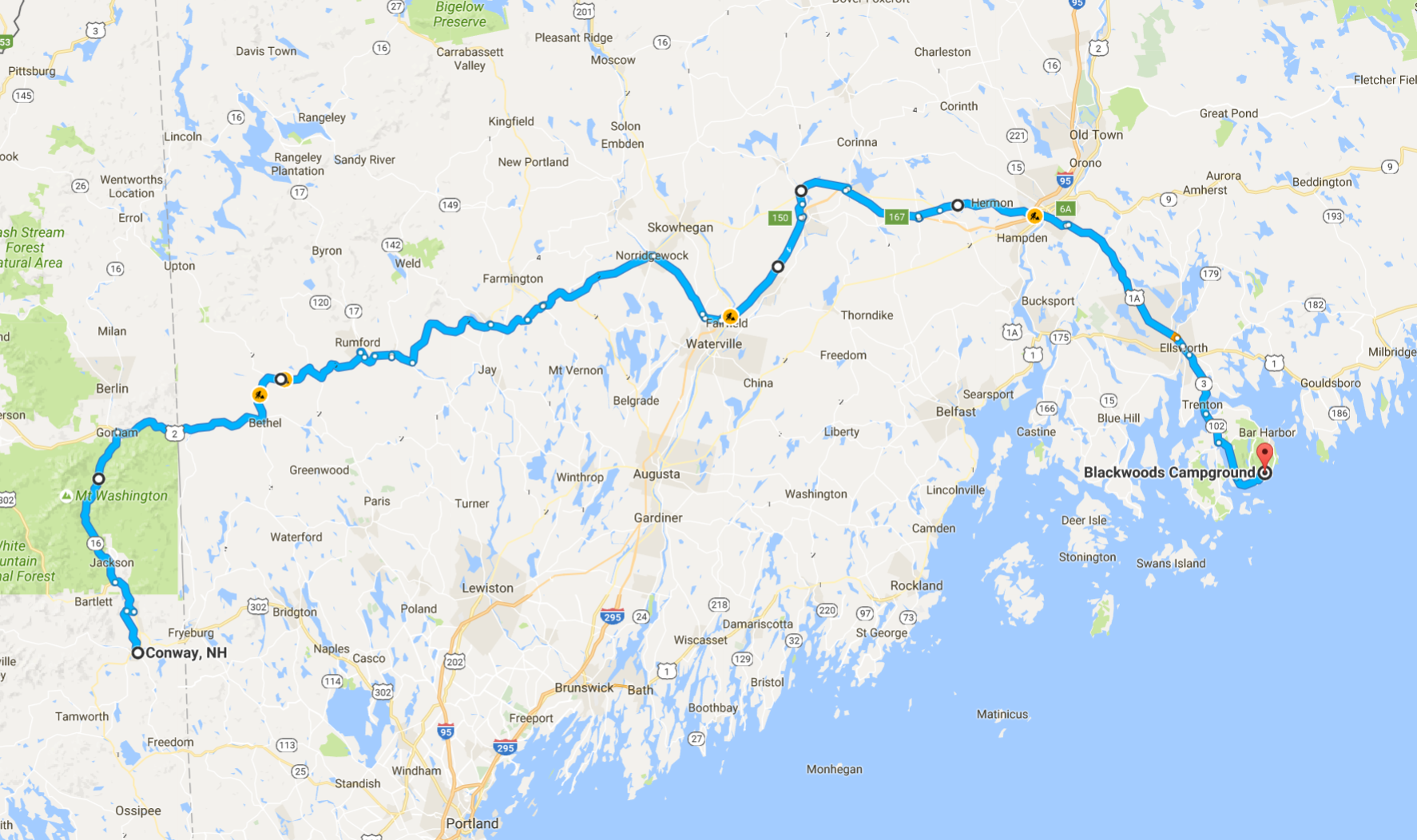
Day’s distance: 260 miles
Total trip distance: 4,441 miles
The day started out in the mid 40’s and finished in the mid 60’s. Mostly sunny with some light winds along the way.
I started out heading north back into the White Mountains. I had a chance to go up to the top of Mount Washington along an 8-mile road called the ‘Auto Road to Mt. Washington’. The entrance fee was $16. While the day was gorgeous and the photos would have been good, I passed up this chance and continued onward.
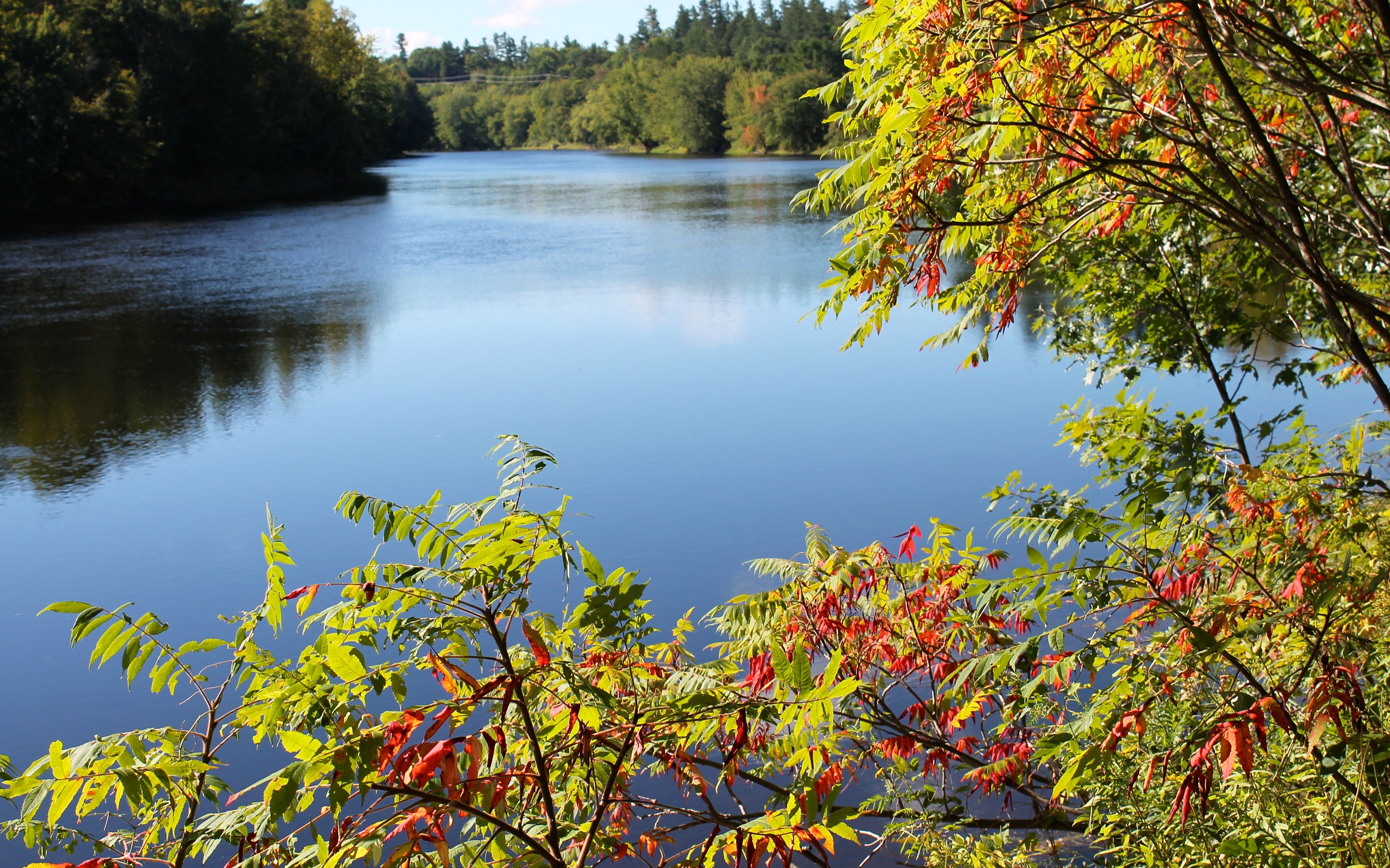
I didn’t stop for photos until reaching Maine – the scenery was similar to the day before.
I took a short break at a rest area in Maine.
My day’s destination is Acadia National Park. I will camp at Blackwoods Campground for one night. I was excited to get there.
Traffic was congested on parts of Hwy 2 where the roads were being resurfaced. I chose to take I-95 part of the way as I would get a chance to pick up the speed. I do have to say that I narrowly avoided hitting a pallet that was in the right lane. The car in front of me was not so lucky, running over it with the passenger side tires. That was when I swerved into the left lane to avoid it. Lucky me!
Highway 1 near the town of Ellsworth had quite a traffic jam. They completely strip the roadway off, leaving a dirt road behind. Traffic into Bar Harbor was slow moving, but the traffic heading the other way was way worse. I just tried to stay focused while traveling on the dirt and gravel.
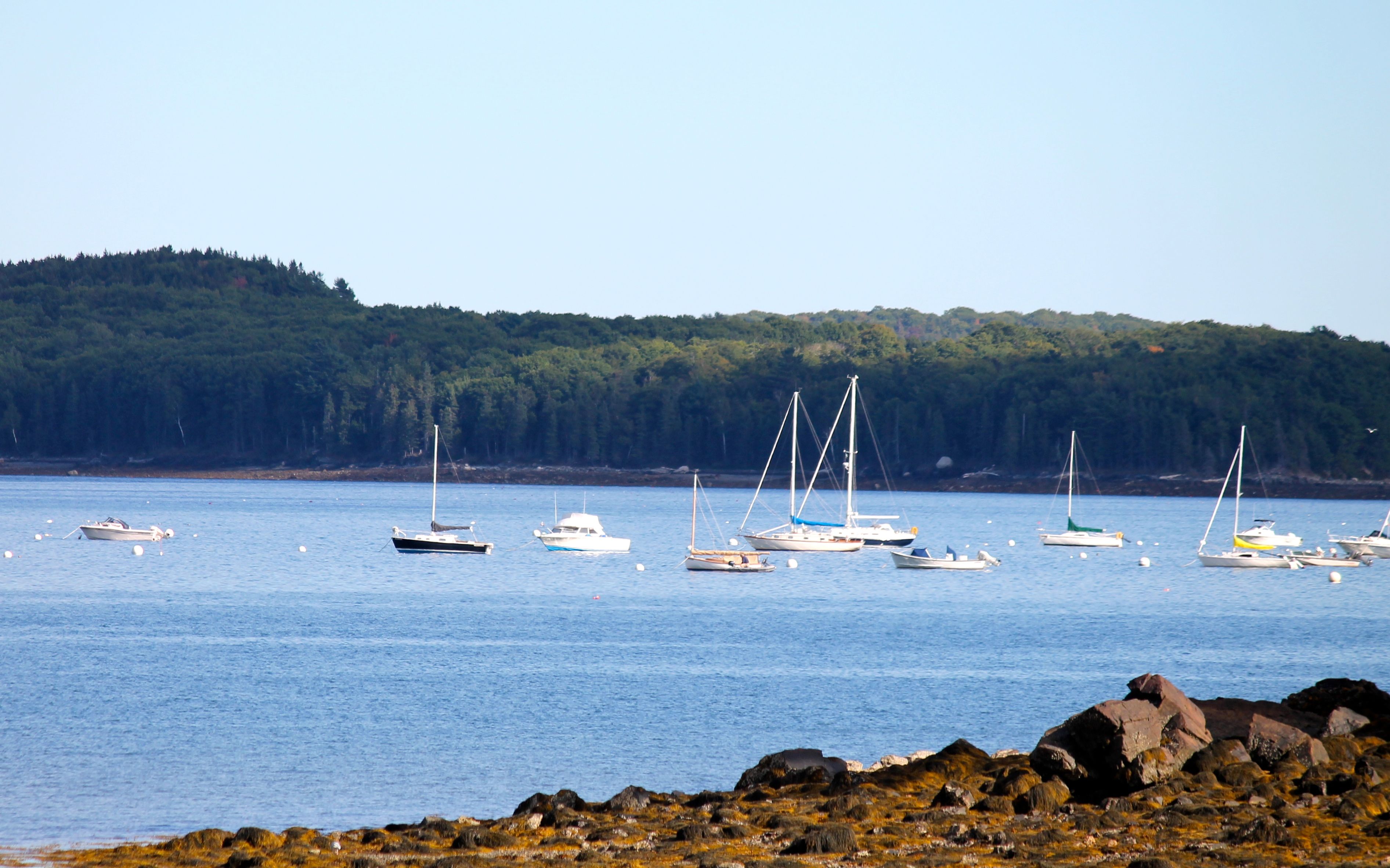
Acadia National Park is located on Mt. Desert Island. Here was one of the harbors that I past heading into Bar Harbor.
I got completely lost following my GPS into Bar Harbor and the park and ended up doing a big circle along the Park Loop. I did stop to take a photo (and try to figure out where I was supposed to go).
Eventually, I reached the visitors center, just before it closed. I still had 30 minutes before getting to camp, but stopped to get a photo of my arrival in the park.
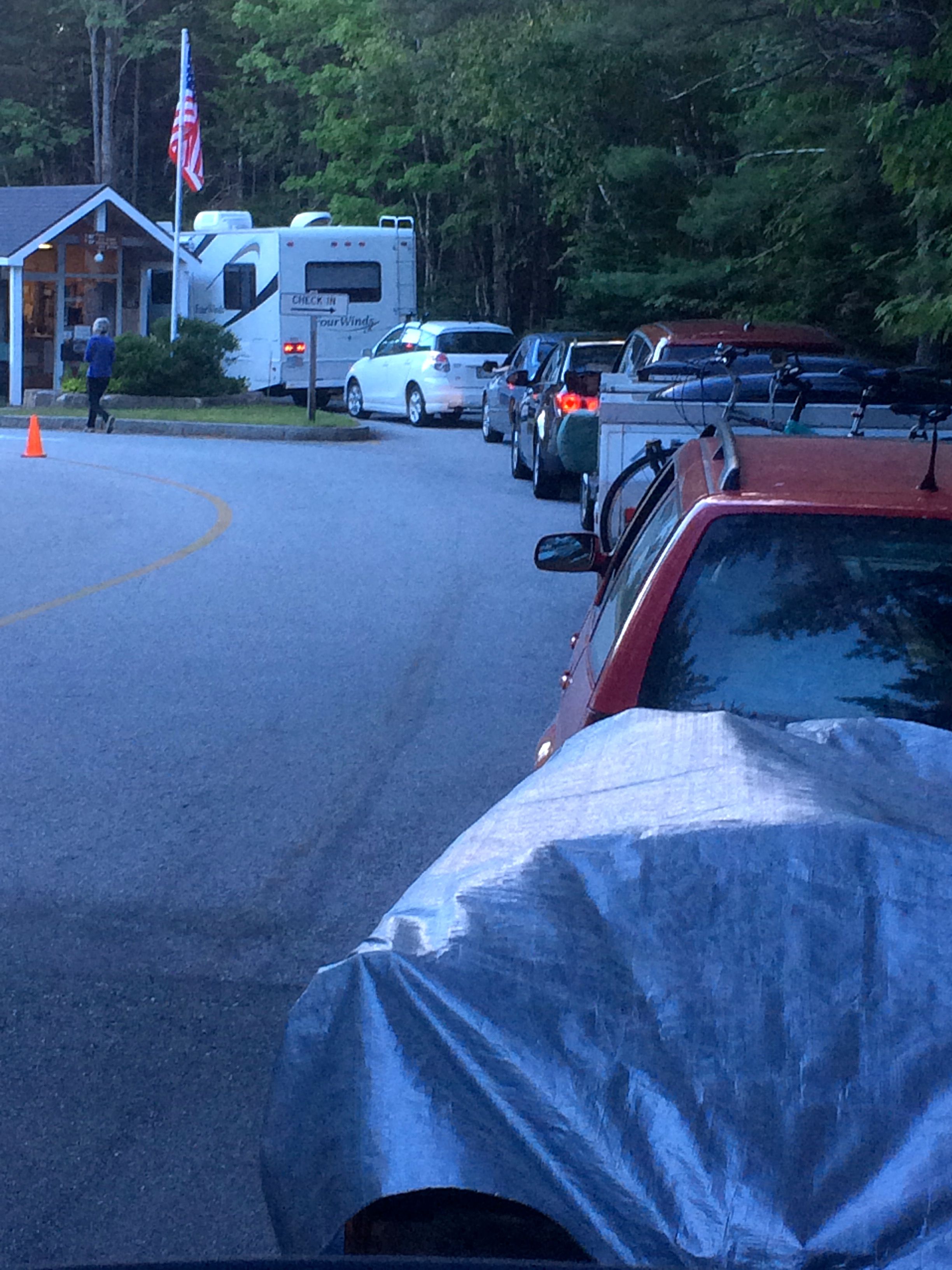
Following the instructions to get to Blackwoods Campground was easy. Of course, there was a line to register. I call the photo below “Nineteen days and waiting.“
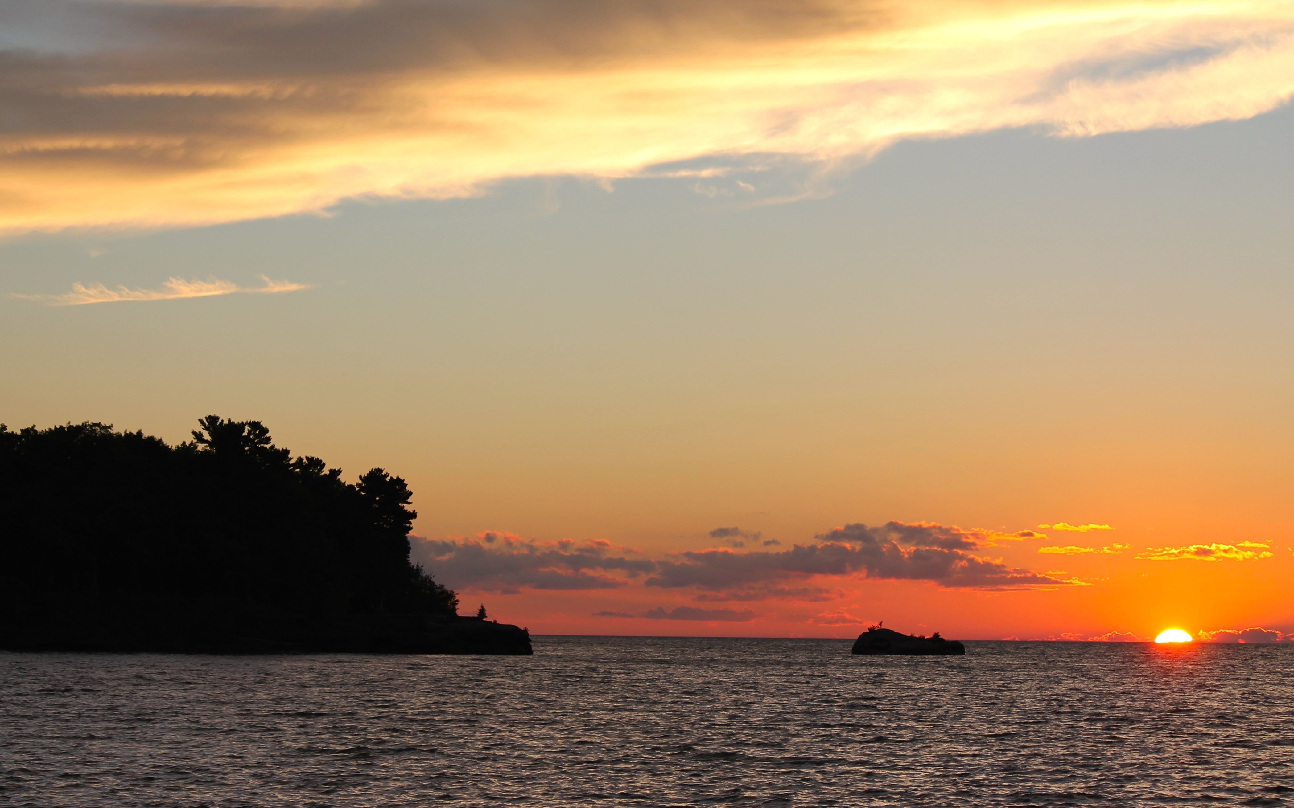
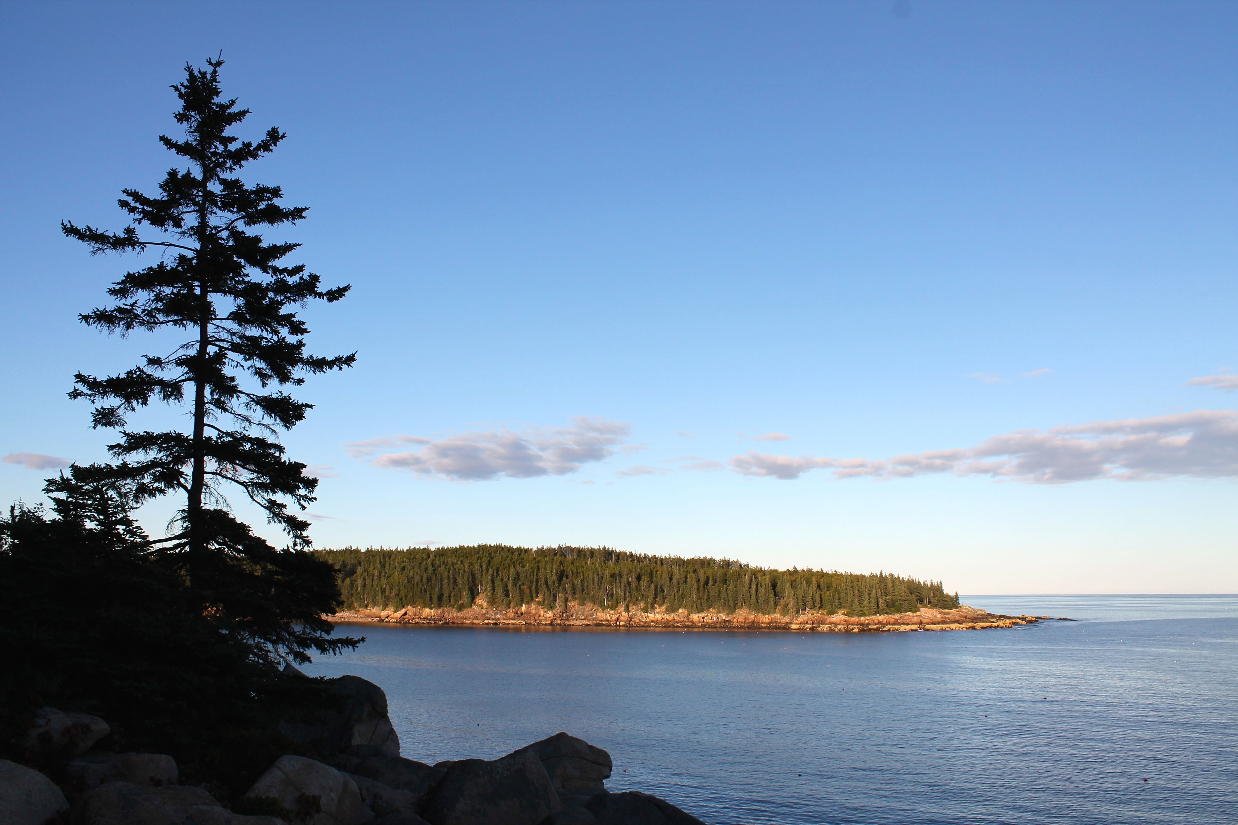
I did get up there and the park staff was super nice. And, I got my campsite set up in record time in order to get to the shore for sunset.
This was my first site of the coast from the vista in the campground. Oh my, it was totally worth it.
I met Danika, Kayla and Bandit the dog when I saw them drinking beers. They were kind enough to share and we talked, and talked …
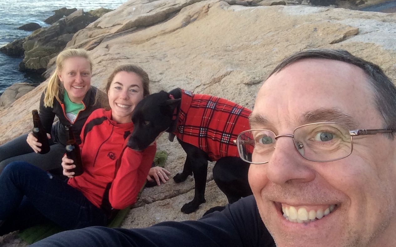
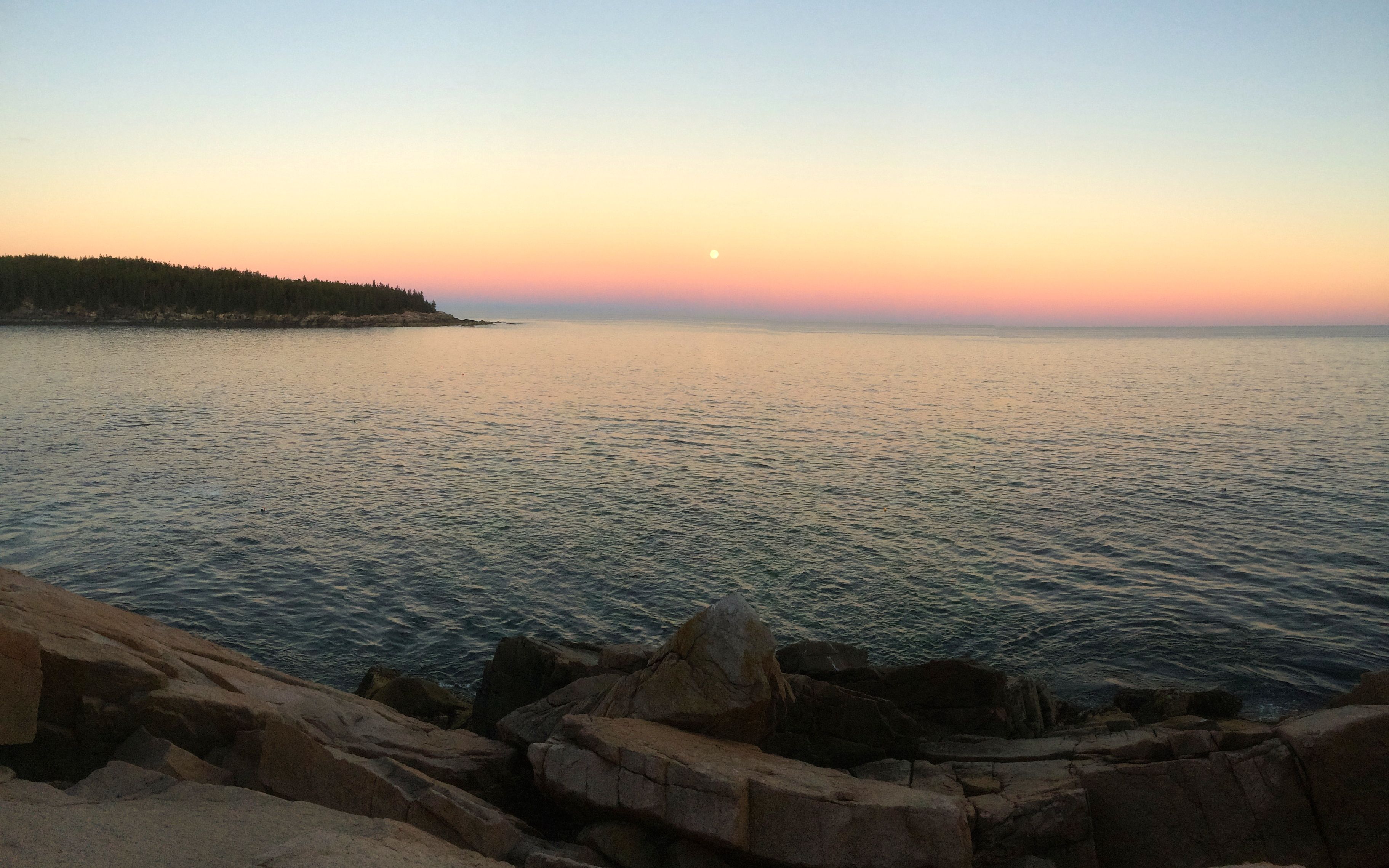
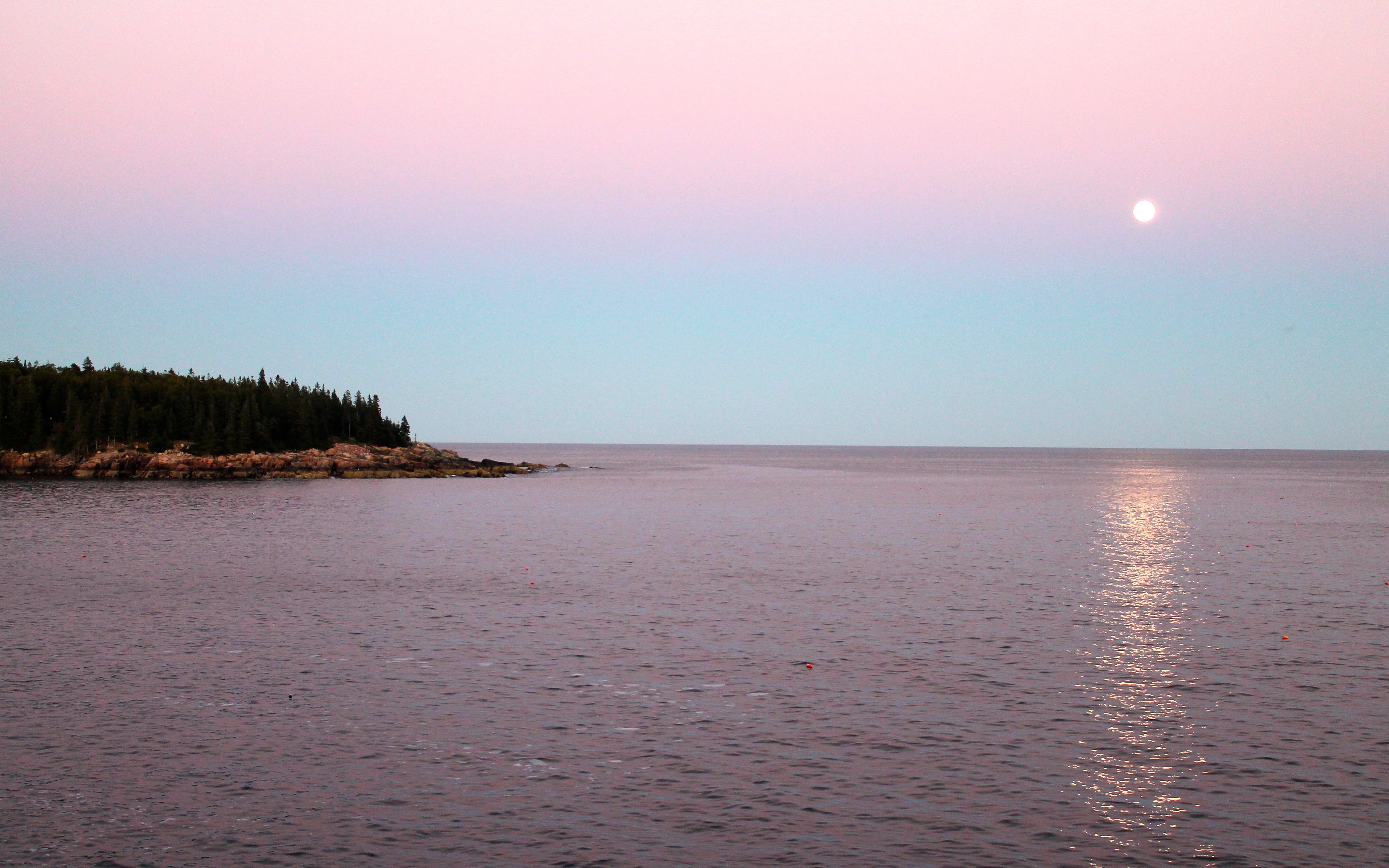
while the nearly full moon rose in front of us. How gorgeous! How charmed I am.
I returned to camp about 7:30 to make a meal and get ready for an early start the next day. I was looking forward to seeing the sun rise on Cadillac Mountain.
This day had its frustrations but also some amazing moments – I wouldn’t trade it for anything. As my “turn-around” point, I will now head south, and then turn west to head towards home.
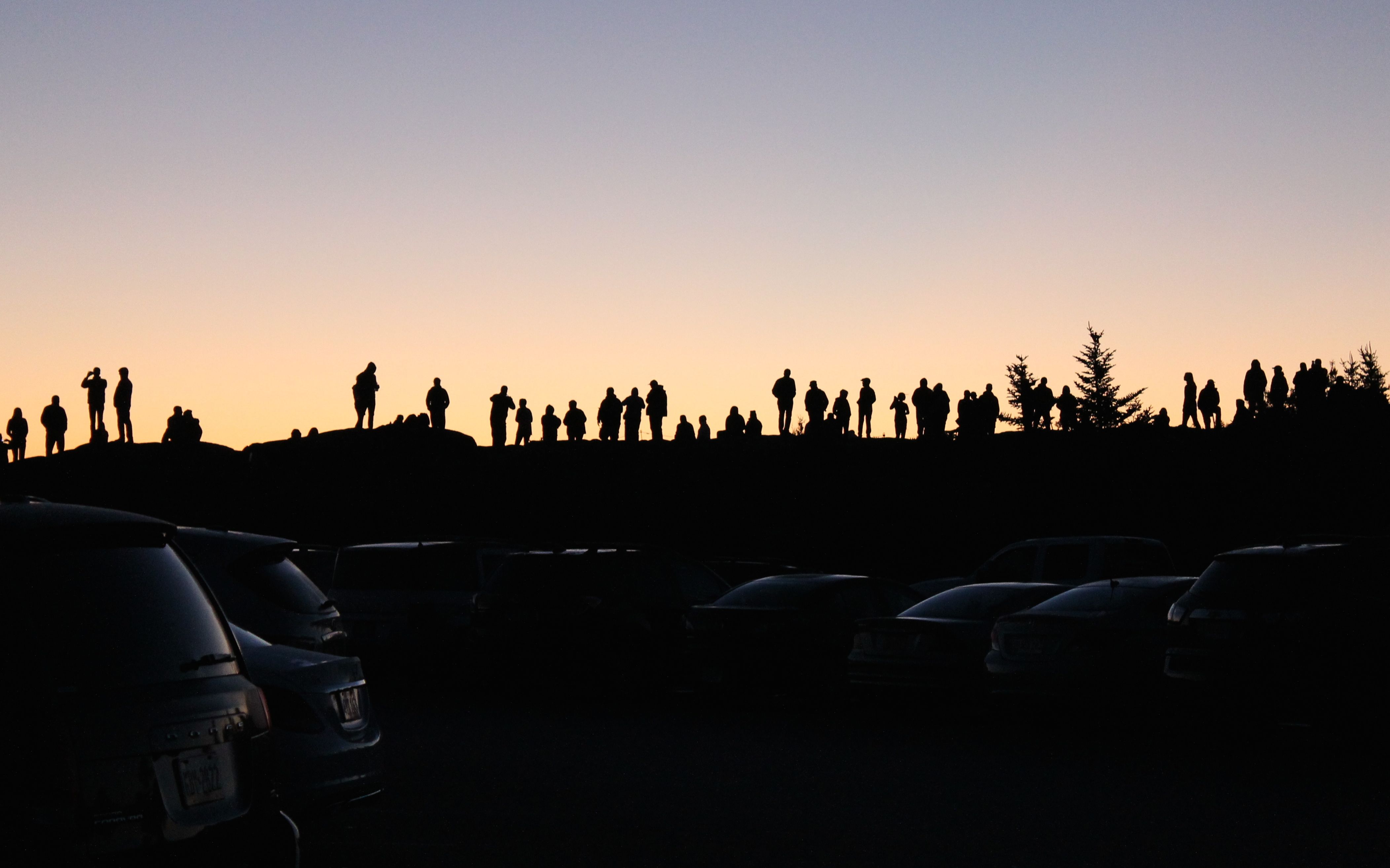
Day 20
Day’s distance: 224 miles
Total trip distance: 4,665 miles
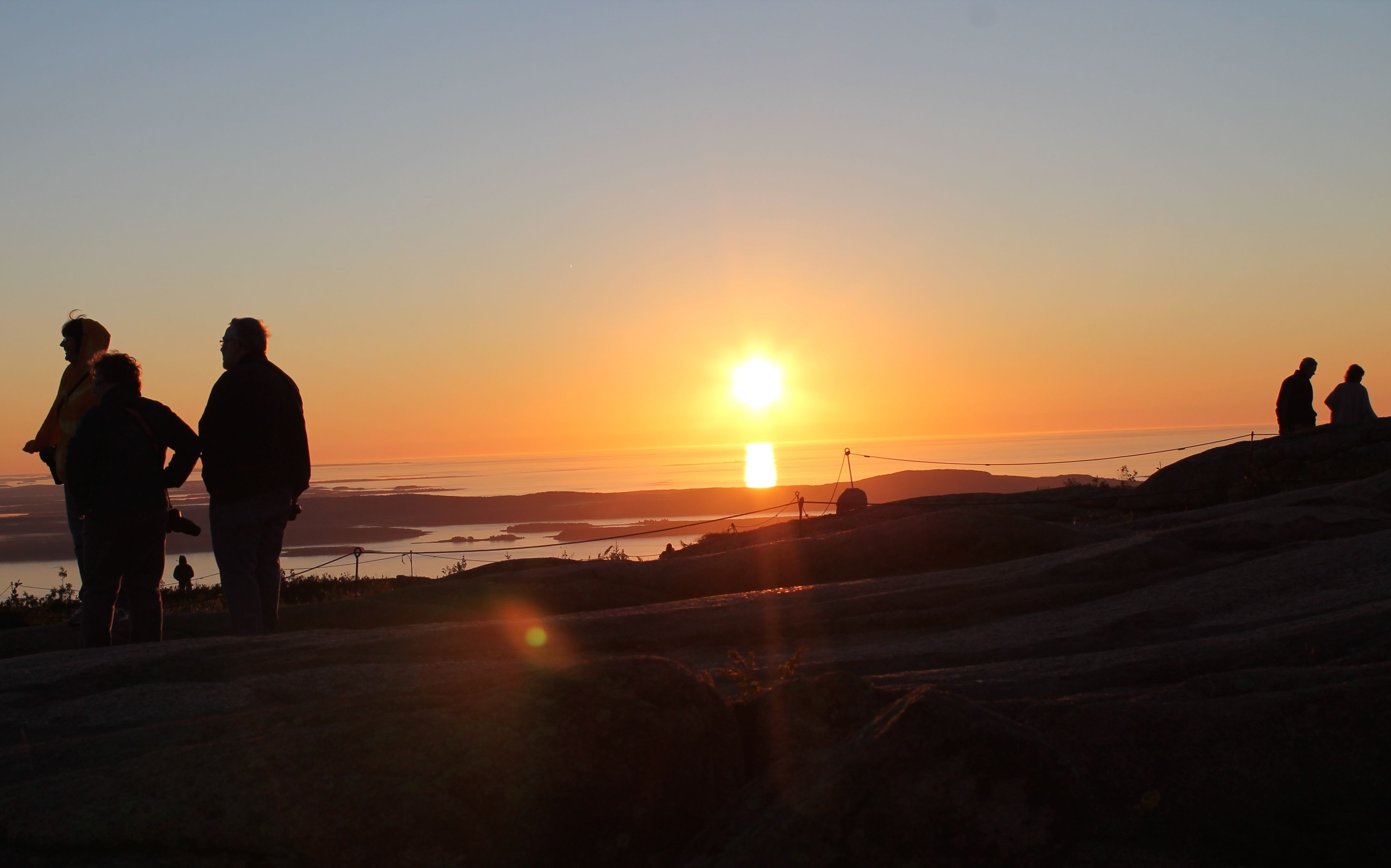
I woke early to break camp and get up to Cadillac Mountain for sunrise. Even waking up at 4:30, and leaving the site by 5:05am, and not getting lost on my way to the summit, I arrived some 30 minutes later to a parking lot already full. It would still be another 40 minutes until the sun rose but this is, apparently, the thing to do.
Kayla thought Cadillac Mountain receives the first rays of sunlight in the country. However, according to this article in wikipedia, it is only true certain times of the year.
Cadillac only sees the first sunrise in the fall and winter, when the sun rises south of due east. During most of the spring and summer, the sun rises first on Mars Hill, 150 miles (240 km) to the northeast. For a few weeks around the equinoxes, the sun rises first at West Quoddy Head in Lubec, Maine.
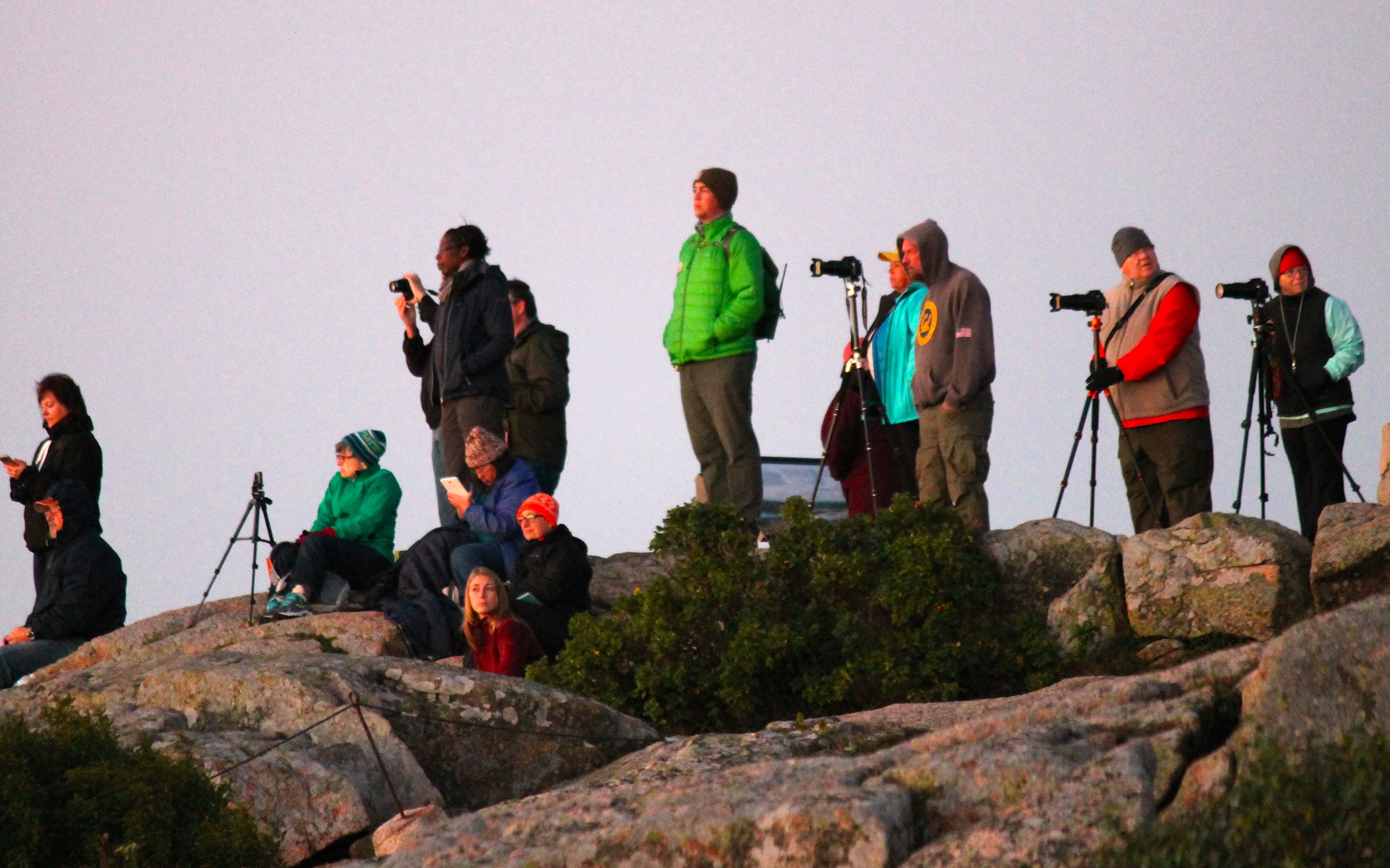
This was quite a show. I wasn’t expecting so many others to be here on a Friday morning after summer is officially over. Crowd watching was fun.
The sun rose, as predicted, and didn’t disappoint.
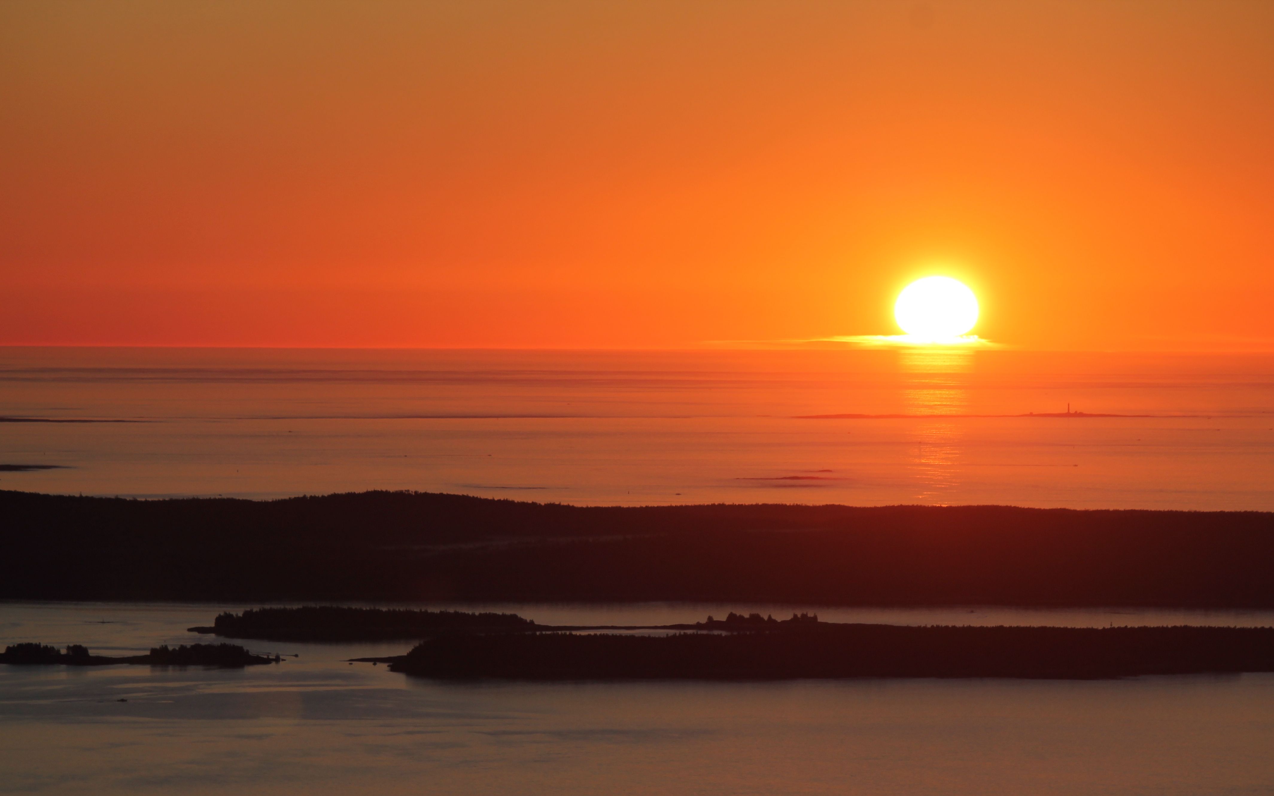
There were more photos, but I’ll spare you all. It was only about 10 minutes after and the place was nearly deserted.
I waited to head down the hill. During that time, I spoke with many people who noticed my outfit and knew I was traveling by motorcycle. I was hoping to see Danika and Kayla, but if they were there, I didn’t notice.
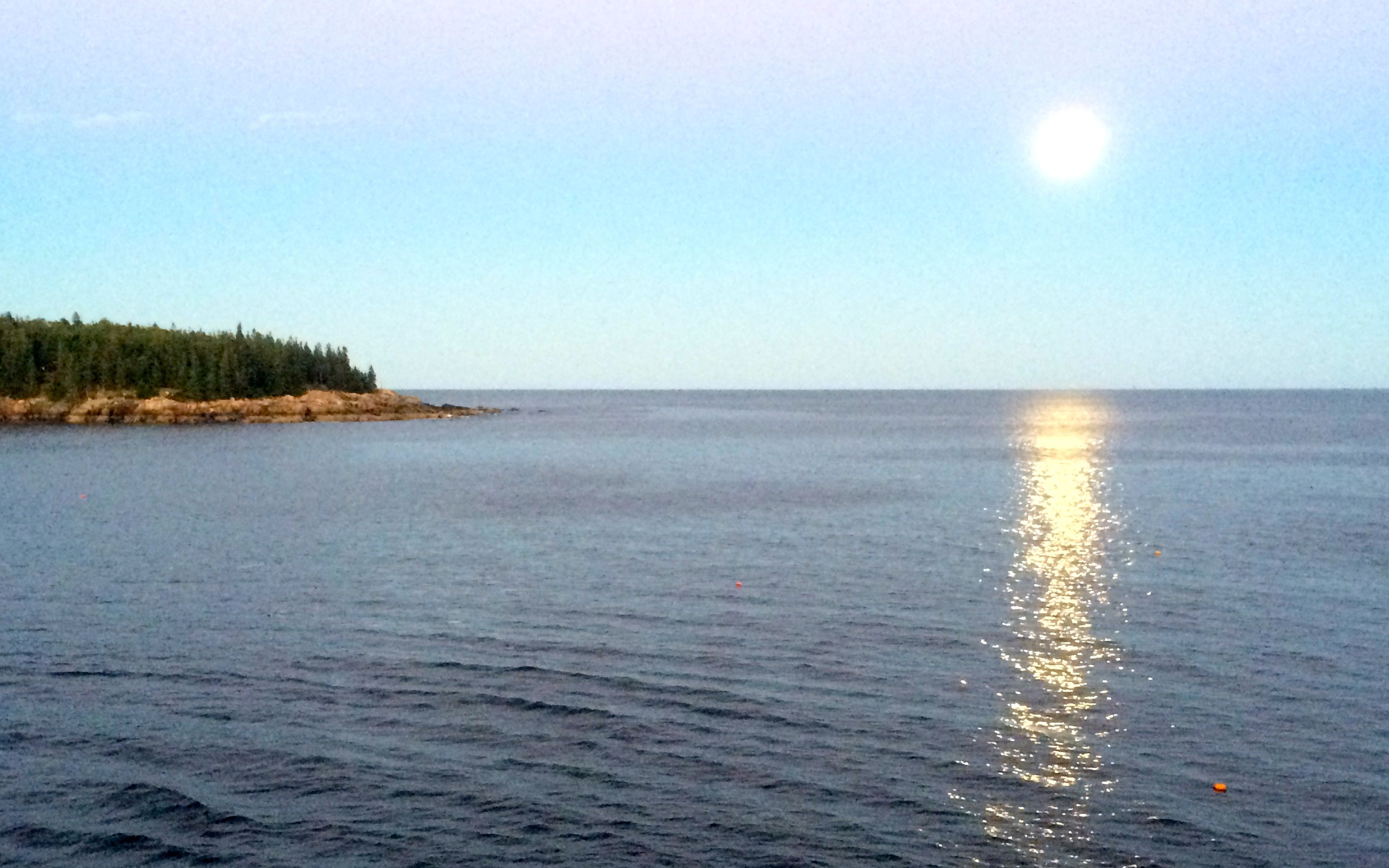
On my way up the hill, the nearly full moon I saw the night before was setting. I didn’t stop to take a photo but it was easy to see from the vantage point of Cadillac Mountain. On the way down, I couldn’t resist a photo of the bike. 🙂
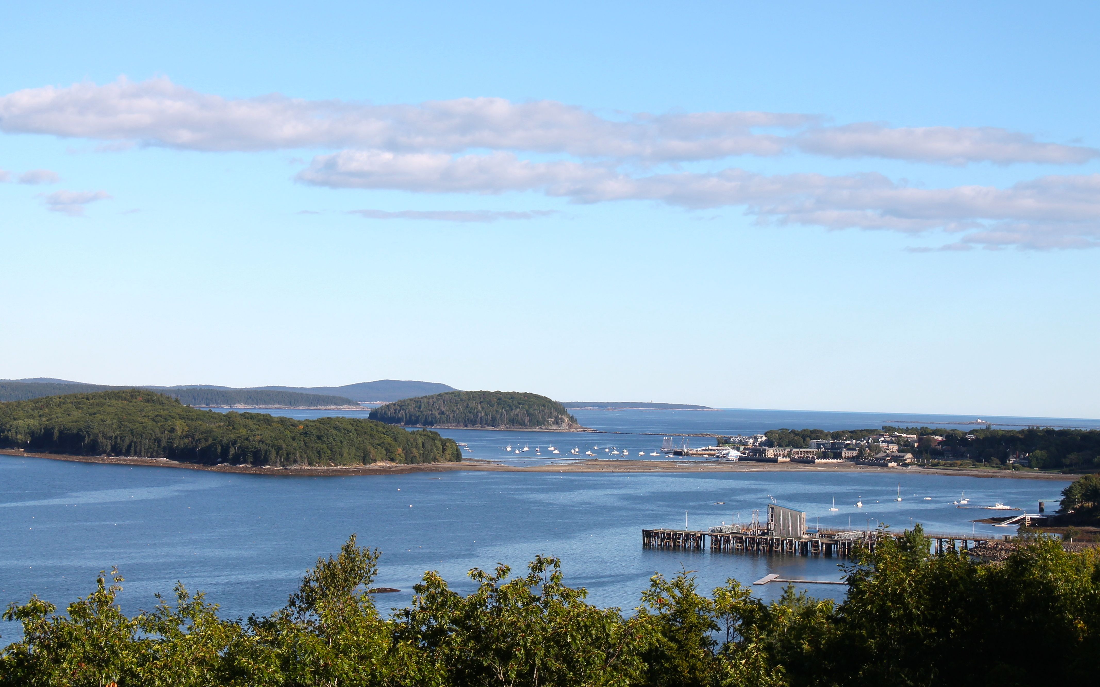
Of course, I needed a latte so I went into Bar Harbor and found the Coffee Hound. I was their first customer this morning.
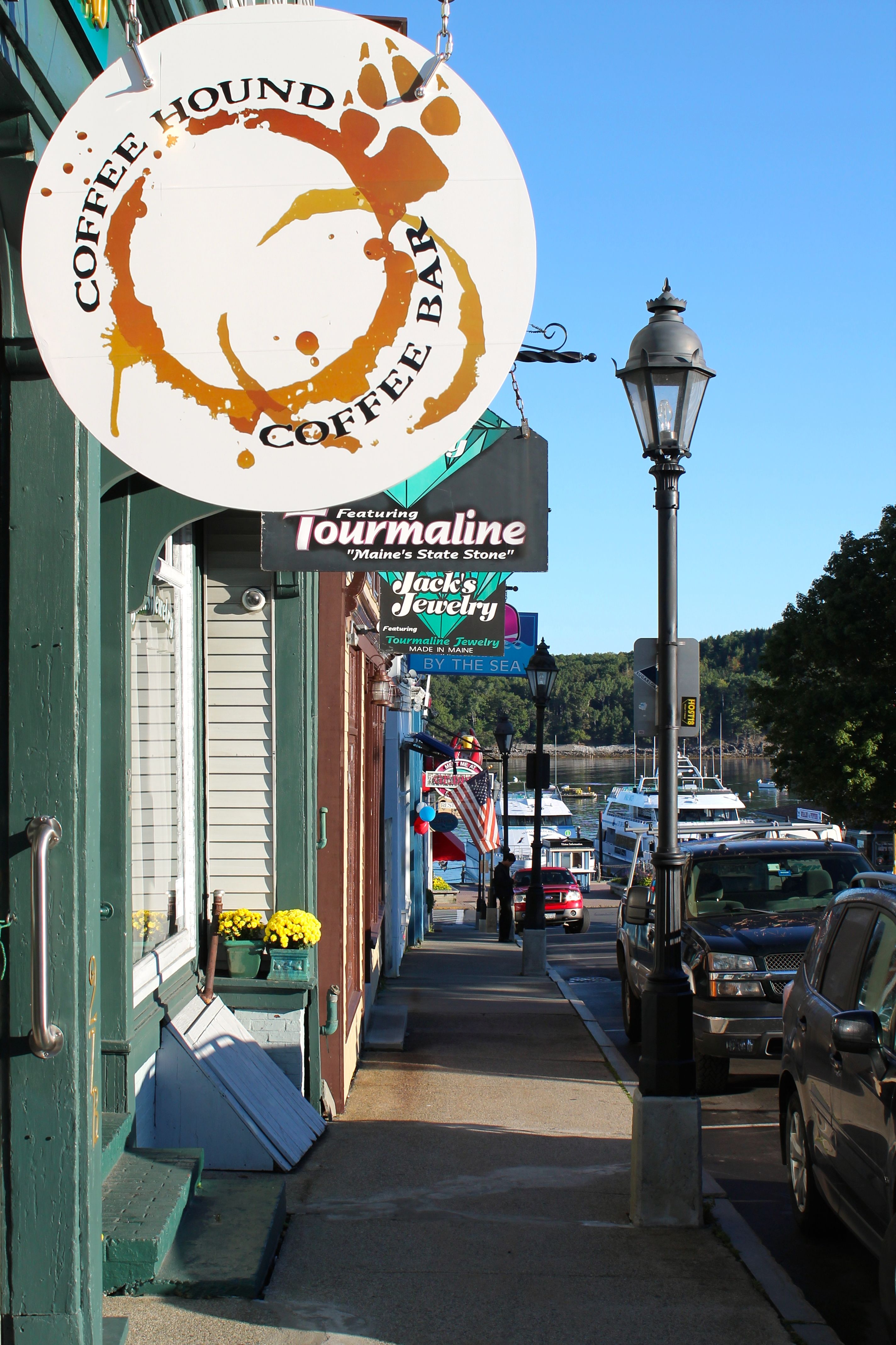
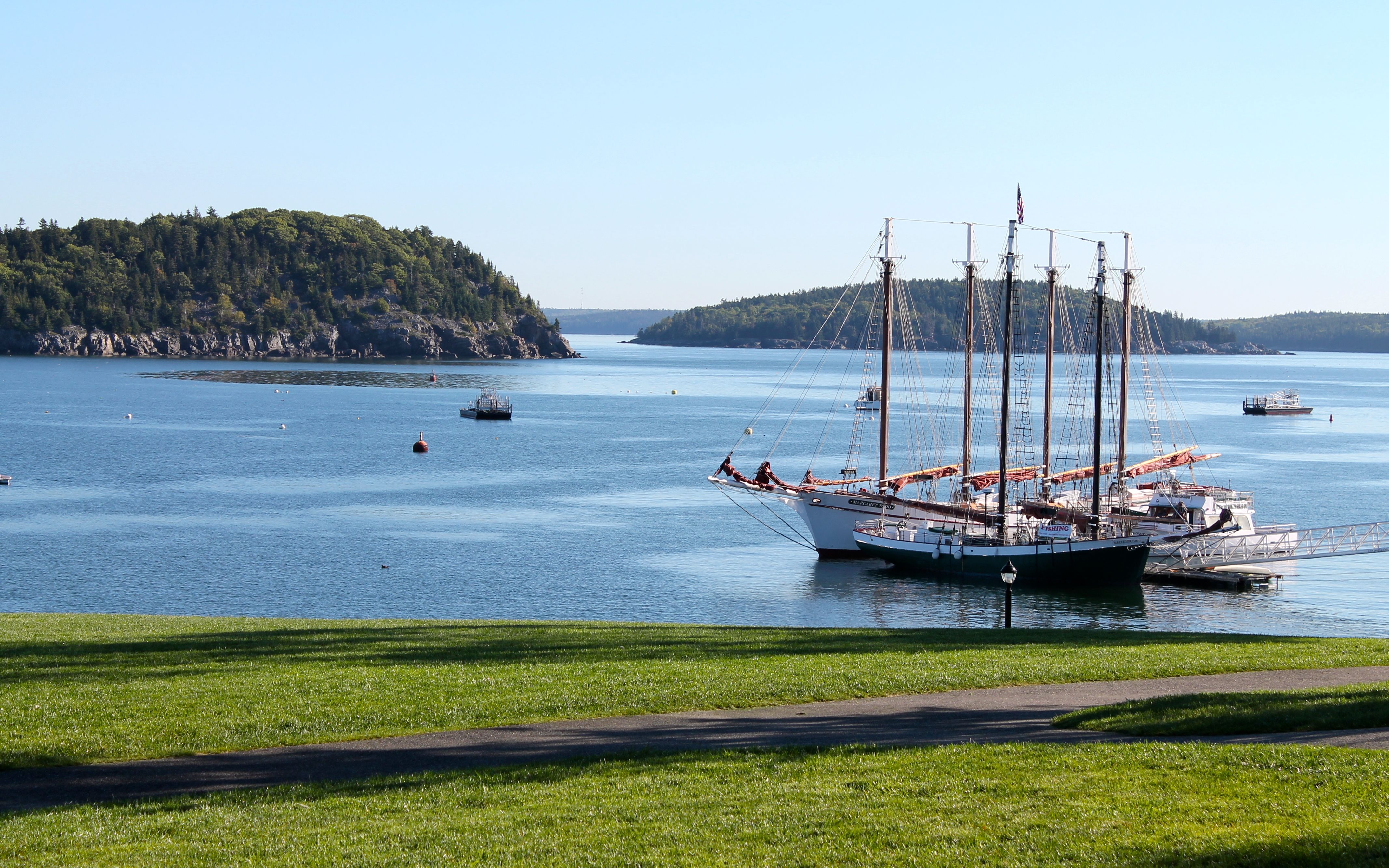
Lots of folks, who arrived on a small cruise ship, were walking about Agamont Park across the street from the coffee house. There were some larger sailing vessels that I couldn’t resist.
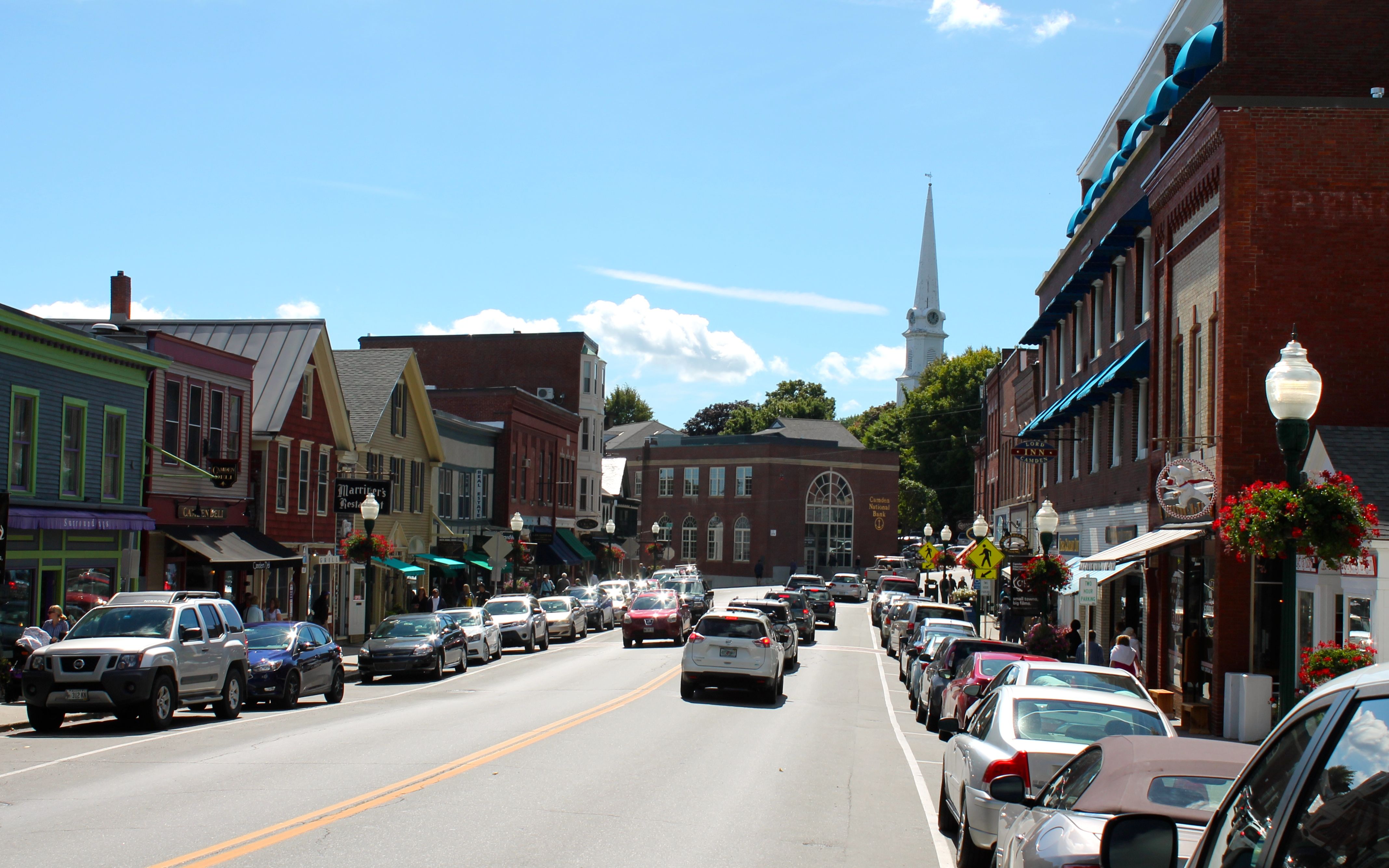
The ride down Hwy 1 was a mix of small towns where the speeds were limited and the more famous small towns that were crowded and full of traffic. Below is Camden, ME. It took about 20 minute to get through Camden along the highway.
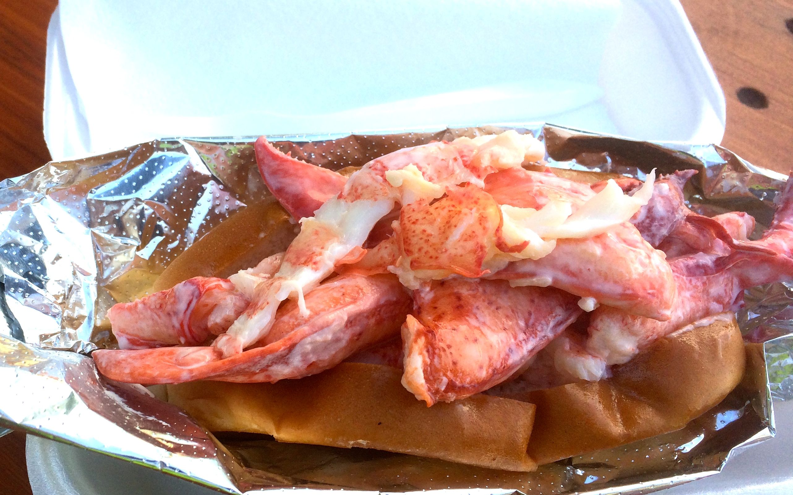
My food experiment for the day was a Lobster Roll. It is lobster meat spread across a bun that was lightly toasted, then spread with mayo. A drizzle of butter tops the sandwich. The hot dog bun used was disappointing but the lobster was good. 🙂
The rest of my route followed I-295 and I-95 into Portsmouth. Traffic moved quickly with one exception, a 5-mile slowdown due to construction. I arrived just before 4pm to check in to the motel.
The weather tomorrow is predicted to be nice and I’m looking forward to riding through Massachusetts, the corner of Rhode Island, and into Connecticut.
Day 21
Day’s distance: 197 miles
Total trip distance so far: 4,862 miles
Temperatures were mild and reached a high of 77. It was a beautiful, mostly sunny day.
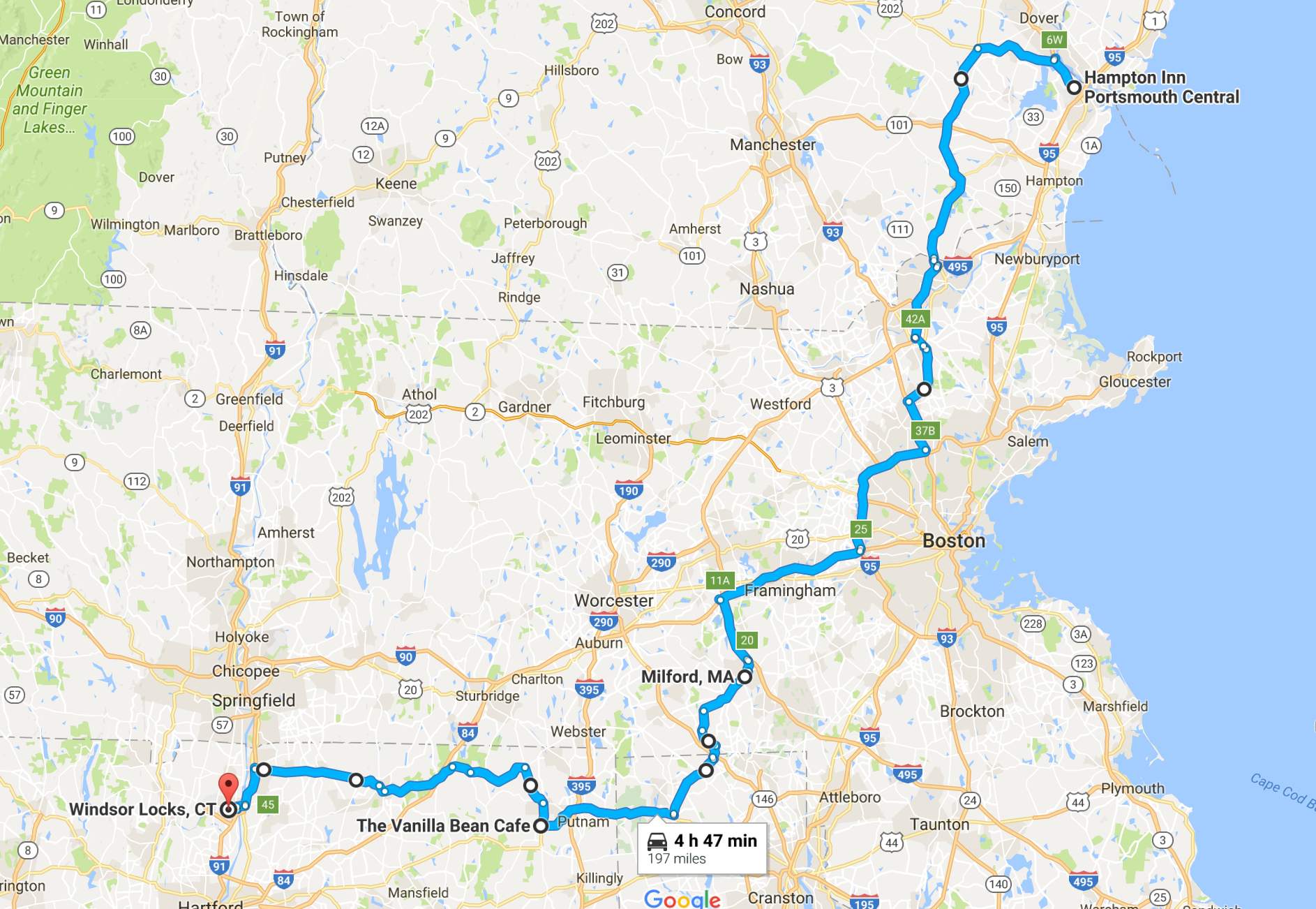
Avoiding Boston and the coastline north of the city, I traveled inland and use some interstates, but some scenic byways as well, to visit Massachusetts, Rhode Island, and Connecticut all in one day. Here is a link to the google map for the day. It was a complicated one!
I visited some beautiful semi-rural countryside. Here is Hwy 125 near Andover.
I took a short break when I arrived in Milford. A Dunkin’ double chocolate donut hit the spot 🙂
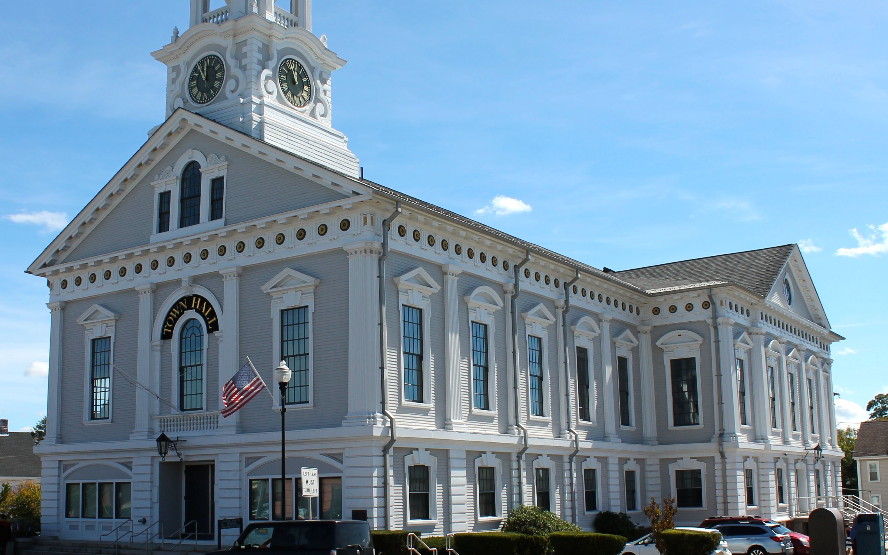
Then I topped off the tank with fuel and saw the Milford Town Hall across the street. Who can resist taking a picture?
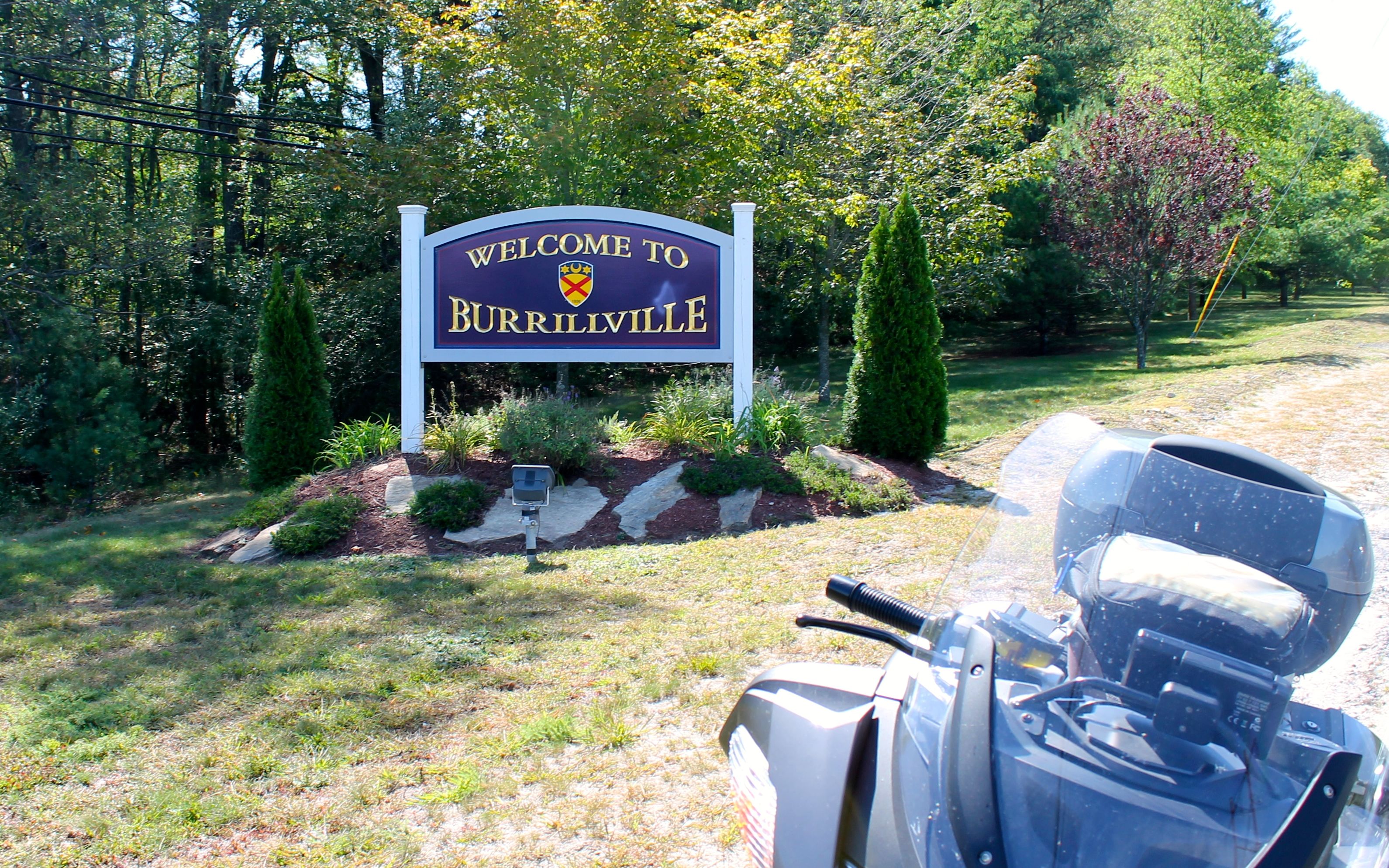
Reaching Burrville, I felt compelled to prove I visited Rhode Island. I risked a parking ticket to get this one!
There were a lot of bikers on the roads today. I was happy to see that as it meant, to some extent anyway, that I had chosen my route well.
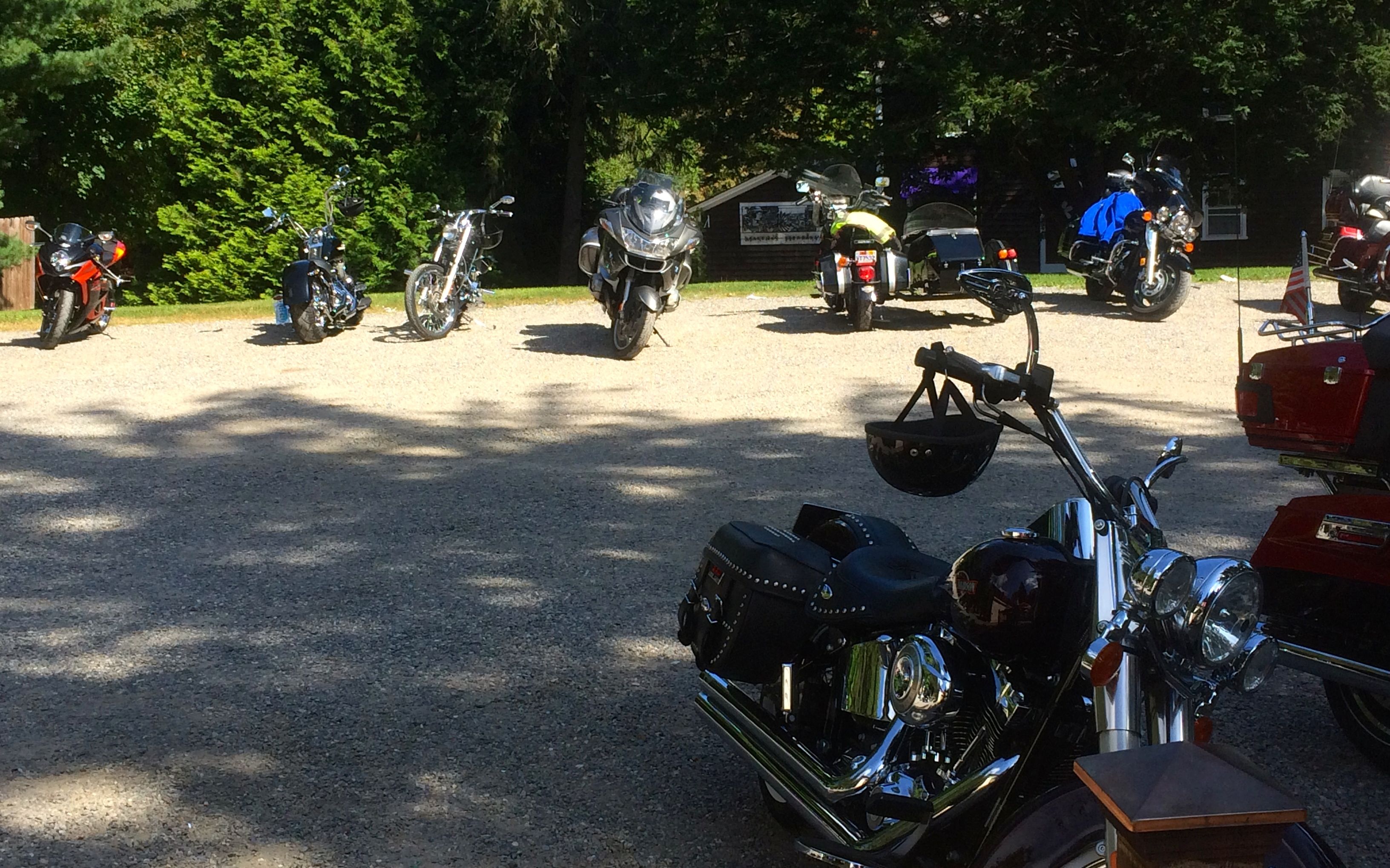
My planned lunch stop was the Vanilla Bean Cafe. It is supposed to be a biker friendly lunch / gathering place.
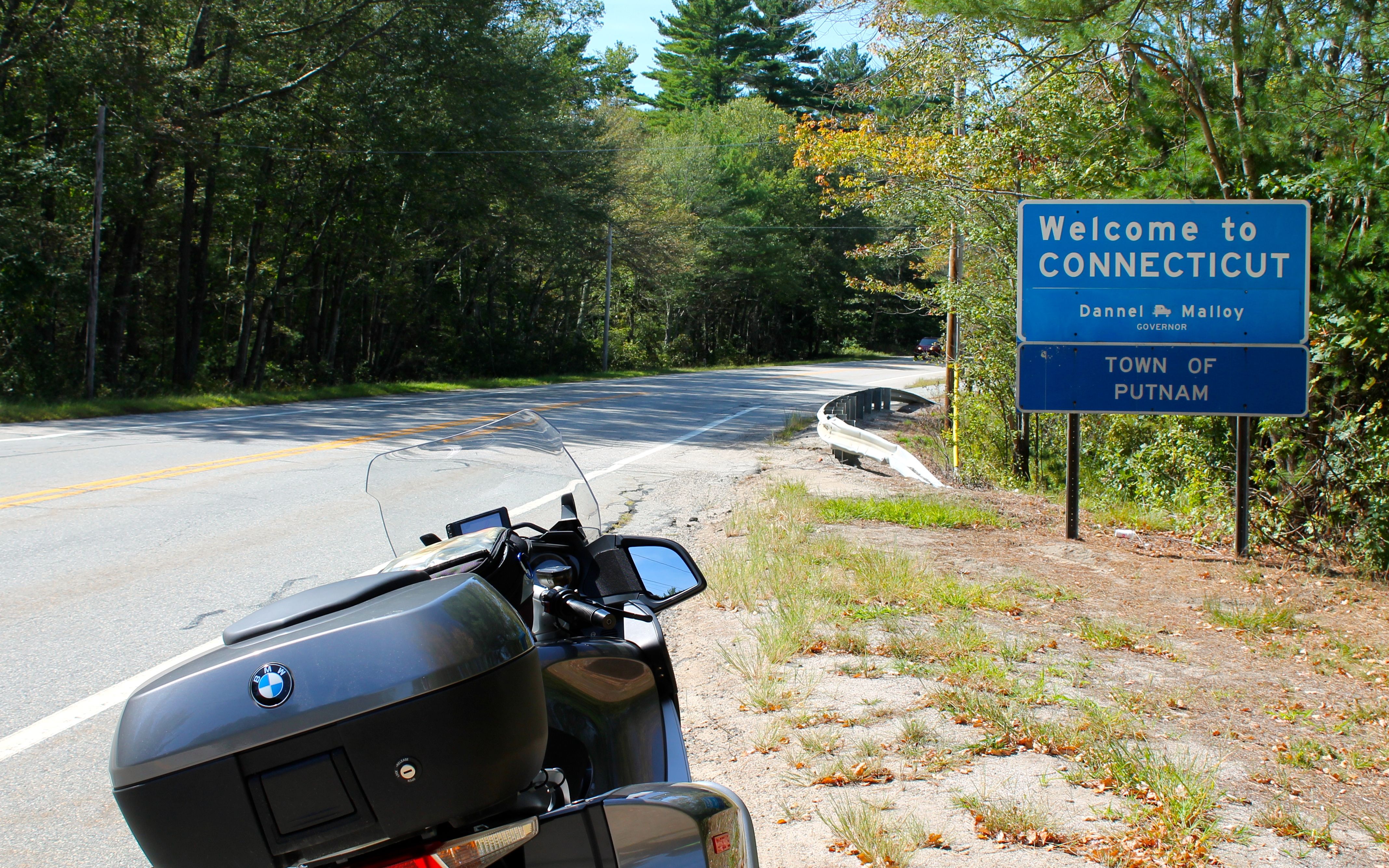
To get there, I crossed into Connecticut on Hwy 44. I think five bikes passed by as I spent about two minutes taking this shot.
Soon enough, I reached The Vanilla Bean Cafe.
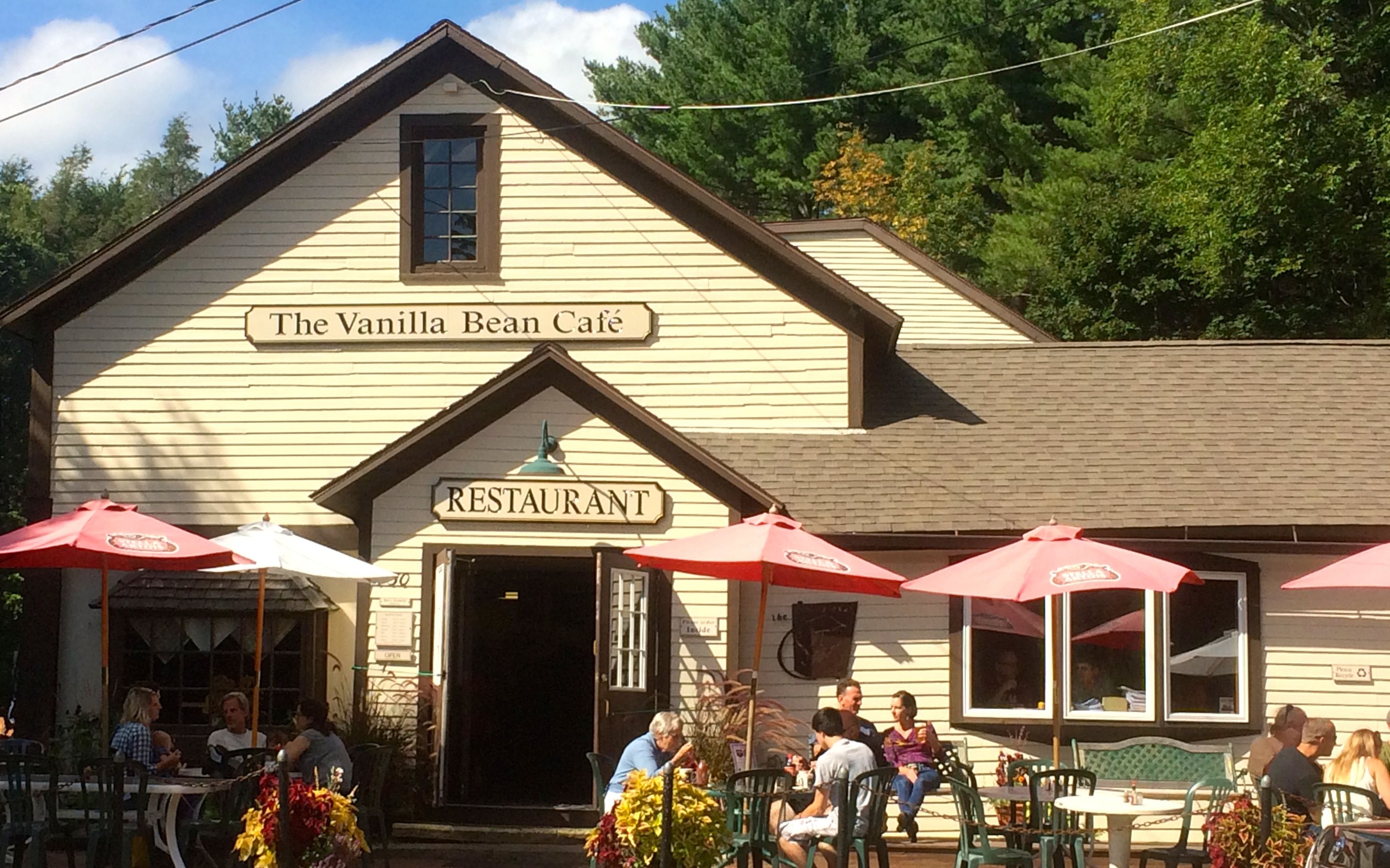
The parking lot was gravel and I stayed focused while parking the bike to avoid embarrassing myself. There were about 30 other bikes there, spread around three different parking areas, including crotch rockets, touring bikes, trikes, two sidecars, and lots of Harleys.
I ordered a buffalo burger and watched the show. At one point, a group of riders left to continue their ride. Watch that video here.
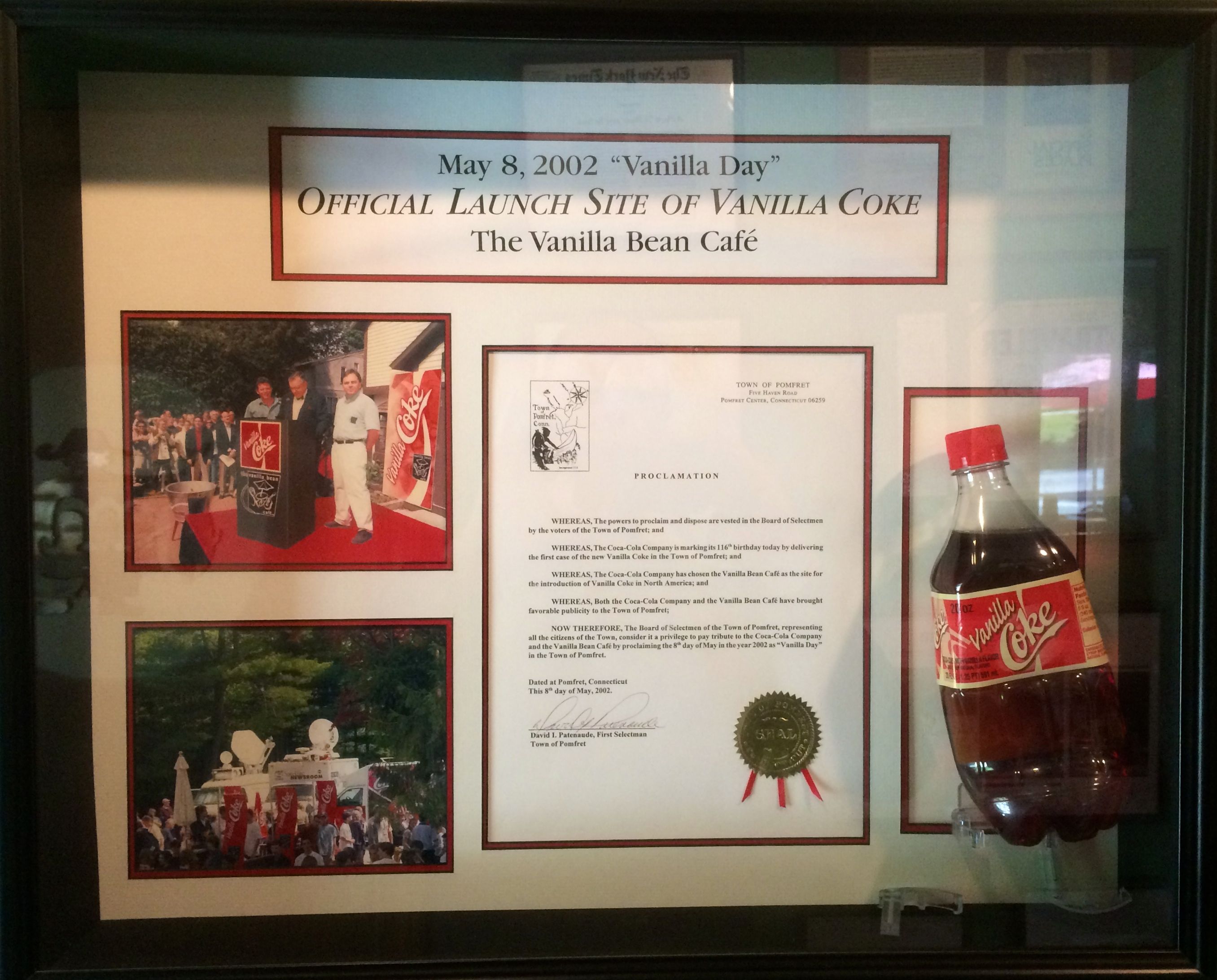
I still had about 90 minutes of riding. Before taking off, though, I noticed this sign near the bathroom. This place was the official launch site of Vanilla Coke!
This place is totally worth a stop if you’re in the area!
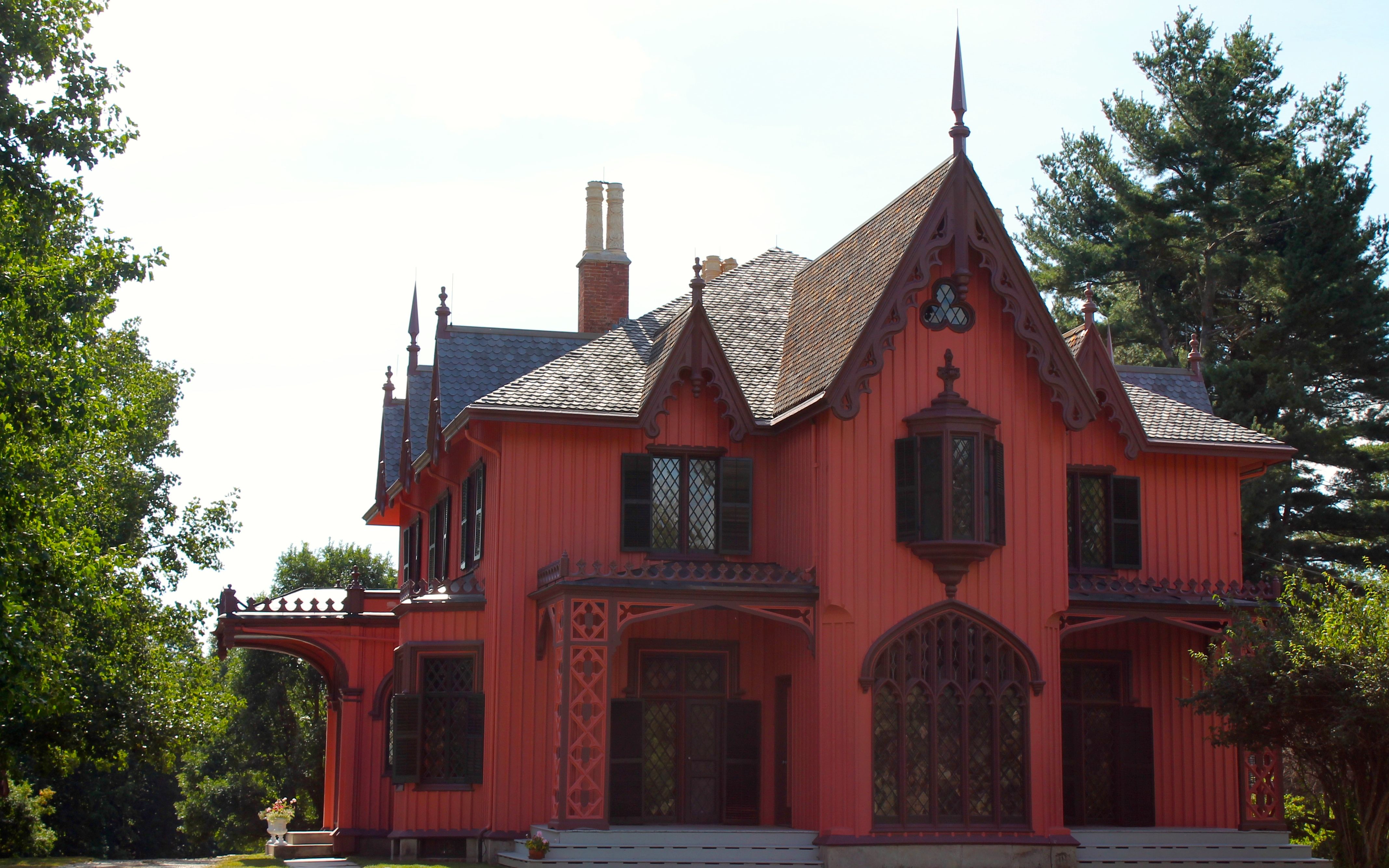
To reach Windsor Locks, I would take Hwy 169 north through Woodstock, a seemingly wealthier community with big properties and prep schools. Most of the speed limits were 35 to 45mph, but I didn’t mind – there was much to see.
This was the end of week three on the road. I have 9 states left to visit on this trip.
I look forward to checking off New Jersey and Pennsylvania tomorrow. I’ll be staying at my sister’s place for a full day of visiting on Monday. This is good timing as it is supposed to rain.
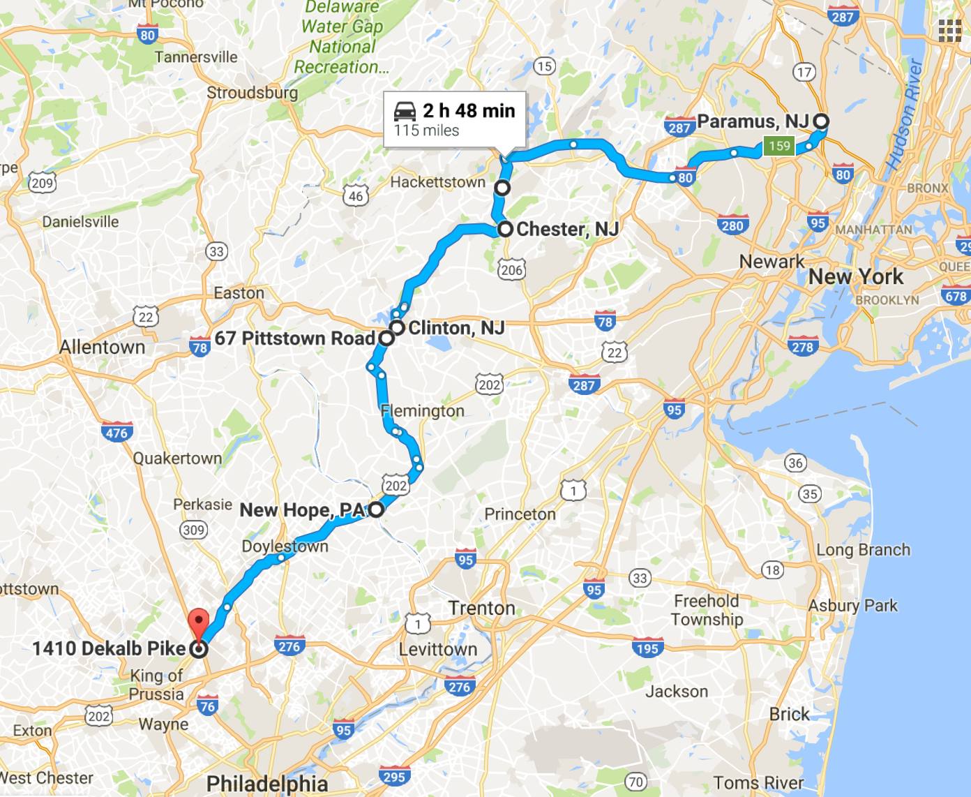
Day 22
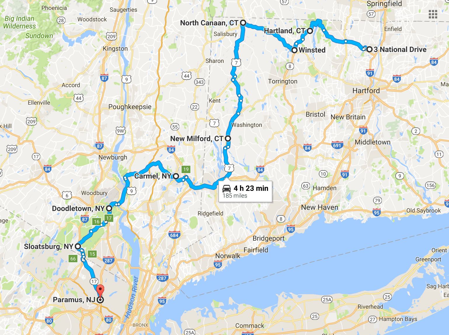
Day’s distance: 299 miles
Total trip distance so far: 5,161 miles
The temperatures reached 88 today after starting in the mid 60’s. I didn’t get caught in any significant rainfall but many of the roads were wet, especially this morning. It was humid all day.
Because today’s route was a collection of specific short rides with lots of via points, it took two google maps to recreate my GPS map here. For folks interested in seeing more detailed maps, click these links to open google maps: First half of the ride Second half of the ride.
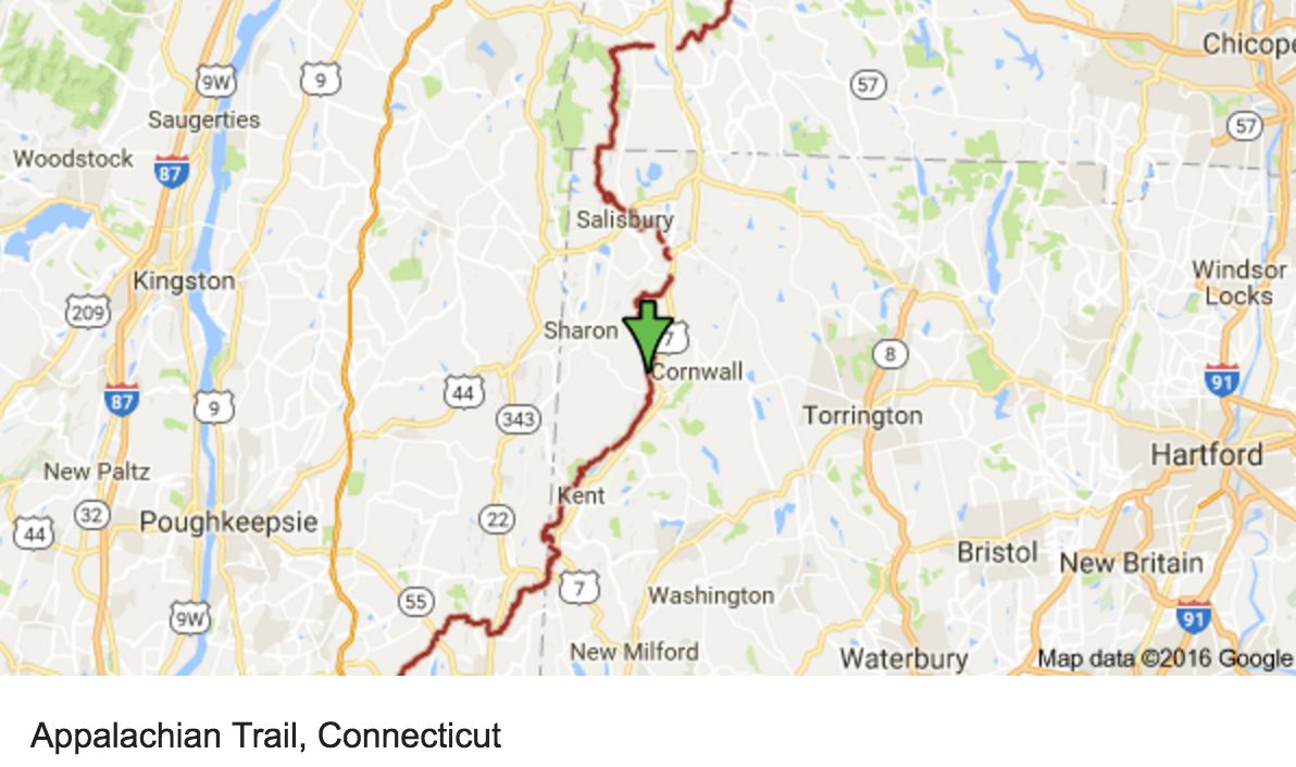
I used motorcycleroads.com to help route my way through much of my tour. Today, I was inspired by the Northern-CT-Appalachian-Mountains-Ride, the NY-Route-301, and the Seven-Lakes-Drive. This site offers a great service and is a super useful tool to aid in trip planning if you wish to avoid the interstates. I also use Butler Maps when I have one for the area I’m riding through.
As the name suggests, the Northern-CT-Applachian-Mountains-Ride travels very near the Appalachian Trail in Connecticut.
The NY-Route-301 ride was probably my favorite of the day. Two lanes and 55mph made riding through the non-technical twists quite fun. This route was patrolled heavily but popular with bikers.
The Seven-Lakes-Drive took me through the Bear Mountain and Harriman State Parks and slowed down once I left the Palisades Interstate Parkway used by folks traveling into New York City.
I did get a late start this morning and didn’t get the bike topped off until 10am. This would be a long day, but I stopped often, anyway.
Here is a photo of Hwy 20 between Granby and Hartland in the Tunxis State Forest.
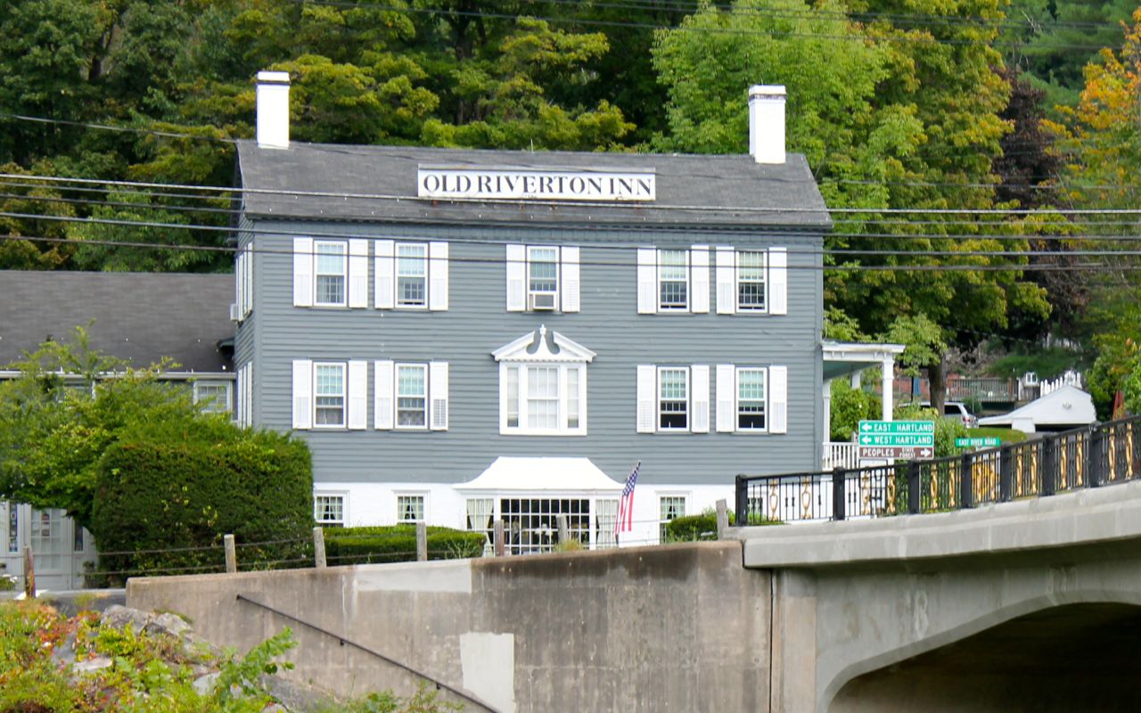
I passed by the Old Riverton Inn. Currently a B&B, it was a historic stagecoach inn built in 1796.
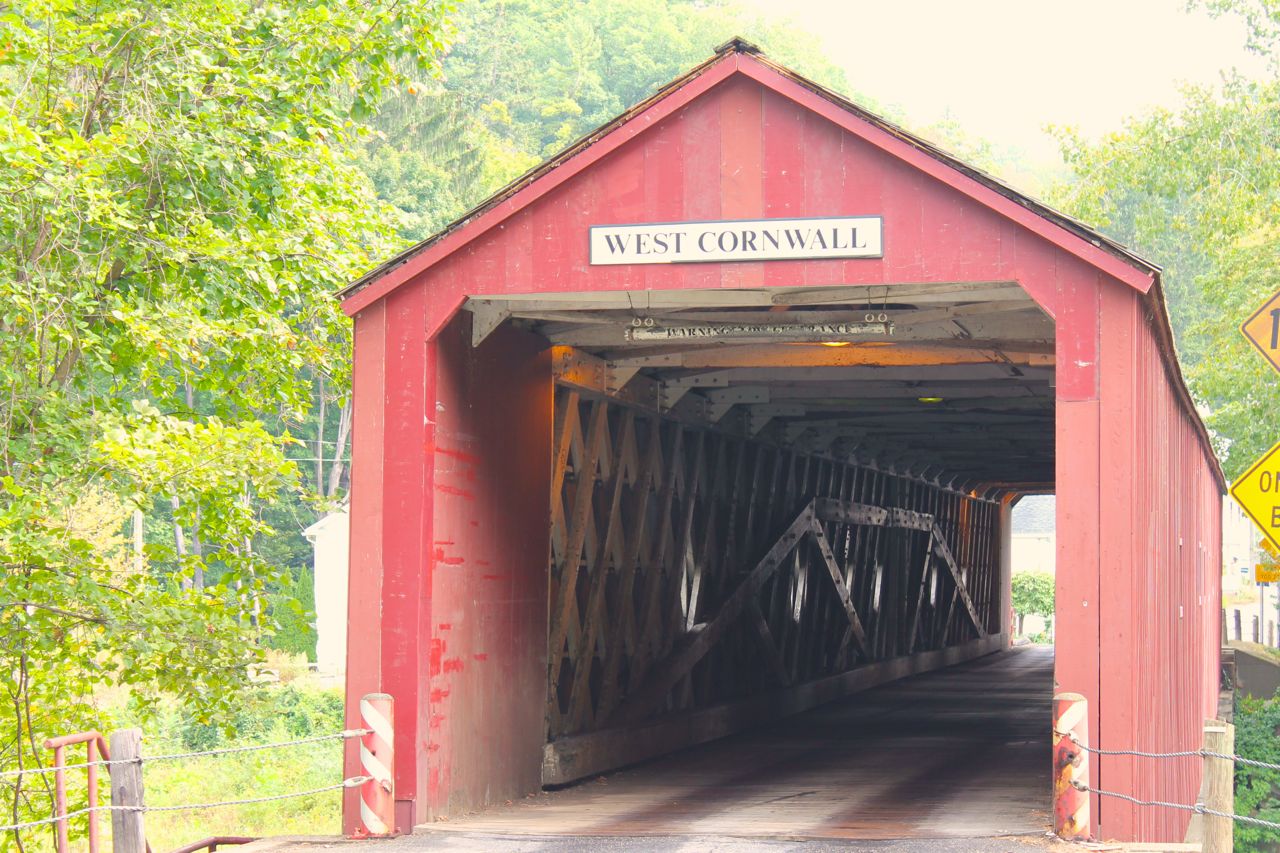
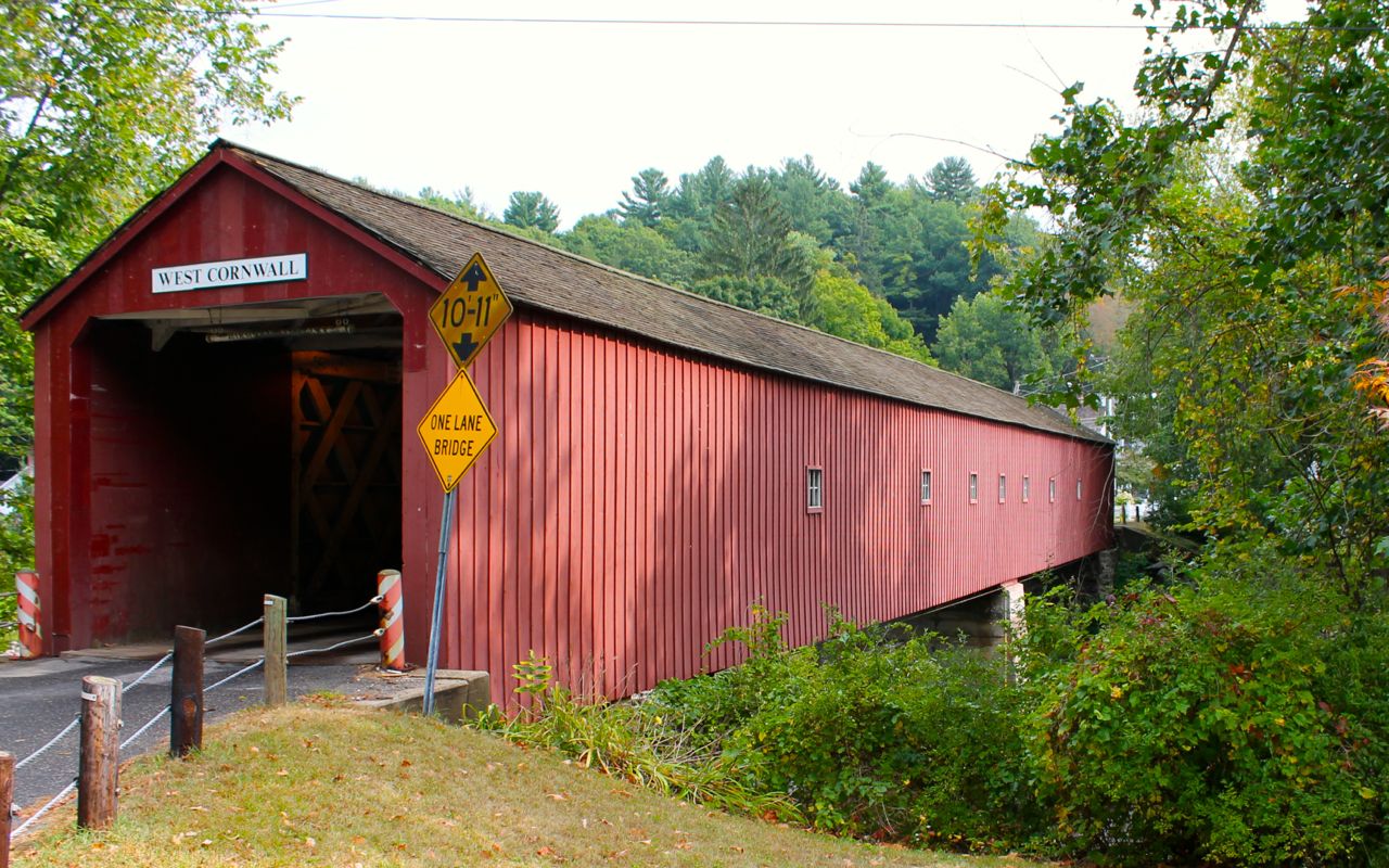
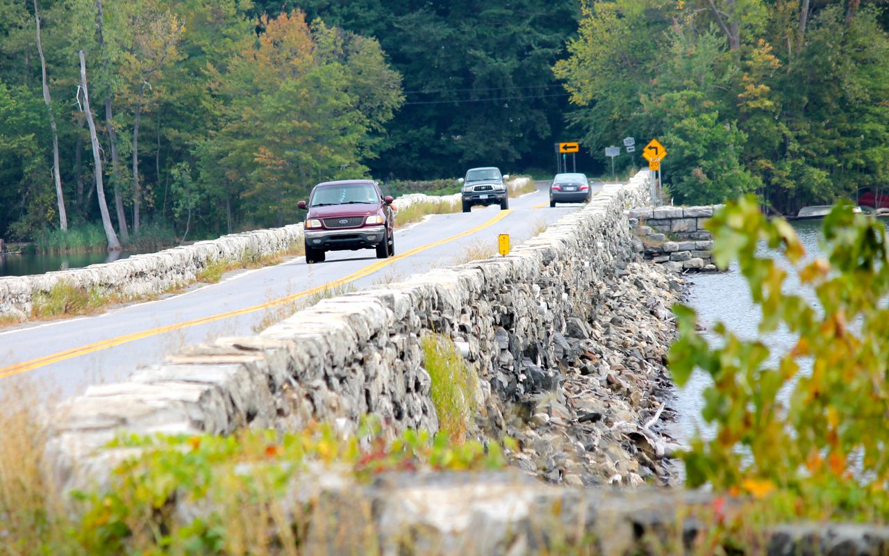
I could not leave the Northeast without taking time to look at least one covered bridge. The West Cornwall Bridge was the one I stopped to photograph today.
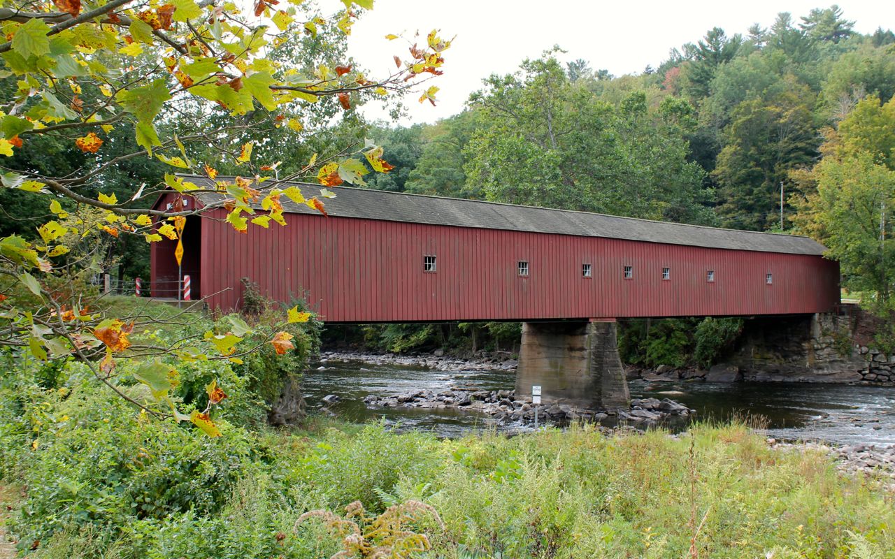
Crossing through (or do you still say over) the bridge to take photos, I noticed the Wandering Moose Cafe.
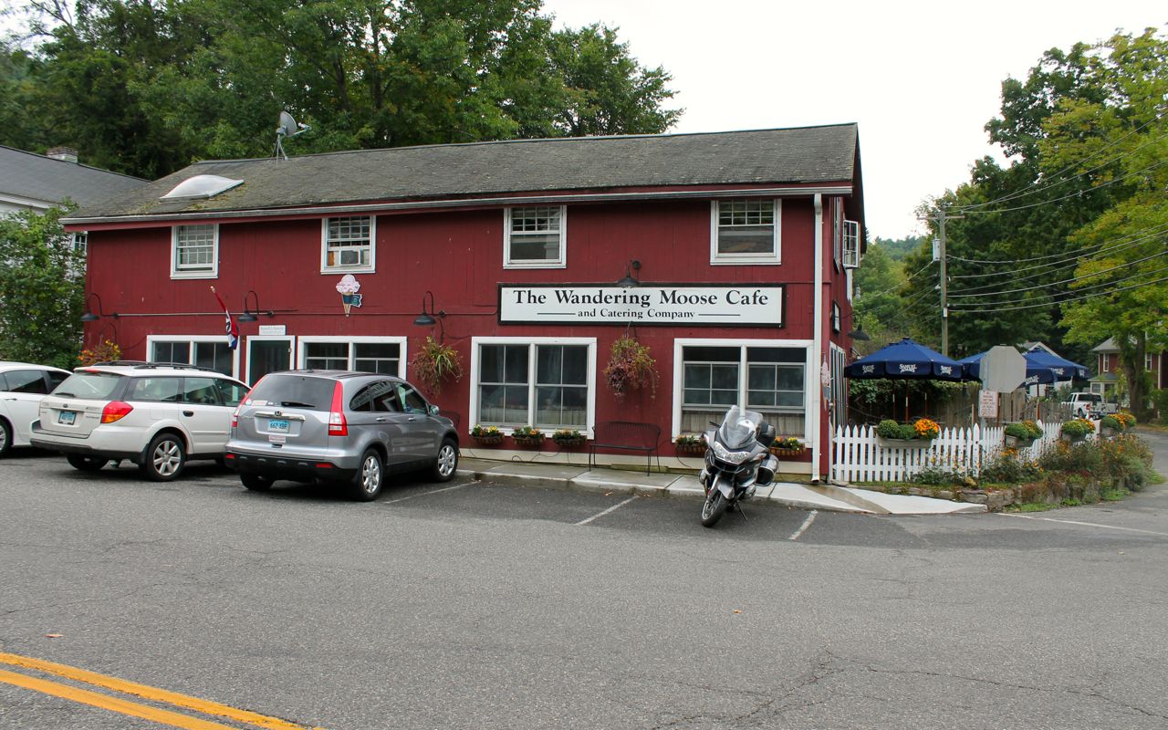
Since it was lunch time, I decided to eat. I ordered a chicken pot pie. It was a big pie, about eight inches across.
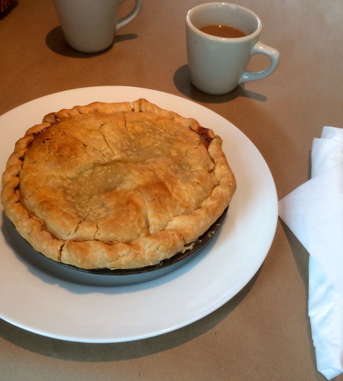
It was incredibly tasty and really hit the spot. Highly recommend stopping here if you’re in the area.
Picking up the pace, I reached route 301 and stopped only to take a photo of the low bridge used to cross a small reservoir.
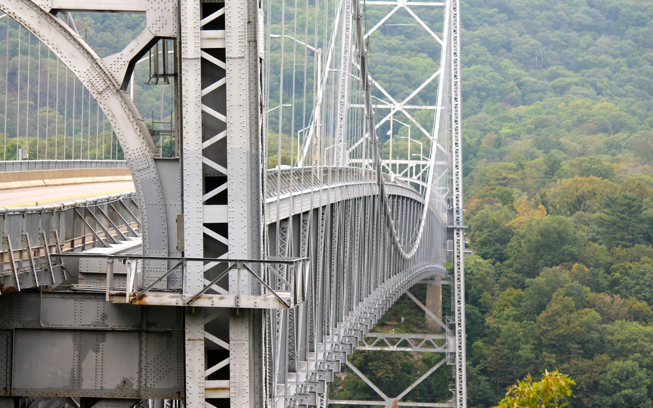
I would travel down part of the Hudson River Valley hoping for some great views but Hwy 9D instead was tree lined and private property and private drives lined the roadway. My only shot of the Hudson River Valley was taken from the Bear Mountain Bridge.
After the Seven Lakes Parkway, I traveled interstates and highways that took me into Pennsylvania where I’ll be visiting my sister. Despite best efforts, I didn’t arrive at her house until about an hour after dark.
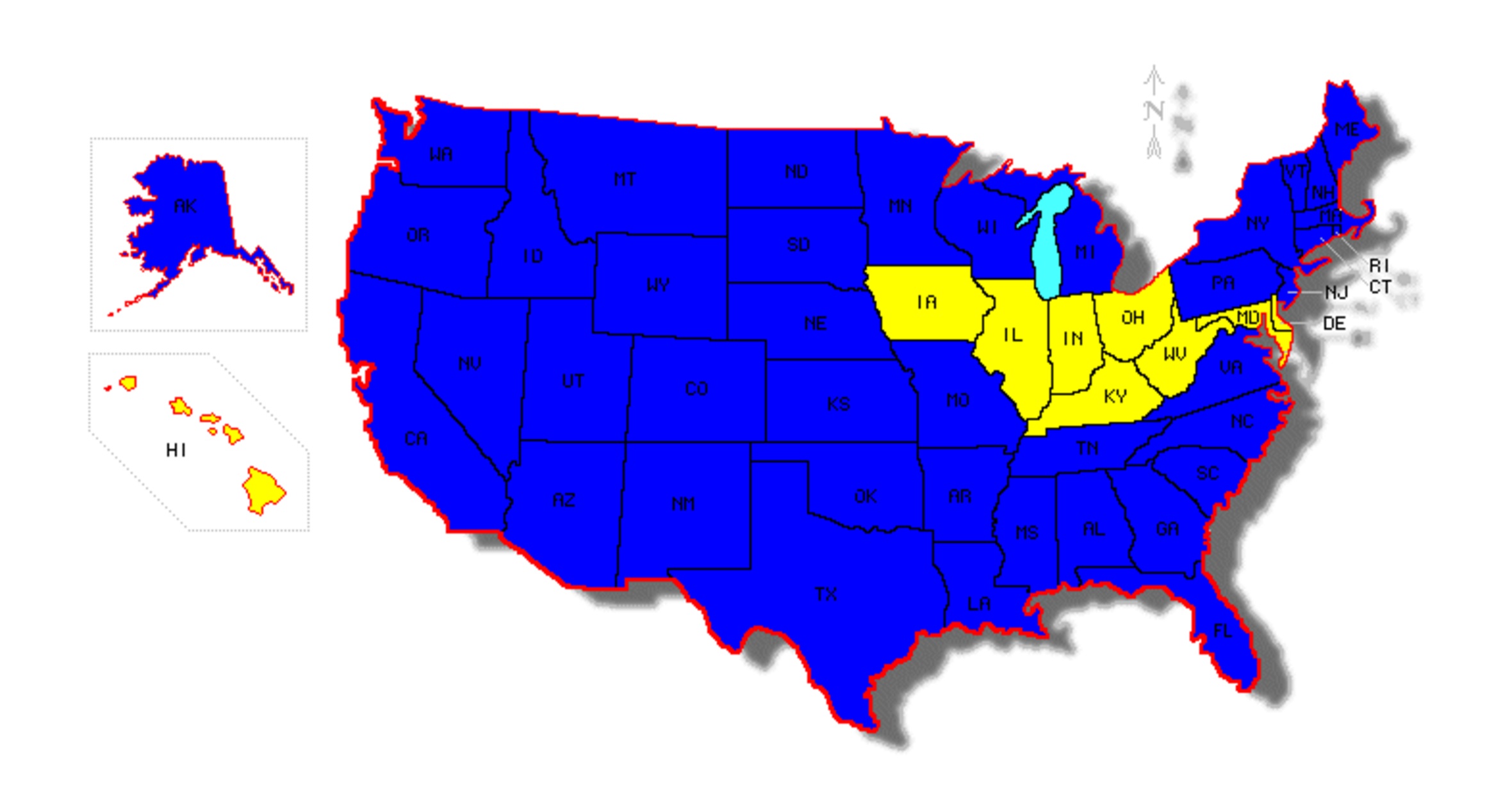
I have updated the map to include New Jersey and Pennsylvania and also correct an inaccuracy from yesterday – I have yet to ride in Kentucky. Just give me a little more time and I’ll remedy that. 🙂
The weather tomorrow is predicted to be rainy. I’ll spend the day off the bike visiting. Wednesday I’ll hit Delaware and Maryland.
Day 23
Day’s distance: 0 miles
Total trip distance so far: 5,161 miles
It rained throughout the day and there was a t-storm this morning. Temperatures seemed to hover in the 70’s.
I’m visiting my sister. I worked a bit in the morning. My sister bought me lunch at a local Thai restaurant for lunch.
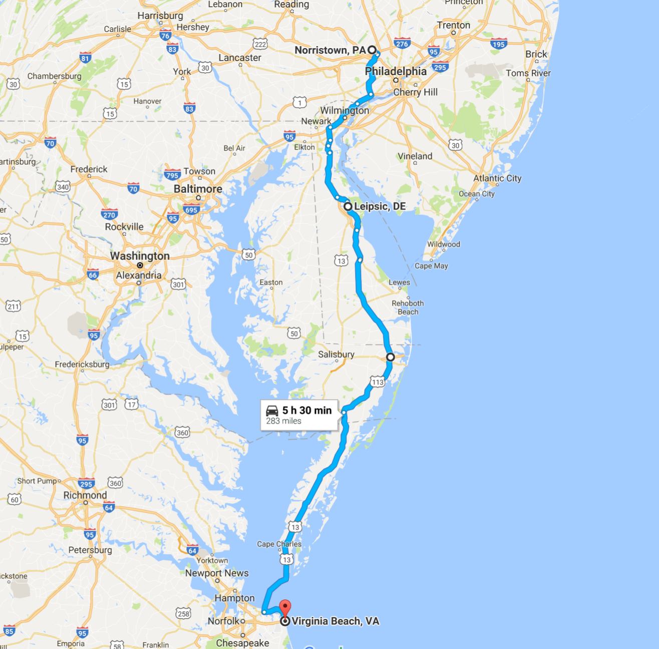
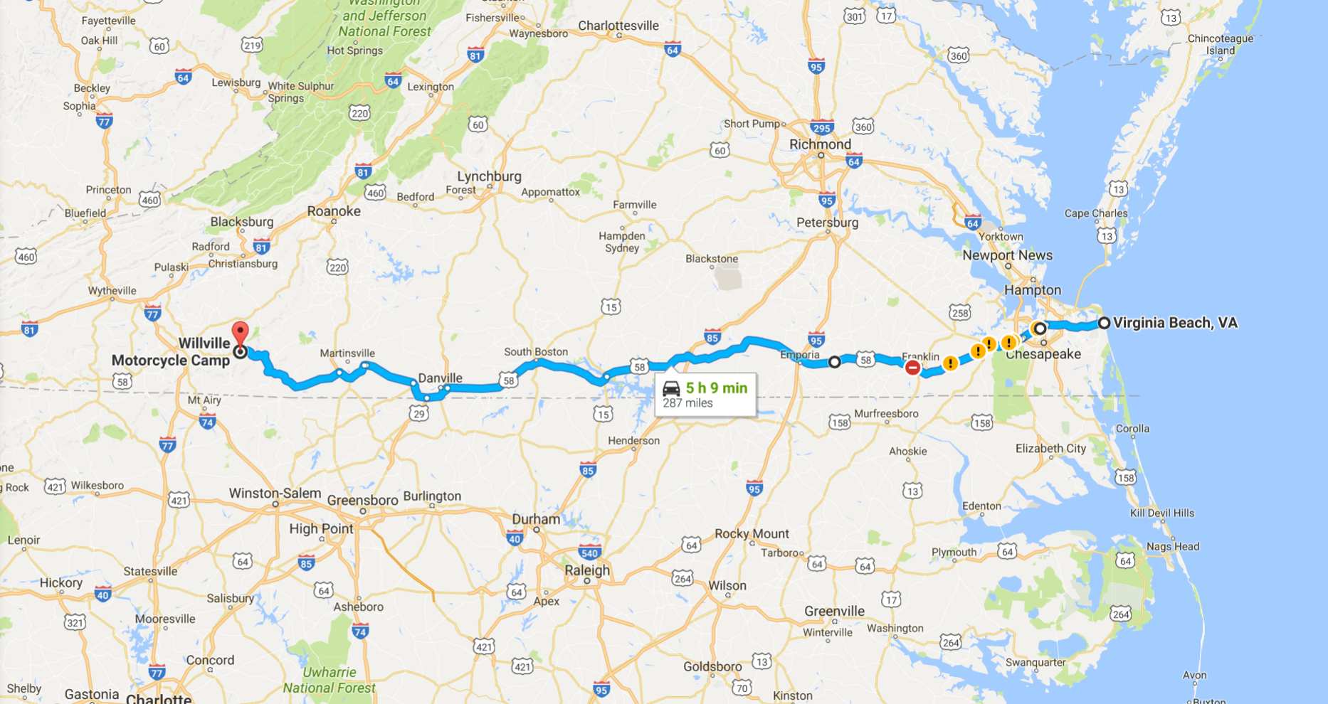
In the afternoon, I got some laundry washed, finished catching up with work, checked the bike’s oil levels, tire pressure and general condition, and planned tomorrow’s route through Delaware and Maryland and across to Virginia Beach where I made reservations at Oceanfront Ramada.
I plan to stay in Willville, a motorcycle only campground in southern Virginia on Wednesday and probably also on Thursday, depending on the weather.
I’m two days ahead of schedule at this point, but will need to use one day to add an exploration of southern Ohio to my current plans. It seems my earlier route plans missed the state completely. 😦
Day 24
Day’s distance: 294 miles
Total trip distance so far: 5,455 miles
Temperatures ranged from the high 60’s to the high 70’s. The morning started off cloudy and I rode through some light showers. After lunch, as I continued towards Virginia Beach the rain started. It rained pretty steady until reaching my destination, a result of a the tropical storm / depression Julia.
Back on the road after one day off to visit my sister, I was heading south into Delaware and then continuing along south into Maryland and across the Chesapeake Bay Bridge Tunnel.
I chose to take Hwy 9 along the Delaware shore line. This is a two lane road that travels through the estuaries, channels, nature preserves, farms and the occasional small track of suburban homes.
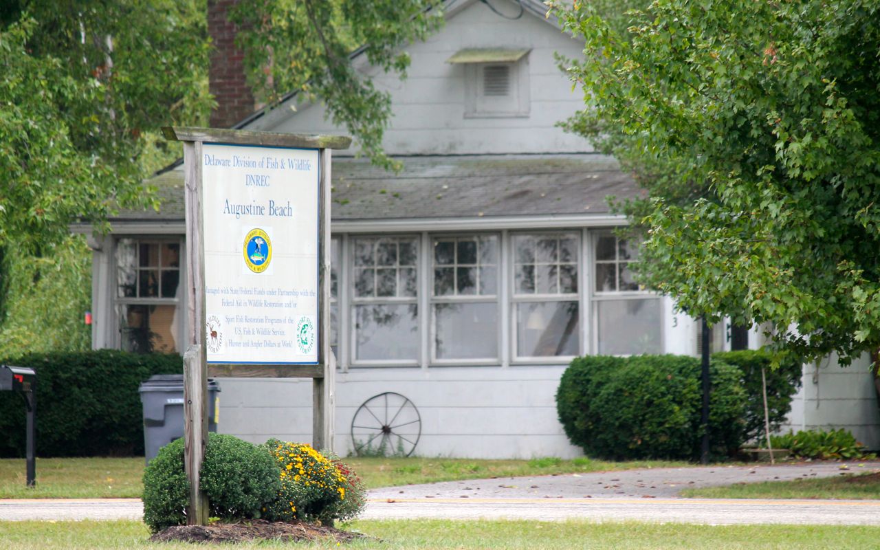
I stopped at the first opportunity to take a picture of the shore, Augustine Beach.
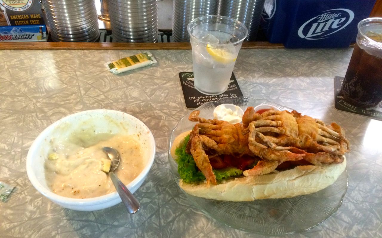
As I rode south, I was looking foward to having lunch at a restaurant recommended in the amenities listed for the motorcycleroads.com route I used for inspiration. Sambo’s Tavern was the place to be and I happened to arrive just minutes after they opened at 11am.
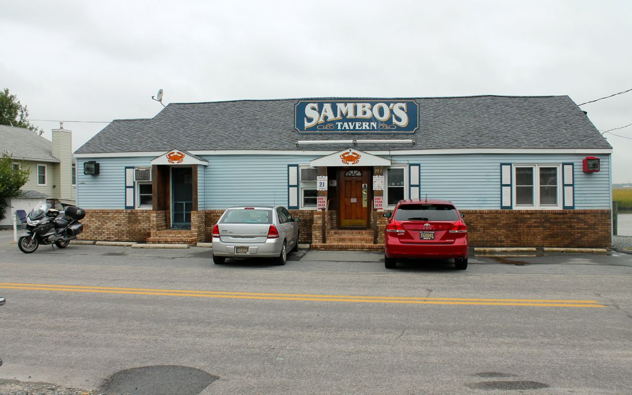
I wanted to try a soft shelled crab sandwich as my food experiment of the day. It was delicious! I also had a bowl of crab chowder, which together filled me up. Definitely recommend the sandwich.
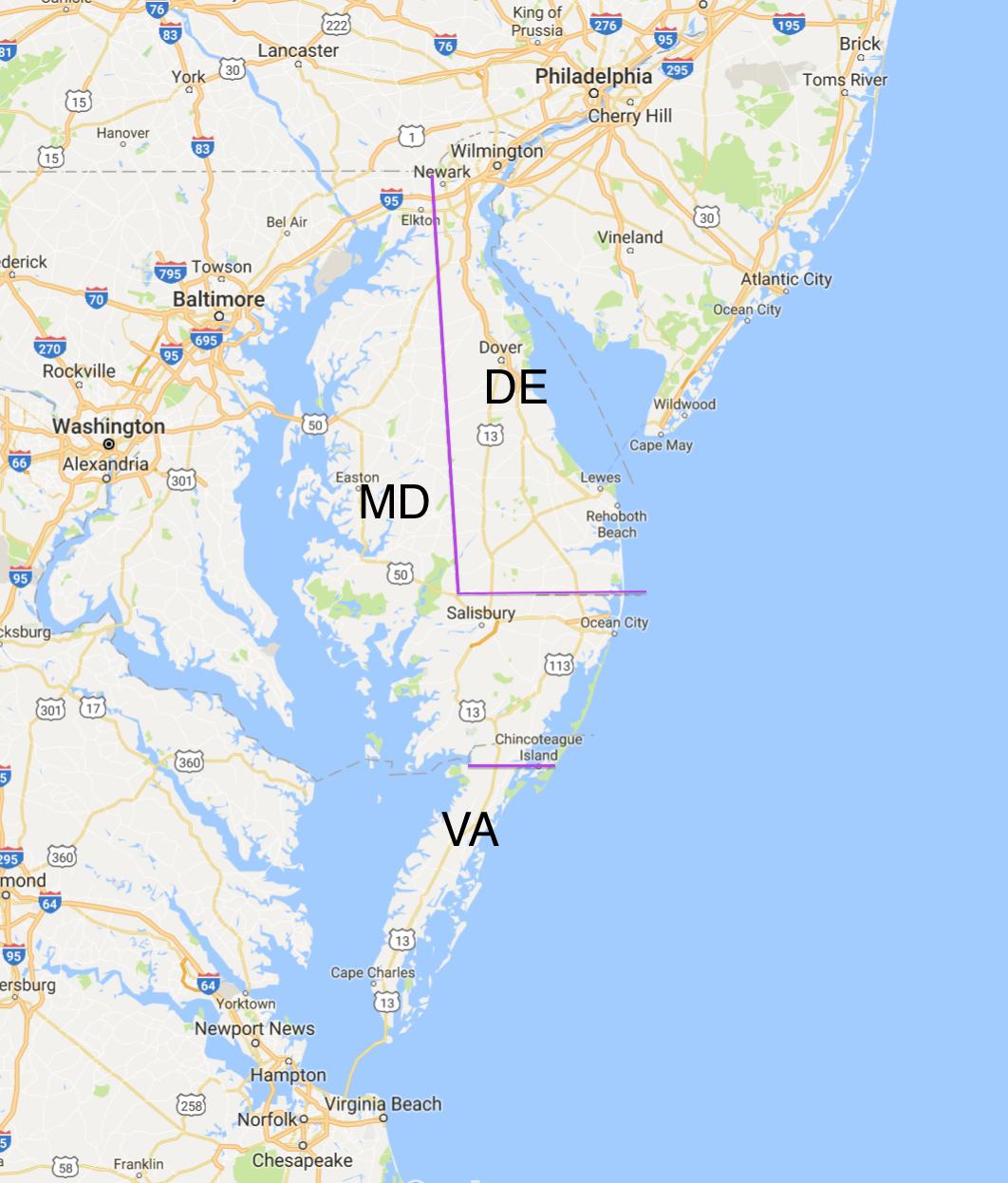
Continuing south, I crossed into Maryland. It was showering and Hwy 113 was less picturesque, so I didn’t take photos along this section.
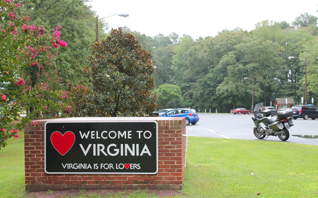
I was surprised when I crossed into Virginia before the bridge. I knew Maryland occupied some of this peninsula but Virginia does as well!
Here I am at a rest area for a quick landmark photo (with my motorcycle). 🙂
I was looking forward to taking the bridge and tunnel into Virginia Beach. I’m not sure why but I was expecting more tunnel than bridge, but there were actually only two short tunnel sections between long two-lane (each way) bridge spans.
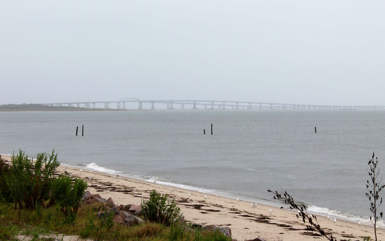
The bridge sections, as mentioned, had two lanes in each direction and each direction was a separate bridge, so you never interacted with oncoming traffic. The tunnel sections, however, were one-lane each direction and both lanes were joined in an undivided narrow tunnel. It was quite intimidating entering the first tunnel! No wonder they have signs inside the tunnel saying maintain your speed.
Exiting the bridge on the mainland side, I quickly realized it was rush hour in Virginia Beach. So I added to the congestion and hopped on another freeway for the 10-mile run to my oceanside hotel.
It was raining pretty hard and I kept a close eye out for standing water on the roadway, but I arrived without incident.
Here’s the view from my hotel balcony.
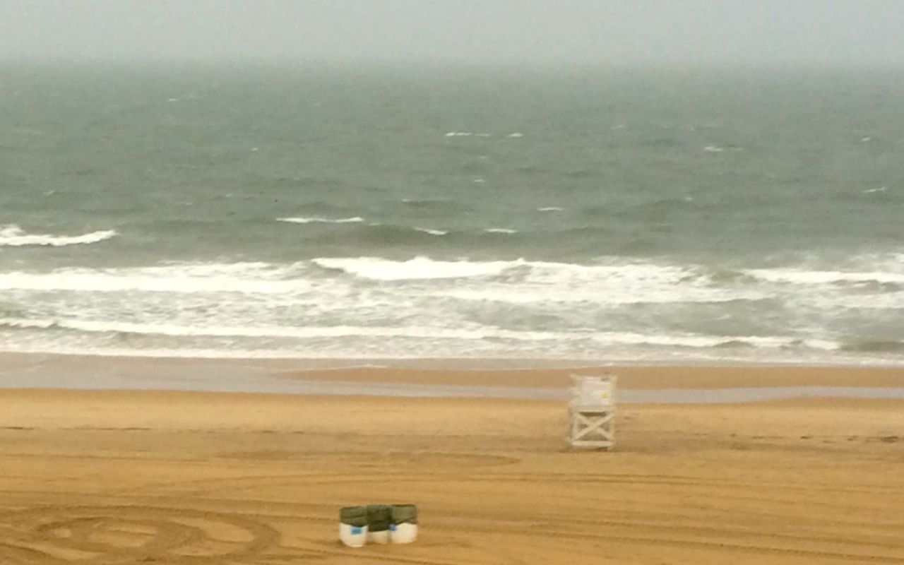
As the weather predicted heavy rain and high winds on Wednesday as well, I decided to camp out here and wait it out. So, tomorrow is going to be an unscheduled day off the bike.
I will use the day to work on my route across the remaining states and to Sioux City where I will celebrate achieving 49 states of my 50 state goal.
Day 25
Day’s distance: 0 miles
Total trip distance: 5,455 miles
Today was a day off the bike. It continued to rain with the exception of early afternoon. I took the opportunity to play in the waves. The ocean was surprisingly warm.
Besides playing in the ocean, I was able to get some laundry done and fix a website bug and do some QA testing for work.
I decided on my route from Virginia Beach to Sioux City, and posted a daily breakdown here.
I would not have planned another day off so soon, but it was fun to celebrate being on the coast for another day. Even though it was still a bit stormy, I feel lucky to have had time to play in the water.
Tomorrow we say goodbye to the coast and begin the long trek west and back to Seattle.
We have just six states remaining!

Day 26
Day’s distance: 331 miles
Total trip distance: 5,786 miles
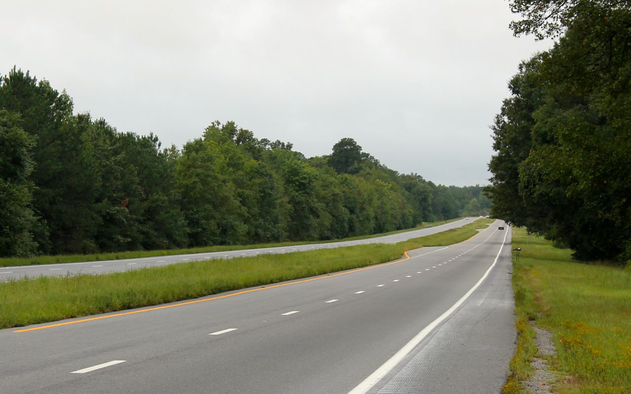
Starting early, before dawn actually, gave me the advantage of both a break in the rain and light commuter traffic. I avoided most traffic but the rain started up again in Norfolk and showers persisted throughout the early afternoon along my entire route. Temperatures were in the high 60’s and 70’s.
I took two interstates to get to Hwy 58, but then I stayed on Hwy 58 for the entire day. It was all two-lane each direction and when it wasn’t going through a built up area, it looked like the photo below – not too scenic, not very hilly, not very curvy. I think I stopped for coffee three times, it was that exciting.
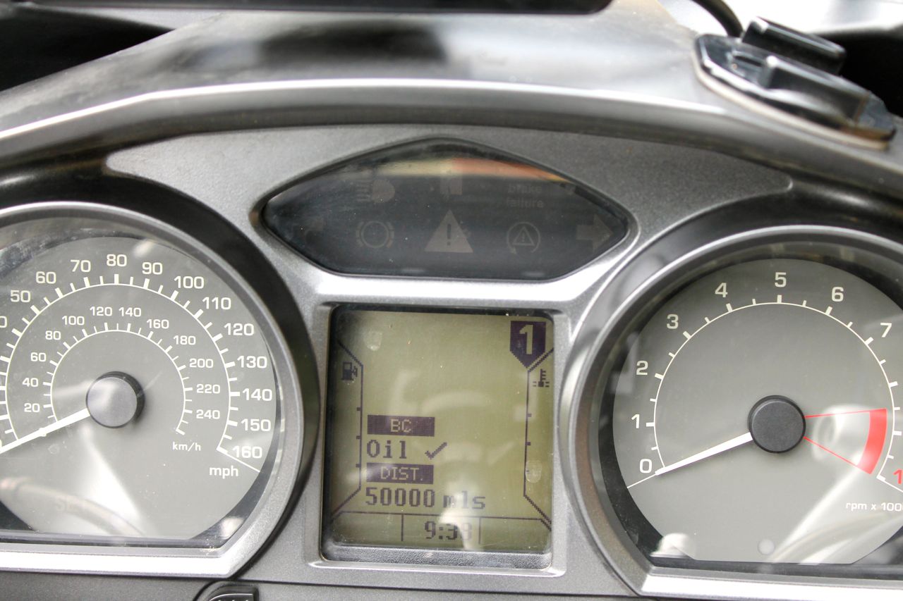
I hit a milestone on the bike today – 50,000 miles! That represents some very good times and a few epic adventures across 43 different states.
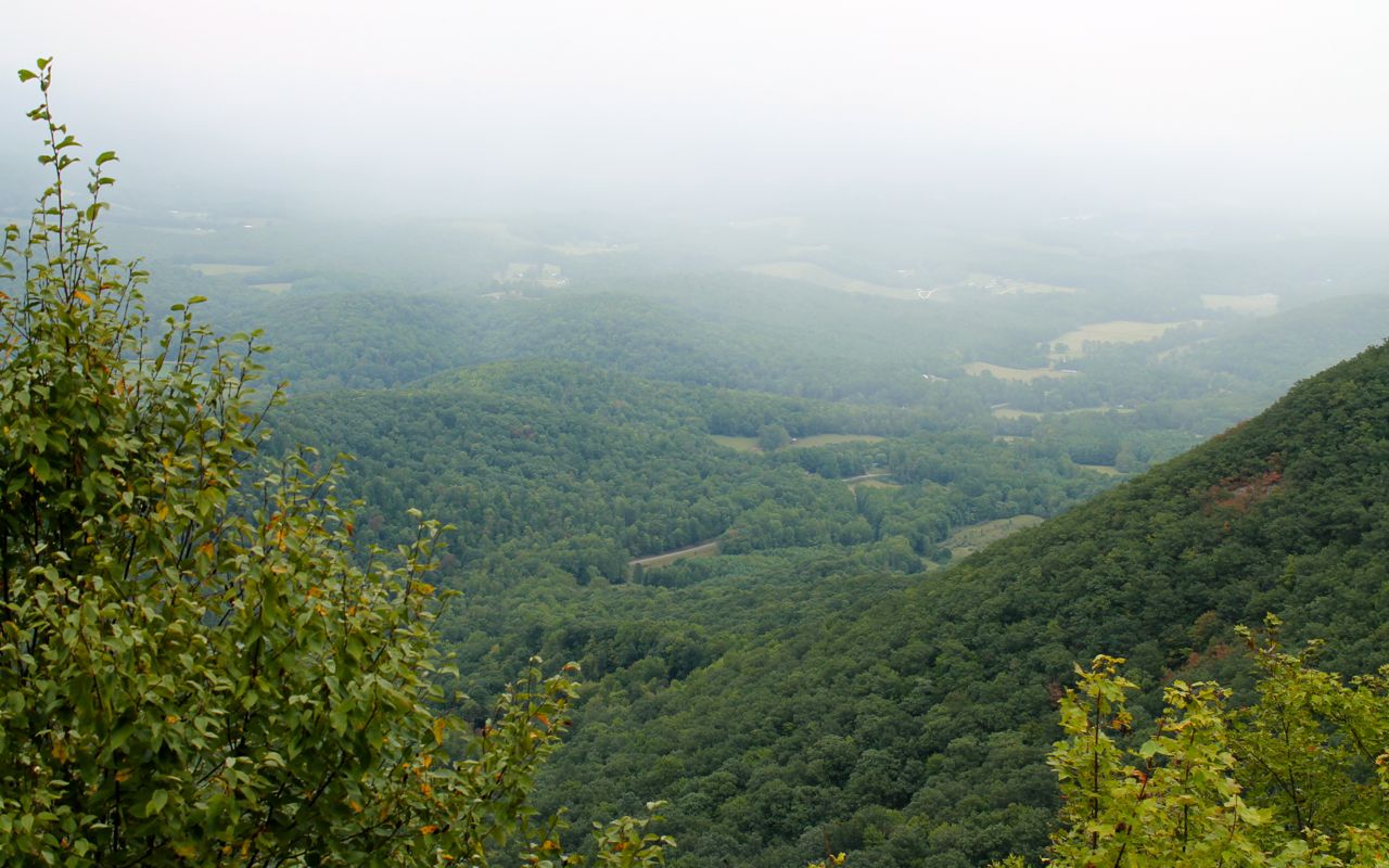
I didn’t take many photos today due to a combination of bad weather and uninspiring landscape. However, as Hwy 58 reaches Stuart, the landscape becomes more interesting quickly. Below is a vantage point called Lover’s Leap. It’s a popular viewpoint on Hwy 58 …
and just seven miles from the motorcycle only campground.
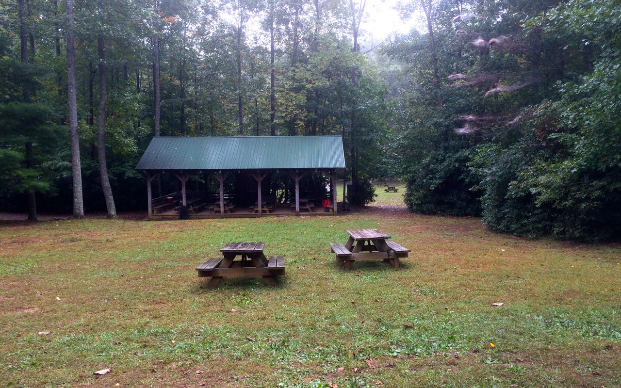
I arrived in the afternoon and joined others at the camp in motorcycle related conversation. It turns out that just this last weekend, the Twin Valley Riders Club held a rally here at Willville. These were some of the folks I met over Memorial Day weekend last year while camping here. Too bad I missed them 😦
I waited until roughly 5pm to set up my tent to ensure the rain had stopped for the day.
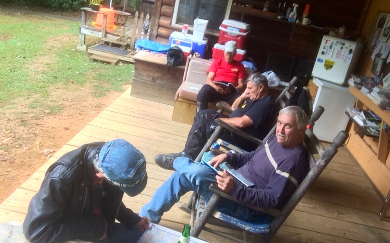
At that point, five of us rode into Stuart for dinner at the Stuart Family Restaurant. The skies were clearing up quickly and the fried chicken dinner was quite good. This day was just getting better!
There should be more photos tomorrow as I travel into West Virginia. The forecast is warmer and drier as I think I’m finally out of the rain for the next week. 🙂
Day 27
Day’s distance: 247 miles
Total trip distance so far: 6,033 miles
Temperatures ranged from high 60’s in the morning to the low 90’s in the afternoon. Fluffly cumulus clouds and bright sun shared the day with a bit of humidity.
I chose my route today based primarily on a ride reviewed in motorcycleroads.com , titled SW Corner of West Virginia on Route 10. It was rated 5 stars for scenery and 4 stars for road quality. Described as having “… a couple of sections that are up and down a mountain with constant switchbacks from start to end of the up and down”, it sounded like it would be a good ride.
Instead of traveling south, I would be heading north, starting in Princeton, WV. To get there from Willville, I would take Hwy 58 to I-77 and I-81. Before getting on the interstate, I stopped to get gas, top off the oil and check the pressure in both tires. I saw two other bikers, one local and one traveler, and answered the local rider’s questions he asked about my bike.
It was a late start for me. Packing up camp involved drying off the dew from the rain fly and ground cloth of my tent as best I could and letting them air dry a bit more before packing them away. This is important because the tent and sleeping bag are packed side by side in the top case.
Anyway, it was 10:30 before I got onto the first of the interstates. They were 65mph and 70mph, so the first part of today’s ride went quickly.
On reaching Princeton, I headed to the Starbucks my GPS told me was about 5.5 miles away. It turned out to not exist. 😦 Garmin maps have, in the last week, directed me to a total of three phantom Starbucks. That is really annoying. I gave up on the idea of a latte and grabbed a sandwich at a Subway, instead.
It was time to hit Highway 10.
I first passed through a number of unincorporated towns and very small communities, all of which seemed to be terrible run down, very poor areas. Many businesses were boarded up and many former industrial buildings in extreme decay. For someone from Seattle, a vibrant town – one of the fastest growing areas in the country, it was shocking to see the conditions here. I presume this is a result of the rapid shrinking of all things related to the coal industry.
It seemed uncomfortable to photograph most of this. I didn’t want to dwell in the sadness that is the daily life of the folks who are still living here.
Much of Hwy 10 follows a narrow valley. Homes filled many of these valleys, along with train tracks and small creeks and rivers. Some of the areas were pretty and appeared to escape the economic blight I first saw.
The three or four twisty sections of roadway were the highlights of this route. I recorded the southern most section on video and posted it to my YouTube channel without much editing and I am reposting it here.
Outside of the twisty sections, I would not recommend this ride.
Besides the towns interrupting the flow, there were homes and businesses along a vast majority of the ride. This means lots of hidden driveways as well as cars and homes along the side of the road. Also, there were few turnouts and much of the roadway lacked shoulders, making sections a zero-tolerance-for-mistakes type of roadway. Finally, traffic steadily picked up as I approached Huntington. The ride became simply a parade of cars towards the late afternoon.
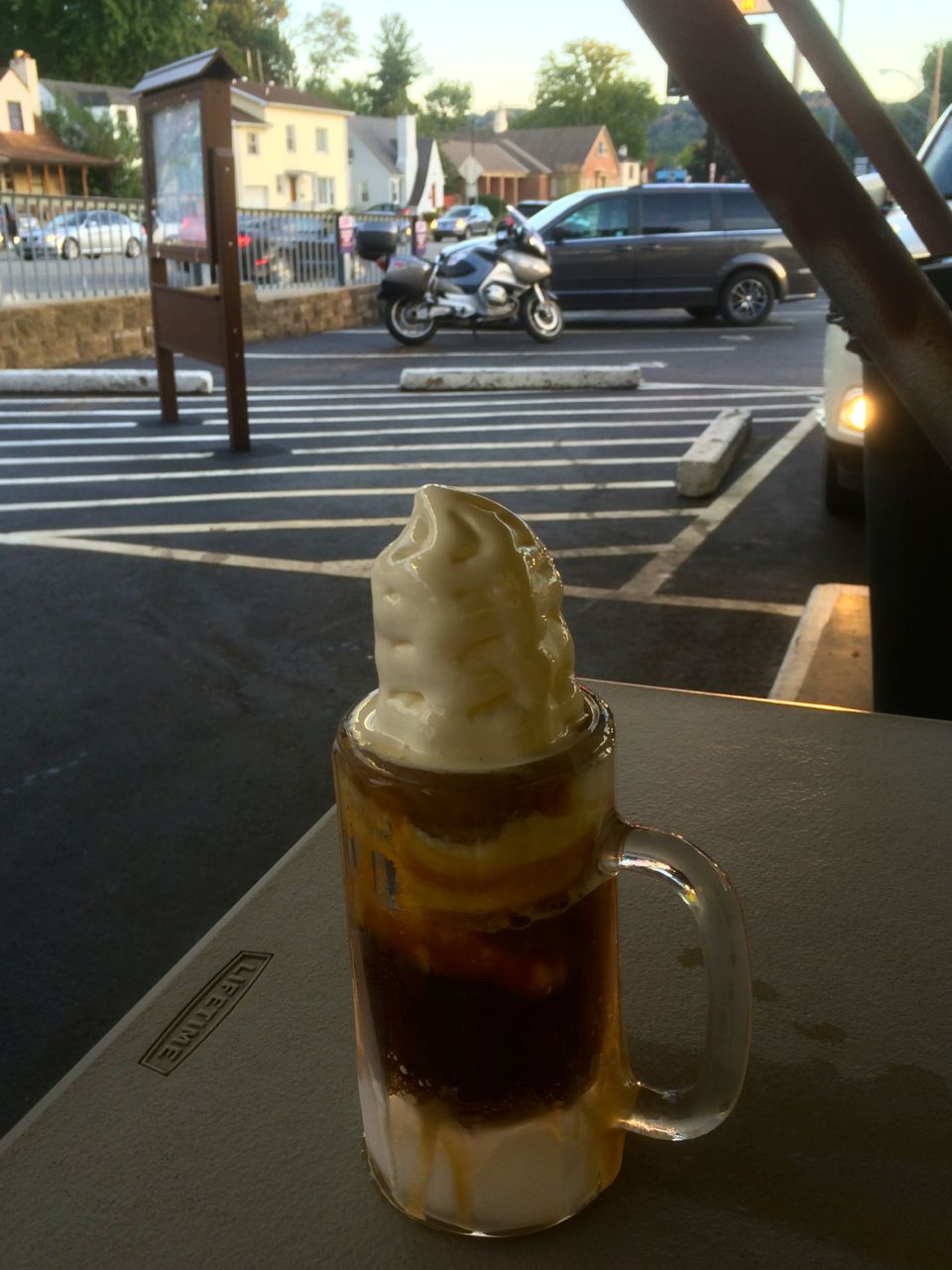
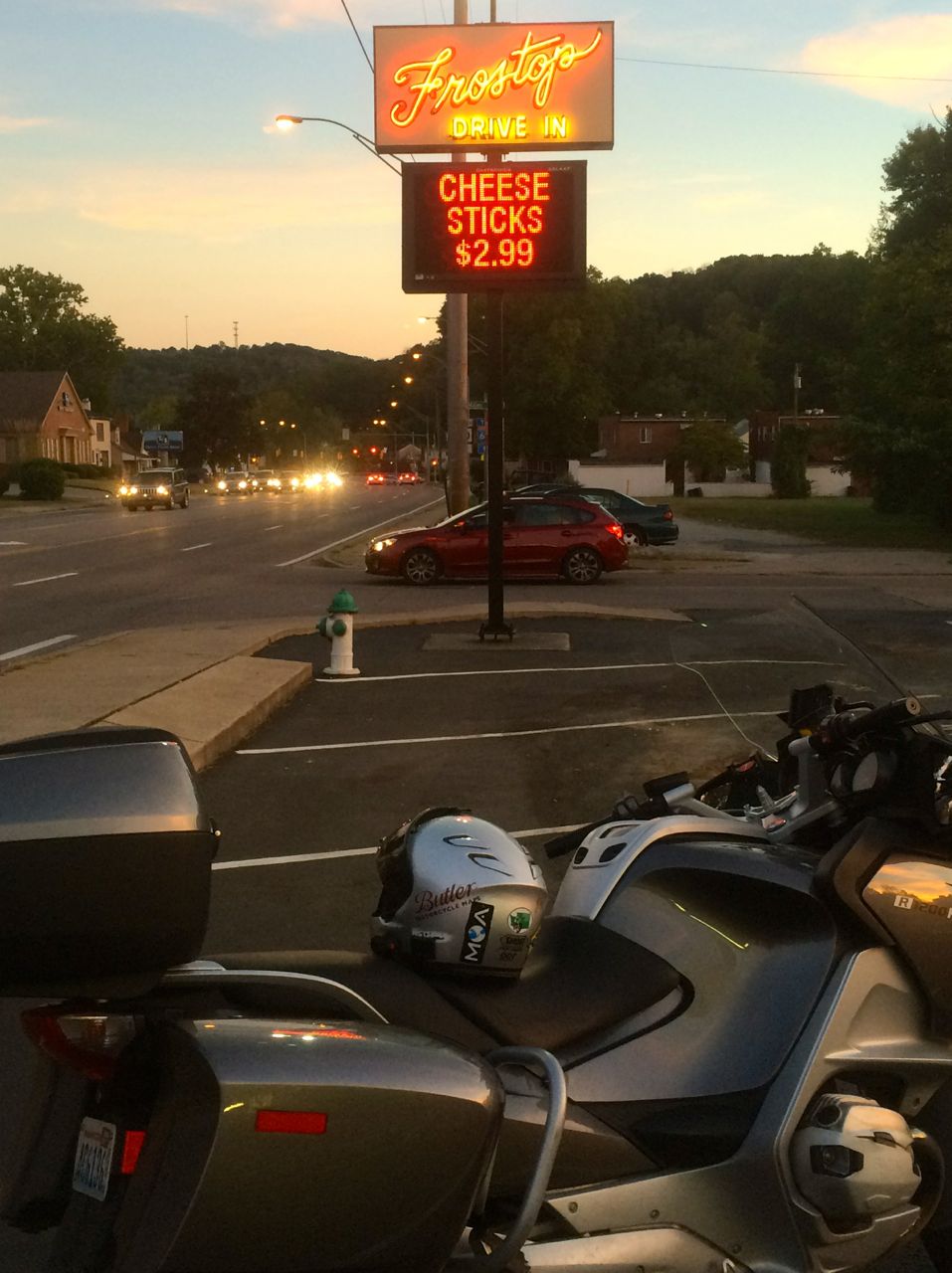
After checking in to the motel and cleaning up, I rode to Frostop, a drive in that was established in Huntington in the early 60’s. The best part was a cool root beer float.
I have learned to read the routes recommended in motorcycleroads.com more carefully. I was already using filters for scenery and road quality. Going forward, I will also look for the opinions of reviewers other than the author.
Using what I’ve learned, I’ve decided to shorten tomorrow’s ride by eliminating the first section. It was reviewed by others but only deemed to be average. Tomorrow is predicted to be another warm day.
I got some suggestions from the staff at Frostops about visiting some caves in Kentucky. I might save that for the next trip, but I appreciated the suggestions very much.
Day 28

Day’s distance: 209 miles
Total trip distance so far: 6,242 miles
The temperatures ranged from the low 70’s to the low 90’s. Skies were sunny and there were some mild winds.
I shortened today’s route, eliminating the initial portion through Crown City Wildlife Area. This gave me an opportunity to have more time for photos and arrive at my destination earlier. With the days getting shorter, the sun has been low in the sky in the late afternoons, making traveling west a ‘glaring’ proposition (LOL – couldn’t resist).
The ride started with a short trip on I-64 over the Ohio River and into Ohio state. Check another state off the list. I traveled north on Hwy 52, called the Ohio River Scenic Road, but it wasn’t scenic and pretty far from the river.
The GPS took me off Hwy 52 and onto Hwy 335, which was actually pretty nice. I saw several groups of bikers riding in the opposite direction.

After a handful of miles, though, the GPS all of a sudden acted as if I was on the wrong road and couldn’t calculate a route to my destination. When it does this, I am on my own to get back to the route it determined I should be on.
In hindsight, I should have stayed on Hwy 335 until I reached Hwy 123, but instead I turned west at my earliest opportunity. I found myself, just through bad luck, stuck in traffic heading to a weekend fair. I was able to get back onto Hwy 23 north, but was delayed about 15 minutes
Back on track, I turned onto Hwy 124, a two-lane each direction road and went into a more forested and hilly area.

The Hwy 124 separated from Hwy 32 and became a two-lane highway, more my style. 🙂


But then my route took me onto Lapperell Road, a narrow road not even close to being called a highway. I wasn’t sure if the GPS was messing with me again, but my “time to destination” hadn’t changed, so it seemed to know what it was doing.

The road continued through the Pine Lake State Park area.

I was nervous about ending up on some gravel road like I did in my travel north of Yaak, Montana. I didn’t have cell reception and no detailed paper map, so I kept going. When I came out of the forest, I was actually just blocks away from the destination I programmed into the GPS – The Country Crust Bakery. Whew!!

I looked up lunch spots in Bainbridge earlier this morning and read about the Amish bakery. It was well rated and perfect for lunch.
No doubt this was a popular place. A ‘U-shaped’ line took you past an order window. Someone outside suggested I try a pretzel sandwich. The special of the day was a Rueben sandwich served on a pretzel, so I ordered it.

The bakery staff was busy baking the pretzels and breads, desserts, etc. and

the line took you past the registers. The sandwich soon followed.

I shared a table with Cheri, Tony and their son Ryan. Tony’s connection to Seattle was through his time in the Army when he was stationed at Lewis-McChord base nearby. We talked of travel and work and generally enjoyed lunch.

Soon enough I was heading south along Hwy 41. This route was inspired by a review that said it was fun for bikers. It was scenic, the road quality was good, and there were some non-technical twists and hills.


I crossed into Kentucky at Maysville.

Heading into Georgetown, my destination, along Hwy 460 took me past many horse ranches and impressive gates and properties.


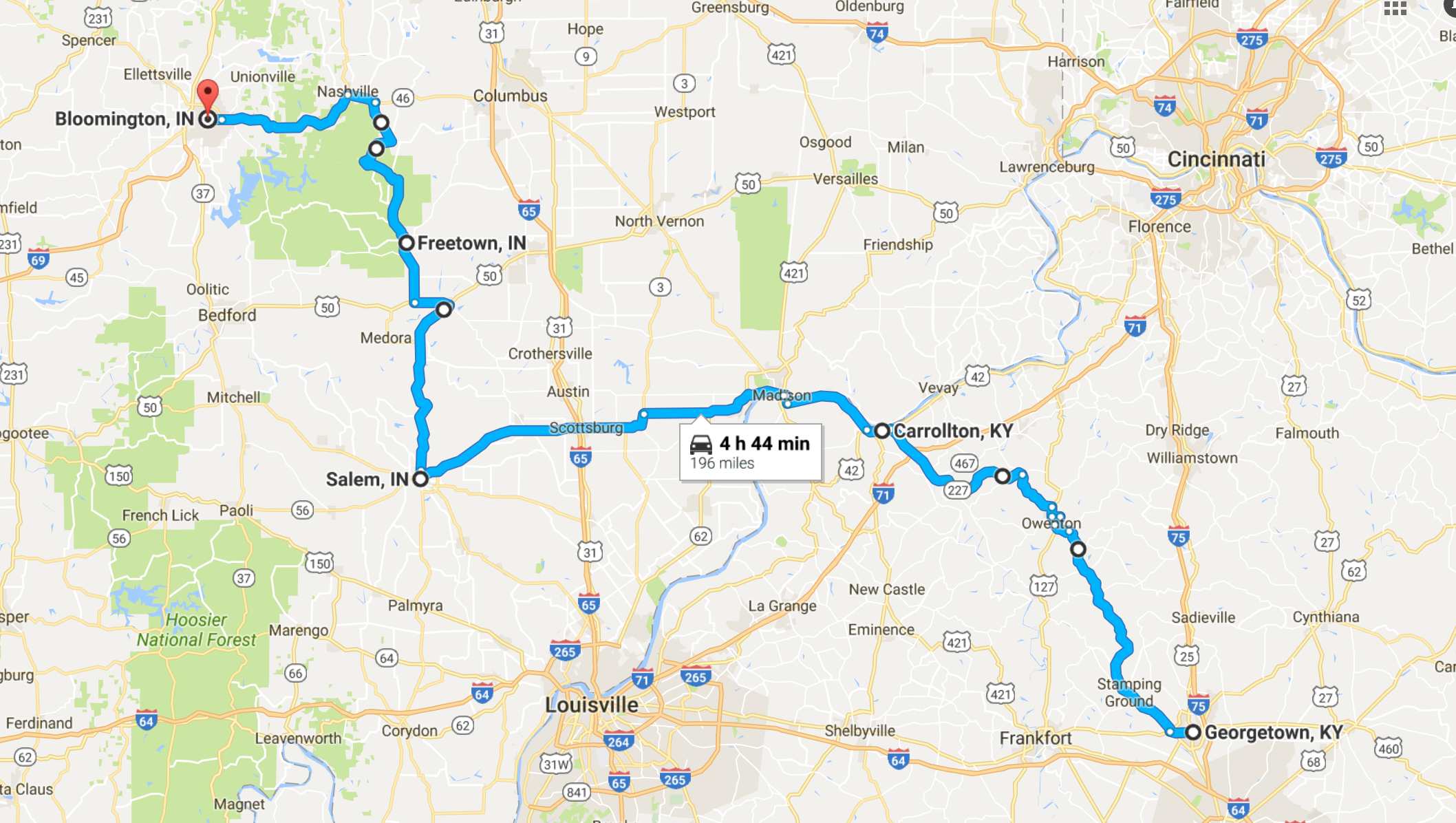
It was a good day, full of meeting cool people and eating a great lunch. I totally live a charmed life. There are three new states left to visit, including Indiana, Illinois, and Iowa.
Day 29
Day’s distance: 202 miles
Total trip distance so far: 6,444 miles
The weather was warm again, reaching into the low 90’s. Clouds built up in the afternoon, but there was no thundershower and they disappeared again.
The route was inspired by two separate reviews on motorcycles.com. And, both roads were quite fun.
In the morning, after stopping for a latte at a Starbucks in Georgetown, and filling the tank, I headed north to Hwy 227. This was a nice quality roadway, with a few frost heaves in spots, and posted speeds of 55mph, mostly. Except for the occasional need to follow another car until reaching a passing zone, one could find a nice rhythm.
There was a northern section after the town of Owenton, KY. It was shorter but together this made for a great ride.
I reach the Ohio river near Milton, KY.
When I took the photo above, I really noticed how dirty the wheels were, and the bike in general. So, before crossing into Indiana, I stopped at a car wash to spruce up the bike.
Then we crossed into Indiana, the 47th state this bike has seen, using the Milton-Madison Bridge.
Downtown Madison was quite busy, there was a fair of some sort and lots of visitors. It was a pretty town, but I wanted to keep going. I followed Hwy 56, more of the Ohio River Scenic Byway, west towards Salem.
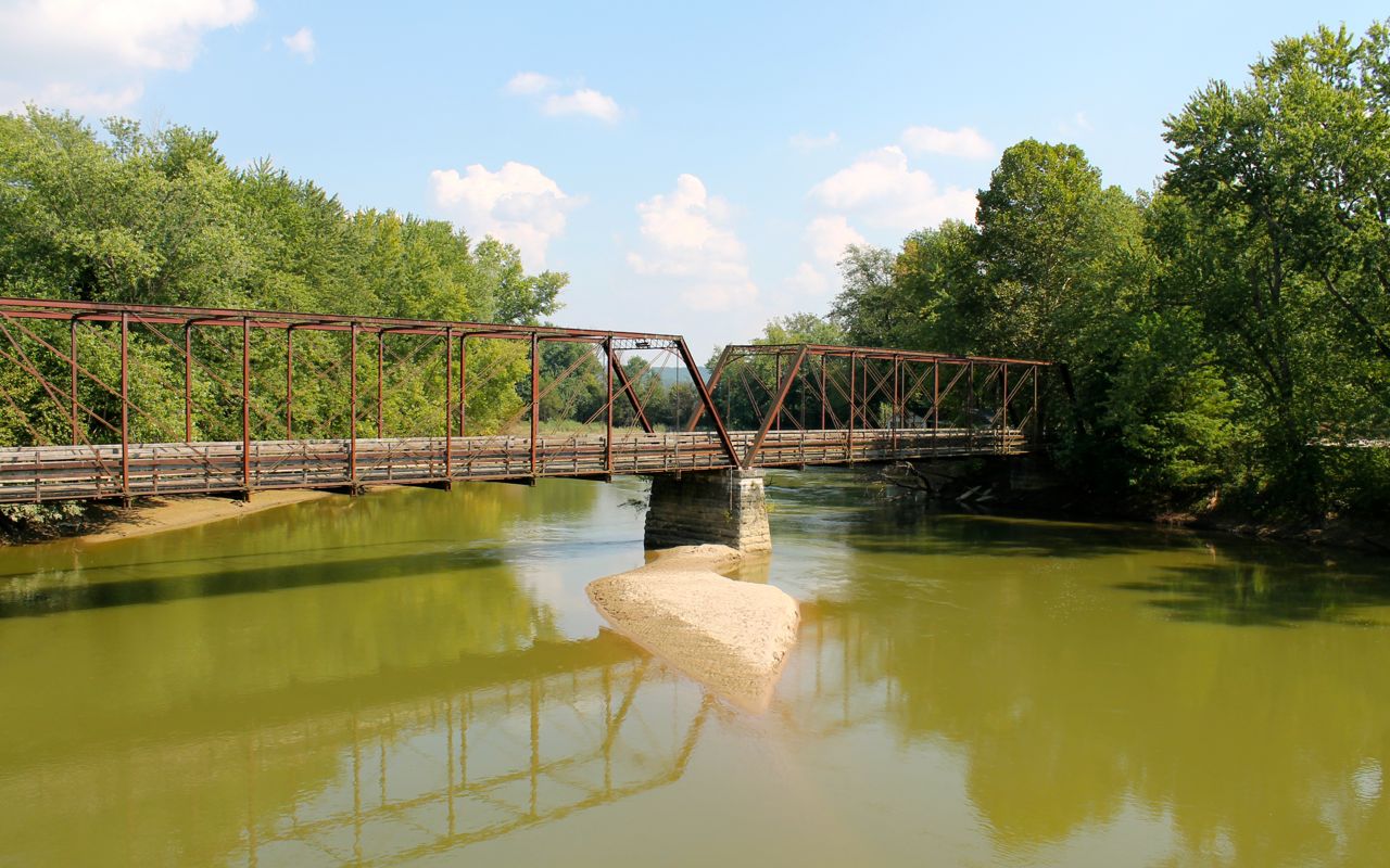
From Salem I would travel north on Hwy 135, another great road. Like this morning’s ride on Hwy 227, this route was scenic and the road surface was of generally good quality. My GPS diverted me onto a side road in Vallonia. I was pretty suspicious, but followed it for about 3 miles, stopping on a bridge to take a photo of another, older bridge, but then it turned to gravel and I returned to Vallonia.
I’m not sure what happens when my GPS routes me like this. I suspect these side roads have exaggerated speed limits (this was posted 45mph) and the GPS uses that to figure out the quickest route to my destination.
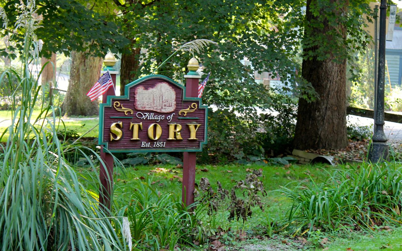
Oh well, no harm and no foul. I detoured using Hwy 50 until reaching the really fine section of Hwy 135, which starts at Hwy 50 and proceeds north. Seeing 60 or 80 other bikers on this route, I knew I stumbled onto something good. Rhythm established and, for the second time in a day, I was in the zone.
I came into a little town called Story, which has an interesting background. From a Chicago Tribune story,
Since 1978, when a local couple purchased the general store, this seven-horse town has seen a strange rebirth. The couple had operated the Story Inn bed and breakfast and restaurant in the turn-of-the-century general store. That couple, who bought out the remaining 23 acres of the town, sold out 15 years later and it was eventually purchased by Indianapolis lawyer Rick Hofstetter.
After commuting for a few years, in 2003 Hofstetter went all “Green Acres” and moved to Story, which now claims a population of six.
Anyway, I just happened to pull up at the right time to see this horse and buggy pass by.
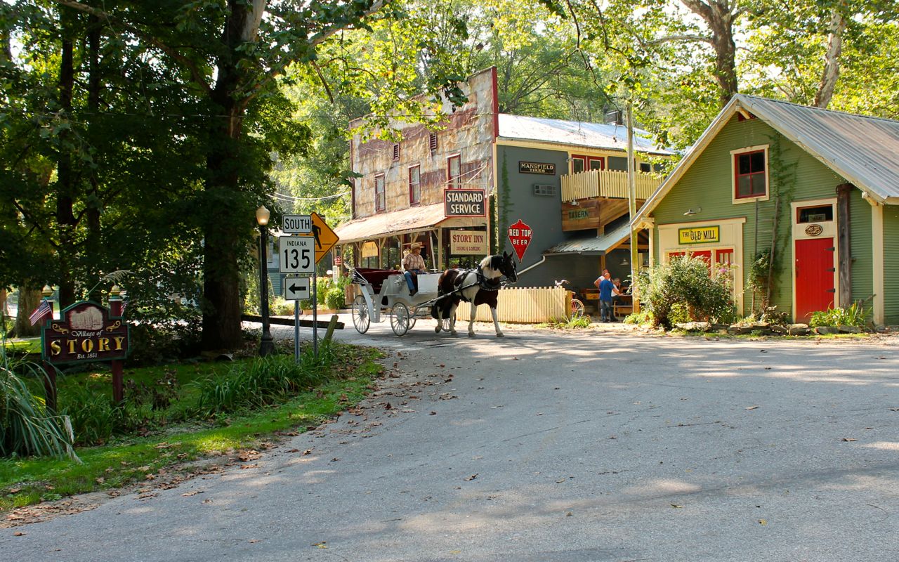
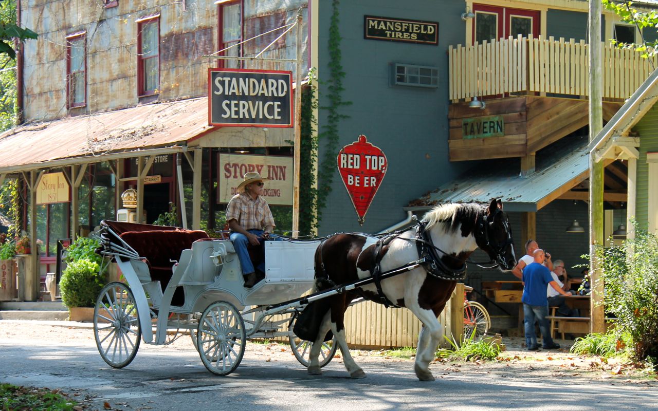
This was definitely a taste of the surreal – one of those surprises I love.
With no more surprises, I continued to Bloomington, my destination for the evening. I chose to stay downtown to have access to restaurants. Dinner was at the Malibu Grill, where I had a wonderful Filet Mignon. It hit the spot and the staff was super friendly.
Tomorrow I head into Illinois.
Day 30
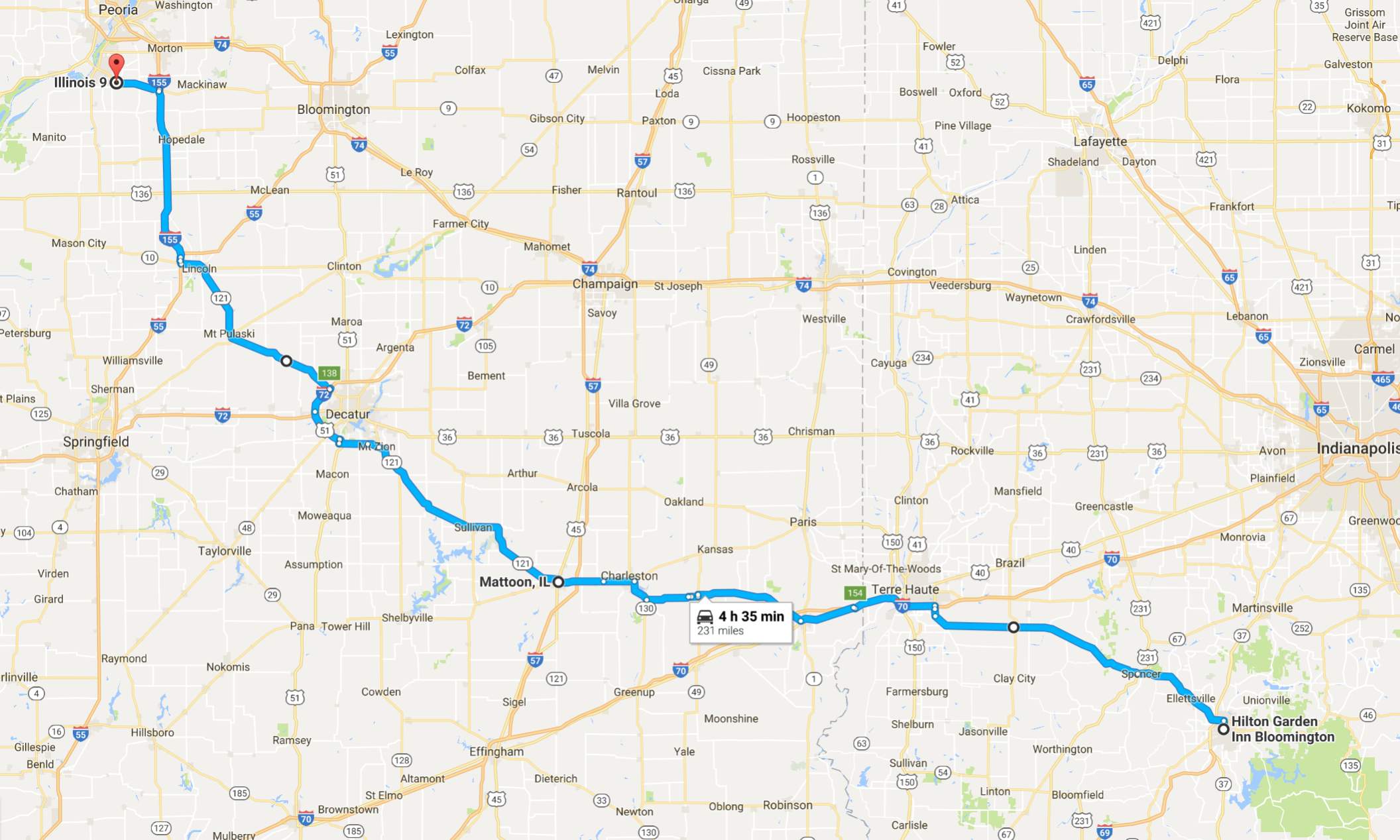
Day’s distance: 235 miles
Total trip distance so far: 6,679 miles
When I woke up in Bloomington, it was raining outside. I was surprised but pleased that it would stop before I left the hotel. Temperatures cooled off quite a bit today. Starting in the high 50s, temperatures never exceeded the mid 70s. Eventually all the clouds disappeared. Now that I’m back in the plains states, I encountered some moderate winds – mostly cross winds, given my direction of travel.
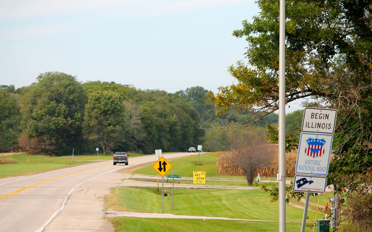
By reaching Illinois, I have traveled through 48 states, leaving only Iowa and Hawaii.
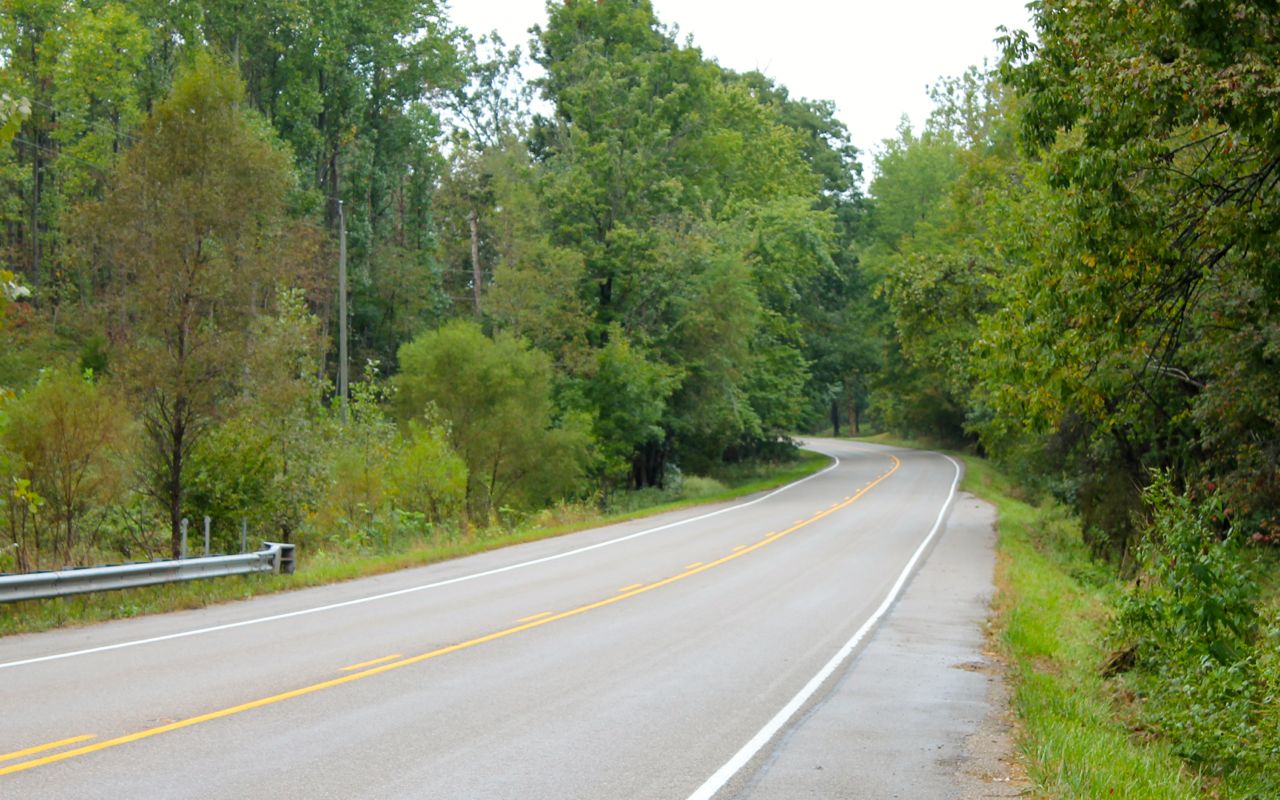
The roads traveled today included Hwy 46 out of Bloomington. This would be the most wooded area today.
After a brief stint on I-70 and a Starbucks stop near one of the exits, I would jump on Hwy 40.
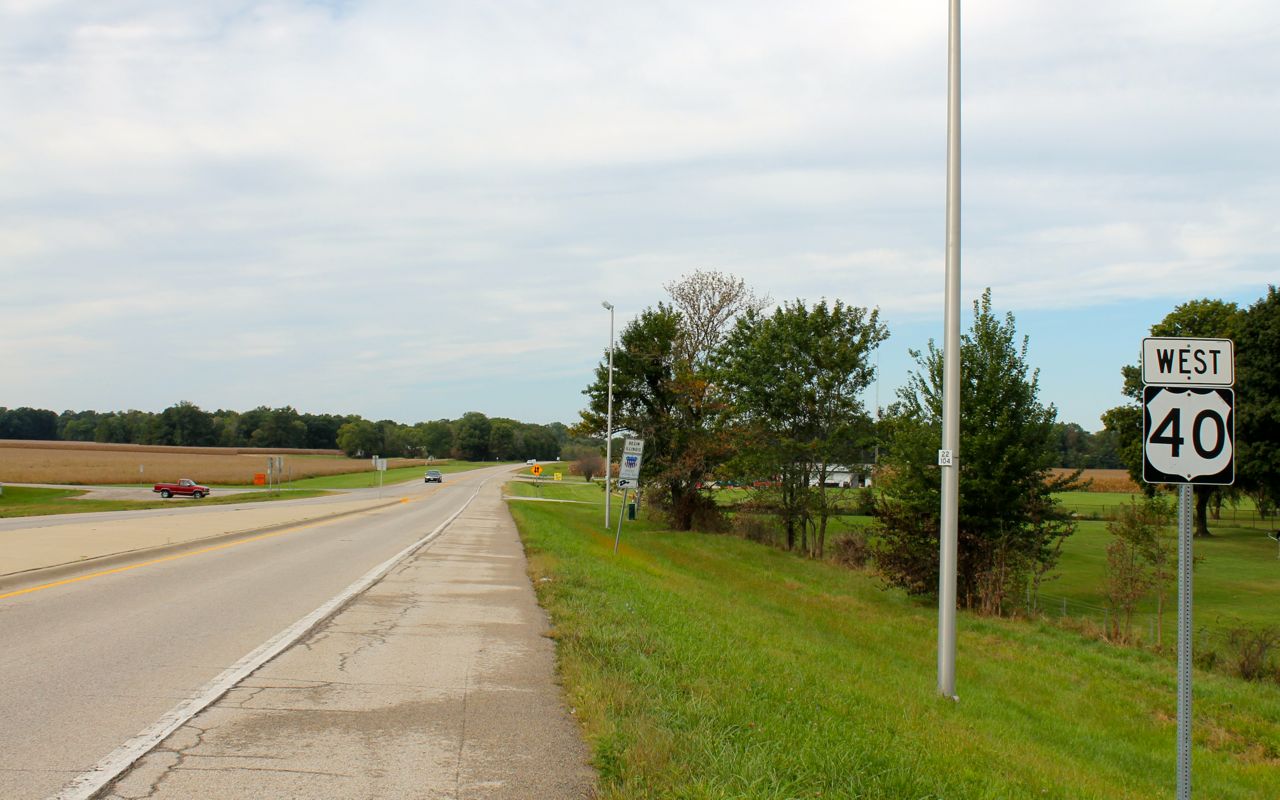
It was classified a Historic National Road, but I mostly chose it as an alternative to staying on the interstate.
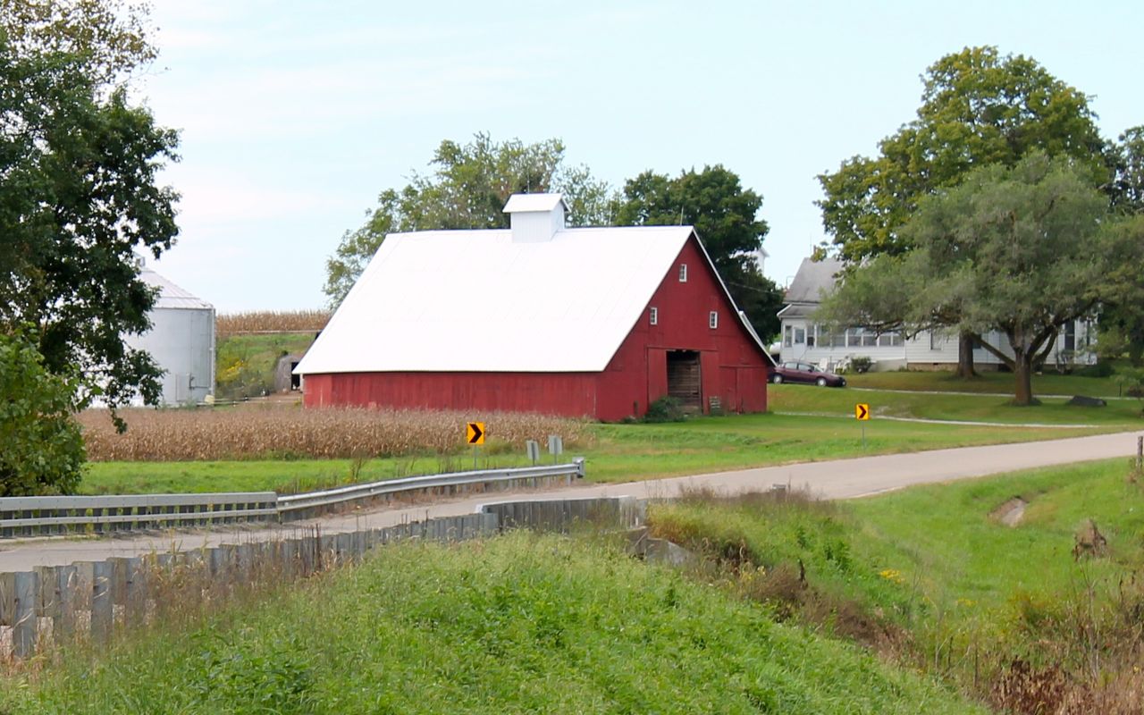
Scenic is relative, and I tried to take short breaks where I thought I might also get to take an interesting, or at least representative picture.
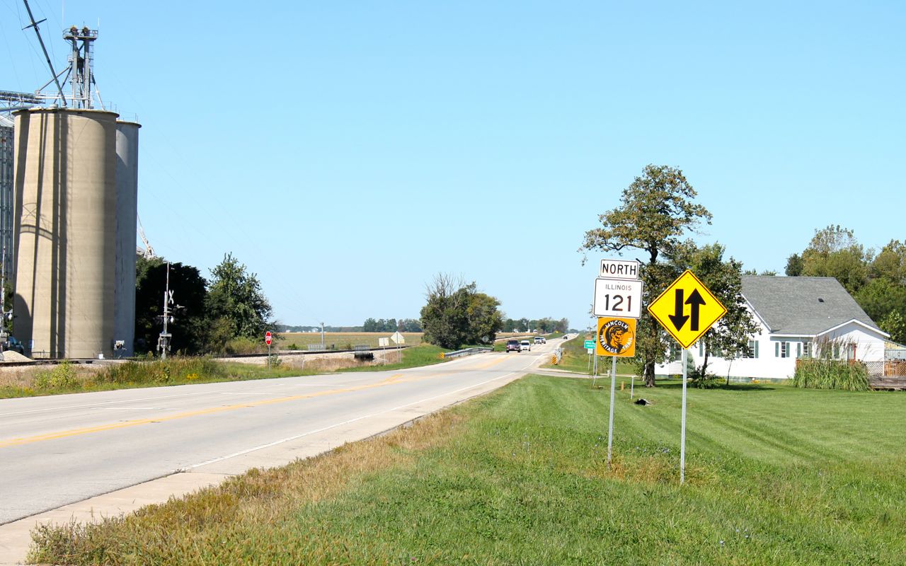
The road surfaces were rough in spots, especially the next section along Hwy 121, part of the Lincoln Heritage Trail.
This was essentially a travel day. I wasn’t expecting to find twisty roads and other bikers. Some days you just need to travel to through to get to the next interesting spots.
Tomorrow will be similar. I am grateful that it is predicted to be sunny and cooler the next few days, especially for my visit to Sioux City.
Day 31
Day’s distance: 278 miles
Total trip distance so far: 6,957 miles
The weather was nice with temperatures in the 70’s and the sun out all day. There was some wind to contend with but much of the time I was headed into it, which was better than having cross winds.
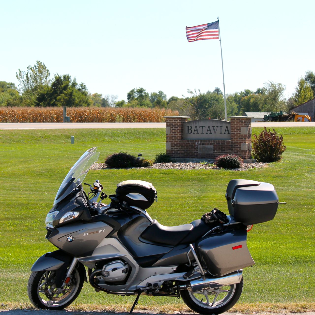
I crossed the Mississippi River into Burlington, Iowa today at about 10:35am. That means I have ridden this motorcycle into every state in the US accessible by road. In looking back at the map, there is a park near the bridge on the Iowa side, but when I was looking for one while on the bridge, I didn’t see it. Oh well.
So, below is the first taken in Iowa, in Batavia. I was here in Iowa and in every other state of the United States (except Hawaii).
The landscape was similar to yesterday’s and I chose 4 lane highways, mostly, so I didn’t take many photos today. I did stop at the Des Moines River where Hwy 92 crossed.
I was curious how high the water levels were given that there was flooding in the Cedar Rapids, Iowa area recently. This is probably high for this time of year, but it appears to have a few feet of room under the bridge.
Since the weather was perfect for camping, and since I’ll be staying in a suite on the Missouri River waterfront for two days while in Sioux City, I thought I’d save a few bucks.
I’m set up at Walnut Woods State Park, near Des Moines.
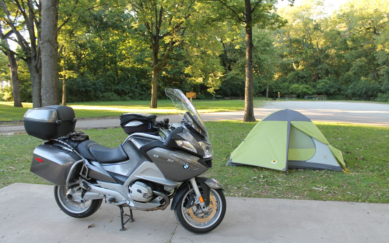
On my way into Sioux City tomorrow, I’ll be stopping by the local BMW dealer. They have ordered a replacement left-side combination switch for me. That is the multi-function switch that controls the horn, high beams, ESA (electronic supsension adjustment), windscreen height, flashers and cruise control. The cruise control switch is malfunctioning. The replacement and labor to replace it should be covered under my extended service agreement.
I’m looking forward to meeting my good friend Charles from Oklahoma City tomorrow. We’ll hang out for my day off the bike on Thursday.
Day 32
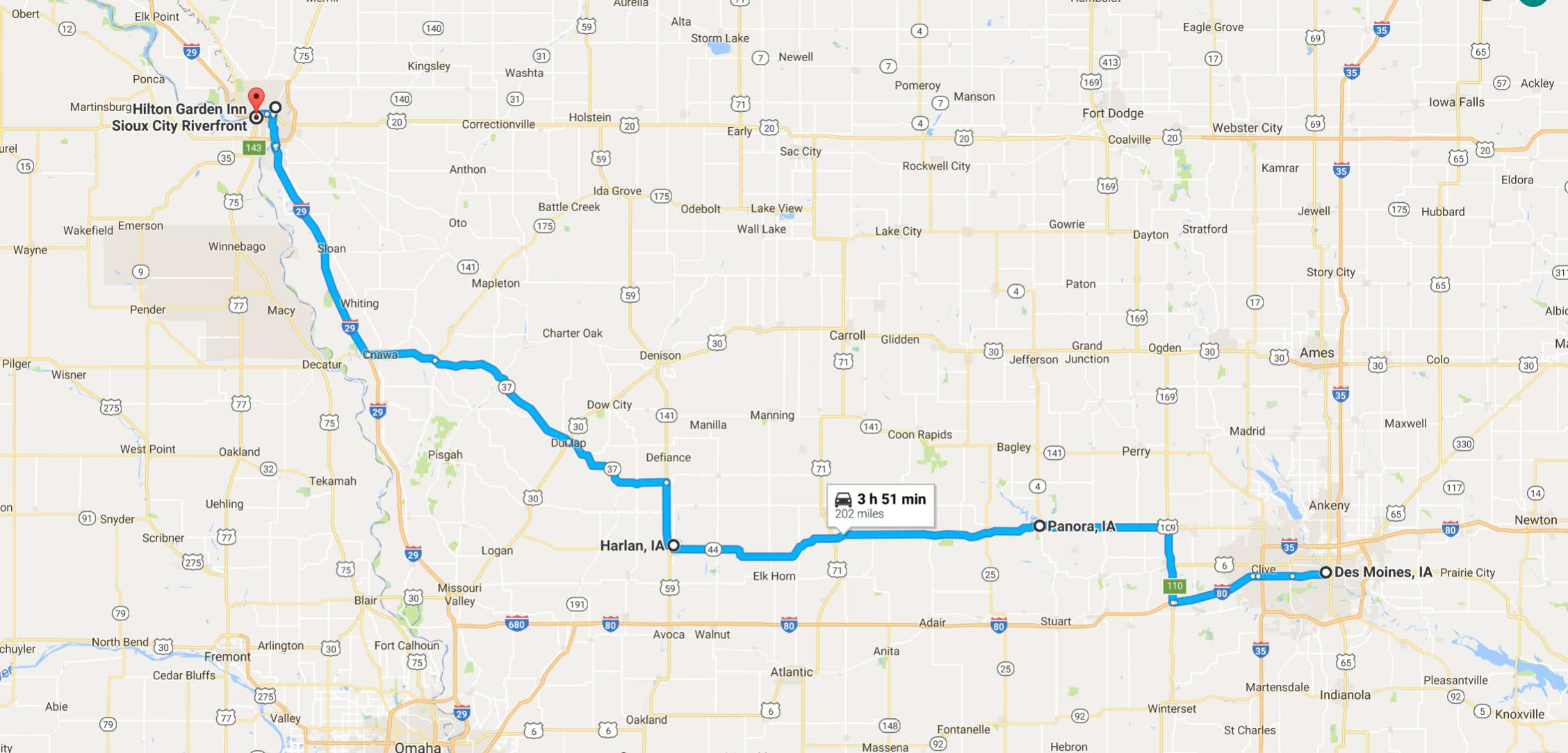
Day’s distance: 218 miles
Total trip distance so far: 7,175 miles
Today’s goal was getting to Sioux City to meet my friend Charles and to get a replacement part for the motorcycle installed.
To avoid most interstates, I chose to take Hwy 44, or the Western Skies Scenic Byway. For the most part, it parallels I-80 but is two lanes and carries much less traffic.
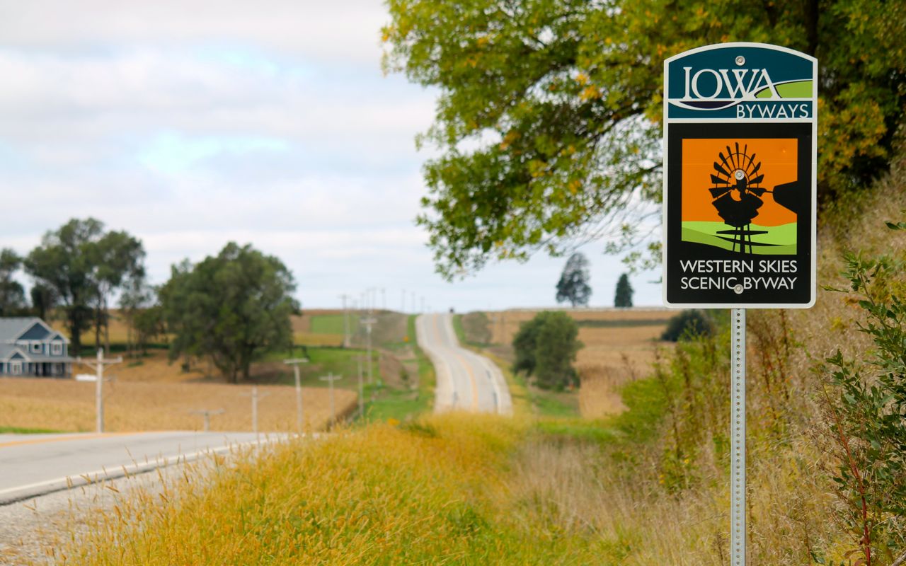
Hwy 37 was used to connect with I-29 for the final leg into Sioux City.
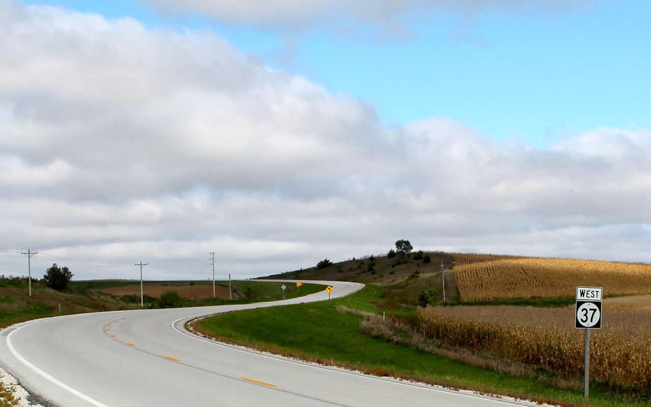
Before checking in to the hotel, I stopped at BAK BMW, the dealer here in Sioux City. The part ordered the day before had arrived and they scheduled time to install it immediately upon my arrival.
The part being replaced is the left combination switch. Fortunately, it was covered under the extended service agreement I purchased. That saved me roughly $550 in parts and labor.
The team at BAK BMW, Dave, Danny and Chris, were all super friendly and talented. They had my switch replaced quickly and Dave managed the communications with Zurich, the company supplying the service agreement. Danny noticed my rear tire was worn down to as little as 3/32″ and cautioned its use too much longer, especially in the rain.
I took off to the hotel and was pleasantly surprised at the luxury of my room, a suite, with a jacuzzi tub, a separate walk-in shower, separate living room and a beautiful view of the Missouri River out my windows.
I met up with Charles for drinks and later dinner. It was a relaxing evening and pleasant reunion.
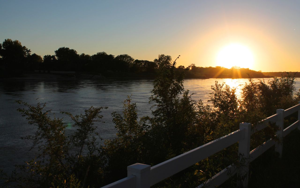
I’ll take tomorrow as a day off. I’m looking forward to seeing a little bit of Sioux City and hang out until the afternoon when the company is launching our latest product.
Day 33
Day’s distance: 9 miles
Total trip distance: 7,184 miles
I rode the bike back to the BAK BMW dealer because I decided to go ahead and replace the back tire. It was a little early but a new tire would ensure the maximum safety factor for the rest of the trip, especially in the rain.
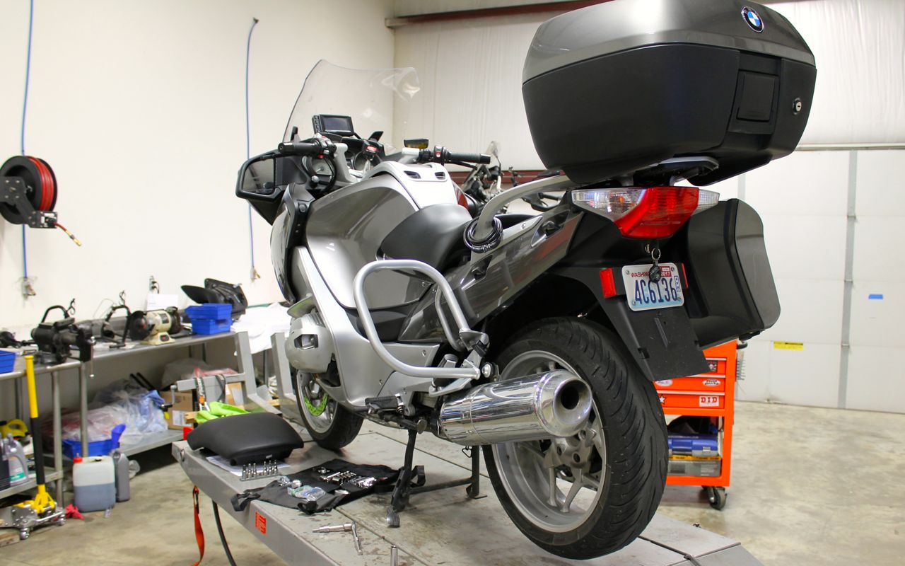
While I normally run 180/55ZR17 tire in the rear, the shop had the 190/55ZR17 in stock, so we used that. The price for the tire matched revzilla.com and the installation fee (mounting and balancing) was under $60. Very reasonable and, again, they got to work as soon as I arrived.
I visited the Sioux City Public Museum while they changed the tire. It is free and quite informative, for a small city focused museum. Lots of information about the history of Sioux City.
I focused my pictures on vehicles of different types, but the museum had a diverse selection of exhibits.
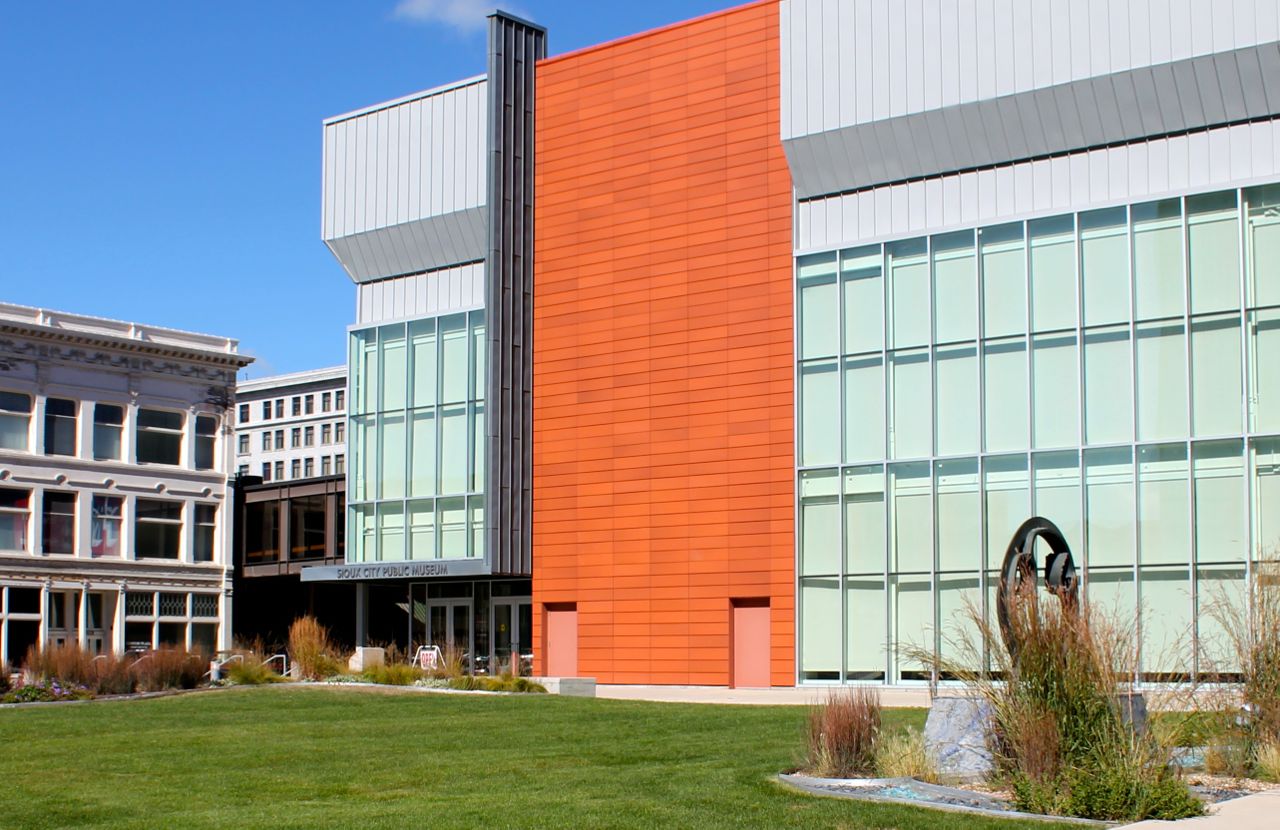
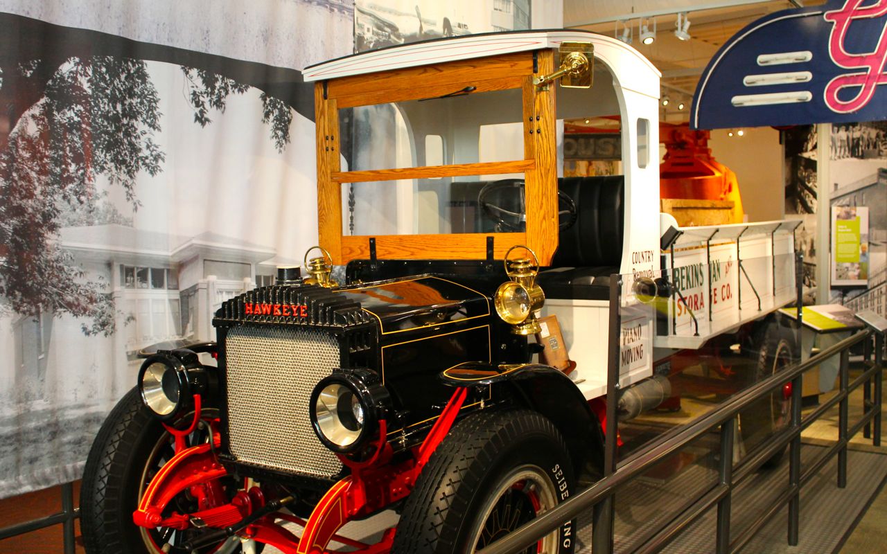
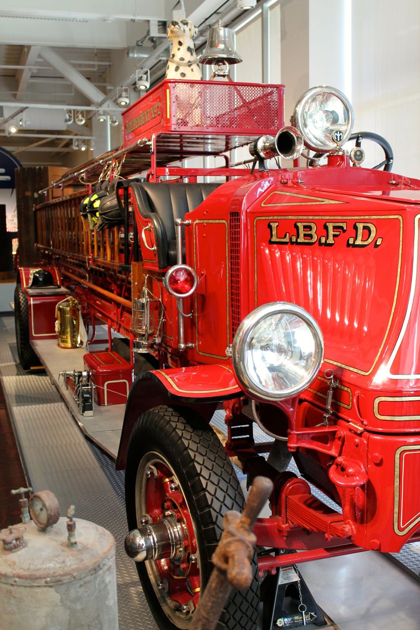
My afternoon hours, after picking up the bike, were filled with work. The company I work for launched a new product today and I helped let the public know, in a small way.
Dinner was here at the hotel and now it is time to plan the remainder of my trip back to Seattle. It should be dry tomorrow as I head towards Rapid City, or maybe Sturgis. Woo hoo, on the road again!
Day 34
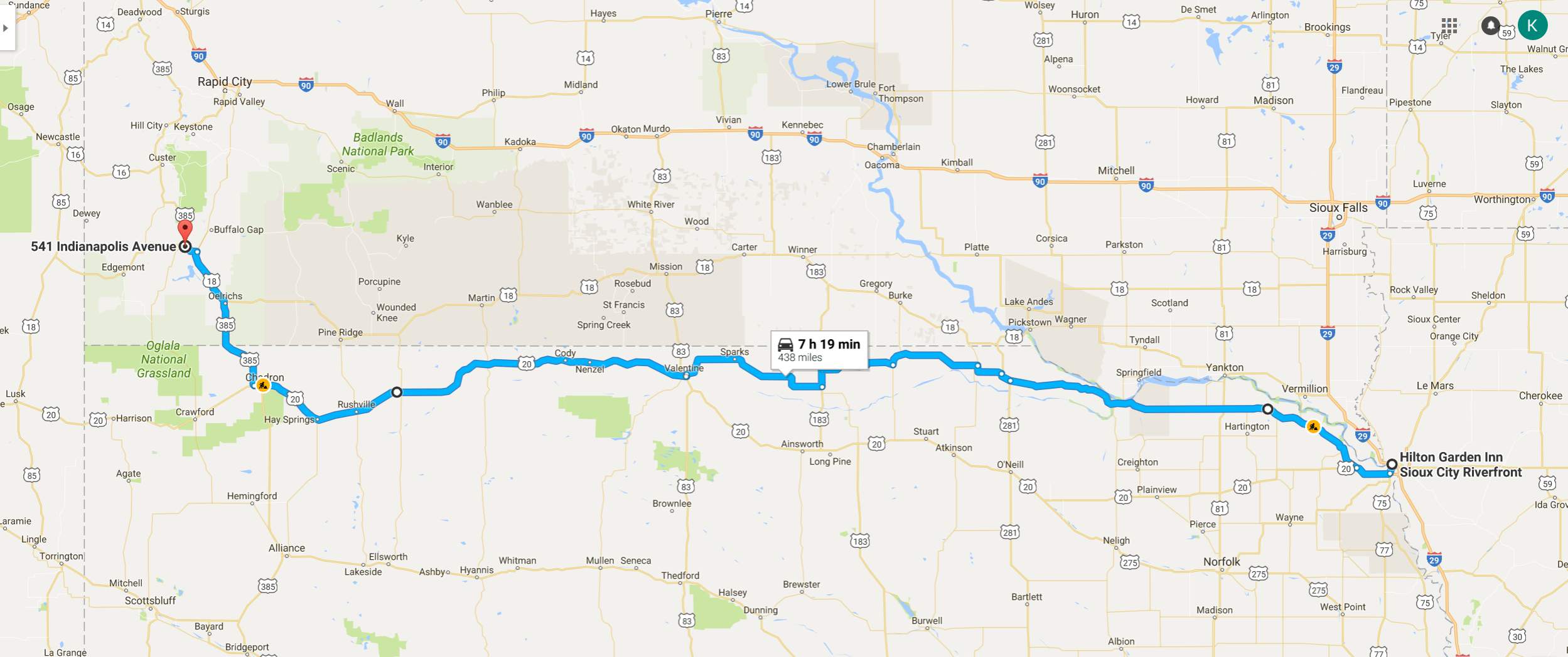
Day’s distance: 438 miles
Total trip distance so far: 7,622 miles
Temperatures ranged from the low 40s to the mid 70s. The day started out with clear skies and light winds but ended with showers and steady light to moderate winds.
The owner of the BMW dealership in Sioux City, Dave Bak, suggested Hwy 12 and Hwy 20 would be good alternatives to I-90 if I were heading west. They were just that. The quality of the roads were generally very good and traffic was light along both. Hwy 12, especially the eastern half, was more scenic – actually quite beautiful for prairie and grass lands. My photos will not do either justice.
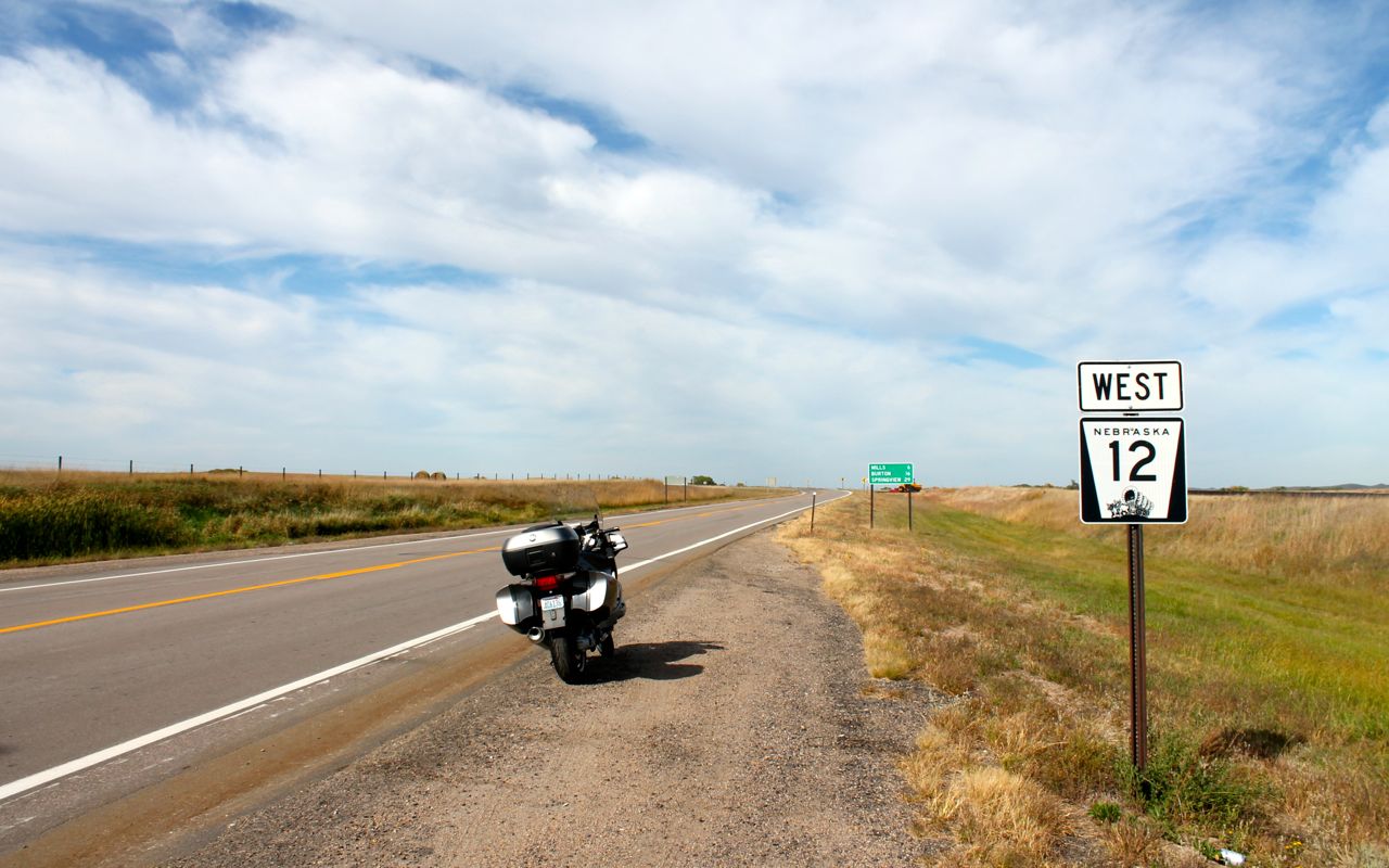
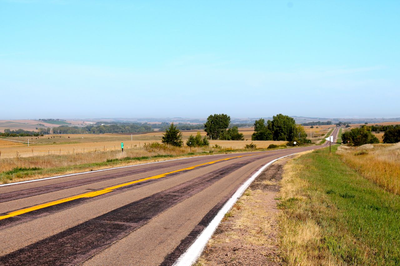
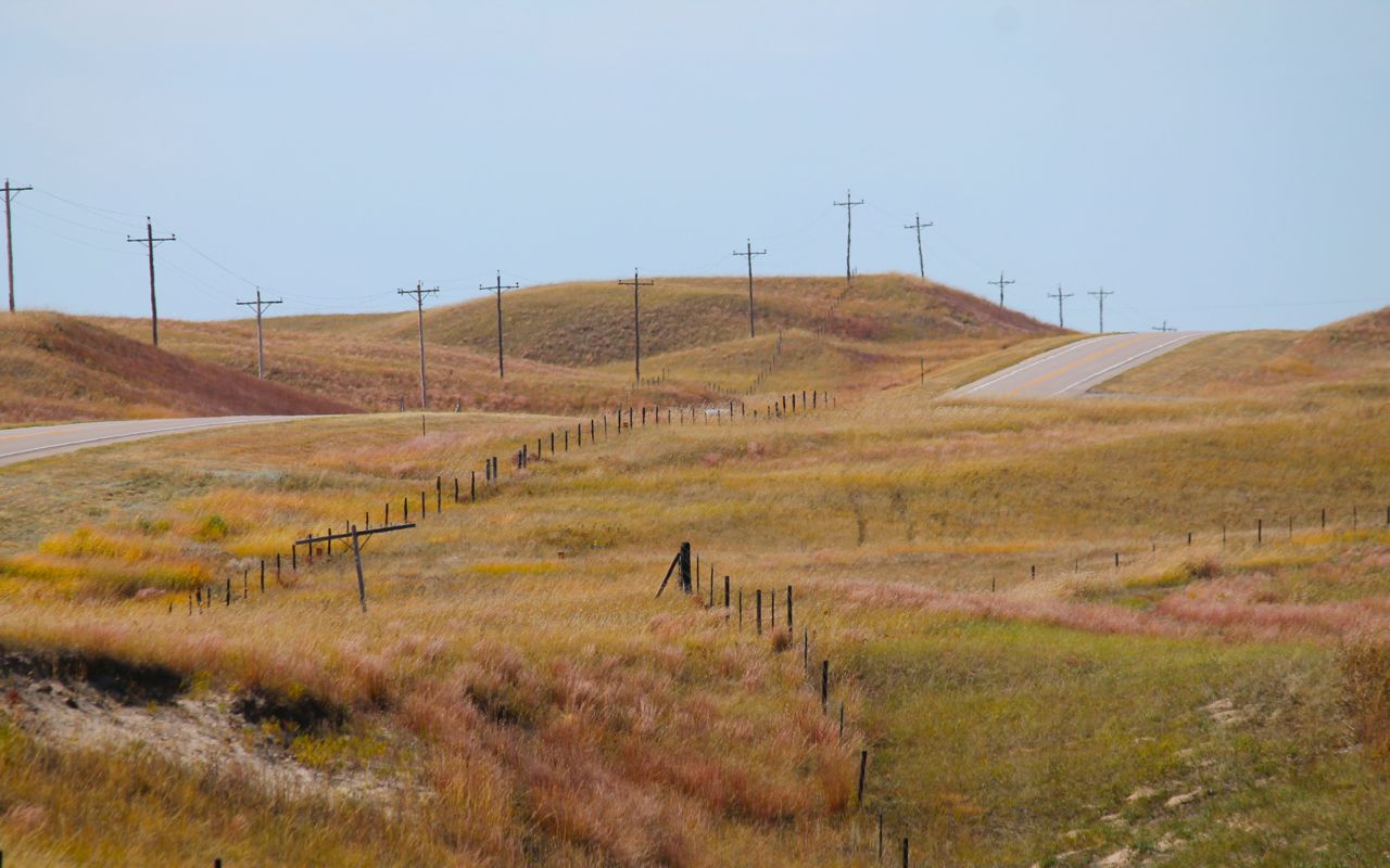
Having made some progress but still having four hours to go, I stopped in Springview, NE for lunch. The population here, according to wikipedia, is about 242 (based on the 2010 census). I saw one gas station and one cafe.
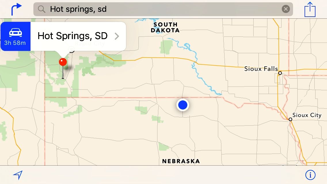
George’s Windmill Cafe was right on main street. I decided to try it.
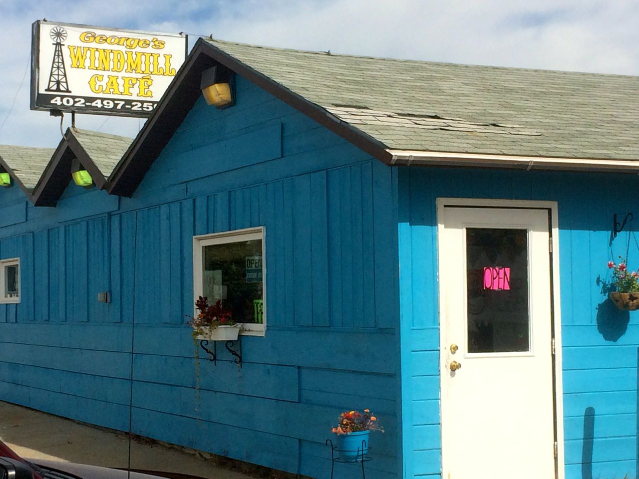
They don’t take credit cards so I had to grab some cash I keep in the bike. The lunch special was a fish fillet sandwich with tater tots, a drink and dessert for $5.85. Lunch hit the spot and I ended up talking to George and another customer about my travels. It was an enjoyable stop.
I left Sioux City with my fuel tank about 3/4’s full. In looking for more fuel, I came across an unexpected situation – no higher octane fuel was available. I stopped at a number of stations and the pattern was the same.
There was Unleaded and ‘Super Unleaded’, which was also 87 octance fuel but with Ethanol added to it (to make it super). Because I was in a pinch, I added three gallons of unleaded to the two gallons or so of 91 octane I had in the tank. At a later stop I added another two gallons.
About 30 miles east of Chadron, the skies darkened …
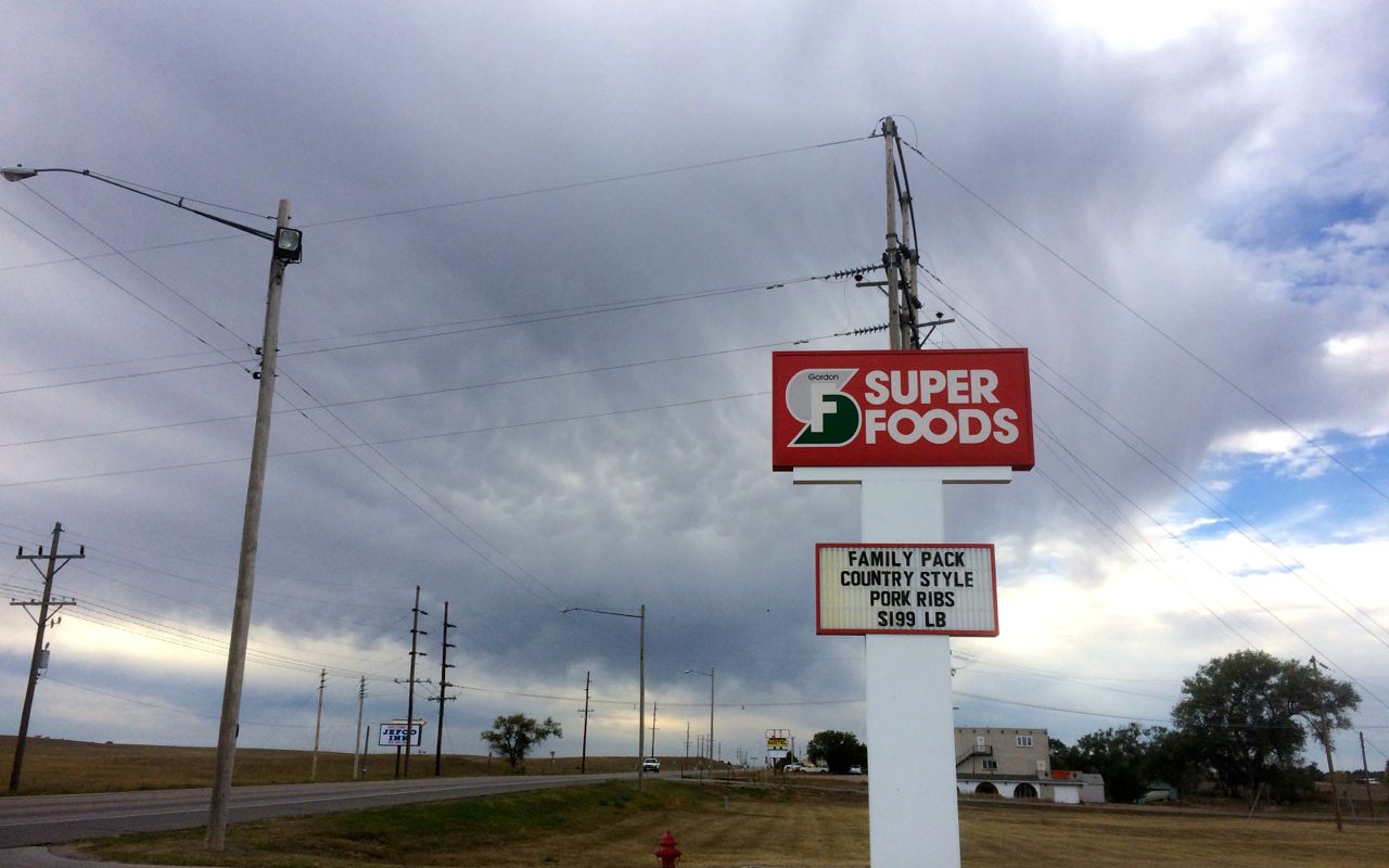
and it appeared I might run into some light rainfall.
I arrived in Chadron dry. And, in Chadron, I filled the tank, which was now running on reserve, with 91 octane. Another option at that point would have been to add an octane booster, but they had high octane fuel available.
It did sprinkle a bit on me between Chadron and Hot Springs. I took a 360 photo prior to getting to Hot Springs. You should be able to get a sense of both the geography and the weather here.
Saturday is going to be another long day at just under 400 miles. I will push on to Cody, Wyoming. Weather permitting, I will go over Beartooth Pass, as I did in 2014. This year I will try come down the western side using Alt 14, instead of Hwy 14. In Cody, I’m looking forward to eating at the Wyoming’s Rib and Chop house again.
Sunday, I will head up Hwy 296, or the Chief Joseph Scenic Byway from Cody. I missed it in 2014 and it is reportedly spectacular. Online photos certainly confirm it will be scenic. Then, I am tentatively planning to then head over Beartooth Pass, if the weather at the top is above freezing.
At this point, the temperature is predicted to be below freezing, but we’ll see if that changes. I’m using this site as reference. It appears I’m one day too late as both Sunday and Monday (not shown) is are no good.
Monday, I’ll ride through Missoula and down Lolo Pass into Lewiston to stay the night.
Tuesday, I’ll head back to Seattle. The bike wont need serviced just yet, as my return route was shorter than planned and my last service was performed in Vermont instead of New York.
Day 35
Day’s distance: 399 miles
Total trip distance so far: 8,021 miles
Temperatures were up and down all day, given the varied elevations, but ranged from mid 50s to the low 80s. There was sunshine and blue skies until the late afternoon when I rode through some showers. Winds were light.
Before leaving Hot Springs, I programmed a cafe’s location. It was the only cafe that showed up in the Around Me app on my phone. The directions took me along a walking path along the Fall River. Following the GPS, it took me along one side and then the other.
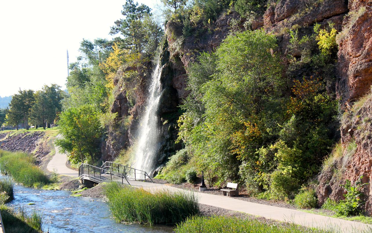
To my surprise, I noticed there were a few coffee shops right where I was! So I parked in front of Morning Sunshine Coffee and quickly had my latte fix addressed. 🙂
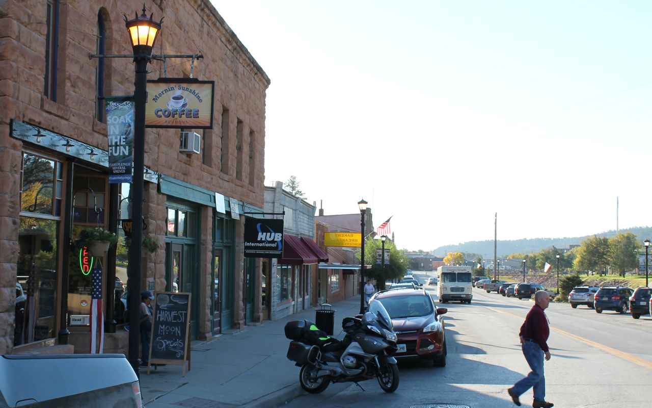
Taking Hwy 385 north I passed through Wind Caves National Park. Buffalo greeted visitors at the entrance.
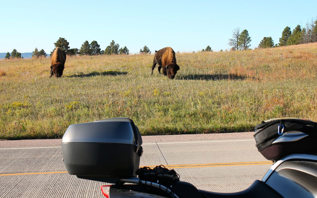
Hwy 385 was scenic, and if I hadn’t planned such a long day, I probably would have enjoyed visiting the Wind Caves.
After reaching Custer, I turned west on Hwy 16, which took me out of South Dakota and into Wyoming.
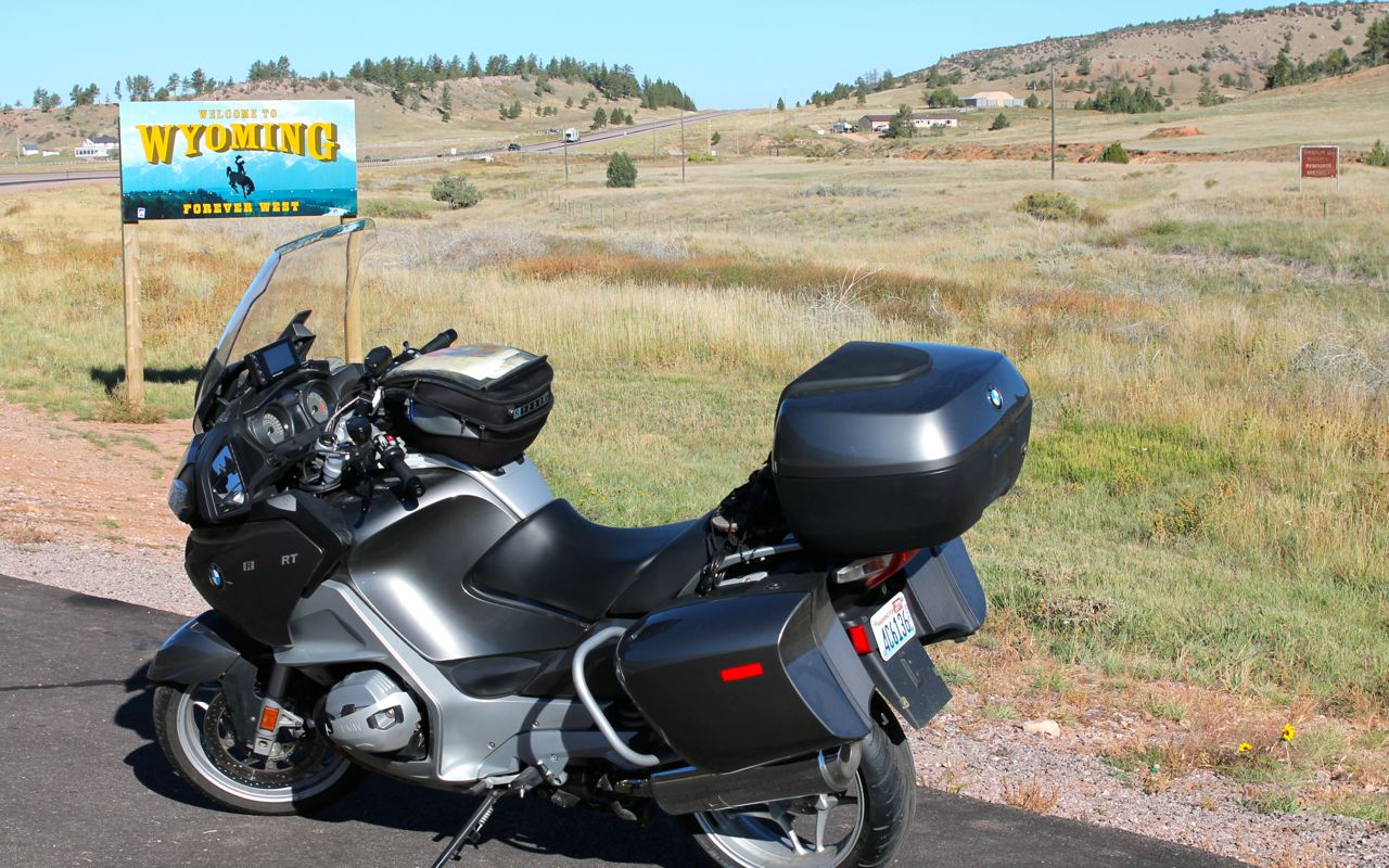
A combination of roads, including Hwy 16, Hwy 14 and I-90 delivered me to the Bighorn Mountains.
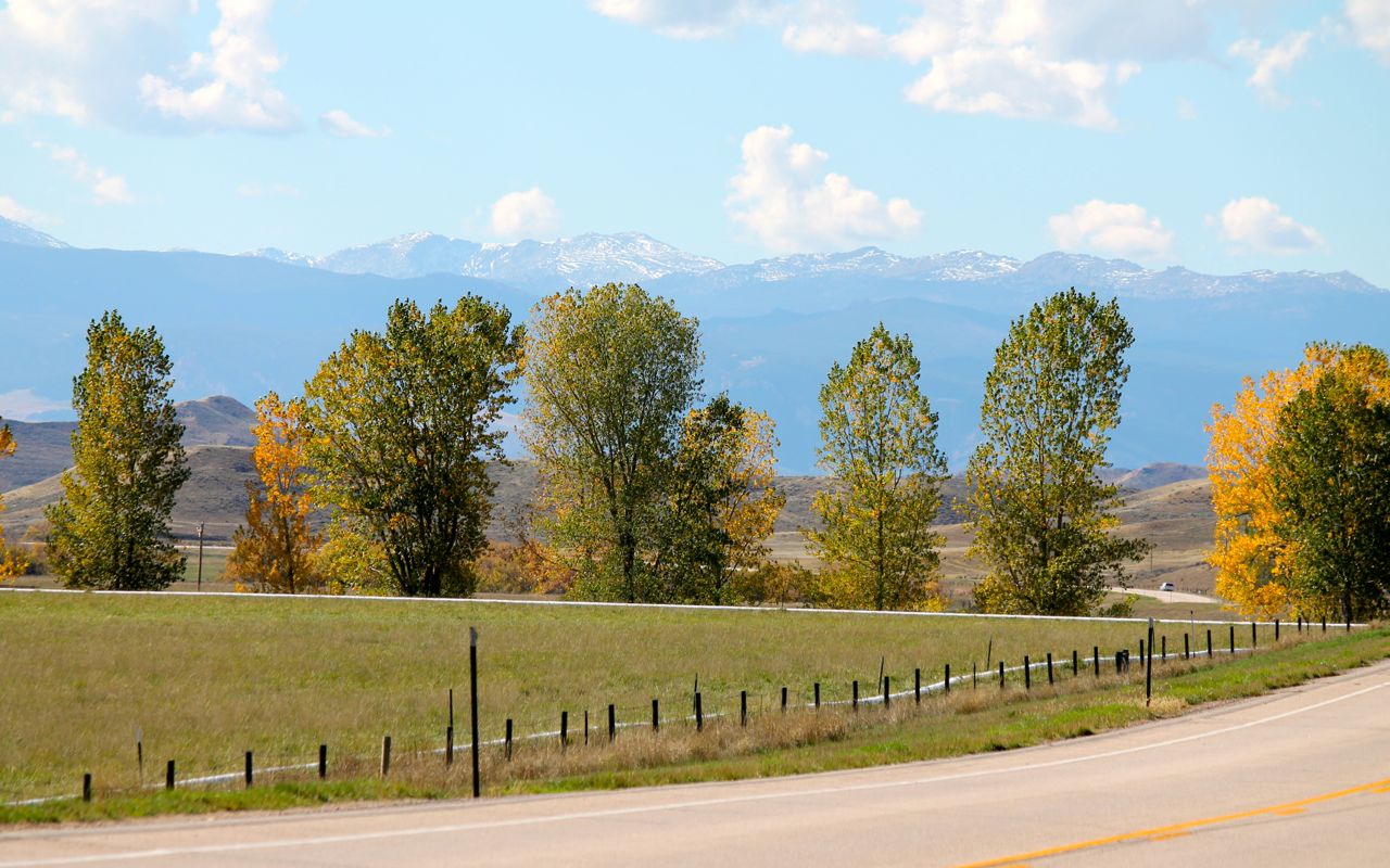
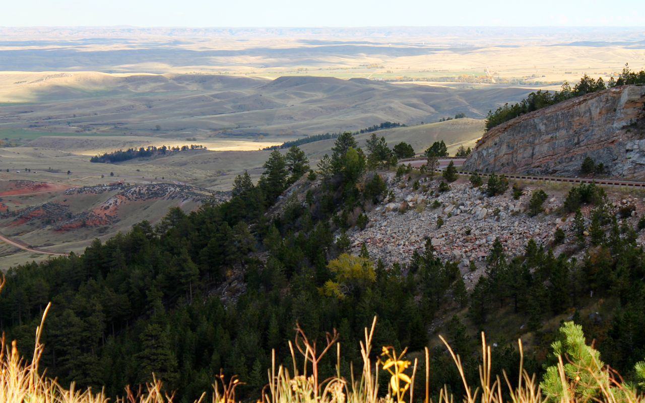
I posted a 360 photo from one of the eastern vista points here.
This year I chose to try Hwy 14A, the alternate route down the western side of the pass. The mountains and pastures near the top were beautiful, and …
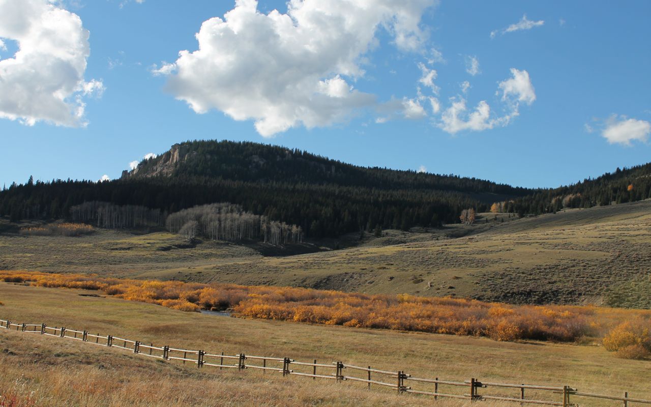
the vistas on the western side were stunning.
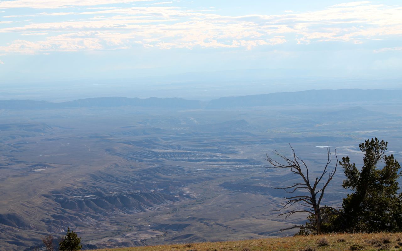
The roadway was steep, exceeding 10% grade at points.
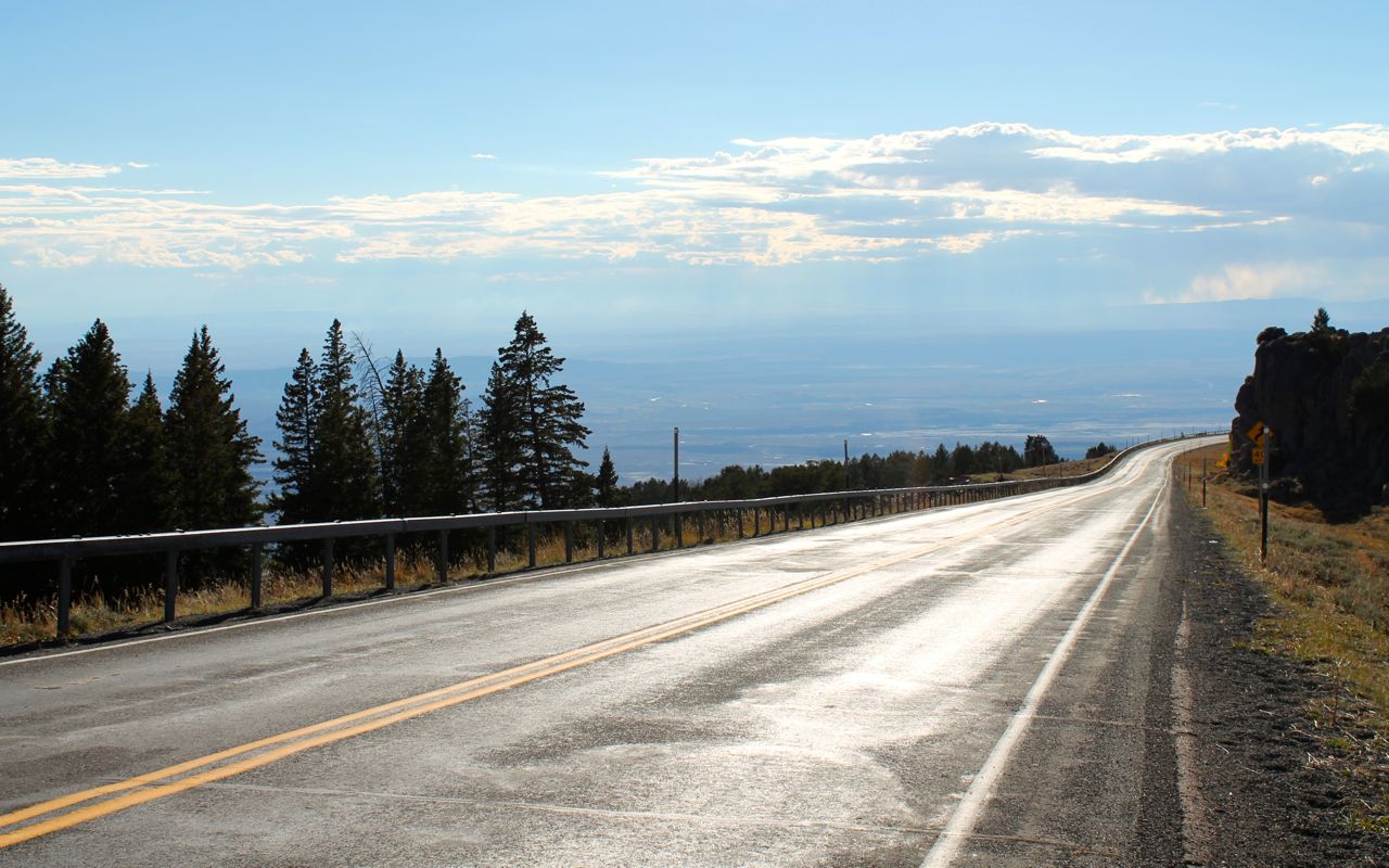
This is Hwy 14A as it approaches Bighorn Lake. I stopped because the temperature had climbed back up into the low 80’s and I needed to take off a layer I added at the pass where Hwy 14 and Alt 14 diverge.
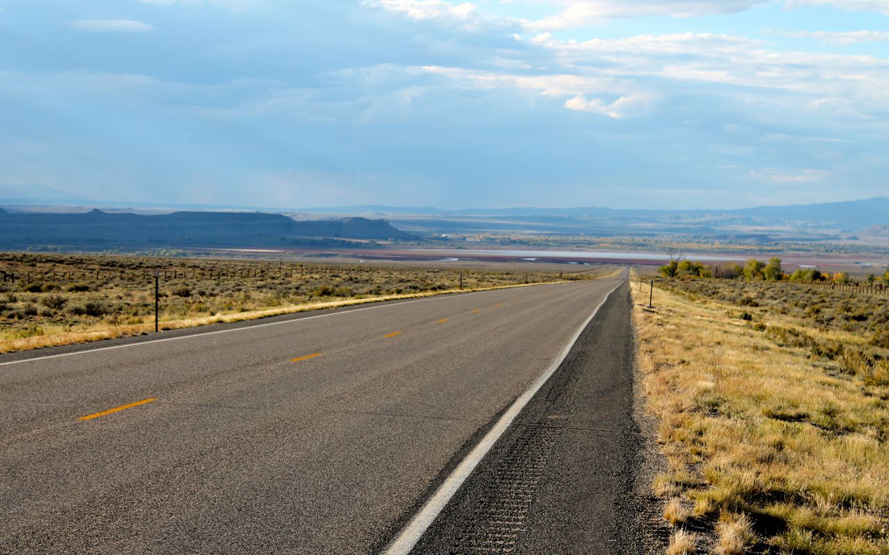
I enjoyed Hwy 14 more than 14A. There were several really rough spots on 14A. Some were under repair, but a blanket 35mph speed limit was posted for several miles of the good stuff. Combined with the repairs, it really wasn’t that much fun.
Clouds and showers met me about 30 miles outside of Cody. I didn’t get too wet.
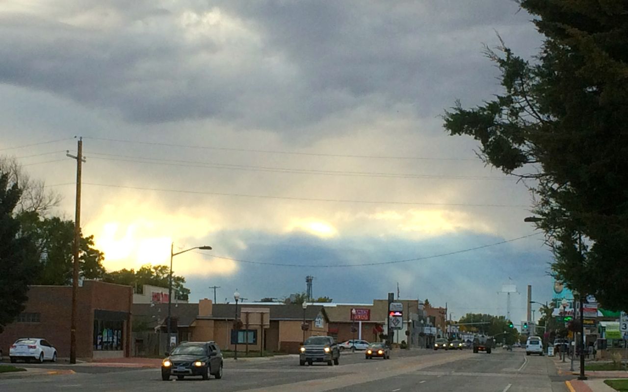
It wasn’t long before I reached Cody and got ready for dinner.
When I visited Cody in 2014, I ate at the Wyoming Rib & Chop House, having a Buffalo Rib Eye Steak. I sat at the bar and met a local couple. They own Moose Alley Lodging and have lived in the Cody area since 1980.
I called them earlier in the day to invite them to dinner. They had plans and invited me to the Octoberfest they were attending. However, I didn’t want to get back on the bike after dark, and traveling on the bike would have preventing me from enjoying some wine.
So, I declined their invitation and walked to the Wyoming Chop House from the motel I was staying at just down the street. I met another local, Paul, who also rode motorcycles and currently owned a number of them. We had a great time telling tales of Sturgis and, as we both had managed large teams, of challenges in that area.
It seems I’m destined to have a great time at Wyoming Rib & Chop House. Woo hoo!
Day 36
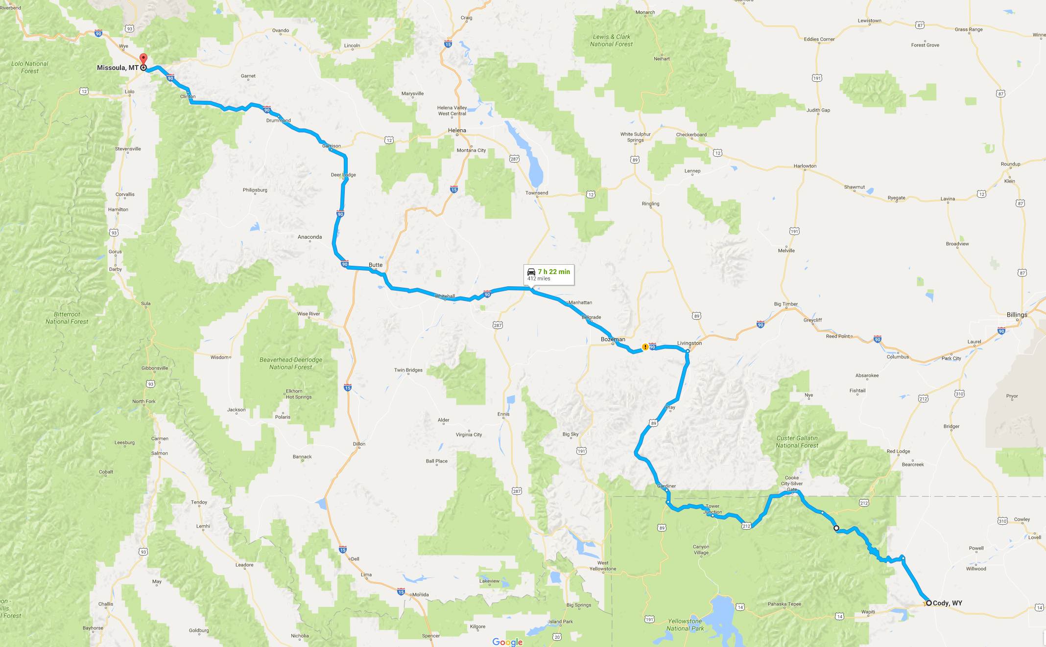
Day’s distance: 416 miles
Total trip distance so far: 8,437 miles
Temperatures ranged from the low 40’s to the 70’s and showered off and on throughout the day.
It was sprinkling when I left Cody and raining before I got 20 miles into the ride. I turned off Hwy 120 and onto Chief Joseph Scenic Byway and headed up the mountain, into the grey skies and wet roads.
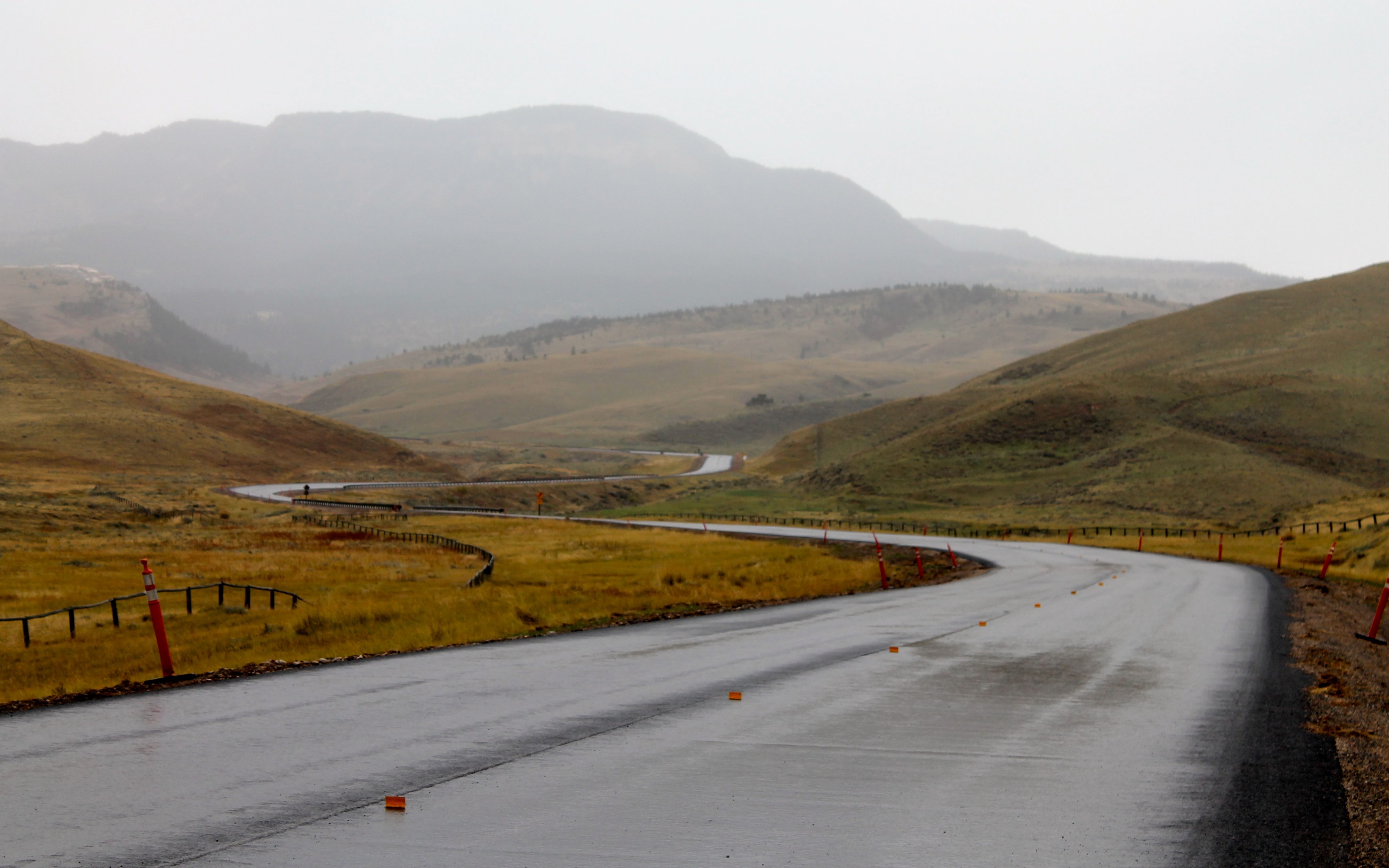
But when I arrived at the Dead Indian Summit Overlook, the clouds vanished and a rainbow appeared to emphasize the glorious vista in front of me.
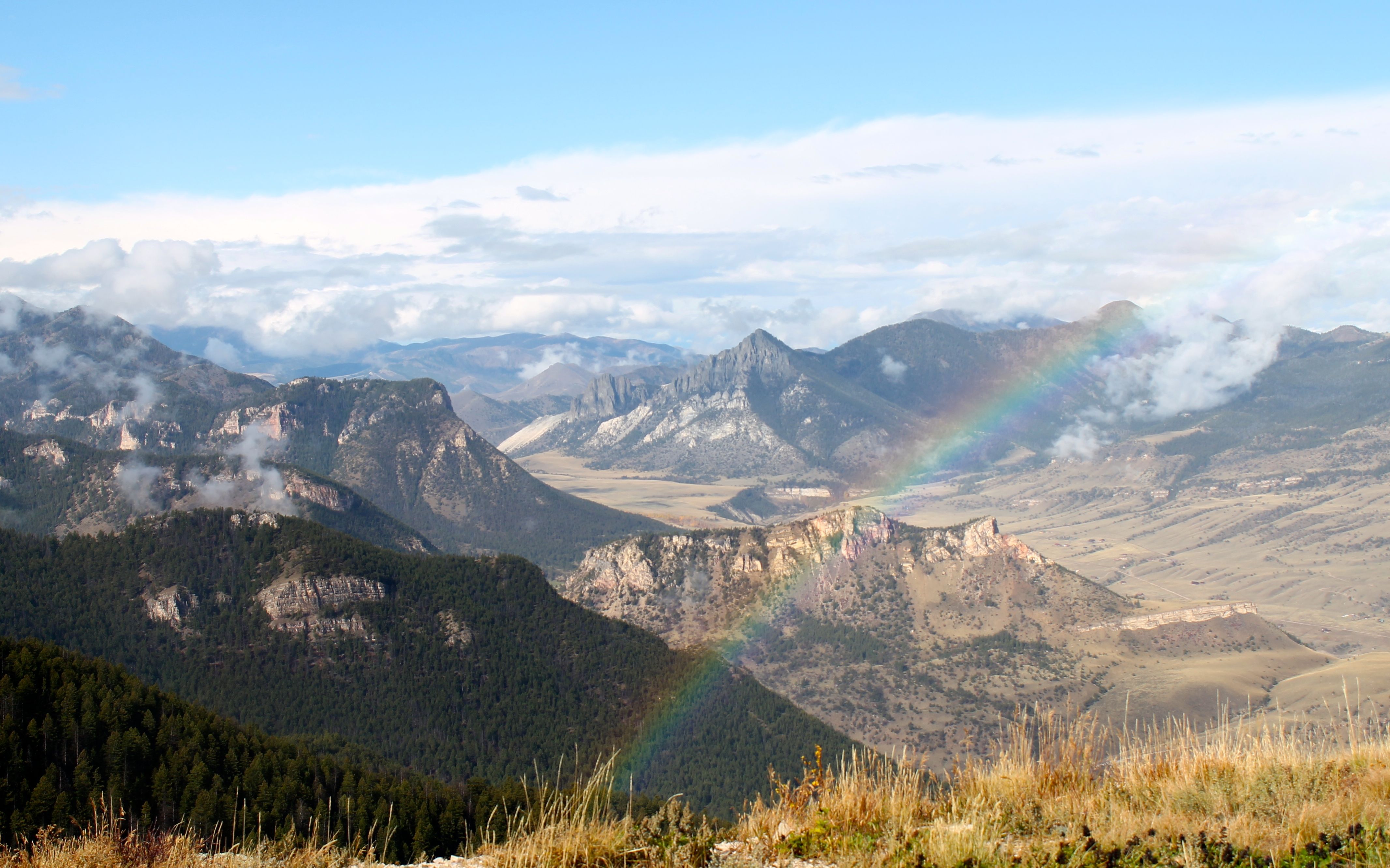
These photos fail to display the grandeur of the mountains in front of me. I posted a 360 photo here. It does a better job of providing a sense of presence.
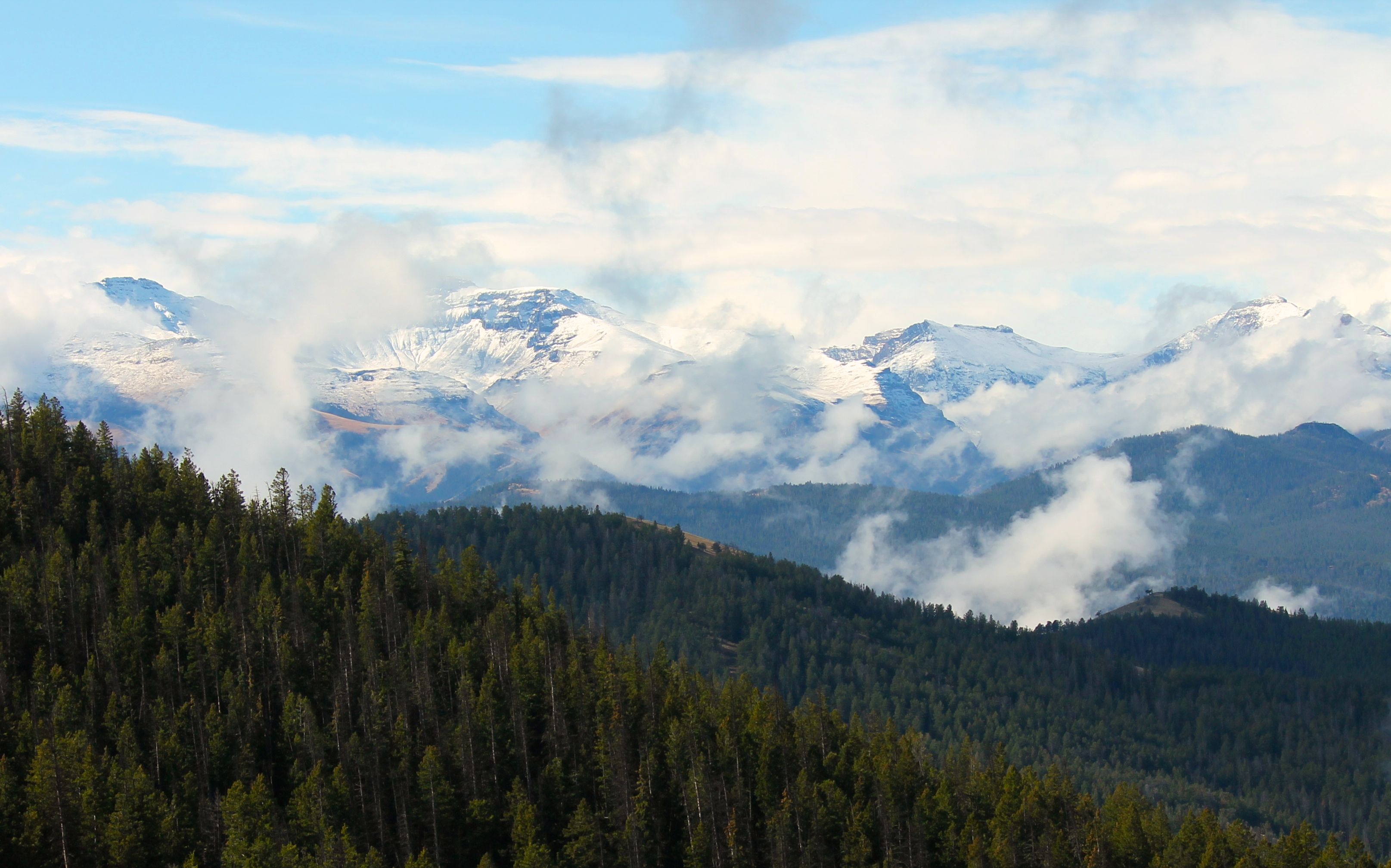
My whole mood changed and I was truly in awe. This moment made the bitterness of riding in the rain just minutes before all worth it. These valleys and peaks were incredibly beautiful and easily one of the highlights of the entire trip.
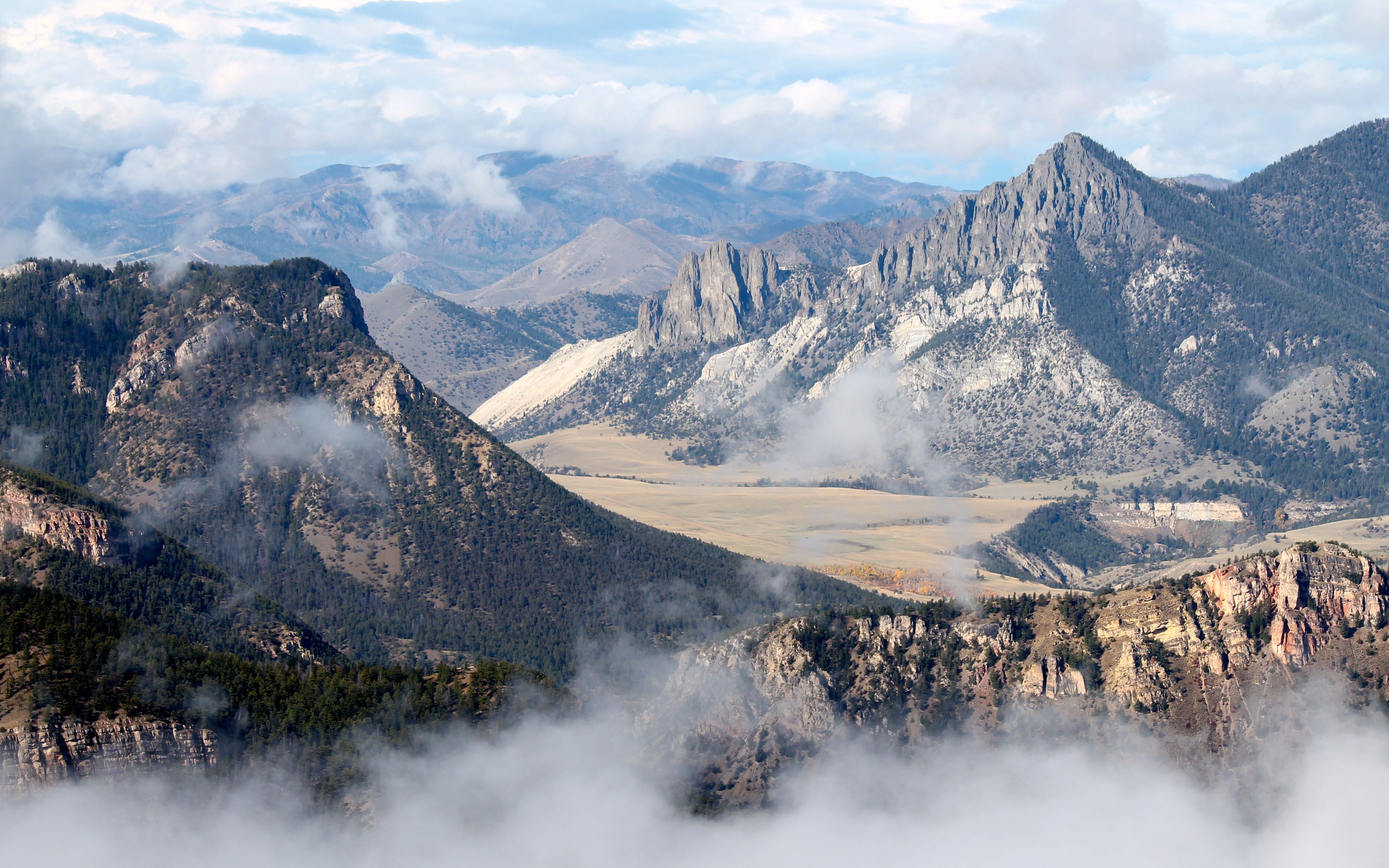
It was a truly spectacular route and a must see for riders.
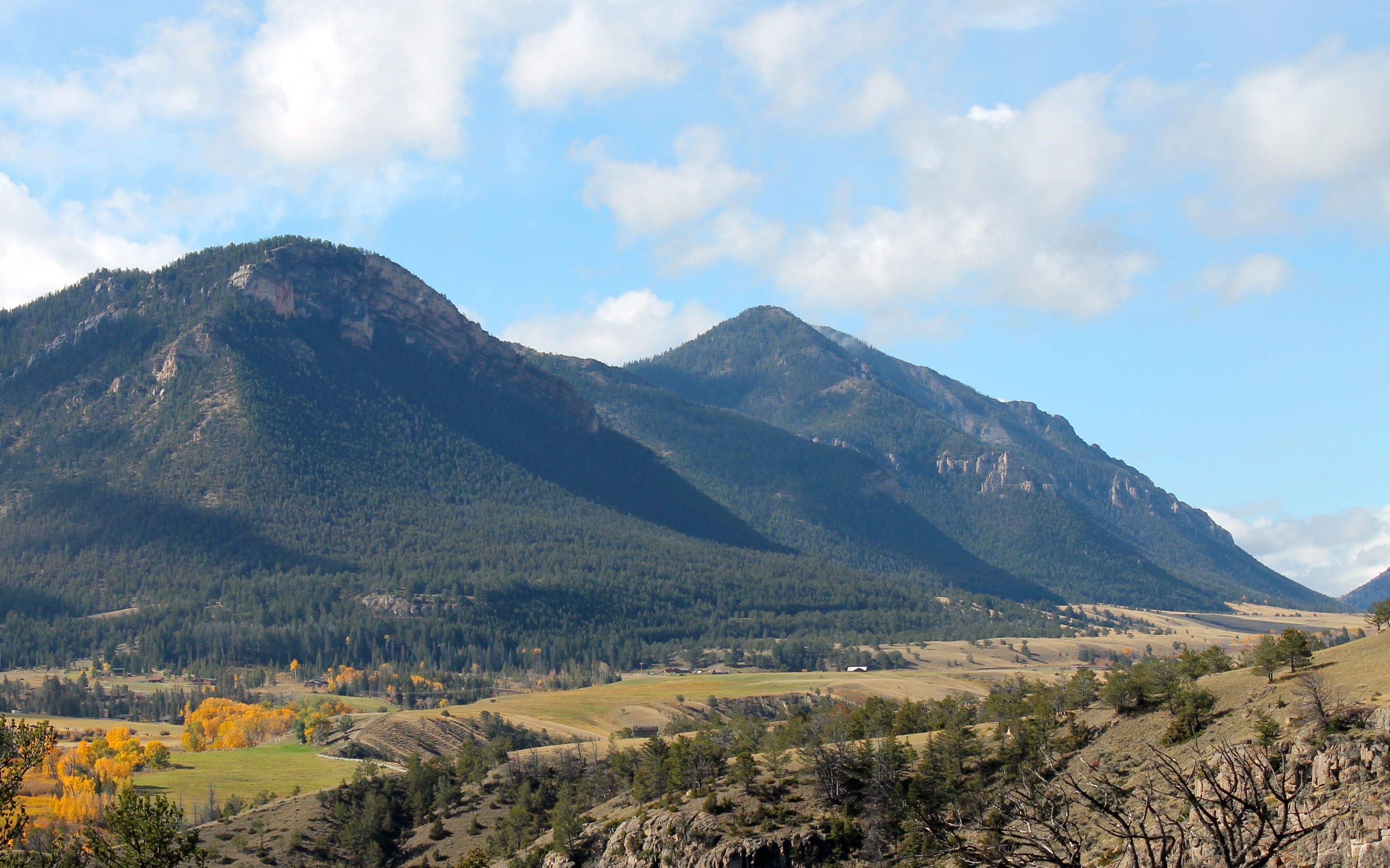
I cut across the top of Yellowstone National Park on my way to Missoula, .
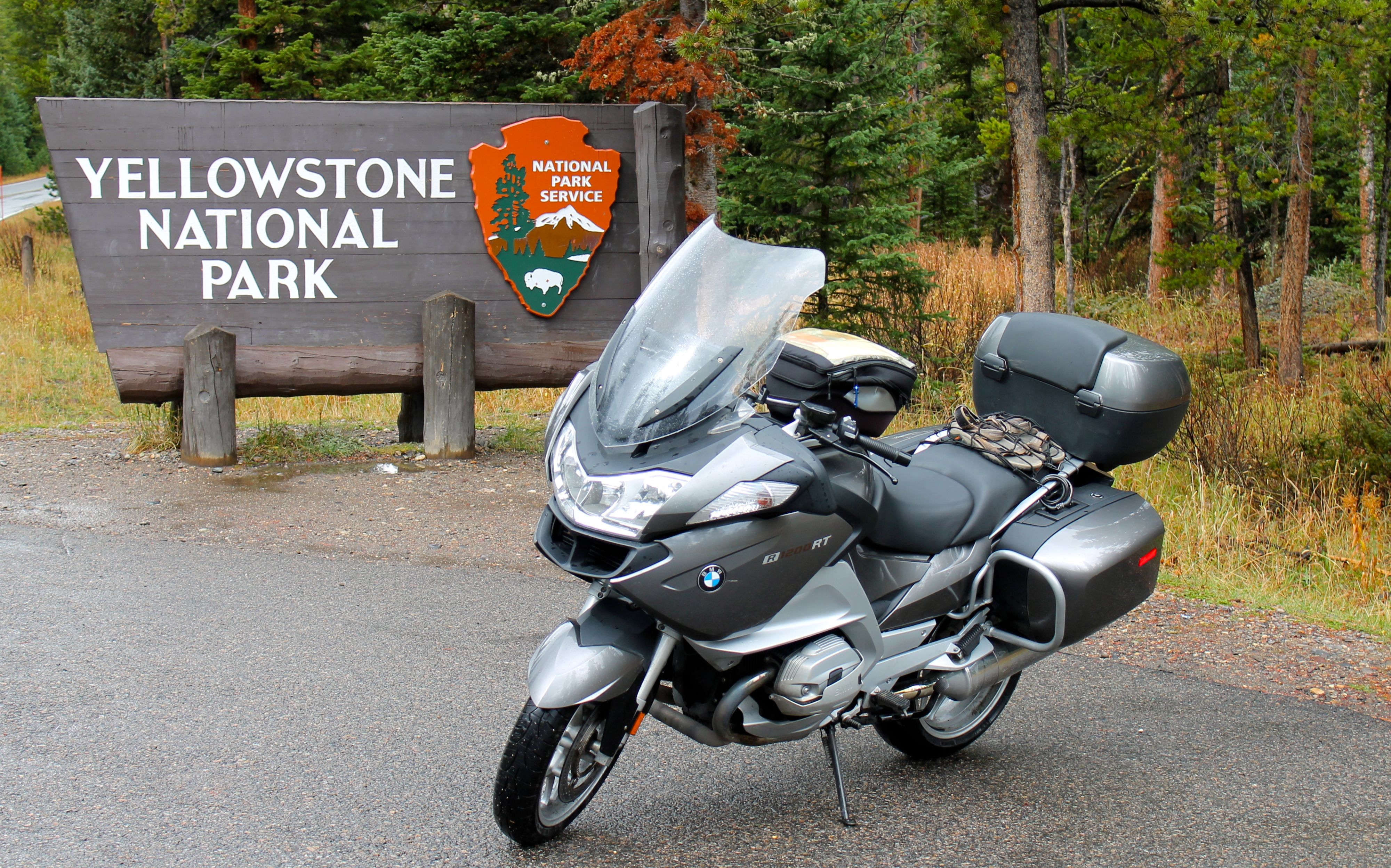
Always beautiful, I was happy to not be dealing with too much traffic this late in the season.
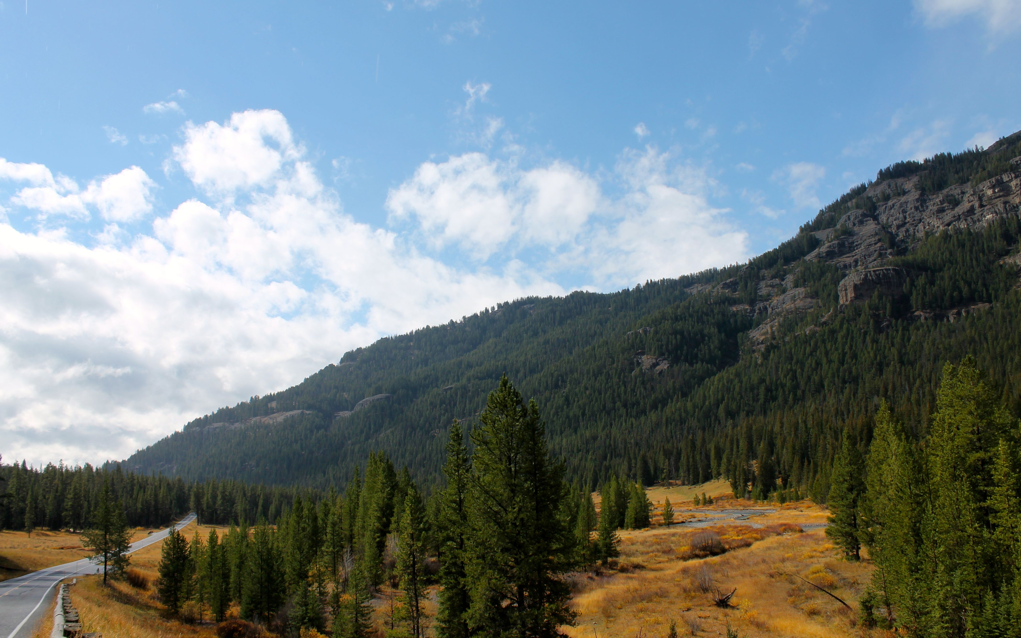
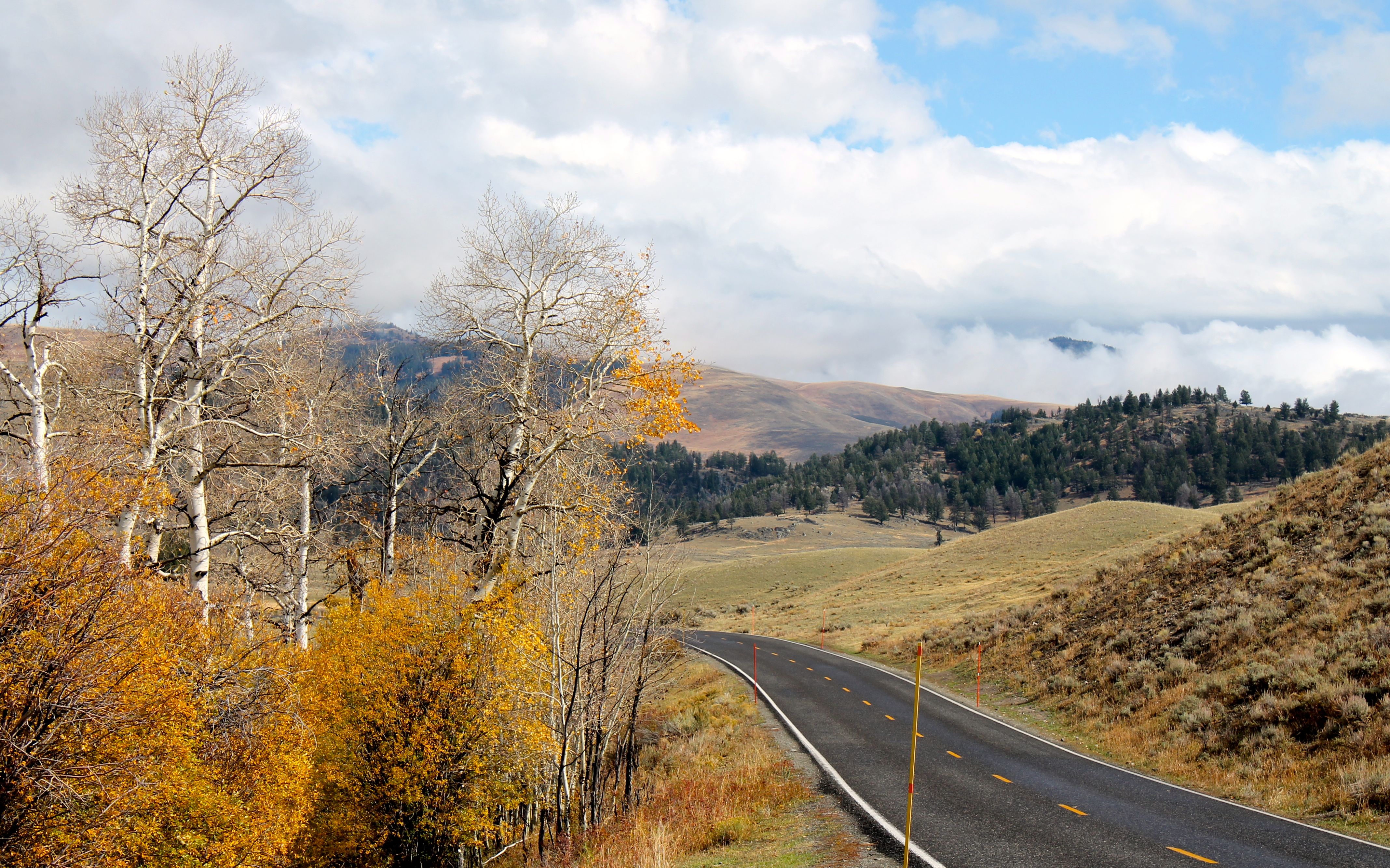
Once I left Yellowstone out of the north entrance, I headed north to Livingston. From there, after a Red Bull and some fuel, I hit I-90 and enjoyed traveling at the posted speed limit of 80mph.
I arrived in Missoula just before 7pm and got a drink or two at the restaurant next door before enjoying the pool and the jacuzzi. This was my last evening on the road and I took advantage of the amenities 🙂
Bad weather was closing in and the plan for tomorrow was to just hop on I-90 and head home. I was looking forward to getting home, but not necessarily a full day on the interstate – that would be a first.
Day 37
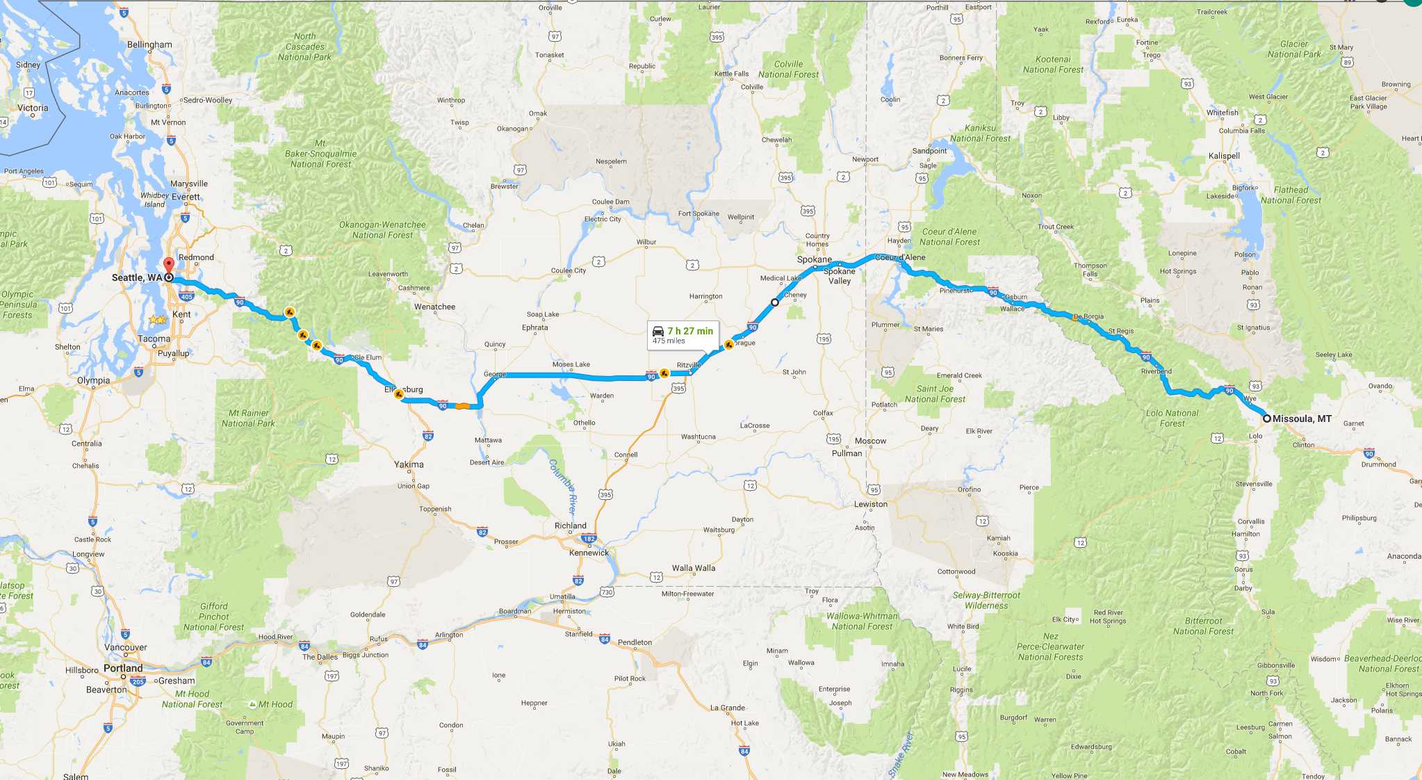
Day’s distance: 473 miles
Total trip distance (final): 8,910 miles
The temperatures ranged from 32 to the low 70’s and I hit several rain showers during the ride from Montana into Idaho.
The rain front was moving westerly, as was I. When it would start to rain, I would pull off and wait. At one point, while I waited at a gas station with a cup of coffee, a rainbow came out – a good sign 🙂
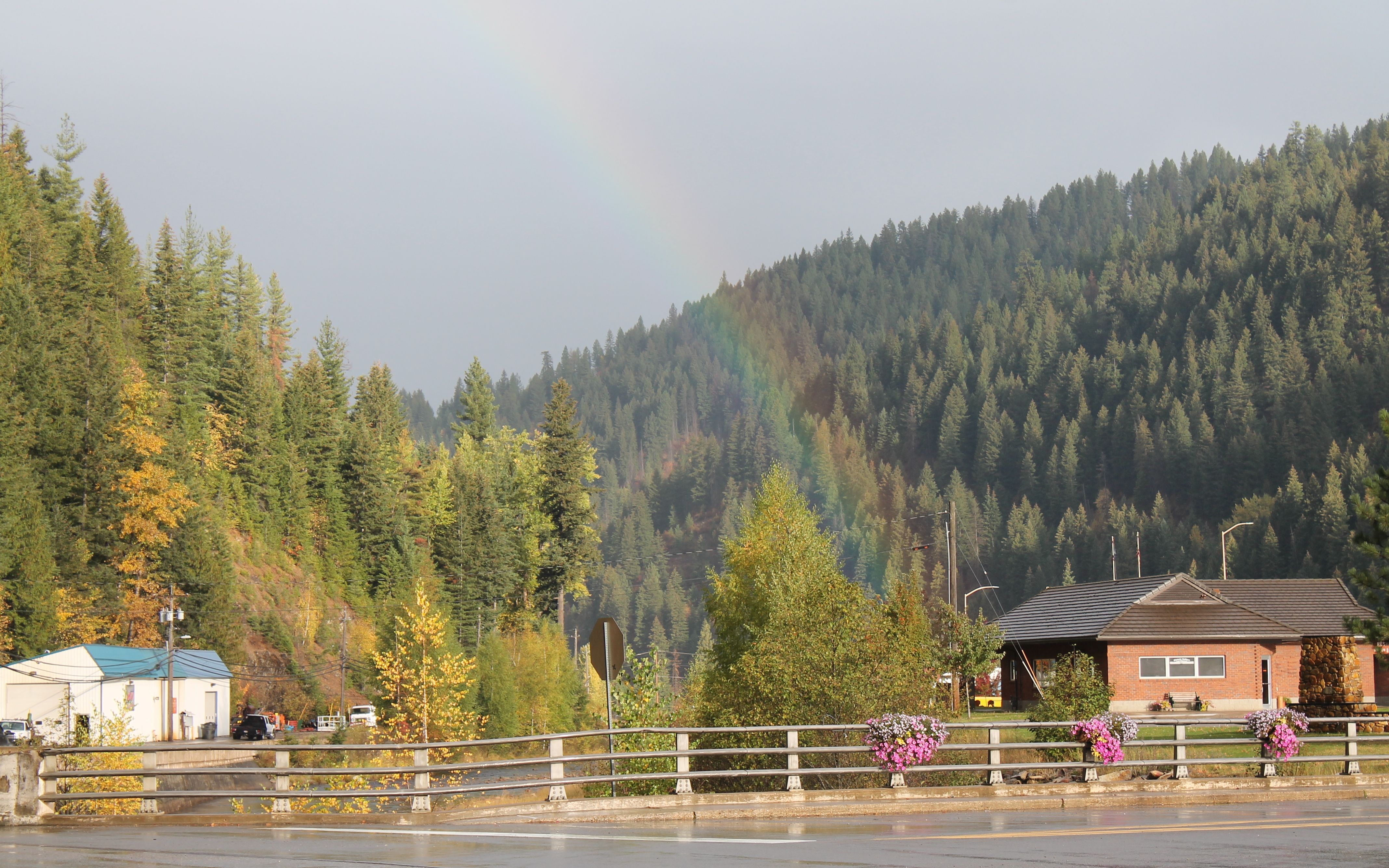
The other time I pulled off at a coffee hut. Since I already had a coffee, I had a hot chocolate this time.
The showers eventually gave way to high clouds and filtered sunshine. Stops now were only for fuel and lunch. I made it home at 4pm.
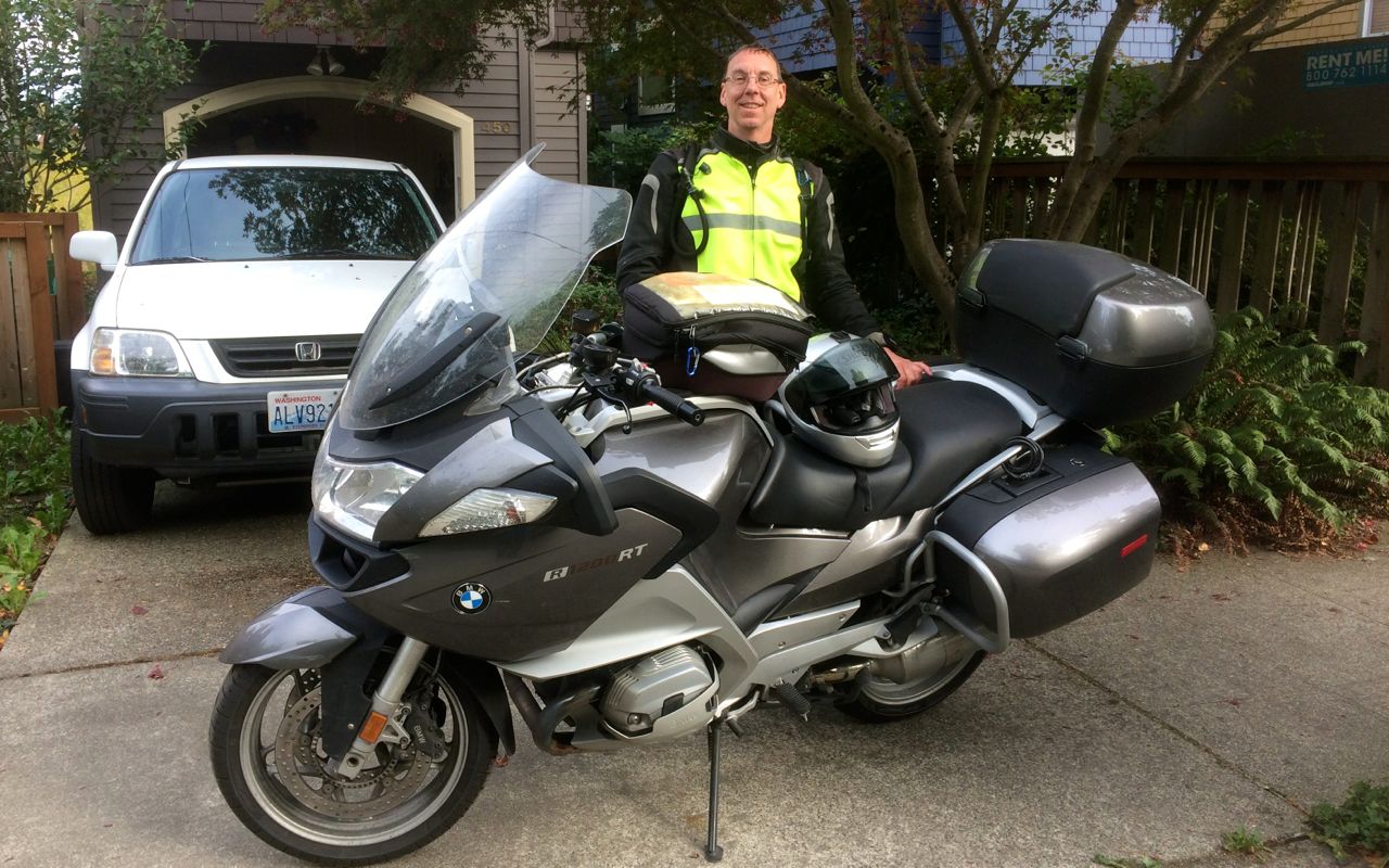
Another successful motorcycle adventure.
My 2014 Western States Tour was the beginning of a goal of riding all 49 states reachable by road on the same motorcycle. Over three riding seasons, and four separate trips out and back, I accomplished that goal while riding over 50,000 miles.
Reflections
How far did I ride every day?
I traveled at a faster pace on this trip than prior trips. Daily mileage has been increasing a bit with each long trip and this was no exception. I finished with quite a push, over 1,700 miles in the last four days to get home before hitting bad weather (think snow).
Now that you’ve ridden every state, what’s next?
Traveling more interstates than in past trips has me thinking about trying a larger sport/touring bike, specifically the BMW K1600GT. With it, I could cross large distances using the interstate highway system to arrive at a locale quickly and spend more time getting to know that region’s amenities, attractions, and roads.
Geographically, I see myself doing more of Alaska, Canada, and the US, perhaps regionally focused trips with fast transit to and from, as mentioned above.
How did my gear do during this trip?
I few things gave me grief during the trip.
The Garmin GPS unit, still under warranty, was showing faulty behavior twice. Each time, with the help of the Garmin tech support team, I was able to get it going again. As a result of repeated complaints about this unit, I obtained a return authorization. Once I send in the unit, the folks at Garmin will send me a replacement.

The cruise control switch, part of the left-side combination switch failed during the trip. I considered ignoring the problem with it until I returned to Seattle, but since I was going to be in Sioux City anyway, I called ahead and the shop ordered a new switch for me. It was installed the day I arrived. The cost of parts and labor were covered by my extended service package, saving me about $550. I only paid $35 for the expedited shipping of the part. This combo switch has been replaced in the past and I expect it will require future replacement, as well. That’s a shame, given the brand’s reputation.
My summer gloves wore out completely. They were a few years old now and I wore them all the time. I purchased replacements while I was at the BMW shop in Essex Junction, Vermont. I bought the BMW Airflow summer gloves, about $110. They aren’t waterproof, but for my tastes, that is fine in a summer glove. They got wet several times over the course of this trip and seem to bounce back well. I purchased the large size and, if I needed to replace them, wouldn’t hesitate to purchase this same glove again. Note, it can be found for about $90 online (Amazon).
My Tech Mount for the cell phone loosened up and in my attempt to tighten it, I overtightened, cracking the nut and making the unit useless for carrying the phone.
I do like this mount system and have ordered a replacement. So, I just need to be more careful about not over-tightening the next one. 🙂
I did end up replacing the back tire earlier than I expected. The very center threads were down to 3/32nd of an inch after about 7,000 miles. I replaced it and, now that I’m home, will likely replace the front tire with my next service appointment – about 1,000 miles from now.
Finally, I will likely replace my helmet, boots and outer layer (jacket and pants) over the winter. Helmets get replaced every 5 years; the right boot may not be waterproof anymore (not sure); the outer layer is failing – the pants leak around the seat and are no longer usable. The jacket still works, for the most part, so maybe I will just replace the pants – not sure at this point. I am looking at the Rukka brand as replacements.
In my three years of long distance touring, I have come to appreciate clothing that can tolerate wide ranges of temperatures and conditions. LD Comfort is still my preferred base layer. The long sleeve / long pant base layer can be used at temperatures. It can easily handle the daily / semi-daily wear with quick dry characteristics for easy cleaning. It is likely that I’ll be purchasing another long set this winter.
Do you still like traveling long distances on a motorcycle?
Yes, very much. But for the next few years, while working, I really think focusing on shorter-duration long distance trips are going to result in less stress. For example, 18-day long trips (eight hard-core travel days and ten relaxing days) including staying at nicer hotels and with plenty of time for off-bike activities).
What did you enjoy most and miss most?
I really enjoyed seeing a new region of the country from the seat of a motorcycle. You are out there, in the environment your traveling through. The immersion is pretty intense. I missed Carson’s cooking and my own opportunity to use a kitchen, even if it is to make oatmeal and coffee for myself.
How much does it cost to do this?
I really like 3-star hotels and used them more often on this trip than in the past. A few times I’ve been disappointed with a Hampton Inn, but very satisfied with the Hilton Garden Inn line of hotels, in every case.
My costs this trip were roughly $300/week higher than last year – so $1,300 per week, roughly. Motel and hotel prices are up this year and everybody raises prices for last minute arrangements, which I hate. Replacing gear will be expensive this year, or after every three heavy riding seasons. You have to remember to account for that in that estimate.
What was the best part?
Descending Dead Indian Hill from the scenic viewpoint. This was riding the Chief Joseph Scenic Byway on Day 36. It was a beautiful vista and fun to ride.
