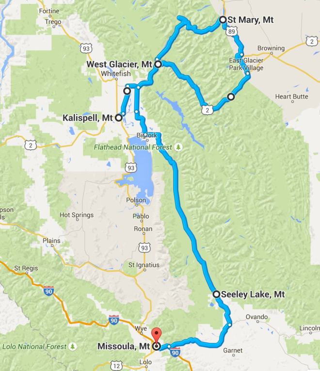
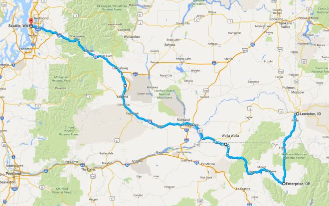
This four-day, 1,539 mile trip to Glacier National Park started on September 12, 2015. It was my second trip to Glacier in two years. This year I traveled solo. On my return, I had a chance to ride across Lolo Pass for the third time and Rattlesnake Highway for the first time.
I camped the last night out and stayed in motels the other two nights. It was a great trip, one without incident or rain.
Day 1

Day’s distance: 512 miles
The day started out in the mid 50’s but reached into the low 90’s in Montana. It was sunny all day.
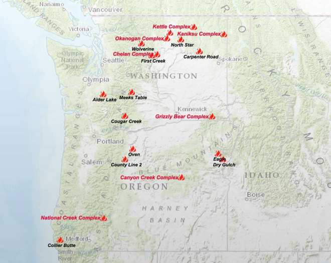
It had been a few weeks since my last trip, and I wanted to get out of the house. In thinking about where I might ride, I considered all of the active forest fires currently burning in Washington ,,,
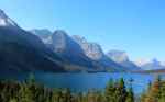
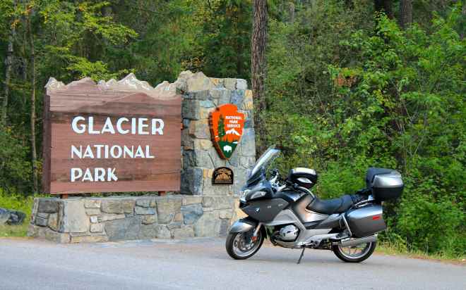
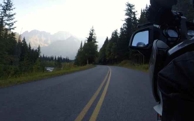
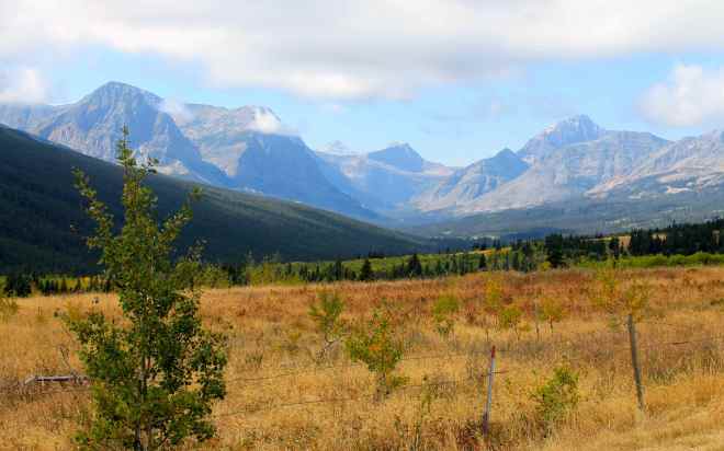
and decided to ride east to Glacier National Park. I visited Glacier last year and wouldn’t mind riding the Going-to-the-Sun Road again.
The route I chose, Interstate 90 most of the way, was a little out of character for me but it avoided those areas impacted by the fires. While I avoided forest fires, I did get stuck in traffic at a construction site near the Montana border.
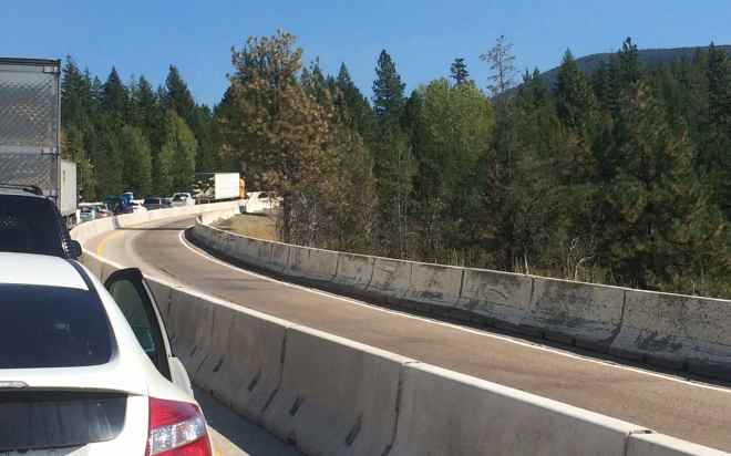
Eastbound traffic was stopped for about 30 minutes. It appeared that a semi-truck overheated, blocking the single lane until a tow truck was able to move it 😦
Putting a positive spin on the decision to take I-90, I was able to exceed 500 miles in a single day. Long time readers of the blog may recall that on my Southern States Tour, I planned a 500+ mile ride on Day 57, traveling from Oklahoma City to Taos, New Mexico but stopped eleven miles short of that goal to camp at Cimarron Canyon State Park.
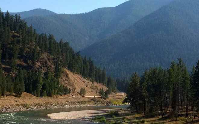
Once I turned off I-90 at St. Regis, traffic fell away.
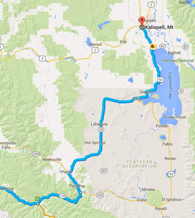
Highway 135 followed the scenic Clark Fork River. In much of Montana, like much of Texas, I found generous speed limits. The limit along here was 70 mph.
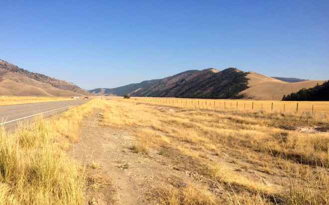
Kalispell, Montana is just north of Flathead Lake. The scenery through the Flathead Reservation land at the southern part of the lake is less forested grass lands.
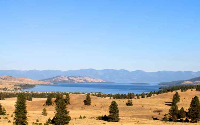
Congestion increased as I approached Lakeside, Montana. It was Dragon Boat Weekend, according to the signs I saw 🙂
I arrived at my motel about 6:30pm. With the timezone change, that meant I was on the road for about 10 hours, including the delay from the construction on I-90.
While I was unpacking, I met another R1200RT rider from the Seattle area. Charlie rode up along much of the same route I did, only he got on the road about 30 minutes earlier than me. We talked for a while about our bikes, and our travels. Good times!
I cleaned up and grabbed dinner at the local Montana Club. Not a bad steak. I was tired and planned to hit Glacier early so I called it a day – a good day.
I live a charmed life.
Day 2
Day’s distance: 342 miles
Total trip distance: 854 miles
Temperatures ranged from the 50s to the 70s on this sunny September day. Winds were moderate with strong gusts in the afternoon.
The plan this year differed from last July’s trip in a few ways.
– The visit was scheduled on a Sunday this year, which was manageable as peak summer vacation season has passed. Last year’s visit was a Wednesday.
– I traveled solo this year and stayed only one night in Kalispell, instead of two. This time I had a sense of how much time I would spend in the park and planned a higher mileage day.
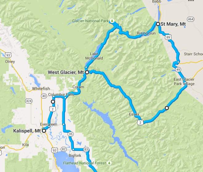
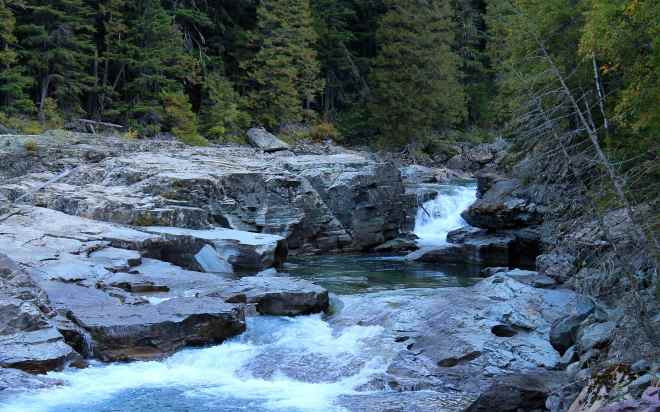
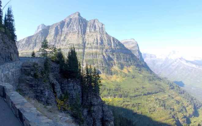
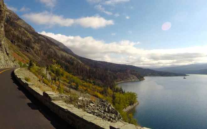
– We didn’t travel the entire road in 2014, as part of it was “under construction”, meaning gravel over hardpacked dirt. At that time, I wasn’t too comfortable with gravel and washboard roads. As a result, I missed seeing Saint Mary Lake. This year the road was paved but there was a forest fire earlier this summer that burned some of the area near the lake.
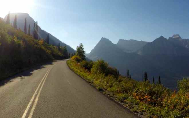
– Last year we entered and exited the park through West Glacier, traveling the Going-to-the-Sun Road in both directions. It was my hope to capture different perspectives and have a chance to return to something we may have missed. This year I looped around the park using Highways 89, 49 and 2.
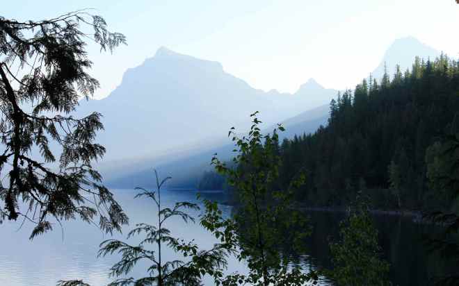
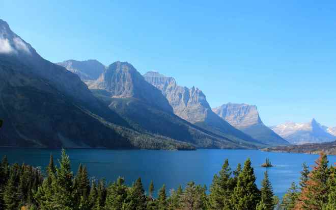
When I look at blog page describing last year’s trip now, it still reminds me of the awe I felt when I would come to one of a zillion scenic vistas along the Going-to-the-Sun Road.
In browsing the photos I took this year, I’m laughing at how I sometimes stopped in the same place and framed a similar shot. I guess the vistas still leave me in awe 🙂
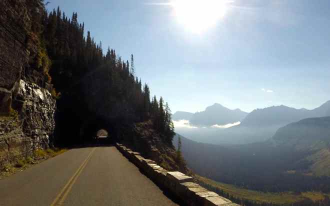
This year I left the motel at 7am, about an hour earlier than last year’s, hoping the rising sun would lend a dramatic feel to the park, combined with a lower angle of the sun in the sky as the Fall season approaches.
It was a good sign that I could drive right up to the park sign for a photo.
My photography muscles were exercised all day.
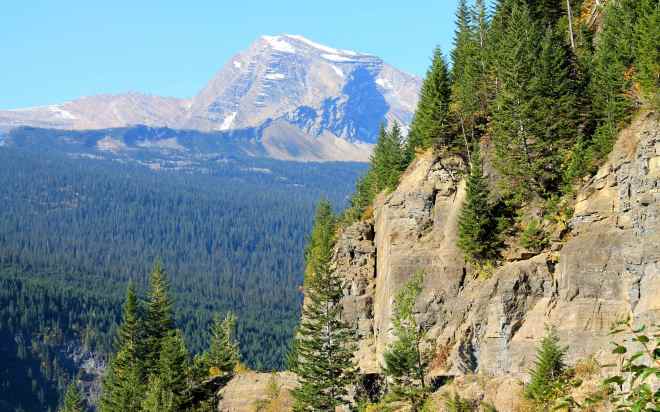
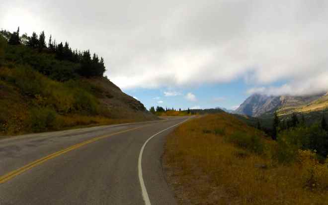
After departing Glacier through St. Mary, I traveled south along Hwy 89. This two lane highway was in good shape and combined 55mph speed limits with scenic views.
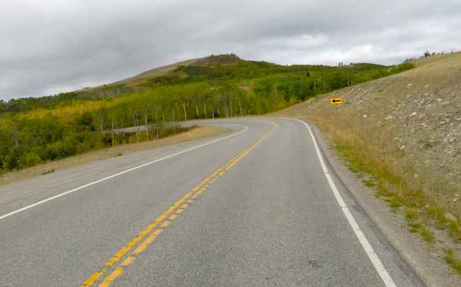
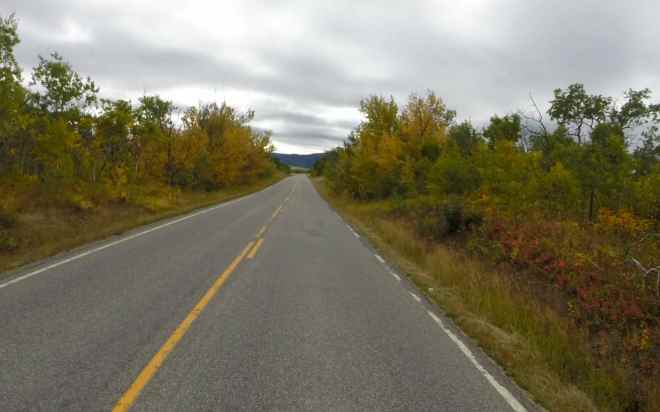
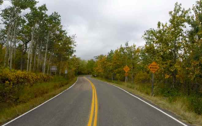
Instead of taking Hwy 89 into Browning before returning to Kalispell, I turned onto Hwy 49. This road reminded me of the Lost Coast Road I traveled on Day 6 of my Western States Tour. That is to say it wasn’t in really good shape but offered tight, sometimes pretty bumpy twists along with some great views. Fall colors were visible as were some cattle grazing alongside the road. Speed limits were 25mph most of the time.

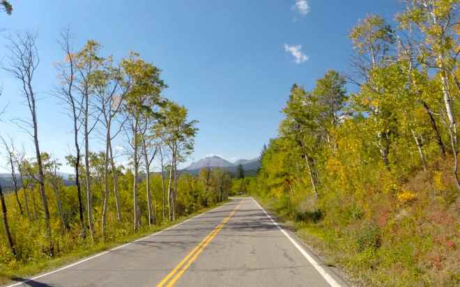
Highway 2 traveled along the southern border of Glacier National Park. Once it reaches Nimrod, it turns north and follows the Middle Fork Flathead River through forested canyons. The turns were mostly gentle and while scenic by most standards, it seemed a little boring compared to earlier roads that day.
Like last year, I took Hwy 83 past Swan Lake when leaving Kalispell. And I stopped for ice cream in Steeley Lake.
It was breezy on Hwy 200 into Missoula. I checked out their KOA but decided not to stay there. The pool was closed :(, and the tent sites felt pretty exposed given the location of the campground is between a subdivision and a mall. Instead I stayed at the Super 8 on Reserve St.
After I showered, I had Italian Pot Roast for dinner at Johnny Carino’s. It was good. The restaurant was within walking distance and it felt good to stretch the legs.
All in all, another long day in the saddle. But so worth the visit. I will have to camp inside the park next time I visit.
Day 3
Day’s distance: 228 miles
Total trip distance: 1,082 miles
Temperatures reached the low 70’s on this partially cloudy day. Winds were gusty at times, mostly on the Montana side.
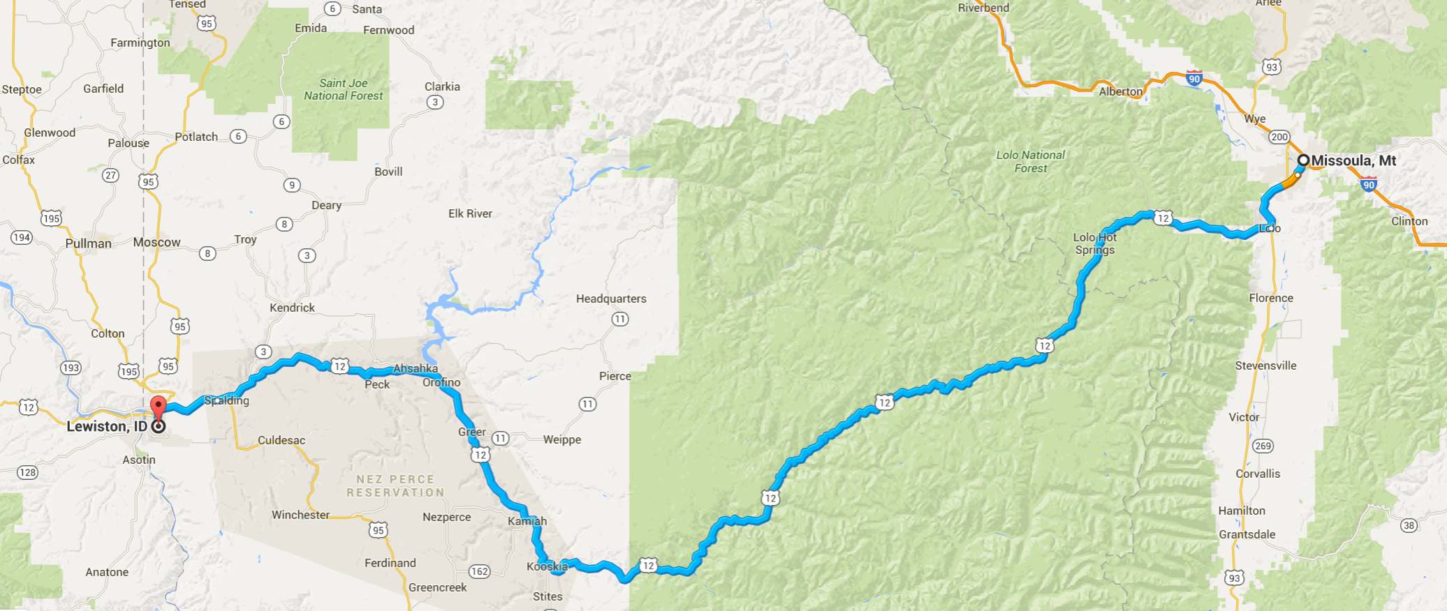
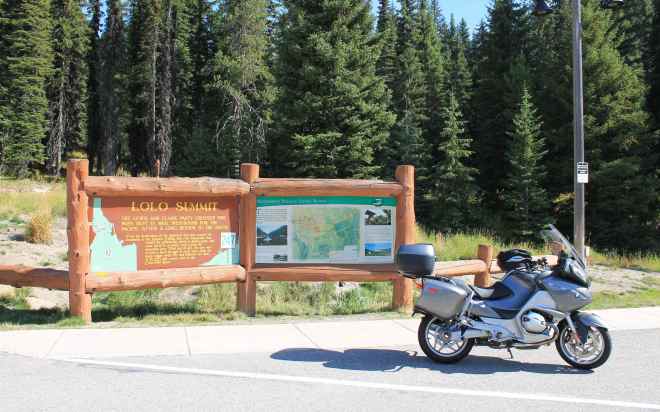
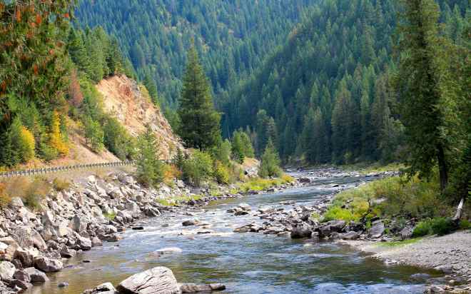
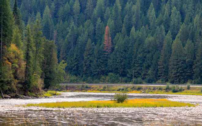
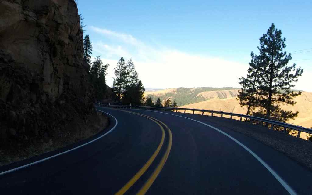
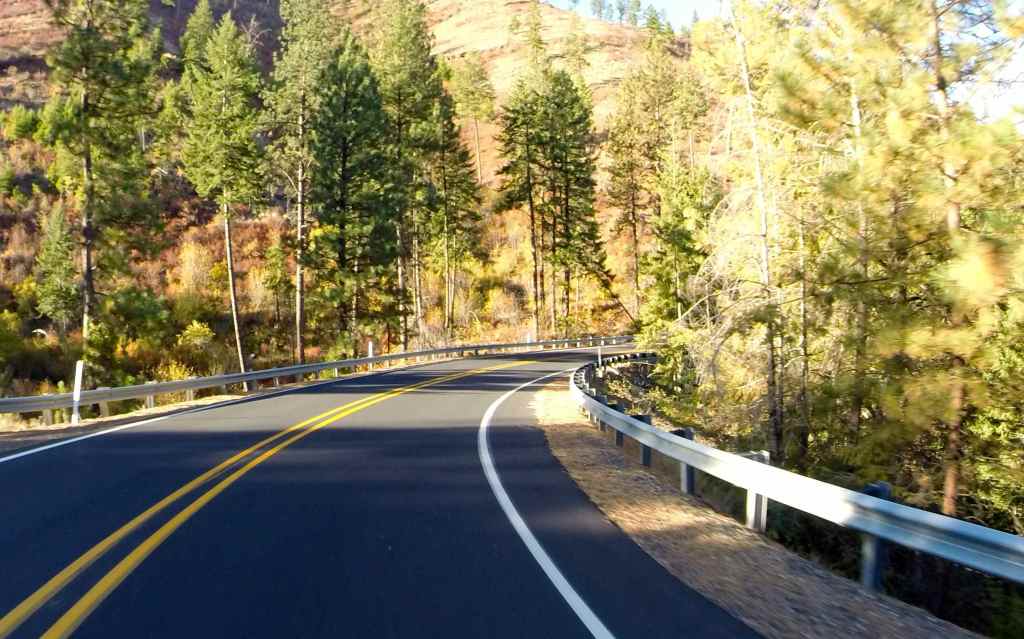
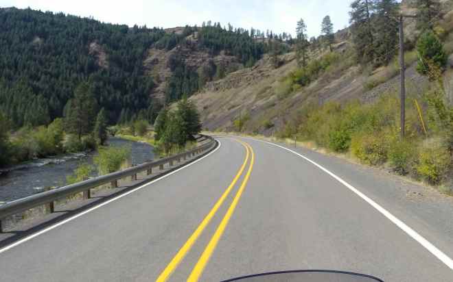
The goal of this day was to ride Hwy 12 across Lolo Pass for the first time this year. Lolo Pass is one of my favorite roads in this area and this makes my third time traveling from Missoula to Lewiston along the Lochsa River.
Originally, I thought I would continue south from Lewiston and camp at Wallowa Lake State Park, but the temperatures overnight there were going to be almost 20 degrees colder than in Lewiston. Because the change in plans would make this a shorter day, I didn’t leave the motel until about 10am and proceeded directly to a local Starbucks for a relaxing latte.
As mentioned in the past, the speed limits on the Montana side of Hwy 12 are 70mph and are 50mph on the Idaho side. During my visit last July, I met a Montana couple who ride BMWs. They indicated that the speed limit on the Idaho side is strictly enforced by police. I have not seen law enforcement vehicles on the route and, from the speed that others travel, I can’t really get a sense of the levels of enforcement, but I kept it at or near the posted limits. For large portions of this ride, I simply set the cruise control for 50, cover the front brake with two fingers and enjoy the zen-like pleasures of motorcycling on a slow windy road on a dry day with perfect temperatures.
The forests in this area looked less impacted by the pine beetle as other areas I’ve been through on this trip. It is really sad when I travel through forests devastated by either fire or pests.
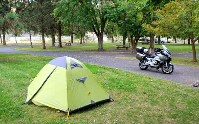
Even with the late start to the day, I arrived at Hells Gate SP before 4pm. The park wasn’t crowded and it was easy to get a tent site even though I didn’t have a reservation.
I had long conversations with two other riders while staying at the park. Al, a local resident and long-time rider with a background in dirt bike racing and I talked at length about all kinds of bike related topics, from trail riding to maps. Al seems to be a big fan of KTMs for the trail.
Ned, who lives in Tacoma, rides a BMW GS with a sidecar and travels with his dog. Both were featured in a SidecarDogs.com production called ‘Sit Stay Ride: The Story of America’s Sidecar Dogs’ available for rent on Vimeo.
Meeting both these folks was a treat. I feel like I can learn so much about enjoying life and motorcycling by meeting guys like Al and Ned.
I hit the sleeping bag early looking forward to riding the Rattlesnake Highway in the morning before heading back to Seattle.
Day 4
Day’s distance: 457 miles
Total trip distance: 1,539 miles
Temperatures remained cool today. As I traveled south this morning, the temperature dropped into the mid 40s before warming into the mid 60s later in the day. Winds were mild and there was no rain, though it was the cloudiest day of the trip.
It’s true I was in the northeast corner of Oregon in early August on my Trip to Wallowa Lake.
It was during that trip that I met up with Forrest, a former co-worker and current BMW rider. He mentioned how cool Hwy 129 was to travel between Lewiston and Enterprise. I decided to add the ‘Rattlesnake Highway’, as it is known, to this trip.
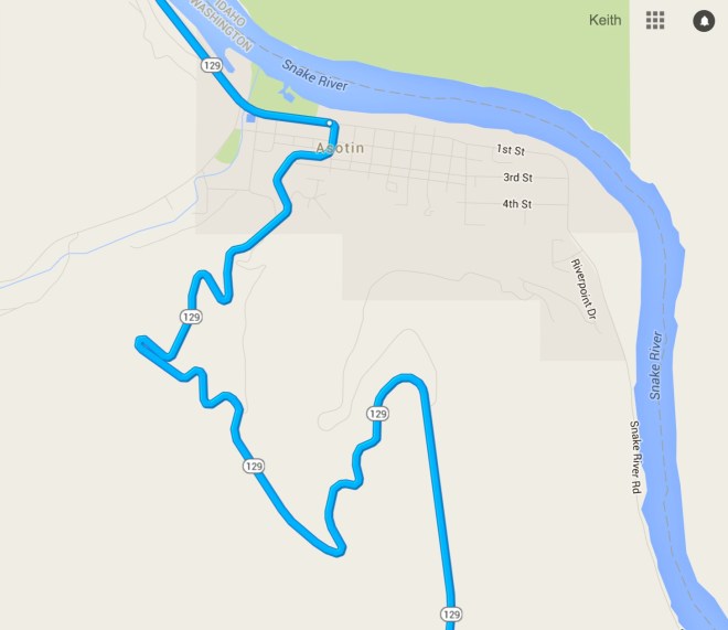
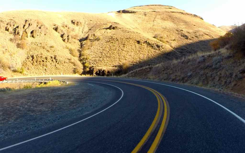
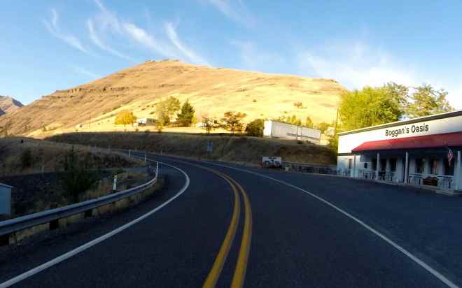
Leaving the campsite in Lewiston at 7am, I crossed the Snake River into Clarkston. I filled up with latte in Clarkston and with gas in Asotin, where Hwy 129 turns south and heads up through the canyon’s grassy hillside. It was kind of a fun introduction to what was ahead of me 🙂
The only issue I had with the trip to Enterprise was it just seemed to get colder and colder as I traveled south.
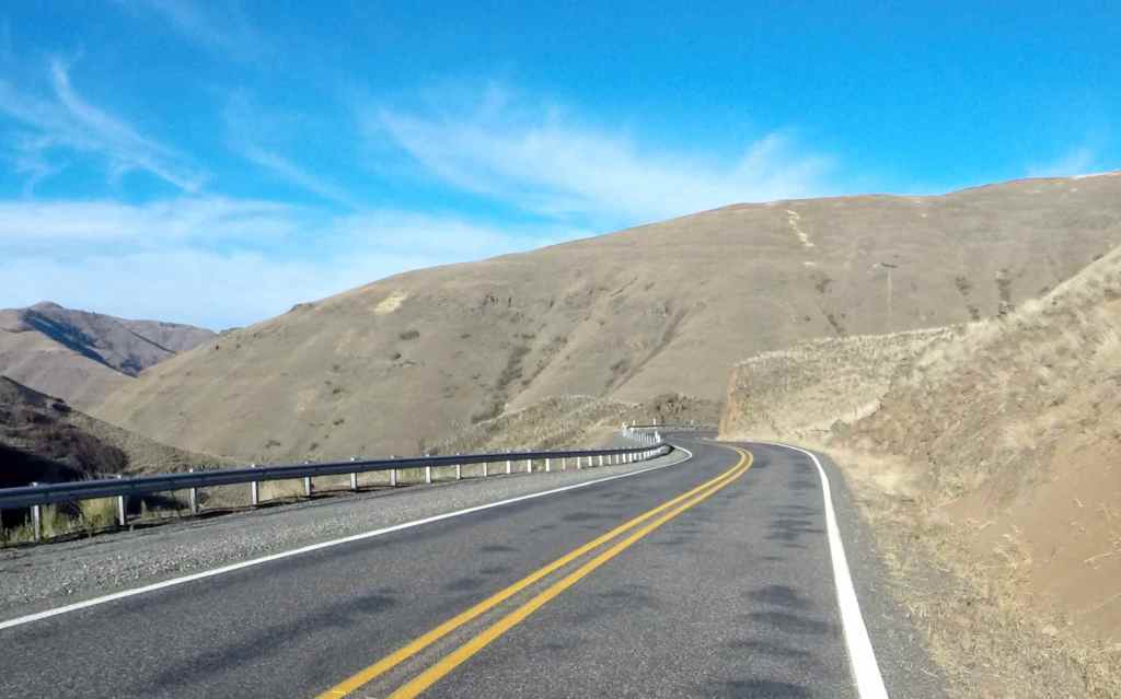
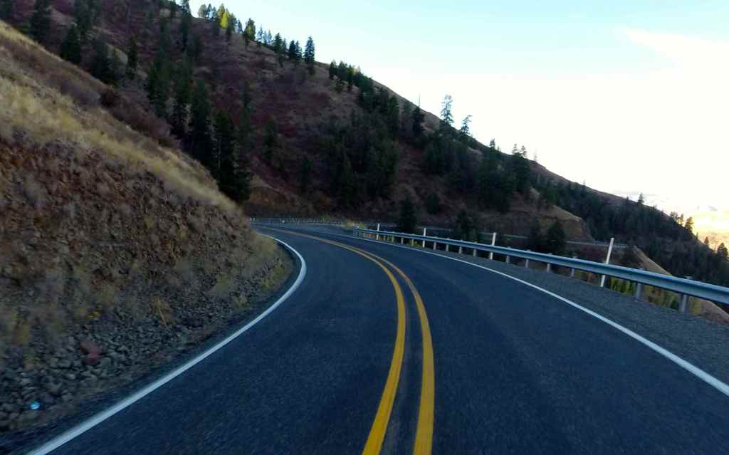
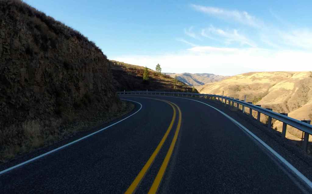
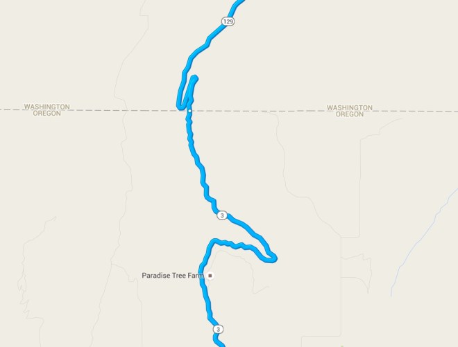
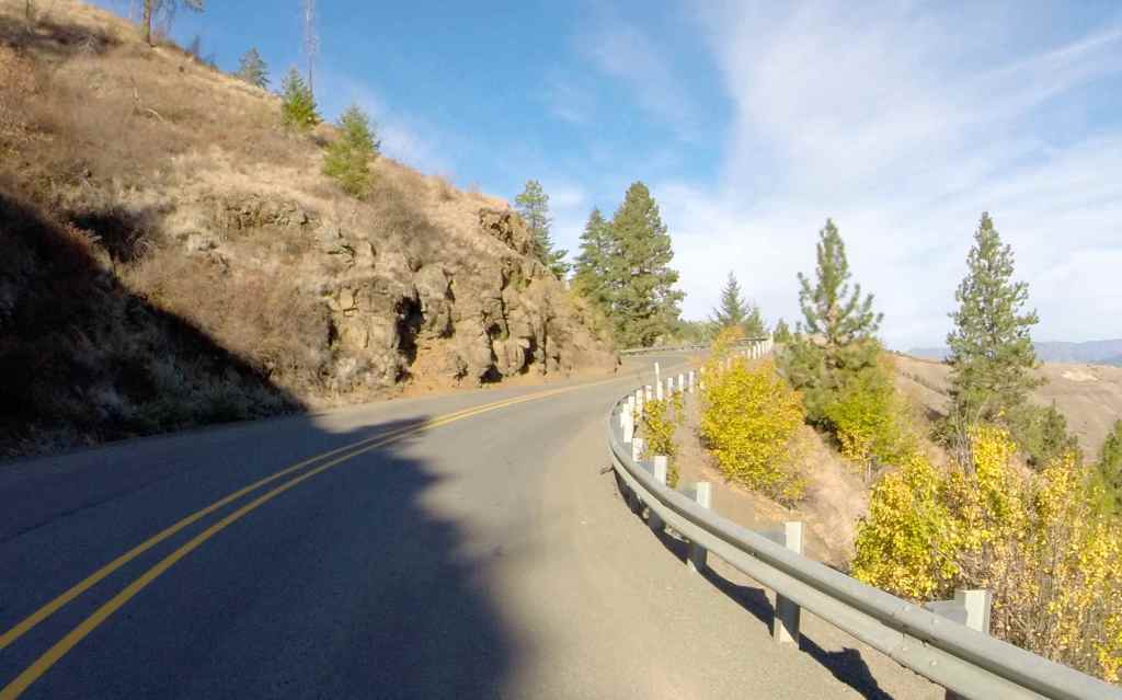
I stopped to put on my GoPro at Fields Spring State Park. Here’s a closeup of that section on the map.
And here are some photos of the roadway as I passed through …
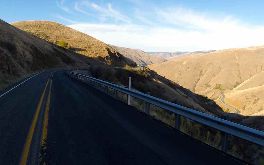
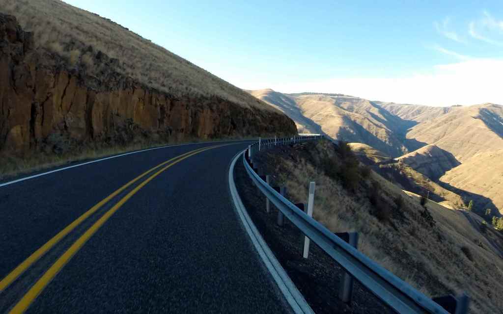
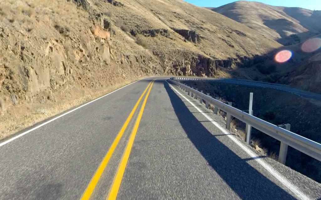
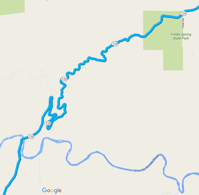
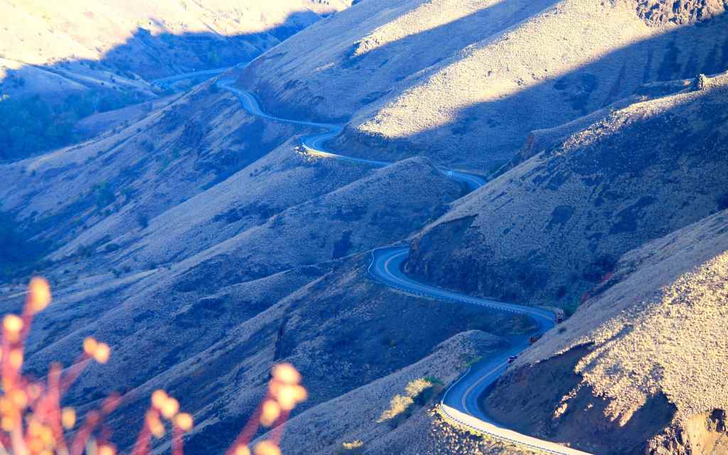
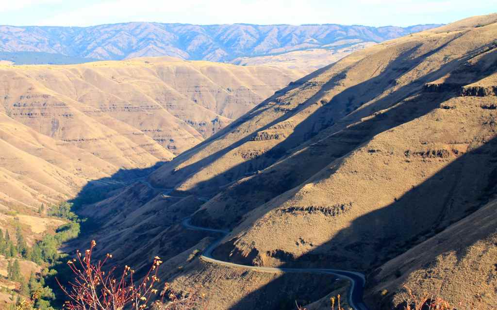
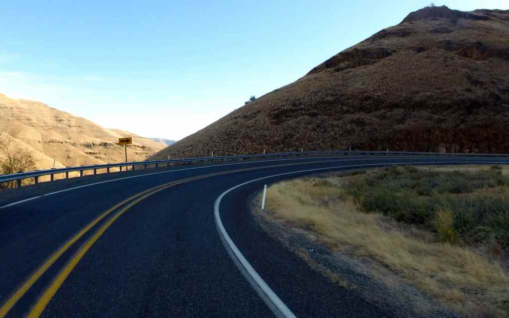
As I passed Boggan’s Oasis, I thought wow, that was cool.
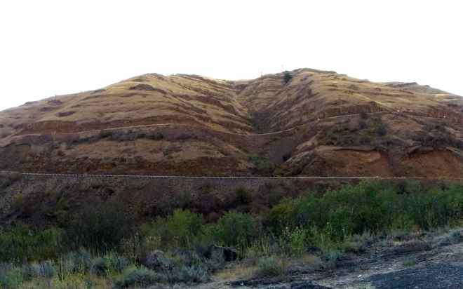
Traveling a bit further, I realized looking up at the switchbacks cut into the hill that more was fun in store for me.
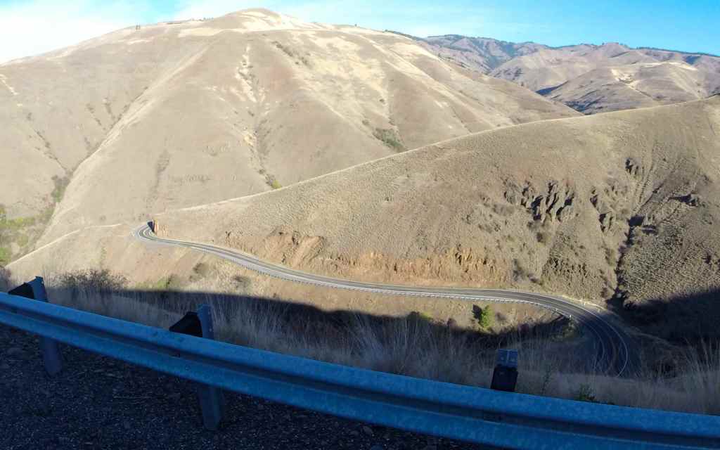
Here’s the map of the second half …
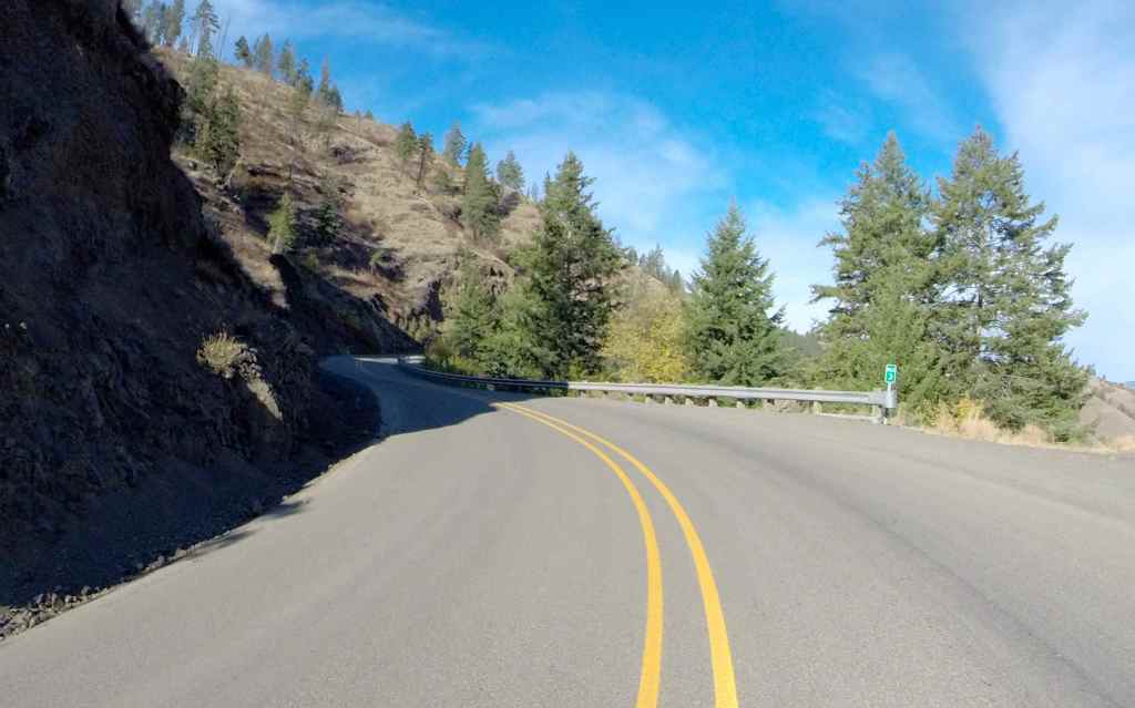
and a few more photos …
The second half put the icing on the cake – what an awesome road. Thanks to Forrest for making me aware of its existence and thanks to Al for encouraging me to detour here and ride the Rattlesnake. 🙂
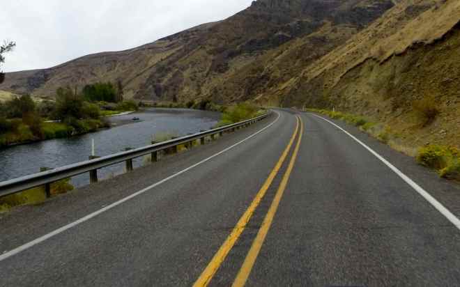
The rest of the trip into Enterprise was pleasant, with the road winding through the Wallowa-Whitman Forest and eventually into town.
The roads home from Enterprise were mostly familiar to me from my trip in August. Here are just a few shots from the afternoon’s canyon carving 🙂
I made it home just after 5pm, before traffic in town was too bad.
This was a great four-day trip.
Reflections
With this trip, I have traveled more than 20,000 miles this year! I now have over 40,000 miles on the odometer of my 2013 R1200RT.
I remember commenting to my friend after returning from my Southern States Tour that I would be hard to impress going forward because of all the great roads I traveled on that trip. Nevertheless, Rattlesnake Highway was impressive, despite my experience on roads like the Tail of the Dragon and the Pacific Coast Highway.
I think conditions change over time, as does my outlook, mood, and experience. There is an opportunity to discover new things even on roads I’ve taken before. Glacier was excellent the second time and I’ve never had a more Zen-like experience on Lolo Pass than I did this trip.
I feel comfortable now with longer days on the bike and routinely plan longer-mileage days than in the past. Though I still prefer smaller, less-congested roads but I’ve used freeways and major highways more this year in a effort to minimize time in hot weather, or in traffic, or just to get somewhere special more quickly if I’ve already seen whatever is between here and there. 🙂
At this point in time, I carefully consider my routes, using many resources to help identify fun roads to ride. However, one area that I want to bring additional energy and focus is combining new activities on these trips. I’m talking about things like hiking, swimming, extending the time spent hanging out in cool places, exploring the towns I travel through a little more. I will work on that with future trips.
Now that we’re into September, it feels like this trip was my last ‘big trip’ of the summer. I ride year-round, but trips in the winter are generally shorter day trips. We’ll see what the gods of Garmin and BMW hold in store for me this Fall. 🙂
