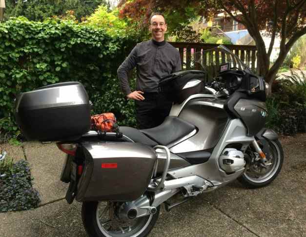
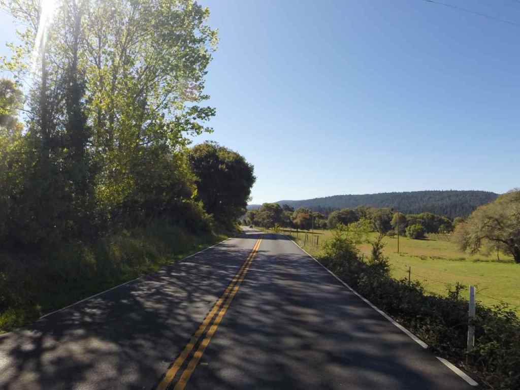
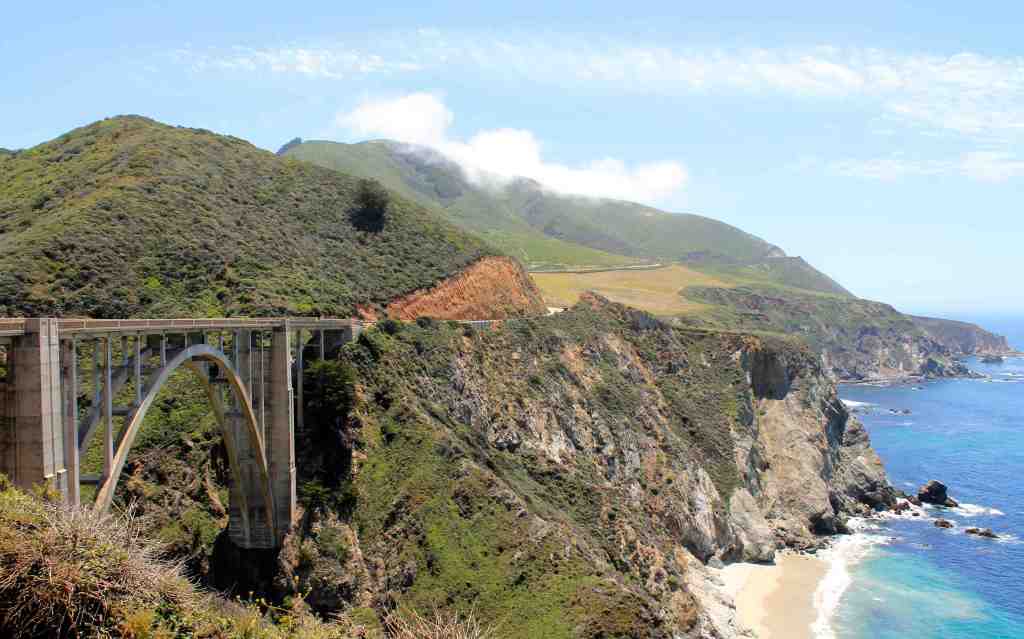
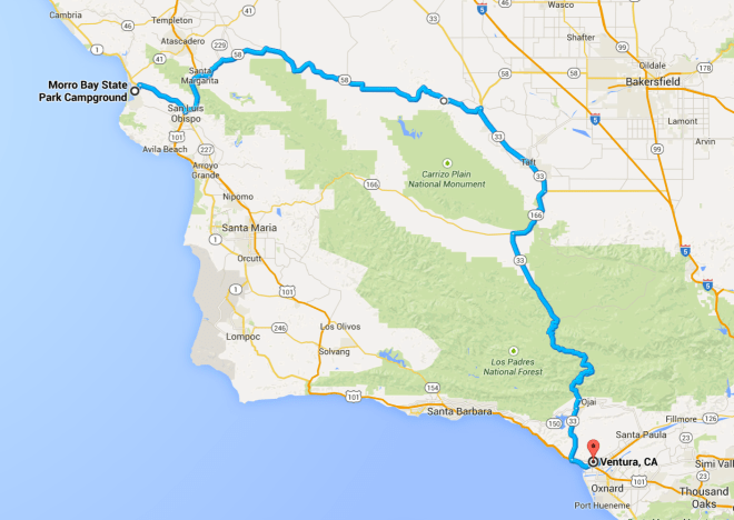
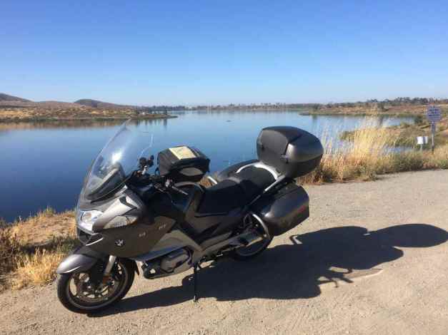
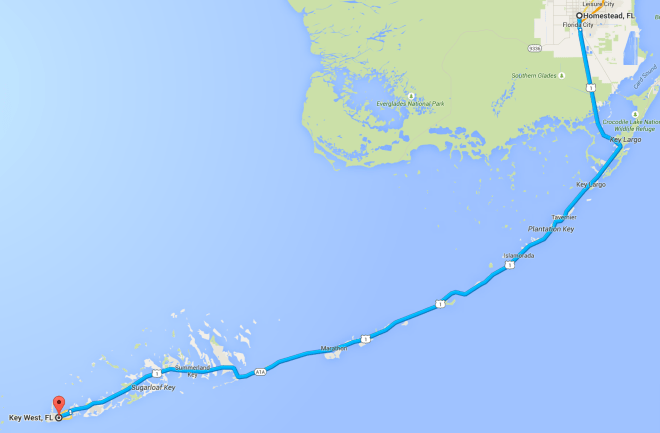
The longest and farthest trip I’ve taken, this 65-day motorcycle adventure started April 13th, 2015.
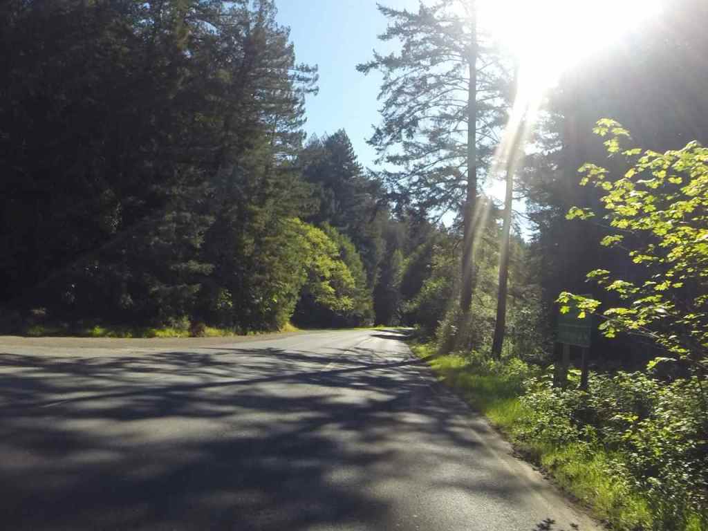
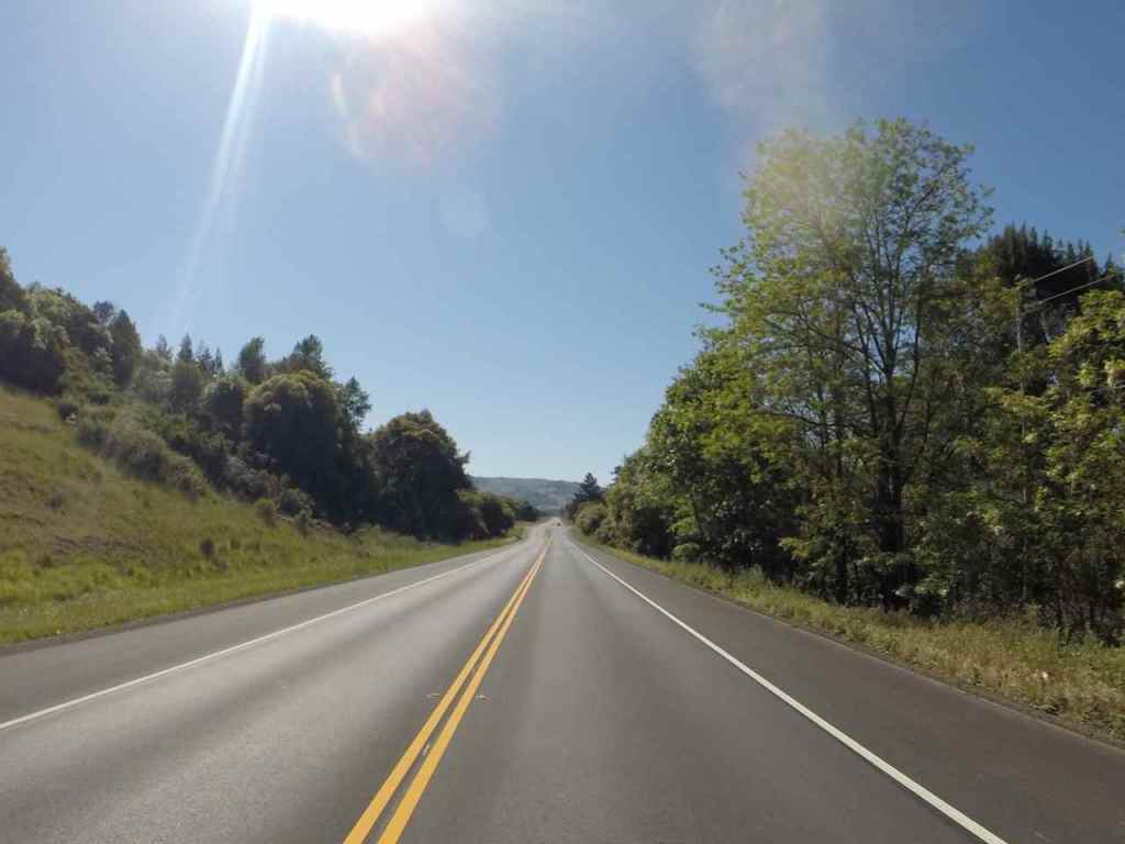
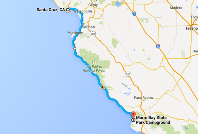
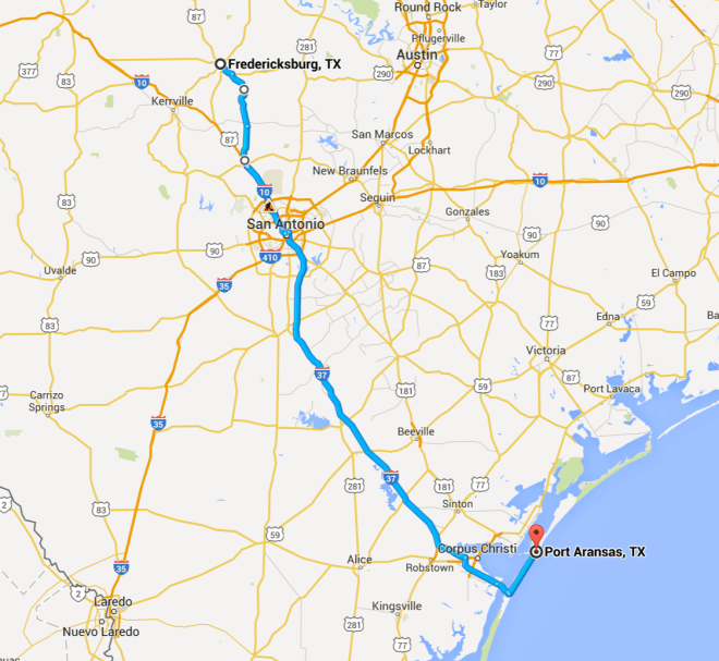
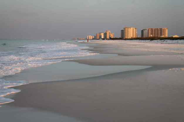
I rode solo into Oregon and California, mostly along the coast with some inland detours. From San Diego, I headed east staying close to the border of Mexico then spending time in Texas Hill Country before heading to the Gulf.

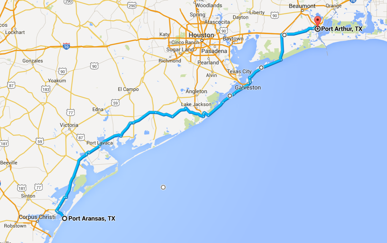
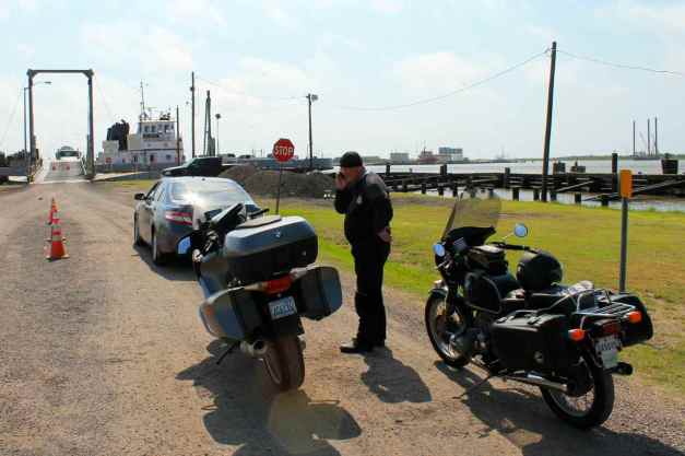
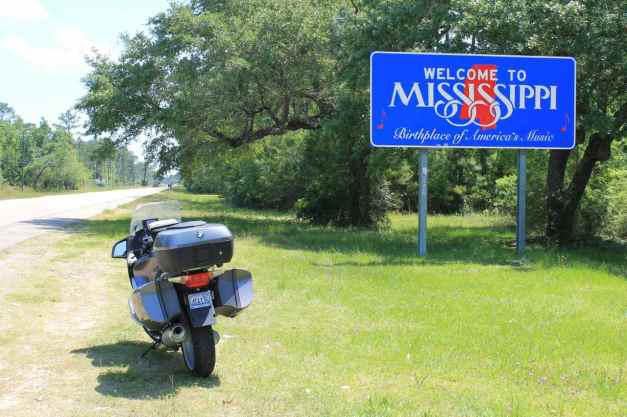
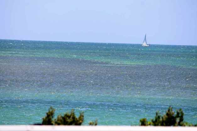
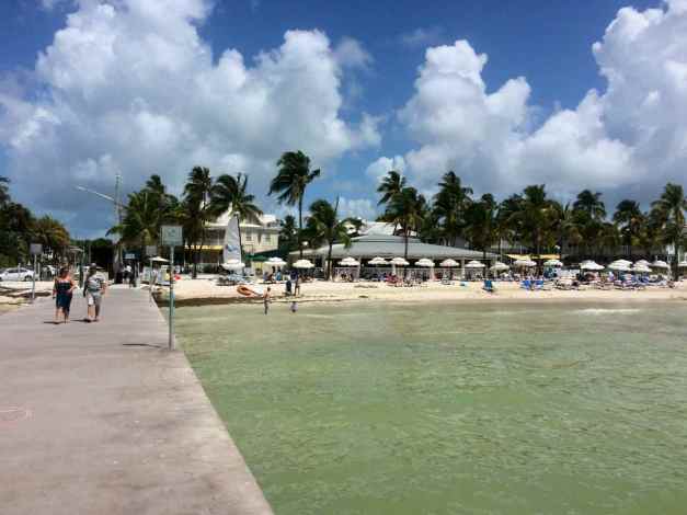
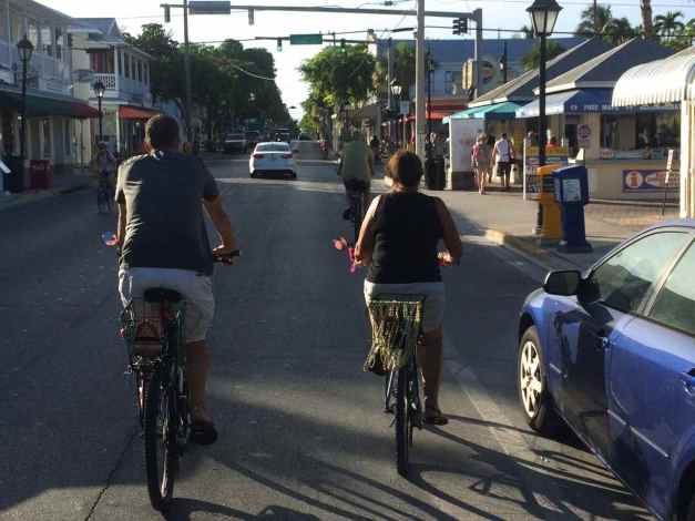
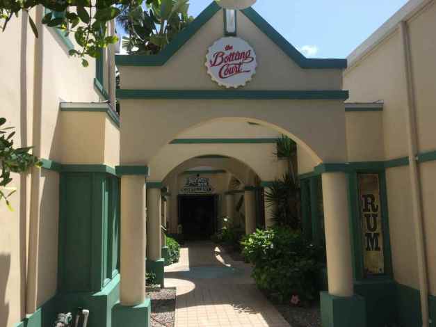
From Texas I followed the Gulf to Key West where I spent a week off the bike visiting with old friends and meeting new ones.
Key West was my turnaround point and I headed up the Atlantic Coast states as the beginning of an exploration of the southern states and the great motorcycle roads found there.
Some of the well known motorycle roads ridden included Tail of the Dragon, Cherohala Skyway, and the Blue Ridge and Nachez Trace Parkways.
During the tour, I traveled 12,566 miles, visiting places I have never seen, visiting friends I knew from Seattle and making some new friends along the way. It was an amazing experience, to say the least.
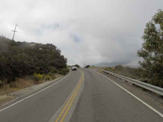
Day 1
Day’s distance: 256 miles
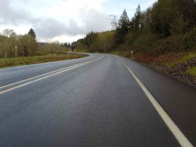
The weather started out with clouds, then became rainy later in the morning as I approached the coast. It continued to rain for the rest of the day’s ride. Temperatures ranged from 43 to 50 degrees.
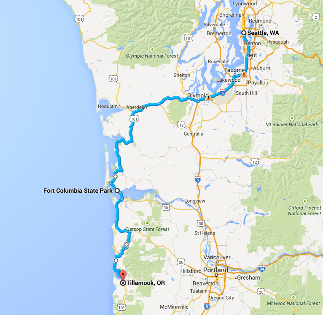
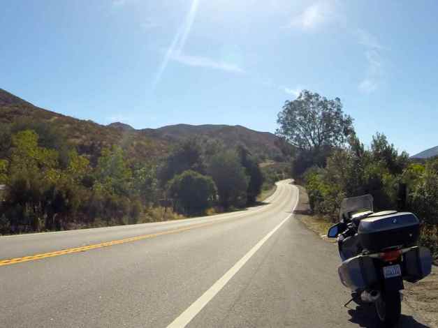
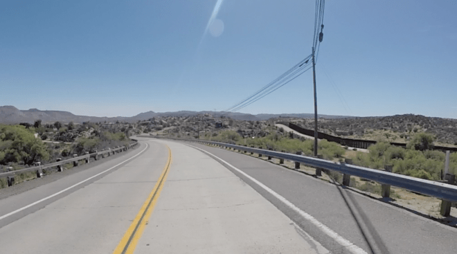
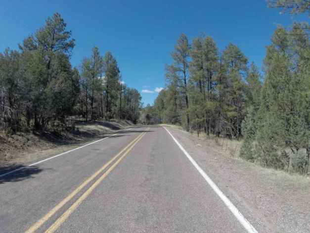
I departed the house just before 8:30am. My route out of Washington took me south on I-5 to Olympia, then west towards Aberdeen on Hwy 101. When 101 turns north, I continued traveling west on Hwy 8.
Just before reaching Elma, I saw a deer crossing the highway. It was maybe 100 yards in front of me, but I slowed way down. This is a best practice as deer often travel in numbers. This one appeared to be alone and quickly jumped over the guardrail and off the highway.
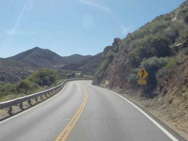
At Elma, Hwy 8 turns into Hwy 12 and continues west. I turned off Hwy 12 and took Hwy 107 south to avoid Aberdeen traffic. One thing sucks worse than riding in a cold rain. That is being stuck in traffic in cold rain. 🙂 Hwy 107 is a two lane road in good condition with little traffic. This is the type of road I like to travel on my motorcycle, but it is short and I soon found myself on Hwy 101 headed south.
I stopped at the McDonalds in Raymond to take a bathroom break and stopped again at Fort Columbia. Perhaps it was a combination of two cups of coffee and riding in the rain. 🙂
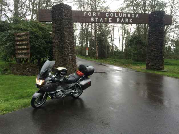
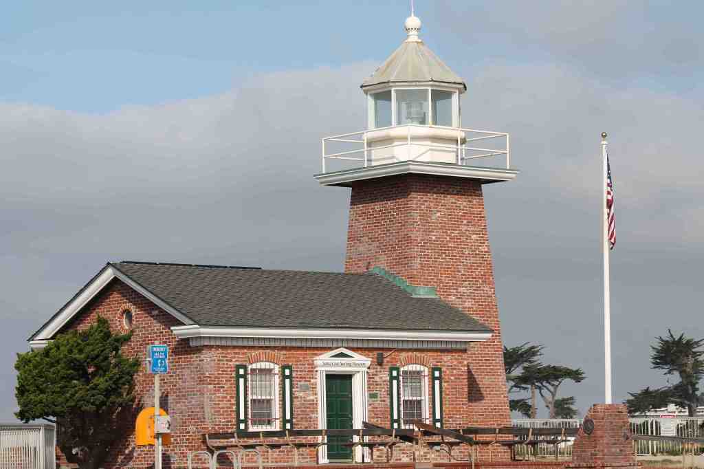
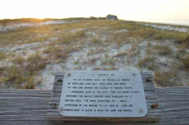
The Columbia River divides Washington and Oregon and the fort guarded the mouth of the river just to the south of this promontory.
At this point, I was still largely dry, but the rains picked up near Gearhart. Along with the rain coming down, trucks were kicking up mass quantities of water and I started feeling it. So I stopped for lunch at a Subway in Gearhart.
The manager, who was working the register, asked if I was heading north or south. I replied south and he told me about Hwy 53, also known as the Necanicum Highway. It is a short, two-lane road through forest lands and he thought I would enjoy it. I was planning on taking Hwy 26 east to Banks and then take Hwy 6 through the Tillamook State Forest, so put Hwy 53 in the back of my mind.
After I finished lunch, I thanked him and went on my way. The rain continued as I turned inland on Hwy 26. A few miles later, I started thinking I needed to shorten today’s ride – it isn’t all that much fun riding in the rain if you’re wet and getting wetter and I was having to work to keep my visor from fogging up. I saw the sign for Hwy 53 and decided to use it and shorten the ride by about 50 miles.
It was fortuitous that I spoke with the Subway manager.
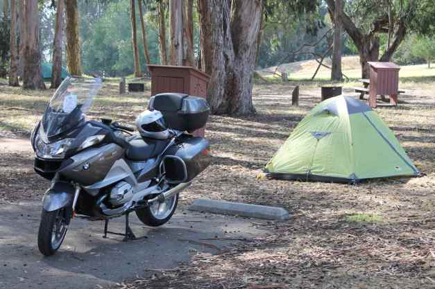
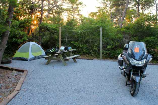
Hwy 53 rejoins Hwy 101 north of Rockaway Beach, then turned south and finished the day just south of Rockaway in Tillamook. I hoped for nicer weather and with it a chance to stay at Cape Lookout State Park, just outside of town. I camped there on Day 2 of my Western States Tour. It was a nice campground and I remember setting up my tent on well maintained grass and taking some really nice sunset photos.
Alas, I needed a hot shower and a heater to dry my gear so I am staying at the Western Royal Inn motel. The room is big, with a sofa, desk, and dining table along with a large queen bed. It isn’t fancy but it’s clean, has good water pressure, and a really good heater.
Not many pictures today. I generally don’t feel like stopping as often in the rain. Future posts will likely have fewer words and more pictures.
Day 2
Day’s distance: 271 miles
Total trip distance: 527 miles
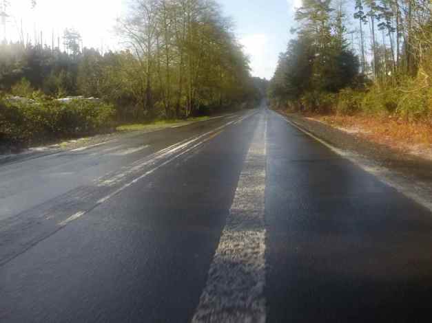
The weather forecast accurately predicted showers today along my route. I was rained on a handful of times, most were quick showers and I stayed dry under my gear. The temperature this morning started at 39 degrees and stayed mostly in the 40’s until late afternoon when it warmed up to 53.
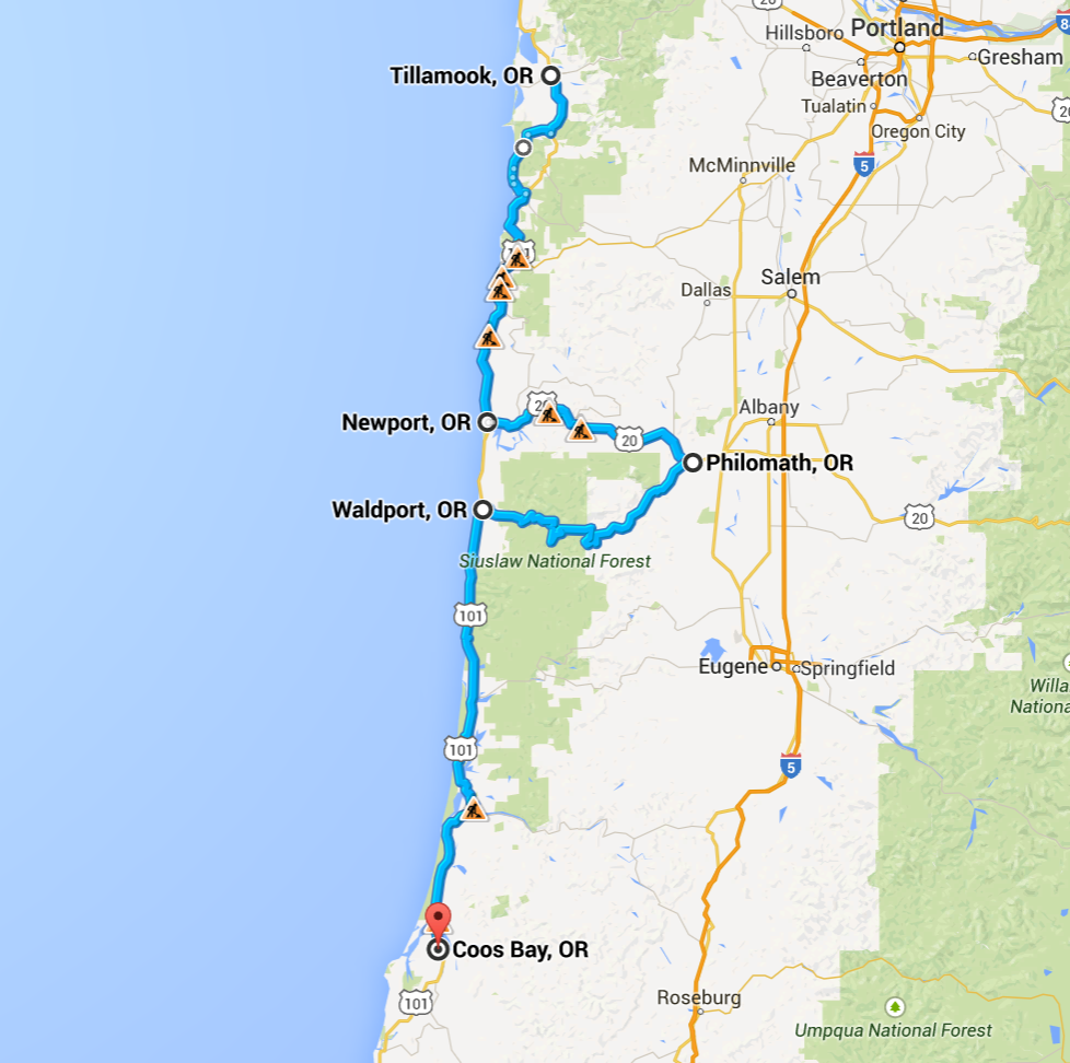
After leaving Tillamook about 8:30, I headed south on Hwy 101 when I noticed a sign for Three Capes Scenic Drive. I pulled over and checked the map. The scenic drive rejoins Hwy 101 south of Pacific City and so in the spirit of exploring I decided to take the detour.
This scenic route consists of a well maintained two-lane set of roads that skirts the coast where Hwy 101 is more inland. I was surprised to come across hail on the road at one point.
One of the small towns I passed while on this scenic route was Cape Kiwanda, situated in a very picturesque area.
I updated my plans to take Hwy 229 inland just south of Lincoln City based on a recommendation from my Coos Bay riding friend. I even programmed it into my GPS unit but somehow I simply spaced and didn’t notice until reaching the turnoff for Hwy 20, which was my original route. Sorry Mark 😦
Hwy 20 took me into the small town of Philomath where I turned onto Hwy 34 to head back to the coast. Both these roads were in good condition, but the latter was my favorite. It cuts through the Siuslaw National Forest roughly following the Alsea River and not only was it scenic, but the air smelled great – very fresh. I think the alternating rain showers and sunshine worked their magic on the trees and soil of the forest.
My Coos Bay hosts took me to Tokyo Bistro for sushi. Part of the dinner discussion tonight focused on how riding a motorcycle allows for a rich interaction with the environment. Feeling the air temperature drop just before the sky opened up with rain and noticing the freshness of the air are two examples of what I mean.
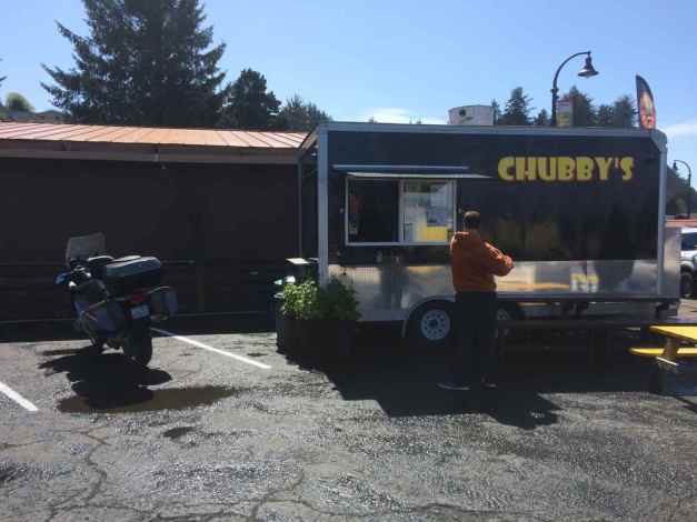
Another example is what happened when I pull up to Chubby’s, a food trailer located in Waldport, for lunch. During my lunch, I had three separate conversations about motorcycling and my travel plans.
These interactions occur regularly when I’m traveling on the bike. In fact, it is how I met my Coos Bay host 🙂 It is one of the best parts of traveling by motorcycle.
Tomorrow’s forecast is for sun !!
Day 3
Day’s distance: 365 miles
Total trip distance: 892 miles
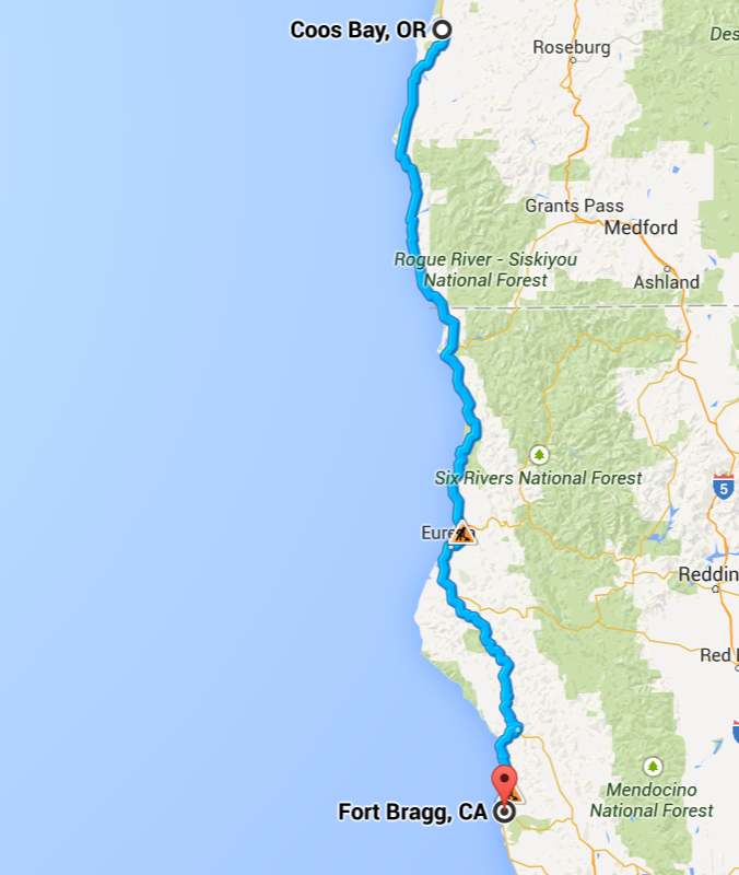
The weather started in the low 40’s but was in the mid 60’s by the time I reached the California border. It dropped backed down into the high 50’s as I approached the coast on Hwy 1. The sky was partly cloudy with a lot of sunshine compared to prior days. Strong crosswinds in the afternoon were challenging.
Mark, my host in Coos Bay, and I rode our motorcycles to Simpson Reef Overlook, part of Shores Acres State Park this morning. The sky was mostly clear and the sun bright.
We left the park along the Cape Arago Hwy, then turned south onto Seven Devils Road. This local road has a number of nice twisty sections and the surface is reasonably free of potholes. Seven Devils Road meets up with Hwy 101 and we traveled south to Bandon for breakfast.
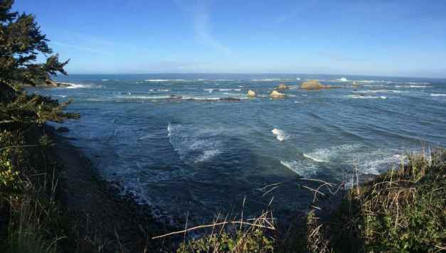
After breakfast, Mark headed east for a short day ride while I went south towards California to continue my tour. It was 10:30 or so by this time.
I reached California shortly after noon.
I didn’t stop in Crescent City or ride the Lost Coast Road this year. But I did ride through the Prairie Creek Redwoods State Park again. Last year, I created of video of my ride along the Newton B. Drury Scenic Parkway. Here’s that video …
I took a short break prior to reaching Leggett, my planned stop for the day. After a snack, I decided that I could go farther today. I’ll be riding into San Francisco tomorrow and don’t want to do so at the peak of rush hour so traveling an extra hour today seemed sensible.
Fort Bragg became my new destination and while on my break I reserved a room at the Travelodge online.
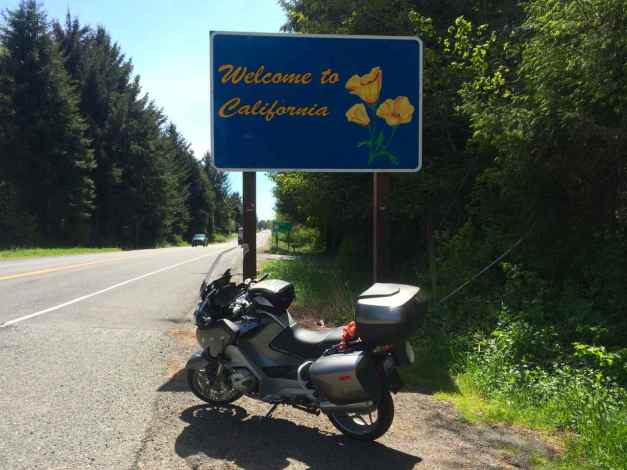
My only disappointment today was not capturing my ride along the northern-most part of Hwy 1 from Leggett to the coast on video. I set up the GoPro on my helmet before turning off Hwy 101. Alas, when I reached up to adjust the camera’s angle, I accidentally turned it off. I realized this only after reaching the coast, some twenty minutes later. Maybe next time 😦
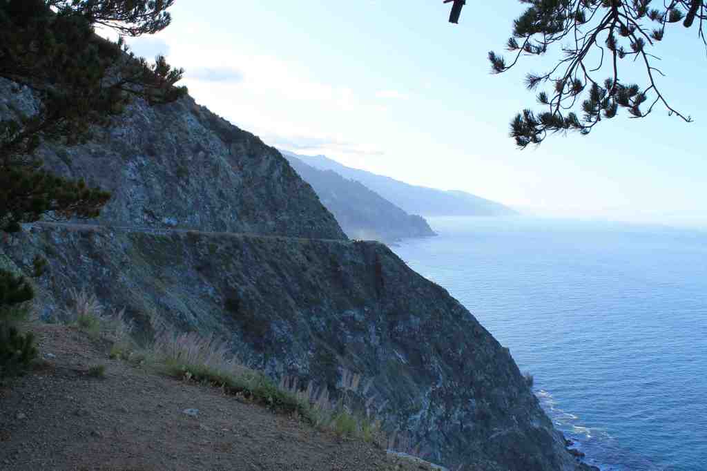
It didn’t take long for me to remember how nervous I was last year while traveling this coast. No guardrails, blind curves, and steep drop-offs still make me nervous.
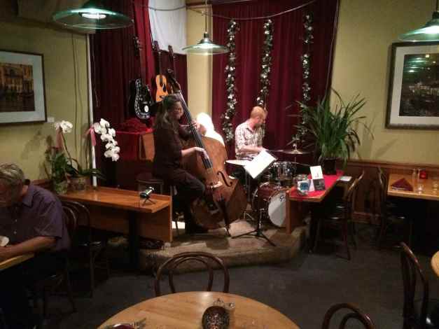
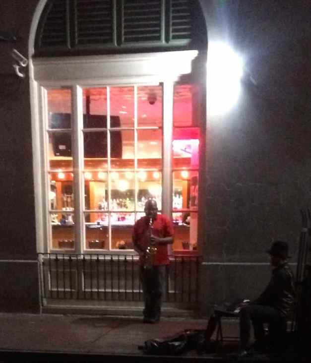
I reached the motel in Fort Bragg shortly after 7:30 pm. Dan, the clerk at the desk, recommended Cucina Verona when I asked about food. After a quick shower, I walked the one-half mile to the restaurant.
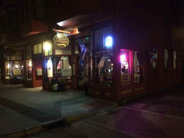
Once there, I discovered that the have a small Jazz ensemble on Wednesday evenings and I was able to catch their second set. I spoke with the bass player after they finished their final set. She told me that she learned to ride a motorcycle in San Francisco in the 60’s. It seems almost everyone has a motorcycle story.
Dinner was good and the walk back helped loosen my sore back.
I’m reminded that I live a charmed life 🙂
Day 4
Day’s distance: 213 miles
Total trip distance: 1,105 miles
Today was sunny and warm. The temperatures started in the high 50’s and peaked in the low 80’s inland. Winds were light. This Seattle resident gets an early summer again!!
It is common at the motels I use on these trips to offer a free continental breakfast, served in the lobby or a room adjacent to the lobby. I usually grab a small bowl of the sugary cereal, a piece of fruit, yogurt if available, and lots of coffee. Oh, if I’m being completely honest, a miniature bear claw, too.
The Travelodge didn’t have yogurt :(. All other critical breakfast items were present!
Breakfast consumed, I packed up and headed south at about 9am.
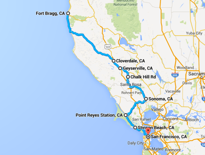
I left the Pacific Coast Highway a few miles south of Mendocino and turned inland on Hwy 128. I’ve traveled this road from Cloverdale to the coast during last year’s Western States Tour. Back then, I thought it was a nearly perfect motorcycle road with smooth pavement, great twisties, and beautiful scenery. This year I rode it eastward.
I stopped in Boonville for a latte and got a little artistic with the camera while drinking it.
Here are some of the other photos taken between the coast and Cloverdale.


[In the interest of full disclosure, there was maintenance being performed on specific part of the road this year. Flaggers were out, as was some big equipment.]
Hwy 128 east of Hwy 101 wasn’t as interesting. It travels southeast from Geyserville, through the vineyards of Napa Valley. Unless you are visiting wineries, there are better motorcycle roads out there. The same goes for Chalk Hill road, which while twisty, is not well maintained. Watch for trucks and tractors on both of these wine country roads. Hwy 12 from Santa Rosa to Sonoma and Hwy 116 from Sonoma to Petaluma are fairly congested and not worthy, either.
Hwy 116 from Petaluma westward had definite merits, including a smooth surface, tight curves and sweepers. The speed is limited in most parts to 45 and was patrolled by the police. Watch for them and bicyclists.
While Hwy 116 goes into Point Reyes Station, today I took the Platform Bridge Road and then part of the Sir Francis Drake Blvd back to Hwy 1. This was a result of my programming the GPS with a slightly different route without intending to do so. Both, however, were smooth and scenic.
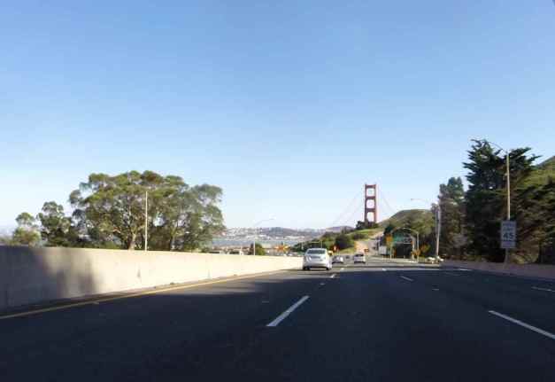
I continued south on Hwy 1 as I did last year, over the Golden Gate Bridge, and into San Francisco.
After unpacking, my friend Craig and I went to a regular Thursday food event in Golden Gate Park. Approximately ten food trucks gather in the east end of Golden Gate Park. The trucks, along with live music, draw a nice crowd of folks from the nearby neighborhoods.
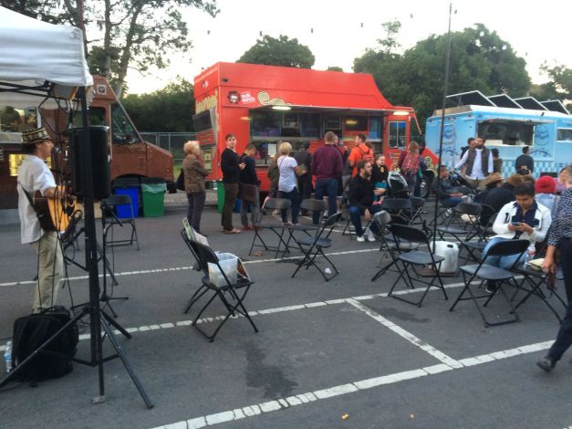
A double scoop of ice cream from The Ice Cream Bar (Cole St) followed by some wine and conversation finished the evening. A great day, indeed.
Day 5
Day’s distance: 104 miles
Total trip distance: 1,209 miles
Today was sunny and warm, with temperatures starting in the mid-60’s and reaching the mid-80’s.
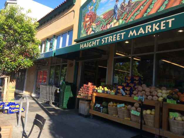
I started the day with a latte from the Haight Street Market, which is steps away from my host’s apartment.
The motorcycle was parked two blocks away during the night, and all three hard cases were brought up to the apartment so they would be safe. It took about 20 minutes this morning to park the bike in front of the apartment and to load the three cases on the bike. It was 10am before I started my short trip down to Santa Cruz.
I wanted to ride along part of Skyline Blvd (Hwy 35), a two-lane road running along the ridge of the Santa Cruz Mountains between San Francisco and Hwy 17 to the south. It is popular with local motorcyclists as well as bicyclists and tourists, scenic and the road is in good shape.
I stopped for brunch at Alice’s Restaurant, located on Skyline Blvd. To be honest, I thought this was a famous Alice’s Restaurant from the Arlo Guthrie song, but that Alice’s restaurant is in Massachusetts. Thanks for keeping me honest, Nils.
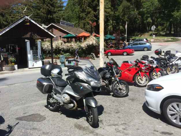
I finished brunch about 1pm and my Santa Cruz host would not be home for a few hours. I decided to ride to one of the local BMW dealers and see if I could find some new riding boots. As you can see from the photo below, I wore out these 🙂
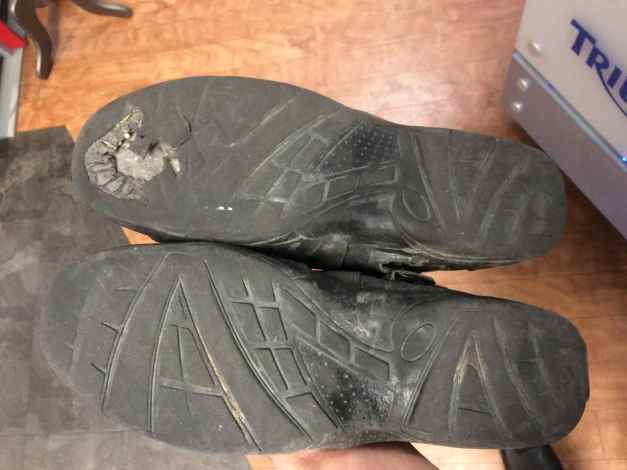
These were Tourmaster boots purchased in the Spring of 2013. I replaced them with BMW’s Allround boots, purchased at CalMoto in Mountain View. Thanks go to Pete, who I met at Alice’s Restaurant, for the suggested source for new boots and to Daniel who assisted me at CalMoto.
From Mountain View, I headed to Scotts Valley to visit friends.
I traveled over the Santa Cruz Mountains via Hwy 17, a fun, twisty four-lane highway used by thousands of commuters daily. It is too congested and busy to recommend, but it was a good time. Despite spending a majority of my childhood living in this area, I think this is only the second time I have traveled over Hwy 17 on a motorcycle.
My Santa Cruz host was home by 5pm and I left Scotts Valley to meet up him. He organized a dinner party with about a dozen friends – it was great fun to catch up with old friends and meet a few new ones. I’ll be staying in Santa Cruz over the weekend and heading south again on Monday.
Day 6
Day’s distance: 0 miles
Total trip distance: 1,209 miles
It was another warm and sunny day in Santa Cruz. The temperature was in the 70’s most of the day. The winds were light.
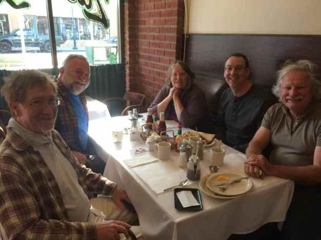
Today began with breakfast at Zachary’s in Santa Cruz. I was joined by four friends. The five of us were housemates in 1991. We all resided at the very house I’m staying in this weekend.
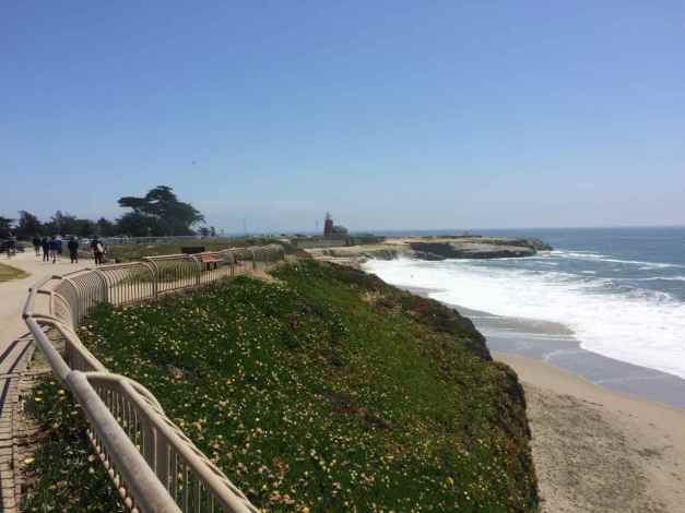
Following breakfast, I went for a walk with another former housemate along West Cliff Drive.
Here are a few more photos of Santa Cruz taken last here while I was on my Western States Tour.

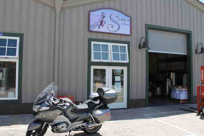
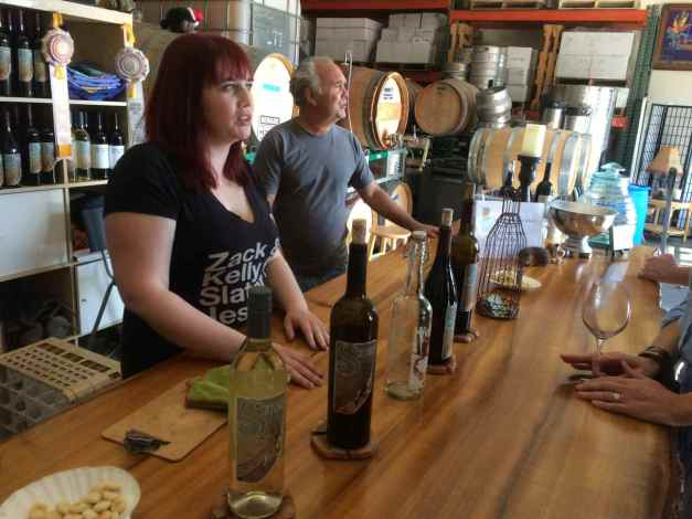
Later in the day, I attended a wine tasting at the Sones Cellars Winery, owned by Lois and Michael Sones, two of the folks attending this morning’s breakfast.
For dinner, my hosts and I ordered a pizza from Upper Crust and watched a movie, continuing the relaxed pace of the entire, wonderful day.
I look forward to relaxing one more day here in Santa Cruz before continuing my trip.
Day 7
This morning was overcast and chilly, with temperatures in the mid 50’s. The overcast burned off eventually and the temperatures rose to the mid 60’s. Winds picked up in the afternoon, making it chilly to be sitting outside.
I mostly rested today, though I did make it to Tacos Moreno for lunch. This was one of my regularly visited taquerias when I lived in Santa Cruz. After, I rode along in a car to visit a nusery in Ben Lomond and another closer to town. The only trip-related task on my to-do list was to clean the motorcycle, which finally happened about 4pm.
On returning, several of my host’s neighbors came over and we all had some beers and a little whiskey before dinner.
I look forward to continuing my trip tomorrow, when I travel down the coast through Big Sur.
Until tomorrow …
Day 8
Day’s distance: 173 miles
Total trip distance: 1,382 miles
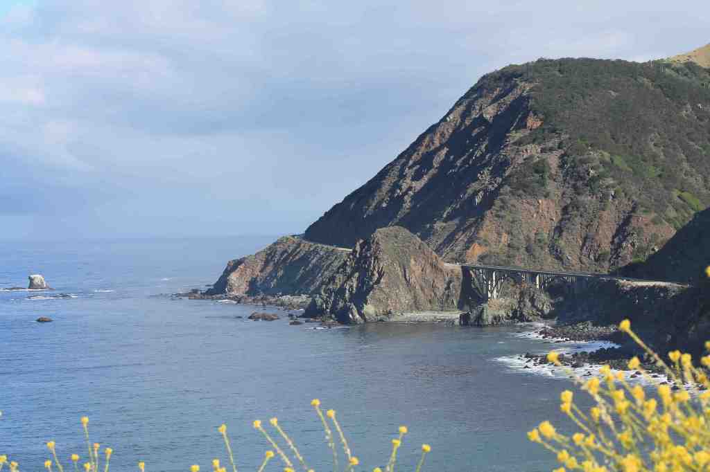
The coastal pattern of overcast skies in the morning continued today and the clouds didn’t break until I was south of Big Sur. Temperatures along my route ranged from the mid-50’s to the mid-60’s.
I left the house about 9am this morning and rode down Hwy 1 through Watsonville and was well into Big Sur before stopping to take a photo.
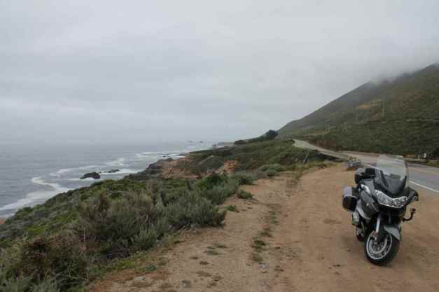
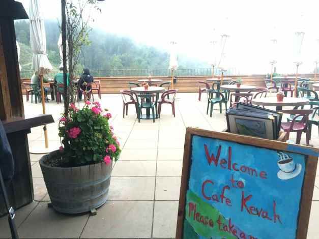
As is my way, I like to stop for a latte in the late morning. This time, I stopped at Cafe Kevah for a single-shot latte and a muffin. The cafe has tables set up outside on a large patio with a pretty scenic overlook.
While there, I met a young couple. He rode and asked me what I was riding and where I was heading. I’ve said this before, it seems everyone has a motorcycle story. Since I don’t carry a selfie stick, I asked if they could take a photo for me.
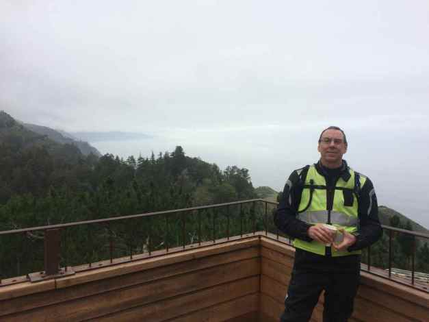
You can just see the sun to the south breaking out from the cloud cover.
Here are some Big Sur coastline photos I took last year, when the sun was shining.
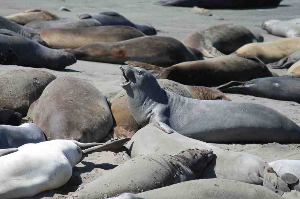
This year, I stopped at Point Piedras Blancas, where the Elephant Seal Colony resides. I had been following a Ural motorcycle with sidecar for a few miles and wanted to ask the riders some questions. It turned out they were staying in Morro Beach State Park, my destination, and we arranged to share a beer later in the evening. The owner, Mike, and his wife travel by RV and tow the Ural with them.
I arrived at the campground about 2pm, hoping they had some first-come, first-served parking spots. They were full over the weekend (according to Mike), but there were plenty of spaces now that most folks go back to work or school.
I set up camp quickly.
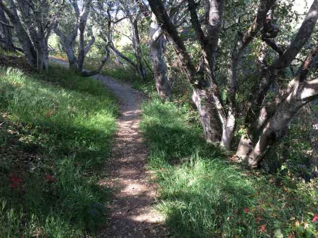
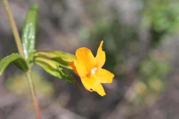
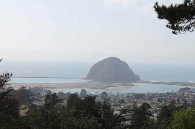
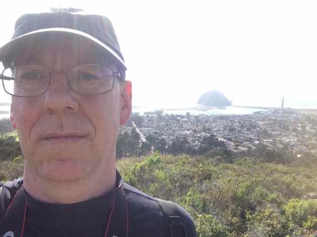
Since it was early, I took a hike up to the top of Black Hill. It overlooks Morro Bay. Here are some photos from the hike.
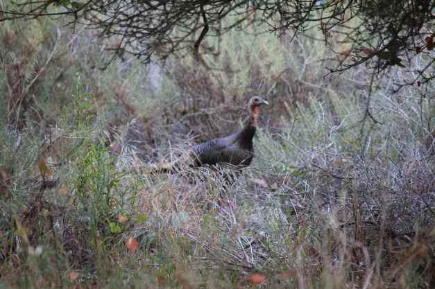
The wild turkey in the last photo was close to me when it jumped onto the trail. It startled me and I about dropped the camera. I followed it for a few minutes until I could get another chance to photograph it.
A selfie, taken at the top of Black Hill.
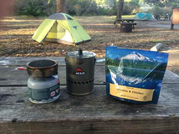
For dinner, I made Noodles and Chicken, one of my favorite Mountain House dehydrated meals. I was using a new gas cannister and had a difficult time getting it to ‘unseal’. Eventually, with some patience, it started supplying fuel to the stove. Whew!
Afterwards, Mike and I shared a beer and talked motorcycles. I crashed pretty early and slept well, for camping anyway. All in all, another great day 🙂
Day 9
Day’s distance: 224 miles
Total trip distance: 1,606 miles
The coast was overcast this morning. The temperature started in the low 60’s but it felt cold. I guess I’m already getting used to the warmer weather. Traveling east on Hwy 58, the temperature increased and in Taft, I recall seeing temperatures in the low 80’s. The clouds returned as I climbed into the Los Padres National Forest and the temperature dropped below 50, briefly, on the southern side of Pine Mountain.
Since I traveled Hwy 1 south last year, I chose to travel inland today.
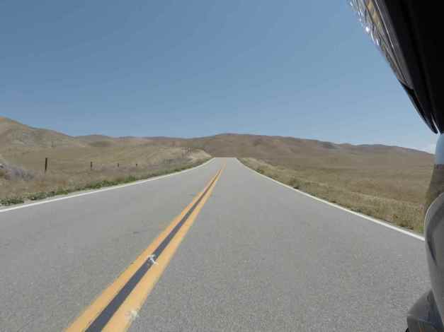
The Butler Motorcycle Map for Southern California indicated that Hwy 58 and Hwy 33 were some of the best motorcycling roads in the area. I was not disappointed.
The road surface was not perfect, but very good. There were a few too many ‘tar snakes’ and too much bumpy pavement to get a 5-star rating, but definitely 4-stars. The road had many wonderful sets of curves, though. Speed limits were generally 55 mph and that was fine for me. Traffic was very light. I don’t think I saw a single vehicle in my rear-view mirrors.
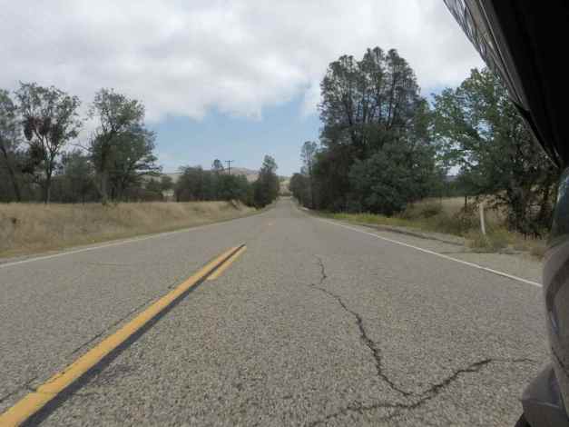
The countryside changed as I traveled east, lightly wooded hillsides evolved into grass covered hills.
The part of Hwy 58 halfway between Hwy 229 and Hwy 33 was the least interesting. I then turned south on Hwy 33. That was an abrupt change of environment. The air smelled bad and there were oil well pumps everywhere.
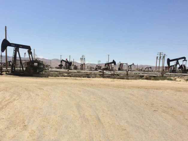
According to a wikipedia article, “Taft is situated in a major petroleum and natural gas production region in California and is one of the few remaining towns in the United States which exist exclusively because of nearby oil reserves.”
Once Hwy 33 entered the Los Padres Mountains, the scenery and the roads more to my liking. South of the peak was especially fun. Again, the road surface wasn’t perfect, but it was a very good motorcycling road. An abundance of switchbacks and sweepers to keep me busy and very little traffic vying for my attention.
Pine Mountain reaches an elevation of 5160 feet along Hwy 33. The temperature dropped significantly on the south side, down to 49 degrees. If you’re riding here in Spring, do wear appropriate clothing.
While taking a break, and taking the above photo, I met another rider who also stopped to photograph the switchbacks. We talked for a while about good roads we’ve ridden and where we’re headed. I love making these connections while on the road.
After riding through Ventura, I arrived at the BMW shop that will be performing maintenance on the bike tomorrow morning. I finalized arrangements and found a motel nearby.
Day 10
Day’s distance: 113 miles
Total trip distance: 1,719 miles
The day was cloudy to mostly sunny with temperatures in the mid 60’s to low 70’s. As for the past few days, the clouds have made me think I’m riding into some rain but it never materializes. The winds picked up in the afternoon.
The motorcycle was in the shop for a scheduled service, specifically the 24,000 mile service. These take about 5 hours. For those interested, they cost along the lines of $700 – $800 dollars.
Part of the service requires the technician to test ride the bike. I was just returning from getting lunch when the technician rode past me on my motorcycle.
While my bike has been in the shop for maintenance many times, this is the first time I’ve seen someone else riding my baby. It’s funny how personal that feels. 🙂
It was well after 1pm when I left the shop, BMW of Ventura County. The service manager, Howard, the service writer, Paul, and the rest of the folks were super helpful and friendly. I was especially pleased with the care and concern from the technician, who recommended additional service that may be required. Overall this shop is great and I recommend them without reservation.
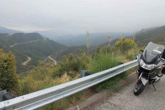
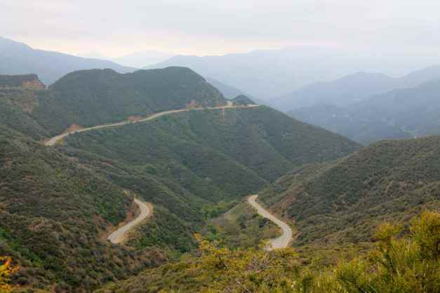
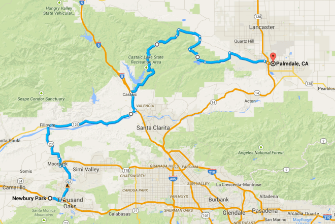
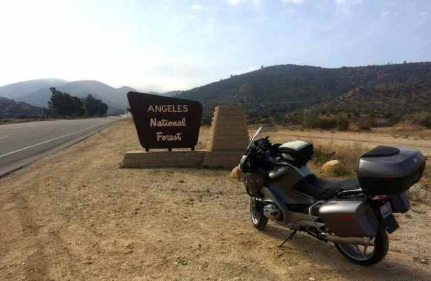
To plan today’s ride, I mostly used the Butler Motorcycle Map for Southern California to find worthy motorcycle roads in this general vicinity as I’ll be in the greater Los Angeles area through Sunday morning. Yesterday, I traveled from the north through the Los Padres National Forest, so today I thought I would visit the Angeles National Forest located northeast of Newberry Park.
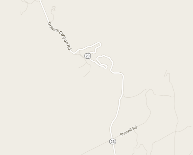
In leaving Newberry Park, one road I traveled was Hwy 23, at least part of which is also called Grimes Canyon Road. A short part of that was really twisty. Here’s what the map shows.
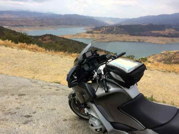
A stop for gas east of Filmore and a short ride north on I-5 and I was soon in the mountains riding some worthy roads. My favorites included Lake Hughes Road, which runs adjacent to Castaic Lake,
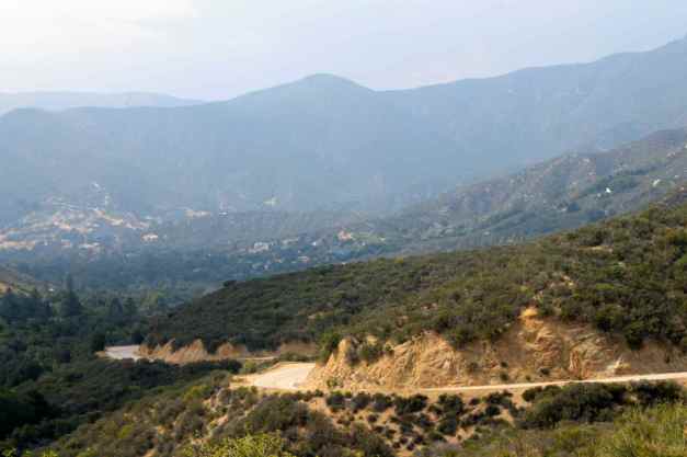
Spunky Canyon Road,
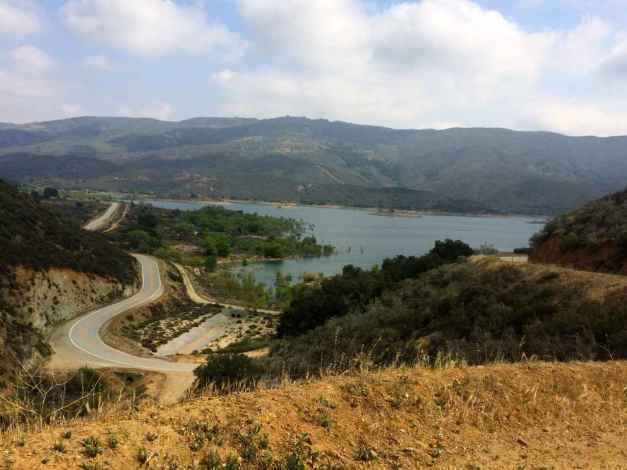
and Bouquet Canyon Road, running past Bouquet Reservoir.
As mentioned earlier, the winds picked up in the afternoon. They felt stronger as I approached Palmdale. Since it was after 4pm, I decided to just call it a day here, as was the plan.
Tomorrow, I look forward to riding through the San Gabriel and San Bernadino Mountains northeast and east of Los Angeles. I may camp again tomorrow night so my next post may be later than usual.
Day 11

Day’s distance: 149 miles
Total trip distance: 1,868 miles
The day started out partly sunny. Later, I encountered wind, then rain, hail, and fog. Temperatures started in the mid 50’s and ended in the high 60’s, but was as low as 36 in the mountains.
Today’s route took me up into the San Gabriel and San Bernardino Mountains. I learned from traveling over the Los Padres Mountains that it can be cold at higher elevations so I put on my “long” base layer and my jacket liner before leaving the motel.
The trip started by taking Mt. Emma Road, followed by the Angeles Forest Highway.
A forest fire swept through this area a few years back (2009?), leaving the trees burnt and the area susceptible to mud slides.
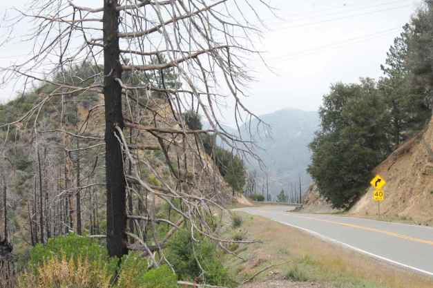
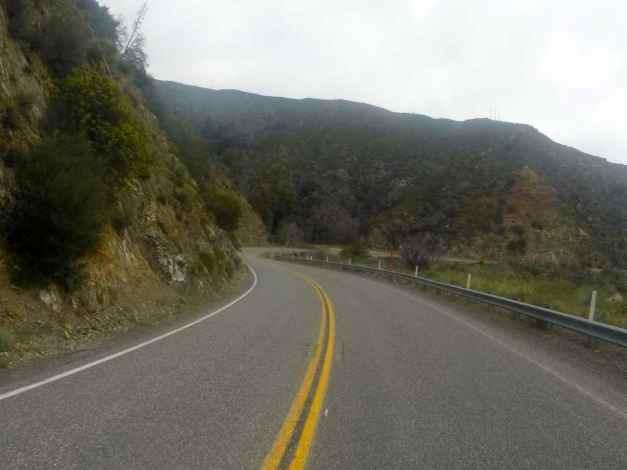
The road was in good condition, though not smooth enough to earn 5 stars. Hwy 2 was next and was in better shape.
I turned the wrong direction getting on Hwy 2 and had to backtrack about 5 miles. Either my GPS was confused or I programmed it with a route different than what I intended – not a big deal either way.
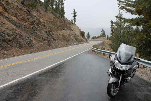
As the elevation climbed, I began to find myself in the clouds.
There was very little traffic. What there was seemed to consist of road maintenance vehicles, a few other bikers, and a few Corvettes 🙂
It started to rain. Near the Dawson Saddle (7901 feet) it started to hail. I stopped at a pullout to close the vents on my jacket and met Deirdre Smith who was hiking the Pacific Coast Trail. This woman had already hiked the Appalachian Trail and it was fun to chat with her for a few minutes.
Luckily the hail was small and the temperatures were warm enough that the road was not slick. Out of an abundance of caution, I did slow considerably until the temperatures rose back into the mid 40’s.
By the time I reached Wrightwood, I was hungry and stopped at the Grizzly Cafe.
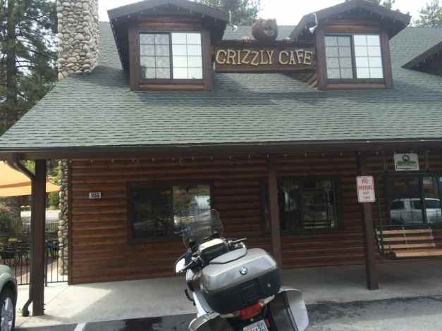
The food was good and the service excellent. Recommended if you’re in the area.
Running into hail made me cautious about going into the San Bernardino Mtns. Heading up Hwy 138 past Silverwood Lake, I encountered stronger winds coming off the mountains I was about to enter.
This road was well maintained and was quite twisty just past the lake.
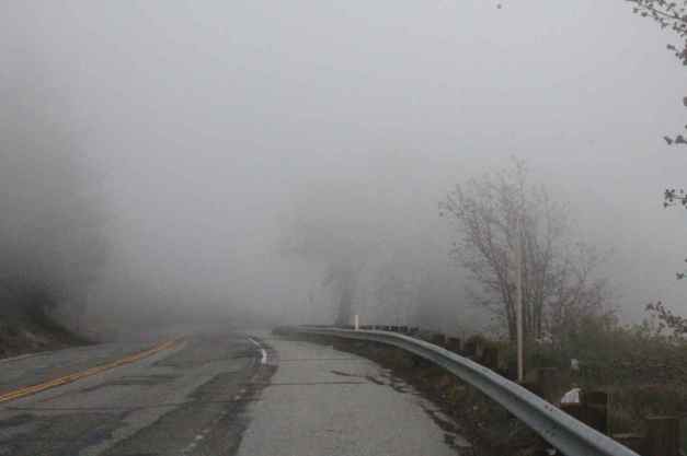
Hwy 18 past Lake Arrowhead was next. I didn’t find this road worthy of the highest rating it received by the Butler folks. It was crowded and in bad shape. I was happy there was no rain or hail, but fog became a significant issue.
Reaching Running Springs, I decided to skip a visit to Big Bear Lake and took Hwy 330 off the mountain and into San Bernardino.
Splurging a little for a room at the Hampton Inn instead of the Motel 6 option I’ve been using, I made use of the heated outdoor pool (twice). All in all, another very good day 🙂
Day 12
Day’s distance: 144 miles
Total trip distance: 2,012 miles
The day was cloudy with light winds. Temperatures ranged from the mid 50’s to mid 70’s.
I traveled along the base of the San Bernardino Mountains and through Oak Glen. Oak Glen Road was called out as twisty and exciting on the Butler Map and that was my first destination. Again, I ran into fog and wet roads.
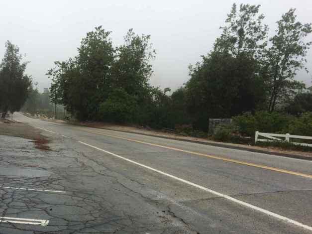
I rode conservatively through this area, partly because of the wet roads and fog, but also because there were businesses and homes throughout this area. I don’t really agree with the rating and wouldn’t recommend this route.
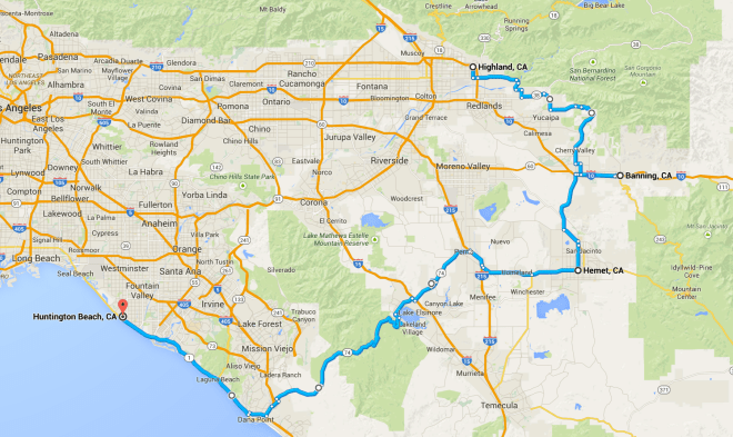
A short hop on Interstate 10 took me to Banning where I intended to ride up the San Jacinto Mountain using Hwy 243 and back down into Hemet along Hwy 74. I stopped at a school at the base because of the ominous looking clouds that covered the top of the mountain.
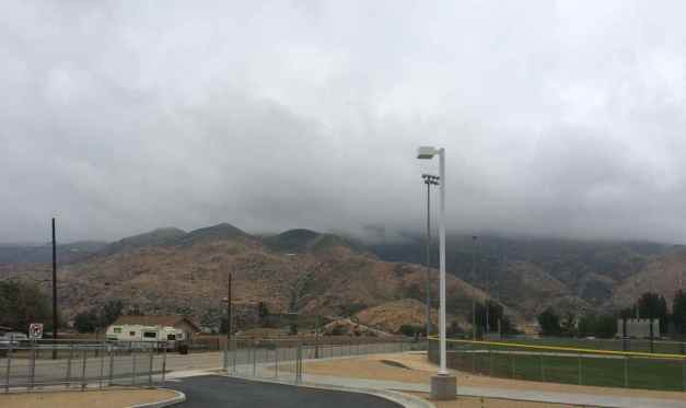
It was misting at the school and I knew if was going to be a wet and foggy crossing. I decided to detour around the mountain using I-10 and Hwy 79.
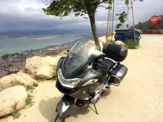
I stopped in Hemet for a bite to eat and continued on Hwy 74 from there. My next destination was the Ortega Highway through the Cleveland National Forest. There was cloud cover over the mountain here as well. I checked my weather app and there was no precipitation between Lake Elsinore and the coast indicated, so I proceeded.
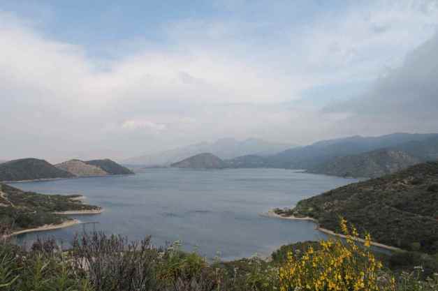
I stopped at the The Lookout Road House for a photo of my motorcycle with Lake Elsinore in the background 🙂
This road was worthy despite the fast moving traffic. Here’s a photo from the Lake Elsinore side …
and one from the western side where much of the pavement seemed new.
I ran into traffic once I was off the mountain and quickly remembered how aggressive Southern California drivers are and how much traffic I’ve avoided by taking roads less popular. I am staying with friends in Huntington Beach for a few days and it didn’t take long to get there from Dana Point.
Despite not completing my entire planned route, it was a good day of riding and exploring.
Day 13
Day’s distance: 0 miles
Total trip distance: 2,012 miles
The weather was cloudy with temperatures in the mid-60’s. It was misty at time.
I hung out with my hosts today. We had a Vietnamese lunch at Dat Thanh in Westminster (recommended), some wonderful English cheeses along with a Sones Cellars wine for an afternoon snack, and finally a visit to the pool and hot tub. After a nap, we drove into Hollywood to see ‘Avenue Q’ at the Cupcake Theater.
Planning days off the bike is important to me. I try to schedule one day off each week, sometimes a full weekend. It helps reset my body and mind to continue the journey, resulting in lower overall stress levels, more patience to manage the inevitable challenges, and a little more energy on the days I do ride.
The weather is going to be sunnier tomorrow. The skies were clearing up this evening.
Tomorrow’s destination is San Diego to visit my former housemate.
Day 14
Day’s mileage: 90 miles
Total trip mileage: 2,102 miles
Today was mostly sunny with temperatures in the 70’s. It was a really pleasant day.
It was just a hop down the coast today to San Diego to visit my former housemate, so there was no rush to leave early. David, Vickie and I had breakfast at the Sugar Shack in Huntington Beach’s downtown area. We then walked to the beach.
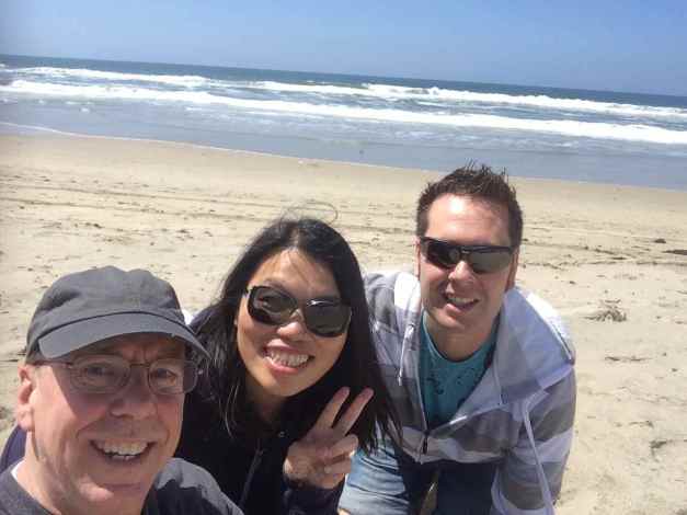
After playing in the water, we walked back to the condo and jumped in the pool. It was a fun morning and I have to say that I’ve had a really fun time hanging here in Huntington Beach. Many thanks to my hosts David and Vickie!
The time was 2pm when I packed up and headed down the coast.
I arrived at Blake’s in San Diego about 6pm. After a drink and some homemade salsa, Blake treated me to Whole Hog BBQ for dinner. I had a Cubano sandwich while Blake had ribs. Everything was really good. Back at the apartment, we had more drinks and some dessert.
During the first leg of this trip, the stretch down the coast, I’ve camped one night, stayed in motels five nights, and stayed with friends eight nights. I feel really privileged to be invited into their homes.
The next leg along the south will provide opportunities to camp more , weather permitting. Tomorrow I will leave California and enter Arizona.
Day 15
Day’s distance: 375 miles
Total trip distance: 2,477 miles
The weather was clear, sunny and starting to get hot. Temperatures rose up to the low 90’s west of Gila Bend.
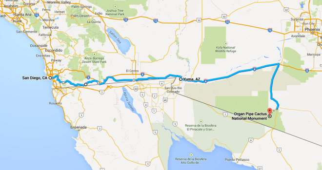
Today was the highest mileage day so far. Much of my travel was on higher speed roads. I left San Diego about 8am. My first destination was the toll road Hwy 125. It was recommended on the Butler map and I found it scenic, smooth, twisty, and lightly traveled. There was a $2.50 toll charged upon exiting the highway. Hwy 125 first travels past Olay Lakes …
and then into the hills. I spoke briefly with another rider at a stoplight. He gets to ride this route to work everyday. He seemed stoked about it, especially on a beautiful day like today.
Hwy 94 was next. It was smooth with sweepers and elevation changes.
Hwy 94 travels through small towns like Potero and Campo. Just prior to Campo, the border fence is very close to the highway.
Border patrol stops are frequent, though so far I’ve just been waived through.
Historic Hwy 80 was next. It allowed me to avoid getting on Hwy 8 for a little longer. Rougher pavement in spots, new pavement in other places. Seemed the least interesting of these three. I then had to travel Hwy 8 for a while until detouring towards Calexico on Hwy 98.
Hwy 98 starts out traveling through desert land. Mostly straight roads and 65 mph speed limits.
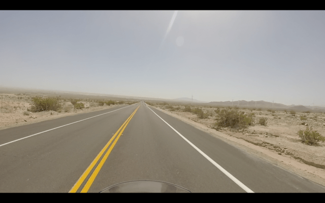
Suddenly desert turns into farmland where I believe they are mostly growing hay. Stopped in Calexico for brunch. Rosa’s Plane Food was highly rated and it located at this little deserted-looking (to me) airport on Second Ave. The food was excellent – highly recommended should you be in town.
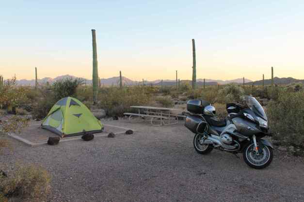
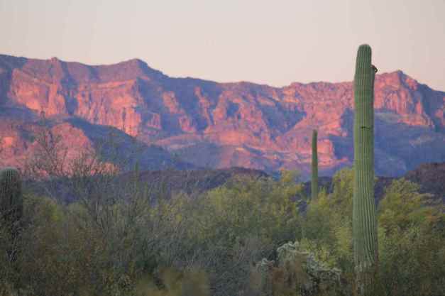
Back on Hwy 98 for a long drive on boring, straight roads. I traveled past Algodones Dunes, and crossed into Arizona about 3pm. Then, I filled the tank in Gila Bend before heading south for Organ Pipe Cactus National Monument, my camp for the night.
The camp wasn’t crowded, and the evening was cool and pleasant.
Tomorrow I head east into the Tucson area
Day 16

Day’s distance: 334 miles
Total trip distance: 2,811 miles
Today was mostly sunny with some fluffy white ‘Simpsons’ clouds here and there. Temperatures were largely in the 80’s but started and finished in the 70’s.
I woke up early, as often happens when I camped. Packing up camp at a leisurely pace, I was still ready to leave by about 7am.
Tire pressure … check. Oil level … check. Sena device (my bluetooth helmet communication unit) … Ugh. It wouldn’t turn on. I had problems late in the day yesterday, but simply thought the battery was drained so I had charged it overnight. Anyway, I tried to reset it using the controls to no avail.
The one-page manual for the Sena suggested depressing the very small reset button located on the back. I needed a pin or something similar, but everything I was carrying was too big. Luckily my nearest camp neighbors, who were also up packing, had something that worked and soon I was on my way.
I stopped at the Why Not Travel Store located a few miles north of camp in Why, AZ.
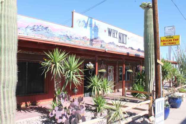
I noticed when I topped off my gas tank that they had an open wi-fi network so I purchased a cup of coffee and a snack and update the blog.
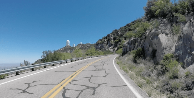
This morning’s destination was the Kitt Peak National Observatory. It’s elevation of 6,883 feet makes it an ideal home for the largest collection of optical telescopes in the world. And there is an 11-mile twisty two lane road that takes you to the top 🙂
I remember some 25 years ago when I first saw Saturn’s rings through a telescope belonging to the Cabrillo Community College Astronomy program. Everyone knows the planet has rings but when I first saw them for myself, I was quite giddy. It made a lasting impression.
Today I saw the sun’s surface through two telescopes here at Kitt Peak. Here’s a photo of the small telescopes used.
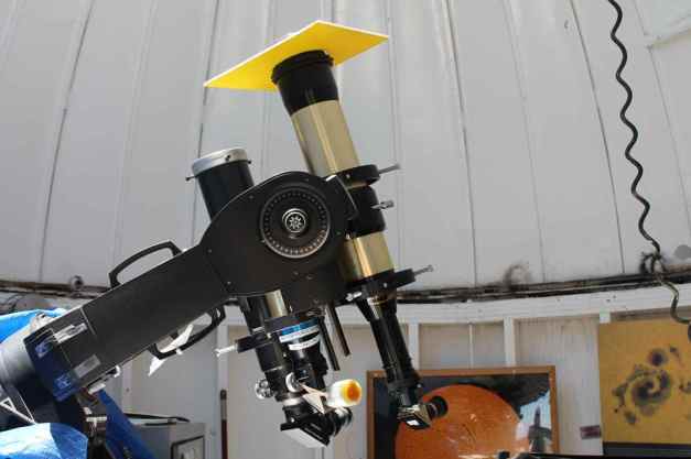
Looking through one of the telescopes showed the full light spectrum, resulting in an uninteresting white sun. The other telescope, with the yellow shade at the top, contained some very expensive filters that allowed only a small portion of the light spectrum, the frequency emitted by hydrogen gas, through to the eyepiece and one could see solar spots, if present, and prominence (flares), etc.. It was an orange-red color. No solar spots at this time but there was a hydrogen prominence that had broken off the surface of the sun. This experience was impressive and very cool – I will likely remember it always.
It was after noon by the time I was again on my way. I stopped for lunch at Cindy Lou’s II, in Three Points, AZ. The place was well rated and turned out to be really good. I had a Southwestern Melt sandwich and about a gallon of ice tea 🙂
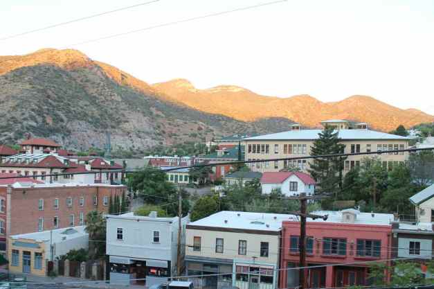
At this point, I wasn’t sure at this point whether I wanted to continue towards Nogales and where I was going to stay for the night. After talking to Carson, my housemate back in Seattle, he suggested I stay in Bisbee, AZ. It’s an interesting historical mining town – a small downtown would make it easy to find somewhere for dinner without having to get back on the bike.
He also suggested that I make a reservation early. This was brilliant as it turns out people that run the historic hotels go home at 6pm and I didn’t arrive until after 7pm. More on that later. I decided on the Eldorado Suites right in the historic downtown.
With reservations made and lunch finished, I continued to follow my Butler Motorcycle Map south on some roads that were marked as interesting. Thing is, I was a little casual today about my route.
I traveled Hwy 286 south to Arivaca Road. The first half was a little rough, but the second half seemed to have better pavement.

I turned south at I-19 until reaching Hwy 82. The land seemed more fertile as I entered the hills of the Coronado National Forest. Encouraged to keep exploring, I took Hwy 83 south. This road turned out to be a very rough, very crappy country road with speed limits of of mostly 25 mph.
The route I followed dead-ended at the West Gate of Fort Huachuca, a military base. I honestly thought when I looked on the map that this was some sort of nature preserve or historical site. Instead, I end up at an automated, highly secured gate with cameras and everything. 😦
It was after 6pm, and the sun was falling fast. I don’t like traveling at night on the motorcycle and I started to feel a bit panicked. There was a call button, so I pressed it hoping for the best.
Someone answered and I told them I was lost, I was trying to get to Bisbee before dark and I didn’t want to retrace 60 miles of what was mostly crappy country roads. I guess they took pity on me and after presenting my driver’s license to the camera, they let me pass through the gates and cut through the base.
Of course, I got lost on the base because none of the roads are straight and there are no road signs on how to get to the East Gate. The first person I asked, apparently a German officer there for training, had only been there two weeks and wasn’t helpful. He did say that he owned a 1983 BMW motorcycle and loved it (everyone has a motorcycle story).
The two enlisted soldiers I asked about 10 minutes later seemed very intimidated and didn’t know whether they should salute, stand at attention or parade rest, who I was, or anything. Eventually, one of them gave me some pointers.
Anyway, I finally found someone who pointed me in the right direction at the gas station. I filled up and took off out the East Gate. It was now 7pm and almost dark.
This story was hilarious to tell Carson and all turned out well, thanks to decision of the person who controlled access to the base (thanks!). I really got a kick out of the reactions of the soldiers, especially the young enlisted men who seemed really scared someone without a recognizable rank was talking to them.
Bisbee looks like a wonderful place. The suite was super large, with its own living room, bedroom, kitchen, bathroom, and walk-in closet. I had a light dinner and a not-light dessert at The Bisbee Table located conveniently in the historic district. Recommended.
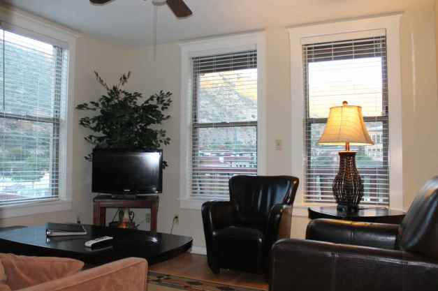
It looks out over the historic part of town. This view is from my balcony.
Overall, besides being a long day, it was an eventful day. Even the really crappy road led me to seeing some wonderful country. I am continual surprised at the variety of environments here in Arizona. It is fast becoming one of my favorites places to visit on a motorcycle.
Day 17

Day’s distance: 326 miles
Total trip distance: 3,137 miles
Today’s weather was close to ideal. Temperatures from high 60’s to mid 70’s. Light winds with moderate gusts were the only downside.
Despite getting up early, I didn’t get out of Bisbee until about 9:30am. I didn’t post to the blog last night and had to complete it this morning. Then I worked out my route details for today. Since the folks at Butler Maps haven’t published anything for New Mexico, I used motorcycleroads.com as a resource. Finally, I cleaned up, packed the bike, and turned in the key to the very friendly staff.
Again, I really liked the Eldorado and recommend it.
The ride from Bisbee through Douglas to the border consisted mostly of relatively straight roads and landscape that was only kinda sort of scenic. Sometimes you just have to get through it.
Interestingly, the folks at Butler Maps identified Hwy 80 between Douglas and the border as a ‘Lost Highway’, by that they mean “a byway that seems lost in time.” There was very little traffic along the entire length, and with a few hills and curves just north of Douglas, maybe it is an apt description.
Entering New Mexico lifted my spirits.
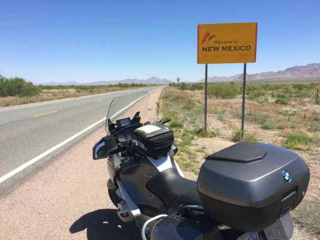
The landscape of New Mexico changed as I traveled north. Here’s the area near the border crossing …
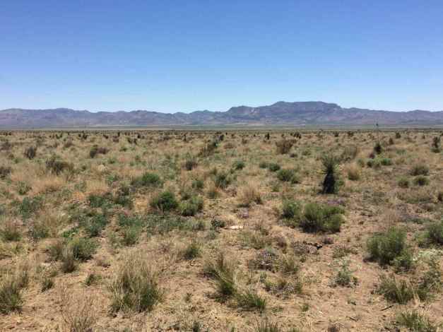
and near Mimbres, located at the southern part of the Gila National Forest.
Today, my actual route differed significantly from my planned route. I intended to spend more time in the Gila National Forest along Hwy 152.
It turns out when I programmed the Garmin (GPS) this morning, I included an unintended way point, Mimbres. This can happen when I ‘move’ the default route by selecting part of the route and moving it over to an alternative road (just like on Google maps only more inclined to include unexpected way points).
I suspected the turn off Hwy 125 onto Hwy 30 wasn’t intended, but I followed it anyway. Without a map of New Mexico with me and having no cell reception, I had no way to check.
When I reached Mimbres, the GPS recalculated the route by taking me still further north along Hwy 30 until it found a set of roads that could turn me around without a making a U-turn.
You see, one of the Garmin settings is called Avoidances. It allows a user to avoid tolls, ferries, U-turns, traffic, and highways. I had it set to avoid U-turns. The consequence today was another 7 miles of travel north when I shouldn’t have been on Hwy 30 at all. 😦
When I confirmed I was off my intended route, and without other resources, I chose to simply reprogram the GPS to take me to Las Cruces by the fastest route possible. No longer using my programmed route, I was directed to Hwy 61 instead of Hwy 152.
With a planned 300+ mile day, getting ‘lost’ was frustrating and time-consuming. However, it turned out that Hwy 61 was a really, really nice highway.
Hwy 61 led me to Hwy 180 and I took that south to Deming. It wasn’t as scenic.
Back on Interstate 10, I stopped at a rest area for a bathroom break. Inside the men’s room, there was music playing. It was the Rolling Stones singing “You can’t alway get what you want, but if you try real hard, sometimes you get what you need.”
Indeed, I got my beautiful road, despite it not being the road I wanted.
I powered into Las Cruces on I-10 and I-85, both of which have speed limits higher than anywhere in Washington. That was an excuse to crank up my beautiful beast and was fun, just a different kind of fun.
I have since changed the Avoidance setting preventing U-turns and I will also take a screen shot of the route details in case I don’t have paper maps or cell reception. This issue shouldn’t come up again.
I can’t wait for the next ‘issue’. 🙂
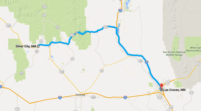
PS – the odometer turned 25,000 miles while I was in Silver City. You go, Girl !!
Day 18

Day’s distance: 281 miles
Total trip distance: 3,418 miles
The weather was hotter today, with highs reaching the mid to upper 80’s in the afternoon. Winds were light with moderate gusts at times.
It was almost 10am when I finally left Las Cruces today. An earlier departure was planned but eating breakfast at the motel, packing up, stopping to purchase a quart of oil from an auto supply store, and then separately stopping for gas, the time slipped away.
There is a long, very strait stretch of Hwy 70 adjacent to the White Sands Missle Range. The winds were a bit gusty so both hands on the bars while doing 75 mph.
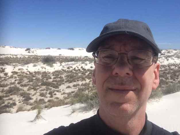
I took about 45 minutes to make an unplanned stop at White Sands National Monument. There is a 5-mile long road that takes visitors to a observation area. Taking the walkway, …
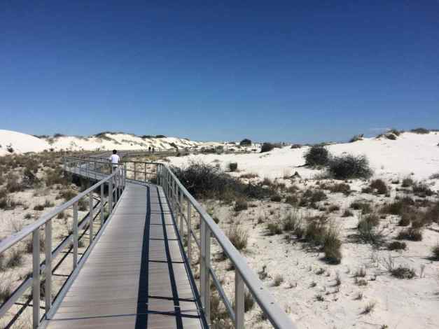
I hoped for a vista-like view but was disappointed. So you get to see a selfie with the local white sand dunes instead 🙂
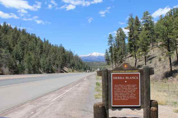
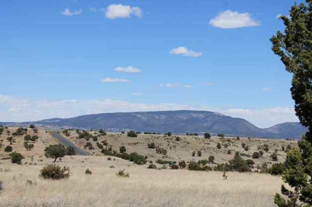
Hwy 70 passed through a variety of scenery. This scenic historical marker is well located for a view of the stunning Sierra Blanca Peak.
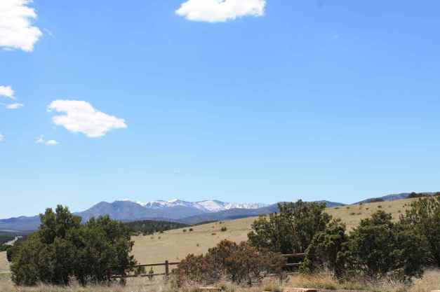
I also really enjoyed the views from the part of Hwy 48 north of Alto.
Because of the late start, I shortened my route midday. I was in Capitan, where Hwy 48 ends, when I was getting concerned about the time. Taking Hwy 246 north around the Capitan Mountains was my planned route, but instead I decided to take the Billy-the-Kid Trail back to Hwy 70, staying to the south of the Capitan Mountains.
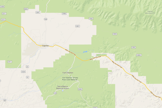
The Trail was a scenic, lightly traveled, well paved two-lane road that passed through several small towns.
Soon enough I was back on Hwy 70. This part was not scenic, but again straight and fast. I stopped at a roadside table (rest area) …
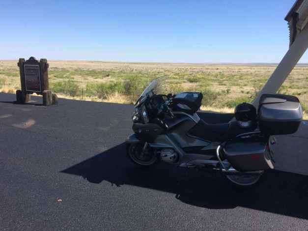
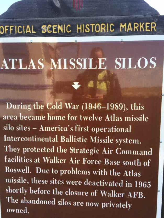
when I discovered I was traveling near the now decommissioned Atlas Missle Silos.
My last stop before the campground today was Roswell, where I passed by the UFO Museum.
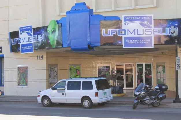
I didn’t spend much time in Roswell. It was congested and I was too hot to deal with it. I took off towards Carlsbad and the KOA campground I chose to stay at because motels are pricey here. This place has internet (albeit slow), a pool, and a restaurant of sorts. It isn’t too scenic or too close to town, but it is inexpensive.
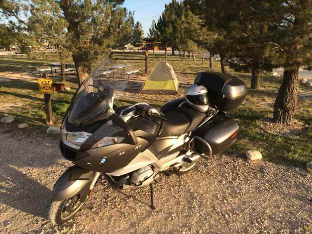
I leave you with the obligatory camp setup photo. Enjoy 🙂
Day 19
Day’s distance: 92 miles
Total trip distance: 3,510 miles
The weather was sunny and warm, with temperatures ranging from 55 this morning to the high 80’s this afternoon.
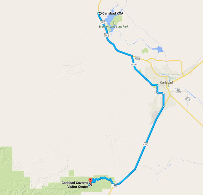
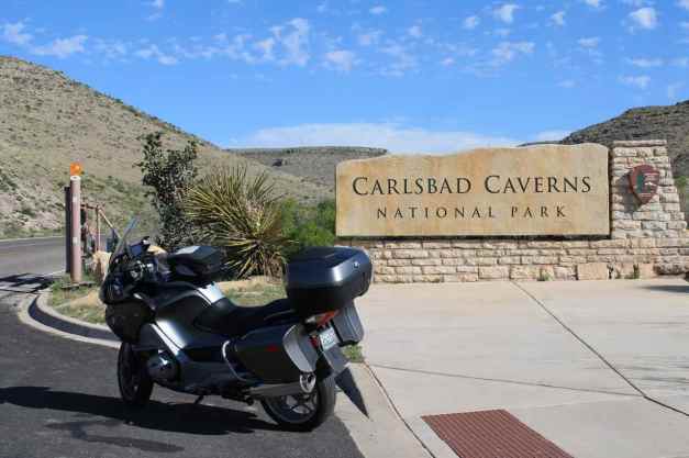
Today was a rest day. My only scheduled activity on the bike was to visit Carlsbad Caverns.
I was awakened several times in the early morning by vehicles leaving the park. We’re talking just after 4am. I will have to move my tent before crashing tonight – there is plenty of room.
I took off a little after 7am and headed for The Blue House Bakery & Cafe. It is on a side street and looks like a well-kept private home.
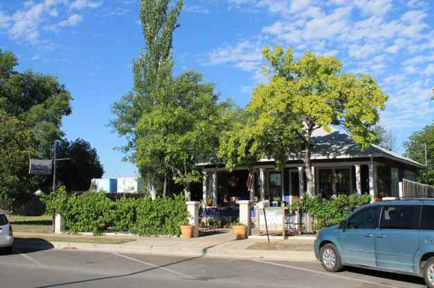
The latte and muffin was very good but the croissant stole the show. Highly recommended. I’ll be stopping by again tomorrow morning on my way out of town. 🙂
The Caverns are about 20 miles south of Carlsbad. It didn’t take long with the generous speed limits outside of towns here in New Mexico.
I spent roughly three hours total there. The cave was the biggest I’ve seen, by far.
I walked down through the ‘Natural Entrance’, as opposed to the elevator, which I used to exit the cavern.
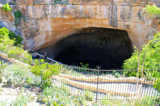
I considered the guided tour, which covers an additional and more decorative part of the cavern, but I didn’t want to be part of a large group. It was the right choice as I encountered the group later – it was approximately 80 people 😦
I followed the entire self-guided path, some 2.25 miles. My boots were comfortable to walk in, though that is about the limit. Changing from my riding pants to a pair of jeans in the men’s room prior to entering the cave, I used my cable lock to secure the riding pants, jacket, and helmet to the bike. Since my camp was still set up, I used the top case to secure my tank bag, minus the camera.
Most of the formations in the cave were no longer ‘living’, which is a bit disappointing. I’ll try to put together a slide show at some point in the near future.
I asked a park ranger for lunch recommendations and was sent to Junior’s in Carlsbad for Mexican. The food was good and plentiful. Another recommend if you’re in the area. Be warned, it doesn’t look like much from outside.
Tomorrow I’ll be entering Texas, intending at this time to camp at Chisos Basin. I don’t expect internet connectivity so my next post may be Sunday.
Time to eat and maybe jump in the pool once more before it closes. I do live a charmed life 🙂
Day 20

Day’s distance: 186 miles
Total trip distance: 3,696 miles
Temperatures reached the high 80’s with partly cloudy skies – mostly Simpsons clouds but I saw some thunderclouds north of Fort Davis. Winds were generally mild with some stronger gusts.
My day started with breakfast at The Blue House Bakery, the cafe I tried yesterday. The breakfast burrito was delicious, as was today’s croissant. A triple 12oz latte set my mind right for the 75mph speed limits around here. 🙂
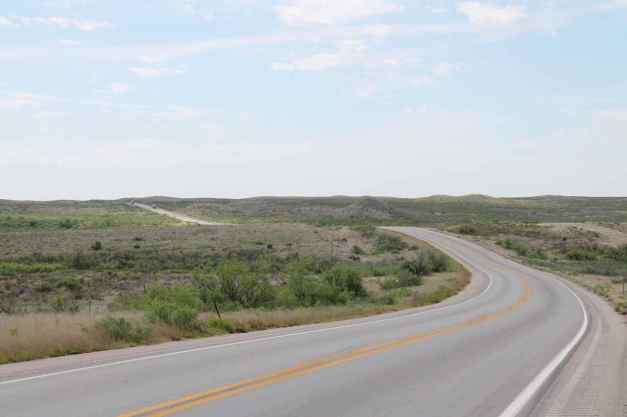
Hwy 285 south is mostly straight and until reaching Texas, seemed to have a lot of potholes. That’s likely from the tanker trucks hauling oil from the wells distributed along the highway. They seemed to represent a majority of the traffic I saw.
Here was one of the more picturesque sections.
You can cover a lot of ground going 75mph. I’m used to 55mph or slower on the “back roads” in Washington. In New Mexico, and now in Texas, many lesser highways are 75mph. The bike is running well and I’ve gotten used to using the cruise control much more than last year.
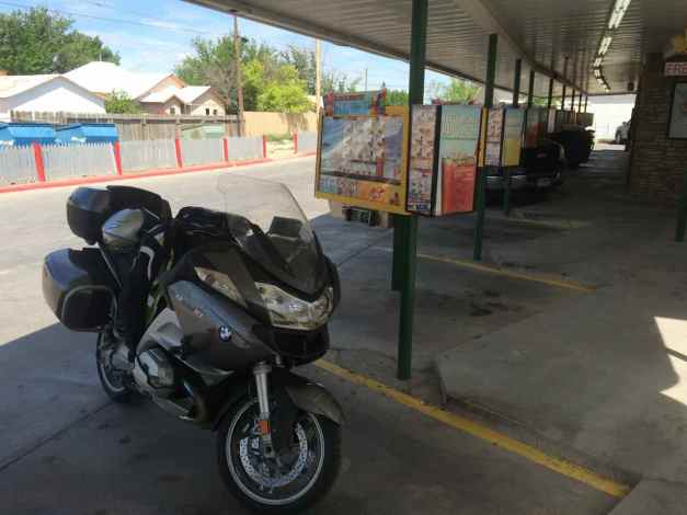
I took a break in Pecos for a chocolate shake. I wasn’t hungry for lunch but needed a few minutes off the bike.
Hwy 17 gets more interesting as it approaches Balmorhea.
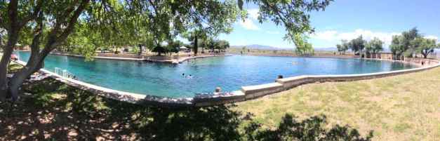
When investigating campgrounds in this area, I came across Balmorhea State Park. Interestingly, the images for this State Park were of a swimming pool. Turns out the park is home to the world’s largest spring-fed swimming pool, covering 1.75 acres. The water is as deep as 30 feet and the park encourages snorkeling and scuba diving.
I stopped here today and enjoyed the two hours I spent swimming and relaxing. Well worth the $7 entrance fee. The park had changing rooms but no lockers, so I left my tank bag containing the cameras, backup drive, USB battery,etc. with the park staff in the office.
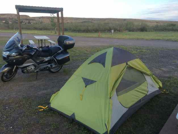
My tentative plans for today, drawn up about two months ago now, had me camping in the Big Bend National Park. However, being a Saturday, I was concerned I would not arrive at the campground early enough to claim a first-served camp spot. The park is much more popular than I expected.
So this morning, I decide to stay at a campground in Fort Davis instead, and ride through the entire park tomorrow. So after the pool, I had a few more miles to ride.
Fort Davis is situated against the southeastern edge of the Davis Mountains. Many of the downtown businesses and lodgings are housed in historic buildings. The McDonald Observatory, is nearby but not on my itinerary this time.
The ‘campground’ is actually an RV park about one mile from downtown Fort Davis, but as far as I can tell, I’m the only camper here.
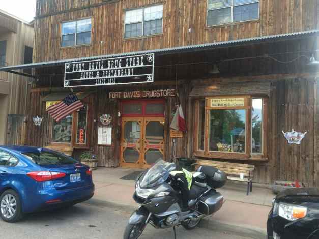
I had dinner at the Fort Davis Drug Store (Hotel and Restaurant). The brisket special which was good, not great.
A 400+ mile day tomorrow that takes me through both the State and National Big Bend Parks and then to Del Rio. I’m looking forward to seeing these two parks.
Until tomorrow !!
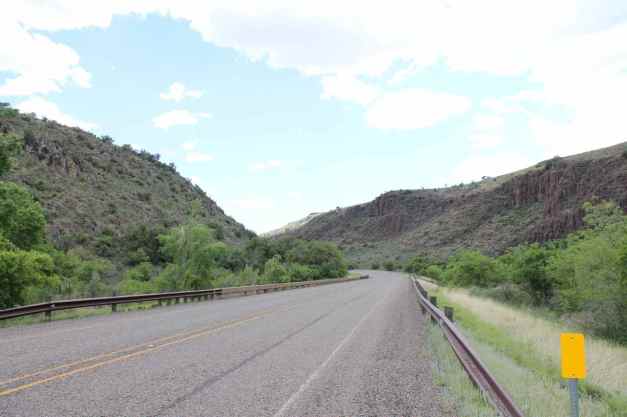
Day 21

Day’s distance: 410 miles
Total Trip distance: 4,106 miles
The weather was mostly sunny with the clouds clearing up as the morning progressed. Temperatures started in the high 50’s and reached the mid 80’s. The winds were mild this morning but by this afternoon they were moderate and gusty.
I woke up early to get to breakfast at 7am when the restaurant opened. After parking the bike, I grabbed a shot of the beautiful sunrise.
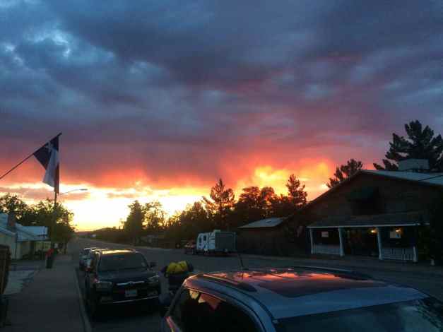
The saying goes, “Red sky at night, sailor’s delight. Red sky in morning, sailor’s warning” In other words, red sunrises often indicate coming rains. Luckily there was no rain on me today.
I had the pleasure to share breakfast with two Texas residents, Donna and Paul. Paul was parking their Beemer near mine. As sometimes happens on my adventures, a quick hello turned into sharing a meal and hints about where to ride and good places to eat along the way. Thanks, you two!!
Because our order took over an hour to get to the table, I didn’t leave Fort Davis until almost 9am.
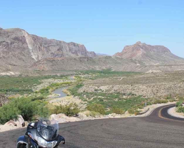
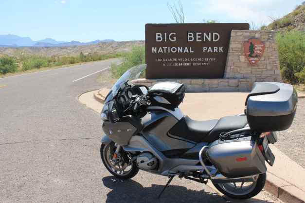
The aim of today’s ride was to travel through both Big Bend Ranch State Park and Big Bend National Park. Of the two, I really thought the State Park’s roads were more fun. Good pavement, roller coaster hills and scenic views.
Here are some of the photos I took throughout the day.
I met a few other riders while taking a break in the National Park. I really dig the community of traveling bikers.
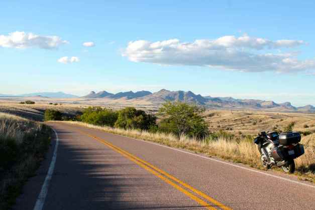
Tonight I’m staying in a motel in Del Rio and look forward to traveling the ‘Twisted Sisters,” three roads popular with Texan motorcyclists tomorrow.
Day 22
Day’s distance: 251 miles
Total trip distance: 4,357 miles
Clouds filled the skies with temperatures mostly in the 70’s. It was also more humid than past days.
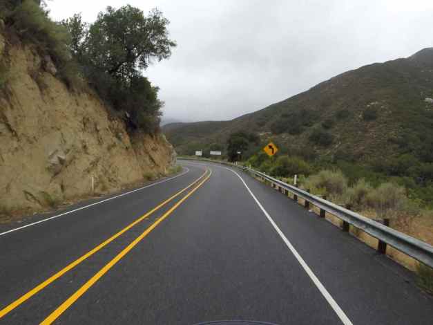
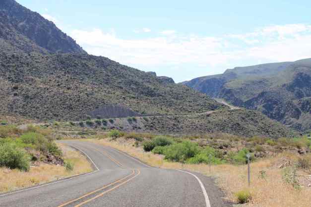
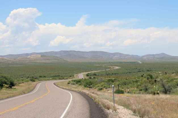
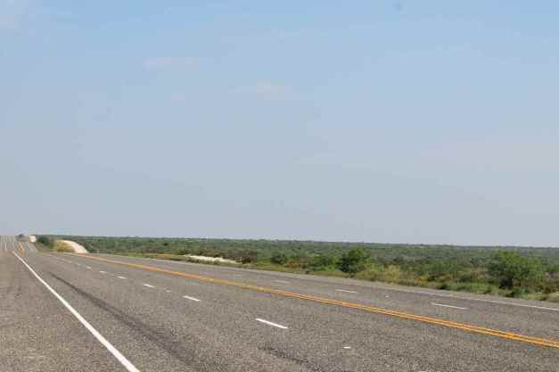
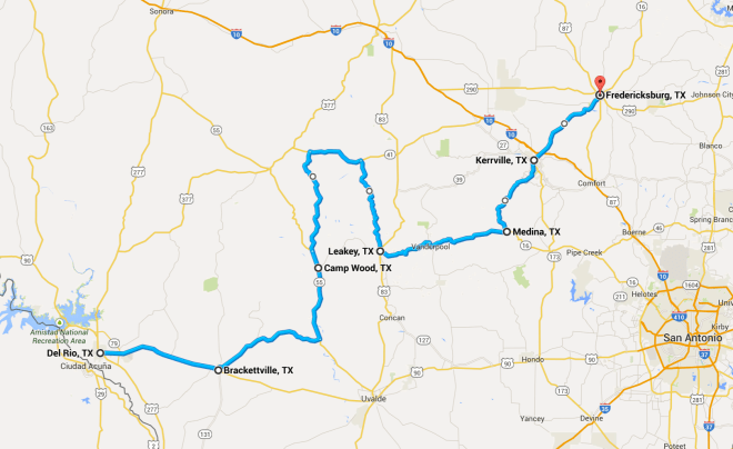
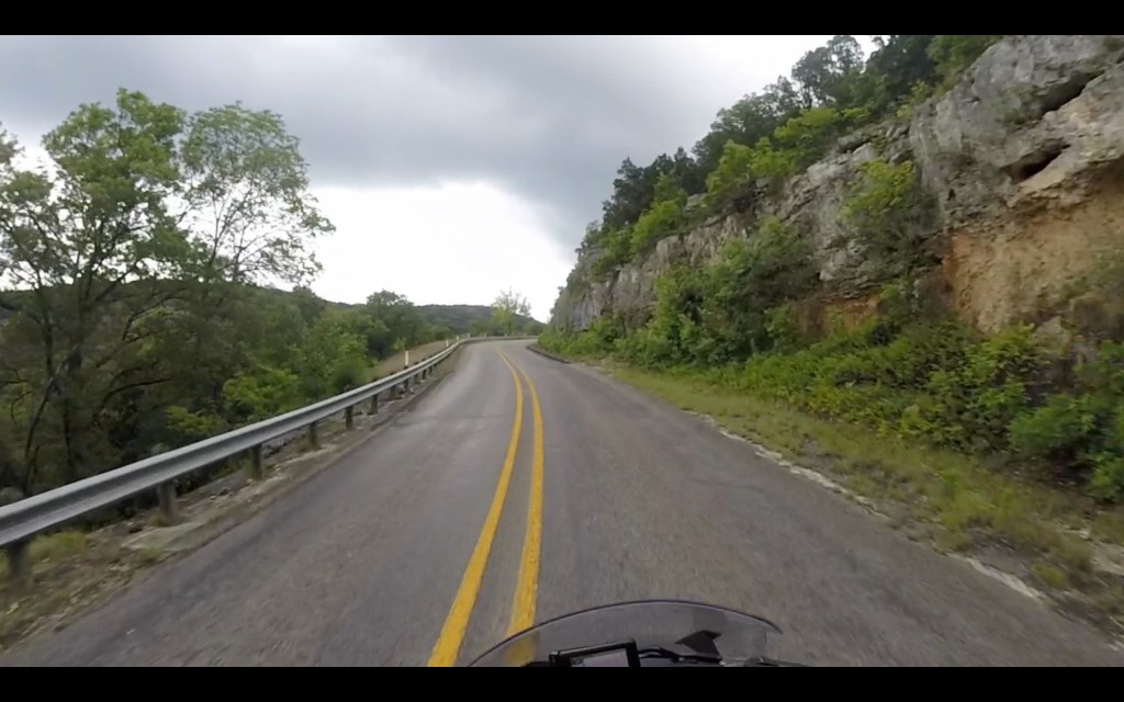
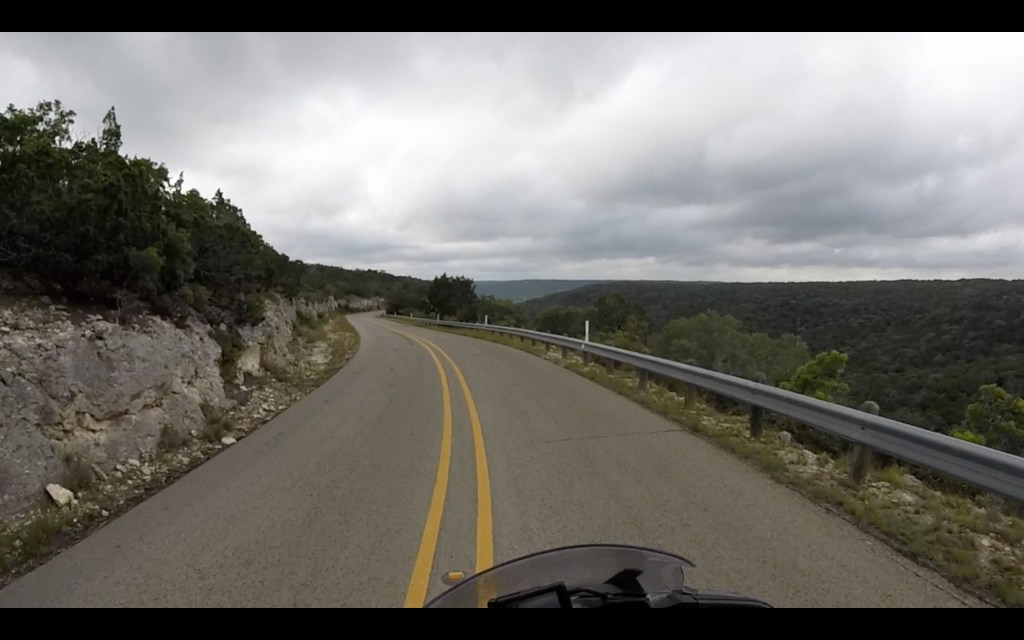
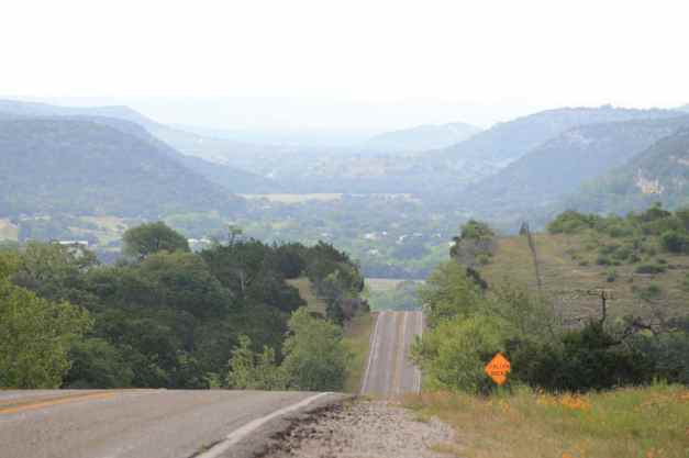
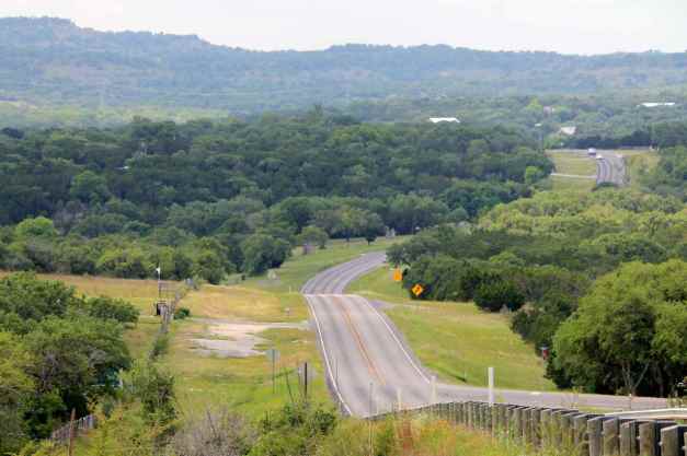
Today’s goal was to ride through Texas Hill Country, including the ‘Twisted Sisters’, three Ranch Roads identified by both the folks at Butler Maps as exemplary.
It rained a bit overnight, but the roads were mostly dry when I left the motel. I stopped at a nearby gas station to fill up the tank and to put some air in both tires. I’m running the Pilot Road 4’s at 42 (rear) and 40 (front) at this time.
The roads became more interesting soon after turning north off Hwy 10 at Bracketville. Traffic was very light, and the road surfaces on these two-lane Ranch Roads, as they are called, were generally very good.
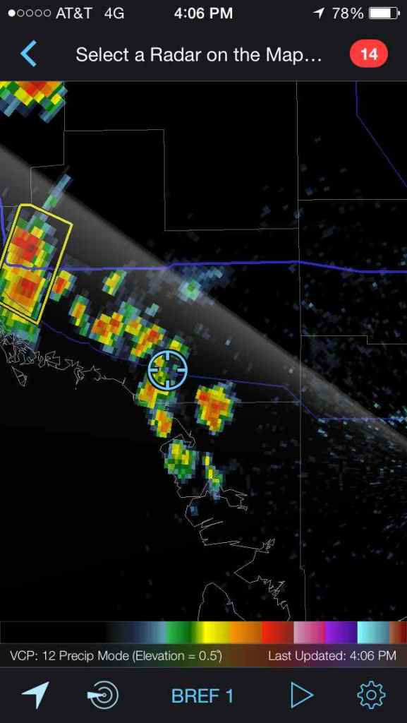
I ran into rain showers before reaching Camp Wood. RadarScope, the iPhone weather app that I purchased last year, indicated more scattered showers in my area but minimal precipitation, so I simply closed the vents on my helmet and jacket and continued, albeit at a conservative pace.
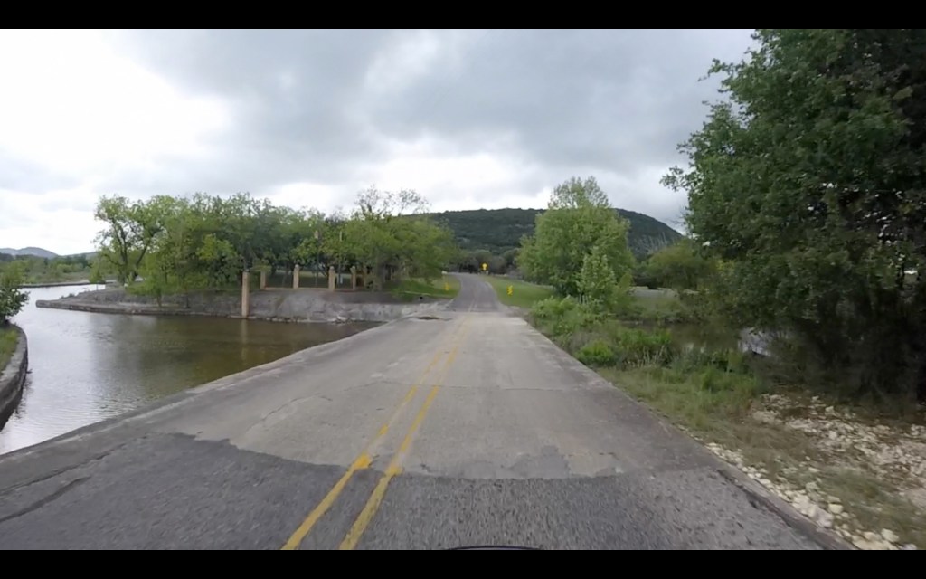
Just north of Camp Wood, the road forks and the first ‘Sister’ begins. This is Ranch Road 335 and it continues until reaching Hwy 41. The second ‘Sister’, Ranch Road 336, runs south off Hwy 41 into Leakey. I had a good time on both these roads, but found RR 335 to be my favorite. It seemed more dramatic, maybe because it was first, and the road surface slightly better.
As it was after 1pm at this time, I stopped at the Buckhorn Bar and Grill in Leadkey for lunch.
While eating, I noticed the app indicating heavier precipitation coming my way. I thought I could travel east along the third leg before it got too bad and it turned out that was correct.
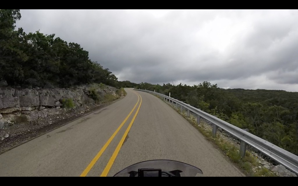
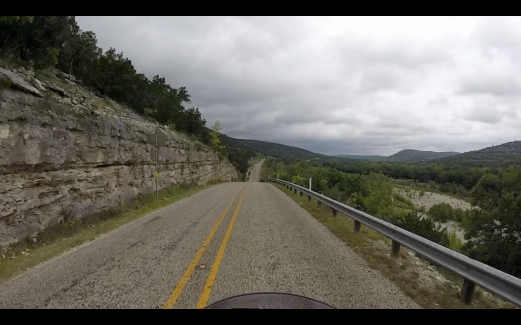
Ranch Road 337, the final ‘Sister’, runs east from Leakey past Vanderpool and towards Medina.
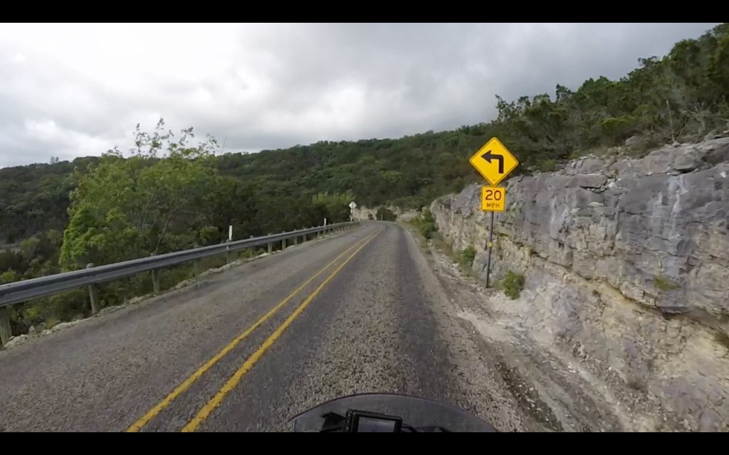
All three roads turned out to be worthy and pretty much unlike anything I had ridden in Washington. They were narrow, and seemed to climb part way up the hillside out of canyon only to drop back down again, repeatedly. There were straight sections, typically past the ranch entrances and fields, sweepers, roller coaster sections that went down and then back up quickly, and blind curves with signs suggesting 10mph. The surfaces were generally good with the exception of parts of RR 336, which had a lot of tar snacks.
I saw signs indicating the number of motorcycle deaths along these roads. There have been seven on RR336 since 2006 and ten on RR 337 in the same timeframe. I was told on the weekends these are quite popular with local riders who travel much faster than I was going today.
Stopping to take pictures of the really interesting parts was not possible as the road was too narrow and there were no turnouts. I was glad that I chose to use the GoPro, and I’ll likely create a video of this ride in the near future. Here are a few video captures for now.


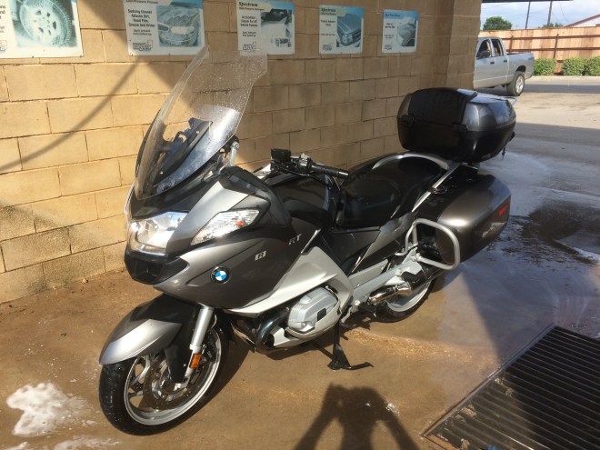
I took Hwy 16 into Kerrville and on into Fredericksburg, stopping at a car wash there to clean the bugs and grime I had been collecting since Santa Cruz.
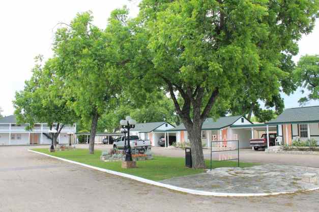
The Peach Tree Inn, an old-fashioned motor court, is where I called home for the night. The room was nice and I met a few women bikers from Louisiana who were also staying.
My next tentative destination was Austin. However, I think I’m going to head to Corpus Christi instead. I’m getting excited to see the Gulf Coast and I’m hoping to avoid the thundershowers predicted for the Austin area.
Day 23
Day’s distance: 257 miles
Total trip distance: 4,614 miles
It was a cloudy day with light rain showers from about 11am to 4pm. Temperatures started in the low 70’s and the high was about 80.
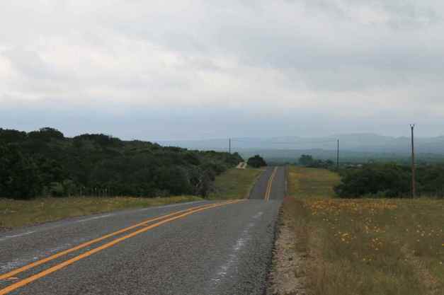
I left Texas Hill Country today, bound for the Gulf Coast. I found the Hill Country scenic, the Ranch Roads fun, and the people friendly. Certainly, I’ll be back to ride more of the area’s roads.
Note: The photo below was taken yesterday, but I forgot to include it in the blog until now.
I didn’t leave the Peach Tree Inn until 10am, having to finish the prior day’s blog entry. As you can see from the photo below, the day began cloudy but dry.
Accuweather.com was predicting thunderstorms in both Fredericksburg and Austin, and I was excited to get to the Gulf Coast so I changed my plans and headed to Corpus Christi where the weather was predicted to be better.
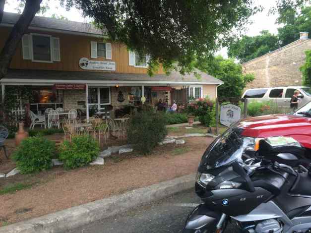
Before leaving Fredericksburg, I wanted to grab a latte. I stopped at Austin Street Java and Muffin House. Inside, I met fellow rider Lynda as well as Judy and the owner Binky. We talked about my trip, some of Judy’s trips, and other topics while I drank my latte and ate a really good muffin. Recommended if you’re in the area.
I left the city and headed south. One of the roads I used was Ranch Road 1376. It would take me out of the hill country, so I took one last photo before the landscape flattened again.
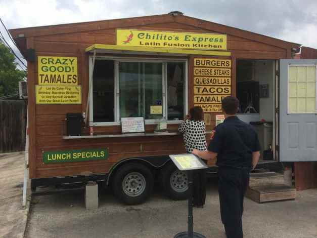
I stopped at a taco trailer in Boerne for lunch and had a couple of tacos that were messy to eat but yummy.
I was back on the road in just about 20 minutes. A definite advantage when traveling is getting good, locally distinct food fast 🙂 On my way to the islands off Corpus Christi, I stopped at Alamo BMW to get a spare quart of oil for keeping with me on the road.
Close readers of the blog may remember I stopped at an auto parts store when I was in Las Cruces. I couldn’t find the correct oil, but wanted something if needed. Turns out I could have waited but I wanted to err on the safe side.
I arrived in Corpus Christi just before 5pm. Traffic was a little heavy but I made it out to Padre Island and then Mustang Island before 6pm. Mustang Island State Park was a possible place to camp. They had a primitive area (for tents) right on the beach as well as campsites with electricity further away but it was too windy to camp in either spot.
While I was checking out the primitive camp area, I took a photo of the bike on the beach.
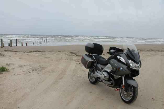
Texans drive on the beaches here, though not within 50 feet of the waters edge, according to a sign I read. The sand at this spot was well packed, but I still needed to put down the kickstand pad I carry with me to prevent the bike from falling over.
Instead of trying to camp on the beach, I found a older (and less expensive) motel right on the beach in Port Aransas. It’s a bit rundown and not for princesses, but I could deal with the shortcomings.
After dinner at Kody’s Restaurant and Bar, I walked along the beach a bit. It was still balmy even though it was after 9pm.
A good day, I say. 🙂
Day 24
Day’s distance: 301 miles
Total trip distance: 4,915 miles
The weather was cloudy most of the day, but less so as the afternoon progressed. It was windy all day, or as I was told by a Texan, ‘breezy’.
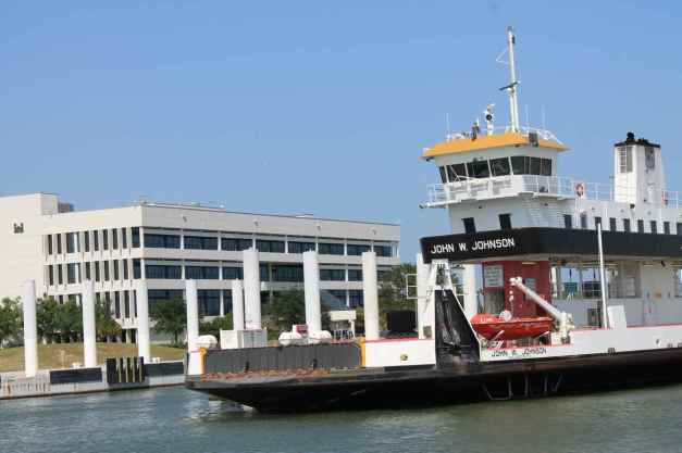
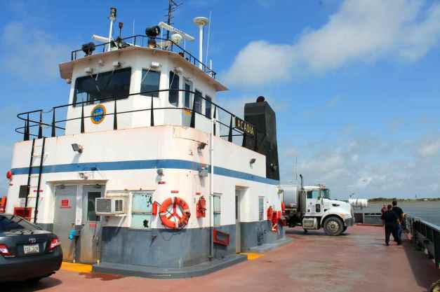
I started the day with a ferry ride off of Mustang Island.

The ferry was free and the ride lasted only a few minutes.
Most of the roads today were straight and very flat compared to where I’ve been. The road I was most interested in today was the Bluewater Highway. It begins after crossing this bridge …
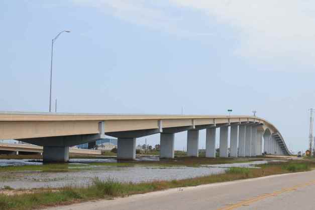
into Surfside Beach. As it took a few hours to arrive here, I was a little hungry and needed a break, so I stopped at Hammond’s shaved ice trailer.
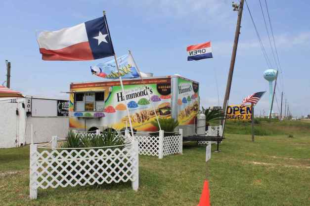
I had a chance to talk to the owners, Melinda and Glenn.
Glenn is a licensed captain and fishing guide. On days too windy to take out the boat, he helps Melinda. She designed this first class food trailer and runs the business. They are super friendly folks and the shaved ice hit the spot. On they weekend they serve BBQ, as well. Stop by and say hello if you’re nearby.
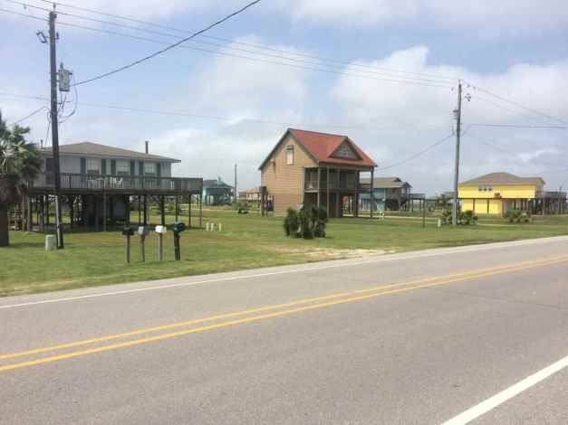
In Surfside Beach, there seemed to be mostly individual homes and small motels, with everything designed on ‘stilts’ to survive storm surges.
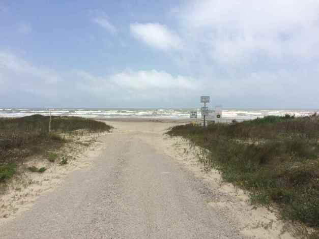
The beaches are wide here with access for your car.
Crossing the San Luis Pass toll bridge takes you onto Galveston Island, another barrier island along the Bluewater Highway. It seemed the individual homes here were built bigger and often as closed communities. There were signs indicating rentals were available, and I’m certain this place is popular in the summer.
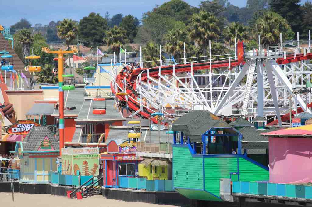
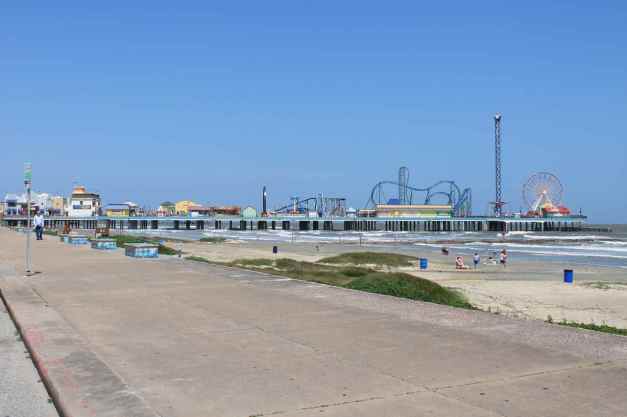
The northeast tip of this island is more commercial with large hotels, narrower beaches, and more tourist attractions, including an amusement park on a pier.
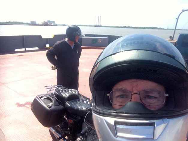
I took another (free) ferry to the Bolivar Pennisula.
This was a longer ride and the boat is tossed around more on the swells generated by the winds. I stayed on the bike the whole time to help ensure it didn’t tip off its kickstand.
After stopping for gas on the peninsula, I noticed I picked up a nail in my rear tire. Turned out it was pretty small and lodge in tangentially. The tire pressure remained good after I pulled out the nail, and I continued on my way.
Thanks to Will, my regular Seattle riding buddy, as well, for his support. I also had a patch kit and an electric air pump should things have turned out differently.
It was late when I arrived in Port Arthur. I stopped to eat before checking in to my motel. The sky was dark by then and with one final check of the tire’s pressure, I went to my room.
The folks I met in Port Davis a few days back, Paul and Donna live nearby. We arranged to meet for breakfast tomorrow. I look forward to seeing them again and to my stay in the French Quarter tomorrow evening.
Day 25

Day’s distance: 314 miles
Total trip distance: 5,229 miles
It was a warm, mostly sunny day with temperatures ranging from the mid 70’s to the mid 80’s. I missed most of the rain that passed through the area, but was caught in some light showers at one point for just a few minutes. The wind was light today.
Today started with breakfast at the Magnolia Diner in Port Neches. Paul, another BMW rider I met while in Fort Davis on Day 21 lives in this area and was able to join me for another shared meal.
After breakfast, we stopped quickly at Paul’s house to use the bathroom and check on my rear tire. The pressure was good. My concern about having picked up a nail set aside, we took off for Hwy 82.
Paul owns two BMWs and chose to ride his R90/6 today instead of the more modern GS that he and Donna ride on longer trips. Despite its age, that R90 was zippy and Paul navigated the route from Port Neches, over the bridge at Sabine Pass, and to the Louisiana coast easily and quickly.
On last year’s Western States Tour, I only spent one day crossing Texas through Amarillo. This trip, I entered Texas on Day 20 and stayed four full days before leaving today. I feel like I was lucky to be able to see so much this time.
Hwy 82 travels along the coast, sometimes close to the shore …
and sometimes a little farther away.
In a little less than 50 miles, we were at the ferry crossing just west of Cameron, LA. The ferry was free and travel from west to east took only a few minutes once the ferry arrived. Today, a temporary ferry terminal was in use.
Cameron has a history of rebuilding after storms.
In a few places along Hwy 82, local residents were fishing in the channels along the highway. Homes along the route were built off the ground or on small (man-made?) hills to protect them from storm surges.
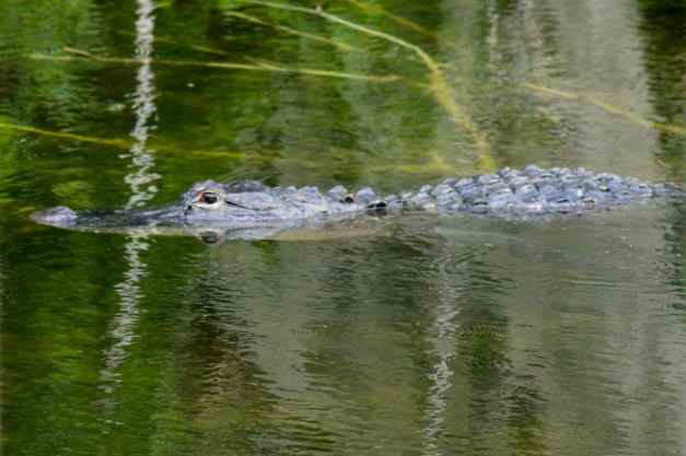
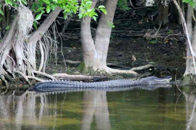
The roads seemed to be in great shape and we stayed at the 55mph speed limits. I saw a small aligator in the road. This was a first for me on my motorcycle adventures. It was likely about six feet and it did run back into the grass as we approached. I also saw several turtles crossing the road. Hope they made it. 🙂
Paul and I shared a soda at a gas station near the intersection of Hwy 82 and Hwy 14. He took Hwy 14 west back to Port Arthur and I traveled east towards I-90 and New Orleans. I arrived at my hotel about 4:30pm, cleaned up and had a drink at the hotel bar before walking along Bourbon Street.
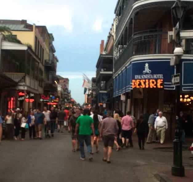
This was my first time visiting the city. Bourbon St. is the famous party street in the heart of the French Quarter. I was impressed by the hustle and grit, the barkers luring tourists into the clubs, the noise and the music coming from every direction. Cars are blocked from using Bourbon St. but use the side streets. There were police at each of these intersections, both in patrol cars and on horseback, keeping an eye on everything.
Traveling even one block off Bourbon St., the crowds diminished as did the noise.
I enjoyed a steak dinner and a martini at Dickie Brennan’s just off Bourbon Street. Sitting at the bar, I met a local architect and his wife. We laughed and talked about my trip and they gave me some suggestions on places to stay while in Florida.
After dinner and another walk down Bourbon St. and a few of the side streets …
I called it a night. What a great day and what an adventure!
Day 26

Day’s distance: 261 miles
Total trip distance: 5,490 miles
Another mostly sunny day with temperatures between the mid 70’s and the mid 80’s. Winds were light. The evening was very pleasant.
I departed New Orleans about 10am after getting my bike out of the parking garage and loading it up. Heading east on Hwy 10, then turning onto the ‘Chef’s Highway’ (Hwy 90), I was soon east of Lake Pontchartrain and into Mississippi.
Hwy 90 hugs the Gulf Coast on a sometimes 2-lane, sometimes more concrete road in generally good condition. Where Louisiana had more wetlands, Mississippi seemed to be more forested. I passed through Gulfport and Biloxi, mostly taking in the sights.
I did stop at The Shed, off Hwy 57, for lunch.
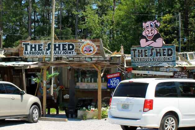
This was an interesting place, lots of character …
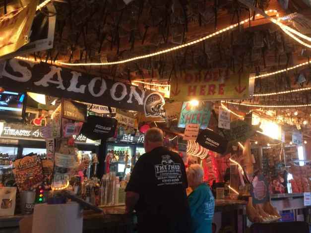
and pieces of wisdom here and there. I liked this one stapled to one of the rafters.

During lunch, I was trying to locate a good campground for the night. Turns out there was a great campground near Destin that was able to accommodate me, Henderson Beach State Park. It was starting to get late, so I stayed on Interstate 10 through Alabama and headed for the park.
As I pulled into the park, the sign said they were full, but I asked anyway. They called a nearby campground for me but they, too, were full. Since it was late, the folks at Henderson assigned me to an ’emergency site’. Turns out that was full, but then they had a last minute cancellation and so I was in (again). Lucky !!!
It was expensive for a campsite ($30) but totally worth it. Each site felt private and the bathrooms were big and clean, there were laundry machines available, and an amazing path that was used as private access for the campers to the beach.
The sand here is much whiter than the sand near Corpus Christi.
There was a sign on the path that indicated the original 2-lane Hwy 98 was much closer to the beach.
Glad it isn’t there now 🙂
Just a few more days to Key West. I’m actually one day ahead of schedule and will likely arrive on Monday, instead of Tuesday.
Day 27

Day’s distance: 373 miles
Total trip distance: 5,863 miles
The weather was sunny, hot, and humid. Temperatures started in the mid 70’s but climbed to 94 and stayed around there throughout the day. The winds were light.
I departed the campsite about 9am and stopped at a nearby Starbucks for a latte and a breakfast sandwich. Since they have wi-fi, I was able to post a blog entry while I ate. It was about 10am when I finished up and hit the road.
Following Hwy 98 most of the day, I noticed the beaches weren’t as wide or long as they were near Destin, but this section, located at Carrabelle, seemed a popular exception.
Inlets and bays were popular fishing spots. It’s clear that parts of my route traveled through fishing country.
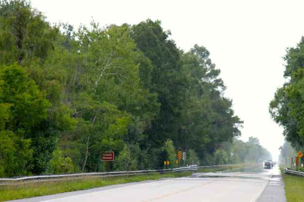
Hwy 98 moved away from the coast shortly after Carrabelle. While scenic, the scenery didn’t change much. It seemed like I was staring at a corridor of trees forever 😦 Some electronic music helped me push on.
I stopped for breaks now and then …
and took a few photos to feel productive while rehydrating.
I didn’t make it as far as St. Petersburg, but the mileage was exactly what was planned. Recall that yesterday I didn’t quite make it to Panama City.
There were a lot of motorcycles on the road. Except for those folks who seemed like long distance riders, few bikers wore helmets or jackets. Harley-Davidsons are easily the most popular bike in this part of Florida.
Day 28

Day’s distance: 305 miles
Total trip distance: 6,168 miles
Another hot and humid day, with high temperatures of mid 90’s above the road surfaces. A few brief showers while in the Everglades cooled things down for a while, then back up into the low 90’s afterwards. Winds were light.
Except for the Tamiami Trail, Hwy 41 through the Glades, today’s route was pretty much congested roads and freeways. I chose this route for expediency – it is too hot and the gear I’m wearing is too uncomfortable to be stuck in traffic sitting still under the Florida sun.
As it was, I stopped frequently to purchase cold drinks and extra water. I would pour some of the cold water on my LD Comfort shirt so that it would keep my cool under my jacket.
There are two roads through the Everglades. Interstate 75, or the Everglades Parkway, is a toll road and travels east to west through the northern part of the Everglades. Hwy 41, or the Tamiami Trail so named as it travels between Tampa and Miami, is only one lane in each direction and has no barriers keeping the local wildlife off the roads. Of course, I chose the latter. 🙂
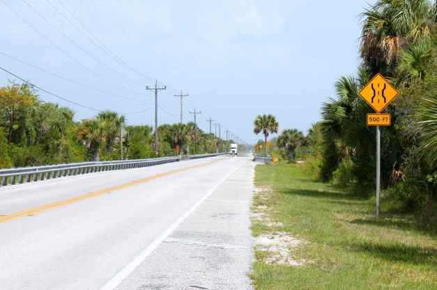
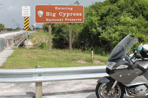
Traveling Hwy 41 takes you through the Big Cypress National Preserve.
It is a straight, two-lane road that is in good condition and is very scenic. I saw many groups of bikers who seemed to be out for a day ride. All along the highway, there were campsites, places offering swamp buggy and/or airboat rides, and tours.
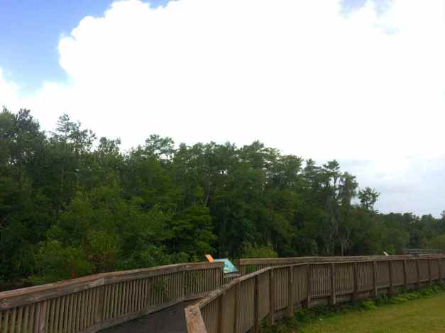
About 20 minutes into the Natl Preserve, it started to rain so I pulled off at a rest stop to check my weather app and use the bathroom.
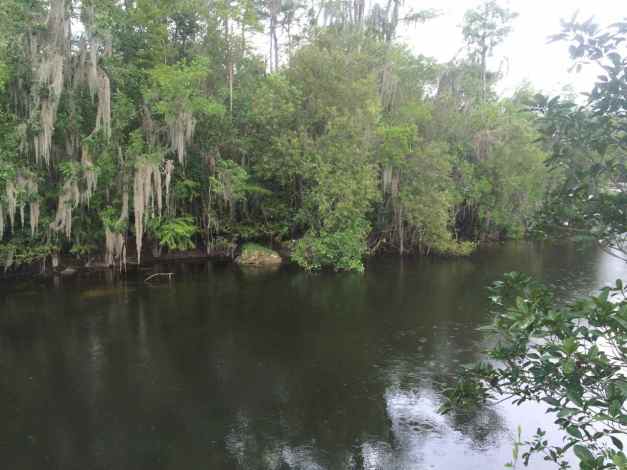
The rain stopped and since the rest area had been set up with a short path along the water, I grabbed my camera.
When I was ready to go, I checked my weather app.
It was showing more potential for rain to the south but I thought I could avoid it as it was moving slowly. I took off and did, in fact, avoid it.
The Everglades are an amazing place and I’ll have to return with the intention of exploring them more thoroughly. One last photo of the road, this one from the western half of the Tamiami Trail.
I arrived at my motel about 5pm. After cleaning up, I walked to a Cuban restaurant and had dinner, then returned and hung out by the pool until calling it a night.
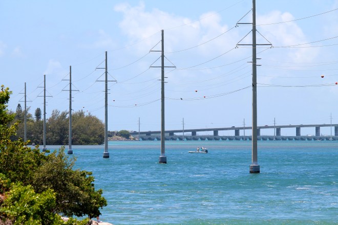
Tomorrow I reach Key West, my turnaround point, where I’ll hang out for a week with friends.
Day 29
Day’s distance: 134 miles
Total trip distance: 6,302 miles
Today was cooler than the past few, with temperatures in the mid 80’s. Sunny with some clouds providing occasional relief, especially in the afternoon. Winds were moderate.
The ride through the Keys was easy. I had to arrive after 4pm so I lounged around the hotel until checkout at 11am. Then I set the GoPro on my helmet and recorded video on my way down Hwy 1.
My first stop was for a late breakfast at Harriette’s. I saw this place and turned around to stop. It was crowded and the sign says they’ve been there for 30 years. Sounded like the place to be.
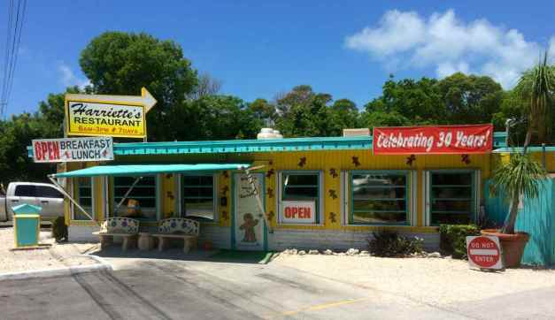
I sat up at the breakfast bar and spoke to a 33 year resident of Key Largo. The food was good and the ice tea refilled many times. Definitely recommended !!
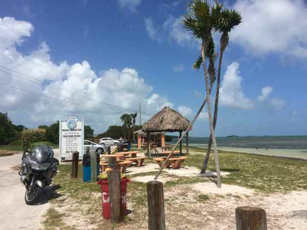
My next stop was a rest area in Lower Matecumbe Key. It seems power lines follow the highway down the Keys on one side or the other. They aren’t photogenic but I included it here as part of the record of life here.
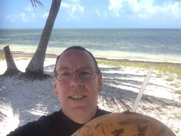
My last stop before arriving was at Veteran’s Memorial Park on Little Duck Key, where I saw a coconut vendor. It seemed appropriate to stop and try one 🙂
The vendor, Tony, had some great motorcycle stories and we talked for about 30 minutes.
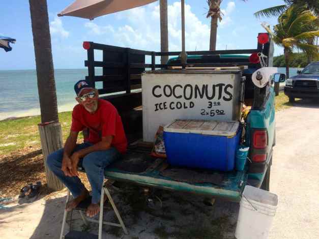
The cold coconut milk through a straw hit the spot.
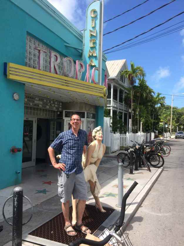
Finally, I had to stop at the Southernmost Point in the continental US for a photo, signaling the end of the first leg of my journey across the country (and back). Parking is restricted and there were crowds in front of the marker, so I parked across the street and took a quick photo.
I arrived at my friend’s Andy and Kai shortly after 4pm. We celebrated with drinks by the pool. I’m happy to have arrived; traveling through ten states, meeting loads of people, seeing some great parts of the country, camping some, and having no problems with the motorcycle.
I’ll take a week off here, parking my motorcycle and renting a bicycle to get around the island. 🙂
Day 30
Today was the first day just hanging out in Key West. I’m staying with friends at their place very close to Duval Street for about a week.
The first thing we did was rent a bicycle for me to use to get around this end of the island. They cost under $60 per week and is really the optimal way to get around. It comes with lights and a lock and with it you can avoid the hassle of finding a place to park.
Andy was on his bike so together we did a quick orientation around the lower end of the island. Stopping for lattes and egg sandwiches at Old Town Bakery, we had some breakfast sweets put in a bag for later. Then we rode around, Andy playing tour guide, me getting a sense of where things are for later exploration.
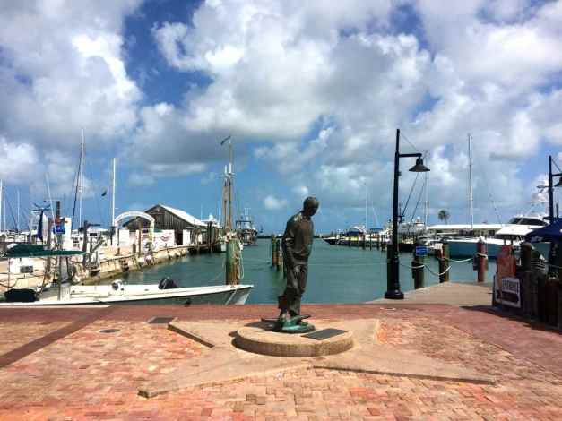
We rode past the harbor.
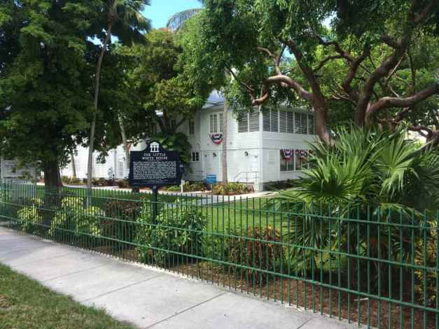
to the Little White House …
Riding down Duval street to the other side of the island, I walked out on the pier at the Southernmost beach,
and then we made our way back home to hang out by the saltwater pool.
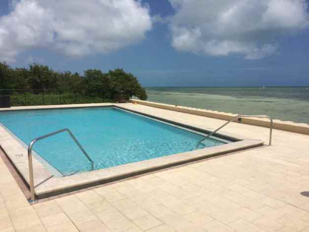
I feel that I have to keep saying it, I live a charmed life 🙂
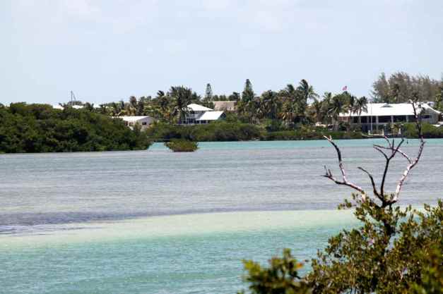
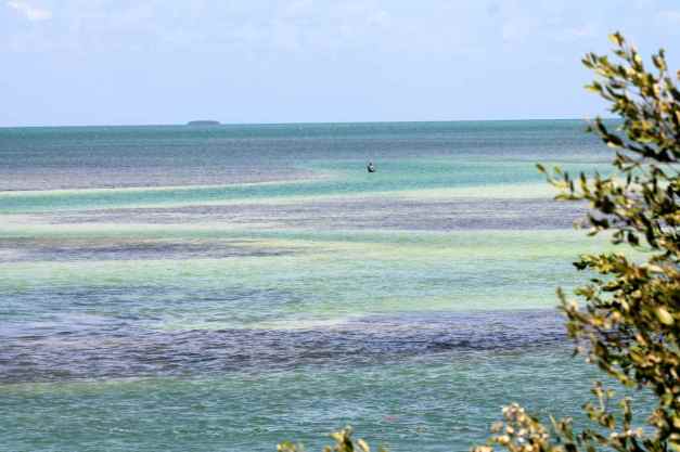
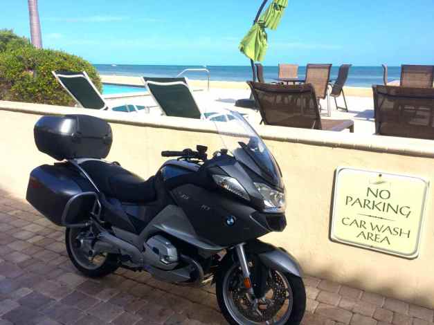
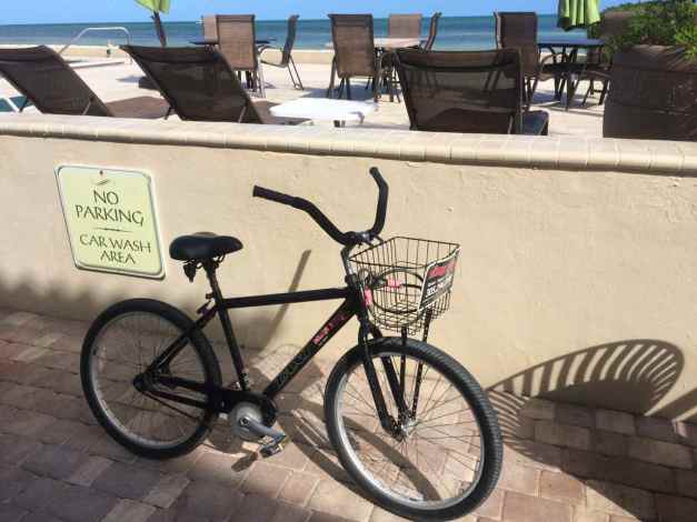
After relaxing and swimming, and walking out to the sandbars in the Gulf, I washed the collection of bugs and road grime off the bike.
This has to be the most scenic car wash area in the Keys !!
The afternoon passed by quickly and it was soon time for dinner. We gathered and rode the bikes down Duval Street (the opposite way this time) …
to our destination, Keyviche, one of Key West’s newer seafood restaurants. I had a ceviche sampler with three different sauces; yellow pepper, riccoto pepper aioli, and an aji lime pepper, the latter being my favorite.
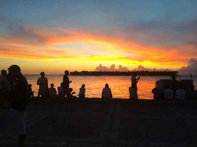
We then made it back to the harbor for sunset, where street performers gather each evening to entertain.
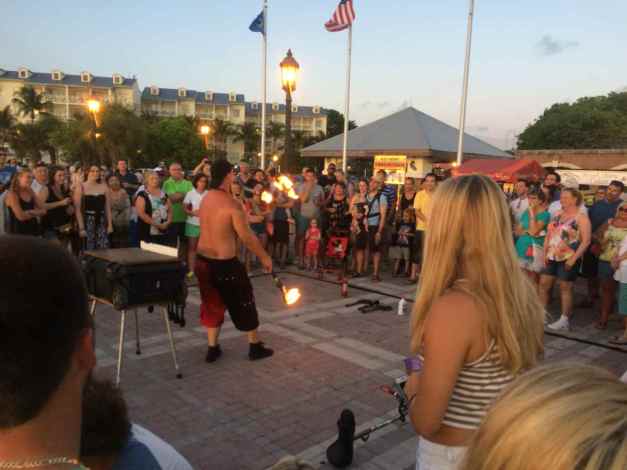
The sunset was beautiful, more so than this photo could capture.
We rode home and soon called it just another day in paradise.
Day 31
Another day in paradise 🙂 This is day 2 of about a week off the bike and hanging with friends who live here in Key West. I get around Old Town on a bicycle and do a lot of eating out and hanging at the pool here and the local beaches.
I have just a few photos today. As I spend time relaxing, I’m also leaving my phone and camera behind and my pockets empty of everything except some cash.
I had breakfast at the Banana Cafe, and dinner at Santiago’s Bodega. The dijon mustard, pecan bread crumb and thyme encrusted Petite Lamb Rack was especially good at Santiago’s.
I’m really enjoying my stay and the time off the bike. Old Town Key West has been very quiet and we haven’t had to wait to be seated in most places.
A neighbor where I’m staying has lived in Missouri for much of his life and used to ride. He will be helping me pin down my route through the Ozarks on my return to Seattle.
Day 32
Today started with coffee and then a session of Yoga on the Beach.
I think this was the first time I’ve taken a yoga class outside. Being on the beach was pretty cool. The classes are held at Fort Zachary Taylor State Park. The price of the class includes entry into the park for the day (keep your receipt, you’ll need it for re-entry to the park). There is a class everyday, weather permitting. Today’s class was referred to as Yin yoga, consisting of a series of more passive relaxation poses. Yin yoga classes are on Thursday while more energetic classes are held other days of the week.
Breakfast was at Harpoon Harry’s and then I returned to the beach at the Fort to swim. We didn’t go out last night for dinner, instead just socializing with the neighbors and eating in. I went for a short bike ride last night after the sun went down when it was cooler. That was fun.
Gear Update
Back at the house, I did some laundry and looked over my gear to see how it’s holding up. There were a few items that are showing signs of use.
Recall, I purchased Bestem Saddlebag liners from Amazon ($48/pr) and used them for all my trips last year as well as using them for this trip. The waterproof coating on the inside of one of the bags is ripping.
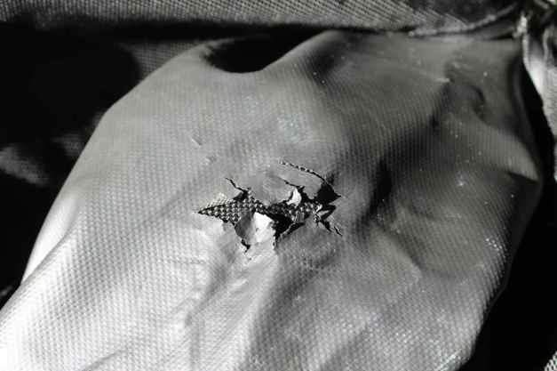
I think this happened because the zipper from my laptop case ( a Case Logic’ sculpted sleeve) rubbed against it, eventually causing a tear. Since the BMW side cases are pretty much watertight, I’m not too worried about the contents of the bag getting wet.
The bigger issue I’m having with the Bestem liners is with the zippers. On each bag, there seems to be one zipper (of the two) doesn’t work well because they can’t get past a certain point. I’ve adapted by using the better functioning zipper for each bag. However, on one of the liners, the zipper pull of the better functioning zipper broke. I honestly can’t recommend these liners because the zippers are not durable.
The BMW tank bag I purchased for last year’s trips is starting rip along one of the seams in front of the lid, or top section.
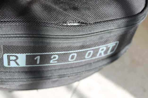
The likely reason for the tear is overloading the bag. 😦 I brought along some Butler maps and stuffed many of them into the top section’s inside facing pocket. The SLR camera sits along the inside edge under that part of the bag and together with the extra width of the maps, there was too much pressure on the seam.
I’m going to try to avoid overloading the tank bag and get it repaired when I return to Seattle. I will also look at replacing the side case liner bags with a different brand then.
Day 33
It’s Friday, already?
My week-long break between the first half and second half of my trip has been restful and energizing at the same time. Staying in one place has been the biggest contributor to feeling rested, I think. I’m so lucky to have access to a quiet home with great amenities and incredibly friendly and open neighbors. It is nice to not have to go somewhere all the time.
That said, going out to meet new people everyday, visiting local attractions and sharing meals with friends, old and new is recharging my energy levels. One attraction I visited was the Key West Butterfly Conservancy. At first I laughed when my friends suggested visiting, but I’m glad I went. I quickly discovered the experience made me very happy. Immediately after entering the “butterfly living quarters”, I was awed by the hundreds of butterflies and their high levels of activity. There were also some small birds, baby ducklings, Koi, and a pair of flamingos living in the conservatory.
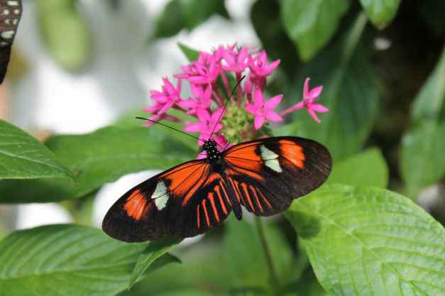
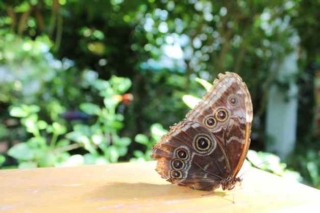
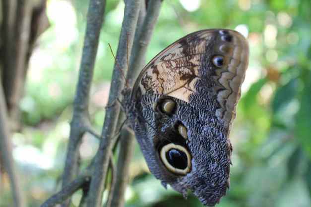
We also visited the fort at Fort Zachary Taylor State Park. Recall this is the park I visited for Yoga on the Beach yesterday (Day 32). The fort looks today to have been built with a mote around it.
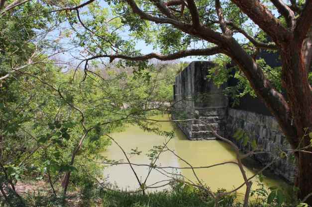
Actually, the fort was originally surrounded by water. The land now there was brought in later and is now used by the Naval Air Station, as seen from this arial photo (source: wikipedia)
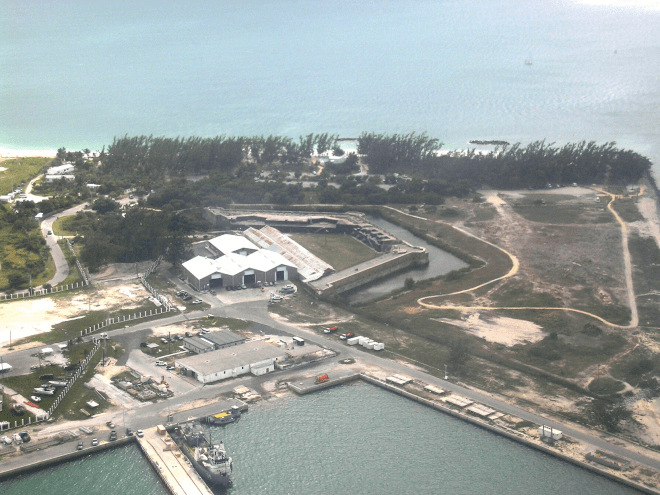
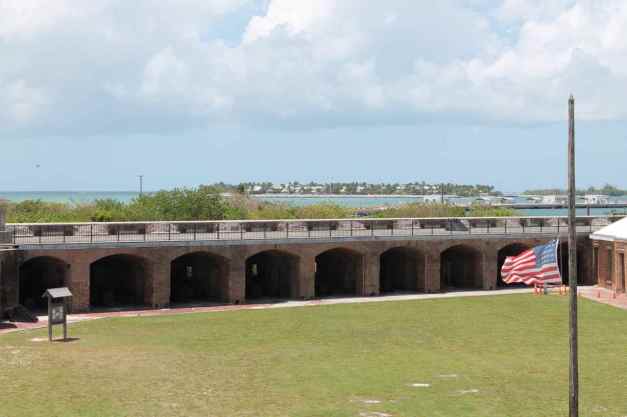
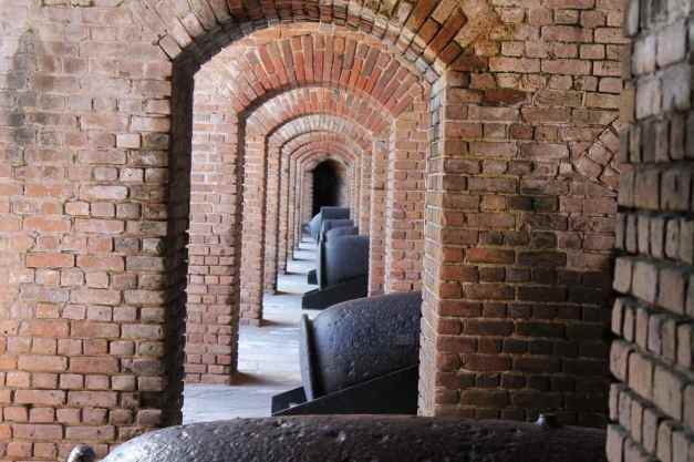
Our last stop for this morning’s tour was the Key West Cemetery. This is located in Old Town and takes up about 19 acres of land. Wikipedia estimates that as many as 100,000 people are buried here (despite an island population of about 30,000).
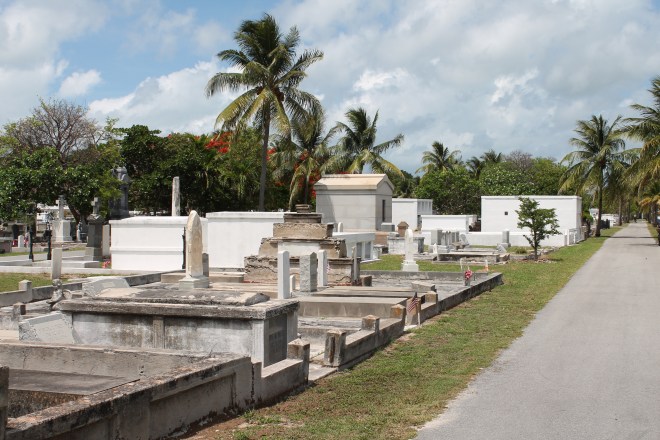
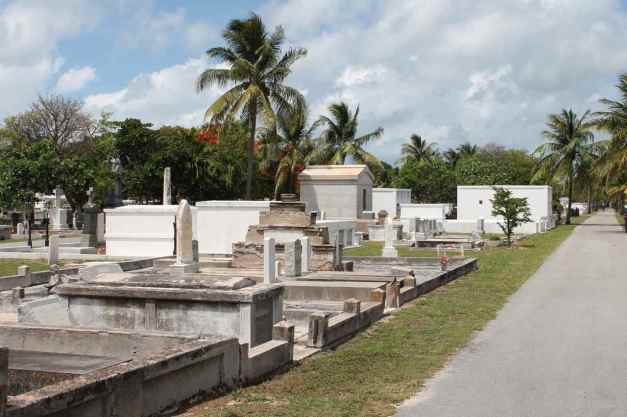
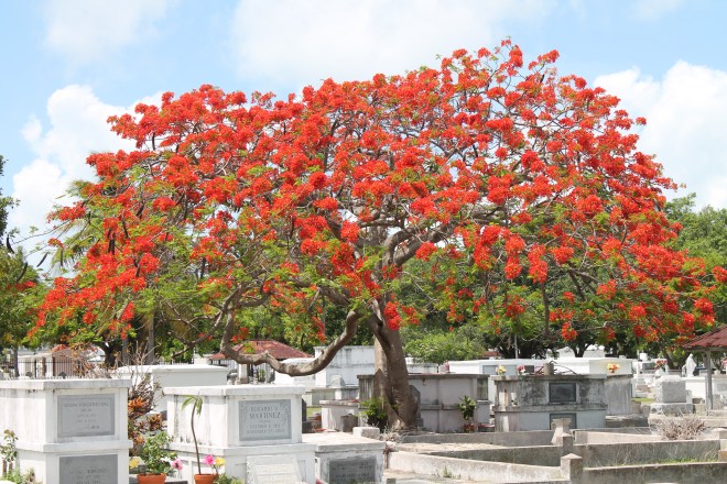
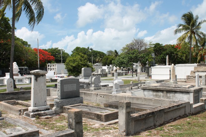
There is even a self-guided tour website that lists 51 noteworthy sites.
I attended a theater performance of Venus in Fur at the Red Barn Theatre as well. Andy is the stage manager at the Red Barn and it was fun to see a show and indirectly watch his work.
I went out for a few drinks after the show, visiting some of the Duval Street landmarks and made it home for a late swim in the pool (great way to end an evening).
Day 34
The weather continues to be pleasant. High temperatures are in the mid 80’s and lows in the mid 70’s. Winds are light. I’m getting used to higher temperatures, but still tend to stay out of the direct sun, except when swimming.
I had breakfast in Old Town with two neighbors of my hosts. We went to Blue Heaven. Sandy and I both had the Lobster Benedict with a Lime Hollandaise sauce and Stan had pancakes. It was super good, consistent with its reputation as a must visit Key West restaurant.
Since Stan and Sandy had never visited the Butterfly conservatory despite living here, I took them for a quick visit after telling them how much I enjoyed it. It was nap time after returning to the house as I was up late the night before on Duval Street.
The afternoon was spent relaxing, sometimes out by the pool, a short walk out on the sandy beach with the low tide. Andy brought back burritos in the early evening and afterwards, I took a short bike ride to watch the locals playing Bocce.
Day 35
Sunday morning meant bagels from Goldman’s Bagel Deli in New Town, a part of Key West I haven’t spent much time exploring. Andy, Kai, and I sat at the bar there for breakfast. Recommended if you’re in the area.
Sunday morning also meant opening day at a new T.J. Maxx just down the street from Goldman’s. Kai stopped for a look inside. We then rode our bikes along the shoreline (adjacent to Hwy 1 and Hwy A1A on the map below) past both Stock Island and the Key West International Airport.
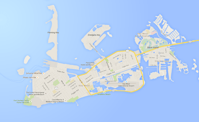
The New Town part of Key West is more developed, with large stores, new hotels and resorts being built, very wide boulevards, faster moving traffic, and few beaches. I prefer Old Town for its history and charm.
All afternoon was spent at the pool, and the sand bar which was accessible with the low tides. Rough life 🙂
Andy and Kai and three other friends of theirs took me to three events to highlight life on Key West. The first was the weekly charity bingo for One Human Family. Mitch was our host.

The closest I came to winning was the last game, where the objective was to fill the card. I was one number away (doh!)
After bingo, we all went out to dinner at Martin’s. Everybody seemed very happy with the appetizers and their meals. My ribeye was very good. I know it’s Key West but I felt underdressed in shorts and sandles 🙂
The final quintessential Key West event was the Drag Show at Aqua.
It was fun to hang out with the group and experience some Key West traditions.
Today was my last full day in Key West. The weather was mostly sunny with temperatures in the mid 80’s, again 🙂
It was a relaxed day for me. I walked along the beach and spent a little time in the pool both in the morning and then again in the late afternoon. Each time I saw one of the neighbors, I was sure to let them know I was leaving. Saying goodbye to them made the day seem a bit sad.
The afternoon was spent first doing some chores. I decided to send a few things back to Seattle, so I needed to stop at the Post Office to pick up a Flat Rate box. As I rode the bicycle through Old Town, past the Lighthouse and the Ernest Hemingway House, I wondered when I would return to Key West to visit some of the attractions I didn’t see this time.
I returned the rented bicycle next. Then, I arranged for Kai to pick me up at the Old Town Bakery so I could bring some snacks back to the house for after dinner.
Returning to the house, I began to look for places to stay in Ft. Lauderdale, my stop on Tuesday night. I found some motel rooms but then Kai suggested I look at Airbnb. I haven’t checked Airbnb often while traveling. The past times when I did, I was traveling down the West Coast. The results were mostly home rentals, when I really just needed a room.
I am stopping in Fort Lauderdale to visit a friend who I have worked with in my last job, but we’ve never met in person. Eric rides motorcycles and invited me to Florida years ago. We are finally going to meet at his house tomorrow 🙂 He and his wife have other guests staying with them, but this time, using Airbnb, I found a room in a house just a few blocks from Eric’s home for $34 plus a $4 service fee. It was too convenient to not try this service, so I reserved the room. 🙂
There are 28,300 miles on the motorcycle now. It will need another service at 30,000 so I spent some time looking ahead comparing both my route and my destinations to dealer locations. I came up with an option in Asheville, North Carolina and one in Atlanta, Georgia. I would prefer Asheville as I have friends who live 30 miles away and a day off waiting for the service to be completed could be used to visit them.
As it is Monday, I can’t call to schedule appointments until first thing tomorrow morning. Recall I scheduled the last service about four weeks in advance. I’ll only be one week in advance this time, but fingers crossed it works out. I should have figured this out when I first arrived in Key West, but forgot in all the excitement. 😦
Until tomorrow, when I hit the road again.
Day 37

Day’s distance: 200 miles
Total trip distance: 6,502 miles
Today’s weather was mostly sunny with highs of 92 on the road near Miami. Winds were light along the coast and the air was calm inland.
With my Key West stay completed, I returned to the road today. I had a great stay in Key West and can’t express enough my appreciation to my wonderful hosts and long time friends Andy and Kai.
It felt good to be back on the road though I could tell my body had gotten used to laying around the pool rather than sitting on a motorcycle. 🙂
My GPS unit wanted to use the most direct route off the island, but I took the long way around because it had just one stop light and was more scenic.
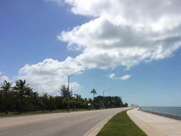
I had a pleasant trip up the Keys and stopped on Key Largo at The Buzzard’s Roost for lunch. It is located inside a marina and I passed by it the first time. This place was recommended by the Yoga on the Beach instructor, Don, if I remember correctly. Well it was good. I had Tuna Tacos, one of today’s specials. It came with Ahi tuna covered with a Cilantro Wasabe Aioli and seaweed.
Oh, I had a slice of Key Lime pie afterwards. I’ve been thinking about Key Lime pie since arriving in Florida. Cindy, my waitress today, says theirs is more custard-like, compared to others that are more like a cheese cake. They are made in house and my slice was quite yummy. Needless to say I recommend stopping here for a meal.
There are two ways off the Keys, Hwy 1 or the the Card Sound Road.
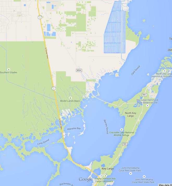
I took Hwy 1 on the way down, but Card Sound Road this time. The speed limits were mostly set at 45 and there was a bicycle lane down much of this route, but there was less traffic and it was a bit less developed.
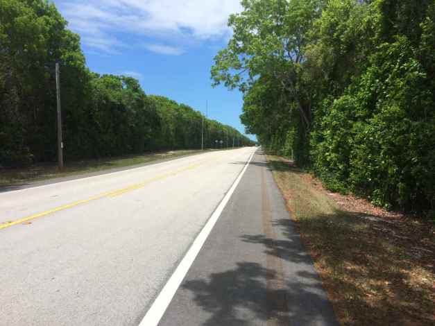
My destination today was Ft. Lauderdale. I wanted to visit someone I worked with while at my last job. We have spoken over the phone and through email, but never met. He rides and invited me to visit back in December of 2013. Well, today some sixteen months later, I stopped by for a visit. 🙂
It was great to connect in person, share a meal and stories of travel and work and share our other interests. Thanks Eric for a really great visit. That made my day.
I had planned to stay in my first ever Airbnb accommodation tonight and made a reservation to stay in a room at a house just a few block from Eric’s place. From the outside, the house looked like it was in very poor shape. There were holes in the soffits and an old mattress in the backyard.
When I looked inside, while the room seemed clean and looked just like the picture, the bathroom wasn’t. The host expected people to put their used toilet paper in a waste basket next to the toilet because the toilet would not flush otherwise.
Next to the toilet there was an open basket of feces-laden toilet paper. I won’t show you that picture.
I didn’t stay another minute. While it took some emailing back and forth, I received a full refund from Airbnb and a $100 coupon good for a year should I want to try again.
I booked a room at a local Motel 6 and am looking forward to sleeping comfortably. Tomorrow I plan to get an early start.
Day 38

Day’s distance: 257 miles
Total trip distance: 6,759 miles
Up until about 5pm, the weather was typical of the last week in the Keys. That means mostly sunny, highs on the road up to 90. About 5pm, I encountered storm clouds followed by thunderstorms and a brief downpour.
My objective today was to get an early start and get to Cape Canaveral about noon. The route I chose was I-95 most of the way. Usually, I try to avoid highways while on my trips but the traffic congestion around this part of Florida is pretty bad, so I’m using freeways to get to my destinations.
I did get out of the motel before 8am, topping off the tank and putting air in the tires before getting on the freeway. On my way to the Cape, I detoured to a Starbucks for a latte and one of their sausage egg sandwiches. With one more short break, I arrived at the Cape just after noon.
This was my first visit ever, and folks there suggested I start with a bus tour. Today the buses were taking visitors to the Apollo / Saturn V Center. On our way there, we past by the Vehicle Assembly Building.
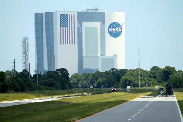
Arriving at the Center, we waited to enter a series of exhibits, each lasting about 10 minutes or so. The first provided some history of the Apollo program.
The second exhibit used the actual equipment from launch control for Apollo VIII.
After the second exhibit, you enter the big hall where there is a Saturn V rocket exhibited horizontally.
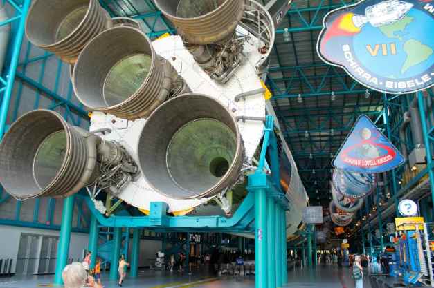
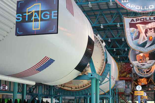
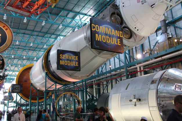
Near the rocket was one of the Apollo Astronaut Vans
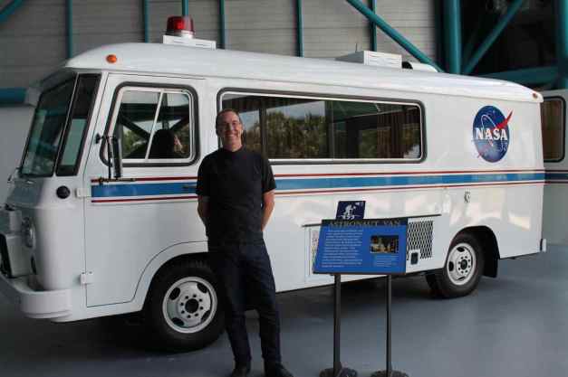
In the same building was a Lunar Presentation and Exhibit
When I was done, I boarded a bus back to the main visitor’s area. They drop you off at in front of the Atlantis Center. This was another presentation and exhibits combination. Seeing the Atlantis was the highlight, for me.
I decided to watch one IMAX movie and then head to my motel in Daytona Beach.
Storm clouds formed about the time I left.
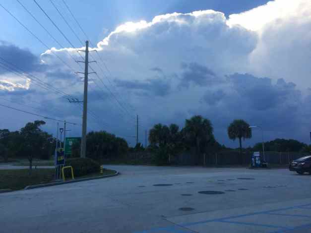
When I stopped for gas, I checked my weather radar app and it showed some rain coming.
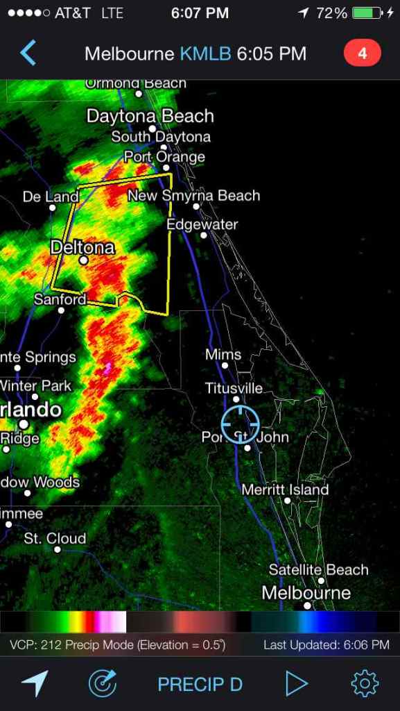
I made it part way to Daytona Beach before pulling into a rest area to wait out the storm. It was a good thunderstorm, with lightning, thunder, heavy rain, and winds.
But 30 minutes later, I took off and made it to my hotel in time for a beautiful sunset.
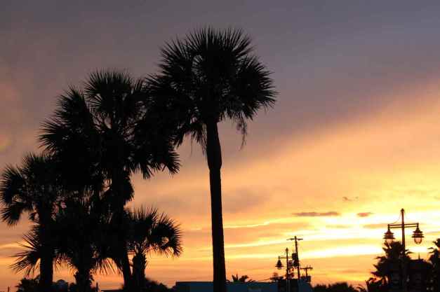
It was a good day, full of discovery with a side order of rainy adventure. Until tomorrow 🙂
Day 39

Day’s distance: 242 miles
Total trip distance: 7,001 miles
The skies were clear and the temperatures reached 96 above the road surface near Savannah, where the reported temperature was 94 when I arrived at 4pm. Winds above Jacksonville were moderate but they were blowing mostly right at me, so the motorcycle wasn’t impacted too much.
I woke up to a beautiful sunrise over Daytona Beach and couldn’t resist another walk along the beach and a dip in the pool afterwards.
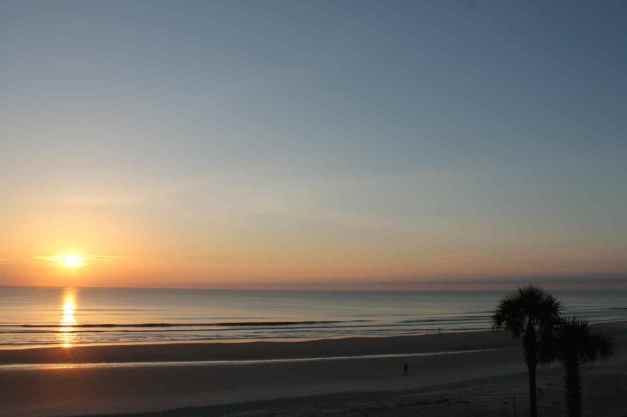
Between the walk, the swim, deciding where to stay in Savannah, and packing up my stuff, it was after 10am when I finally made it out of the motel.
The rear tire needed some air, again. I am going to have to keep an eye on it. Recall that back on Mustang Island (near Corpus Christi), I picked up a nail. Perhaps there is a slow leak as I had to put air in that tire just yesterday.
I looked for a latte before leaving town. Starbucks seemed to be the only choice my GPS unit knew about but when I rode past, there was no convenient parking so I ended up getting on the freeway and waiting until a bit later.
My route took me to Savannah directly, which means another day of freeway miles. I don’t enjoy traveling by freeway and will soon be taking more interesting and scenic roads again. The drivers here in Georgia share one annoying trait with those in Florida – they love to pass people on the right 😦 Despite my late departure from Daytona Beach, I arrived at my hotel by 4pm. I guess there is one advantage to taking the freeways – you can travel quickly between cities.
My neighbor back in Seattle encouraged me to stay in Savannah’s Historic District, and specifically stay at the Planter’s Inn, a restored historic hotel on Reynolds Square. I took her advice and found the hotel to be an excellent choice. It is beautiful from the outside …
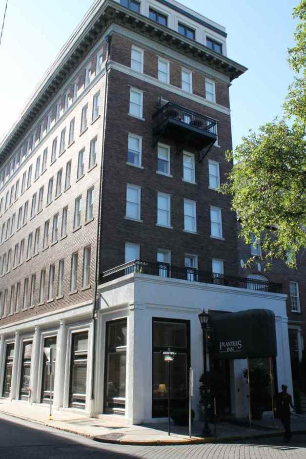
and the inside.
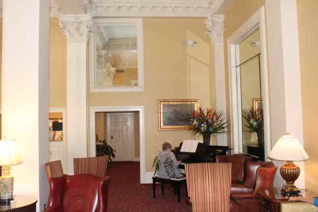
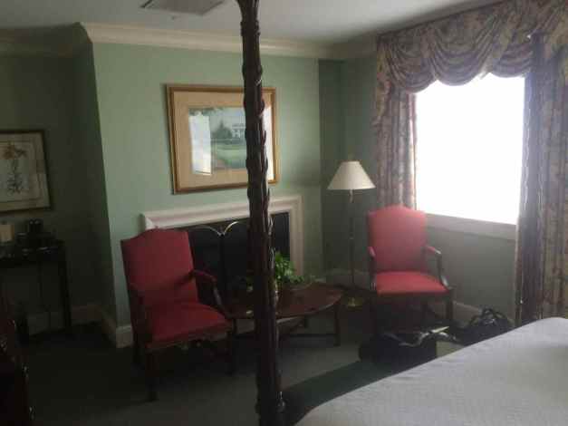
Amenities include a complimentary sunset social hour, consisting of wine and cheese in the hotel’s lobby. I met two former Seattlites, Jan and Doreen, while enjoying my wine. I love being reminded of how small our world seems, sometimes.
The Historic District of Savannah is adjacent to the Savannah River, separating Georgia from South Carolina. I enjoyed a brief walk along the riverfront …
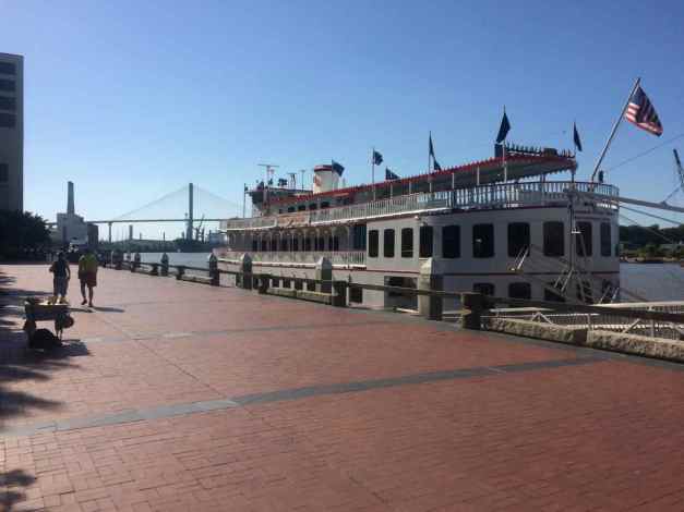
and along River Street, the old brick street immediately adjacent to the river.
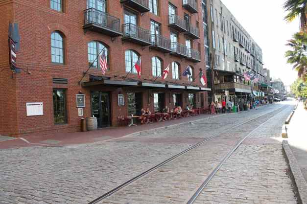
This part of Savannah is organized around squares, or small parks. Each one is dedicated to a piece of the town’s early history. I plan to take a tour of these squares in the morning before leaving.
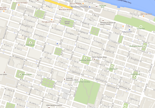
I ate dinner across the street from the hotel at The Olde Pink House, Savannah’s only 18th Century Mansion, downstairs at the bar. This is a great way to meet folks and enjoy a meal while not feeling alone.
Choosing a few appetizers, I had the intention of experiencing some unique southern cooking; including ‘Southern Sushi’, smoked shrimp mixed with grits and rolled in a coconut nori, and Blackened Oysters, served with a watermelon relish and an apricot and pear relish. Both were super good and unexpectedly affordable. Thanks again to my neighbor back in Seattle for the suggestion 🙂
I planned to head to Myrtle Beach from here, but Memorial Weekend begins tomorrow. I’m re-evaluating whether I want to stay on the coast or move inland and find some of those scenic, lesser traveled roads a few days sooner.
Today’s travel was a struggle with the heat, but there is going to be a significant drop in the region’s temperatures beginning tomorrow. That will be nice. Staying in nice hotels, meeting super people, and traveling around for extended vacations, I’m reminded once again that I live a really charmed life.
Day 40
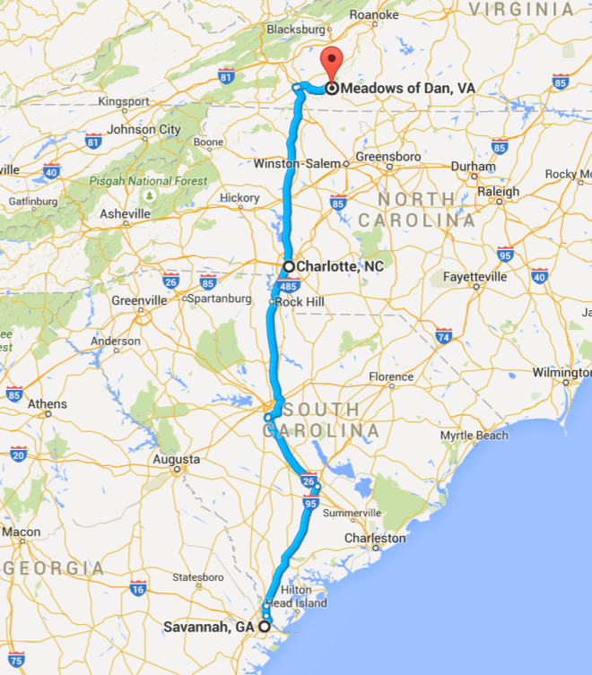
Day’s distance: 381 miles
Total trip distance: 7,382 mile
It was mostly cloudy in the morning and mostly sunny in the afternoon. Despite the sun, the temperature was about 15 to 20 degrees cooler than the prior day – a welcome relief.
As mentioned in my prior post, I changed my travel plans to avoid Myrtle Beach over the long weekend. Instead, I decided to head up to the Mt. Airy area early.
Trivia: Did you know that Andy Griffith, of Mayberry fame, was born in Mt. Airy? I didn’t, at least not until I pulled into a gas station there and saw a rack of ‘Beyond Mayberry: A Memoir of Andy Griffith and Mount Airy North Carolina’ books in paperback and looked up Andy’s history on wikipedia, confirming his birthplace.
Deciding to travel almost 400 miles and not leaving town until after 10am, I felt a bit of pressure to make some miles. Despite the GPS estimating the trip to take six hours, I knew it would take at least eight, including stops for fuel and food.
My route took me across three state lines but the interstates weren’t particularly scenic until reaching Virginia and beginning the climb into the Blue Ridge Mountains.
Before arriving at the campground, I stopped at a roadside food trailer (shack?) for dinner. I had picked up a few more Mountain House (dehydrated) meals for use, but anytime I can try local food, I usually do so.
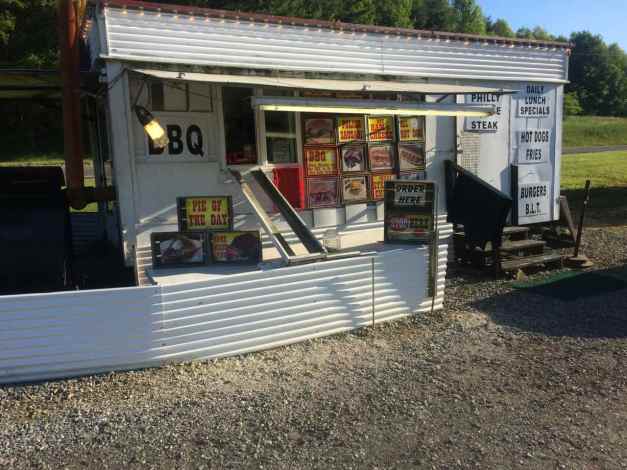
The campground I chose is a motorcycle-only camp, and this was going to be my first experience at such a camp. I arrived a little after 7pm and set up camp in the field along with the twenty or so others.
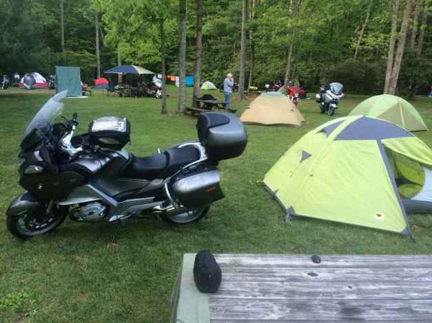
Every night, there is a campfire where most of the campers gather. I found the other riders friendly and open at tonight’s campfire. I look forward to some local area rides and at least one more night here.
Day 41

Day’s distance: 86 miles (approx)
Total trip distance: 7,448 miles
The weather was cool in the morning, maybe the low 50’s, but it was ideal in the afternoon with temperatures in the mid 70’s and the skies mostly sunny.
I woke up about 6am and took a shower before having coffee in one of the outdoor covered gathering places in Willville. I met several other riders the night before and went to breakfast with one of them, Fritz. We went to the Meadows of Dan Community Center that was putting on an all-you-can-eat breakfast.
After breakfast, we returned to the camp. I was socializing with North Carolina residents Dwayne and Susan, who also arrived at camp the prior night. Their Goldwing 1800 tows a trailer that folds out to cover approximately 100 sq ft. They called it the Tajma-trailer.
They also set up an additional cover. They are totally ready for inclement weather.
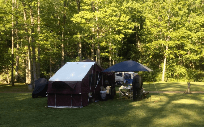
Anyway, they invited me to have a second breakfast. I joined them and enjoyed grits, biscuits and gravy, fresh OJ, and some (more) eggs.
Word was spread that there was a chili cook-off in Floyd and since it was after noon, Fritz and I decided to head up there. We first headed to the Honduras Coffee Roasters and Cafe in Stuart for a latte.
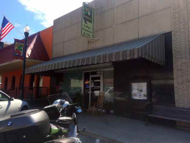
Good coffee and the treats looked good, but since I had eaten two breakfasts already, I didn’t try one.
After our coffee, we took Hwy 8 to Floyd. It turned out the Chili Cook Off was the prior day, so we walked around a bit, stopping first at an open market …
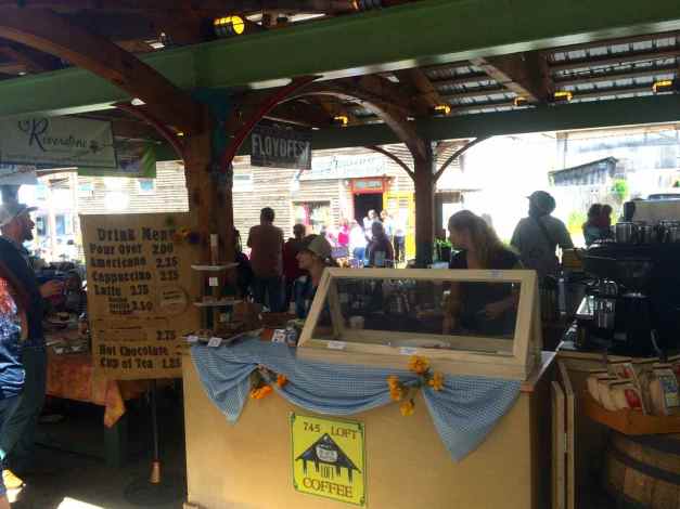
Floyd has a reputation of being a bit of a hippy haven, a liberal town with strong sense of community. They are also supporters of authentic Appalachian music, with several music venues, including the Floyd Country Store …
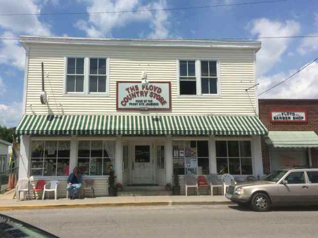
They had a live blue grass band playing this afternoon.
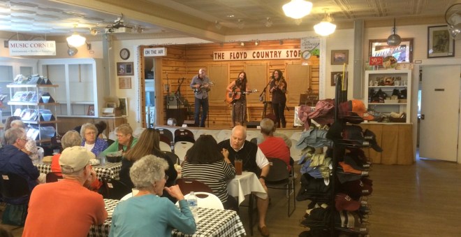
We grabbed lunch at the Oddfella’s Cantina. I had a burger that was really good.
The two of us rode back to camp via the Blue Ridge Parkway to Hwy 58. The afternoon passed by quickly with lots of motorcycle-related conversations. Soon it was dinner time. This day seemed to be all about eating. We grabbed dinner nearby at the Crooked Road Cafe and by the time we returned, it was almost dark.
Soon it was time for the nightly campfire. When I camp alone, I never have a fire. It is really nice to have a communal fire where campers gather to sway tall tales. 🙂
Someone who shall not be named was sharing a bit of local moonshine. It was flavored by fresh peaches and aged for about a year. Surprisingly smooth, it was a great nightcap.
Day 42
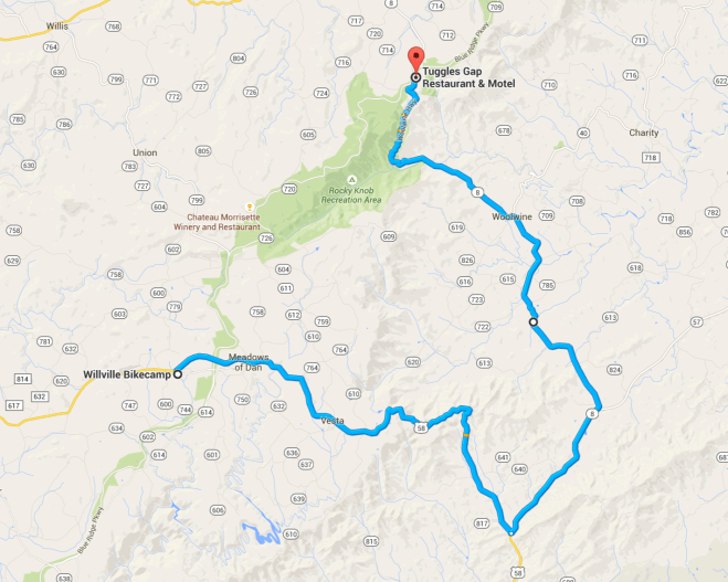
Day’s distance: 126 miles (approx)
Total trip distance: 7,594 miles
Last night was warmer than the prior night, very comfortable in the tent. Today’s highs were in the mid 70’s, and the skies mostly sunny. Winds were light. It was a perfect day for motorcycling.
I rode to breakfast with Fritz, David, and Hank, a friend of theirs who showed up at the camp this morning.
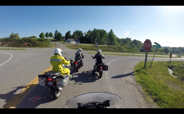
Everyone was headed to Tuggles Gap to meet up with the Twin Valley Riders club. The club meets for breakfast at Tuggles Gap Restaurant on the fourth Sunday of odd numbered months.
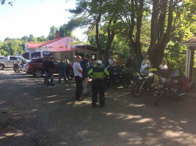
I sat with Cliff and Michael and had a great breakfast. Michael has lived in Seattle (small world). He’s a writer and motorcycle enthusiast.
After breakfast, Michael and I rode together for about an hour before he continued home and I headed back to camp. I didn’t keep track of the roads we took, only that they were twisty and challenging. I rode more slowly than Michael, so he waited at intersections for me to catch up.
It’s important when riding with groups or just a new person to ride your own ride. Put a plan in place to accommodate differences in skill and preferences in riding style.
I took a few short rides by myself, one into Stuart for lunch and a late afternoon ride along the Blue Ridge Parkway.
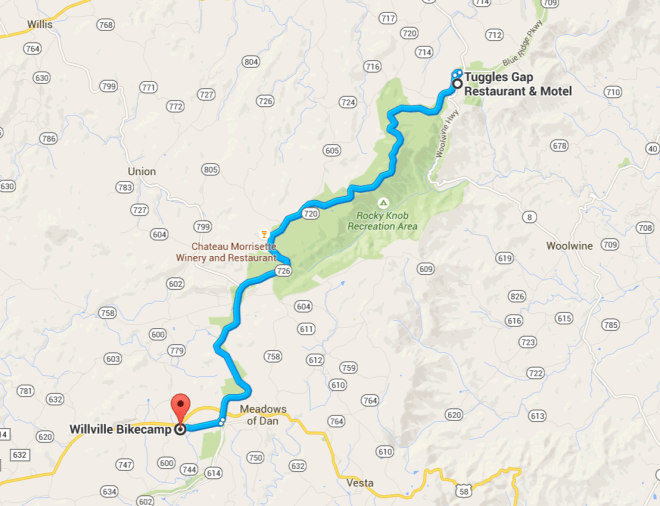
I stopped at The Saddle overlook …
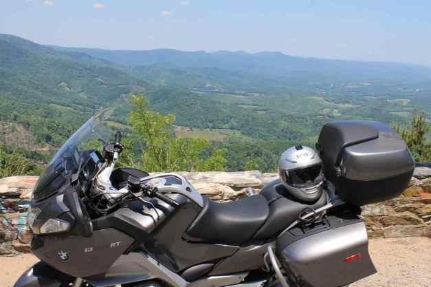
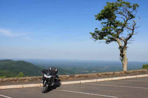
and again at Mabry Mill.
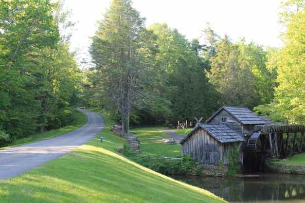
That is the Blue Ridge Parkway in the picture above, adjacent to the mill. In the section I rode today, the parkway feels narrow because there is not a useful shoulder, but the pavement is in very good shape.
I’m looking forward to traveling more of the Parkway tomorrow. Having a few days to adjust to the narrow and windy roads here in Virginia was useful. I will have to consider adding extra time onto a trip if switching from primarily interstqte usage to rural roads.
Day 43
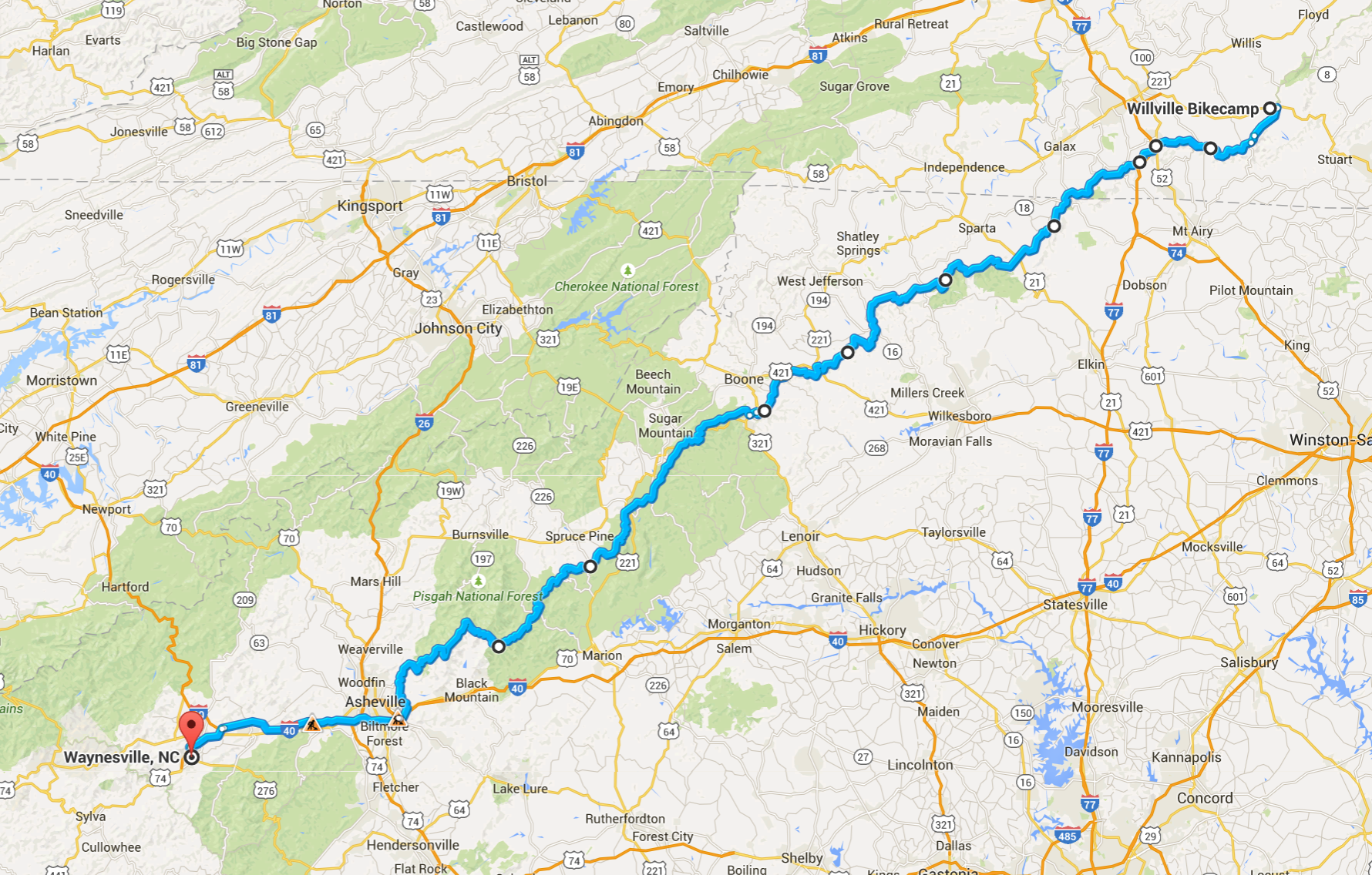
Day’s distance: 266 miles
Total trip distance: 7,860 miles
The day was close to ideal, with temperatures in the mid 70’s and the skies partly cloudy.
I left Willville this morning at 7am and I will miss this campground and the other riders I met here over the last three days. 😦 This place is highly recommended if you’re in the area and the weather is appropriate for camping.
I spent most of the day on the Blue Ridge Parkway. Originally called the Appalachian Scenic Highway, according to a wikipedia article, the two lane road is in overall great shape with largely gentle twists and turns. The speed limit along most of the parkway is 45mph and fines are reportedly steep for speeding, so I just settled in a took my time.
There was little traffic until later in the day as I approached Asheville. As it was Memorial Day, I was surprised and delighted and really enjoyed this most scenic roadway.
Below is a slide show of my favorite photos from the day.
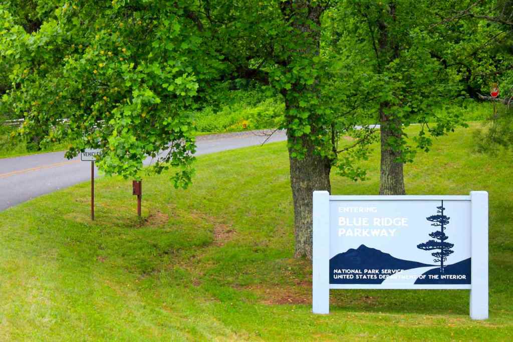
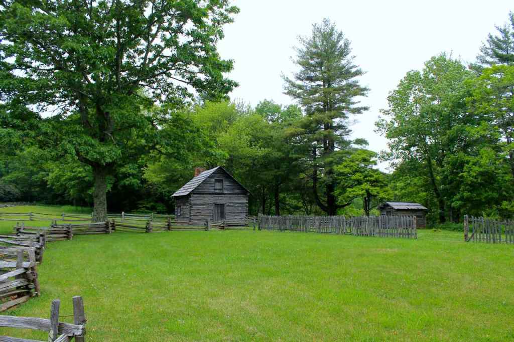
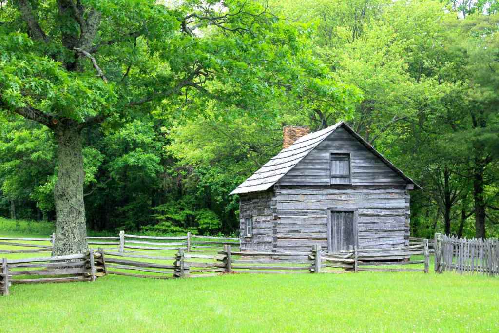
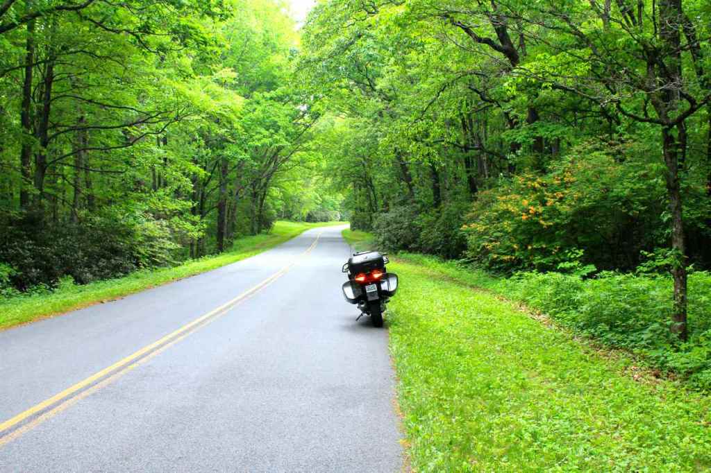
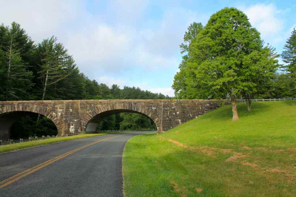
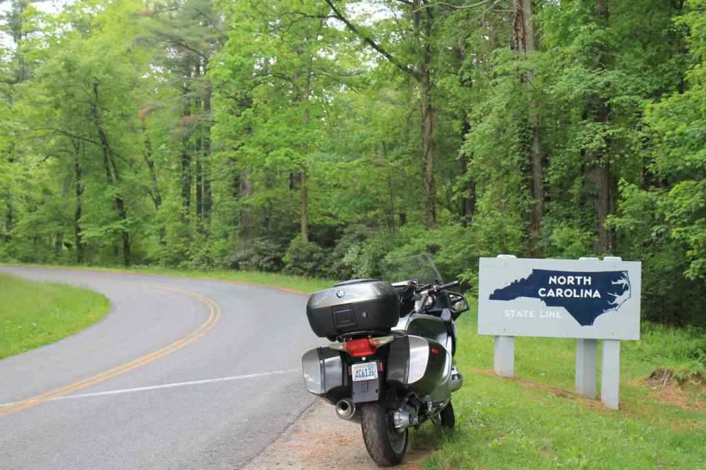
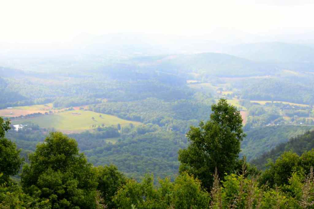
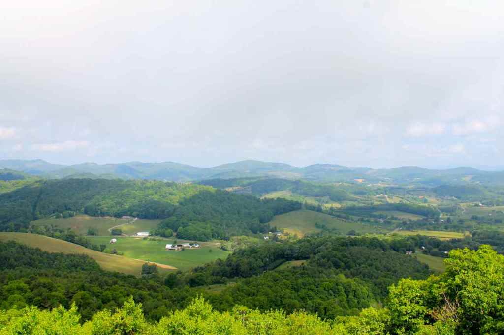
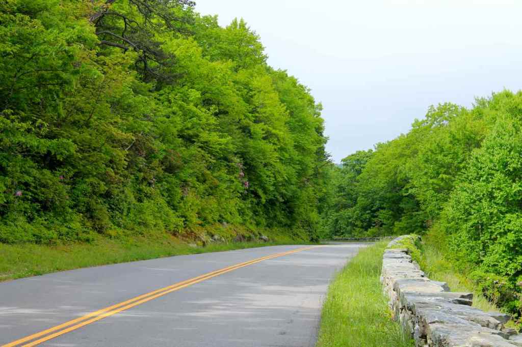
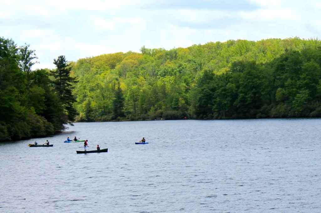
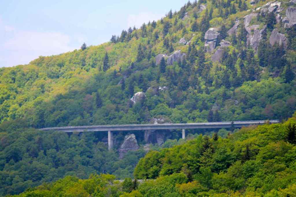
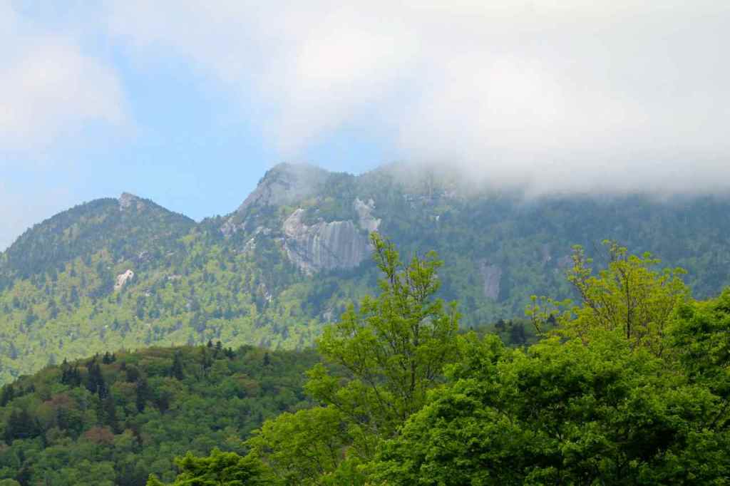
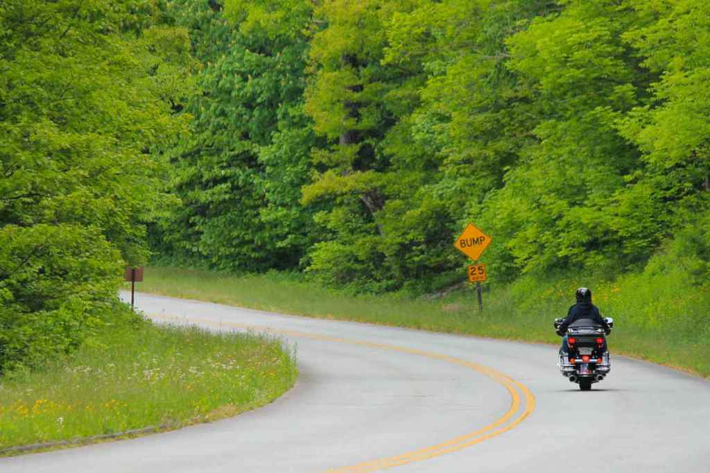
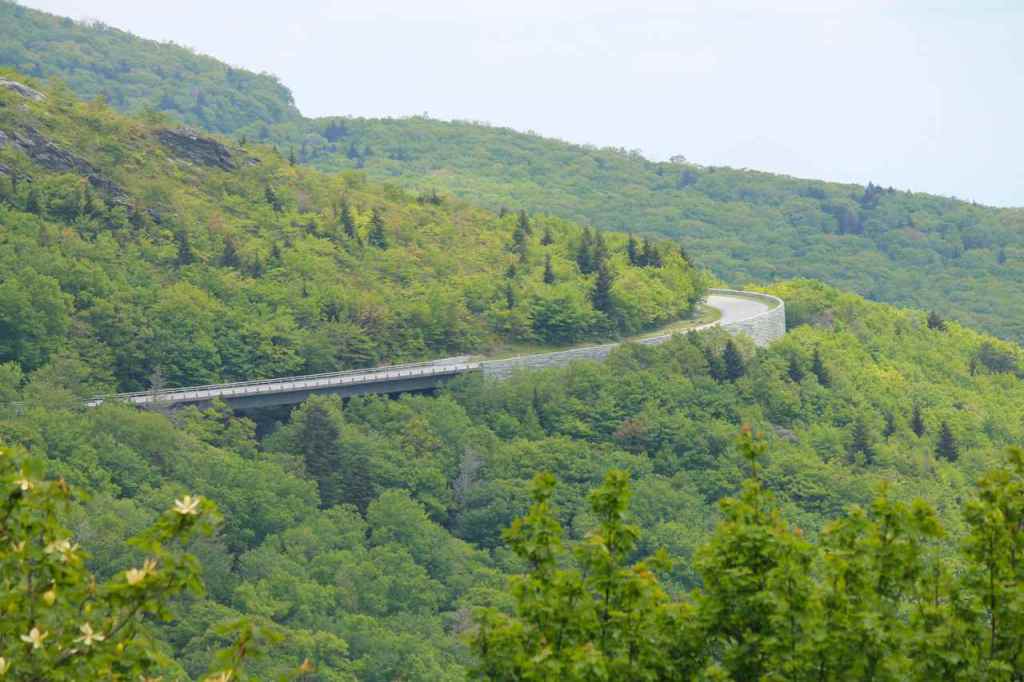
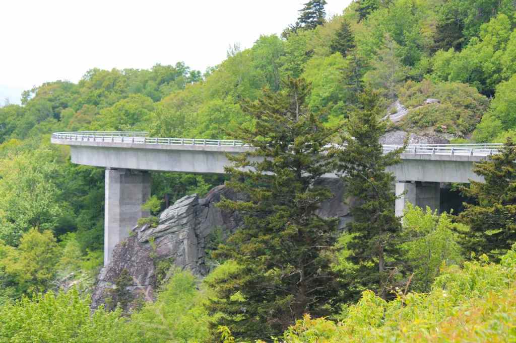
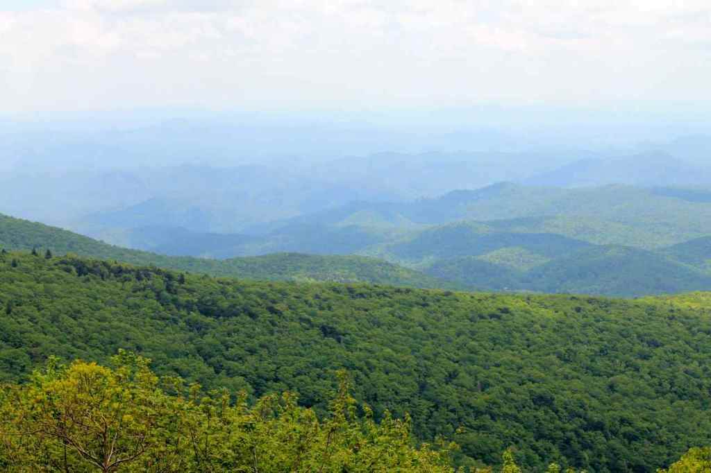
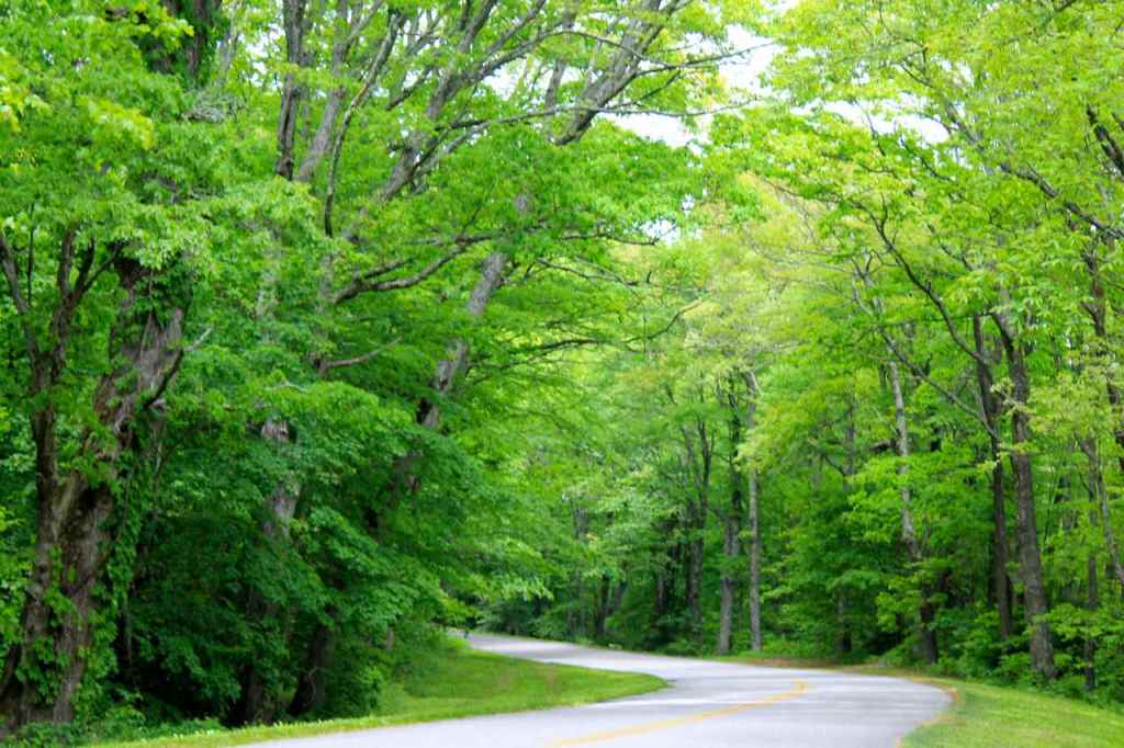
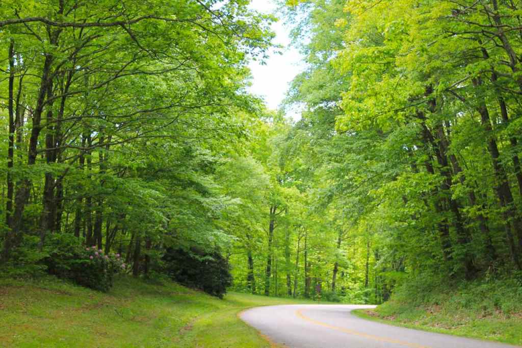
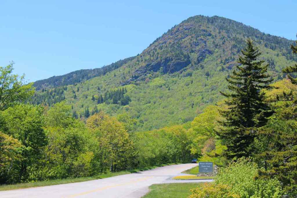
I used I-40 to get to Waynesville from the Parkway. It was already past 3pm and since I’d be in the area only one day, I wanted to spend a few extra hours with my friends than more time today on the Parkway.
Former Seattle neighbors live in Waynesville and agreed to put me up for the night. It had been about six years since they’ve lived in Seattle and they recently purchased this house. I deeply appreciated the comfort of the bed after camping for three days straight, the longest stretch of camping I’ve done on any motorcycle trip.
We ate dinner in town at The Sweet Onion. I had a delicious steak and some nice wine. Thanks to my hosts for treating 🙂
The weather is predicted to turn rainy tomorrow. Let’s hope for the best.
Day 44

Day’s distance: 138 miles
Total trip distance: 7,998 miles
The weather varied today. It was raining lightly when I left this morning. At higher elevations, it was very foggy. About noon, the rain had stopped and the sun began to shine through the clouds. Late in the day a light rain started once again. Temperatures reached 88 but cooled off in the early evening when the rain returned.
Today, I was on my way to one of the country’s notable motorcycling roads, the Tail of the Dragon. Because the weather was predicted to be less than ideal, I shortened my tentative route and put off the Cherohala Skyway ride until tomorrow.
I left the house about 8am and stopped to put air in the tires and gas and oil in the bike. With everything set, I left Waynesville and returned to the western-most section of the Blue Ridge Parkway. Just like yesterday, the parkway was beautiful with scenic overlooks, only today it was too cloudy and foggy to see much.
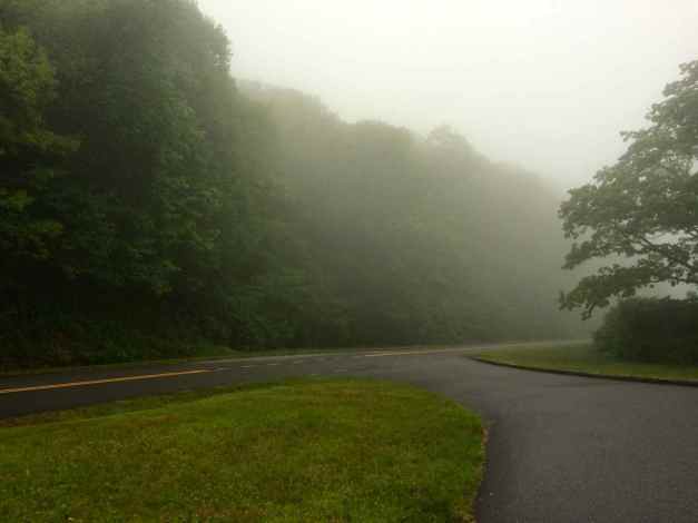
There was little traffic on the Parkway, and when I saw two motorcycles pass me coming the other way with their hazard lights on, I thought that was a great idea since I was only going 25 or so in the worst spots, which seemed to be the elevations about about 4700 feet.
Many of the roads follow local rivers, such as this scenic pull out.
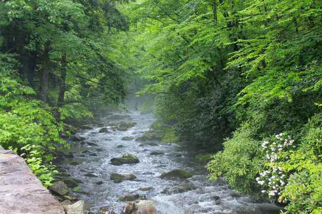
As I reached the end of the Parkway and the entrance to the Great Smokey Mountains National Park, I detoured into Cherokee for a latte. The Cherokee Coffee Shop had really excellent coffee and treats. They roast the beans themselves, several times a week, and the results might just be heaven. A definite stop if you’re in the area.
I worked on catching up with the blog while drinking coffee. It was well past noon by the time I was back on the bike. Then another BMW rider flagged me down and wanted to ask about my GoPro mounts. We compared notes about a number of things until about 1pm. I was glad for two things: my day’s route was shortened and the weather was dry and much nicer than expected.
I crossed into Tennessee while riding Hwy 441. At this point, it was quite breezy and the fog had returned. Of course, there is an obligatory bike photo 🙂
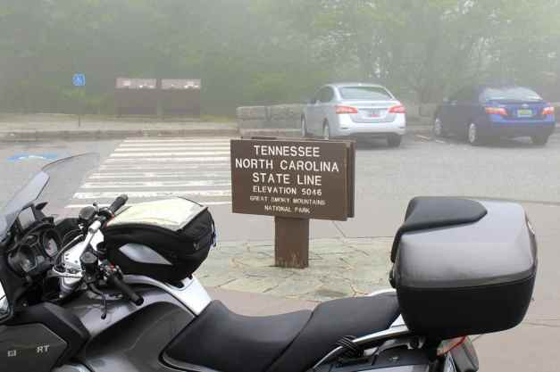
The Tail of the Dragon begins in North Carolina and ends in Tennessee. I would be riding it the other way and took the opportunity before entering Townsend, TN to stop watch the folks tubing down the Little River and to soak my shirt in the cool water. It was getting a bit hot by then and humid. I think it was 86 degrees or so.
Along both the Blue Ridge and Smokey Mountains, my cell coverage with AT&T has been very spotty. But during lunch I made a quick call back to Seattle. It was good to catch up with events back home.
Entering the Foothills Parkway,
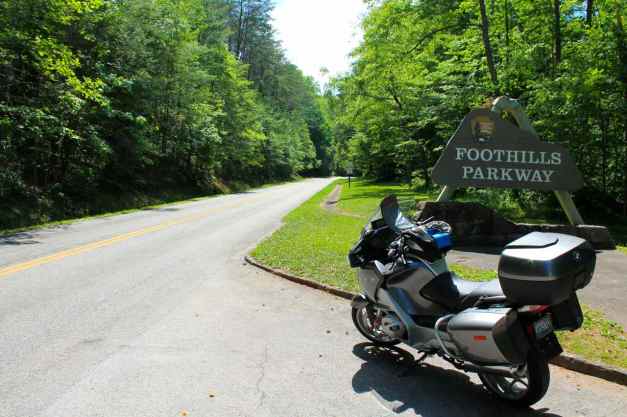
I would ride the ridge between the Smokey Mountains to the east …
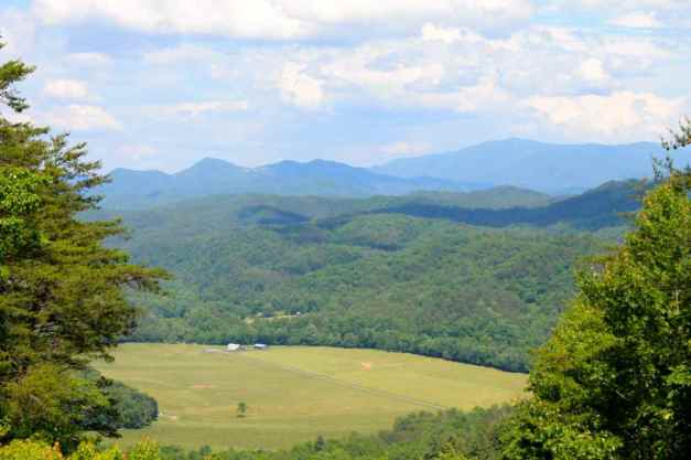
and the Tennessee River Valley to the west.
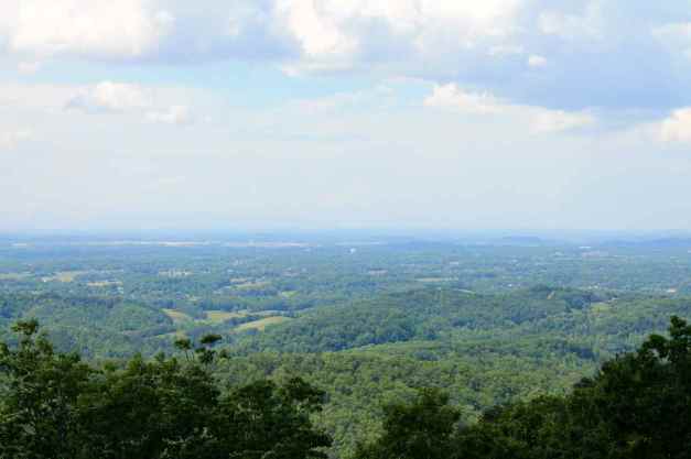
The time finally arrived. I have been looking forward to riding the Tail for a while and I was grateful the surface of the road was dry and that it wasn’t a weekend when the road is full of bikers who go much faster than I can on an unfamiliar road.
The Tail of the Dragon has a reported 318 turns in just 11 miles. I’ve ridden twisty roads – many of them – but this road has what I believe to be the most concentrated set of curves I’ve ever ridden. Here’s a short video of a few of those curves.
A very fun event occurred as I was about half way through the Dragon. The odometer turned 30,000 miles!
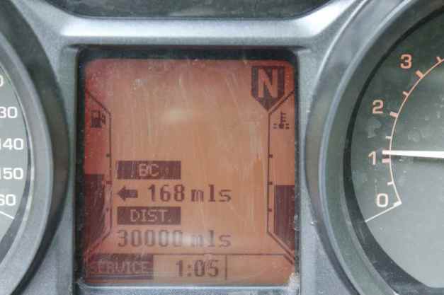
Deal’s Gap is a motel, gas station, and gathering place at the start of the Dragon.
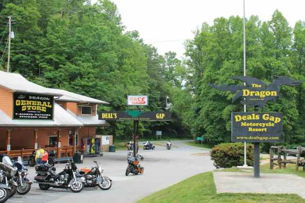
Arriving at Deal’s Gap, I was told I had to visit the Tree of Shame. If you wreck while riding the Dragon, it is custom to hang something on the tree. You’ll see x-rays, fenders, etc. on it.
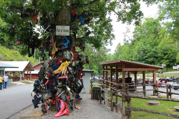
I noticed after the ride that over time I’m using more of the usable surface of the tire. Bikers would say that my ‘Chicken Strips’ are getting narrower. I’m a conservative rider, as you can tell, but at least the rubber ‘hairs’ are no longer there 🙂
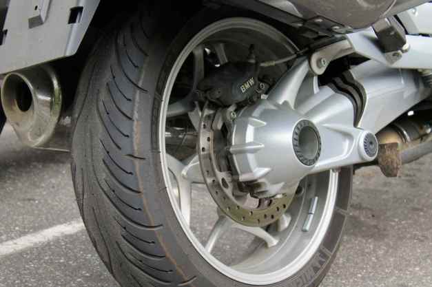
I left Deal’s Gap tentatively headed for Robbinsville to stay the night, but ended up stopping for a cold drink at the Pit Stop, part of the Fontana Lodge. It began to rain and I decided to stay here for the night. The Lodge has two pools and a lazy river and two restaurant on premises. I used the pool and lazy river, then went to the Bistro for dinner.
While being seated, I noticed there was only one other table occupied and they were talking about the Dragon. I introduced myself and ended up eating with them, telling tales of motorcycling and sharing information about routes. I love the motorcycling community and am lucky to be able to spend time with folks like Butch, Cody, Karen, and Viann.
There was a nice sunset tonight.
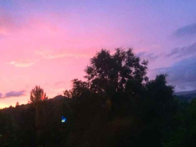
Tomorrow I plan to ride the Cherohala Skyway before detouring to Marietta for Thursday service appointment with BMW of Atlanta.
Day 45
Day’s distance: 199 miles
Total trip distance: 8,197 miles
Again, the weather was very nice and much better than expected. High temperatures reached the low 80’s and the skies were partly cloudy to mostly cloudy later in the day.
I didn’t have far to travel today, so I did some laundry in the morning while still at the Fontana Village Resort. Finished with that, I departed the lodge about 11am, headed for Robbinsville and the Cherohala Skyway.
The Fontana Village is quite extensive and includes a marina at Fontana Lake. It seemed quite a scenic area and the resort was full of amenities, including a frisbee golf course. Frisbee golf takes me back to my graduate school days. 😉
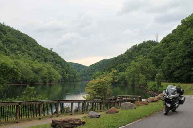
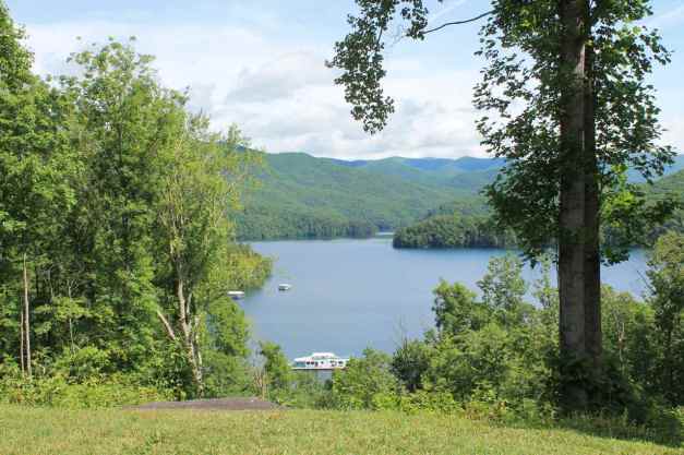
Today’s goal was to ride the Cherohala Skyway, starting in North Carolina and finishing in Tennessee.
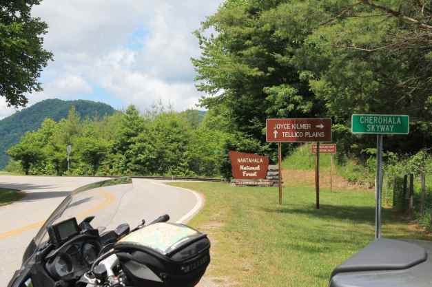
The two-lane road was in very good shape, with a speed limit of 45mph in most places. The twists and turns of Cherohala weren’t as concentrated as on the Tail of the Dragon, but the speed limit was higher and the scenery was more expansive as the Skyway runs partly on top of the local mountain ridges.
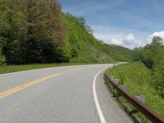
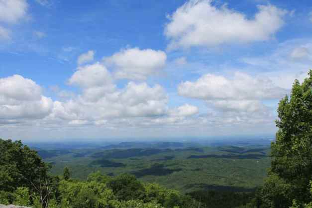
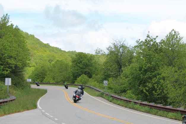
As the Skyway approaches Tellico Plains, it follows a river and reminded me of Hwy 12 in Idaho.
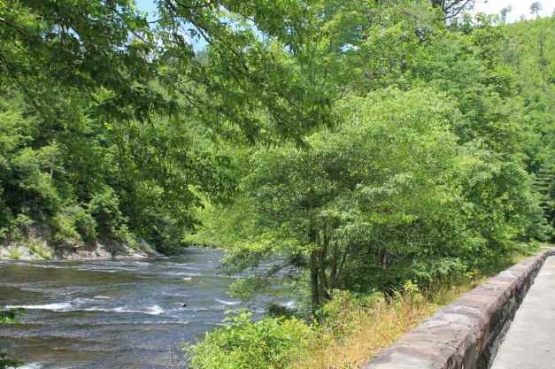
I stopped at the Tellico Kat’s Deli for a sandwich and some coffee. I sat out back on the porch that overlooks the river, enjoying the tranquility and winding down after traveling the Skyway.
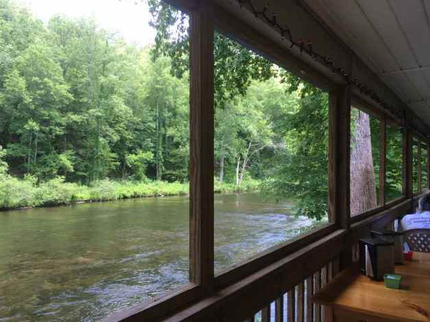
Most of the rest of the day was spent traveling from Tellico Plains to Marietta where I stayed the night. The motel was about 3 miles north of the dealer that was going to perform my 30,000 miles service the next morning. The roads I took were a mixture of smaller highways congested with local traffic to some interstates which were less interesting but moved quickly. I guess sometimes you take the good with the bad.
Until tomorrow !!
Day 46

Day’s distance: 156 miles
Total trip distance: 8,353 miles
The weather consisted of periodic rainstorms throughout the day, with temperatures in the low 70’s to 80 when not raining.
My first stop and main goal today was to get the motorcycle serviced at BMW of Atlanta. The bike requires service every 6,000 miles and this was the second service stop of the tour. Except for needing a new set of tires, the bike should be good until I get back to Seattle. Although my last set of tires lasted more than 13,000 miles, the bike was fully loaded for only about half of those miles. I will play it by ear, but likely stop in Denver to pick those up.
The folks at BMW of Atlanta took great care of me and the bike. Everyone working at this family-owned dealership was cordial and the bike seemed to purr after the service. Definitely two thumbs up!!
Since I only had to travel a short distance today, I was open to the suggestions provided by the folks I met at the dealership. I planned a lunch at a nearby Jim N’ Nicks BBQ followed by a short but twisty ride down a local road named Raccoon Creek Road.
The driest part of the whole day was spent waiting for the bike to get serviced. The afternoon was spent ducking the worst of the multiple rainstorms that came through the area. I made it to my lunch stop, but not before the first afternoon thunderstorm started.
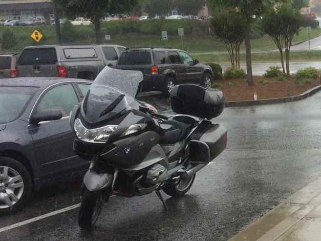
This storm passed through in about 30 minutes, and I finished lunch and continued to Raccoon Creek Road and Braswell Mountain Road, in that order.
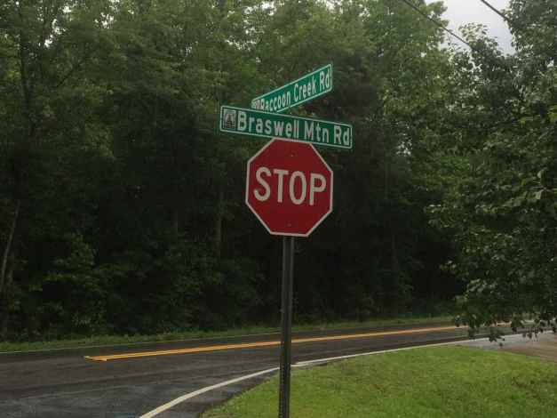
The surface was in good shape on both, but it was wet from the continuing rain.
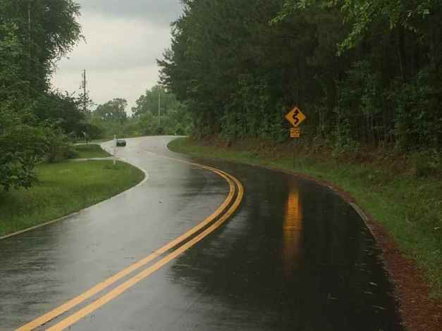
Braswell Mountain Road was a pleasant alternative to taking I-20 directly to Leeds, AL. It was a quiet two-lane road passing by some very large farmhouses and estates.
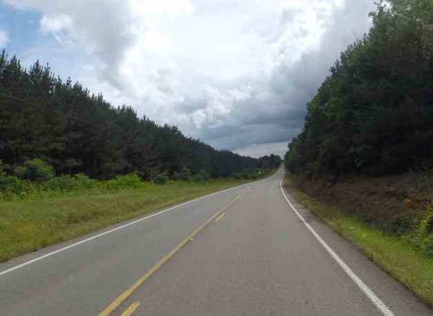
When I do have to ride in the rain, I’d rather be on a quieter road going more slowly than on a freeway getting splashed by cars and trucks.
Ducking under cover at a roller skating rink was required while the worst of yet another storm passed through.
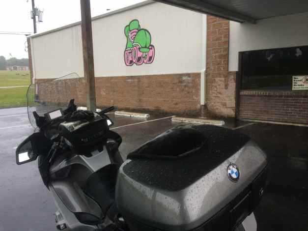
I arrived at the motel just outside of Leeds, Alabama just after 5pm. I was again on Central time, gaining back an hour. While traveling east and losing a hour due to the timezone change felt like progress on my tour, this timezone change made me feel like I was leaving part of the South, and therefore part of the Tour, behind me.
I walked to Logan’s Roadhouse for a beer and maybe some dinner. While there, I was talking to a local resident for some time. After she left, I caught up with Facebook. I caught myself watching One Direction videos on my iphone and felt self-conscious, but the bartender said she loves One Direction 🙂
I used the motel’s pool and hot tub before crashing for the night. Tomorrow I’ll visit the Barber Vintage Motorcycle Museum.
Day 47
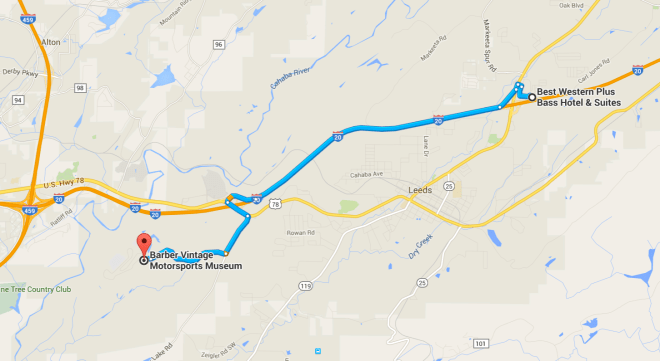
Temperatures reached into the low 80’s and despite the clouds rolling through much of the day, it didn’t rain that I noticed, at least not during the day.
Today was a day “off”. While I put a few miles on the bike, it was only traveling to the Barber Vintage Motorcycle Museum and back to the motel, twice. 🙂
I arrived at the museum at about 10:30am.
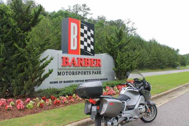
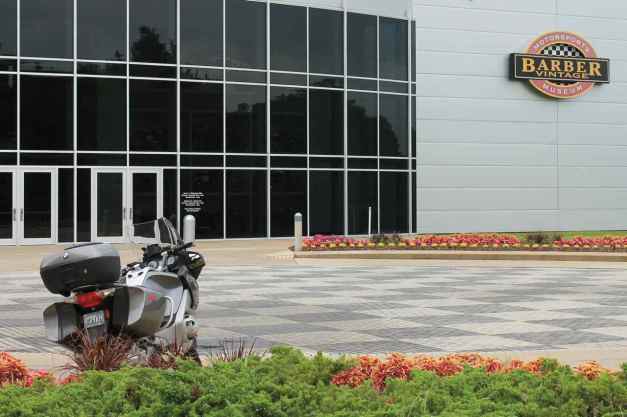
The museum building is huge, with five floors, not including the basement level.
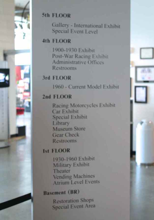
A large nicely-finished glass freight elevator is located in the center with a circular ramp traveling from the first floor to the fifth floor located around the elevator.
On Fridays and Saturdays, the museum offers a guided tour through the museum, including two areas that are off-limits to general museum visitors. It was scheduled to begin at 11am so I signed up for it. Our guide’s name was Jack and he has been associated with the Barber organization for nineteen years. With a background in engineering and as the owner of a 2015 R1200RT, we got along well !!
The tour started in the basement, where there is a restoration area …
and a race shop where bikes are prepped for racing …
as well as a warehousing area for about 500 motorcycles. Good thing there are high ceilings 🙂
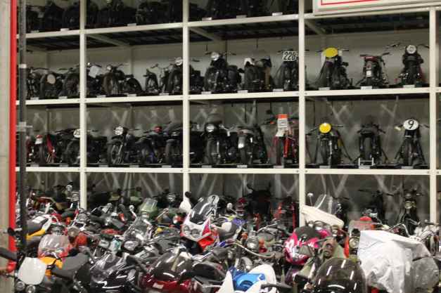
From the basement, we went outside on the walkway over the track.
There was a California Superbike training session going on.
Besides housing the largest motorcycle collection in the world, the museum holds the largest Lotus collection in the world, although they are still waiting for certification before they can say that officially.
I spent hours walking around and took almost 400 photos. I had to return to the hotel to get a fresh camera battery at lunch time. Thankfully, the museum allows visitors to come in again if you have your receipt.
Here is a slide show of some of my favorite photos.

This was a fantastic museum, a must stop if you’re in the area. Everything on display was in excellent condition. There are three full time restoration experts on staff at the museum. It is obvious they know what they’re doing.
Day 48

Day’s distance: 231 miles
Total trip distance: 8,614 miles
Thunderstorms dominated the afternoon, but the morning was very nice. Temperatures were as high as 88.
I detoured to Tupelo, Mississippi today to ride part of the Natchez Trace Parkway into Vicksburg tomorrow. My route took me around Birmingham to the south on I-495 and then west to Tuscaloosa.
I ate lunch at a hole in the wall taqueria in Tuscaloosa. Sometimes you get lucky and find little family-run places that are super good. Well, this was not one of those times 😦 Anyway, back on the road, I was looking forward to the next section of the day’s trip.
Hwy 69 north from Tuscaloosa seemed popular with local riders. It’s a non-technical, two-lane highway with good surfaces that has some sweepers and small hills, with some nice scenery.
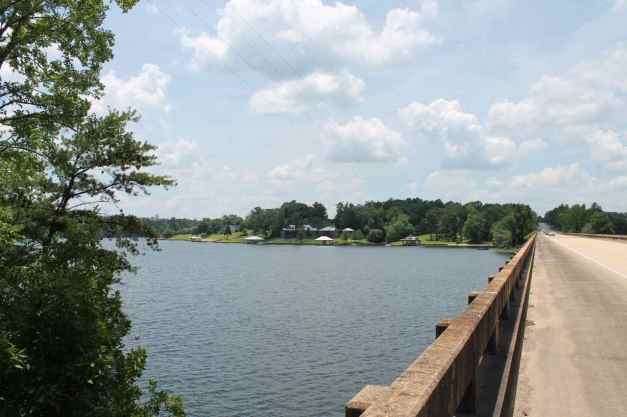
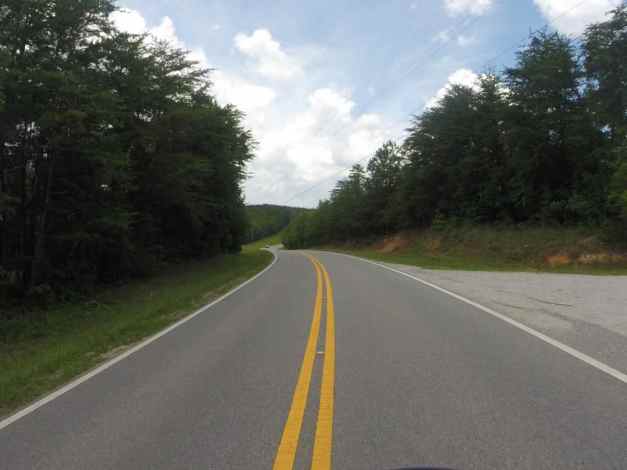
Oakman, Alabama was the last town I passed on Hwy 69.
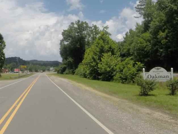
I would likely not remember Oakman, which seemed to be typical of the small rural town. They had a huge, beautiful, and apparently very well maintained High School. I didn’t stop to take a photo with the good camera, but I did get a photo from the GoPro.
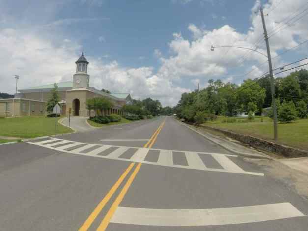
I finished high school is a small-ish town in Central Pennsylvania. Though this school building seemed more ornate, with columns built into the architecture, seeing it took me back to my high school days.
Back on a larger and busier highway, Hwy 78, the rain clouds began to gather for the predictable afternoon thunder showers. I did duck into a rest area to wait out the worst of it.
This image on my RadarScope app …
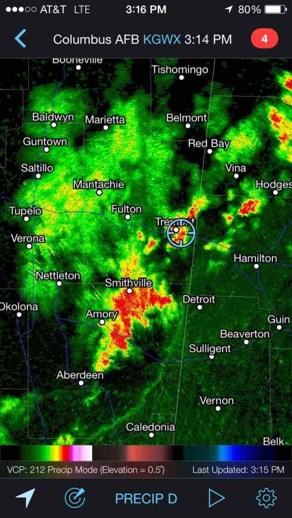
corresponds to this type of rainfall …
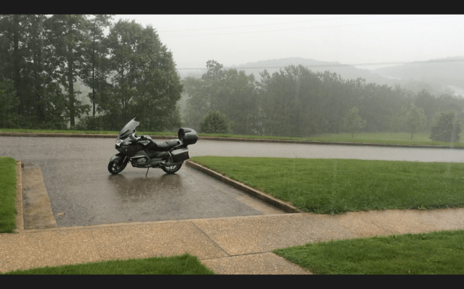
I arrived at my motel in Tupelo and later, after another rain shower passed through, went to a local BBQ restaurant for ribs, and fried green tomatoes. I met two bikers from Louisiana who were on a week-long adventure and we talked until the sun set.
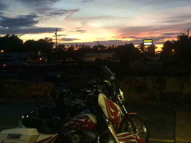
Tomorrow, I’m looking forward to riding the Natchez Trace Parkway and stopping at my friends’ place in Vicksburg.
Day 49

Day’s distance: 234 miles
Total trip distance: 8,848 miles
The weather continued to follow a pattern of a warm, humid partly cloudy morning followed by afternoon thunderstorms.
While in Tupelo, I stopped by the birthplace of Elvis Presley.
After a quick stop at the local Starbucks for a latte and snack, I jumped on the Natchez Trace Parkway where it crossed Main Street. Next stop was Clinton, some 185 miles or so south.
The Natchez Trace was originally created aut of a series of Indian trails by order of President Jefferson to speed up delivery of the mail, and to help hold this frontier area together with the rest of the nation through the early 1800’s, according to information signs located on the trail. Some of the Old Natchez Trace exists and crosses today’s paved version.
Like the Blue Ridge Parkway, the Natchez Trace has no lights or stop signs. Instead, bridges are used to cross over intersecting roads. The speed limit was 50mph for most of The Trace, faster the the BRP. Due to the flat landscape, the Trace was overall less scenic.
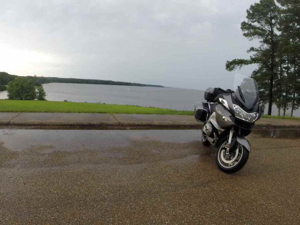
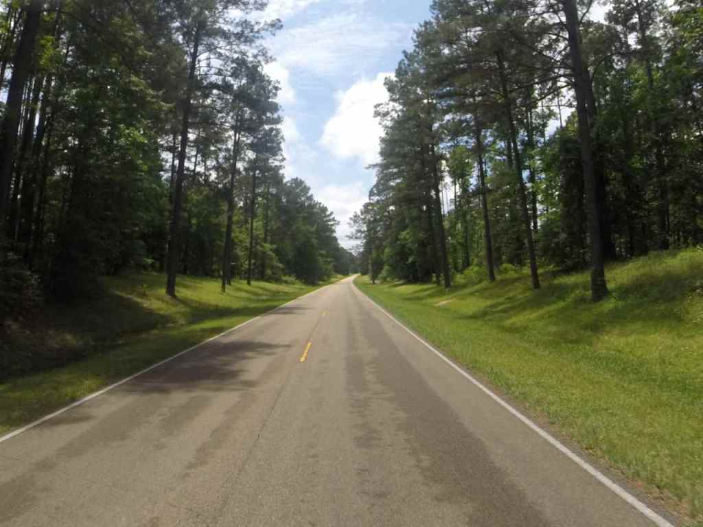
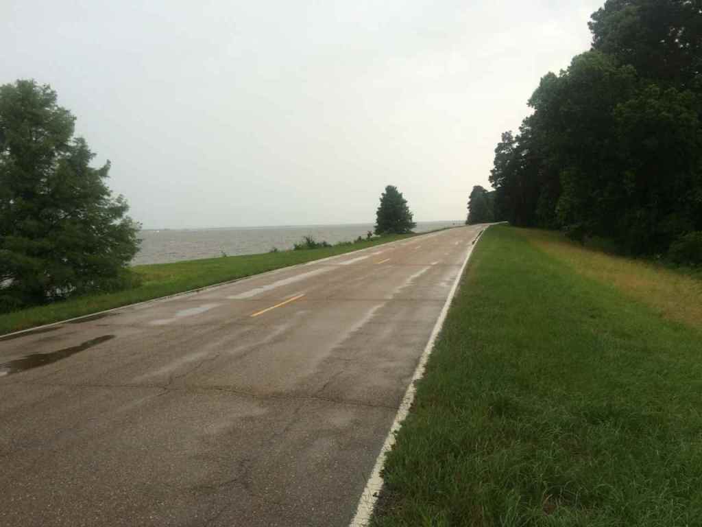
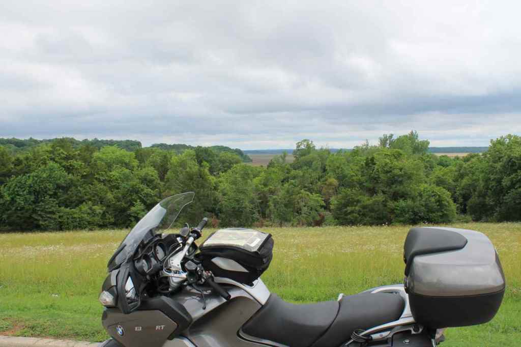
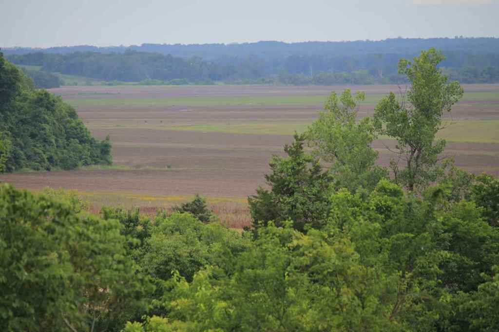
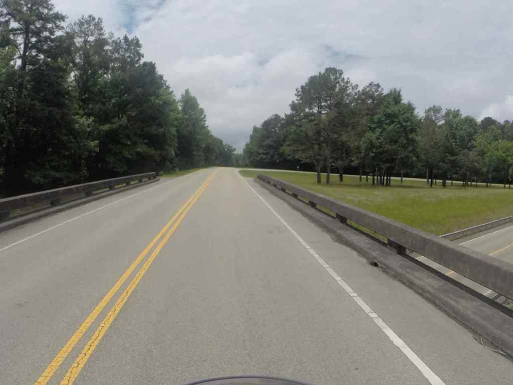
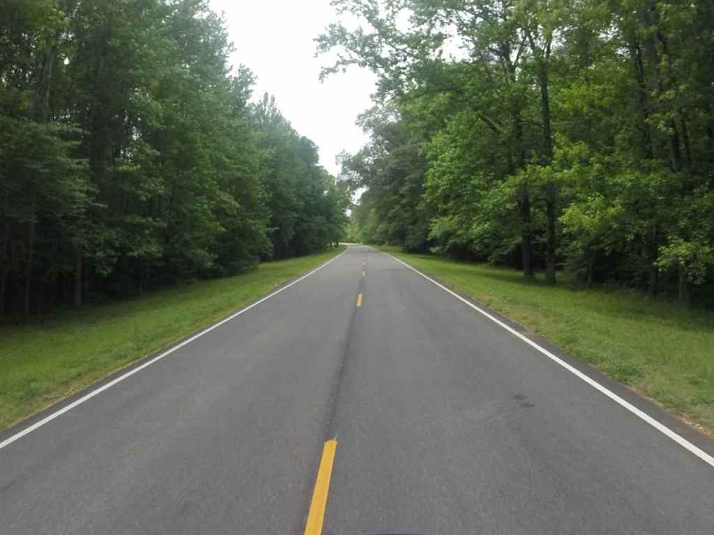
Afternoon thunderstorms arrived at about 2:30pm when I was north of Jackson. I pulled off for the worst of it, but since there wasn’t shelter, I pushed through most of the rest of the rain.
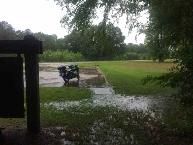
I arrived in Vicksburg just before 5pm and enjoyed a wonderful home cooked meal with two of my former neighbors before checking into my motel. The next three or four days will be used traveling to and through the Ozarks. 🙂
Day 50
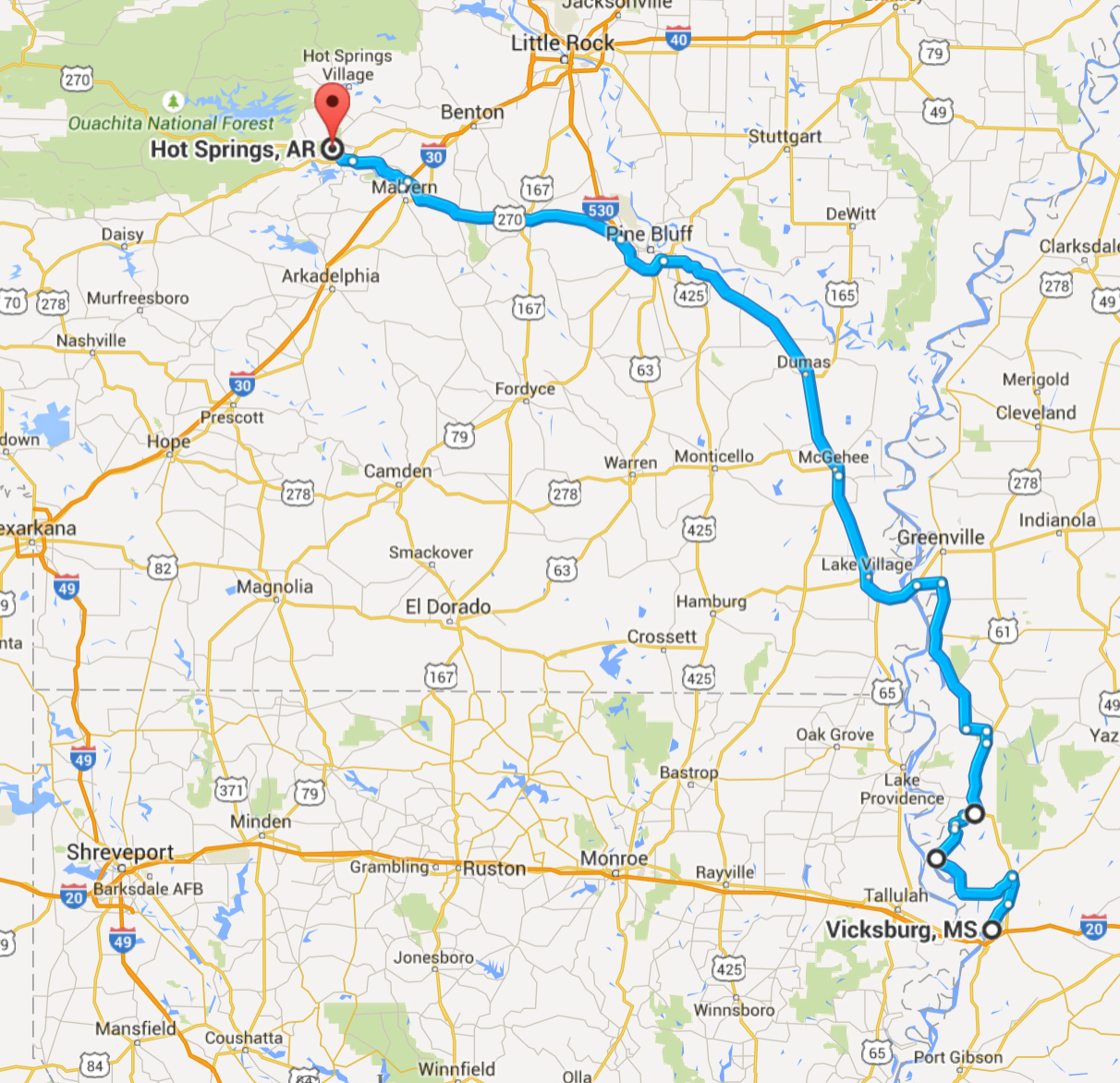
Day’s distance: 287 miles
Total trip distance: 9,135 miles
The weather varied from partly cloudy to very cloudy with just a few sprinkles while I was still in Mississippi. Temperatures were in the 70’s all day – ideal for motorcycling.
I cruised into downtown Vicksburg to the Route 61 Coffeehouse for my morning latte and grabbed a bagel with cream cheese to go with it. Both were good.
While I didn’t get a chance to visit much of downtown Vicksburg, I did take a photo near the coffee shop …
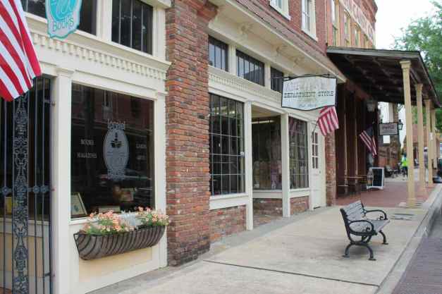
and one of the riverfront.
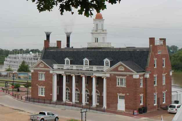
The American Queen Steamboat company runs river cruises and the boat in the background above, The American Queen is the largest steamboat ever built, according to the company’s website.
My destination in Arkansas was the Hot Springs area, and got a little creative with my route. Instead of staying on Hwy 61 north, I diverted to a minor roadway, Hwy 465.

This was a pretty part of the delta, with farmland and bayous.
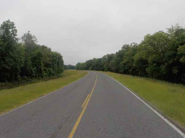
But the road soon turned into a one lane paved path on top of a levee.
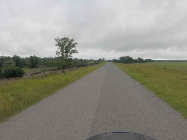
Then it turned to gravel. OMG 😦
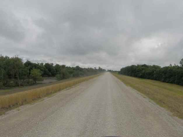
When the “highway” was detoured off the levee and into the nearby farmland, I took the opportunity to abandon my creative and adventurous side and get back on Hwy 61.
Crossing into Arkansas over the River Bridge meant I’m heading back west and leaving the deep south behind.
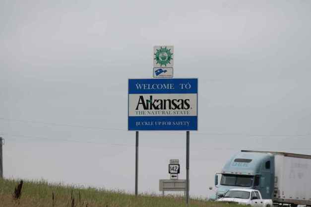
I used multi-laned highways to get to Hot Springs. Since it wasn’t going to rain tonight, for a change, I intended to camp. There was a first-come, first-served campground in the Hot Springs National Park called Gulpha Gorge, and I made that my destination.
The way things usually go with first-come campgrounds is they have been filled for hours or there are lots of spaces available. This time, I found several campsites available on my arrival and set up one quickly – I’m pretty practiced at it these days 🙂
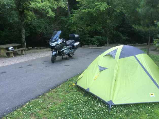
I met several other motorcycle campers, all traveling two-up. Camp host JJ was super friendly and is a rider himself, looking to purchase his next bike soon.
The campsite had no showers and no hot water, but did have the Gulpha Creek running through it and the sound of running water was very soothing and made for a great night of sleep.
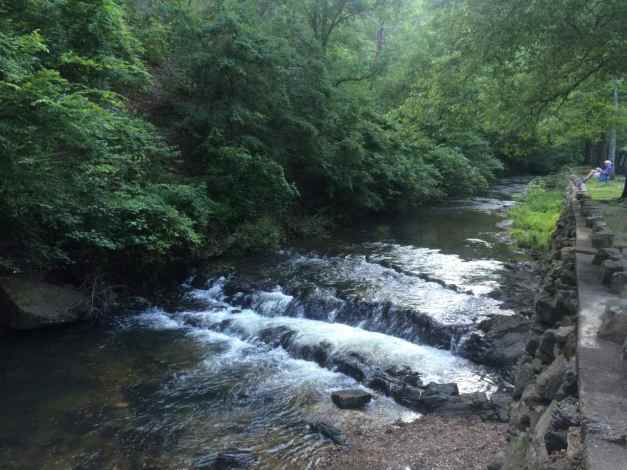
Day 51
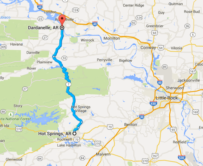
Day’s distance: 78 miles
Total trip distance: 9,213 miles
With temperatures in the 70’s, and no rain, it was close to an ideal day for a ride.
I woke up early and got the tent packed away quickly, leaving the campground a little after 7am and heading for a latte on Central Ave. Stopping at Si’s coffee house first, I found that while the donut I purchased was good, the latte wasn’t, and the place had no wi-fi. 😦
Knowing there was a Starbucks on Central, just down the street, I tossed the bad latte and went to Starbucks. The internet connection was super fast and I ordered just a latte. Since it was warm, I sat at an outdoor table and worked on the blog.
As soon as I finished the blog, I studied the Butler Map for the Ozarks and decided on a route that would take me up to Harrison, Arkansas via a 200+ mile loop. By the time I left Starbucks, it was close to 10am.
Traveling north on Central Avenue from the Starbucks took me past the historic downtown full of large hotel spas, stand alone bath houses, and museums.
Hwy 7 was somewhat congested until reaching the Ouachita National Forest.
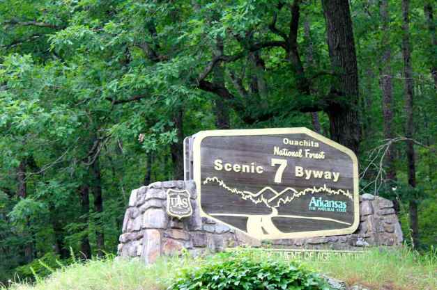
Entering the National Forest land, the road really became worthy. The road surface was good and the traffic light. Though not technical, the sweepers and elevation changes were enjoyable.
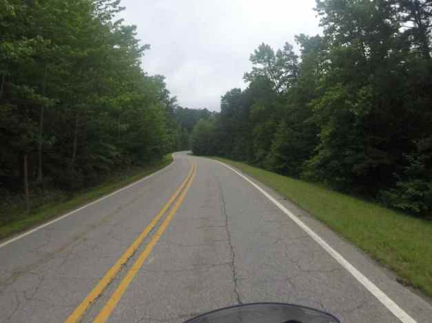
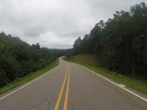
The day took an unexpected turn while I passed through the town of Dardanelle. I hit a rock in the road. I wasn’t traveling too fast, about 35mph and the bike remained upright but I could tell the front tire was going flat and pulled off the road quickly.
There was significant damage to the front rim and, as I thought, the front tire was losing pressure quickly. I was just about 50 feet past an intersection with both a restaurant and a tire service center, so I turned around and got the bike into the service station parking lot.
I recovered the rock I hit from the highway, in part so no one else would hit it. Here’s the rock and the damage it caused.
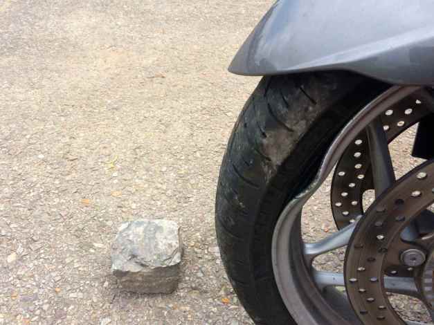
Because the bike is still under the original warranty, BMW roadside assistance is available to me. With one call, a tow truck was dispatched from Bentonville, the city with the closest BMW dealer. My next call was to the service department at Bentonville BMW to let them know I was dropping in unexpectedly. They ordered a new front rim so that it could be overnighted from California.
The tow came quicker than expected and soon the bike was loaded up and tied down.
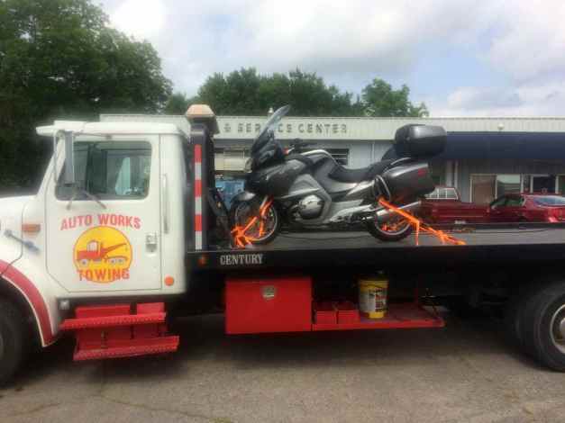
The tow company owner, Mark, rides and had many entertaining stories. It was a long ride to Bentonville, and I felt like my motorcycle was just staring at me with an angry look.

We dropped the bike off just after 6pm and Mark drove me to the motel. After some time, I found a nearby hotel with a bar and had some dinner and a couple of drinks.
It was a sad evening, but it could have been much worse. I didn’t wreck the bike, and I wasn’t hurt at all. I went to sleep hoping the bike would still be at the shop when I arrived the next morning.
Day 52

Day’s distance: 75 miles
Total trip distance: 9,288 miles
Temperatures were warmer today and reached the mid 80’s. The skies were partly cloudy to overcast and it felt a bit more humid than the day before.
The morning started with a cab ride from my motel to the BMW dealer in Bentonville, about six miles away.
I met Jerry, the service manager and co-owner of the dealership. The new rim was on its way and the new tire was sitting in the sunlight to warm up a bit (apparently it is easier to mount when warmed up by the sun – makes sense). We would examine the rear tire and rim after mounting the front.
Jerry took my copy of the tire and wheel protection agreement, measured the tread depth, and secured pre-approval for the front tire repairs. Fed Ex arrived and the tire was mounted and balanced by 11am. A test ride couldn’t detect any issue with the rear rim, but after dismounting the tire and putting it on the balancer, a minor imperfection could be detected. The warranty would not cover this damage, however, because the tire’s seal was still good. Jerry was certain that the new defect would not impact tire wear or safety.
Since the rear tire wasn’t visibly damaged, but would need replaced in another 1,000 miles, I chose to replace it now at my expense. A new tire was mounted and the motorcycle put back together.
While all this service was taking place, I met the Sales Manager and other co-owner, Bob. It turns out we have a friend in common, the former CIO at Amazon, Rick Dalzell. Bob worked with Rick at Walmart. We had some great stories to share and the morning passed quickly.
I left the shop on the bike about 2pm and headed directly to the local Mexican restaurant recommended by the staff. While eating, I considered staying in Bentonville since it was getting late, but after talking to my Seattle housemate, I chose to head towards Branson and get some miles on the new tires and maybe camp, since there were many options in that area.
Hwy 340 took me to Hwy 94 and I turned north into Missouri, the final southern state in my tour and the last “new” state I’ll be visiting.
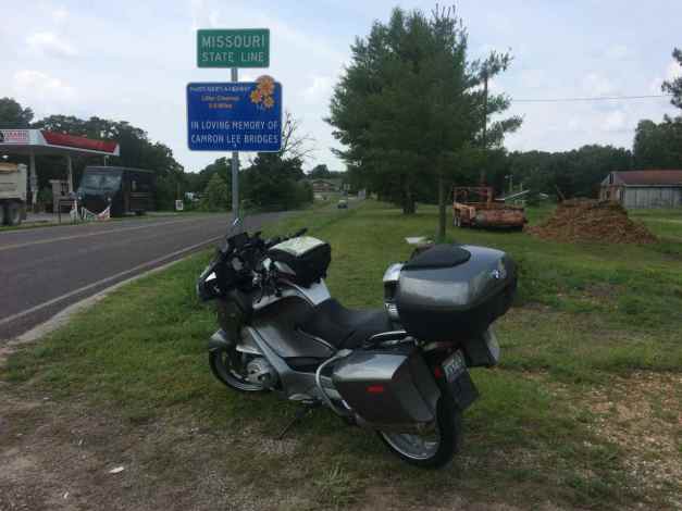
That road took me to Hwy 90. There was a lot of gravel on Hwy 90 from a recent resurfacing effort and I adjusted my speed down. I stopped for a cool drink at a gas station. After talking to the folks there, I detoured back into Arkansas to check out Beaver Lake and the dam, which had been releasing water through the spillway recently.
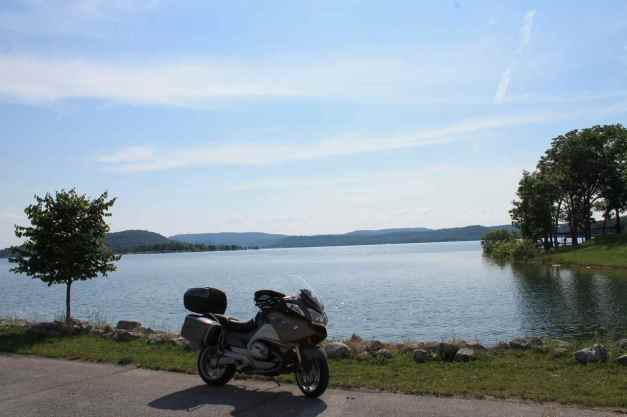
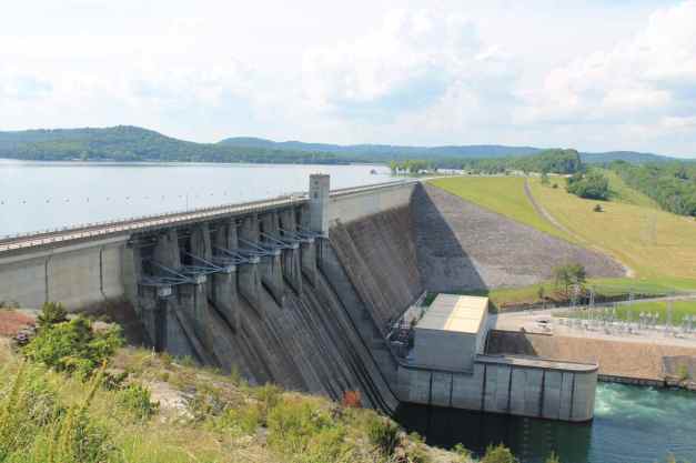
Although the spillway wasn’t open at the time, I soon was joined by two other bikers, Julie and Bob. We ended up swapping stories and riding to Eureka Springs together.
We took Hwy 187 North, and passed through some nice slow speed twisties as well as Arkansas’s Little Golden Gate Bridge, a one-lane wood plank bridge crossing the Beaver River.
After stopping for gas, we ended up eating together with others at the Rockin Pig Saloon.
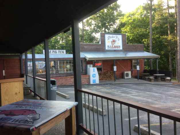
It was 8pm before I left and, having given up on camping, I grabbed a local motel (there were many, many choices in Eureka Springs).
Meeting Bob and Julie and sharing stories over a meal really helped me put the tire incident behind me. I am thankful for the support I received by BMW roadside assistance and the team at Bentonville BMW. I live a charmed life, despite the occasional bump in the road. 🙂
Day 53
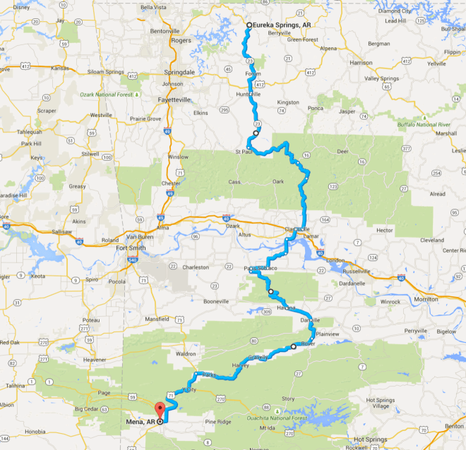
Day’s distance: 253 miles
Total trip distance: 9,541 miles
Today was hot, humid, and sunny. Temperatures reached 91 close to Mena, Arkansas this afternoon but they were cooler in the mountains.
At dinner last night, my new friends suggested that I not miss the Talimena National Scenic Byway. Of course, heading south meant that I would not spend more time in Missouri. In the end, I decided that while I was only in Missouri a short time, I would visit again next year on my intended Northern States Tour of 2016.
Deciding to head south today, I wanted to end up in Mena, to set up an early ride along the Talimena Byway.
Hwy 23 is a well maintained two-lane road passing through hills and farmland.
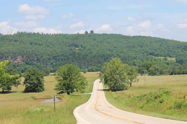
The Arkansas Pig Trail was closed, the road being washed out from the recent heavy rains, so I chose a route that went through the Ozark Highlands Scenic Byway, aka Hwy 21.
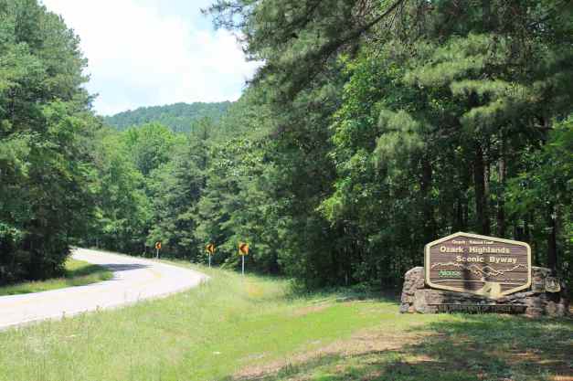
I stopped at the Ozone Burger Barn, a few miles north of Clarksville for a quick lunch.
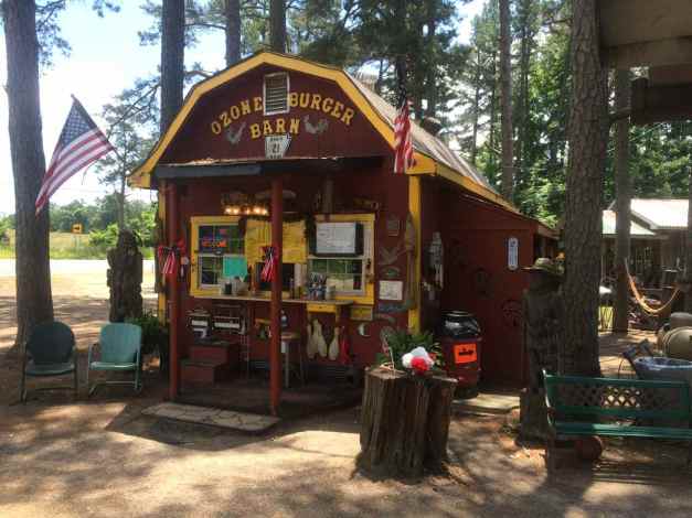
Crossing the swollen Arkansas River,
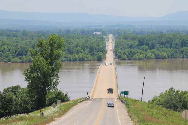
and headed up Mt. Magazine …
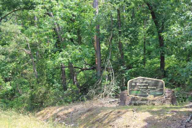
which treated me with some pretty views …
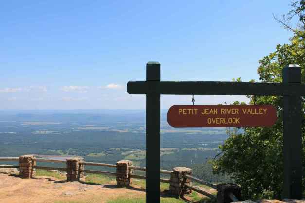
and nicely maintained twisty roads.
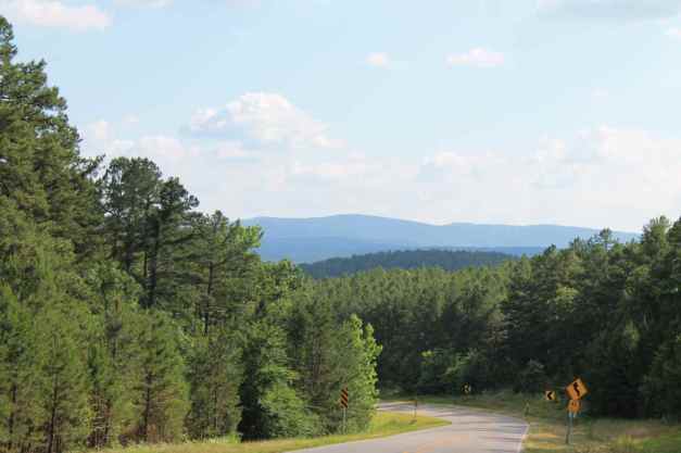
The rest of the ride was uneventful and hot, as the temperature climbed into the low 90’s. I was happy to land in Mena and take a cool shower.
At one point today, I was only 20 miles from Dardanelle, the place where I hit the rock in the road. I covered quite a bit of Western Arkansas and its roads over the last three days.
Missouri is another story. I did enter Missouri, but only for a short time. The time spent in Bentonville getting the bike repaired really threw me off my schedule and I feel like I lost two days. But I rode some great roads, I have a whole bike with new tires, I met some great people, and I have another story to tell.
I’m ready for Oklahoma.
Day 54

Day’s distance: 270 miles
Total trip distance: 9,811 miles
I started the day with two goals. The first was to ride the Talimena Scenic Byway. The name comes from the end points, Mena, Arkansas and Talihina, Oklahoma. Since I spent the night in Mena, it would take just a few minutes to arrive at the beginning of the Byway.
Before leaving the motel, I checked the oil and tire pressure. The oil was fine, as was the pressure in the front tire. However, the back tire had lost six pounds of pressure since it was replaced some 36 hours earlier. I went to the local service station and filled it to 42 pounds and decided to keep going but keep an eye on its pressure throughout the day.
It was about 10am when I arrived at the start of the byway.
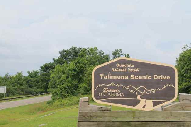
I saw at least a dozen motorcycles while on the eastern half of the trail, usually while I was stopped at one of the many vistas.
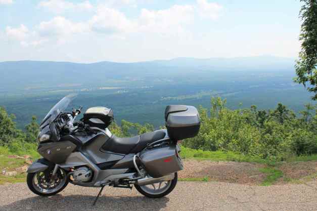
The eastern half of the byway, while not technical was full of sweepers and twists with pavement was in generally good shape.
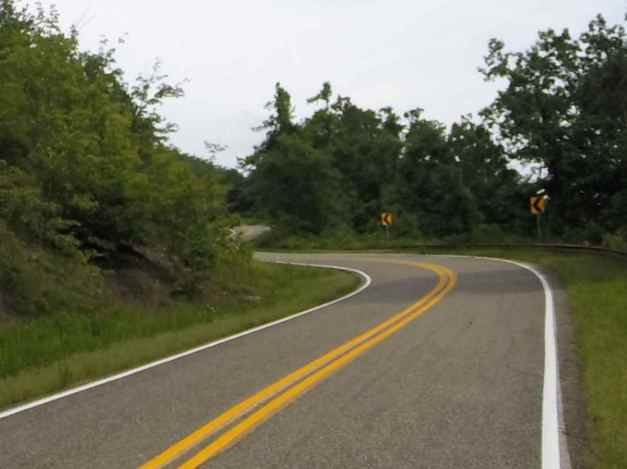
Frequent elevation changes added to the fun. The Byway crosses the border into Oklahoma not far from Mena, Arkansas.
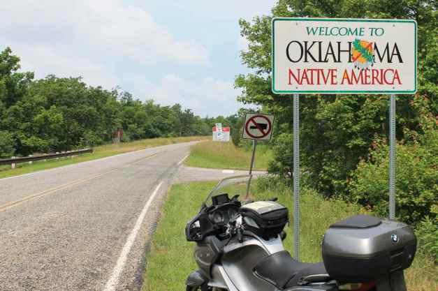
Unfortunately, the western half of the Byway was closed due to flooding. Oklahoma received record rainfall in May and this is one of the roads impacted.
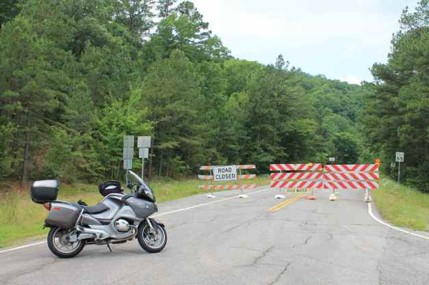
Most of the rest of the ride to Edmonds, my second goal, was along I-40 and tollways. Before I reached I-40, I did stop in Heavener, OK to find a bite of lunch. I found a pizza place but passed it by. Then I saw a Taco Trailer with about 6 people eating on the benches in front. Ordering 6 tacos, a mix of carne asada (beef) and al pastor (pork), I figured I would give it a try,
From the photo, it looks abadoned, but it did seem to be the place to pick up lunch and there was a steady stream of orders being prepared inside.
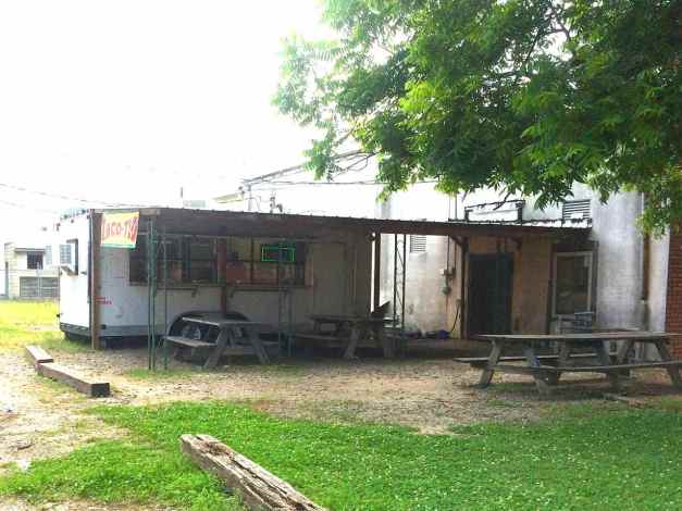
My last stop before arriving in Edmonds was in Okemah, Oklahoma, which according to the city sign is the home of Woody Guthrie. 🙂
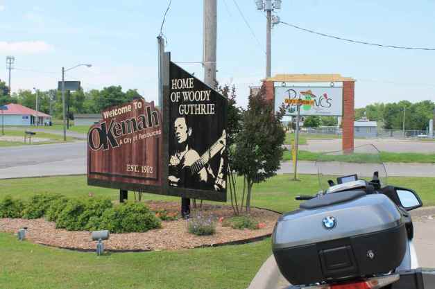
I arrived at my friend’s place about 4:30pm and I’ll be largely off the bike for the weekend before heading to Colorado on Monday.
Day 55
Day’s distance: 24 miles
Total trip distance: 9,835 miles
I thought the motorcycle could use some special treatment after last week’s incident when I ran over what was likely a loose piece of highway, so I took her to a local car wash.
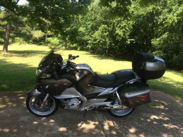
Afterwards, Charles and I went to Nichols Hills, the affluent neighborhood a few miles south of Edmond. There is a service station there that sells very high octane fuel for the many high-performance sports cars that populate that area.
I filled the tank with 101 octane gas in the bike. This was definitely an extravagant purchase. At $8.76 a gallon, it took over 5 gallons to top off the tank as it was using the reserves.
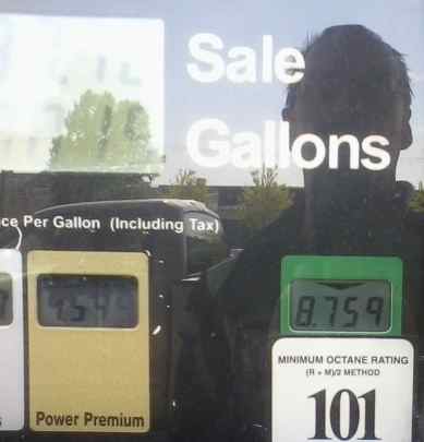
For dinner, my hosts took me to the Red PrimeSteak restaurant in downtown Oklahoma where we met up with Rob and Kathy, friends made last year when visiting Oklahoma City. It was a delicious filet mignon, along with a wonderful warm chocolate cake dessert.
Tomorrow, I look forward to stopping by the Seaba Station Motorcycle Museum again. Now that I’ve been to the Barber Museum, I wonder what I’ll think.
I live a charmed life. 🙂
Day 56
The temperature reached a humid 92 with mostly sunny skies.
Today was a day off the bike. Charles and I visited the Seaba Station Motorcycle Museum, as we did a year ago. The museum is located in Warwick, along route 66. (upper right corner of map above)
Seaba Station is a collection of about 100 motorcycles. The original building was completed in 1921 and opened as a motorcycle museum in 2010, according to their website.
One of the motorcycles on exhibit, a Hodaka Super Rat,
reminded my host of the Hodaka he rode in the early 1970’s when he was in his early 20’s. He found the photos shown below in the shed. Unfortunately, they were damaged by water.
Many of the motorcycles on exhibit have been moved around, giving the exhibit a fresh feel. One of the new exhibits was the motorcycle used in the movie ‘Captain America’.
It looked a bit beat up, even for a Hollywood prop. 😦
I took many, many photos last year when I visited Seaba Station on Day 35 of my Western States Tour. It was a notable and favorite Route 66 experience.
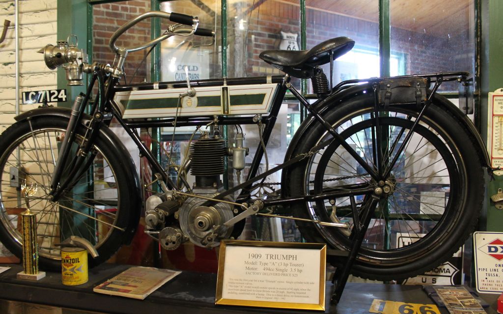
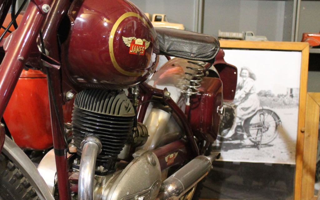
Besides visiting the museum, I took some time during the afternoon to do a load of laundry and to unpack my top case and let the tent dry out as it was last packed away while still wet with condensation.
I head west tomorrow, leaving Oklahoma behind. I’ve had a wonderful visit and thank my gracious hosts for their hospitality. My current plan is to ride to Taos, New Mexico rather than Trinidad, Colorado. It is about 532 miles to Taos, and would be the first time I’ve ridden more than 500 miles in a day. The weather forecast calls for some wind, but only a 20-30% chance of rain.
Until tomorrow …
Day 57
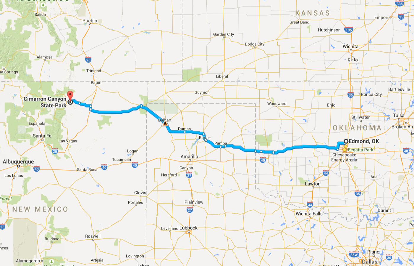
Day’s distance: 489 miles
Total trip distance: 10,324 miles
The weather forecast had me on the lookout for increasing winds and chances of thunderstorms in the afternoon. Temperatures were in the 80’s and the skies partly cloudy. There was a thunderstorm to the south of me in New Mexico, but my path led me away from it.
My intention today was to travel through tornado alley while the weather was good. The day’s destination was Taos, New Mexico. I did get to ride a bit of Route 66 and passed the National Route 66 Museum in Elk City, Oklahoma.
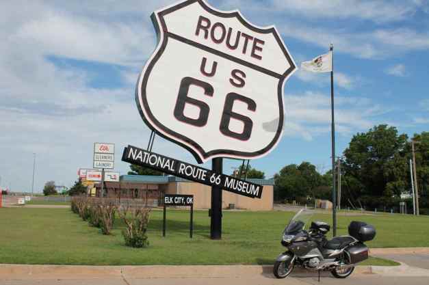
I passed another mileage milestone soon after (really just another even number) …
and I crossed the Texas border …
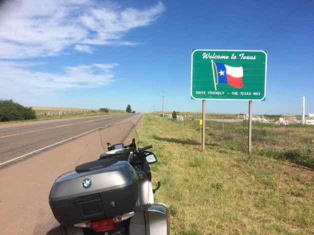
In Texas, I was traveling along, occasionally glancing at the fuel gauge, I noticed that it indicated the tank was half empty. A short time later, it indicated it was full. This was concerning because I don’t believe the gods of travel would grant me such a gift. 🙂
I filled the tank since I was at a gas station and continued on my way hoping that this behavior was a fluke. I suspected the charcoal canister was clogged, or perhaps fuel-soaked and that it would clear quickly.
The behavior repeated itself and I stopped frequently throughout the day to release the vacuum. I was still thinking the charcoal in the canister, which is designed to clear itself in the event fuel gets in it, would clear itself.
This part of Texas had some big sized potholes in the highways and a lot of trucks, cattle feed lots, oil and gas platforms and equipment and man-sized smells that were mostly unpleasant. But it didn’t take too long to cross into the New Mexico border …
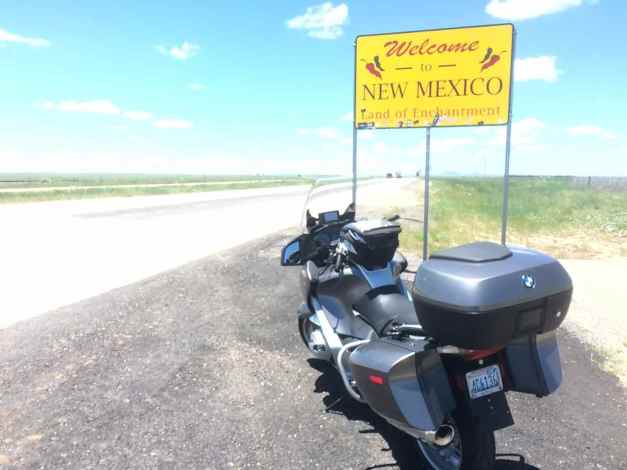
all while nursing an ailing bike, cause what else are you going to do when it is Monday and BMW service centers in the US seem to be universally closed on Monday.
My mood improved when I realized that my path was going to miss a thunderstorm that formed to the south. Soon, I reached the edge of the Rockies.
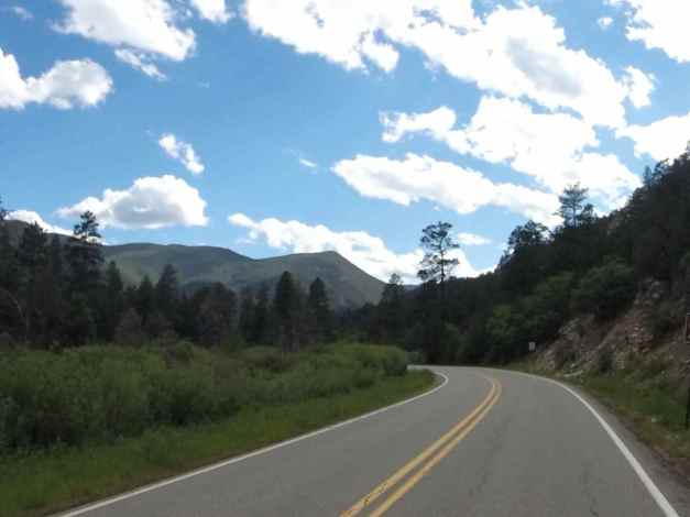
The weather was clearing some and no rain was predicted for the evening, so camping was an option and an alternative to heading into Taos. I found a spot at the Maverick Campground inside the Cimarron Canyon State Park.
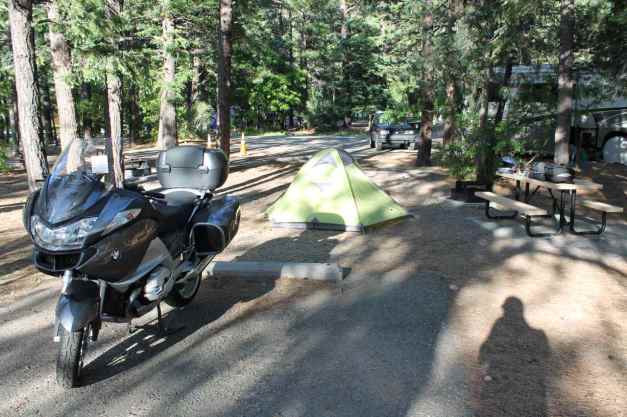
The Cimarron River ran through part of the campground …
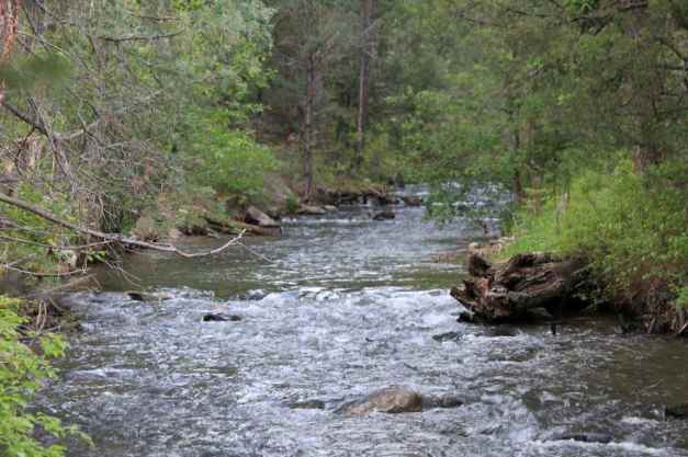
I did some research after dinner to better understand how the charcoal canister works. The fuel tank on the bike is a plastic, and a vacuum can cause it to collapse inward. It also can damage the fuel guage, a float inside the tank, as well as cause engine performance. I decided that I would have to have the bike looked at and planned to stop at either Colorado Springs or Denver the next day.
Day 58
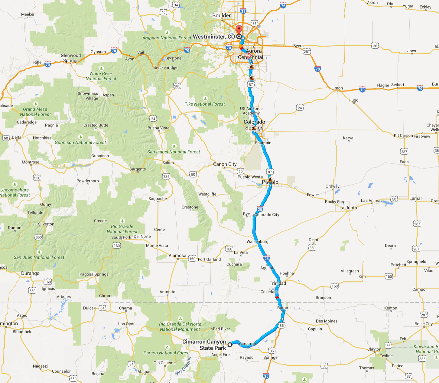
Day’s distance: 288 miles
Total trip distance: 10,612 miles
The weather was dry until thundershowers late in the day with temperatures up to high 80’s.
I woke up early and was out of the campground by 6am.
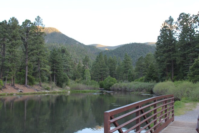
I knew I would have to stop every few miles to vent the fuel tank, and I proceeded down the mountain slowly as deer and elk were likely feeding at this time of day.
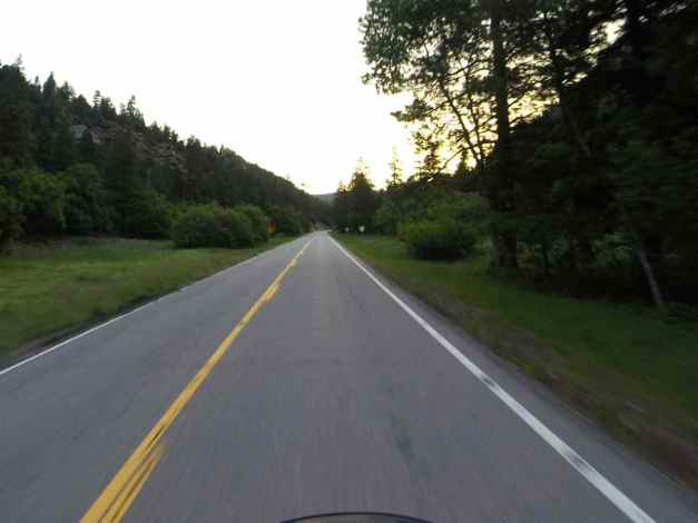
My mind was busy with the bike’s mechanical issue, my eyes watching for deer, but I stopped for a moment to just take in the beautiful morning.
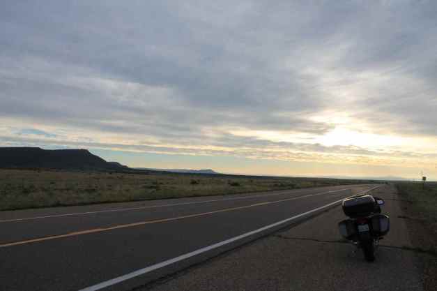
I knew it was going to be a difficult day trying to get the bike serviced. First, it was Tuesday – always the busiest day at a BMW shop. Next, it was spring and everyone thinks about getting their bikes serviced in the spring. Finally, there are a lot of bikes on the road and that means break downs are more of the service emergencies that shops have to schedule around.
Long story short, the Colorado Springs shop was incredibly busy and I was not confident of their ability to diagnose the issue and represent it as warrantied, if necessary. So I traveled to Denver BMW, where last year I had my 12,000 mile service performed. To make better progress, and avoid numerous stops every few miles, I rode with the filler cap cracked open. I finally arrived in Denver about 1pm.
Though I had a few travelers ahead of me, the experts at the Denver shop found the issue to be a clogged vent hose off the charcoal canister and corrected it at no cost to me. I can’t praise the team at Denver BMW enough for getting me back on the road quickly.
It so happened that my Denver friend Jed was getting his new K1600GT serviced that same day. Our jobs were finished at nearly the same time and Jed invited me to stay the night at his house in Westminster. I was happy to accept and with Jed’s wife, we went to Parma Trattoria Mozzarella Bar for a wonderful Italian meal.
Jed has two crazy friendly Portuguese Water Dogs named Mogul and Glacier that were great company.
The day ended much differently than I expected. The bike was running great, the company was great, and my unexpected stay in Denver was super! The charmed life I live continues 🙂
Day 59

Day’s distance: 221 miles
Total trip distance: 10,833 miles
It showered while on Trail Ridge and as I arrived into Steamboat. Temperatures ranged from the mid-30’s to 70’s.
Steamboat Springs was my destination today. My first waypoint would be Nederland, Colorado via the Boulder Canyon Road, Hwy 119. This two-lane road was relatively busy and the pavement was in rougher shape in spots. The roadway follows Middle Boulder Creek.
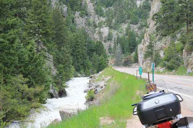
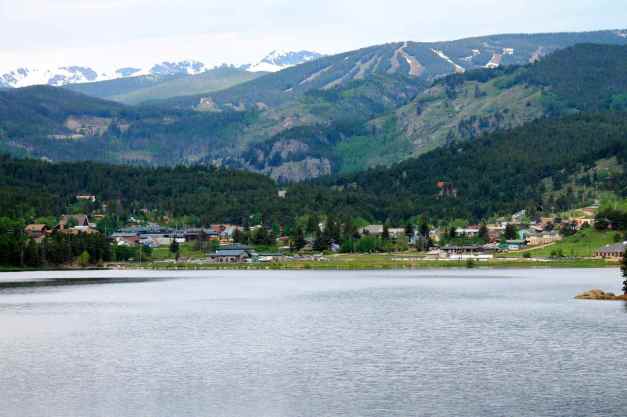
From Nederland, I traveled along the Peak-to-Peak Highway, Hwy 72. I traveled part of this road last year, on Day 40 of my Western States Tour. Last year, I stayed overnight in Estes Park, but this year I was just grabbing breakfast at ‘Coffee on the Rocks’, a yummy cafe located near the entrance to the Rocky Mountain National Park.
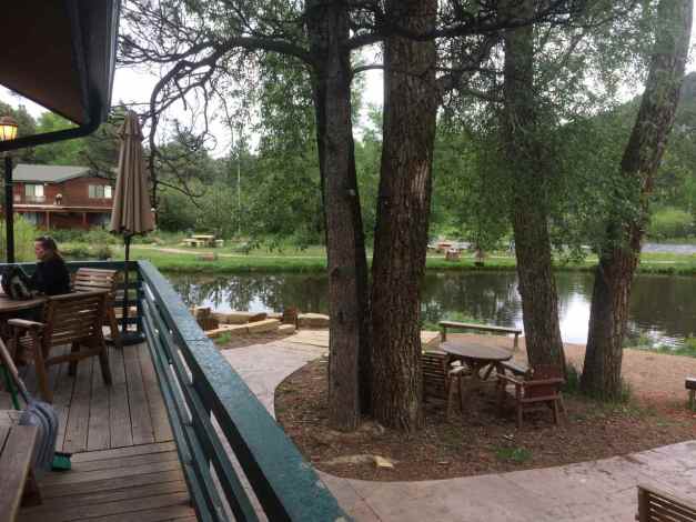
I rode the Trail Ridge Road last year. This time, it was rainy, and very foggy at the top. The highlight of today’s passage was watching an elk eating very close to the road.
Here is a short video of Trail Ridge Road created from the photos I took last year when the day was clear and sunny.
Since it was raining, I only took a few shots this year.
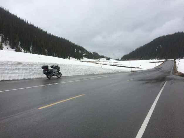
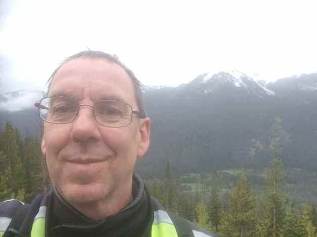
The rest of the ride to Steamboat was uneventful, although I noticed that my fuel gauge may not be functioning correctly. It was either raining or threatening to rain, so I didn’t stop to take too many pics.
I stayed at the Rabbit Ears Motel in Steamboat …
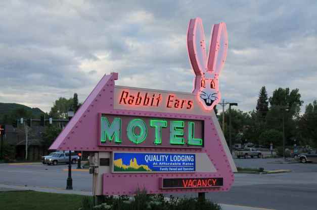
named after the Rabbit Ears Pass I just rode across. It is located across the street from Old Town Hot Springs, which I visited (twice) before they closed at 10pm.
I really enjoyed the visiting the soaking tubs at Hot Springs. The last two evenings have been relaxing. Together, they have created a very soft ‘landing’ from the stress of the mechanical issue with the bike.
Tomorrow, I’ll be leaving Colorado, entering and leaving Utah, and landing in Wyoming. 🙂
Day 60
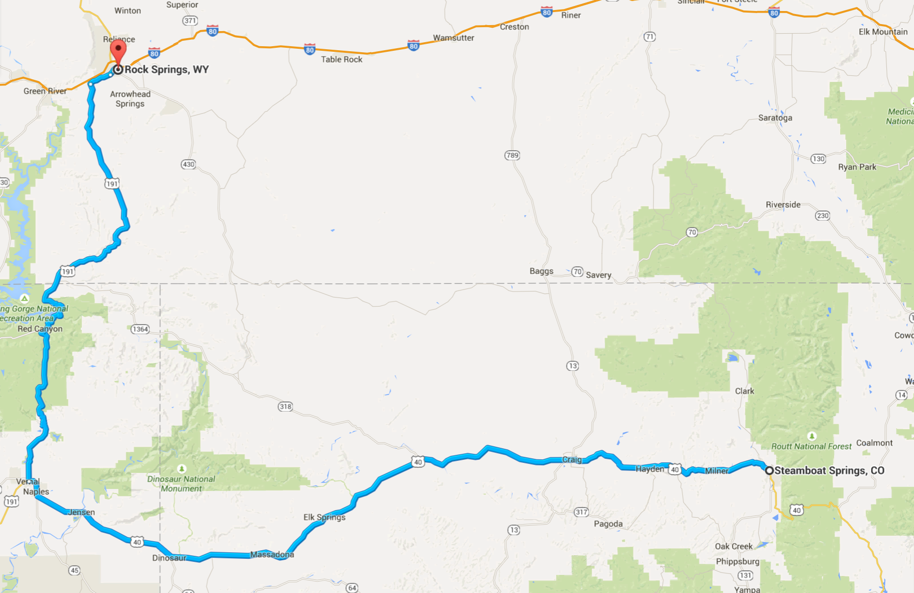
Day’s distance: 268 miles
Total trip distance: 11,101 miles
Repeated periods of rain through the day with temperatures ranging from low 50’s up to low 70’s.
Forecasts called for periods of rain tapering off in mid afternoon and that’s what happened, but the taper was missing and mid afternoon became later 😦
“Guess you can’t always get what you want …”
That’s become the quote for this trip, mostly in a sense of irony. This trip has been 60 days of amazing travel adventure !!
Today’s plan was to get to Rock Springs, Wyoming and I knew there was going to be some rain. I set out with the jacket and helmet vents closed, and my insulating liner already in the jacket.
I encountered the first and heaviest rain just outside of Maybell, Colorado. Luckily there was a little town and I ducked into the diner.
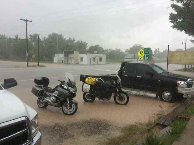
Continuing on my way after lunch, I soon crossed into Utah.
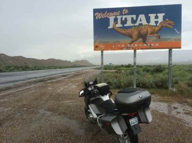
Turning north on Hwy 191, I was headed to see Flaming Gorge Country. This mostly two-lane highway was in good shape and while the speed limits seemed low in Utah, in Wyoming the limit was raised to 65mph.
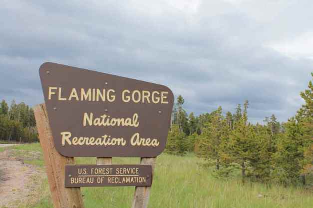
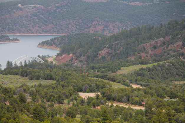
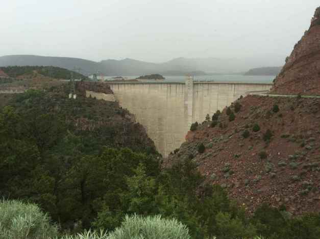
Crossing into Wyoming, Hwy 191 moves away from the river and onto a long plateau. I pulled over at a scenic viewpoint …
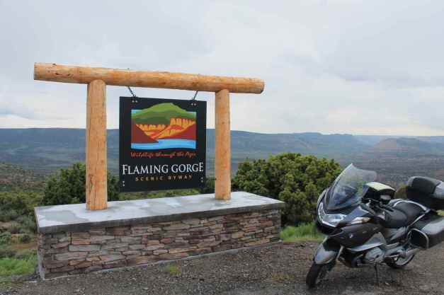
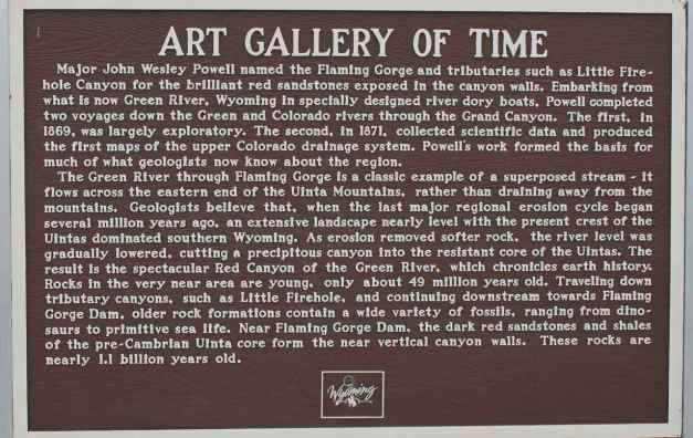
with dramatic views of the gorge.
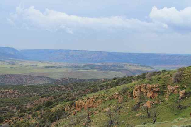
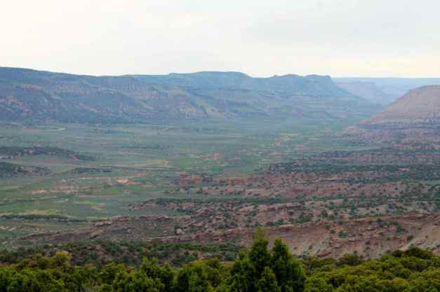
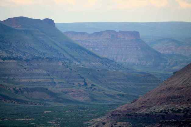
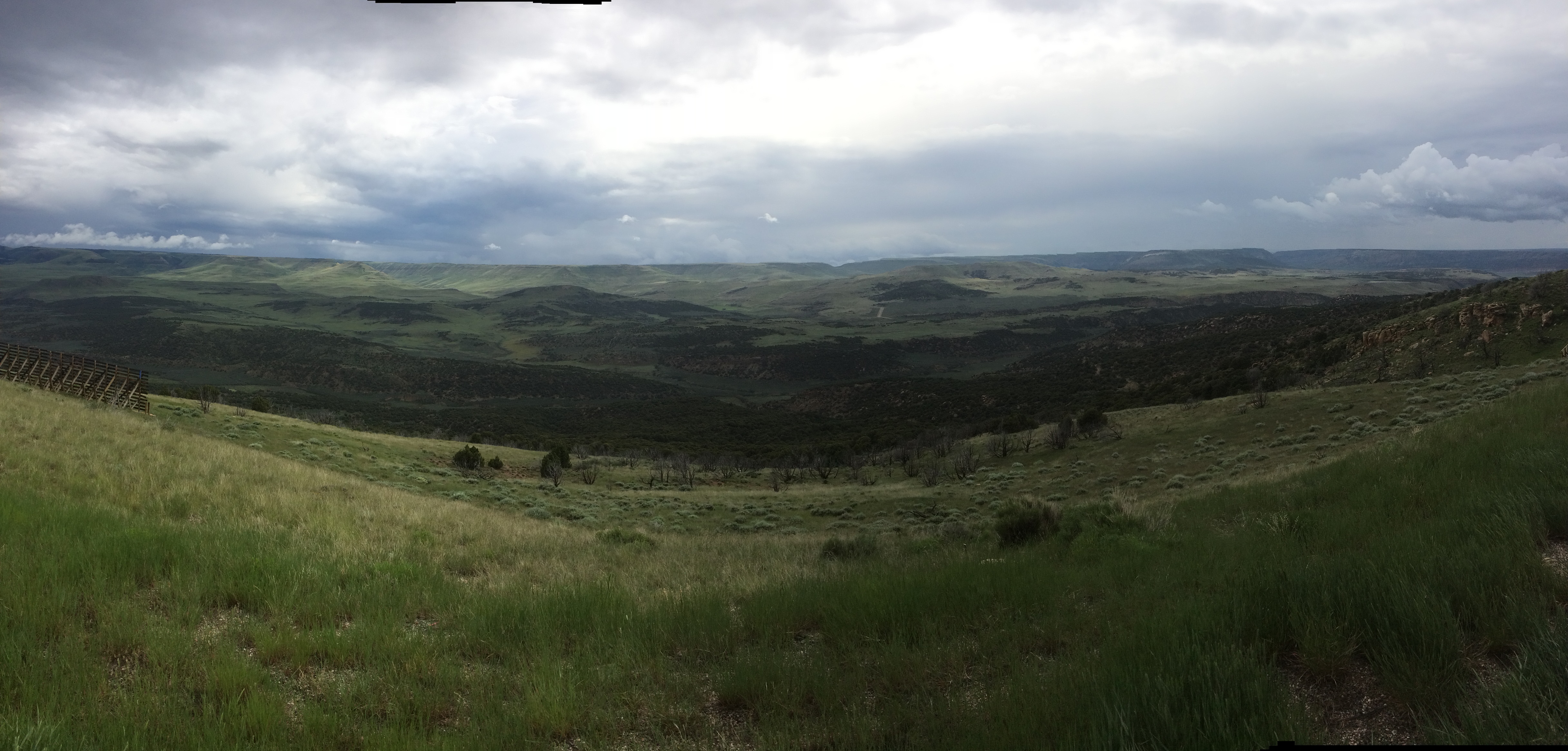
This was my first time visiting the Gorge. The beauty was beyond my expectations and I think the storm clouds added to the drama of the visit. This was the rainiest day since I was traveling down the Blue Ridge Parkway and I was looking forward to getting to a motel in Rock Springs.
Being on the road for 60 days seemed significant. Cheers to my ride for taking me over 11,000 miles so far.
Day 61

Day’s distance: 243 miles
Total trip distance: 11,344 miles
The weather today was partly cloudy to sunny for the most part of the day. One very minor shower (just nicked the edge of a rainy spell). Temperatures from the 50’s to the 70’s.
Readers who follow along may be surprised by my change in route today, back into the Northeast corner of Utah. In a conversation with my housemate Carson last night, I was reminded of how frustrated I was last year getting through the park with other traffic and the road work. To go through both parks from south to north is just too much, especially when starting from Rock Springs.
With Carson’s knowledge of alternatives, I planned a way to see some more beautiful country using a route that is not the full on Grand Tetons experience but allows me to impulsively skip it, too. That’s something I’ll decide tomorrow.
I settled in at 4pm tonight, so I put together a brief video of a few of my Flaming Gorge photos taken yesterday.
Today’s best hope for a beautiful motorcycle experience did not disappoint. Hwy 39 between Woodruff and Huntsville was beautiful.
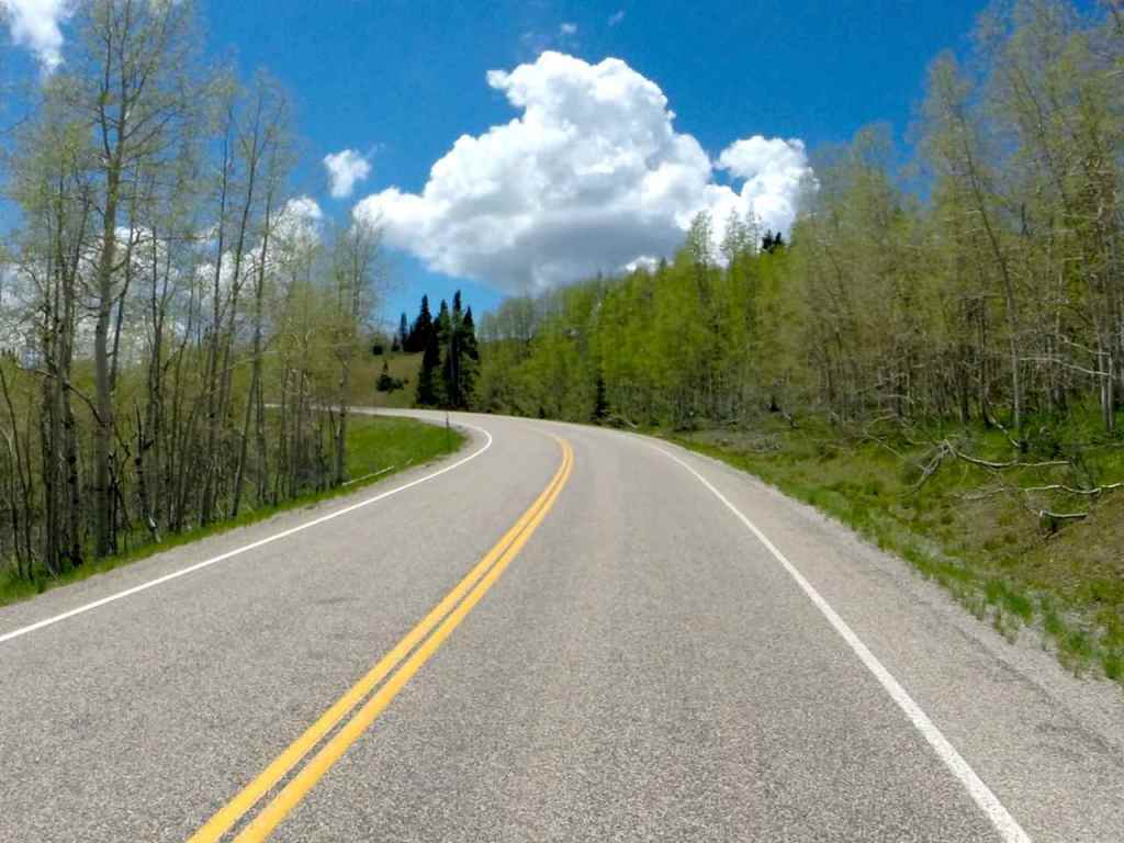
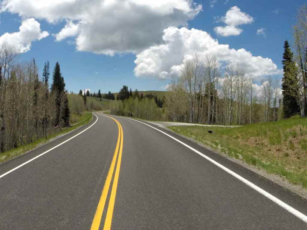
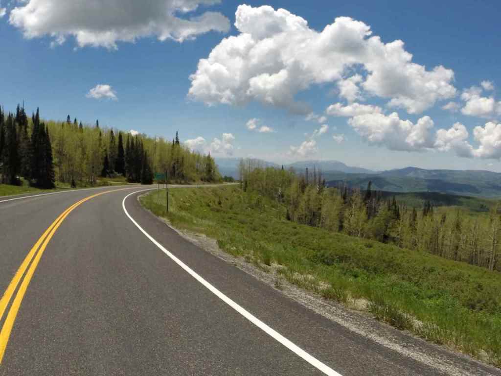
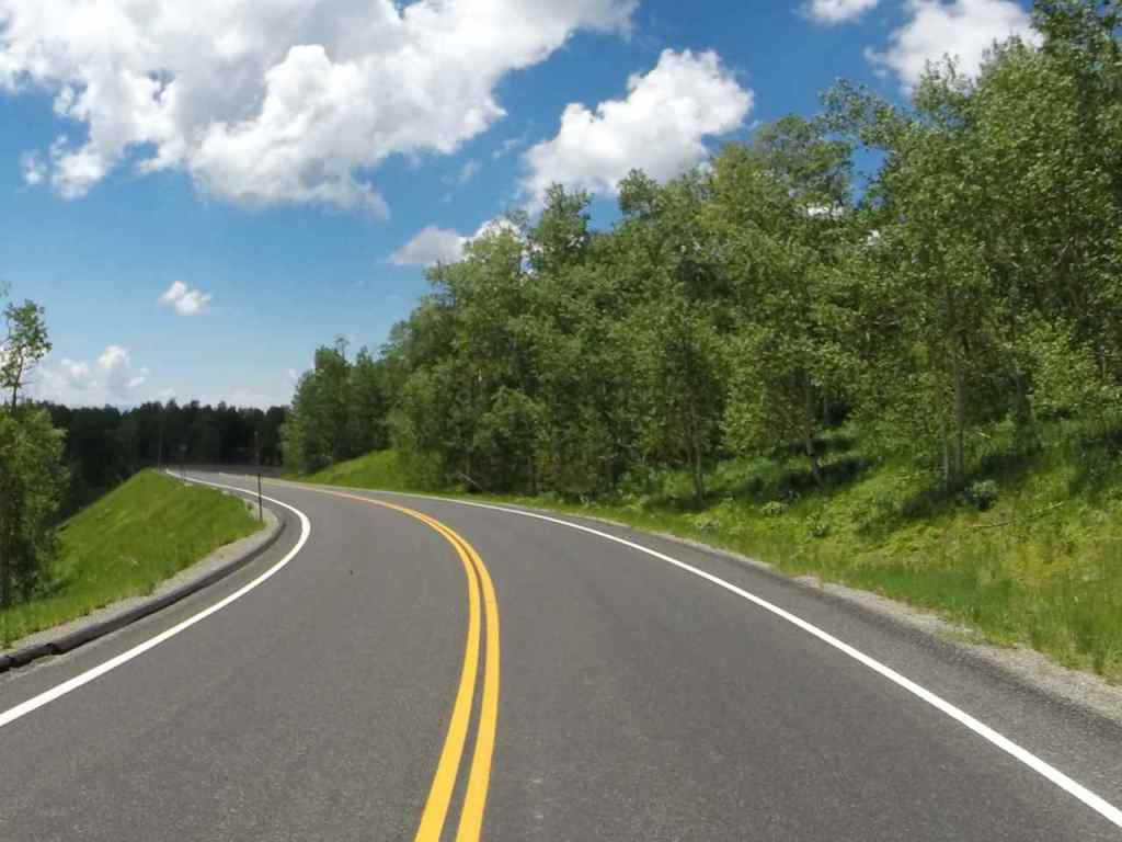
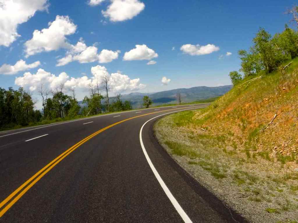
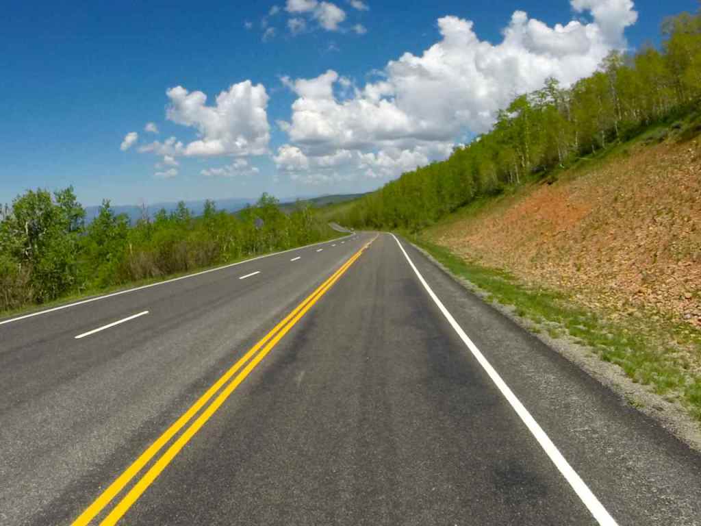
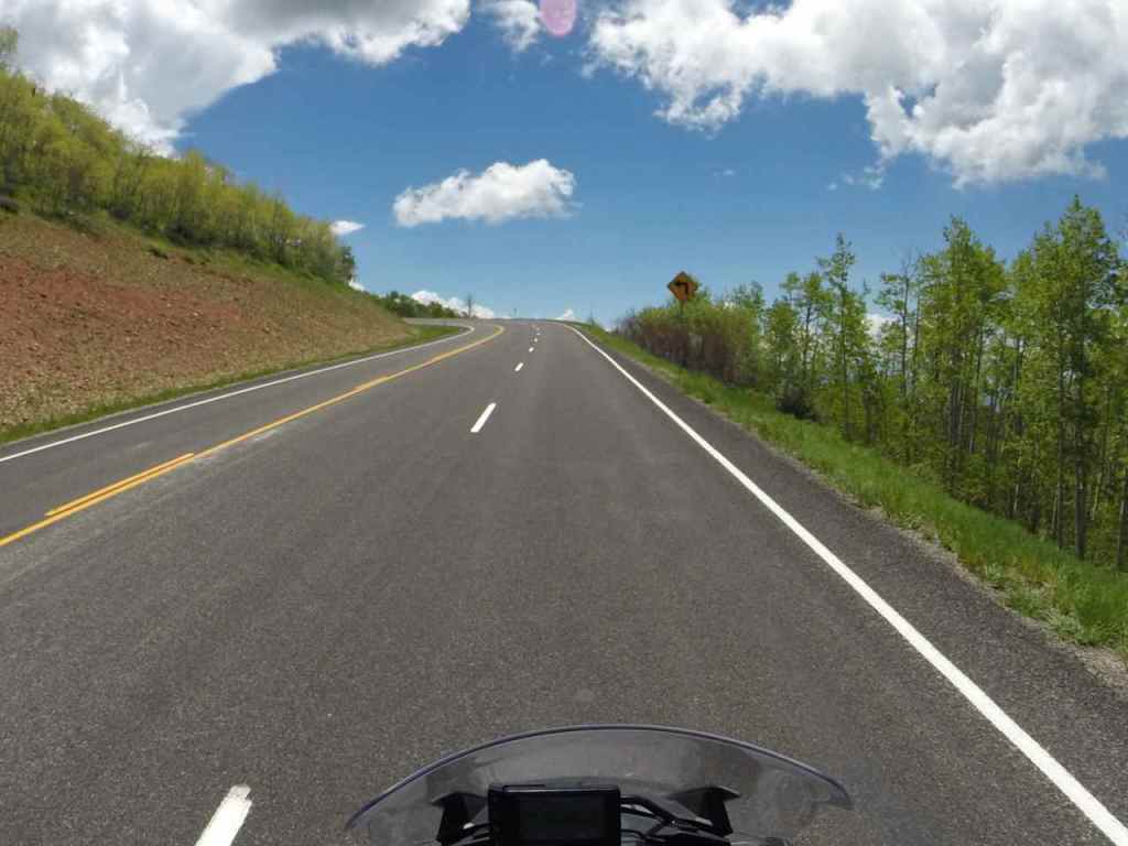
There is a 180 degree curve about halfway between Woodruff and Huntsville that opens up to a beautiful gorge. Here’s a short video trying to capture that experience.
I’m staying in Logan overnight.
PS – sorry for the delay in publishing this post. I apparently previewed the post this morning but never published it 😦
Day 62

Day’s distance: 293 miles
Total trip distance: 11,637 miles
The weather was sunny with some gusty winds in places. Temperatures reached into the high 70’s.
I rolled out of the motel a few minutes before 10am this morning. My route took me out of Logan on Hwy 89 through Logan Canyon and alongside the Logan River. The roadway was in great shape with some light twists and the canyon walls were forested making for a very scenic ride.
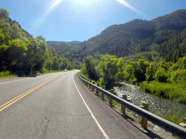
As Hwy 89 begins to descend to Garden City, it provides a view down to Bear Lake. This morning, fog remained over the center of the lake when I took this shot.
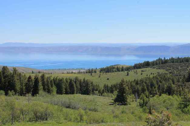
Hwy 89 crosses into Idaho, the 22nd state visited on this tour.
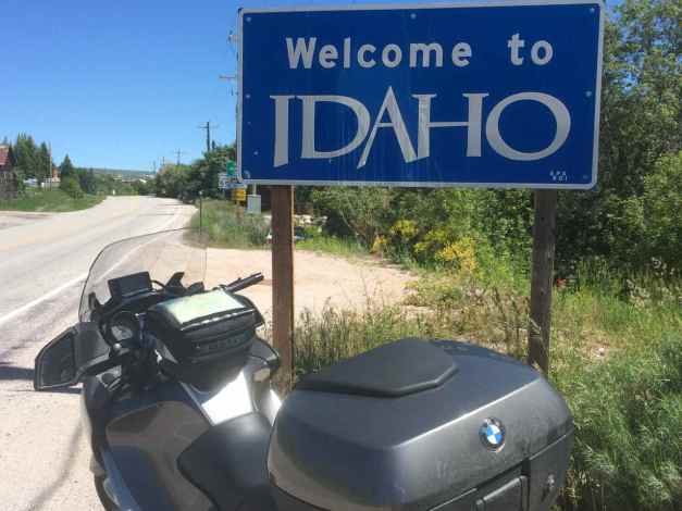
Shortly after entering Idaho, I crossed back into Wyoming and into Afton, a small town with an unusual claim to fame – the world’s largest arch made from the antlers of Elk.
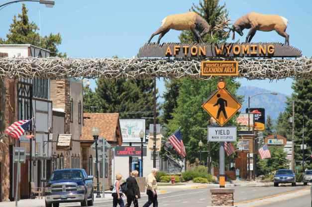
As I approached Jackson, Wyoming, I decided to skip visiting the Grand Tetons National Park. I continued my ride through the mountains by taking Highways 22 to Wilson, 31 to Victor, and 33 to Swan Valley.
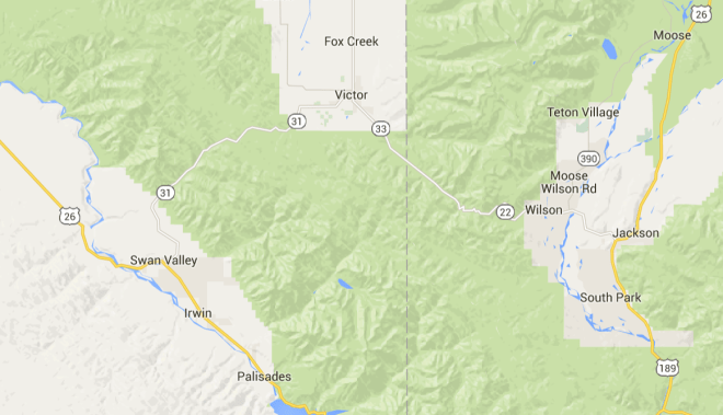
The roads were in generally good shape and fun, while scenery continued to inspire.
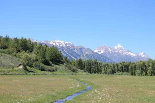
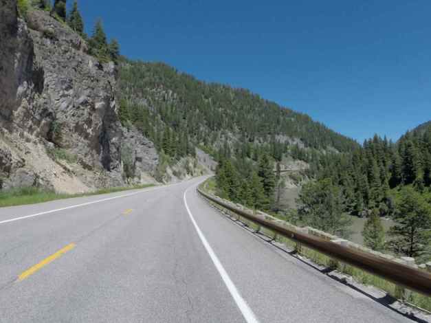
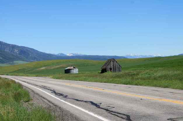
In Idaho Falls, I stopped at the city park downtown.
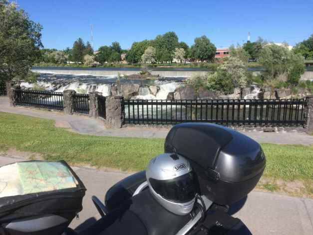
I stopped for a quick dinner at Pitmaster BBQ and checked in to my motel.
Tomorrow, I’ll cross the Snake River Plain and explore the Sawtooth Mountain Range.
Day 63

Day’s distance: 335 miles
Total trip distance: 11,972 miles
The day was sunny and dry, with temperatures starting out in the low 60’s with highs in the 70’s. Winds were occasionally gusty but generally mild.
It was another 10am start by the time I was out of the motel and done with my Starbucks latte. Initially, I would cross the Snake River Plateau.
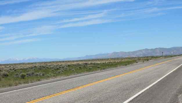
There were quite a few energy labs behind guarded gates located along Hwy 20. It reminded me of when I was in the Navy at Nuclear Power School. At the time, there were two prototype training sites – Idaho National Labs and upstate New York. When I stopped at a rest area, the sign below confirmed the prototype training center was in this area.

When I reached Arco, to my surprise I saw a roadside exhibit about the nuclear power development that took place in the area. The sail of the submarine USS Hawkbill (the ‘Devil Boat’ because of its designation USS 666).
The museum curator has been involved in the Navy’s Nuclear Power Program since graduating college in 1957 (if I remember correctly).
Arco was the first town powered by atomic energy on July 17, 1955, a byproduct of the research being performed and makes for good press within the community, I’m sure.
The history of this area had an unexpected connection to my past, despite never having been here, that made me very happy. It’s a small world 🙂
My next quick stop was Craters of the Moon National Monument. This is a volcanic fissure that was active about 2,000 years ago.
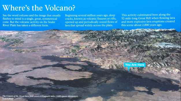
There was a short loop to drive around and optionally stop and walk up the pathways.
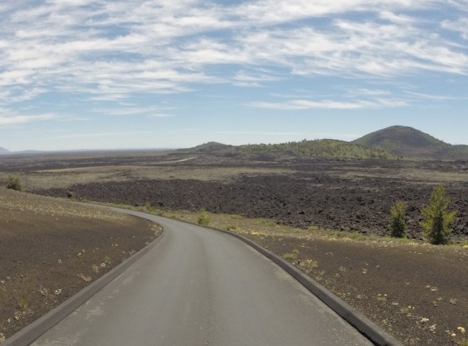
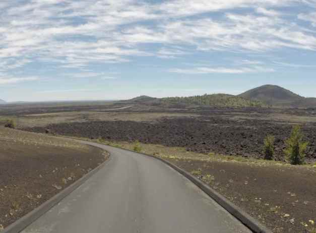
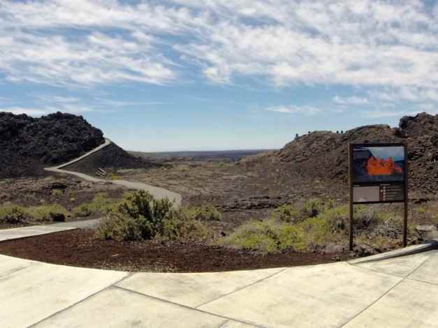
The rest of today’s riding was about exploring the roads inside the Sawtooth Mountain Range. According to my Butler Motorcycle Map, these would be scenic and fun. They did not disappoint, either. The elevation changes, sweepers and non-technical turns, and steep dropoffs sometimes without guardrails were worth the travel.
The road surfaces were generally in very good shape with some exceptions, where winter damage was evident but either repaired or not too rough.
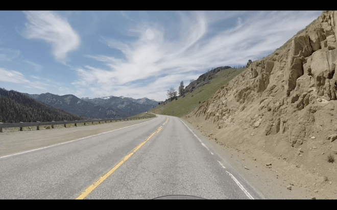
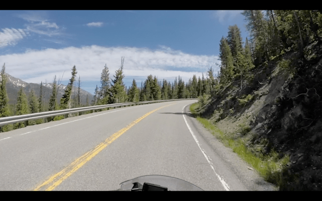
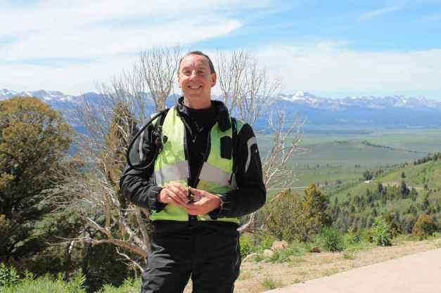
I kept running into three guys on motorcycles throughout the day. We first passed while they were at Craters of the Moon, then in Stanley, then on the mountains west of Stanley, where we finally talked about our trips.
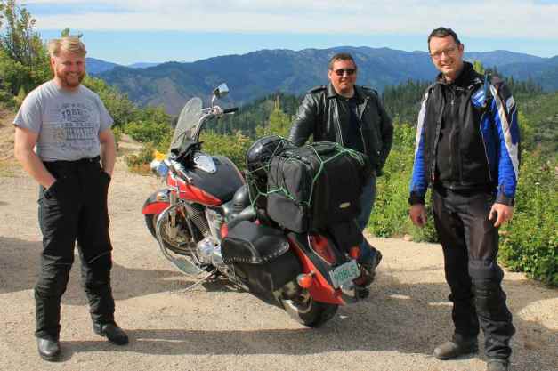
As it was starting to get late, I focused on getting off the mountain and to my motel in Boise. I’ll likely camp tomorrow night so this may be the last motel stop for the trip. 🙂
Tomorrow I’m hoping to stay at the Hell’s Canyon State Park in Lewiston. I stayed there last summer during my 2014 Trip to Glacier.
Day 64
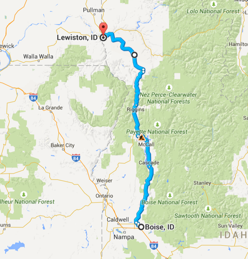
Day’s distance: 277 miles
Total trip distance: 12,249 miles
The weather was sunny and warm. Temperatures started in the high 60’s and hit the high 80’s near Lewiston.
I had a relaxed day on the road without really interacting too much with other folks. I’ve noticed that as I get closer to home, I haven’t been engaging with others as much as earlier in my trip.
My route took me north through canyons along the Payette River and the edge of the Boise National Forest (Hwy 55), then past Hells Canyon National Recreational Area, the Salmon River, the edge of the Payette National Forest, and the Nez Perce Reservation as I approached Lewiston (Hwy 95).
Speed limits were mostly 55 or 65 and the road surfaces along the entire route were in good shape and used by both cars and large trucks, sometimes leading to a “parade of cars” following someone who is moving more slowly. When this happened, I usually just pulled over and waited for a few minutes to let them get well ahead of me.
Below are some photos taken through the day.
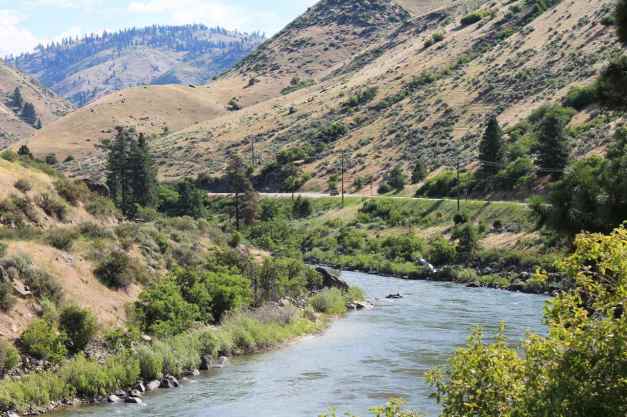
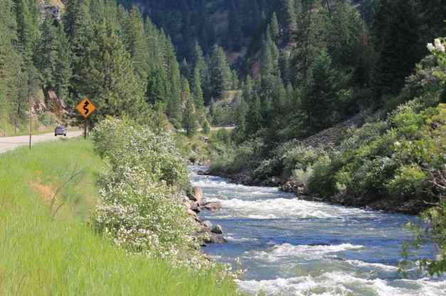
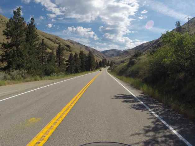
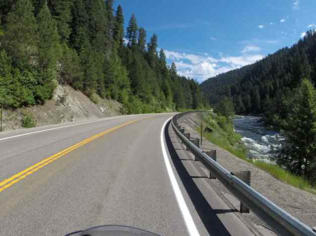
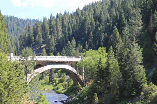
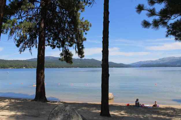
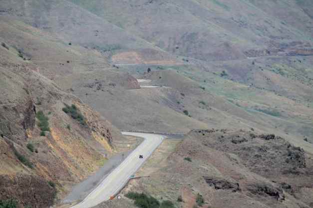
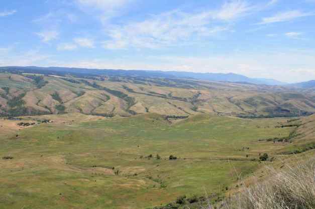
Tomorrow is my last day of the tour. I didn’t feel like camping once I arrived in Lewiston, so I stayed in a motel with a pool. 🙂
Day 65

Day’s distance: 317 miles
Total trip distance: 12,566 miles
Sunny and warm with light winds, gusty at times. Temperatures ranged from mid 60’s to mid 80’s.
My GPS had routed me out of Lewiston via I-95 North. I knew from my previous visits to Lewiston that there was an alternative route to the top of the hill north of town called the Old Spiral Highway.
It was a fun diversion.
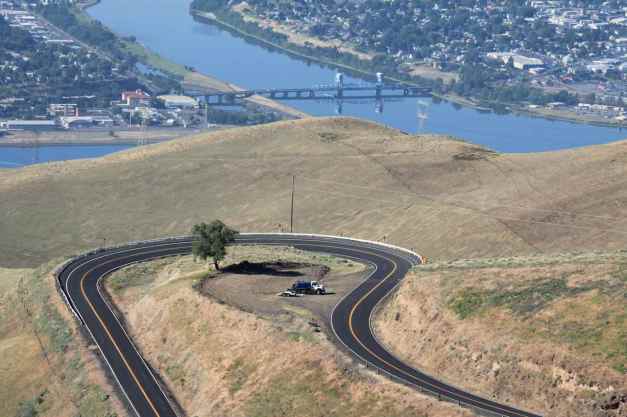
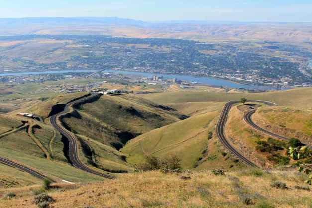

Leaving Idaho shortly after, I was headed home.
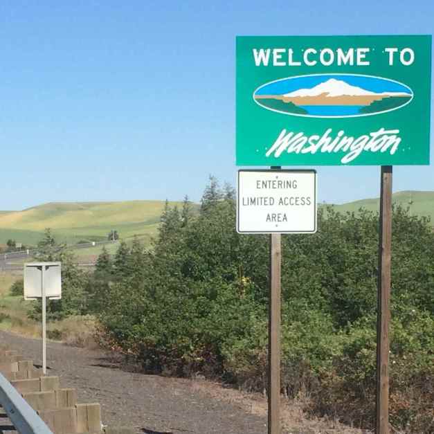
I crossed over the Columbia River getting onto I-90.
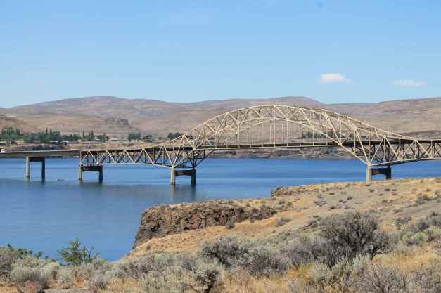
From there, it was a straight shot home, with one diversion to my favorite Seattle Taco Truck for a burrito 🙂
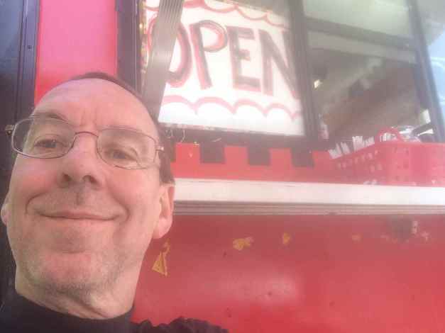
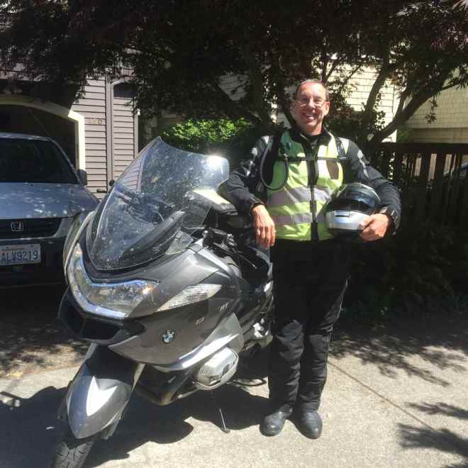
Reflections
How many miles a day did I ride?
I averaged just over 215 miles per day both to Key West and on the way home, counting days off ‘en route’.

My longest day was 489 miles, a personal record. I had planned my do my first ‘500 mile day’ by riding from Oklahoma City into Taos, New Mexico. However, once in the mountains east of Taos, I came across Cimarron Canyon State Park. Since the weather promised a clear night, I decided to stop there and camp. The result was I didn’t hit my goal of 500 miles.
A large majority of long-distance riders I’ve met travel farther each day than I do. I am cool with that and with my average. I’m engaged in leisure travel, designed to be long in duration as well as distance. Regular days off and short-ish days help me maintain a good attitude over the long haul and helps with scheduling activities ‘off the bike’.
How much does this cost?
I budget $1000 per week for my longer trips. This includes the cost of lodging, food, and fuel, as well as money for recommended services and gear replacement. I camp 10-20% of the time, stay with folks 10% of the time, and stay in inexpensive motels the rest of the time.
To help keep this simple on the road, I keep my daily average spending on fuel, food, and lodging to around $100, sometimes a little more. This allows for roughly $200 – $300 per week to be allocated to maintenance of the bike and gear.

By occasionally camping, I can put the money saved on lodging that night towards a nice hotel room another night. Not only does that give me an opportunity to “splurge” on myself, but it also provides a more diverse experience.
Sometimes I know I will want a nice hotel. Usually in bigger cities, for example, I’ll opt for nicer lodging.
Did you have any close calls?
This question never sits right, but it comes up often. In any case, there was both a little drama and some trauma for the bike.
The drama happened in Texas on Day 24 when I picked up a nail in the rear tire. Here’s what I wrote for that day’s blog post:
After stopping for gas on the peninsula, I noticed I picked up a nail in my rear tire. Turned out it was pretty small and lodge in tangentially. The tire pressure remained good after I pulled out the nail, and I continued on my way.
Thanks to Will, my regular Seattle riding buddy, as well, for his support. I also had a patch kit and an electric air pump should things have turned out differently.
As you can see, the drama involved a lot of support calls and texts, a little breath holding, and some delays, but ended happily.
Trauma happened twice. The first time was in the afternoon of Day 51.
The day took an unexpected turn while I passed through the town of Dardanelle. I hit a rock in the road. I wasn’t traveling too fast, about 35mph and the bike remained upright but I could tell the front tire was going flat and pulled off the road quickly.
There was significant damage to the front rim and, as I thought, the front tire was losing pressure quickly. I was just about 50 feet past an intersection with both a restaurant and a tire service center, so I turned around and got the bike into the service station parking lot.
I recovered the rock I hit from the highway, in part so no one else would hit it. Here’s the rock and the damage it caused.

Because the bike is still under the original warranty, BMW roadside assistance is available to me. With one call, a tow truck was dispatched from Bentonville, the city with the closest BMW dealer. My next call was to the service department at Bentonville BMW to let them know I was dropping in unexpectedly. They ordered a new front rim so that it could be overnighted from California.
The tow came quicker than expected and soon the bike was loaded up and tied down. The tow company owner, Mark, rides and had many entertaining stories. It was a long ride to Bentonville, and I felt like my motorcycle was just staring at me with an angry look.
We dropped the bike off just after 6pm and Mark drove me to the motel. After some time, I found a nearby hotel with a bar and had some dinner and a couple of drinks.
It was a sad evening, but it could have been much worse. I didn’t wreck the bike, and I wasn’t hurt at all. I went to sleep hoping the bike would still be at the shop when I arrived the next morning.
The morning started with a cab ride from my motel to the BMW dealer in Bentonville, about six miles away.
I met Jerry, the service manager and co-owner of the dealership. The new rim was on its way and the new tire was sitting in the sunlight to warm up a bit (apparently it is easier to mount when warmed up by the sun – makes sense). We would examine the rear tire and rim after mounting the front.
Jerry took my copy of the tire and wheel protection agreement, measured the tread depth, and secured pre-approval for the front tire repairs. Fed Ex arrived and the tire was mounted and balanced by 11am. A test ride couldn’t detect any issue with the rear rim, but after dismounting the tire and putting it on the balancer, a minor imperfection could be detected. The warranty would not cover this damage, however, because the tire’s seal was still good. Jerry was certain that the new defect would not impact tire wear or safety.
Since the rear tire wasn’t visibly damaged, but would need replaced in another 1,000 miles, I chose to replace it now at my expense. A new tire was mounted and the motorcycle put back together
The other trauma was mechanical in nature and impacted my route choices and my mood during Day 57 and Day 58.
In Texas, I was traveling along, occasionally glancing at the fuel gauge, I noticed that it indicated the tank was half empty. A short time later, it indicated it was full. This was concerning because I don’t believe the gods of travel would grant me such a gift. 🙂
When I stopped at a service station a short time later, I found a vacuum built up in the fuel tank. This was unusual and I suspected the venting on the charcoal cannister designed to prevent fuel and fuel vapors from leaking to the atmosphere.
I filled the tank since I was at a gas station and continued on my way hoping that this behavior was a fluke. I suspected the charcoal canister was clogged, or perhaps fuel-soaked and that it would clear quickly.
The behavior repeated itself and I stopped frequently throughout the day to release the vacuum. I was still thinking the charcoal in the canister, which is designed to clear itself in the event fuel gets in it, would clear itself.
Well, it didn’t clear itself so …
I did some research after dinner to better understand how the charcoal canister works. The fuel tank on the bike is a plastic, and a vacuum can cause it to collapse inward. It also can damage the fuel guage, a float inside the tank, as well as cause engine performance. I decided that I would have to have the bike looked at and planned to stop at either Colorado Springs or Denver the next day.
I knew it was going to be a difficult day trying to get the bike serviced. First, it was Tuesday – always the busiest day at a BMW shop. Next, it was spring and everyone thinks about getting their bikes serviced in the spring. Finally, there are a lot of bikes on the road and that means break downs are more of the service emergencies that shops have to schedule around.
Long story short, the Colorado Springs shop was incredibly busy and I was not confident of their ability to diagnose the issue and represent it as warrantied, if necessary. So I traveled to Denver BMW, where last year I had my 12,000 mile service performed. To make better progress, and avoid numerous stops every few miles, I rode with the filler cap cracked open. I finally arrived in Denver about 1pm.
Though I had a few travelers ahead of me, the experts at the Denver shop found the issue to be a clogged vent hose off the charcoal canister and corrected it at no cost to me. I can’t praise the team at Denver BMW enough for getting me back on the road quickly.
It turned out that my friend Jed was at the shop that same day getting his bike serviced. We were done at the same time, and Jed invited me to stay with him and his wife.
I’m thankful both these traumatic events had a soft landing.
What stood out as special on this trip?
Among the roads I’ve ridden, the northern half of the Pacific Coast Highway (Hwy 1) and where it passes through Big Sur stands out as special, as does Hwy 33 south of Pine Mountain (CA), Hwy 170 through Big Bend State Park (TX), the ‘Twisted Sisters’ (TX), the Blue Ridge Parkway, Tail of the Dragon, Cherohala Skyway all seemed very fun and totally worthy.
Hanging out with old friends from Santa Cruz, friends that have moved away from Seattle to Huntington Beach and Key West, a virtual friend living in Ft. Lauderdale, and friends I’ve made on the road is a highlight of this trip.
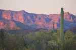
Camping at Organ Pipe Catcus National Monument in Arizona, Henderson Beach State Park in Florida, and the Willville motorcycle-only camp in Virginia were all very special and very different.
Breakfast in Calexico, croissants at the Blue House Bakery in Carlsbad, Ahi tuna tacos for lunch in Key Largo, appetizers at The Olde Pink House in Savannah, steak dinner at Red Steakhouse in Oklahoma City were some of the meals that were especially yummy.
Looking through a telescope at the sun while at Kitt Observatory was super exciting, as was visiting Carlsbad Caverns, swimming in the giant spring-fed swimming pool at Balmorhea State Park, yoga on the beach in Key West, visiting Cape Canaveral, and the Barber Motorcycle Museum were some of my favorite activities this trip.
Did you get lost often?
Not lost, exactly, but a few times I encountered the unexpected. Here’s one example.
On Day 16, I followed roads on the Butler Map that were supposed to be super fun but that led me to a dead end, or so it should have been. 🙂
The route I followed dead-ended at the West Gate of Fort Huachuca, a military base. I honestly thought when I looked on the map that this was some sort of nature preserve or historical site. Instead, I end up at an automated, highly secured gate with cameras and everything. 😦
It was after 6pm, and the sun was falling fast. I don’t like traveling at night on the motorcycle and I started to feel a bit panicked. There was a call button, so I pressed it hoping for the best.
Someone answered and I told them I was lost, I was trying to get to Bisbee before dark and I didn’t want to retrace 60 miles of what was mostly crappy country roads. I guess they took pity on me and after presenting my driver’s license to the camera, they let me pass through the gates and cut through the base.
Of course, I got lost on the base because none of the roads are straight and there are no road signs on how to get to the East Gate. The first person I asked, apparently a German officer there for training, had only been there two weeks and wasn’t helpful. He did say that he owned a 1983 BMW motorcycle and loved it (everyone has a motorcycle story).
The two enlisted soldiers I asked about 10 minutes later seemed very intimidated and didn’t know whether they should salute, stand at attention or parade rest, who I was, or anything. Eventually, one of them gave me some pointers.
Anyway, I finally found someone who pointed me in the right direction at the gas station. I filled up and took off out the East Gate. It was now 7pm and almost dark.
This story was hilarious to tell Carson and all turned out well, thanks to decision of the person who controlled access to the base (thanks!). I really got a kick out of the reactions of the soldiers, especially the young enlisted men who seemed really scared someone without a recognizable rank was talking to them.
What was different about the design of this trip?
This trip was farther and would take longer than any trip in the past. So, knowing that I started to burn out towards week seven of the last trip, I organized this one around a full week off the bike while staying in Key West. With that design, this trip really became two trips – one out and one back. That really seemed to help me get a second wind and avoid most of the burnout.
Aren’t you worried traveling alone?
I really enjoy traveling throughout the US on these long trips by myself. Most folks don’t believe me when I say that this is enjoyable and preferable. Besides, how many people have friends who ride who can also take off two months or more from work?
En route, my plans are more flexible when traveling alone. I can plan the next day’s route the night before or the morning of and still change my mind part way through the day. I can wait longer to make motel reservations.
At stops, I’m very approachable – being alone and generally smiling. People say hello and sometimes volunteer their stories or their questions that start a short conversation. Other riders will ask where you’re heading, etc..
At mealtimes, I tend to eat at the bar or counter where locals tend to gather. Being by myself, I can usually find a place and I have to talk to others if I want to be social. In this way, I’ve met loads of folks and often we have a good time swapping stories.
I strongly encourage folks who haven’t traveled alone or done so in a long time to try it. You’ll find yourself forced to engage others in a way that I suspect you’ll find very rewarding.

I enjoyed “riding along” with you on your 2015 Southern States Tour. A trip like that is not in the cards right now, but I can dream!
LikeLike
Thanks, Brad. It feels great having supporters.
LikeLike