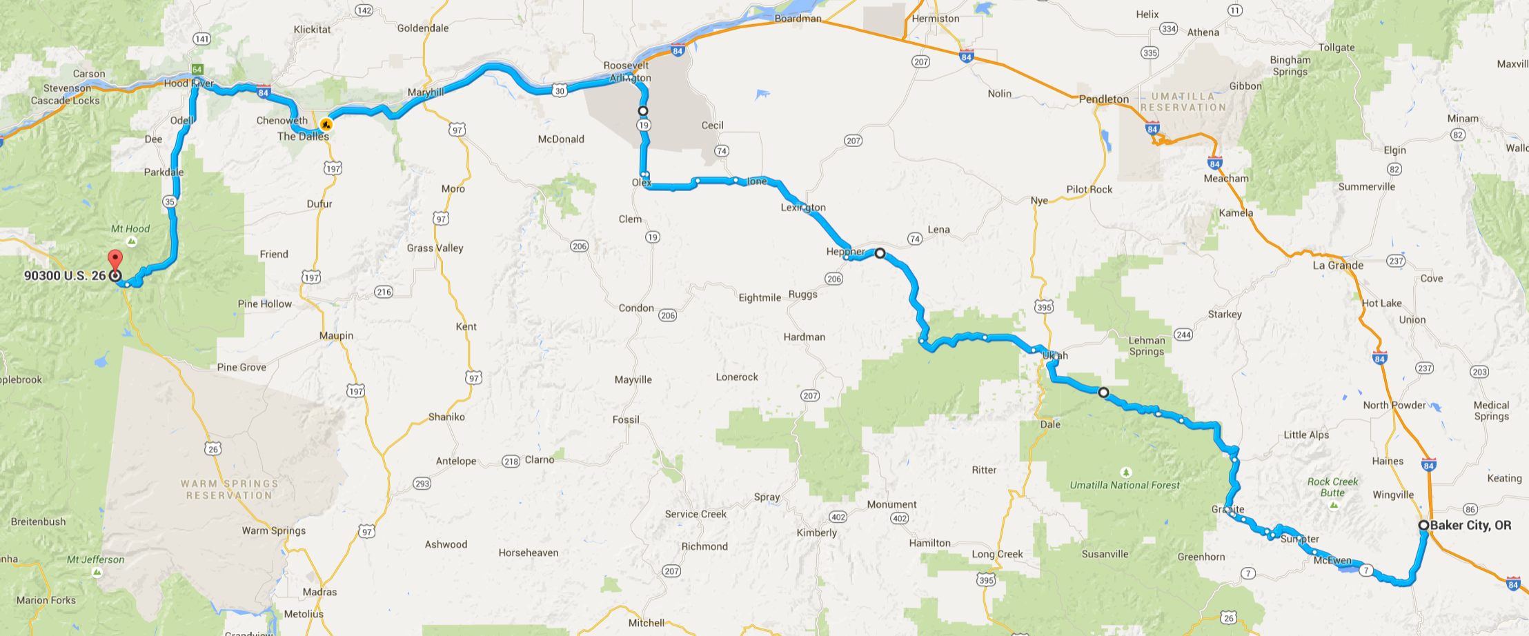
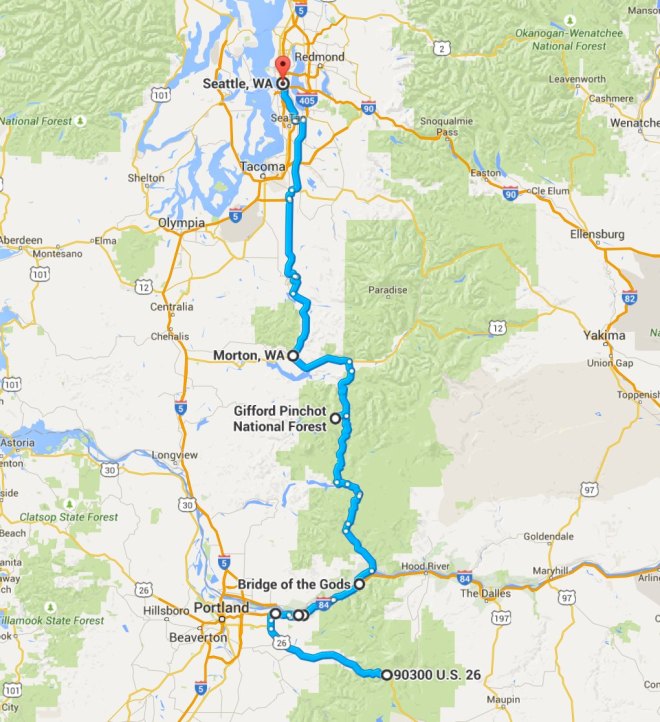
I began this four-day, 1,160 mile trip on August 4th, traveling alone to Wallowa Lake in Eastern Oregon. From there, and with an old friend I had not expected to meet, I visited Hells Canyon National Rec Area on Day 2.
Continuing together, we traveled west through scenic byways and to the Maryhill Stonehenge along the Columbia River before turning south to reach Mt Hood on Day 3, returning to Seattle on Day 4 after riding Historic Route 30, crossing the Columbia River on the Bridge of the Gods, riding close to Mount St. Helens and within camera distance of Mt. Rainier.
Day 1

Day’s distance: 414 miles
The weather was mostly sunny with some cloud cover in the afternoon from passing thundershowers, which I missed 🙂 Temperatures ranged from mid 50’s on Snoqualmie Pass to the high 80’s in parts of Oregon.
I left the house at 7am in order to miss the morning commuter traffic. Waking up early, I did my final packing and left town via I-90 east. I so needed a latte and made a quick stop in Preston, about 20 miles east of Seattle to grab one.
The ride over Snoqualmie Pass was pleasant and the traffic was light. Just like my 2014 trip to Crater Lake, I took Canyon Road (State Route 821) to cut between I-90 and Hwy 82 south to Yakima. Canyon Road took me through Yakima Canyon, scenic and full of gentle curves that follow the Yakima River.
Because the route I chose to ride today was over 400 miles, I used major highways often. Hwy 82 crosses the Columbia River into Oregon near Umatilla and I stopped for a cold drink at a gas station just over the border.
While resting, I met a Goldwing rider from Alberta who was heading to the coast of California. He was on a two-week ride and wasn’t traveling along a route he planned out ahead of time. From the questions he was asking, it seemed like he didn’t even have a map. To me, it also seemed like he had a very bad sense of direction 😦 I hope he has a good time, and I bet he will, whether or not he makes it to his destination.
Leaving the main highways in Pendleton, I traveled to Weston along Hwy 11, turning east onto Hwy 204 from there. There was a temporary highway sign indicating dense smoke 30 miles ahead. I was hoping that the road remained open and the smoke wasn’t going to be too bad. As I didn’t have cell reception, I wasn’t able to find out any more at that time and just stayed on my intended route.
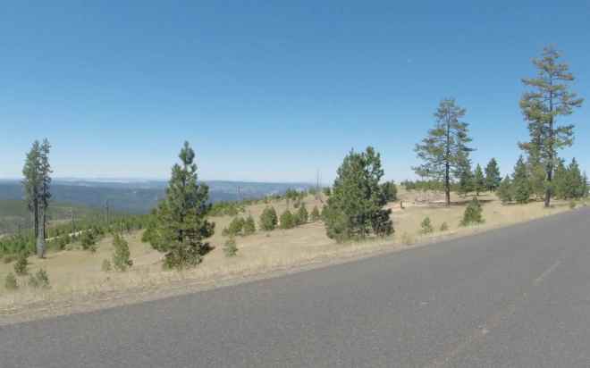
The Blue Mountains were a welcome change of scenery.

The smoke was getting progressively worse as I approached Elgin from the west. I was concerned if the road was closed, that I would not have enough fuel to retrace my steps back to Pendleton. Fingers crossed, I continued along.
At the smoke’s densest point, which turned out to be noticeable but not dangerous to my lungs, I saw forest service aircraft flying low over the ridge and assumed the fire was on the other side of the hills. Despite its proximity, the roads were open and I made it to Elgin without incident. I grabbed lunch and fuel there.
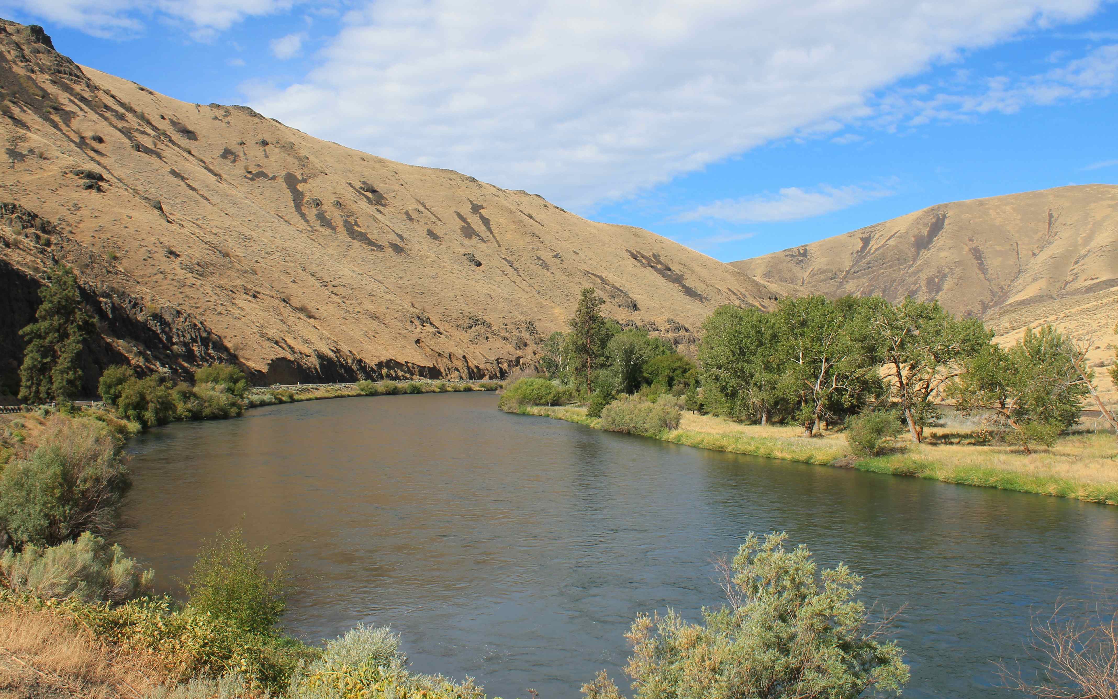
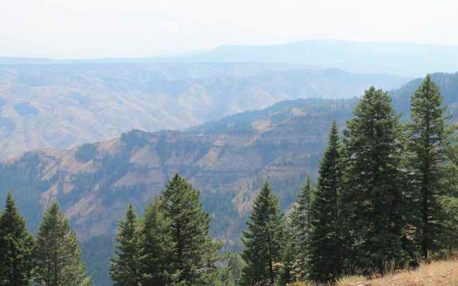
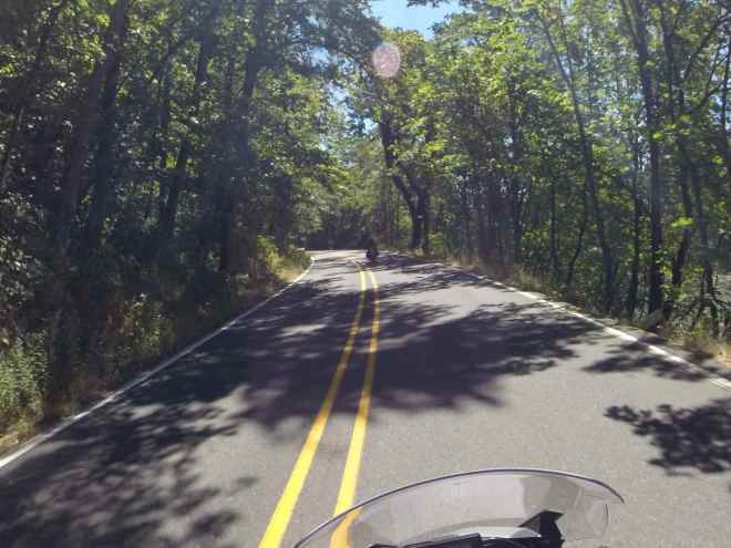
My route was following Hells Canyon Scenic Byway.

I’m again reminded that many fun motorcycle roads run along rivers 🙂

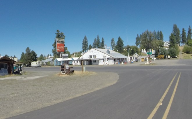
I traveled through a few small towns …

but Joseph, the town closest to Wallowa Lake impressed me. It seemed well maintained and economically vibrant, filling the historic buildings throughout the town’s main street with shops and restaurants used by both the local population and the tourists.
According to wikipedia, Joseph was originally named Silver Lake and Lake City, in 1880 the city formally named itself for Nez Perce Chief Joseph.
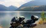
Wallowa Lake is nestled among the mountains of the Willowa Whitman National Forest.

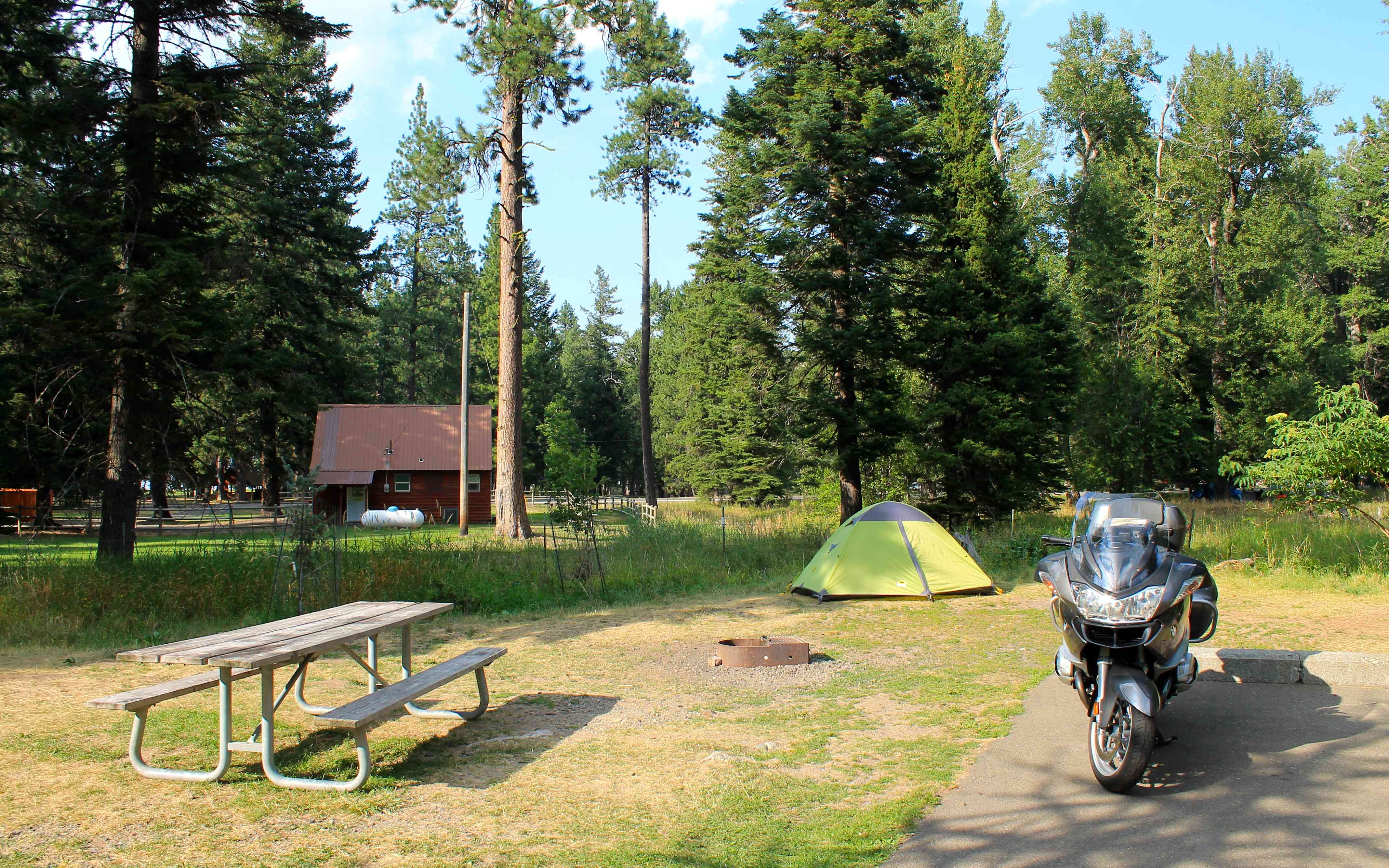
I set up camp on my arrival …
and met a motorcycling couple, Tim and SueAnn, who live in Bend and were out for a few days enjoying the summer.
As we were swapping stories, another BMW rider pulled up and called out my name. At first I didn’t recognize him. It was Forrest, a software developer I worked with some at my second start up! His wife and I are Facebook friends. She told Forrest, who was in the area, to look for me.
Everything about seeing Forrest so far from home was delightfully unexpected. I didn’t know Forrest had started to ride, and vice versa.
Well, he was looking for a place to camp for the night and ended up sharing my camp site. After catching up over dinner at the restaurant just a few hundred feet from the Park, Forrest decided to join me on the rest of this trip. Very cool 🙂
Day 2
Day’s distance: 150 miles
Total trip distance: 544 miles
Despite the skies being clear when I fell asleep, it rained a bit overnight from a passing shower. However, this day was mostly sunny and warm, with highs in the mid 80’s.
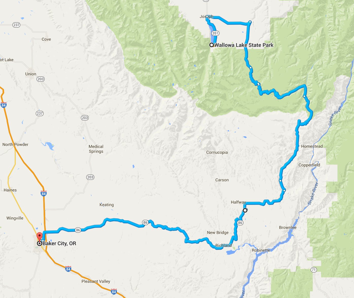
Today’s focus was to travel through Hells Canyon National Recreation Area. Originally, I planned to first travel north to Imnaha using Hwy 351 and then take a canyon road south from there.
I learned from a ranger at the State Park that the canyon road south from Imnaha wasn’t paved, so I took Wallowa Mountain Loop south towards the Snake River.
Last night, Forrest and I planned to have breakfast in Joseph with Tim and SueAnn. As our tents were still damp from the rain, we decided to return to camp after breakfast and finish packing up.
We left about 8am and headed for the Cheyenne Cafe, recommended as the place to have breakfast by Park staff. The place was full of locals and the food really good. While we ate, we continued to swap stories. Regular readers know I love to engage with other travelers this way.
All of us were headed in the same general direction today, but Forrest and I traveled back to camp while Tim and SueAnn rode off towards Hells Canyon.
Once we returned, packed up the bikes and stopped for gas in Joseph, it was 11am. We were relaxed about our late start as we planned a relatively short day. Google maps indicated the route would take about 2.5 hours.
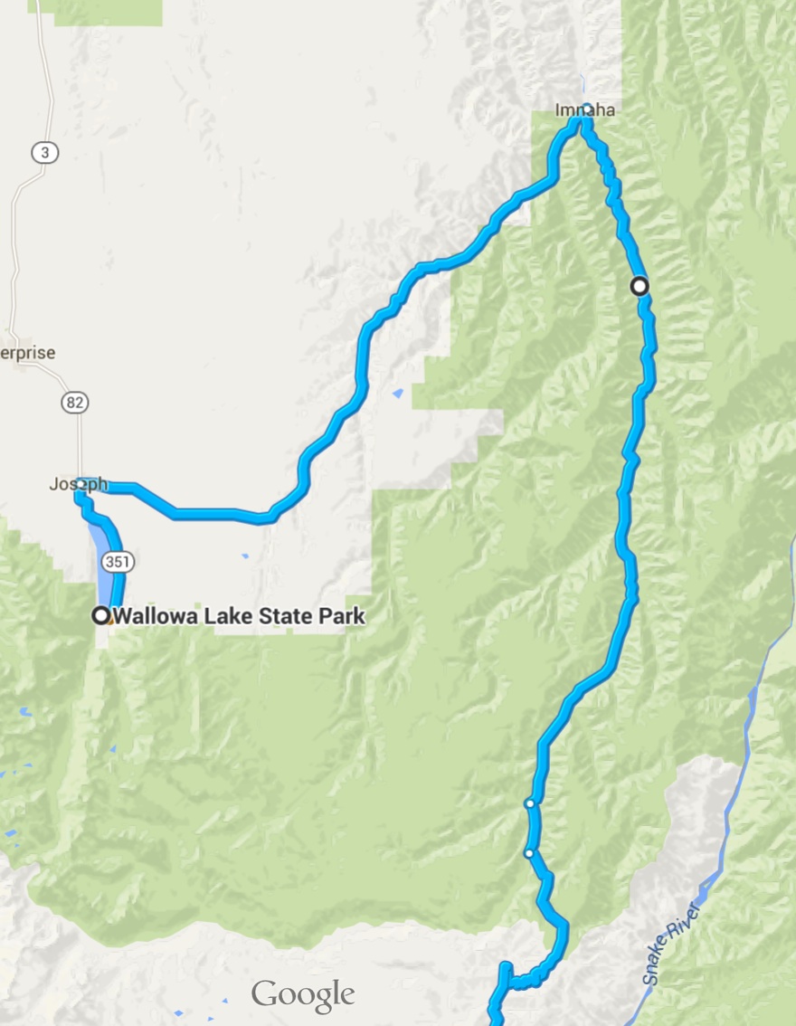
The road from Joseph to Wallowa Mtn Loop traveled first through farmland …
and then through more forested hills …
as it approached the Wallowa Mountain Loop.
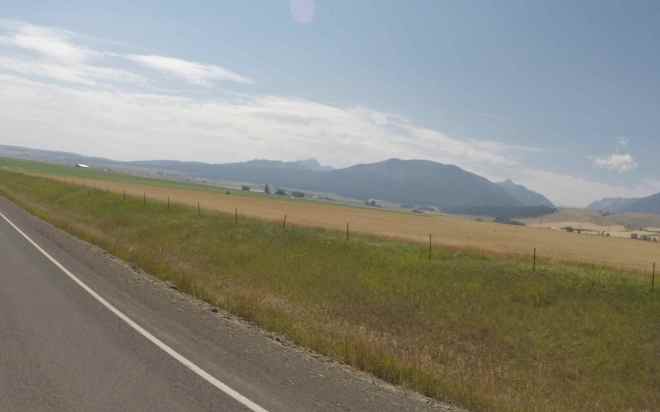
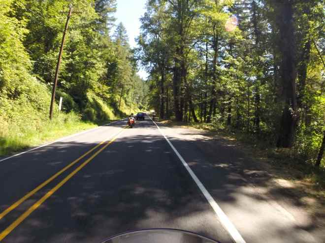
The ‘Loop’ road was paved in most places, but not in great shape. Most of the roadway had no painted centerline and no shoulder.
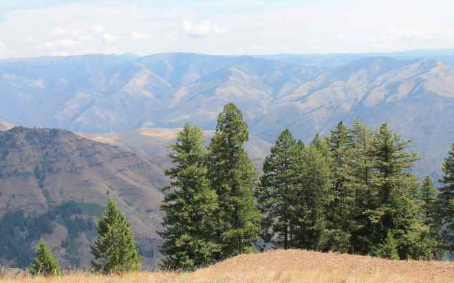
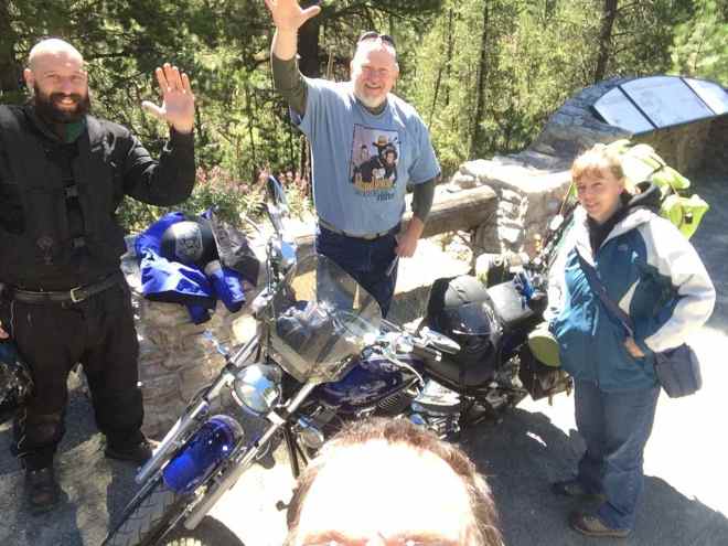
We stopped at the Overlook and took a few photos while eating snack bars and talking to other travelers.
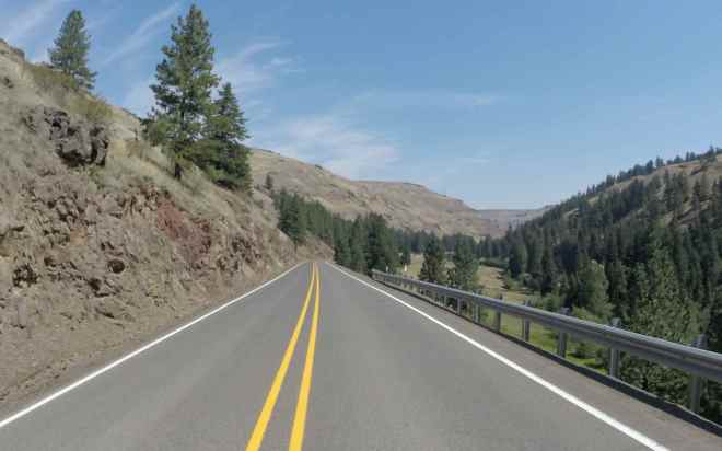
Afterwards, we headed north along the opposite side of the Snake River on my 2015 Southern States Tour and it was interesting to see this side now. In Idaho, I traveled Hwy 95 with much more traffic than we found on the ‘Loop’ road. No surprise there.
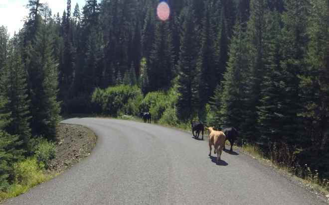
It was downhill past the Overlook. There were cattle roaming along one part of the road. Seems like they were headed down the mountain just like we were. 🙂
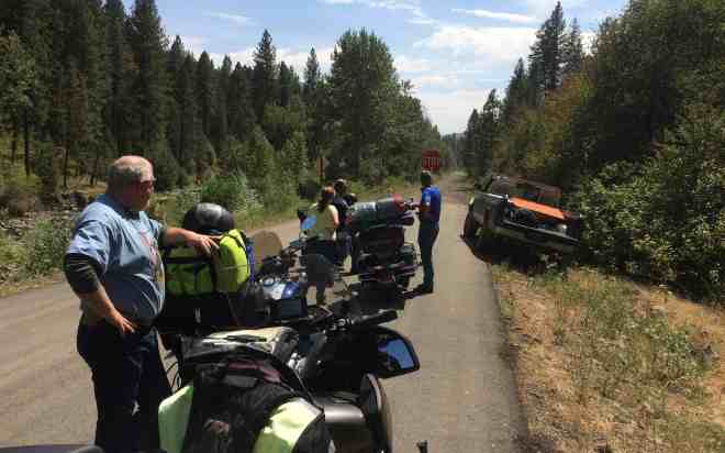
There was road construction as we approached Hwy 86. A fellow traveler told us about it at the Overlook, so we knew to expect a delay. Reduced to one lane, we had to wait about 30 minutes for the pilot vehicle. It was here where we ran into Tim and SueAnn again, along with two other bikers that had just completed a ‘Four Corners’ tour in 31 days.
Tim told us that they first traveled up to Imnaha to confirm the ‘Loop’ road was not paved, and they returned and followed the route we chose. They were planning to camp that night some 30 miles south of Baker City and head back towards Bend the next day.
Hwy 86 to Baker City was in great shape, lightly traveled and had enough twists and turns to be interesting. Back down out of the mountains, we were back into the bright sun and brown grass-covered hills and ranch land typical of other parts of Eastern Oregon.
Approaching Baker city, we found all traffic on Hwy 84 south was being detoured into Baker City due to a fire that had begun to burn that morning just to the south. Luckily, it wouldn’t impact our travel plans the next day.
Once settled in our rooms, Forrest and I hung out by the pool until we had dinner and drinks at the motel’s restaurant. I had a vegetable stir fry over wild rice that was unexpectedly tasty and a few vodka martinis that went down easily and help me unwind.
I was tired from the previous night’s light sleep and my body was a little stiff from camping so I crashed early. We planned to get an early start the next day.
Day 3
Day’s distance: 315 miles
Total trip distance: 859 miles
Another warm and sunny day with temperatures starting in the low 60’s and peaking in the mid 80’s.
Forrest and I met for breakfast at 8am. The motel supplied a coupon for free meals at their restaurant when we checked in the day before. I had oatmeal and a fruit bowl along with my coffee.
We packed and were on the road just after 9am. Hwy 7 was full of small horse ranches and followed a small river to Phillips Lake. This part of our route is known as the Journey Through Time Scenic Byway.
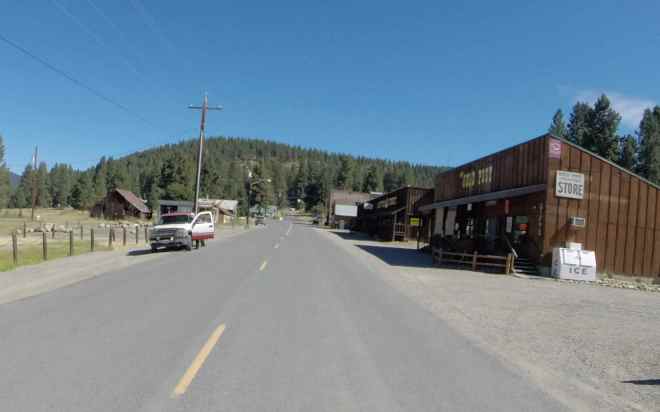
We then took Hwy 410 through Sumpter, a small town with its roots in gold mining.
We then rode up into the mountains towards Granite where the scenery consisted of pine forests. We saw a bobcat dart across the road. That was a treat!

It was along here that we met up with Tim and SueAnn again.
We were surprised to see them along this route, but they re-routed due to the fire south of Baker City and, as it turned out, had also stayed in Baker City the night before.
After taking a 15 minute break with the two of them, we then continued on towards Ukiah where the grassy hills returned.
We stopped for lunch in the small town of Ukiah. Forrest needed gas so we rode to the only retail gas station in town. They only had regular and not premium. He put only as much as he needed to make it to Heppner.
The attendant at the service station was quite a character and a bit of an ornery sort. But he told us there were lots of deer this year and to watch for them along the next section.
We continued on to Heppner along more forest roads. These roads are paved but are not maintained in the winter time. The GPS routed us on the John Day Highway (Hwy 16?) between Hwy 74 and Hwy 19. We found several sections of roadway that turned to gravel road. The first time it happened, the road was only marked with a few small orange cones. After that time, we were on the lookout. If I remember correctly, there were a total of four gravel sections, all total less than a mile in length.
As we approached the Columbia River basin, the air filled with smoke from yet another forest fire.
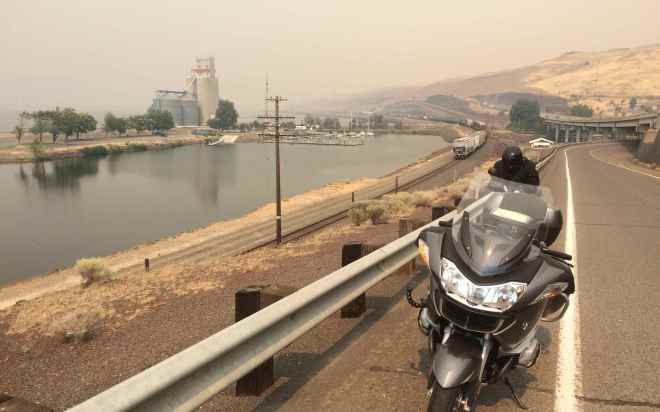
The fires were on the Washington side of the Columbia River and didn’t impact our route. The air cleared as we traveled west along Hwy 84.
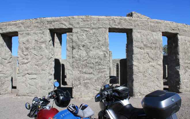
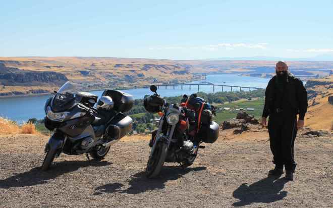
We soon reach the Biggs Rapid Bridge and crossed over the Columbia River to see the Maryhill Stonehenge found nearby. According to Wikipedia, the Maryhill Stonehenge was the first monument in the United States to honor the dead of World War I. Commissioned by Sam Hill, it was completed in 1929. I had no idea it was there when I came by last year during my trip to Crater Lake. Thanks to Forrest for the suggested visit.
The view of the Columbia River and the bridge was pretty cool.
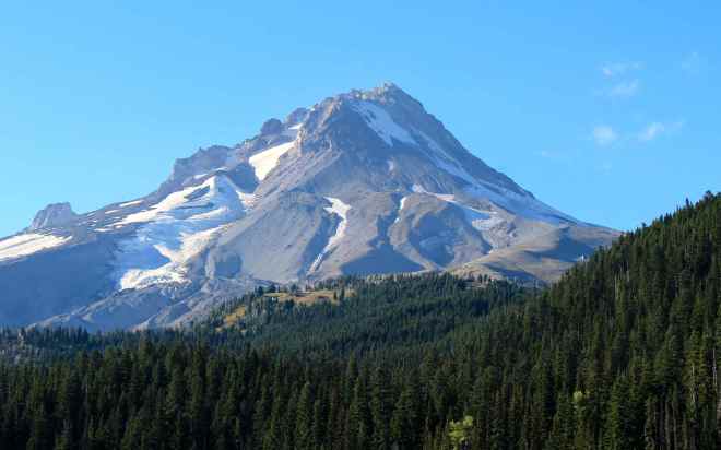
Crossing back over the Columbia River, we continued towards our final destination, Mt. Hood by traveling along a section of Hwy 84, a freeway which parallels the river, turning south on Hwy 35, and then east on Hwy 26.
It was a beautiful day to visit Mt. Hood as the skies were clear and the air in this area was smoke-free.
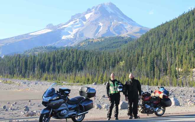
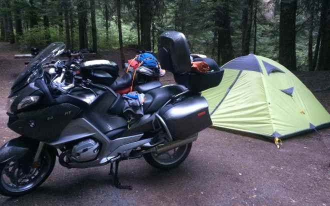
We had reservations at the Oxbow Regional Park near Gresham but we stopped at Still Creek Campground, located near Government Camp, at the base of Mt Hood, just to see if there was a spot open. There was and it was a sweet campsite, complete with a running stream which provided a wonderful sleep aid 🙂
It was a full day of site seeing and getting dark quickly. I rehydrated a Mountain House meal and by the time it was ready, it was dark. Even though it was a long day in the saddle, I felt very satisfied with the scenery and the roads. Motorcycle touring doesn’t get much better than this.
I have to say it again that I live a charmed life.
Day 4
Day’s distance: 281 miles
Total trip distance: 1,160 miles
Yet another beautiful day. Sunny, warm with clear skies. You would not think I am traveling in the Northwest with a string of beautiful days like I’ve had on this trip. 🙂
On our way home today, we traveled down from Mt Hood and, after a leisurely caffeine stop in Sandy Hill, we rode along the Historic Route 30.
This was the original Oregon highway that, because the railroads already ran along the banks of the Columbia River, was built partway up the hillside through the Columbia River Gorge.
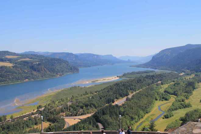
My first time visiting the Vista House,
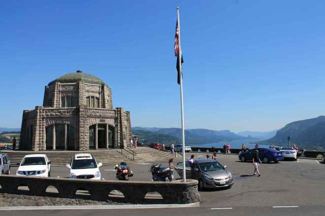
I found it had some spectacular views of the Columbia River Gorge.
We continued traveling along the scenic Hwy 30, past Bridal Veil Falls, Horsetail Falls and other sites. The road here was congested with cars trying to fit into parking lots and spilling out into the roadway 😦 But it was a beautiful scenic place to visit, despite the traffic.
Our next stop was fuel and lunch in Cascade Locks. Afterwards, we crossed the Columbia River via the Bridge of the Gods. Here’s a video of that crossing.
We traveled along Hwy 14 to Carson and then headed north onto Hwy 30. This two-lane road was in good condition and we saw quite of few other bikes out enjoying the twisties with us.
Continuing north along Hwy 51 and Hwy 25, we traveled towards Mount St. Helens. We detoured to Bear Meadows Vista Point on the Windy Ridge Trail.
We intended to continue along until reaching the Windy Ridge (see map), but were running out of daylight and still had a few hours until we reached home.
Hwy 25 had many, many frost heaves making for a sometimes bumpy ride 🙂 Having traveled other moutain roads in the area, this didn’t come as a surprise. And I am more confident these days in the bike’s ability to manage these uneven streches of road with grace.
We stopped in Morton after a short hop on Hwy 12 for some cold energy drinks. There was a festival of sorts going on in town. A few other bikers were resting in the shade with us and one mentioned they were having lawn mower races later. I laughed not really knowing if he was kidding or not. I asked if Tim Allen would be there.
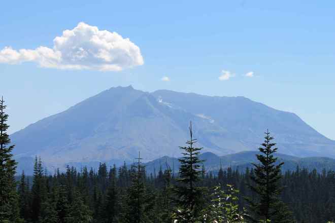
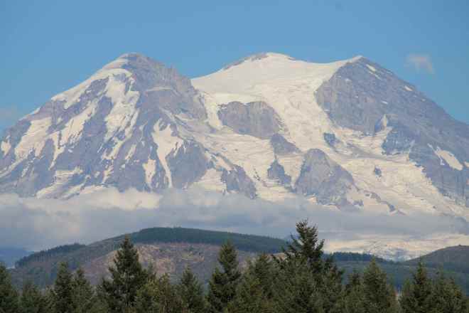
After a quick stop to photograph Mt. Rainier,
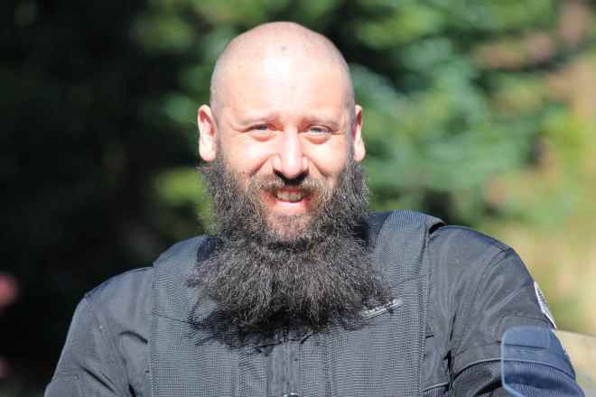
and take a semi-candid portrait of Forrest,
we buckled down and slogged through traffic to make it home just before 8pm.
Reflections
The days seemed stuffed as, once Forrest join me at the end of Day 1, we stopped to see more things than I generally do on my own. And he suggested some really great routes that I would have missed. Having him along really made this trip a memorable one.
Having an old friend, who I didn’t even know rode a motorcycle, join me by surprise set a great tone for the trip. We were both surprised to see Tim and SueAnn again on Day 3 reinforced that tone, and we all laughed at the obvious serendipity of it all.
This trip comes just two weeks before I leave for Hyder, Alaska, so I’ll be in good spirits for that trip – a benefit of having such a good experience this trip.
I would definitely travel this entire route again. It was a sequence of great scenery and fantastic roads.
