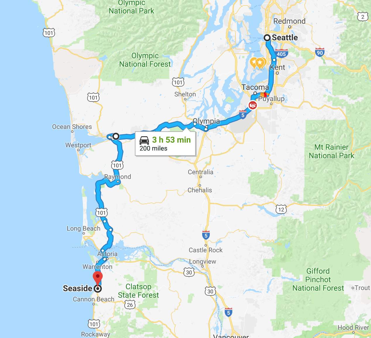
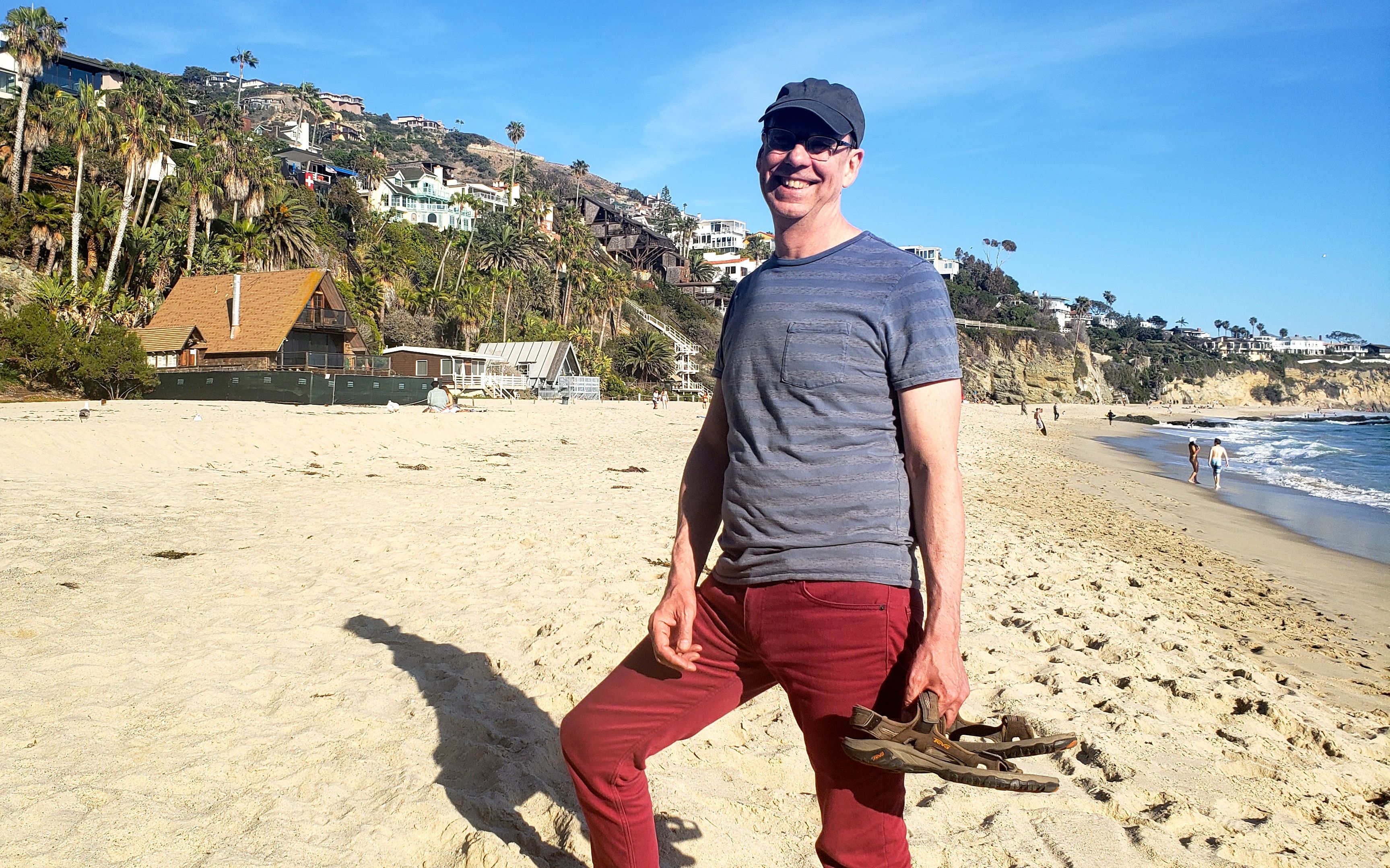
This 5,116 mile solo motorcycle tour of ten western states began on April 23, 2018 and lasted 23 days.
Vistas became the dominate theme.
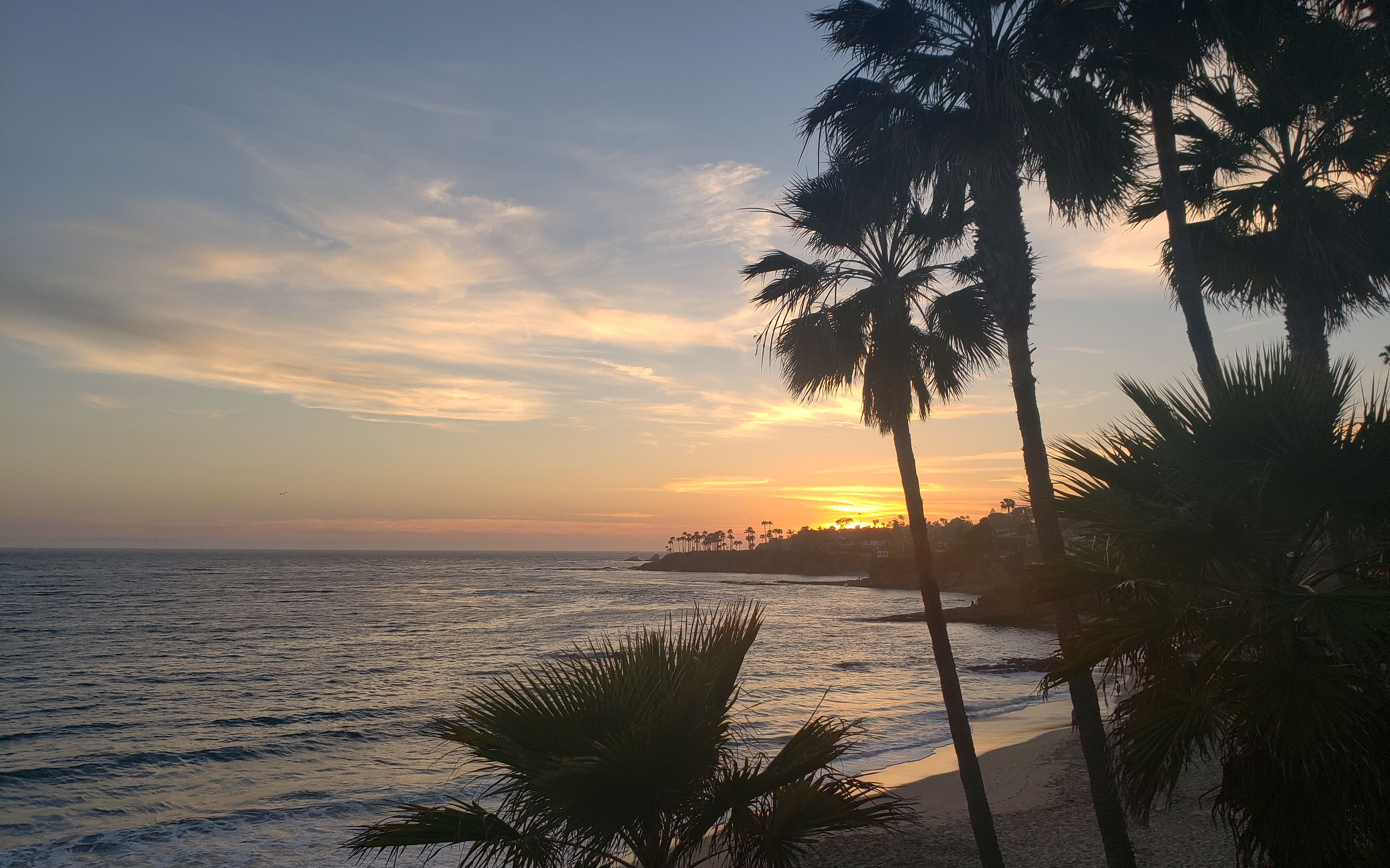
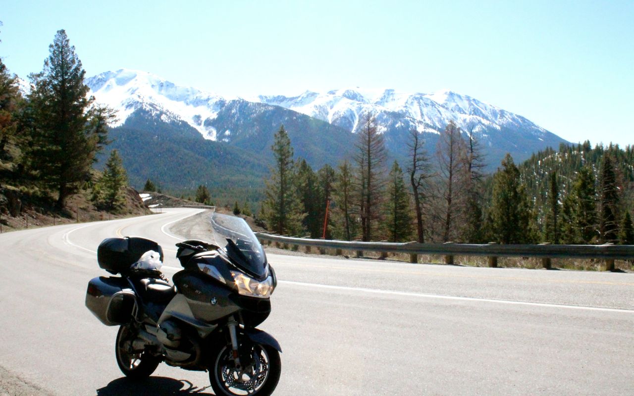
I ride through California’s Lost Coast, Death Valley, the Devil’s Highway in Arizona, the Million Dollar Highway in Colorado, and scenic byways of Utah and Idaho.
Day 1
Day’s distance: 201 miles (odometer)
Total trip distance: 201 miles
Day 1 was an auspicious beginning to my 2018 riding season. Temperatures ranged from the 50’s to the 70’s. Let me sum up the warmth of the Oregon coast today with some evidence taken at 8pm.
Today’s ride was a relatively short and along a familiar route. I wasn’t rushed to leave the house and it was a little after 10am when I departed. Traffic along Interstate 5 flowed quickly and I reach the turn off to the coast in Olympia in good time.
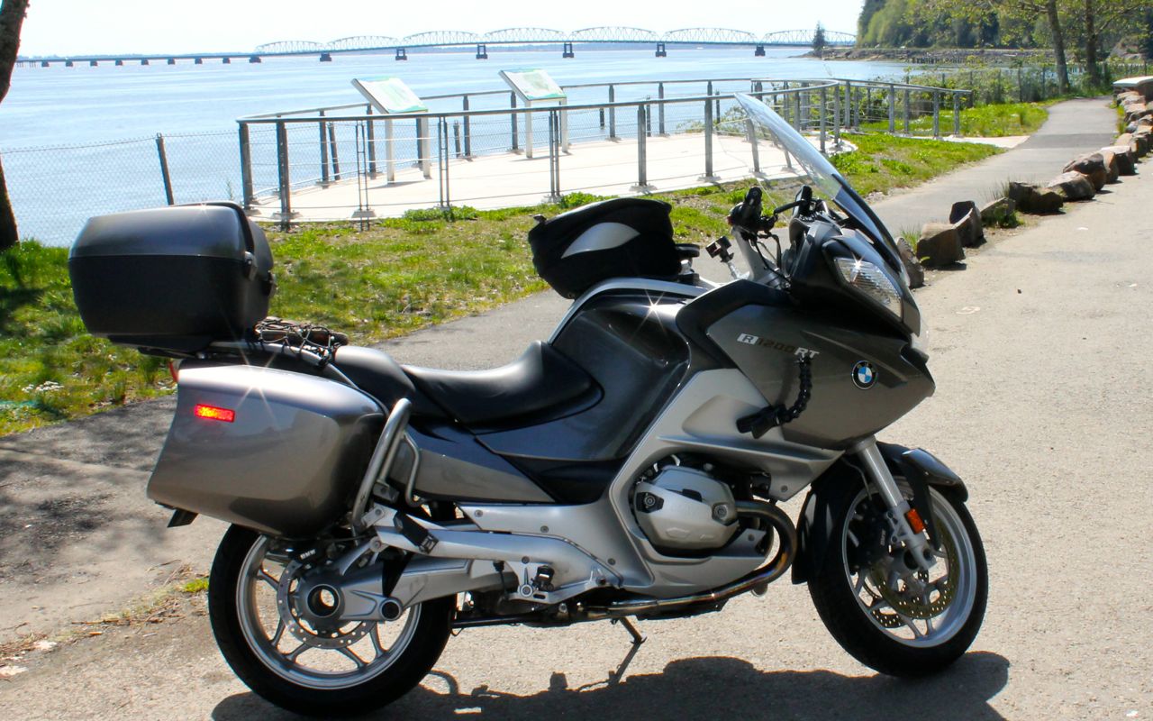
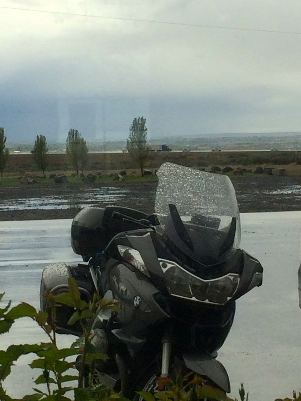
I didn’t take a lot of photos during the ride. I stayed focused on riding and enjoying the weather, but thought this photo shows how happy the bike was to be out in the sun. She’s beaming! We are just about to cross the Astoria – Megler Bridge into Oregon.
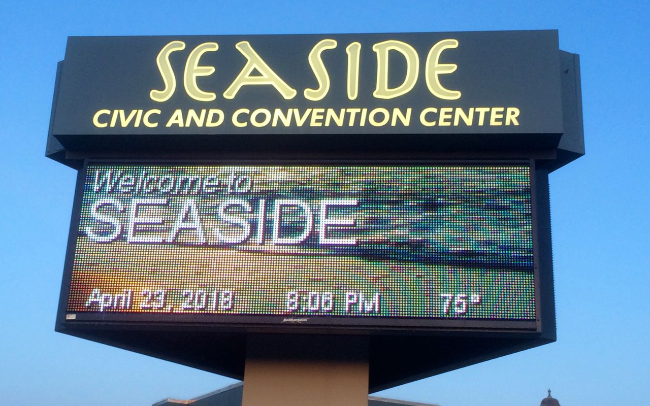
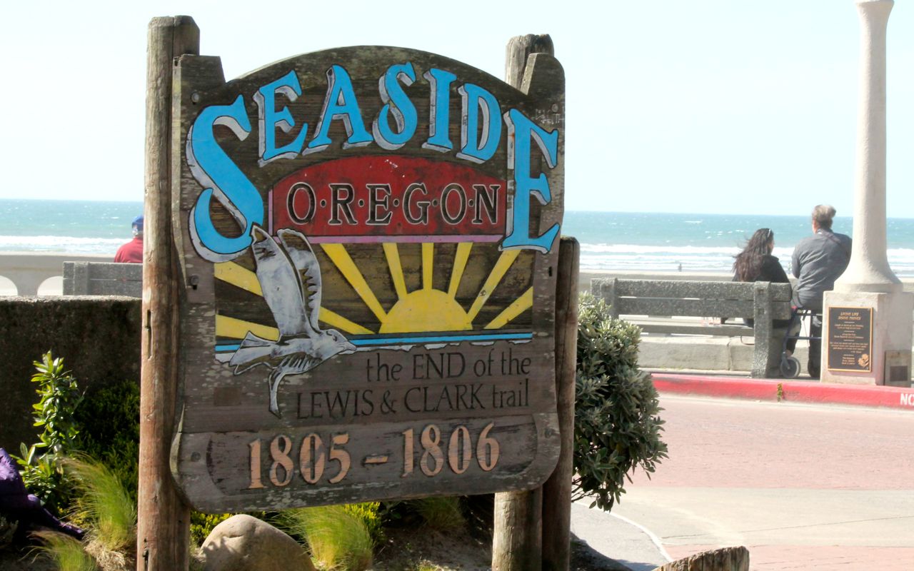
After checking in to the hotel about thirty minutes later, I changed and headed out for a walk around this little town just south of Astoria.
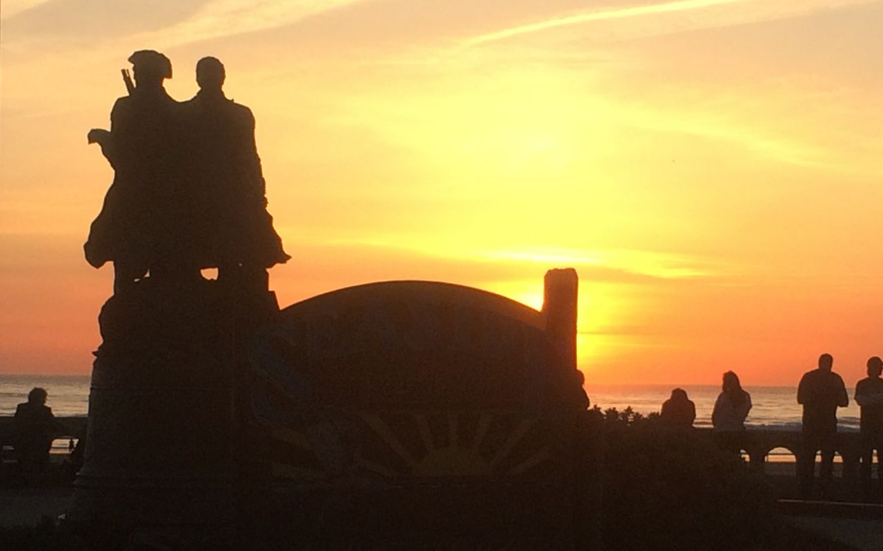
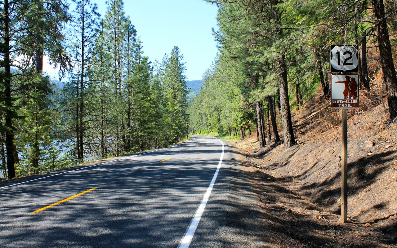
Seaside is the end of the Lewis and Clark Trail.
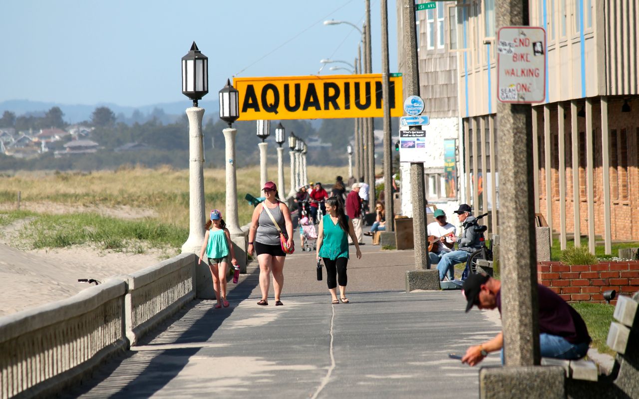
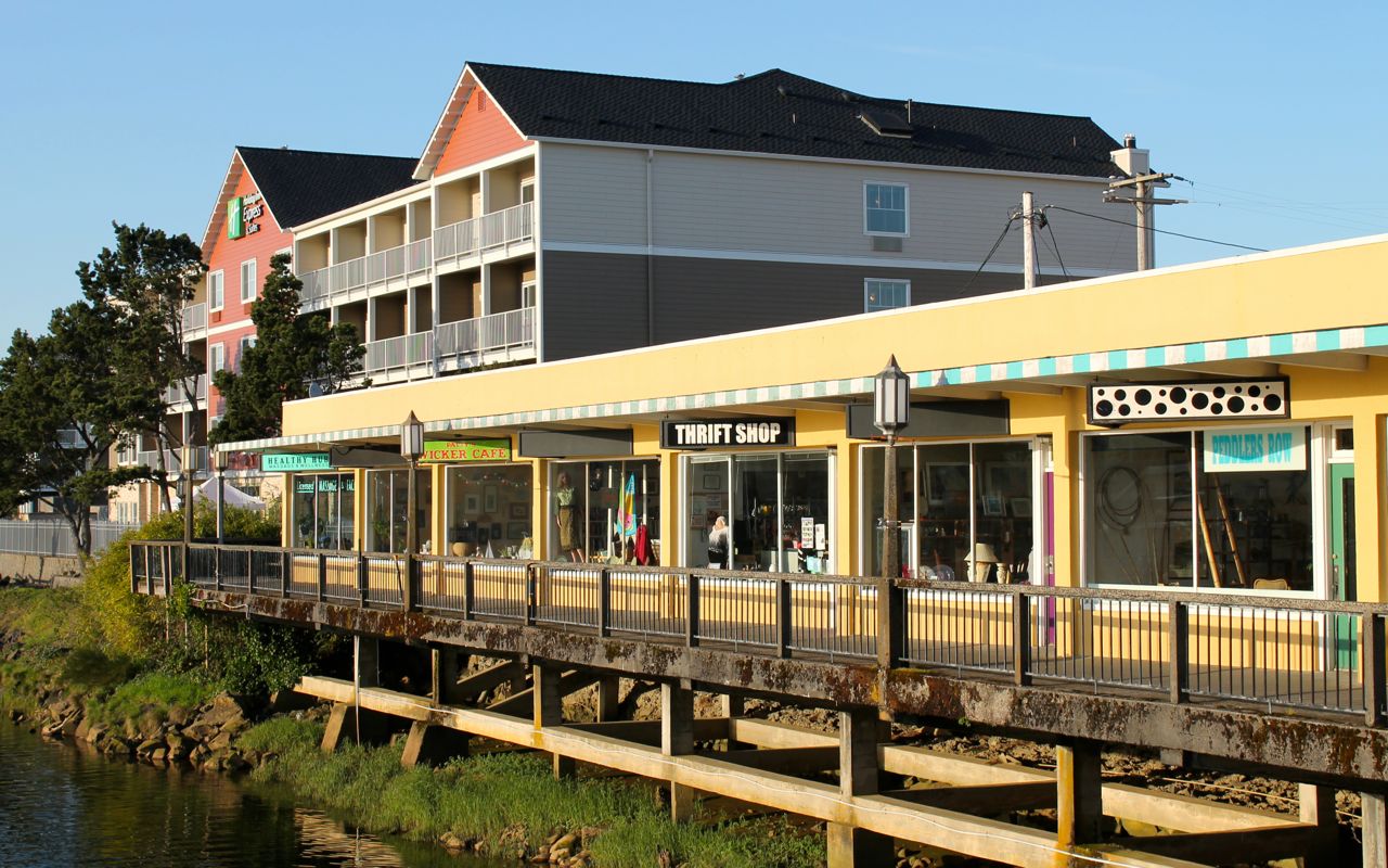
There is a Promenade along the shore in both directions from this landmark.
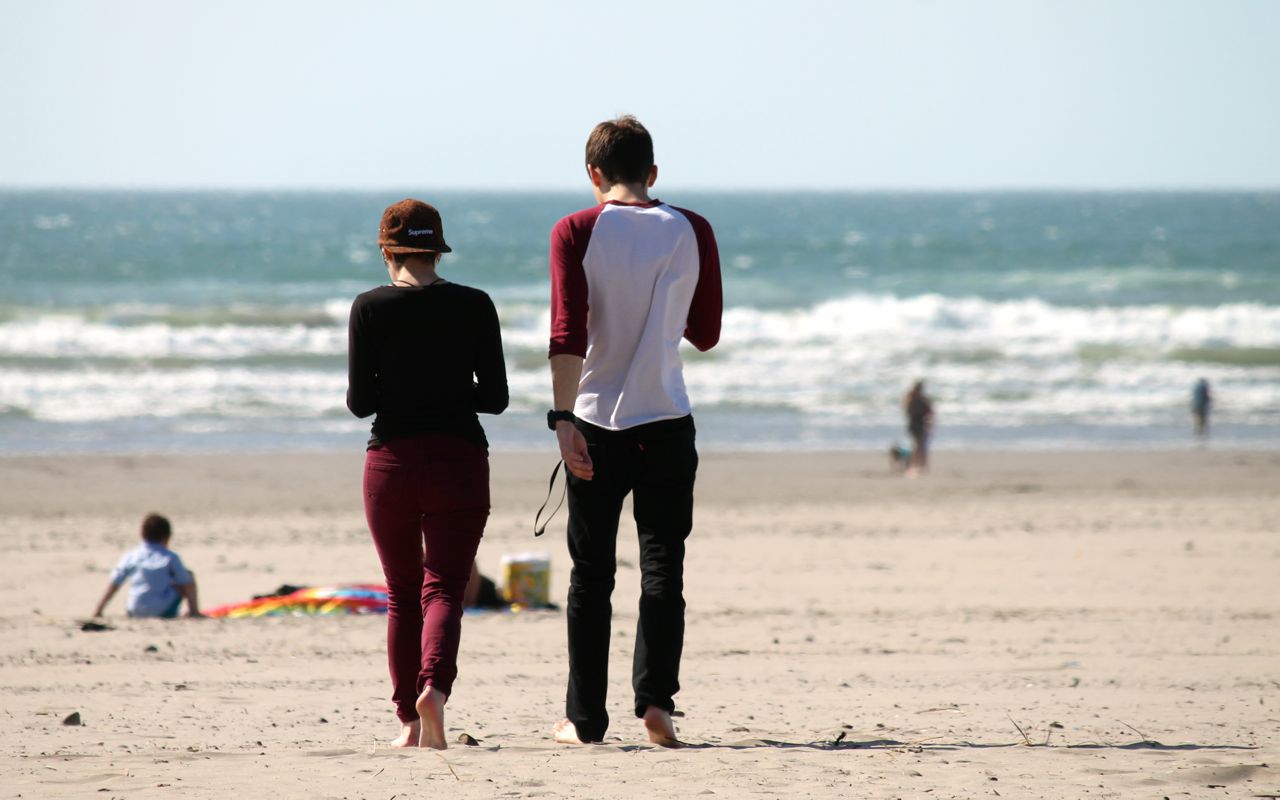
The beach is quite wide with sand that is soft on the feet.
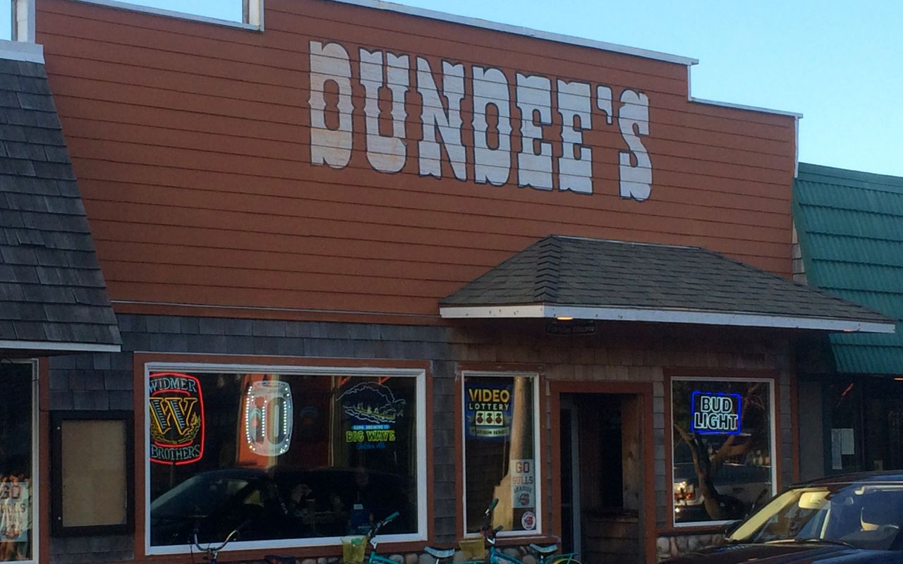
It was Happy Hour at Dundee’s. 🙂
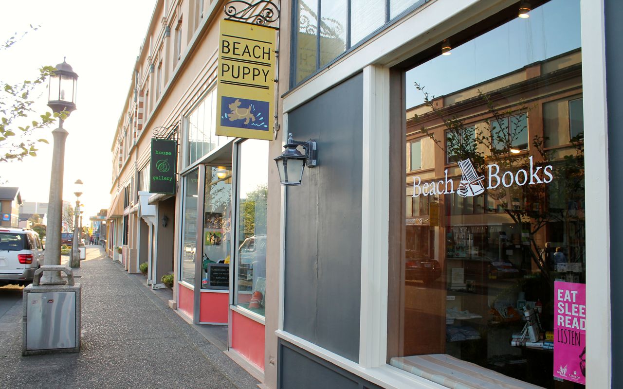
The town was a mix of newer buildings and the older ones found throughout this very walkable downtown core.
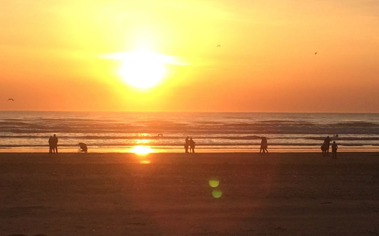
The sunset was made better by being warm with very light winds.
Today was charmed mix of riding and walking around this beach town. postponed the trip for a week due to the rain storm(s) passing through the coast. I’m happy I did. Today’s mix of sun and warmth was an easy start to the rides ahead of me during the next couple of months.
In contrast to today’s warmth, Apr 23rd, 2015, was a bit chilly. I was in the Angeles National Forest on my Southern States Tour (Day 11). It was raining at lower elevations but hailing at the Dawson Saddle (elevation 7901 ft).
It started to rain. Near the Dawson Saddle (7901 feet) it started to hail. I stopped at a pullout to close the vents on my jacket and met Deirdre Smith who was hiking the Pacific Coast Trail. This woman had already hiked the Appalachian Trail and it was fun to chat with her for a few minutes.
Luckily the hail was small and the temperatures were warm enough that the road was not slick. Out of an abundance of caution, I did slow considerably until the temperatures rose back into the mid 40’s.

I’m looking forward to tomorrow.
Day 2
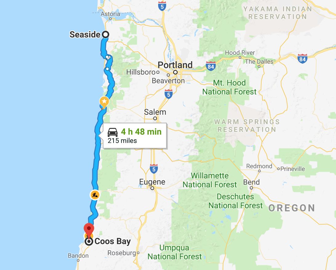
Day’s distance: 215 miles
Total trip distance: 416 miles
Today was another sunny day, with temperatures starting at 70, getting as high as 85, then dropping again into the mid 60s. The wind was gusty and brought in some haze in the afternoon, leading to the quick drop back down in temperature.
It was also another short day so I took off about 10am (again).
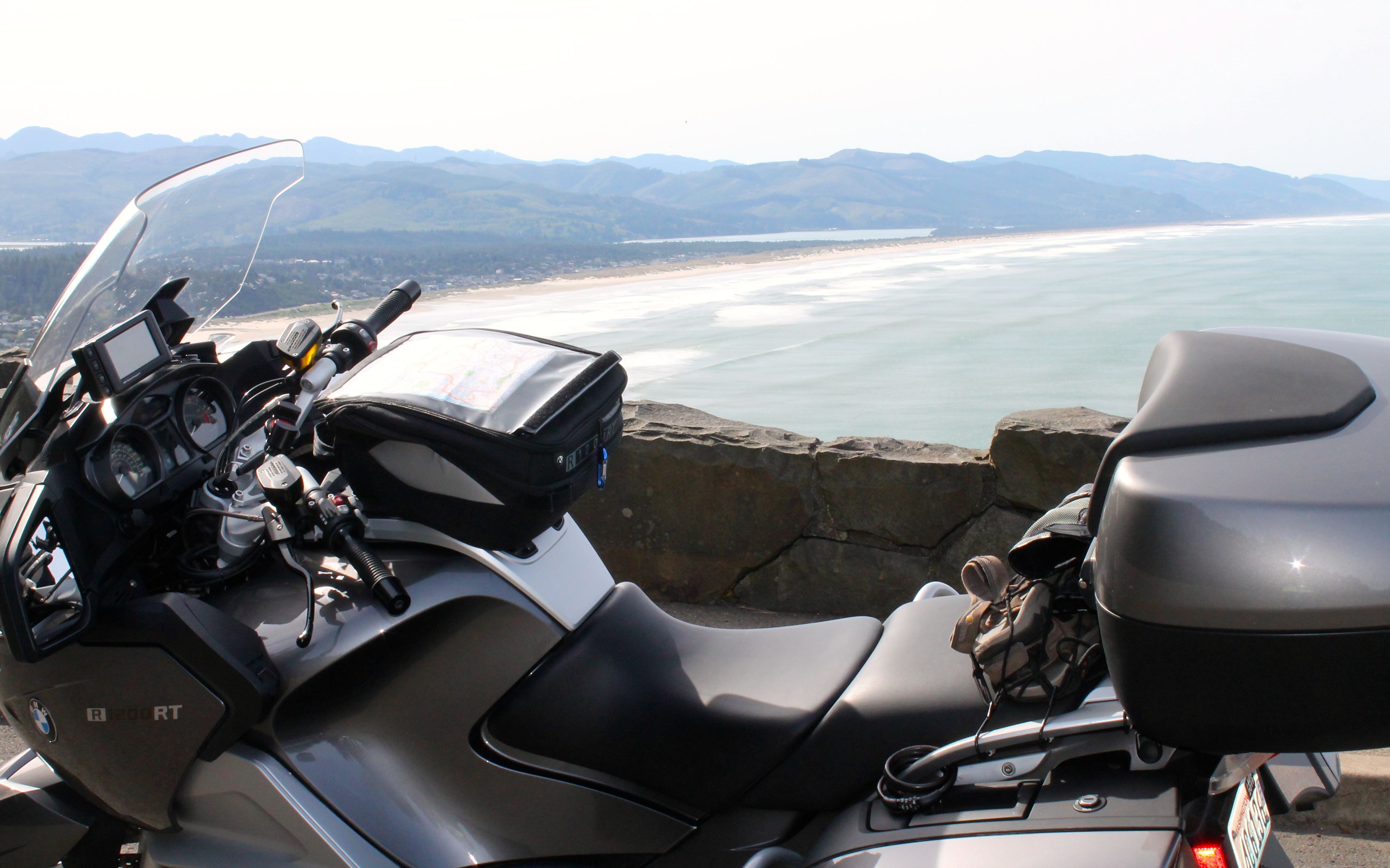
Many things today seemed familiar – memories of Day 3 and Day 4 of my 2014 Western States Tour – places I stopped to take pictures or a place I stopped to get lunch. Canon Beach, the Yaquina Head Lighthouse and the Sea Lions Cave are examples.
I love that I spent so much time on that trip stopping and taking photos. That was, after all, the first week of my first big adventure. I was quite excited and full of energy.
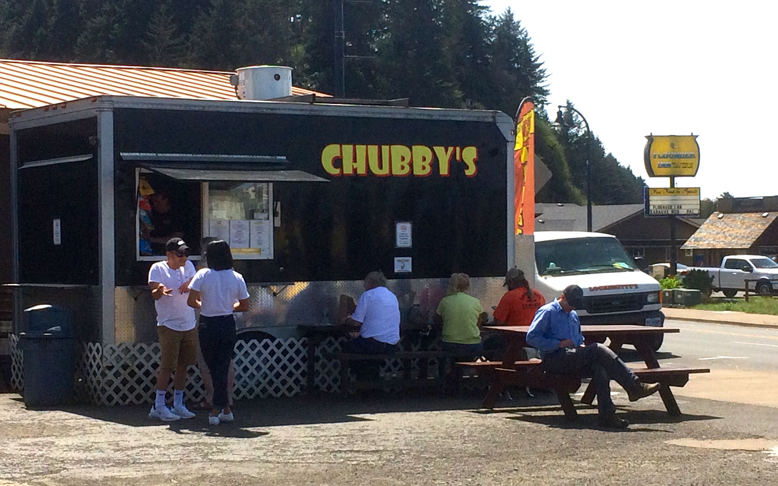
Stopping at the Chubby’s food truck in Waldport for a burger, several folks asked me about my trip.
I arrived in Coos Bay just about 4pm. While checking in at the Edgewater, I was informed my reservation was for the prior night (OMG?). Apparently I used the wrong dates and hadn’t noticed in the confirmation email. They were very cool and called on my behalf and was able to get a room using that (already charged for) reservation. Whew! .
The mixup got me checking my other reservations when I got settled. I found another gap – no confirmation of my reservation for tomorrow. I called and was able to book a room directly – my earlier attempt through Priceline was not successful.
With that stuff addressed, I got cleaned up and walked to Little Italy, a recommended restaurant in the downtown area. The food was very good. Since I had a burger for lunch, I only had room for a salad and a bowl of minestrone soup, which was especially yummy. Oh, and the Tiramisu. Yum! Thanks for the recommendation, Mark.
On the way back, I walked along the Boardwalk. It was getting dark and still windy, so I hustled back to my room.
Last note for the night – it seems hotel internet service is so superior to just a few years ago, at least so far. I like this trend.
Day 3
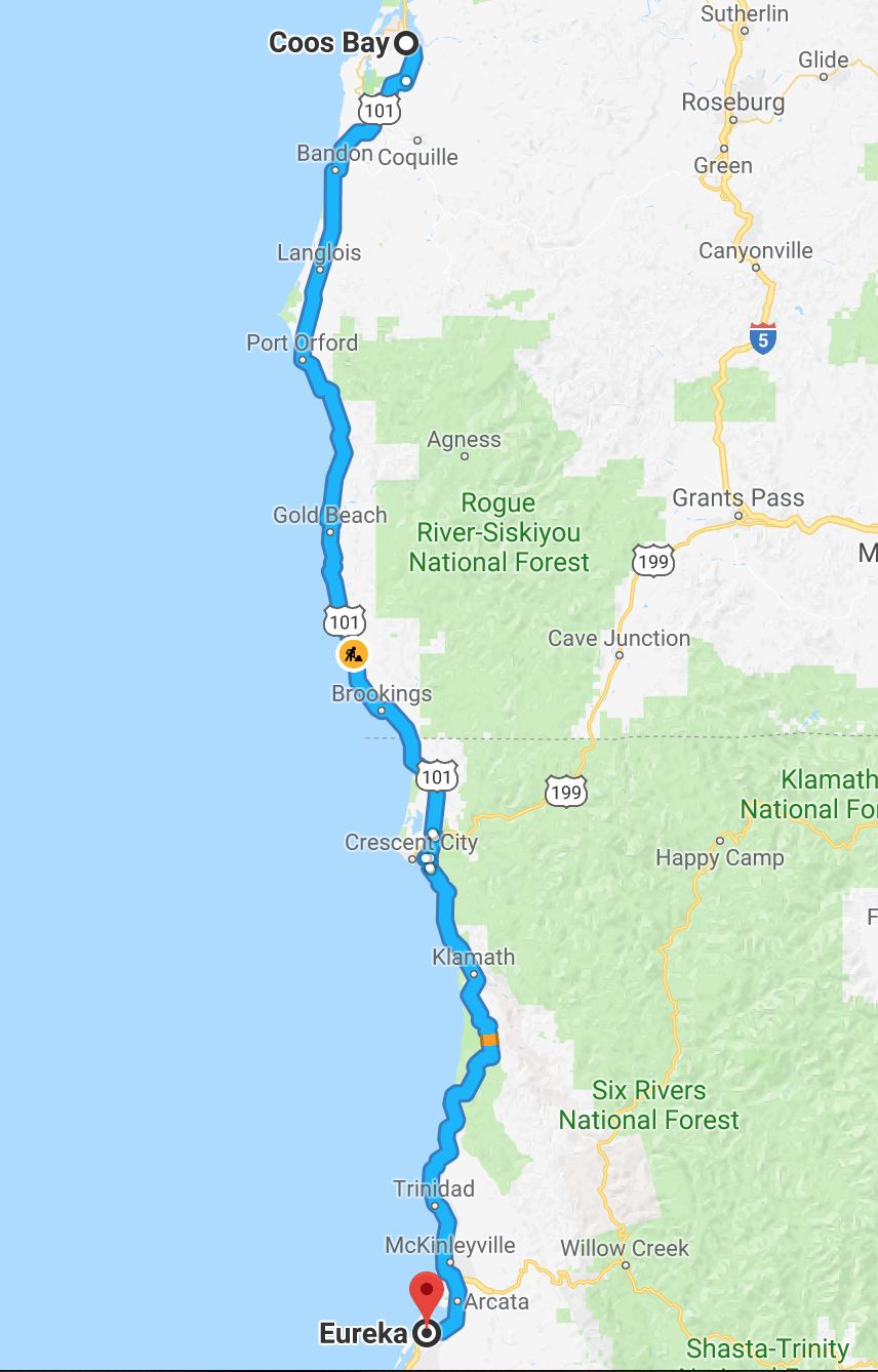
Day’s distance: 225 miles
Total trip distance: 641 miles
Typical coastal cool weather was back today. It stayed in the low 50s all day and felt downright cold after the first couple of warm days. I used the heated grips and heated seat the entire day to stave off certain hypothermia 🙂
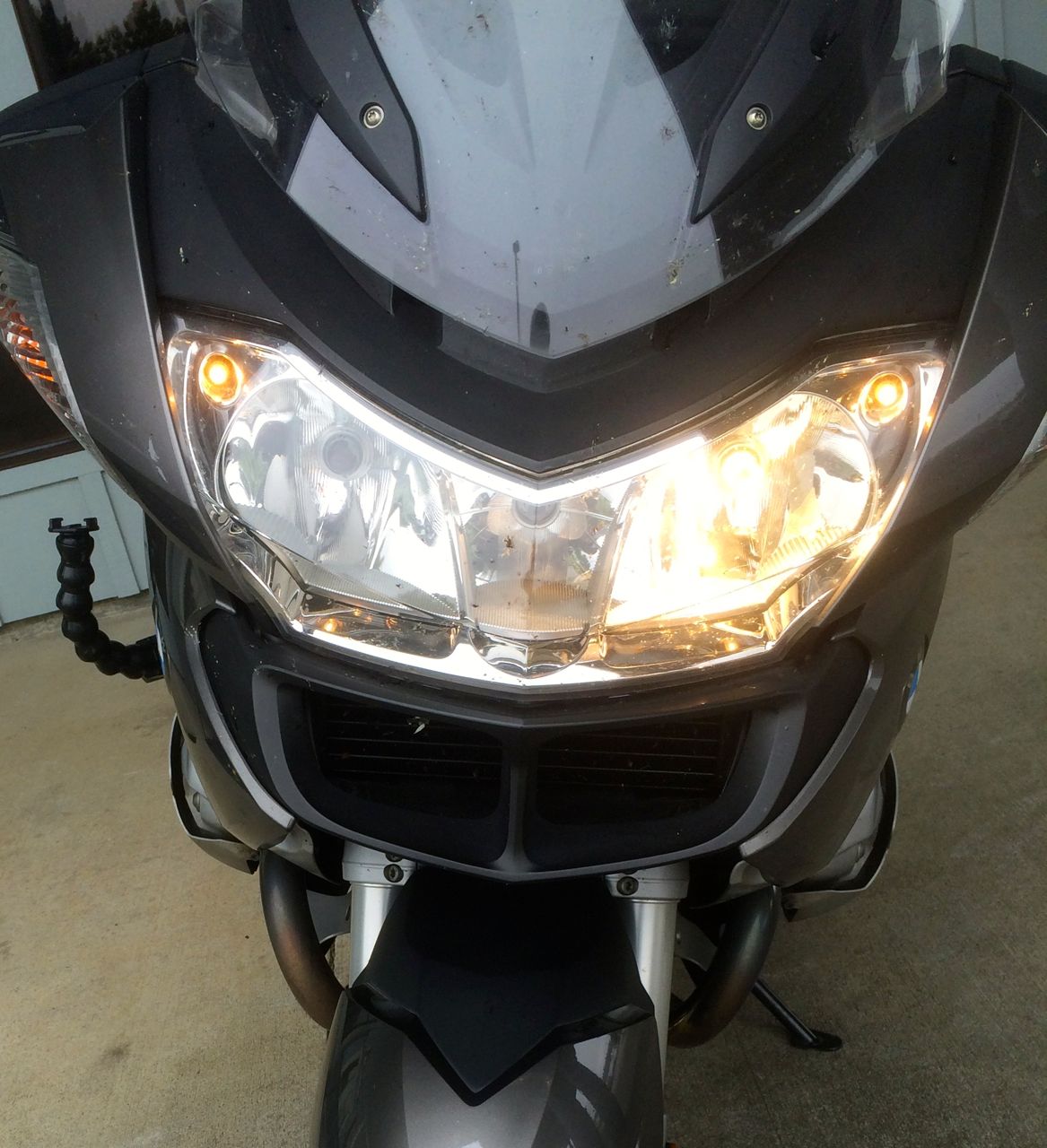
I noticed in my pre-ride inspection that one of my headlights was burned out. It seems that headlight bulbs have a somewhat limited lifetime on this bike and I carry two spare bulbs for just that reason.
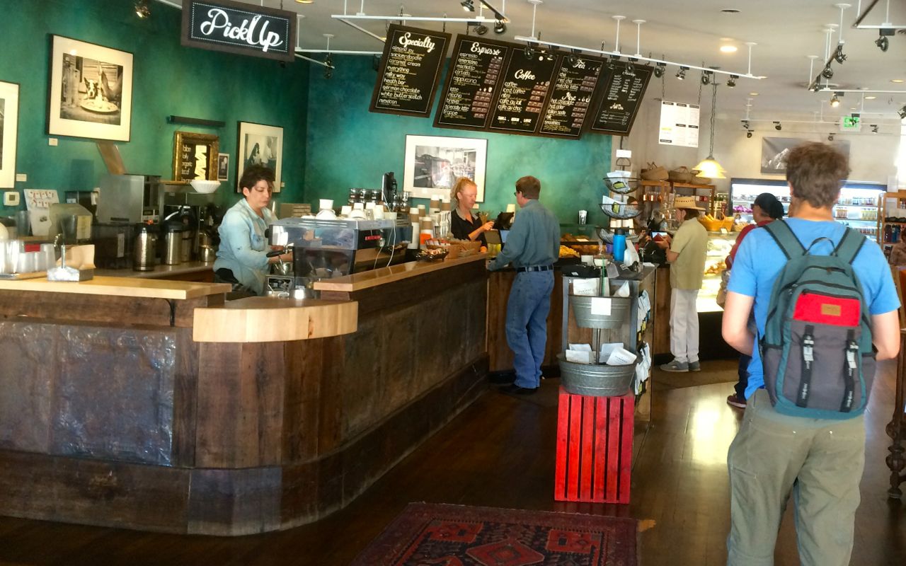
Departing a little before 10am, I stopped in Bandon, the next big town south of Coos Bay for a latte and snack.
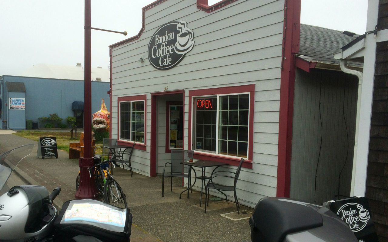
I sat outside and enjoyed a really tasty carrot cake muffin with my latte. I would definitely recommend the Bandon Coffee Cafe, if you’re in the area.
There are more bicycle travelers along the route than I expected for this time of year. I saw a bicycle with a small trailer leaning on the utility pole in front of the cafe. When I stopped later to take a photo of the bike at coast …
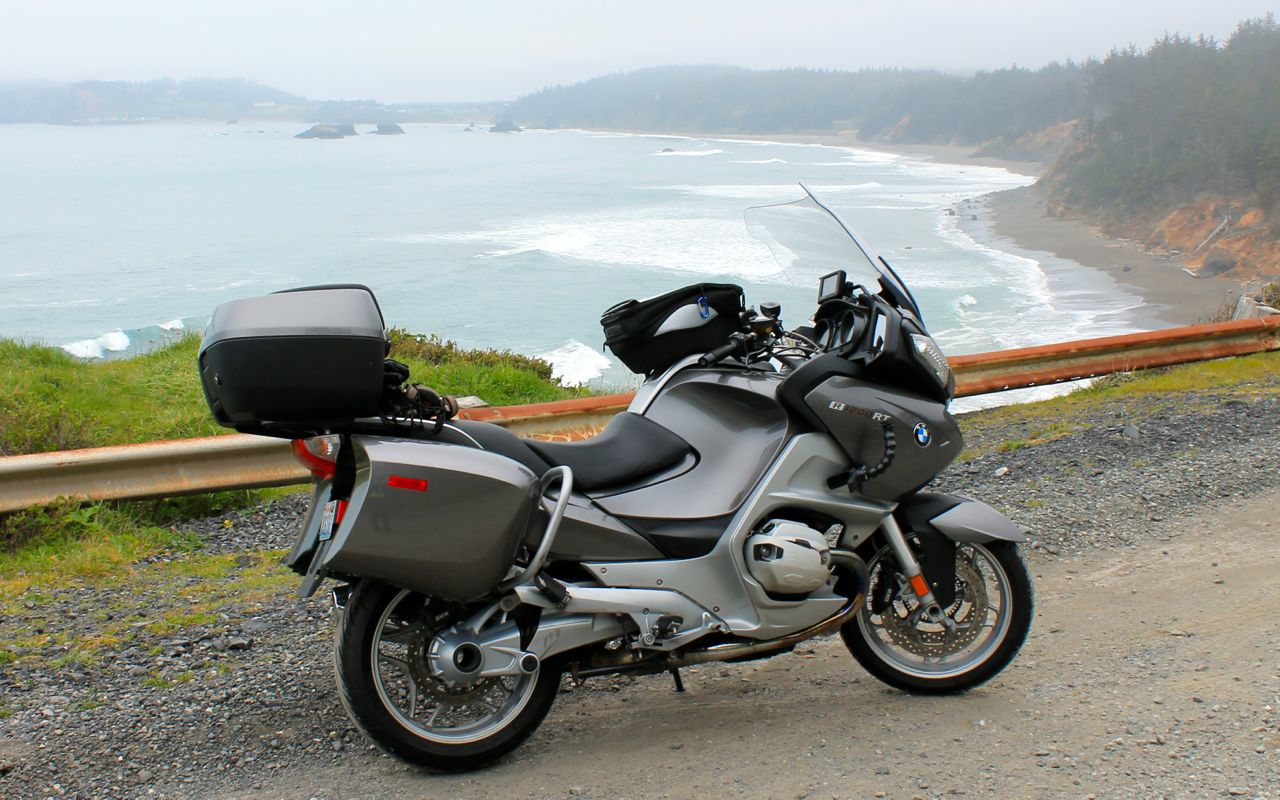
when another bicycle traveler pulled up to say hello. Jeffrey hails from Detroit and was completing another section of the Pacific Coast Highway. I shared some of my experience riding a large section of the coast highway with a friend in college.
Jeffrey also belongs to a street-legal dirt bike club back in Michigan and we talked about KTMs and riding sand dunes, etc. until we each took off to continue our rides. Everyone seems to have a motorcycle story. 🙂
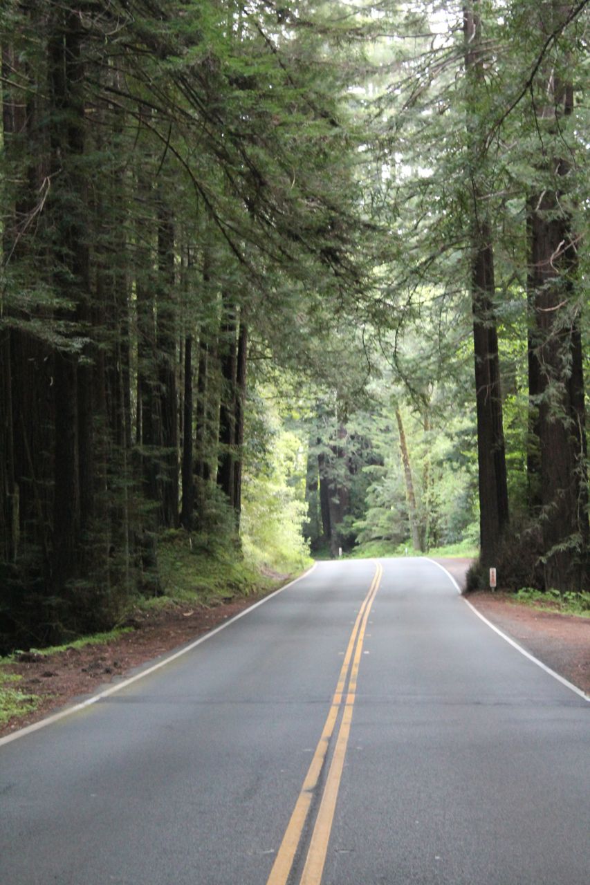
The low hanging overcast turned to heavy fog in places. The moisture collects in the redwood trees and then drips down onto the road surface. Something a car driver might never notice made me smile when I felt the drops hit my helmet.
There was a lot of highway construction projects underway. Google maps showed one construction site but there were many others. Luckily, traffic was light and the delays minimal.
I grabbed lunch in Brookings and struck up a conversation with a guy who works in the IT field for UPS. We talked about Amazon, the Post Office, and package delivery issues addressed by UPS drivers.
I thought the funniest part of our conversation centered around the Amazon logo. Of course, he sees the logo all the time and thought it was meant to represent a smile. According to one media story, it is supposed to be a smile.
That yellow arrow is more than just a decorative swoosh. The Amazon logo was created to represent the message that it sells everything from A to Z (the arrow connects the two letters) and also represents the smile that customers would experience by shopping on the Amazon.com Web site (the arrow becomes a smile).
I always thought the symbol was more phallic shaped and told the UPS guy that issue came up in an all-hands meeting back in the early days of its use at Amazon. He laughed and says, “Now that you mention it, you’re right!”
I don’t think he’ll ever look at that logo in the same way again.
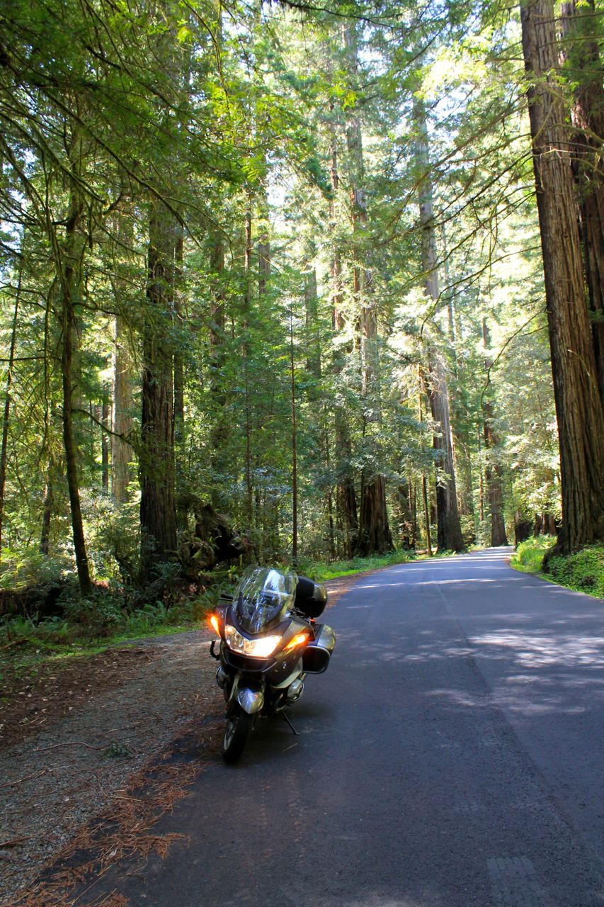
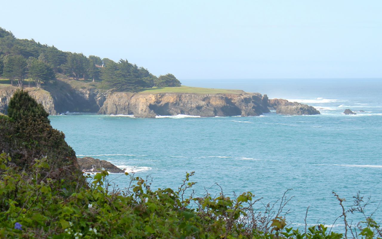
The ride across the state line and into Eureka was uneventful. There are some twisty sections of Hwy 101, but they are generally short. The scenery is spectacular and the redwood forests smell great. There was a small group of elk along the highway at one point.
One flagger I spoke to at one of the construction sites didn’t ride 101 much anymore, saying it was too beat up. I still enjoy it to the alternatives and want to thank all the construction crews for their effort at keeping this cliff-hugging coastal highway under repair after the heavy rains they experienced this last year.
I had dinner at Bless My Soul Cafe. This is a Cajun restaurant I ate at back in 2014. The highlight was the Voodoo Pudding. Very tasty chocolate pudding made from a secret recipe. 🙂 Sweet Mama Janisse, the owner, was telling me of their struggle to keep the restaurant open in the changing economics of this small town. Fingers crossed she is successful.
Tomorrow I’m looking forward to visiting the Lost Coast on my way to Fort Bragg.
Day 4
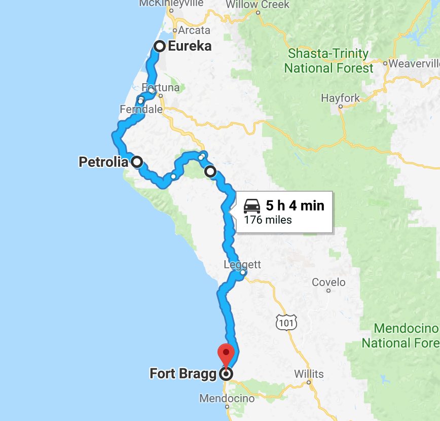
Day’s distance: 176 miles
Total trip distance: 817 miles
Temperatures varied from low to mid 50s along the coast and mid 60s more inland. Not as much overcast today and the winds felt lighter than yesterday. All in all, quite nice.
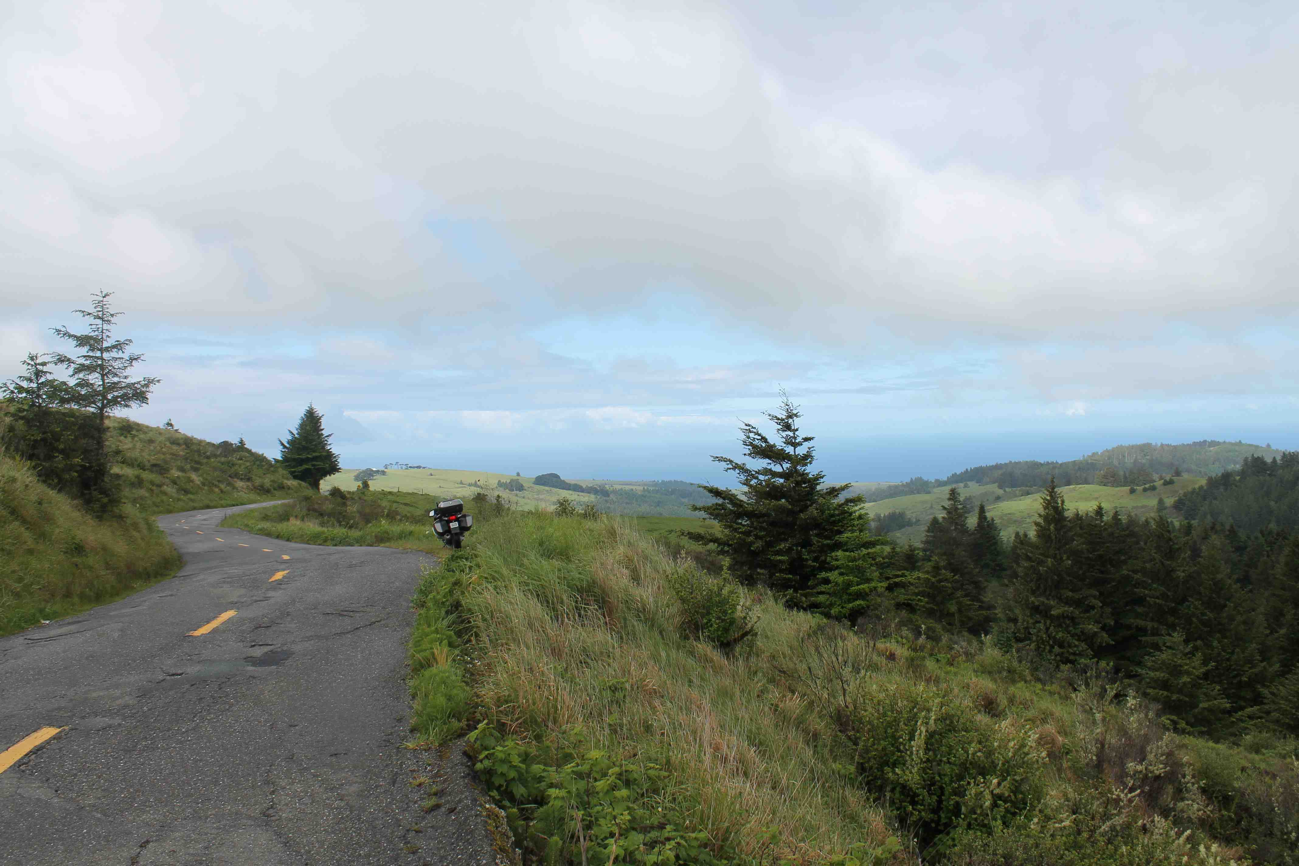
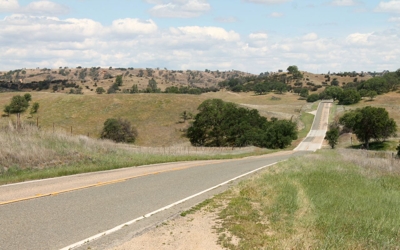
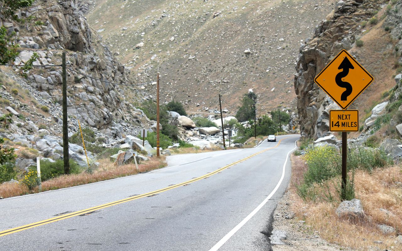
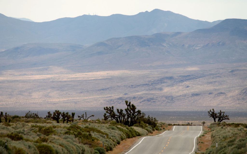
Today’s short ride included two challenging sections. First was the Lost Coast via Mattole Road. This detour off Hwy 101 begins in Ferndale, a small town heavily influenced by Victorian buildings like the Victorian Inn.
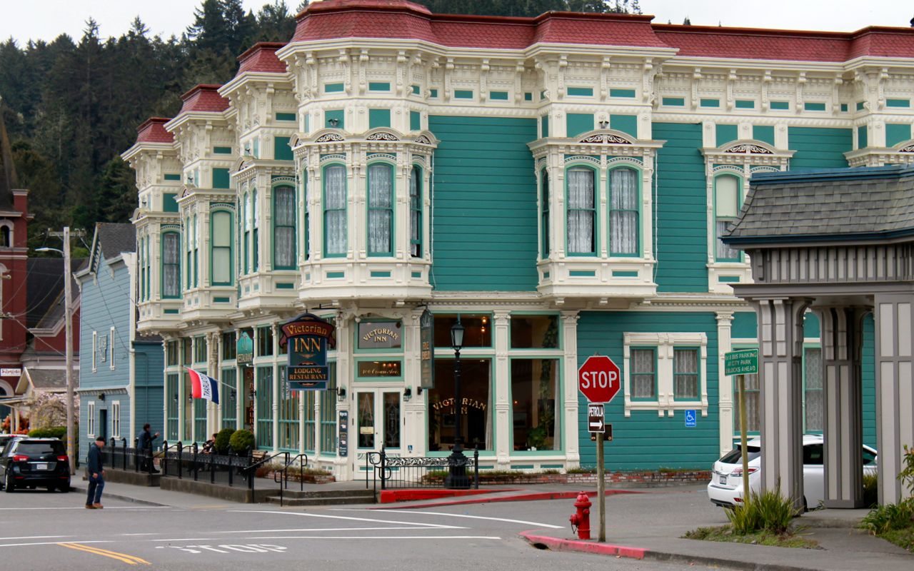
Mattole Road begins by climbing up a narrow two-lane (mostly) road out of town.
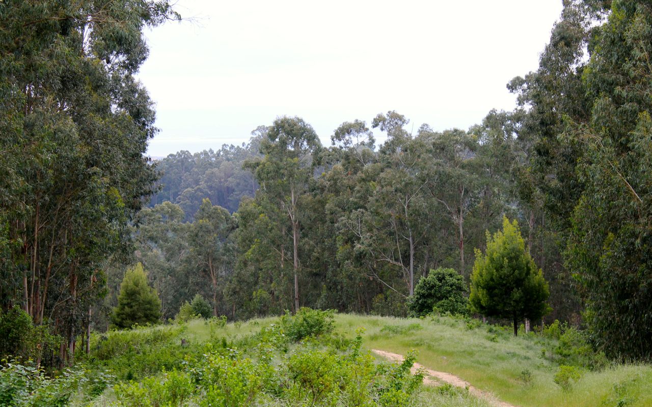
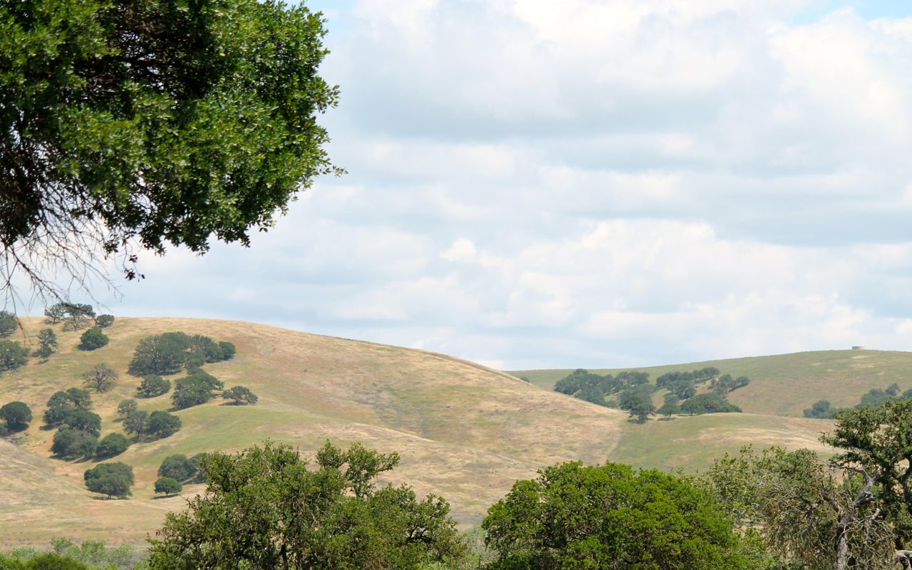
The Lost Coast is a mostly undeveloped area that almost immediately begins to feel very remote.
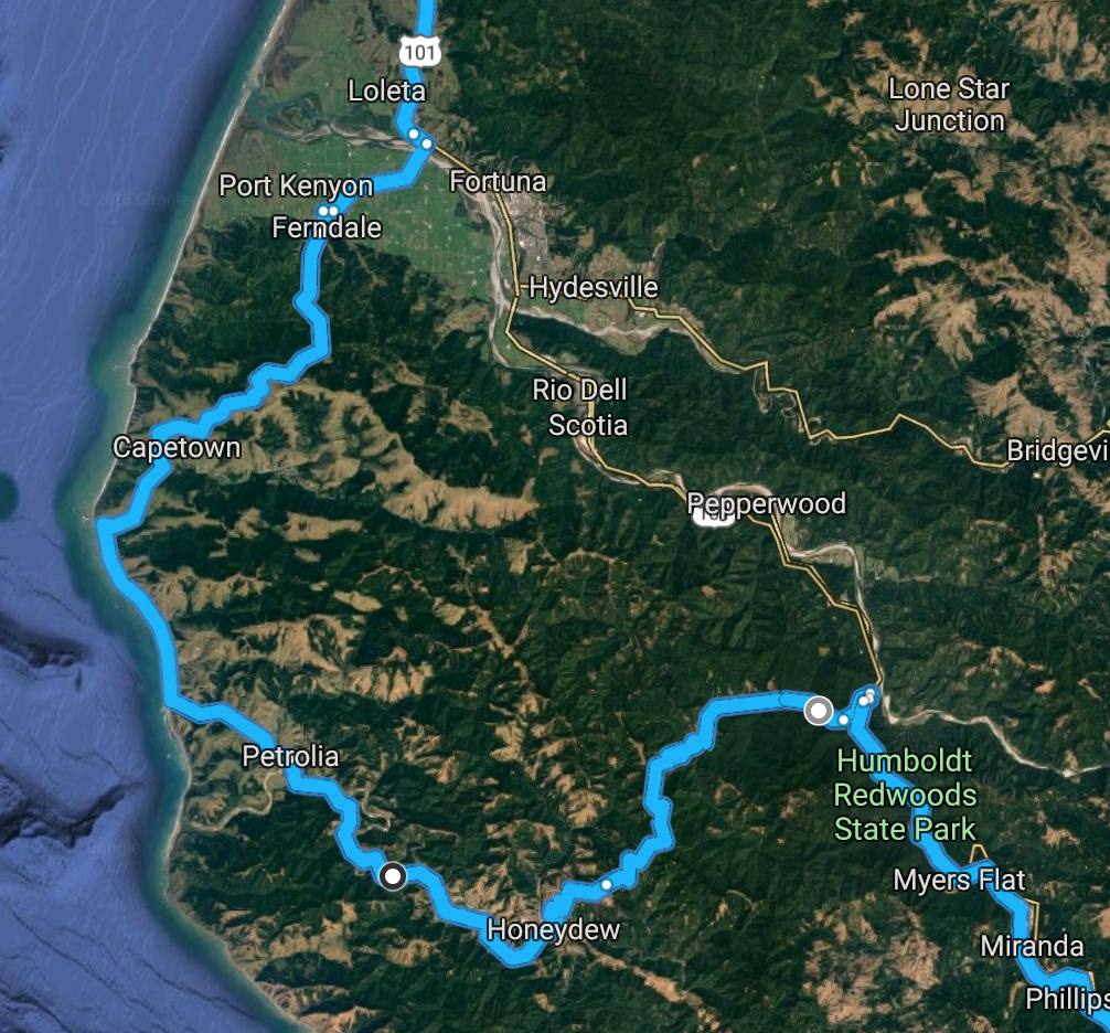
The road itself isn’t well maintained and seemed even worse this time than in 2014. I figure it is good practice for the road surfaces I’ll find on my trip to Alaska in June. The scenery can’t be faulted, even with overcast.
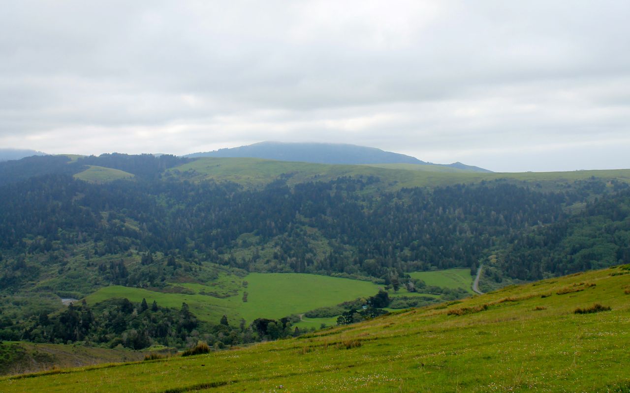
The Lost Coast includes the longest undeveloped stretch of beach in California.
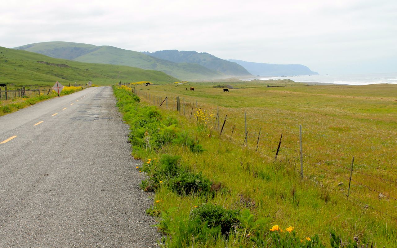
There is little doubt why this is considered one of the most beautiful roads in the country.
Wildlife sightings included a deer, two turkeys, hawks and eagles.
Traveling from Ferndale, you end up in the Humbolt State Park. The Redwoods smelled amazing!
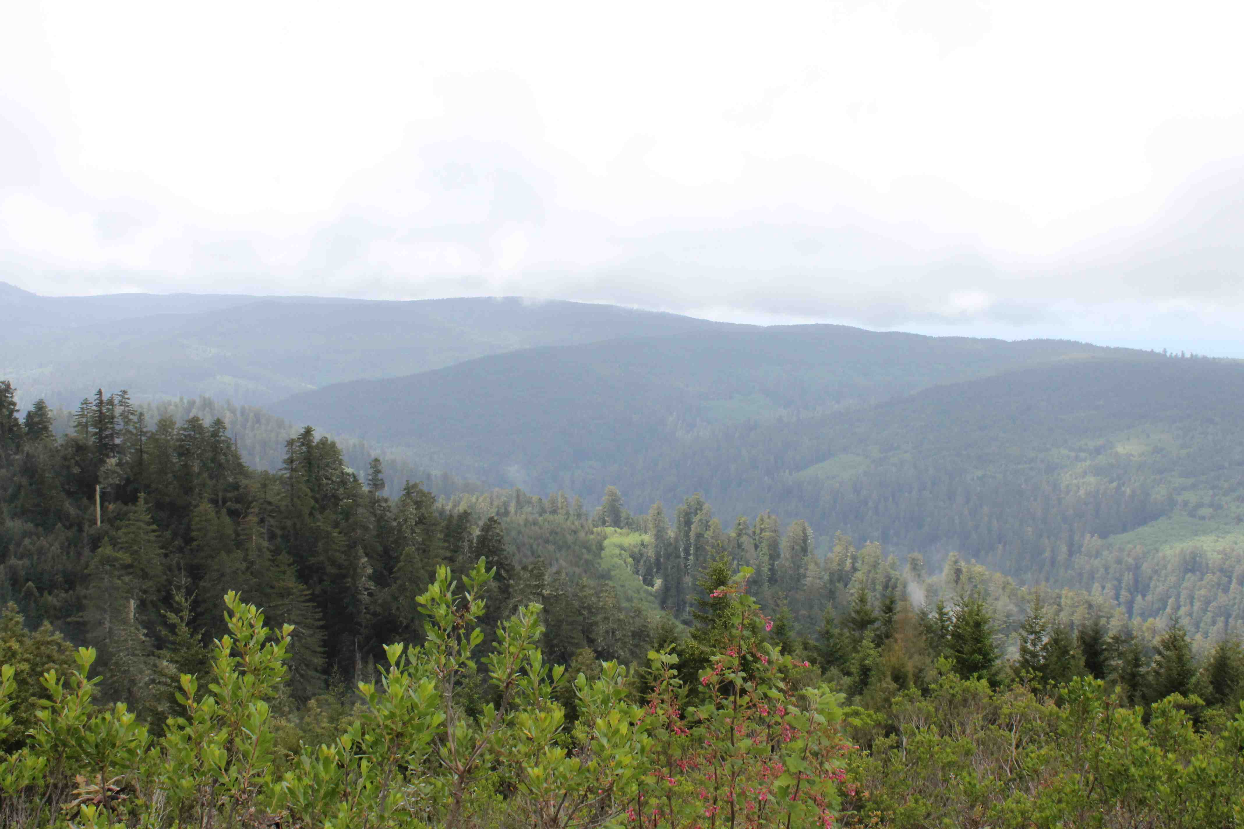
The second challenge was the northern end of Hwy 1, starting at Leggett and continuing to the coast. This is one of my favorite roads and I’ve traveled it now three times. Two lanes, generally a very good surface, little traffic, generous speed limits (that I am not good enough to test).
While Mattole Road was twisty and technical, the condition of the road surface didn’t allow for one to get a flow going. Hwy 1 from Leggett is also twisty and technical and the road surface is in good shape, allowing one to find a nice groove.
After checking in to my motel and showering, I grabbed dinner at Cucina Verona, my habitual eating establishment here in Fort Bragg. The rib eye steak was, again, very good.
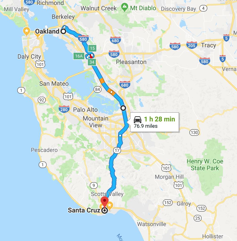
I’ll land in the Bay Area tomorrow, staying with one of my best friends in Oakland. I’ll then head to Santa Cruz on Saturday to visit both friends and former housemates.
Below are a few photos from my 2014 visit to the Lost Coast on Day 6 of the first Western States Tour.


Day 5
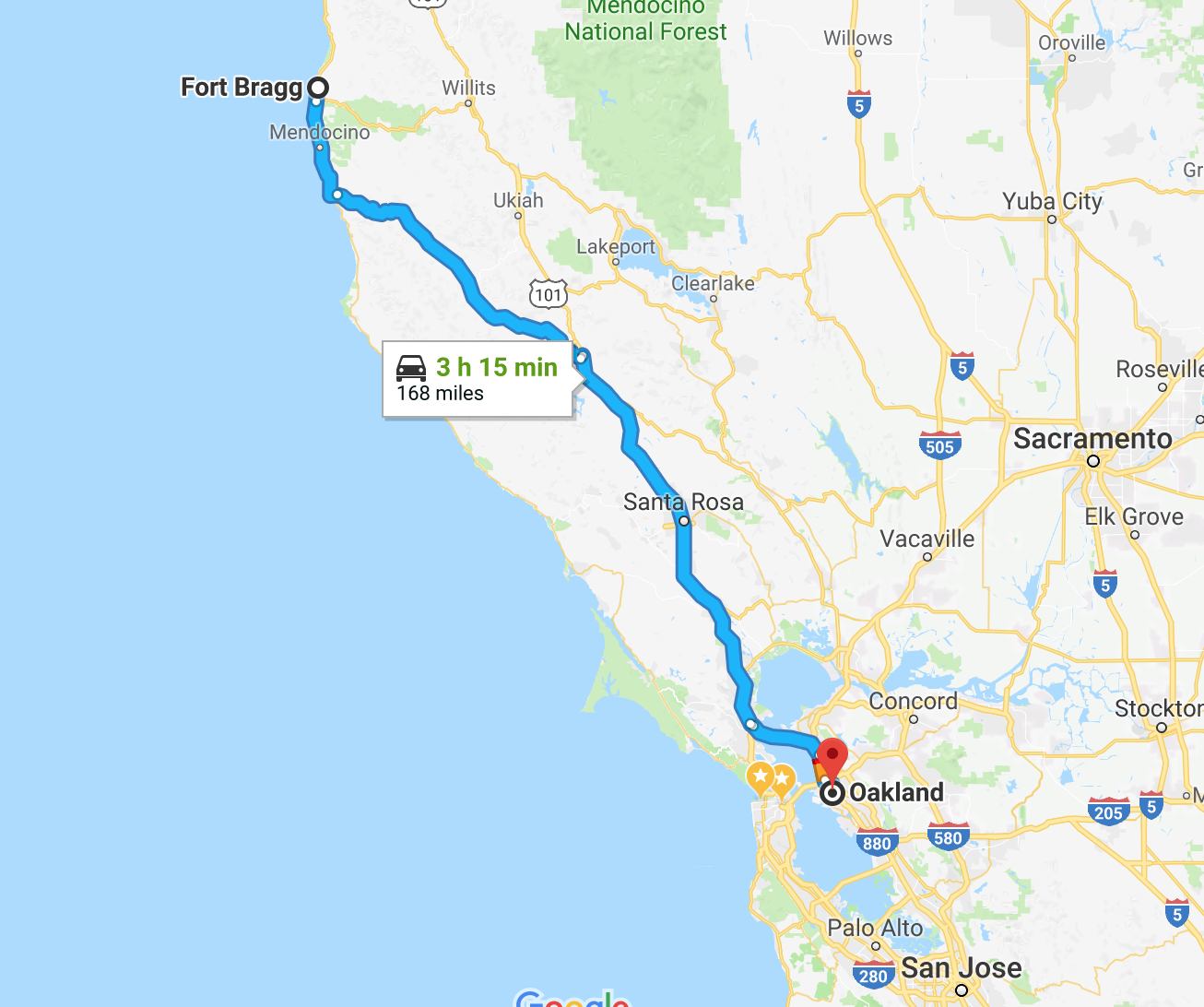
Day’s distance: 168 miles
Total trip distance: 985 miles
Temperatures ranged from high 50s to mid 60s. Overcast skies and increased cloud cover inland actually caused the temperature to drop as I traveled away from the coast today.
Today’s route took me south along Hwy 1 briefly before turning inland.
I needed to arrive at my destination before 3pm today. Instead of staying on Hwy 1 all the way to the Bay Area, I chose to ride Hwy 128 from the coast just south of Mendocino over to Cloverdale.
I have ridden this section of Hwy 128 before, first towards the coast during my 2014 Western States Tour and then away from the coast during my Southern States Tour the following year. The road has a nearly perfect surface and light traffic.
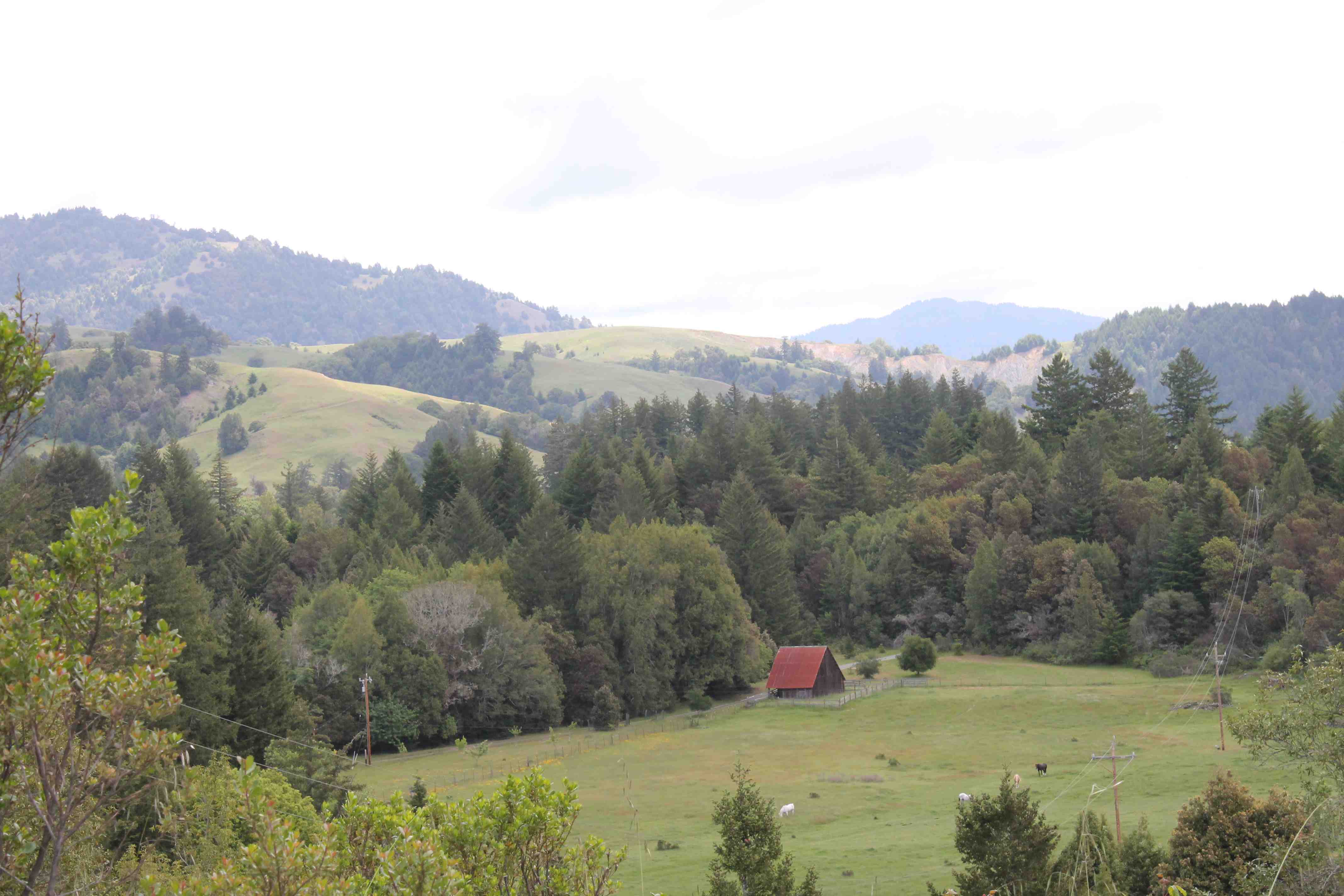
Near the coast, Hwy 128 travels through the Navarro River Redwoods State Park.
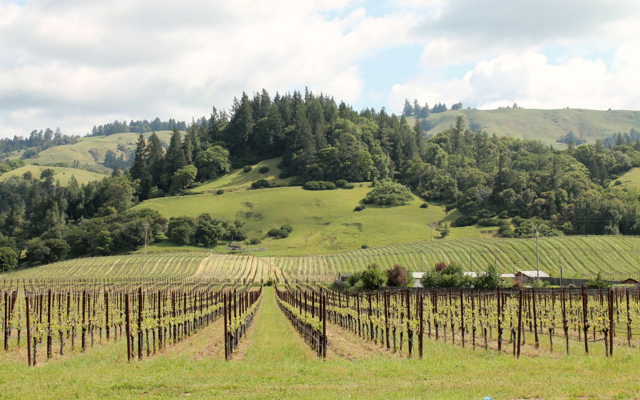
Further inland, the landscape opens as you pass by wineries and ranch lands.
I stopped (again) in Booneville at the Mosswood Cafe and Market for a latte. A small group of bikers were out on a day ride and I spoke with them briefly before they took off for the coast. A short time later, as I approached Cloverdale where Hwy 101 intersects with Hwy 128, I stopped for lunch at the Hamburger Ranch and BBQ. I have been here before as well. Today seemed in some ways like it was a tour of my favorite Northern California food stops. I loved it and am not complaining at all.
The remainder of the ride was along fast moving freeways. Traveling through this section during the middle of the day allowed me to avoid most of the commuter traffic and I arrived within the 30 minute window I provided my host and long time friend, Craig, who had to return to work for the remainder of the day.
In the evening, Craig and I went out to one of the neighborhoods along Lake Merritt, a large tidal lagoon in the center of Oakland. The area was vibrant with a lot of restaurant choices and we ended up eating Thai food.
Another great day all in all for this charmed traveler.
Day 6
Today was a day off the bike. After a leisurely breakfast, Craig and I drove to the nearby Anthony Chabot Regional Park, located in the foothills east of Oakland.

We hiked for about two hours. It was reasonably warm but overcast.


After the hike, we spent some time hanging out and hot tubbing at Craig’s place before ordering a pizza and watching a movie.
Tomorrow is a short ride to Santa Cruz to hang out with friends and former housemates. Readers may remember that I moved to Seattle from Santa Cruz. Monday I will head east towards Death Valley.
Day 7
Day’s distance: 80 miles (odometer)
Total trip distance: 1,065 miles
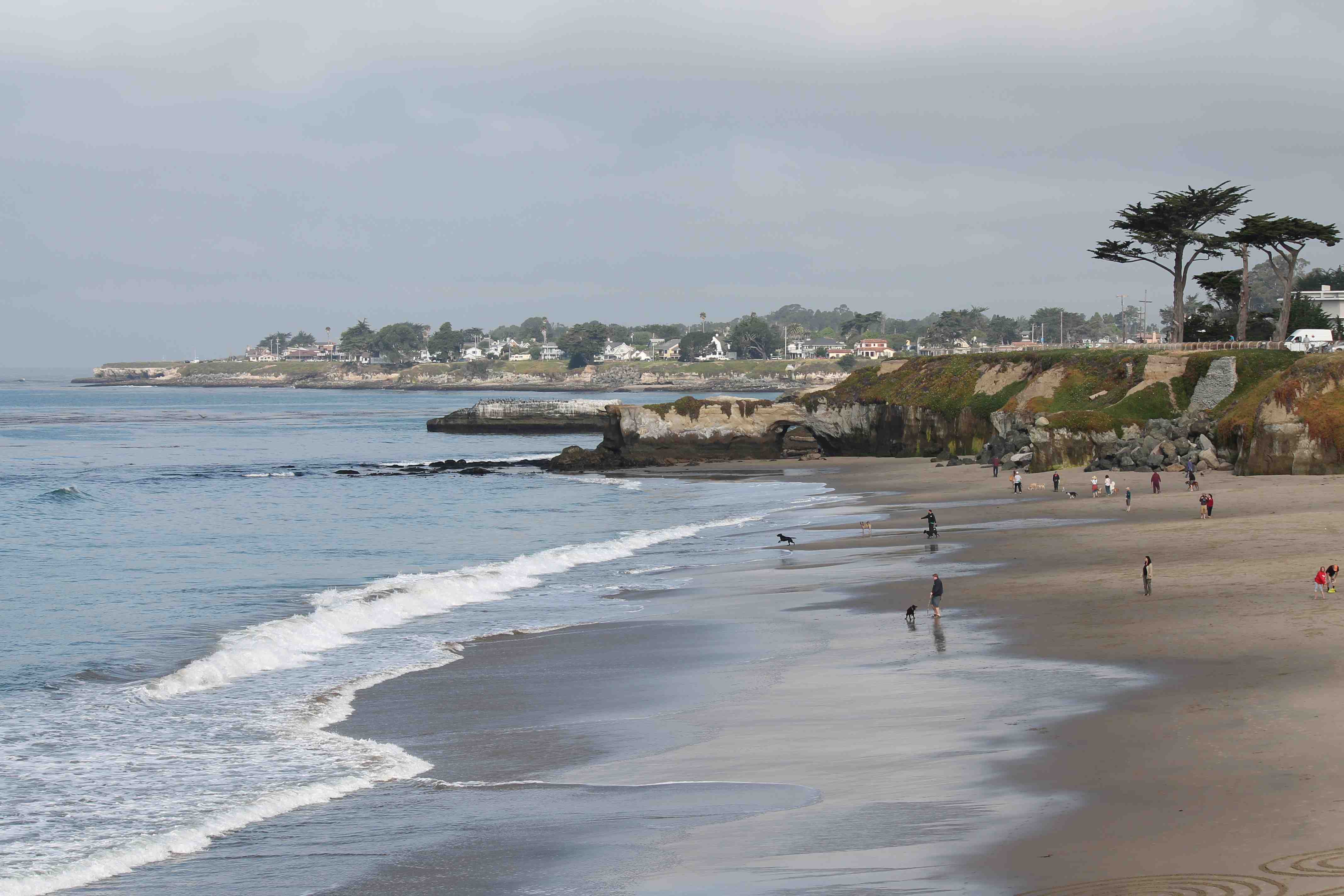
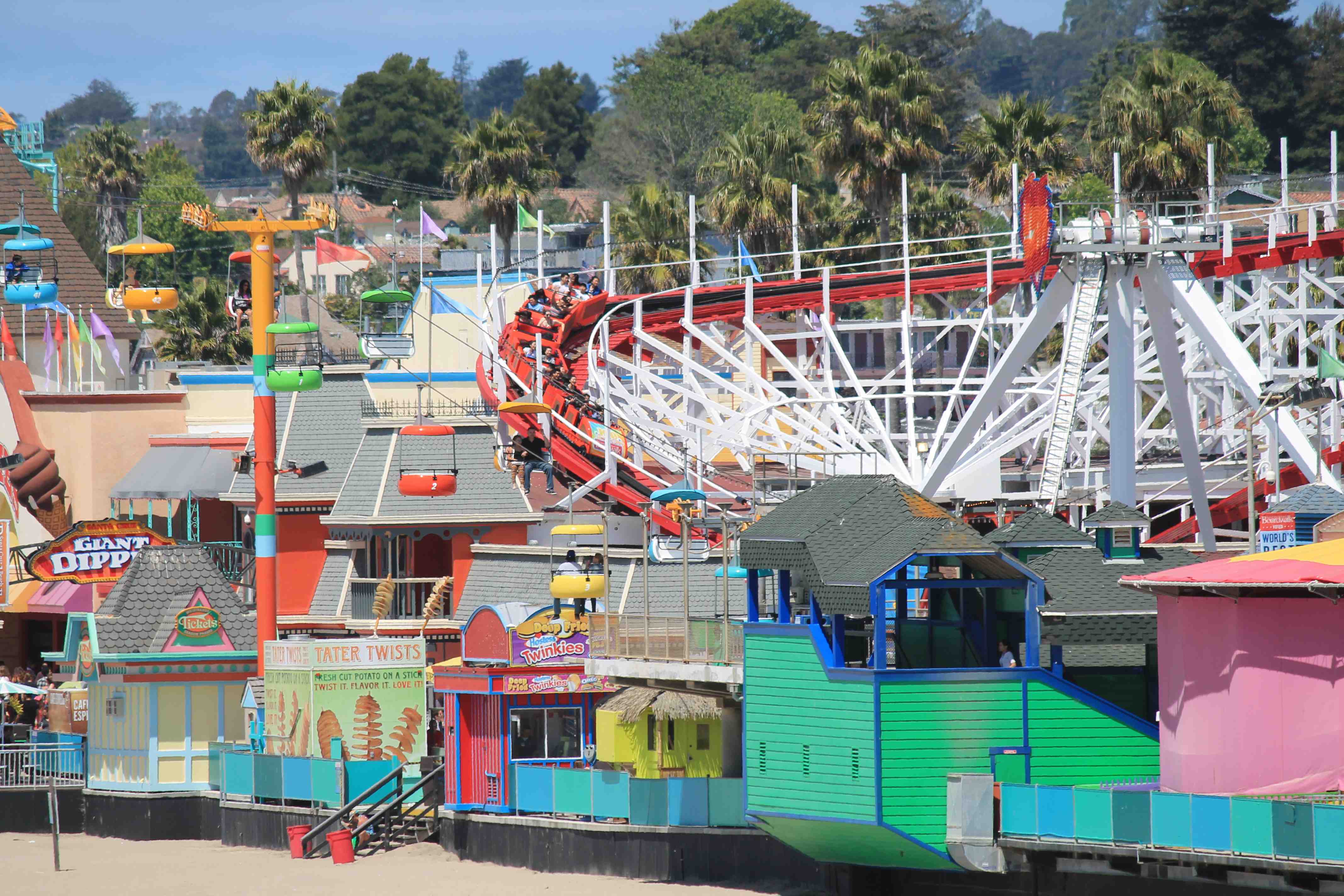
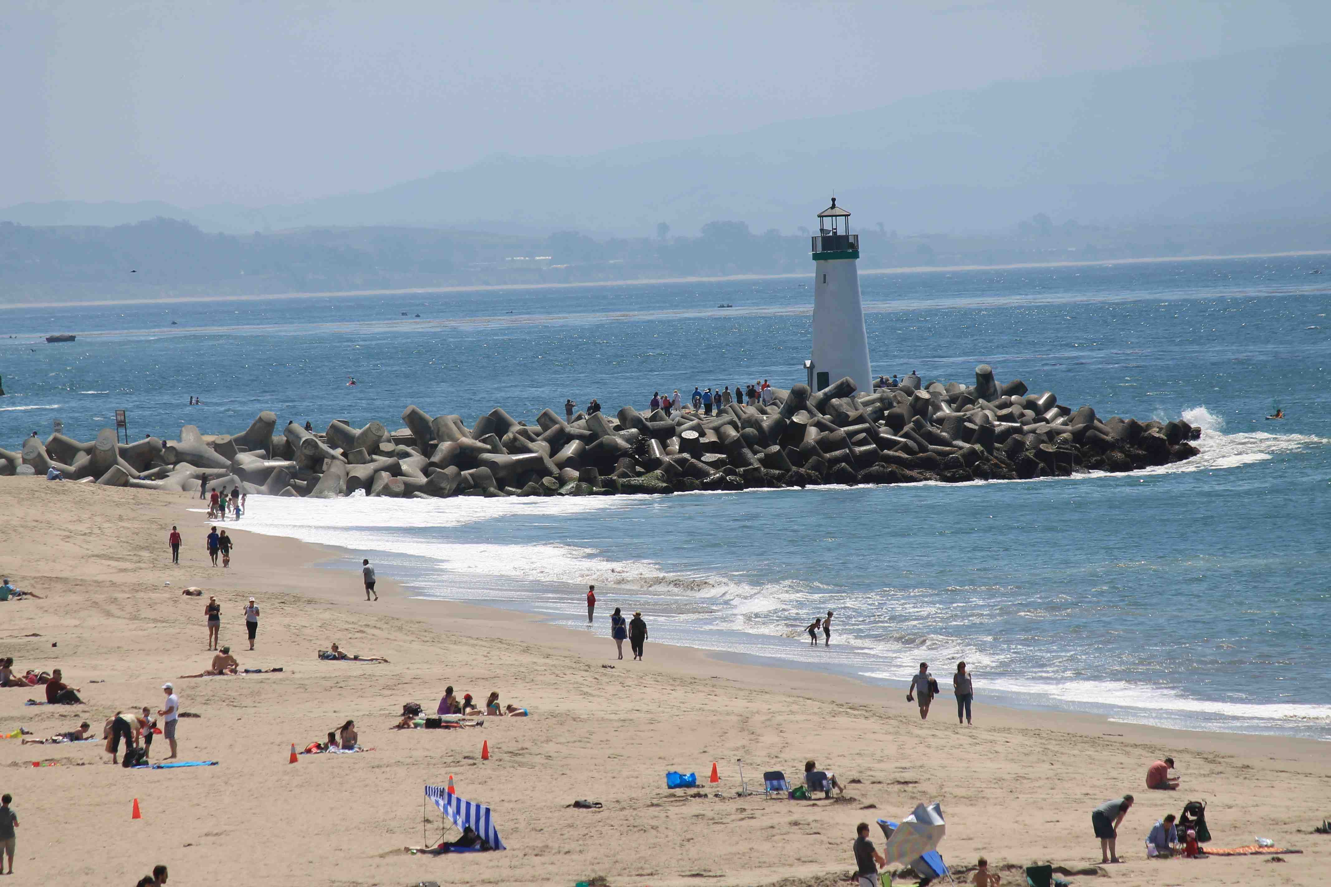
Today was a short ride to the coastal town of Santa Cruz where I lived off and on for a total of about six years before moving to Seattle for more fulfilling work opportunities. It was cool, in the 50s and cloudy through my ride but cleared up as I reached town.
West Cliff Drive, in Santa Cruz, follows the coastline from Natural Bridges to the Boardwalk area. It is one of my favorite walking paths.
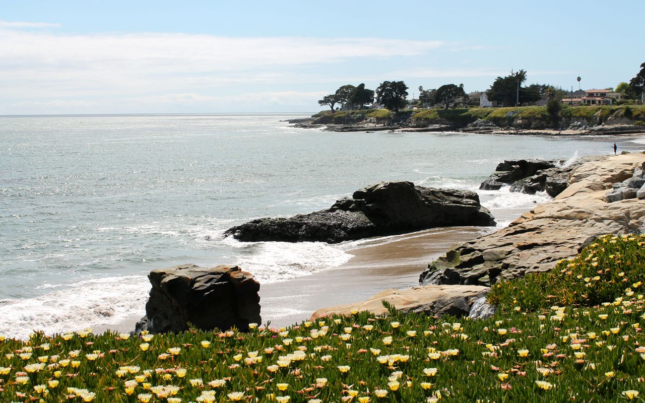
That particular photo was just a block from where I lived at one point. It was a beach I spent a lot of time on.
My former housemate Scott and I walked to the Sones Winery to visit the owner Michael, another former housemate.
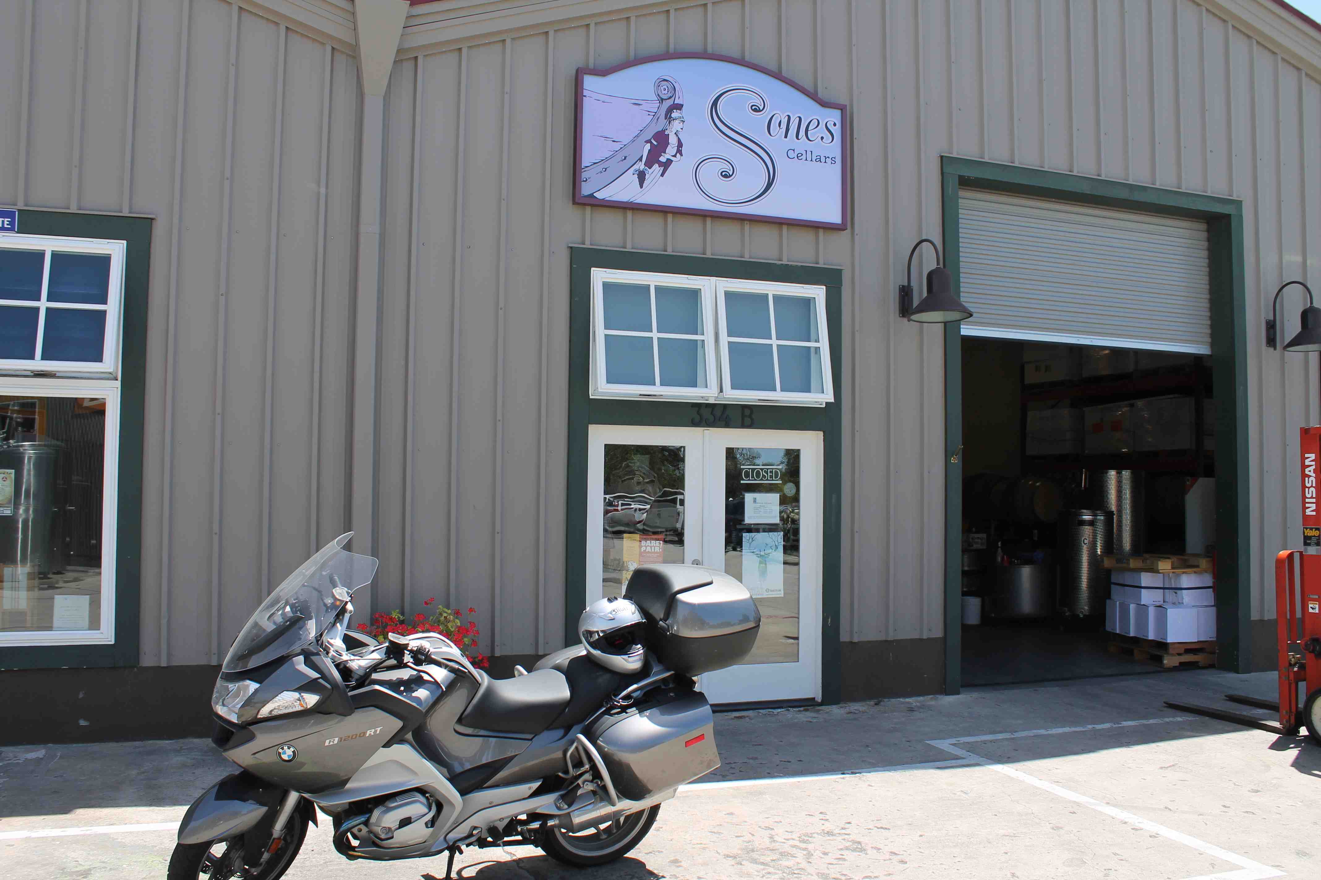
Observant readers will see my motorcycle in that picture. It was from a previous trip, but the winery is in the same place. LOL
We just missed Michael so we continued our walk to visit another former housemate/former mathematics professor of mine and his wife, Brad and Nancy.
Returning home we made a meal and enjoyed catching up. Finally about 9pm, another former housemate showed up. I know, a lot of former housemates but you have to realize I lived in shared housing situations all of my time in Santa Cruz.
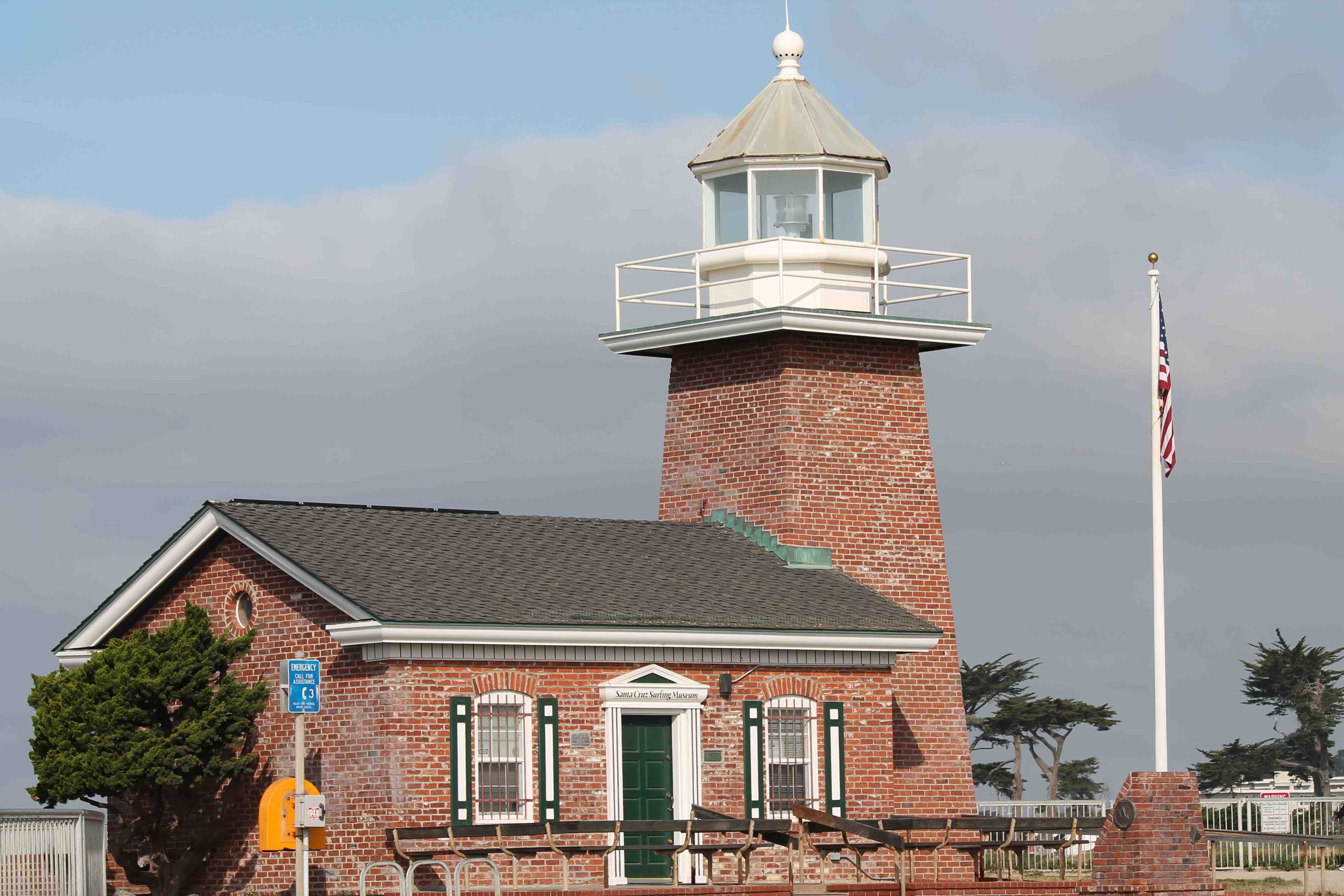
Some past photos of this area are posted below.
Monday I’ll head to Bakersfield to set up my ride through Death Valley on Tuesday.
Day 8
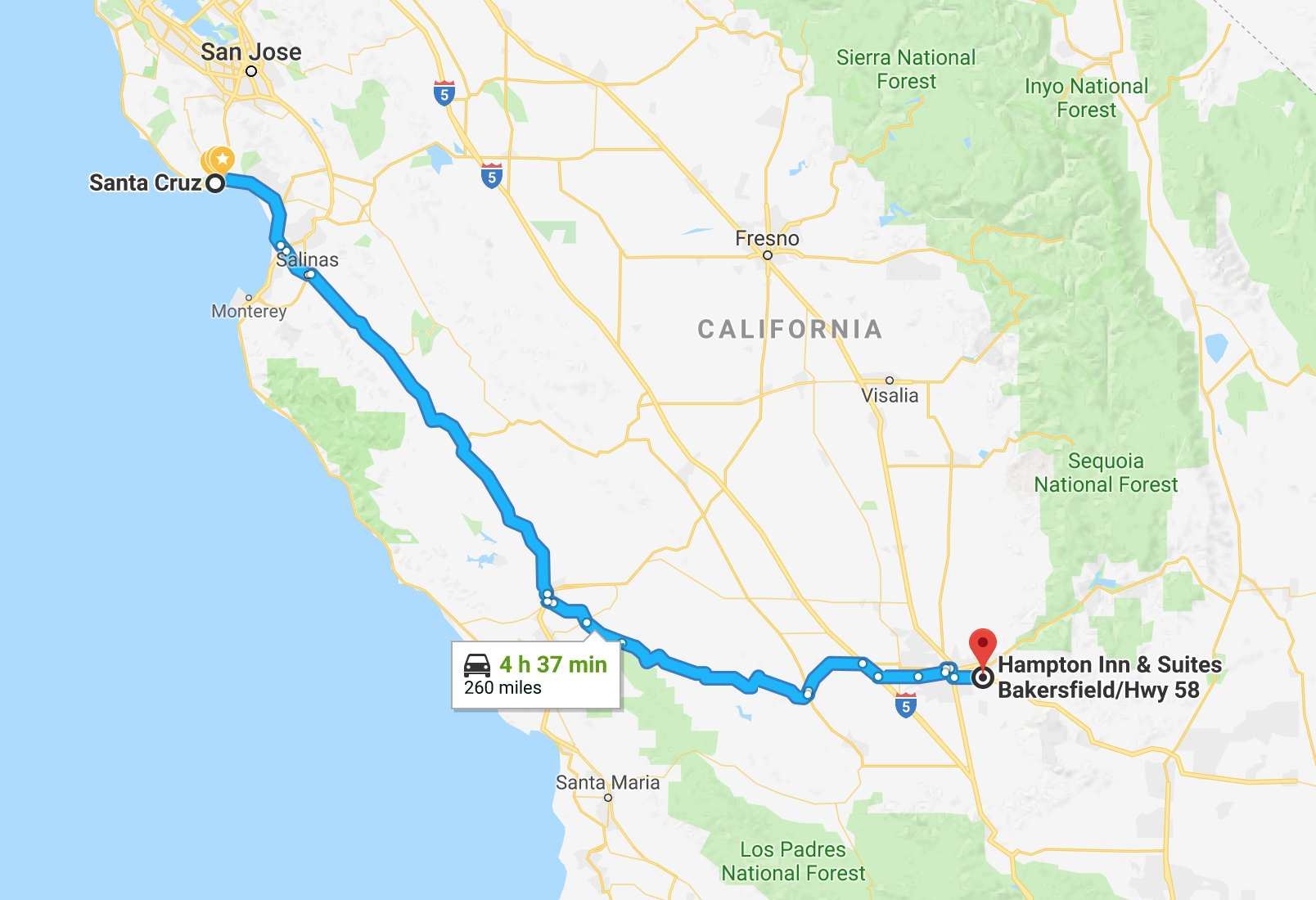
Day’s distance: 260 miles
Total trip distance: 1,325 miles
Temperatures varied up and down throughout the day, ranging from the upper 50s to mid 70s. Winds also varied from light to moderate.
Highway 1 remains blocked at Big Sur due to the very large Mud Creek landslide. As an aside, Caltrans is estimating a September reopening. Click here for an interesting video of the progress.
Instead, I traveled south on Hwy 101 along El Camino Real. Most of the highway is two lanes in both directions. It lies in a valley with foothills on both sides. The grasses on these foothills are beginning to take on its summer coloring (brown), sooner than those in Oakland.
On reaching Paso Robles, I turned east and made my way to Hwy 58, marked as interesting on my Butler motorcycle map. It parallels the shortest route to Bakersfield, Hwy 46, but carries much less traffic.
I traveled along Hwy 58 during my 2015 Southern States Tour, but turned south onto Hwy 33 at McKittrick rather than continuing to Bakersfield.
Traveling east, I first passed through small farms, vineyards and a few wineries. Soon the terrain changed to a drier, less vegetated semi-arid area. Horse and cattle ranches replaced the vineyards.

Hwy 58 consists of everything from gentle sweepers to 15mph hairpin turns to gentle whoops that are similar to a roller coaster.
I passed by the California solar ranch, a 250 megawatt photovoltaic power plant in the Carrizo Plain. I couldn’t get a good photo from the ground, so I’ll use this satellite image.
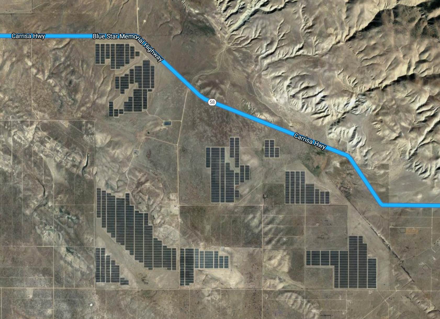
The most interesting part was the section just east of the solar ranch.
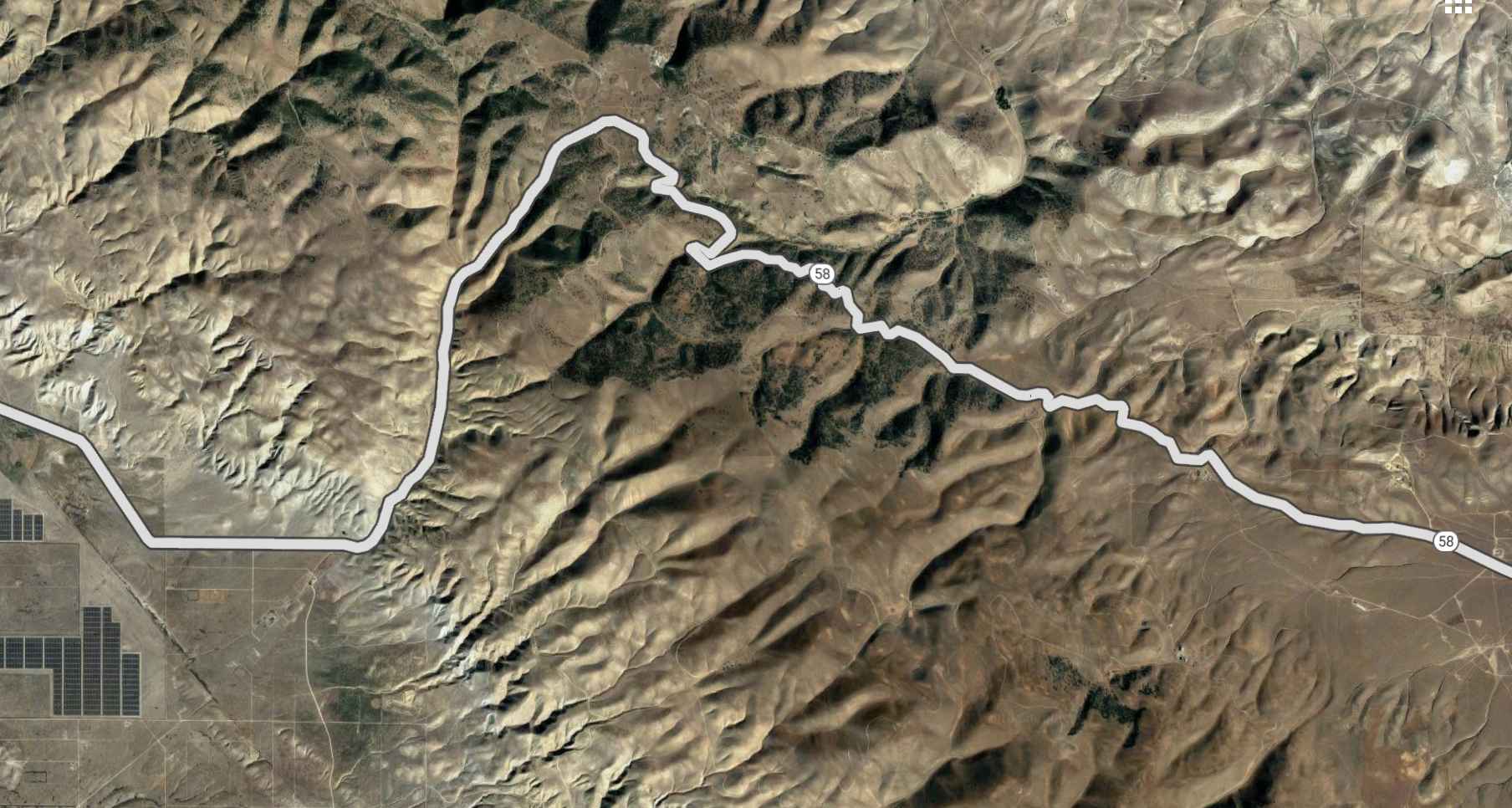
One reason I keep a blog of my travels is to remind myself of where I’ve been and what roads I’ve ridden. I didn’t initially remember riding this route before but the solar ranch seemed vaguely familiar. When I entered McKittrick, and crossed Hwy 33, I remembered the town’s name.
I can’t recommend traveling a long distance to ride Hwy 58 as the surface of the roadway is pretty rough in some parts and overall in need of a complete resurfacing.
On reaching Bakersfield, I got checked in to my hotel, cleaned up, and grabbed some dinner.
Tomorrow I will ride through Death Valley on my way to Las Vegas.
Day 9
Days distance: 398 miles
Total trip distance: 1,723 miles
The weather varied throughout the day. Temperatures started in the 50s, getting up to 79 in Death Valley when the sun broke through the clouds, and then as low as 41 briefly at the pass at Mountain Springs, just outside of Las Vegas before rising up again to the 50s.
It also rained off and on throughout the afternoon. Most were short-lived showers but in the evening, after leaving the park it rained more heavily and persisted for the rest of the ride, resulting in some flooded streets in Vegas.
Highway 178 from Bakersfield past Lake Isabelle was a fun road. Good surfaces and while there was a bit of traffic, most of it was oncoming and did not bother me in the least. The canyon road follows the Kern River.
Hwy 395 turns from one lane in each direction to two lanes each direction. It is actually considered a freeway for a while, surprisingly. Lake Isabella is one of the area attractions.
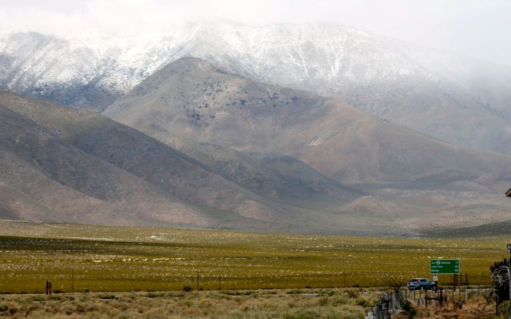
East of Hwy 178, I traveled north first on Hwy 14 and then Hwy 395, also known as the East Sierra Scenic Byway. It was colder here than expected. I think if the road was 1000 feet higher in elevation, it would have been snowing instead of showering.

Turning east onto Hwy 190, I started to get close to the park entrance.
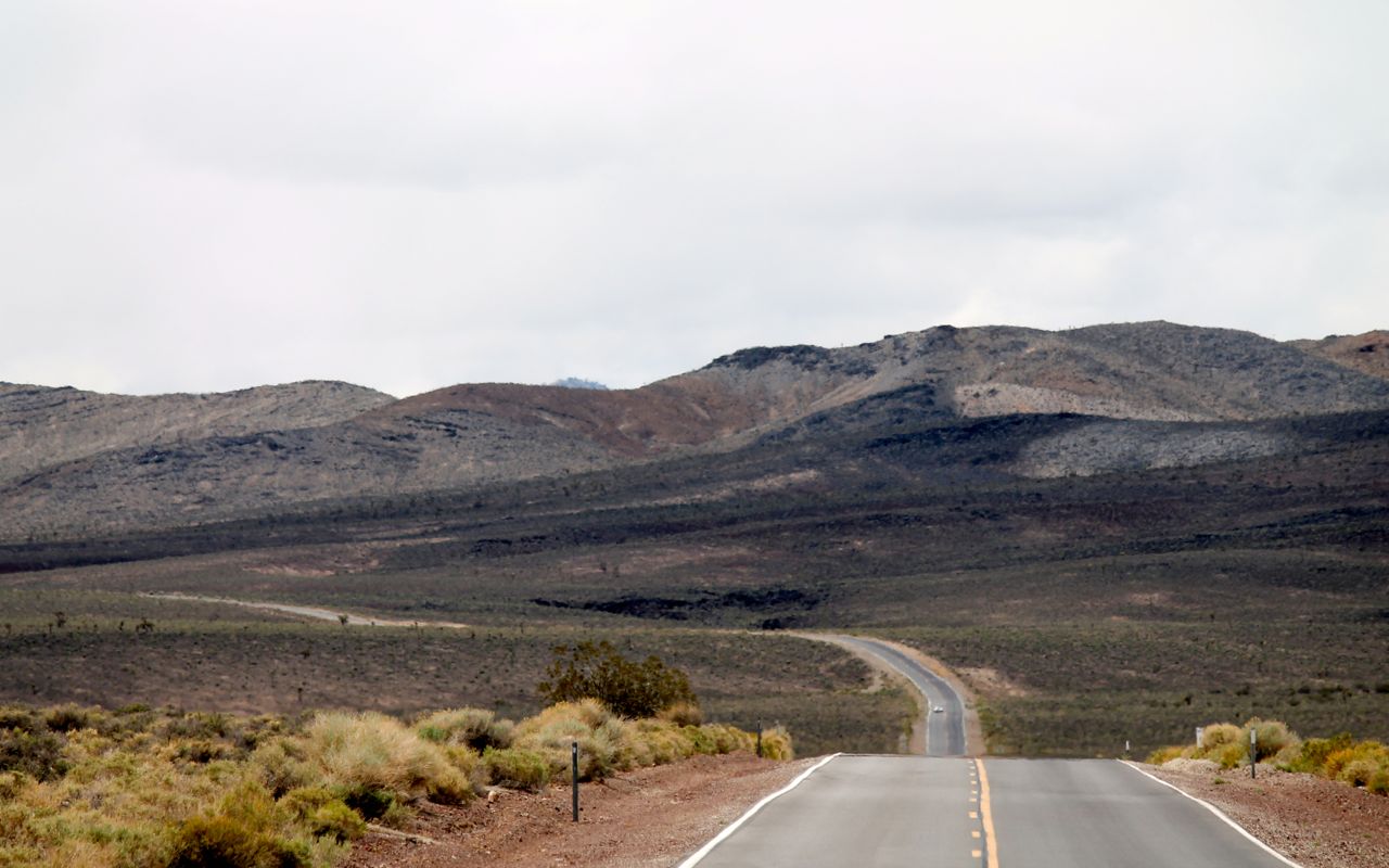
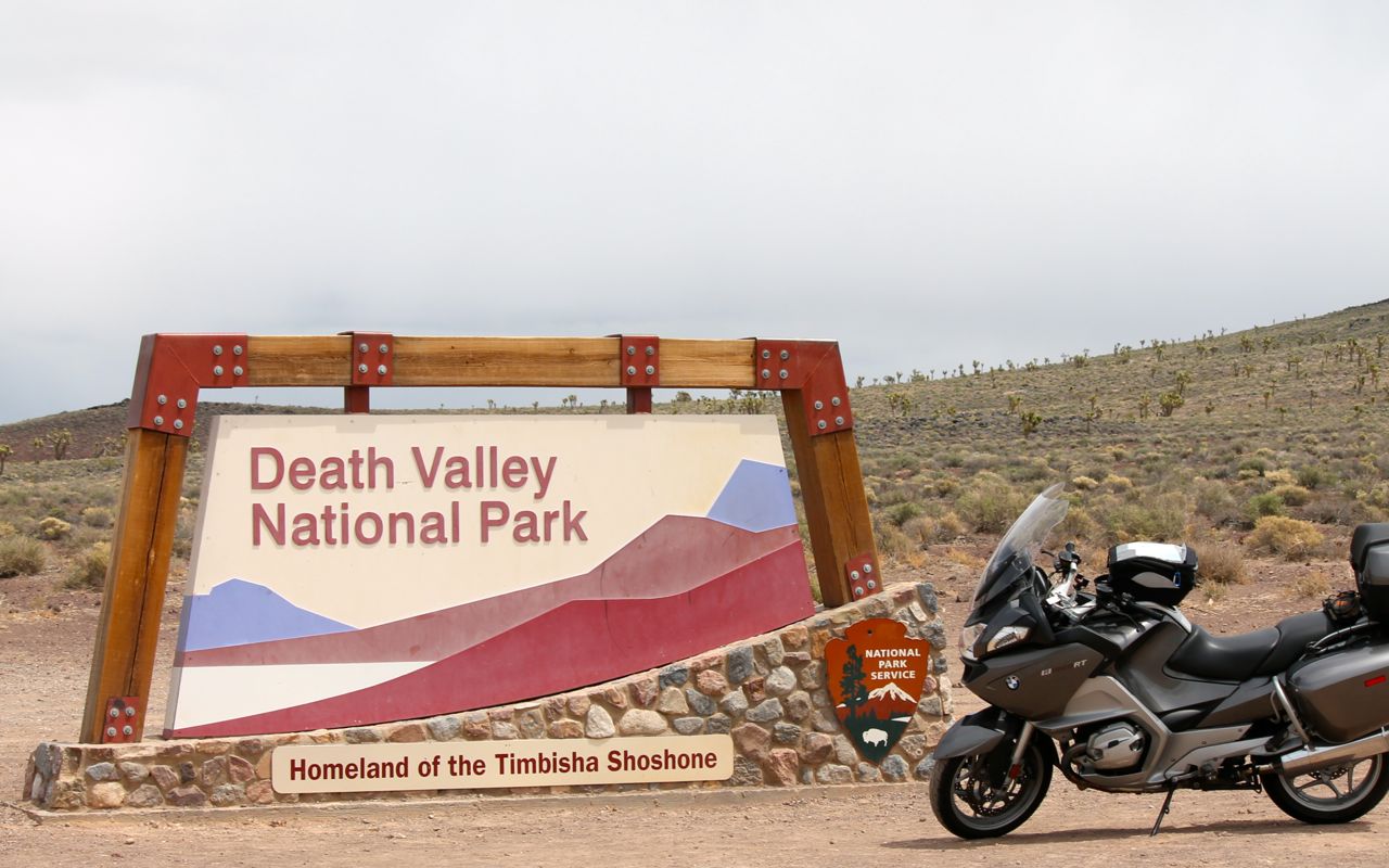
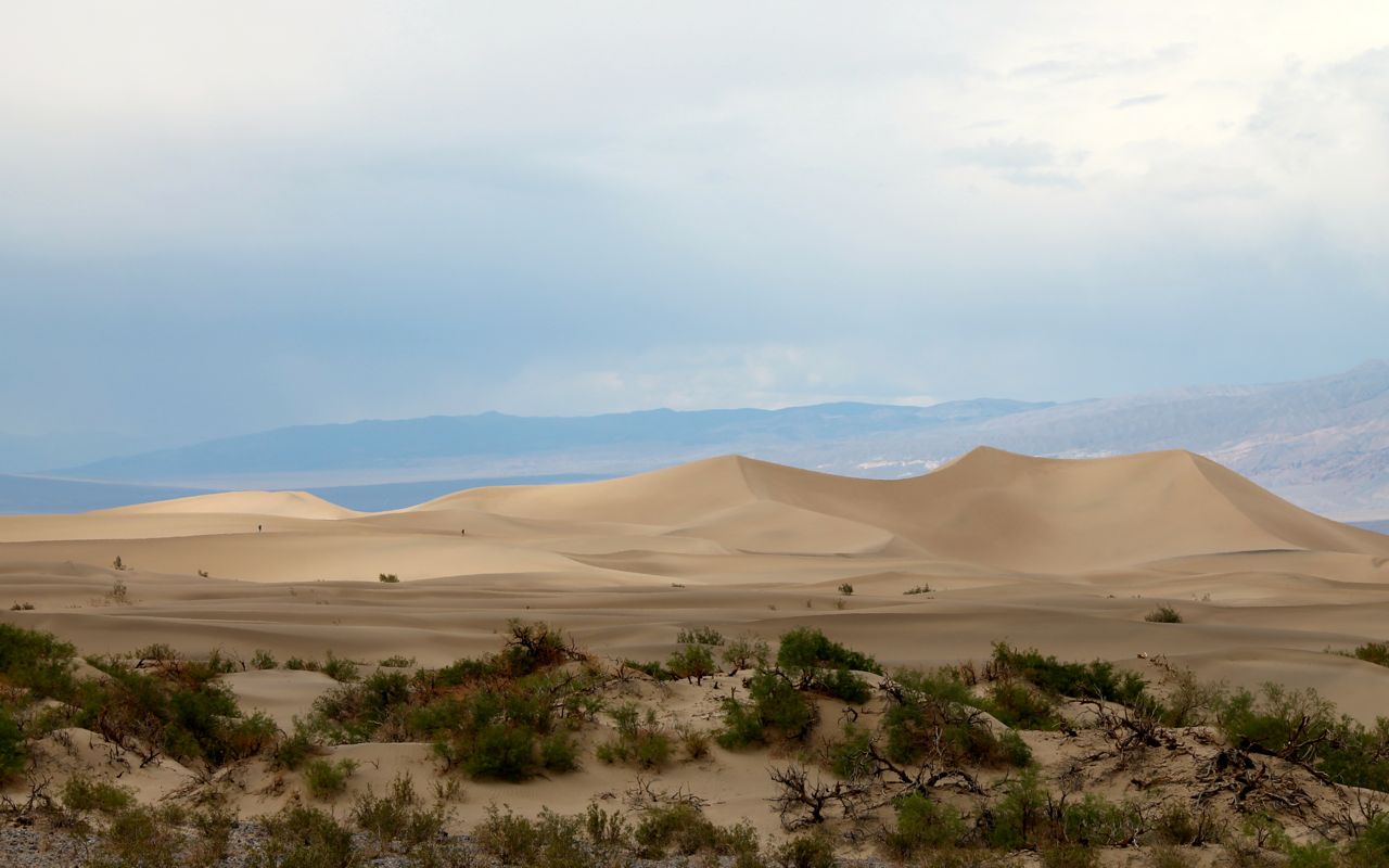
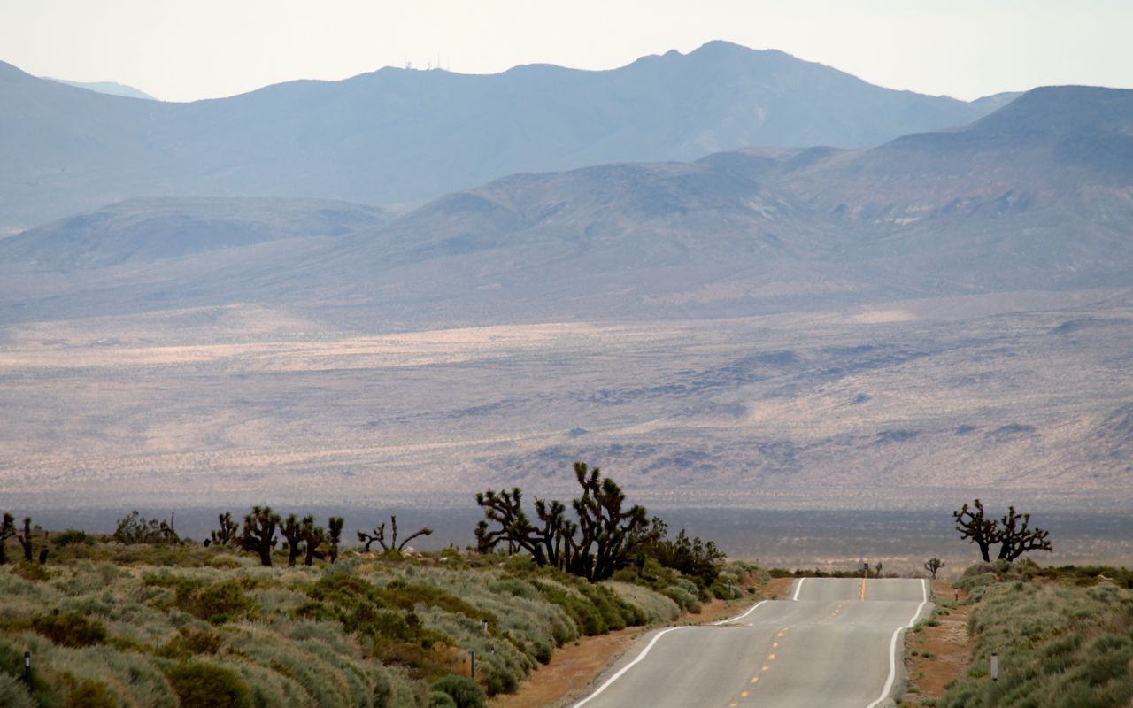
This was my first visit to Death Valley National Park.
Entering from the west, visitors descend a steep winding road. It had all of my favorite components including a good surface, little traffic, and great scenery.
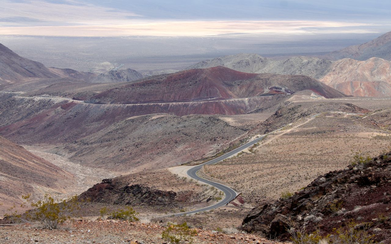
Park roads take you over one pass after another with dramatic valley landscapes between each.
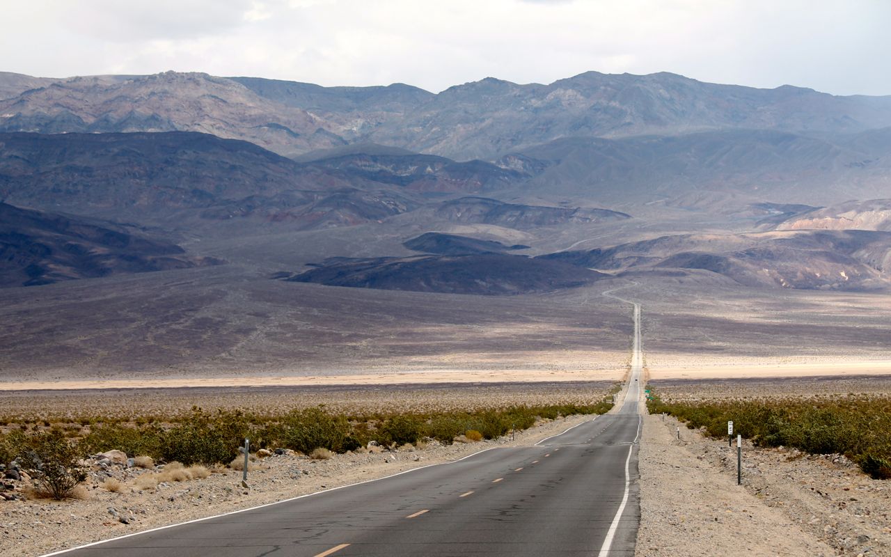
I found it difficult to capture the grandeur of this place with still photos but that won’t stop me from still posting them. 🙂

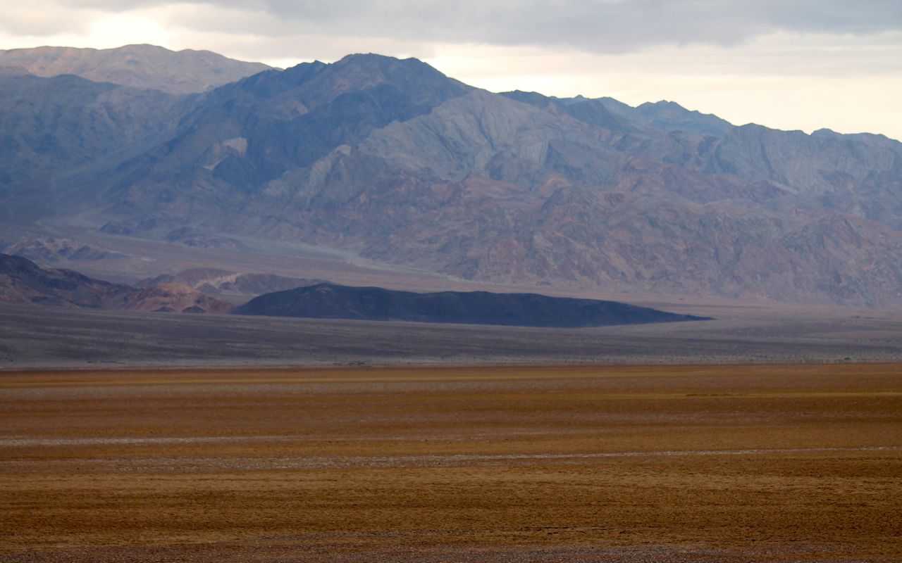
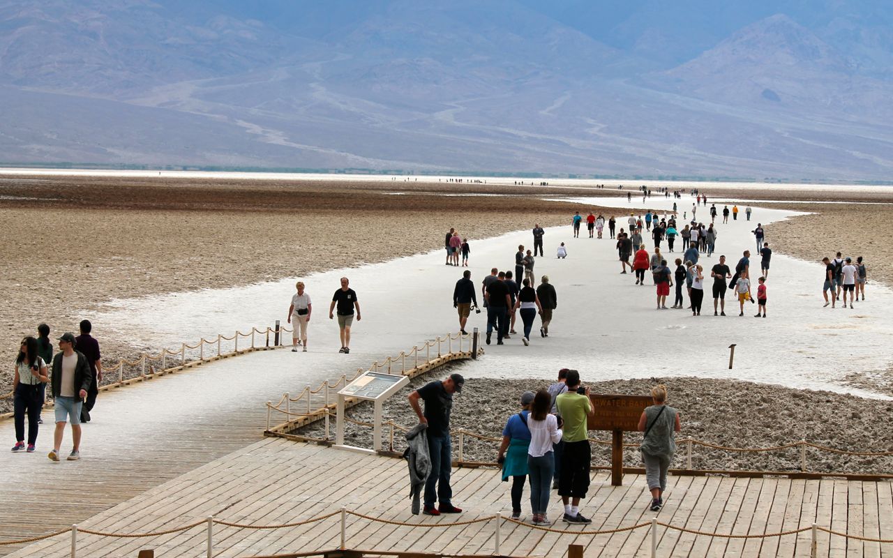
Badwater Basin is the lowest point in the country at 282 feet below sea level.
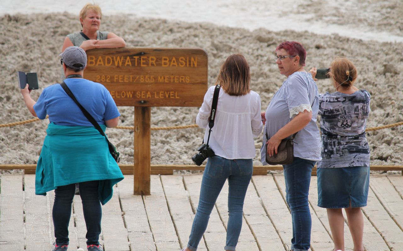
Visitors are able to walk out to the salt flats that are created by a spring (according to wikipedia) located here.
I continued south from Badwater Basin to exit the park near Shoshone.
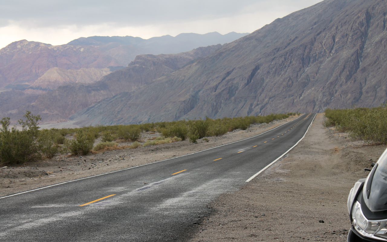
Because I extended my ride once entering the park, I arrived at my destination after dark. Usually I’m off the bike before dark but on this day, due mostly to the ambitious extension of my ride, I ended up entering Las Vegas after sunset and after traveling through successive rain storms.
I’ll be in the Las Vegas area for the next few days attending memorial services for my younger brother who unexpectedly died last week while I was on the road.
My next travel post will be Day 12 when I head back to the west coast to continue my tour.
Day 12
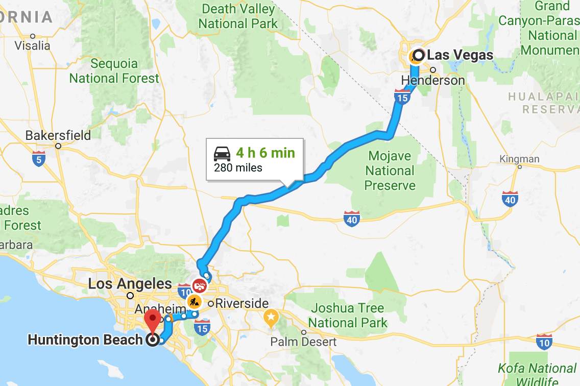
Day’s distance: 280 miles
Total trip distance: 2,003 miles
Today I resumed my trip with a sunny and comfortable ride. Temperatures in the desert started in the mid 60s and ended in the 70s at the coast. It was as hot as 96 (above the tarmac) while riding through the LA basin.
I’m visiting my friend David who moved to Huntington Beach from Seattle and arrived just before 1pm.
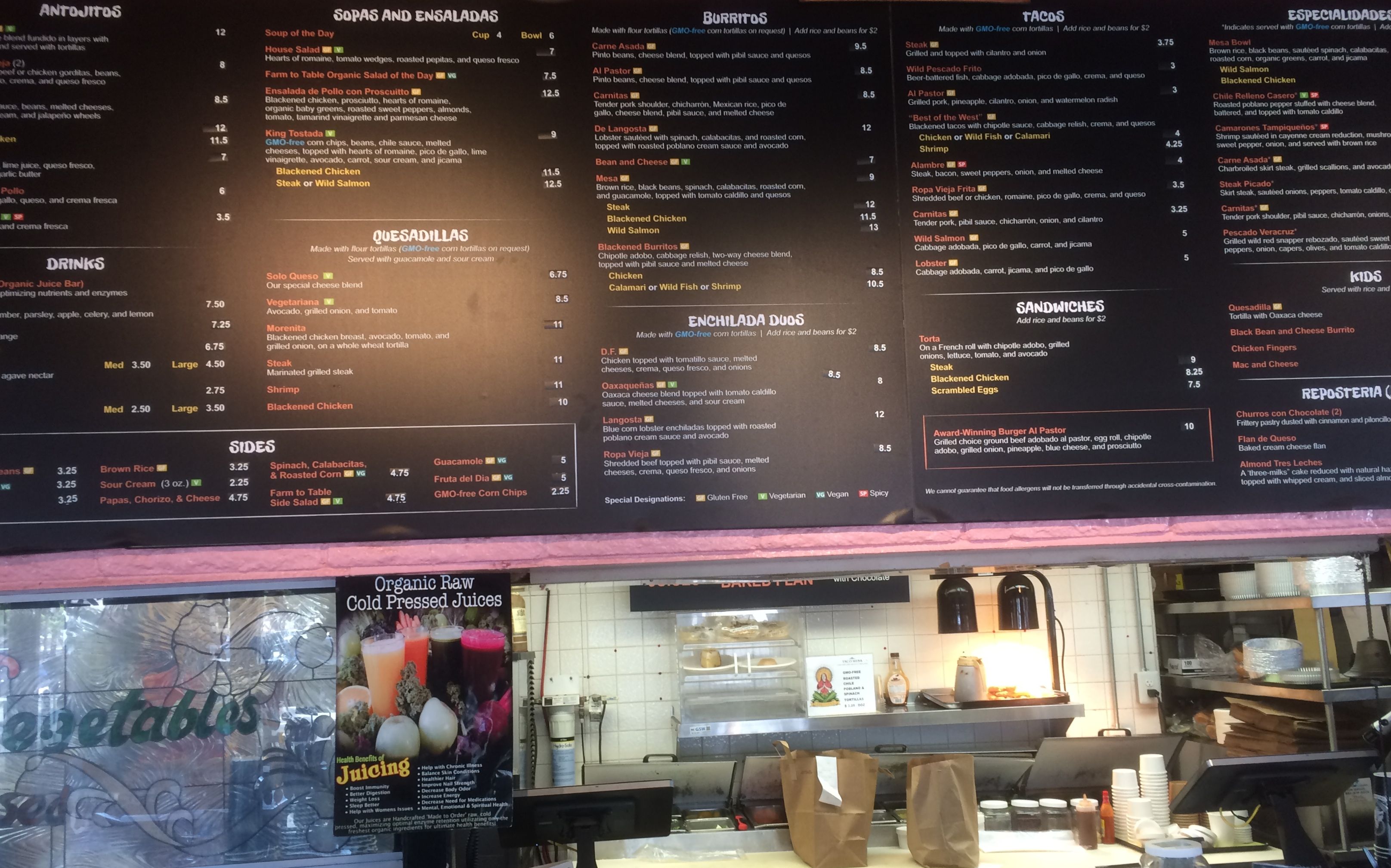
We traveled to neighboring Costa Mesa for lunch at Tacos Mesa. I had two tacos Al Pastor and one with Calamari. Yummy and highly recommended.
Continuing south to Laguna Beach we spent the rest of the day walking around and catching up.
I’ll be hanging out tomorrow and then continue on the bike Sunday morning.
Day 13
Day’s distance: 0 miles
Total trip distance: 2,003 miles
Today, Cinco de Mayo, was a day off the bike, hanging out in Huntington Beach with David.
We started the day with a long walk, starting near the mouth of the Santa Anna River and turning around at the Newport Beach Pier. The skies were clear and the temperature was in the 70s.
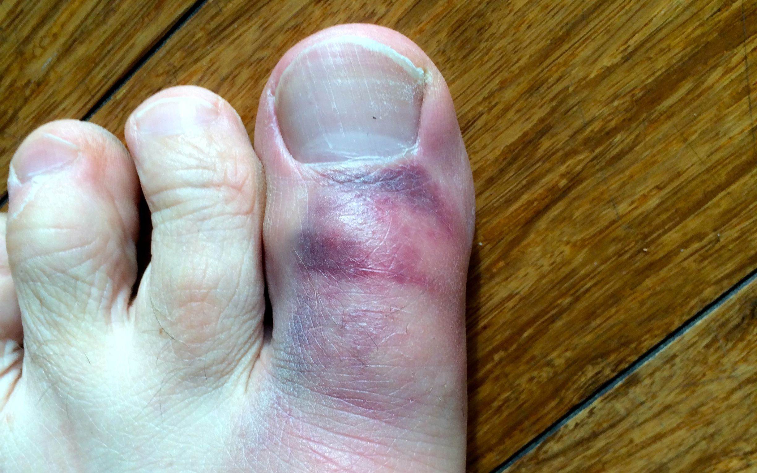
For lunch, we packed up some marinated steak and a few beers and a portable stove and drove about 4 miles north to the Huntington Dog Beach with David’s Corgi. The water was warm enough, for me anyway, to get a bit wet but not really swim.
I did manage to stub my toe on a rock as we walked back towards the car. Ouch!
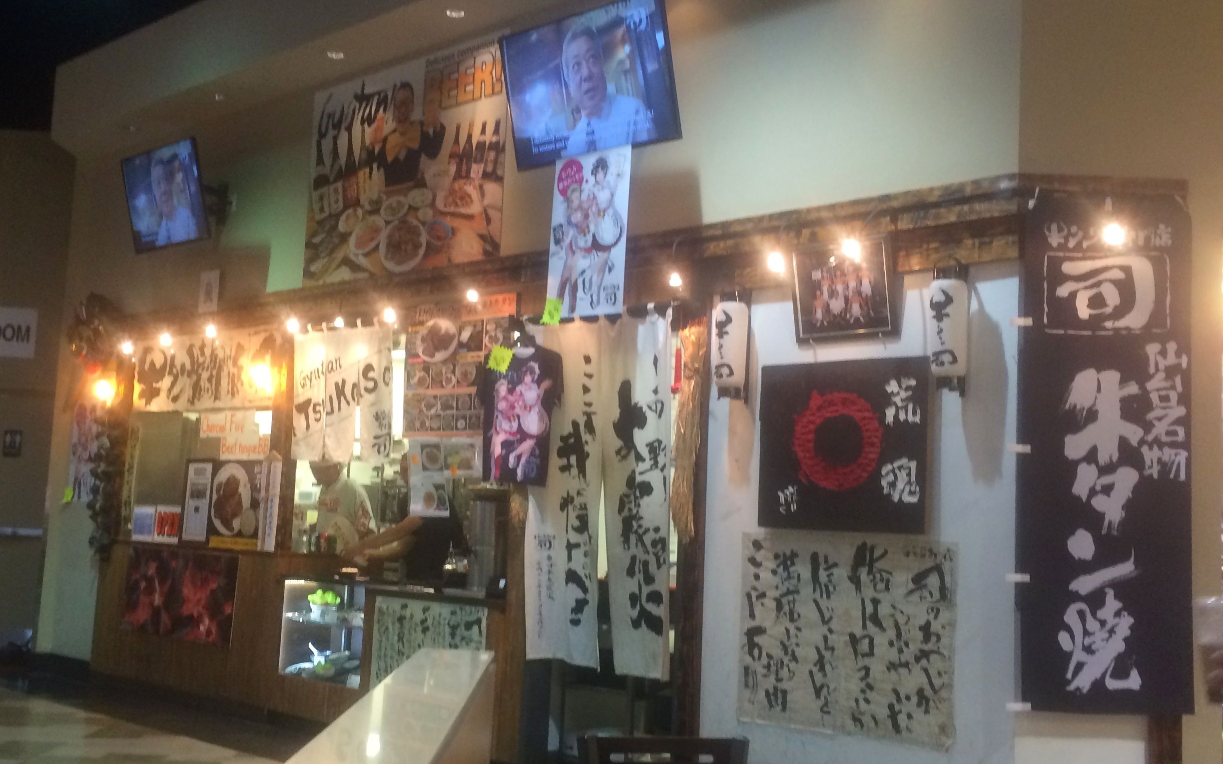
After a short rest at home, we were off to a Cinco de Mayo music event at the House of Blues in Anaheim. On our way we stopped at a Japanese market for a quick dinner.
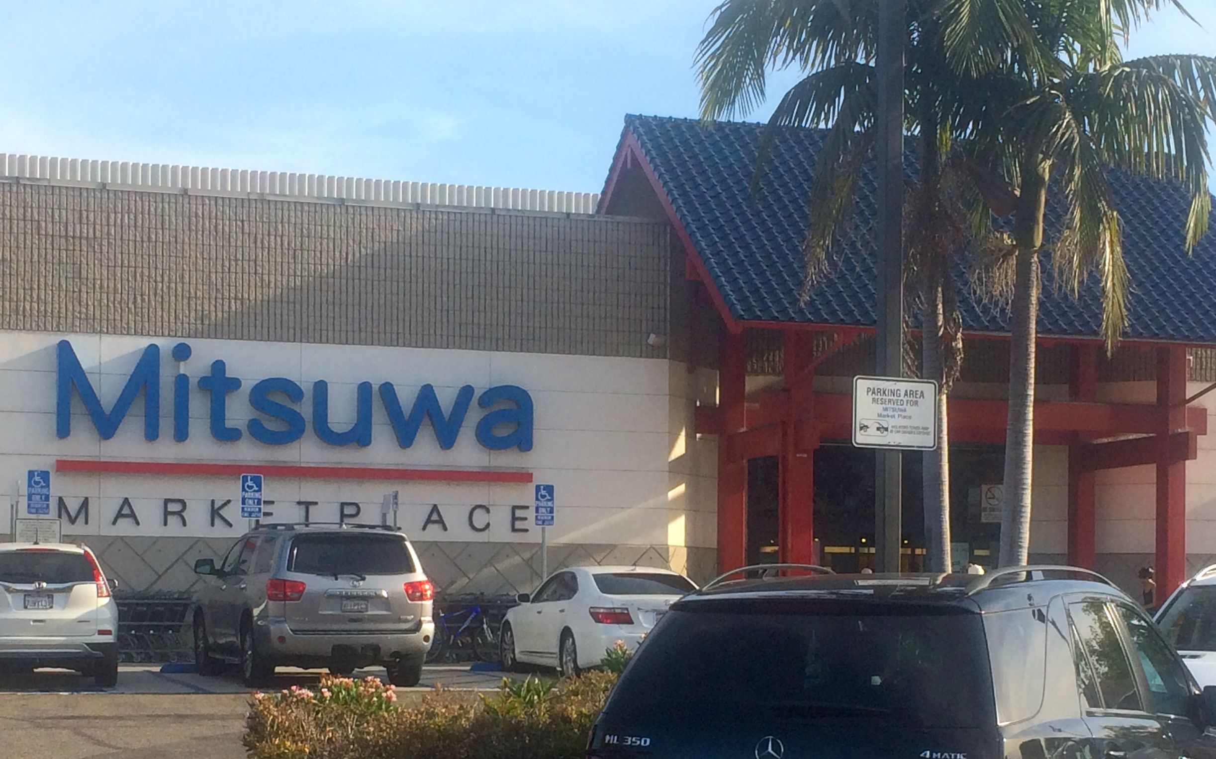
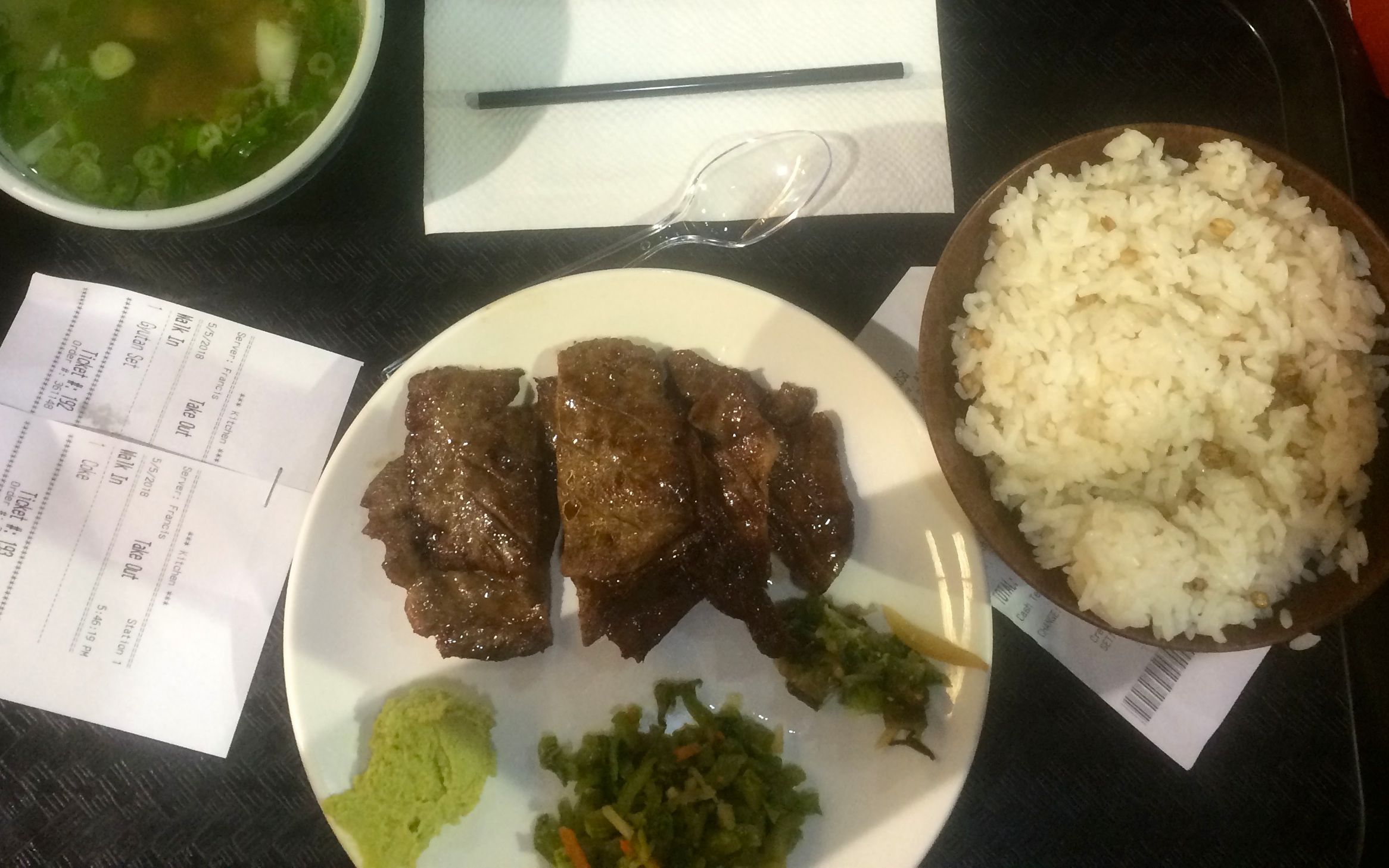
David and I were each open to trying something we haven’t eaten before, so we both ordered BBQ beef tongue from this little restaurant inside the market’s food court.
It was served with soup and rice. It was yummy!
Our next destination was the House of Blues in Anaheim. David secured (free) tickets for the Cinco de Mayo festival that night.

Of course, with free entry we still had to pay for parking and overpriced drinks. Inside the complex there were five stages. The photo below was the largest stage inside the complex.
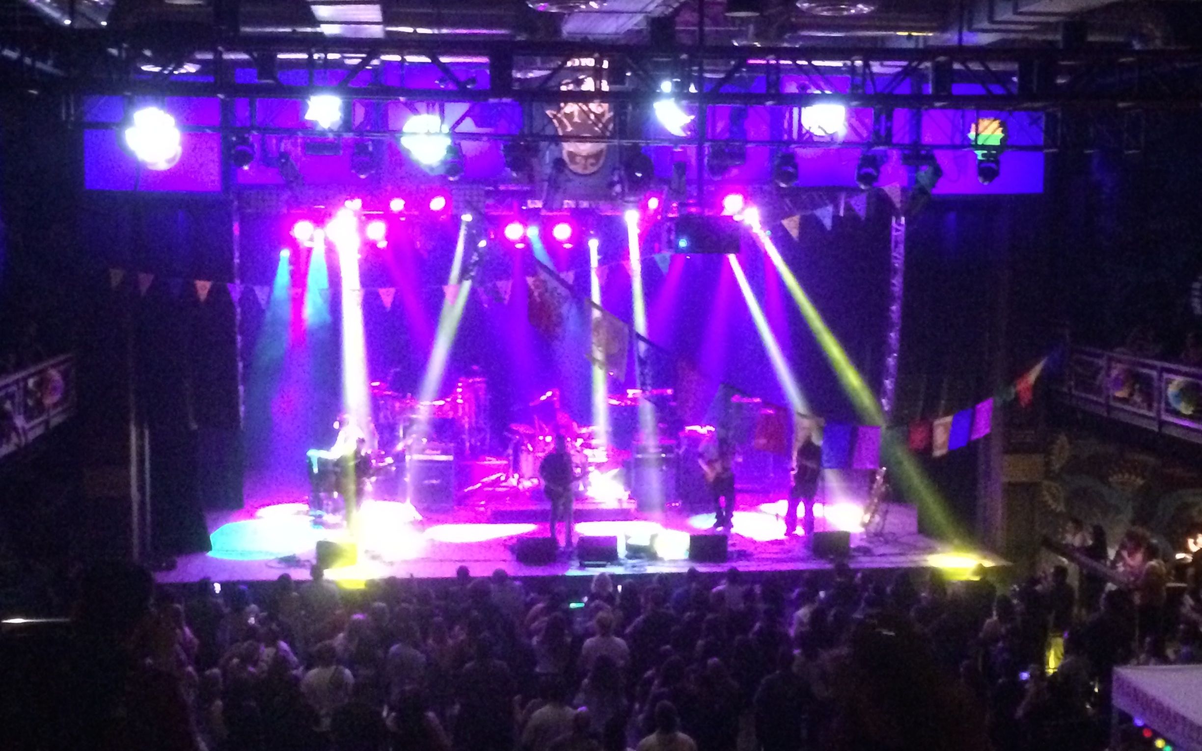
The headline band, Kinky, was great. For their encore, they played their second single entitled ‘Mas.’ Great show! I will update this post later with a short video of Kinky performing.
David leads an active life. Hanging out for a few days will shake me up in a good way. It’s been a lot of fun.
I’ll be staying here in Huntington Beach tomorrow as well, because why not? On Monday, I’ll head east into Arizona.
Day 14
Another day off the bike in Huntington Beach. My host has yet to not fill the day with activities.
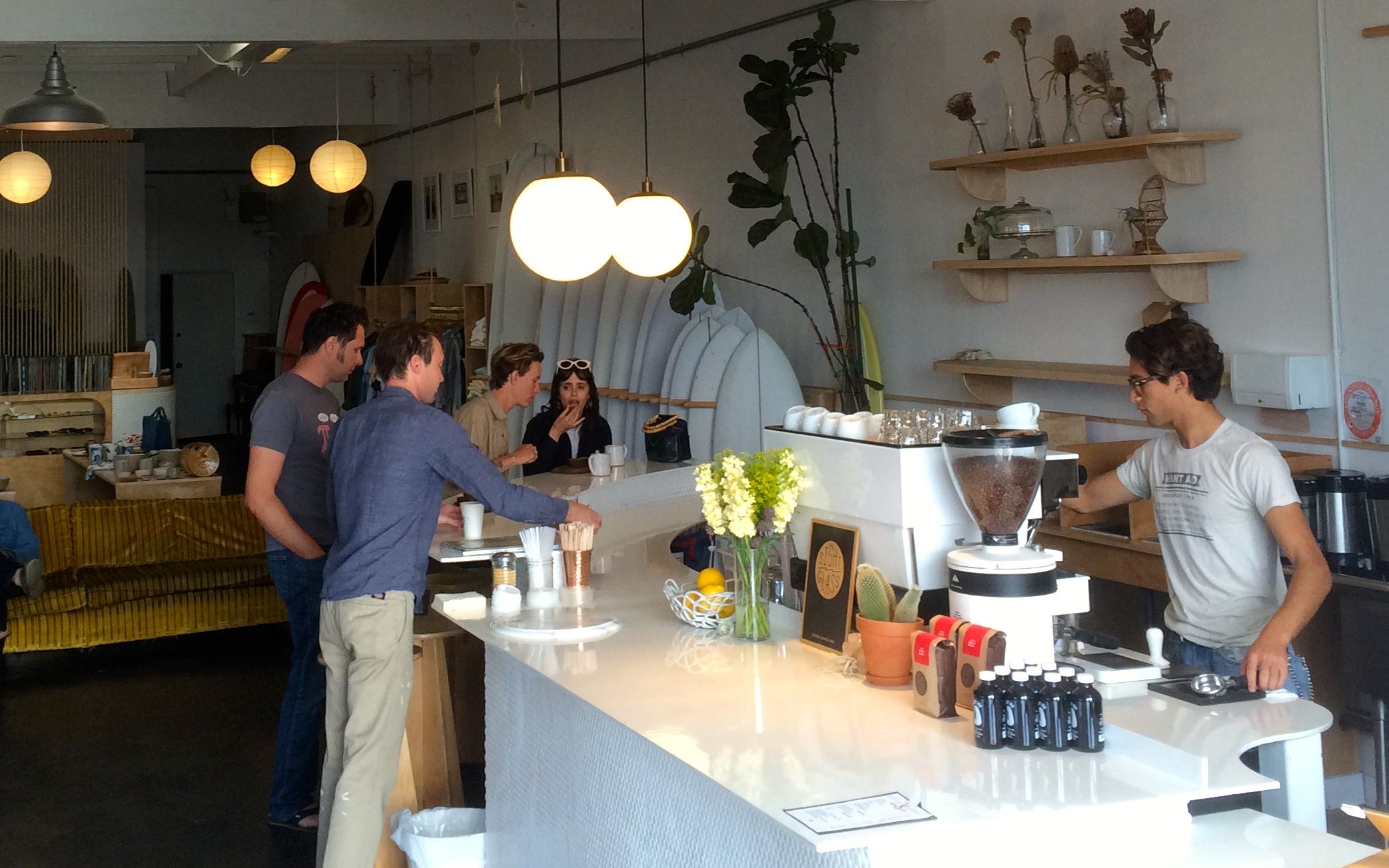
Daydream Surf Shop was our first stop of the day. Good coffee and breads.
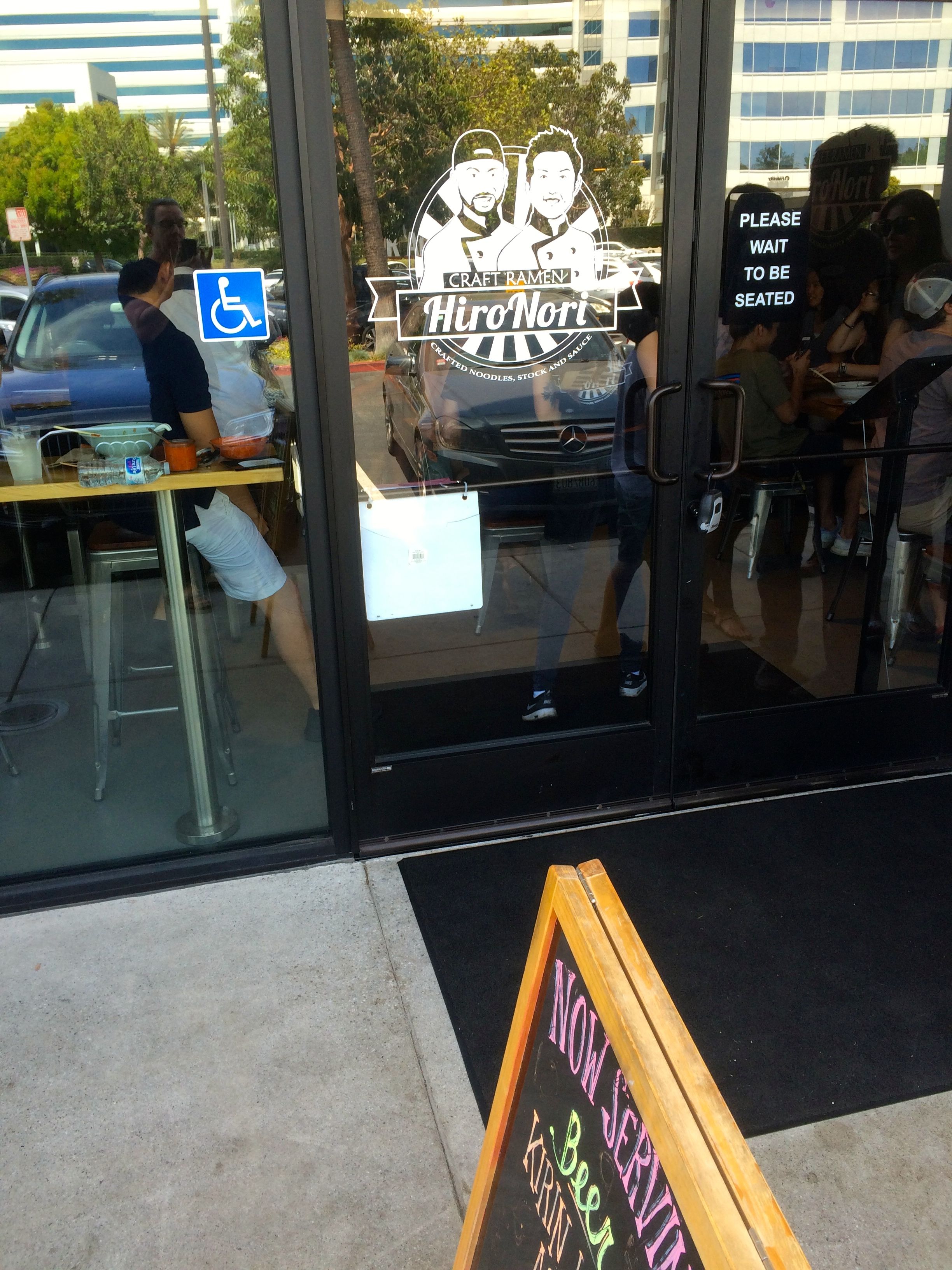
Craft Ramen Hiro Nori for lunch.
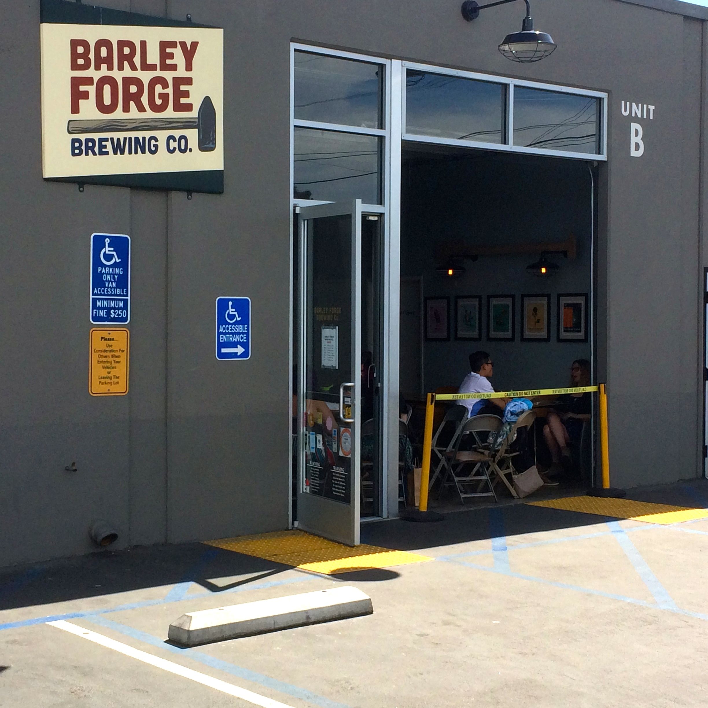
Barley Forge Brewing Company for some samples beers on our way back to the house.
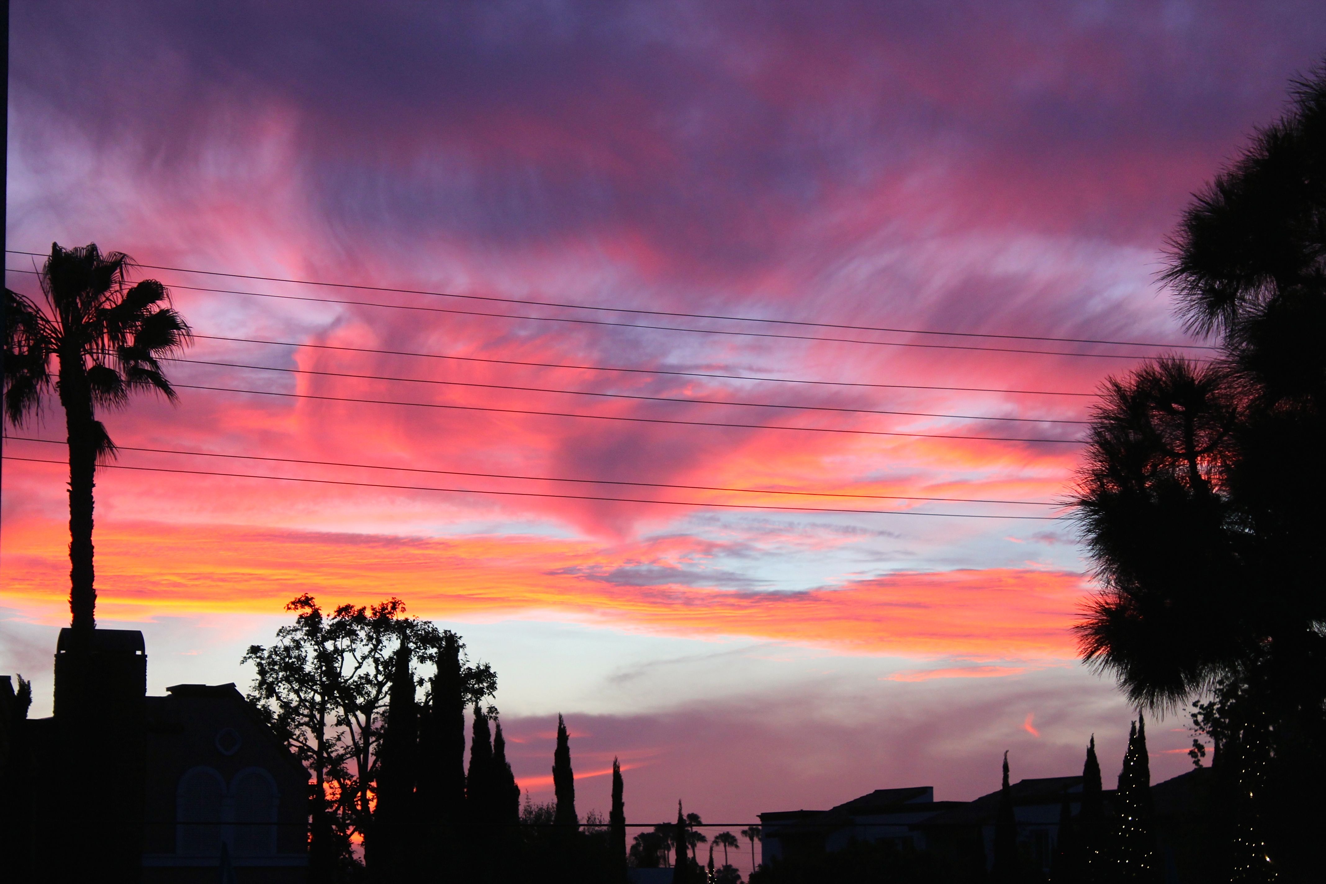
Huntington Beach Sunset tonight.
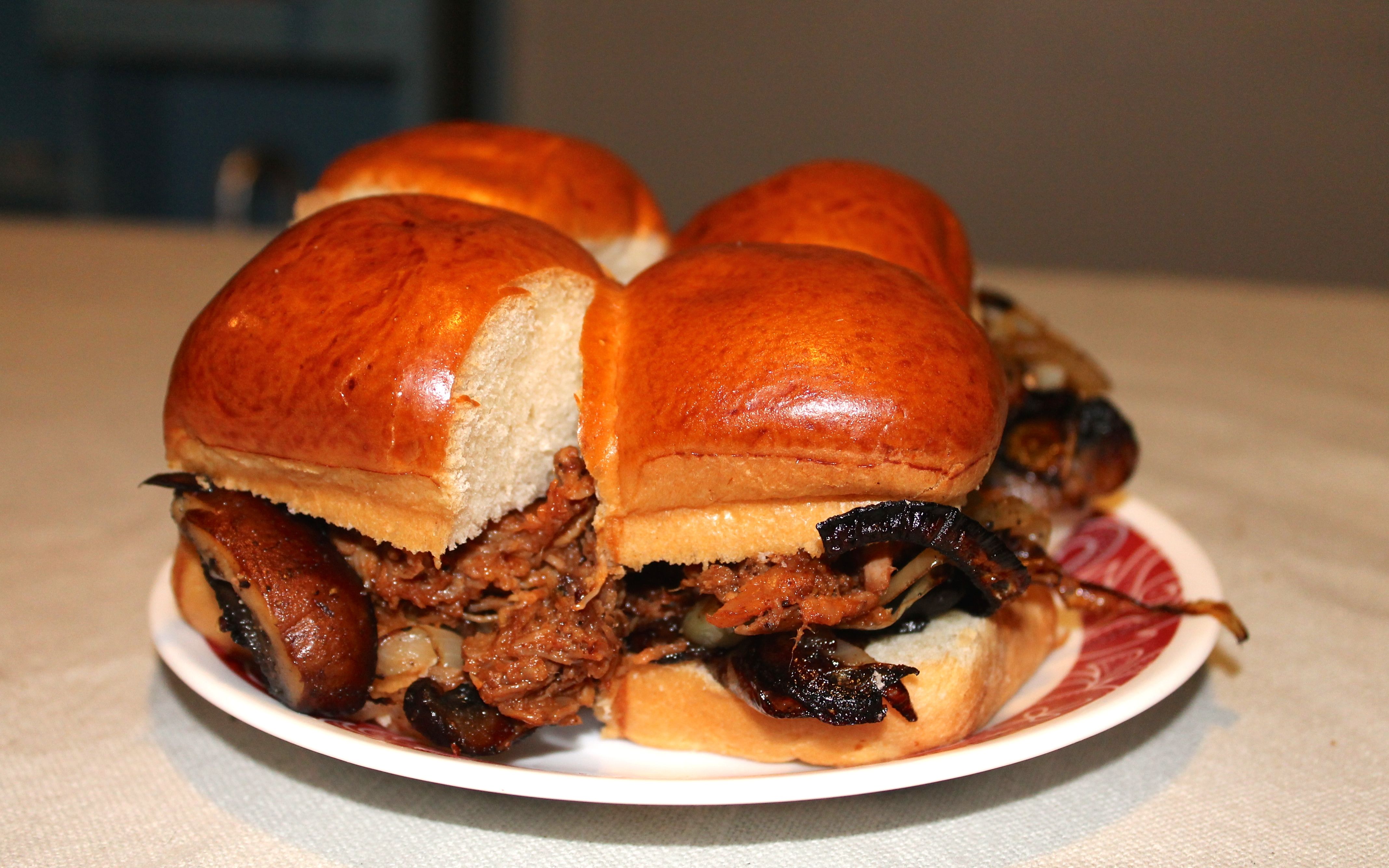
David made pulled pork sliders for dinner. Yum.
This was a great layover. Thanks, David!
Tomorrow I’ll be heading east to the Tucson area. This will be one more interstate-only day that gets me through the current 3-digit temperatures in that area.
Day 15
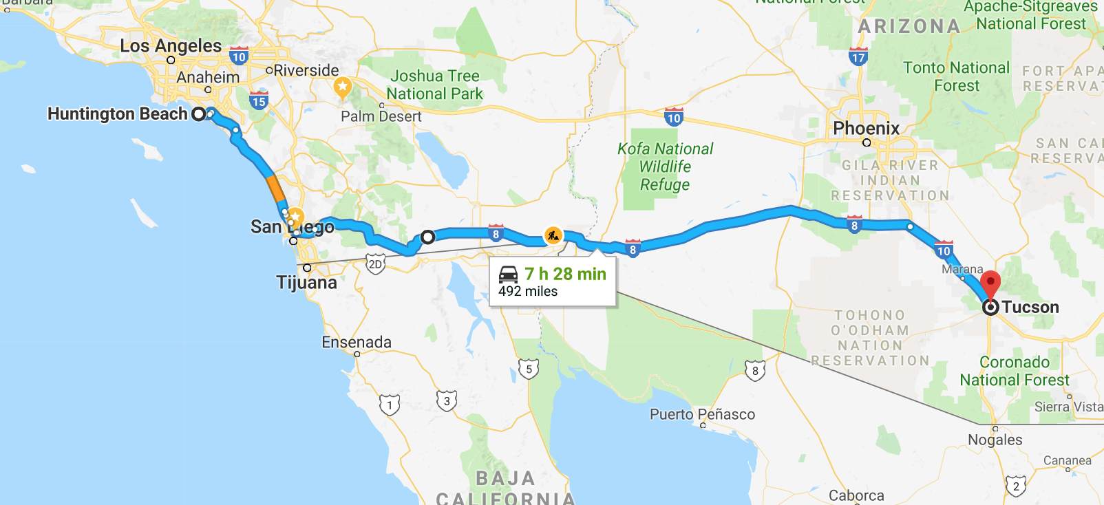
Day’s distance: 492 miles
Total trip distance: 2,494 miles
The starting temperature this morning was 56. Expected highs along my route were 102 today. The actual temperatures above the road surface, according to my onboard instrument, was 105. With the exception of a brief time around Dana Point where I traveled through dense fog, the day was sunny with a bit of haze and some high cloud cover.
To minimize time spent in excessive heat on this trip, I decided to skip the many interesting options along California’s southern border and just get through the hottest part of the trip in a single day. I am not feeling as tolerant of the heat as I used to on my rides. Guess I’m getting old and cranky. 🙂
I departed Huntington Beach just before 6am and made a quick stop at a Starbucks. I wanted to take the route google maps showed me, using Hwy 73 to Interstate 5. My GPS wasn’t cooperating. As it turned out, Hwy 73 is a toll road and I set my Garmin unit to avoid tolls. I got it squared away after the caffeine started to kick in. 🙂
The toll for one-time users of Hwy 73 must be paid within five days “to avoid additional violations.” Toll signage indicated I should not expect any notices in the mail, so I stopped at a rest area north of San Diego to spend the time necessary to provide the toll company’s web page with my payment information proactively so I wouldn’t forget to take care of it.
While I avoided LA commuter traffic by leaving so early, there was some slow moving traffic about 20 miles north of San Diego. It wasn’t hot and the bike’s engine never started to get hot either, so I wan’t tempted to lane split.
My route skirted around most of the rest of the commuter traffic once I turned east off of I-5 at Hwy 805. At that point and going forward, I was traveling counter to the commute.
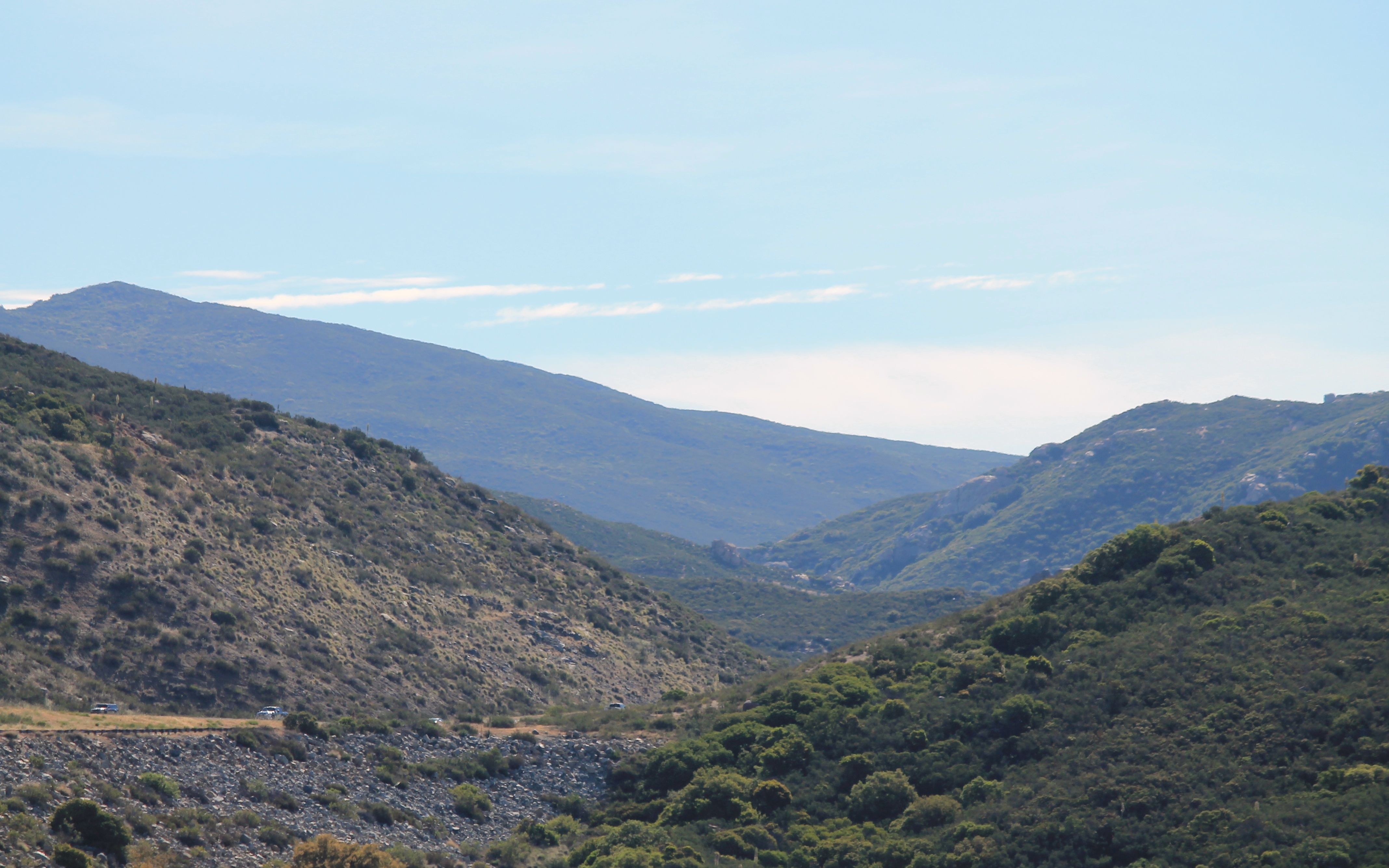
The scenery started to change in the eastern part of California.
This would likely be my longest day and I planned to make it to Benson, Arizona, a small town about 40 miles east of Tucson. I wasn’t sure I would make it that far so I didn’t make advanced hotel reservations.
In past trips, I’ve traveled part of Interstate 8 so it was familiar. I saw the turn off I-8 to Calexico and remembered my visit there on my Southern States Tour.
To remain safe in the heat, I stopped at least hourly and hydrated. In the afternoon, I started to also get my base layer wet so it would slowly evaporate under my jacket and keep my skin cooler. Along with liquids, I munched on trail mix to replenish my electrolytes and energy level.
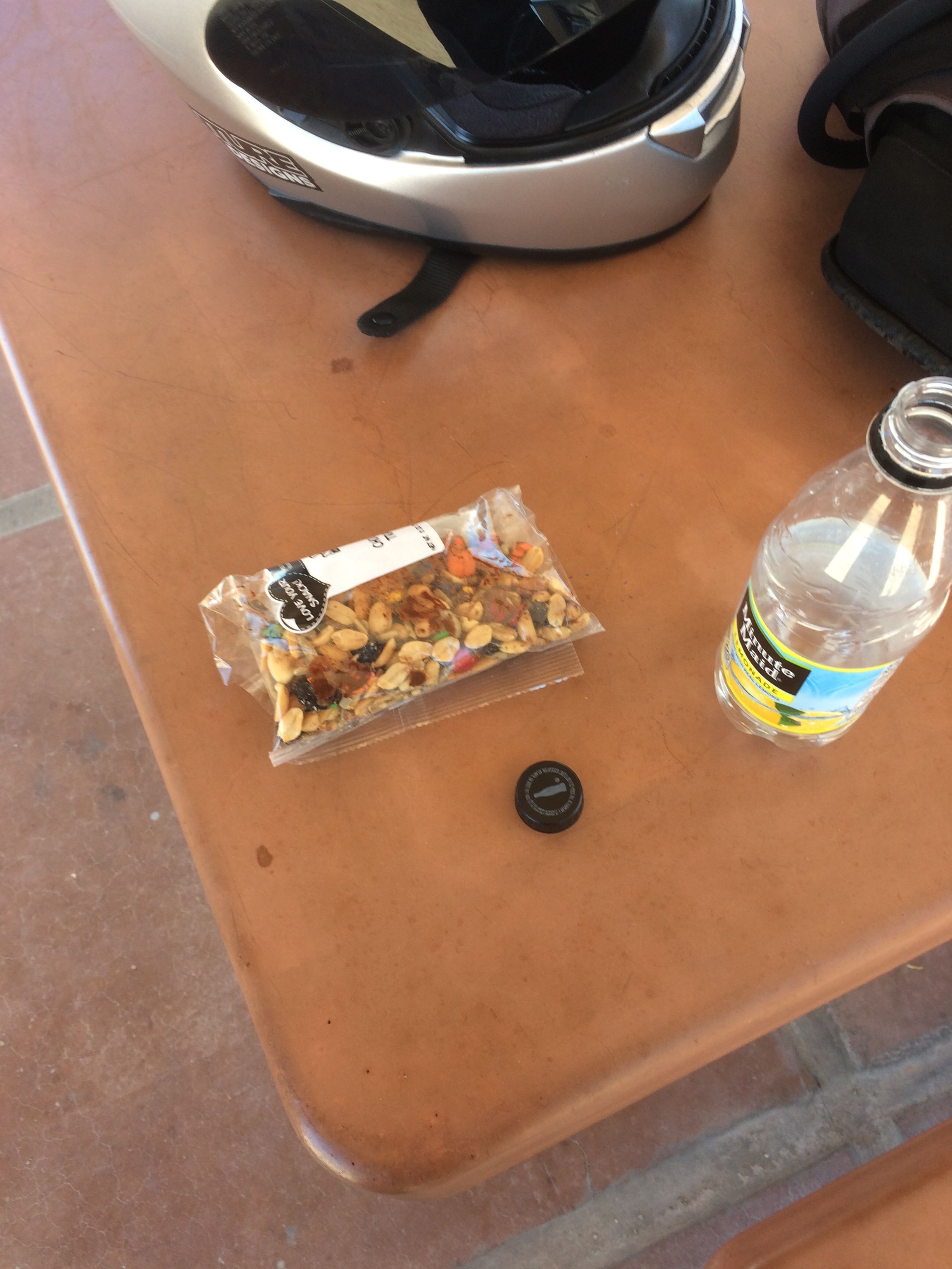
Yes, that is the chocolate bits melting in the heat. Oh well, they were still tasty.
Closer to Phoenix, I saw my first self-driving vehicle.
They still require someone to put gas in them. LOL
I arrived in Tucson about 5pm and chose to splurge at another Hampton Inn to ensure I can fully recharge after an eleven hour travel day.
Tomorrow I am looking forward to heading back north, spending time in the mountains of Arizona and riding some new and potentially great motorcycle roads. I am also planning to start mixing in some camping.
Stay tuned!
Day 16
Day 16 distance: 308 miles
Total trip distance: 2,802 miles
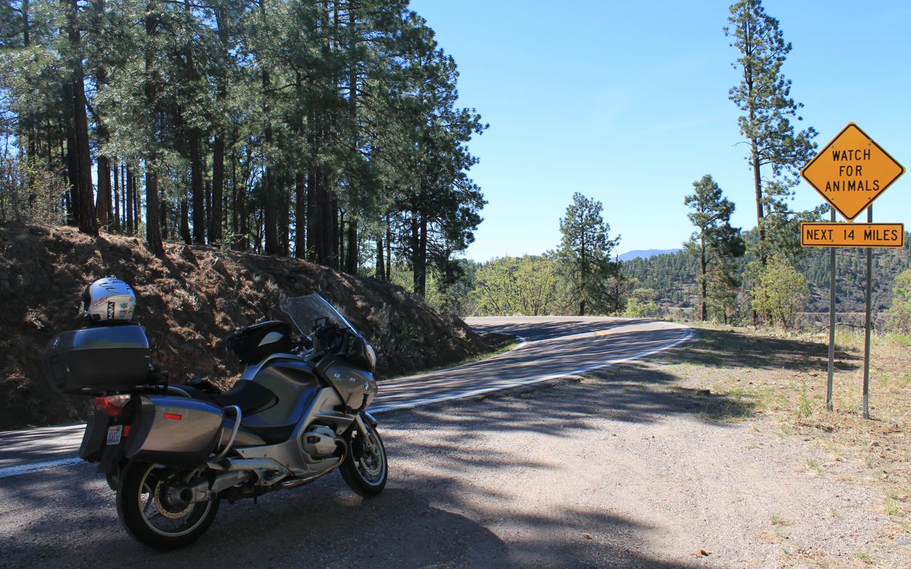
Temperatures never reached triple digits but instead peaked at 95 degrees. My route would take me to a road that I’ve been interested in riding on previous trips to Arizona, Hwy 191 north of Morenci.
Leaving Tucson about 8:30am, I headed east on I-8. This stretch of interstate was full of semi-trucks traveling at 75mph. A close call with one truck entering my lane unexpectedly reminded me to give them a wide berth and assume at all times that they do not see me.
Once I turned north on Hwy 191, a road with far less traffic, I was able to relax a bit again.
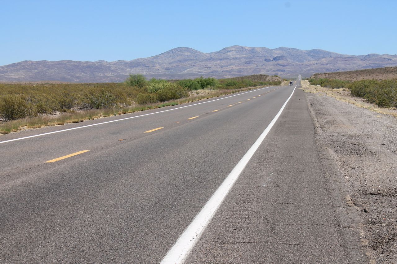
I soon reached the town of Morenci at the southern end of what is nicknamed ‘The Devil’s Highway’, billed as one of the top motorcycling roads in the continental US, according to Butler Maps.
What I wasn’t prepared for, and was initially thrown off by, was the copper mine I had to go through to get there. The town of Morenci is named after the copper mine found there. This was the biggest strip mining operation I have ever seen and the workers and trucks used in the operations of the mine are the primary users of this part of the road.
When I stopped to take the photo below, one helpful miner told me there was a better vista point a couple miles up the road.
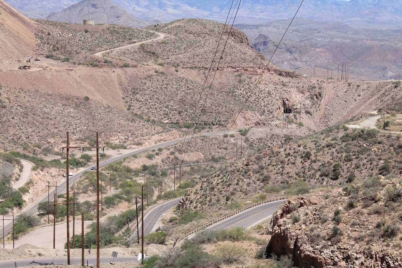
On my arrival at the Vista Point, I was disappointed to find not a view of the road but of the giant open wounds to the earth that result from this type of mining. 😦 I have to admit I freaked out a little, thinking the guys that called this a great motorcycle road were off their collective rockers.
Continuing on about 5 miles more, I started to understand what they were talking about.
With the mining operations behind me, beautiful and diverse Arizona landscapes opened up to me.
Speed limits were posted at 25mph for much of the nearly 90 miles. Sometimes they were warranted, sometimes not.
I needed several breaks as this was a long, unbroken stretch of intense riding that took about three hours to get through.
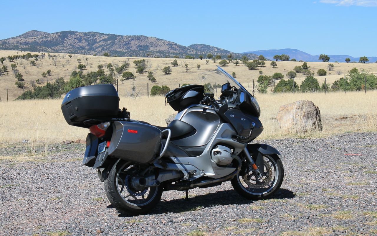
Cattle and deer were seen crossing the road, but I encountered very little on-coming traffic and only passed one camper (who pulled over as soon as they saw me).
The road surface was in good shape along the entire mountain ride, once leaving the mining operations. I would highly recommend this ride to anyone interested.
I planned to camp and landed at Lyman Lake just after 5pm. This pretty state park had maybe a dozen other campers staying there.
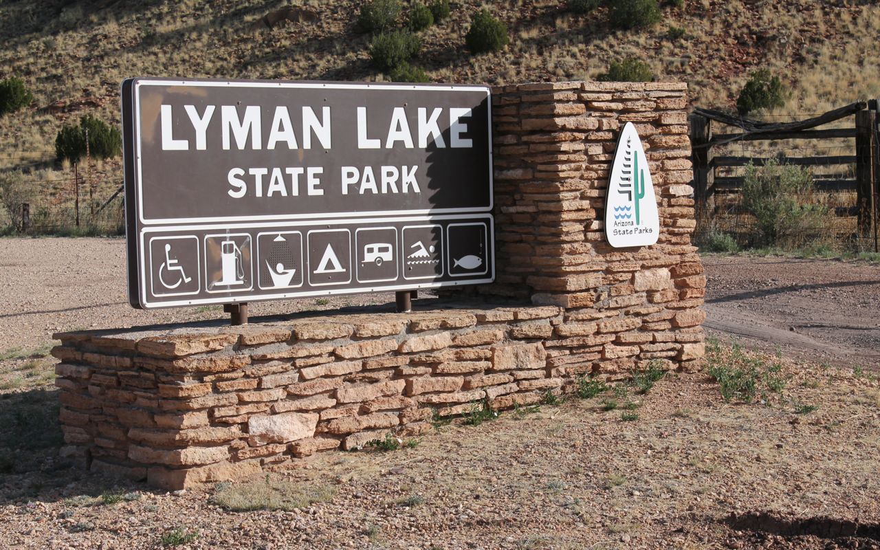
The lake looked inviting and “beach” camping was allowed, but I chose a tent spot closer to the showers and bathrooms.
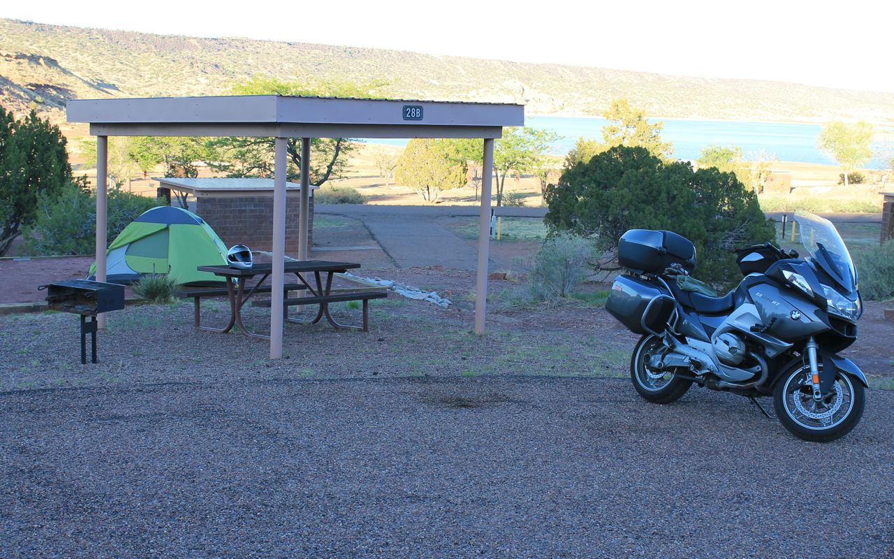
Tired and hungry, I fell asleep shortly after sundown with a belly full of dinner.
Day 17
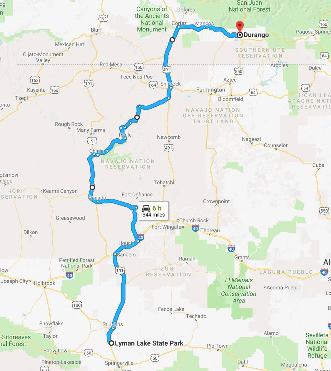
Day 17 distance: 344 miles
Total trip distance: 3,146 miles
Waking up at 5:30, I got the bike packed up and ate trail mix and an apple for breakfast. Coffee would have to wait a while as the first few towns I passed through were too small for any type of restaurant.
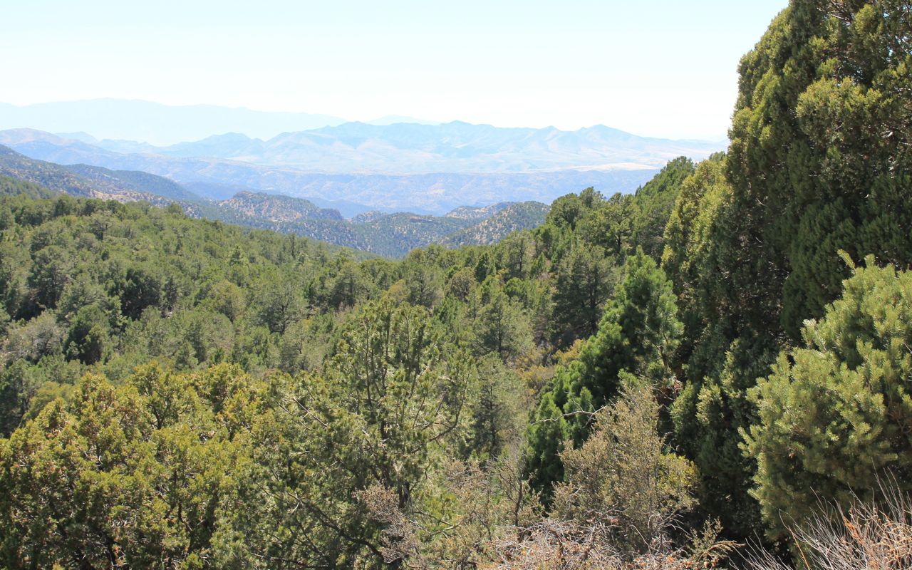
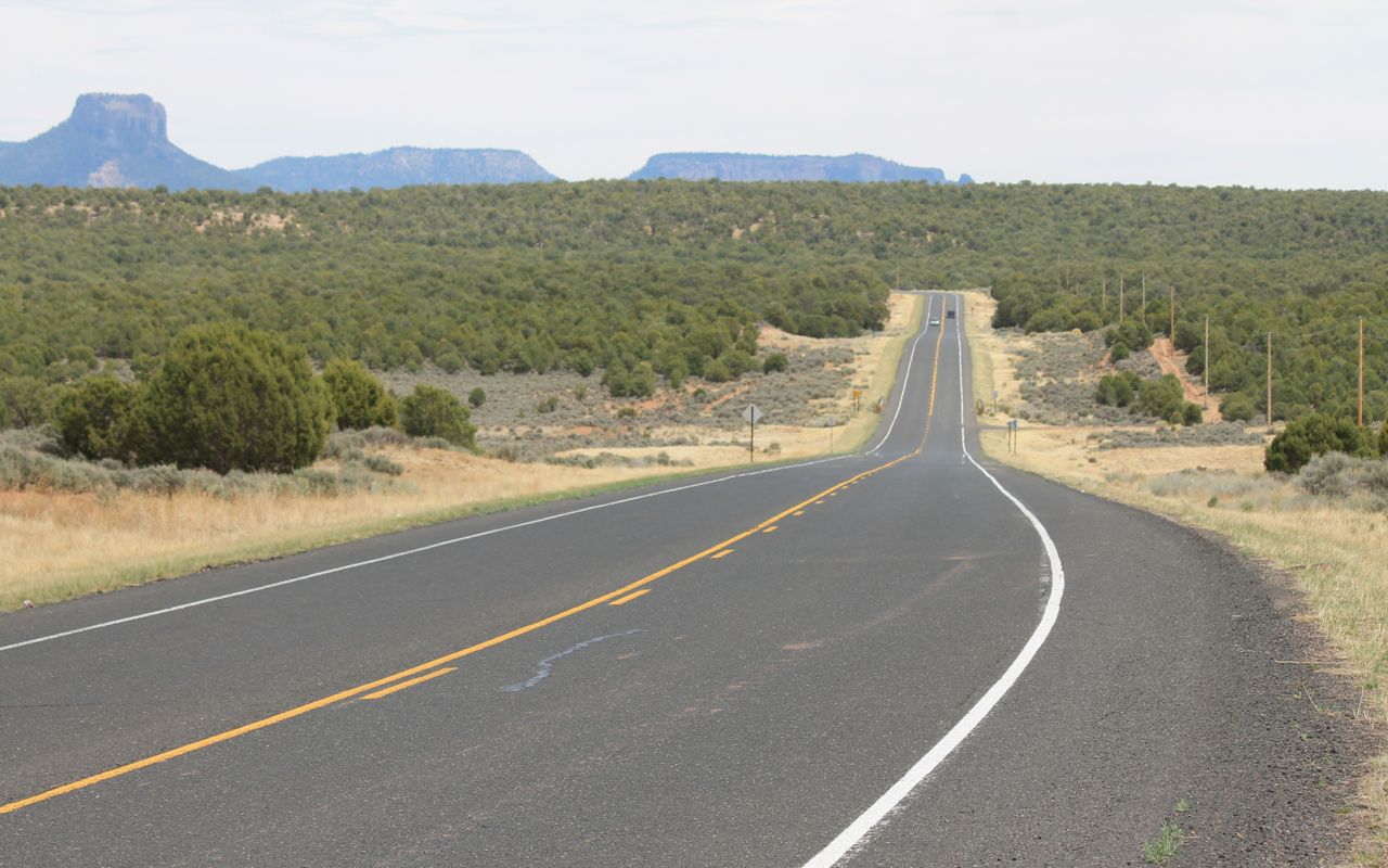
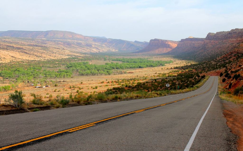
Heading north on Hwy 191 afforded some amazing vistas.
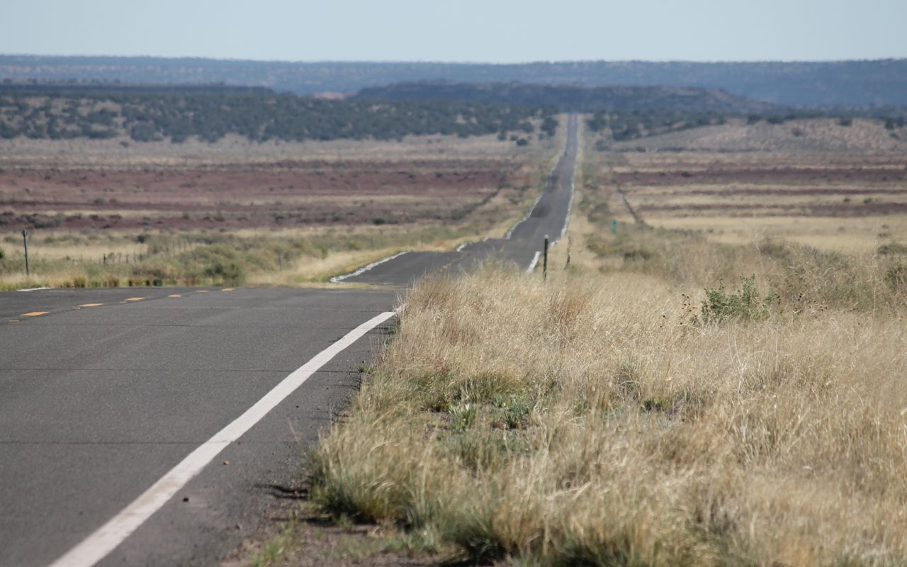
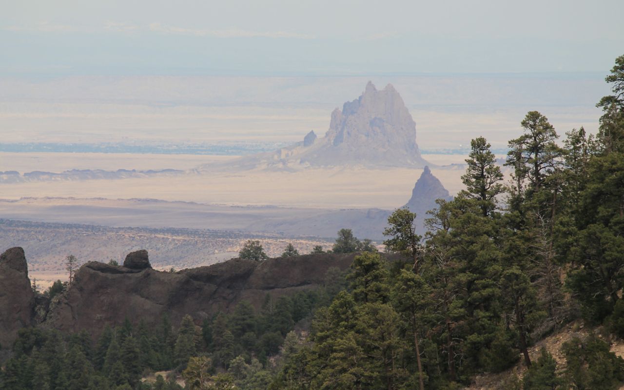
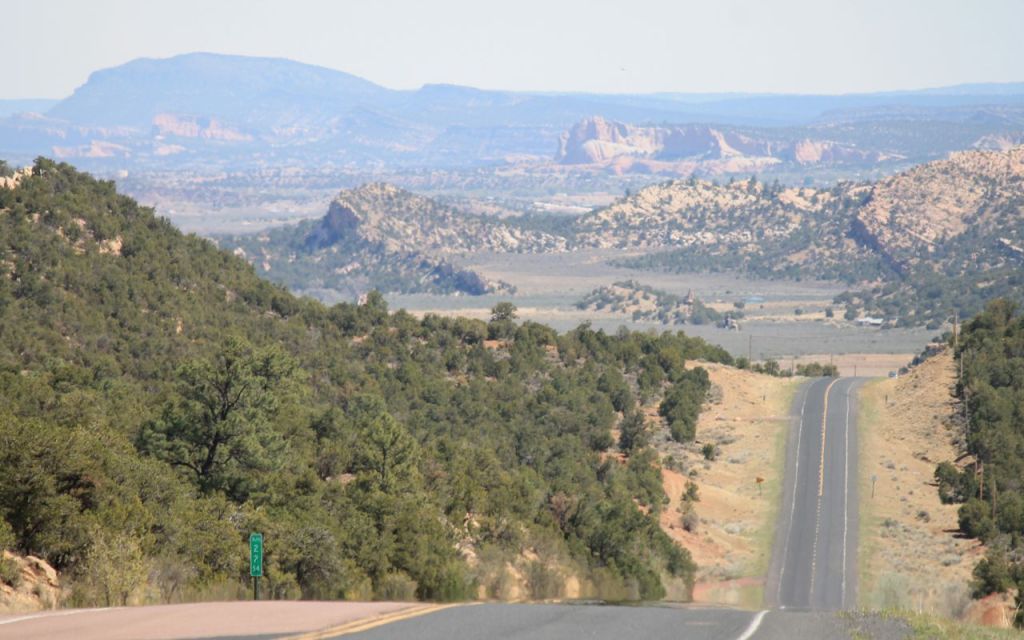
From Hwy 191, I turned east on I-40 briefly before entering Navaho tribal lands using Hwy 12, just west of the New Mexico border. This was not a challenging road technically, but the vistas were incredible.
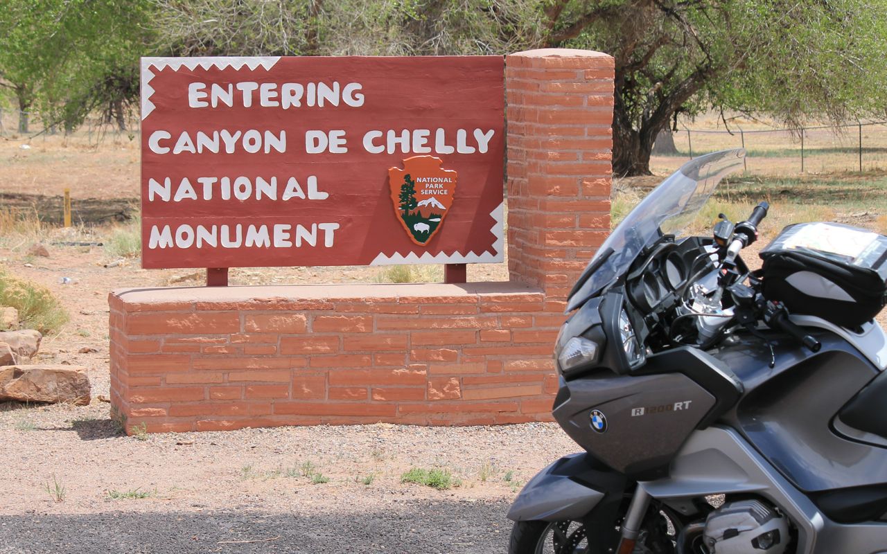
After a late breakfast at a Denny’s in St. Michael, I continued to Canyon de Chelly.
Also on Indian lands, this road took me east towards the red rock plateau in the distance. I was a little disappointed not getting any vistas of the Canyon itself, which seemed to lay to the south out of view.
Of course, disappointment is relative and didn’t last long. 🙂
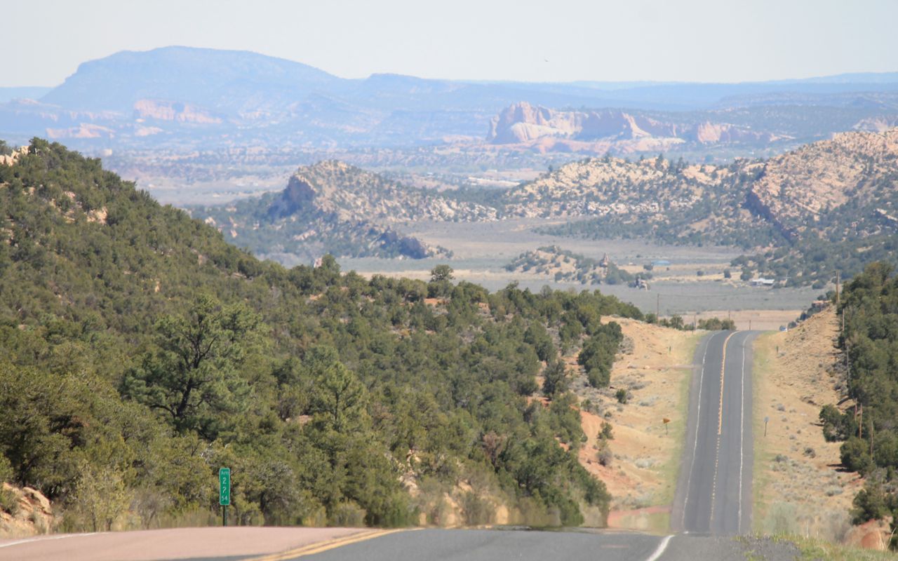
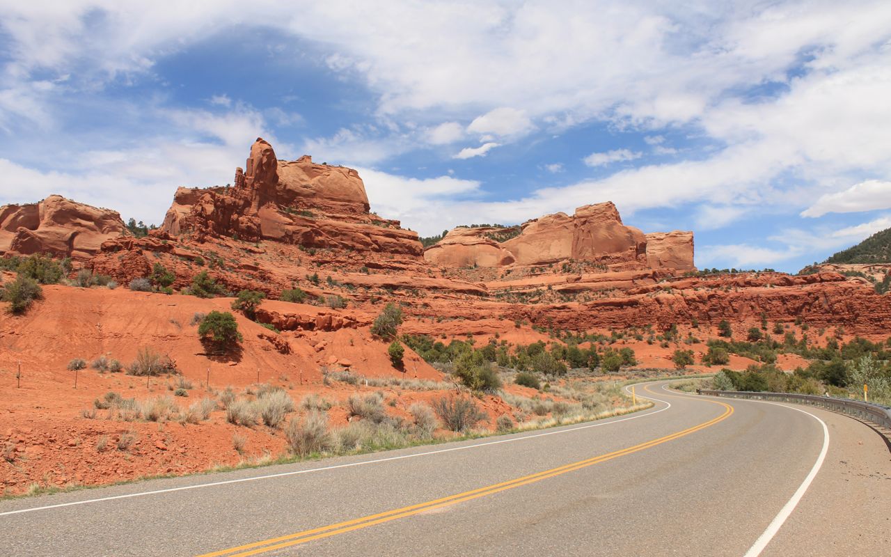
Soon enough, I crossed through Red Rock and the landscape that gave the town its name.
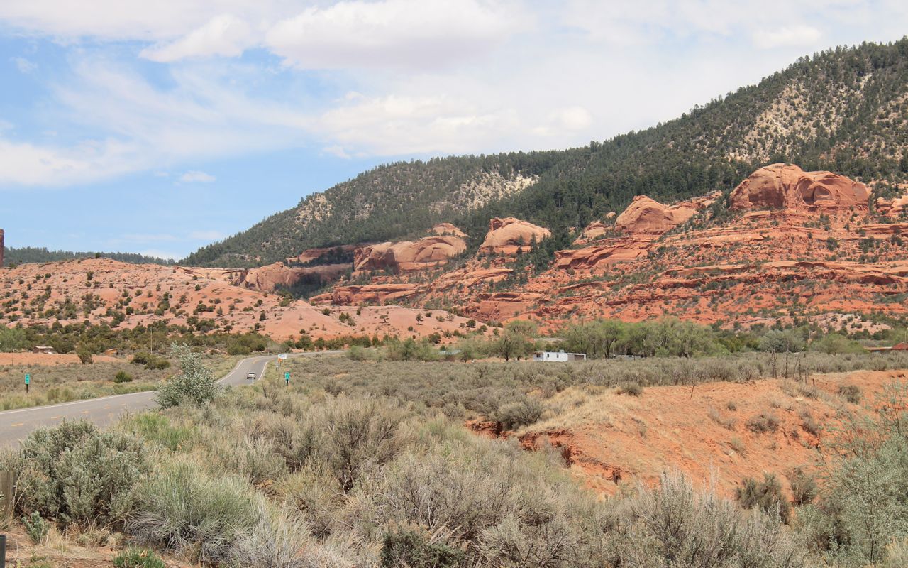
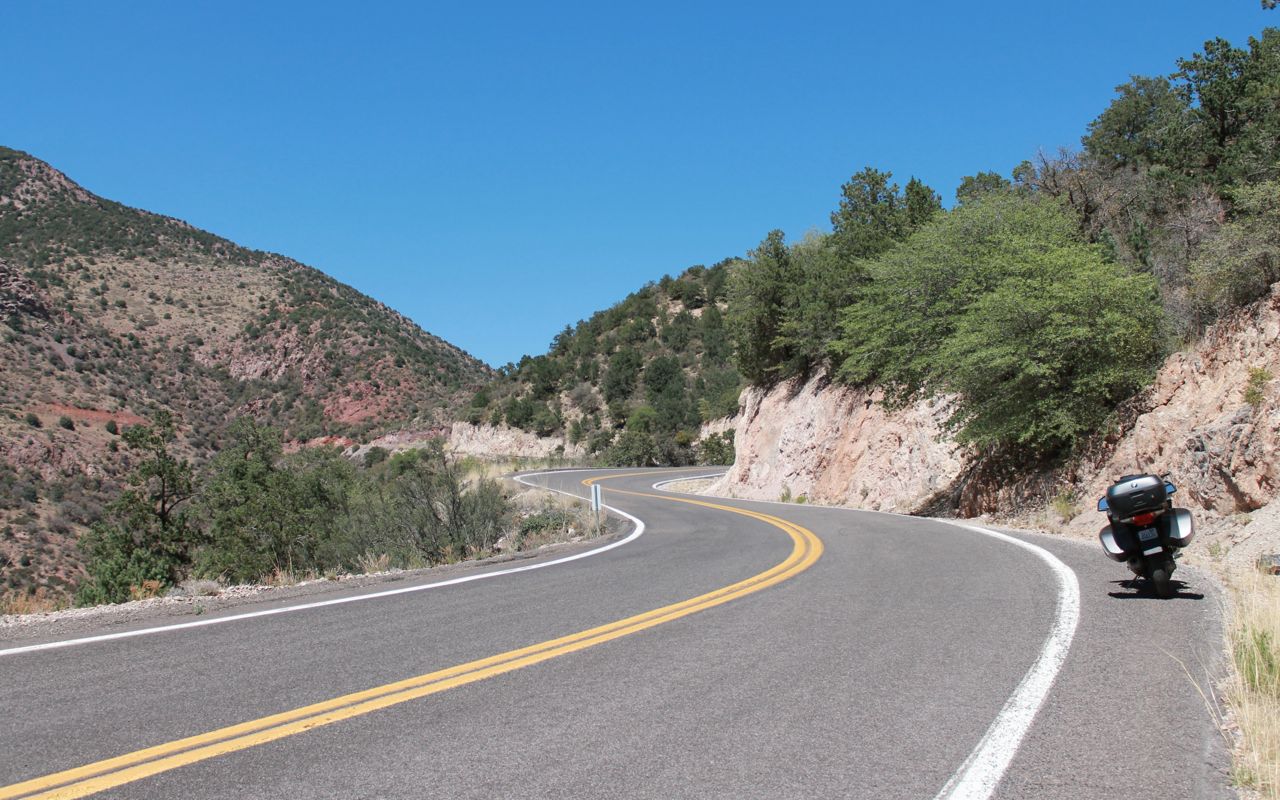
This road was technically challenging, beautiful and reminded me of parts of Hwy 12 in southern Utah.
The top of the plateau was forested …
and one vista point offered a view into New Mexico.
The temperatures at the top were in the mid 70s and I wasn’t looking forward to the higher temperatures I would find in the valley below.
I arrived at my motel in downtown Durango about 5pm. I chose a spot downtown so I could walk to dinner at Steamworks, the restaurant I ate at last time I stayed here. And guess what? I ordered the Cajun Boil again. 🙂
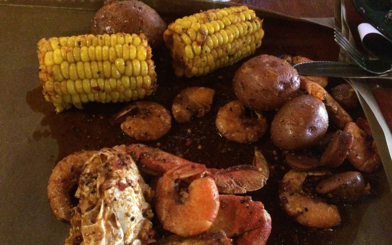
Shrimp, lobster, sausage, potatoes, corn mixed in a spicy sauce. Yummier than I remembered. I sat at the bar and talked with two people for the next couple hours while enjoying some craft beers. A great evening!
Tomorrow is a ride along the Million Dollar Highway and some other scenic roads here in Colorado. I can’t wait!
Day 18
Day’s distance: 238 miles
Total trip distance: 3,379 miles (odometer)
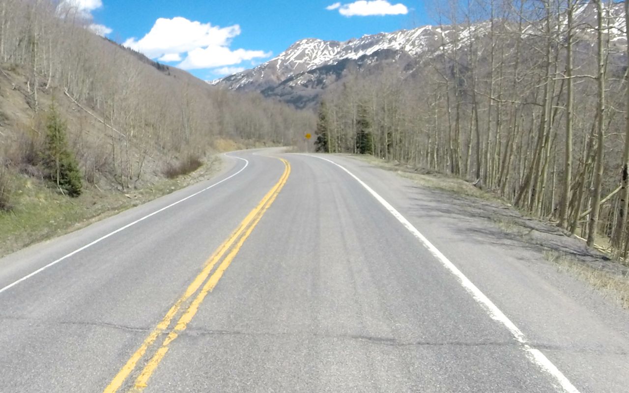
Sunny skies and warm weather continued today with temperatures ranging from low 60s above 10,000 feet to high 80s at lower elevations. Winds picked up quite a bit as the day progressed and were blowing both me and bike around during the last two hours.
Rolling out of the motel in Durango about 9:30, I made a quick stop at Durango Roasters for a latte. I needed the energy as I woke up way too early!
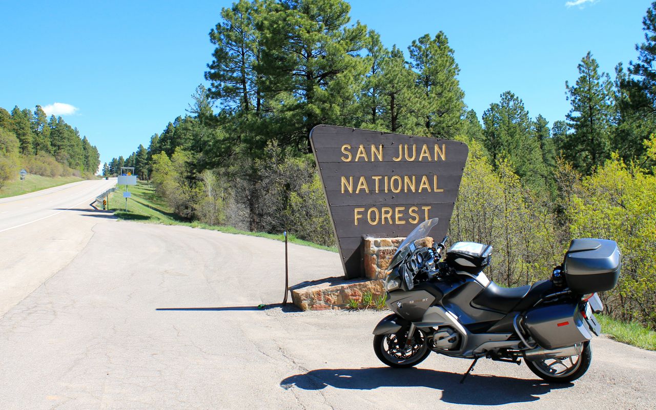
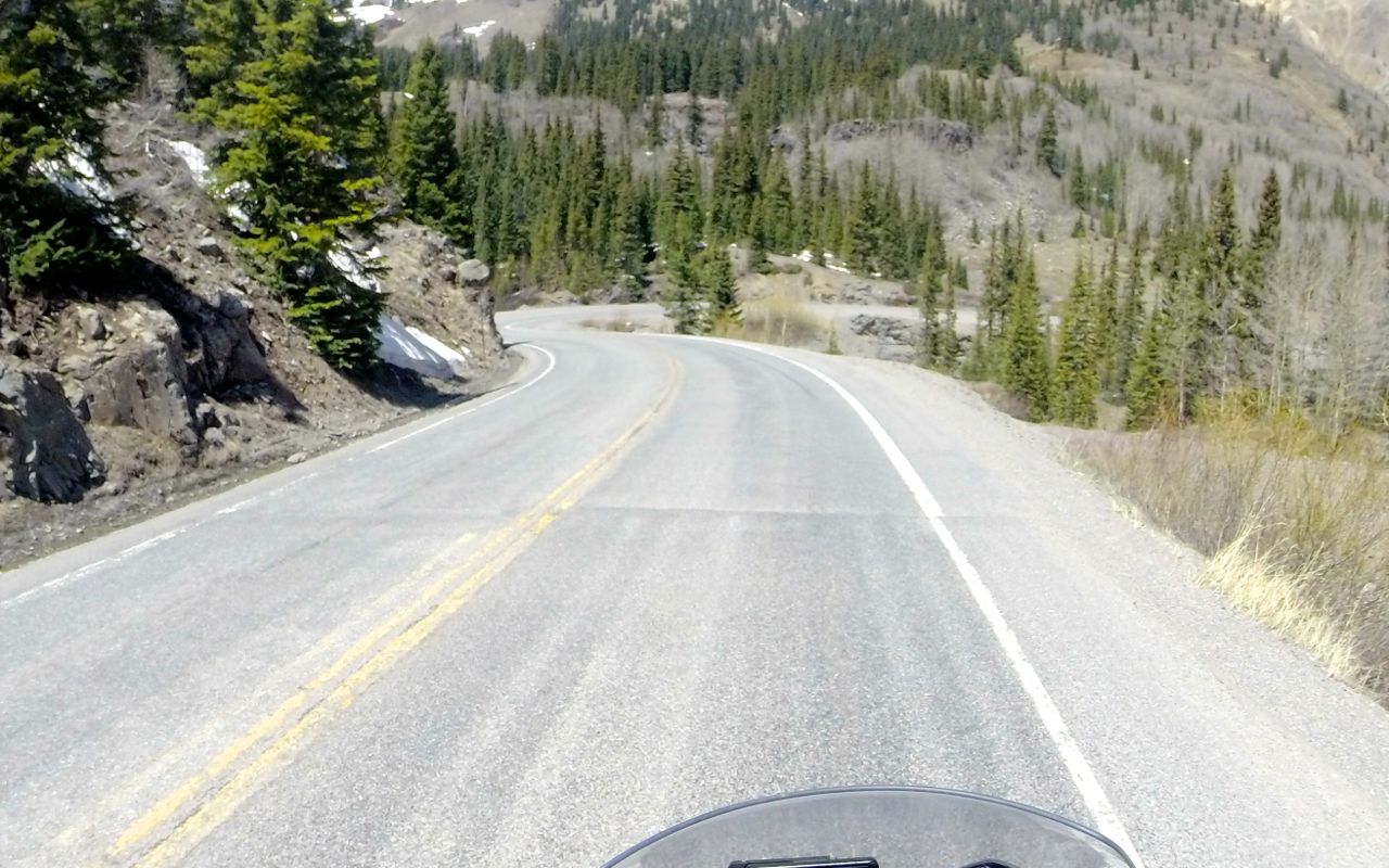
Finally, I rolled out of town heading north at 10am. Traveling north on Hwy 550, traffic quickly diminished and I found myself in the San Juan National Forest.
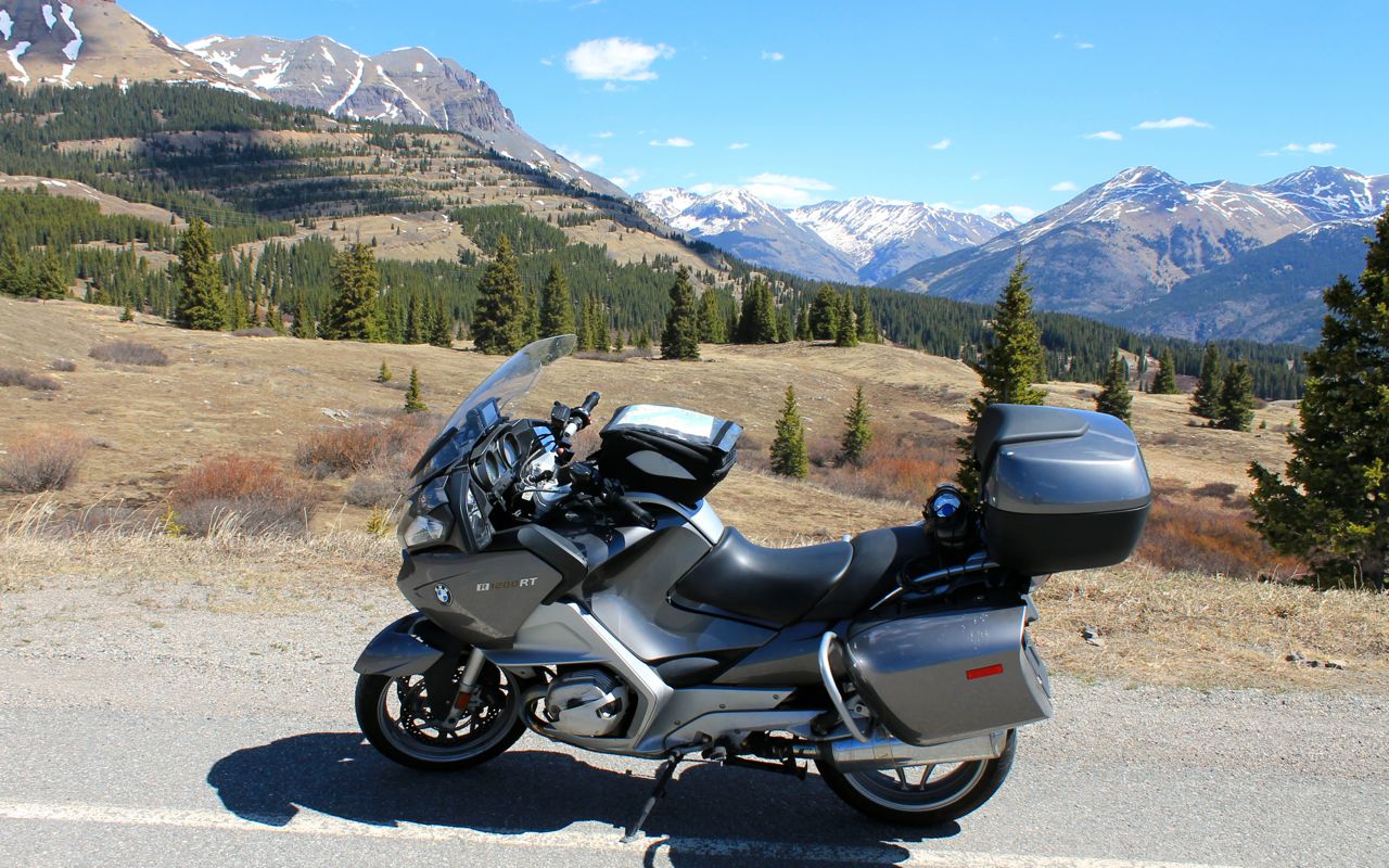
The highway climbed up from Durango’s 6,500 ft elevation to about 10,900 ft at Molas Pass Summit.
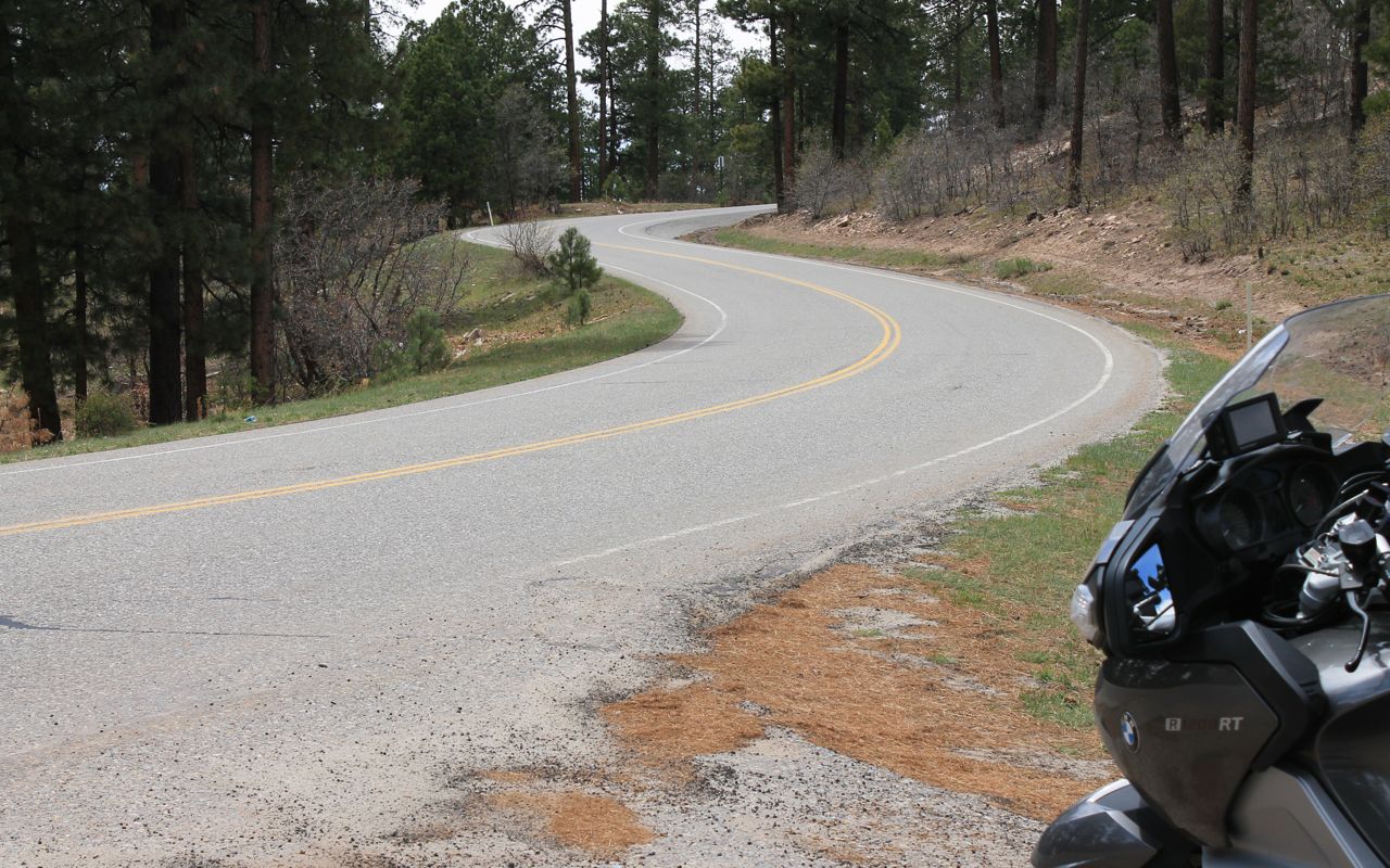
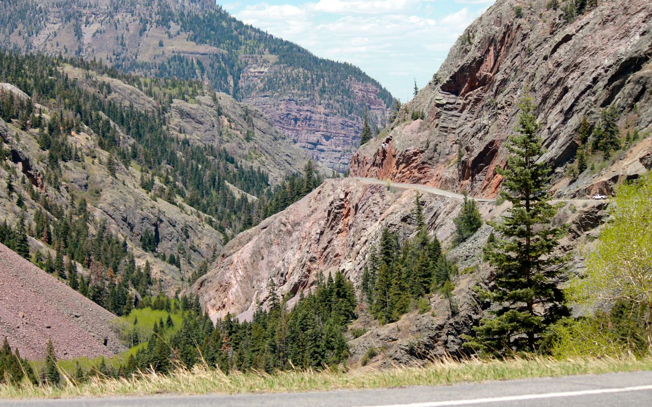
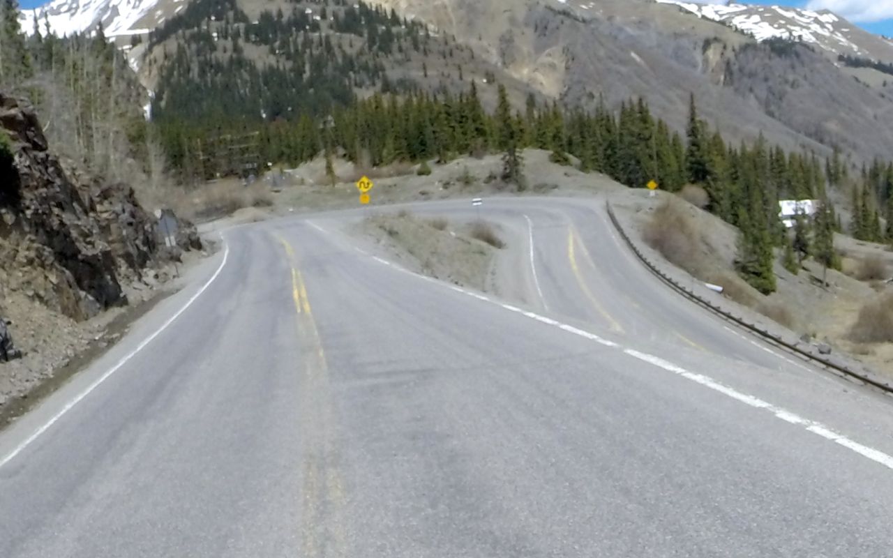
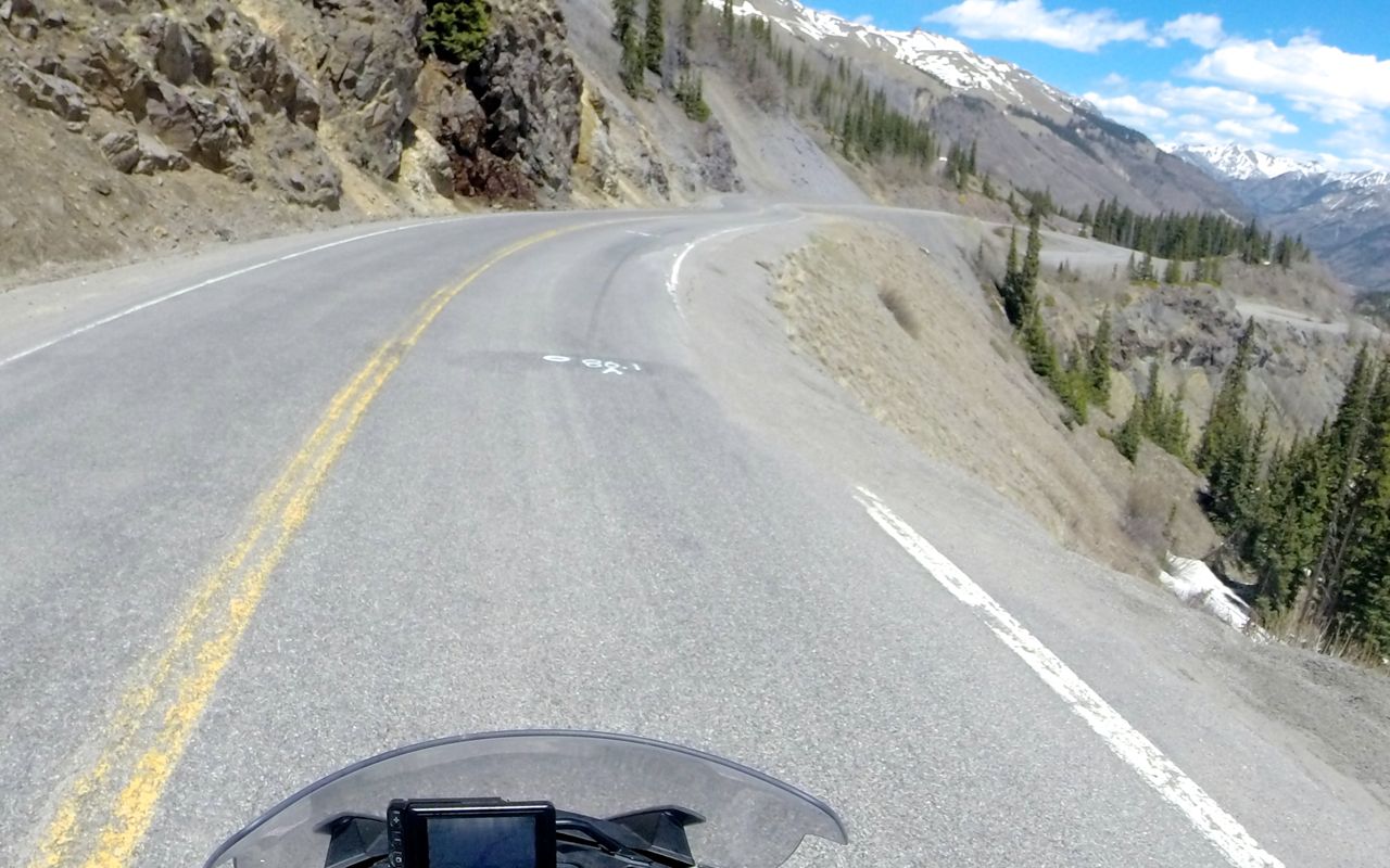
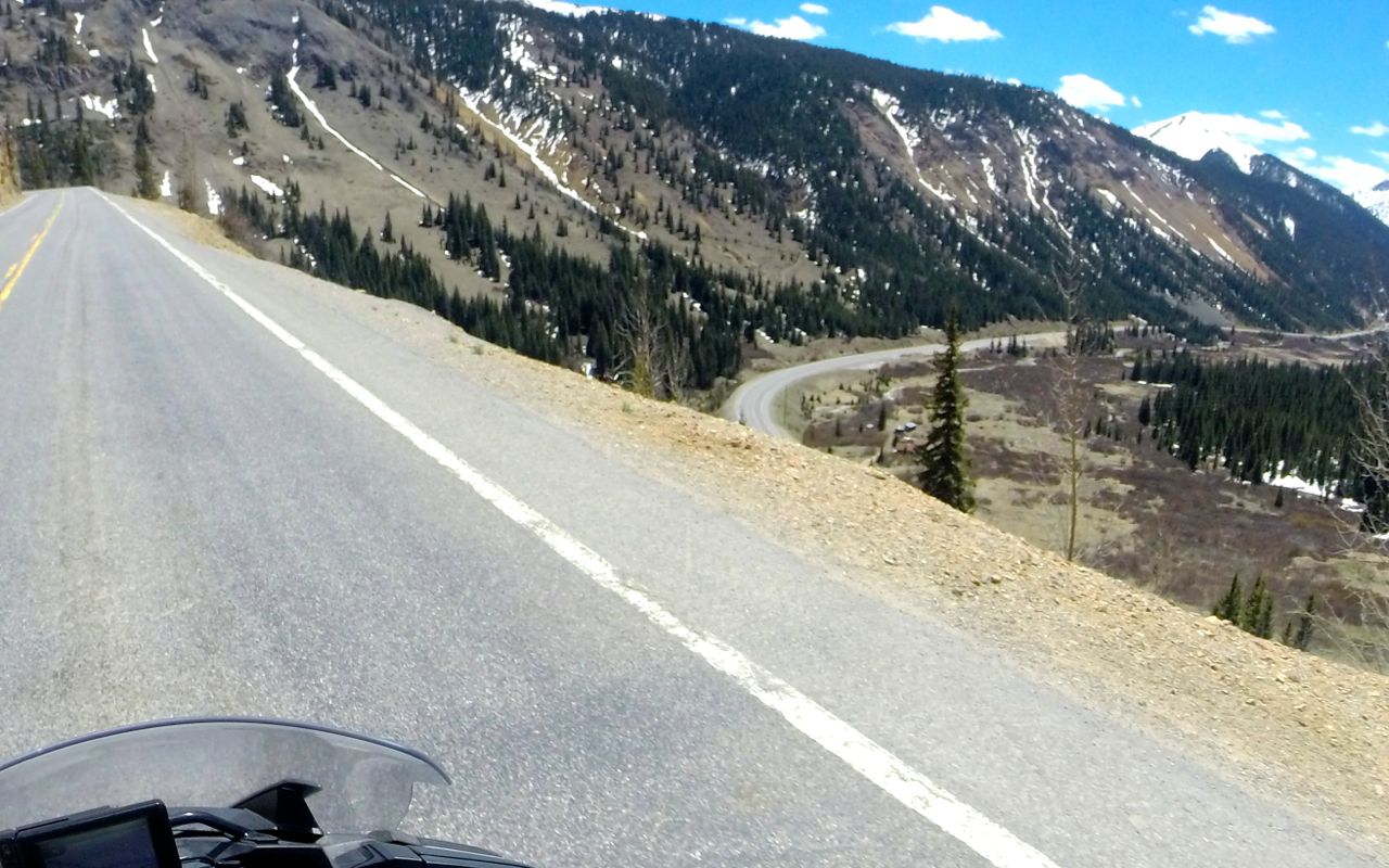
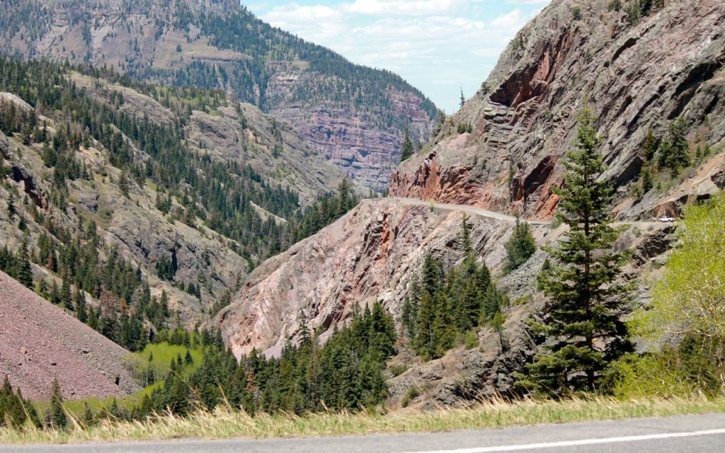
The section of Hwy 550 between Sliverton and Ouray is often referred to as the Million Dollar Highway. According to wikipedia …
though the entire stretch has been called the Million Dollar Highway, it is really the twelve miles (19 km) south of Ouray through the Uncompahgre Gorge to the summit of Red Mountain Pass which gains the highway its name. This stretch through the gorge is challenging and potentially hazardous to drive; it is characterized by steep cliffs, narrow lanes, and a lack of guardrails; the ascent of Red Mountain Pass is marked with a number of hairpin curves used to gain elevation, and again, narrow lanes for traffic—many cut directly into the sides of mountains.
Here’s a shot of the roadway cut out from the mountain side with steep drop-offs and no guardrails …
and one of the many hairpin turns.
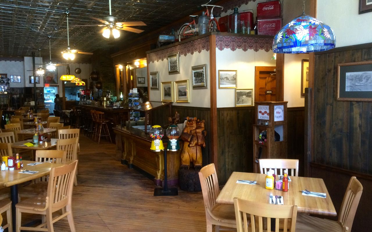
I grabbed lunch in Silverton at the Brown Bear Cafe.
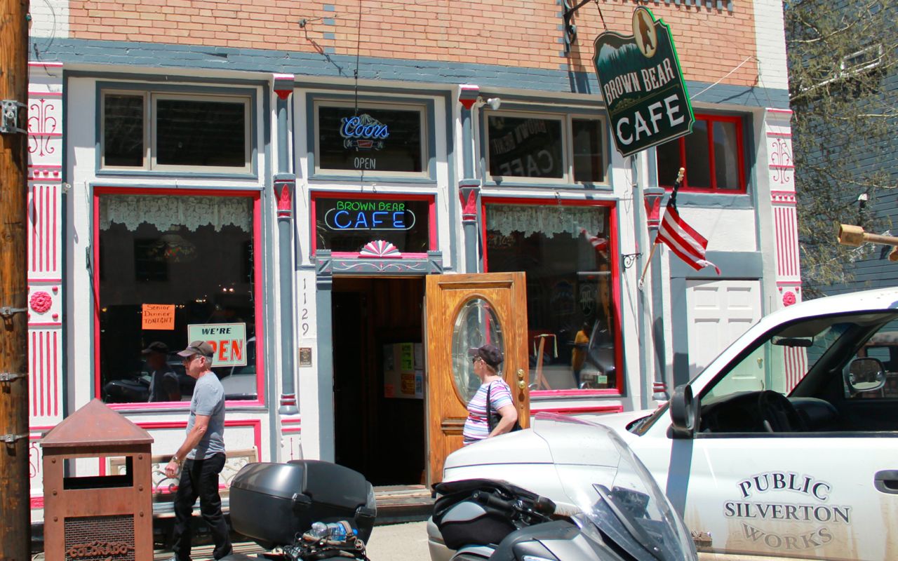
The building that houses the Brown Bear Cafe was originally built in 1893, according to the information on the back of the menu.
I shared my table with another biker, Brian, who hails from Oklahoma City.
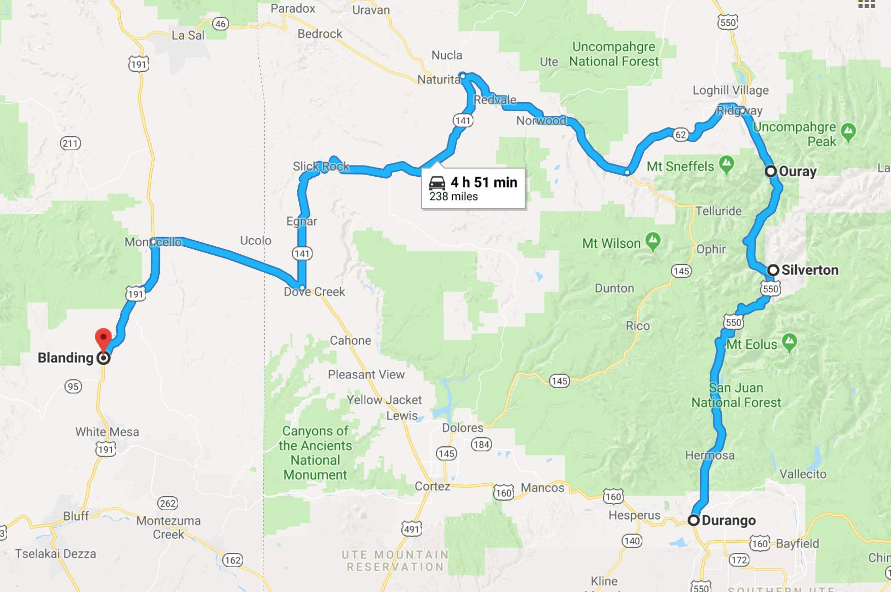
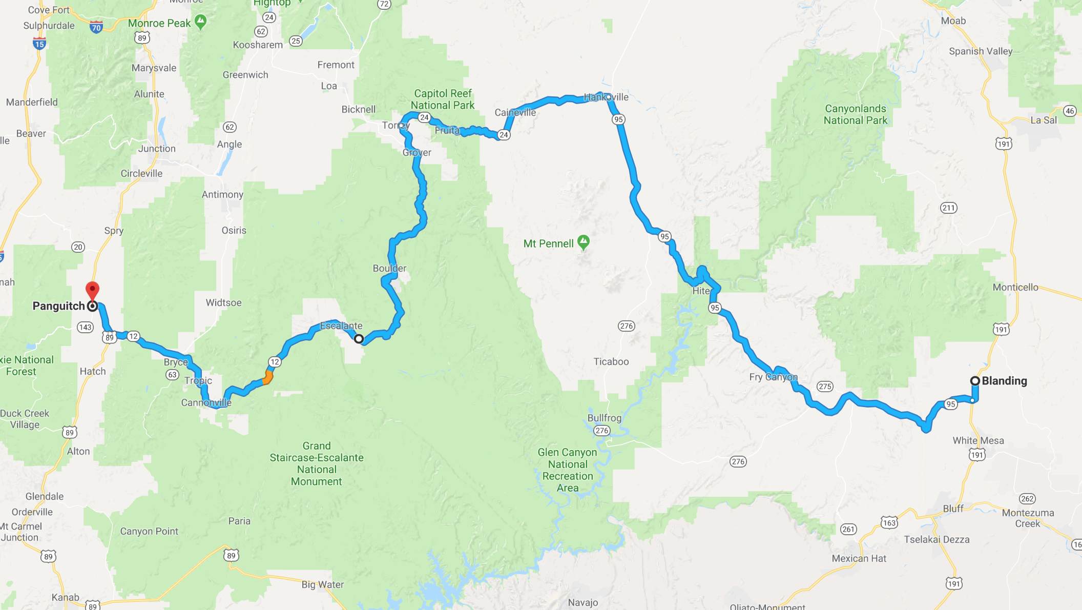
Originally, I had planned to ride to Grand Junction today to then ride through Moab tomorrow. However, on reaching Norwood and taking a break for another latte at the Good Eats Cafe, I decided to skip both Grand Junction tonight and Moab tomorrow.
Instead, I altered my route to head straight to Blanding. This shortens my trip by one full day. I’ll return on another trip to spend some time in Moab when I’ve done more planning. I can feel myself running out of energy and getting home a little earlier will give me additional time to rest up before my June trip to Alaska.
From Naturita to Blanding, the roads were lightly traveled and in good shape.
The wind was strong and, as mentioned, threw me and the bike around quite a bit. This did not contribute to my overall energy level. 😦
Eventually I entered Utah …
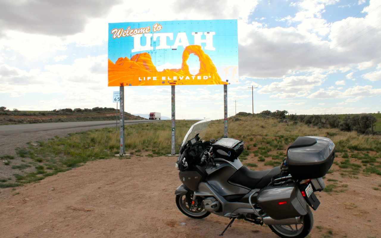
and my motel for the night. It was good that I arranged this room while in Norwood because the Inn was full when I arrived at 6pm.
Below are a few more photos of the Million Dollar Highway.
Since 2014 when I entered Colorado on my Western States Tour, I’ve wanted to check this road off my bucket list. It is now checked!
Tomorrow I head west across southern Utah. High winds are projected for the day, again, but temperatures will be a bit cooler.
Day 19
Day’s distance: 300 miles (odometer)
Total trip distance: 3,679 miles
It was another windy day with reported gusts to 45mph this afternoon. Temperatures ranged from a low of 60 to the high 70s. The skies were hazy and a bit cloudy but predicted showers did not materialize, for me anyway.
None of today’s route was new to me, though I haven’t ridden west along it, so it was a bit different feeling.
I left Blanding at 8:30 feeling well rested. I expected the road surface of Hwy 95 to be full of slippery tar snakes but was pleasantly surprised at the good quality of all of today’s road surfaces.
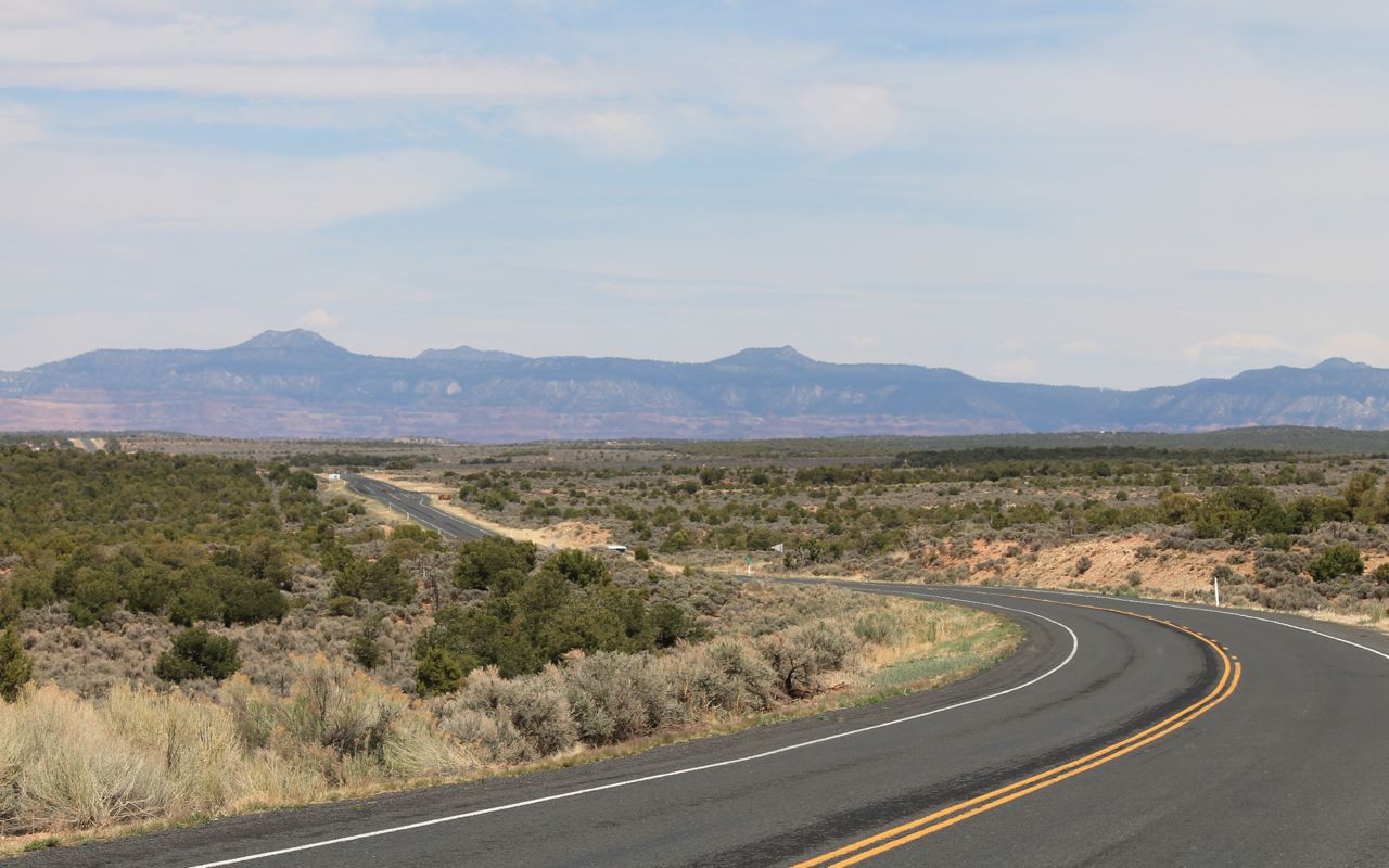
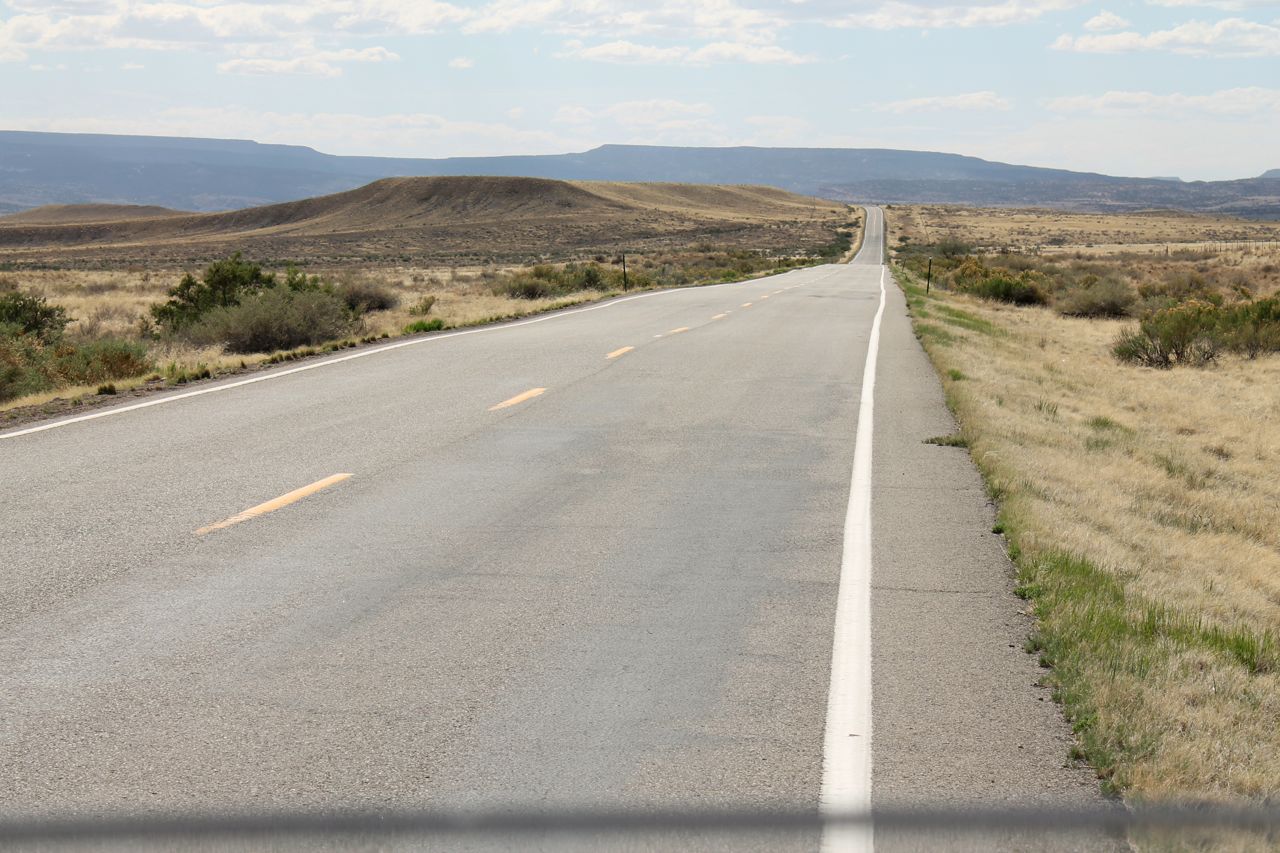
The views were great right from the start.
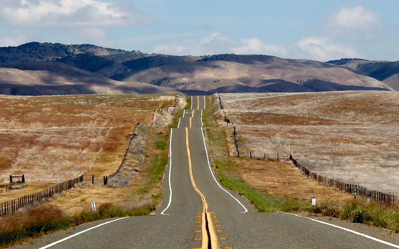
My readers might be tired of these “disappearing roads into the distance” photos, but they are great at highlighting both the roads I travel and the scale of the vistas. 🙂
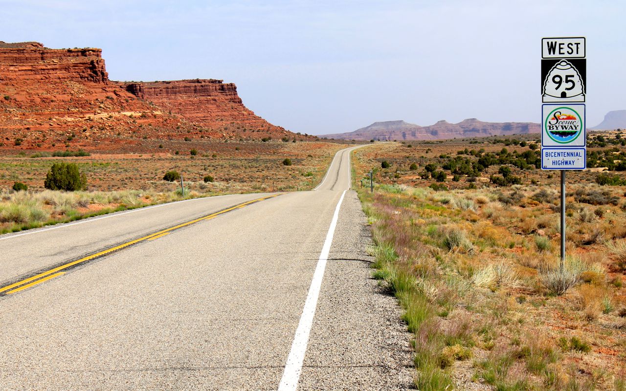
I have mentioned this before, but it is worth repeating. America’s Scenic Highways are very often very scenic and lightly traveled, making them superb choices for motorcycle touring.
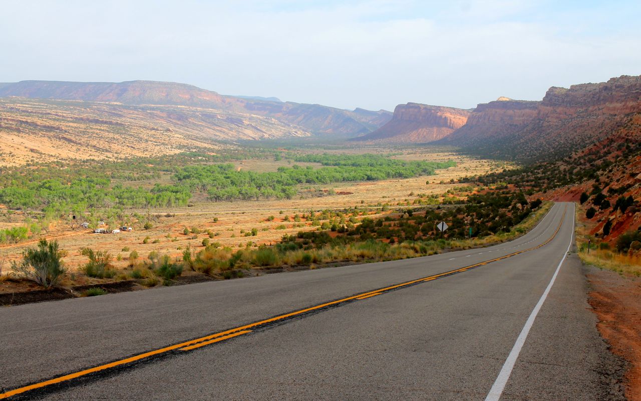
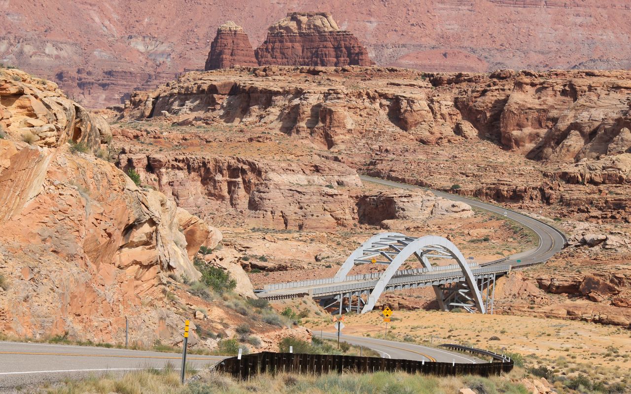
I’m getting close to the Colorado River flowing beneath this bridge. Today’s ride was full of non-technical gentle sweepers. Finding a flow was easy, especially when it felt like I had the road to myself.
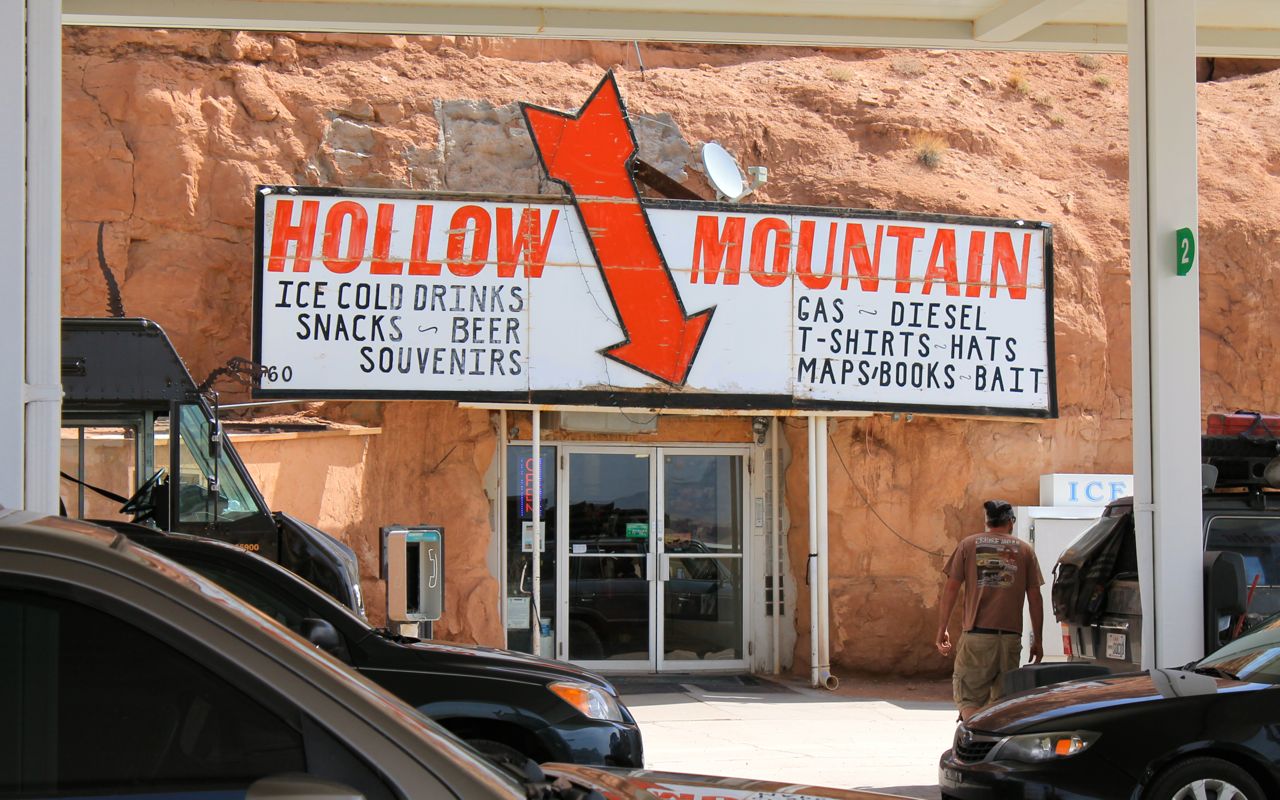
This was a unique gas station market built inside the mountainside. It is in Hanksville, where I would turn west on Hwy 24.
A section of Hwy 24 near Capitol Reef National Park was fun but today the park was crowded with cars, trucks and motorhomes. You would think it was summer already.
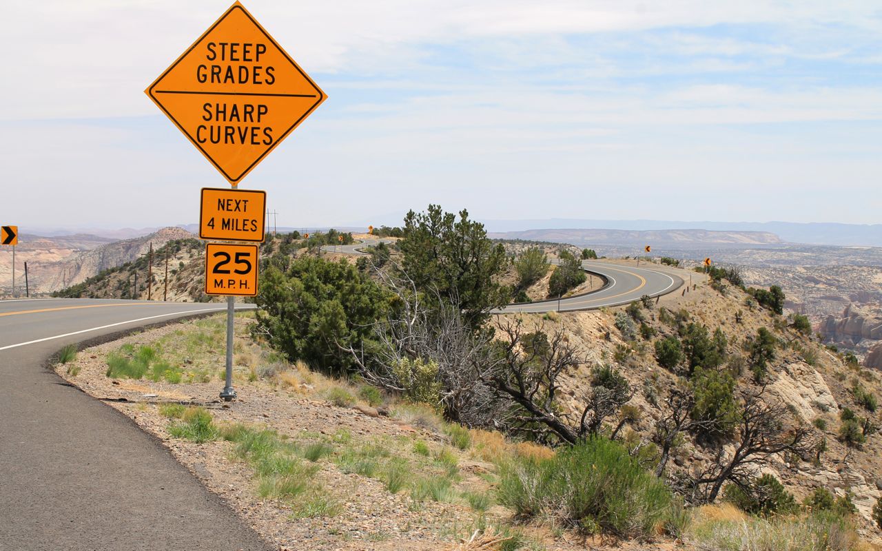
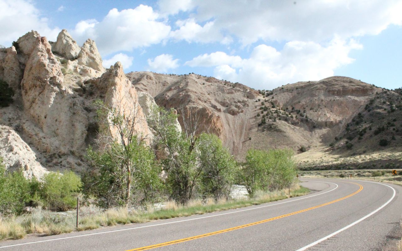
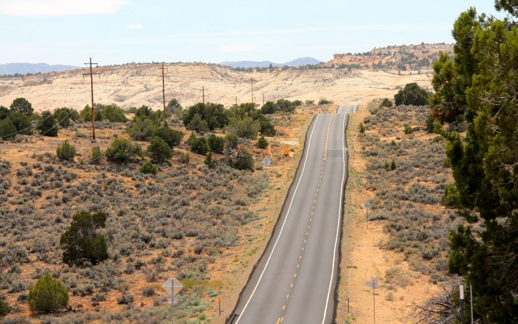
I stopped in Torrey for lunch before turning onto Hwy 12, one of my favorite roads.
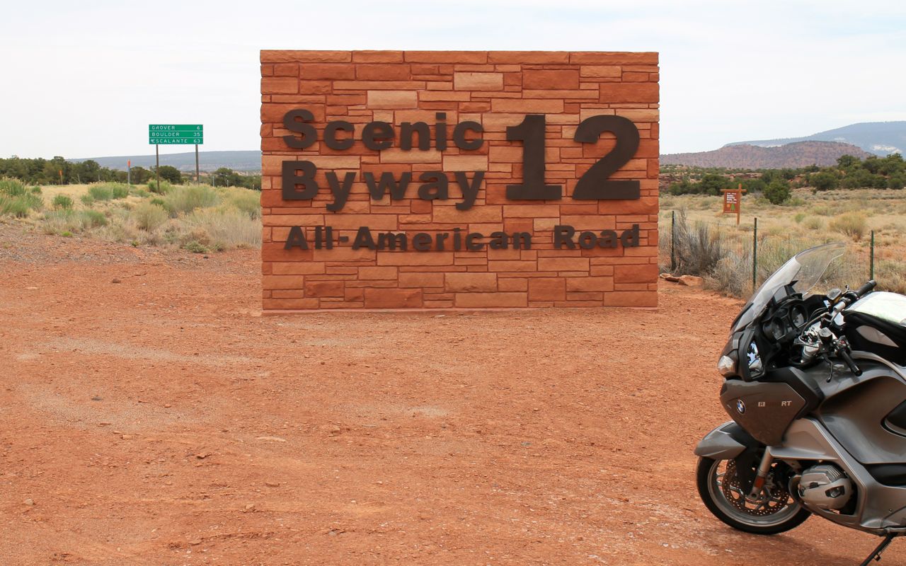
A section of Hwy 12 is nicknamed The Hogsback.
The Hogsback is a portion of Highway 12 that travels over the narrow spine of a mesa with canyons on either side created by Boulder Creek and Calf Creek.
It’s hard to imagine how these two creeks could create this. I’m impressed. 🙂
I have ridden this once before, from west to east. This time, it would be the other direction. To make it more challenging, nature threw in some very strong crosswinds.
Here’s a video I recorded in 2014 when I rode The Hogsback. There were no winds that day.
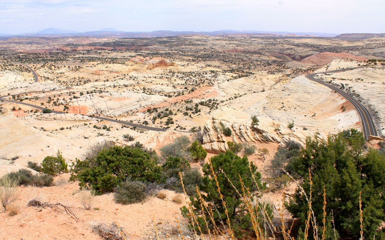
I could never tire of the combination of good roads and great views. It is no wonder Hwy 12 is usually included in various top-10 motorcycle road lists.

The view of Hwy 12 from a vista point. A close look reveals the snake-like shape of the road from left to right.
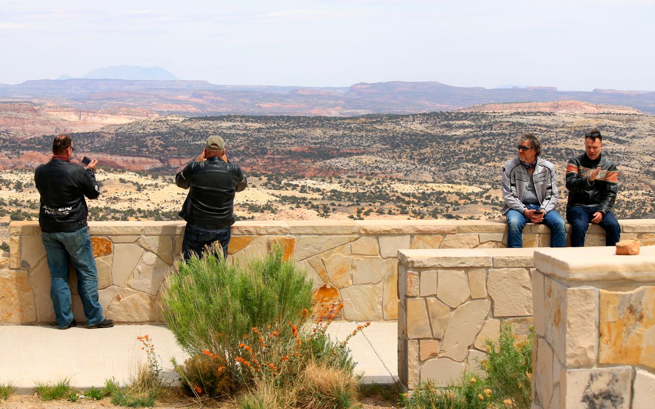
When traveling through popular motorcycle areas, you tend to see the same guys over and over. The two on the left were from Switzerland, the right two were German. I first saw all of them in Torrey, when they were topping off the tanks of their rented Harleys.
There are many national parks in this area, but today was just about the ride. I arrived at my motel in Panguitch a little after 4pm.
My housemate was born here in Panguitch. At his recommendation, I ate dinner across the street at the Cowboy’s Smokehouse Cafe where I sampled the brisket, baked beans, coleslaw and cobbler.
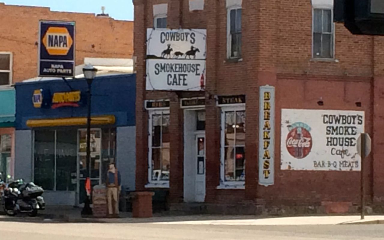
Everything was excellent!
I had time to see a movie also across the street from my motel at the GEM theater.
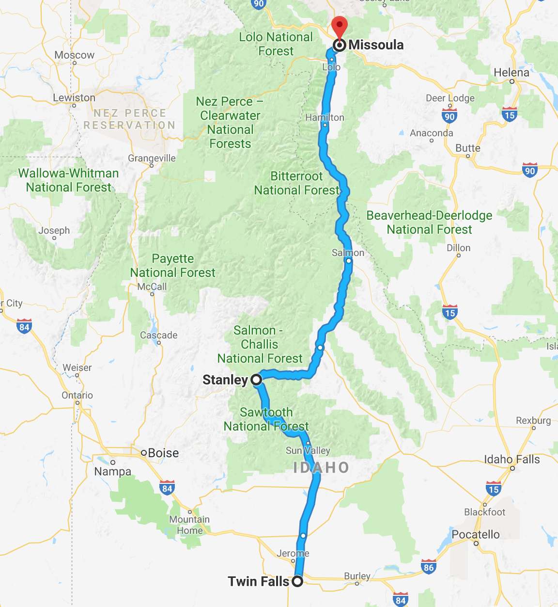
Tomorrow, I’m going to make a mostly-interstate run to Twin Falls, Idaho to set up my ride to Missoula through the Sawtooth, Salmon-Chalis and Bitterroot National Forests.
I feel I have to say I live a charmed life.
Day 20
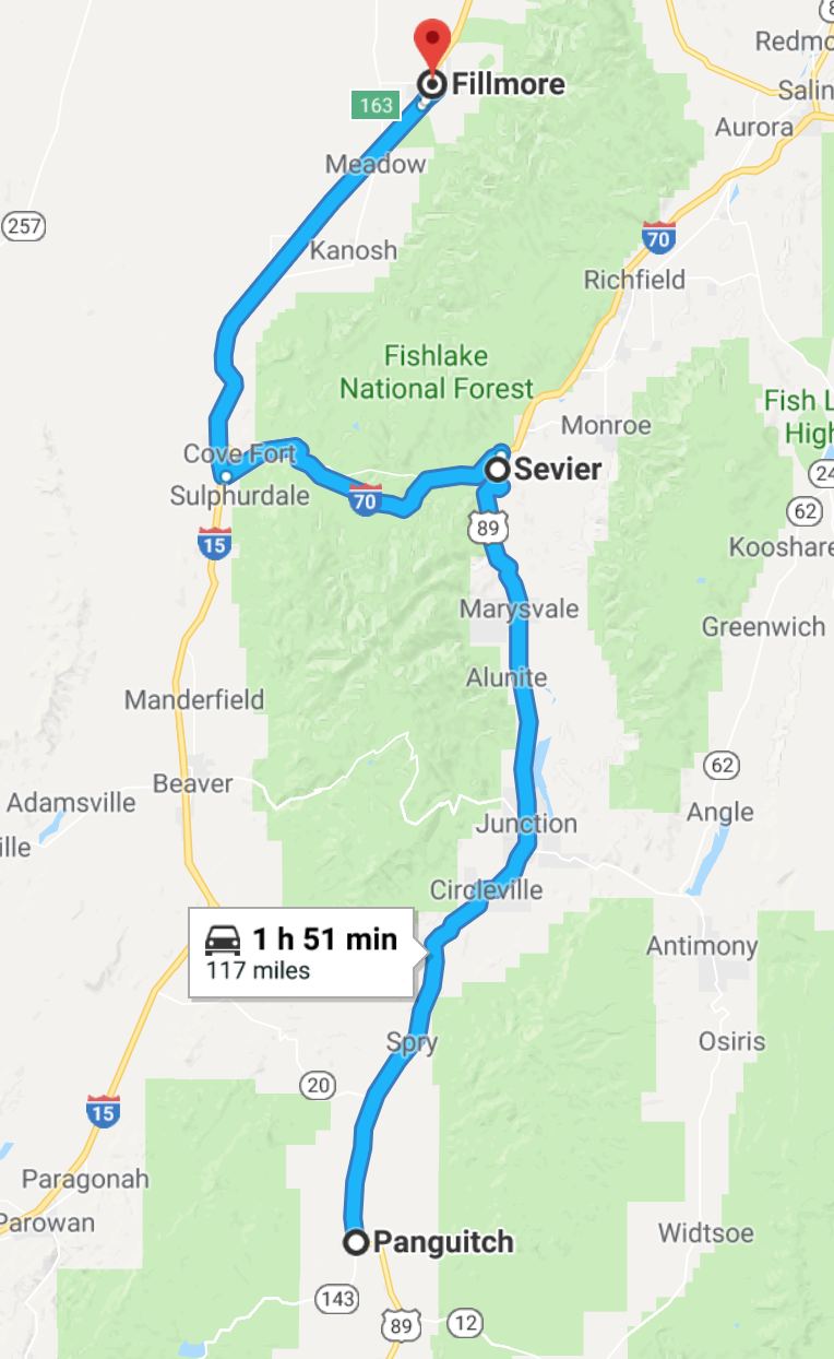
Day’s distance: 117 miles
Total trip distance: 3,796 miles
The weather started out with some dark clouds and a prediction of showers along my route. I felt better on reaching Sevier where there were blue skies and a short section of fast sweepers that made me smile.
However, on turning west on I-70, the skies opened up and the temperatures dropped to 37. It was pretty drastic and I stopped in Fillmore, which was the first opportunity to warm up.
I grabbed breakfast at a Burger King and drank a few cups of hot coffee with it.
I was evaluating my options for a day where I planned to ride 463 miles when I realized there was a Comfort Inn right next door. They allowed me the option to check in early (it was a little after 11am) and after seeing the weather improving all along the remaining route if I wait a day, I decided to take the rest of the day off.
I made use of my day by replacing the one burned-out low beam headlight (I have two) and creating a day-by-day itinerary for my June trip to Alaska.
For my Alaska trip, I think I would like to have all my hotels reserved and just do my best to stay on schedule during the entire trip. It is too risky to arrive in a small town in Alaska, northern British Columbia or Alberta without reservations at the beginning of the summer season.
Today is a good example of where the gear I brought with me fell short. For Alaska, I will want to augment my current riding suit with an old-school heavy duty 100% waterproof rain suit to keep me dry during most any rain storm and can be hosed off if it gets muddy. It would need to fit over my current riding gear, which fails in heavy rain, especially the pants.
I feel that to get all new gear before Alaska risks trashing it all if it is as muddy and messy as one might imagine.
I will also purchase either a tight fleece vest for between my base layer and the jacket liner or get a heated vest. Probably the former because I can see myself repeatedly trying to walk away from my bike still plugged in. How embarrassing would that be?
Yes, there are battery operated vests. I do believe that is what Carson uses. But knowing me, I would forget to charge it the night before I needed it or not be able to recharge it because I’m camping that night. Doh!
For those interested in my Alaska plans, I will be creating a trip planning post next week after I return home. There are a few details still being worked out.
Day 21
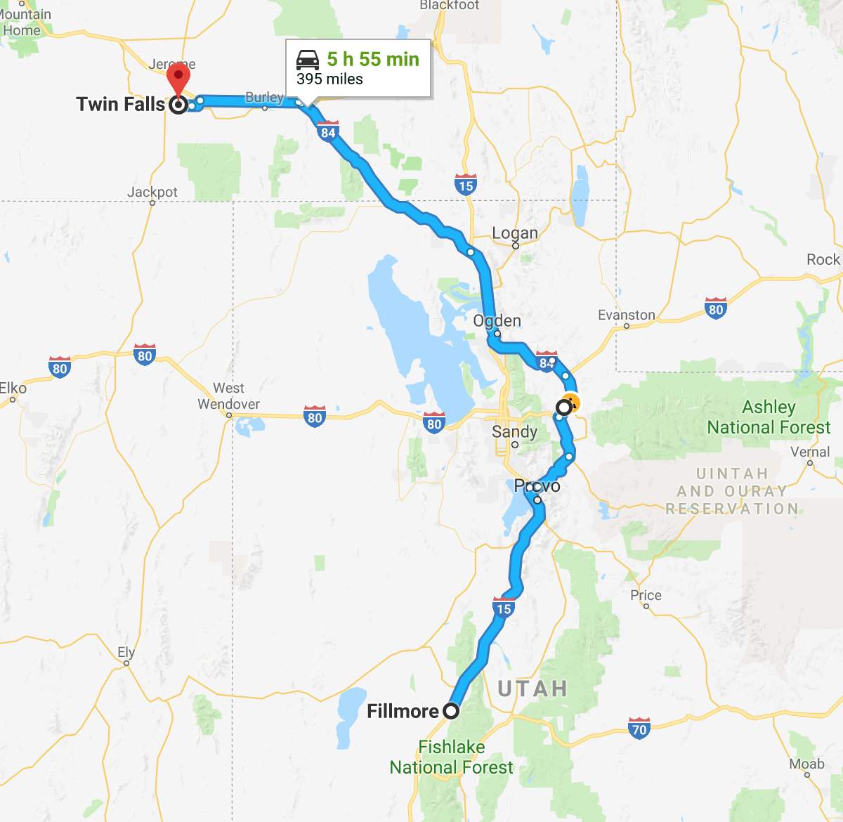
Day’s distance: 395 miles
Total trip distance: 4,191 miles
Much of the day was very pleasant. Temperatures started in the 50s with blue skies and fluffy clouds. This lasted until about 2pm when I encountered some gray skies and storm clouds. More on that later.
My destination was Twin Falls, Idaho, the same as yesterday, and I began just after 8am. Heading north on Interstate 15, I made good time due to a combination of light traffic (being a Sunday) and very generous speed limits of 80mph.
As I had time today, and wasn’t (yet) expecting to hit rain, I stopped in Payson for a latte at Joe Coffee Shop and Espresso.
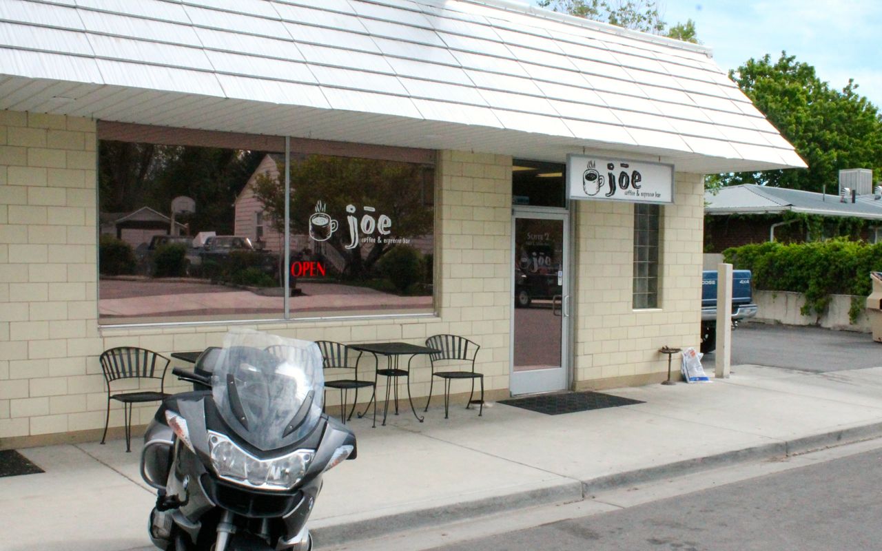
This place is a couple miles off the interstate but worth the ride for the good coffee and great bagel sandwiches. I had a Turkey and Avacado – their most popular option. Much more popular than the photo above suggests, there was a steady stream of traffic through the drive in as well as folks sitting inside.
Several local residents who were standing outside talking when I arrived asked about my trip. Two of them had or have a motorcycle and one used to live in Bellingham, WA. They told me about some of the local roads that I might enjoy and pointed them out on my Utah Butler Map. Every one was marked in either gold or red, meaning they were well judged and suitable for enjoyment.
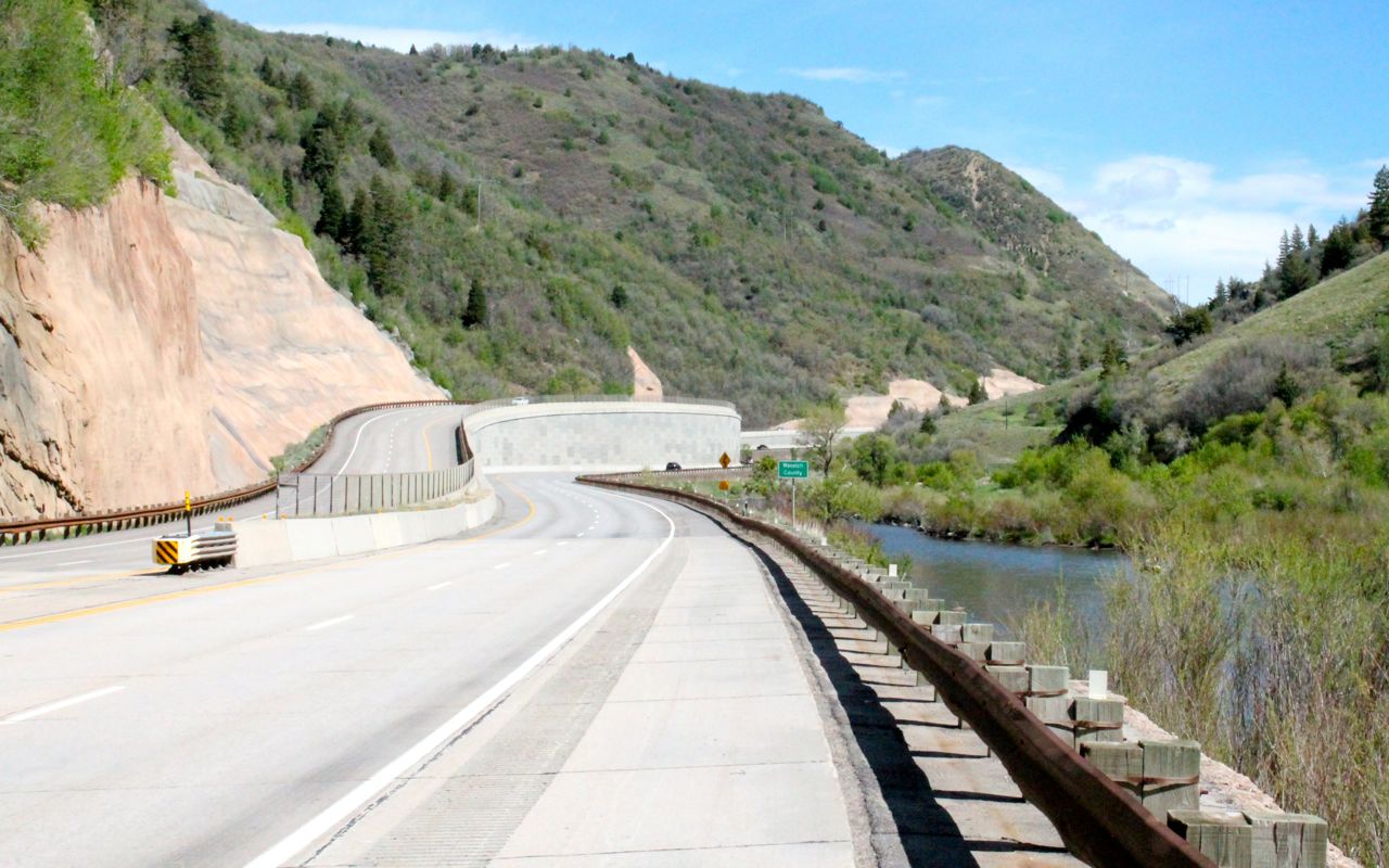
I decided to take a detour around Salt Lake City as it was early and the change only added an hour to my day. So after getting back on I-15, I turned east on Hwy 189 and headed towards Heber City.
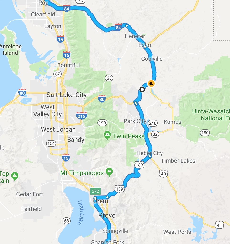
Hwy 189, also known as the Provo Canyon Road, follows the Provo River. It is a wide, well-surfaced divided highway but had some fun sweepers and interesting scenery.
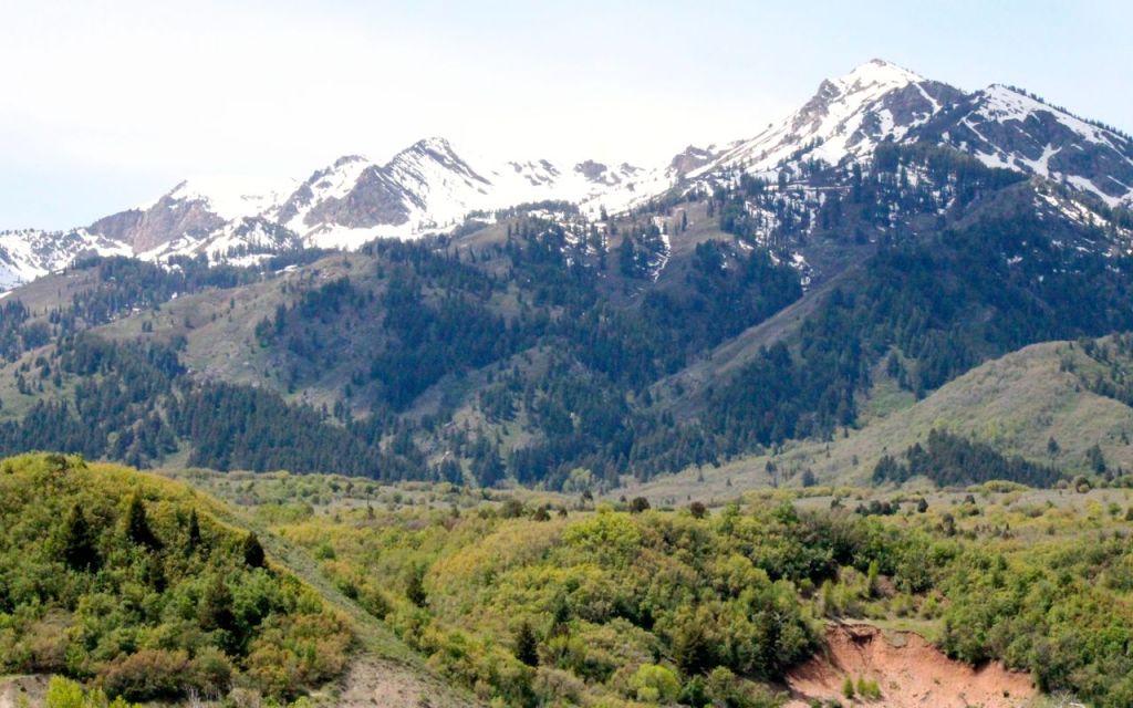
The mountain peaks of the Wasatch Range, to the east of Salt Lake City were to my west on this ride, and rarely out of sight.

I kept flashing back to the time I was stationed in Colorado Springs long, long ago. It was a combination of strong sunshine, cool temperatures, and the Wasatch peaks that reminded so much of that city in Colorado.
The detour around SLC was totally worth the extra time and miles.
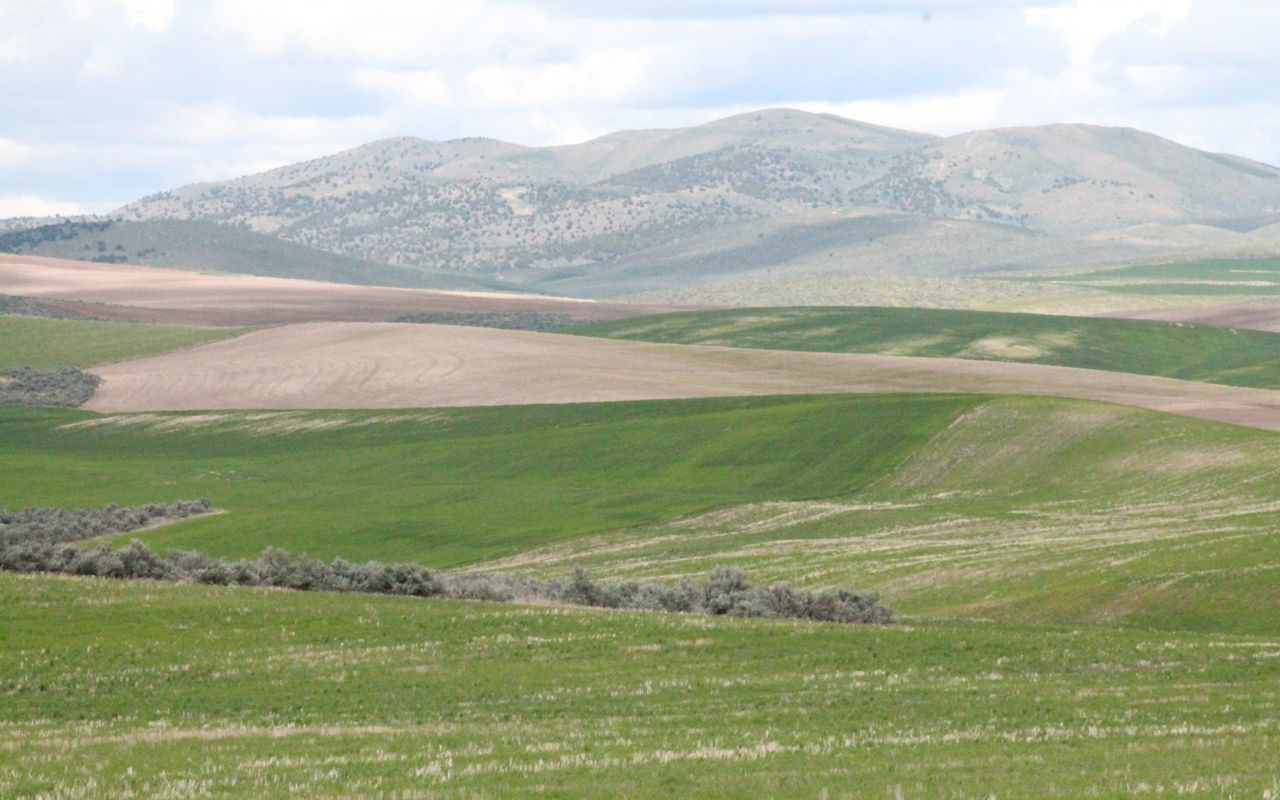
Later in the day and closer to the Idaho border, the landscape changed.
The skies were turning dark ahead, so I stopped and looked at the weather radar in the area. Sure enough, there was precipitation ahead along my route.
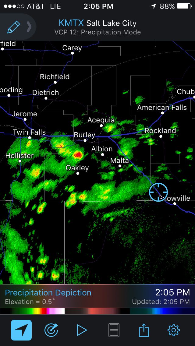
I rode through some light showers north of Snowville, but was able to stay out of the rest of the precipitation until I was within 20 miles of Twin Falls. The temperature had fallen down to 50.
It looks worse than it was.
The accumulated rains didn’t soak through my riding gear and I stayed dry and warm (enough) with the seat and grip heaters on low.
After checking in to my motel and cleaning up, I went to the local bar and grill for a bite to eat and a pint of ale. I was told by two ladies also sitting at the bar that I looked like a younger Ted Allen (Chopped, Queer Eye, etc.). Little did they know that I’m actually seven years older, but I’ll take it. LOL
Tomorrow, I’ll be riding north to Missoula through Stanley, a small town located in the Sawtooth National Forest. I’ve been there before, but not further north through Salmon, Idaho. The weather looks dry, though maybe cloudy.
From Missoula, I will (probably) ride back to Seattle via Hwy 12, one of my favorite semi-local rides.
Day 22
Day’s distance: 395 miles (odometer)
Total trip distance: 4,586 miles
This was a gorgeous day of riding in the mountains of Idaho. Temperatures reached 80 after starting off at 45. Skies were clear in the morning with increasing cloud cover in the mountains. At times, I thought I was going to get rained on, but it never happened and when I reached Missoula, there were only a few fluffy cumulus clouds.
I grabbed a Starbucks latte and breakfast sandwich while still in Twin Falls. I was heading north on Hwy 93 by 8am.
In Shoshone, I continued north on Hwy 75. This section is also known as the Sawtooth Scenic Byway.
I think I need to change the name of this tour to the 2018 Western Vistas Tour. The vistas I’ve seen on this trip will totally spoil me.
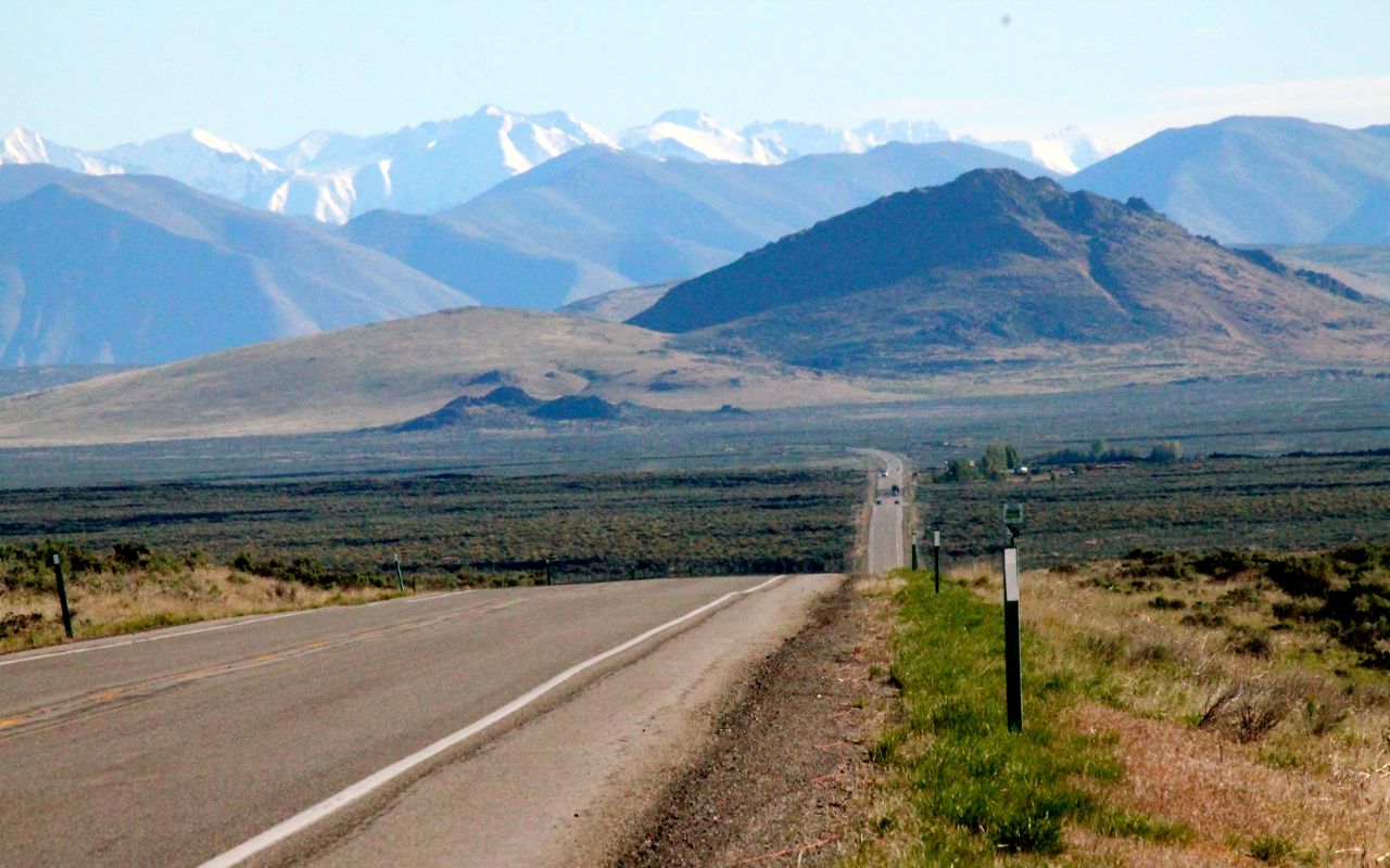
As the mountains got close, I started to get very excited for today’s ride.
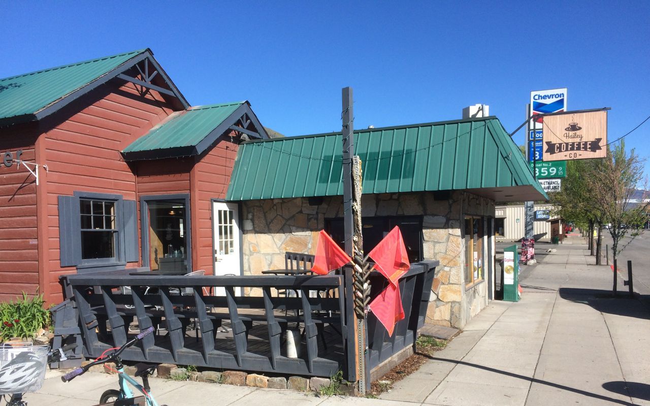
I stopped in Hailey to update folks back in Seattle. While there, I had another latte and a cinnamon roll from Hailey Coffee Company.
This trip has continually surprised me. It seems I get a clear cell signal almost everywhere. Things have changed since 2014 when I took my first long trip.
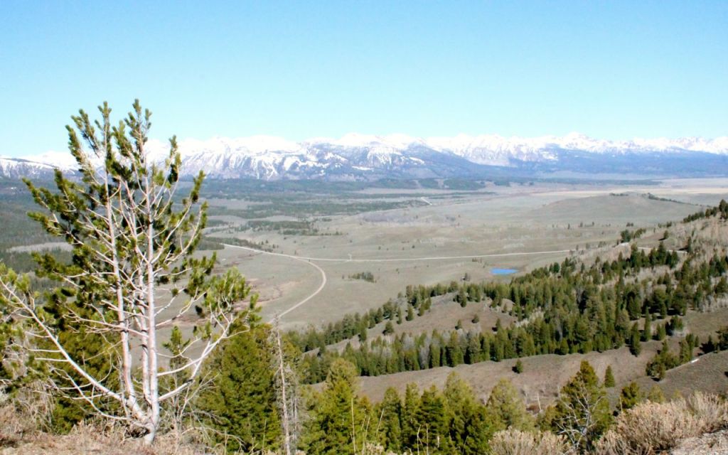
Soon I was ascending Galena Pass …
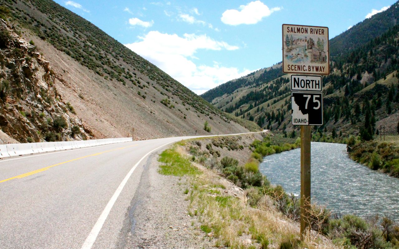
and overlooking the Sawtooth Valley that is the headwaters for the Salmon River.

On arriving in Stanley, I topped off with fuel and grabbed a snack. There were three motorcycles in the parking lot that weren’t there when I arrived, so I strolled over to say hello.
We ended up chatting and laughing for about 20 minutes, during which time we collectively nicknamed the group the Team PALMM. From left to right, Paul, Andy, Laura, Matt, and Mark. Paul came up with the name to help me remember who was who. Paul, Andy and Mark were riding while Laura and Matt provided support from their car.
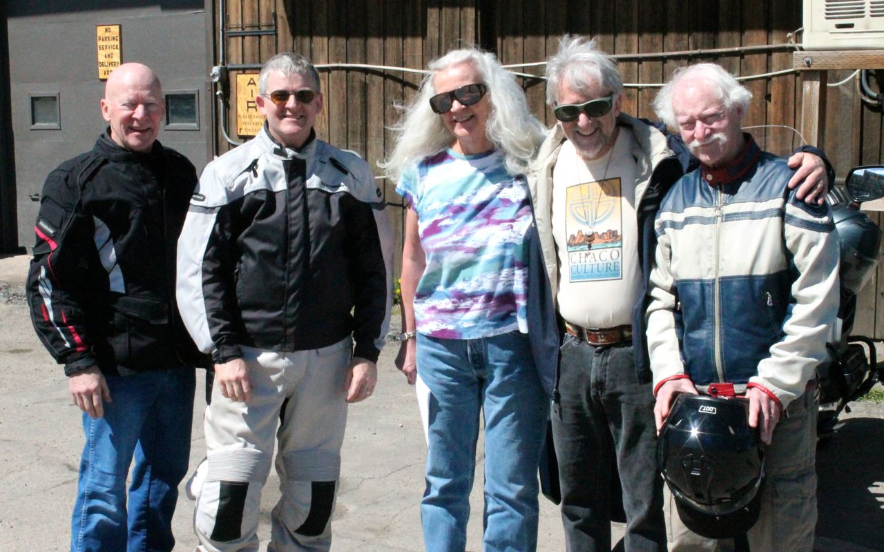
They were taking Hwy 21 west out of Stanley, the route I took last time I was here. I was to continue north on Hwy 75, now also known as the Salmon River Scenic Byway.
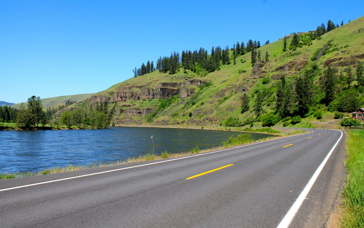
Regular readers know that I love two-lane roads that follow alongside a river and this one would take me happily towards Missoula. The surface was excellent and the road twisty while not being technical.
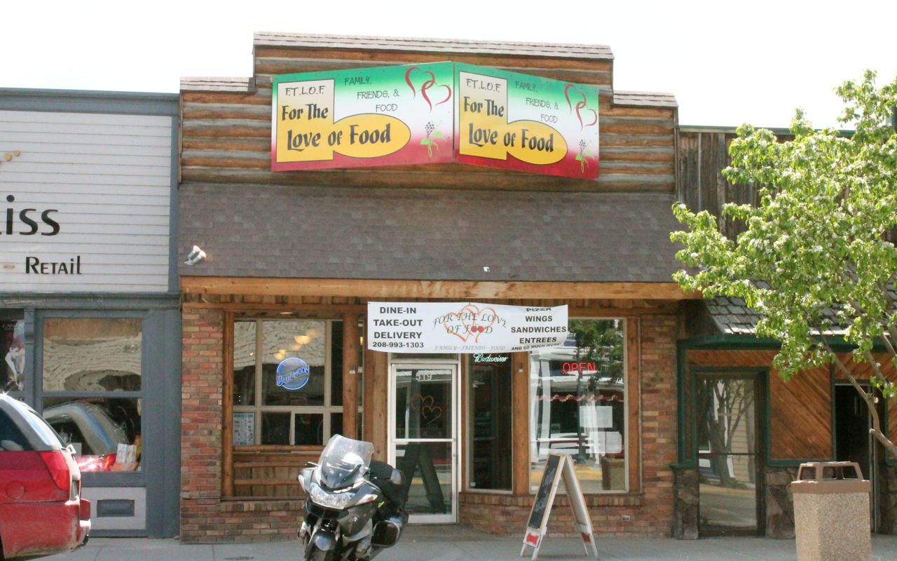
I stopped in Salmon for lunch at For The Love of Food. The chef recommended the Cajun Quesadilla, one of the two specials of the day. It was excellent. Stop by if you find yourself in Salmon, Idaho.
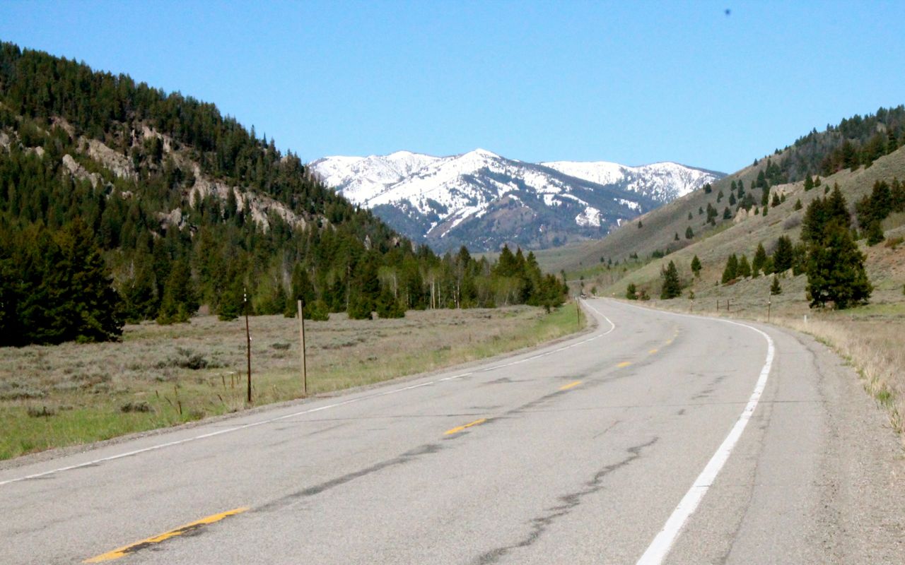
While the roads were generally in great shape and I soon reached Montana.
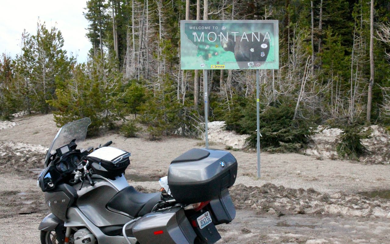
The last 10 miles of Hwy 93, near the Montana border and the first five miles or so on the Montana side were pretty rough, no doubt from snow plows. Views on the Montana side didn’t disappoint, though.
The speed limits went from 45mph in Idaho instantly to 70mph on the Montana side. They do love driving fast here.
On this side of the mountains, Hwy 93 follows the Bitterroot River. As I got closer to Missoula, the once-remote road became crowded. I slogged through the rush hour traffic until reaching my motel.
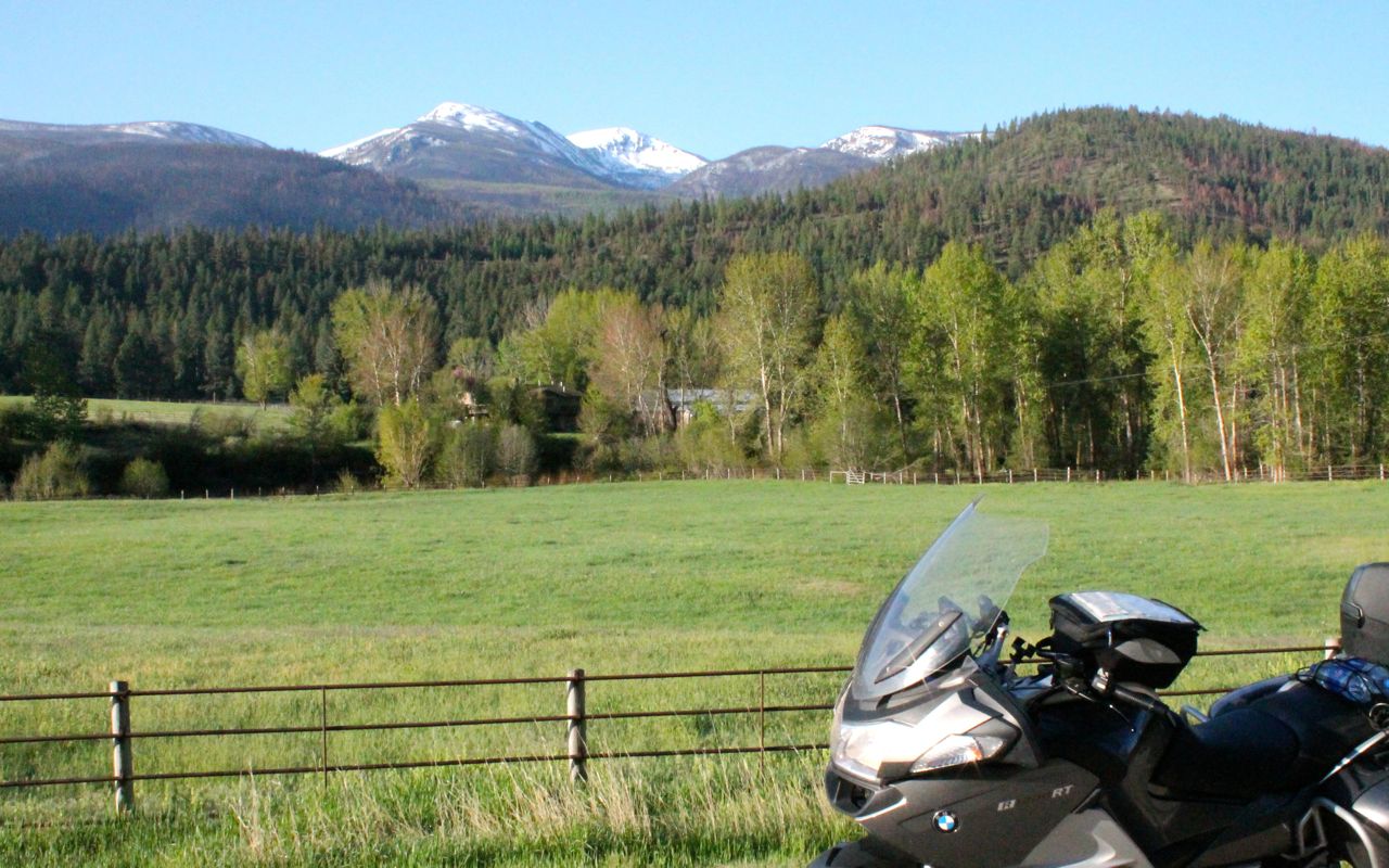
Tomorrow, I’m planning to take Hwy 12 over Lolo Pass and down into Lewiston. This route follows the Lochsa River and is one of my favorite roads. If I get an early start, I’ll have time to head back home afterwards. In my favor is a one hour time change. We’ll see how it goes.
Day 23
Day’s distance: 530 miles (odometer)
Total trip distance (final): 5,116 miles
Today’s temperatures started at 45, dropped to as low as 38 at the Pass, and rose to 94 before finishing in the 80s. All this under sunny skies. Light headwinds buffeted my final two hours of riding back home.
My second highest mileage day ever was just 10 miles below my record It took about eleven hours and a half, my second longest day of this trip, by about 30 minutes.
Lolo Peak is visible early in my morning ride. It’s about 7:30 local time and still brisk.
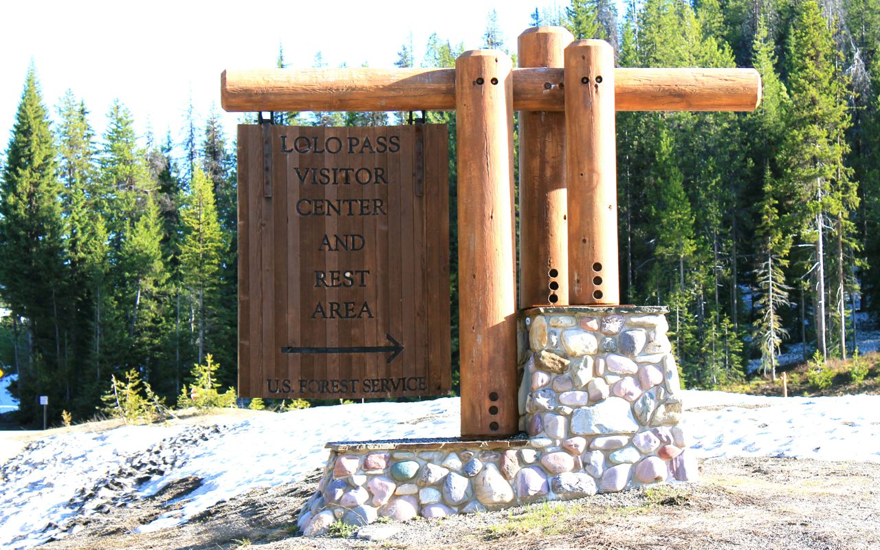
Snow still around at the Visitor Center and Rest Area (and state border and place where the time changes back to Pacific).
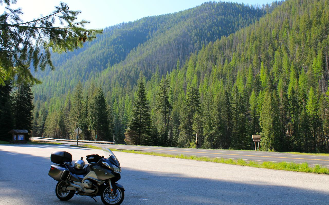
As happened last time I crossed the Idaho-Montana border, immediate speed limit changes, this time from 70mph to 50mph.
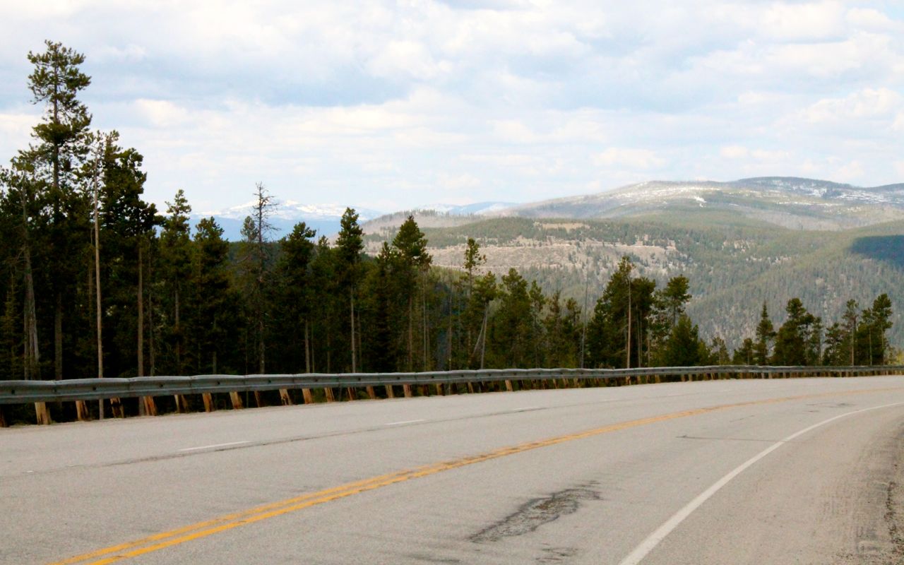
The road surface at the top and down quite a ways on the Idaho side is really rough. With the morning sun still casting shadows, it took my focus away from taking pictures of the snow capped mountains in the vista ahead of me. I could generally choose a flexible line and adjust as needed to avoid pavement issues.
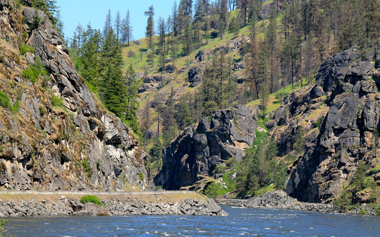
The roughly middle third of my ride down Hwy 12 towards Kooksia was more relaxed as the road surface was in better shape. It was a picture perfect weekday early morning ride with almost nobody else to distract. The last third, barring the two road work sites, was excellent.
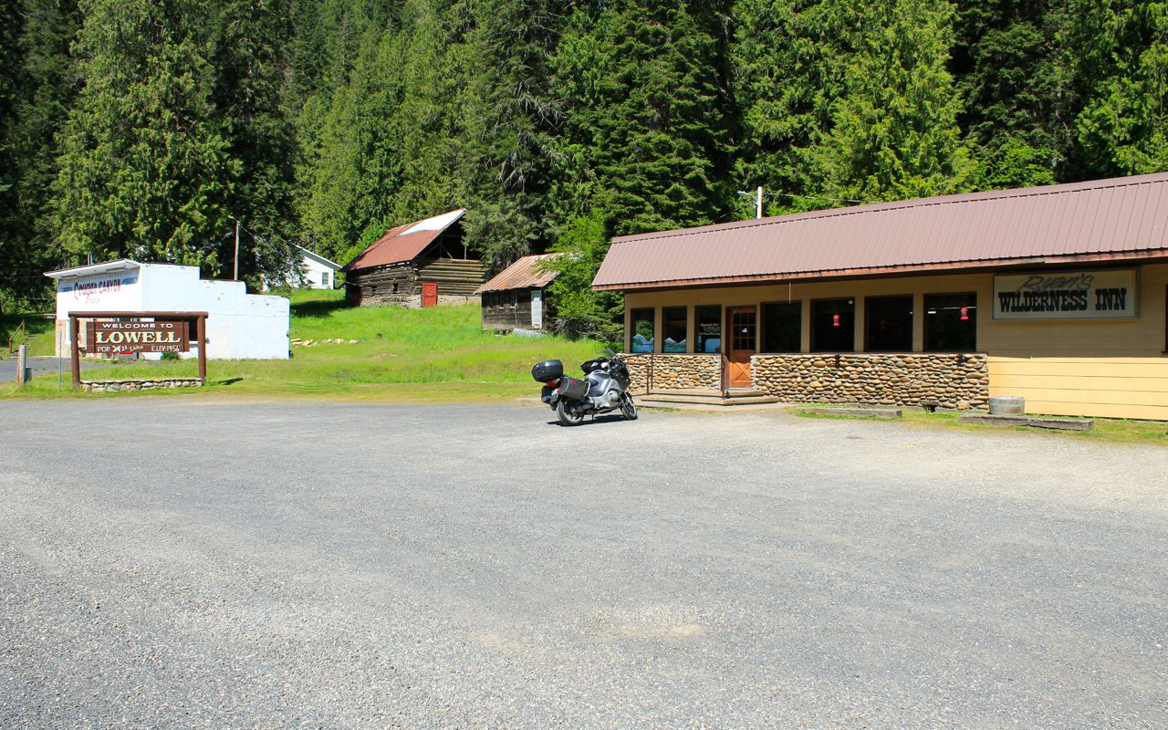
My first time for breakfast at the Lowell Wilderness Inn. Struck up a couple of conversations while eating.
Part of the Lewis and Clark trail, Hwy 12 signage reminded me that I started this trip staying in Seaside Oregon, the end of the Lewis and Clark trail. Cool.
The canyon opens up and the river spreads out. Loving it!
The Clearwater River is what Hwy 12 follows next as I head west.
I didn’t stop in Lewiston but continued after topping off my fuel tank. It was still before noon and I knew I could make it home.
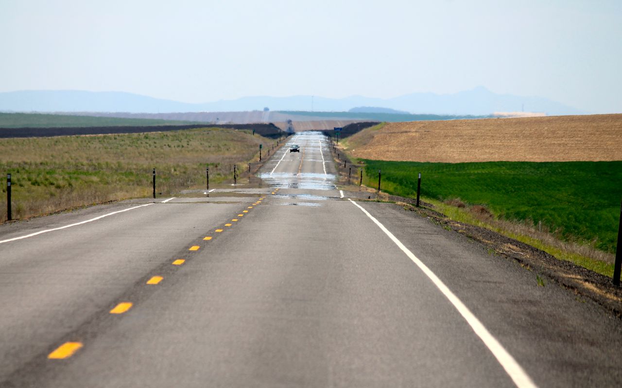
To reach the coast from here, I (eventually) took Hwy 26 and traveled through vast farming tracks. My last vista shot for the trip.
I reached the outskirts of Seattle about 6pm just after most of the rush hour traffic heading back into the city had dissipated. Convinced Seattle put something in the water, I was shocked at how Seattle drivers changed my state of mind. 😦
Getting home felt great. That was good riding. I do live a charmed life.
Reflections
Why did I change the name of the tour?
Mostly to avoid repeating names but also because it seemed vistas became the recurring theme, that thing I kept taking pictures of in hopes of sharing the grandeur.


Grandeur and scale are what I seek in my rides. Forgotten and scenic byways provide gateways to the less traveled coast or mountain pass or desert plateau.
How far did I ride each day?
I always get asked this question. Here’s the daily breakdown of this 5,116 mile adventure.
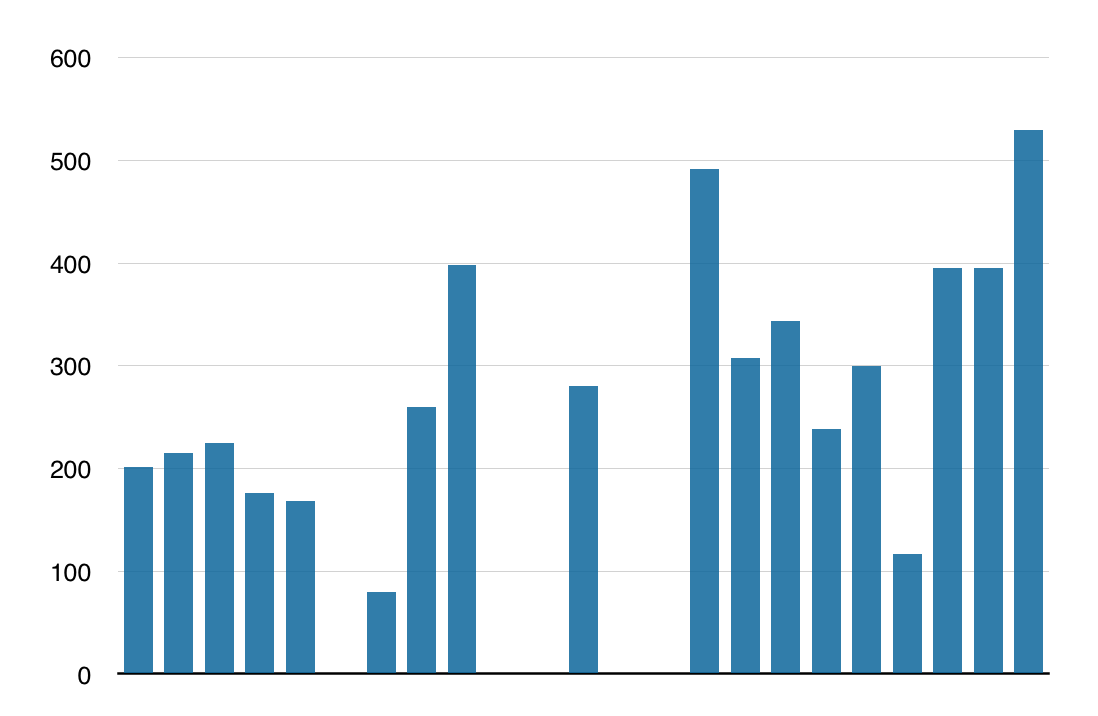
Daily Average (days riding only): 285 miles
Daily Average (overall): 223 miles
On this trip, I spent a weekend in the Bay Area, including Santa Cruz, two days in Las Vegas and a weekend in Huntingdon Beach all off the bike.
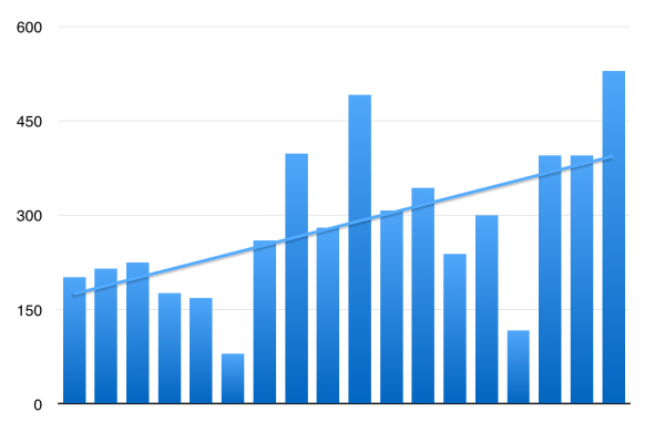
Over the 23 day long ride, the chart shows my three ‘stretch days’ were successively longer.
Tossing outliers both high and low, then excluding days off, there is an upward trend of longer days.
I see this pattern on my longer trips. As I travel, my ability to travel farther improves.
I ride while I am able to do so.
Traveling by airline these days is unpleasant, to say the least. And there is nothing more destination focused. Boo, hiss.
I travel by motorcycle, taking scenic byways across America, to see incredible scenery, meet other riders, and experience the journey richly as I’m literally in it.
Tragedy can strike at any time, so I ride while I’m able to do so. Thanks to all who reached out in support during this trip. Your comments mean a lot to me.
Special thanks to Will and Carson who keep their eyes on me daily while I’m on the road.
How did my gear choices work out?
I would have loved to have my tight fitting fleece vest with me for the cold wet days. It will be replaced before heading to Alaska.
I think I can pare down my electronic accessories. There are cords and connectors I haven’t used or are redundant.
Updates to my small trauma kit are in order. Replacing the worn phone case should be considered. A small pen-type tire pressure gauge I can keep in the glove box is needed.
A rain over-suit will be needed for the Alaska trip. Staying on schedule will be easier by staying dry and warm.
