
What was the highlight of the trip?
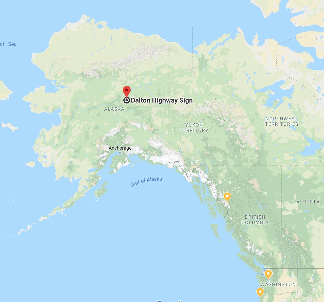
This is a common question but one I find difficult to answer. If a single event had to be highlighted, I would say it was the ride up to the Dalton Highway sign on the morning of my 60th birthday.
Just 114 miles south of the Arctic Circle.
Say, “cheese!”

How did the extra preparation and planning in advance work out?
Really well, actually.
With regard to reserving all my lodging ahead of time, I know my patterns and preferences well, nowadays. Also, I had just completed a ride of equal length four weeks earlier. So I planned days off on the return leg, shorter days in case bad weather made the ride more challenging, and a wide range of accommodations.
Knowing I had confirmed reservations at the end of each day was honestly a joy. Choosing lodging while on the road can be frustrating and time consuming.
Also, stopping at the Liard Hot Springs was rewarding. I was stoked afterwards that I spent a bit of energy planning this enroute stop, something I need to do more often.
Having researched the best dinner options in an area in advance was also nice. I like to try to lodge near where I want to eat. My advance choices worked out well on this trip.
What were the roads like?
Better than expected – smoother and cleaner. Some definite challenges inside construction zones and more remote, less maintained parts of my route. More day-by-day info in the trip details, but nothing felt unsafe or threatening. I saw campers and rented Canadream RVs on every road I was on.
That said, I chose not to ride up the Dalton. I didn’t want to get into trouble out there in the type of weather ahead for that day. I would have held up trucks on narrow road surfaces where I would have chosen only half their speed. I would never be relaxed.
I later learned from the gang of three, a group of three bikers whose paths crossed my own in Anchorage, who rode that same day to the Arctic Circle sign, that I would likely have had trouble.
My route at the time I traveled was definitely street bike friendly, enough, that I returned home from the 6,000 mile trip with no issues to report.
It’s funny to me now to re-read my reflections from my 2015 trip to Hyder, Alaska, including this response to the question, “Would you travel to Alaska again?”
Yes, but not on my current motorcycle. My road bike, a 2013 R1200RT, doesn’t like gravel roads much, and my impression is that the further north one travel’s, the higher the likelihood of finding gravel or mud. I would like to explore more of Alaska and northern British Columbia on an adventure bike or a larger enduro bike.
Some practice on gravel is recommended if you haven’t ridden on hard packed dirt or gravel roads on the bike you’ll be riding.
Over time and experiences usually not sought out, I’m not nearly as freaked out by the varied conditions I’ve chosen to ride into and over. The RT is a stand-up bike – not perfect but dependable, comfortable, powerful. I make it home again.
Mud ended up covering the bike, especially through construction sites. Boots and lower half of riding gear will get dirty. Expect tar and oil to accumulate and gravel to act as bullets when they pop out from under the tire of a big ride coming at you.
I’m getting the bike cleaned up for another service. We’ll see then if there was any other issues to report.
Used Google Doc to record / update itinerary
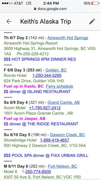
I found this to be useful. You can share access with members of your support team back home, or more broadly if you choose.
As mentioned, this was the most extensive pre-planning I’ve done. Tracking details is what provided the value as a support tool, so folks back home know where I should be at the end of the day and so I know what to look forward to that evening.
I set up an additional page should it have been needed to navigate through or re-route the trip due to road conditions or bad weather. I really didn’t use it as the weather was not severe at any point, except for the wind, which was very gusty at times.
Did I have a cell signal often?
Yes, surprisingly so. I would say off the cuff that the busier the road, the more likely there is a cell tower nearby. That said, sometimes it seemed everywhere. I was texting halfway between Fairbanks and the Dalton Highway sign.
That has the down side is getting accustomed to having it. I believe I finished/started each day with the ability to update folks. Definitely one day with no cell whatsoever in between seemed the most desolate, in both that regard and the literal out there in the wilderness sense.
Was it cold?
There were cold days, and wet days, but fewer of each than I expected. Day 4 at Bow Summit was the coldest point on the ride.
In hindsight, my experience with the weather could be summed up as summer breaking out from spring leftovers. It was summer, longest days and no darkness, but early summer from a weather perspective.
There were no hot days, though I might remember taking my jacket liner out once, back on again soon afterwards.
The Frogg Toggs, acting as a second rain suit, worked out well to keep me mostly dry and always warm in the rain. I found they add a bit of warmth, less than a mid layer but noticeably less draft-related heat loss.
Was premium grade fuel widely available? Expensive?
There were only two gas stations that did not have premium. I never used the octane booster I brought for this trip, but I’ll keep around for future use.
The highest price I paid was $1.71 / liter. I was surprised to find gas stations were not price gouging in that the lowest price paid was around $1.45 / liter.
Part of my trip planning included identifying fuel stops in advance. I love having a 250 mile range, reducing the total number of fuel stops required. For this trip, in all but one case, these worked out to be appropriately conservative and open!
One more thing that helped reduce anxiety and keep me focused on reaching my night’s accommodations.
Most merchants took Visa
There were a few places that I paid cash for things by choice, but very few that required cash. I think I went through maybe $350 CAD cash on the trip. I used about $100 US during my time in Alaska, for comparison.
I describe the process for buying fuel and paying at restaurants in the trip details.
Best Meal?
Easy. The rabbit stew at the Twisted Cork in Prince George. I highlight a lot of my favorites in the trip details.
Did I need the warmer sleeping bag?
No. Readers may recall I was considering a warmer sleeping bag. I decided that if it was that cold, I would not likely decide to camp and so didn’t purchase it. I was never cold at night on any of the four nights that I did camp.
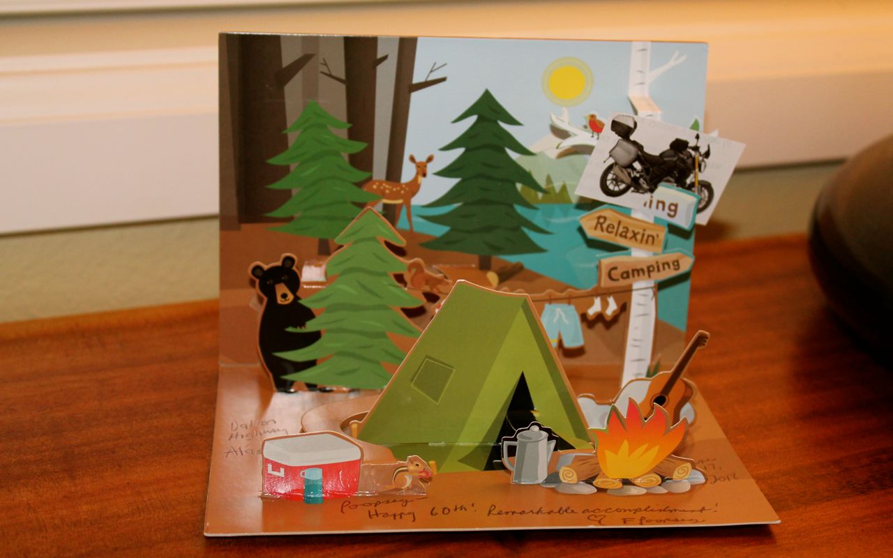
Motorcycling Relaxin’ Camping
A pop-up 60th birthday card from my sister was waiting for me. Needed a minor edit …

Keith If you are going to continue these kind of adventures you really need a GS.. When I sold my RS and bought my RT I thought it may be the best bike ever, but then when I rode a demo GS and purchased one I knew I now had the very best Beemer ever.
LikeLike
Soon, I’ll give one a ride. I get the RT serviced soon and could probably take one out for a spin.
LikeLike