
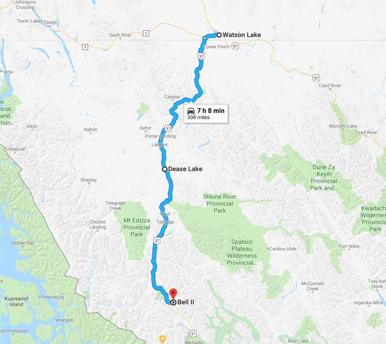
Day’s distance: 308 miles
Total trip distance: 4,897 miles
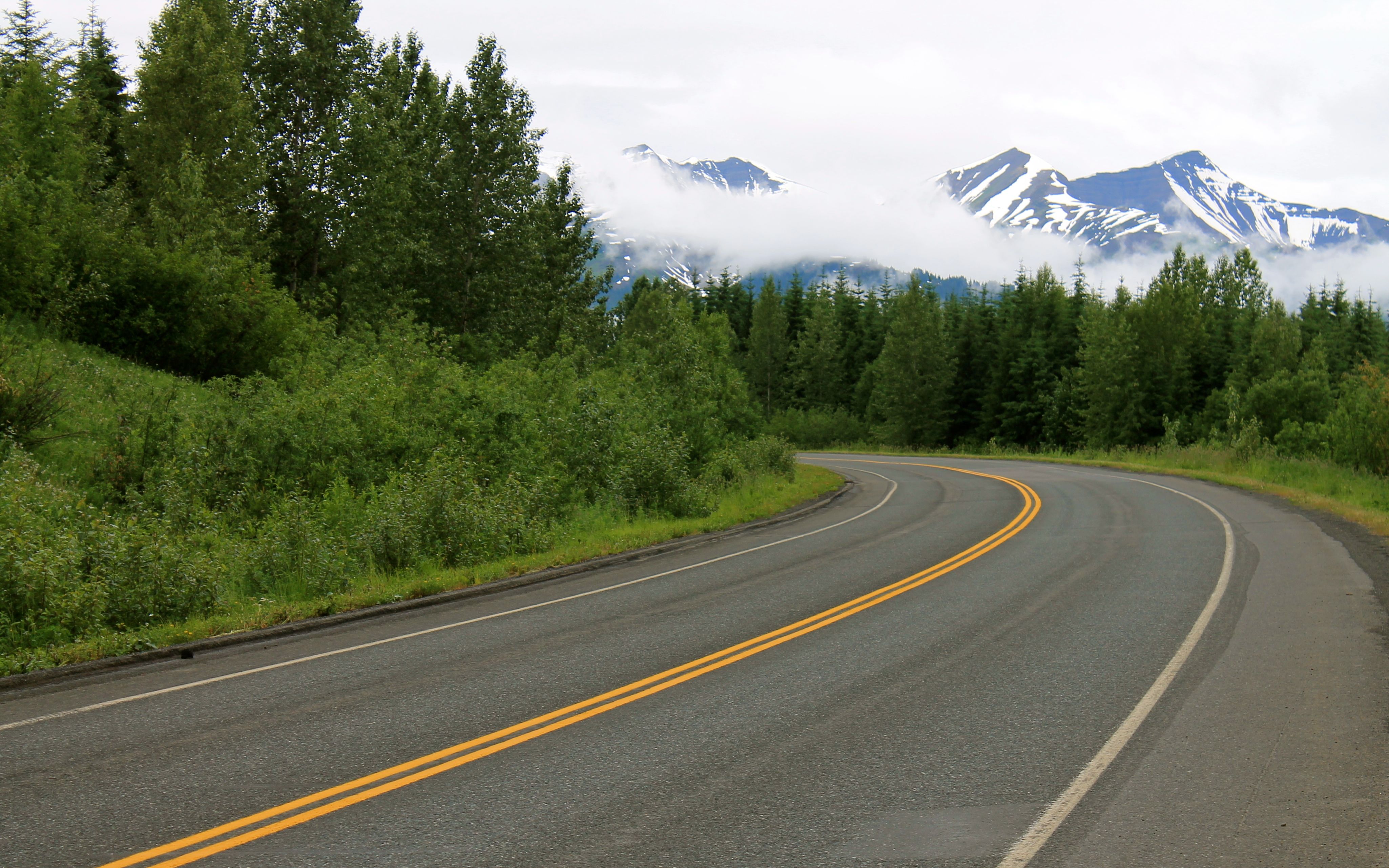
Temperatures began in the low 50s with mostly sunny skies. Steady showers started in the afternoon south of Dease Lake and continued through dinner time.
I woke up early and received an email alert that my credit card had been charged by the Big Horn motel just a few minutes earlier. While I stayed there last week on my way through, I canceled my second night and switched to the Air Force Lodge for last night’s stay. Since I would be leaving town, I decided to stop at the Big Horn and clear the charge. This took about 20 minutes.
I stopped at Kathy’s Kitchen for breakfast since I would not have another chance to eat before Dease Lake. There I spoke with a few bikers while we ate, comparing previous rides, the gear we carry, and the bikes we were riding. It was interesting that all three of us were heading off in different directions since there are only three directions to go. 🙂
I backtracked along Hwy 1 north for about 20 miles until reaching the turn off for the Cassiar-Stewart Highway (Hwy 37). I had no cell signal at this point and would not regain signal the rest of the day.
The road was in good shape, with the first 25 miles having an 80 kph speed limit.
From about mile 25 to about mile 50, new pavement was laid down recently and was super smooth. Then the chip seal surface, still in good shape, continued.
The brush was cut back from the side of the road in the past, but was growing back. This meant if there were animals along the side of the road, I might not see them as early as on other roads, like Hwy 1. I kept the speed down a bit and applied continued vigilance, but ended up seeing no animals the whole day.
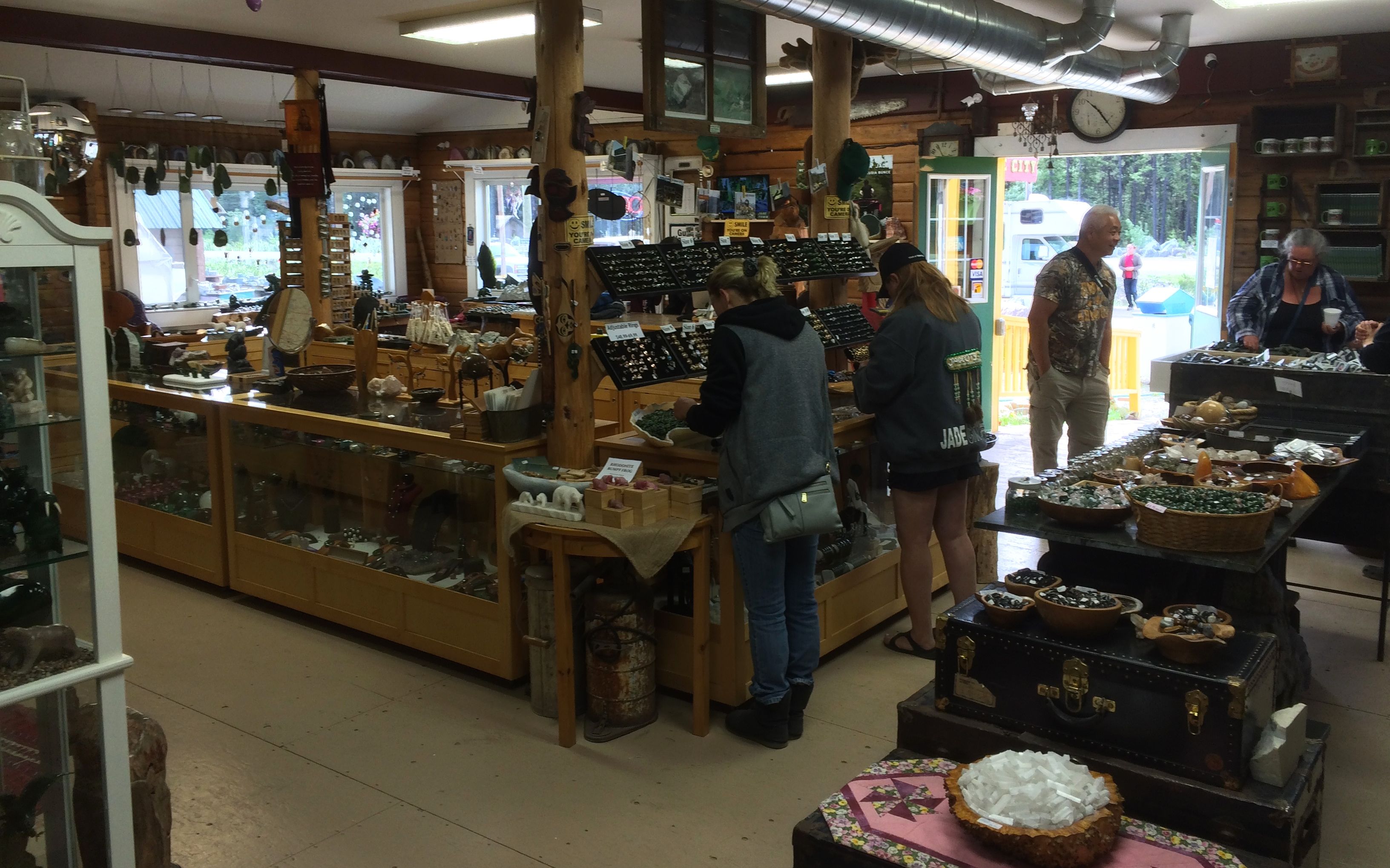
About one-third of the way, I came upon Jade City, a family run mining and retail operation specializing in jade.
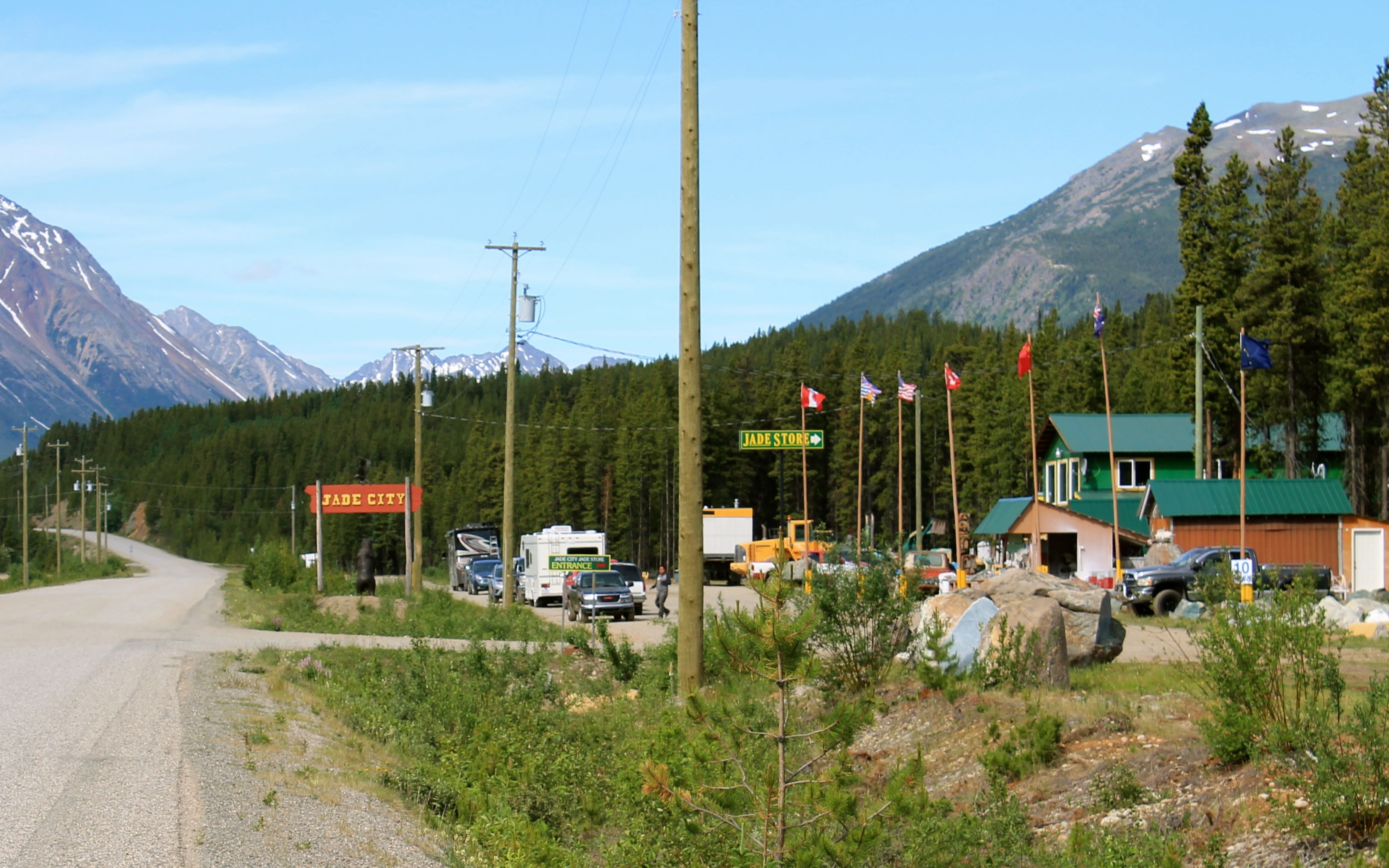
While I wasn’t particularly interested in buying jade, they offered free coffee to lure travelers into the store. I was in need so I stopped.
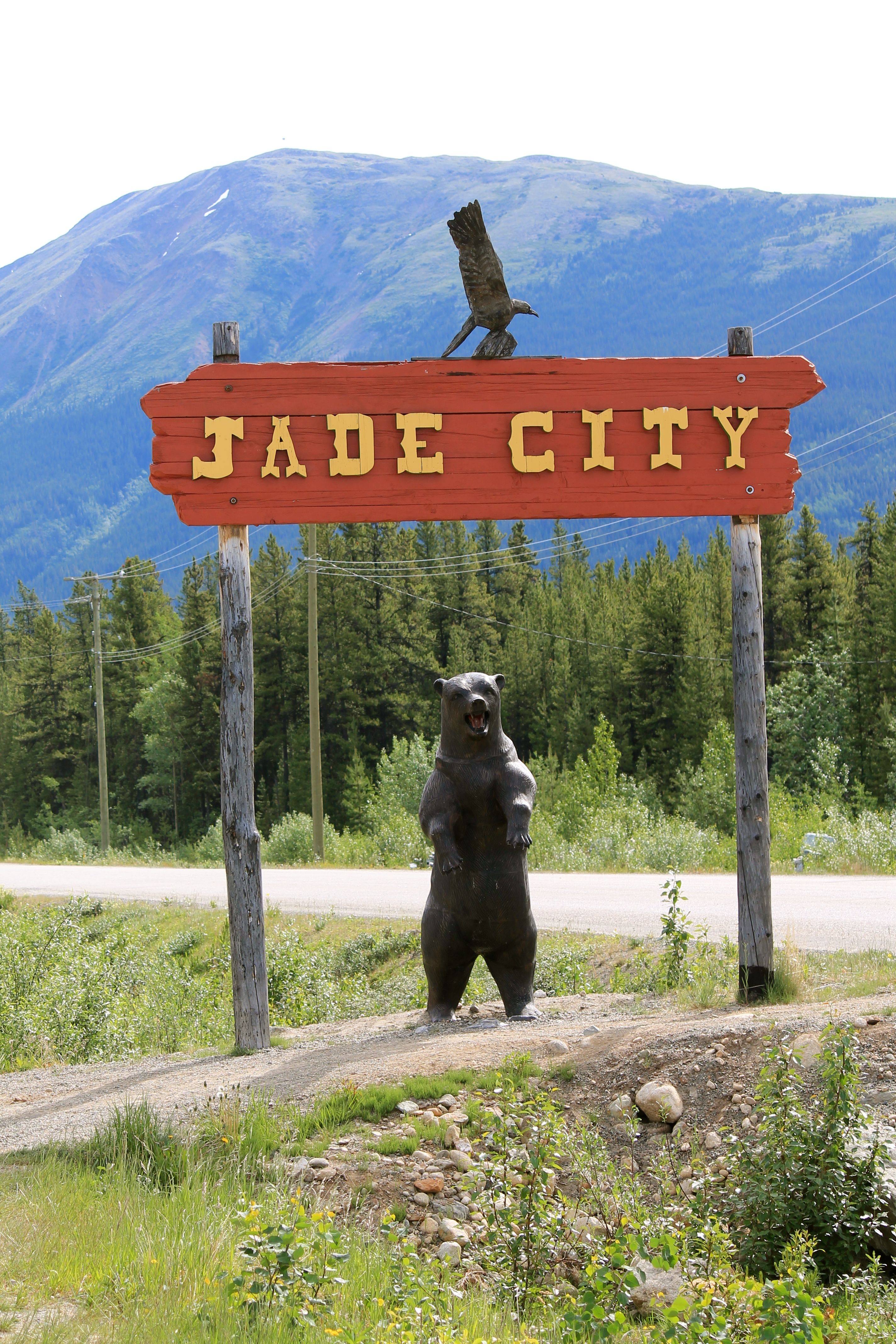
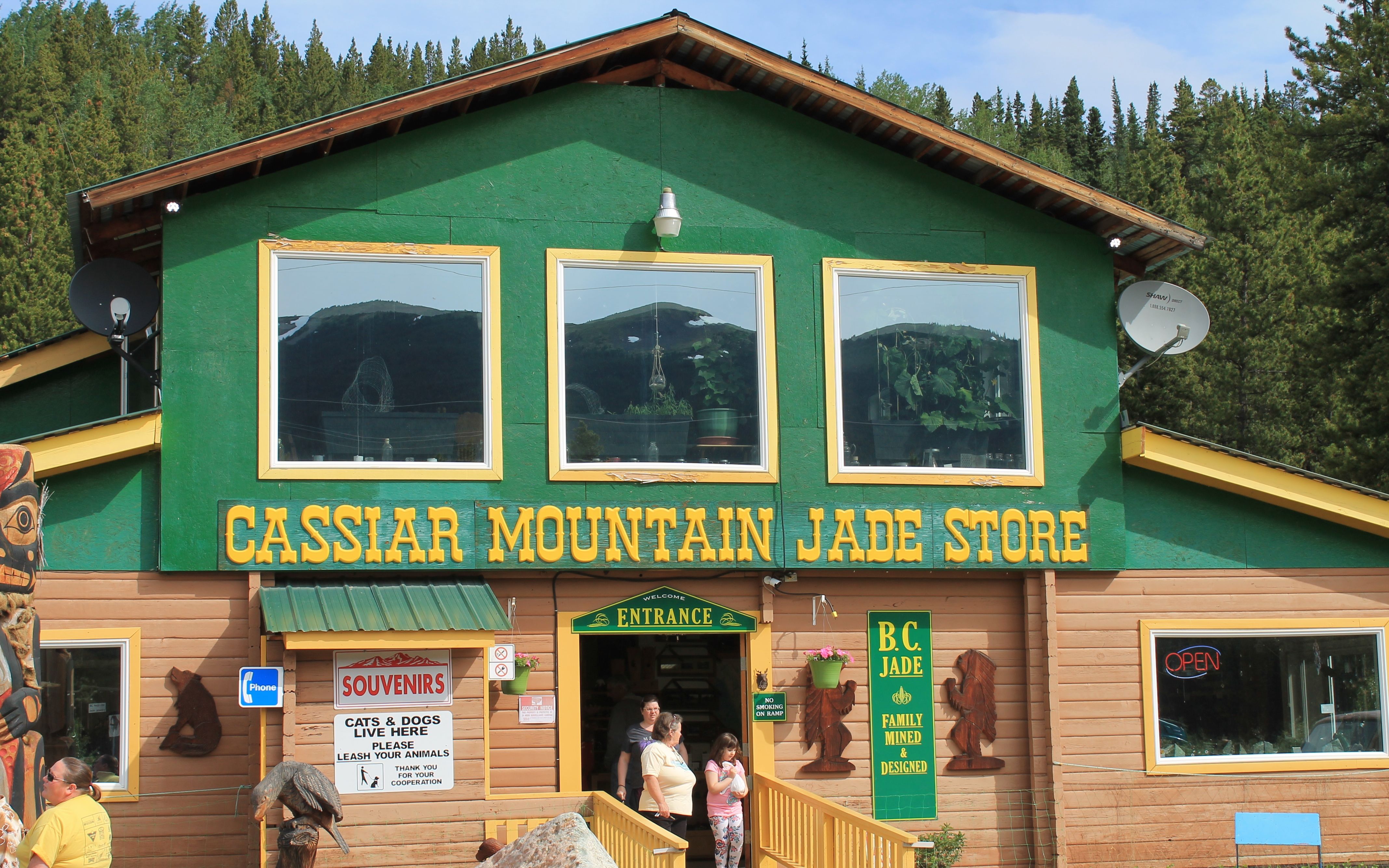
The coffee was, of course, in the back of the store. I was grateful and left a small donation of a Loonie for my cup of joe.
My GPS wasn’t allowing me to reach Bell II (or Bell 2) using this road. It was a bit later that I discovered it didn’t think the road went through. In fact, for the middle third of this trip, while my GPS indicated it knew I was traveling south on Hwy 37, it showed an otherwise blank screen. This was a little unnerving, but everyone I spoke with said the road went through and the information signs at the rest areas also indicated solid surfaced roads went all the way.
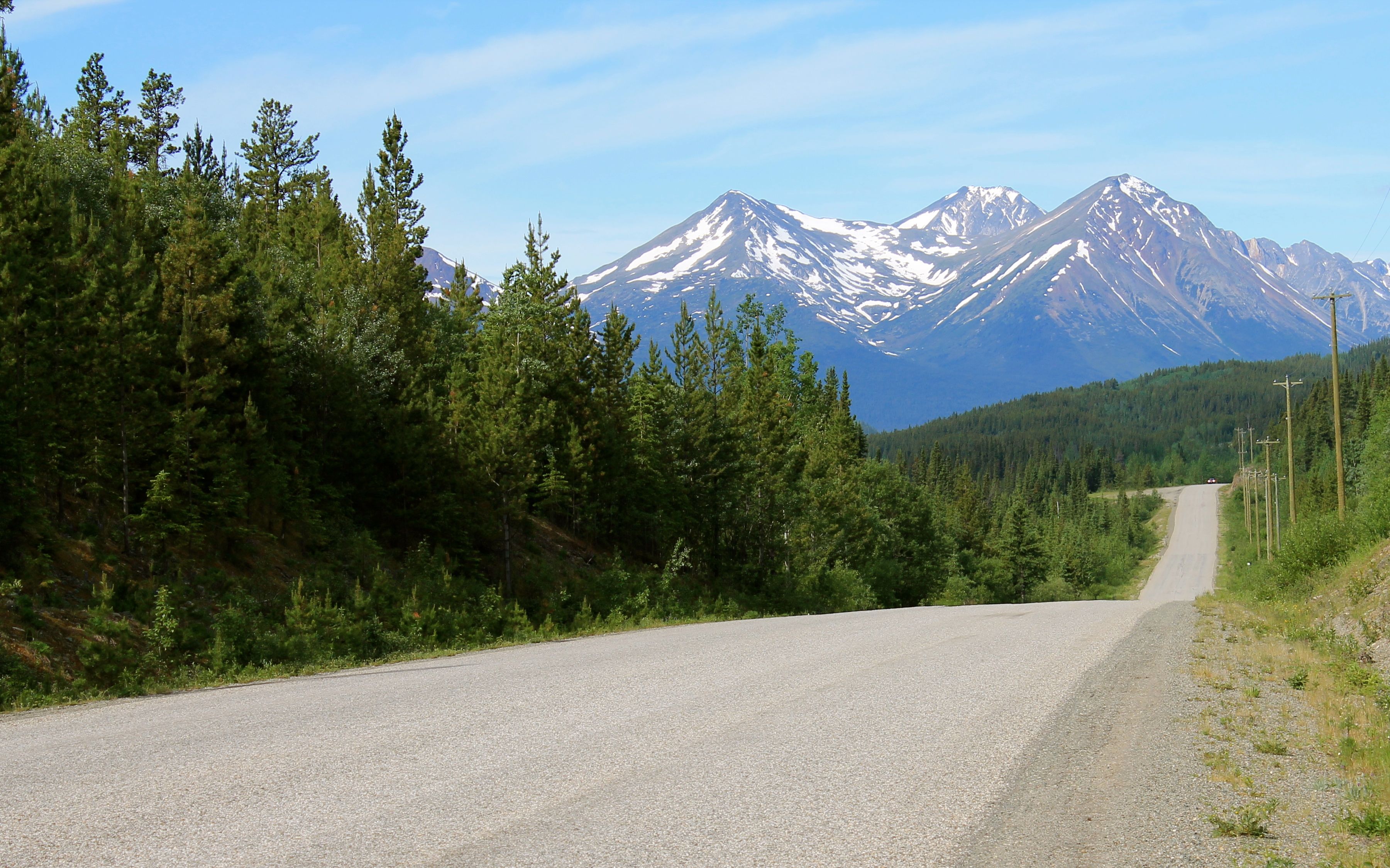
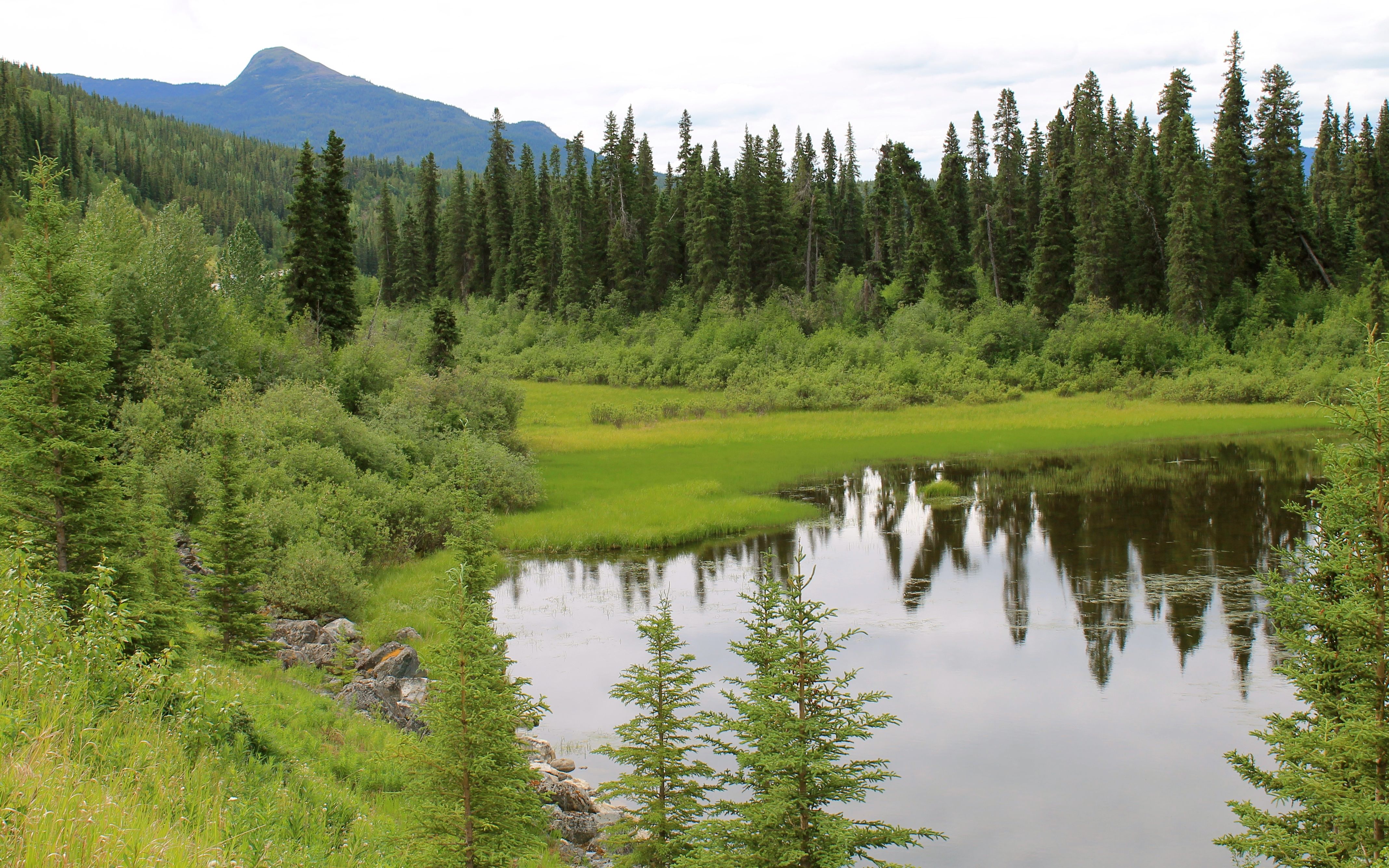
I tried to not let it bother me too much after reading the highway information signs, which also confirmed fuel should be available in Dease Lake. I was able to stop now and then to take some photos of the scenery.
Most of the roadway was narrow and semi-trucks were present, though because it was Sunday there were likely fewer than on other days. I was told before leaving Watson Lake that there was a fatal collision between a trucker and a motorcycle just the week before on this road.
With no usable shoulders in many spots, it was necessary, in the curves especially, to anticipate their presence and stick to the ‘steep’ side of the highway.
There was indeed fuel in Dease Lake. Surprisingly, it wasn’t way expensive. In fact it wasn’t even the most expensive I’ve seen for Canada. I grabbed a grilled cheese sandwich at the market’s deli after filling the tank. There I found other bikers and spoke at length with one of them while we ate.
I was told there was a wi-fi connection at the local college just down the street and the login information was posted for public use. Alas, it was only turned on between 8am and 5pm, Monday through Friday. Oh well, no updating my support team back home.
I will say the ride today easily felt like the most desolate area I’ve ridden on this trip. That said, it seemed someone came by each time I stopped for a break, so I wasn’t too anxious.
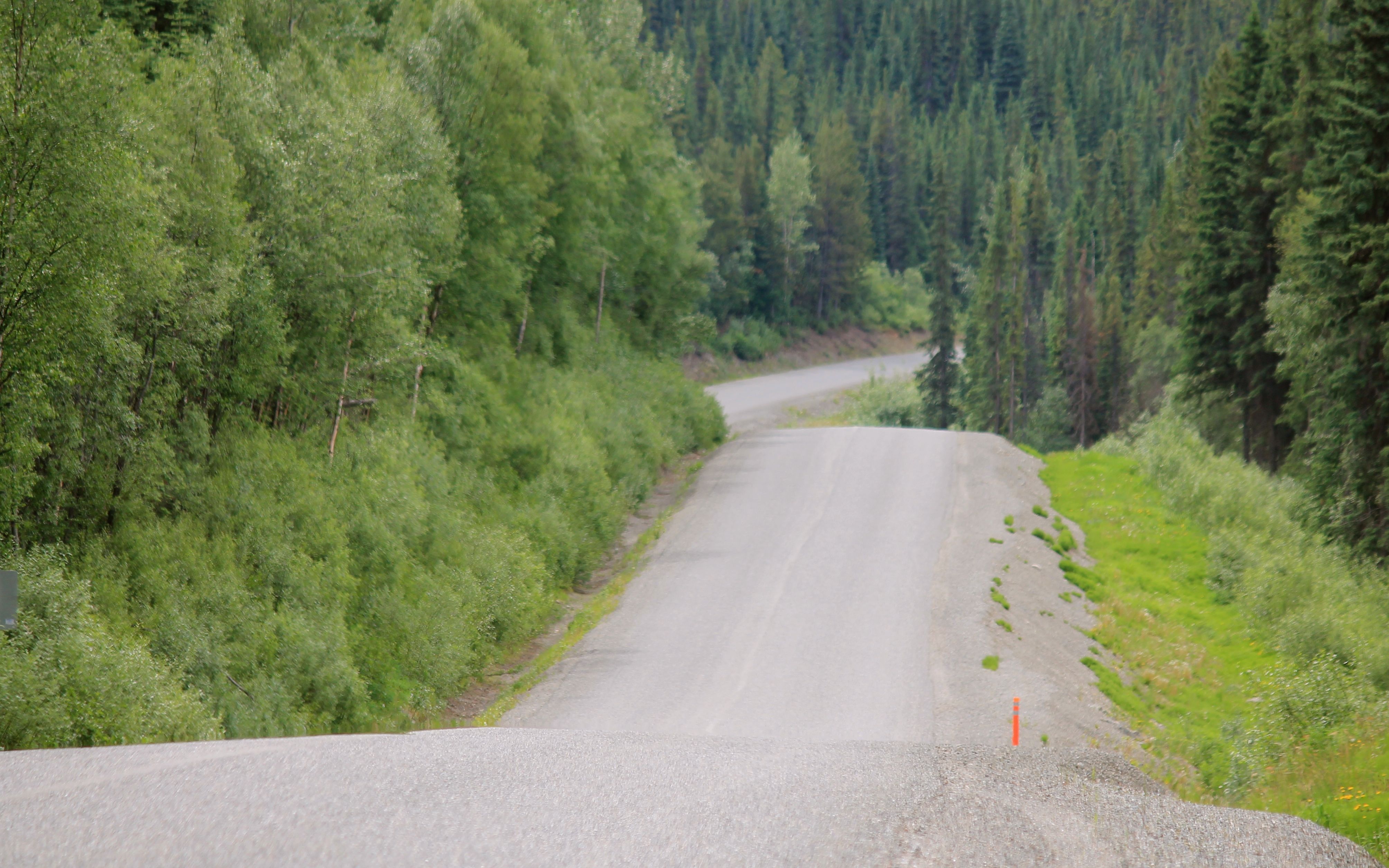
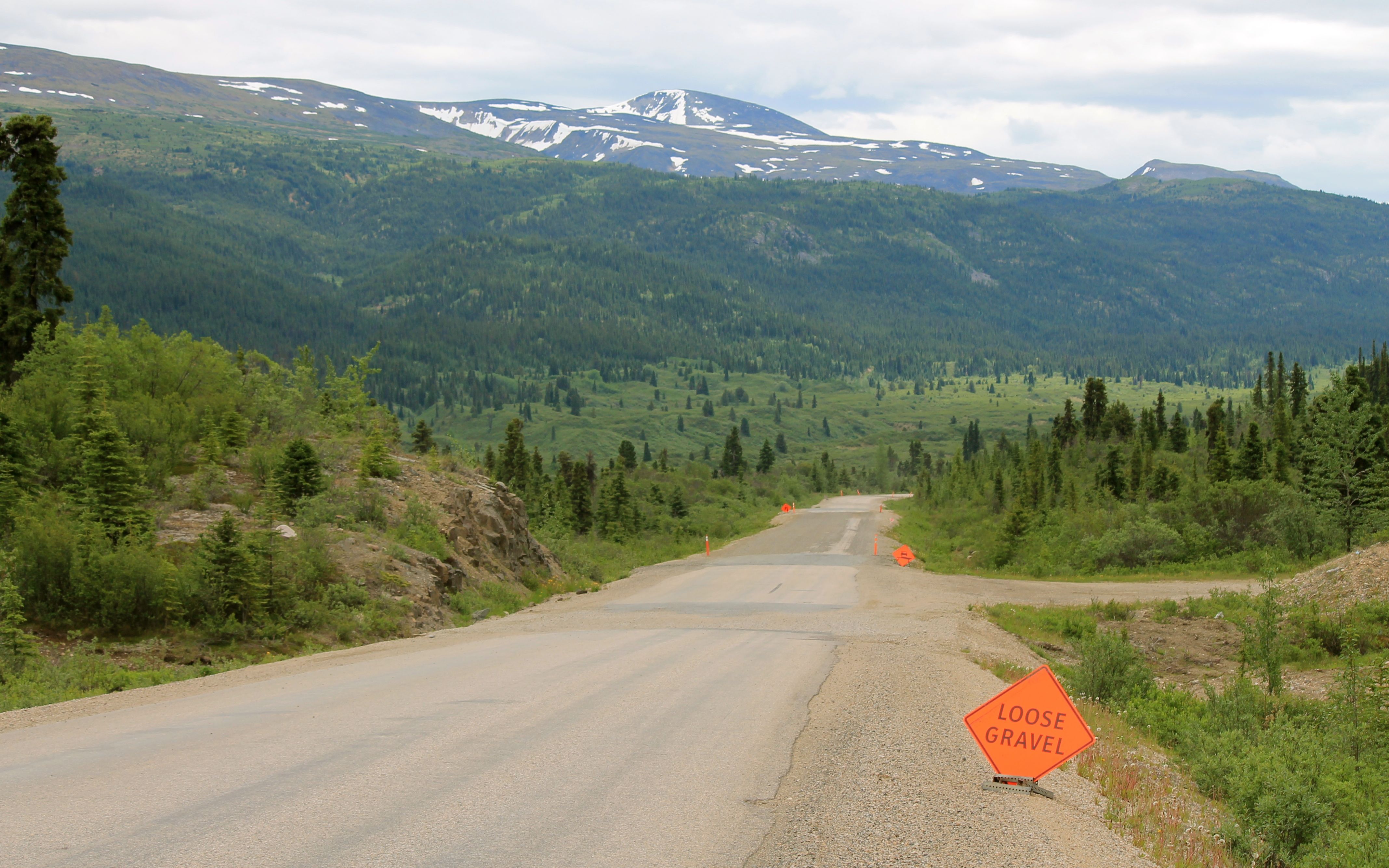
I was told the road south of Dease Lake may be rough. While it wasn’t in as good as the first half of the ride, it wasn’t too bad. There were many many sections of loose gravel that seemed to be 10-20 feet wide, sometimes longer at this point in the ride.
I would slow a bit, depending on the width of the patch.
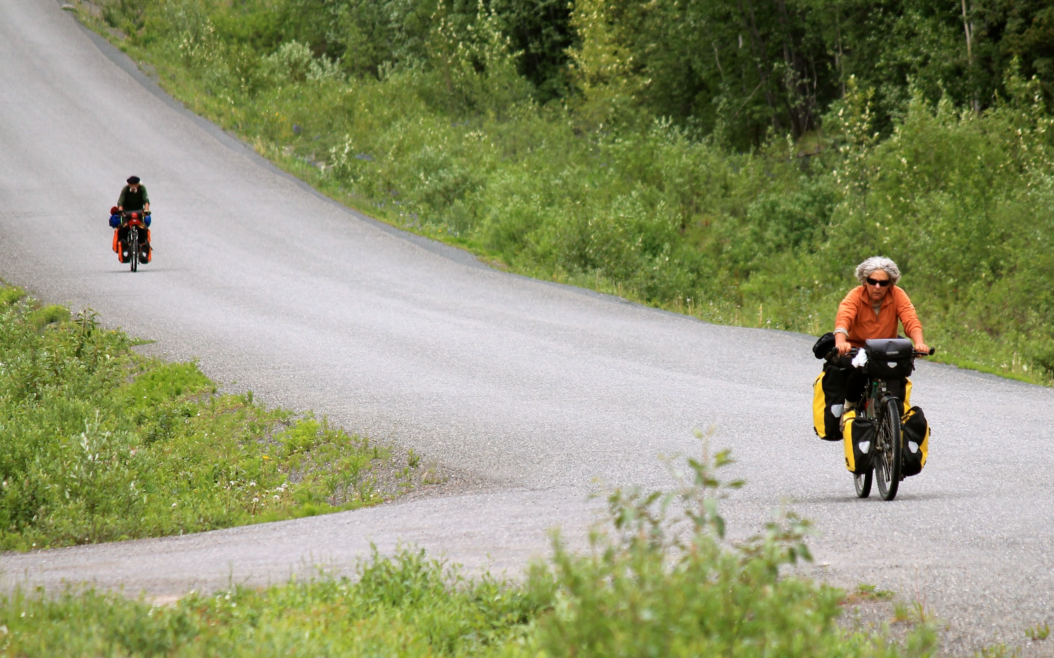
I saw at least a handful of bicyclists along the highway. Personally, I was glad to have an engine to propel me, but these folks reminded me of rides I’ve done when I was younger – all much less adventurous than this.
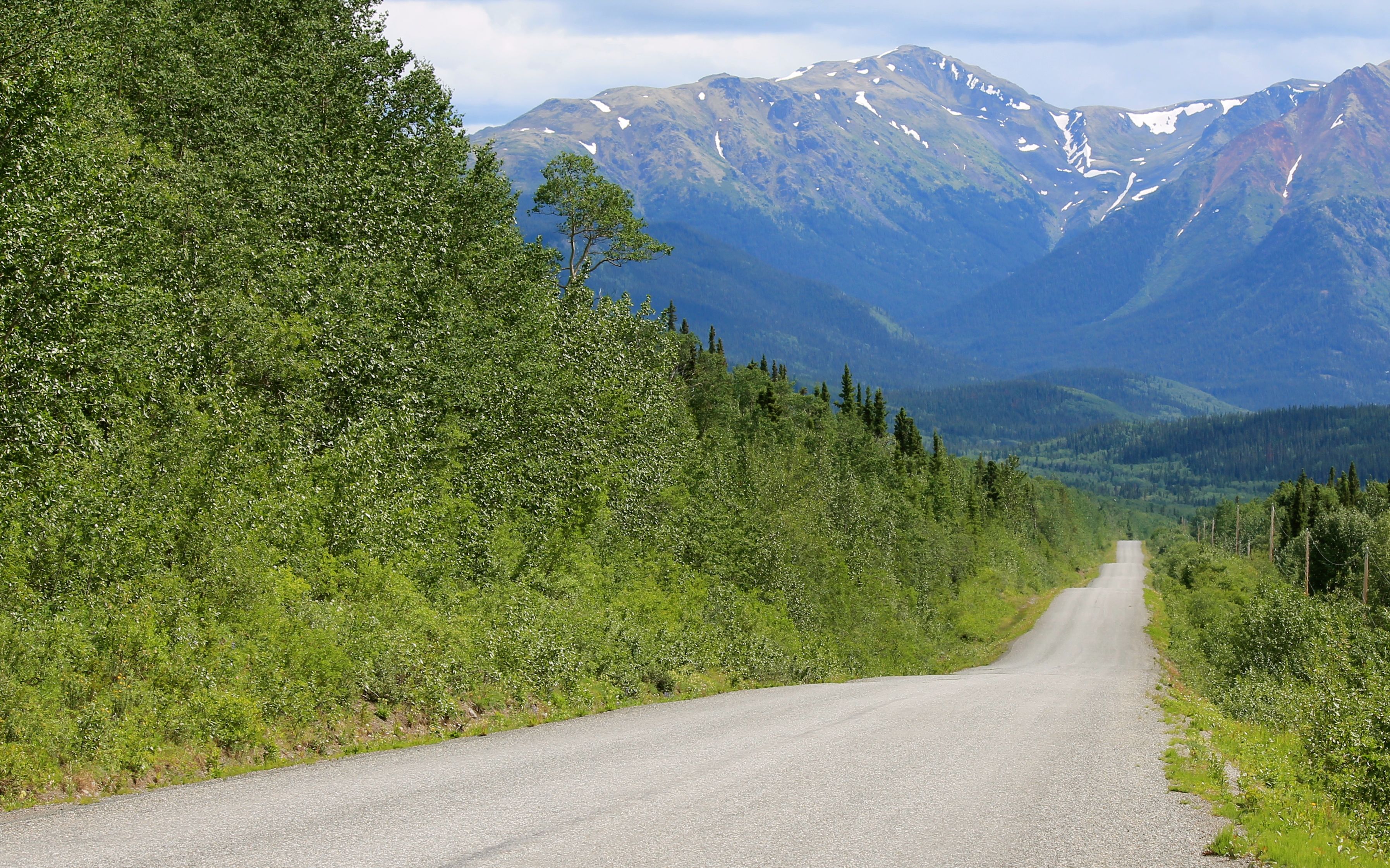
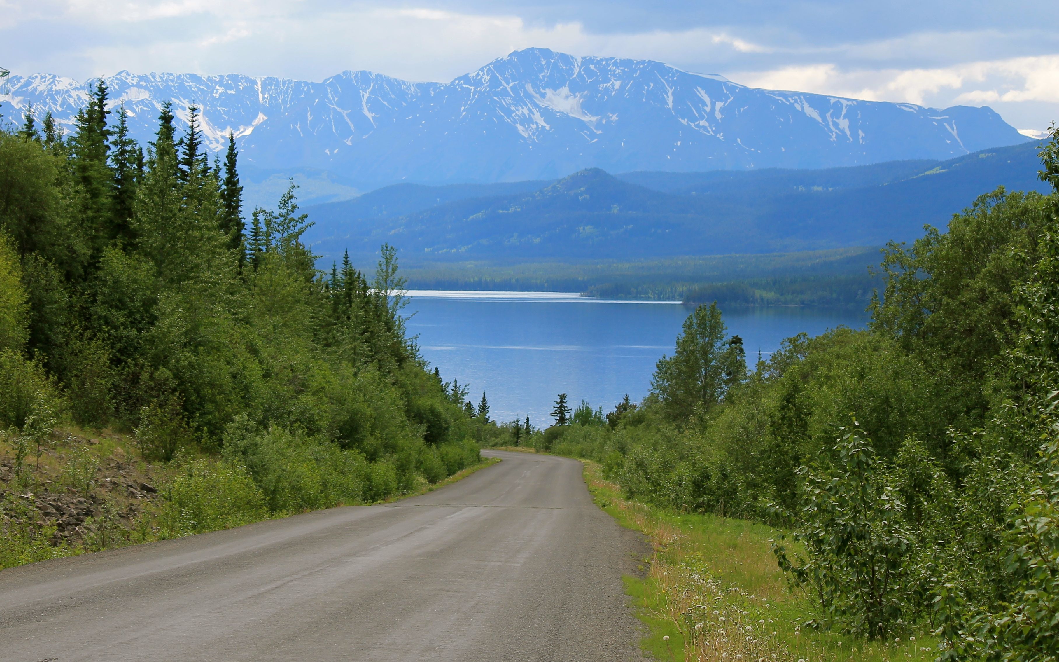
It was a long ride, but very scenic. I am spoiled for life, I think. I don’t know if I’ll find anything more scenic and remote and still paved anywhere in the US.
If there is a reason to call this a ride of a lifetime, it would be for the opportunity to experience such a remote adventure on a street bike with street tires. More so than the ride on the Alaskan Highway, this day’s ride really conveyed the feeling of desolation.
There was one or two lengthier sections of gravel roadway. On the one below, it was really hard to focus – the view was spectacular!
It was a bit later that the rain started and I packed away the camera and put on the rain gear. As mentioned, it continued until I reach the Bell 2 Lodge. Rooms were available but way pricey, and the rain was supposed to stop shortly, so I ate dinner at the lodge restaurant with some other travelers while waiting.
I was able to set up the tent and sleep with no further rain. The tent area was pretty wooded and filled with hungry mosquitos. I left my riding gear, and gloves, on while using the mosquito net I purchased for over my head while setting up the tent. That netting saved my sanity!
I guess that’s what I get for being too stubborn to spend the money for a room. 🙂
The restaurant was good, and not very expensive, so I planned on breakfast there in the morning. Wi-fi was doled out using 30 minute access passes that I had to purchase. Again, being stubborn and thinking wi-fi should be universally free, I only purchased one to update folks back home and check mail and the weather forecasts.
I did sleep fine noticing it got dark at night, unlike further north in Alaska.
With the exception of an hour remaining on the Cassiar-Stewart Highway, I’ve previously traveled the remaining roads on this trip I’ve been on before. I do look forward to reaching Prince George and taking a day off tomorrow.
My final thought of the day – British Columbia is a big place. British Columbia is a big place.
Day 20
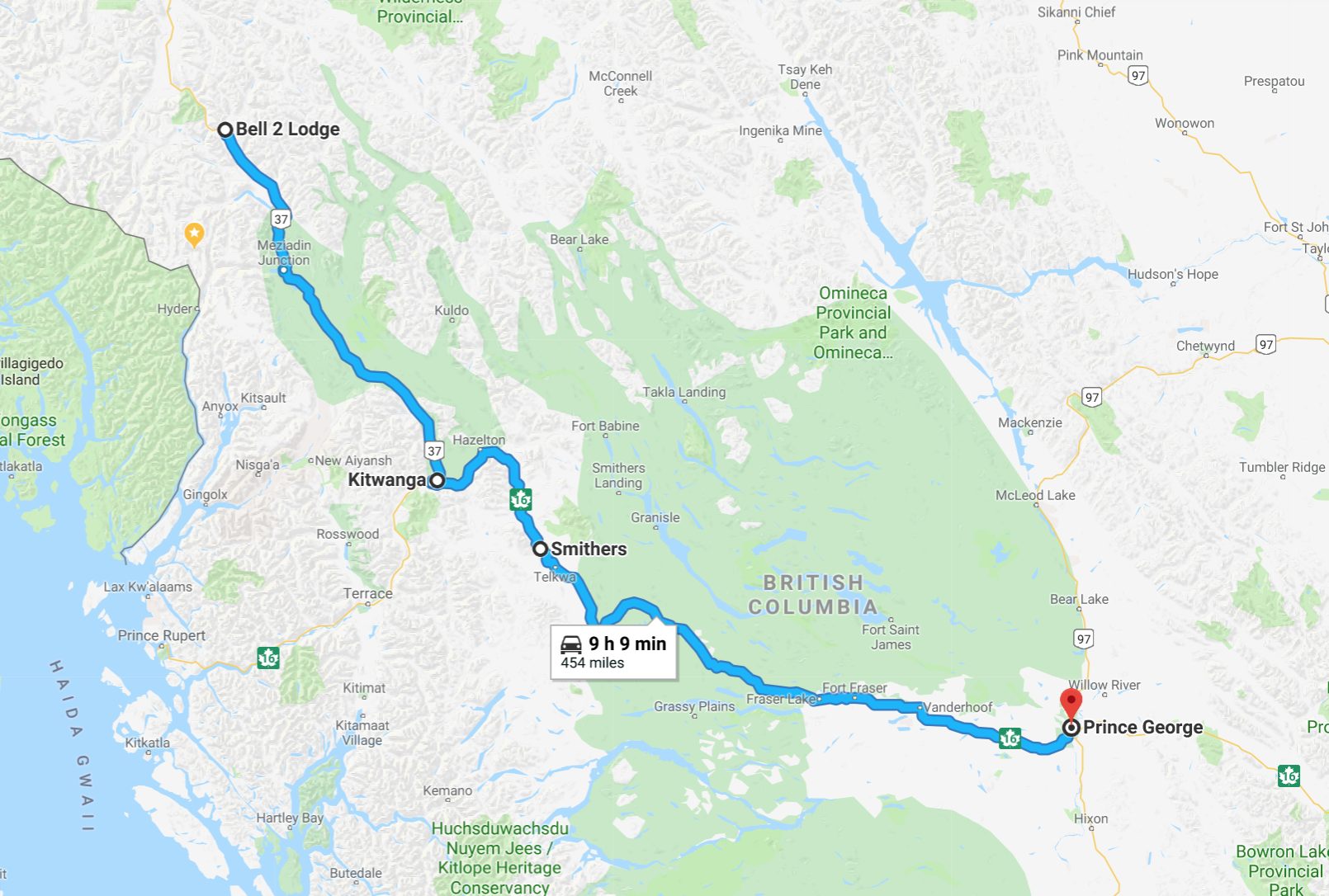
Day’s distance: 454 miles
Total trip distance: 5,351 miles
Overnight temperatures were in the high 40s but it didn’t rain until I was underway. Showers dominated the morning but were over, I thought, when I reached Smithers. But showers re-appeared as I approached Prince George. I put the extra rain layer back on just in time for them to stop again. Ugh. I just left on the extra layer until arriving at the hotel.
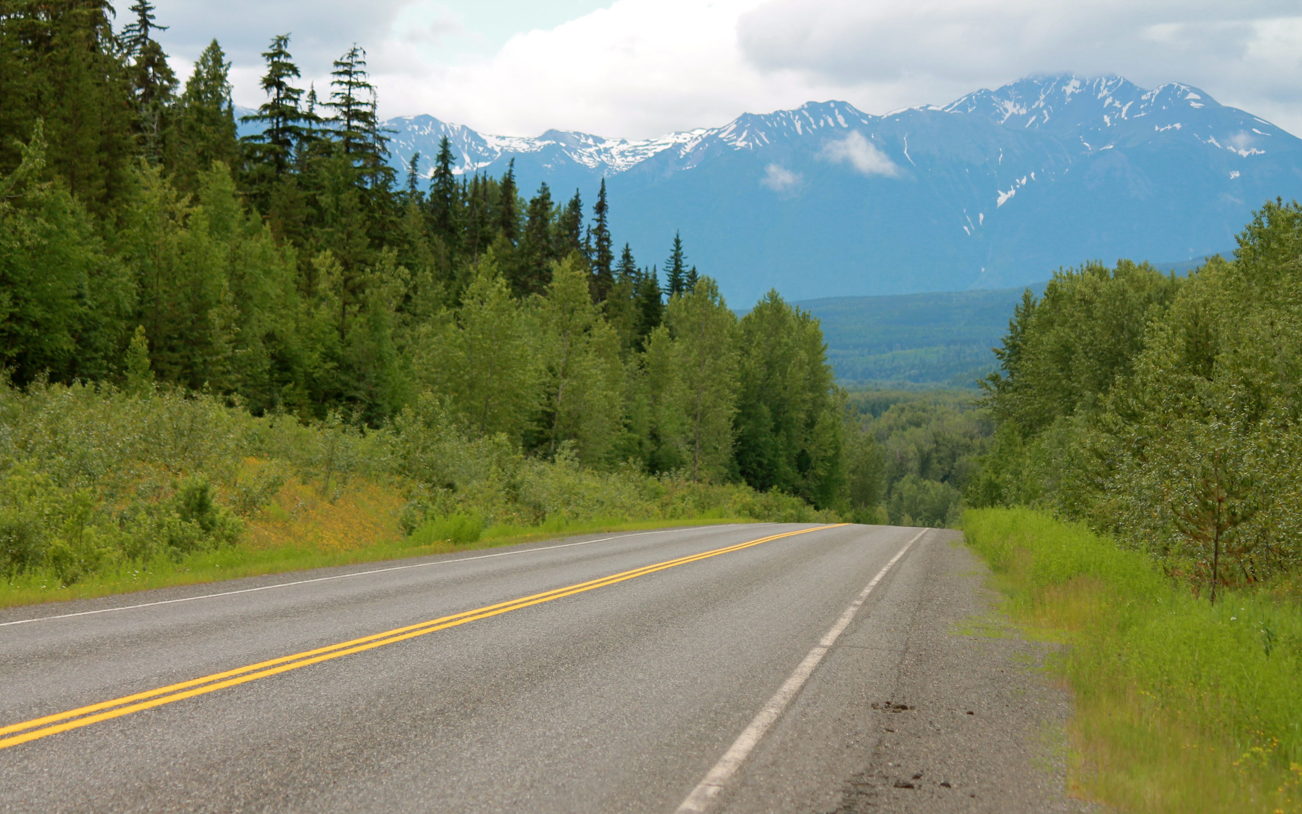
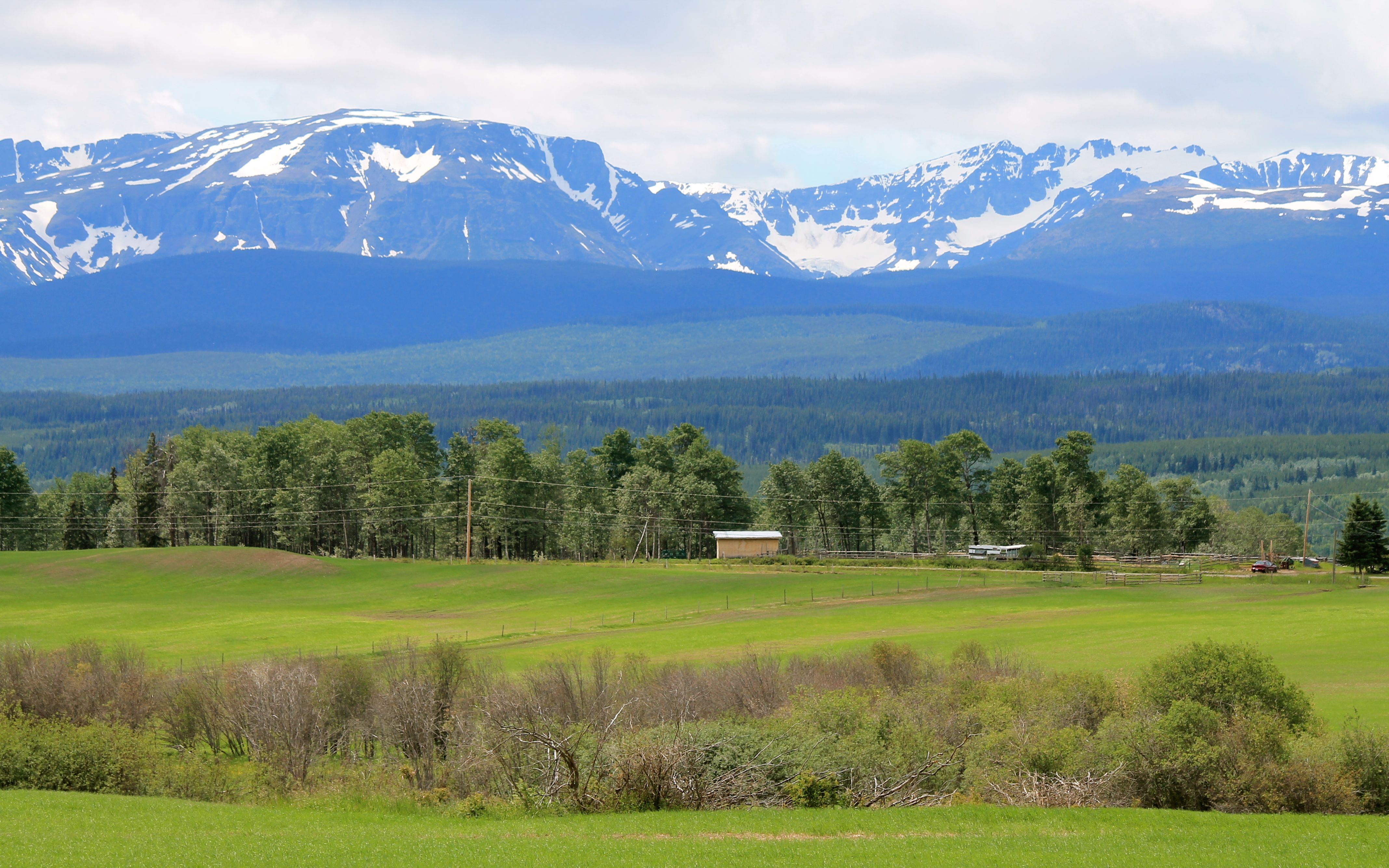
The fog hung low against the mountains this morning.
When the road moved away from the mountains, the void was filled by enormous forests.
I stopped in Moricetown, but no First Nation Wet’suwet’en people were fishing at this time.
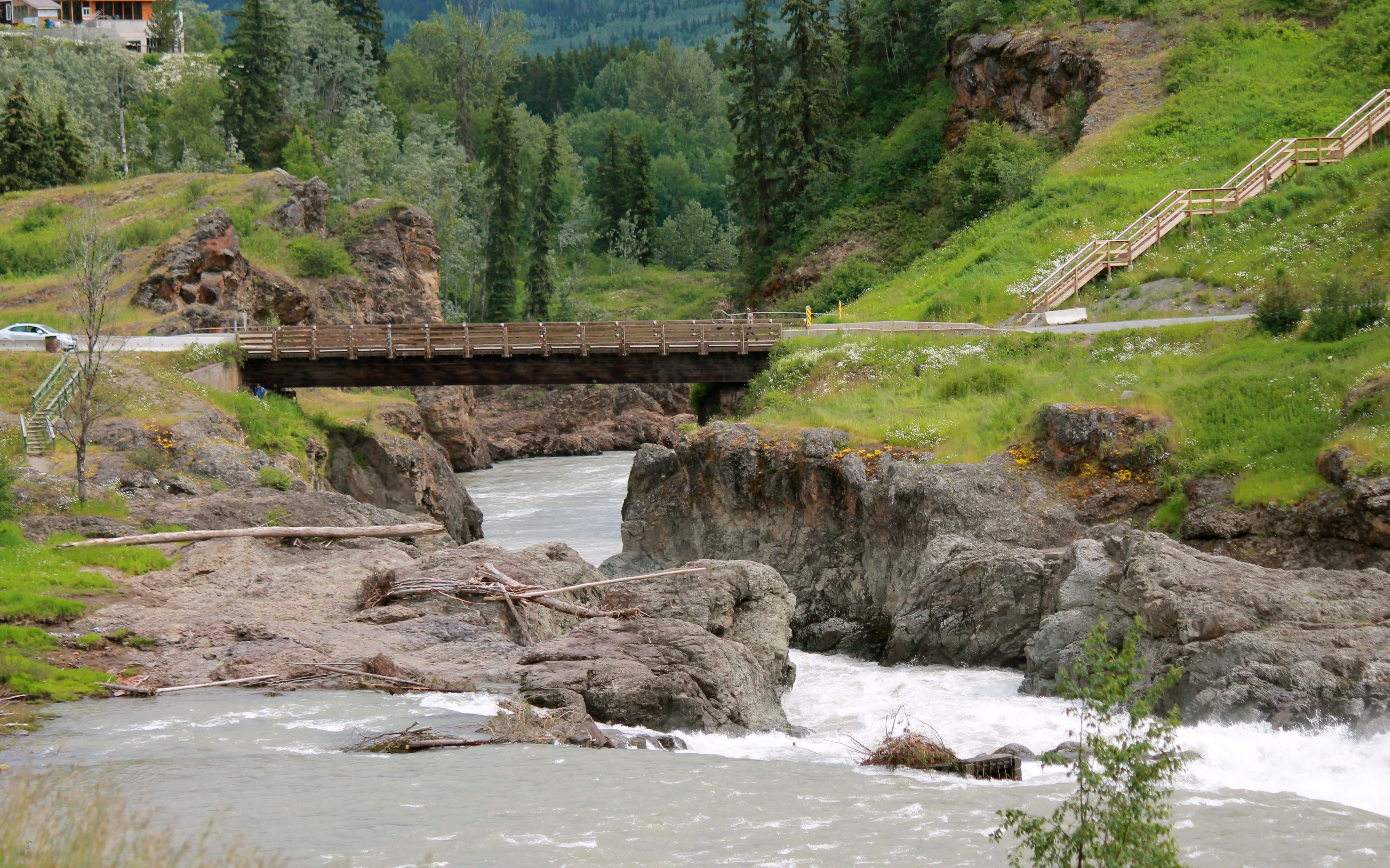
As I saw on my 2105 trip to Hyder, these folks use nets on poles while walking out over the Bulkley river along planks to fish.
I spoke with another lodge guest while eating breakfast and she suggested the Two Sisters Cafe in Smithers for lunch.
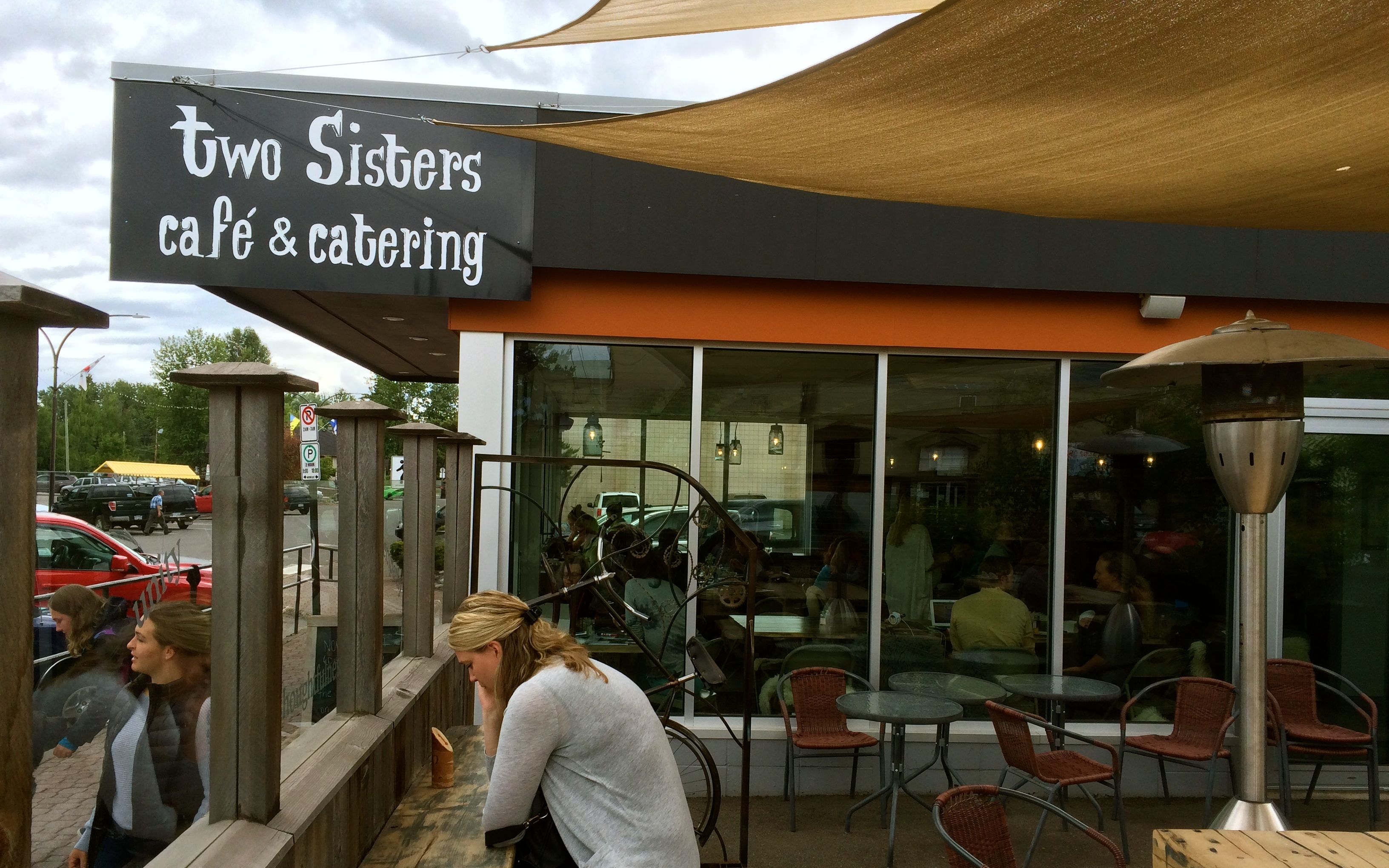
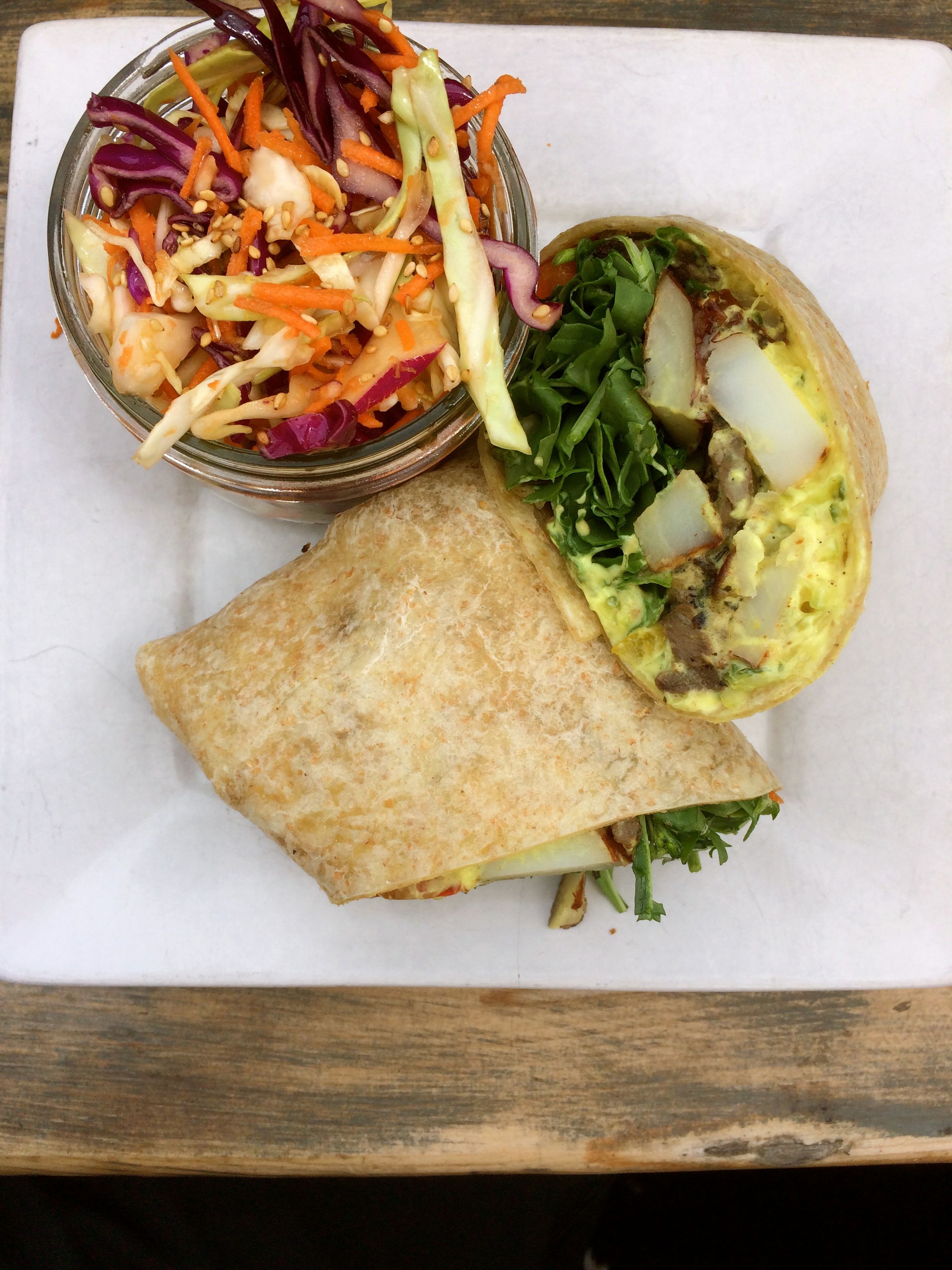
I had the Garlic Steak Wrap, local marinated steak sautéed with potatoes and peppers, and rolled up in a 12” tortilla with raita and arugula. It came with a side. I chose the coleslaw. Everything, including the large latte, was excellent!
I topped off with fuel here as I heard there may be some stations to the south out of fuel. That actually was the case at a stop I made for Red Bull a few hours later.
In this area, the mountains recede and farm land fills in along the road.
The highway is pretty congested, traffic increasing steadily since getting on Hwy 16 at Kitwanga.
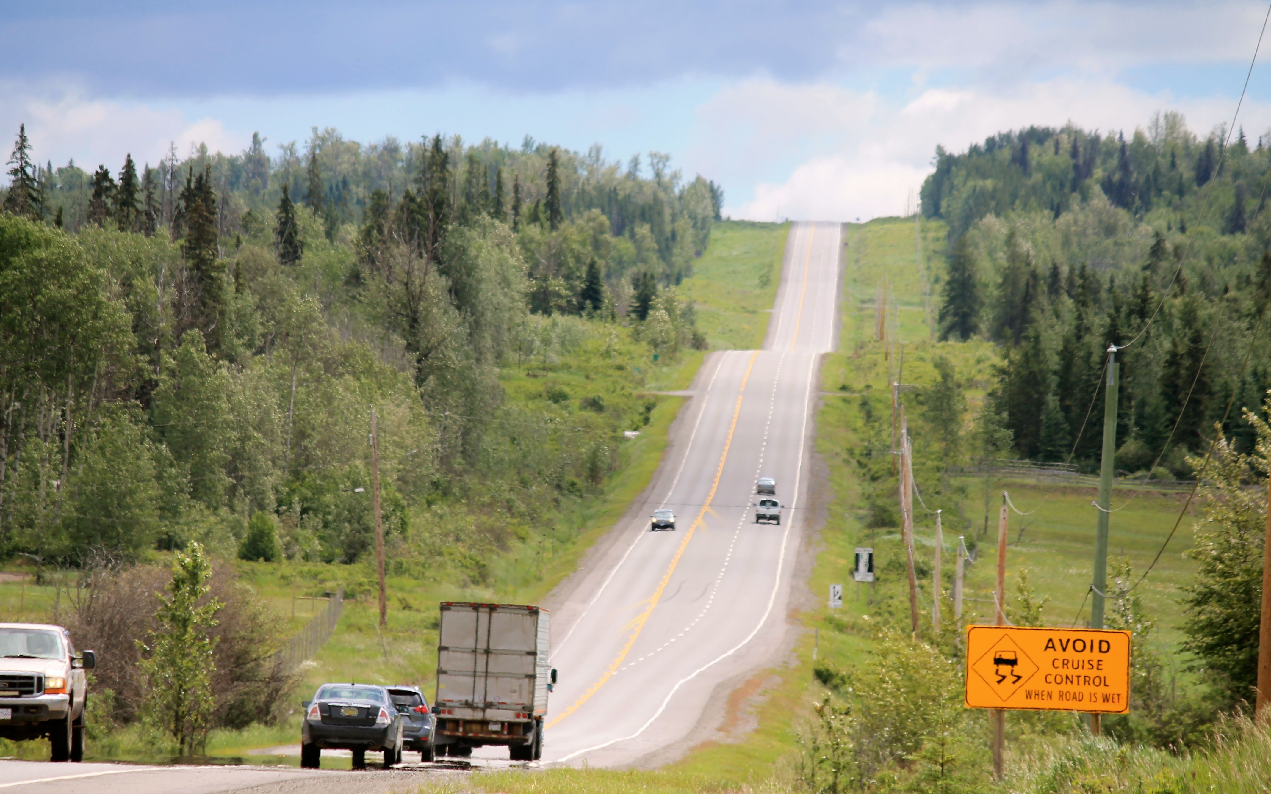
There was road construction close to Prince George that did not present delays, per se, as the work wouldn’t start until after 6pm, but the speed limits were lowered in the area to 70kph, enforced by the only police car I saw the whole trip that was monitoring speeds.
Thanks to the unknown trucker who alerted me to their presence. I was getting tired of Canadian drivers passing me all day long and was, by then, going a bit faster than the lowered limits. Whew!
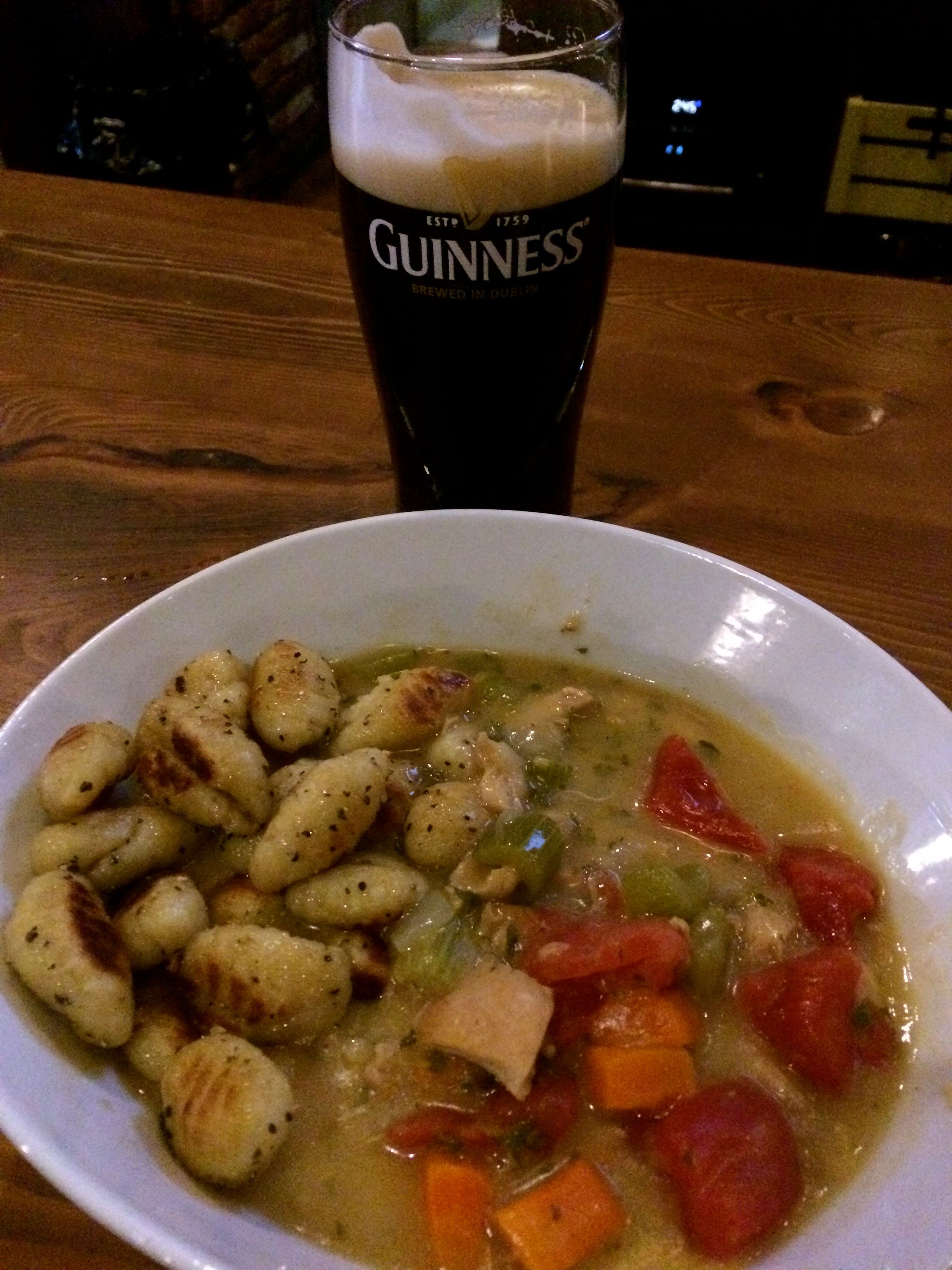
After checking in to my downtown Prince George hotel shortly after 6pm and getting cleaned up, I walked to the Twisted Cork restaurant and brew pub for dinner. In keeping with the theme of sampling wild meats, I had the rabbit stew and a Guinness.
The stew was most excellent! Highly, highly recommended.
Tomorrow is a day off the bike, with the exception of topping off fuel and maybe washing it for my final two days of riding home.

Amazing photos! Although I cringed at the idea of riding on the sloping side of the road & watching for oncoming behemoths. Glad to be back with you on your travels, April
LikeLike