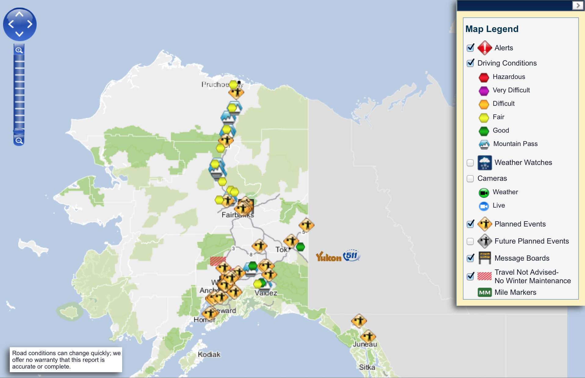
While on this trip, my housemates and I will be tracking road conditions carefully. An information site I’ll rely on is 511.alaska.gov.
The day after my arrival in Fairbanks, I’ll have an opportunity to ride north from Fairbanks up the Elliot Highway to the start of the Dalton Highway, some 84 miles farther north near Livengood, AK.
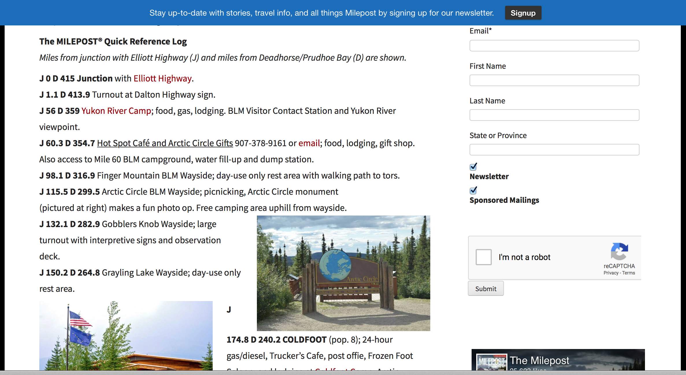
From there, depending on road and weather conditions, my mood and many other things, I can choose to ride the 115.5 miles (farther) north to the Arctic Circle Sign between the two mountain pass icons in the upper left corner of the photo below.
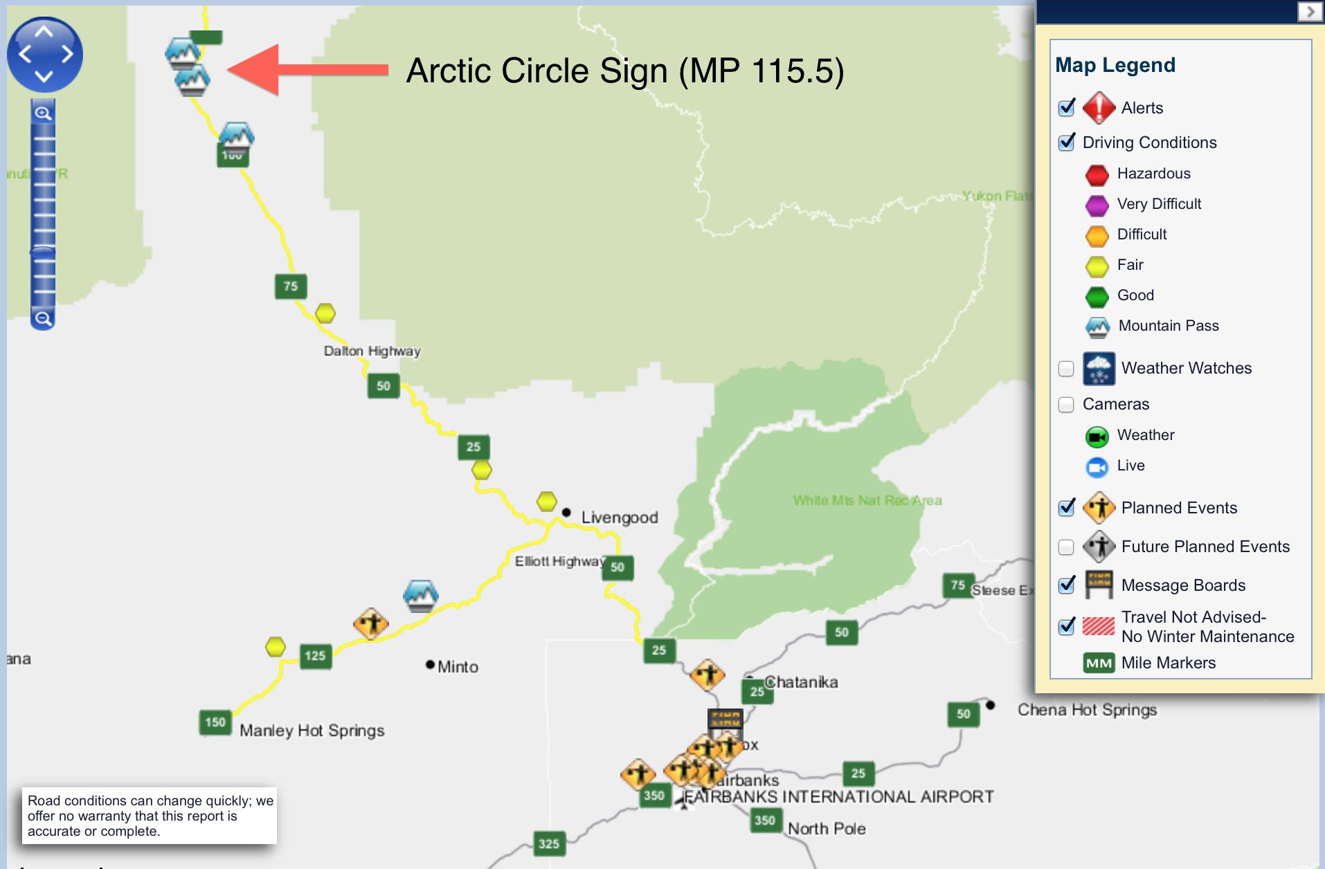
During the last few weeks, road conditions have been both good and fair (the condition at the time of this screenshot). Here are those two conditions defined:
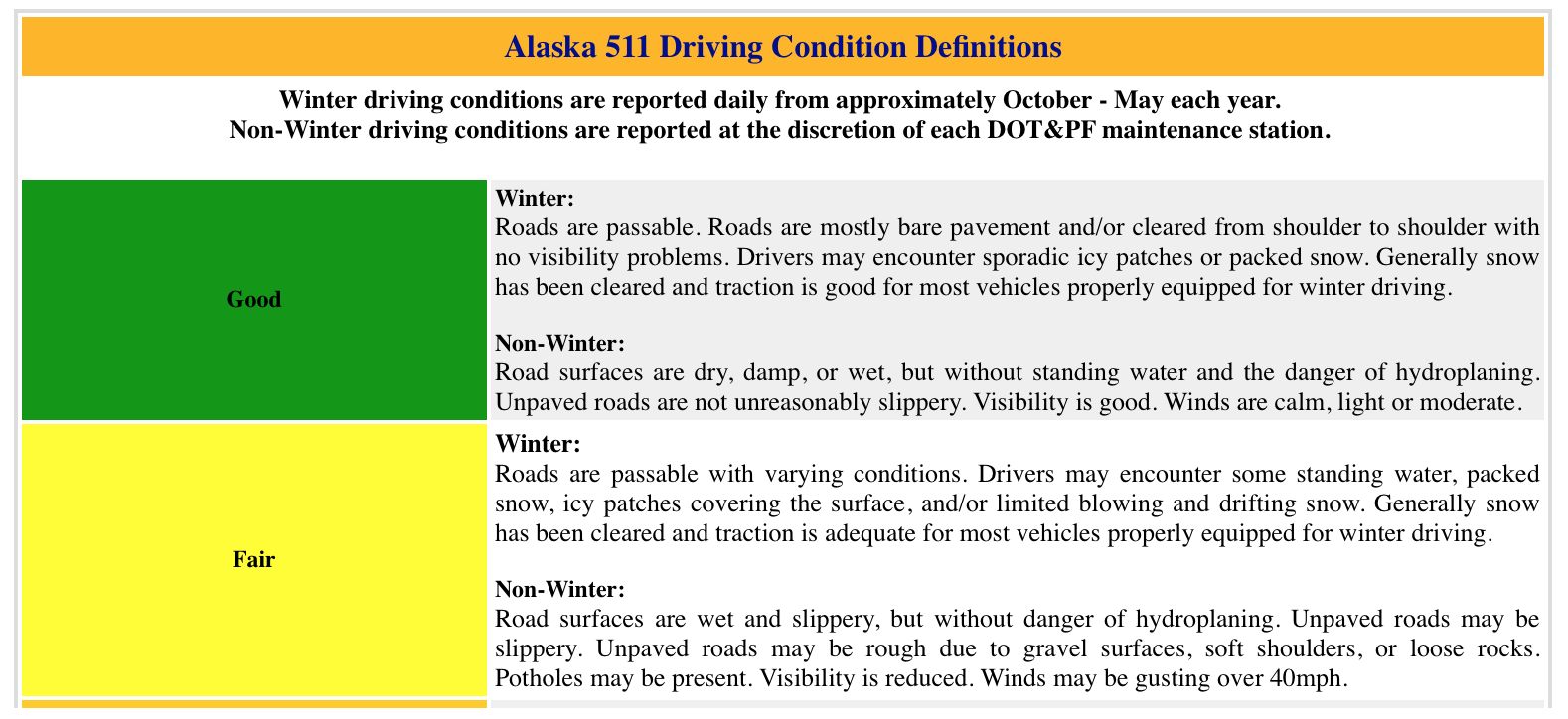
I will likely only consider traveling to the Arctic Circle Sign if the road conditions on the Dalton are considered good and, in fact, are not unreasonably slippery. My tires are not designed for use in muddy conditions.
According to the travel site TheMilepost.com, there is free camping at the Arctic Circle Sign wayside should it be needed for a rest before returning to Fairbanks. There is also fuel available at Yukon River Camp, should it be needed on the way up or back.
I have the same Fairbanks hotel room reserved for three nights, giving me a “base camp” for my ride to the Arctic Circle sign. I arrive in Fairbanks on a Friday evening, so my first opportunity to ride the Dalton will be on a Saturday.
I hope opportunities arise to speak with other riders, or perhaps travel with another rider or two, to share the experience and risks involved.
I’m getting excited!
