The 2017 ‘Loop Around BC’ Tour – updated plan
This stage of planning makes concrete the timetable, outlines reasonable daily distance goals that end near lodging or camping options, and helps choose days/dates for the trip based on available reservations, ferry schedules, and such.
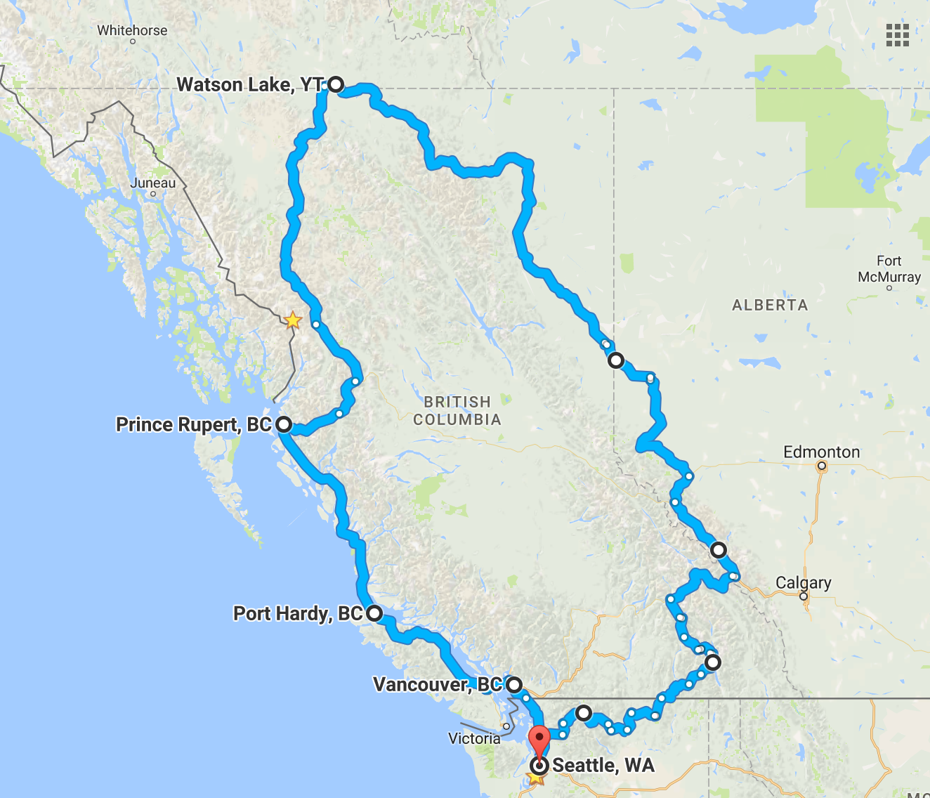
Full route map – 14 days and roughly 2,900 moto miles
DAY #1: (310 miles) route Camping at Curlew State Park
DAY #2: (170 miles & border crossing) route Stay at Ainsworth Hot Springs Resort 🙂
Ainsworth Hot Springs to Dawson Creek map
DAY #3: (277 miles) route Camping at Lake Louise Campground
DAY #4: (274 miles) route Stay near Grand Cache (TBD)
DAY #5: (196 miles) route Motel in Dawson Creek (TBD)
Dawson Creek to Watson Lake map
DAY #6: (282 miles) Stay in Fort Nelson (TDB)
DAY #7: (318 miles) Motel in Watson Lake (TBD)
Watson Lake to Prince Rupert map
DAY #8: (308 miles) Camping near Bell Li (TBD)
DAY #9: (310 miles) Motel in Prince Rupert (TBD)
DAY #10: DAY OFF in Prince Rupert
DAY #11 – BC Ferry ride down the Inside Passage Motel in Port Hardy (TBD)
DAY #12: (199 miles) route Camping near Powell River (TBD options)
DAY #13: (106 miles) route (may be 5+hrs) Hotel in Vancouver (TBD)
DAY #14: (142 miles) Border Crossing and back to Seattle

Some of those days look pretty long! Are you going by yourself? Looks like a great trip.
LikeLike