Day’s distance: 299 miles
Total trip distance so far: 5,161 miles
The temperatures reached 88 today after starting in the mid 60’s. I didn’t get caught in any significant rainfall but many of the roads were wet, especially this morning. It was humid all day.
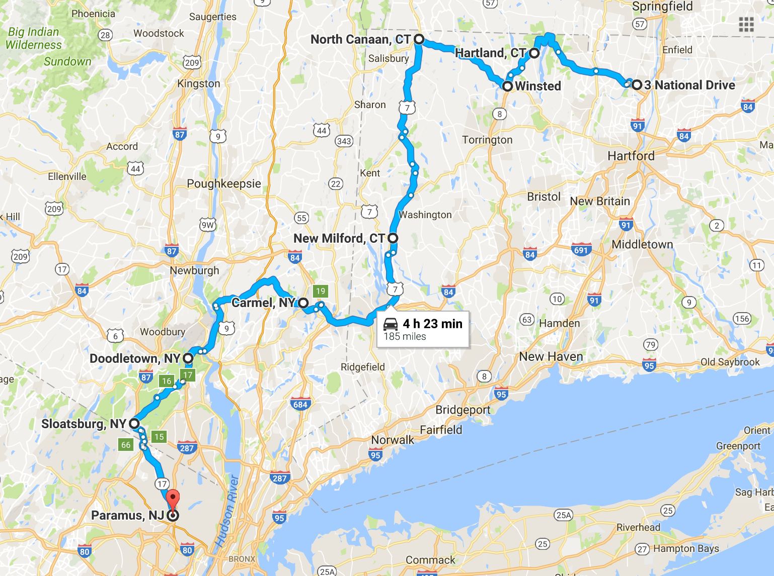
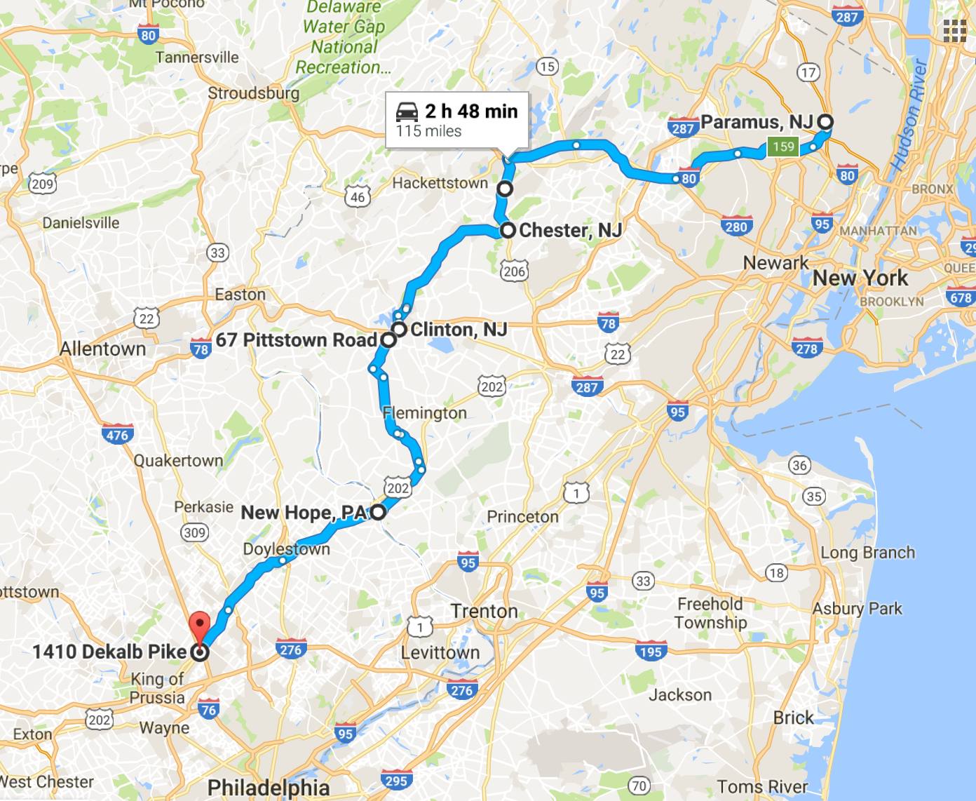
Because today’s route was a collection of specific short rides with lots of via points, it took two google maps to recreate my GPS map here. For folks interested in seeing more detailed maps, click these links to open google maps: First half of the ride Second half of the ride.
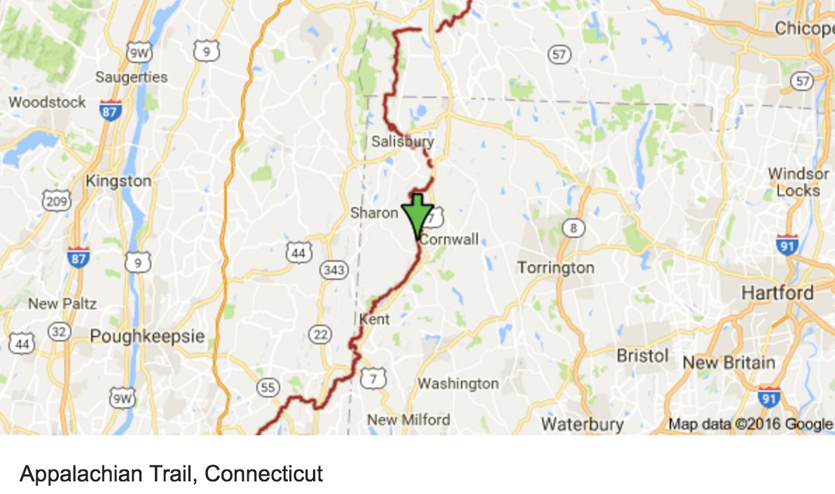
I used motorcycleroads.com to help route my way through much of my tour. Today, I was inspired by the Northern-CT-Appalachian-Mountains-Ride, the NY-Route-301, and the Seven-Lakes-Drive. This site offers a great service and is a super useful tool to aid in trip planning if you wish to avoid the interstates. I also use Butler Maps when I have one for the area I’m riding through.
As the name suggests, the Northern-CT-Applachian-Mountains-Ride travels very near the Appalachian Trail in Connecticut.
The NY-Route-301 ride was probably my favorite of the day. Two lanes and 55mph made riding through the non-technical twists quite fun. This route was patrolled heavily but popular with bikers.
The Seven-Lakes-Drive took me through the Bear Mountain and Harriman State Parks and slowed down once I left the Palisades Interstate Parkway used by folks traveling into New York City.
I did get a late start this morning and didn’t get the bike topped off until 10am. This would be a long day, but I stopped often, anyway.
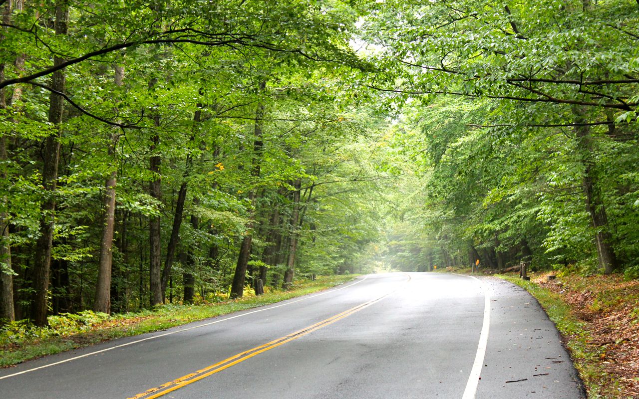
Here is a photo of Hwy 20 between Granby and Hartland in the Tunxis State Forest.
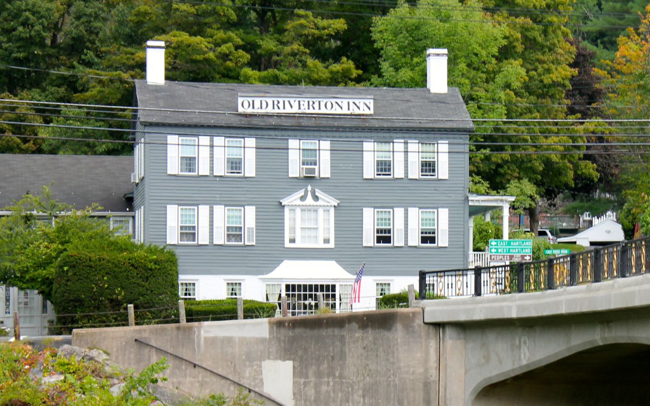
I passed by the Old Riverton Inn. Currently a B&B, it was a historic stagecoach inn built in 1796.
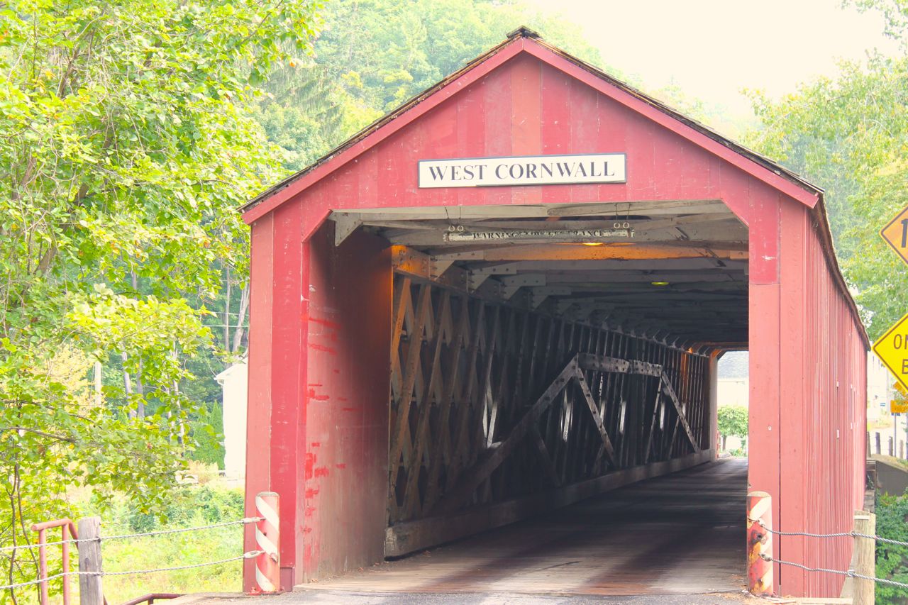
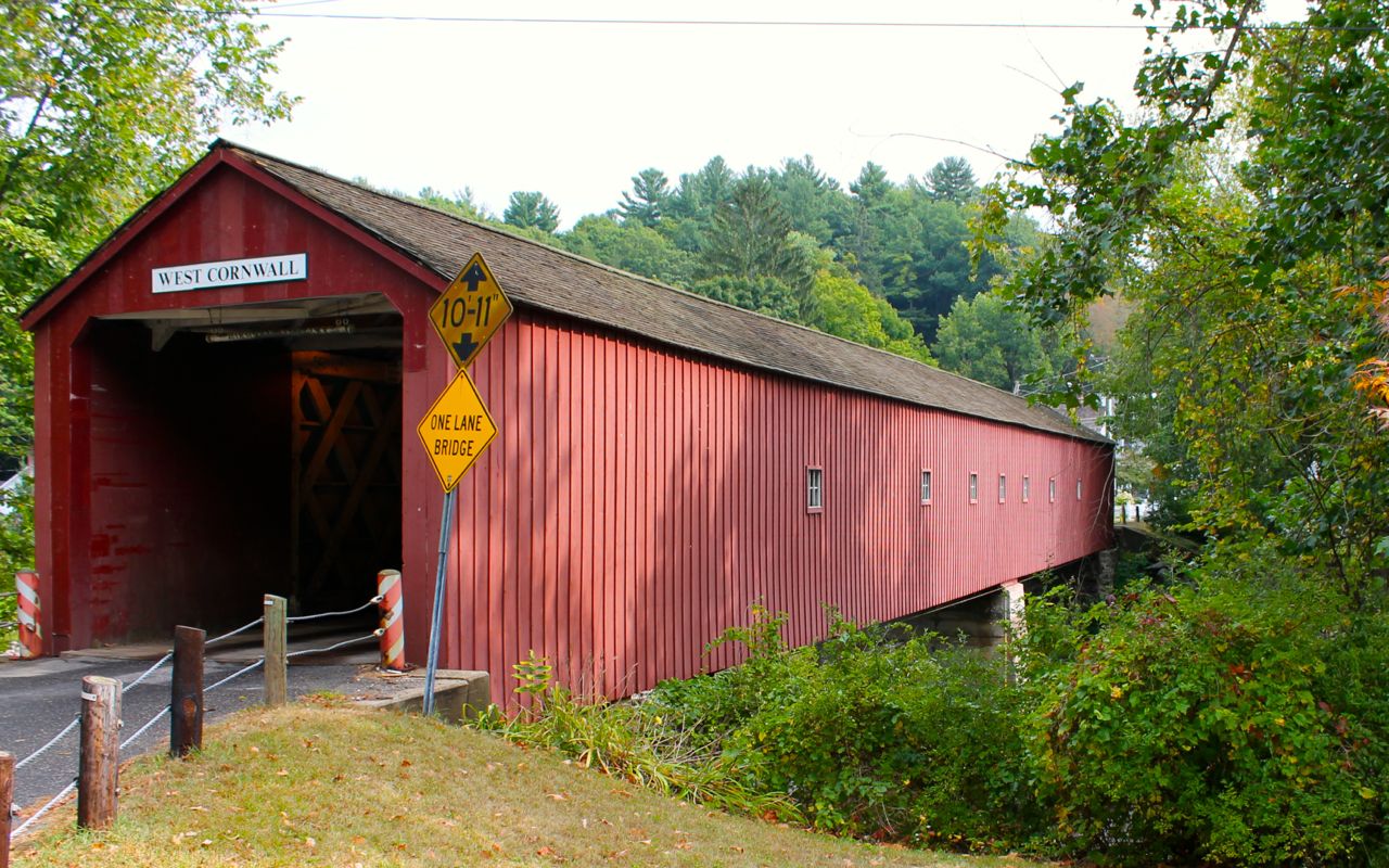
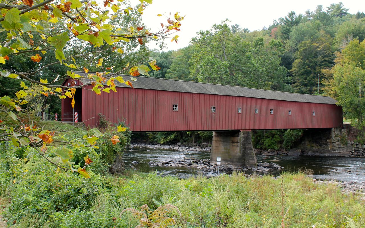
I could not leave the Northeast without taking time to look at least one covered bridge. The West Cornwall Bridge was the one I stopped to photograph today.
Crossing through (or do you still say over) the bridge to take photos, I noticed the Wandering Moose Cafe.
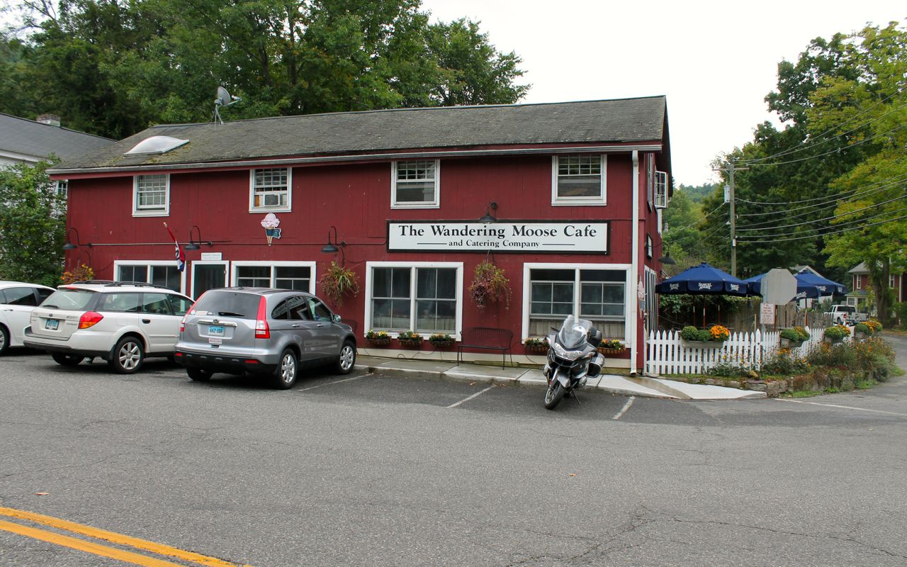
Since it was lunch time, I decided to eat. I ordered a chicken pot pie. It was a big pie, about eight inches across.
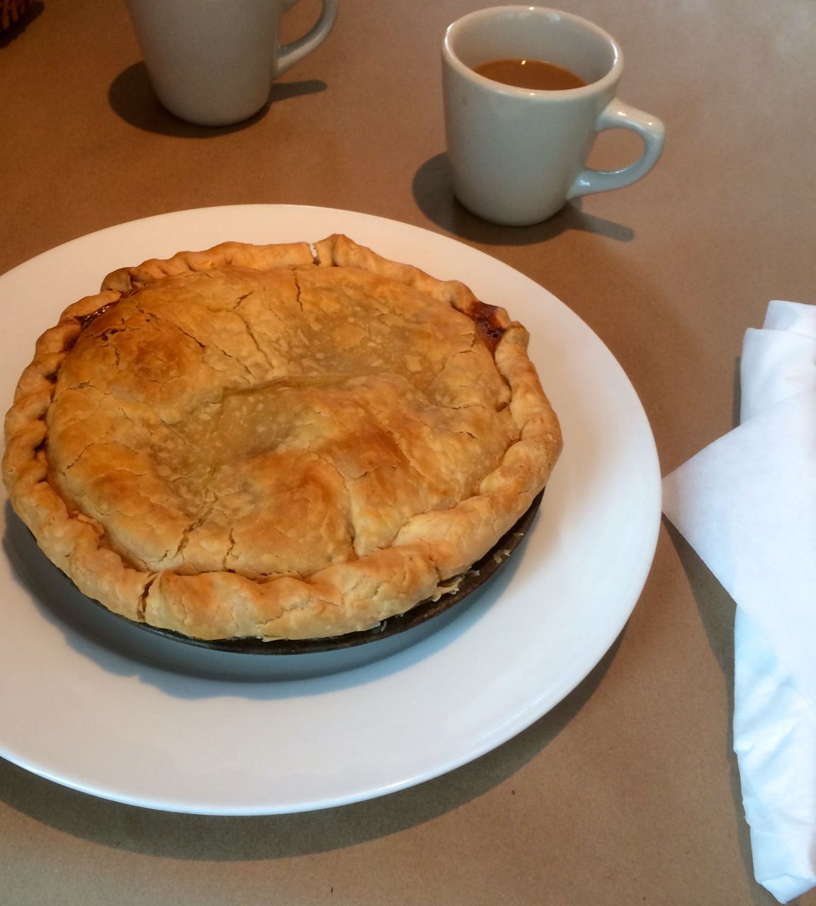
It was incredibly tasty and really hit the spot. Highly recommend stopping here if you’re in the area.
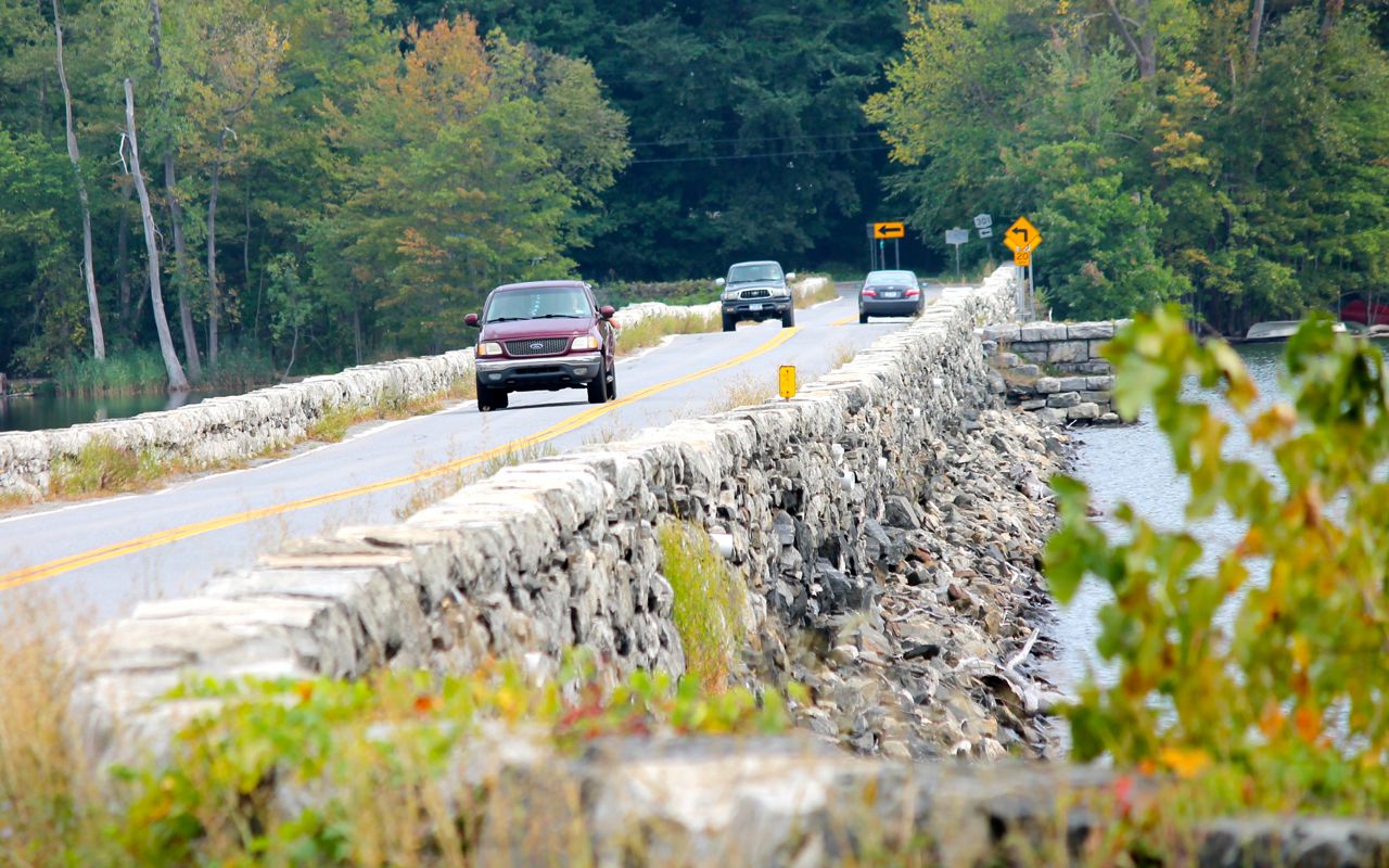
Picking up the pace, I reached route 301 and stopped only to take a photo of the low bridge used to cross a small reservoir.
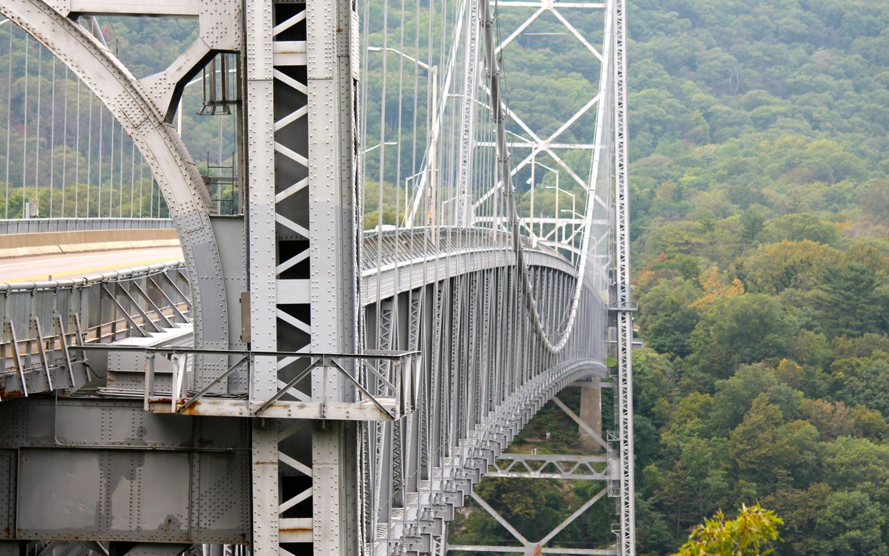
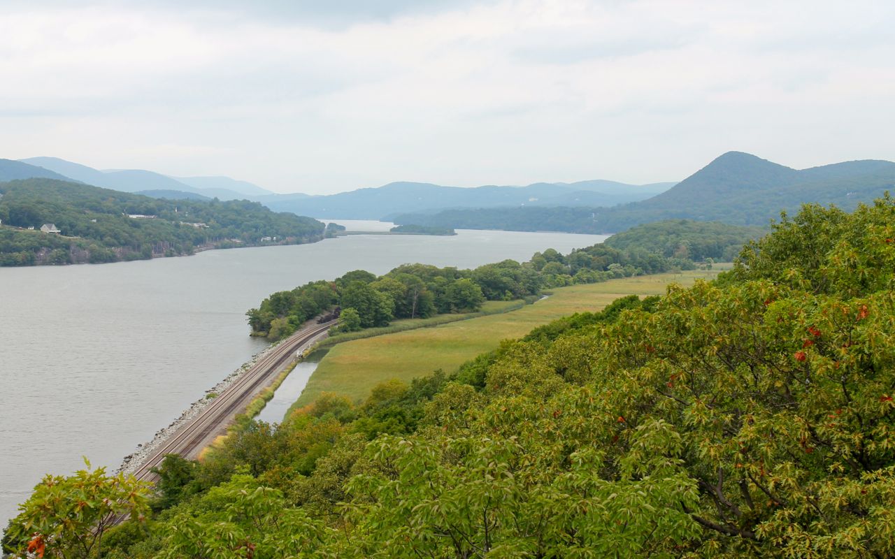
I would travel down part of the Hudson River Valley hoping for some great views but Hwy 9D instead was tree lined and private property and private drives lined the roadway. My only shot of the Hudson River Valley was taken from the Bear Mountain Bridge.
After the Seven Lakes Parkway, I traveled interstates and highways that took me into Pennsylvania where I’ll be visiting my sister. I didn’t arrive at her house until about an hour after dark.
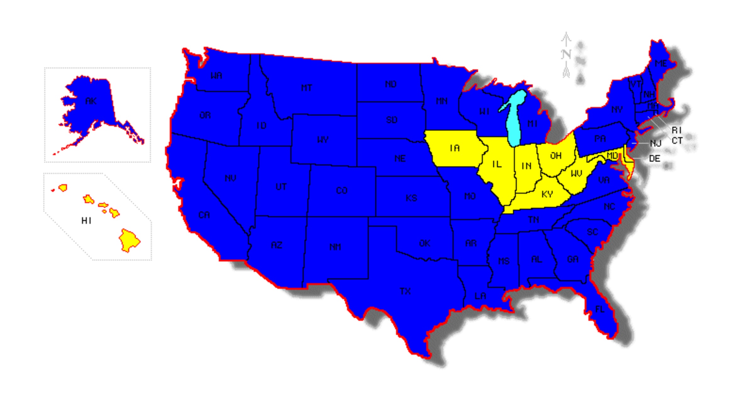
I have updated the map to include New Jersey and Pennsylvania. I also corrected an inaccuracy from yesterday – I have yet to ride in Kentucky. Just give me a little more time and I’ll remedy that. 🙂
The weather tomorrow is predicted to be rainy. I’ll spend the day off the bike visiting. Wednesday I’ll hit Delaware and Maryland.

When you posted that you’re close to coverage of 49 states,I went back to check this map. I must have missed your trip to Alaska. Motorcycling in Hawaii, of course, is a short affair but there’s no lack of scenic spots to do photo shoots. Depending on your stamina, you could bike all the main islands and maybe throw in some point to point kayak trips. I’d also be happy to serve as a dining consult.
LikeLike
Yep, went to Hyder, the southern-most town in Alaska with Will last year. We took the BC ferry from Prince Rupert to Vancouver Island on the way back. It was beautiful!
LikeLike