Summary
This was a four-day trail ride circumnavigating the Olympic National Park with two friends from Port Angeles, Will and Mark. The ride started on June 5 and covered about 450 miles. This was my first multi-day trail ride ever. I borrowed a dual sport motorcycle from Will, along with appropriate trail bags for my stuff. Overall, this was a fun introduction to what’s cool about trail riding.
The GripTwister Tours Route
Our route largely followed the Olympic Mountains Loop GPS Tour found here. This tour was put together with a collection of routes shown above, each filled with the GPS tracks that can be uploaded to a GPS navigation unit. It places riders mostly on forest service roads and identifies points of interest along the way. I highly recommend the self-guided tour, even for trail riders with limited experience.
The starting point for the three of us was on Route C, between the Lower Elwha and Crescent Bay. We rode the loop in a counter-clockwise direction covering roughly two of the routes each day. Due mostly to inclement weather, we chose to skip the loop around Lake Quinault, much of Route A and the bit of Route C between Draper and Lake Crescent.
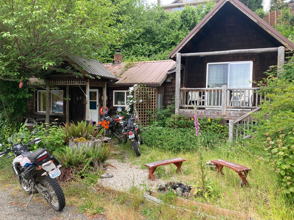
The Bike
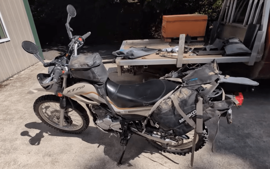
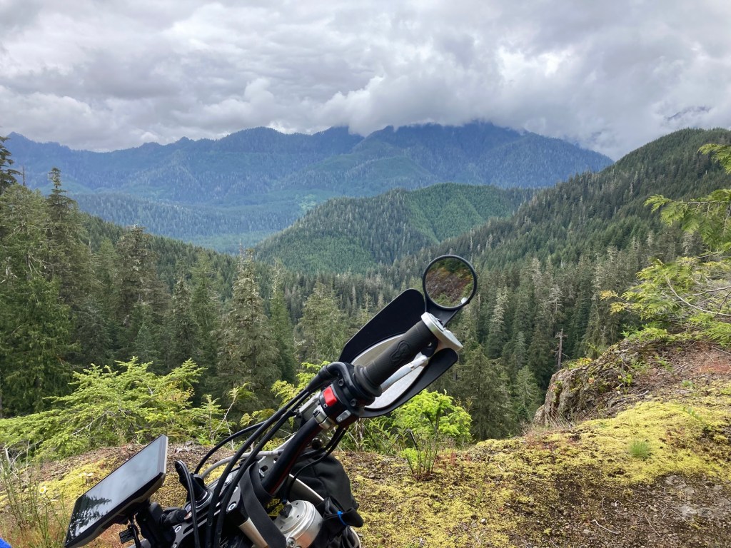
Since I don’t have a street legal dirt bike, I borrowed a Yamaha XT 250 for this trip. It is a single cylinder four stroke with 20 hp capable of carrying me and a small load at highway speed for those short sprints between trails. The bike was equipped with a small tank bag and a U-shaped Mosko 40 bag that fits over the back seat. Here’s a short video from Will describing the setup.
Not shown in the photo was the GPS unit that my host Will added so I could follow the route and see each track in detail during the ride.
Day 0
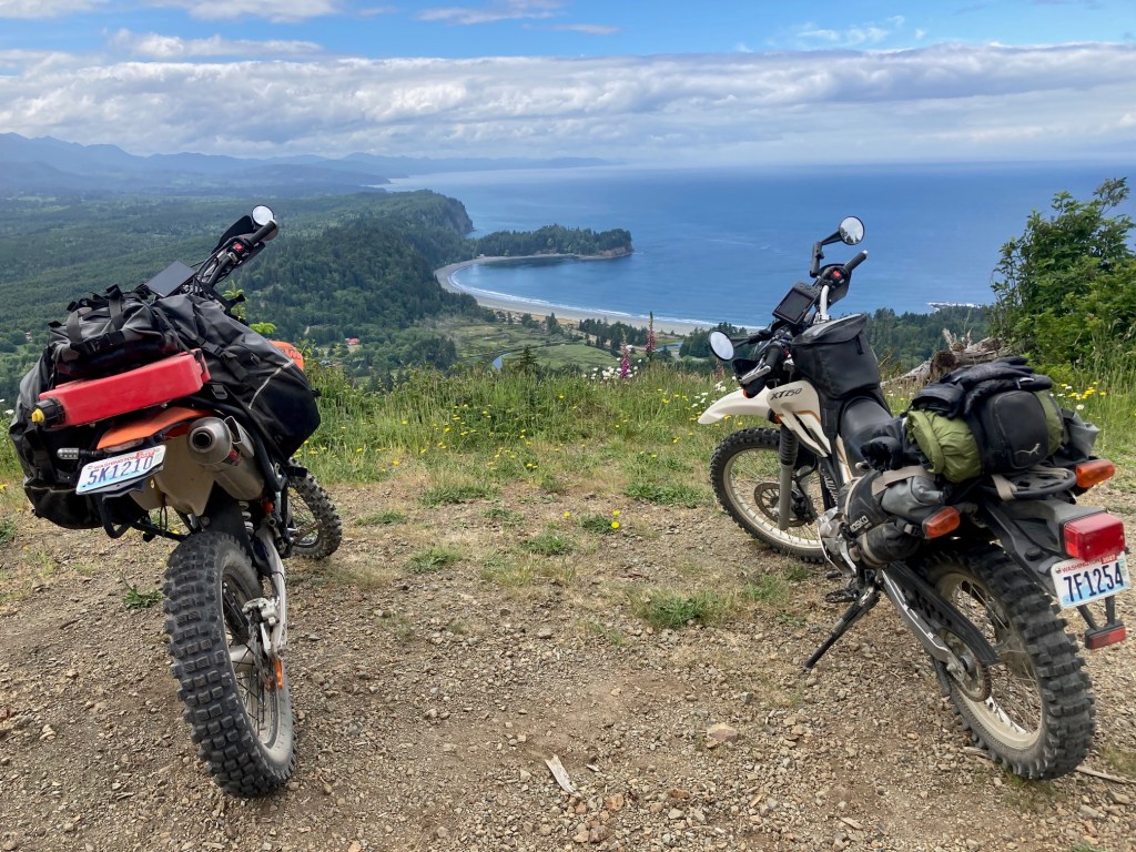
The day before we left on the trip, Will and I took a short ride with the bikes loaded up. The XT (on the right) was easy to ride and it didn’t take long to settle in to the broad power band and to get used to the brakes and clutch. At highway speeds (max of about 65 on the flat or downhill), I found the bike to be stable even in light winds.
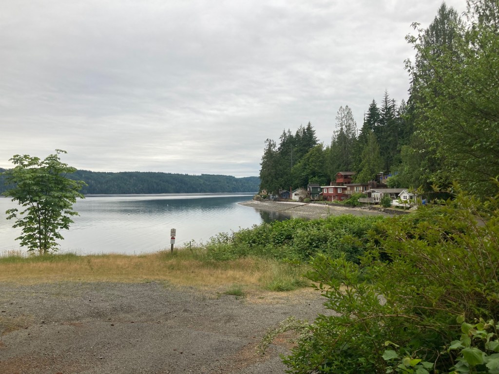
The photo catches the view of Crescent Bay from Striped Peak. We rode roughly 20 miles over gravel covered roads and a bit of highway with the bikes loaded to give me time to get comfortable.
Day 1
95 miles from Freshwater Bay, WA to Forks, WA along Route C and Route D.
Temperatures in the high 40s and low 50s with rain throughout most of the day.
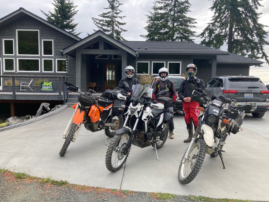
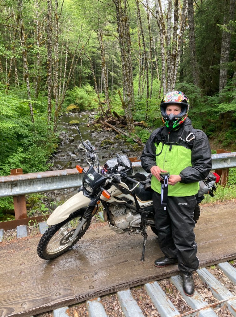
Ready to depart. We named ourselves the Cardiac Team as we have all had heart interventions of one sort or another. Will commented at one point he is never the youngest rider but he was this time 🙂 It was just before 9am when we departed.
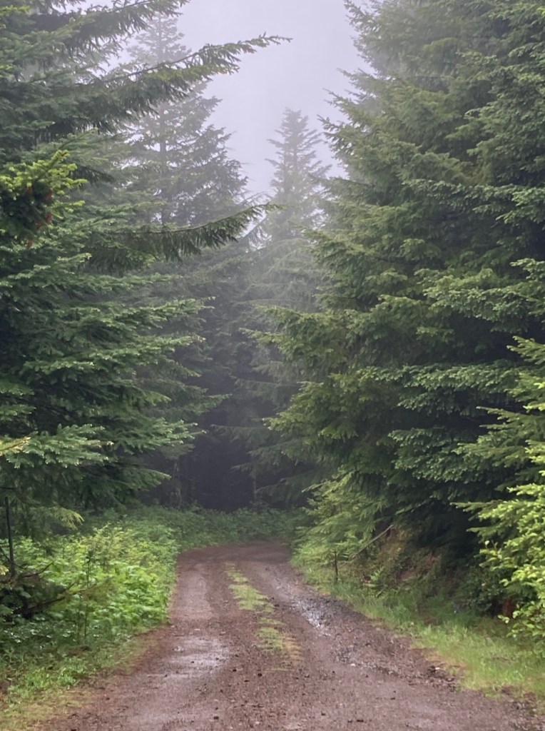
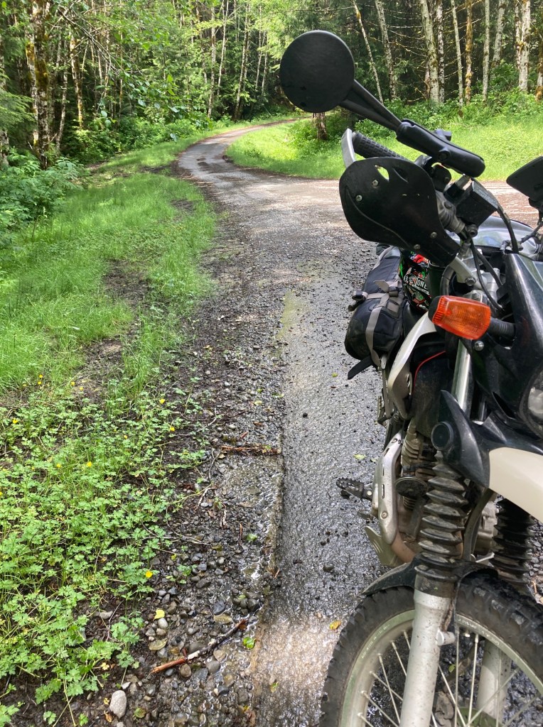
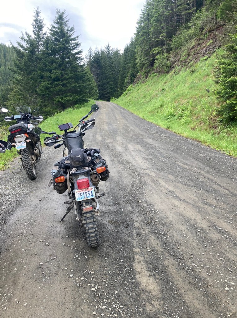
We stopped to put rain gear on after a short ride down Hwy 112. We would start trail riding proper along forest service roads on West Twin River Road. We would never enter the National Park but instead stay outside the boundaries on state forest lands.
Not all of the terrain would be as smooth as the image above shows. While most of the trails we would ride started out as dual track roads, at times the brush was overgrown, the ruts deeper, the gravel used to repair the roads bigger and fallen rocks complicating our passage.
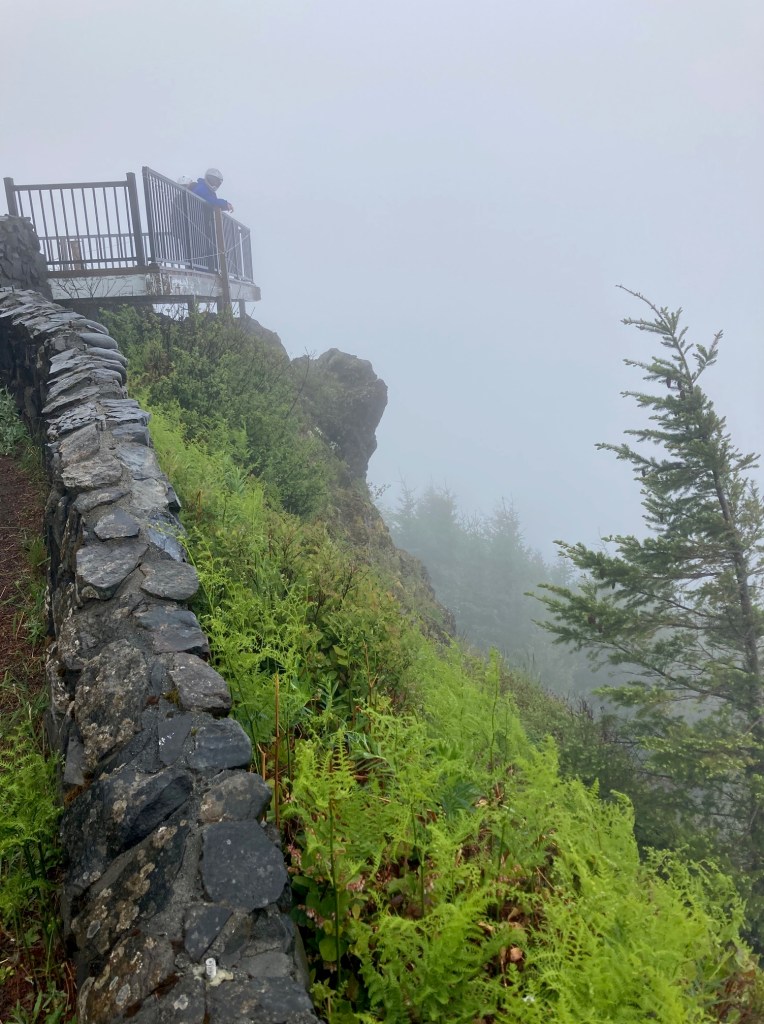
We stopped at one of the day’s points of interest, the Kloshe Nanitch Lookout (elevation 3,147 feet). As you can see above, the view was completely obscured by the weather the day we arrived.
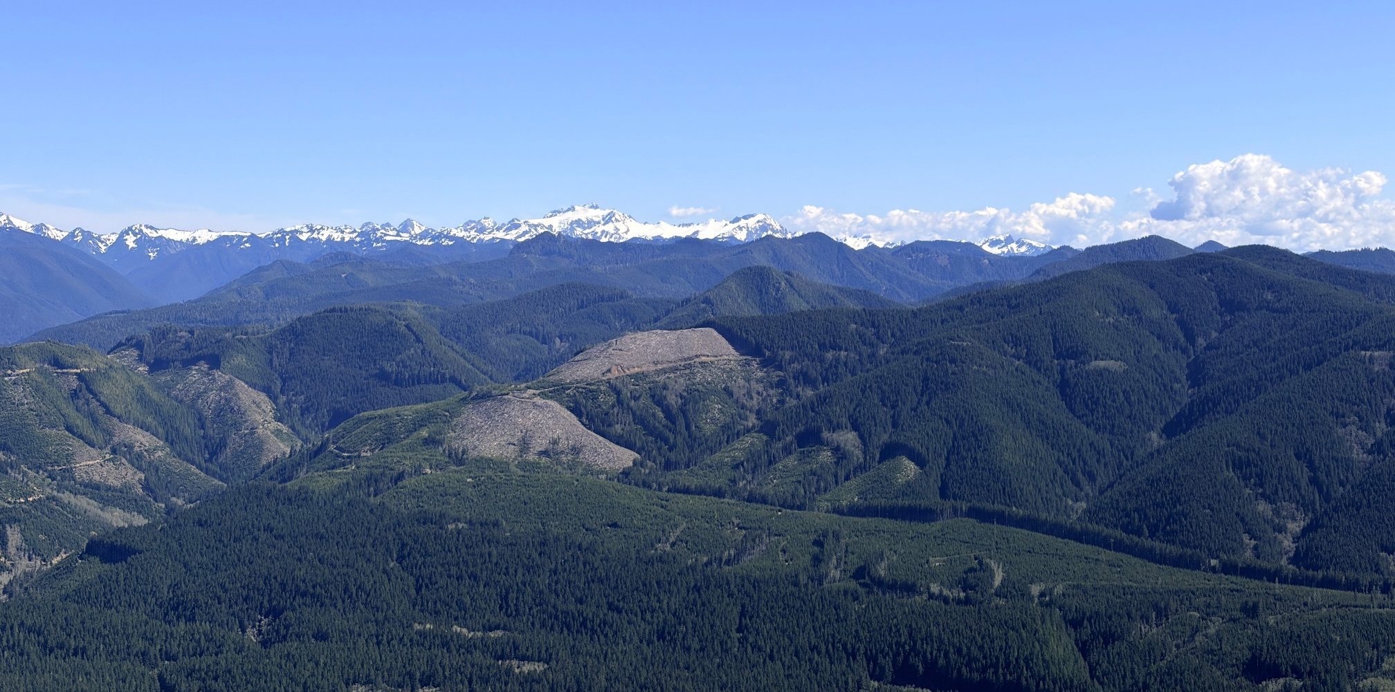
Mark was up here in April on a clear day. This was his view.
We continued on, backtracking a bit and returning to the route. Our moving average speed for the day was 24 mph, according to the GPS. This would be pretty consistent throughout the trip. We stopped at least hourly, hydrating and munching on protein bars throughout the day.
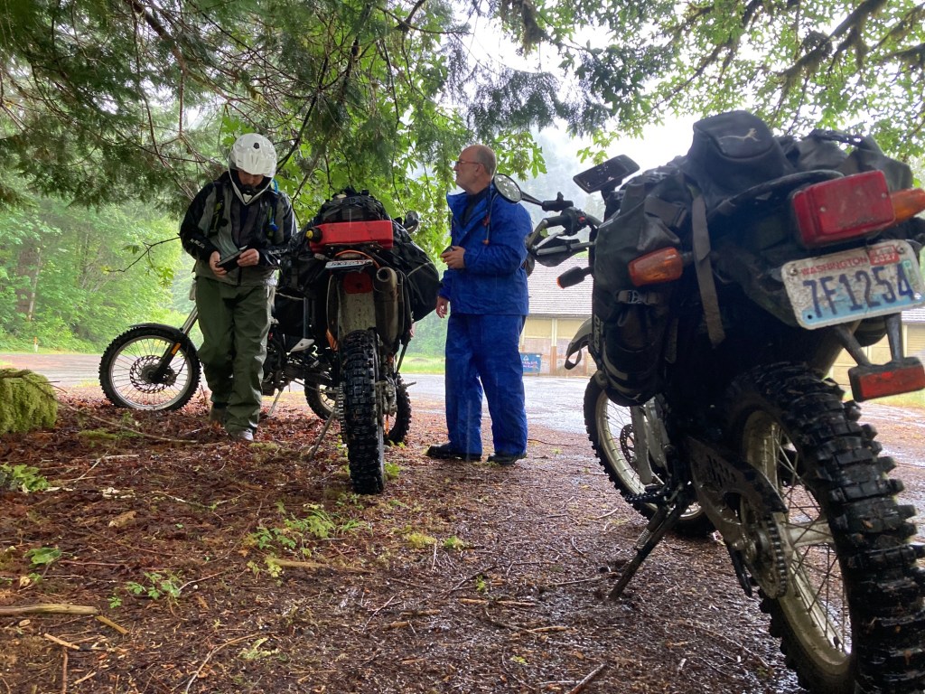
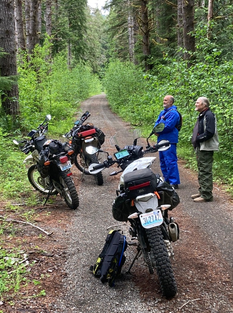
Working out the GPS sync issues at a forest service camp under the limited cover of trees.
Taking a break to grab a snack bar and to give Will a chance to tell a tall tale from his past related to this bridge. 🙂
As we completed Route C and began Route D, the trail at times became much more difficult. This would be the most technical part of our four-day adventure. The two-track path becomes deeply rutted and those ruts often contained sharp rocks that fell from the hillside. Between the ruts, slippery grass was waiting to wash out your front tire. This is what happened to me. My only slow-speed crash happened as I attempted to switch tracks. I was uninjured and the bike unharmed.
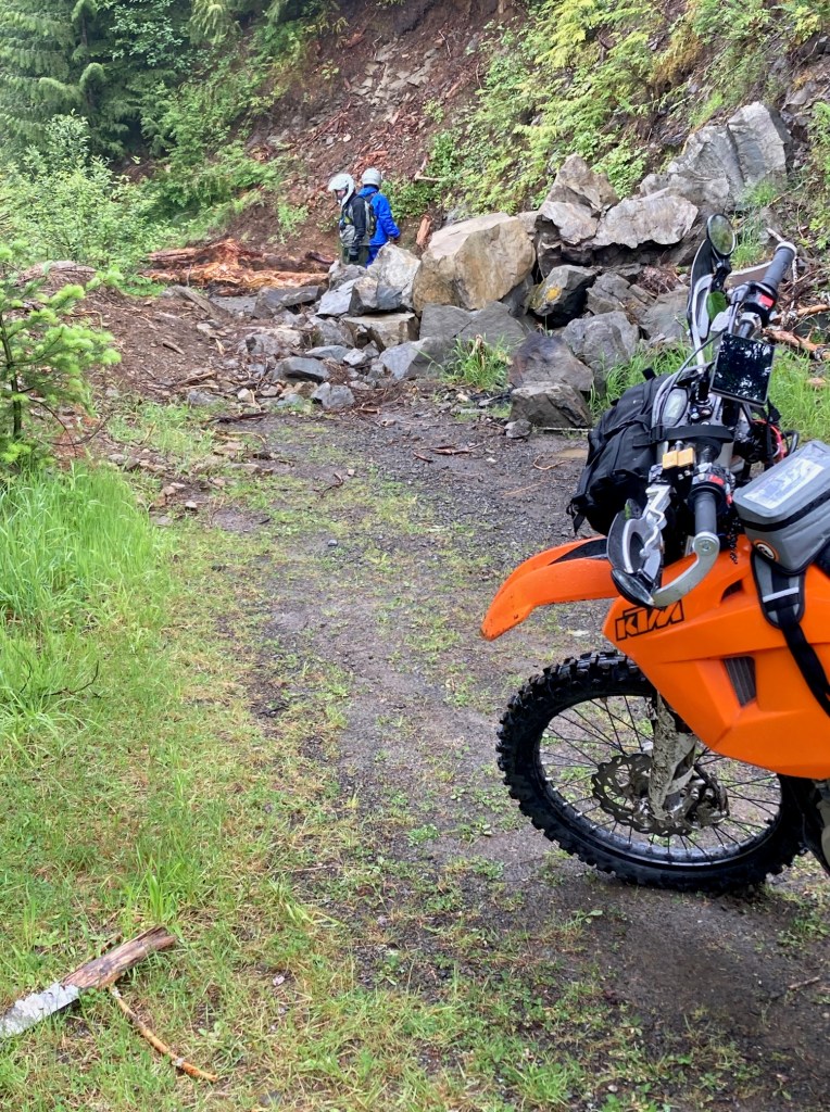
It seemed like each day there was a big obstacle to traverse. This is where my trials experience helped. Walking over the obstacle before trying to ride over, just like in a trials, allowed one to pick their path over and through. For the above obstacle, I did have Will spot me but rode the bike over it myself. I would ride all the obstacles myself over the four days. For folks who ride trials, I would say the worst obstacles were harder than typical novice lines but not as hard as intermediate lines. Of course, we weren’t riding trials bikes but larger dual-sport bikes loaded with gear.
We arrived in Forks, WA at about 3pm. Since the weather was still very wet, we stopped for dinner before heading to our accommodations for the evening at about 4:30pm.
My boots and gloves were soaked from the day’s rain. We set up some fans to dry these and threw our Frog Toggs (rain gear) and other wet gear into the dryer. Everything was dry and ready to go in the morning.
Day 2
110 miles from Forks, WA to Quinault, WA along Route E and F.
Temperatures generally in the 50s. Steady rain after about 2pm.
Starting the day at the In Place restaurant for breakfast. This, by the way, was where we had a late lunch the previous day. We would ride down Hwy 101 for about 15 miles before turning onto another paved road for another 5 miles or so.
My focus today was to keep a light grip on the bars. I was kind of, sort of getting used to riding on gravel but it was and still is a nemesis for someone who is primarily a street bike rider. I also aired-down my tires to about 12 psi once we hit the gravel. Tires with too much air just bounce on gravel and I was struggling the day before.
Day 2 seemed easier from a technical perspective. Both ascending and descending gravel covered forest roads seemed easier and I was more comfortable at the slightly slower pace I set for myself. I found traveling along these less challenging roads at about 25 mph was where I wanted to be.
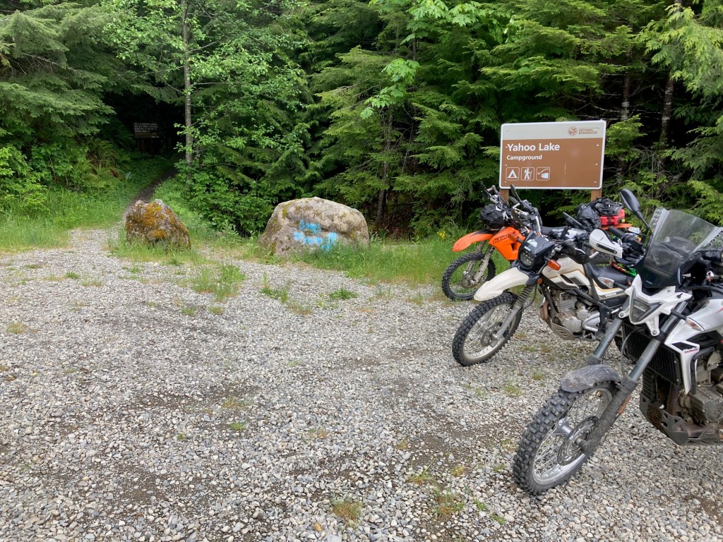
We saw a black bear on the road near Yahoo Lake where we hopped off our bikes and hiked in a couple hundred yards to see the lake. This would be the only bear sighting for us which didn’t bother the city boy in me at all.
There was a campground here but it appeared to be empty on this day.
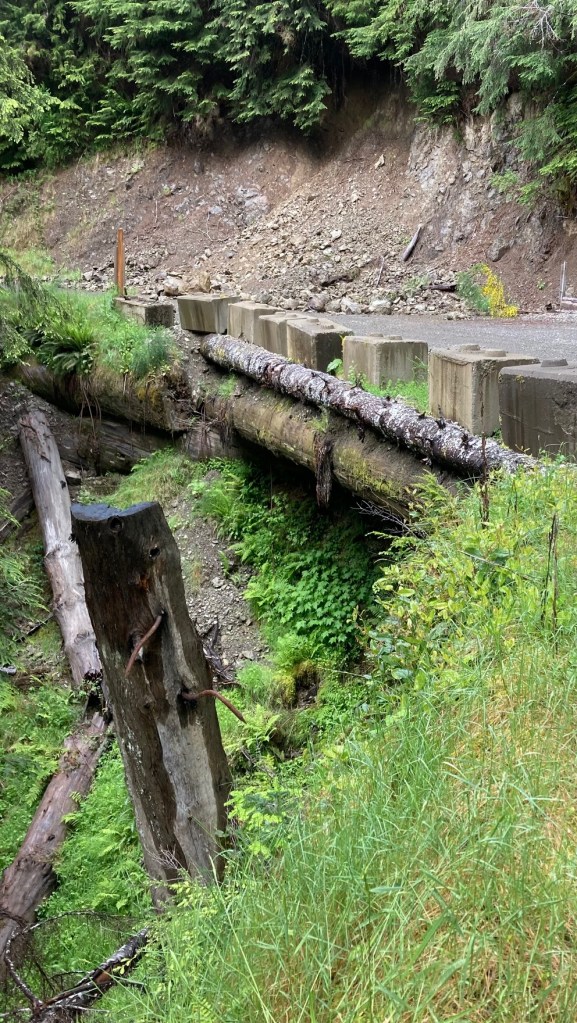
One of the many washout repairs we saw along our route. This looked like the timbers used previously failed and fell down the ravine a bit. The new timbers were substantially bigger.
Again, because it was raining, we decided to eat before we checked in to our lodging. We stopped at Dino’s Pizza and Grill instead of the fancier places in Quinault as we were wet and still in our riding gear. It was cash only on this night as a region wide internet outage kept their electronic systems from working. Luckily we had cash.
Accommodations for the night were at The Elk House. This was by far our fanciest lodging, very warm and comfortable. They had left us microwave popcorn for our evening snack. I had the upstairs master bedroom (really a fancy loft) that looked out those large windows shown in the photo. It was beautiful, but alas we saw no elk.
I definitely felt more drained at the end of Day 2, both from the rain and soaked boots but also from the longer day. Near the end of our ride, we decided as a group to not ride the loop around Lake Quinault. That was a good decision because, as it was, we checked in to our lodging after 7pm.
Day 3
140 miles from Quinault, WA to Hoodsport, WA along Route G and Route H.
Temperatures warmed up a bit and I believe were in the 60s.
This would be our longest and driest day on the loop. In all, we spent about 9 hours on the bikes, including the short breaks and small detours. We skipped one “out and back” section of Route H and cut one last bit of the trail ride in favor of a few more street miles as we were all tired and hungry.
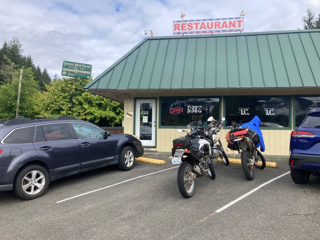
We started the day with breakfast at the Internet Cafe in Quinault River Village along Hwy 101. This is a place I’ve visited on my road riding adventures. I enjoyed Huevos Rancheros and a latte. In my opinion, this was the best breakfast we had while on the road.
We would take Hwy 101 south for a while and carry extra fuel on this day. Combining these two routes formed the longest stretch of the loop between fuel stops. I believe I ate three protein bars between breakfast and dinner and was hungry when we arrived in Hoodsport.
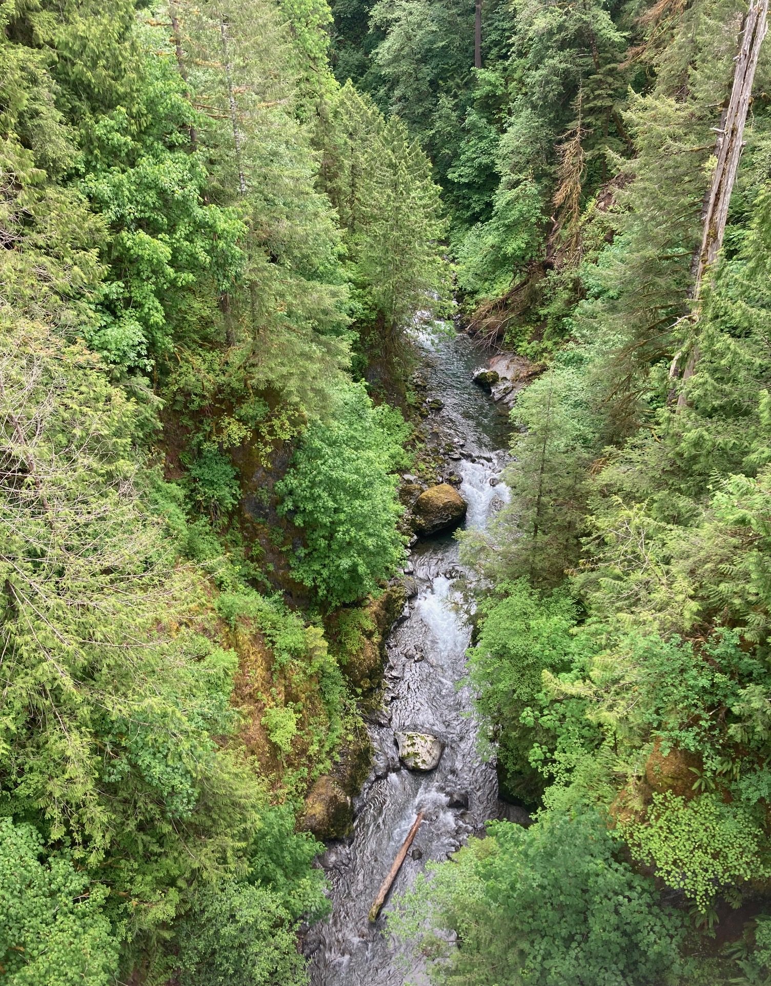
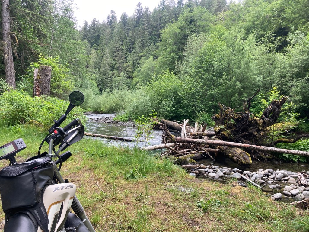
Scenic ravines were common along our routes.
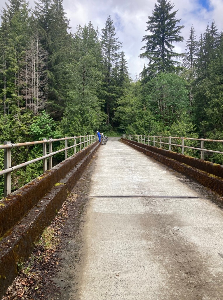
This was one of the longest spans I remember crossing along the trail.
While much of the day was cloudy, I was grateful it was dry.
Sometimes all you need is a tiny excuse to stop.
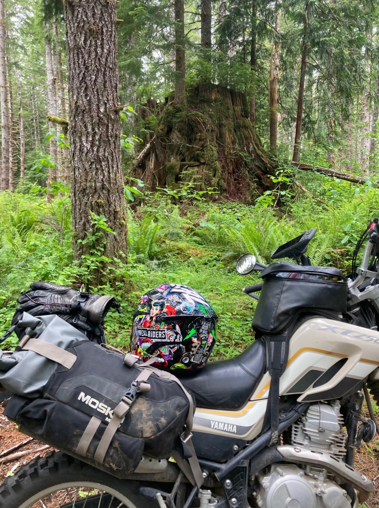
In this case it was a giant cedar tree stump. We did see a handful of elk shortly after this stop. Unfortunately, they quickly scattered when they saw us.
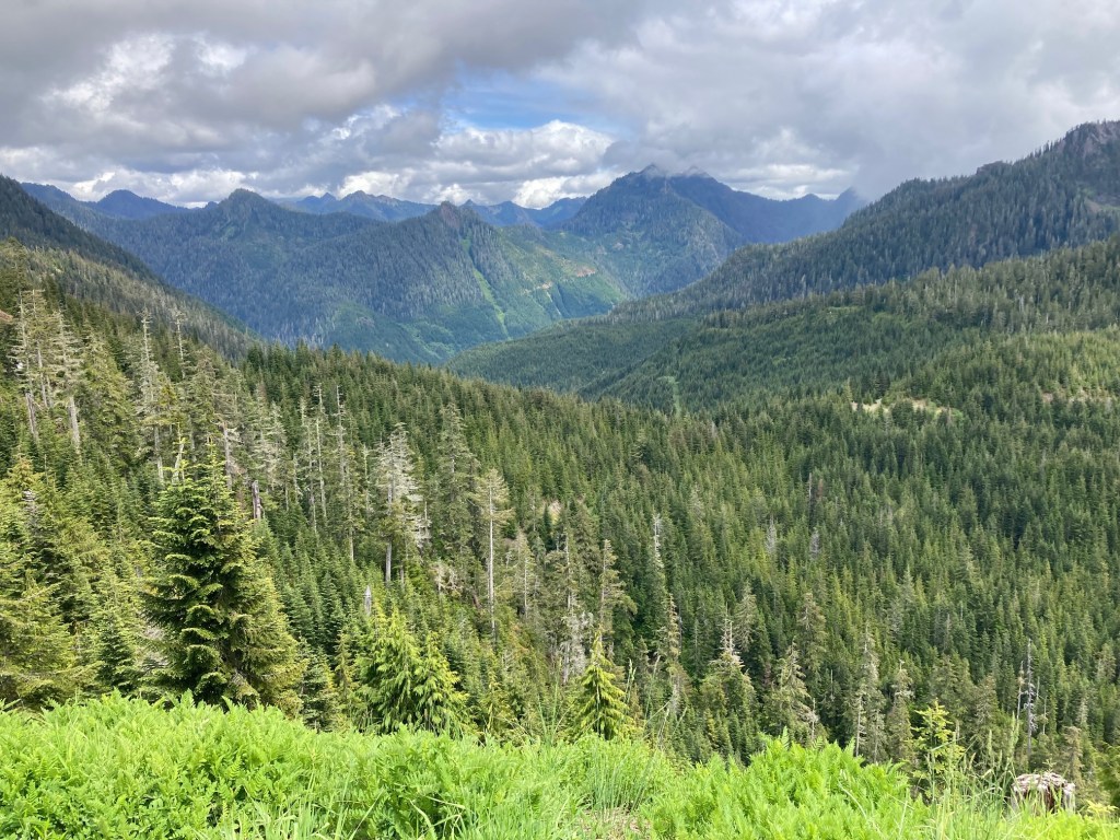
Perhaps the most scenic landscape was found on Route H. This was taken near the top of the loop above Lake Wynoochee.
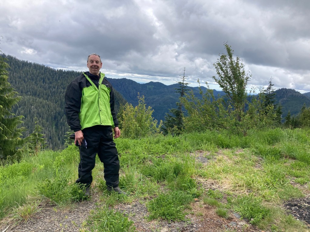
Taking breaks when it isn’t raining comes with the benefit of being comfortable taking off the helmet and posing for a picture. 🙂
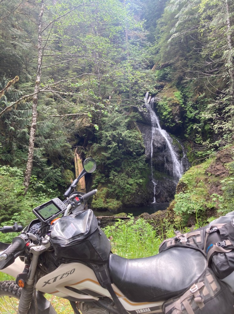
Small waterfalls were ubiquitous on the trail. This one has a nice swimming hole for riders who want to cool off in the warmer summer months.
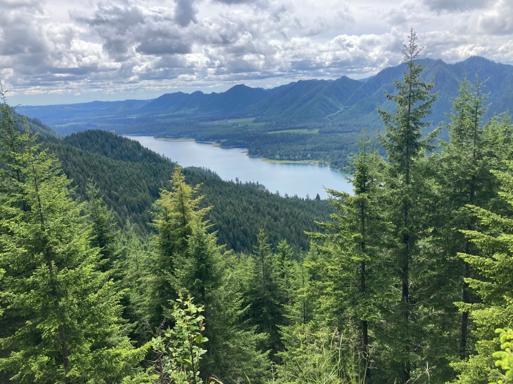
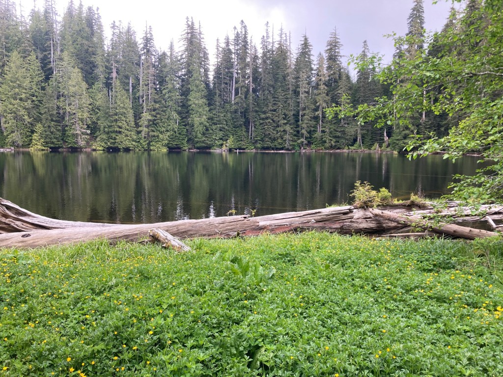
Lake Wynoochee from Route H.
It was only on Day 3, which was a Sunday, that we encountered other vehicles on the trail. Despite some obstacles that I thought were a bit challenging on two wheels, including washouts and significant ruts, we saw a number of pretty standard trucks and and a 4-door jeep up there with us. Later in the day we encountered other trail riders on motorcycles, as well.
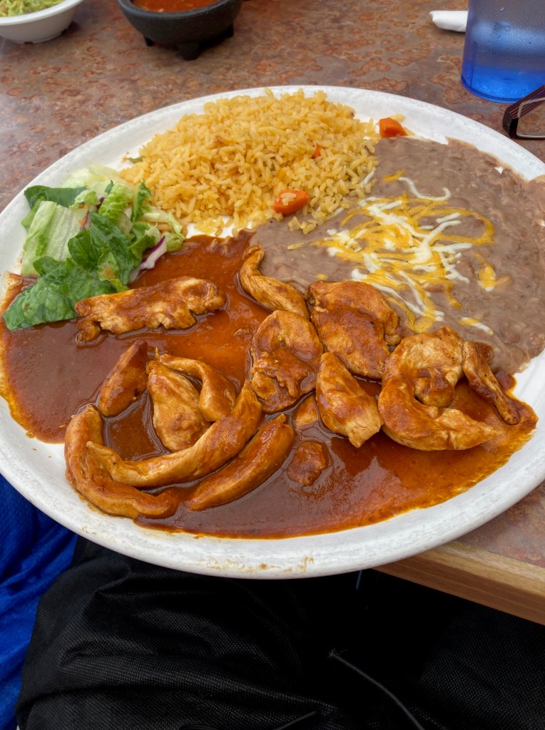
Once we were down off the mountain, the roads widened and our pace picked up. We decided to follow a shorter route into Hoodsport and about an hour later we landed at El Puerto De Angeles for dinner. The Chicken Mole was excellent. Let’s not tell our cardiologist about the refried beans for a second time in a day 🙂
Our lodging for the night was a small beach house on the edge of Hood Canal.
View of Hood Canal from the porch of the house.
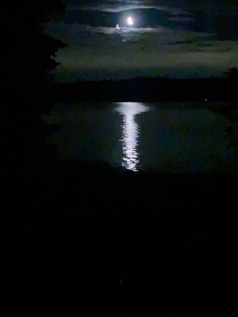
There was a pretty moon rise over the canal that night. This was the best my aging cell phone would do given the lighting conditions. This was after midnight and taken through the patio doors.
Rain was predicted to start about 10am the next day so we agreed to get up early and see how close we could get to Port Angeles before it started.
Day 4
100 miles from Hoodsport, WA to Port Angeles, WA along Hwy 101 before and after Route B.
Temperatures in the 50s, cloudy with rain late in the morning.
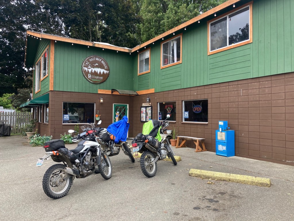
We started the day with breakfast at the appropriately named Halfway House Restaurant. Decent food and a very entertaining waitress named Flo.
As mentioned, we skipped much of Route A that morning, instead riding along Hwy 101 until we reached Quilcene, WA. We joined Route B there. The roads today were not technical, just covered in gravel, sometimes a fresh, deep gravel.
We took a short detour into the Dungeness Forks Campground to take a break before making our final push along Hwy 101 into Port Angeles. The rain started to fall but stayed relatively light.
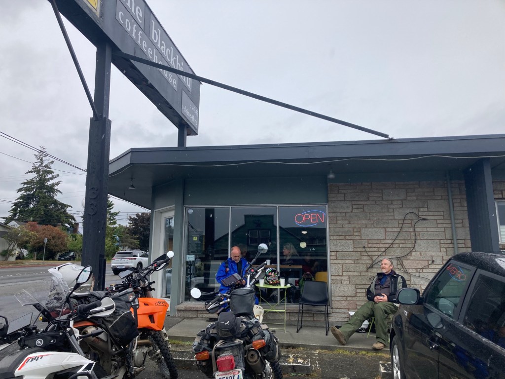
We stopped for a coffee and a snack at the Blackbird CoffeeHouse in Port Angeles before splitting up and heading back to our respective homes. It was still before noon and I decided to drive home after unloading the bike and changing clothes. It poured rain almost the whole way back to Seattle.
Reflections
This was a great trip and an excellent introduction to what trail riding is all about. The company was experienced and helpful to this noob and we all got along great.
I did buy an off-road helmet and some trail pants. I’ll be using the trail pants for trials riding. I may use the helmet as well because I’d prefer to retire my open face trials helmet.
The Yamaha XT 250 was a good bike for me to use. Powerful enough for our short highway sprints and docile enough for trail use. I think it got somewhere around 75 miles to the gallon of gas – very efficient.
A great deal of forest land we rode through was clear cut. That’s what those roads we traveled along are used for. One particular cut left a lot of stumps and other detritus behind making it look a bit like a graveyard. It was on Day 3 that we seemed to pass through the largest number of cleared areas.
I was never too sore while on the trail, though by the time I returned home, my neck and shoulders were stiff and sore. I’ll attribute much of that to learning the cost of not staying relaxed on gravel roads, however part of that was the drive home in the rain. I swear people in the northwest don’t know how to drive in the rain despite living in it.
I would do another multi-day ride. It was fun. This tour had some challenges but not too many and I liked having a bed each night versus camping. I would not want to carry more gear and would not enjoy setting up and packing up camp in the rainy weather.
Beyond wet boots and gloves, I stayed pretty dry thanks to my Frog Toggs. My butt was damp on rainy days but I stayed warm for the most part despite missing the heated grips and heated seat on my road bike.
I turn 68 in a week (from the day this posted). I’m grateful to be physically able to continue my two-wheeled adventures. Sunday I have a trials event to ride and next week I’m off to British Columbia on the road bike. Stay tuned for that!

It was fun for me to read my way through your trip, especially as I won’t be out there on a bike. The wet gear reminds me of walking in England on rainy days and drying gear for the next day’s hike. It was nice to hear that your trials riding gave you some insight into scoping out the roads on this ride. There were some beautiful views along the way. I didn’t expect to hear about clear cutting, but after looking it up, it’s the most common method of logging. It has some ecological benefits (some trees need lots of light to sprout, can be quickly reforested) as welll as some ecological harms (changes local wildlife habitats, increases short-term soil erosion risks).
Looking forward to hearing about your trip to BC.
LikeLike
It was wonderful
LikeLike
Keith, it was great to read through your posts and see the photos. I’ve been feeling nostalgic about my backpacking days in the Olympics and this brought so much of it back. I’m impressed that you maneuvered those edgy sections of the road. And that you conquered gravel, which, as a biker, I dreaded and put a lot of scrapes on my street bike.
Although I’m living in one of the rainiest areas of Hawaii, I still miss the fog and drizzle of the PNW.
LikeLiked by 1 person