Day 1
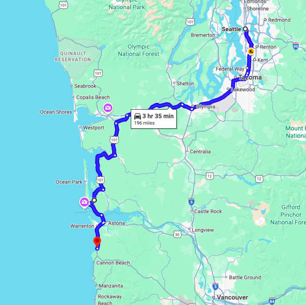
Distance traveled – 196 miles
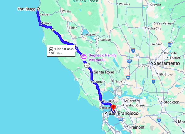
I left the house shortly after 9am on a motorcycle ride down to Santa Cruz, CA. Heading south, I was on the interstate for about 50 miles before turning west on Hwy 8. I meet up with Hwy 101 just north of Raymond.
The best road segment of the day was the curvy bit of road south of the Hwy 4 turnoff. The road adjacent to Long Island and towards the Willapa National Wildlife Refuge, specifically.

I’m heading down to Santa Cruz to reconnect with friends. On my way, I’ll be stopping in Oakland to visit another friend I met in Santa Cruz but who lives in Oakland now. Reasonably short days in the saddle with a full day off the bike on the way, I’ll land in Santa Cruz on Sunday.
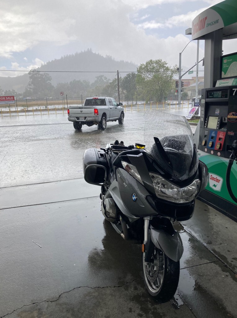
The weather started in the 60s and warmed to the 70s when the overcast skies cleared. That’s perfect for the gear I wear. There is no rain in my forecast 🙂 so I left the rain gear at home.
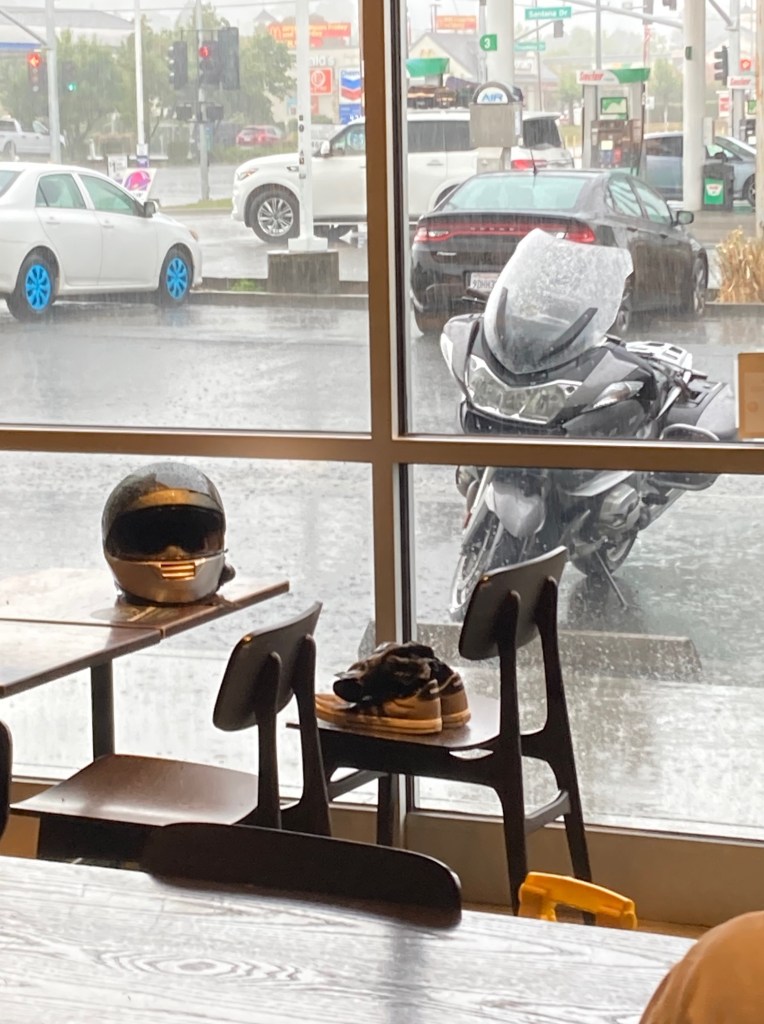
In addition to leaving the rain gear, I left some other gear I normally carry, including a 12v air pump, some motorcycle jumper cables and a USB battery backup. I made room for the tool set by strapping my sneakers to the back seat. I am also bringing my DSLR and a second lens, but that stuff is in one of the panniers and not as convenient. I’m going to be taking more photos with the phone as an experiment. I like traveling this light and I’m going to try ways to make it work.
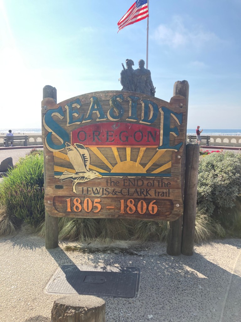
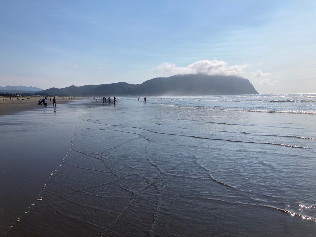
I didn’t take any photos until I was close to the Oregon border.

And the next photos were taken during a walk, starting at my hotel to the beach. Seaside is known for being the end of the Lewis and Clark Trail.
The weather gods were smiling today.
Tomorrow I ride to Gold Beach, Oregon. It’s located about 30 minutes north of the border of California.
Day 2

Day’s distance – 294 miles
Total trip distance so far – 490 miles
Seaside is about 26 miles south of the Washington border. Gold Beach is about 34 miles north of the California border. So I traveled the length of the Oregon coast minus about 60 miles today.
The weather was similar to yesterday. A heavy overcast mixed with some coastal fog greeted me in the morning with temperatures hovering just below 60. It didn’t warm up until the overcast burned off at about 2pm.

Unlike yesterday, the winds were blustery. Lucky for me they were mostly blowing south and didn’t bother me at all. In fact, at times the air felt uncharacteristically still. That said, at points, it was blowing across the road surface, especially it seems, on the bridges.
Below is the last bridge for the day. That’s Gold Beach in the background, my destination for tonight.

I’ve traveled this route many times in the past. My 2014 Western States Tour, my first extended motorcycle trip followed the coast. Where I will get to Fort Bragg in three days, it took me twice as long then. Six days were spent exploring side roads far more, stopping frequently for photos and even taking videos. On a happy note, I have reservations for dinner at Cucina Verona in Fort Bragg. I ate there on that trip and every time I have been through Fort Bragg since then.
I am finding I want to take a more direct path this time, in comparison. It feels late in the season and I feel noticeably less energy around exploring. I’m not saying I won’t explore in the future, but I’ve planned my schedule in a way this time that prevents too many sidetracks this time.
I’m tired and a bit sore tonight. Tomorrow is about and hour shorter than today and I’m glad for that. Until then!
Day 3

Day’s distance – 271 miles
Total Trip distance so far – 761 miles
The weather was similar to the previous days with a touch more fog in the morning and more heat in the afternoon. The low was 59 along the coast and the high was 94 inland on Hwy 101 this afternoon. Winds were light.
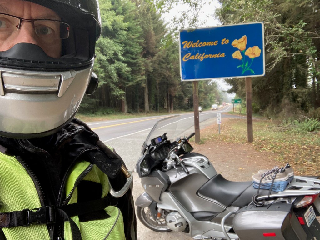
I arrived at the California border about 9:30am. Had to stop and get the photo 🙂
I put off breakfast until I reached Crescent City. Oatmeal and fruit were my choice at the Good Harvest Cafe.

My favorite part of Hwy 101 along the Oregon coast is south of Gold Beach to Brookings. The highway is largely uninterrupted by the small towns that populate most of Oregon’s Hwy 101.
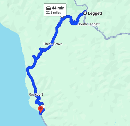
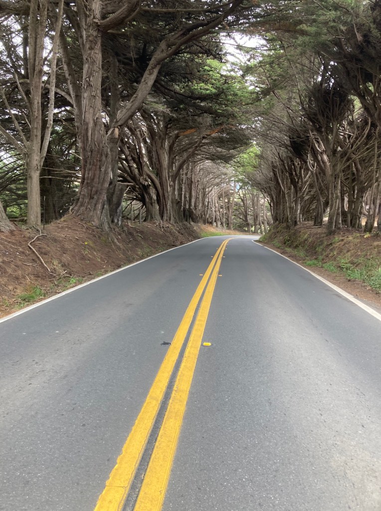
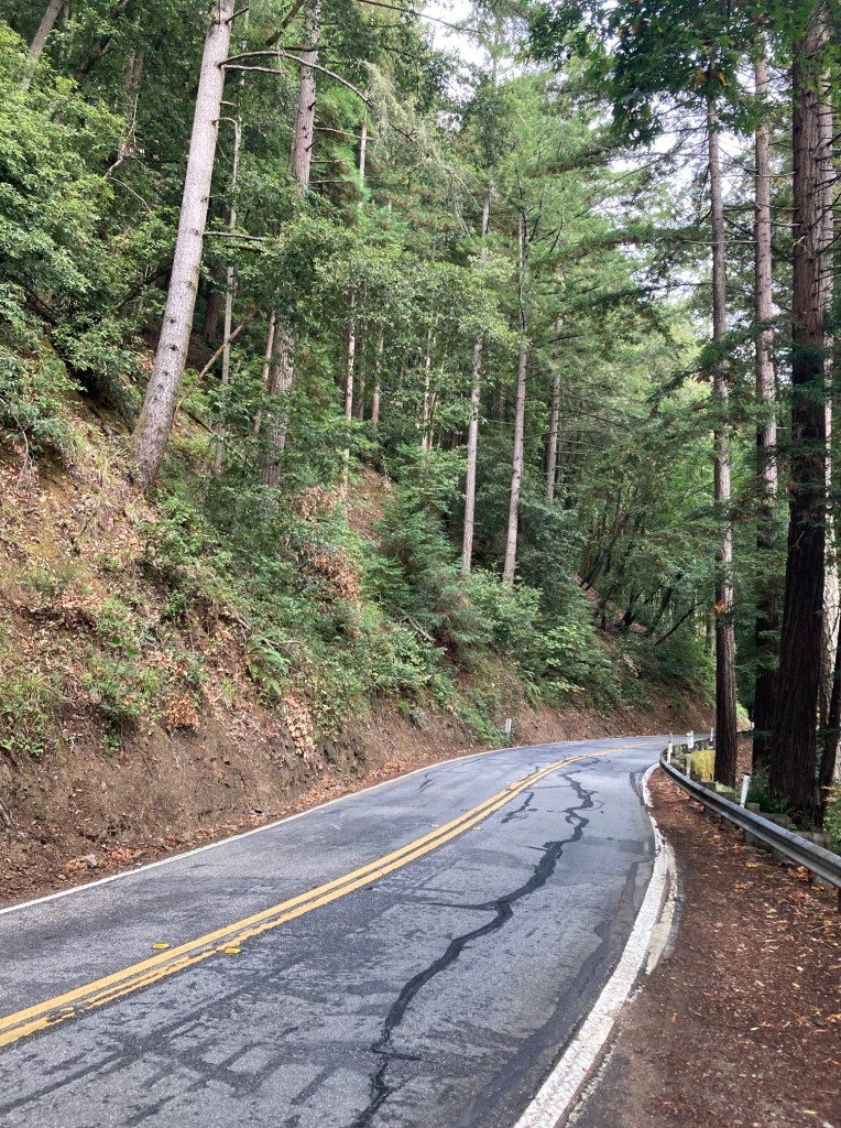
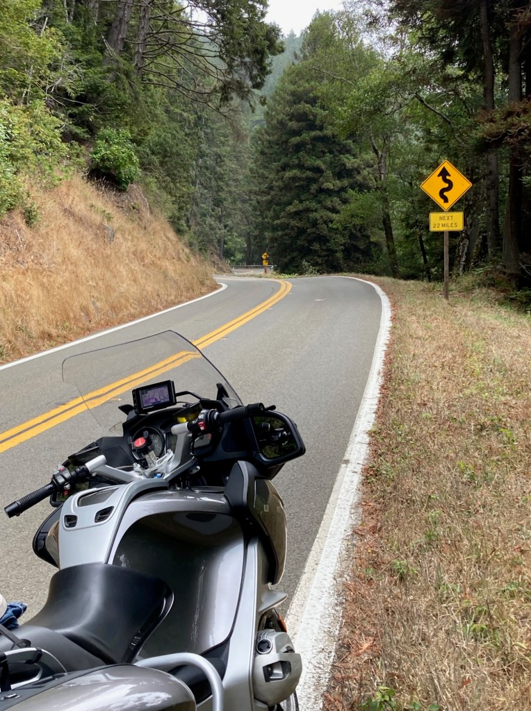
In California, Hwy 101 initially moves inland and through farm land. Then it becomes a divided highway and the traffic builds up before largely disappearing again around the Redwoods National Park. It remains mostly divided highway and isn’t bad – 65 mph with wide sweeper turns and good surfaces. But the highlight of the day is when I turned off Hwy 101 for California Hwy 1 in Leggett, California.
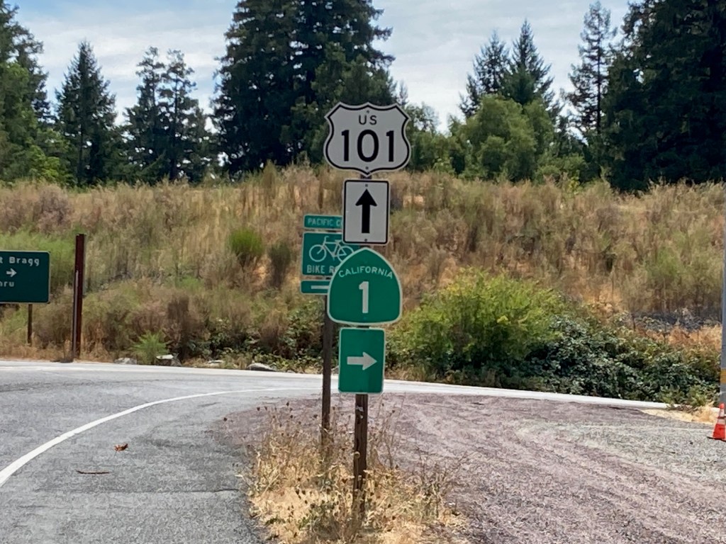
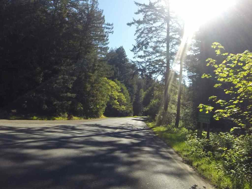
Here begins curvy bliss – about 22 miles of one of the best roads on the Western coast.
The road surface is generally excellent and characteristics include elevation changes, tight blind corners, no guardrails, and little traffic.
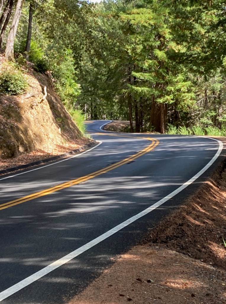
Most of the road has no shoulders, especially the really tight parts. But I stopped in a few places to try to capture some of the moments, if not the best parts of the road.

Soon enough, about 40 minutes later, your out of the redwoods and on the coast.
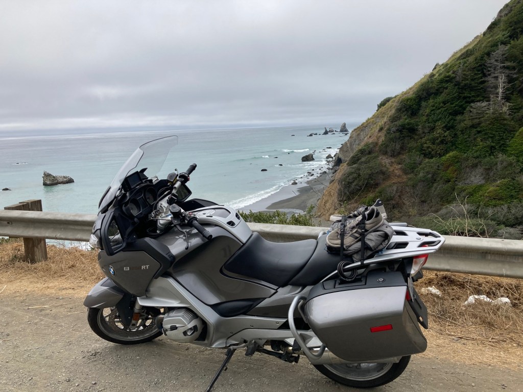
There were multiple sites along the coast where work crews had one lane shut for repairs. It takes a lot of work to keep Hwy 1 open through the years.
Many parts of Hwy 1 are just magical.
I arrived in Fort Bragg before 4pm and got cleaned up for dinner experience at Cucina Verona.
Dinner was yummy …

and Tommy Grotton was playing guitar. That’s Joe on the bass, co-owner with his wife Kathleen of the restaurant. Tom used to ride a BMW RS 1100 but gave up riding when he turned 70.

It was a fun day all around.
Tomorrow I arrive at my friend Craig’s in Oakland. Getting there, I’ll be taking another fun road, Hwy 128.
Day 4
Day’s distance – 168 miles
Total trip distance so far – 929 miles
The weather was again, very pleasant. Overcast this morning and clear skies as I worked my way away inland.
The best part of the short ride today was the section of Hwy 128 west of Cloverdale. I have been on this road two or three times before. I think twice heading west and once heading east. It’s all two lane with good surface conditions.

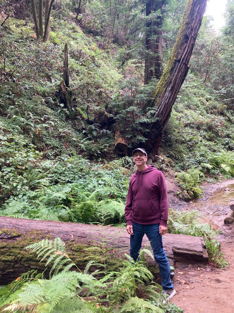
The western most 11 miles is through the Navarro River Redwoods State Park. It’s second growth forest but beautiful to be able to ride through.
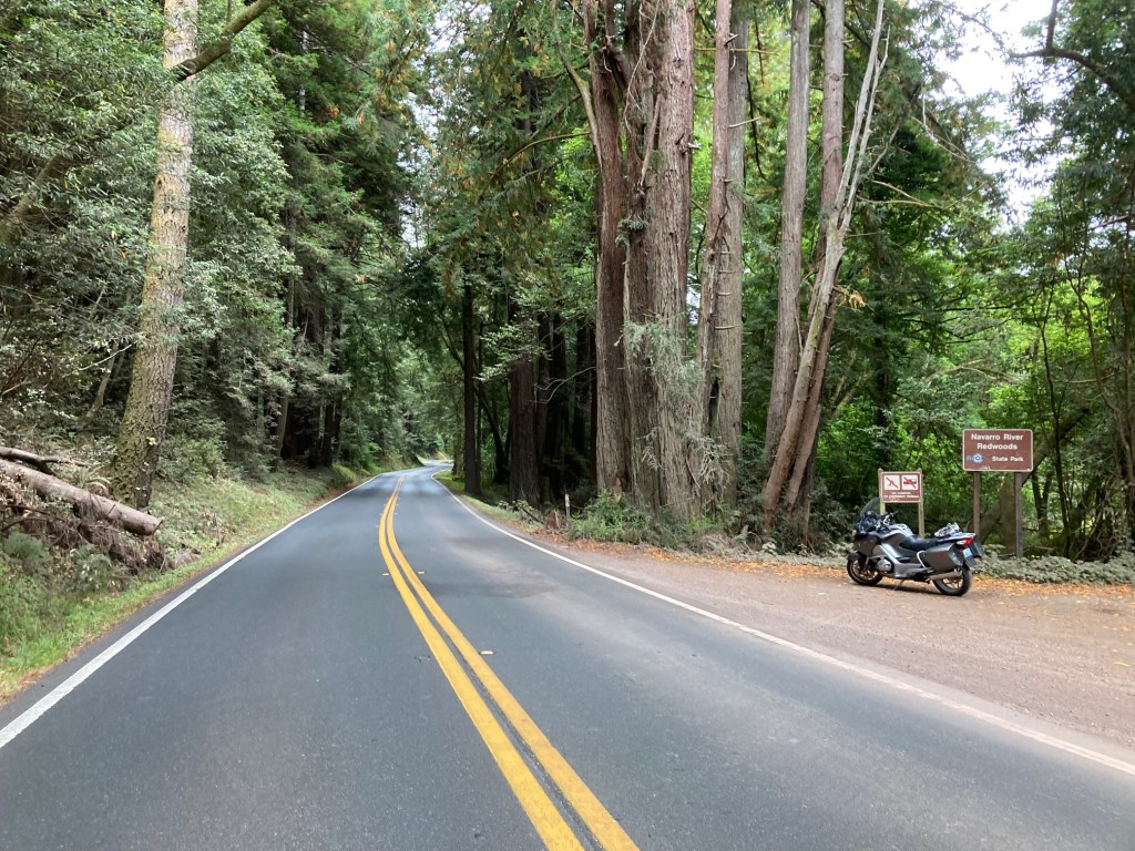
Redwood forests are amazing.

Here are some photos of Hwy 128 from Day 4 of my Southern States Tour.


I stopped at Boonville Cafe and Bakery on this trip, like previous trips. Today I had an egg sandwich, fruit and a latte.

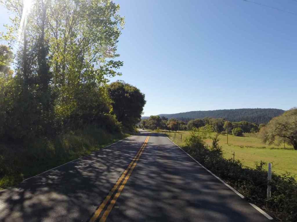
From the bakery about halfway to Hwy 101, there are more twisties making the road just about as fun but with less distracting scenery.
I reach my day’s destination about 1pm. My friend Craig agreed to take a half day so I could ride through Oakland not at rush hour. The plan worked well and we spent part of the afternoon hiking in the hills near his place.
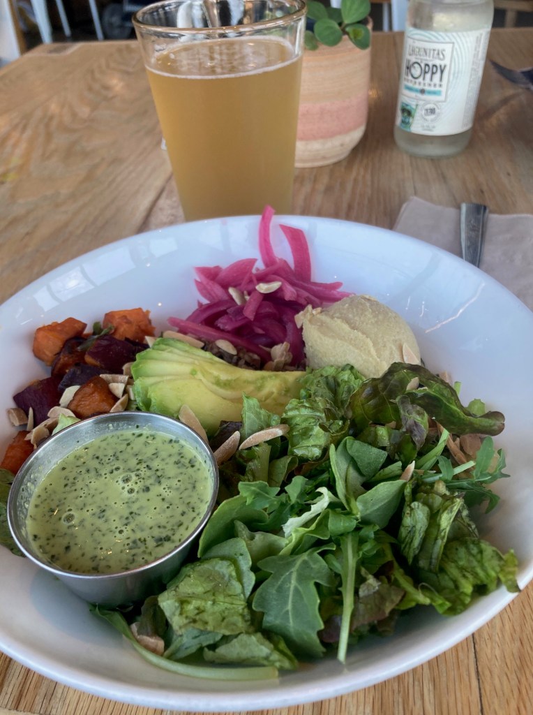
For dinner, I wanted something healthy and without meat. We went to Kitava in Oakland and I ordered one of their signature bowls, the Power Bowl. It had a wild rice blend from Lundberg Farms, farmer’s greens, hummus, sweet potatoes, avocado, pickled onions, almond slivers, green goddess dressing. I also had a ginger lemongrass drink.
Tomorrow I’ll be hanging out with Craig before heading down to Santa Cruz on Sunday.
Day 5
Today was a day off the bike, hanging out in Oakland.
This morning we drove to Lake Del Valle with Craig’s paddle boards. It was my first paddle board experience. It was too windy for me to really learn so it was a short time on the water. Craig went for a slightly longer paddle. I will give paddle boarding another try at some point.
We are going to cook some salmon tonight for dinner and hang out by the pool afterwards. Tomorrow morning I’ll head out down to Santa Cruz. It’s about an hour and a half.
Day 6

Day’s distance – 70 miles
Total trip distance so far – 999 miles
I arrived in Santa Cruz today at 10am. Because I left early, my ride over Hwy 17 was uneventful and the roads were not crowded. Hwy 9 was an option, mentioned by a friend yesterday. I will be taking Hwy 9 north to begin my ride back to Seattle, stopping at Alice’s Restaurant on Hwy 35 before rejoining Hwy 1 at Half Moon Bay.
I’m staying at my friend Scott’s house, a house I lived in back in the day. He arranged a picnic at a local park where the entire gang showed up, making me feel very welcome to be back in town for a visit.

Scott took the first photo and then Fran took the next photo, so everyone is in one or the other 🙂

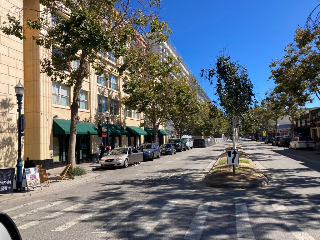
A quick car ride to the downtown core and along West Cliff Drive found many familiar landmarks …


and a lot of very large buildings changing the Santa Cruz skyline 😦

Over the next two days, I’ll be hanging out with many of the friends who came out today in smaller groups, and I’ll get an opportunity to walk along the shore as I’m staying two blocks off West Cliff Drive. I will also finalize my route back to Seattle and make necessary lodging reservations.
Day 7
Today was a full day of hanging out with friends.
The weather was perfect. You could see clear across Monterey Bay. Temperatures were in the 70’s and the wind light.

Nancy and Steve came by the house. We walked to Natural Bridges State Beach along West Cliff Drive. Then through part of the Monarch Trail. We ended up having lunch at Ivéta Westside, a self-described sidewalk cafe. I had a yummy vegan spicy humus sandwich.
After walking back to the house, I rode the motorcycle to Scott’s Valley to visit Fran and Mark once more. Dinner was waiting when I returned 🙂 The evening was spent hanging out with my hosts and watching a movie.
Tomorrow I have a lunch get together at Upper Crust Pizza (a single decadent slice for me – can’t wait). And after dinner I’ll be hanging out for a while with Lois and Michael.
Day 8
Today was my final day in Santa Cruz.
I started the day with a hike accompanied by Scott and Jeff that took us through the Henry Cowell State Park.
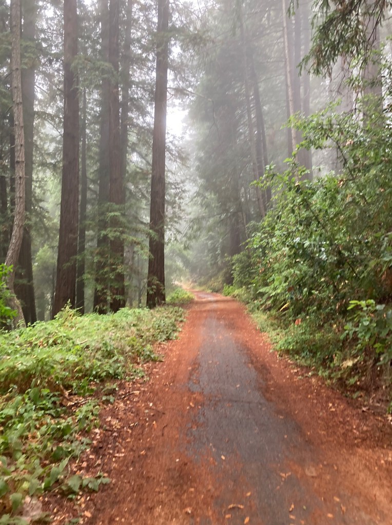
What started out misty ended up with some light rain. By the time we returned to town, the rain stopped.
The next stop was at Upper Crust Pizza for lunch. Pizza is a treat these days but I couldn’t visit Seattle without having a slice from this Santa Cruz landmark.
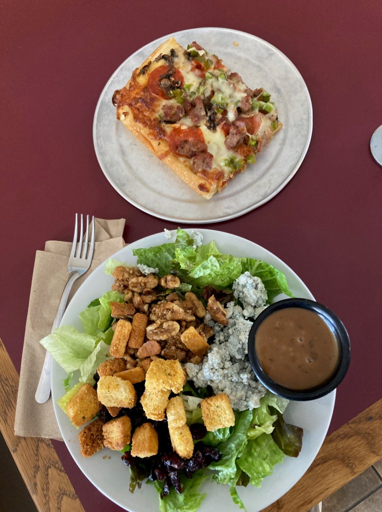
One slice of the meat special. Note, the blue cheese was also a yummy treat!
I made up for pizza with a vegan noodle bowl for dinner – lots of veggies. The evening was spent hanging out at Lois and Michael’s house.
I’m back on the bike tomorrow, heading north. My first day north will take me to Alice’s Restaurant in Woodinville, over the Golden Gate Bridge, along some different sections of Hwy 1 and back to Fort Bragg.
Day 9

Day’s distance – 246 miles
Total trip distance so far – 1,245 miles
Today was the start of my return leg. After coffee and hugs with my hosts, I left Santa Cruz shortly after 8am. My first stop was Alice’s Restaurant, estimated to be an hour away.

This was my opportunity to take Hwy 9, a road I’ve ridden in the past on both a motorcycle and a bicycle.
The road surface between Santa Cruz and Felton did have a lot of tar snakes. Above Felton, the surface was better. The weather was overcast and it did start to rain after I was on Skyline Blvd (aka Hwy 35). I kept the speed way down as it may be the first rain of the season, I didn’t know.
My arrival at Alice’s Restaurant was a little later than expected.

On this day, I was the only motorcycle in the parking lot. 😦 I understand – it is a school day and it was rainy and wet.

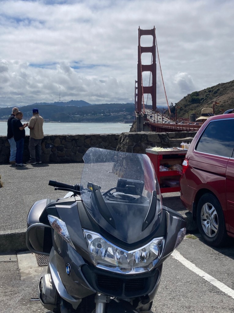
After breakfast, I continued north on Skyline until I could get back to the coast in Half Moon Bay. Heading north from there, I rode through San Francisco and crossed the Golgen Gate Bridge. This is the second time for me on this motorcycle – once now in each direction.
It was an hour later than I estimated based on google. It took an hour extra to get to the restaurant. So I decided to stay on Hwy 101 until Cloverdale, and then backtrack on Hwy 128. In theory that saved me time but I got caught in a heavy rain shower.
I filled up with gas and then went into the Starbucks next door.
It didn’t rain for long and I was dry the rest of the day. I returned to the coast south of Mendocino.

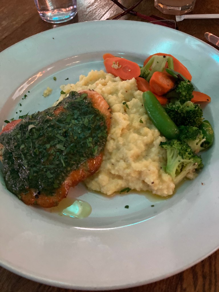
Dinner was at Cucina Verona again. Salmon Alla Genovese.
And entertainment during dinner again. Excellent staff and solid entertainment.

Tomorrow I’ll go back to Hwy 101 at Leggett over my favorite segment, and ride Hwy 199, a promising road that I’ve not ridden yet. Grants Pass is my stop for the day.
Day 10

Day’s distance – 299 miles
Total trip distance so far – 1,544 miles
Riding north from Fort Bragg, I initially cover the same ground as my trip down. The very north of Hwy 1 really is my favorite part. This was the last coastal photo while on Hwy 1 for this trip.

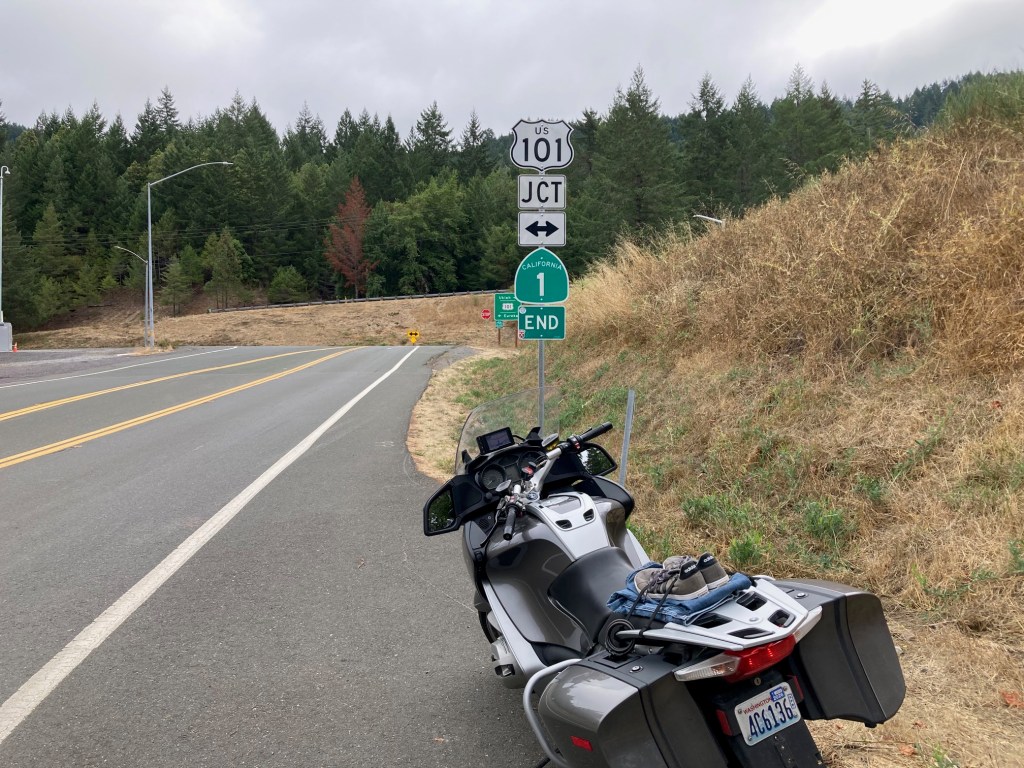
No morning ride is truly excellent without some curves. This sign brought a smile to my face. I think this is my favorite photo of the trip LOL It really captures what makes travel by motorcycle so much fun for me.
And just a week after passing through this intersection going south, I am here again at the top of Hwy 1.
Travelling north on Hwy 101 was interrupted by many contruction delays. The photo below captures the first one I came across on Hwy 199. I took the opportunity to grab this photo. It reminded me of the truism, the best motorcycle roads seem to follow rivers. In this case, Hwy 199 follows alongside the Smith River.
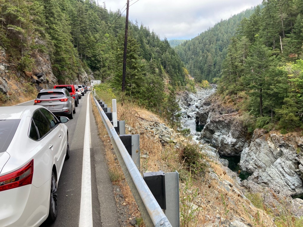
This was my first time on Hwy 199. It has some good spots, and is generally gentler and less technical than the top of Hwy 1. I was in the middle of this pack of traffic so after we passed the construction, I pulled off and let everyone go by. The road surface was generally excellent and today it was mostly dry. There are points where the highway opens up to two lanes in each direction, and there is some congestion, especially around the Cave Junction. I’d say ride it if convenient but don’t travel far just to ride it.

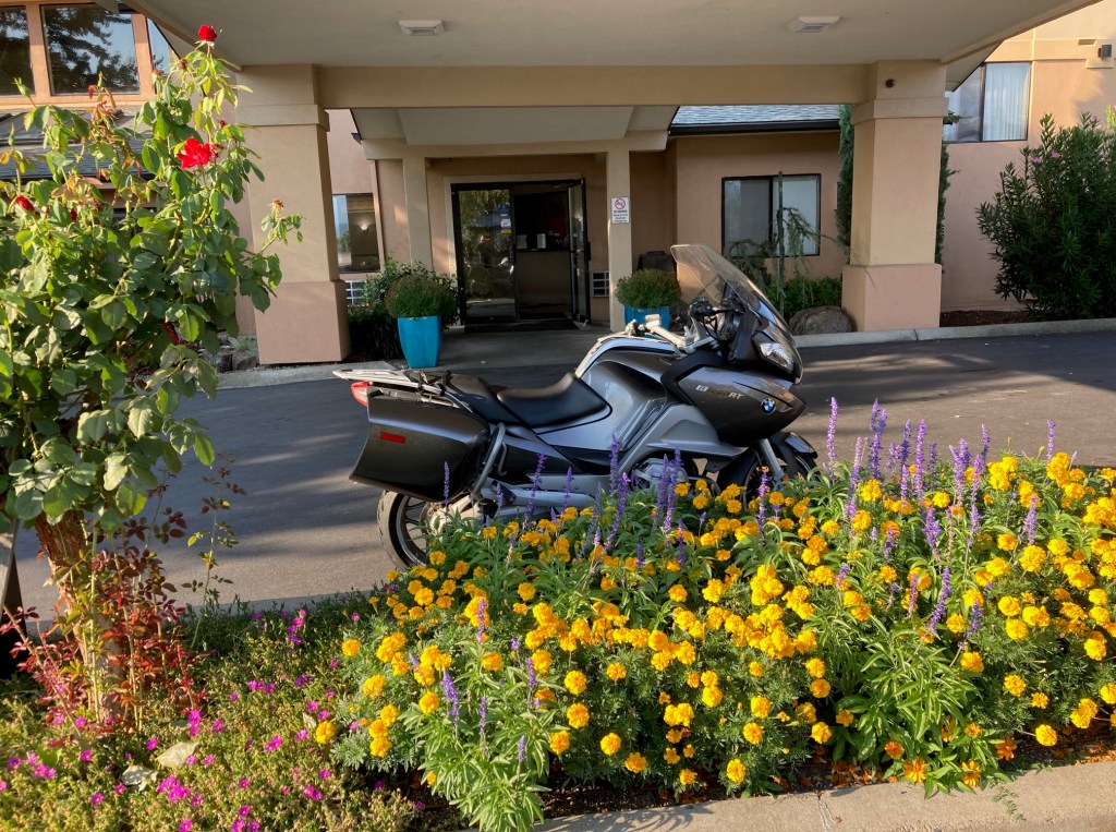
I crossed back into Oregon around 4pm and rolled into Grants Pass about an hour later. The bike gets a special parking spot tonight 🙂
A few days back, I planned to take I-5 back home from Grants Pass as it was going to be raining in Seattle on Saturday. While the threat of rain is now on Sunday, I’ve decided to just head home. Once it was in my head that I’d be sleeping in my own bed on Friday, I couldn’t get motivated about changing my route. Until then, there is a pool and jacuzzi at the hotel 🙂
Day 11

Day’s distance – 424 miles
Total trip distance (final) – 1,968 miles
Today was definitely an outlier with travel exclusively on the interstate. I rolled out of Grants Pass at 8:05am after checking oil, tire pressure and filling up with fuel. I didn’t end up taking any pictures but made my stops as short as possible. That focus got me home at 4:00pm.
I’ll post some reflections on the trip over the weekend.
It’s good to be home 🙂
Reflections
How many miles per day did I ride?

The longest day was 424 miles and that day was all interstate. The shortest day was 70 miles from Oakland to Santa Cruz. Not counting days I didn’t ride, I averaged 246 miles. Even throwing out the high and low mileage day, the average is still pretty much the same.
How does that compare to past rides?
To answer that, I pulled up the miles per day chart for my 2019 trip across Canada.

On that trip, the riding from Maine to Ohio is the best comparison. The roads were generally two lane and curvy with small towns along the way. The mileage is pretty similar. On that trip, from Ohio to Seattle was generally interstates and my 424 mile day is similar to the days on the interstate back then.
My record day is 542 miles (or 553 according to Google), from the 2019 trip across Canada. That was from Ogden, Utah to Hermiston, Oregon. I noted in the blog that the speed limits were 80 mph most of the way on those roads.

I would say my capacity to ride distance has diminished some but I never was an iron butt rider (those that ride more than 1,000 miles in 24 hours).
What were the highlights of the trip?
Catching up with friends, especially those I haven’t seen in the 10 years since my last visit is the first thing I think of as a highlight. Finding that I still really enjoy traveling on the bike was another big one. It encouraged me to start planning a few trips for 2026. Rediscovering some favorite west coast roads that seem perfect when on two wheels. Having, for the most part, perfect weather was a bonus.
Is it time to buy some new gear?
Most definitely a new helmet. New boots, riding pants and jacket are something to definitely consider.
How did packing light turn out?
What do I mean by packing light? I pulled up a photo of my 2018 Western Vistas Tour. On this ride, I carried both a top case on the back of the bike and a tank bag in addition to the panniers. I found the top case would fit all the camping gear and use it on rides when I know I’m going to be camping. The tank bag was used most often for camera gear, so it would be convenient to pull over and take a quick picture, often without getting off the bike.

If I’m not camping, such as my trip across Canada, I leave the top case at home. I can’t recall ever leaving the tank bag at home before this trip.
This trip was without a tank bag. I put the DSLR in one of the panniers. All the photos on this trip were taken with the camera on my phone as an experiment. However, I keep the phone in a pocket that is difficult to get at without getting off the bike. I’ll consider putting it in a more accessible pocket next time.
I think the results were fine but I also found that I feel a little more creative when I use the DSLR. I have lens choices and can frame photos a bit more precisely through a view finder. I’ll decide on a trip by trip basis whether to bring a full size camera and to pack it in the tank bag.
Also, without the tank bag, I didn’t take the GoPro or the 360 degree camera. If I had the GoPro, I would put it on my helmet and have it take a photo every few seconds while on some of the curvy roads. Often that is the only way to get the curviest part of the road in pictures where there is no shoulder.
The tank bag also has the advantage of having a map pocket with a clear window so I can always quickly reference a physical map. Cell signals are not always a given, even in 2025.
Packing light also meant not bringing a few tools. I left the jumper cables, the 12 volt air pump, a USB battery, paper maps for each state I’m traveling and the rain suit. I guess I’ll double my effort to fit a rain suit on future trips, even those with predictions of dry weather each day LOL.
How much $$ did I spend?
Motels costs for five nights was $457.32 total. Food (and misc.) costs totaled about $751.92. Fuel for the bike ran $127.65. The grand total was roughly $1,336.89.
What was the theme of this ride?
Trips are always an excuse to travel, and always fun. On one trip, the 2018 Western Vistas Tour, the theme of vistas emerged from my photos. For this ride, the motivation was to renew my connection with friends and my connection with traveling on the motorcycle.
Renewal was the theme this time. The trip was motivated by the death of a friend from Santa Cruz. Brad was a teacher of mine, a professor of mathematics and chair of the department – also a juggler, good friend and Santa Cruz house mate for a time. I will miss him.
In reconnecting with others there, and by reminding myself how good traveling by bike is, the trip has been wonderful and I’m really glad I went. A trip down to Santa Cruz at least every other year is not only possible but worth it. I plan to make that happen.
A huge thank you goes to my hosts; Craig and Scott and Jeff.
Until the next trip!
