
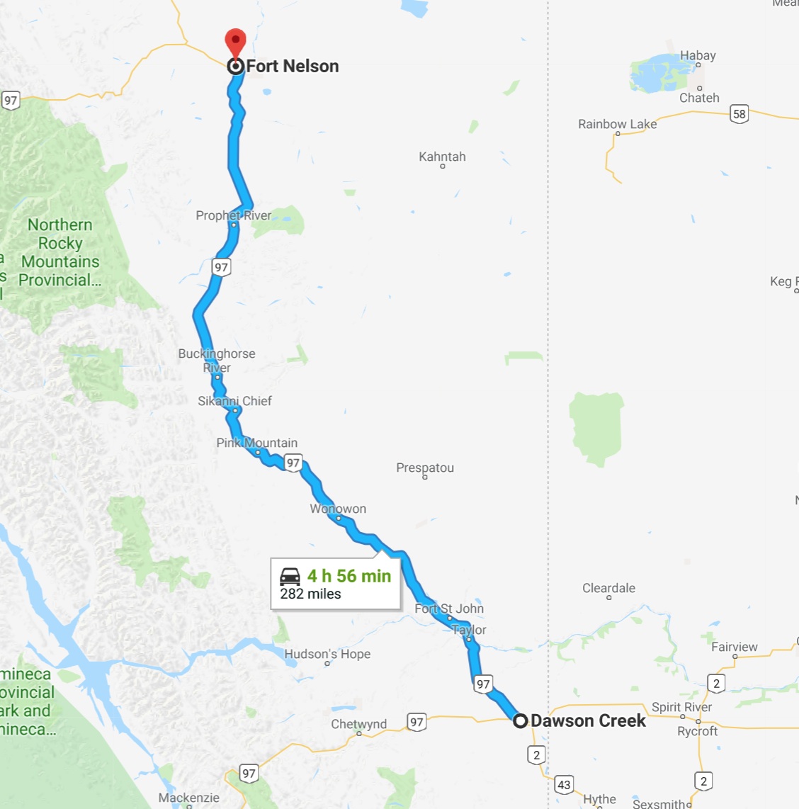
Day’s distance: 282 miles
Total trip distance: 1,576 miles
Mid 50s in both the morning and evening with a daytime high of mid 60s. Some moderate winds this morning and a few heavier showers this afternoon just during my last 50 miles or so.
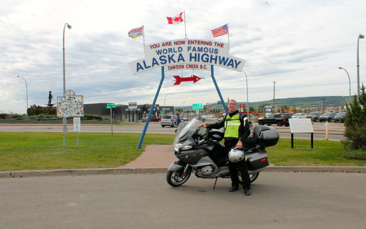
As mentioned in yesterday’s post, the Alaskan Highway begins in Dawson Creek.
According to wikipedia,
The Alaska Highway (also known as the Alaskan Highway, Alaska-Canadian Highway, or ALCAN Highway) was constructed during World War II for the purpose of connecting the contiguous United States to Alaska across Canada. It begins at the junction with several Canadian highways in Dawson Creek, British Columbia, and runs to Delta Junction, Alaska, via Whitehorse, Yukon. Completed in 1942 at a length of approximately 1,700 miles (2,700 km), as of 2012 it is 1,387 mi (2,232 km) long. The difference in distance is due to constant reconstruction of the highway, which has rerouted and straightened out numerous sections. The highway was opened to the public in 1948.[1] Legendary over many decades for being a rough, challenging drive, the highway is now paved over its entire length.[2] Its component highways are British Columbia Highway 97, Yukon Highway 1 and Alaska Route 2.
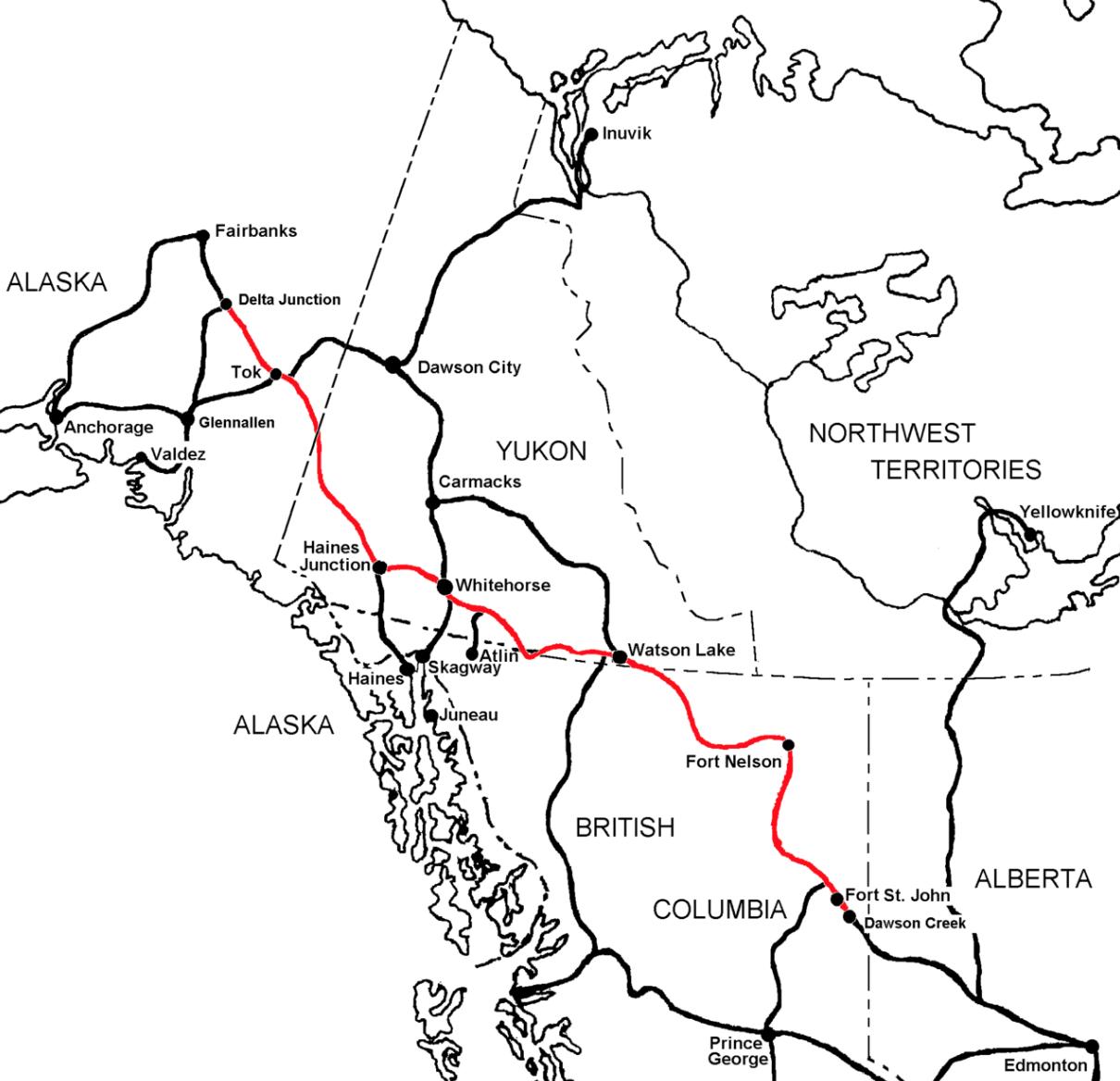
It will take me many days to travel the Alcan. I will be stopping in Watson Lake on Day 7, then Whitehorse, and finally Tok before reaching Fairbanks at the end of Day 10.
Other riders will travel faster and farther, covering the total distance in fewer days. My plan covers roughly 300 miles of the Alcan each day.
Speed limits along the highway are generally 100 kph, except in towns and construction zones.
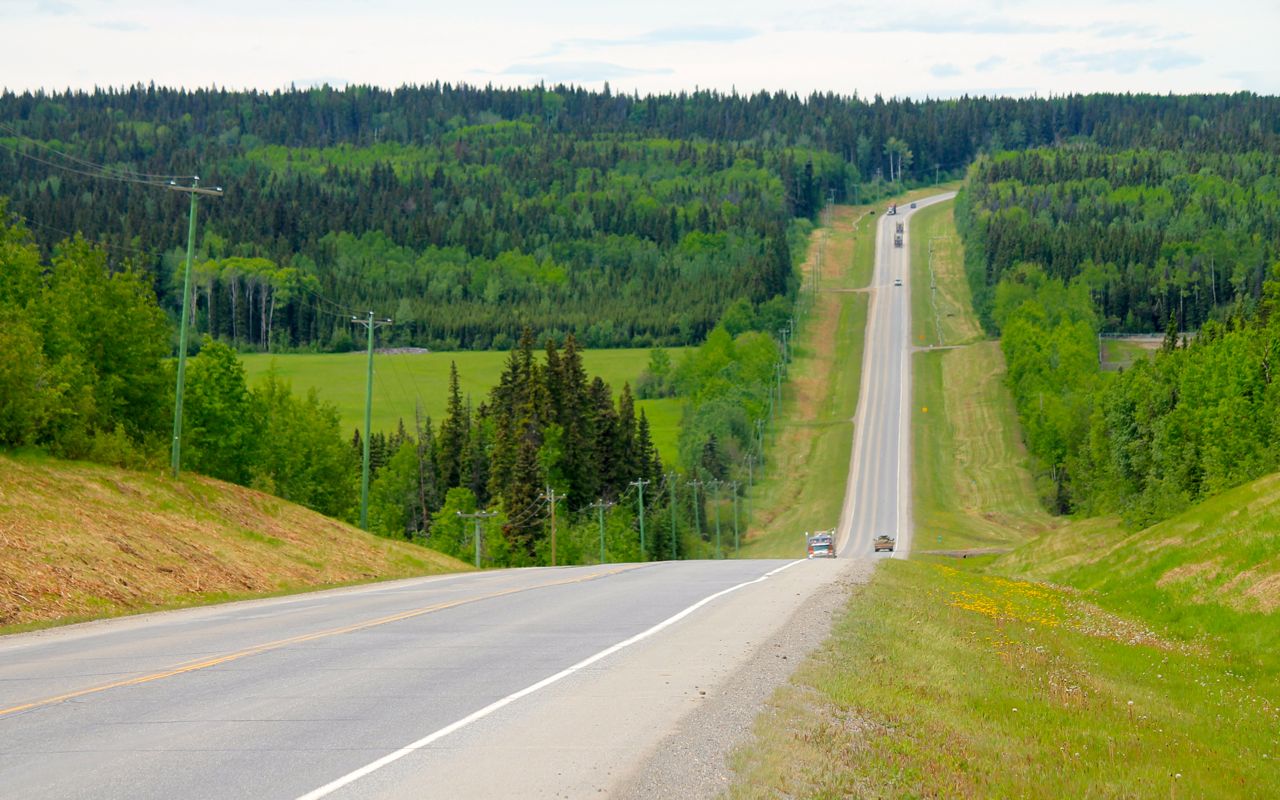
Between Dawson Creek and Fort St. John, the road is pretty much like any semi-rural highway in the US. I felt more isolated along Hwy 40 heading to Grande Cache. 😉

North of Fort St. John, I encountered less traffic. It seemed vehicles are either trucks hauling commodities like fuel or tourists, like myself.
I planned my gas stops according to the information I found from the internet. So far, that has worked well for me. Below is a photo taken in Wonowon, BC.
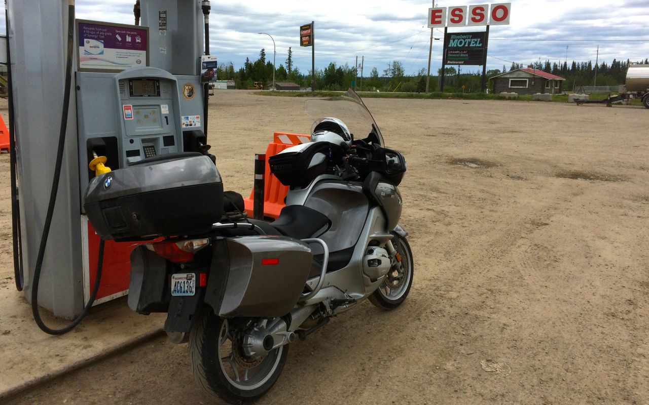
I was unexpectedly pleased to find premium fuel here and topped off the tank. The price of premium fuel so far has been about $1.50 to $1.67 CAD per liter.
Here is Canada, you explicitly prepay for fuel. If using a credit card, you (can usually) select or specify the maximum amount you want to spend, say $40 CAD, and the card will be pre-authorized for that amount to make sure funds are available. Then you fill up and your card is charged for the actual amount you use. The preauthorized amount falls off your credit card balance a day or two later.
Some stations default to a preauthorized amount of $200 CAD unless you go inside and make arrangements for a lower amount, a good idea if your card has a lower limit or you carry a balance.
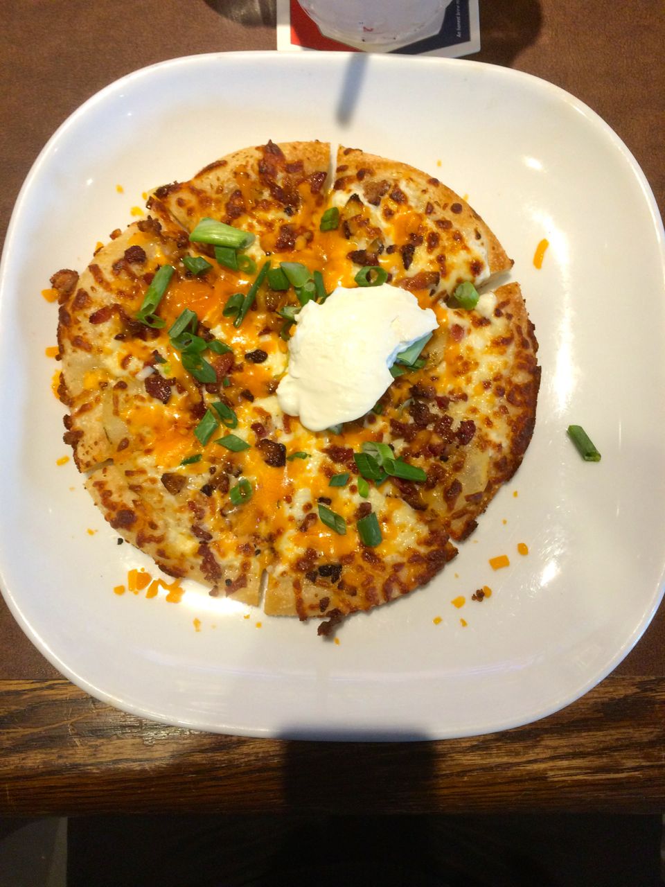
I arrived in Fort Nelson before 4pm, delayed by the late rain showers and a 15 minute wait at a highway construction zone south of town. There was a Boston Pizza restaurant and sports bar next door with good reviews so I headed over after cleaning up.
I ordered an individual sized Spicy Perogy pizza and a pint of Richard’s Red. The pizza had a sour cream base, bacon, cactus cut potatoes, green onions, cheddar and mozzarella cheeses, finished with another dollop of cream. It was very good.
On my return to the motel, I met two other Washington riders, Michael (Mike) and Jim. Jim bought his bike from Roman, the same salesman that sold me my bike. Small world, eh?
They had yet to eat and thought the pizza sounded great. I went back to the restaurant with them and had another beer while we talked for another two hours.
Restaurants use these wireless handheld devices to process credit card transactions. It was a little weird at first, but overall it seems convenient, reliable, and you don’t have to hand over your credit card to anyone during the process.
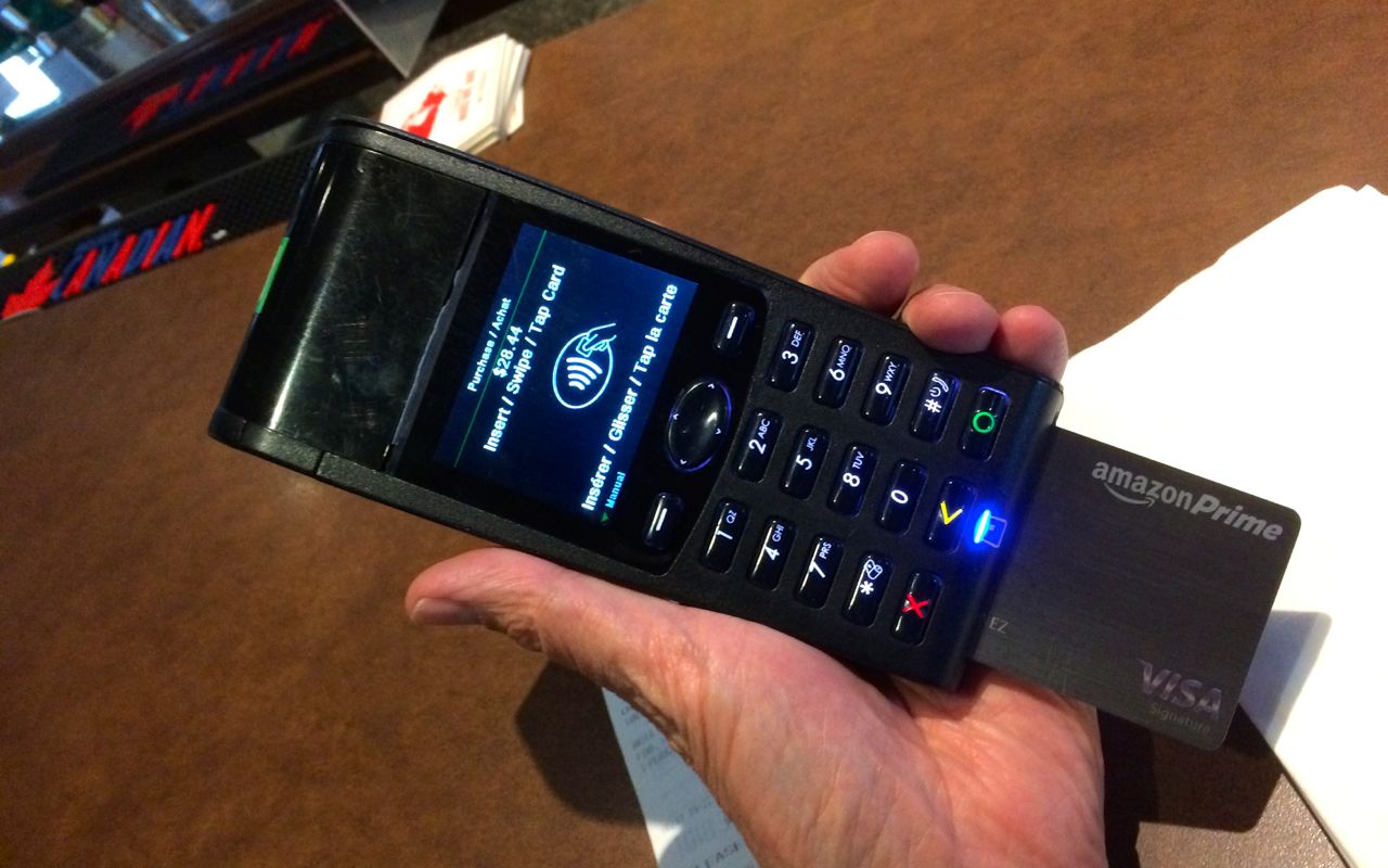
I have alerts set up on my cards and usually receive an email with the US dollar pricing of the charge before I’ve even left the restaurant.
Tomorrow, I continue to Watson Lake with a stop at Liard Hot Springs Provincial Park for a soak, if things work out.
From my trip planning notes, posted before leaving,
North of Fort Nelson, the Alaska Highway crosses the Rocky Mountains: Expect about 200 miles of narrow road with curves and hills with 10 percent grades and few passing lanes. This stretch of road crosses Summit Pass (Historic Milepost 392), highest summit on the Alaska Highway at 4,250 feet elevation. You may experience an odd snowstorm here, even in July. After winding through the MacDonald River valley—few guardrails and watch for caribou and stone sheep on the road—the highway straightens out again for the next 140 miles into Watson Lake, YT
Fun, fun!!

It looks like the road conditions are pretty good! Is it all paved so far?
LikeLike
All paved with the exception of inside areas where they are repaving. Easy, breezy for an RT so far.
LikeLiked by 1 person
Bucket list trip for sure! We’ll be in Banff and Jasper at the end of June.
LikeLike