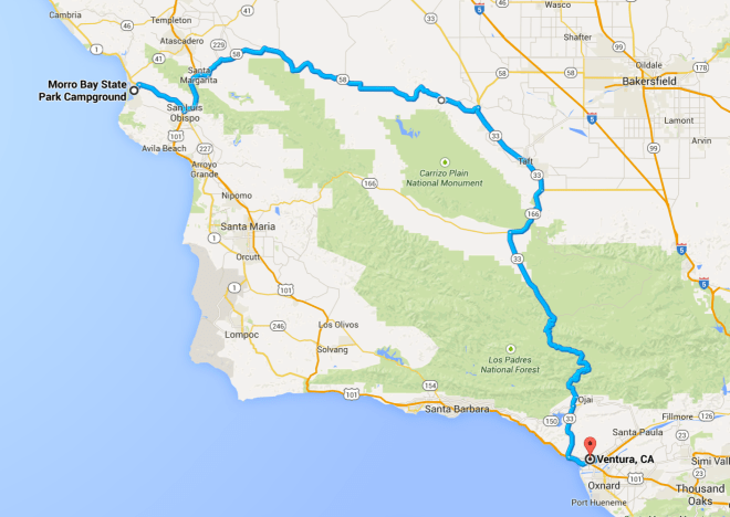
The coast was overcast this morning. The temperature started in the low 60’s but it felt cold. I guess I’m already getting used to the warmer weather. Traveling east on Hwy 58, the temperature increased and in Taft, I recall seeing temperatures in the low 80’s. The clouds returned as I climbed into the Los Padres National Forest and the temperature dropped below 50, briefly, on the southern side of Pine Mountain.
Day’s distance: 224 miles
Total trip distance: 1606 miles
Since I traveled Hwy 1 south last year, I chose to travel inland today.
The Butler Motorcycle Map for Southern California indicated that Hwy 58 and Hwy 33 were some of the best motorcycling roads in the area. I was not disappointed.
The road surface was not perfect, but very good. There were a few too many ‘tar snakes’ and too much bumpy pavement to get a 5-star rating, but definitely 4-stars. The road had many wonderful sets of curves, though. Speed limits were generally 55 mph and that was fine for me. Traffic was very light. I don’t think I saw a single vehicle in my rear-view mirrors.
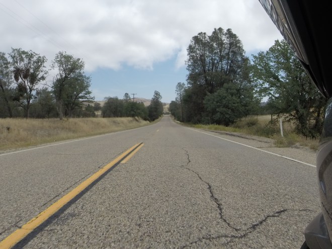
The countryside changed as I traveled east, lightly wooded hillsides evolved into grass covered hills.
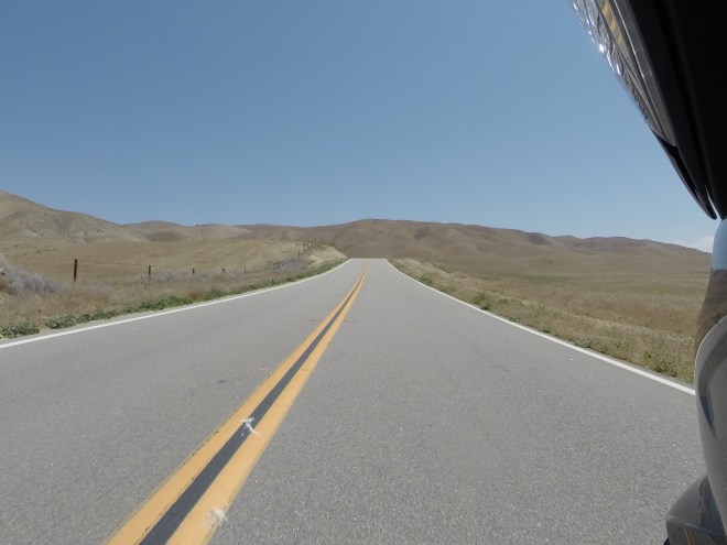
The part of Hwy 58 halfway between Hwy 229 and Hwy 33 was the least interesting. I then turned south on Hwy 33. That was an abrupt change of environment. The air smelled bad and there were oil well pumps everywhere.
According to a wikipedia article, “Taft is situated in a major petroleum and natural gas production region in California and is one of the few remaining towns in the United States which exist exclusively because of nearby oil reserves.”
Once Hwy 33 entered the Los Padres Mountains, the scenery and the roads more to my liking. South of the peak was especially fun. Again, the road surface wasn’t perfect, but it was a very good motorcycling road. An abundance of switchbacks and sweepers to keep me busy and very little traffic vying for my attention.
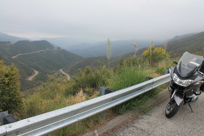
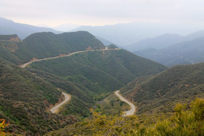
Pine Mountain reaches an elevation of 5160 feet along Hwy 33. The temperature dropped significantly on the south side, down to 49 degrees. If you’re riding here in Spring, do wear appropriate clothing.
While taking a break, and taking the above photo, I met another rider who also stopped to photograph the switchbacks. We talked for a while about good roads we’ve ridden and where we’re headed. I love making these connections while on the road.
After riding through Ventura, I arrived at the BMW shop that will be performing maintenance on the bike tomorrow morning. I finalized arrangements and found a motel nearby.

Hi Keith! its Andy the Harley rider You met on hwy. 33 going the other direction…it was great meeting You too and cool to see your blog! I’m in Barstow tonight and headed up to St. George or Cedar City to check out the canyons in Utah. Safe rising and hope to see You down the trail!
LikeLike
Andy, good to hear from you. I’m in San Bernardino tonight, headed to Hungtington Beach to hang with friends for a couple days, then San Diego to see one other friend. I thought Southern Utah was beautiful, especially Hwy 12. I’m sure you’ll enjoy it. Keep the rubber side down, my friend.
LikeLike