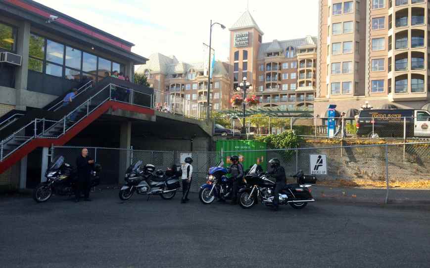
 Leaving August 18th, this 1,766 mile eight-day trip took me and good friend Will to Hyder, Alaska. It took three days to get to Stewart, British Columbia, our staging point for the day we would spend exploring Hyder and the local attractions, including Fish Creek and Salmon Glacier.
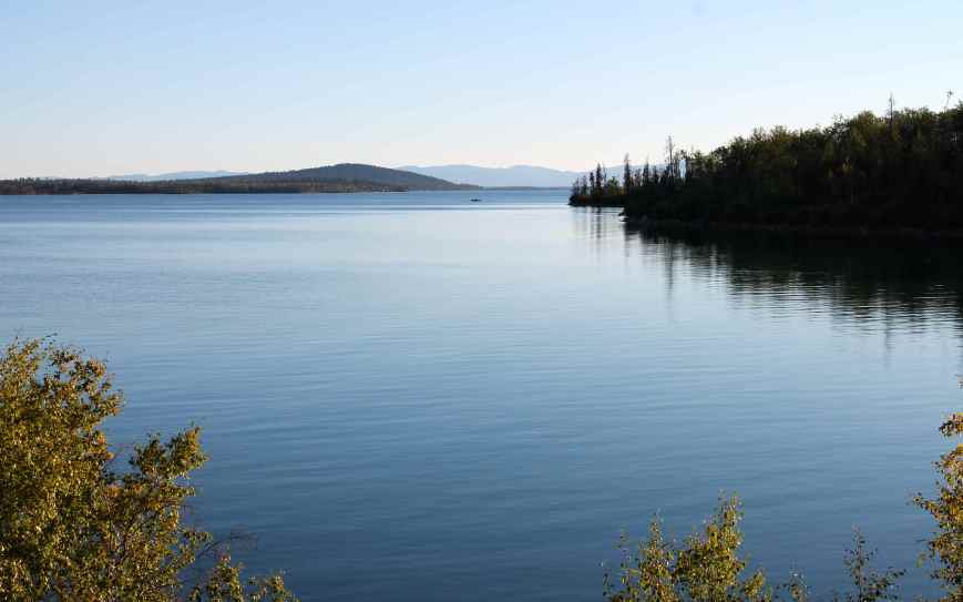
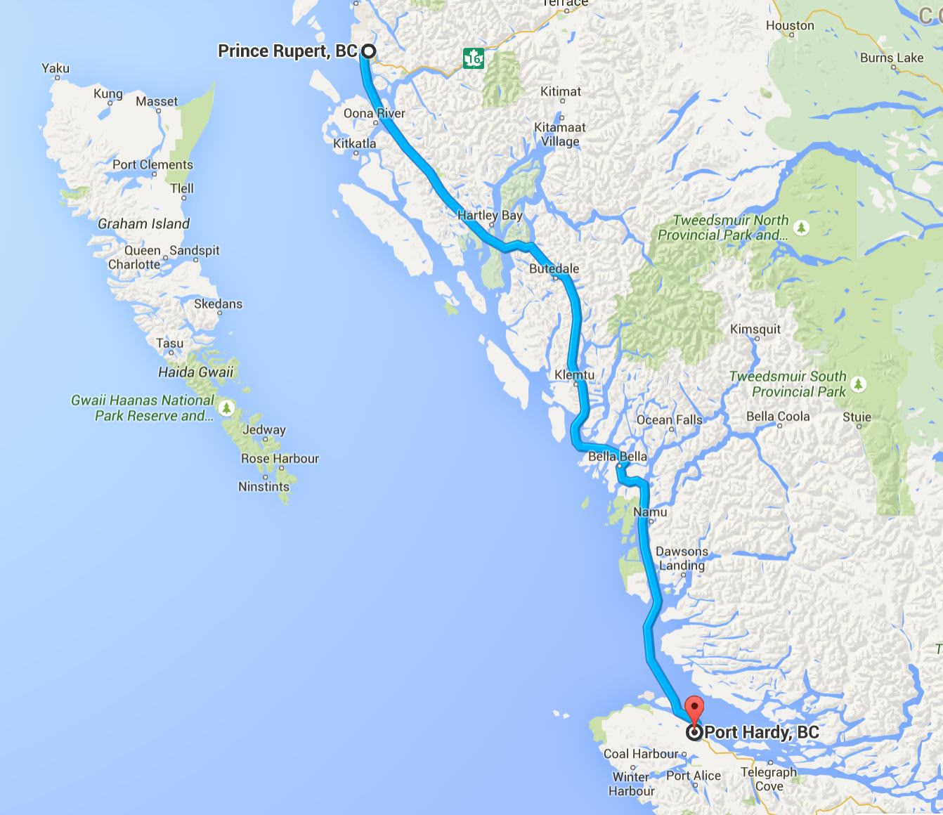
Our return trip involved a ferry ride through the scenic Inside Passage from Prince Rupert to Port Hardy, on Vancouver Island. A secondary goal reached on this trip was to traverse Vancouver Island from north to south.
A second ferry trip from Victoria to Port Angeles brought us back into the US and a third ferry took us from Bainbridge Island back to Seattle. An awesome loop through some super scenic country.
Day 1
Day’s distance: 357 miles
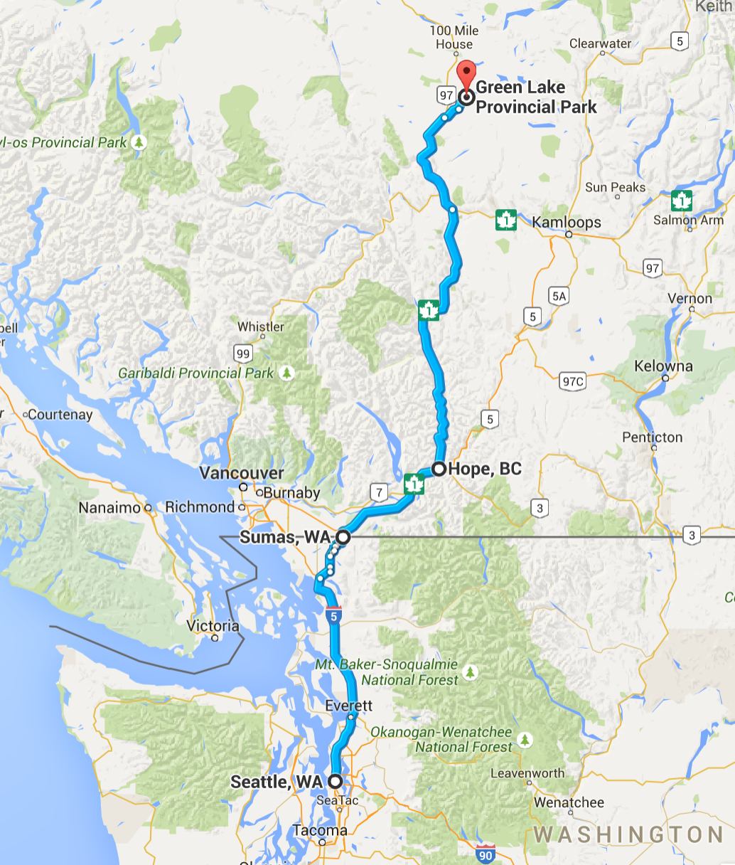
On Day 1, Will and I traveled from Seattle to Green Lake Provincial Park. We were on the road by 7:30am. Temperatures started in the mid 60s and reached 92.
We crossed the border in Sumas, after filling up with fuel and getting a latte (for me, of course). It was easy and we were both through in about five minutes. The border agent we spoke with rides and was interested in our route. Our first stop was a bank to withdraw some Canadian currency. The next stop was Hope, BC.
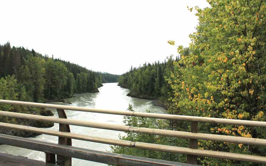
Highway 1 east to Hope is a heavily used thoroughfare. It moves fast and always seems congested. Once in Hope though, most of the traffic continues east on Hwy 3 and our route turns north. We rode through the scenic Fraser River Valley where the river is wide and the mountain peaks are dramatic.
The highway is two lanes and a third passing lane often enough to keep traffic from building up behind slow vehicles. The pavement is in good shape and the turns non-technical. Easy riding with some traffic.
At Cache Creek, we turn north onto Hwy 97. Shortly afterwards, we pass the intersection of Hwy 97 with Hwy 99, the road to Whistler. Everything beyond this point were new roads for me. It is also where the “scenic” portion of the highway ends. The mountains pull away and the scene is filled with farms, managed forest lands, and straighter roads. I wasn’t expecting parts of the road on this trip would actually be ‘boring’.
I am so spoiled having been on many of the best roads in the country.
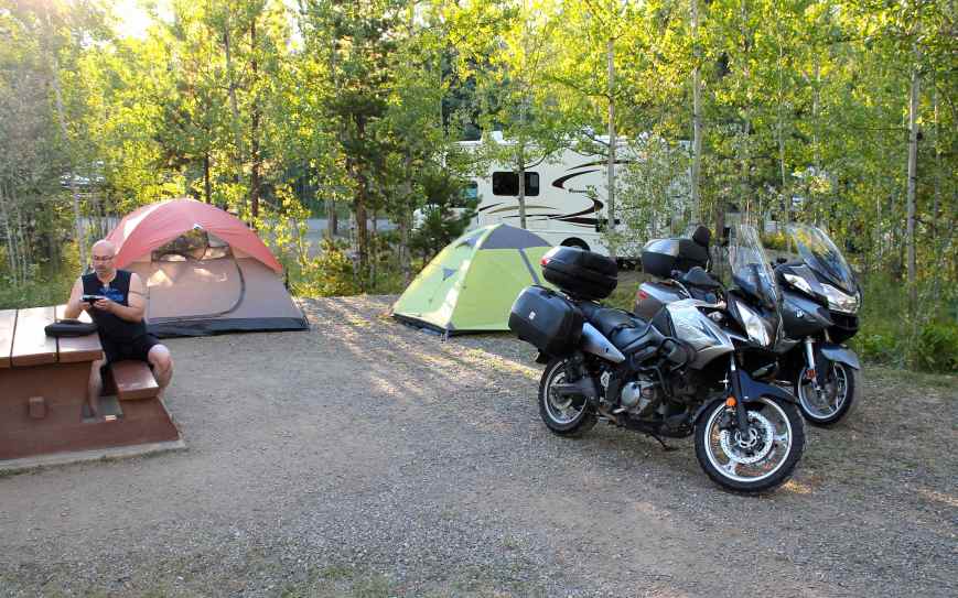
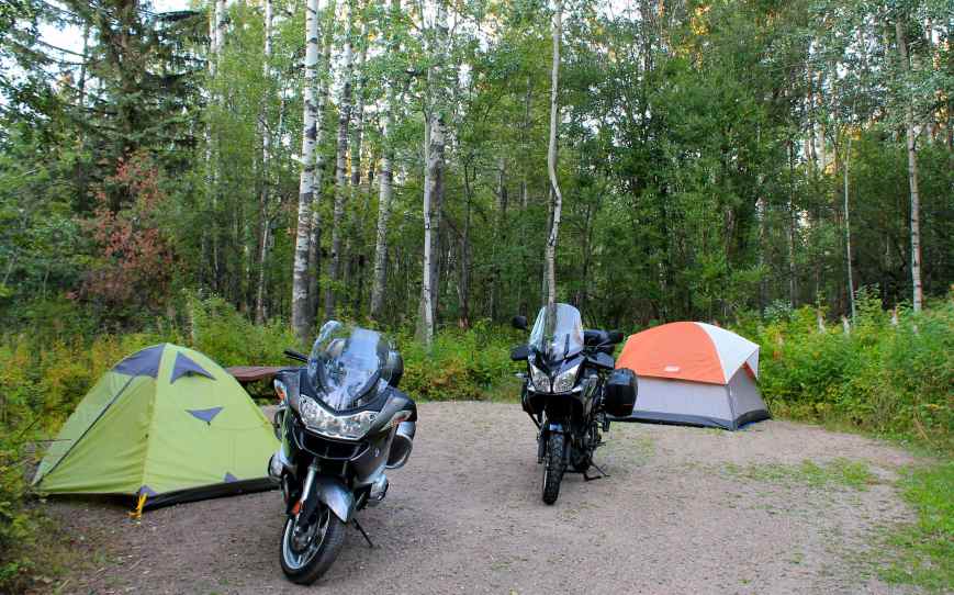
Green Lake was pretty, and there were a number of campsites associated with the Provincial Park. We had reservations at Emerald Bay. The site itself was comfortable enough though it lacked a tent pad. Glad I use a mattress pad as the gravel was a little big.
Vault toilets were available but I didn’t see potable water spigots. Luckily we had brought enough for our needs.
I did jump into the lake, briefly. The temperature was unexpectedly warm during the day, and I felt that a swim would be a decent substitute for a shower before dinner. The water was chilly, maybe in the low 60s or a touch colder, so the total time in the water was about two minutes.
Our immediate “neighbors”, Uli and Volker, were visiting from Germany with their two young boys.
They were super friendly, offering us a beer that evening. We enjoyed comparing our experiences crossing borders in both Canada and the US while the boys ran around with the endless energy I lost long ago 🙂
Day 2

Day’s distance: 317 miles
Total trip distance: 674 miles
Day 2 took us from Green Lake Provincial Park to the Beaumont Provincial Park near Fort Fraser. Temperatures overnight dropped to 39 but warmed quickly to reach the low 80s.
Before leaving, Will and I met the other biker camping nearby. He was visiting relatives, who were also camping in Emerald Bay. Bill was riding a BMW Burgstrom, a hybrid scooter with a 650cc two-cylinder engine. He had put over 100,000 kilometers while touring. Call me impressed!
About 7:30am, as we finished packing up the bikes, Uli brought us over two mugs of strong German coffee. That was really nice.
Both low-beam headlight bulbs went out this morning. I noticed the warning light just as we got on the road and Will confirmed I only had one low beam working. Within about 30 minutes, the other low beam bulb went out, leaving me with only the two running lights (and my high beam). I suspect the vibration of the numerous cattle guards we crossed on our way to Green Lake hastened their demise.
As we approached 100 Mile House, we both needed coffee so we stopped at the Chartreuse Moose cafe.
I had wi-fi and uploaded a photo to my Facebook feed, letting people know we were making progress.
Back on the road for a while, we next stopped at a rest area adjacent to McLeese Lake.

I found H7 type replacement bulbs at the Walmart in Quesnel and was able to install them both in about 60 minutes.
One side, the ‘drivers’ side, only took about 10 minutes. Replacing the other side requires me to use my left hand, which is far less coordinated. You can’t see what you’re doing during the replacement operation. It requires you to put your hand through a small circular port, then lift off the electrical clip, then remove the two sides of a metal clip that holds the bulb in place. It is tough to do with bigger hands.
I’ve had to replace both in 2014 as well, so while I knew what to do, but it was still frustrating. I’m going to have to look into non-incandescent bulb options in the near future.
Our route took us through Prince George, to Highway 16, but we chose to skirt around most of the city and most of the traffic. Will’s familiarity with this place allowed us to get through town quickly. The congestion was a bit jarring and I was happy to leave it behind. We had a few hours remaining before reaching our day’s destination.
Highway 97 north of Cache Creek and Highway 16 were not as scenic as some of the earlier roads. These are major thoroughfares and the highways were wide with speeds of 110 km/hr except through the numerous small towns. Farms and lumber operations were common. This was part of the trip where you just push through, taking in the scenery and sometimes listening to music.
On this trip, Will was using his new Garmin GPS unit. It is the non-OEM version of my Garmin, but we still had some issues communicating. It seems that if Will was listening to music, I was unable to reach him. We have yet to work out the problem.
When traveling solo, especially on new roads, I don’t know in advance when I’ll want to stop to take a picture. I often stop very quickly or need to turn around and go back a short distance. Without a reliable way to contact Will, I tried to put in place an alternative to stopping and digging out my DSLR. On past trips, I have set up the GoPro camera on my helmet to take a photo every 30 or 60 seconds to get photos that are able to capture road scenes without stopping. The trouble with that is those great shots are often missed as you drive by in between photos 😦
On this trip, I tried a new strategy. I would take a 15 or 20 second video and later grab screen shots to put into the blog. This may work, but my hard disk is getting full and I can’t download the video without removing other files. Long story short, the jury is still out on this technique.
Our campsite at the Beaumont Provincial Park was adjacent to Fraser Lake.
The sites were spaced farther apart and resulting in feeling much more private. This campground had flush toilets and running water. I chose not to swim this night, as it wasn’t as warm and our campsite was quite a walk from the beach
We were both tired but found the energy to meet two other motorcyclists. They were Canadians, Terri and Ray, from Smithers, BC and were riding Suzuki enduro bikes. We exchanged notes on various motorcycle-related topics and laughed a lot.
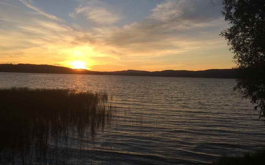
The sunset was pretty down by the lake.
I crashed just after dark and slept surprisingly well.
Day 3

Day’s distance: 356 miles
Total trip distance: 1030 miles
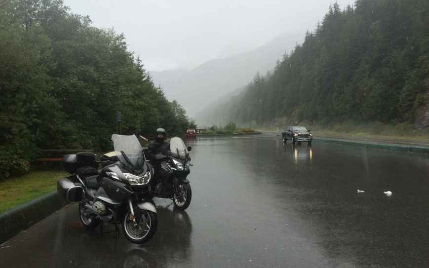
During Day 3, the two of us traveled from Beaumont Provincial Park to Stewart. It was cooler today, reaching only into the mid 60s with showers throughout the afternoon.
We got an early start, leaving the Park about 8am. It wasn’t actually as cold but it seemed colder than prior days. I likely should have put on my “long” base layer stuff. We ate enough breakfast while still at camp to keep us going until reaching Smithers, a scenic town known for skiing. I found a latte at a Starbucks inside a Safeway. Will wanted coffee but also something more substantial than their pastry selection. We decided a quick stop at a Subway just down the street would meet his needs and get us back on the road.
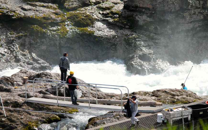
Near Moricetown, we stopped to watch First Nation Wet’suwet’en people fishing using nets on poles while walking out over the Bulkley river along planks.
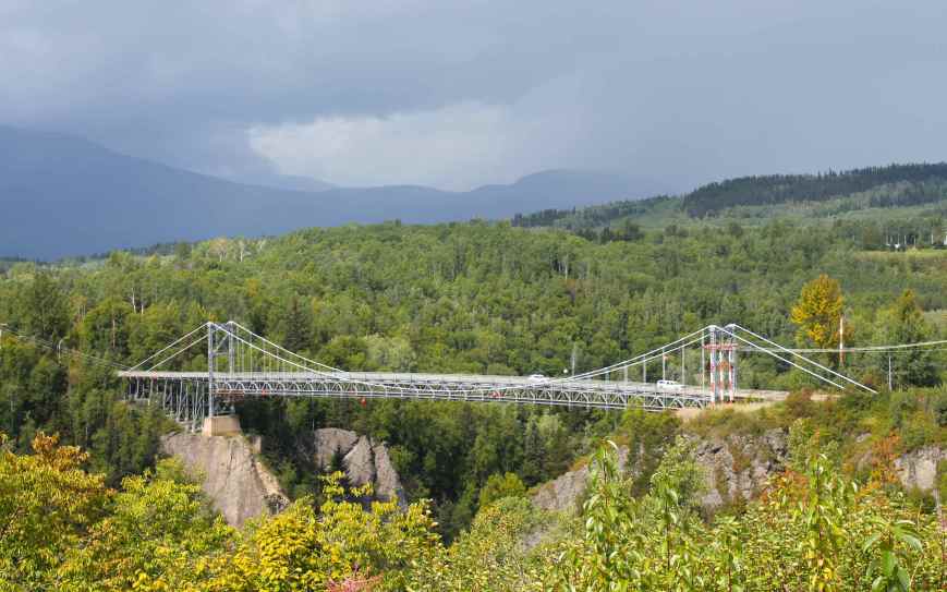
As we continued north, the skies became cloudier and it started to sprinkle. Entering Hazelton, Will wanted to show me a one-lane metal-grate suspension bridge and take me in to the local First Nation ‘Ksan museum.
Hazleton is the ancestral home of the ‘Ksan tribe. It was about the time that we arrived at the village that it started to rain. We didn’t take the walking tour but Will stopped at the gift shop to pick up a few things before we hopped back on the bikes.
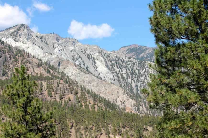
There was some significant construction along a stretch of Hwy 37. Roughly seven to ten miles of roadway appeared to have been removed and replaced by a significant amount of loose gravel. This part seemed very slick as it was also raining, and I proceeded with an abundance of caution. I actually lost sight of the pilot vehicle after a few miles. This section was followed by about ten miles of roadway covered by finer gravel and I continued at a slow pace. Eventually, the roadway improved and remained clear of gravel into Stewart.
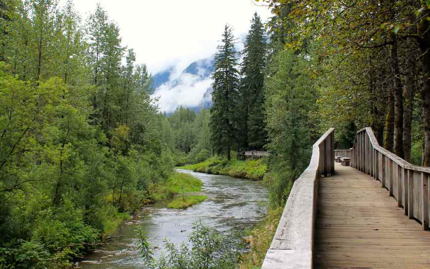
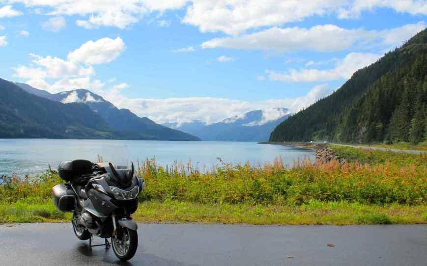
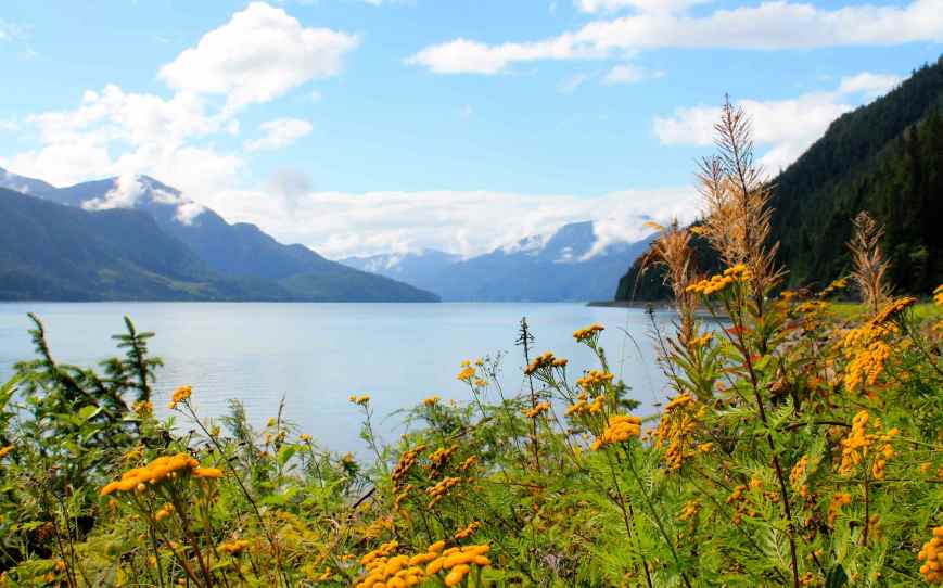
Once we turned west onto Hwy 37A, not only was the road excellent, but the scenery was fantastic. Hwy 37A followed a canyon form by granite mountains, topped with small glaciers, dense greenery and/or waterfalls. The highway had enough twists and turns to keep it interesting as it followed the Beaver River through the Pass by the same name. We stopped at Bear Glacier for a few photos.
The wind was really blowing at the time, providing an interesting headwind. At one point, I questioned whether my bike was going to blow over on its side.
We arrived in Stewart just before six, checking into the King Edward Hotel.
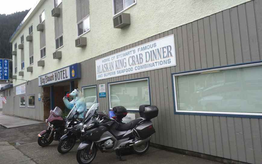
The place was comfortable enough, but the internet connectivity was problematic, restricting users to a limited bandwidth and usage time. I was told, though I think it is made up, that the system is supposed to reset every six hours. Not true in my case – it never reset. The second day, I managed to get on a neighboring hotspot, but photo uploads were not going to happen.
Tomorrow I am looking forward to going into Hyder, Alaska, my destination for this trip. It will be the 23rd state I’ve visited this year 🙂
Day 4

Day’s distance: 50 miles
Total trip distance: 1080 miles
Day 4 took the two of us into Alaska!
The morning was foggy, and the temperatures in the 50’s at that time. By the afternoon, the fog lifted and temperatures in Hyder reached the mid 60s. In all, a super pleasant day.
Passing through a Canadian customs checkpoint is only required on the return into Stewart, so our ride into Alaska took only a few minutes.
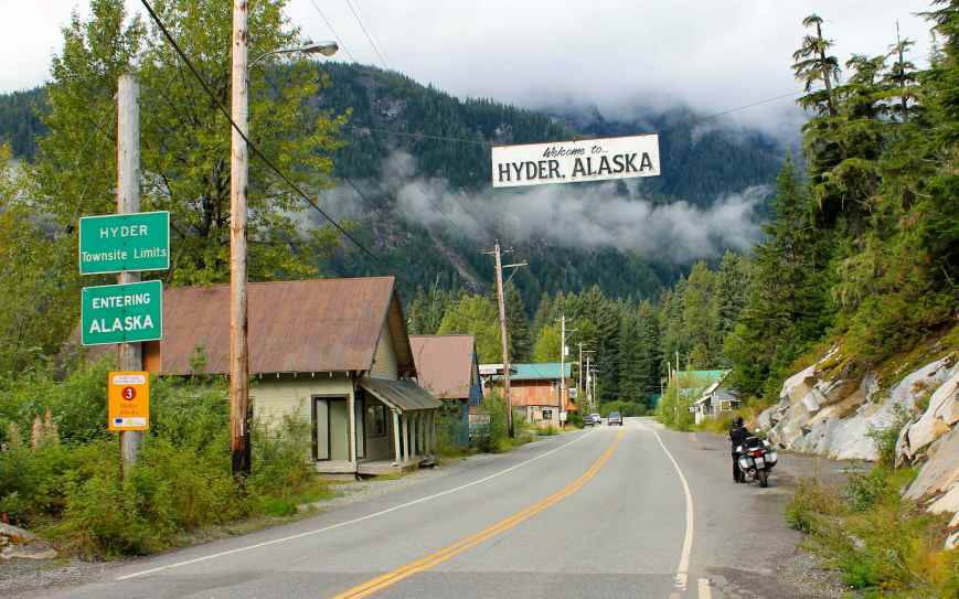
Hyder, Alaska is a small town. One sign I saw indicated “We are a town of about 100 happy people and a few ****heads”.
One of our first stops was at the Fish Creek Wildlife Viewing Area.
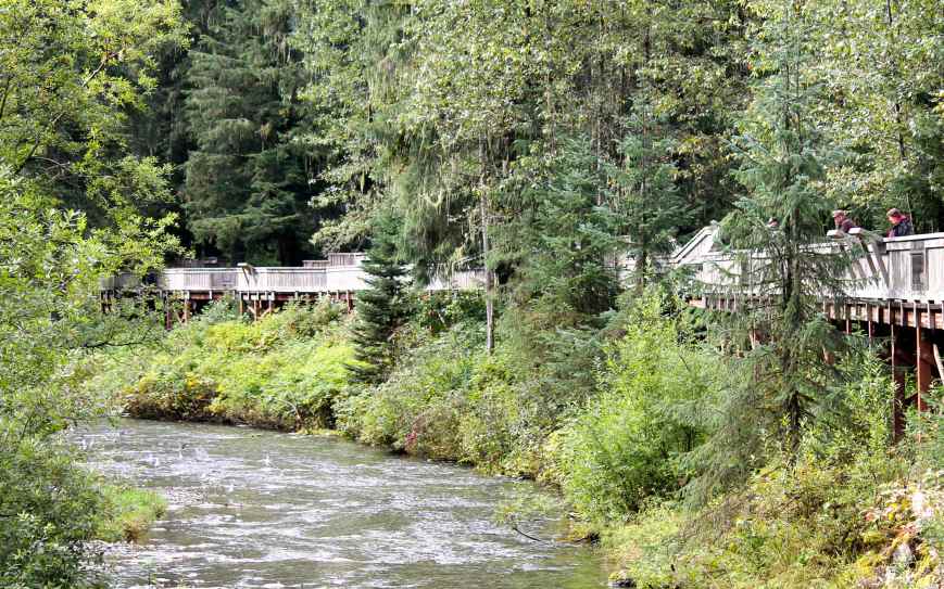
This area is set up for viewing both the salmon spawning in the Salmon River and the local Grizzly and Black Bear populations which feed on the salmon. This time of year is the end of the spawning season, and many dead fish were seen and the air contained a smell of decaying fish. Those salmon still alive were continuing to spawn. We didn’t see any bear in the morning. Since we had a day pass ($5 CAD), we could return on our way back and check again.
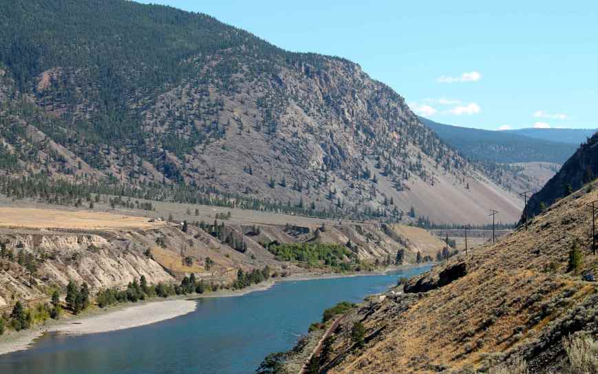
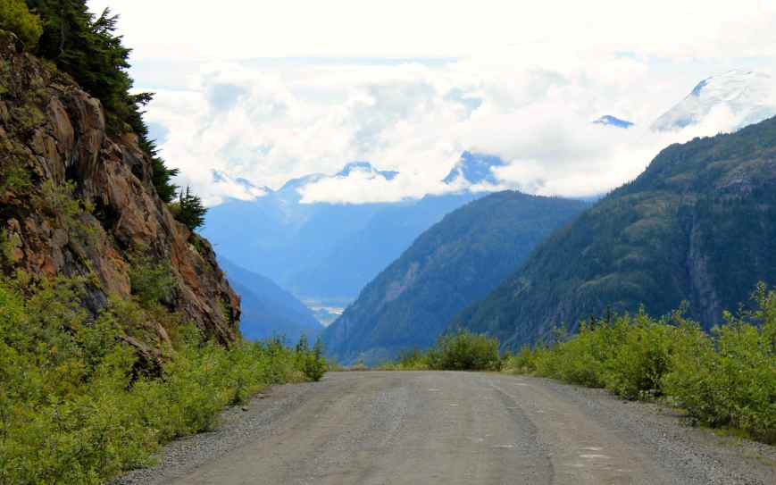
We continued on the Ganduc Road, aka the Salmon Glacier Road, where the pavement ends and the gravel road begins. Soon we leave the Salmon River behind.
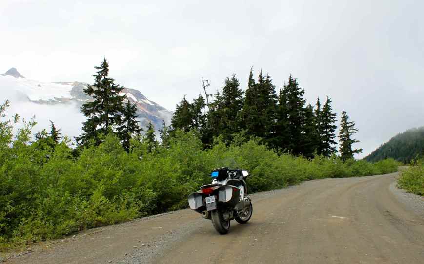
Passing two mines, the Riverside and the Premier, and actually crossing the border back into Canada (at the Premier Border Crossing), we left the Salmon River as we began to climb up into the coastal mountains.
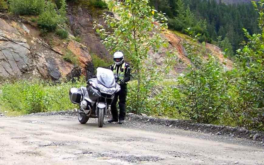
Our only bear sighting this day was near the Premier mine where a single Black Bear was in the road. He ran away from us while I was trying to dig the camera out from my tank bag. Will’s video camera was running and he was able to capture a small and brief image of the bear, but I wasn’t able to get a photo. We gave the bear a brief chance to either come back onto the road ahead or, as it turned out, leave the roadway and re-enter the woods.
I have street tires on my motorcycle, and didn’t think I would want to travel to Salmon Glacier at all. However, Jeff, a motorcyclist, who was riding from Wisconsin on a Harley, said the roadway wasn’t too bad. He had ridden to the Arctic Circle and, I suspect, was a seasoned veteran at gravel roads. Indeed, while there were a few rougher spots, most of the roadway was pretty smooth.
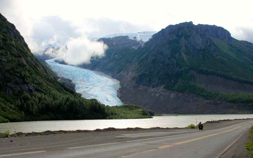
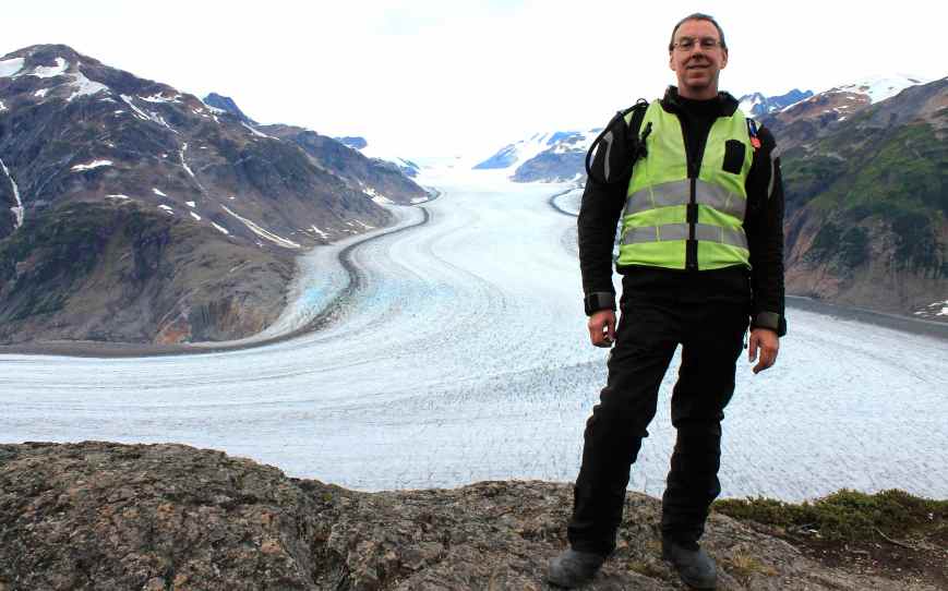
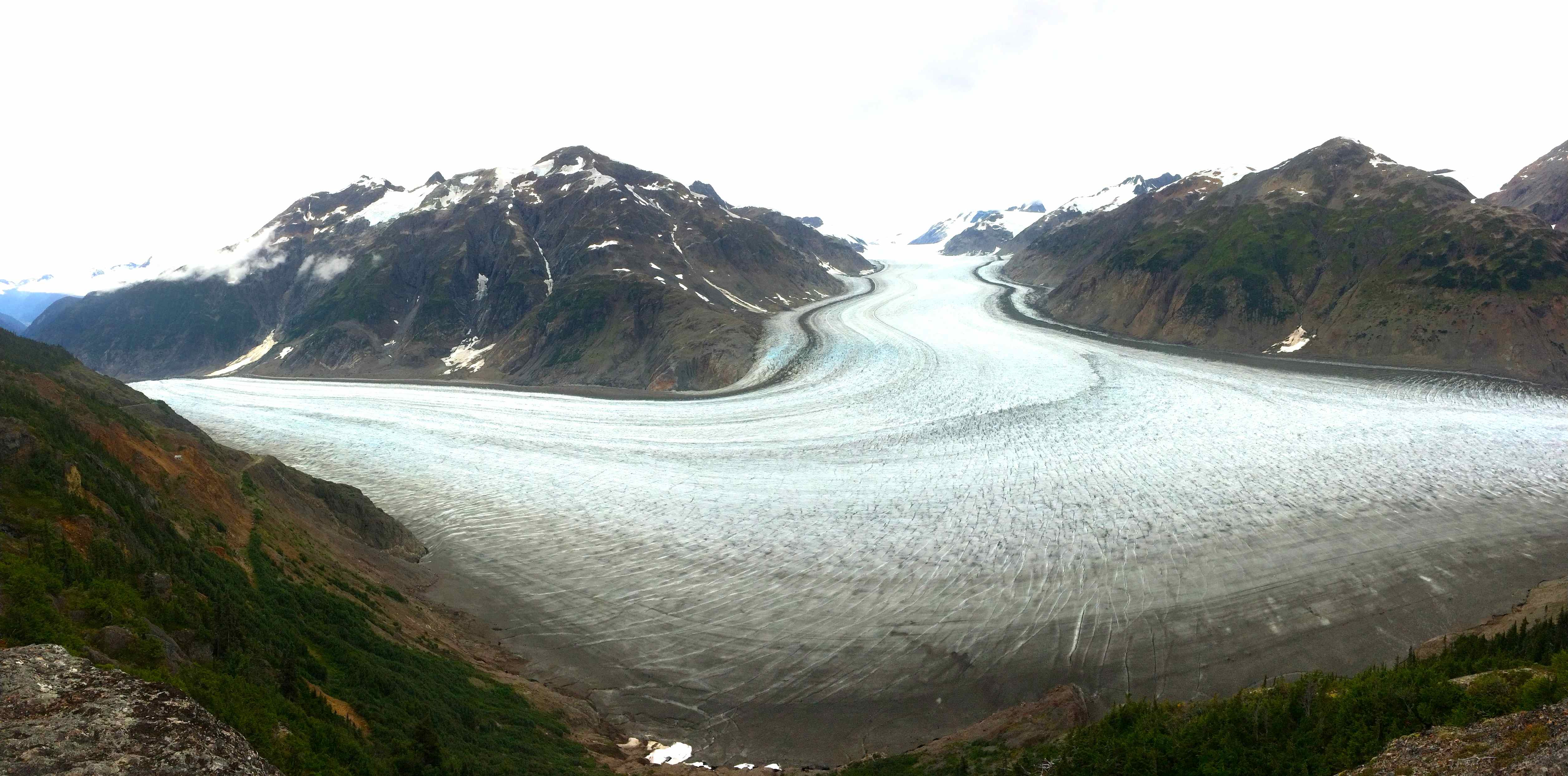
We first encountered the Toe of Salmon Glacier about 17 miles along our path.
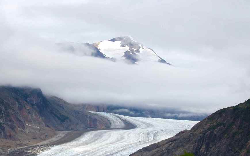
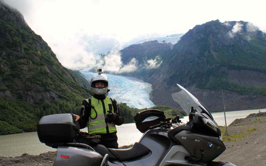
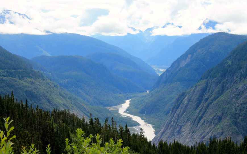
We found the distance to Salmon Glacier viewpoint was a total of 25 miles from our hotel in Stewart. When we first arrived, there was a significant amount of fog preventing us from seeing both the glacier and the surrounding mountains. But after about 45 minutes or so, the fog lifted. I have to say, while we saw Bear Glacier the day before on our way into Stewart, Salmon Glacier was much more spectacular.
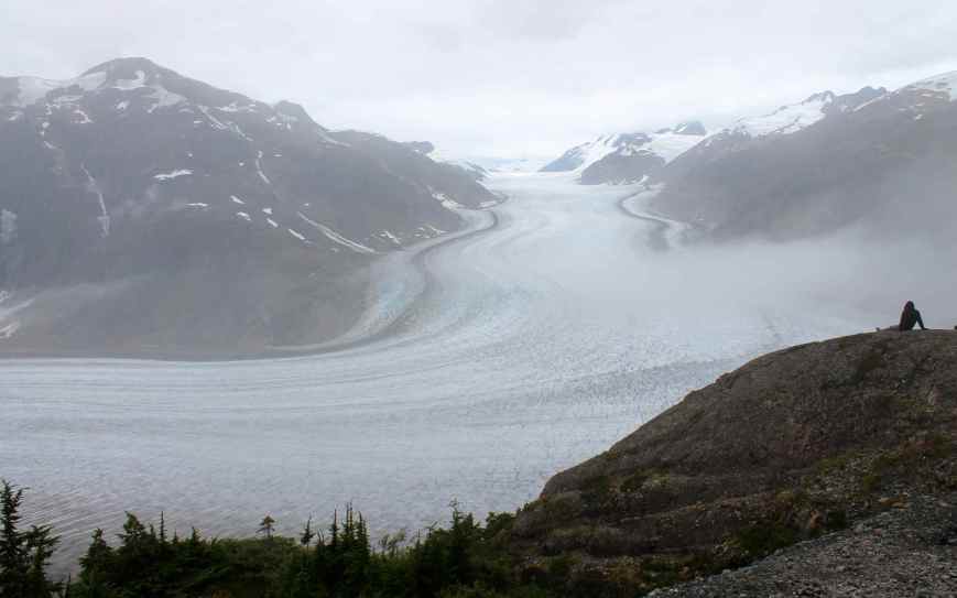
On our way down the hill, I kept my camera around my neck, just in case I needed it quickly. Turned out there would be no additional bear sightings this day.
Stopping again at Fish Creek, we met two riders from California. One road a KLR and the other a BMW F800. They were returning to California after riding through Alaska. Again, with no bear sightings, we decided to head into Hyder to eat.
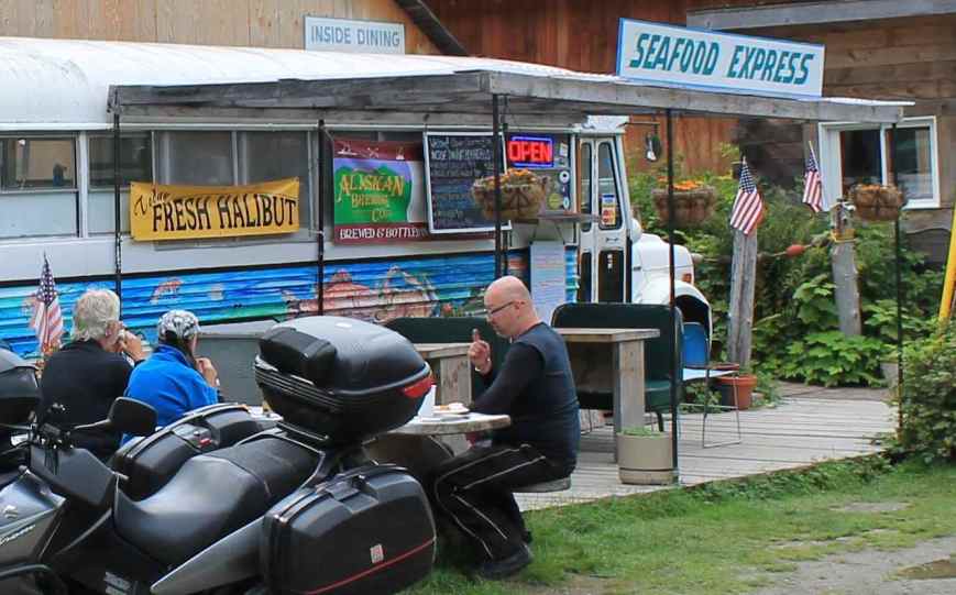
We stopped at the Seafood Express Bus, aka “The Bus”. Diane, the owner, had fresh halibut fish and chips which I thought was super yummy and the temperature was warm enough to eat outside.
On trip back to Stewart was only briefly interrupted by a quick stop at the border. Canadian customs looked at our passports and asked a few questions and we were soon back in town to enjoy the beautiful and warm summer evening.
Day 5

Day’s distance: 285 miles
Total trip distance: 1,365 miles
Will and I traveled from Stewart to Prince Rupert on Day 5. It was raining at the start of our ride today and showered throughout the day.
We had to travel back along both Hwy 37A and Hwy 37 and saw our second Black Bear immediately after turning onto Hwy 37. We pulled over quickly, but again I wasn’t fast enough with my camera before a few other cars passed us and scared the bear away.:(
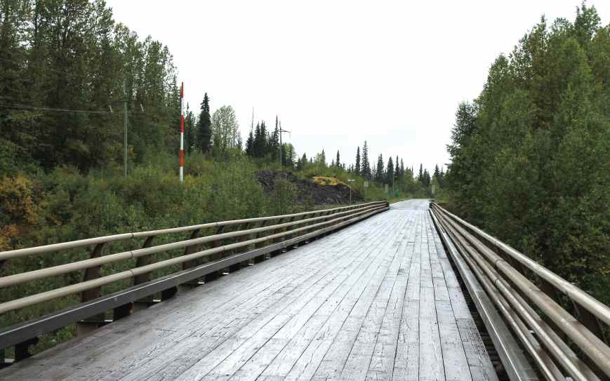
On Hwy 37, there was a one-lane wooden planked bridge. We didn’t stop on the way north, so this time I grabbed a photos.
We continued south, once again riding through the road construction that we passed on our way up to Stewart. As it was a weekend, there were only the flaggers and pilot vehicles present. The delay was short.
We had enough fuel to make it to Hwy 16, where we again stopped to top off our tanks. Premium grade fuel was available so I didn’t need the octane booster I used in Stewart. I was happy I thought to bring it along.
There was a restaurant at the service station but it didn’t appeal to either of us so we decided to continue a few miles, following the Skeena River until we found a pull out and just make one of the meals we were carrying in our packs.
It wasn’t raining when we stopped but started up again just as we were finishing.
Soon after lunch we arrived in Terrace where we stopped again. I was sore when I woke up and needed more stretch breaks than usual. After our break, we continued on Hwy 16 with Prince Rupert our next and final destination. This part of our route was scenic, with mountains on one side and the inlet on the other.
On one of our photo breaks, I wanted to check the oil level. Fully loaded, the bike is sometimes difficult to lift it all the way up on the center stand and, in this case, the bike came back down off balance and fell over, falling away from me. Will quickly came over and we picked it up. I was happy to see that the rear protection bars, combined with the cylinder head covers protected the rest of the bike, including the mirrors. I was always curious if they were sized properly because they don’t stick out much past the side cases they are designed to protect.
Well, after the drama of dropping the bike for the first and hopefully the last time, the oil level was fine and we were soon on our way again.
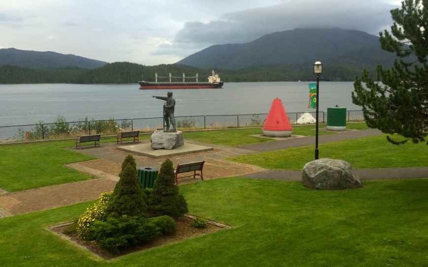
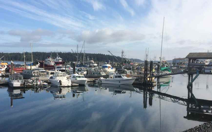
We arrived in Prince Rupert and, after stopping for fuel, we checked in to our hotel. After unpacking the bike, I took her to a car wash nearby and sprayed off a good portion of the dirt and mud collected so far. I guess I was trying make her feel better after the earlier incident. 🙂
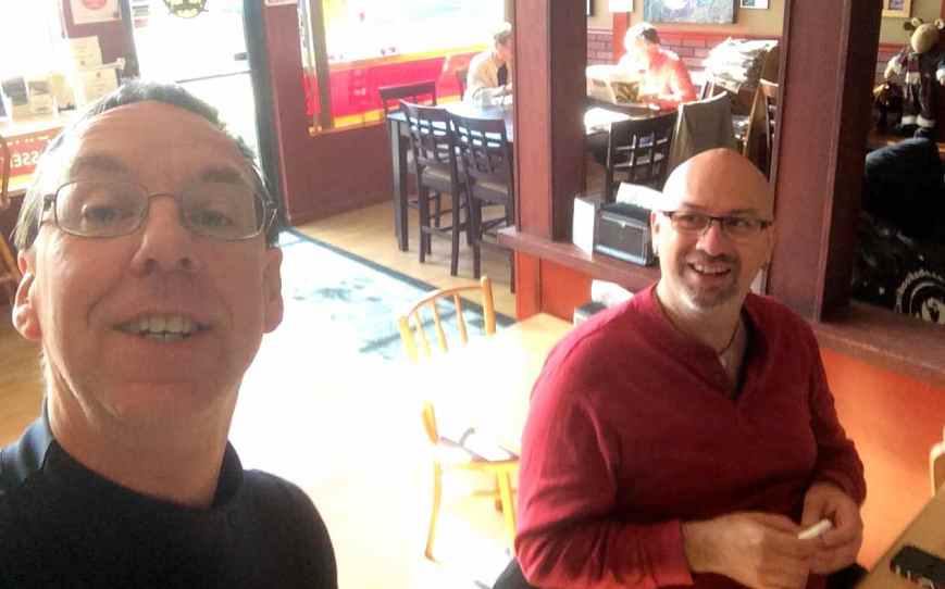
We met up with a friend of Will’s for dinner at the Cargo Kitchen and Bar. I enjoyed my meal but Will thought the salmon was just ok. The view from the restaurant was pretty cool.
By the time we were done with dinner and our drinks, it was getting late and dark.
We knew we had to get up very early (4:30am) the next morning for the ferry ride through the Inside Passage, so I called it a day.
Day 6
Day’s distance: 8 miles (on the odometer)
Total trip distance: 1,373 miles
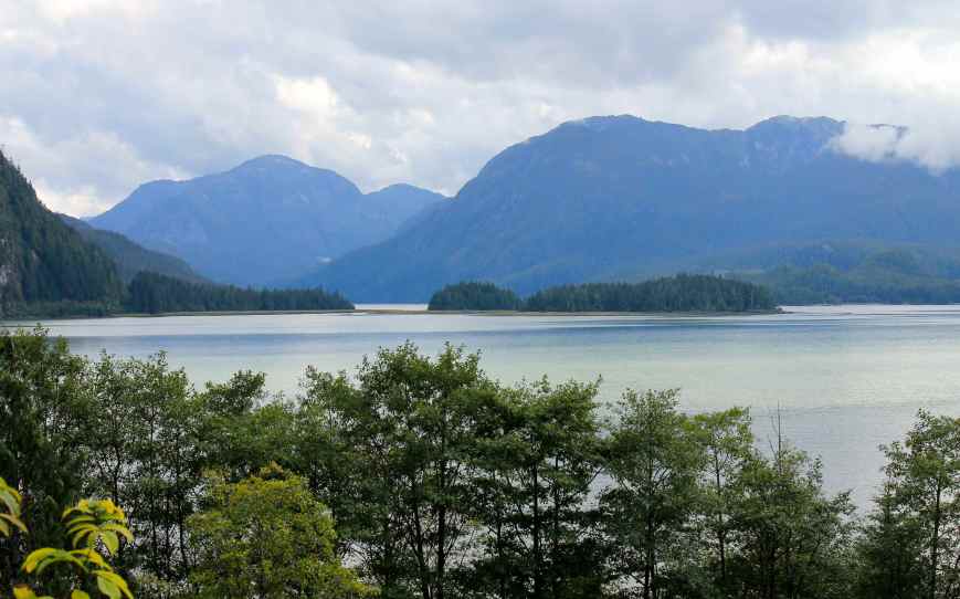
Day 6 involved a BC Ferry trip from Prince Rupert to Port Hardy on Vancouver Island. This 16-hour ride took passengers through the Inside Passage on a day that was initially raining but sunny by late afternoon. Although most of my time was spent inside the ferry, when I did wander out on the deck, it seemed like it reached the mid 60’s or warmer when the sun showed up.
Passengers are asked to arrive two hours prior to the scheduled departure. For us, that meant waking up at 4:30am to arrive at the terminal at 5:30am. We had our bikes packed and were ready to leave the hotel at 5:25am when Will’s bike would not start. His battery was completely drained 😦 Luckily, I brought along a pair of jumper cables, designed especially for motorcycles. I suspected when I purchased them I might need them, not for myself, but for someone else’s benefit. We were able to get our respective seats off, exposing the batteries quickly and we were on the road only 10 minutes late.
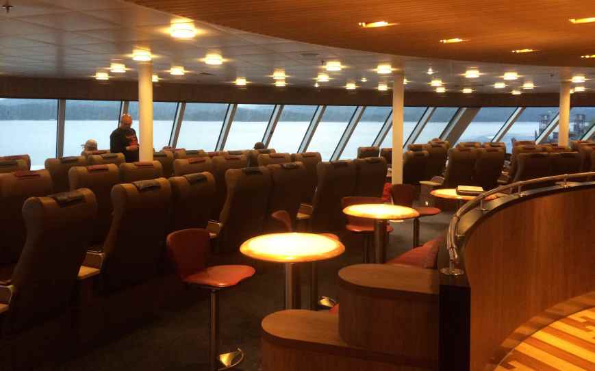
We chose to get reserve seating in the Aurora Lounge, a forward facing area with its own restrooms and complimentary beverages and snacks.
We also chose to prepay for two buffet meals, breakfast and dinner. Breakfast was good and I had two helpings of French Toast, eggs, ham, sausage, orange juice, coffee and a danish.
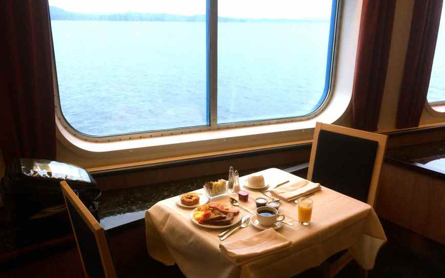
At dinner, I had salad, prime rib with Yorkshire pudding, potatoes, veggies and wine on the first go-around. On the return trip to the buffet, I grab some egg rolls, a curried pork dish over rice, a sample of the ravioli, and quinoa salad. For my dessert, I grabbed some New York style cheesecake with strawberries over the top.
The boat wasn’t crowded at all. The Aurora Lounge had only one full row of seats, out of five or six rows available. If I had to guess, the entire ship was at about 25% capacity, maybe, providing a lot of room on the decks. I also liked not having lines to purchase anything or get window seating in the dining room.
The scenery was spectacular throughout the day, even during the rainstorms encountered early in the day.
There were two movies shown in the ship’s theatre, and I watch the later one, starting at 8pm, just as it was getting dark outside.
Throughout the day, I spoke with many folks. The relaxed pace of the ship and varied scenery throughout the day contributed to the pleasure of my longest ferry ride with the motorcycle. I experienced a sense of travel without having to be on the bike. It was a great decision to do this, and I highly recommend taking the trip, at least once.
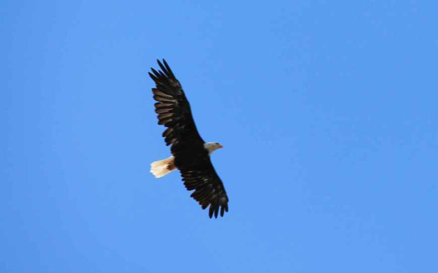
Wildlife viewing included whales and dolphins,
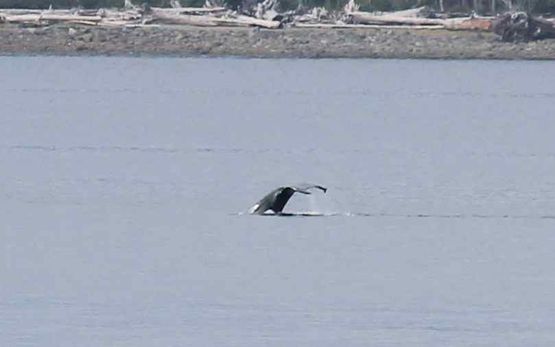
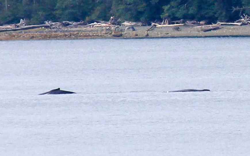
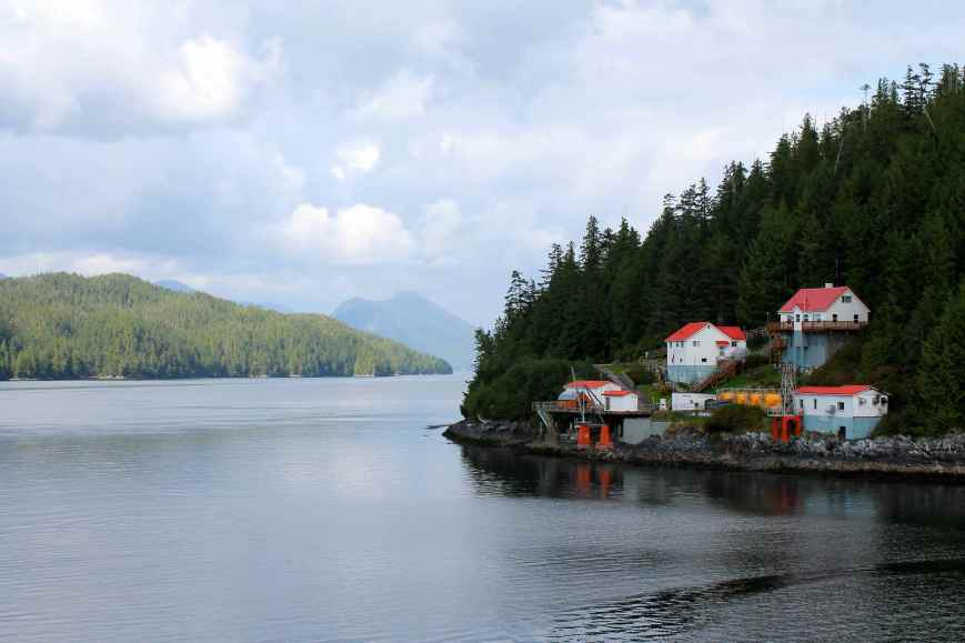
eagles and ravens, and lots of salmon jumping out of the water near Bella Bella. There were many lighthouses, most were automated but a few still had traditional lighthouse keepers.
The trip down the Inside Passage on the BC Ferry was pretty cool. It added a ‘loop’ component to our trip and combined a day off the bike with travel from port to port. It was quiet, contemplative, and we had some food prepared for us twice. The movie entertained us after the sun went down. Long day, don’t get me wrong, but totally worth doing, at least once.
We docked in Port Hardy on time, and were off the boat before 11:30pm. Our motel was in Port Hardy and we both crashed quickly once the bikes were unloaded.
Day 7

Day’s distance: 315 miles
Total trip distance: 1,688 miles
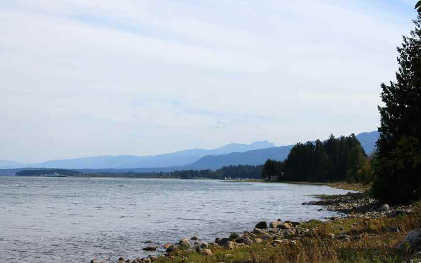
The plan for Day 7 was to travel Vancouver Island from top to bottom, along the eastern side. The day’s temperature was perfect, mid 60s to mid 70s. Scattered clouds punctuated otherwise very blue skies.
The northern end of the island was unexpectedly beautiful. This part of Hwy 19 gently twists through tall mountains and dense, managed forest lands and freshwater lakes. It felt a bit like an extension of the Inland Passage scenery with a two-lane road substituting for the channel. We stopped at Port McNeill for a quick coffee & pastry breakfast.
I took a quick walk down to the harbor while Will grabbed a map from the Visitor’s Center.
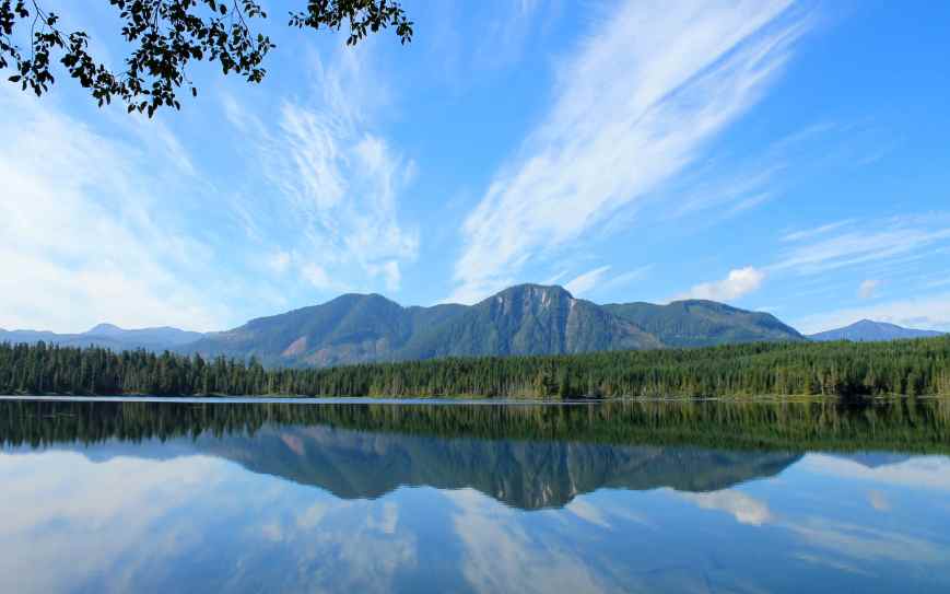
Our next stop was at Hoomak Lake Rest Area. The lake itself was 200 ft down the hill from the parking lot, but it was totally worth visiting. We didn’t know that in advance and were encouraged to check it out by a couple also riding south on their motorcycle.
At Campbell River, we turned onto Hwy 19A to stay along the coast as Hwy 19 becomes freeway and travels inland. We stopped for lunch at a Subways before getting through town. Hwy 19A traveled close to the shore, and was somewhat congested, with many stop lights and frequent speed limit changes. While scenic, it took longer than we expected to travel this mostly two lane road to Parksville where 19A rejoins Hwy 19. Worth it for the scenery, at least once.
From Nainamo south to the turnoff to our campsite, Hwy 19 was a congested highway with regular stop lights controlling cross traffic. Not very much fun, especially compared to the relative remoteness of our earlier travel. But it is cool to have traveled from top to the near bottom of this larger-than-I-thought-it-would-feel island.
The campsite itself wasn’t far off the highway, but it was amazingly quiet. Well, let me say that there was little traffic noise.
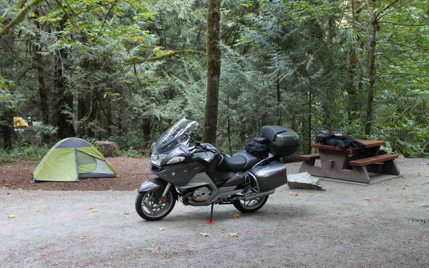
There were a few folks who didn’t apparently know about quiet hours. As a remedy, I put in earplugs when I turned in for the night.
Day 8

Day’s distance: 78 miles
Total trip distance: 1,766 miles
Day 8 involved two more ferry rides and a short ride between them. It was another beautiful day. A fog lingered over the water’s surface as the ferry left Victoria, but that soon dissipated. Temperatures were again very pleasant and the crossing was smooth on this calm sunny morning.
Leaving our campsite before 8am, it took about 35 minutes to get to the terminal where we would meet the ferry to Port Angeles. And they say to arrive two hours early so that there is time to inspect vehicles, get through customs, and get the bikes loaded and strapped down.
Customs was pretty easy and quick, although it felt like a lot of waiting around. I grabbed a latte and snack first thing after paying the fare for the ferry.
Strapping the motorcycles for the two ferry crossings have been a learning experience, and involved a bit of stress.
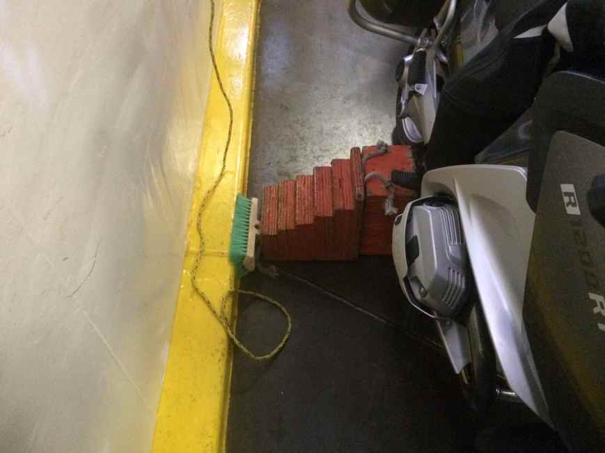
On the crossing between Prince Rupert and Port Hardy, the bikes were on their sidestands, with a wooden block on the opposite side. A sturdy strap, hooked into the deck at both ends, was placed over the seat to prevent rocking.
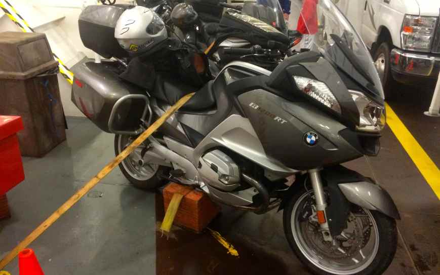
Oh, I left the bike in first gear to prevent rolling. The bike was fine, and with the minor rocking we experienced, I am certain no undue stress was placed on the bike, specifically the side stand.
Crossing to Port Angeles involved only poor placement of strapping points. I had to sign a waiver even before purchasing my ticket for the crossing. The waiver indicated there were tie down straps but they assumed no liability for damage. Of course I signed it.
What I found actually on the boat was a flimsy nylon rope tied off to a handrail some seven feet or so above the deck on the top of the bulkhead next to me. A tie up? WTF? This is not a proper tie down by any stretch of the imagination.
** Beware: consider alternatives if it is going to be a rough crossing **
I rigged one of the straps I brought between the base of the handrail and the far side of the bike itself. This placement removed some of the load off the side stand and trapped the bike against the blocking below the centerstand.

I’ve taken this ferry ride a few times in the past. On this crossing, you could make out the top of Mount Baker, and the snow-capped peaks of the Olympics. I was happy that the water was flat.
Once the boat arrived, it was pretty quick to get through the very cursory customs check in Port Angeles. We were soon on familiar ground heading to Bainbridge Island and our next ferry.
The ride between Port Angeles and Bainbridge was pretty much a slow moving parade of cars. I listened to music and reflected on the trip during the 90 minute or so ride to the ferry. We arrived at 2pm, just in time to board the next ferry before it pulled away at 2:05pm. Whew!!
I was parked at home by 3pm, happy to have reached my goal of visiting Alaska, the 28th state I’ve entered on the motorcycle.
With the Western States Tour in 2014, the Southern States Tour in 2015, and now Alaska, I have only Northern States Tour and afterwards, a trip to Hawaii,to plan.
I can’t wait 🙂
Reflections
What was the goal of this trip, again?
Reaching the state of Alaska on my motorcycle was the goal, part of my quest to ride all 50 states. I now have visited 28 states.
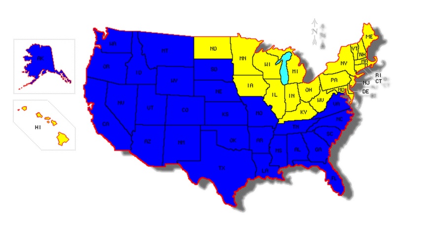
I’m already dreaming of a ‘Northern States Tour’, visiting the remaining states in the continental US. I would want to ride the whole way there and back, and maybe visit a few Canadian provinces, just for the record books.
What stands out as special about this trip?
– Exploring new territory, including riding further north than ever before. I reached latitude 56 and then some 🙂
– Seeing some great roads. The Glacier Highway, Hwy 37A, and the western-most part of Hwy 16 approaching Prince Rupert were the best overall, with the Granduc Road to Salmon Glacier winning the most scenic category, I think.
– Traveling Vancouver Island, top to bottom, was a goal of Will’s for sometime. It was great to make this happen. These roads were new for both of us and that is always makes a route special.
– Taking a cruise through the beautiful Inside Passage was super special. It was the first time I traveled all day along our route but not on the bike. With meals and seating accommodations reserved in advance, and with few other passengers, it was a relaxing and quite scenic way to have a day off the bike.
– Meeting other travelers, especially other bikers, is always one the best parts of travel.
What challenges did you have this trip?
– We traveled about 90 miles of gravel or gravel-covered roads. I took each opportunity slowly and was pleased to survive with only one minor equipment failure (the tire pressure gauge).
– Pushing out the length of an ‘accompanied’ trip to 8 days was challenging to me. Things that helped were separate rooms most nights, and the day on the ferry allowed us to spend time apart throughout the day.
– Both H7 low-beam headlights on my bike required replacement. I was able to purchase replacement bulbs at the Walmart in Quesnel, BC and install them myself (did this in 2014 as well). In all, with shopping and repairs, set us back about two hours.
– My tire pressure gauge failed. I am certain traversing the gravel roads on this trip caused the sensitive internal parts of the gauge to shake apart. Note to self: put the pressure gauge in the tank bag if traveling on gravel roads.
– I had the opportunity to use my motorcycle’s battery and jumper cables to assist Will start his motorcycle one morning. I often don’t carry the jumper cables but I brought them along on this trip as it limited our delay to 10 minutes.
– Strapping down the bike for the two longer ferry trips was stressful. Neither time was there a possibility of strapping it down in accordance with the instructions found in the owners manual. Thankfully, both trips were across calm waters.
– I had to use regular gas once during the trip. The octane level of 87 was too low for my bike so I added some octane booster I purchased for this trip. I recommend bringing some along if you’re traveling in this area or points north.
– Keeping up with the blog was difficult for a number of reasons. Camping, many “high-mileage” days, time spent repairing headlights, unreliable internet connectivity, late dinners, no ship-board wi-fi, and a full hard disk on my laptop conspired to delay the delivery of complete blog entries. Maintaining the blog in a timely manner typically takes two hours per day with a good connection to the internet.
– Seeing the bike tip onto its side. Completely my fault, I was happy to see the protection bars and cylinder head guards worked to keep the bike’s parts off the ground. Nothing broke and we had the bike back up quickly.
– Communications through our bluetooth helmet communicators was problematic. This was a first trip with Will’s new GPS unit, and there appeared to be some issues with the intercom being blocked from use at times. We are still trying to sort these out but it kept us from being able to easily update each other.
Would you travel to Alaska again?
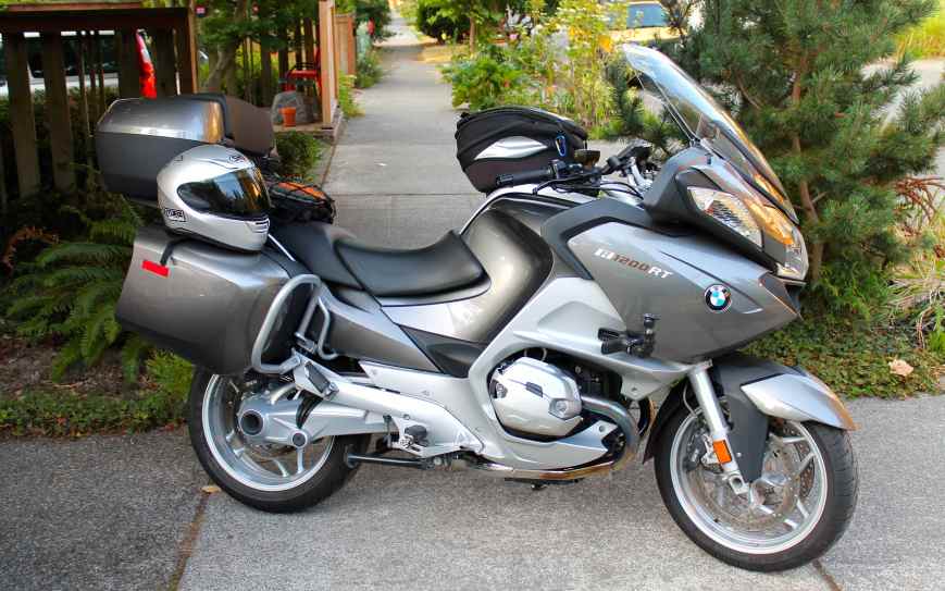
Yes, but not on my current motorcycle. My road bike, a 2013 R1200RT, doesn’t like gravel roads much, and my impression is that the further north one travel’s, the higher the likelihood of finding gravel or mud. I would like to explore more of Alaska and northern British Columbia on an adventure bike or a larger enduro bike.
